A collection of walks, discoveries, insights and pictures of exploring Dartmoor National Park
September 18, 2020
DOE TOR FARM
Steve Grigg and Frank Collinson
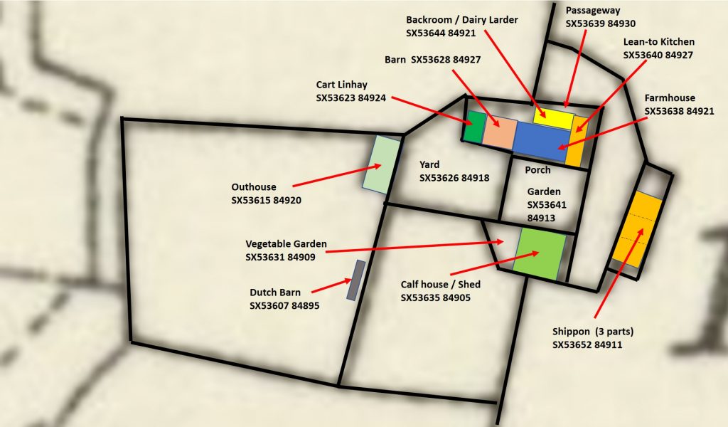
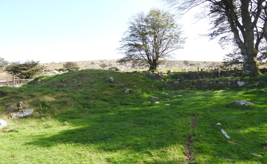
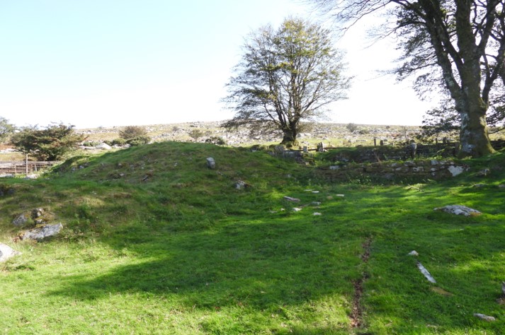
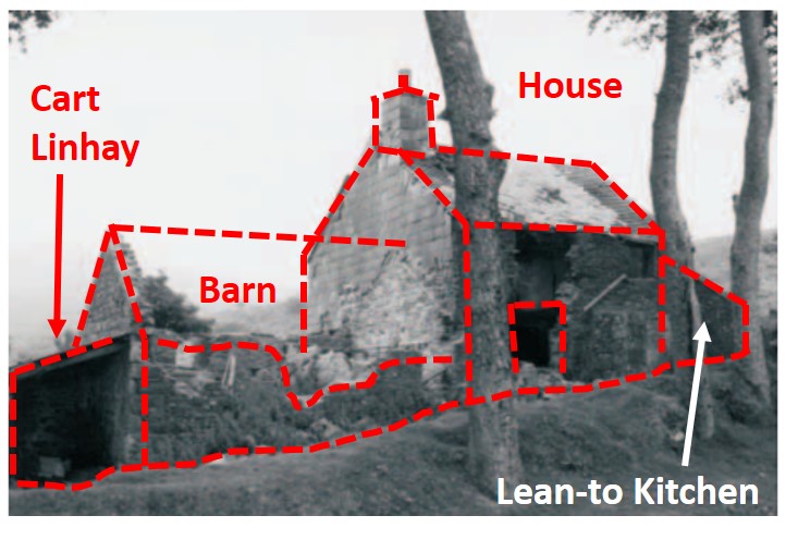
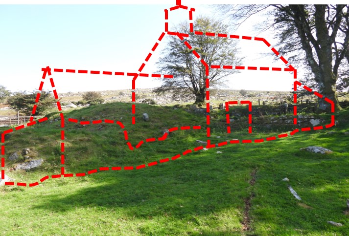
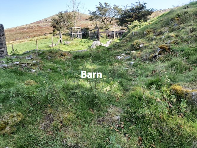
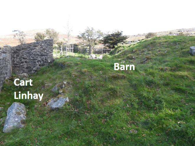
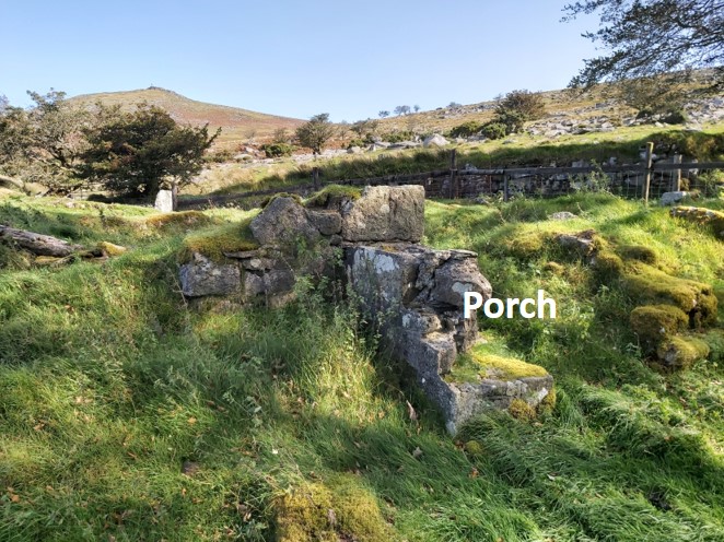
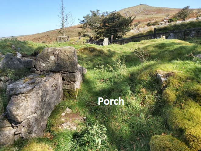
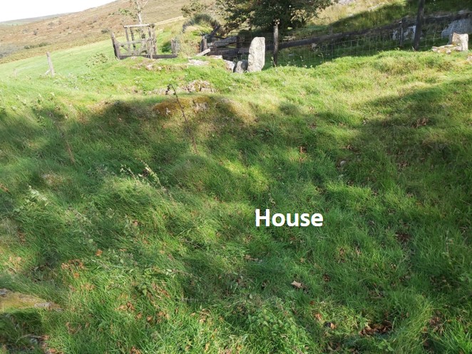
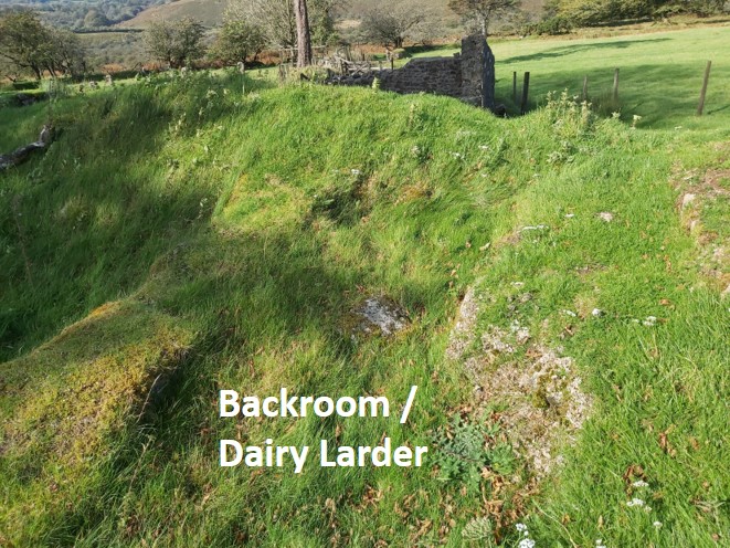
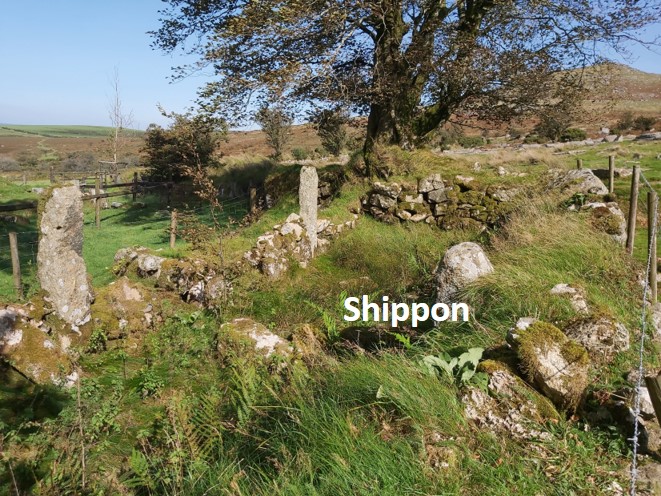
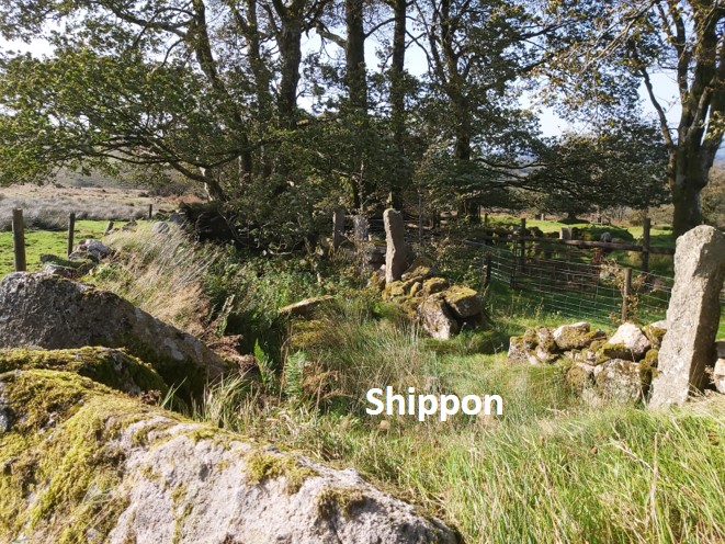
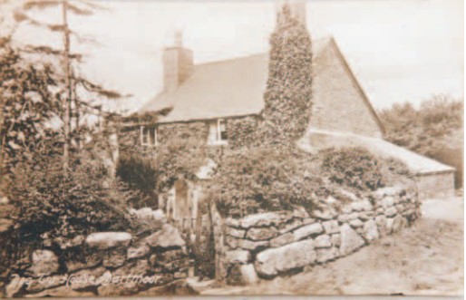
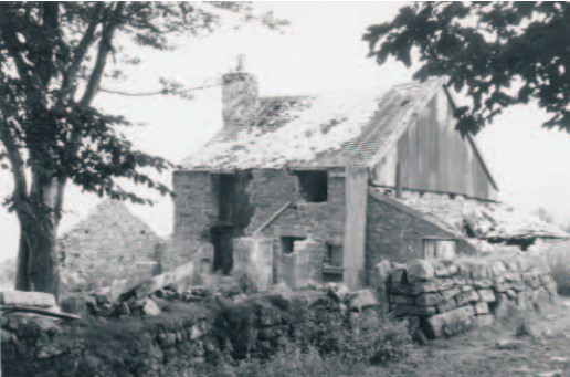
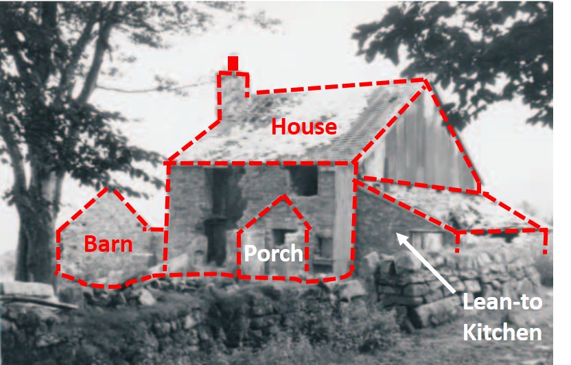
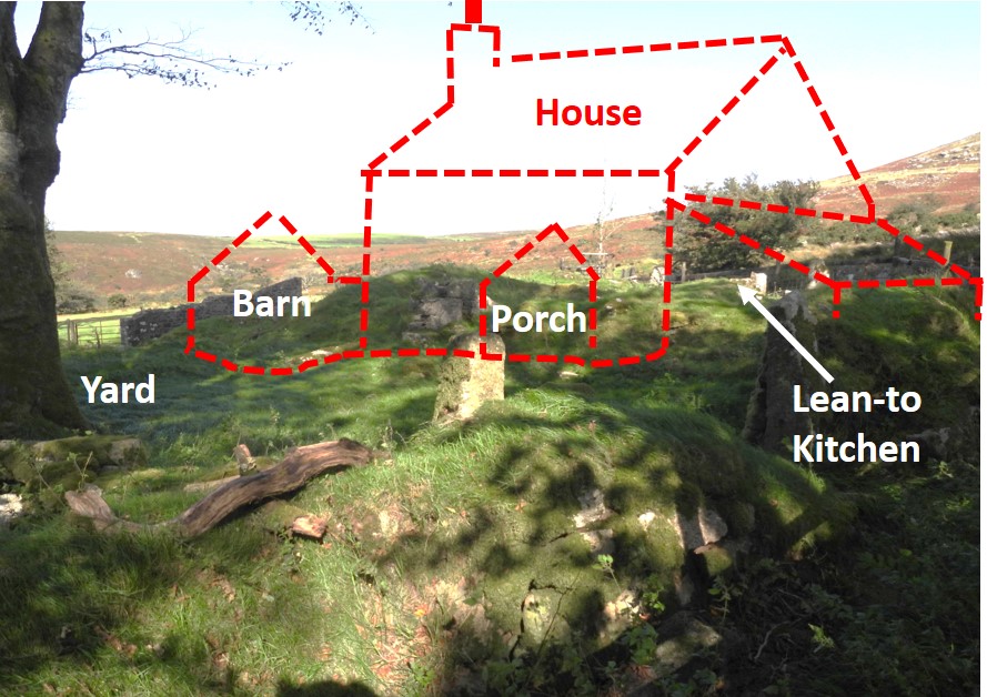
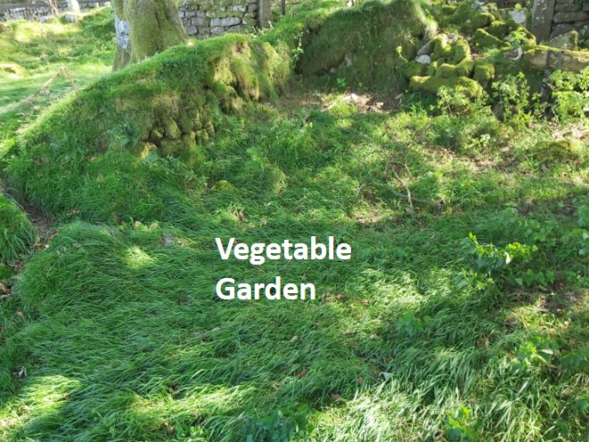
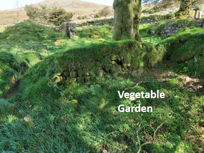
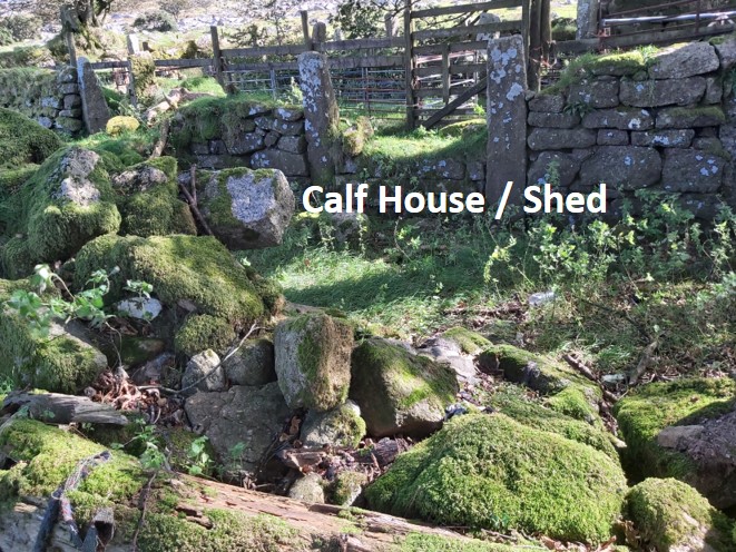
This abandoned farm nestles under the southern slopes of Doe Tor. It is believed it was established around the 1730’s and was a working farm up to 1955 and, like so many other buildings no longer in use on Dartmoor was demolished; this was around 1970. Eric Hemery mentions the farm in “High Dartmoor” (p921) and tells us that the water supply came from an open leat which extracted water from the Doe Tor Brook and ran to a clay pipe chute in the farmyard.The water was for both domestic and farm uses. Using a Wessex Archaeology (WA) survey (2007), it is possible to trace the farmhouse and porch, a cart linhay, a barn, a lean-to kitchen, a dairy larder, a shippon, a calf shed, a vegetable garden, an outhouse and the location of a possible dutch barn.
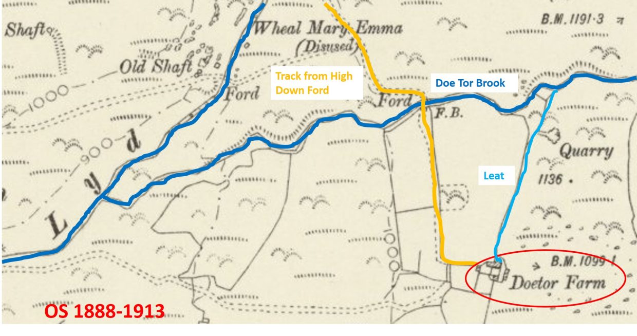
Location of Doe Tor Farm, which is easily accessed from High Down Ford or alternatively up the track from Wheal Mary Emma. Using the OS Map farm outline and looking at the Wessex Archaeology plan, the infrastructure of the farm becomes apparent. This plan also shows 10 digit NGR references of each part of the farm
A Ministry of Agriculture survey taken in 1941 gives a good idea of the various land uses at the time; fodder crops of oats, potatoes, turnips and swedes were being grown along with hay. The grazing land was stocked with cattle and sheep and there was the normal flock of farm hens along with two workhorses (source: Legendary Dartmoor website).
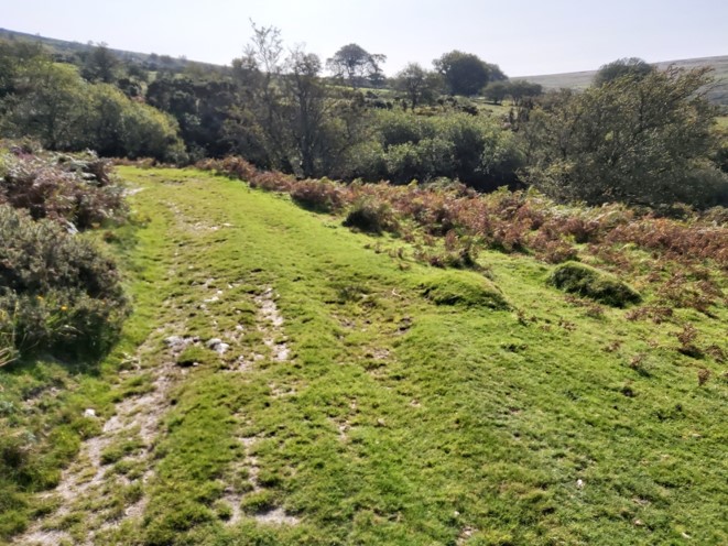
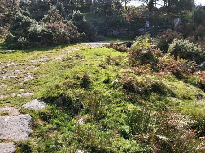
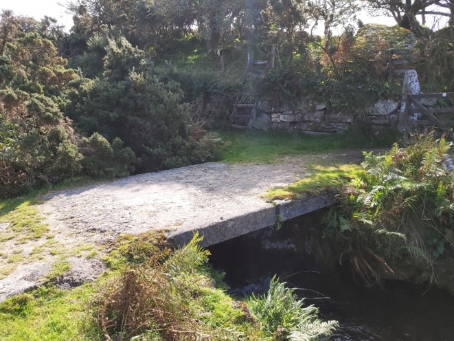
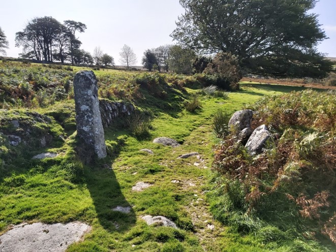
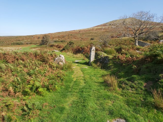
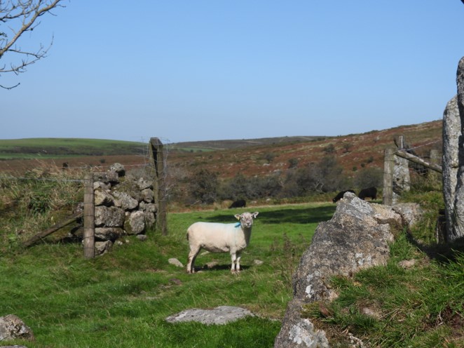
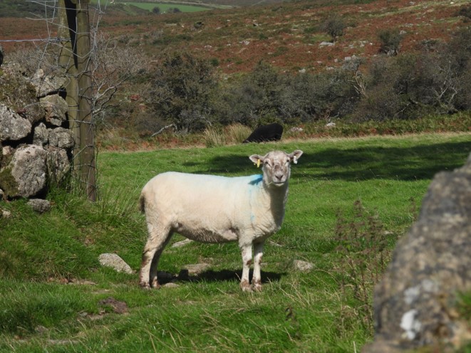
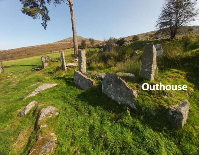
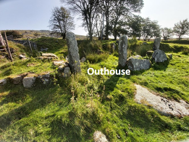
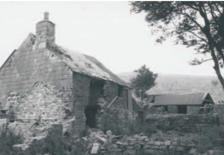
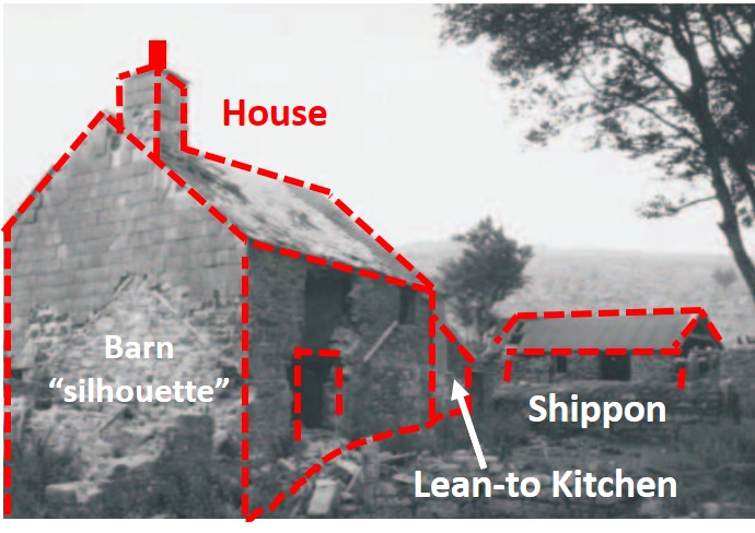
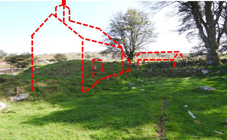
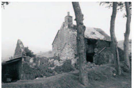
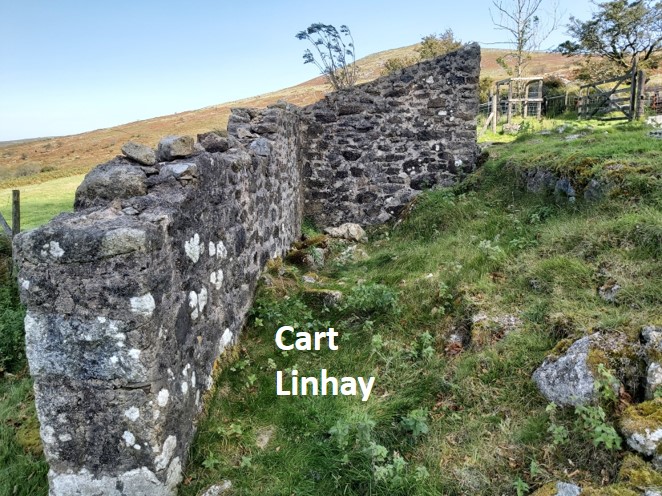
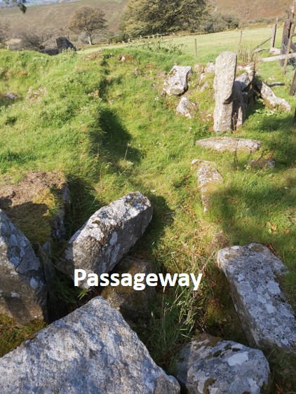
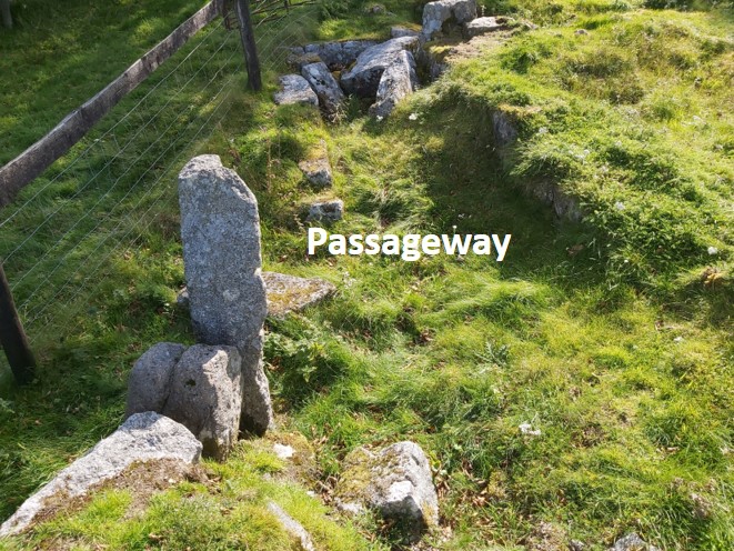
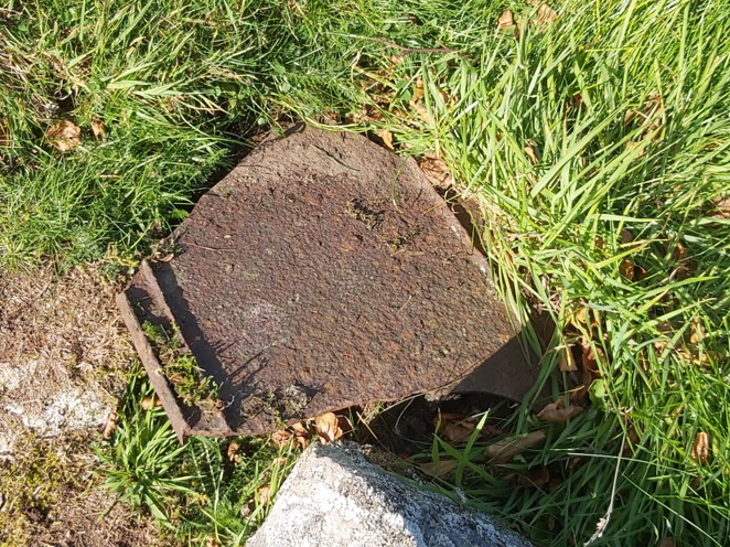
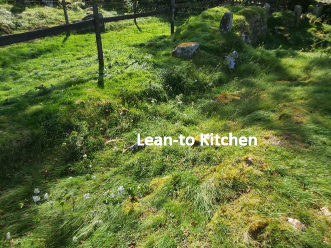
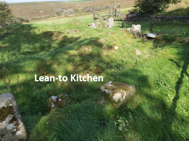
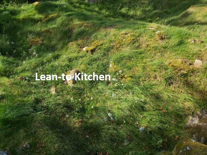
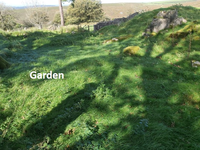
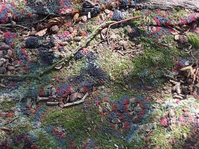
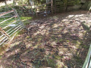
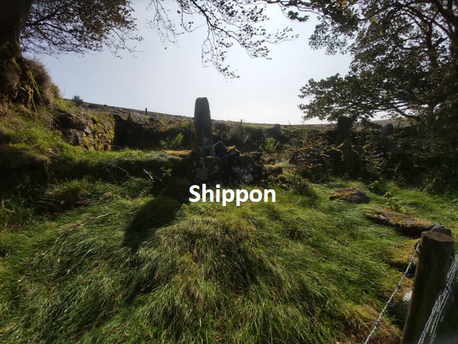
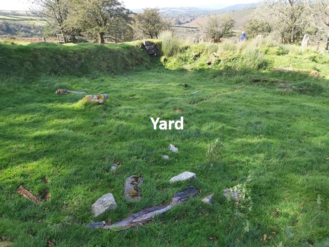
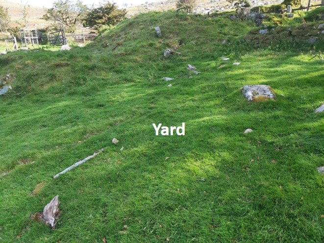
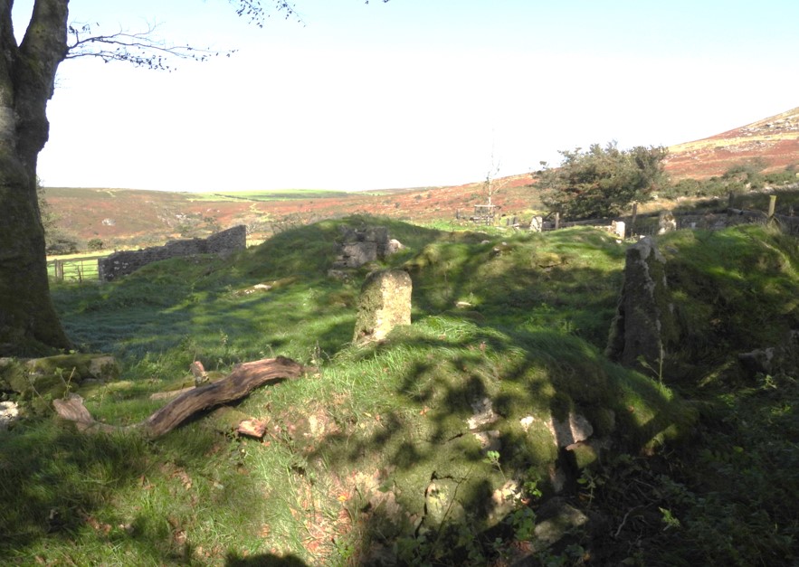
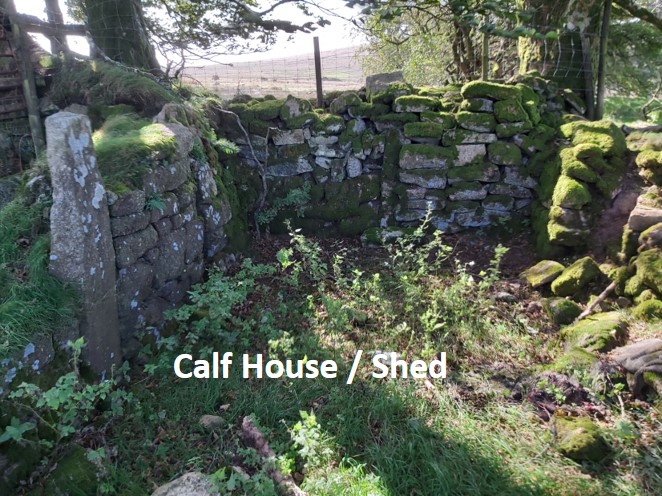
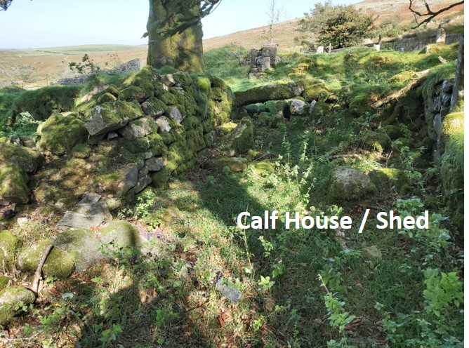
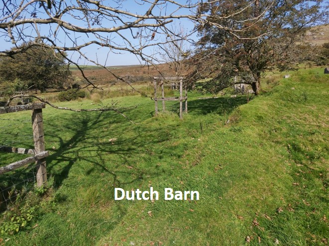
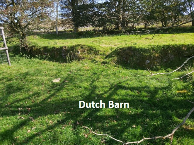
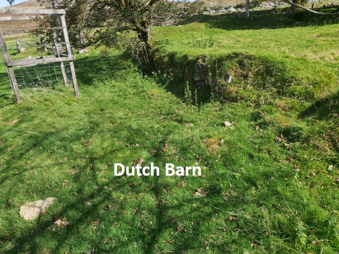
This is the track from High Down Ford approaching Doe Tor Brook on the way to the farmApproaching Doe Tor BrookCrossing Doe Tor Brook on a modern substantial bridgeEntering into a farm enclosure. The gatepost is at SX53566 85007Looking back at the entrance from inside the farm enclosureA second gated enclosure, this one being guarded by a local residentThis local resident stood for quite a while in this pose and appeared curious as to our prescenceThis outhouse is of unknown function (WA). It is 6m x 2.2m and is located at SX53615 84920Another view on the outhouse. In this picture Doe Tor can be seen to the left and behind the treesApproaching the farmhouse through the yard from the outhouse, this was the view in 1969This is the 2020 view from the previous photographOutline of key features from the 1969 pictureSilhouette of the buildings onto the 2020 viewAnother 1969 view of the FarmhouseThe 2020 view from the previous pictureOverlay on the 1969 picture, detailing some more features of the farm infrastructureThe overlay on the 2020 viewThe Cart Linhay is one of the few substantial walls that have been left standing. WA state this is 4.5m x 2.1m and is where a two-wheeled cart was kept. SX 53623 84924.The Barn was located between the Cart Linhay and the Farmhouse at SX53628 84927. Picture showing the Cart Linhay and Barn side-by-side. The House was to the right of the barn from this angleThe porch to the farmhouse can still be traced. It is 1.4m x 0.9m (WA)Another view of the porch. Brat Tor on the horizonInside the farmhouse at SX53638 84921. It doesn’t feel very big, being measured by WA as 5.2m x 4.5m. Apparently there was one room downstairs and three bedrooms upstairs. At the back of the main farmhouse was a backroom / dairy larder which was around 1.4m wide and ran the length of the house (WA). The grid is SX53637 84925.Immediately behind the backroom / dairy larder was what is described as a passage wayAnother view of the passageway. SX53639 84930A piece of metal found in the passageway. We speculated it might have been part of the fireplaceThe lean-to kitchen can be located at SX53640 84924Another view of the lean-to kitchen, which was 6.9m x 2.3m (WA)The lean-to kitchen had a peat burning stoveThe garden is located immediately in front of the farmhouse at SX53641 84913. This area (WA) is 8.8m x 5.5m and had flowerbedsThis was found behind the garden. An old carpet !The carpet laid outThe shippon can be found at SX53652 84911The shippon is 16m x 3.5m and was split into three sectionsThere was a horse stable at the south end, cows were kept at the north end and bullocks in the middle (source WA).The yard at SX53626 84918. This is looking towards the outhouseThe yard looking towards the farmhouse. Taken from between the Shippon (south end) and the calf house / shed. This view of the farmhouse and lean-to kitchen is from around 1910Slightly wider angle form the 1910 picture, this one is from 1969…..and the 2020 viewOverlay on the 1969 pictureThe overlay in the 2020 viewThe vegetable garden at SX53631 84909The plot was 6.4m x 4m (source WA)The calf house / shed can be found at SX53635 84905This is 6.3m x 2.9m (source WA)A horse and bullocks were kept here.Probable location of the dutch barn at SX53607 84895The Dutch Barn would have been for storing hayA final view of the dutch barn foundations
Fascinating research Steve. I think it is so sad that more of these building were not preserved. They are as much a part of the Dartmoor Heritage as the cairns and crosses. Because they are ‘near’ history no one seems to think it important to preserve them
The last tenants of Doe Tor farm were an elderly couple Mr and Mrs Ball. Mr Ball was the father of a friend of my Mother.
When I was about 14 years old I stayed for two weeks with Mr and Mrs Ball.
I remember going with Mr Ball by pony and trap to the Dartmoor Inn where we left the pony and trap whilst we caught the bus to Tavistock.
Apart from goats there was also poultry on the farm.
There are reports that the farm may have provided cream tea’s for visitors to the moor and even possible accomodation. Did you have any knowledge of such things? Thank you.
Wootton, M. & S. 1972. The Little Book of Lydford. Tavistock: The Trident Press.
In the 1900s cream teas were served at Doe Tor Farm at a shilling a throw which at some week ends upwards of fifty a day being sold, Wootton, 1972, p.32.

Peter Brooks September 23, 2020
Fascinating research Steve. I think it is so sad that more of these building were not preserved. They are as much a part of the Dartmoor Heritage as the cairns and crosses. Because they are ‘near’ history no one seems to think it important to preserve them
SteveGrigg1961 October 13, 2020 — Post author
I agree Peter. It would be nice to see a few more “information boards” around as well, like the ones at Leather Tor farm and Lowery Barn
Regards,
Steve
Roger Treeby July 29, 2024
The last tenants of Doe Tor farm were an elderly couple Mr and Mrs Ball. Mr Ball was the father of a friend of my Mother.
When I was about 14 years old I stayed for two weeks with Mr and Mrs Ball.
I remember going with Mr Ball by pony and trap to the Dartmoor Inn where we left the pony and trap whilst we caught the bus to Tavistock.
Apart from goats there was also poultry on the farm.
SteveGriggDartmoor July 29, 2024 — Post author
Hi Roger,
Thank you for sharing your lovely experiences of the farm
Kind Regards,
Steve (Dartmoor Explorations)
David Young May 14, 2026
There are reports that the farm may have provided cream tea’s for visitors to the moor and even possible accomodation. Did you have any knowledge of such things? Thank you.
SteveGriggDartmoor May 18, 2026 — Post author
Hi – this reference might help
Wootton, M. & S. 1972. The Little Book of Lydford. Tavistock: The Trident Press.
In the 1900s cream teas were served at Doe Tor Farm at a shilling a throw which at some week ends upwards of fifty a day being sold, Wootton, 1972, p.32.
Kind Regards,
Steve (Dartmoor Explorations)