A collection of walks, discoveries, insights and pictures of exploring Dartmoor National Park
November 20, 2021
Whitchurch Common – An Exploration
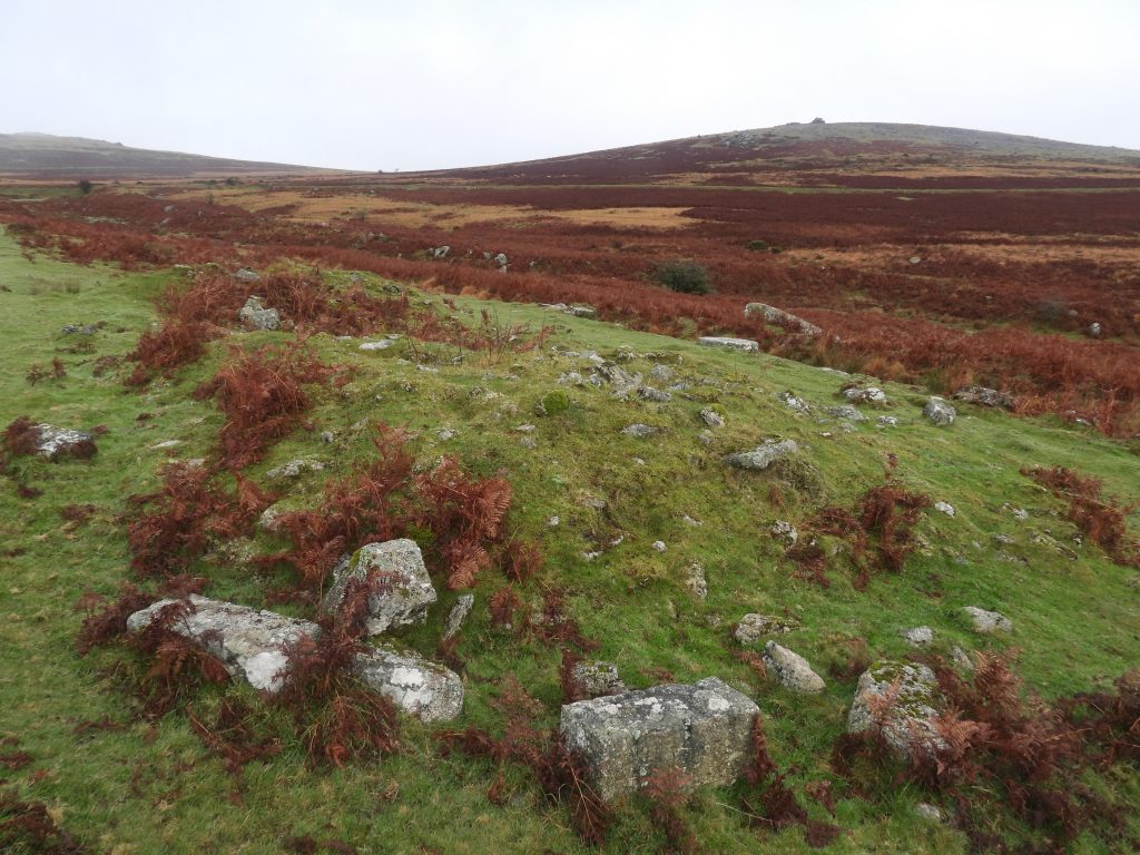
This exploration of a small area of Whitchurch Common around Beckamoor Brook shows a diverse range of features, some well known and some less so. The post shows a couple of Longhouses, a Blacksmiths Shop, a Wheelwrights Form, an Aqueduct with an inscription, an unusual Granite Clapper, four Military redoubts, a pair of parish Boundary Stones and a benchmark with associated rivet. The author would strongly recommend a visit to the area in the late Autumn or Winter months when the bracken has died back and some of the more conspicuous features reveal themselves.
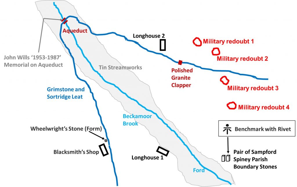
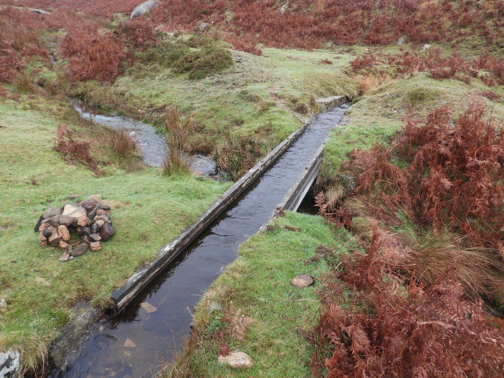
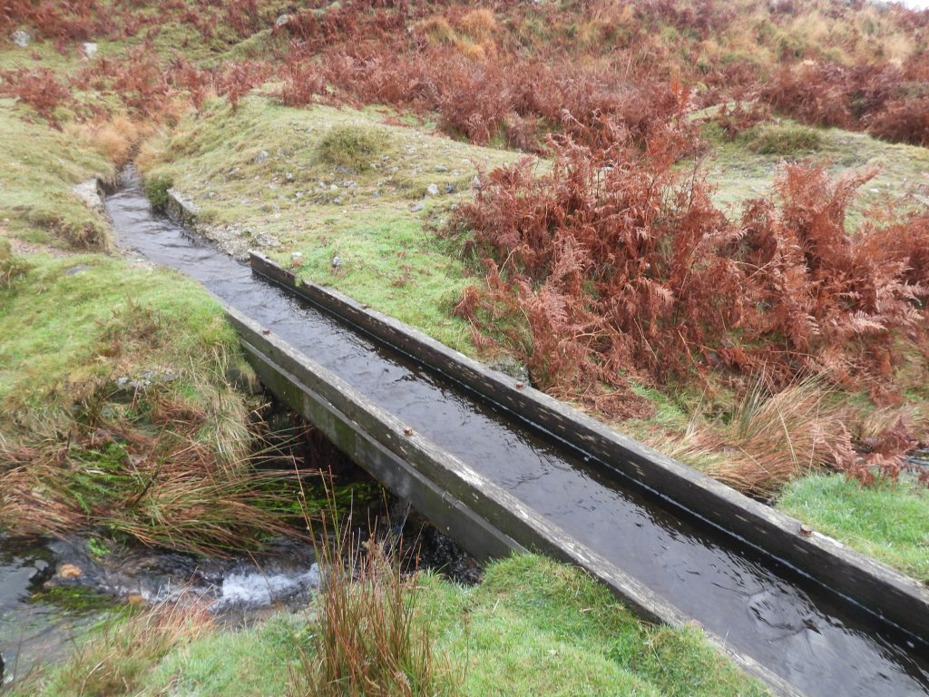
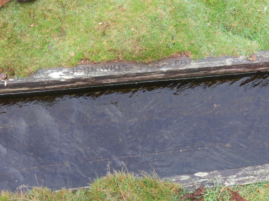
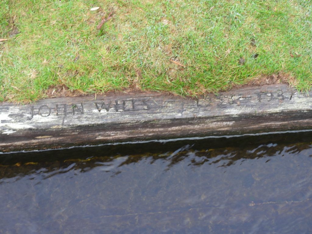
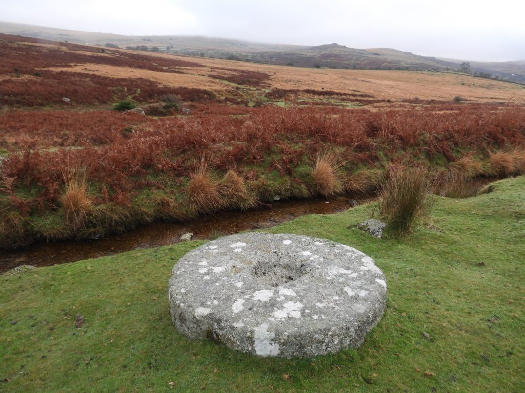
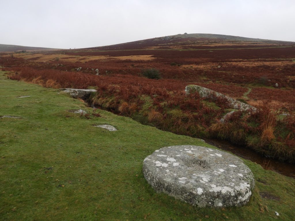
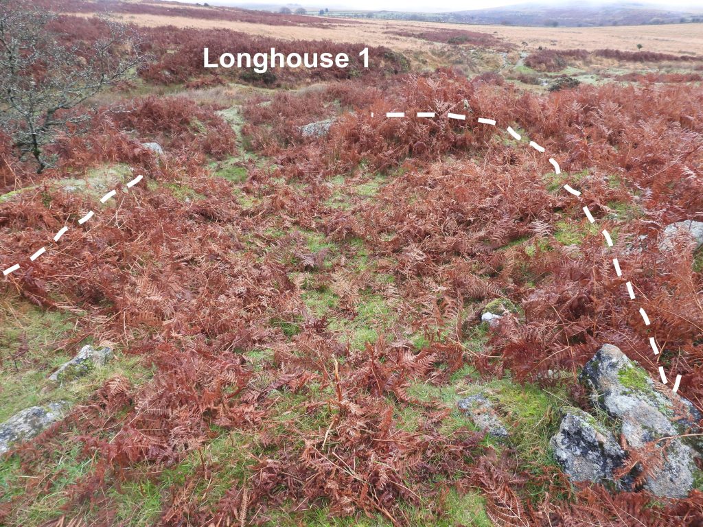
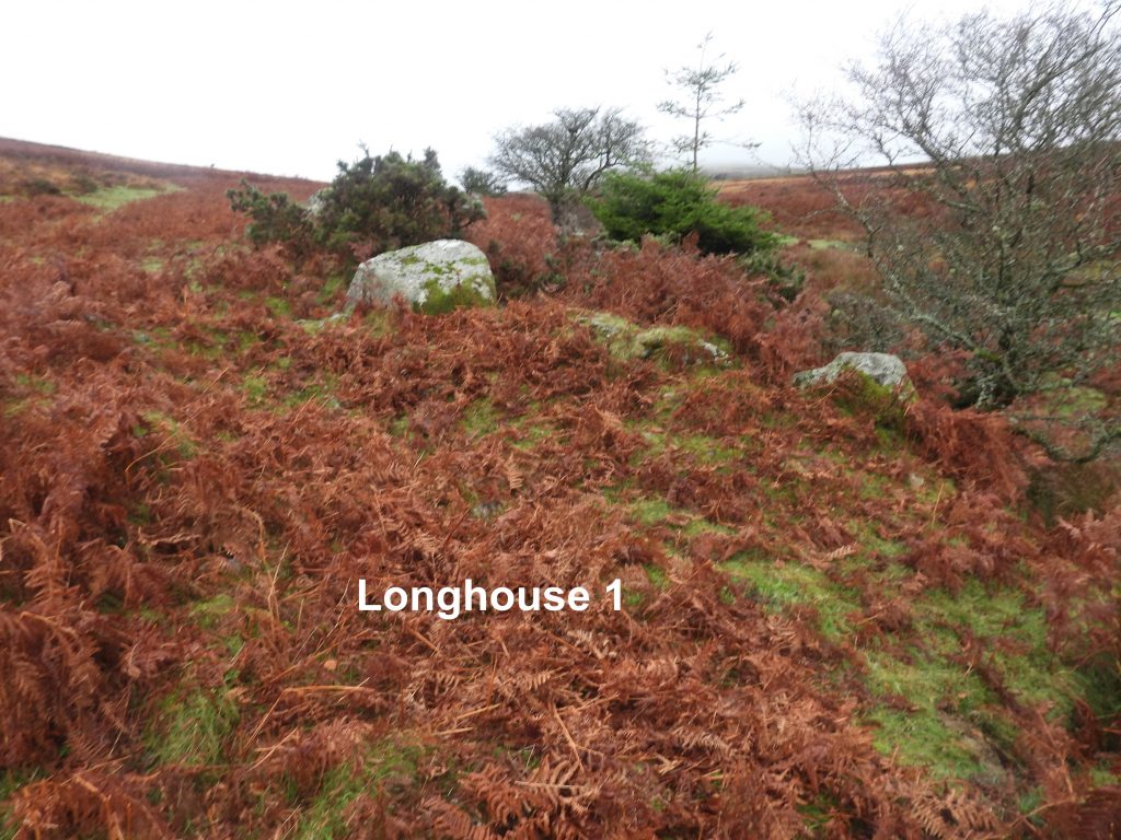
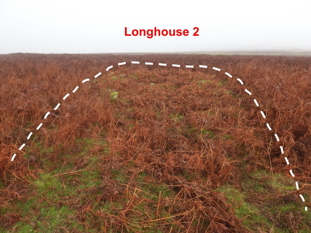
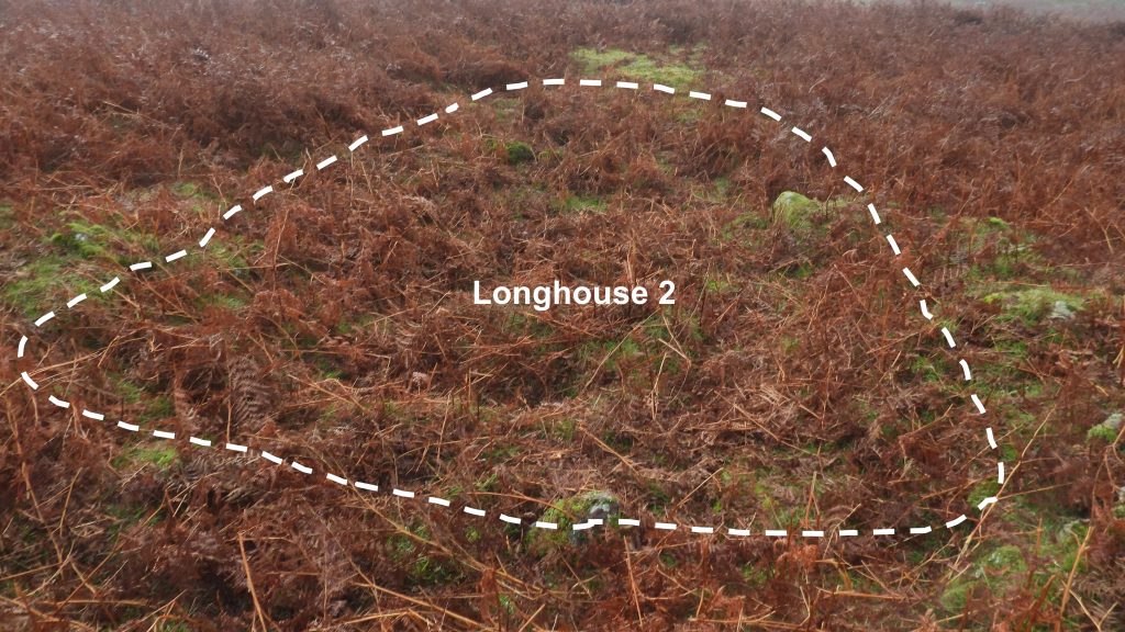
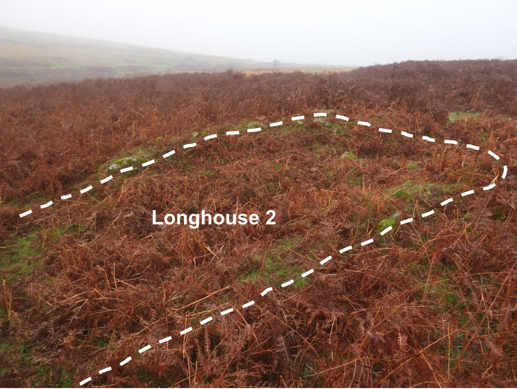
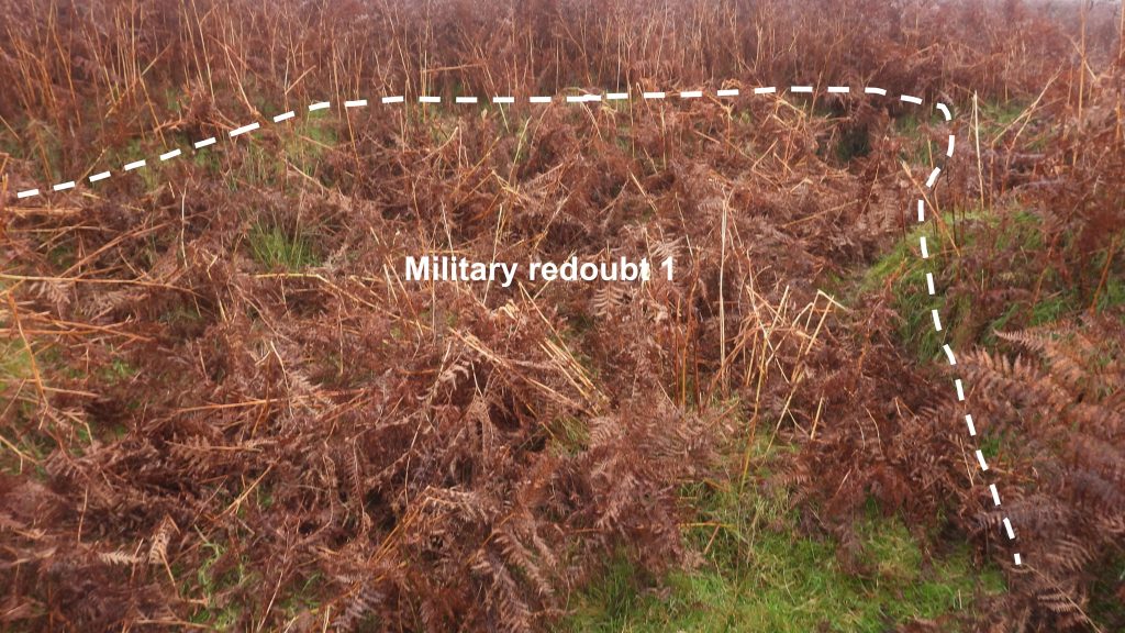
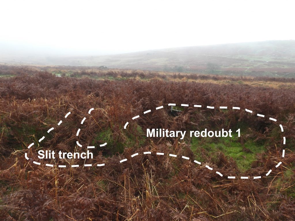
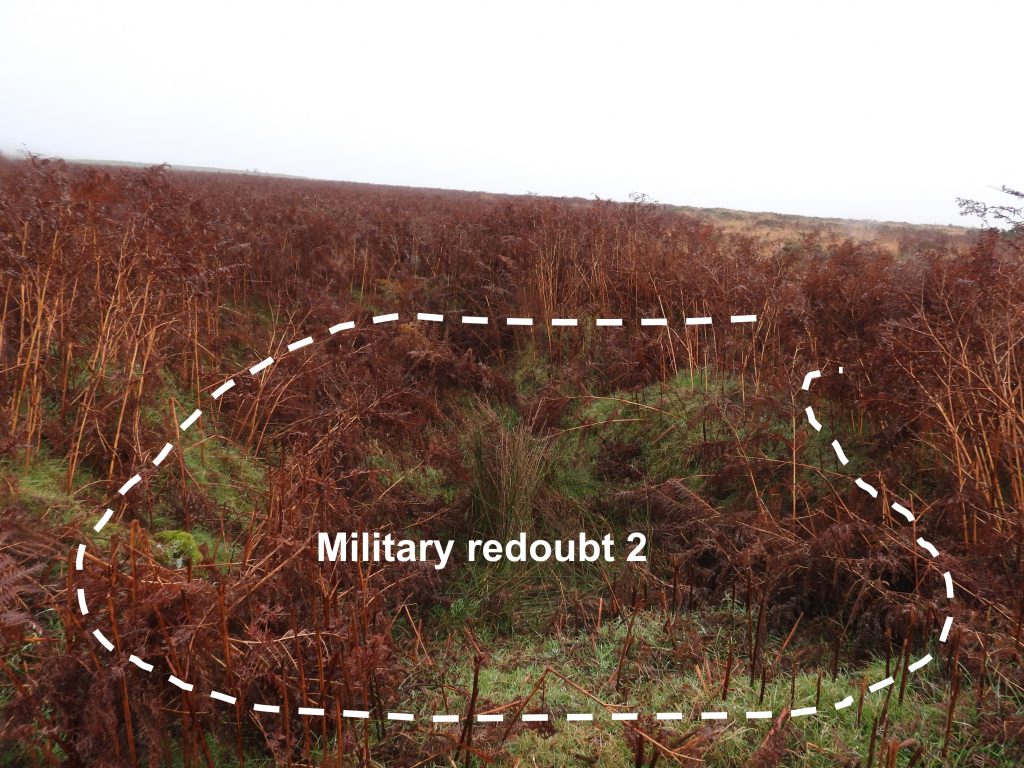
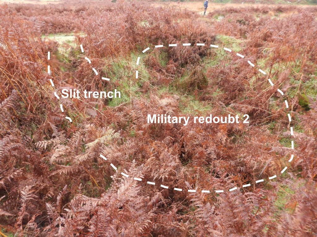
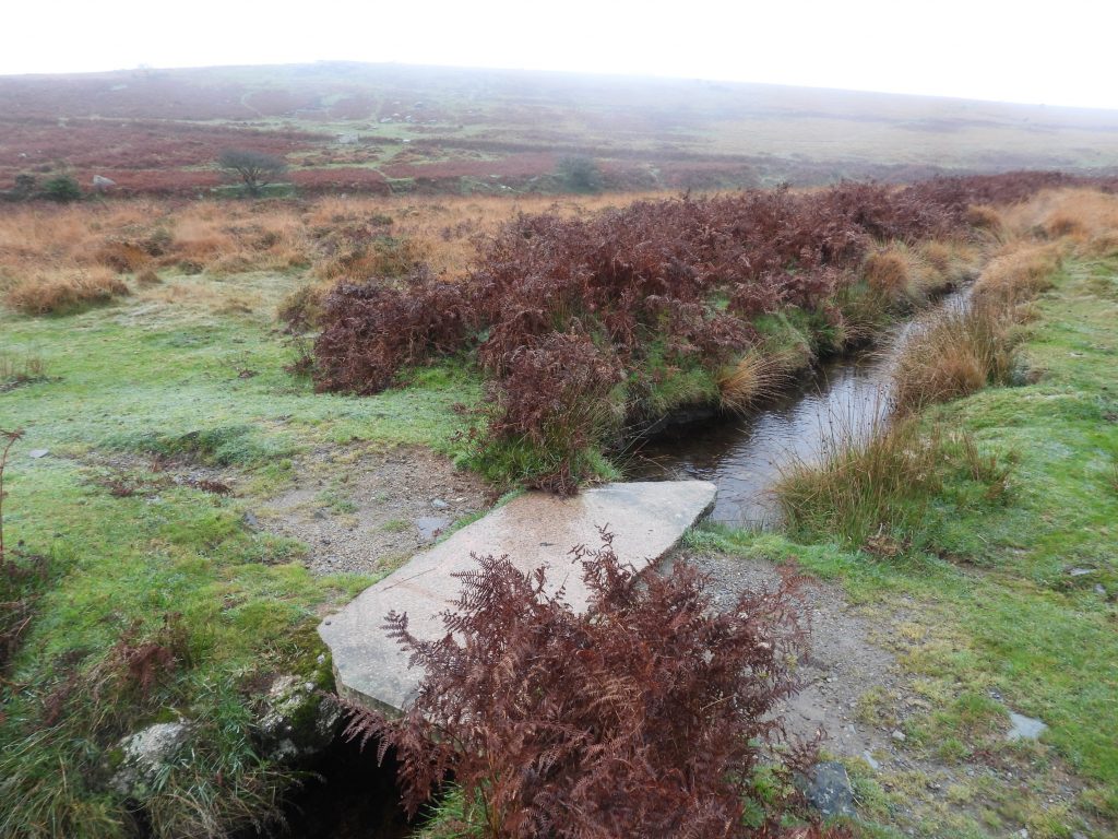
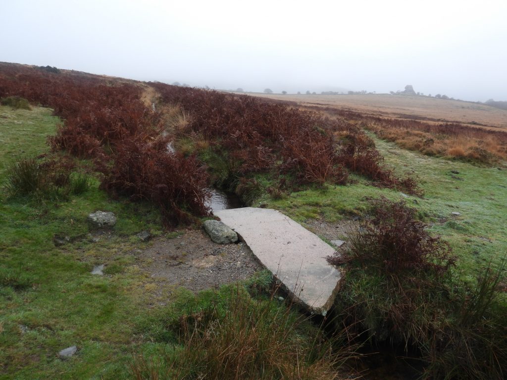
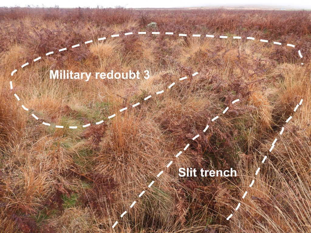
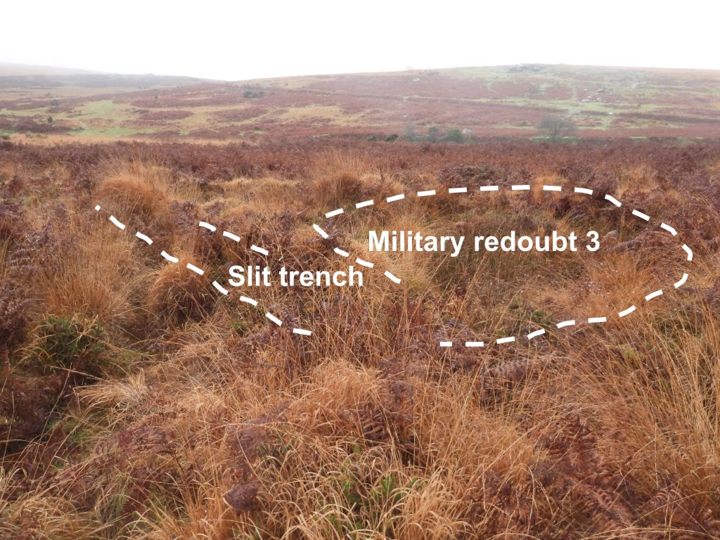
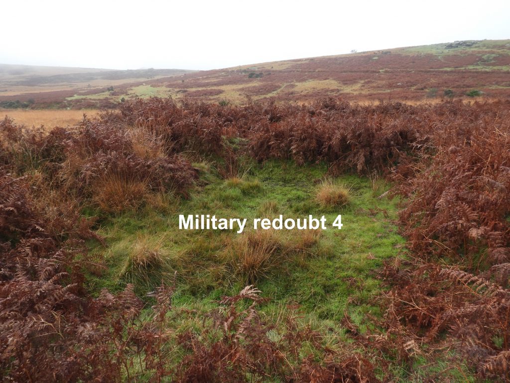
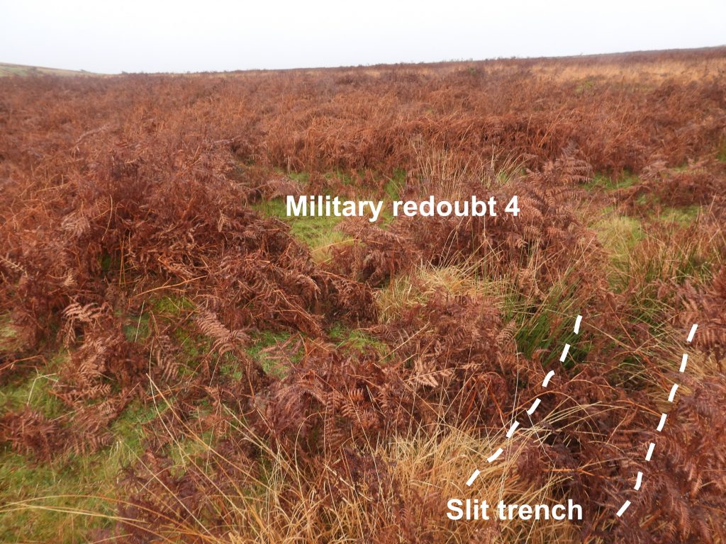
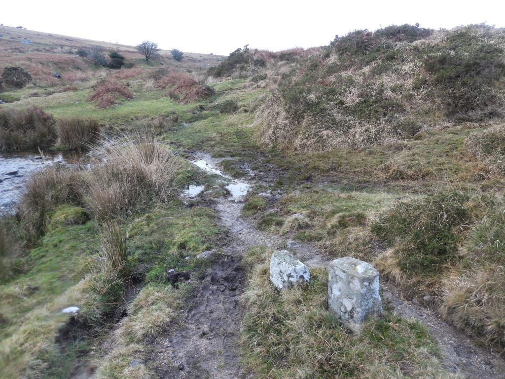
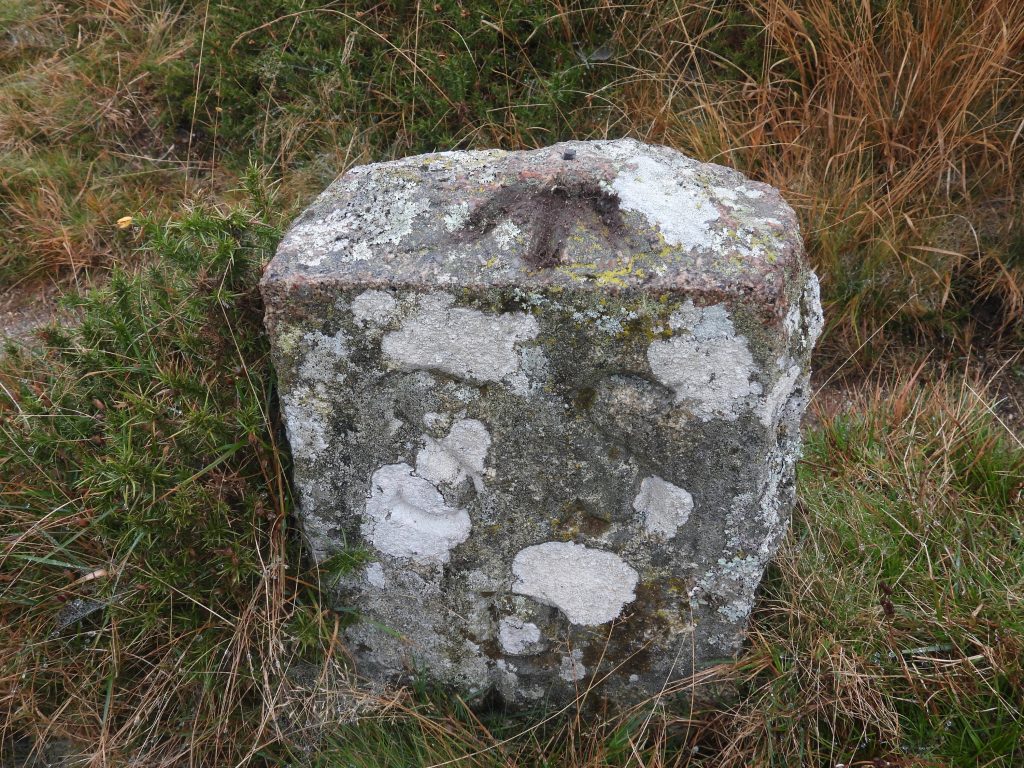
Sketch map of the features covered in this post. The aqueduct over the Beckamoor Brook carries the Grimstone and Sortridge Leat. The leat take off point (head weir) is on the River Walkham, north of Shillapark at SX5528 7729. The leat served the medieval manor houses of Grimstone and Sortridge, near Horrabridge and is over 9km long.On the north west side of the launder is an inscription “John Wills 1953-1987”.Close up of the inscription.The ruined smithy (Blacksmiths shop) lies to the west of the Grimstone and Sortridge Leat. It is believed to have been erected in 1871 (source: Dartmoor Trust) to serve the needs of stonecutters and their horses working the granite on their setts, which included Pew Tor and Staple Tors.The Blacksmiths Shop was demolished in June 1964 by Blundell’s School Army Cadet Force with the authorisation of the Dartmoor National Park Committee.The Blacksmith’s Shop was also known as the “Mine House on Barn Hill”. Another piece of history relating to this location is that “it was at this spot in 1858 that John Bickle was caught and arrested for the attempted murder of Joanna Bolt at Huckworthy Bridge School House” : Source: Mike Brown (2001) Guide to Dartmoor, CD-ROM. This event would have taken place before the building was erected.A well known feature in this area is a former wheel-binding stone which was used by the wheelwright to fit an iron tyre around the outside rim of a wooden wheel.The Wheelwrights form is located adjacent to the Grimstone and Sortridge Leat and a small granite clapper.Historic England described this as “The remains of a medieval farmstead on Whitchurch Common. The longhouse has been truncated by the Beckamoor Combe streamwork”. The truncation is certainly evident at the lower end of the remains.The building lies below the Grimstone and Sortridge Leat and not far from site of the Blacksmith Shop and Wheelwright form on the west side of Beckamoor Combe. It can be found at SX53683 74762.Described by R.G.Haynes (in Dartmoor HER) as “a simple longhouse without apparent division, probably cross-passage type”.Described by Dr Phil Newman (Dartmoor HER) as “well defined rectangular earthwork incorporating vestiges of walling and-turf covered tumble”.This Longhouse is certainly “lost” to bracken during the Summer months and can be located at SX53687 74901This area was used for military training during World War II and during this time at least four redoubts were excavated.Each if the Military redoubts is a roughly circular earthwork comprising a flat-bottomed hollow with embanked side and internal divisions. Military redoubt 1 was recorded at SX53734 74900 The Military redoubts have previously been described as hut circles and medieval remains by Dartmoor recorders and observers. Military redoubt 2 has a clear slit trench entrance. The redoubt was recorded at SX53758 74886.This granite clapper crossing the Grimstone and Sortridge Leat is unusual insofar as it is a polished slab. It has a couple of pieces broken off it. The author summises that the slab was once part of something ornate (perhaps a wall or a hearth) but was re-purposed due to the breakages.The granite clapper is close to Longhouse 2 at SX53741 74868.Military redoubt 3 is south of the Grimstone and Sortridge Leat and has a slit trench entrance.Military redoubt 3 with Barn Hill in the background. The redoubt was recorded at SX53770 74849.The fourth Military redoubt (and most southerly) in the area was the least overgrownThe fourth military redoubt also has a slit trench entrance. The redoubt is at SX53779 74816.A pair of boundary stones are inscribed SSP (Sampford Spiney Parish) on their southern faces can be found close to a ford on the Beckamoor Brook. These BS’s mark the northern point of an area known as “Ace of Diamonds”. The pair of stones were recorded at SX53761 74731The eastern of the two boundary stones has a benchmark inscribed on its top surface complete with rivet.