A collection of walks, discoveries, insights and pictures of exploring Dartmoor National Park
November 17, 2021
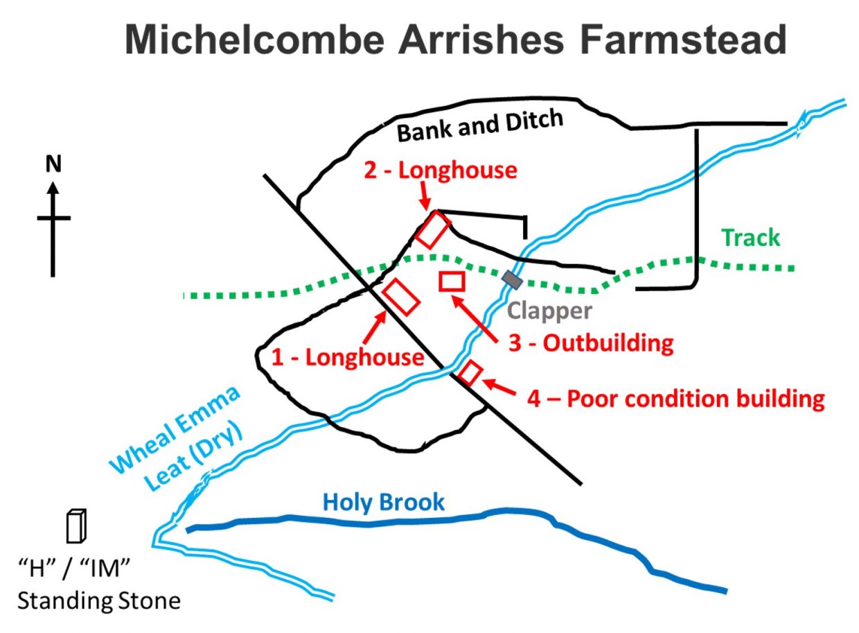
Michelcombe Arrishes Farmstead
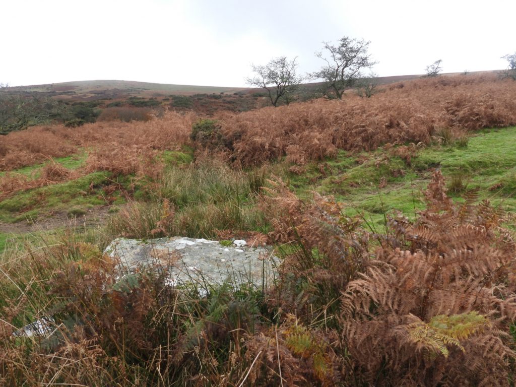
This farmstead comprises a cluster of four Medieval or later buildings, which lie in a sheltered south-east facing combe on the south-east flank of Two Barrows Hill. The buildings comprise two longhouses (albeit only one is fully recognised by some observers recorded on the Dartmoor HER) and two further rectangular buildings. The site also comprises two terraces and associated enclosures and is bisected by the (now dry) Wheal Emma Leat which is crossed by a track where there is a small granite clapper. Nearby towards the head of Holy Brook is an old granite post inscribed “H” (for Holne) and “Im” (for Ian Mercer). It is best to visit this area during the late Autumn and Winter months when the bracken has died down.
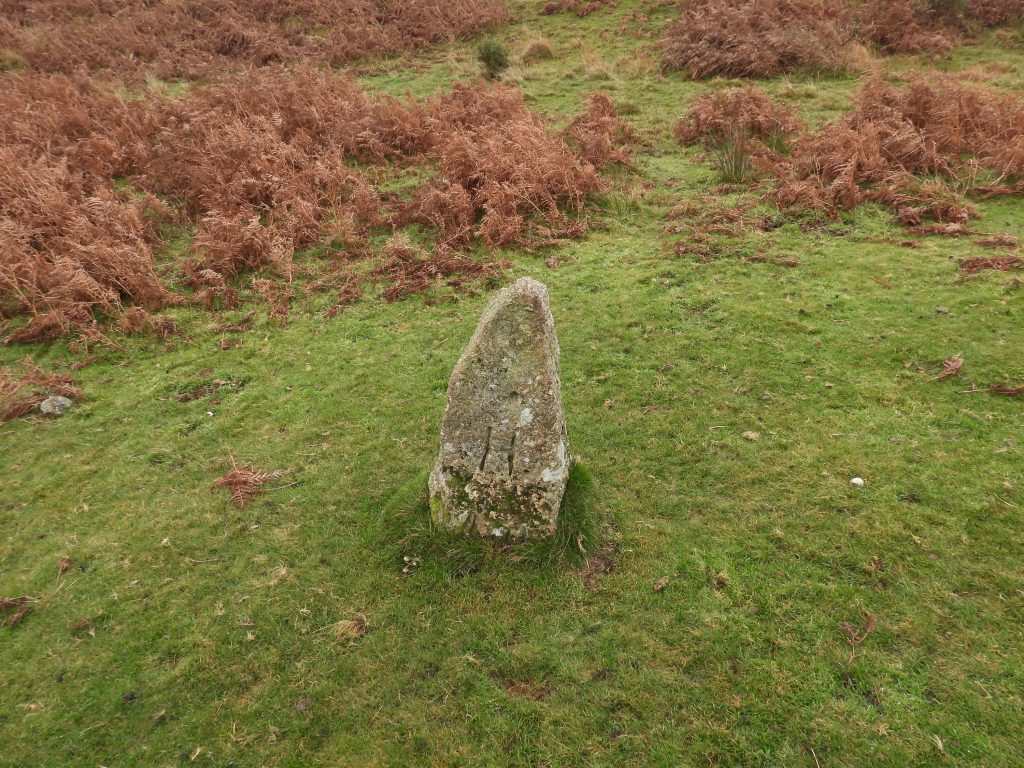
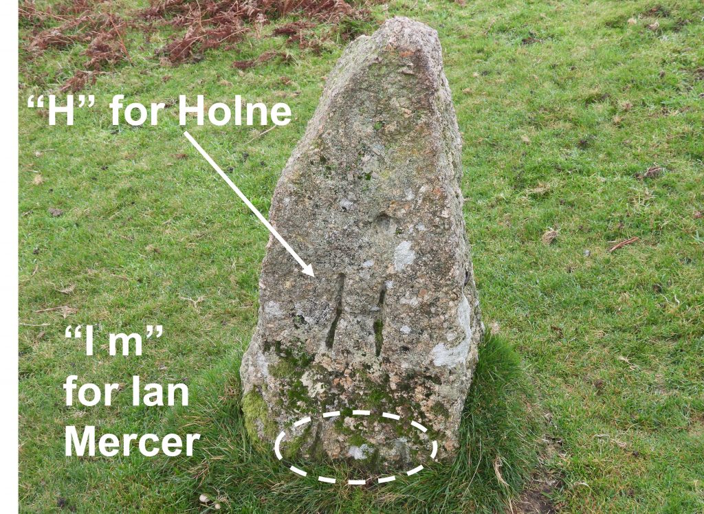
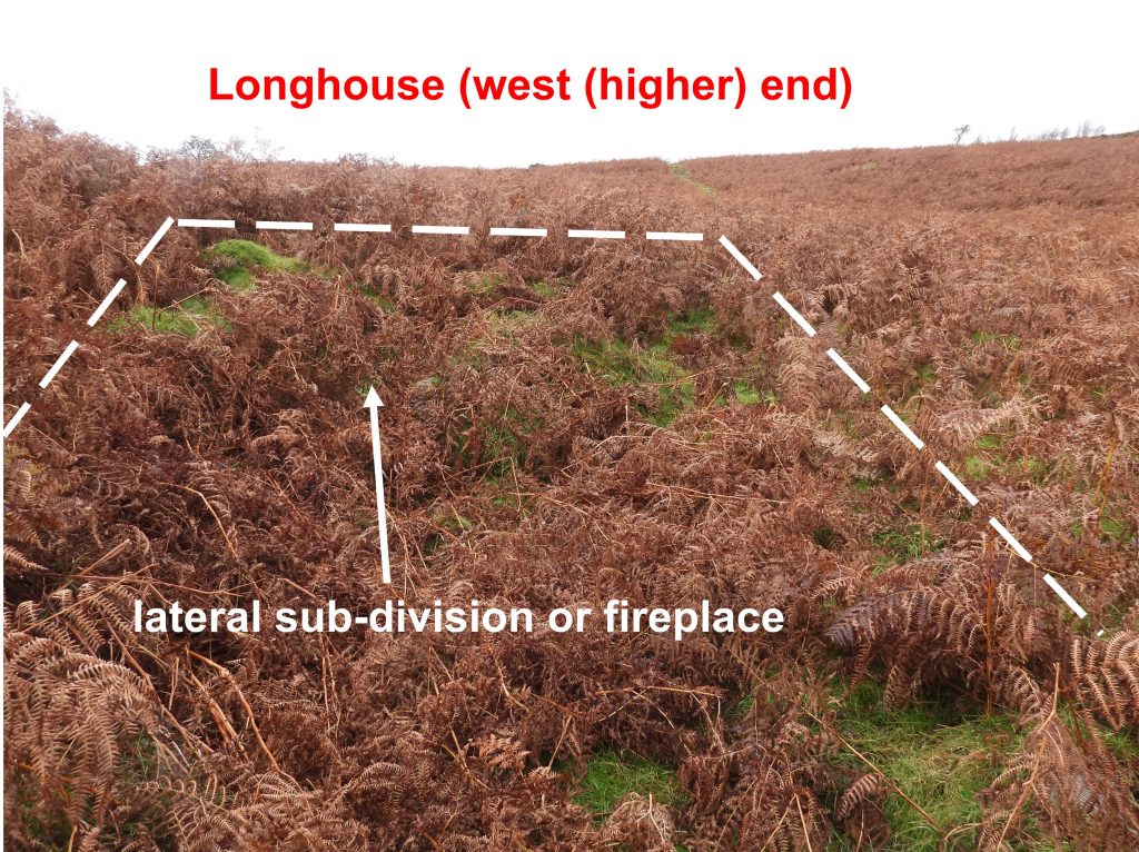
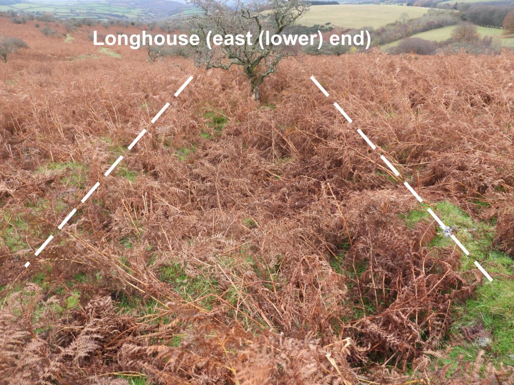
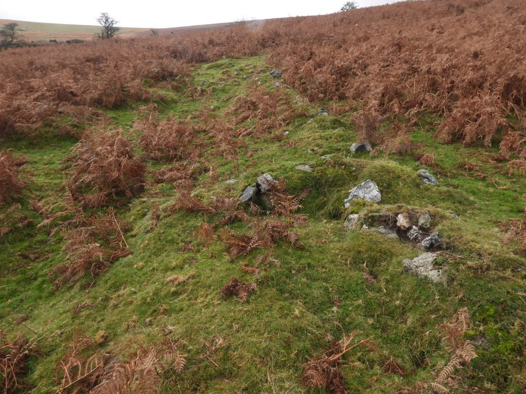
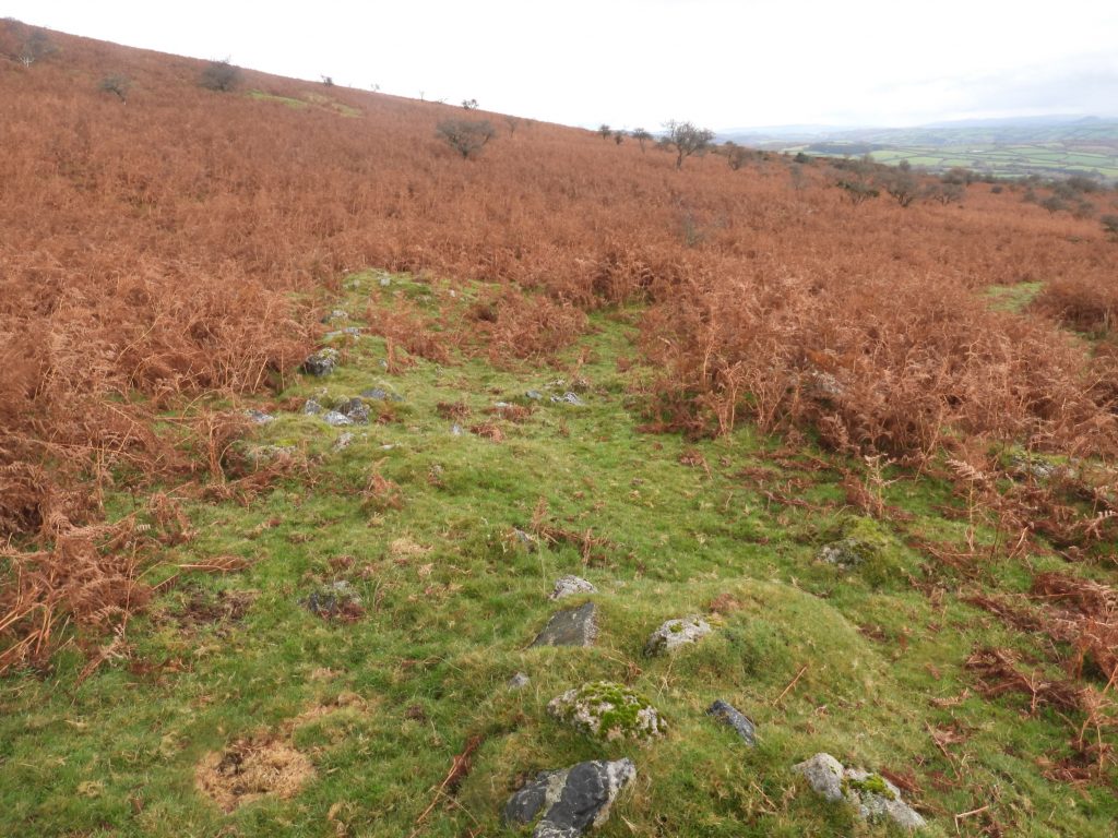
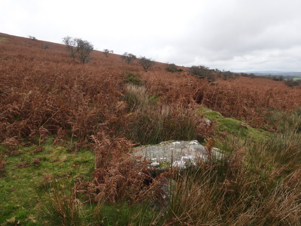
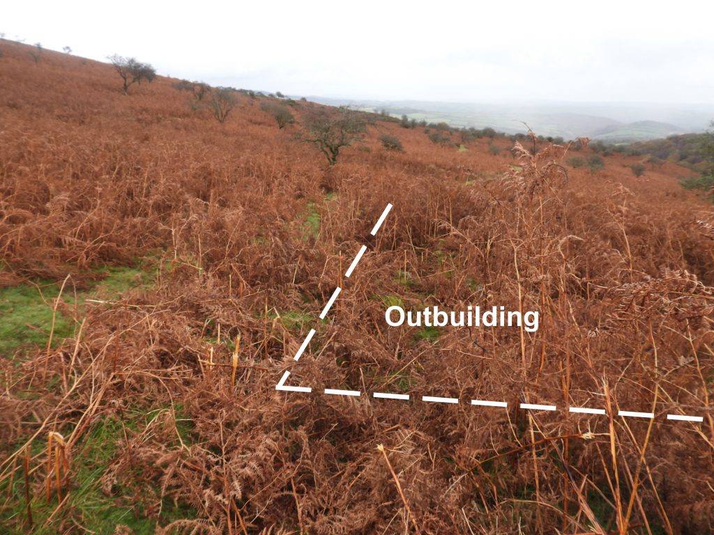
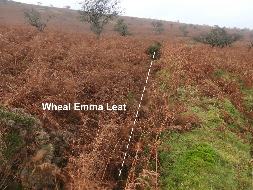
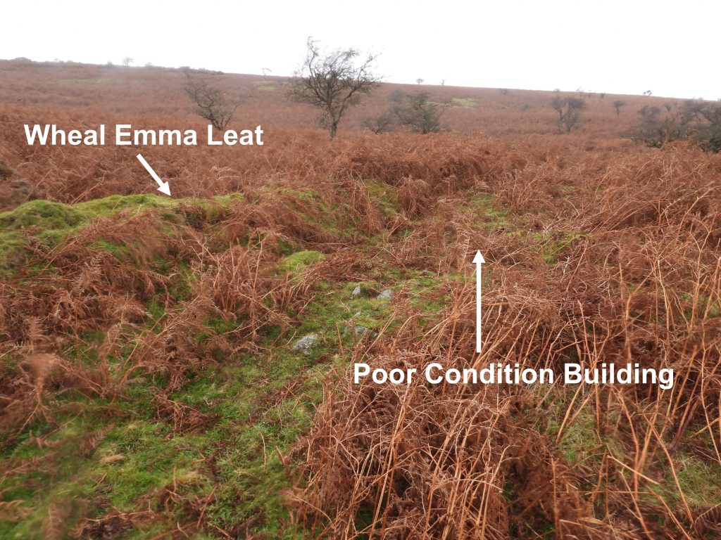
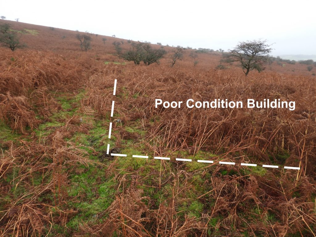
Sketch map of the the features covered in this post. The map is based on one found in Jeremy Butler’s Dartmoor Atlas of Antiquities (South East), Page 169, figure 58.6. This is a relatively new set boundstone, dating from 1990. It is located at SX67820 68647. It was ‘unveiled’ at the 1990 beating of the bounds, when Ian Mercer, the then Dartmoor Park Officer and acting steward of Holne Manor on behalf of Devon County was asked to remove a covering of bracken to reveal it.The stone is inscribed with the obligatory ‘H’ but also (in sans-serif apparently) the initial I m (Ian Mercer). The stone was a token of appreciation by the Commoners for Ian Mercer for all he had done for the moorland farming community and Dartmoor in general. He was, apparently, ceremoniously ‘bumped’ on the stone, being lifted by several of those assembledMarked as 1-Longhouse on the sketch map, this building according to the Dartmoor HER is the only building which can be identified as a true longhouse. It is a long tapering building with the dwelling end measuring 7.5 metres by 3.9 metres. There are traces of a lateral sub-division or fireplace at the upper, west end.1-Longhouse is recorded by Butler as measuring 14m x 2.5m. The author found walls which appeared to extend beyond the tree shown in the picture. The corner of the building was recorded at SX68069 68833.The building marked 2-Longhouse is the most exposed (free from bracken) on the site. Butler records this as a building with cross walls measuring 14m x 3.3m, but not as a Longhouse per-se. The Dartmoor HER describes this building as possessing traces of a cross-passage with the interior is divided into three rooms, the largest being in the middle of the building with access from it to the others. In plan this building resembles a small hall. An entry in the Dartmoor HER intimates this may have been a Longhouse, albeit most of the commentaries do not describe it as such. The centre of this building was recorded at SX68078 68861.The clapper bridge across the Wheal Emma Leat comprises a single slab of granite laid over the leat and is reported to measure 1.8m by up to 1.2m and 0.25m thick.The granite clapper rests on edge set stones placed in the side of the leat. The clapper can be found at SX68135 68839. Marked as 3-Outbuilding on the sketch map, these foundations can be found next to a small path. It is a very overgrown and poorly constructed building is situated at SX 68094 68842. It is recorded as being “cut into the gently sloping ground and measuring 6.8 metres by 2.7 metres internally with coursed boulder walls 1.0 metres wide and 0.5 metres high”.The foundations marked as 3-Outbuilding has reported traces of an entrance slightly east of centre in the north side and a possible fireplace is visible in the lower, east,end. The author found these features but with all the bracken these were difficult to photograph as the bracken hadn’t died off enough. Wheal Emma Leat bisects the farmstead. Astonishingly the leat starts at River Swincombe, near Fox Tor mire on its long journey (14.9 kilometres / 9.25 miles) to supplement the River Mardle whose water was used for the Wheal Emma mine, which is located to the east of Combe near Brook Manor.Next to the Wheal Emma Leat on the south-east side of the site lies a building described by observers as being poor condition. It is labelled as 4-Poor Condition Building on the sketch map. This building is believed to measure 9 metres by 6 metres internally and has tumbled walls about 1.5 metres wide. Many walls can be traced but are difficult to photograph with all the bracken.The building is very poorly preserved, which probably is as a result of disturbance to a contemporary field wall by the constructors of the Wheal Emma Leat. The recorded location is SX68114 68795.