A collection of walks, discoveries, insights and pictures of exploring Dartmoor National Park
October 9, 2020
YELLOWMEAD FARM, WILLSWORTHY
Steve Grigg and Frank Collinson
The ruins of this farm lie very close to the route of the Lych Path (or Way) which runs from Lydford to Widecombe, therefore is is possible that there may have been a farmstead here since medieval times. The farm may have once been called “Old Meade” at one time as the prefix of “Yellow” in Dartmoor placenames can sometimes be derived from the word “Old”. From a fabulous survey conducted by Dr Tom Greeves in 2008, the farm historical records can be found from 1672 to 1904.
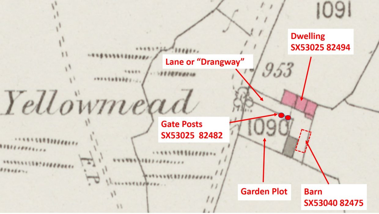
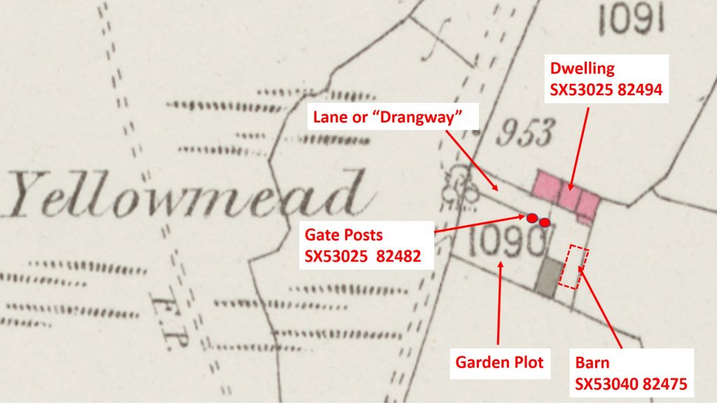
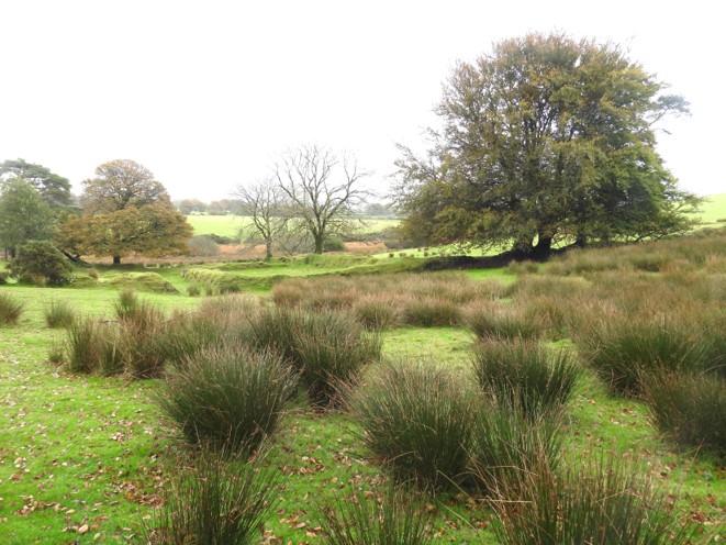
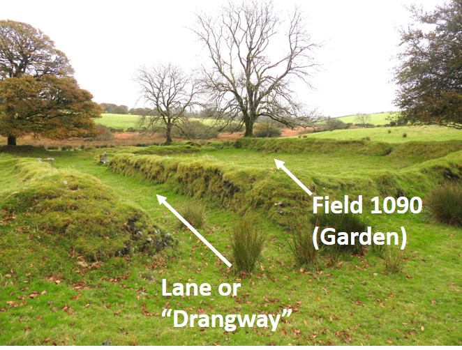
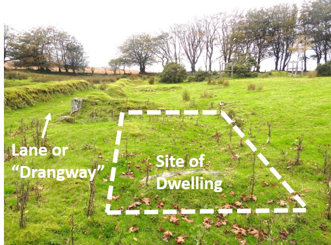
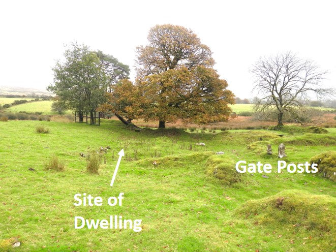
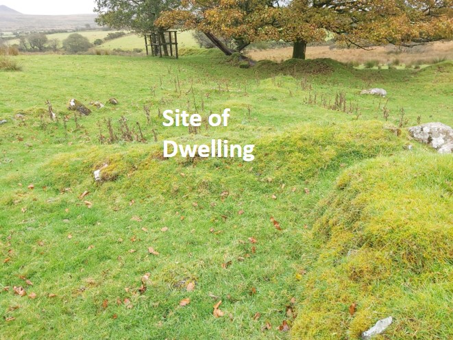
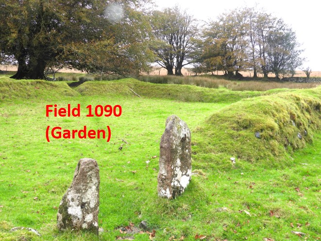
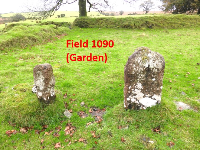
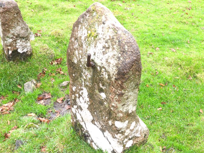
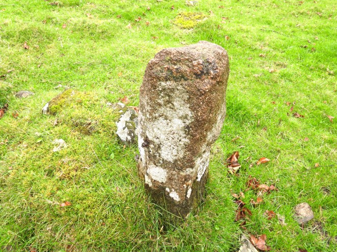
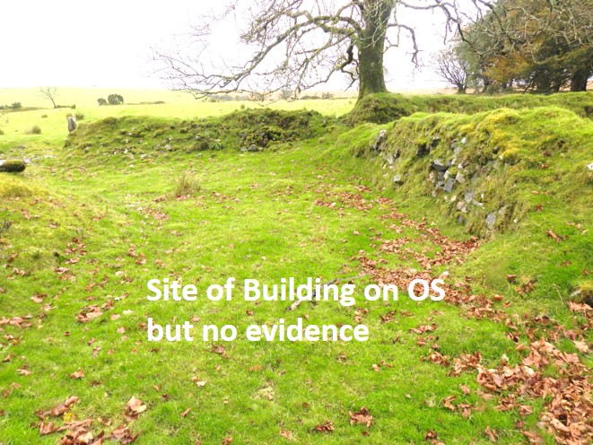
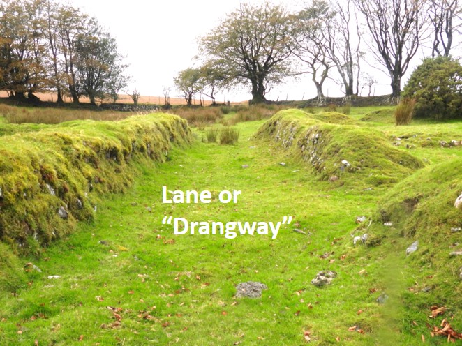
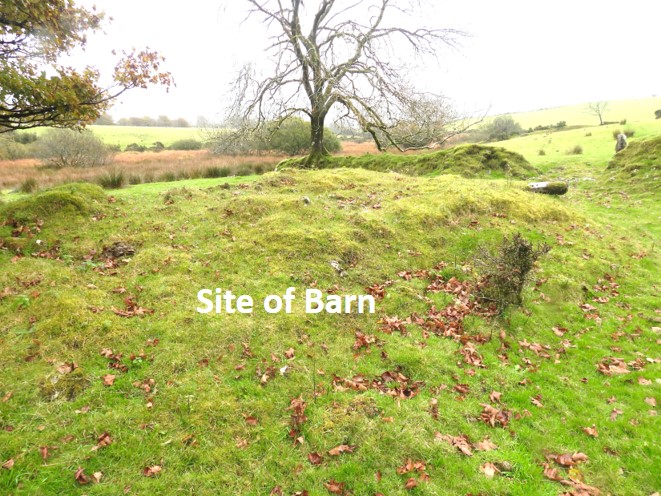
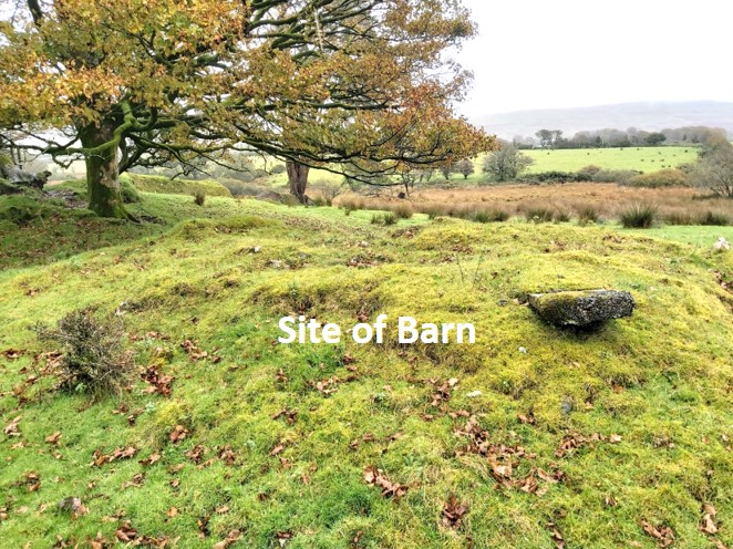
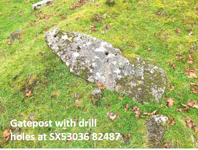
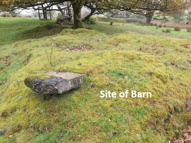
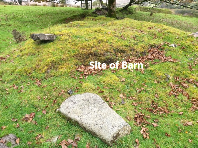
OS Map from side-by-side map, dated (1873-1888) overlaid with the key features contained in this postGeneral view of the farm approaching from the Lych Path / Way from the westTwo of the most striking features noted when first approaching the farm are the lane or “drangway” and Field 1090 (see map), which was the garden.To the north east of the lane, the foundations of a dwelling can be made out (as per the location shown on the map). Stone from this building were taken for use on other sitesAnother view showing the site of the dwelling in relation to two gateposts, which are at the entrance to field 1090 (the garden). This view is looking east.Close up view of the site of the dwellingThe Dr Tom Greeves report states that this field is : “internally approx 21m x 12m and bordered by hedgebanks mostly about 1m in height but reaching 1.5m at the lower end.”The field was the garden plot. These posts are at SX53025 82482.Detail of the west most gate post into the garden. In the Dr Tom Greeves report it is stated that this, the westernmost of the two posts “has a maximum height of 1.15m, with remains of iron hangings on its N side”Details of the east most gate post stated as having “a maximum height of 0.90m and has a chamfered edge on its NE side. This chamfer is about 0.10m wide and suggests that the stone might be a fragment of dressed building stone, perhaps of the sixteenth or seventeenth century. There is an iron plug set in the chamfer.” The iron plug is discernible in the pictureThe OS map shows a grey rectangle indicating there should be a building to the south east of the garden. This is the location clearly shows no building, but there is one adjacent to this location and the edge of which can just be seen on the left side of this picture.The ‘lane’ or ‘drangway’ is aligned approximately NW-SE and mostly about 3m wide. It gives access from the NW to the farm complex itself. (ref. Dr Tom Greeves).This is the most conspicuous building remains on site at SX53040 8275. It is a stony mound (3 and is approx. 10m x 8m and around 0.8m max. height.Another view of the site of the barn. There are some discarded gateposts and slab associated with this featureOne such feature found at the site of the barn was this gatepost with four drill holes (SX53036 82487). Three drill holes are easily seen. The fourth hole was plugged with lead and the “stain” from the lead can be seen weeping down the gatepost. The fourth hole is just below the right hand most third obvious hole in the picture.Another view of the site of the barnFinal view of the barn with another piece of discarded stone