A collection of walks, discoveries, insights and pictures of exploring Dartmoor National Park
October 5, 2020
EXPLORING BURRATOR WATERSHED – OLD RUINED FARMS, ONE SUBMERGED FARM, PLUS A LODGE, MANOR, COTTAGE AND AN INN
Steve Grigg and Frank Collinson
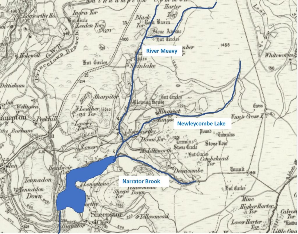
This post covers the watershed area of Burrator Reservoir and includes the valleys of Narrator Brook / Deancombe Brook, Newleycombe Lake and the Meavy. The aim of this post is to photographically record most of the dwellings (mainly ruined) which have frequented the area since the 14th century up until last century. There are 17 farmsteads contained in this post plus a manor and an old inn. Much of the information in this post has been gleaned from Dartmoor Historic Environment Record (HER) and “Exploring Around Burrator” by Paul Rendell.
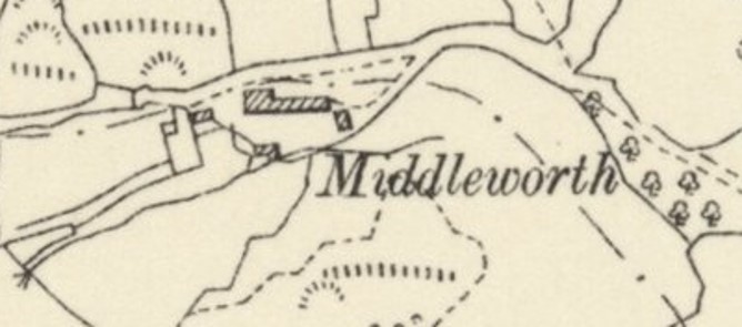
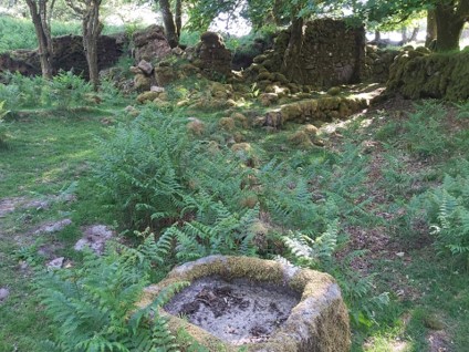
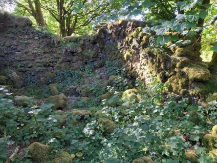
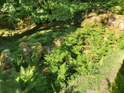
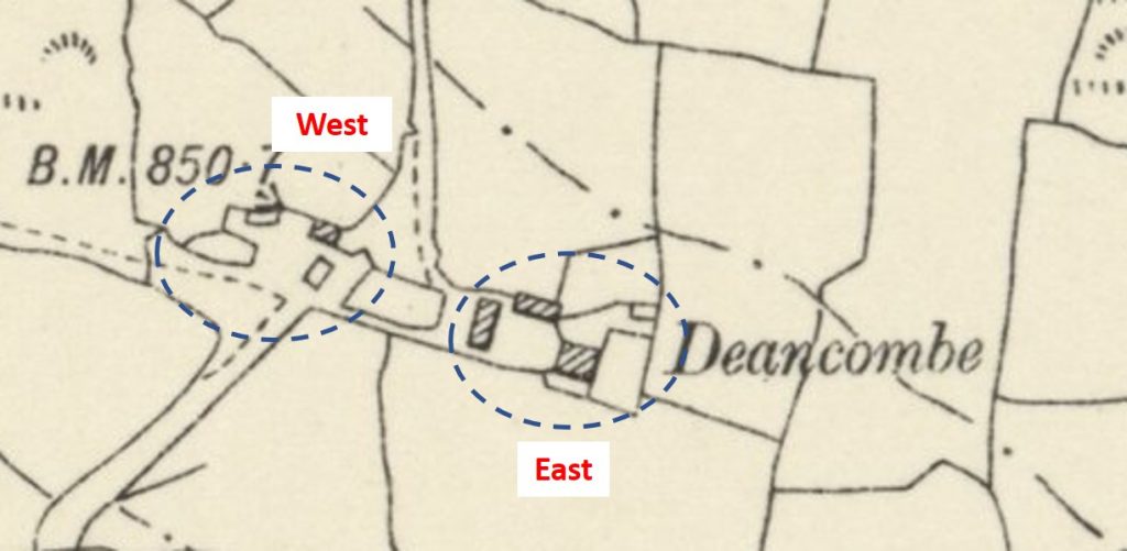
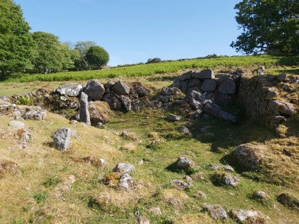
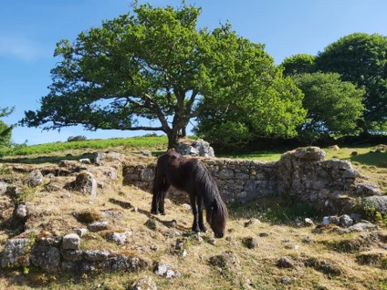
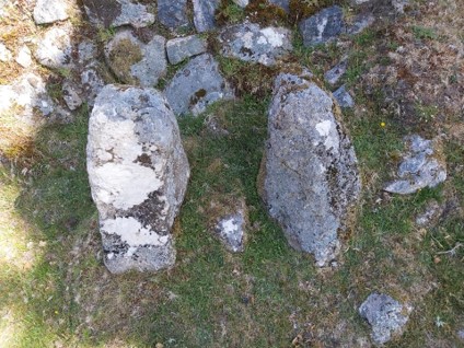
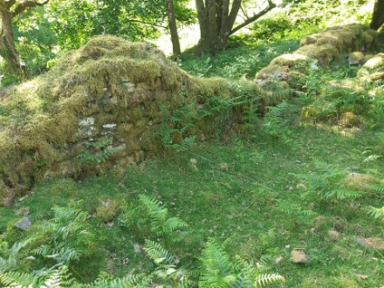
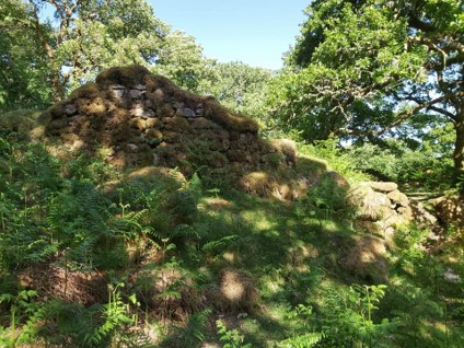
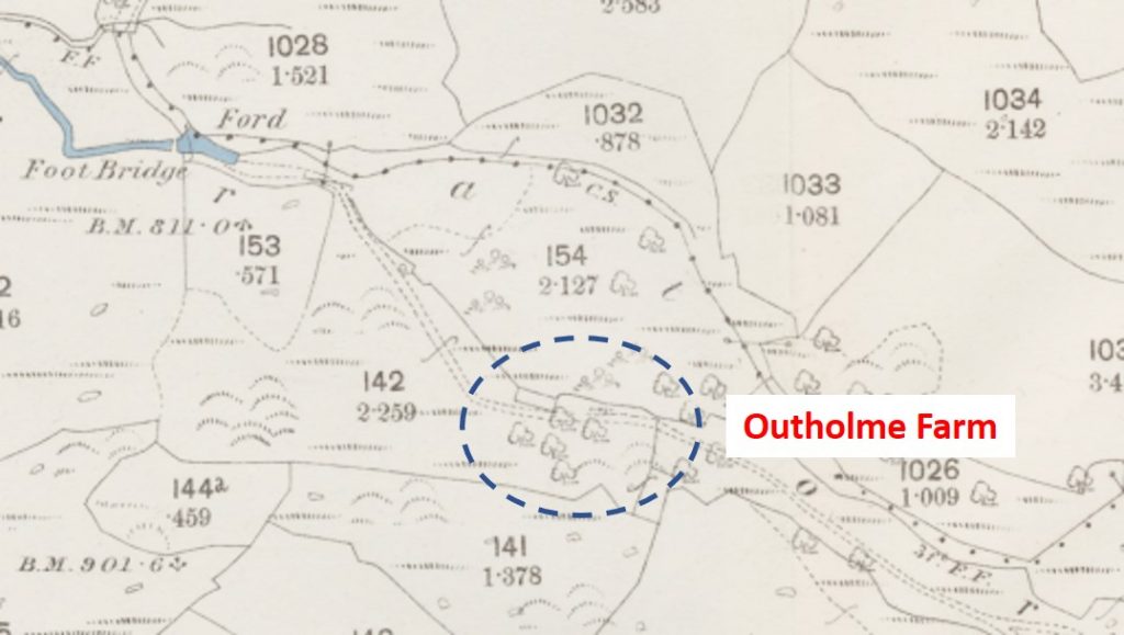
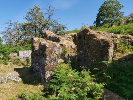
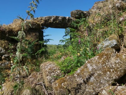
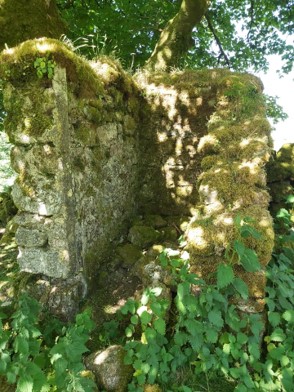
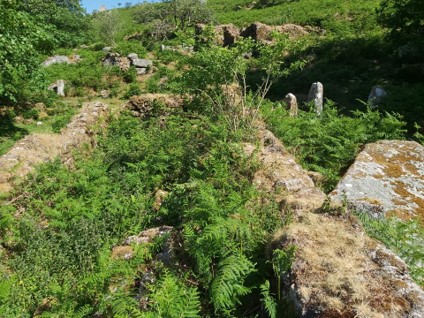
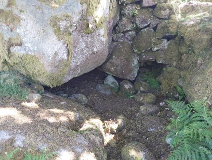
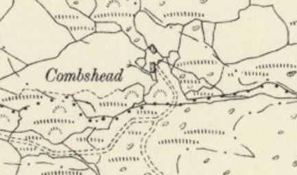
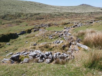
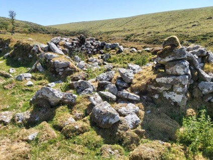
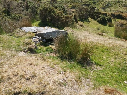
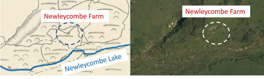
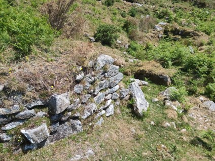
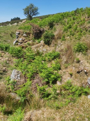
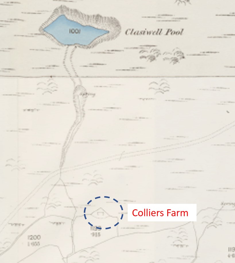
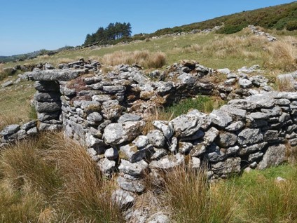
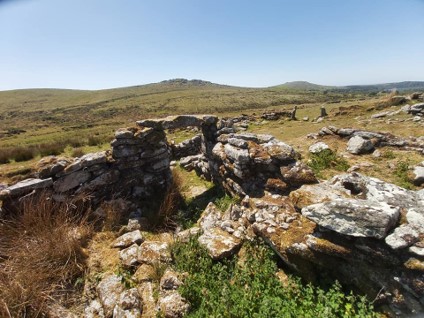
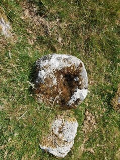
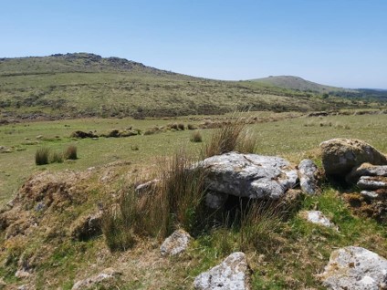
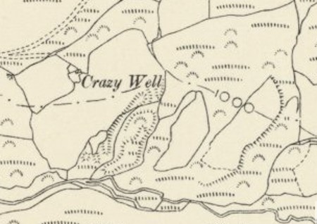
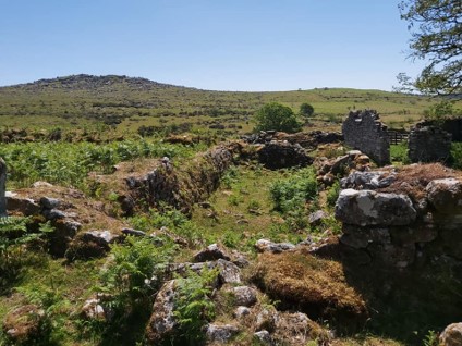
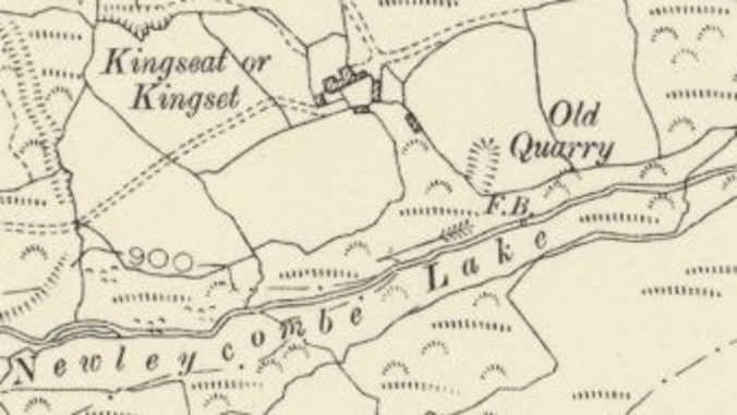
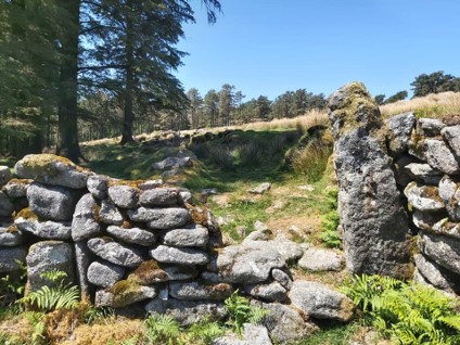
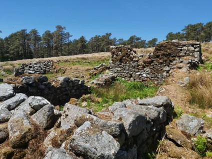
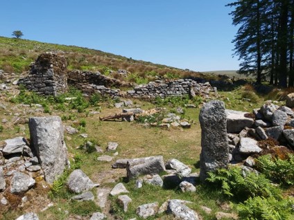
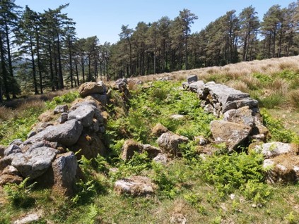
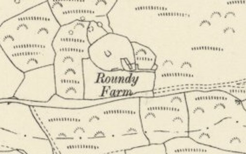
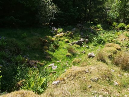
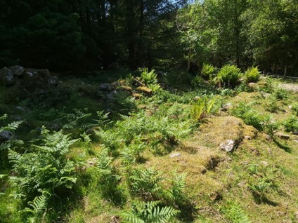
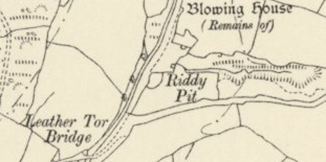
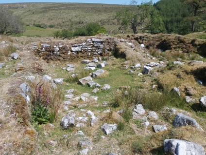
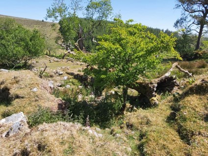
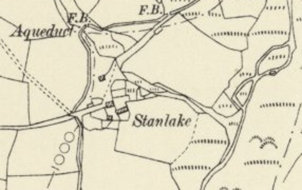
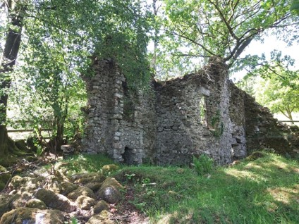
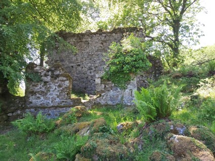
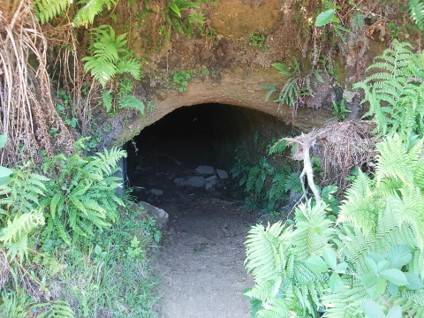
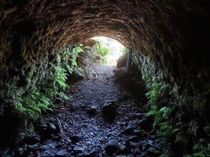
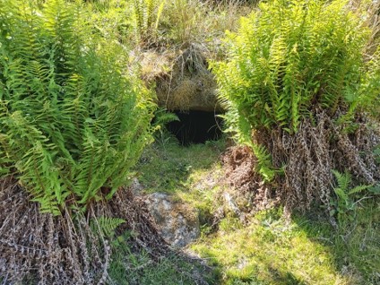
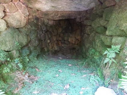
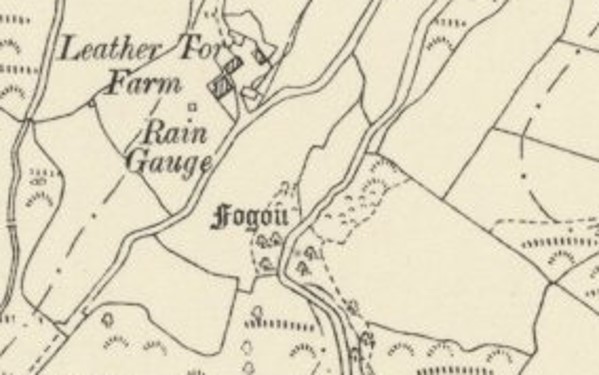
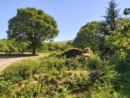
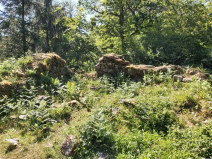
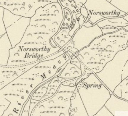
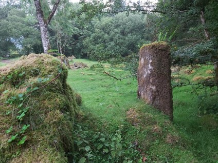
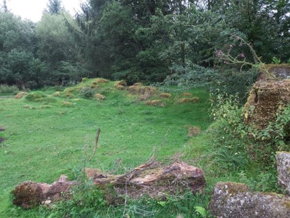
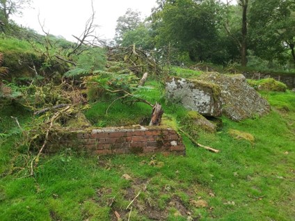
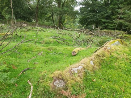
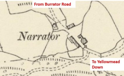
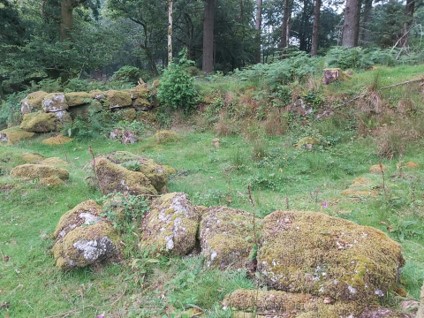
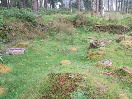
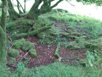
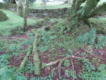
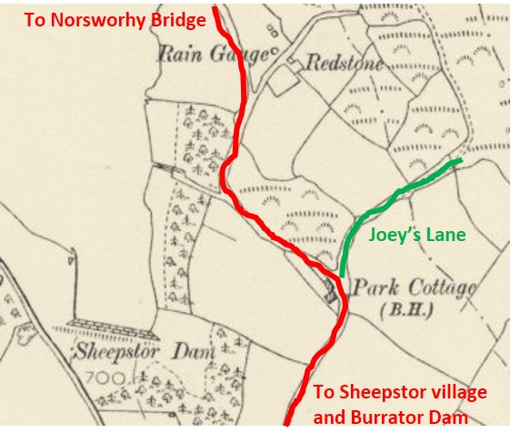
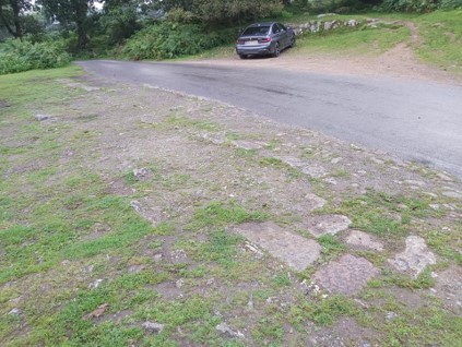
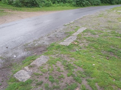
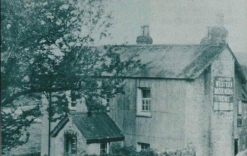
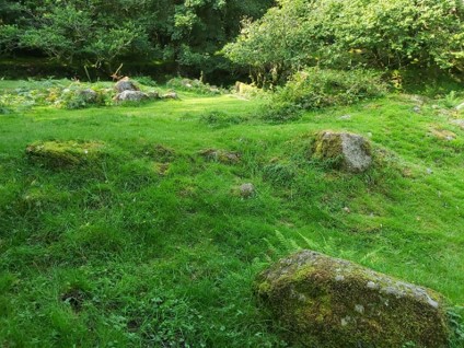
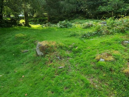
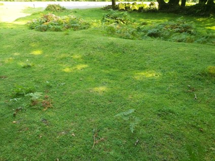
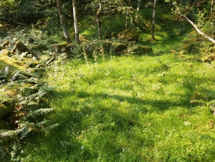
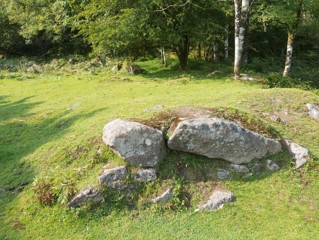
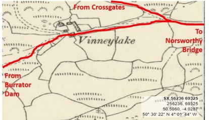
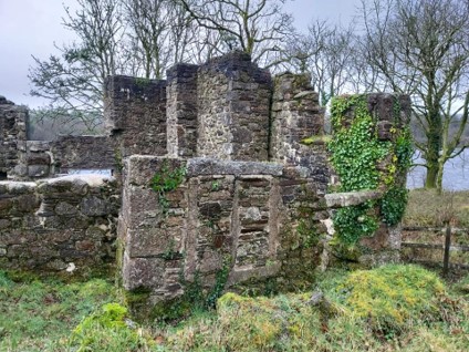
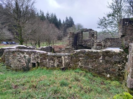
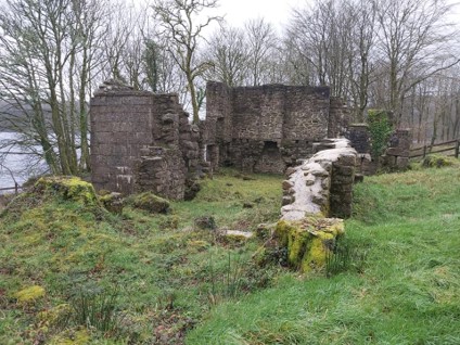
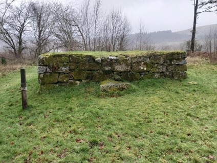
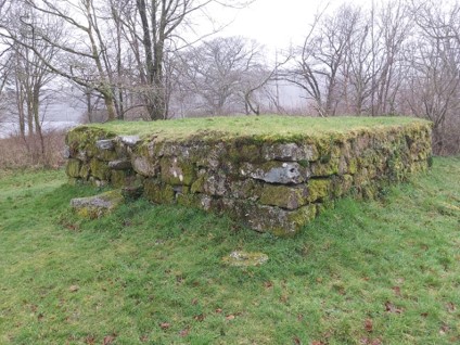
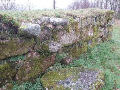
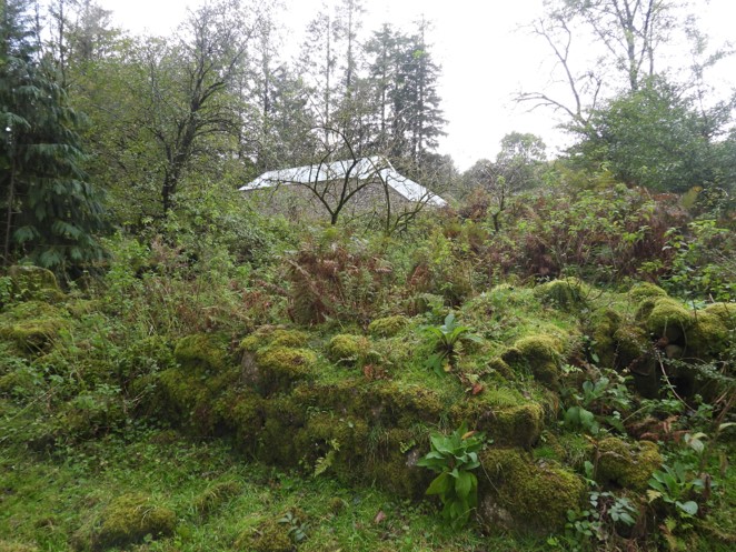
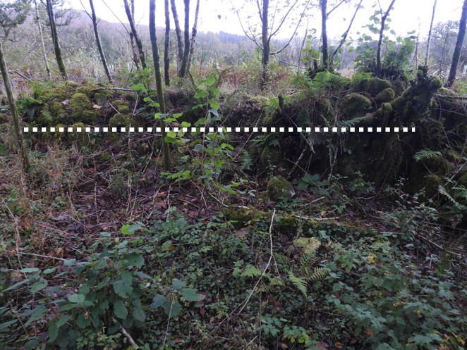
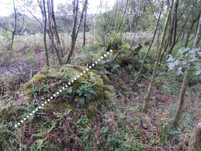
Burrator Reservoir watershedMiddleworth Farm. SX57208 69177. This is the first ruined farm up Narrator Brook (Deancombe Valley)Middleworth Farm. SX57208 69177 Earliest reference 1281, abandoned by 1919.Inside Middleworth Farm ruin. SX57208 69177Map from 1900The next farm along the track from Middleworth is West Deancombe Farm (with trough SX57934 68788)West Deancombe Farm main building SX57950 68792. It was known there were two farmsteads at Deancombe in 1582.West Deancombe, outbuilding SX57927 68810Map from 1900 of the two Deancombe FarmsEast Deancombe FarmEast Deancombe Farm. SX58021 68757 with local residentTwo pillars for a grinding wheel. SX58043 68769Taking the track southwards between East and West Deancombe farms and crossing the Narrator Brook, Outholme Farm can be found. Abandoned around 1849. SX58028 68544Outholme Farm. Abandoned around 1849. SX58028 68544Location of farm in relation to Narrator Brook. There is also a lovely Blowing House between the brook and the farm ruinsReturning to Deancome Farms (West and East) and following the track up the valley past Cuckoo Rock we come to Combeshead Farm. First recorded mention around 1768 and abandoned in 1931.Combeshead Farm. SX58558 68546Was this the outside toilet at Combeshead Farm ? SX58551 68522Outbuilding at Combeshead Farm. SX58561 68511Underground store at Combeshead Farm? SX58569 68528Potato Cave just up the track from Combeshead Farm. SX58640 68552Inside the potato cave. Storage for root vegetables with a pleasant temperature regardless of the time of year.Map from 1900Heading north from Combeshead Farm, passing Hingston Hill Stone Row, then dropping down into the Newleycombe Lake Valley we find Newleycombe Farm. First recorded 1584, abandoned around 1839. SX58764 69936. Down Tor can be seen in the above picture.Newleycombe Farm. First recorded 1584, abandoned around 1839. SX58764 69936This square feature in an enclosure wall, looked like it allowed water into the farmstead ? SX58777 69944Clapper below Newleycombe Farm over the leat that bypassed the farm. SX58820 69927Newleycombe is not named on 1900 map, but is easily locatedMoving west from Newleycombe Farm in direction of Crazwell Pool, we come to Colliers Farm. SX58252 70157. Abandoned by 1840. Paul Rendell describes the location as being between Newleycombe Farm and Crazywell farm at SX582 701. The Dartmoor HER describe this location as a longhouse associated with Crazy Well Farm. It is further stated that it is a medieval farmstead first documented in 1585. MDV104029Colliers Farm. SX58252 70157. Abandoned by 1840Location of the Longhouse / Colliers FarmA short distance west from Colliers Farm we come to Classywell (Crazywell) Farm. First recorded 1565, abandoned 1914.Classywell Farm with view to Down Tor and Sheepstor. Burrator reservoir just visible. SX58089 70046Quern. SX58091 70041Dog Kennel at Crazywell Farm. SX58078 70047Mao from 1900 (Crazywell / Classeywell)Just west of Crazywell Farm is Kingsett Farm. First recorded 1333, abandoned 1924. SX57666 69915Kingsett Farm. First recorded 1333, abandoned 1924. SX57666 69915Kingsett Farm. First recorded 1333, abandoned 1924. SX57666 69915Kingsett Farm from1900North of Kingsett Farm. Entrance to Roundypark Farm. SX57853 70108Roundypark Farm. First recorded 1668, abandoned around 1841Roundypark Farm. First recorded 1668, abandoned around 1841 SX57807 70120Second building at Roundypark Farm. SX57787 70113Map from 1900, farm close to track heading from Norsworthy Bridge to Older BridgeRiddipit Farm Longhouse. First recorded 1564, abandoned by 1871. SX56996 70083. Next to track between Norsworthy Bridge and River Meavy (near aqueduct)Riddipit Farm Longhouse. First recorded 1564, abandoned by 1871. SX56996 70083Map from 1900. There is a Blowing House close to the Riddipit LonghouseNear Devonport Leat in the Meavy Valley is Stenlake Farm. First referenced 1281, abandoned in 1920’s. SX56930 70918Another building at Stenlake Farm. SX56955 70917Stenlake (Stanlake) Map from 1900Leather Tor Farm. First mentioned in 1362, abandoned in 1924. SX56677 69809Leather Tor Farm. First mentioned in 1362, abandoned in 1924. SX56677 69809Leather Tor Farm potato cave SX56718 69810Inside the potato cave.Vooga / fougou below Leather Tor Farm. SX56720 69769Inside the vooga / fougou. Map from 1900, complete with “fogou” location. The Rain gauge location can also still be found.Norsworthy Farm. First recorded 1384, abandoned after 1891. SX56831 69486Norsworthy Farm. First recorded 1384, abandoned after 1891. SX56831 69486Map from1900. The farm is just up the track from Norsworthy BridgeNear the base of Sheepstor. Part of Narrator Farm at SX56705 68777Part of Narrator Farm from slightly different angle at SX56705 68777Part of Narrator Farm at SX56730 68737. Farm was last used in 1923.Raised platform, presumed part of Narrator Farm at SX56728 68733Map from 1900Heading towards Sheepstor (Dam / Village) from Narrator Farm, we come to Redstone Farm Building #1 at SX55865 68201 Redstone Farm Building #1. Built in the 18th Century. The first owner was a John Collier, who let a Mr John Atwell live there.Redstone Farm Building #2 at SX55840 68238Redstone Farm Building #2. The last tenant was in 1891.Location of Redstone Farm and Park Cottage InnFoundations at Park Cottage, now used as a car park. Two cottages were built here in 1840s. During the construction of Burrator Reservoir in 1890s it was decided to turn the cottage into a pub. It had 8 rooms and was run by Josias Nelder. It was known as Park Cottage Inn. The car shown in the picture is was dug out by the landlord as a lay-by to encourage visitors from Plymouth.More foundations of Park Cottage Inn. Its water supply came from old Longstone leat. Plymouth corporation tried to buy it in 1924 and eventually closed it down in 1930 as it had drainage problems (it was polluting the reservoir)The Park Cottage Inn. SX55898 67957On the northern side of Burrator Reservoir, next to a Bus Stop lies Vinneylake Farm. This is one of two obvious raised platforms at the site. First reference of a farm here was from 1585.Another angle of the raised platform at Vinneylake Farm at SX56226 69336Another part of Vinneylake FarmArea where farm building was located. I am led to understand that the Farm was last used in 1926.Another part of the farm at SX56240 69336This view of the farm is the one most recognisable as it’s right next to the modern road and bus turning bay.Map from 1900
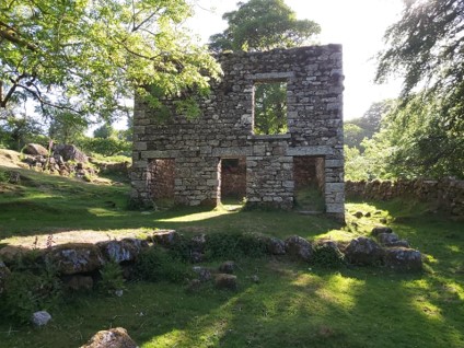
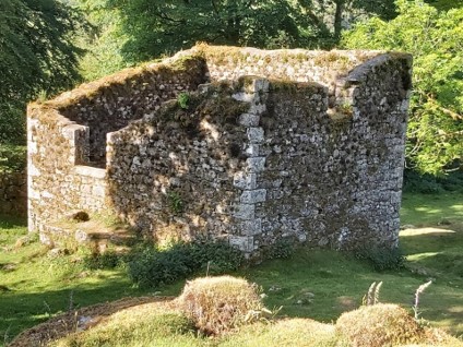
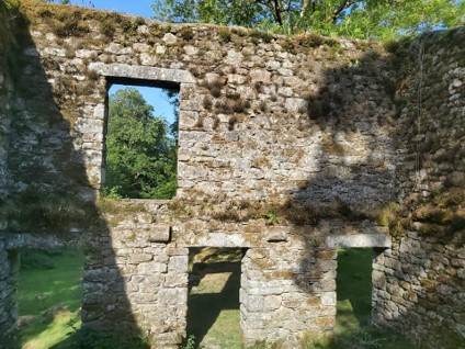
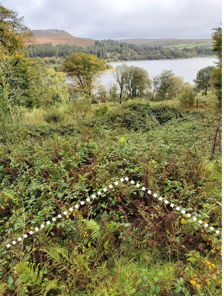
And now to Longstone Manor / Farmhouse, located on the peninsula jutting out into Burrator Reservoir. The first dwelling on this site is believed to have been built in mid-13th century, by the Herbert family. It was rebuilt in 1633 by Walter Elford and his wife Barbara. Their son John (of Piskies cave fame) had the windstrew built. It reverted to a modest farmhouse by mid-18th century , occupancy included, William Smith and the Creber family. It remained a farmhouse until it was abandoned in 1898, as the reservoir was built.
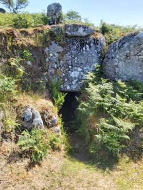
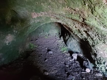
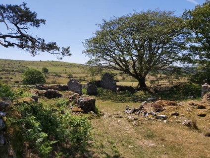
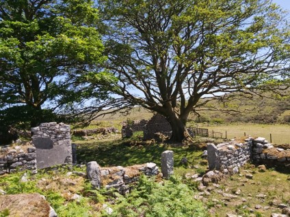
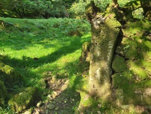
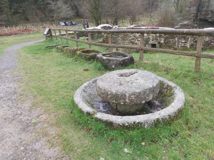
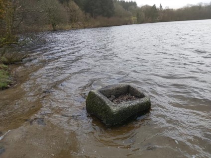
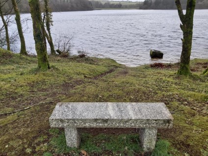
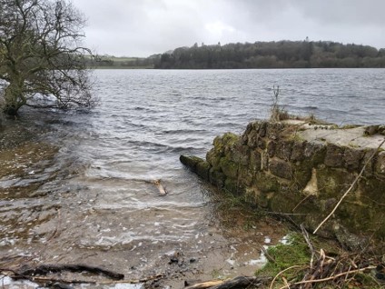
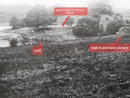
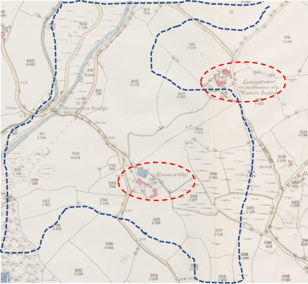
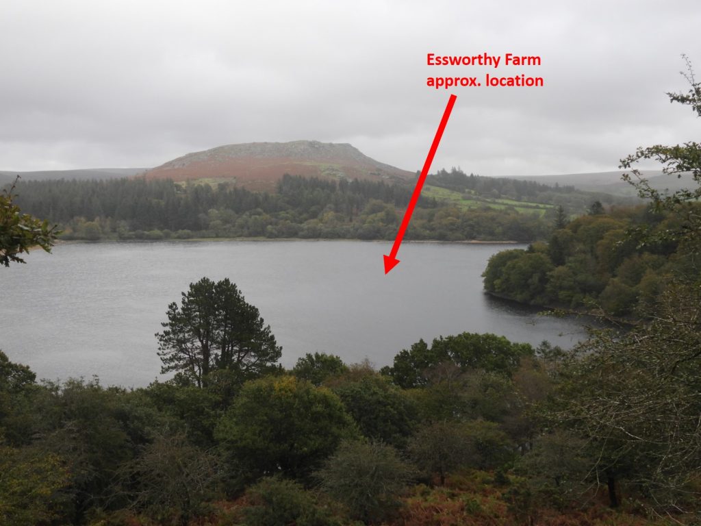
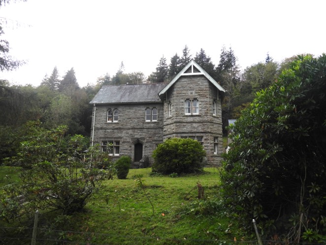
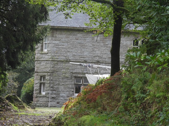
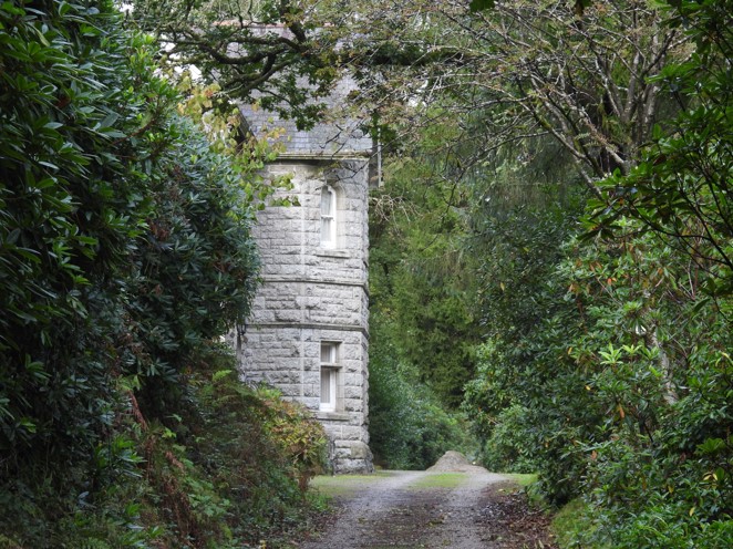
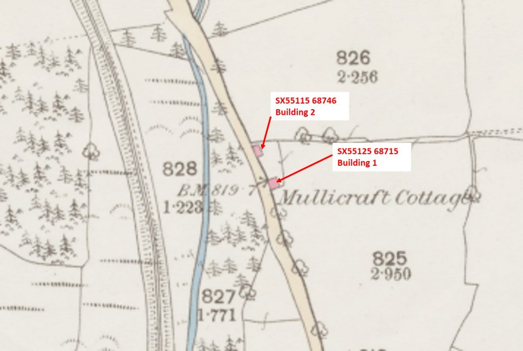
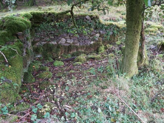
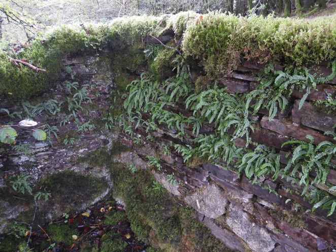
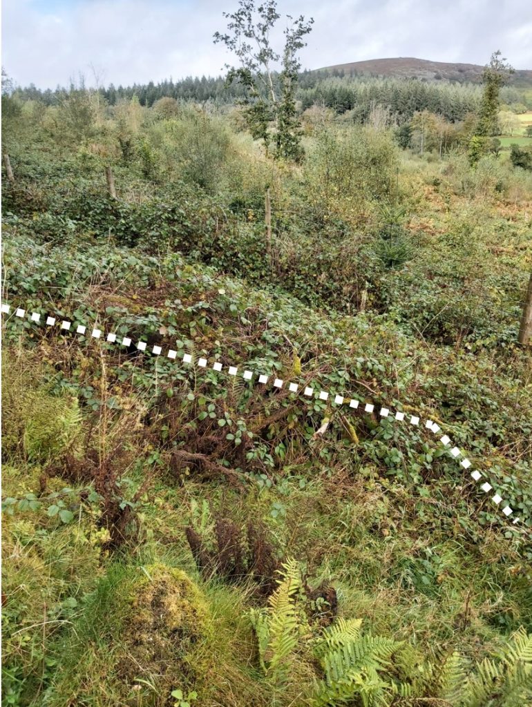
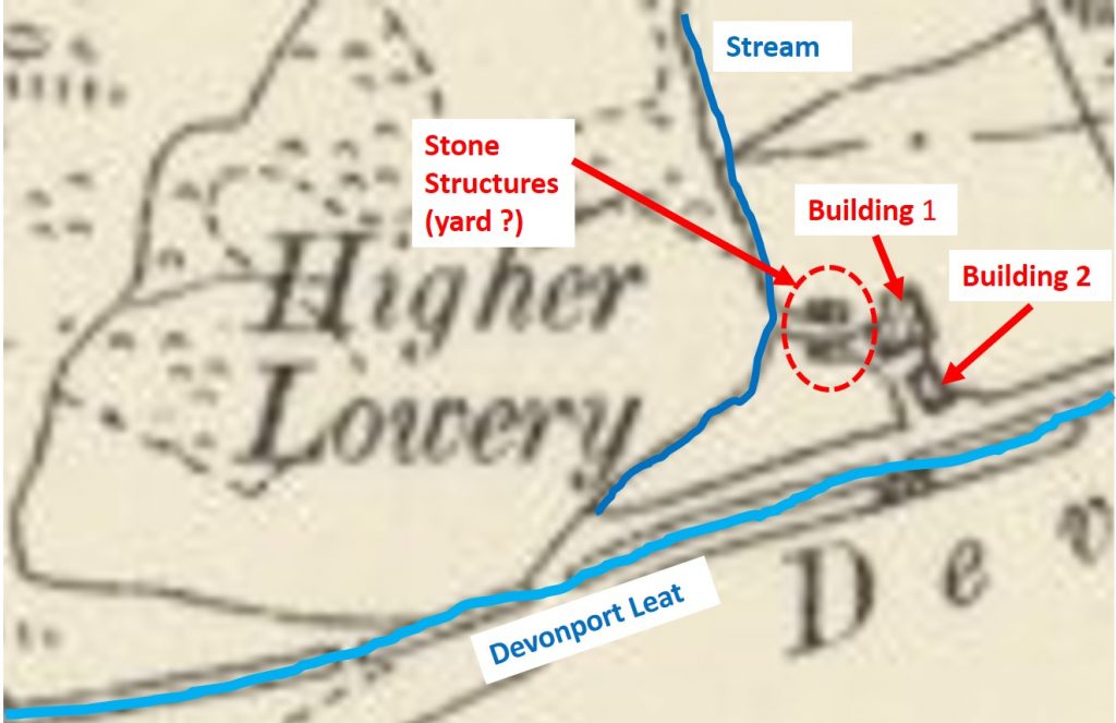
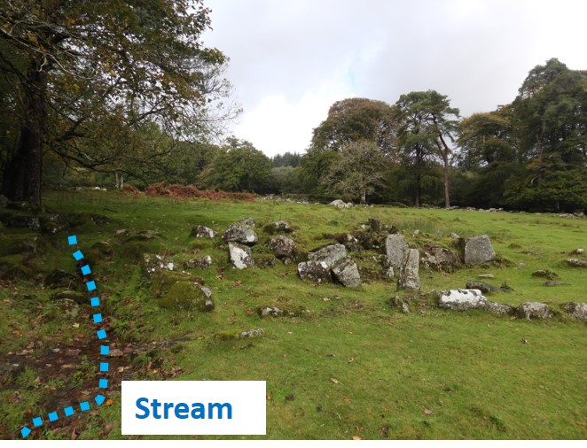
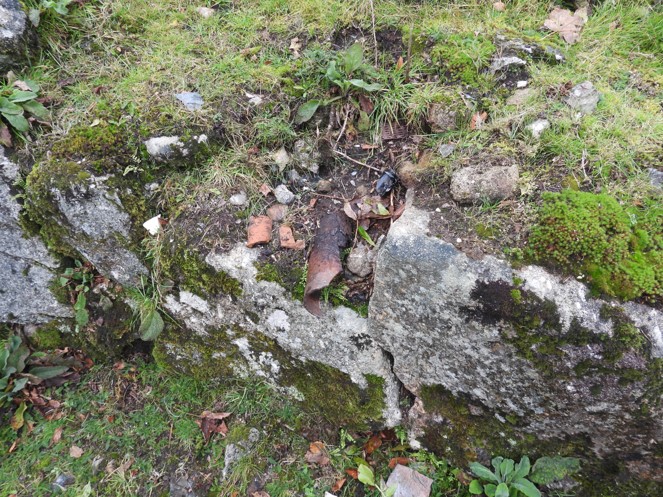
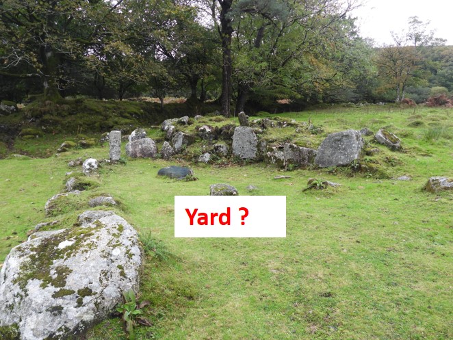
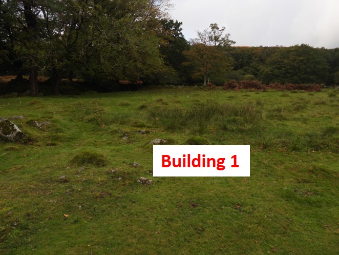
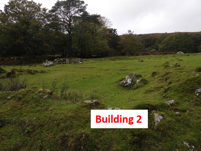
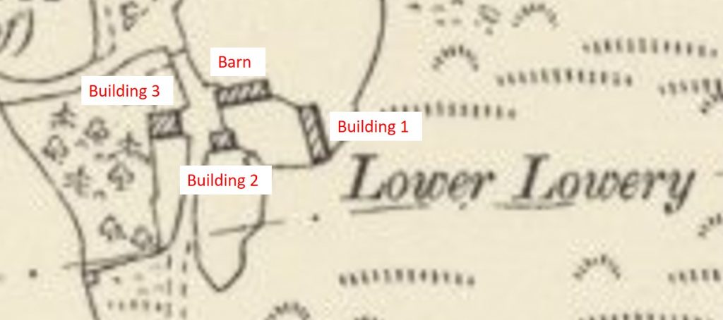
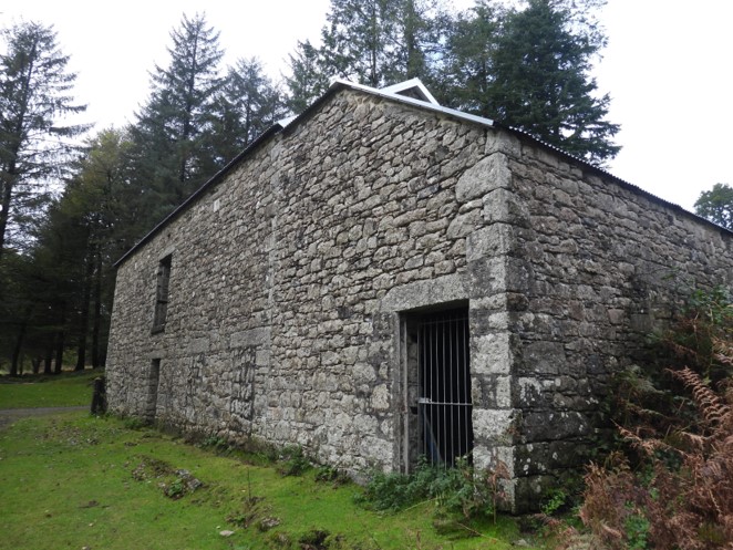
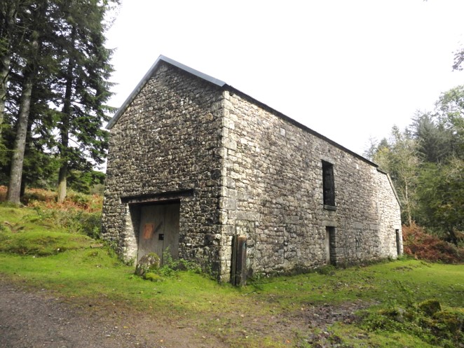
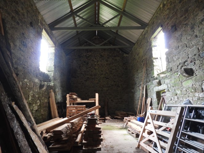
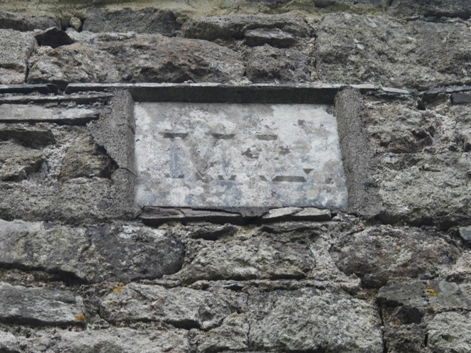
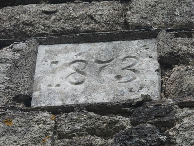
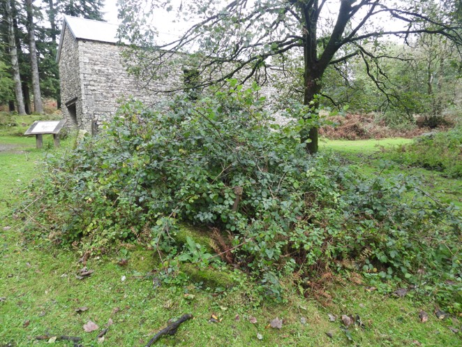
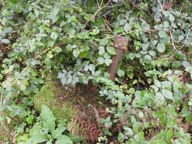
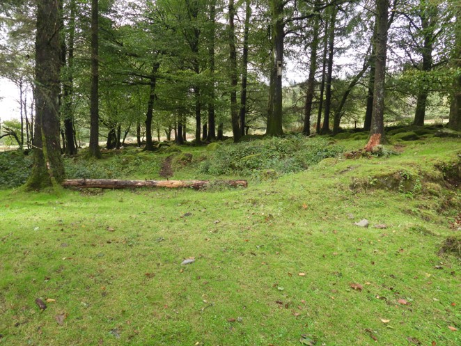
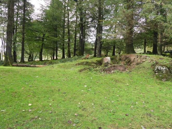
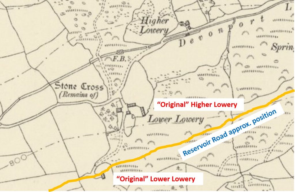
Longstone Manor / FarmhouseLongstone Manor / Farmhouse. The wall stabilisation took place in 2014, with the help of lottery funding.Longstone Manor / FarmhouseJohn Elfords WindstrewJohn Elfords WindstrewSteps on the side of the windstrewCider press and granite troughs. Apparently, there used to be 14 granite artefacts here, but many have been stolen – very sad.Semi – Submerged troughMemorial bench. SX55627 68451When the water level recedes, following this wall around to the right, leads to a well (see next picture)Picture from early 20th century.Location of Longstone Manor / Farmhouse with approx. location (blue dotted line) of reservoir (which does extend northwards beyond what is shown). The only farm which was actually submerged as a result of the flooding of this valley was called Essworthy. This farm and the Longstone estates were merged in 1893. It was last used in around 1898. Plymouth Corporation were the last owners of Essworthy. Estimated location of Essworthy.Burrator Lodge was built in 1895 by Plymouth Corporation. The lodge stands on the site of once was Mullacroft Farm and was built as a replacement for the Head Weir Cottage, which was the accommodation for the Plymouth Leat Foreman.Side on view (from the north) of the lodge. Amos Shillabeer (Plymouth Leat Foreman) and his wife lived at Head Weir Cottage before moving to Burrator Lodge. They lived here until 1898.View of the lodge from the south. Amos Shillabeer’s son became the foreman of the newly completed Burrator Reservoir. Members of the Shillabeer family lived here until the 1940’s. Today the lodge is a private dwelling.Not far from Burrator Lodge and virtually opposite the Burrator Discovery Centre is a narrow lane, which climbs the hill towards the Yennadon Down / Lowery Cross Car Park. A short distance up the hill are the foundations of Mullacroft (Mullicraft) Cottage.Mullacroft (Mullicraft) Cottage at SX55125 68715. A Harry Legassick was believed to have been the last occupant of the cottage. He was jobbing-carpenter and a mason.Inside Mullacroft Cottage. The outer wall abuts the narrow lane.A short distance from the main Mullacroft Cottage is an outbuilding at SX55115 68746. The walls are just about discernable.Mullacroft Cottage outbuilding looking northThe map of Higher Lowery shows there were at least two buildings and two other “structures”. It was built in 1807 as a leatman’s cottage by the Dock (Devonport) Water Company and was occupied until 1922. Devonport Leat is a few metres away to the south.This view is close to the stream on the west side of the site. The standing stone and blocks appear to occupy the area shown on the map with two rectangles, which the author believes may have been a yard.Amongst the ruins of the two rectangle blocks (in the yard) is an iron pipe. On the Dartmoor HER (MDV20614), this pipe is mentioned as leading to a trough. Located at SX55773 69454. There are clay shards at this location as wellView of the yard (?) from the south. SX55778 69449.The main building location. No discernible foundations remainBuilding 2 is next to the road and some foundations can be picked out. SX55789 69447This is named as Higher Lowery on the Tithe Map and the farm complex dates from the medieval period. However, when the new Higher Lowery was built this became Lower LoweryLower Lowery Barn now known simply as Lowery Barn. There is a very good information panel located on site. It is a type known as a chamber barn. There was a Shippen below (for cattle) and a Threshing Floor above. This view shows a lean-to stable which was added in 1876.The barn was built in 1873 and on the south wall (this view) there is a date stone and a stone with “ML” on it. ML standing for Massey Lopes from the Maristow Estate. The barn corner is SX55620 69239.Inside the barn, which was quite ruinous until 2014, when a roof was put on it to stabilise the walls as there was a lot of water ingress into them. The roof funding was provided by the heritage lottery fund. It is being used a a forestry storeML stone. The barn stood on Sir Massey Lopes land1873 date stone.Building 1 foundations at SX55680 69207Another view of Building 1 foundations at SX55680 69207Building 2 foundations at SX55625 69221 with the barn behindBuilding 2 foundations at SX55625 69221 close up yields and old iron bar (origin unknown)Building 3 foundations at SX55613 69243. Little can be seen here and a little interpretation of the map in relation to the barn is neededAnother view of the building 3 foundations at SX55613 69243.The map from late 19th century shows the buildings at Higher Lowery and Lower Lowery (the original “Higher” Lowery), plus one other building to the south which was the original “Lower” Lowery.According the Dartmoor HER (MDV20621), the site of the original site of Lower Lowery was destroyed when the road around the reservoir was made. By looking at side-by-side the site of the building appeared to be south of the road, so an exploration was warranted. This wall appears at SX55552 69062 – was this part of the original farm, maybe some field walls ?Another view of the wall at SX55552 69062
My ancestors are the crebers. My mother was a creber. Many crebers lived around sheepstor. Some in the farms where the dam is now. I have researched the area for quite a few years, but there are still surprises to be found. I am very eager for any new information.
Hi, I am fascinated by the fogou listed at Leather Tor Farm. I first came across it when I was 10 (1965) and saw the strange word “fogou” on the 2.5 inch OS map. It was written in a font which indicated an archaeological feature. I couldn’t find the word in any reference book at home; at Plymouth Central Library I discovered it was an underground chamber. I went with my dad to try and find it more than once but was never able to – the location was difficult to determine from the map. As an adult I have visited the fogous of West Cornwall, which I have read in several sources (e.g. Cornish Heritage) are the only ones in Britain. This prompted me to look again for the fogou near Burrator, which seems to have vanished from more recent OS maps. I have wondered, therefore, if it was a mistake on the map I read. as a child or if I had manufactured a false memory. I am delighted to learn from your article, that I haven’t made the fogou up. But it does prompt several other questions. Why do archaeologists claim the only fogous are in “Cornwall west of the Fal”? Do you know any more about this feature?
I was first shown this FOGOU on a night walk by Ted Burkett Dixon (a Dartmoor Guide) in the 1990s. He called it a Fogou and thought it was used a storage chamber by the occupants.


Julia Dalton September 24, 2023
My ancestors are the crebers. My mother was a creber. Many crebers lived around sheepstor. Some in the farms where the dam is now. I have researched the area for quite a few years, but there are still surprises to be found. I am very eager for any new information.
SteveGriggDartmoor September 24, 2023 — Post author
Dear Julia,
Thank you for your comments.
Kind Regards,
Dartmoor Explorations (Steve)
John Cosgrove August 10, 2024
Hi, I am fascinated by the fogou listed at Leather Tor Farm. I first came across it when I was 10 (1965) and saw the strange word “fogou” on the 2.5 inch OS map. It was written in a font which indicated an archaeological feature. I couldn’t find the word in any reference book at home; at Plymouth Central Library I discovered it was an underground chamber. I went with my dad to try and find it more than once but was never able to – the location was difficult to determine from the map. As an adult I have visited the fogous of West Cornwall, which I have read in several sources (e.g. Cornish Heritage) are the only ones in Britain. This prompted me to look again for the fogou near Burrator, which seems to have vanished from more recent OS maps. I have wondered, therefore, if it was a mistake on the map I read. as a child or if I had manufactured a false memory. I am delighted to learn from your article, that I haven’t made the fogou up. But it does prompt several other questions. Why do archaeologists claim the only fogous are in “Cornwall west of the Fal”? Do you know any more about this feature?
SteveGriggDartmoor August 12, 2024 — Post author
Hi John,
I was first shown this FOGOU on a night walk by Ted Burkett Dixon (a Dartmoor Guide) in the 1990s. He called it a Fogou and thought it was used a storage chamber by the occupants.
Kind Regards,
Steve (Dartmoor Explorations)