A collection of walks, discoveries, insights and pictures of exploring Dartmoor National Park
August 23, 2022
Widecombe Tinners’ Knocking Mill
R.H.Worth in 1953 (ref: SDV231148 in Dartmoor HER) wrote of the former existence of a tinner’s mill in the post-office garden at Widdicombe (sic). He recorded there being two anvil or mortar stones, which lay behind rhododendrons in the southwest corner.
Further to this, Dr Tom Greeves has recorded in his List of Known Devon Tin Mills c1450 – c1750 and in A Tin Mill in Widecombe Village, that there was a knocking mill (latterly they were known as stamping mills) for crushing tin ore in this locale. It is labelled as Widecombe Mill (B) in the list of mills. Presumably Mill (A) is the one located at the nearby North Hall Manor.
With this brief information, the author decided to investigate what could be seen from the public highway.
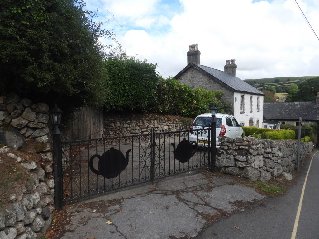
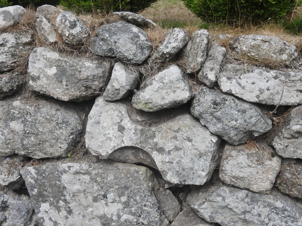
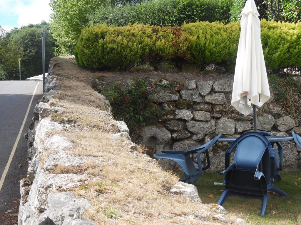
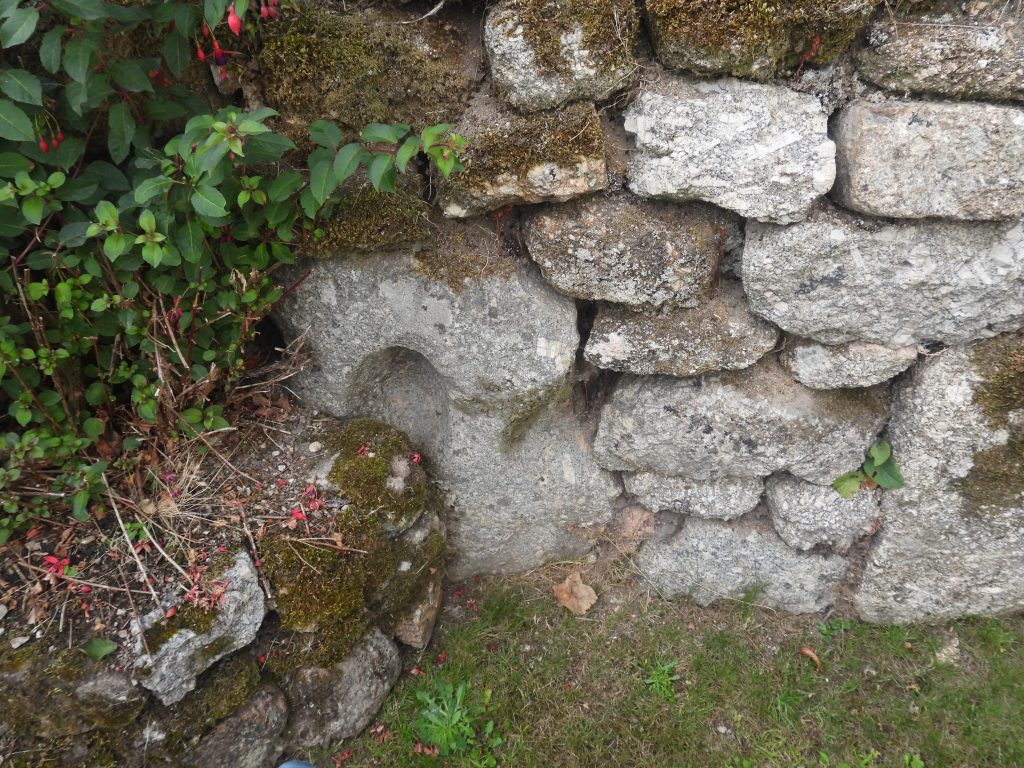
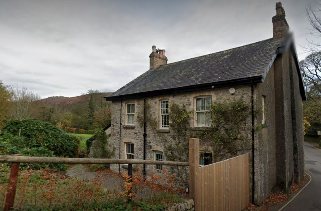
Location of the Tinners’ Mill next to the former Post Office, which is now a building named “Wayside”. The current Widecombe car park is located behind this property. Located a short distance downhill from “Wayside” is a former grist mill.Two tea pots on the gates of “Wayside” are testament to the building being a former cafe. Within the walls of the garden of this property are a couple of mortar stones which are evidence that a Tinners’ Mill was once located in the locale.Looking at Wayside from the front elevation. In the wall is an unusual shaped rock, which possibly could have related the tinners’ mill which is said to have been located in the garden. On the tithe apportionment in 1840, the parcel of land was No. 398, the land owner was Margaret Baring and the tenant was Thomas Warren and was described as House and Garden, therefore no reference to a former tinners’ mill.This stone is located at SX71946 76835. This rock certainly has been worked, however, the curves do not look consistent with typical mortar stone. That said, it could well be a former mortar stone albeit not that convincing. It is more likely to have had some other previous use before being recycled into the wall.A definite mortar stone is located in the garden of “Wayside”. It is built into the south west wall of the garden, which is consistent with Worth’s observations 70 years ago.With permission, the author was able to take some close up shots of the mortar stone in the garden of wayside. The stone looks like a “double mortar”, with the left side intact and the right side broken away. Worth mentioned two mortars – did he mean a double mortar or is there a second mortar aside this one ?This mortar stone is located at SX71935 76844This building is located a few 10’s of metres downhill from “Wayside”. R.H.Worth in 1953 described this building as: “…….a grist mill, now a private residence lies further from the river than is usual for such a mill but in a normal one for a tinner’s mill which usually avoided encroachment on the area to be streamed. It stands about fifty yards from the post office on the right bank of the East Webburn River, which has been extensively streamed for tin”. On the tithe apportionment in 1840, the parcel of land was No. 399, the land owner was Margaret Baring and the tenant was John Tarr and was described as House, Garden and Mill.