A collection of walks, discoveries, insights and pictures of exploring Dartmoor National Park
October 10, 2021
Wheal Fanny
Wheal Fanny is believed to have been opened as a copper mine around 1822, with a lead lode being discovered about five years after. The mine was originally worked together with Tor Wood mine (see separate post on this mine) which lies over a mile away to the north east. It is recorded (Harris) that the mine was also known as Crandford mine and the walls of the engine house, of local stone with fine granite groins, still partially stand, and around are the remains of the old workings, undulations and spoil heaps. This recording was circa 1960s and today very little is said to remain and certainly not visible from the (public) footpath / bridleway.
The mine was worked on and off until 1836, by which time the engine shaft had reached 30 fathoms and the adit driven approx. 300 fathoms. Then the mine remained idle but was reopened in 1851. This re-opening was unsuccessful and the mine was put up for sale in 1854. Finally the mine resumed work in 1864, on this occasion under the name of Leawood Mine. The mine was finally abandoned in 1868. Source of information : Mindat.org
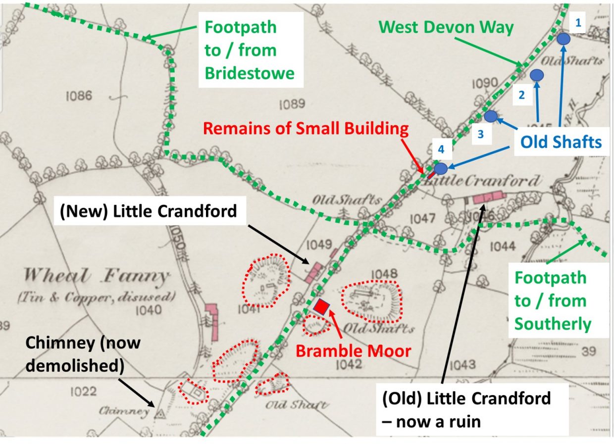
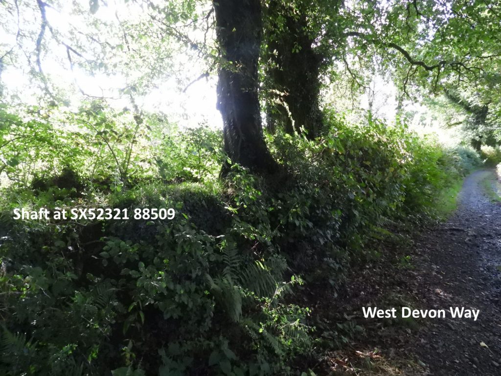
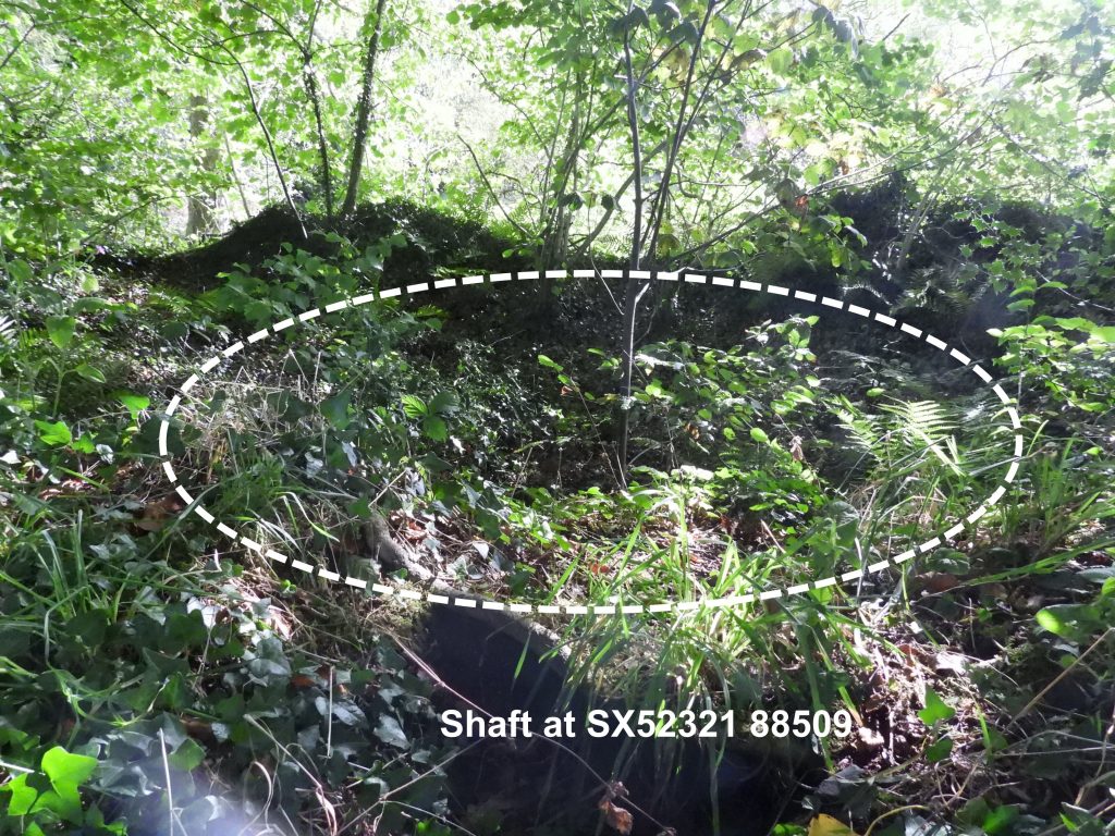
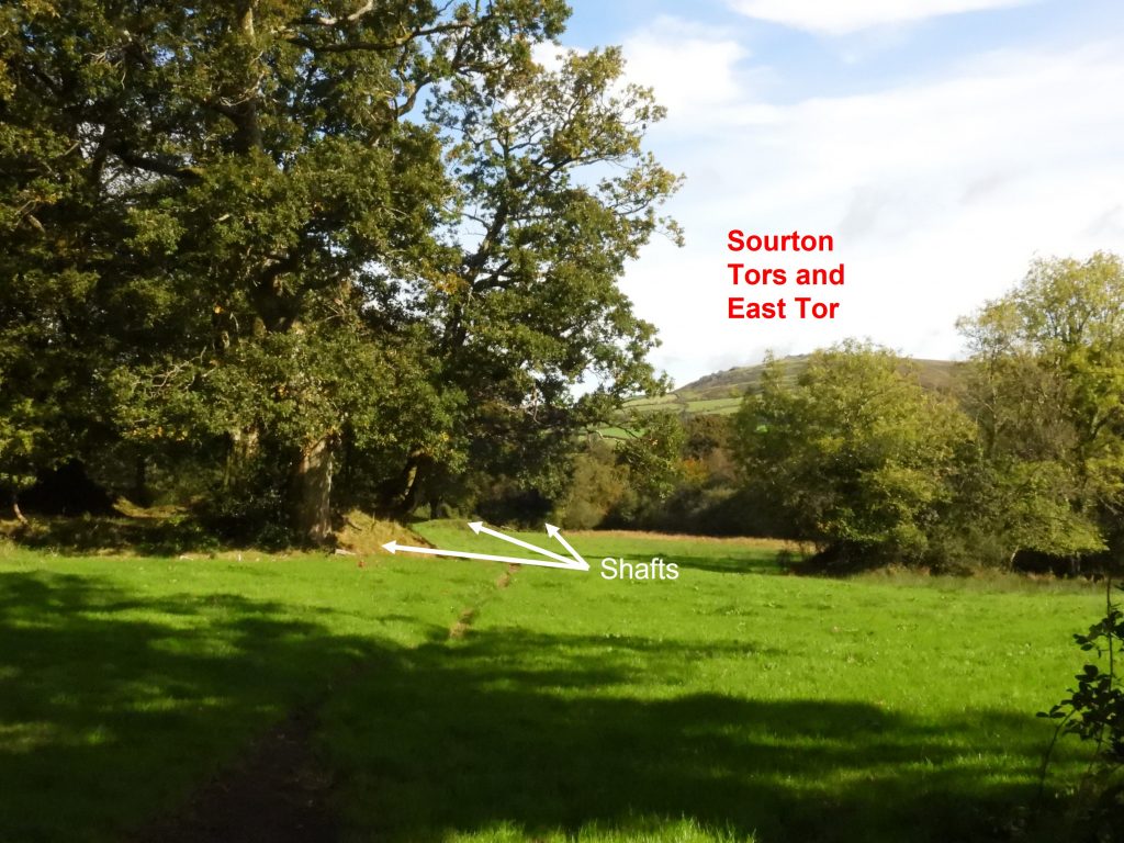
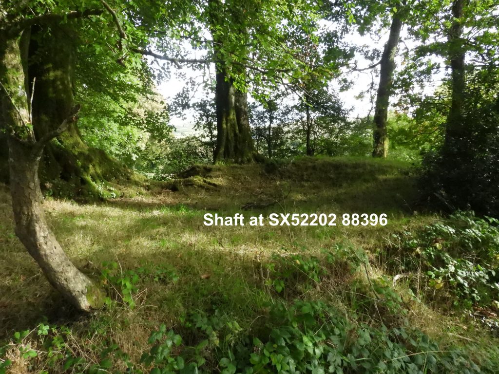
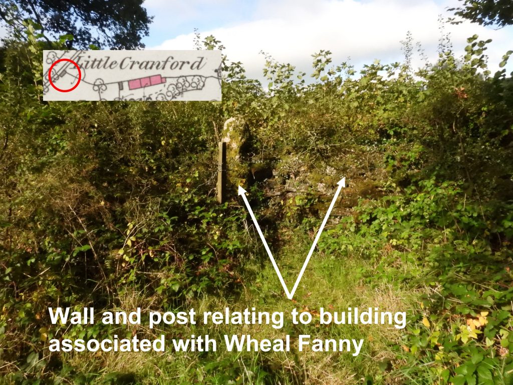
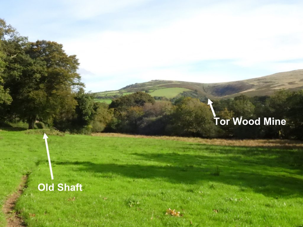
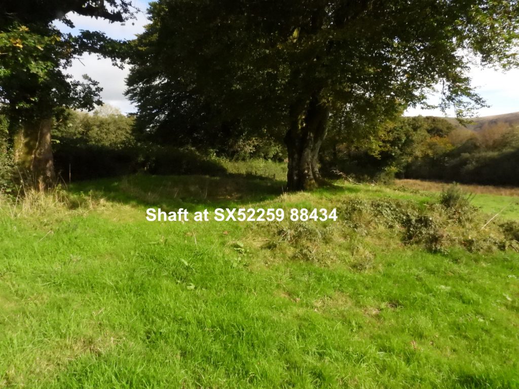
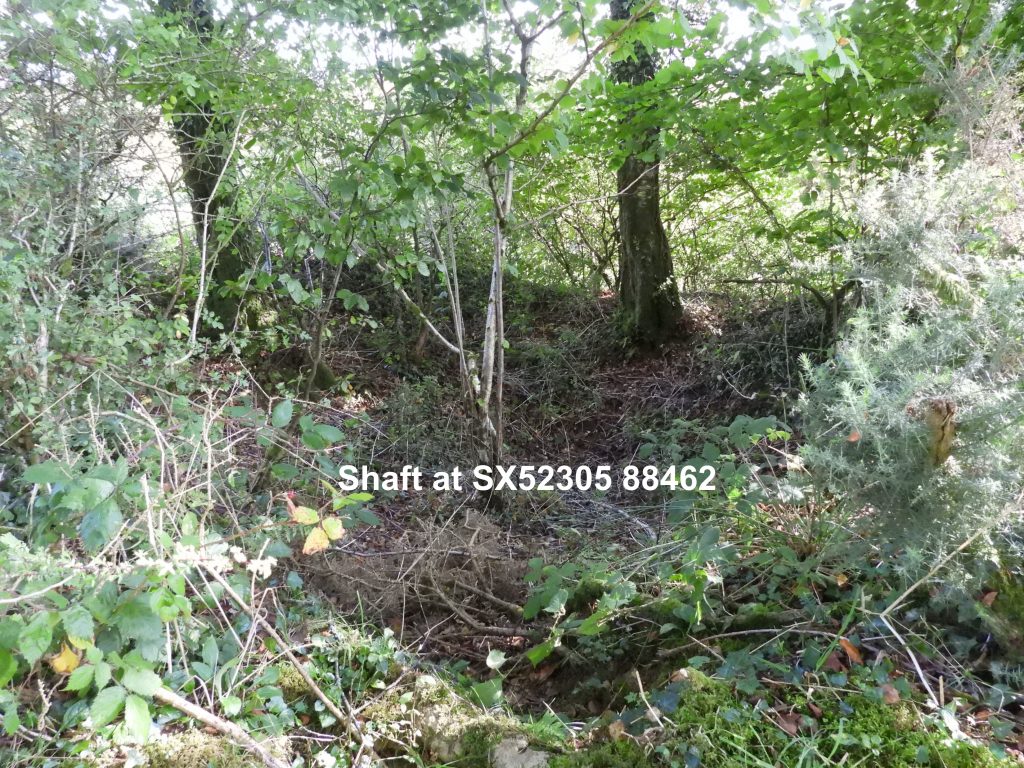
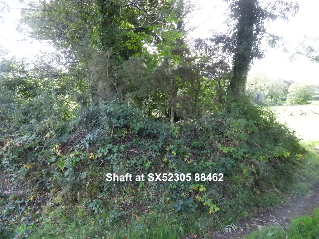
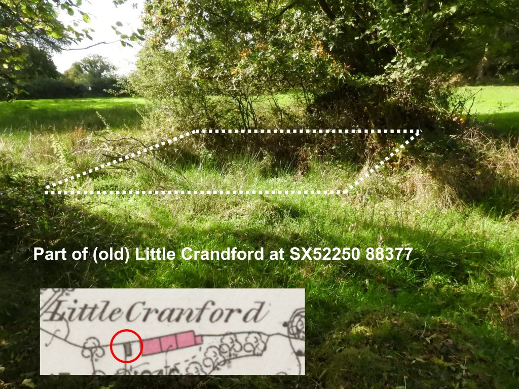
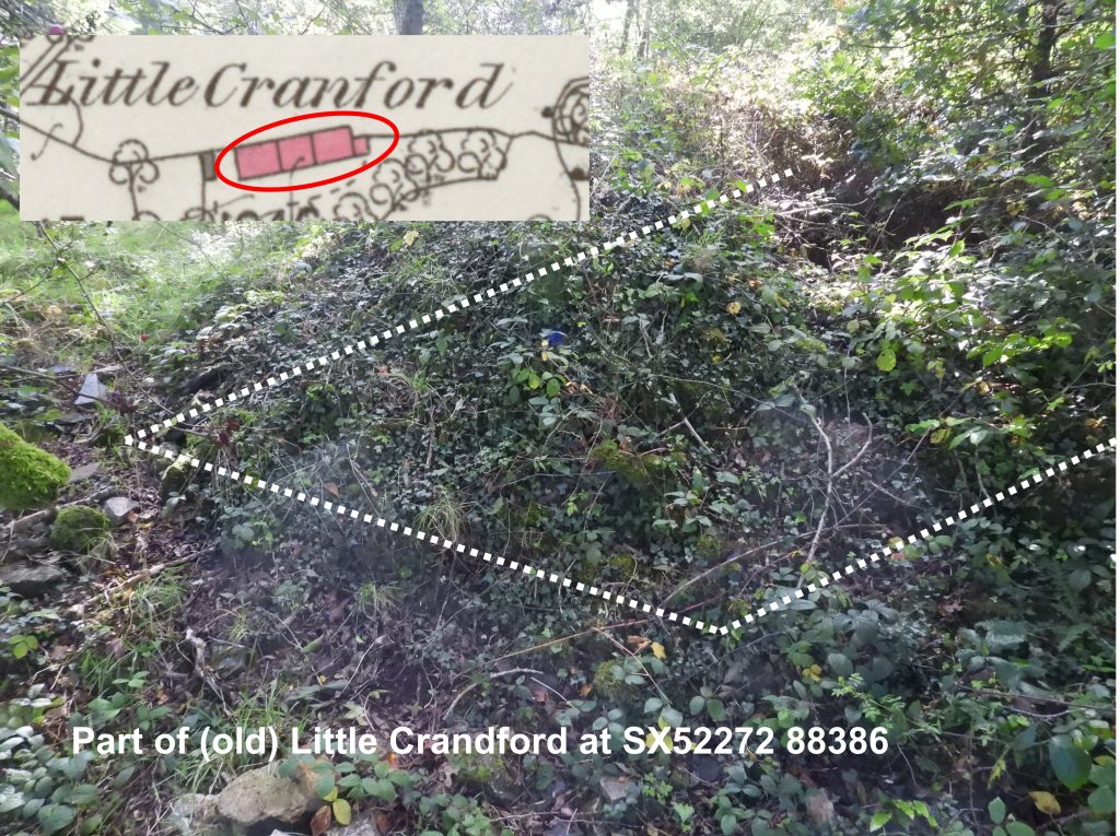
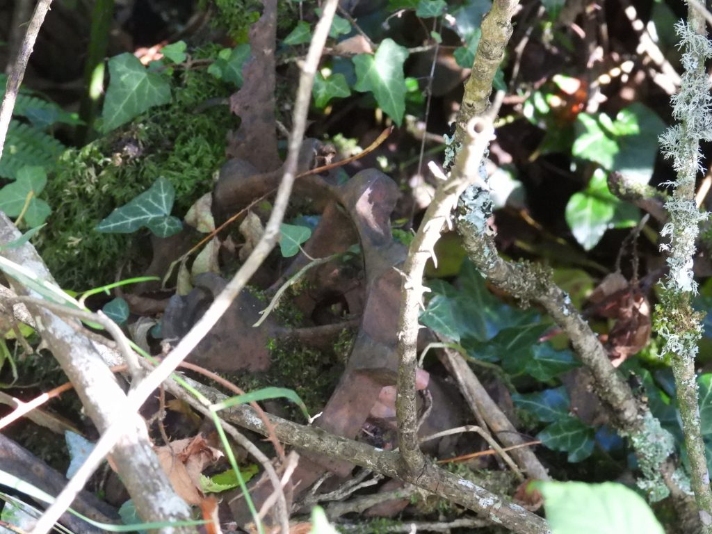
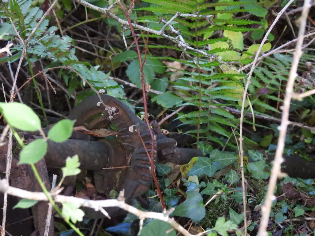
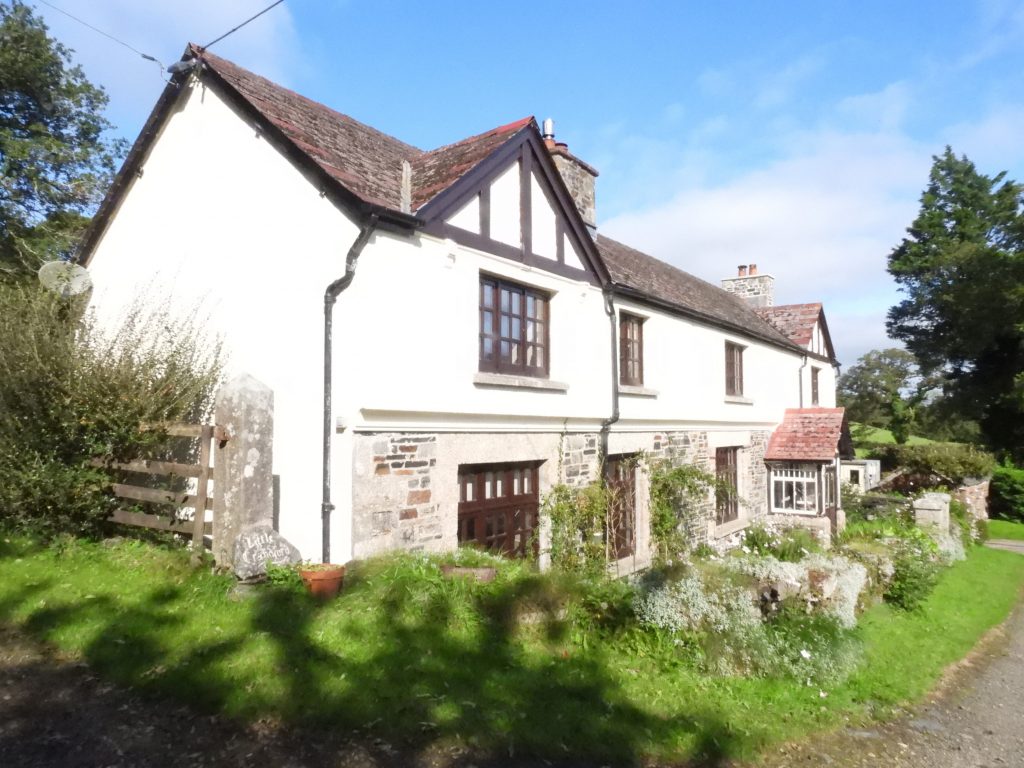
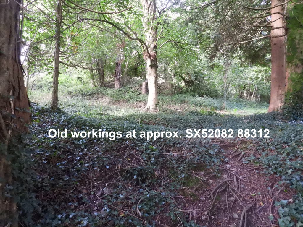
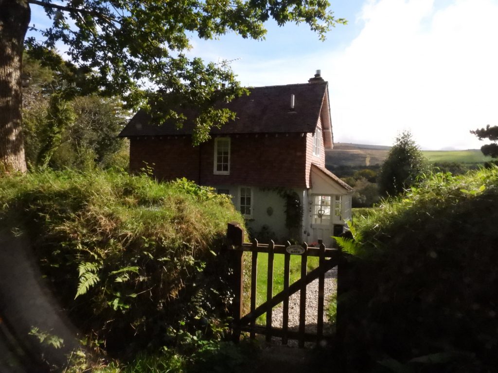
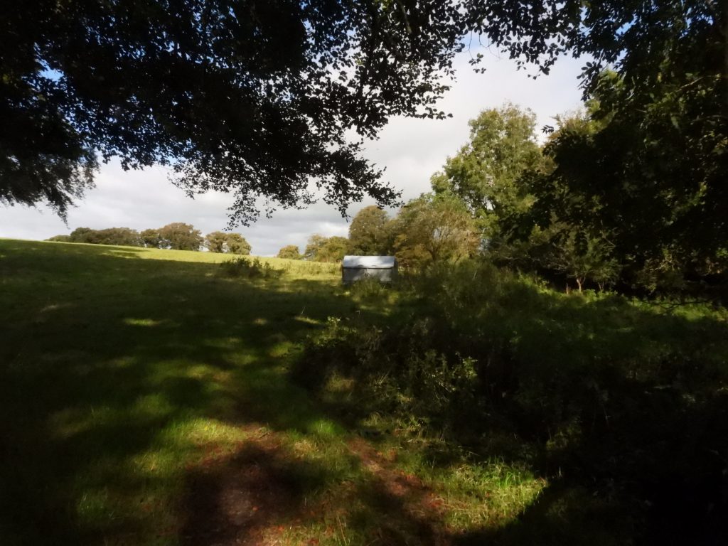
Wheal Fanny lies just to the west of the hamlet of Southerly (which is on the Dartmoor National Park boundary). With a little careful exploration some features of this old mine can still be found. Interestingly, the old 19th century map shows the mine as being tin and copper, whereas records suggest it was initially copper then lead. At the north end of the old mine workings, shaft (1) as marked on the map can be found by looing over the hedge from the West Devon Way bridleway.Shaft (1) looking over the hedge on West Devon Way.In order to find the other old shafts (2, 3 and 4) at Wheal Fanny, the explorer must use the field over the hedge from the West Devon Way bridleway. Great views towards Sourton Tors and East Tor can be had.Shaft (4) as shown on the map.Alongside shaft (4) are the (hard to find) ruins of an old building. The building is clearly seen on 19th century maps. The old building can be found at SX5200 88383.Looking north from shaft (4) towards shaft (3), Deep Valley can be seen, the location of where the sister mine (Tor Wood Mine) can be located.Shaft (3)Shaft (2)Close up of shaft (2). At the mine, originally an adit connected a line of six shafts, with two air-shafts. However, there has been considerable subsidence and subsequent levelling by the owner (Source : Harris).Hidden in the undergrowth near the footpath to Southerly are the foundation ruins of the former “Little Crandford” which are described in the HER as being “possibly associated with mining and quarry industry in the area. Visible on Ordnance Survey 1880s-1890s First Edition 25 inch map”.The larger of the two buildings of (old) Little Cranford are shown on 19th century maps as having three rooms. This building is very overgrown.Hidden in the undergrowth of the larger building of (old) Little Crandford, old farm / mine machinery can be found. More old farm / mine machinery hidden in the undergrowth of the larger building of (old) Little Crandford.Next to the West Devon Way bridleway lies the (new) Little Crandford, which has this lovely little outbuilding, which is shown on the old 19th century maps.Little CrandfordJust south of (new) Little Crandford, old workings of the mine can be seen from the bridleway.Adjacent to the bridleway and sandwiched between old workings lies a house called Bramble Moor. Great views towards Southerly Down can be seen to the east.Southern end of the mine where a chimney once stood,

Glennon Chatting-Walters February 23, 2022
Do you know how and why this was covered up? So interesting but can find very little on its history
SteveGrigg1961 February 28, 2022 — Post author
Hi, I am very sorry, I have no further information.