A collection of walks, discoveries, insights and pictures of exploring Dartmoor National Park
May 2, 2023
Upper West Dart Tinner’s Huts
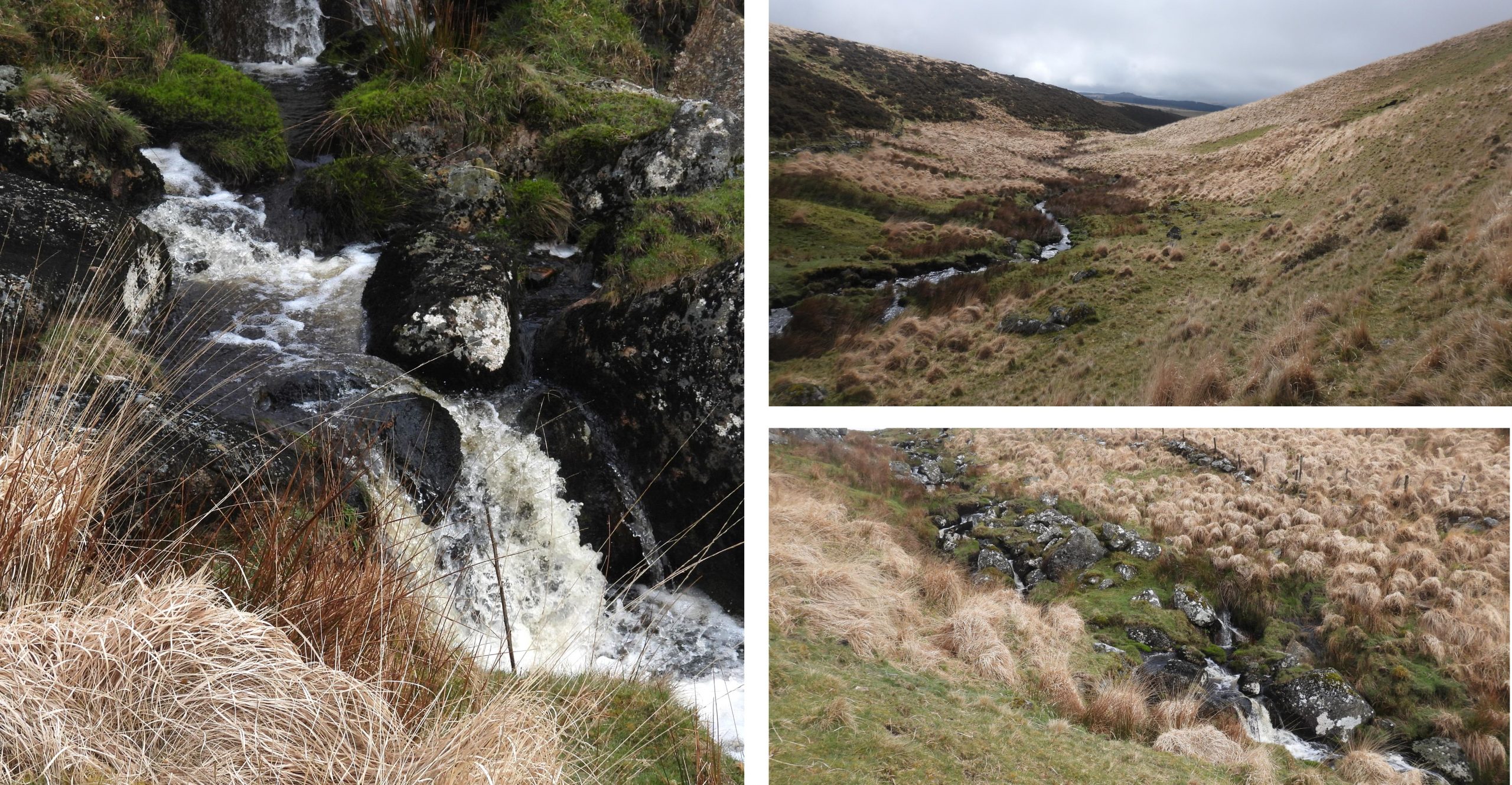
The Upper West Dart valley is a lovely remote location 2-3 miles north of Two Bridges. The easiest points of access to the area are from either Two Bridges or Postbridge. There are many features of historical and geographical interest in the area including a few tors, newtake walls, a prehistoric settlement (in West Dart Hole) and military artefacts.
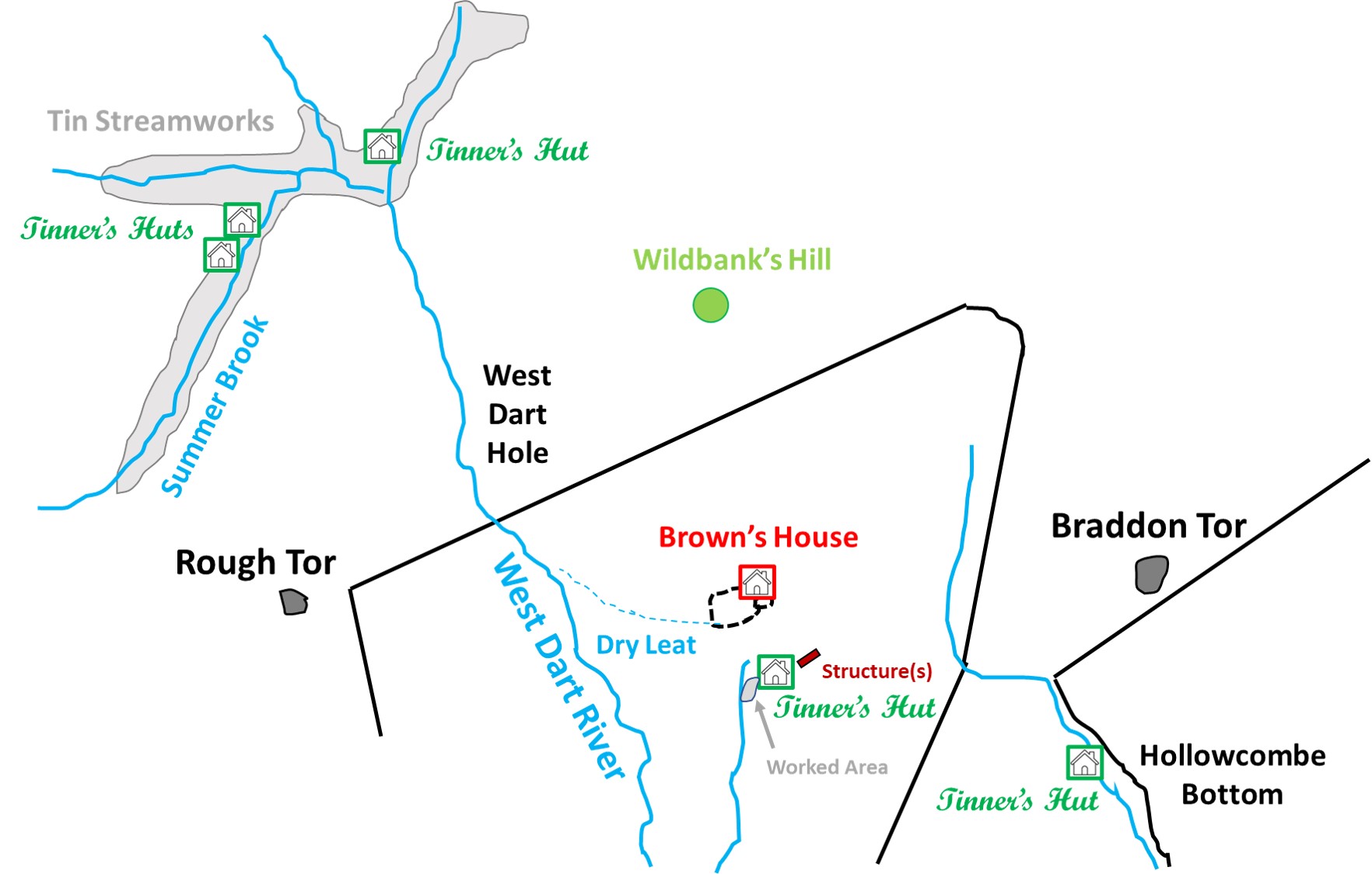
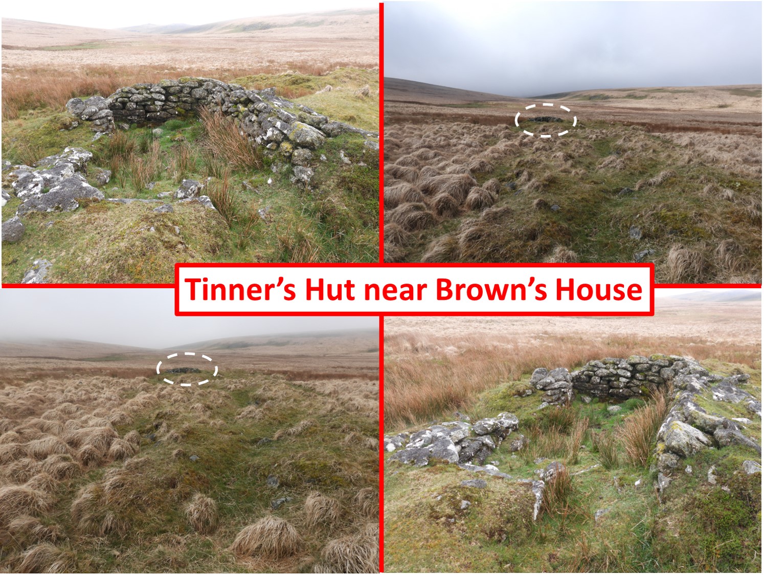
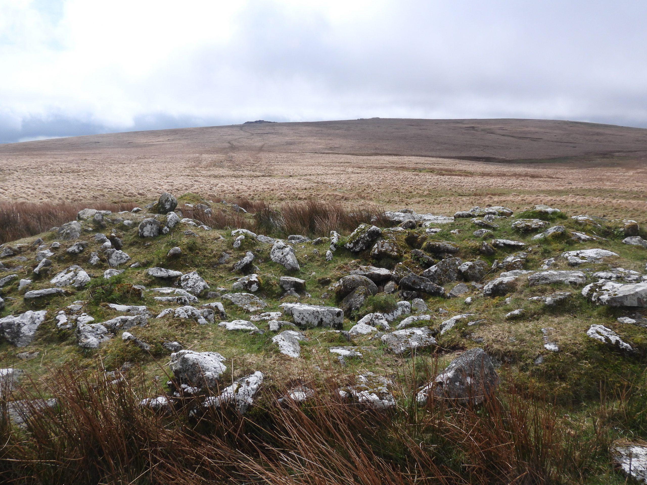
Between the Cherry Brook (Hollowcombe Bottom) and Summer Brook there are 5 Tinner’s Huts to explore as well as streamworks and the more well known ruins and enclosure of Brown’s House which is shown on modern OS maps. This post records these structures.
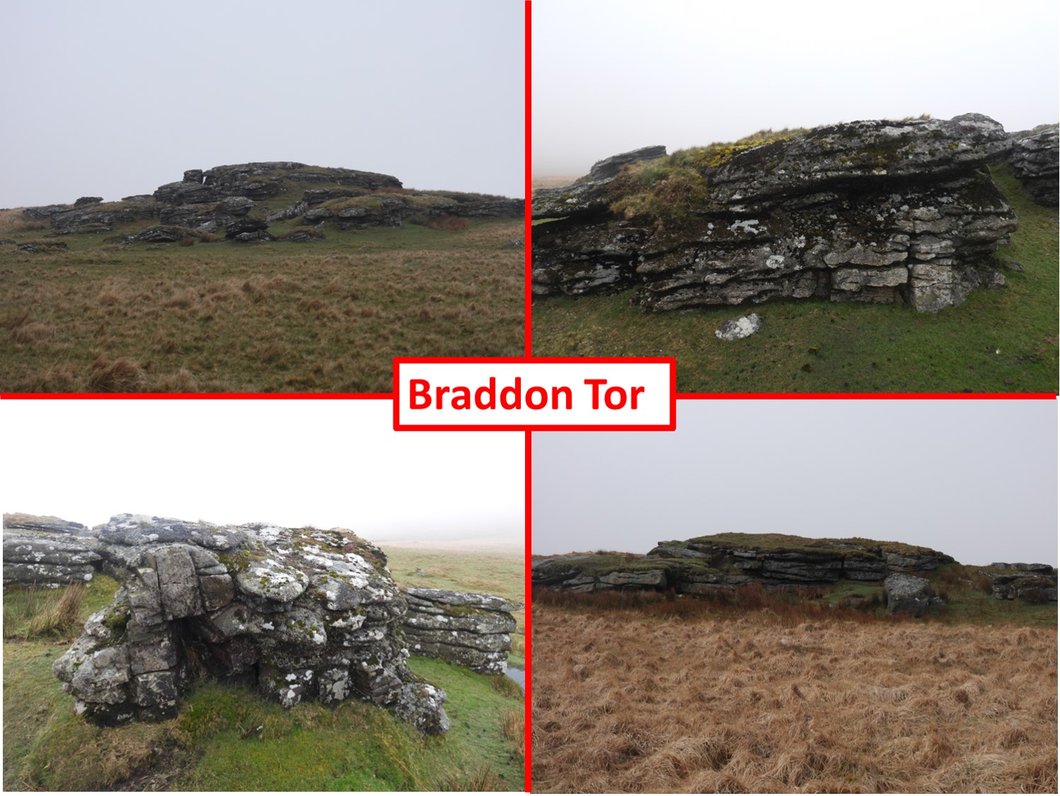
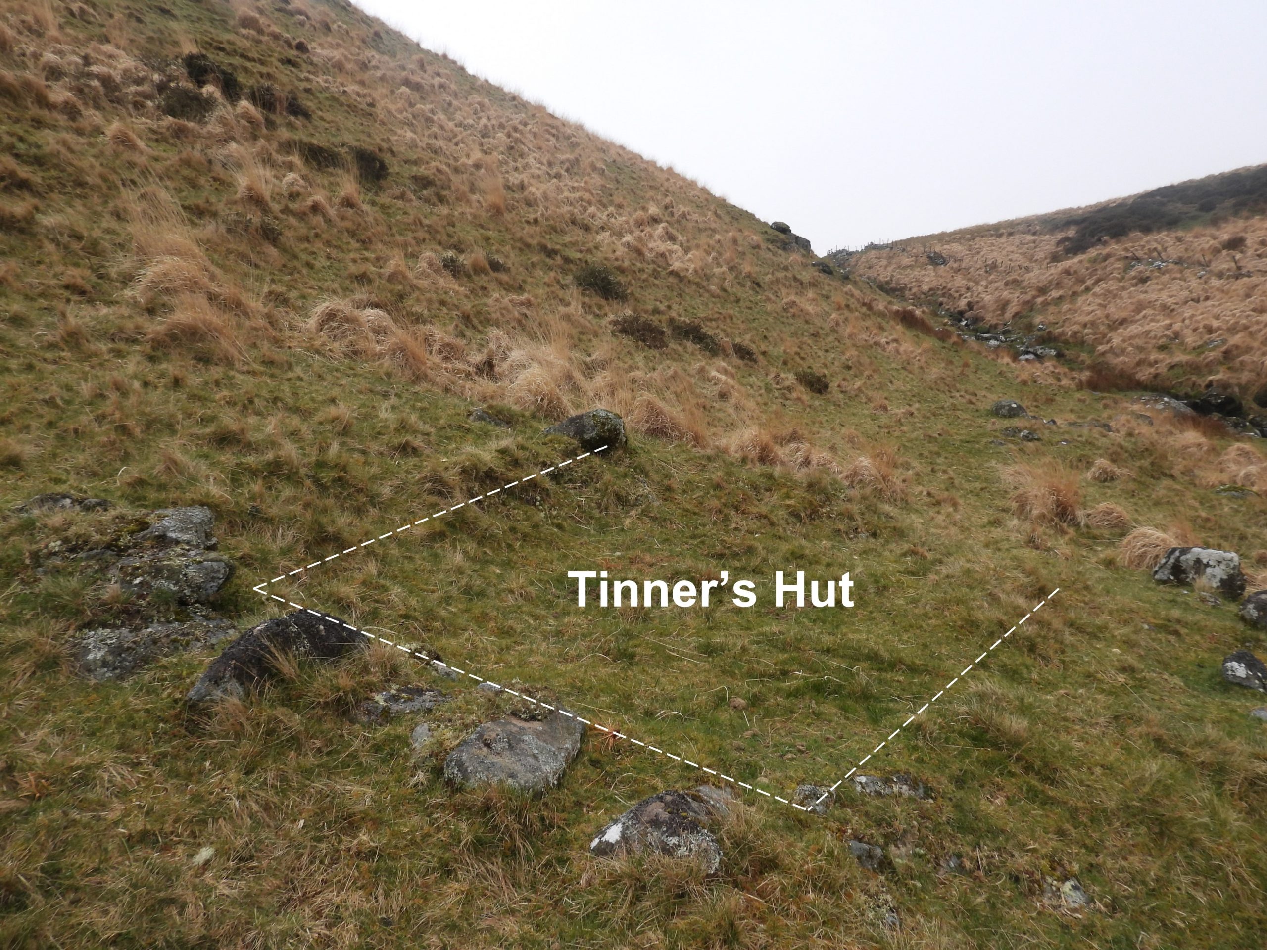
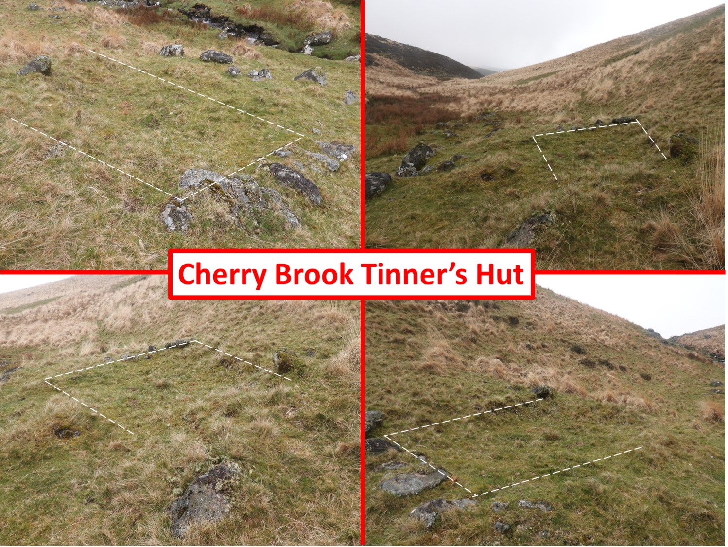
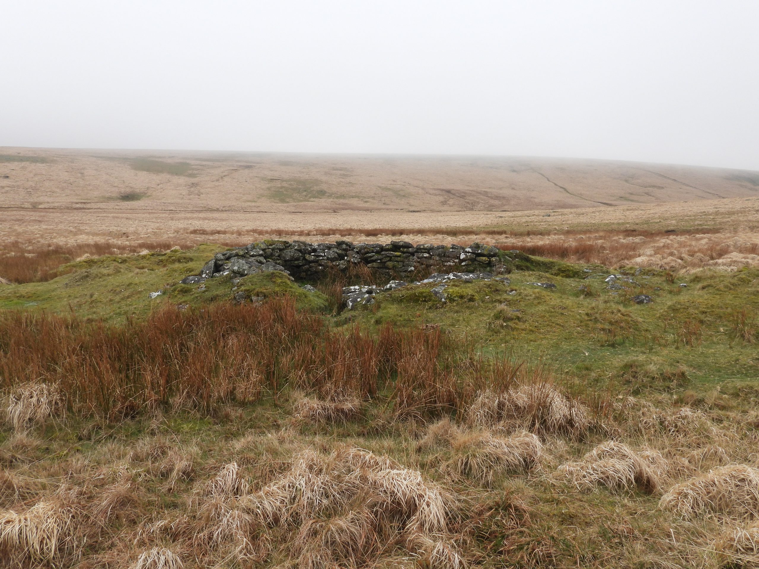
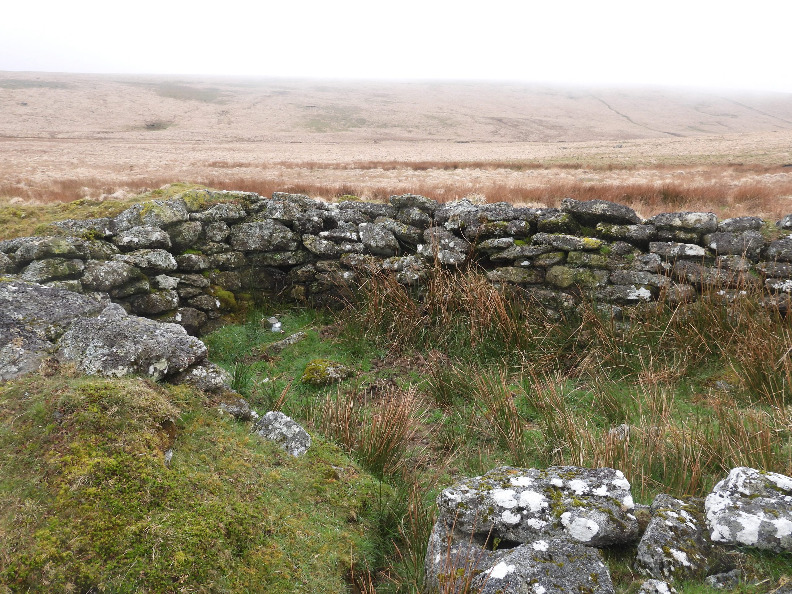
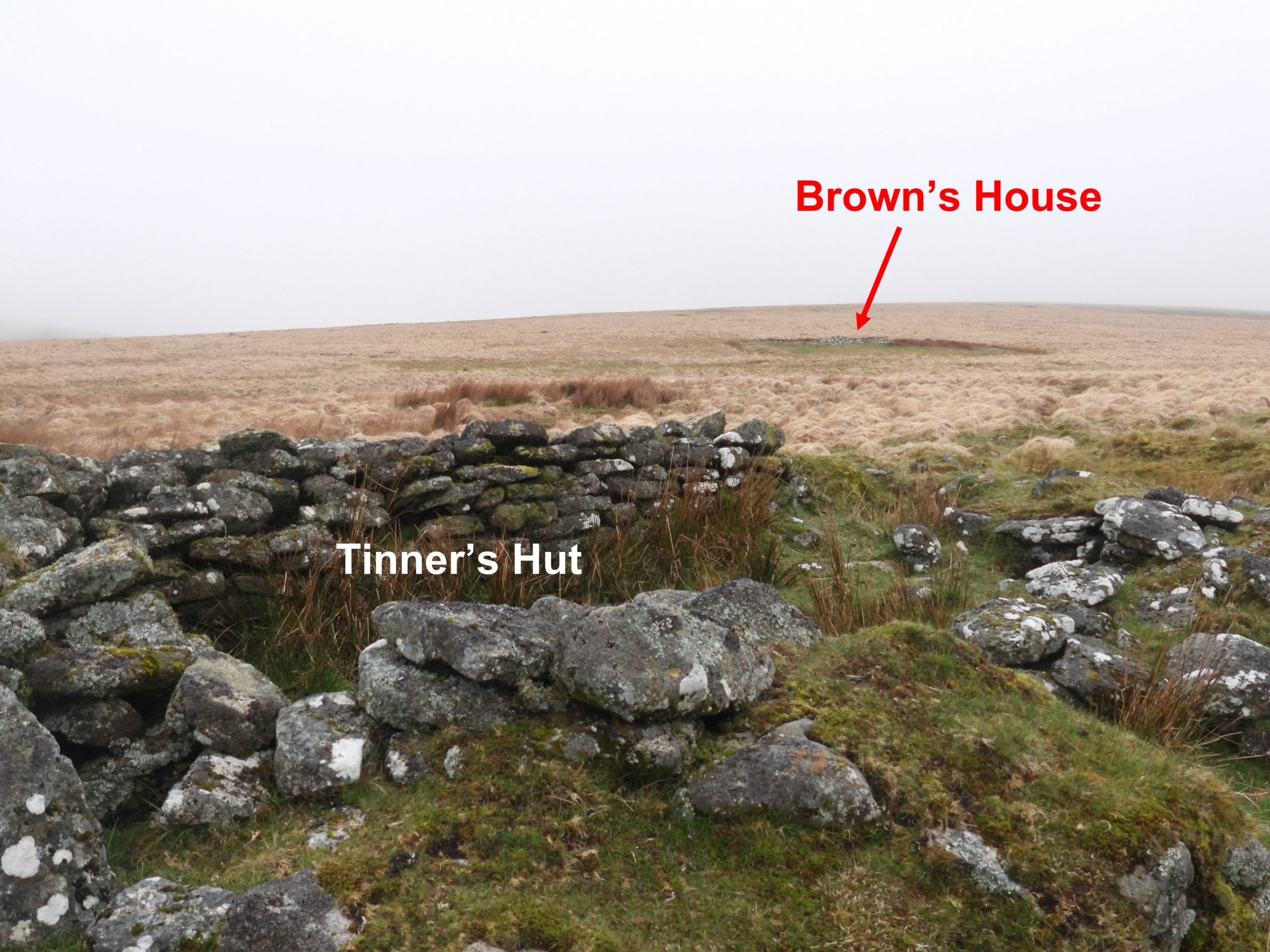
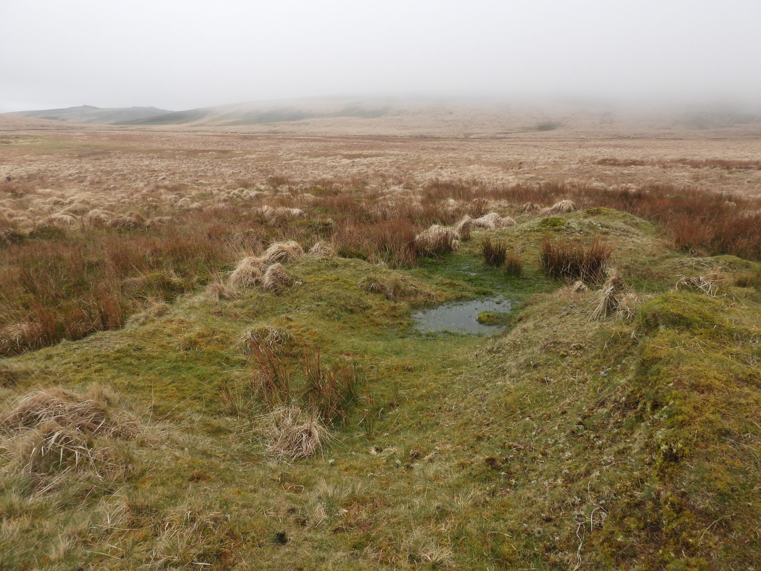
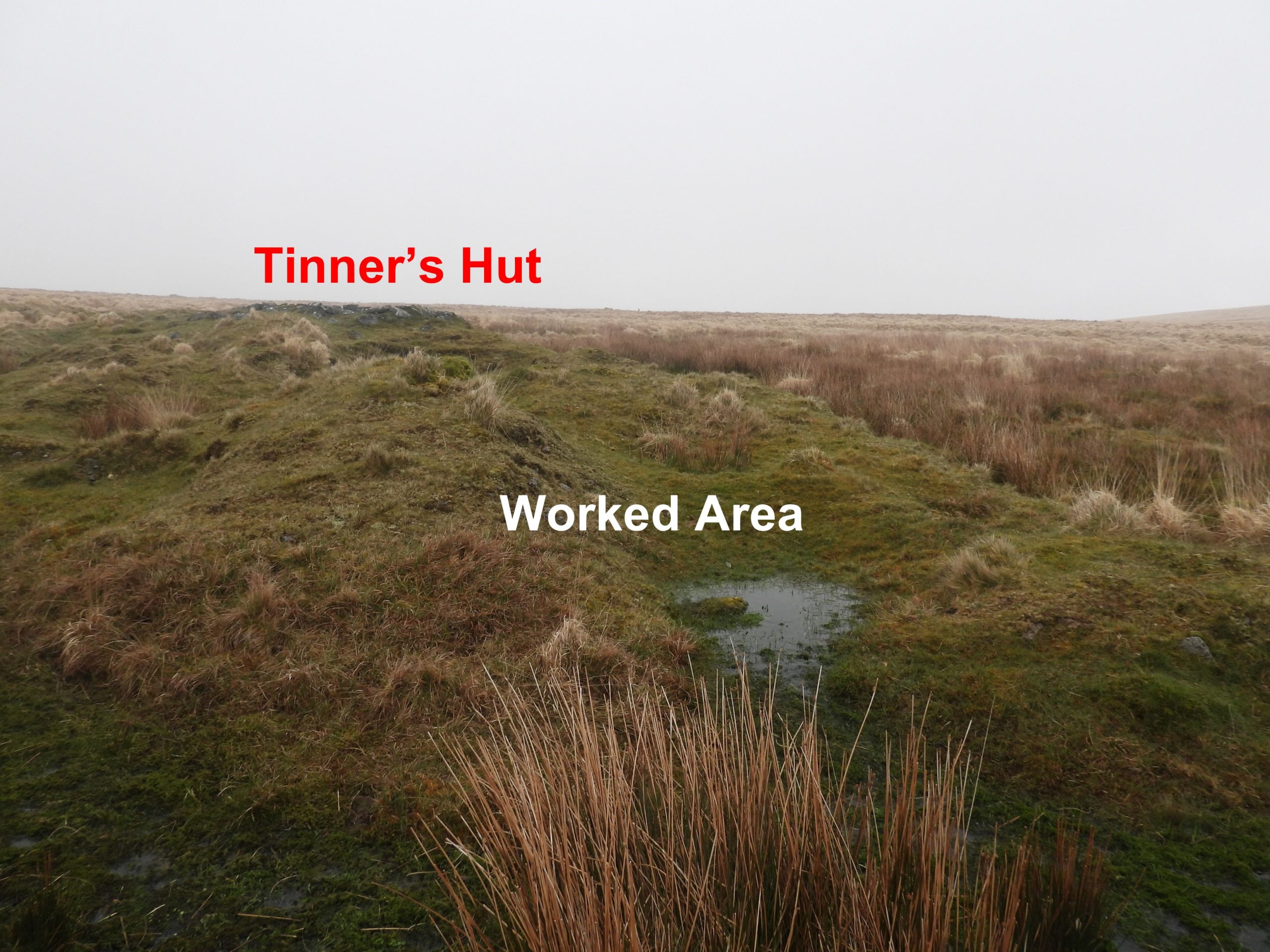
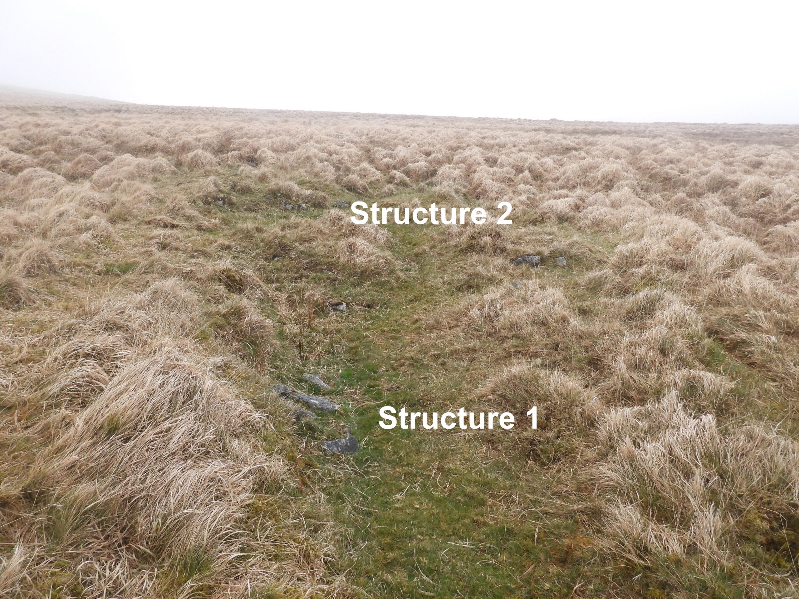
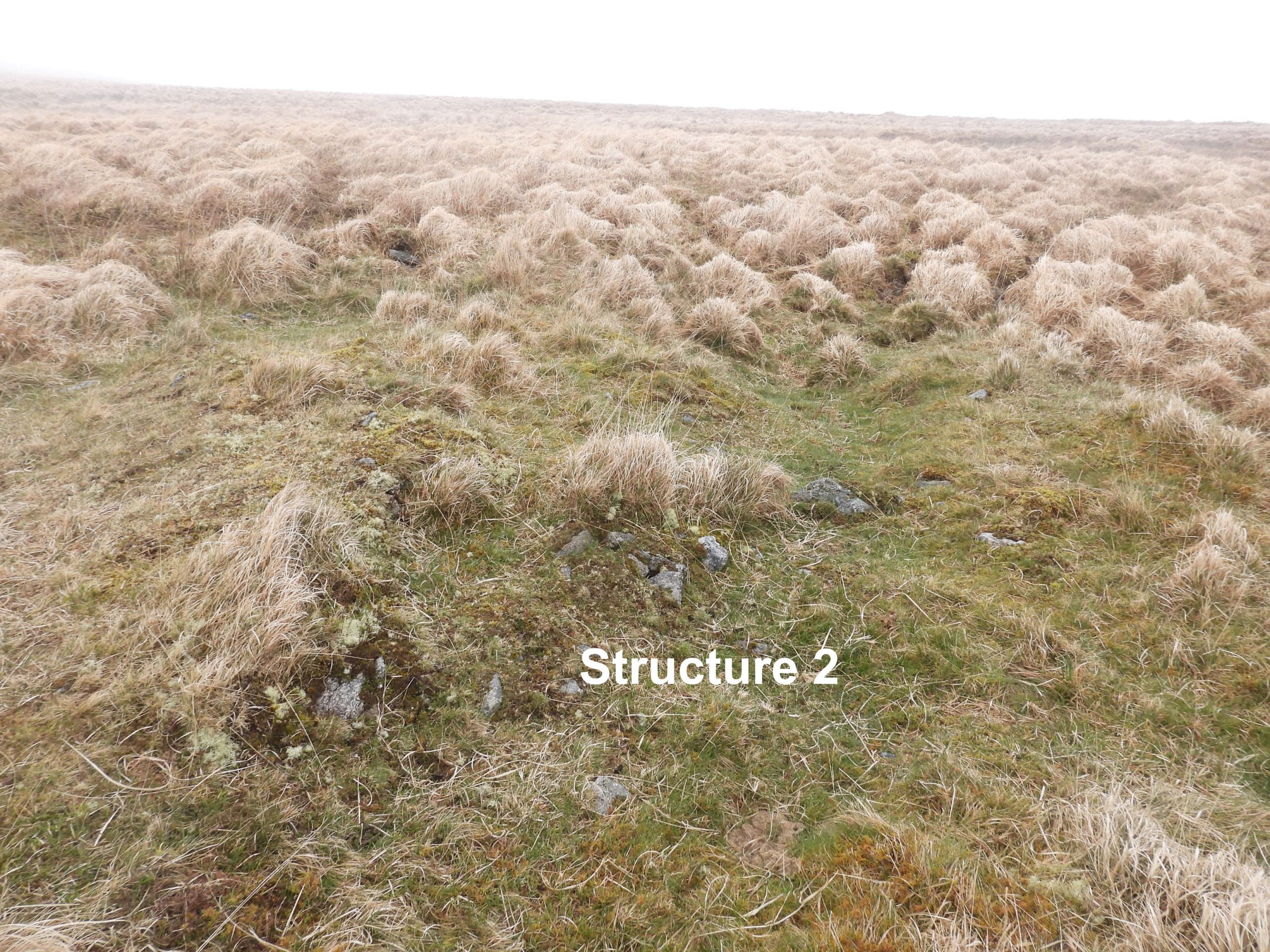
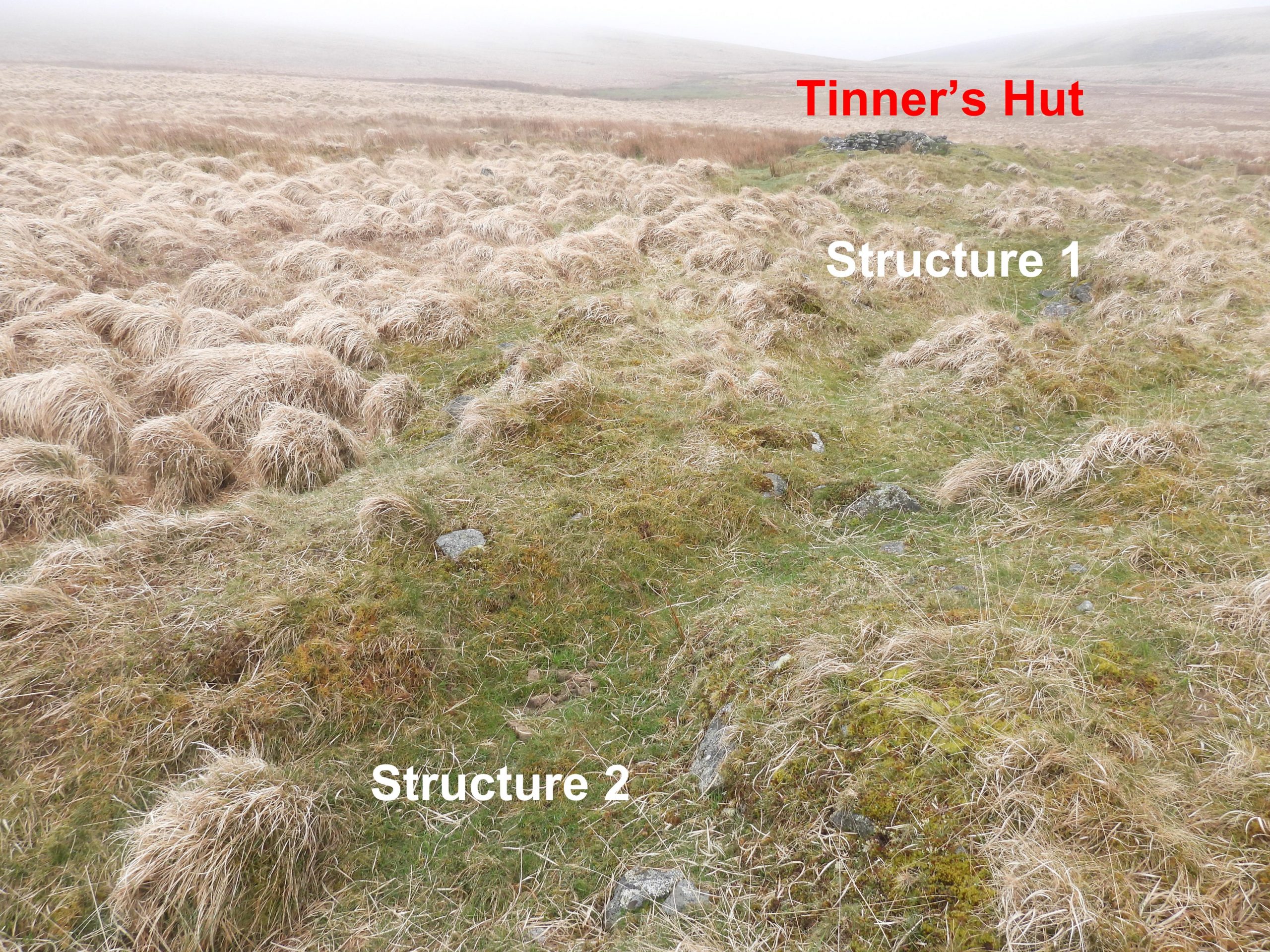
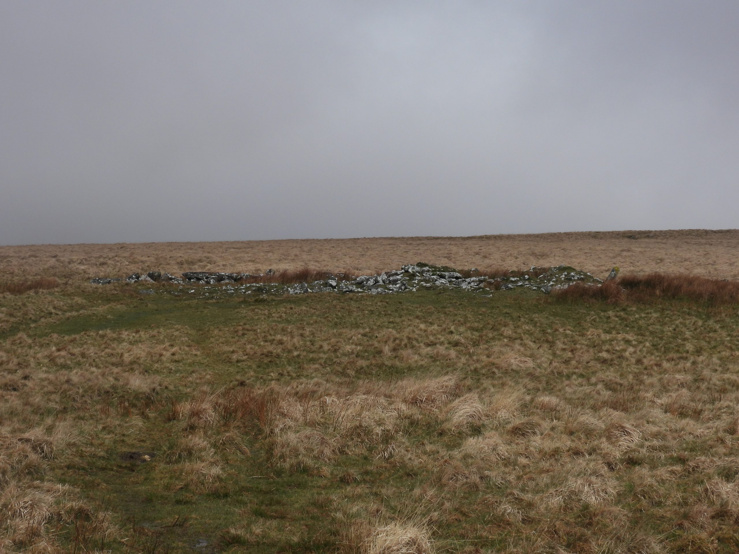
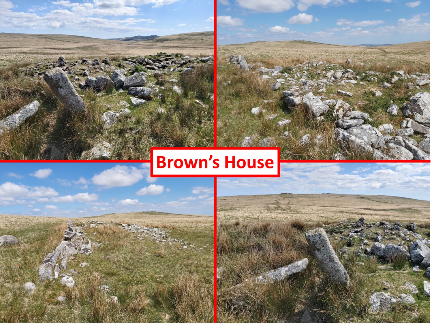
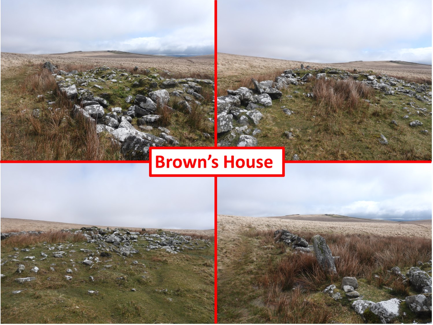
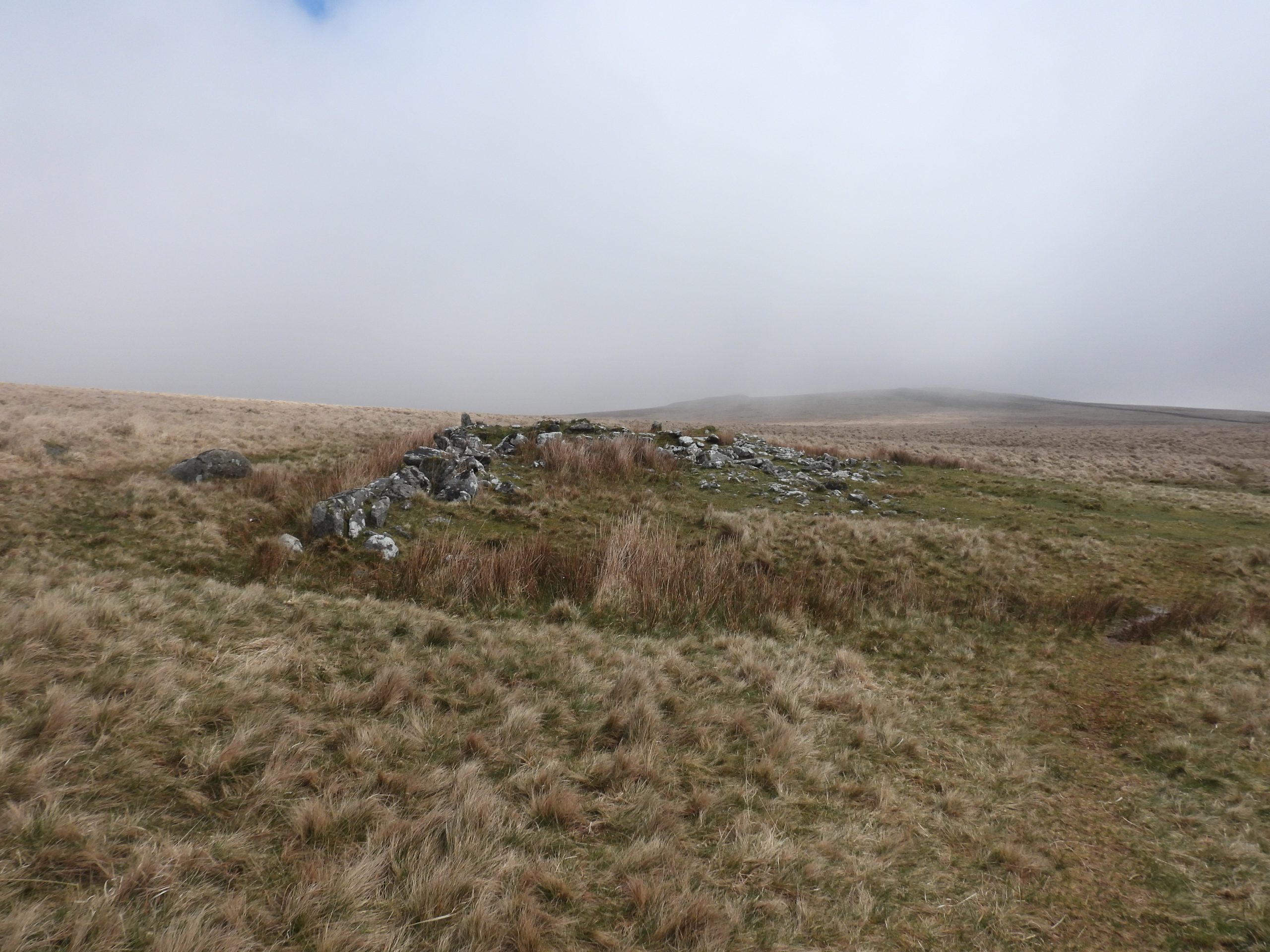
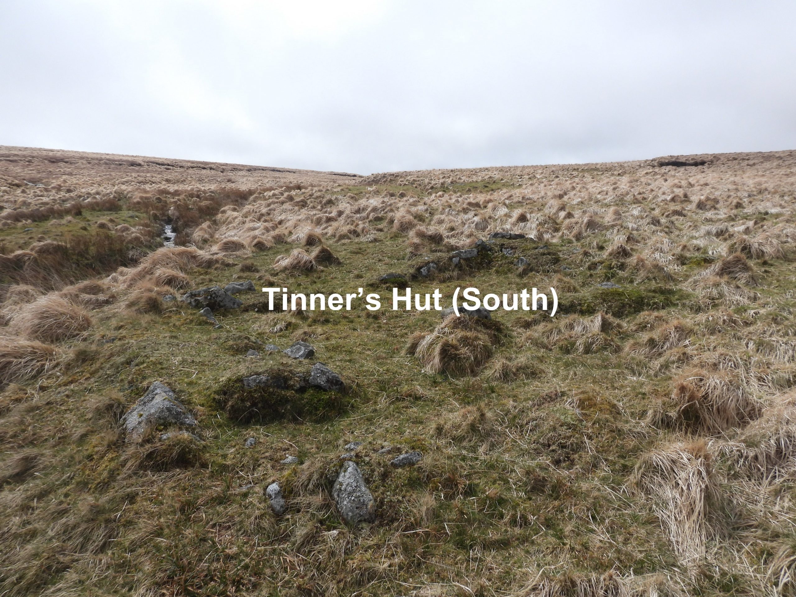
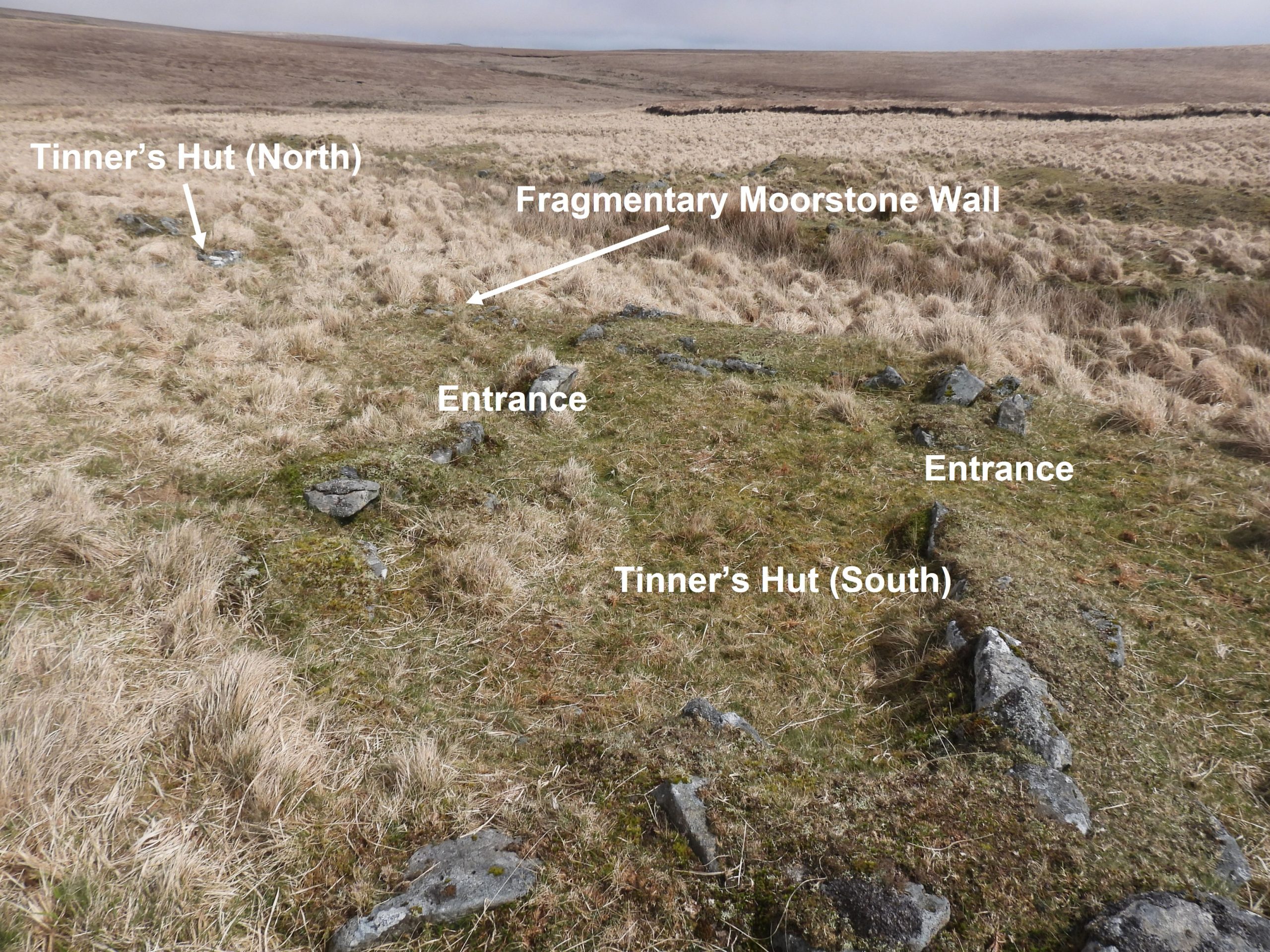
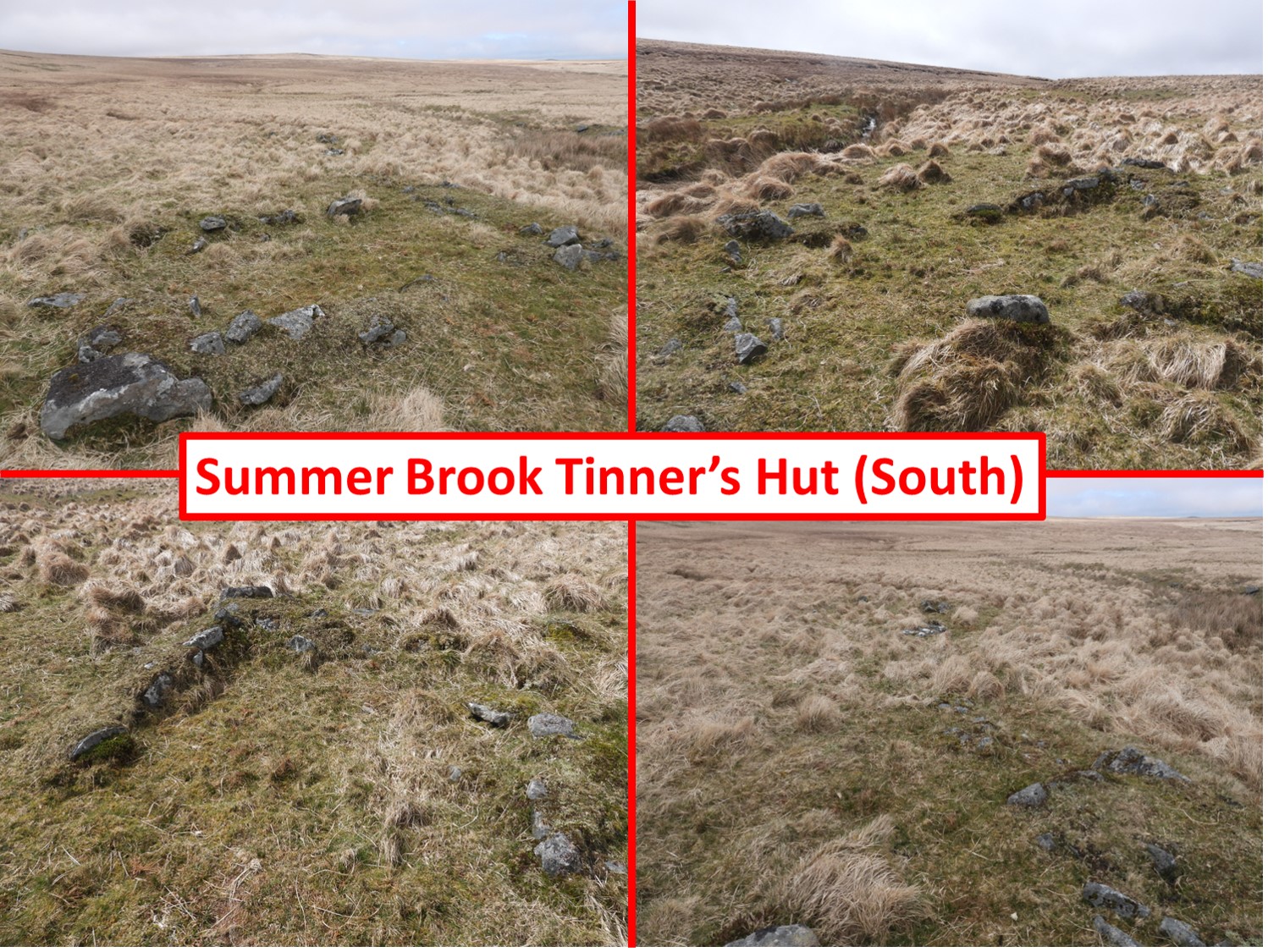
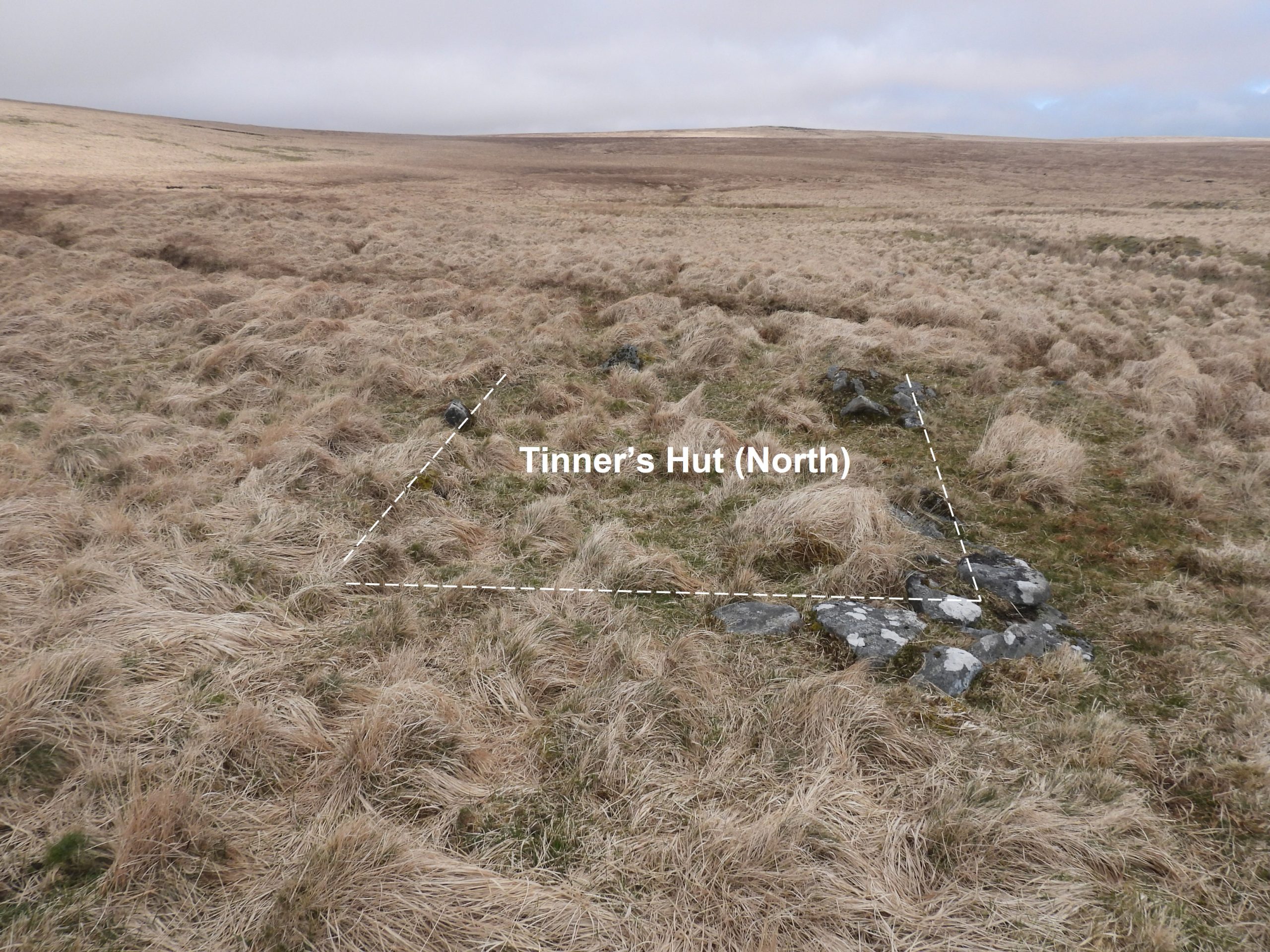
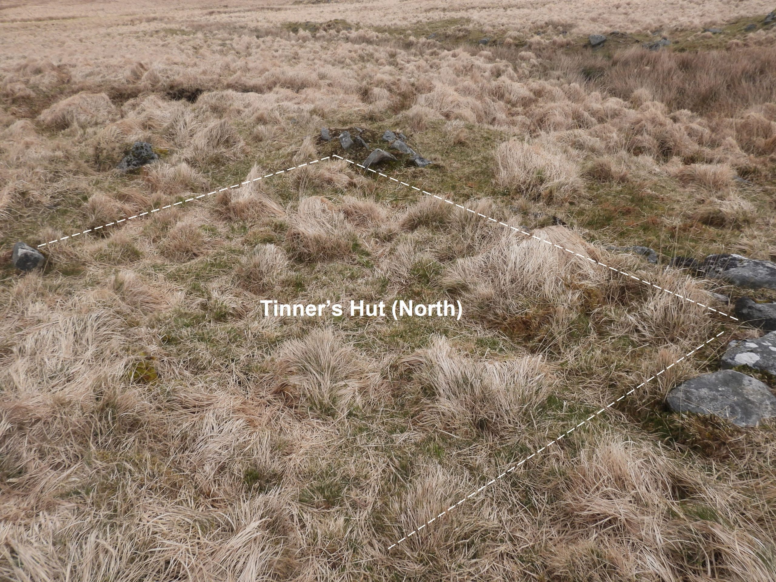
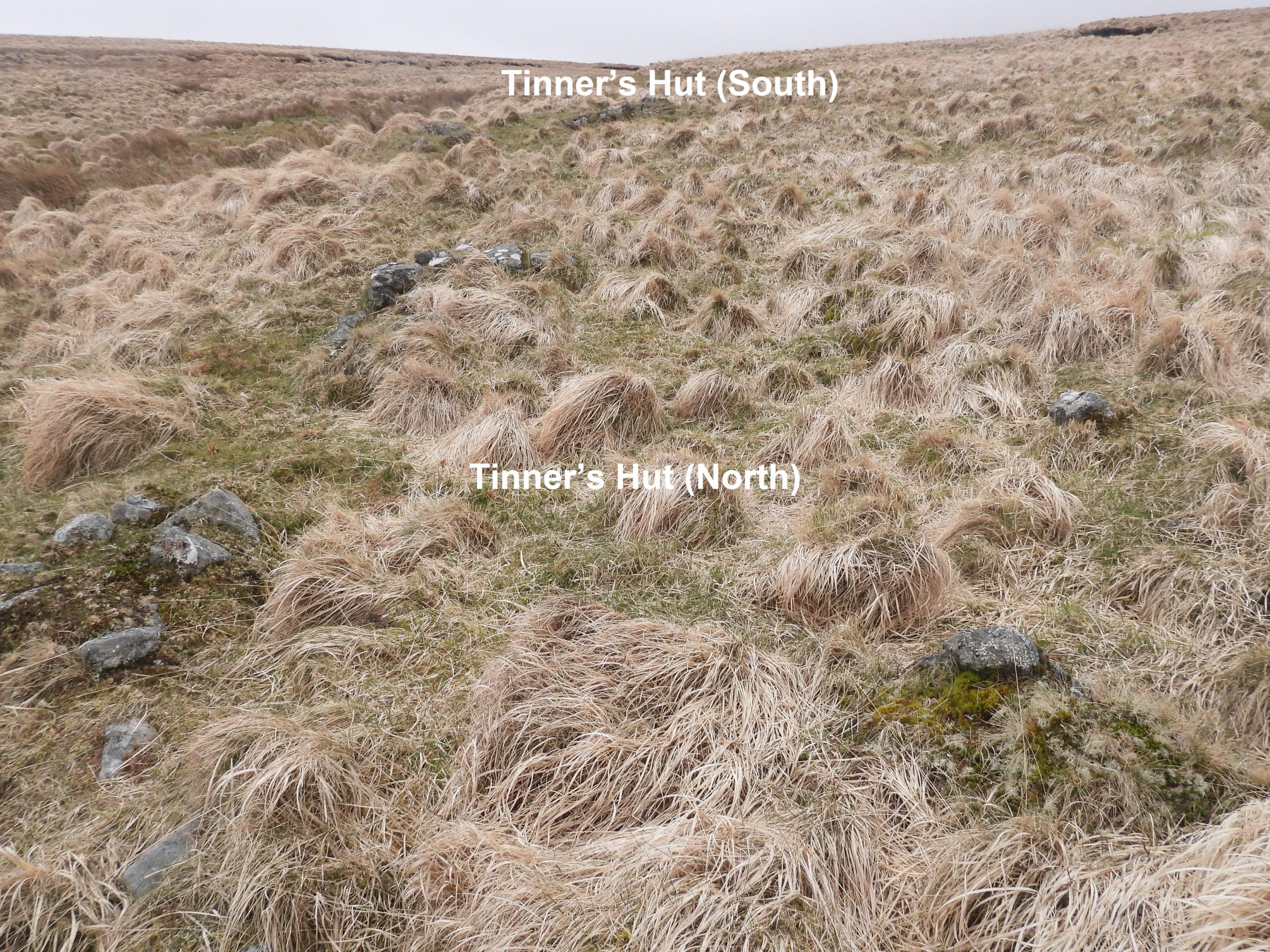
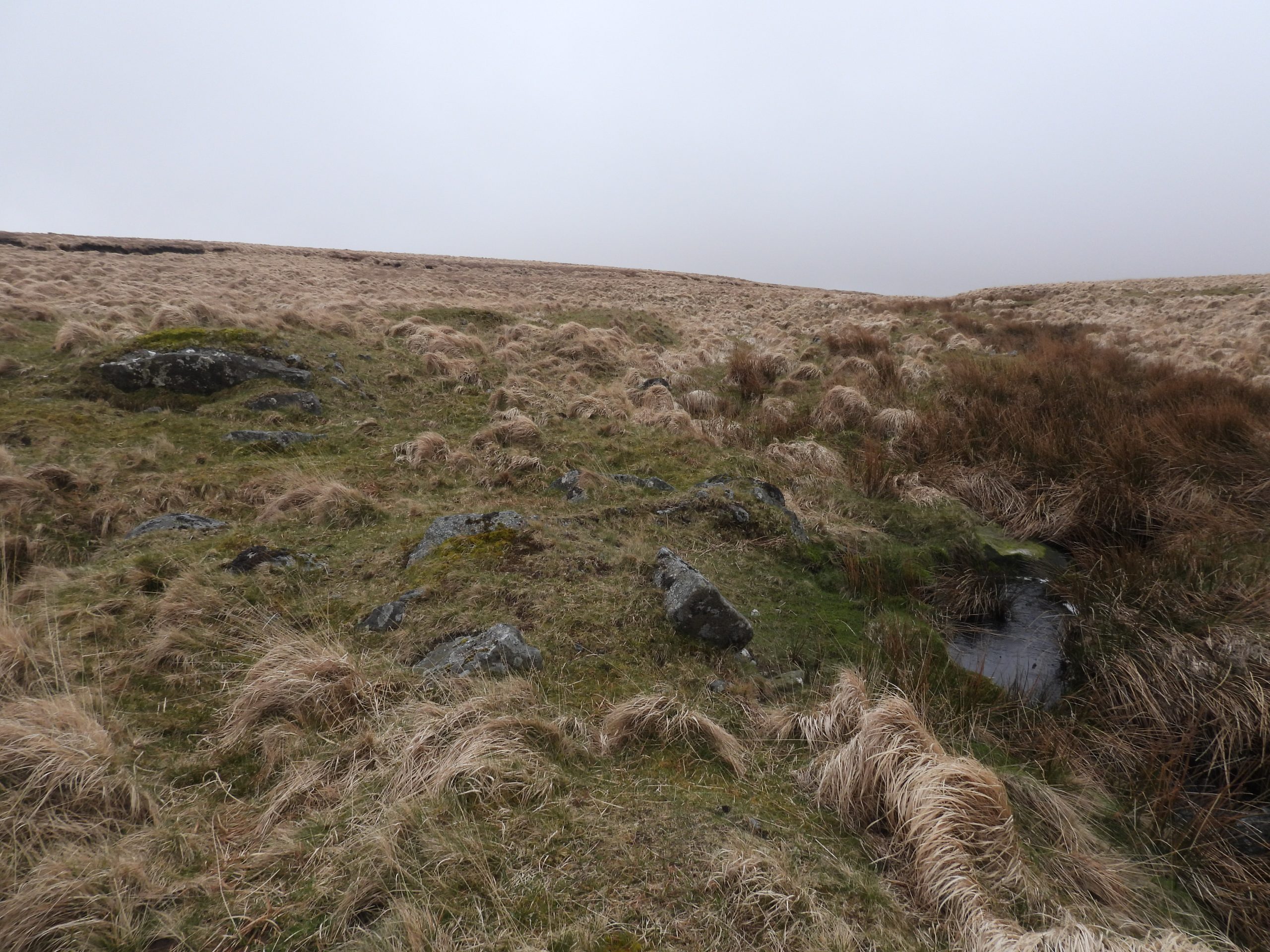
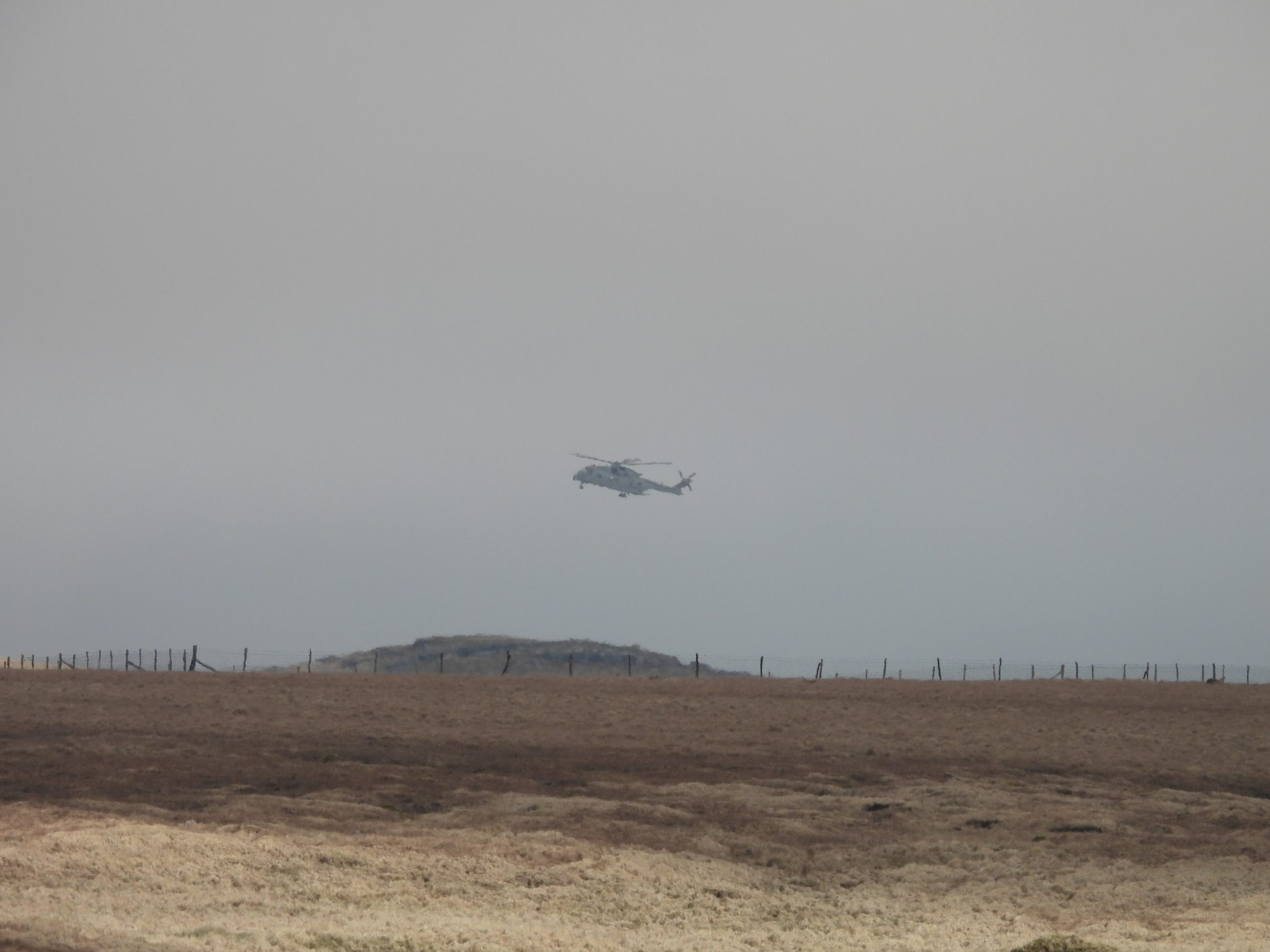
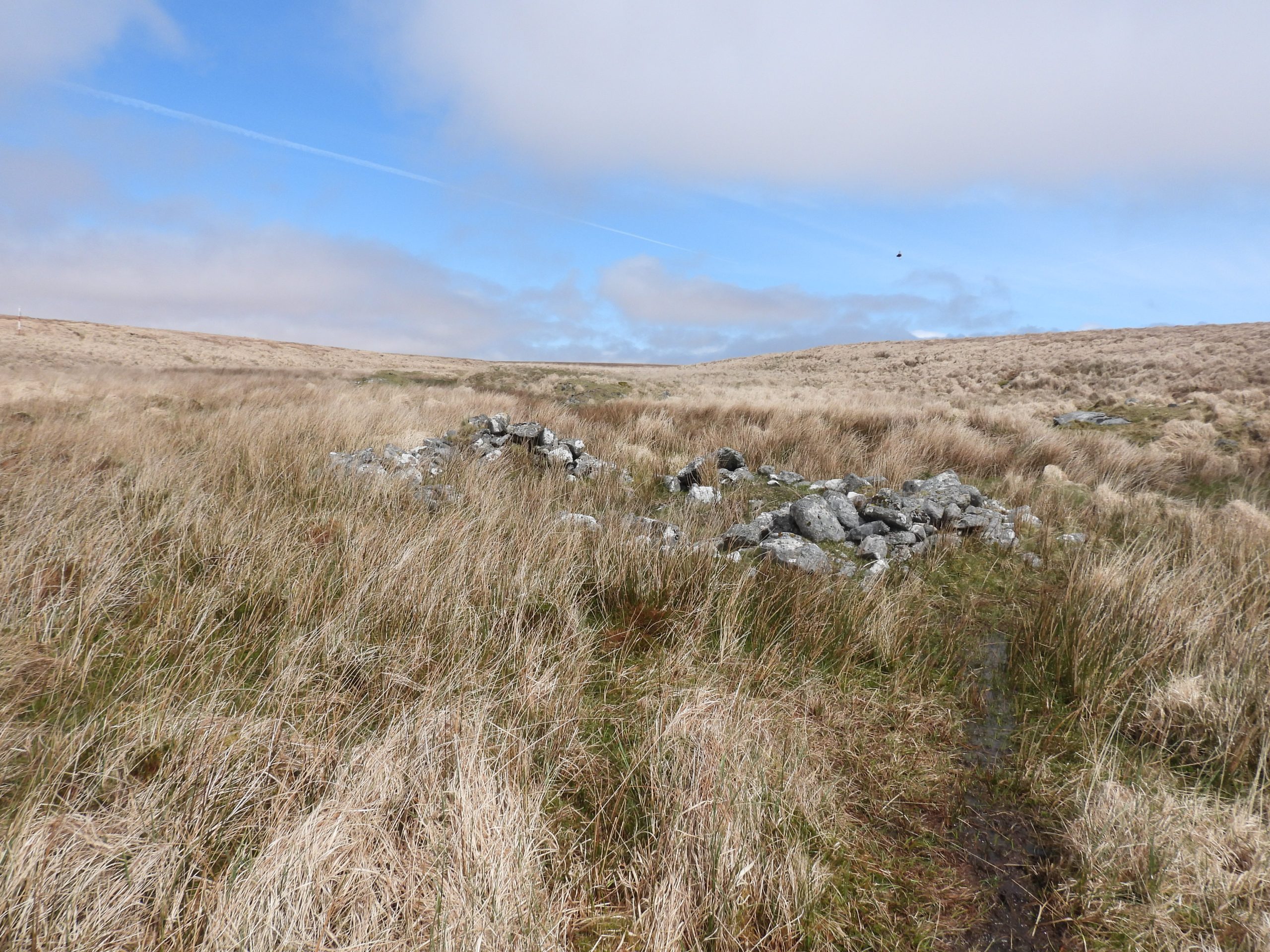
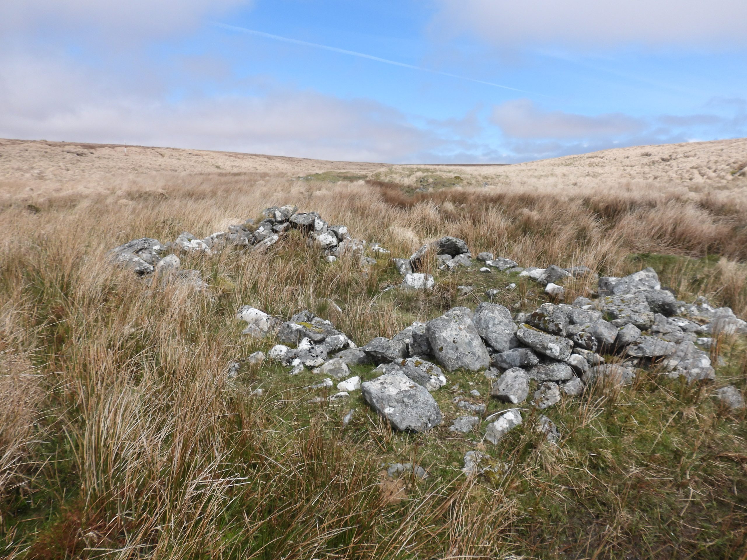
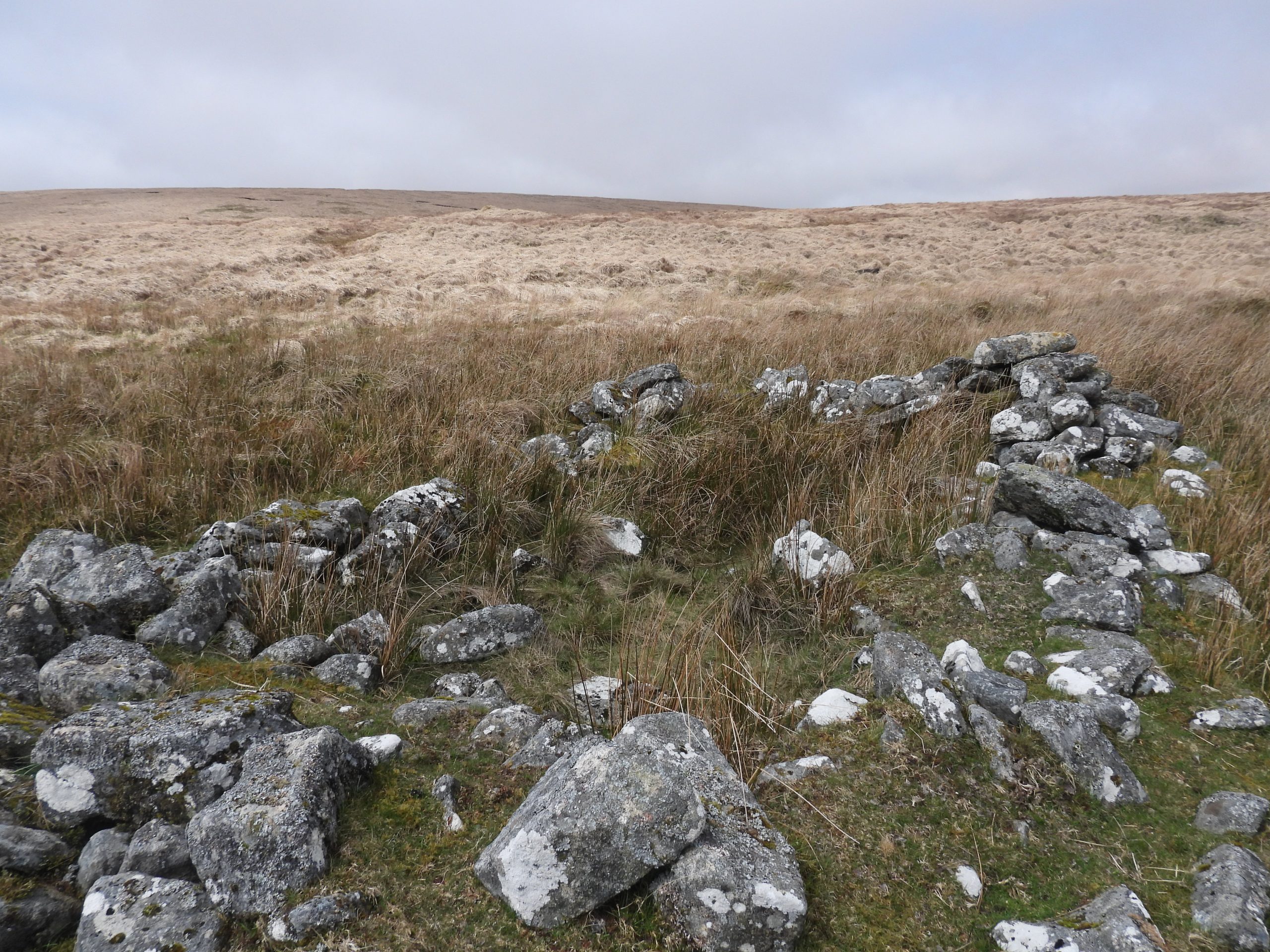
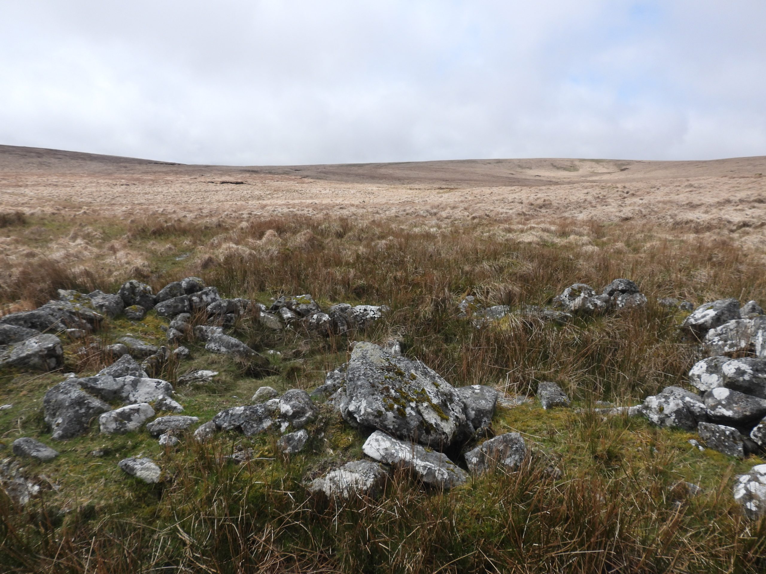
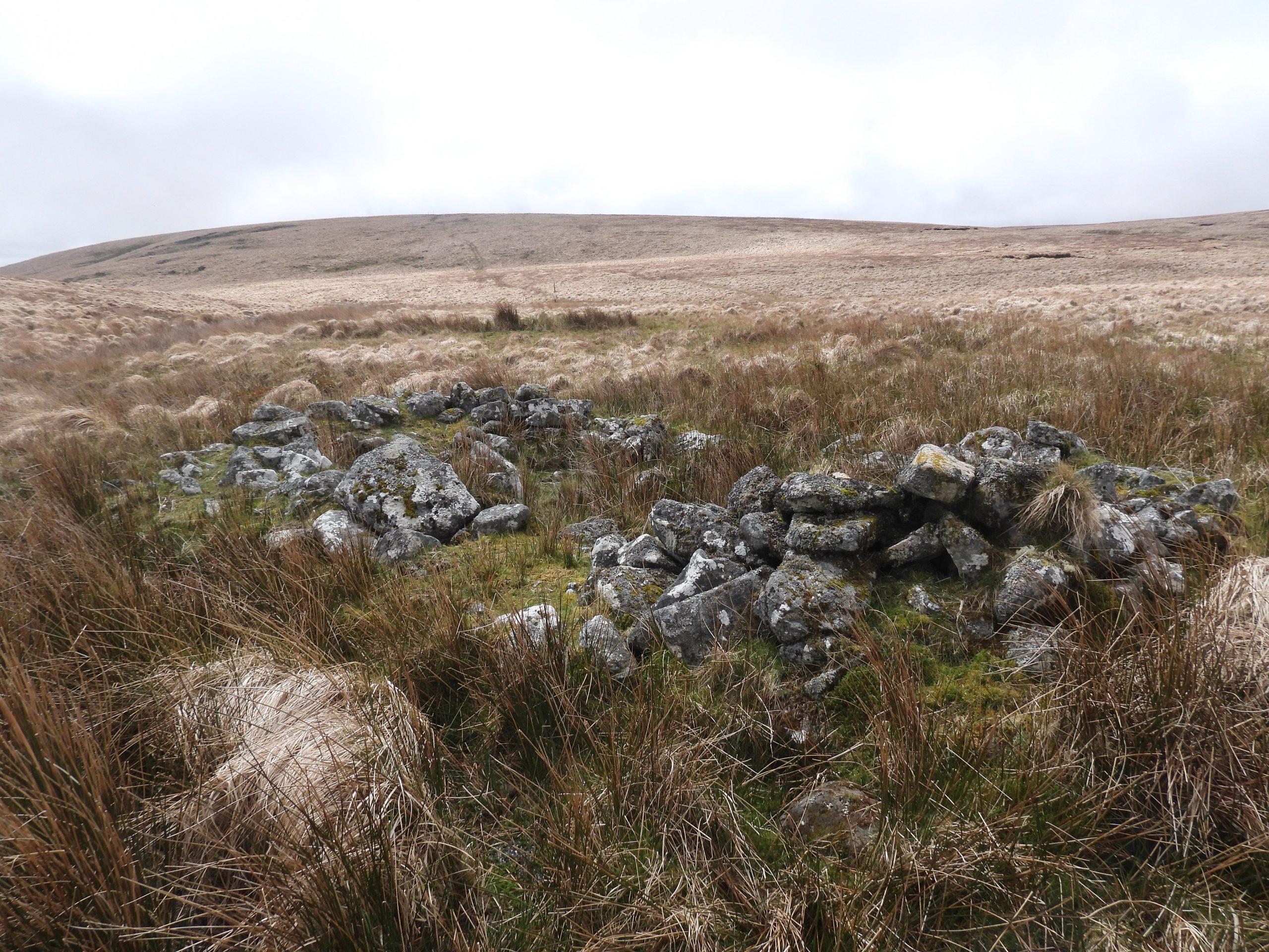
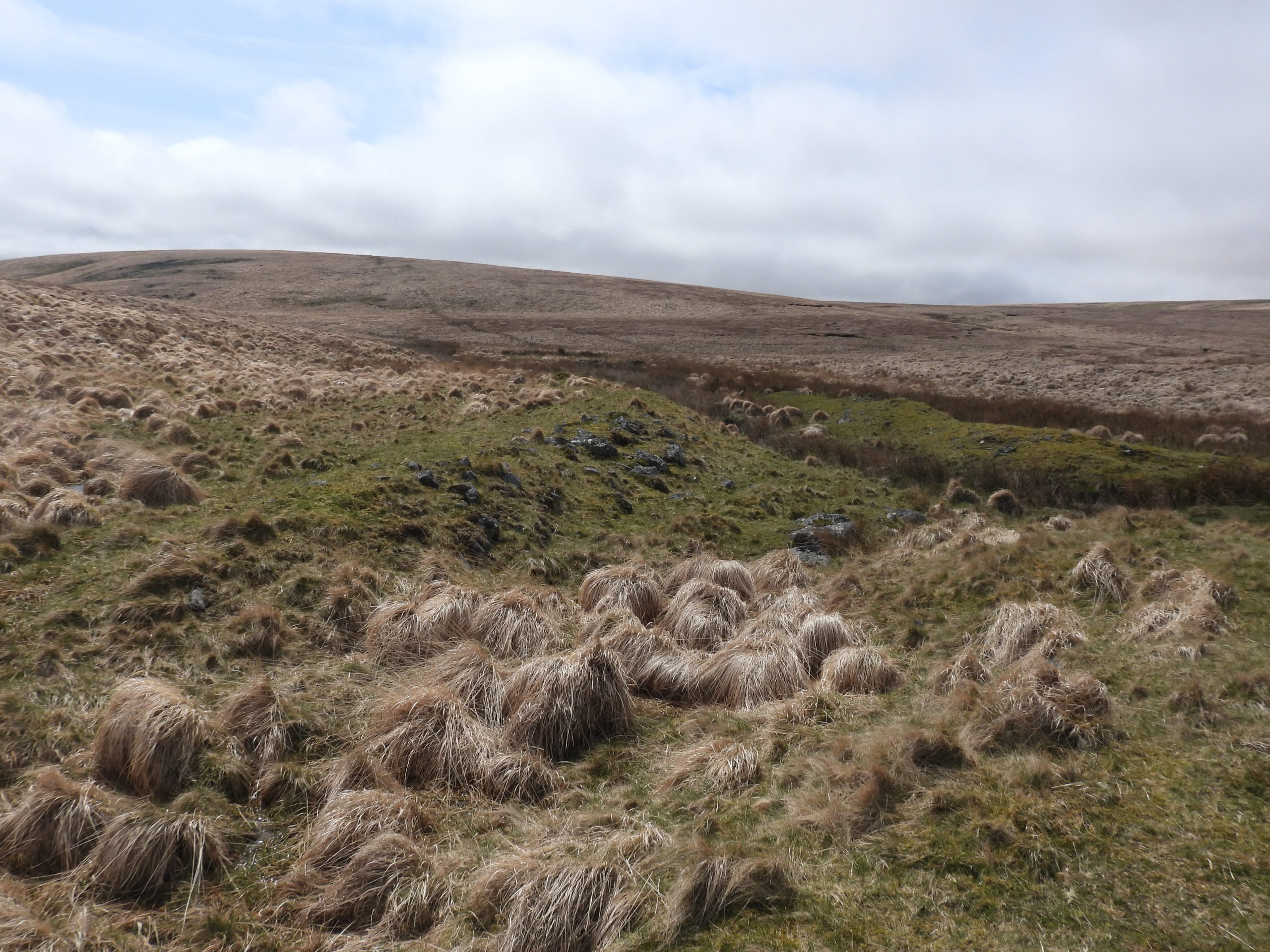
Sketch map of the area covered in this post, which includes 5 tinner’s huts and the ruins and enclosure at Brown’s House. The author first visited this tor in the late 80’s / early 90’s and knew it as Hoax Tor. Today, it is more usually called Braddon Tor. It has been given other names over the years, such as Rowter Moor Rocks (Hemery). On the south west outcrop the author has observed (with ‘an untrained geologists eye’) at least 4 Xenoliths (there may be more). This tinners hut is located at the foot of a steep E-facing slope on the right bank of the Cherry Brook (Hollowcombe Bottom) not far from its head. It is located at SX62118 79563The Royal Commission for the Historical Monuments of England record this tinner’s hut as having three sides by coursed boulder revetments up to 0.6m high. Internally the structure measures 4.2m by 2.5m.Views of the upper Cherry Brook (Hollowcombe Bottom), where there are small pockets of streamworking remains on the marshy floodplain. The streamworking lies downstream from the tinner’s hut.This ruinous structure lies around 150m south of Brown’s House. It is surrounded by tinworking features including spoil heaps so is assumed to be a tinner’s hut, albeit larger than most. Because this part of the West Dart valley has been utilised for peat cutting English Heritage suggest this ruin may actually be a peat cutter’s hut. There does appear to be spoil around the ruin, which suggests it probably relates to tinners.The remains of this rectangular ruin is roughly 4.5 metres by 2.2 metres and has drystone walls up to 1.2 metres high (ref: Horsham). It is located at SX61534 79718. In spite of its proximity to Brown’s House, it is believed there is no connection between the two ruins.Historic England suggest this ruin, which is in relatively good condition might be late 19th century. However, as recorded on the Heritage Gateway, (Tom) Greeves is noted as suggesting a pre-1600 date for this building, “due to the construction of the hut with two diagonal corners”. The entrance to the ruin is on the eastern side.To the south west of the ruin is an area of spoil / worked area.The spoil / worked area is to the south west of the tinner’s hut leading into some rather boggy ground.Whilst researching for this post, the author read an entry in the Heritage Gateway (Horsham) which suggested there were two rectangular structures to the east of the main ruin (tinner’s hut). The structures are each about 7m long x 2m wide. The author believes the ‘structures’ described are those shown in the photograph.The structures described by Heritage Gateway (Horsham) are suggested that they may have been a settling pits or buddles. There is no doubt that these two ‘structures’ are man made, however, their location is somewhat of a mystery, insofar as they are uphill from the tinner’s hut. The tinner’s hut in turn lies between these ‘structures’ and the spoil area. Structure 1 is located at SX61540 79736 and structure 2 is located at SX61545 79740Brown’s (or Browne’s) House was described by Brian Le Messuerier in 1975 during a field visit, as a: “Well-founded house and enclosure of at least two rooms”. It lies under the slopes of Wildbanks Hill, which unlike Brown’s House is not labelled on modern OS maps.In Eric Hemery’s High Dartmoor (page 423) the story of the origins of the house as told by Sabine Baring-Gould is recorded thus: “Browne, an ungainly, morose man, had a pretty young wife, of whom he was jealous. He built this place in which to live with her away from the society of men, and the danger such proximity might bring to his connubial happiness”. Also recorded by Hemery was Sabine Baring-Gould’s description of the house written in the late 19th century. Baring-Gould wrote: “Although, judging from the dilapidation and the lichened condition of the stones, one could have supposed that this edifice was of great antiquity, yet it is not so, by any means. There are those still alive who remember when the chimney fell; and who had heard of both the building, the occupying and the destruction of Browne’s House. Few indeed have seen the ruin, for it is in so remote a spot that only the shepherd, the rush-cutter and the occasional fisherman approach it”.Brown’s house (and farm) were believed to have been occupied from 1810-1830. The remains of Brown’s House measures approx 9m x 7m with walling 1.0m high. Some observers believe it may have been two storied.Adjacent to Brown’s House are two enclosures. The larger enclosure is immediately west of the building measures approximately 70.0m x 70.0m. The eastern enclosure is D-shaped and measures approx 45m x 40m. There is at least one leat (possibly two) coming from the West Dart to the farm.Rough Tor with its two military range huts lies at 547m above sea level. It was known as ‘Rowter’ by the old moor men, with Rowter Moor being around 1km away to the east. Beside Summer Brook are two Tinner’s Huts which are less than 10 metres apart. The Tinner’s Hut to the south is the best preserved and is located at SX60519 80534The southern Tinner’s Hut beside Summer Brook is ‘connected’ to the northern Tinner’s Hut by a fragmentary moorstone wall. The hut has two opposing entrance gaps in the northern and southern walls.The southern Tinner’s Hut has been recorded as being 2m N-S by 4.4m E-W. The walls have two courses of moorstone blocks and are 0.5m wide and 0.3m high. (Ref: Royal Commission for the Historical Monuments of England)The northern Tinner’s Hut on Summer Brook is less well defined than its near neighbour. It is located at SX60525 80549The Royal Commission for the Historical Monuments of England record this Tinner’s Hut as being 5.2m N-S and 2m E-W. The walls, like the southern hut are of coursed moorstone blocks two courses high. The walls are 0.5m wide and 0.2m high.There is an entrance gap lies in the eastern wall of the northern hut (side nearest the brook).Around the two Tinner’s Huts at Summer Brook is an area of streamworking. This picture is downstream (north) of the two huts.Getting ready for the ten tors weekend. This zoomed in picture of the helicopter was taken from Summer Brook with the fenceline of the mires project at Flat Tor pan in the foreground and Sittaford Tor in the background (where the helicopter landed briefly).Next to the West Dart, a short distance upstream from its confluence with Summer Brook are the remains of another Tinner’s Hut.The West Dart Tinner’s Hut was recorded by Jeremy Butler in Dartmoor Atlas of Antiquities: Volume Two – The North, page 153, Map 34, as being: “….circa 4.8 metres by 2.0 metres with one corner still standing over a metre high with an entrance facing away from the river. This building is at the lower end of a 200 metres streamworks involving both banks of the West Dart River”. The river is on the right (east) in this photograph.The West Dart Tinner’s Hut is located at SX60814 80711View of the West Dart Tinner’s Hut looking west across towards Summer Brook. The hut has been divided into two by a central partition wall.The walls as with other Tinner’s Huts are constructed from coursed moorstone blocks. They are 1m wide and 0.6m high. It seems that there has been a limited amount of rebuilding at the north-eastern end (nearest the camera position). There are patchy areas of tin streamworks, like those shown in the picture which are located along the course of the West Dart and its upper tributaries. The ‘dome’ on which Rough Tor sits is on the top left in this picture.