A collection of walks, discoveries, insights and pictures of exploring Dartmoor National Park
June 8, 2023
Throwleigh Parish incursions into Forest of Dartmoor (Duchy Land) in 18th Century
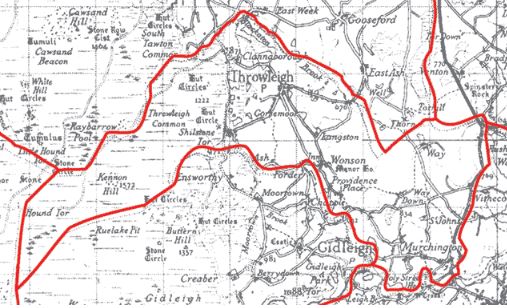
Dartmoor Parish ‘Beating the Bounds’ historically have been undertaken every 7 years, usually in Rogation Week {Note: The Sixth Sunday of Easter (the fifth Sunday after Easter Sunday) is traditionally known as “Rogation Sunday” in the Church of England’s calendar of festivals. This is because the Monday, Tuesday, and Wednesday of the following week are known as the “Rogation Days,” days for fasting and prayer}. That said, many moorland parishes lapsed this tradition from mid 19th century to the early 20th century. Throwleigh Parish was no exception in this, having neglected their bounds from (probably) 1786, when their bound had been recorded in a document through to 1923, when the bounds were known to have been beaten. There is great detail of the history of the 1786 document and 1923 beating of the bounds contained in ‘Dartmoor Boundary Markers (second edition), by Dave Brewer, pages 48-62 (Throwleigh)’, which has inspired this post.
Of particular interest to the author in the Brewer book, which inspired this post, was the apparent incursion of the Throwleigh Bounds into the Forest of Dartmoor (Duchy Land), in the 18th century. The 1786 document records that the far western boundary of the parish apparently instead of following a line directly between Wildtor Well and Hound Tor, made a diversion through to Wild (Will / Well) Tor. Historically, Wild Tor has never been on the Forest of Dartmoor boundary, from the original 1240 perambulation through to the 1608 perambulation, thus Throwleigh definitely appear to have made an encroachment sometime between 1608 and 1786. This apparent incursion has been rectified and the present Forest / Throwleigh Bounds taking the expected course.
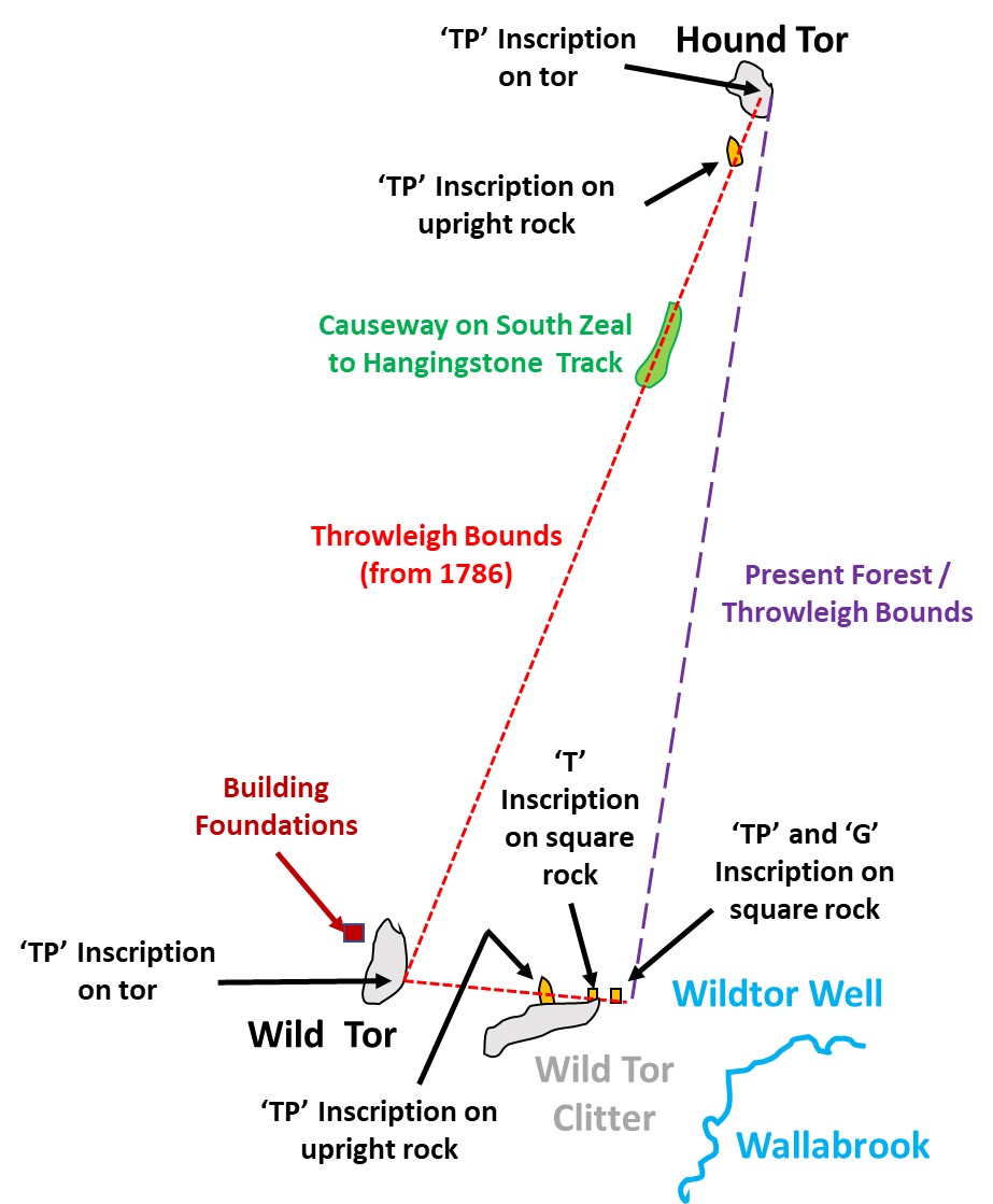
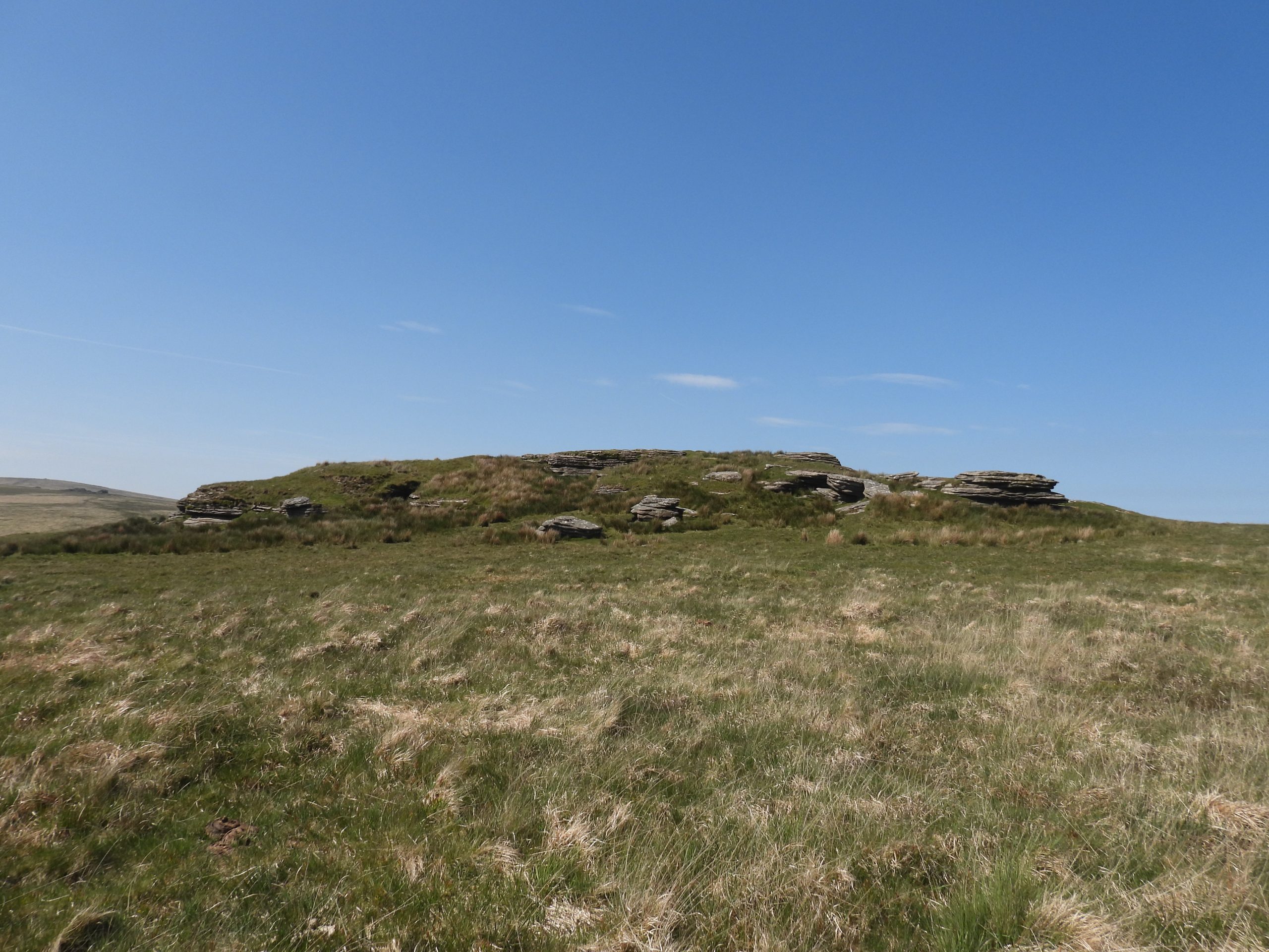
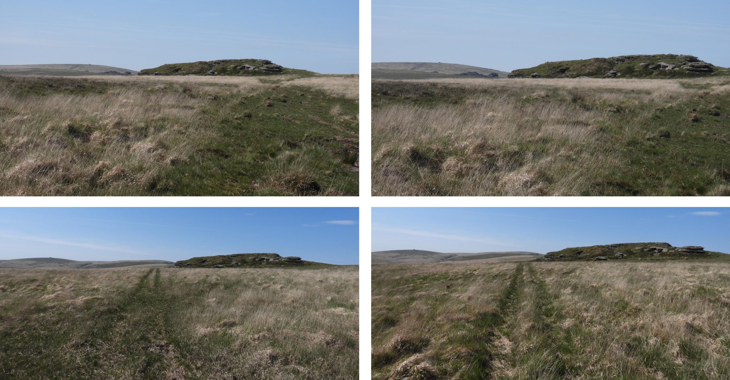
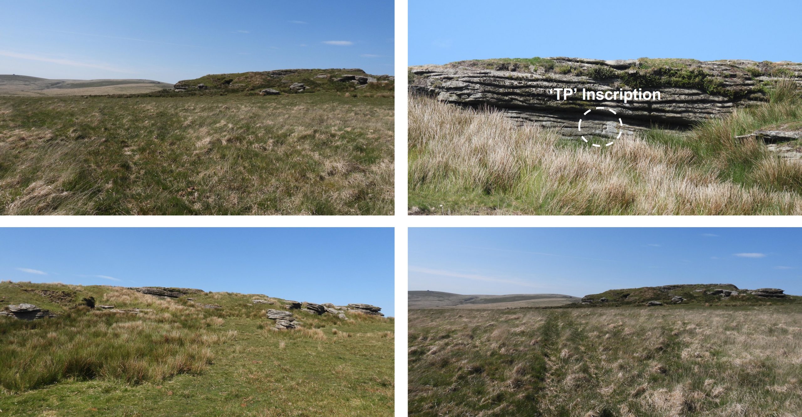
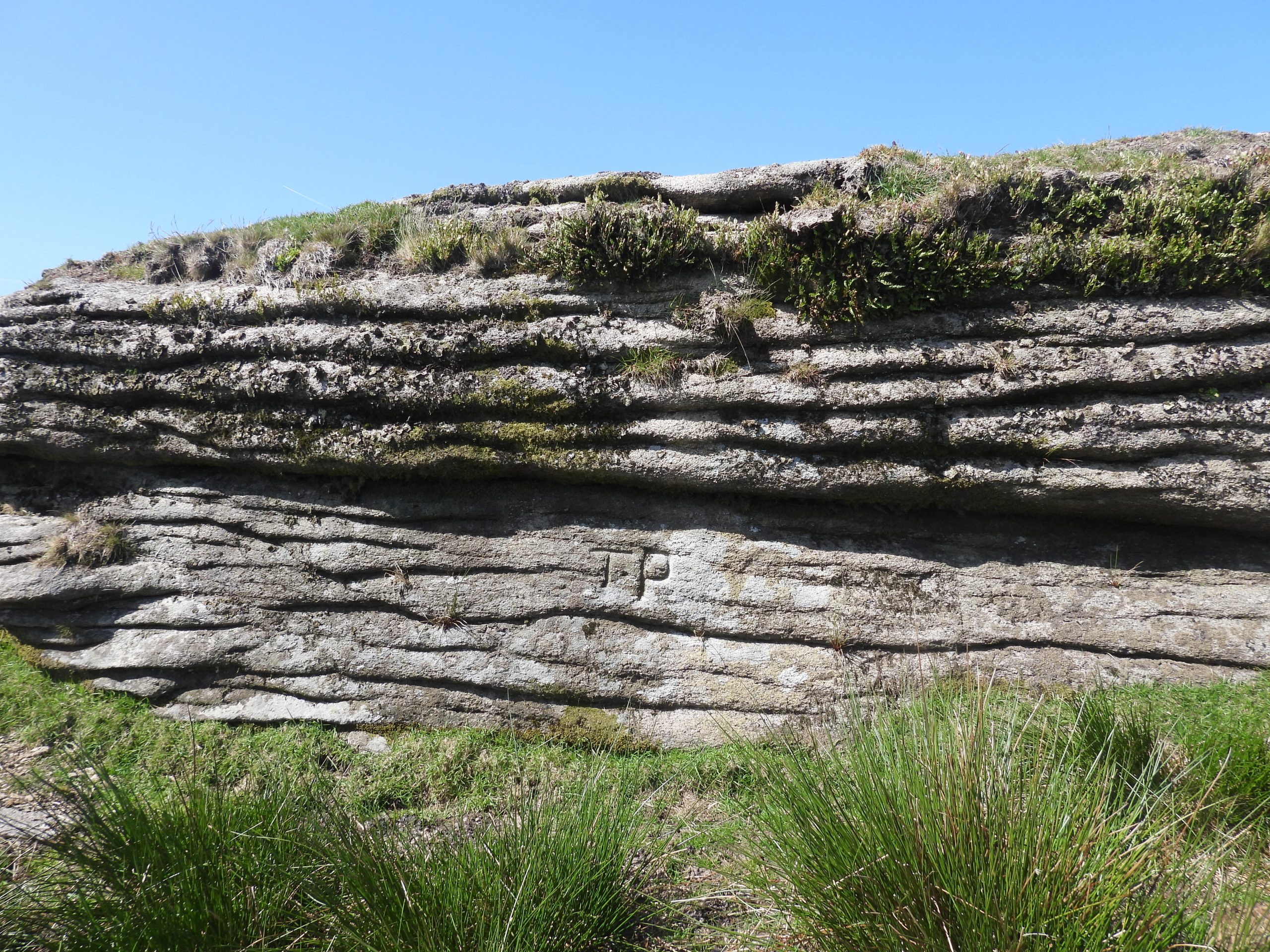
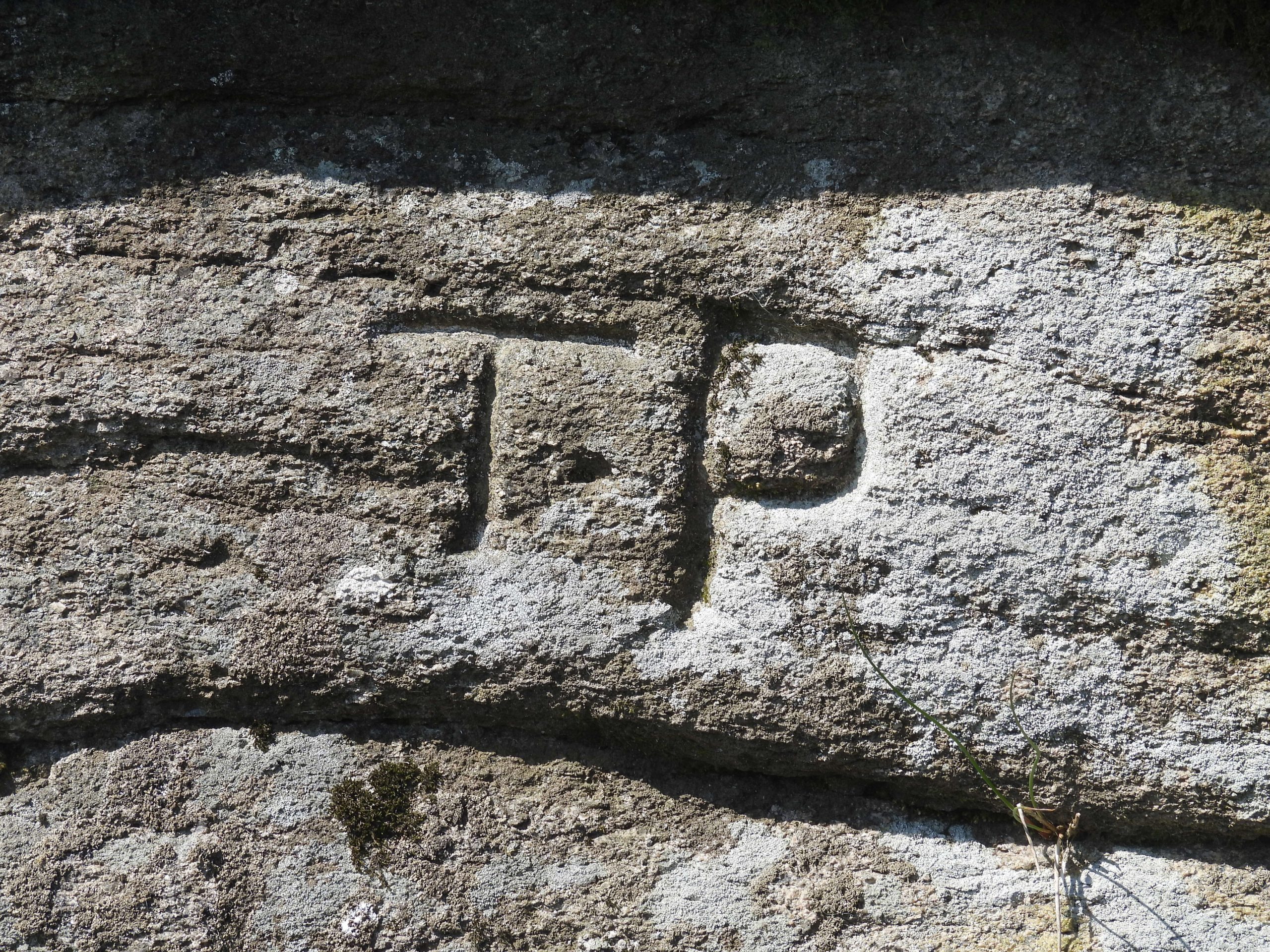
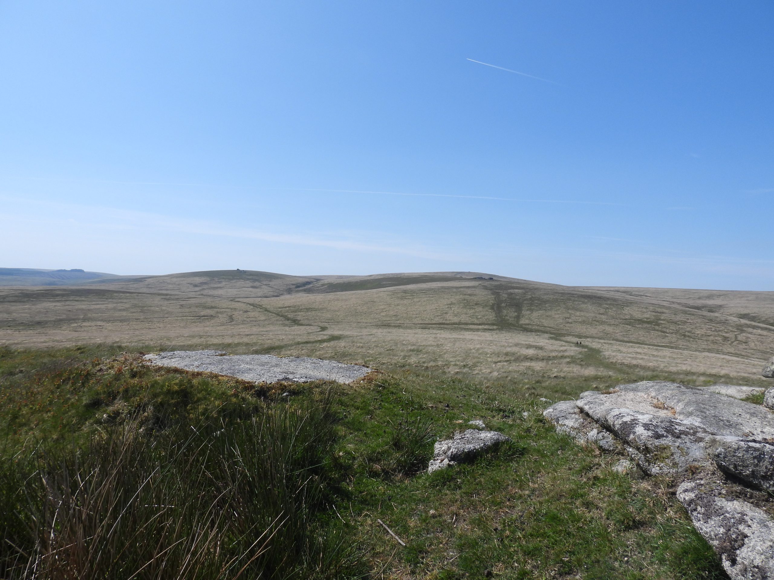
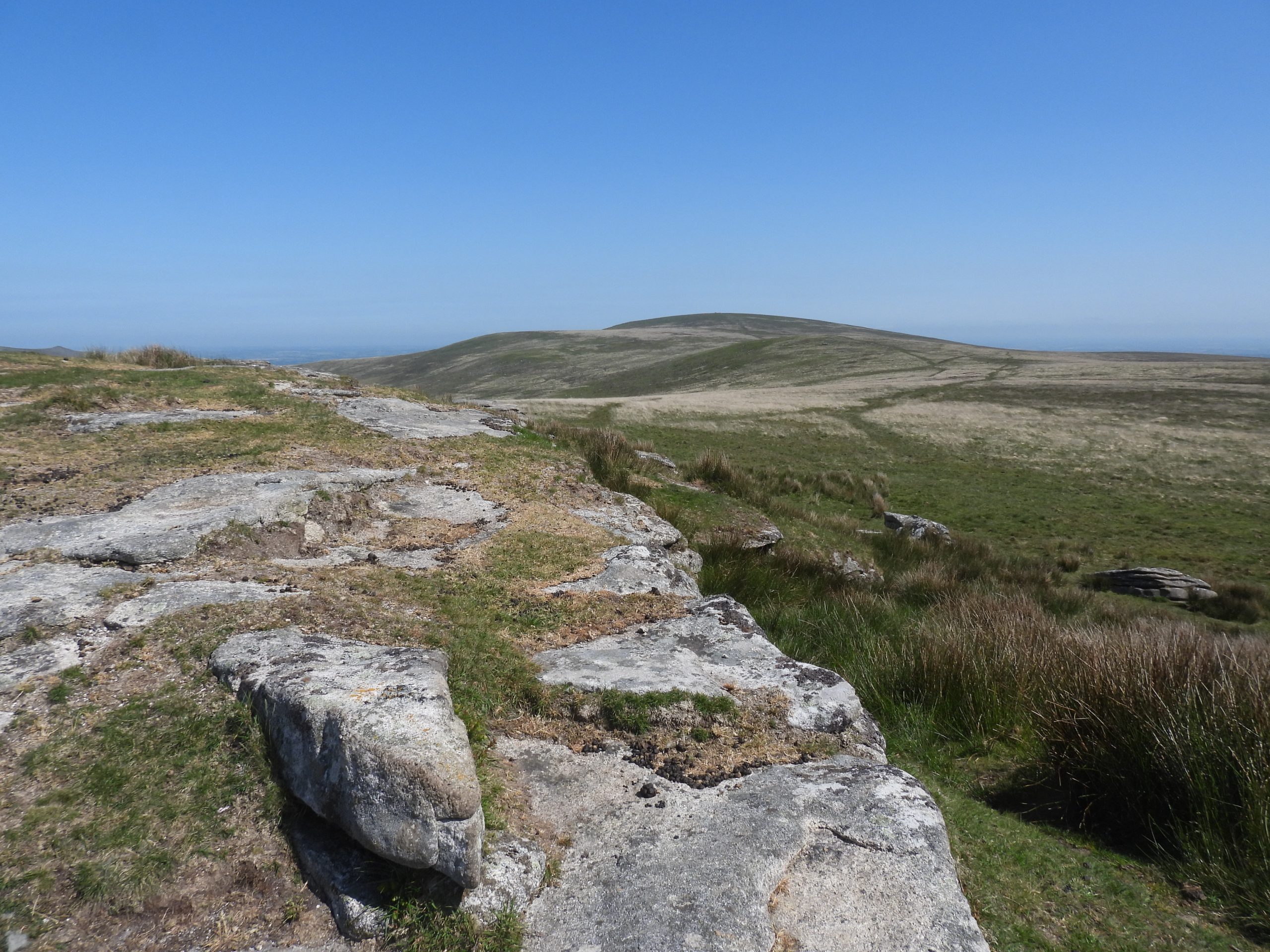
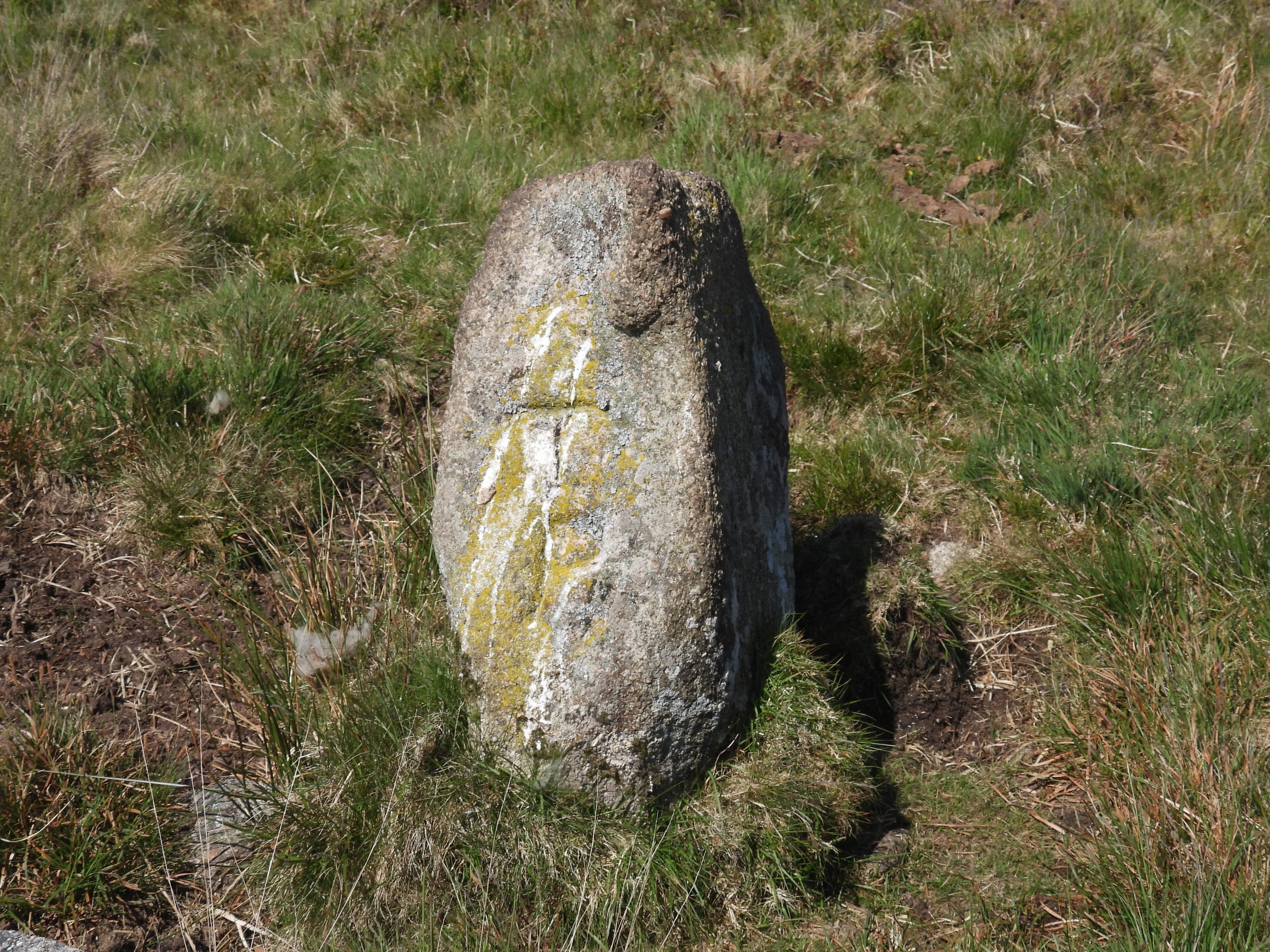
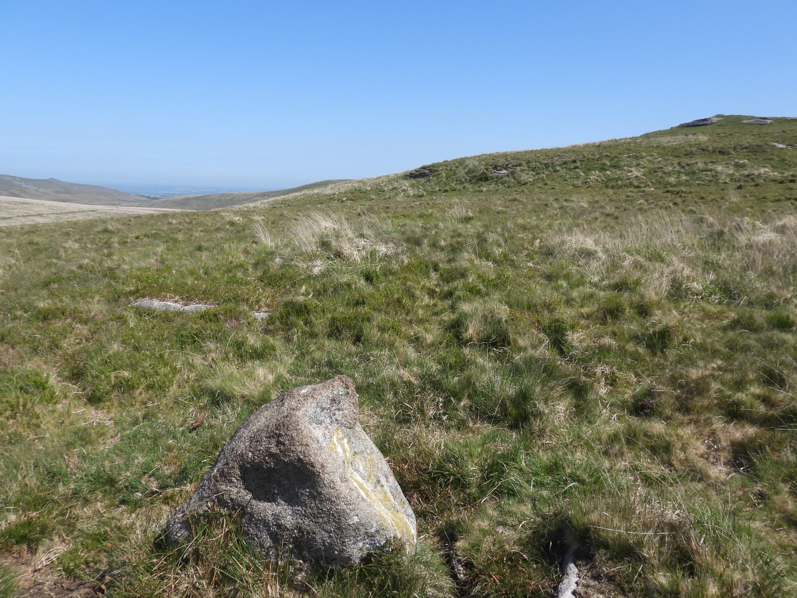
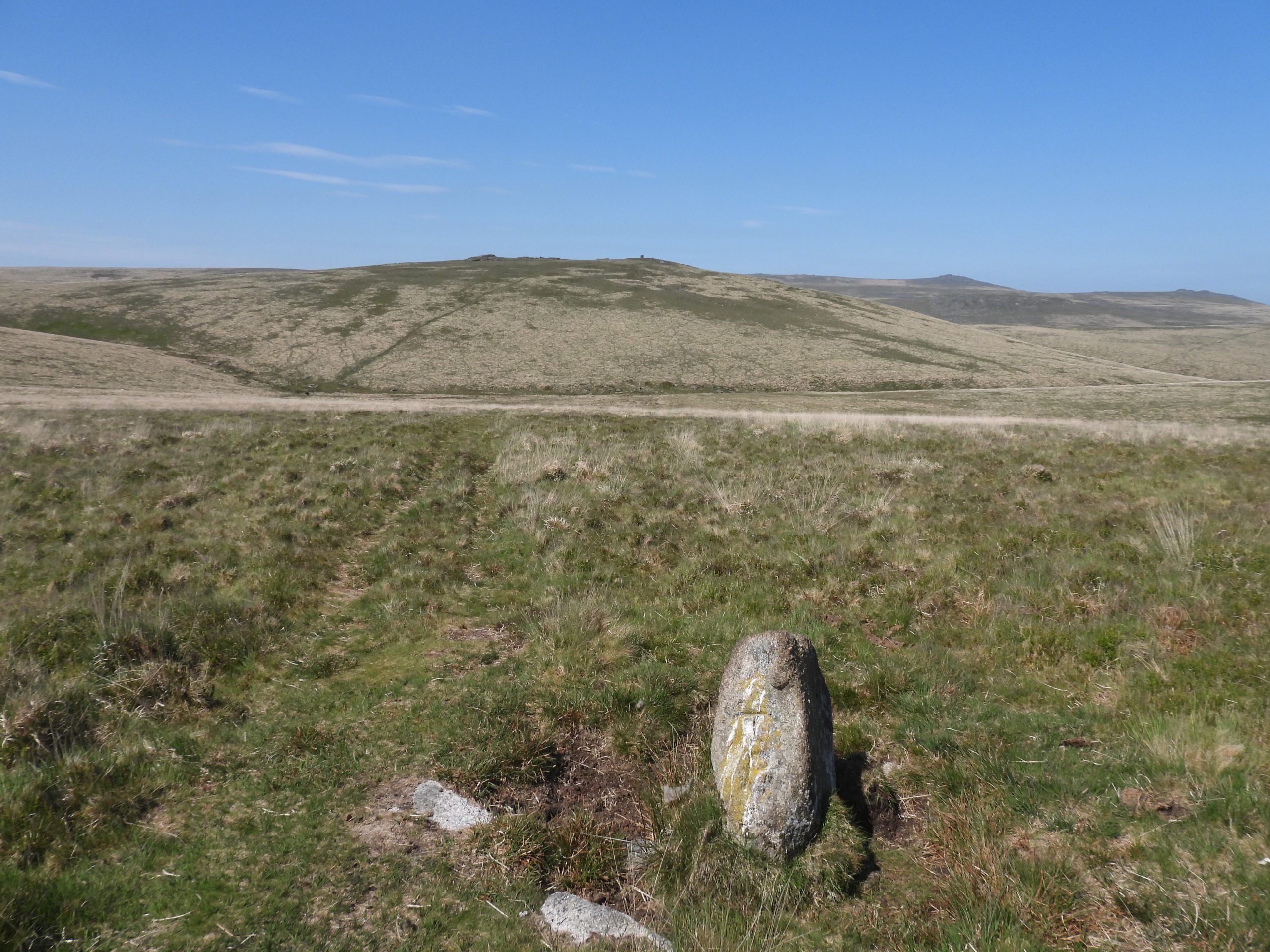
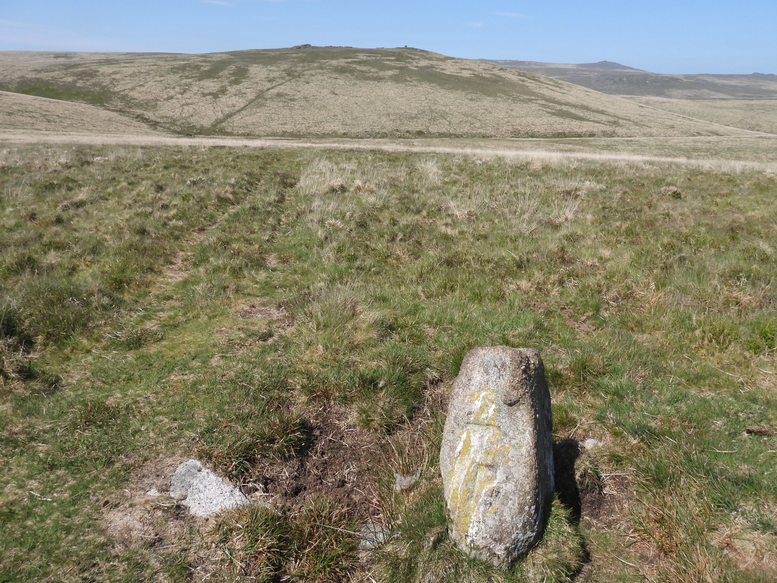
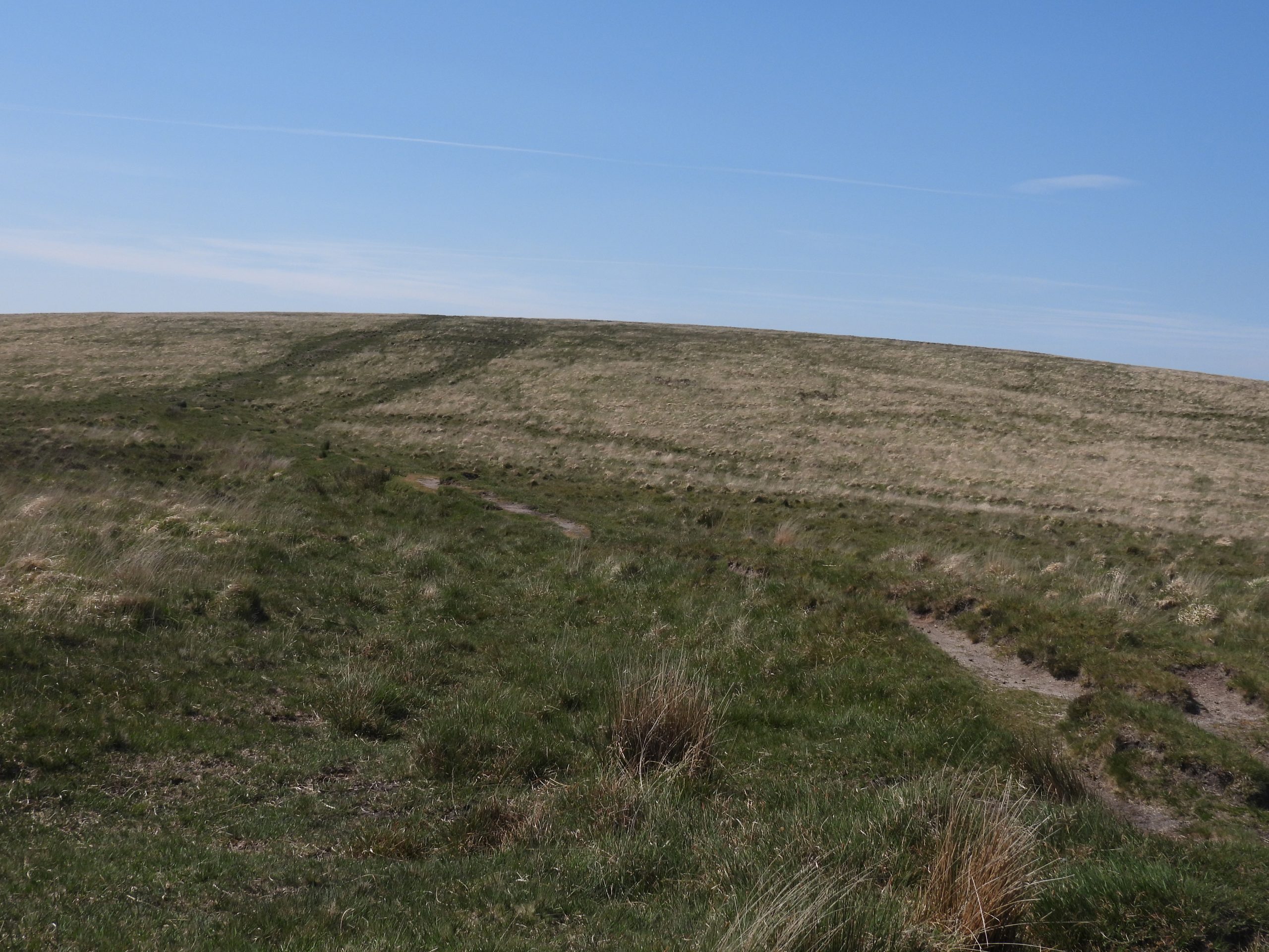
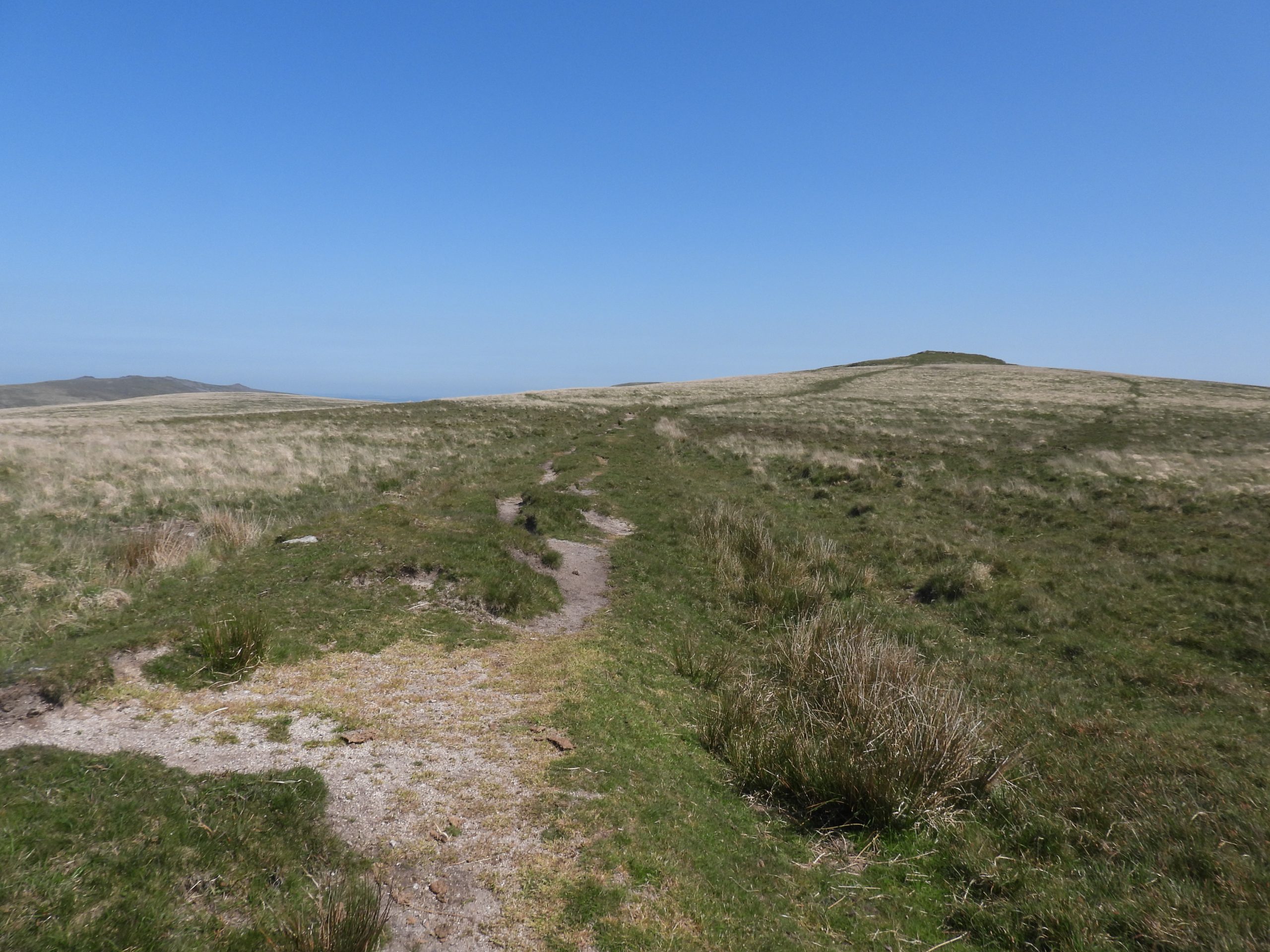
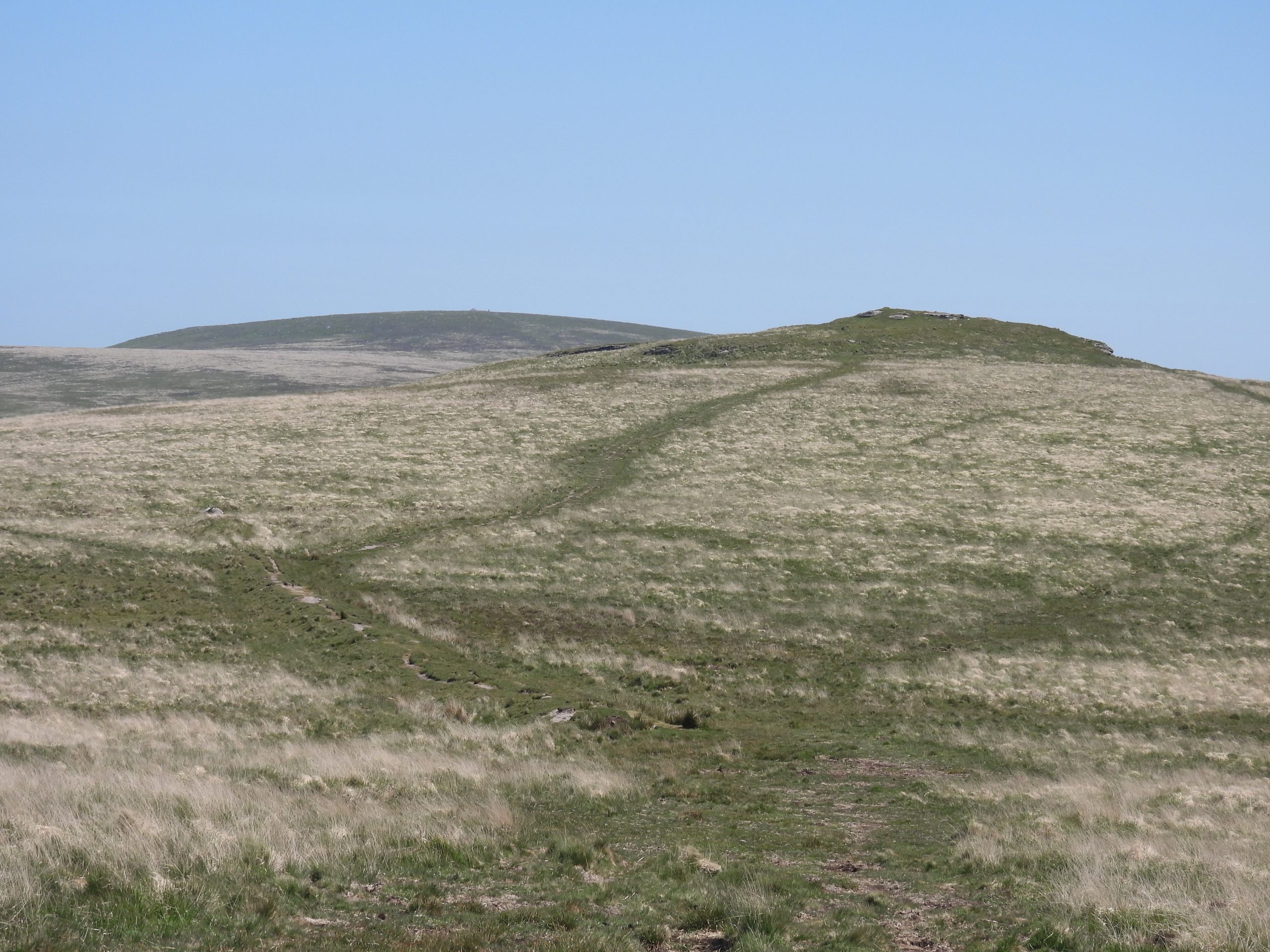
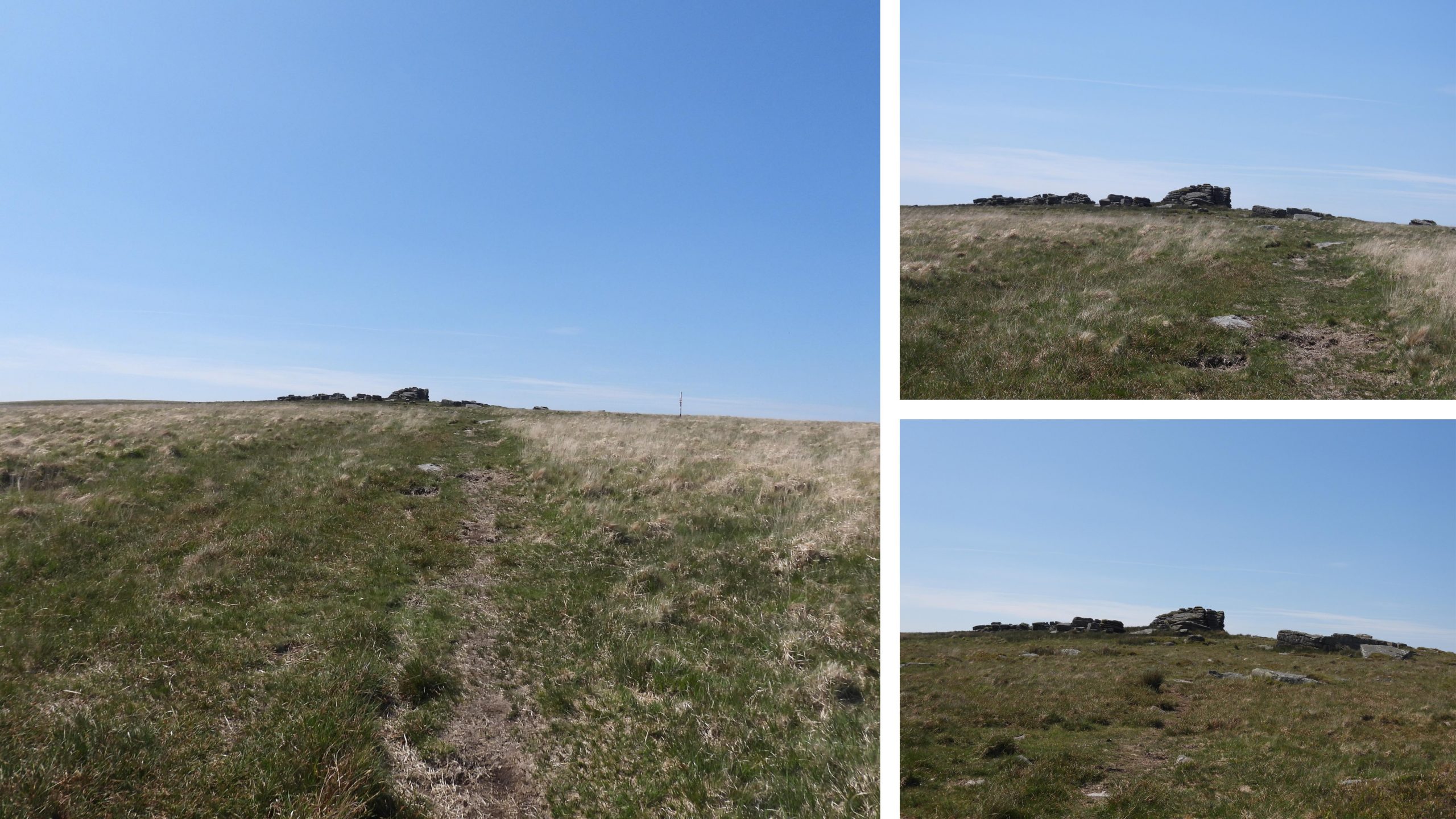
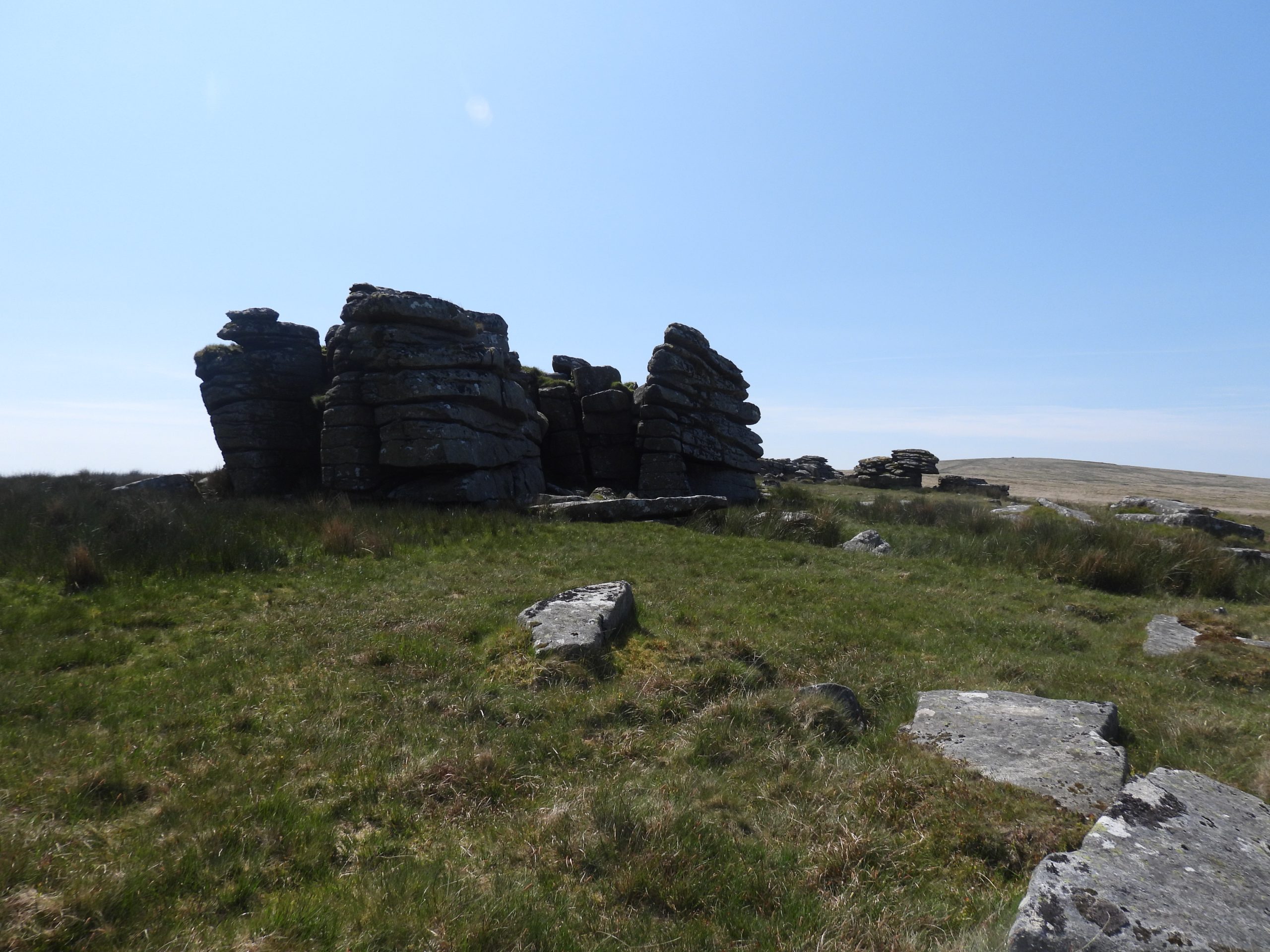
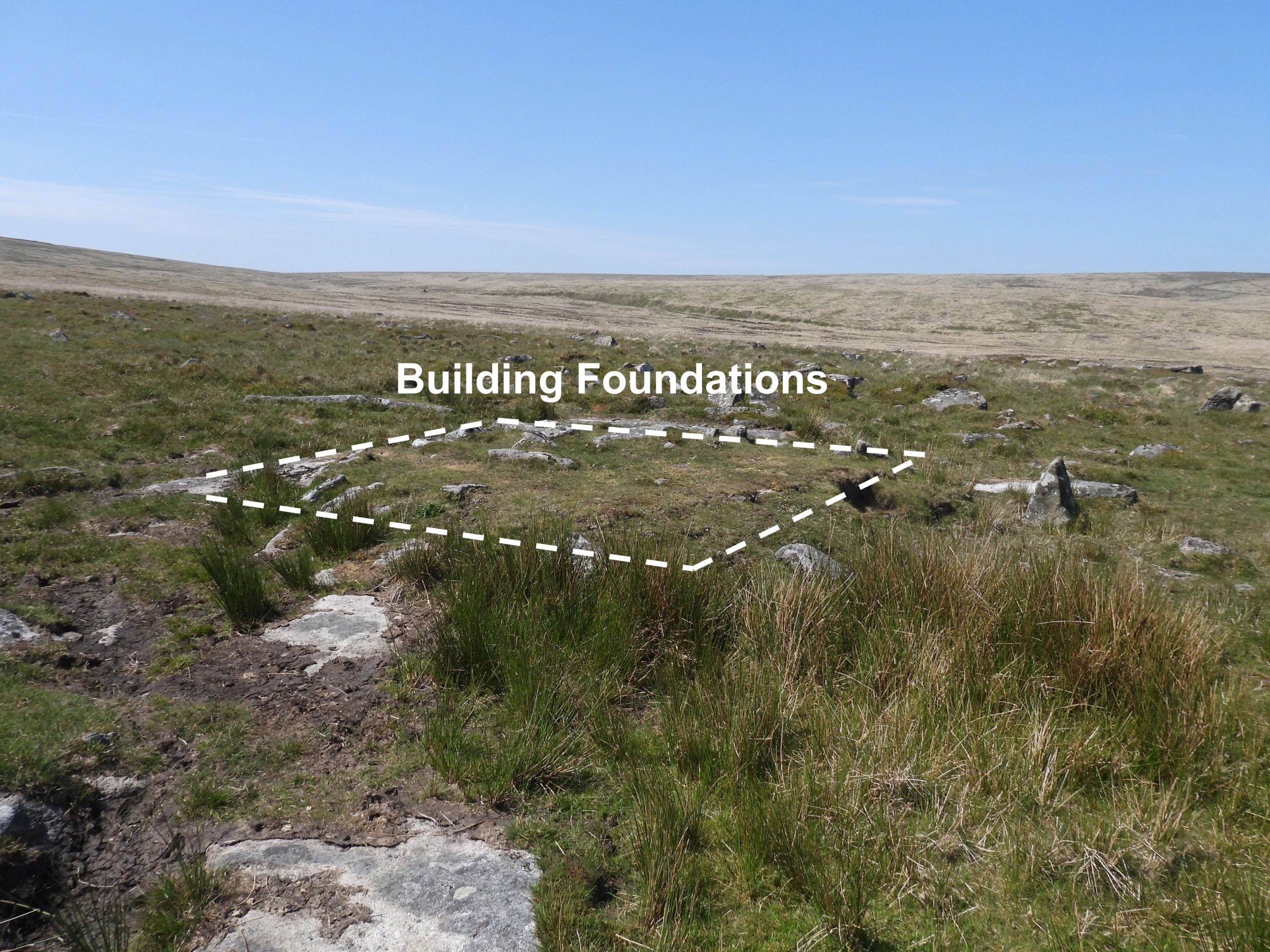
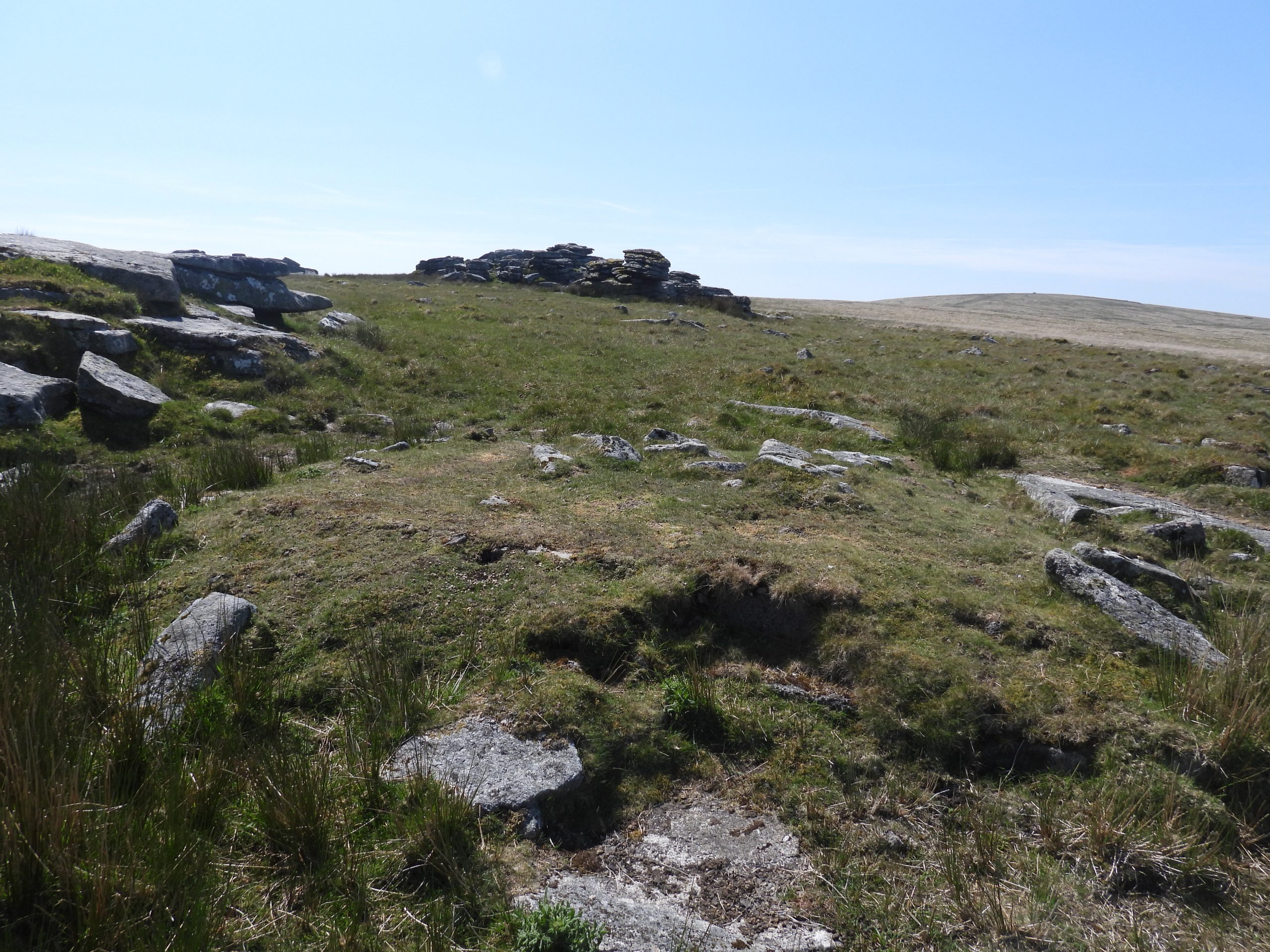
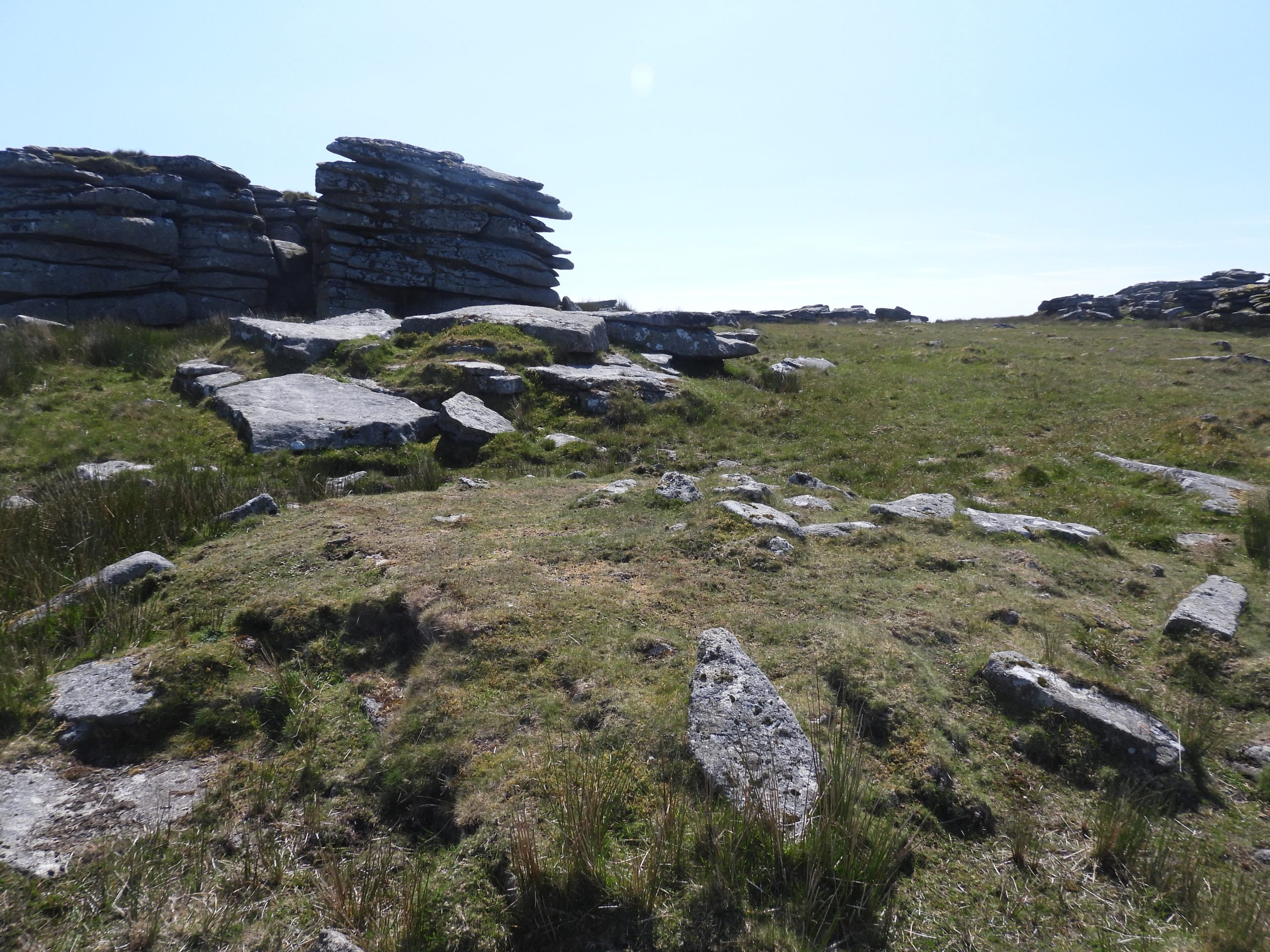
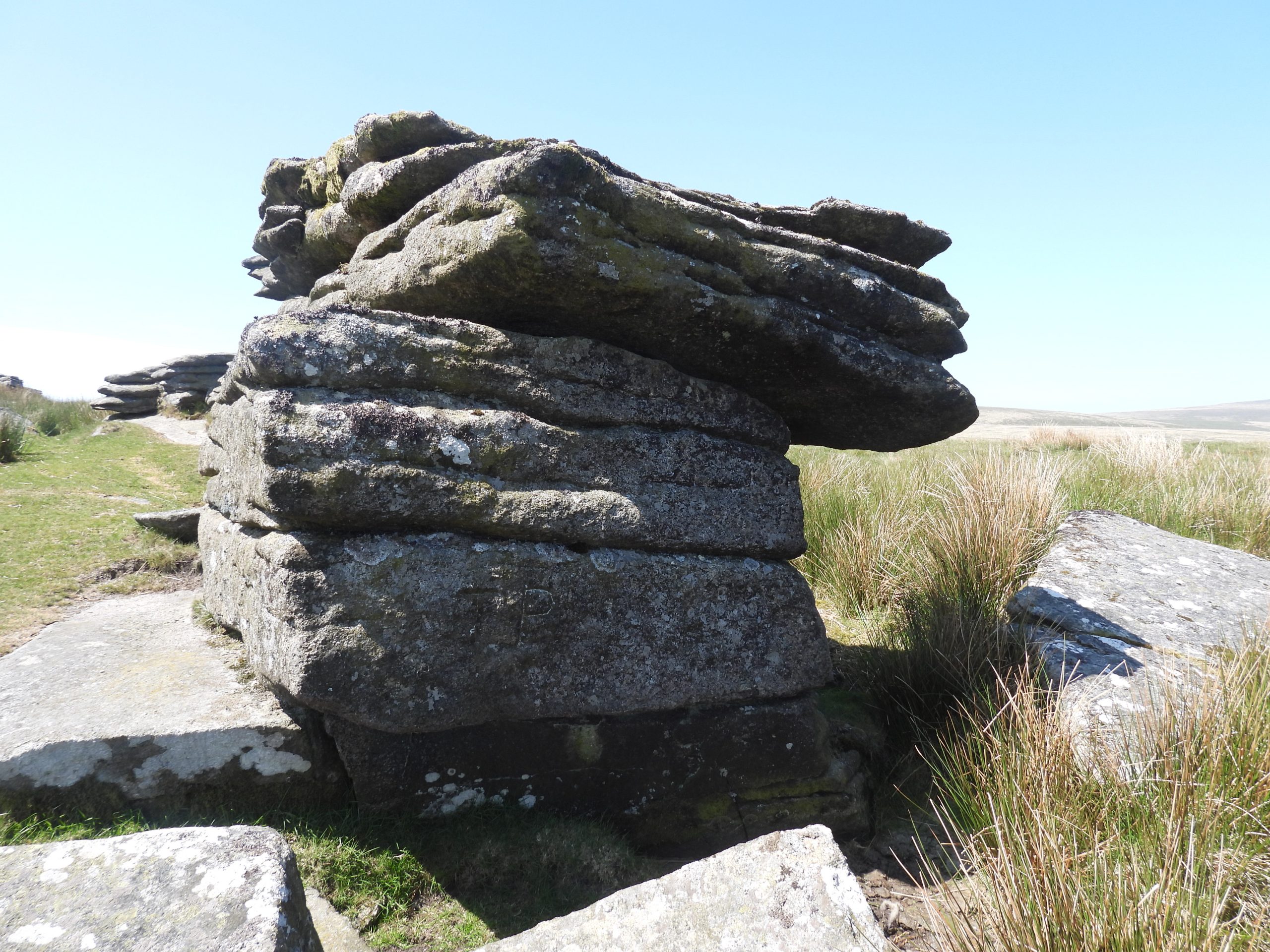
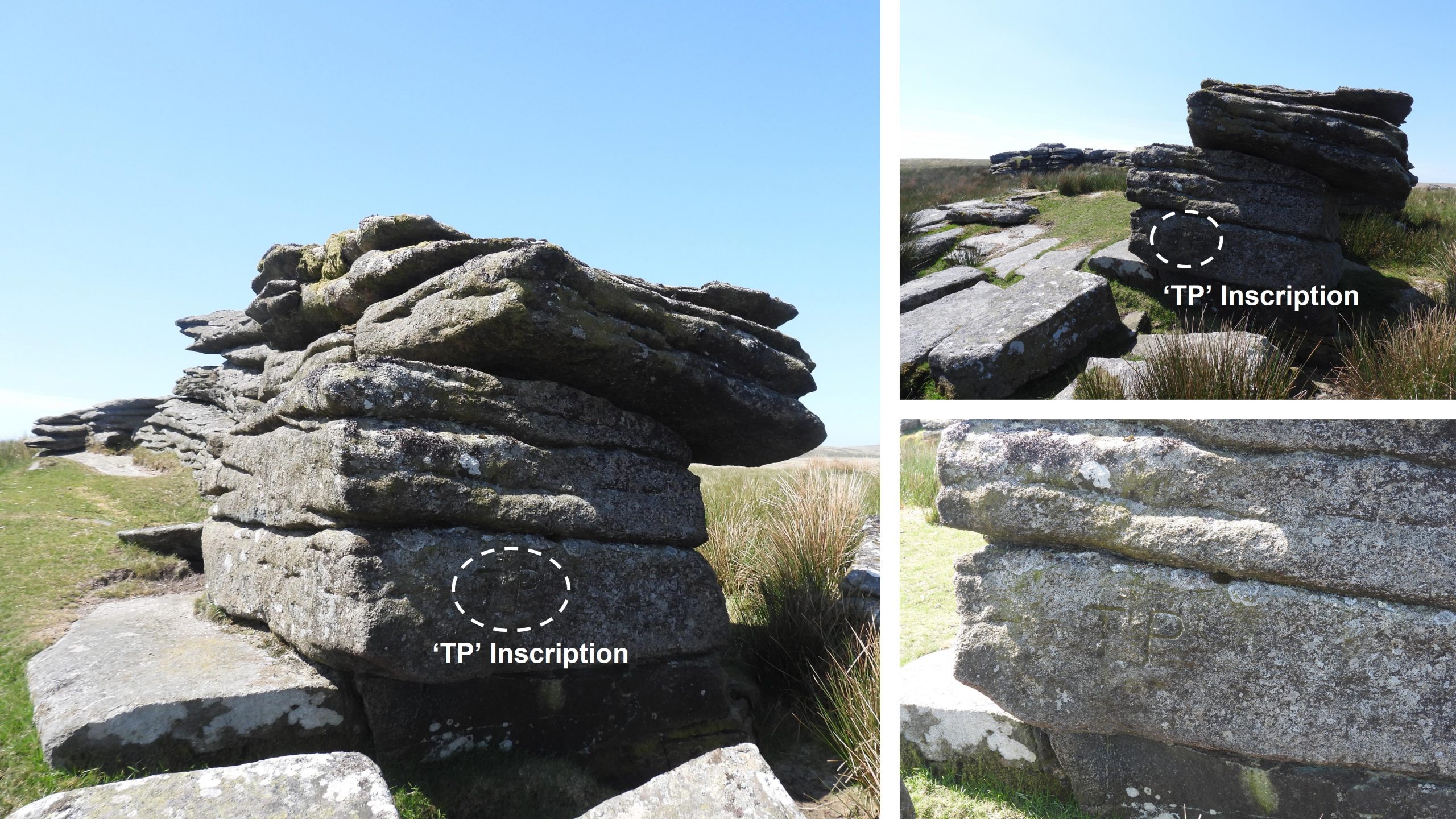
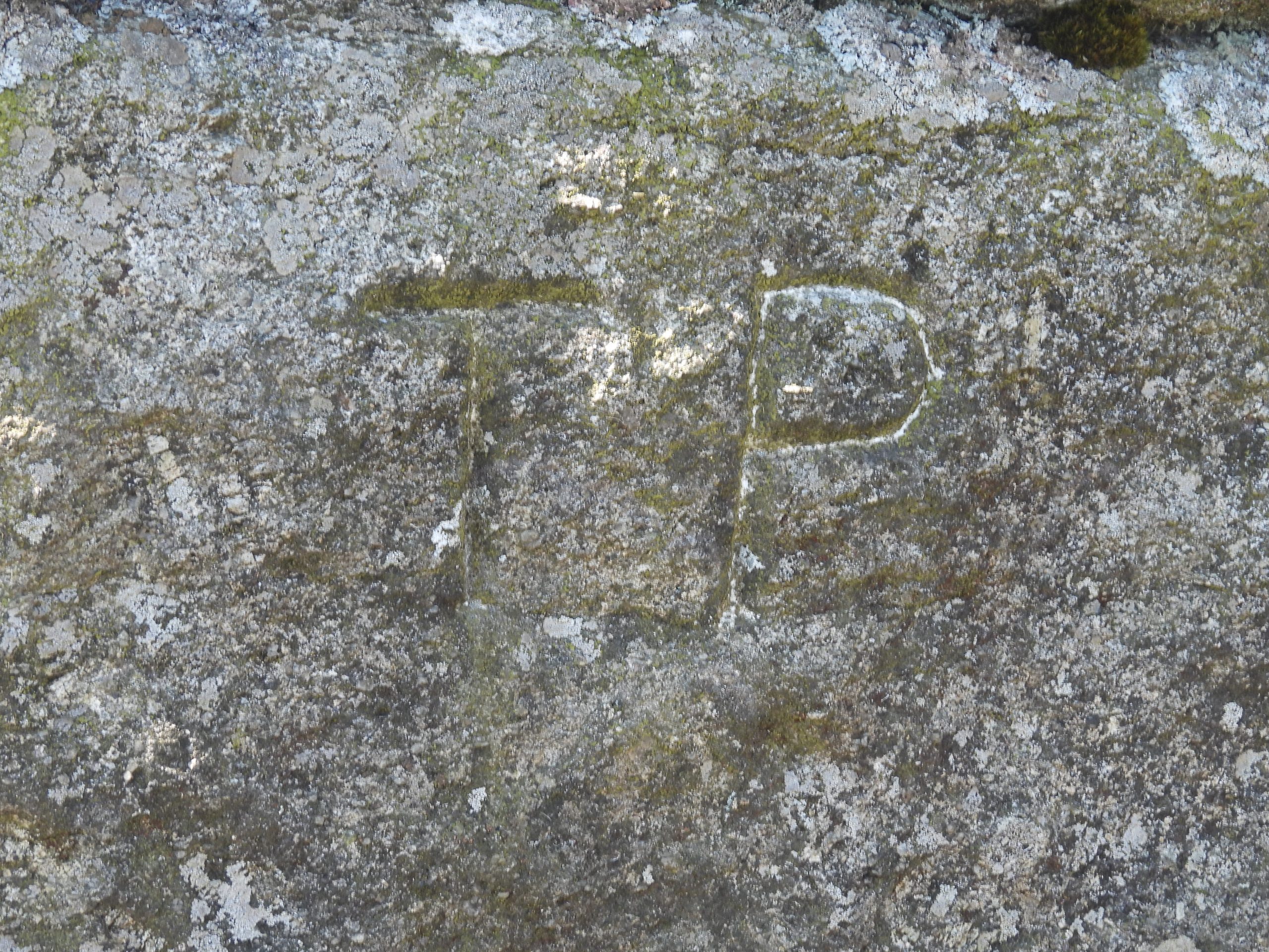
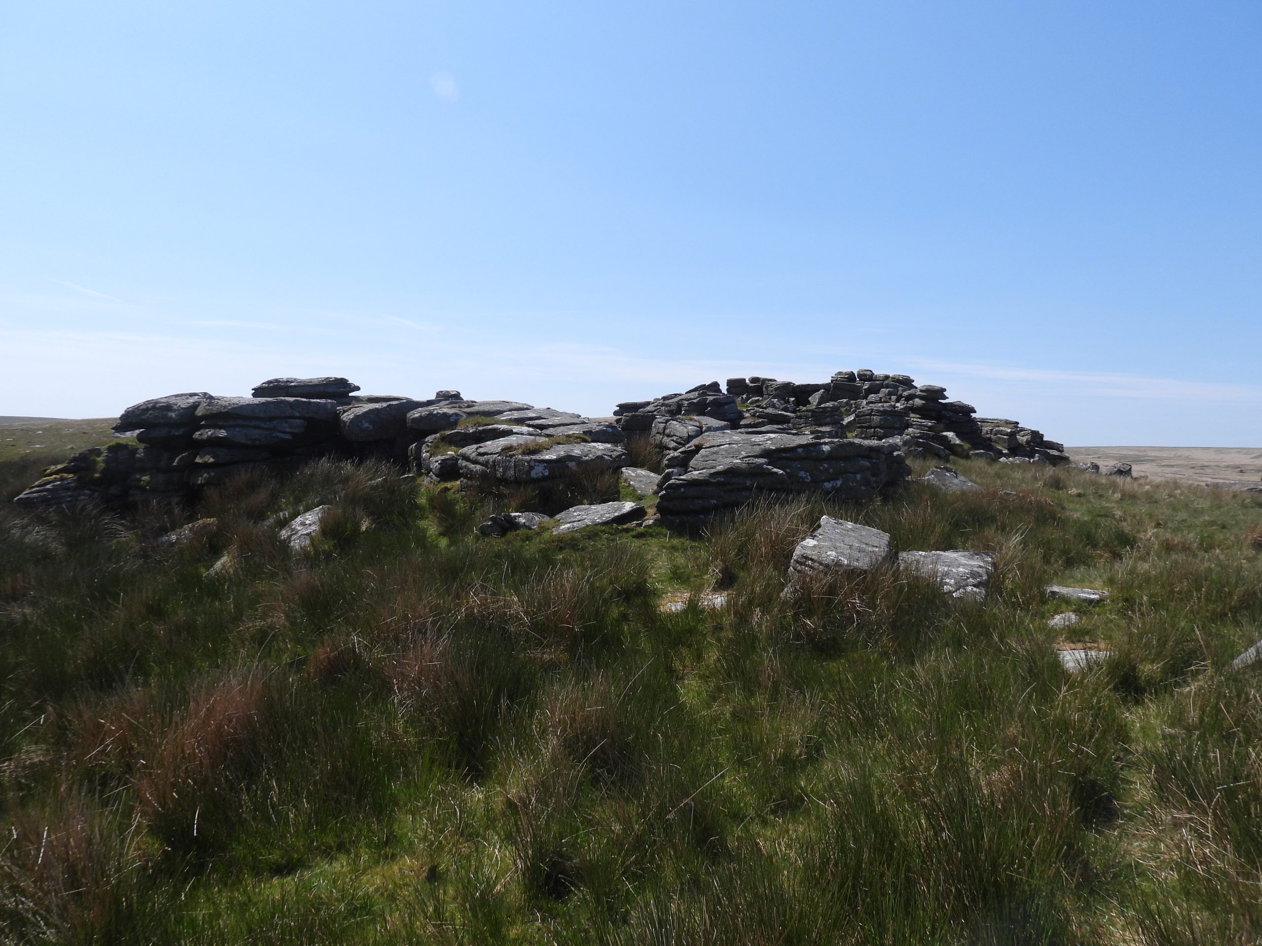
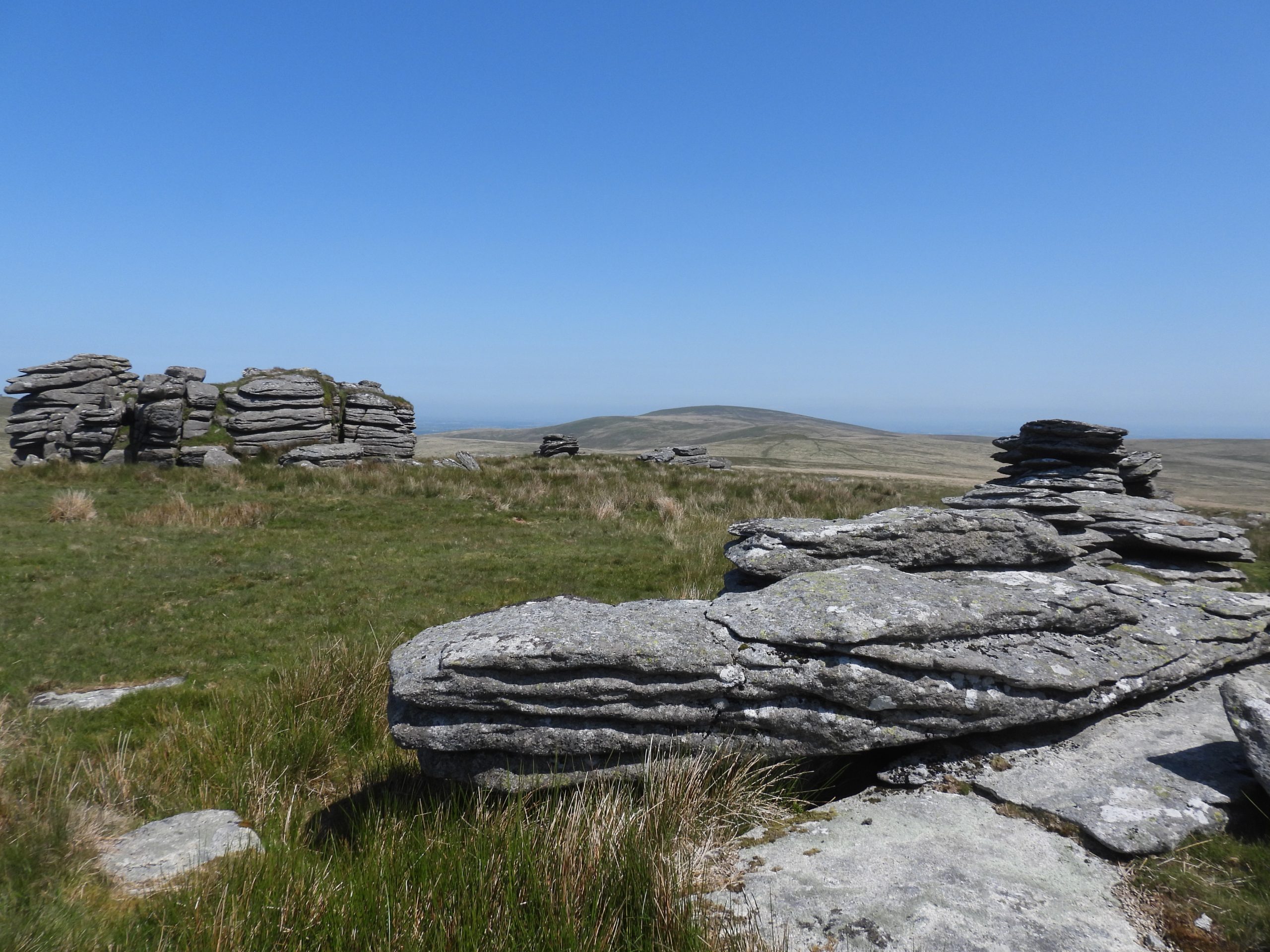
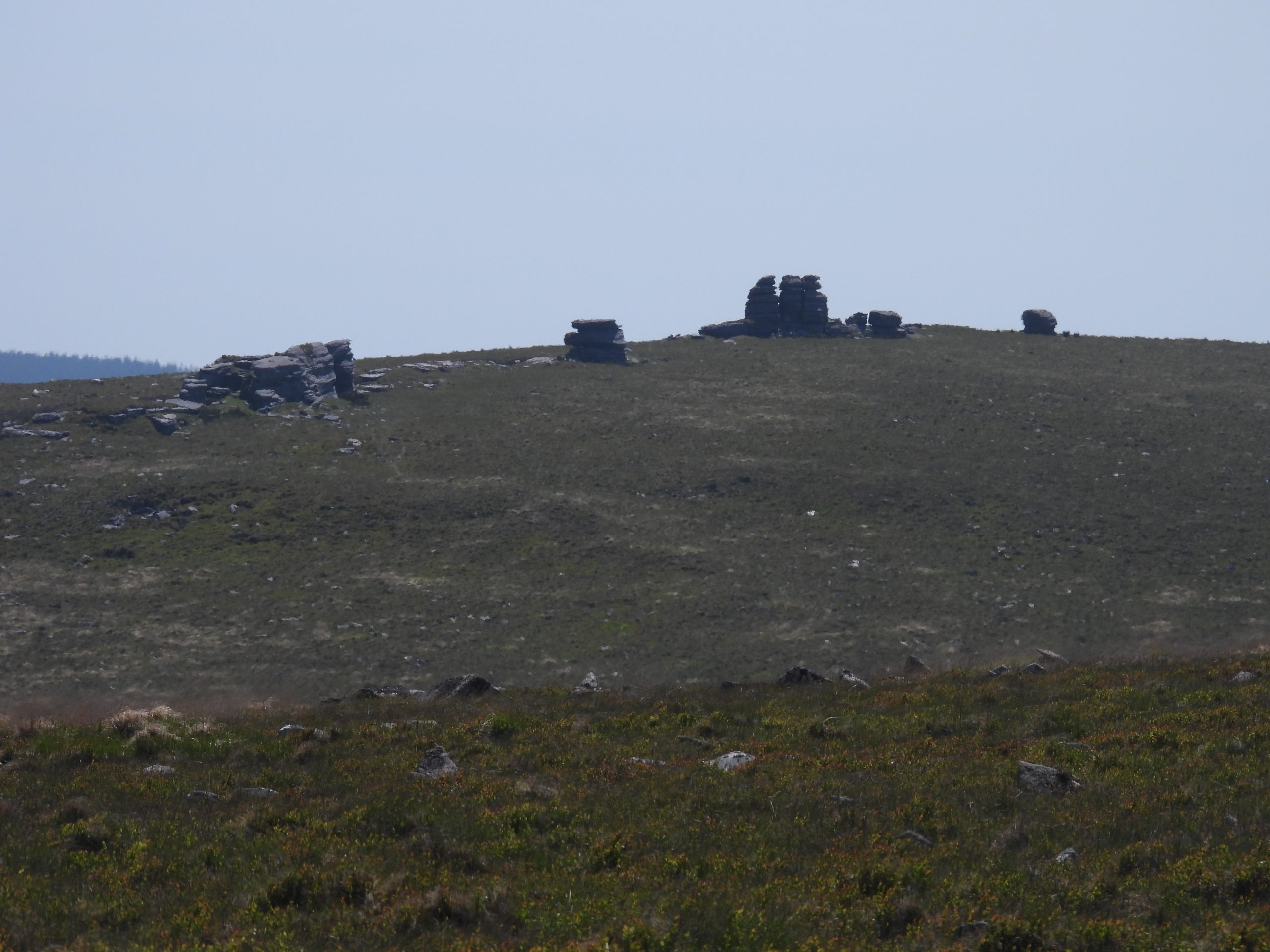
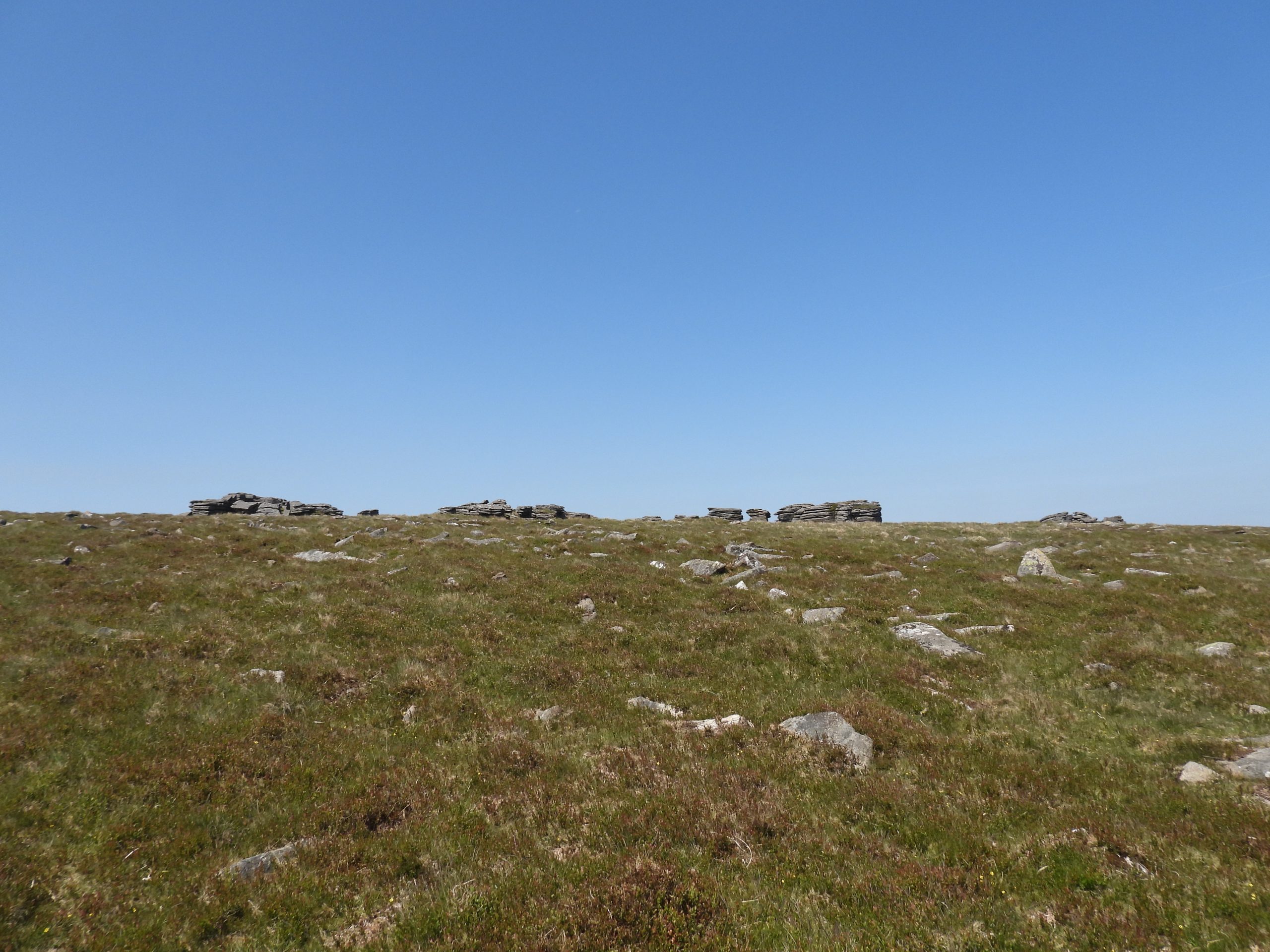
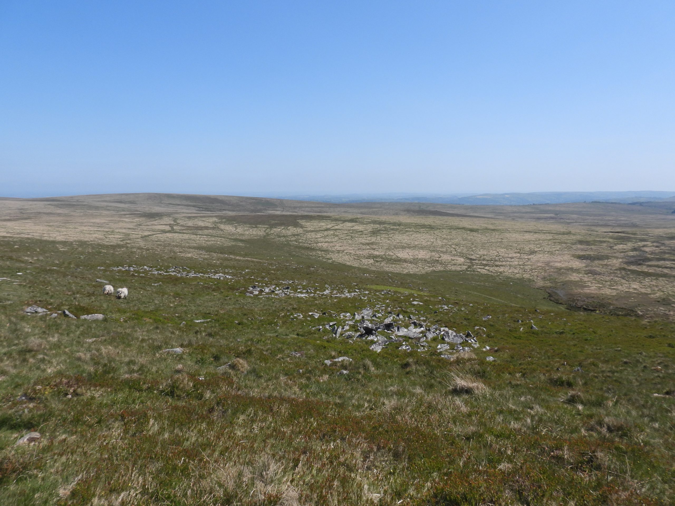
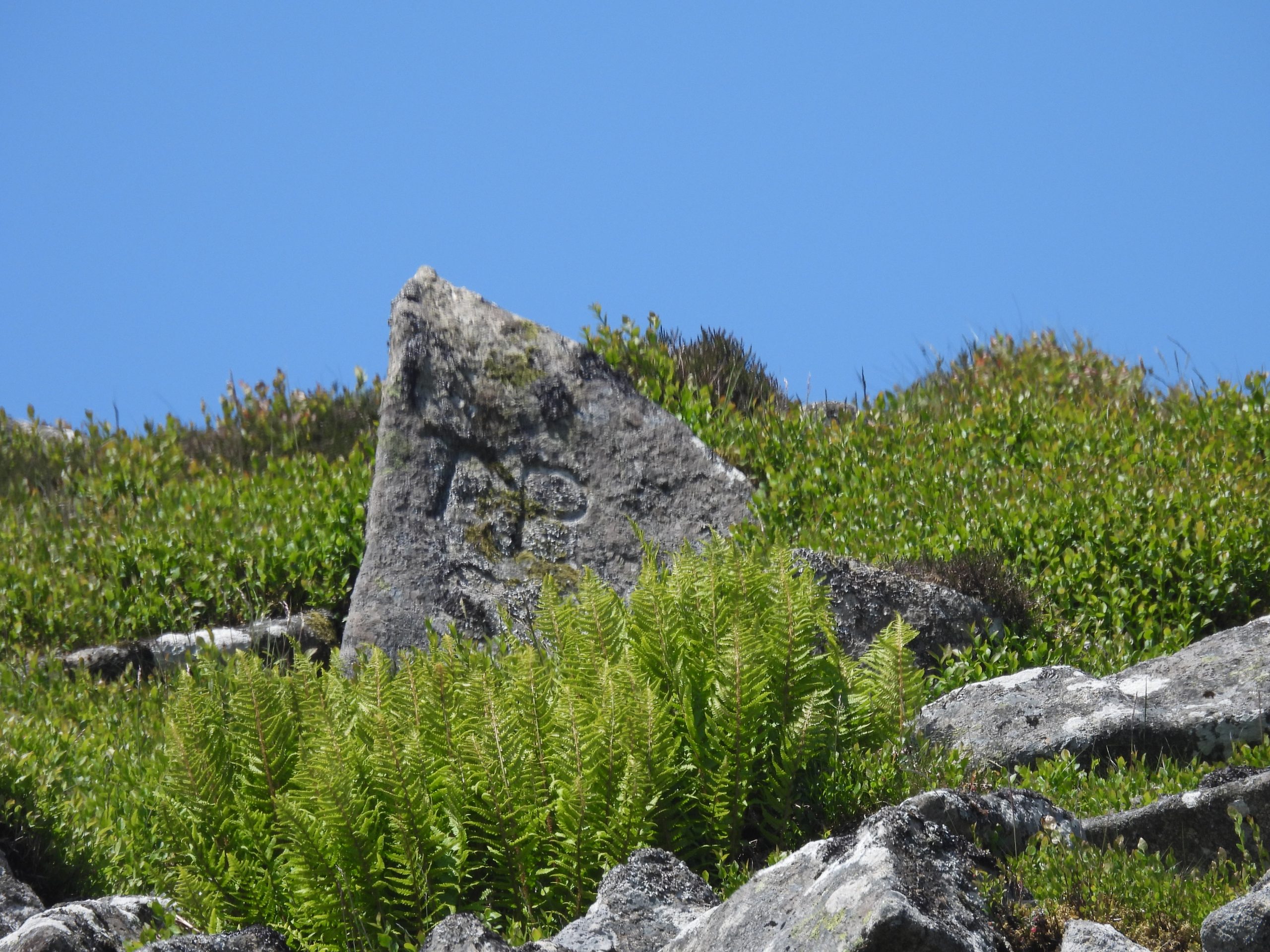
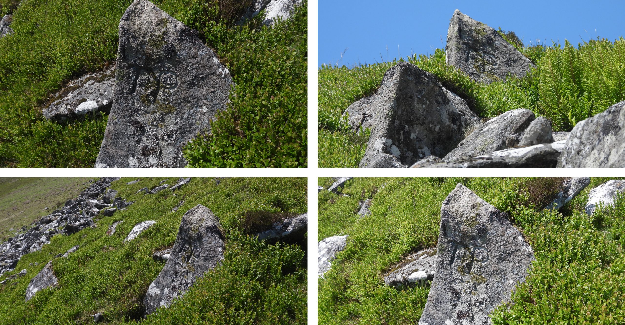
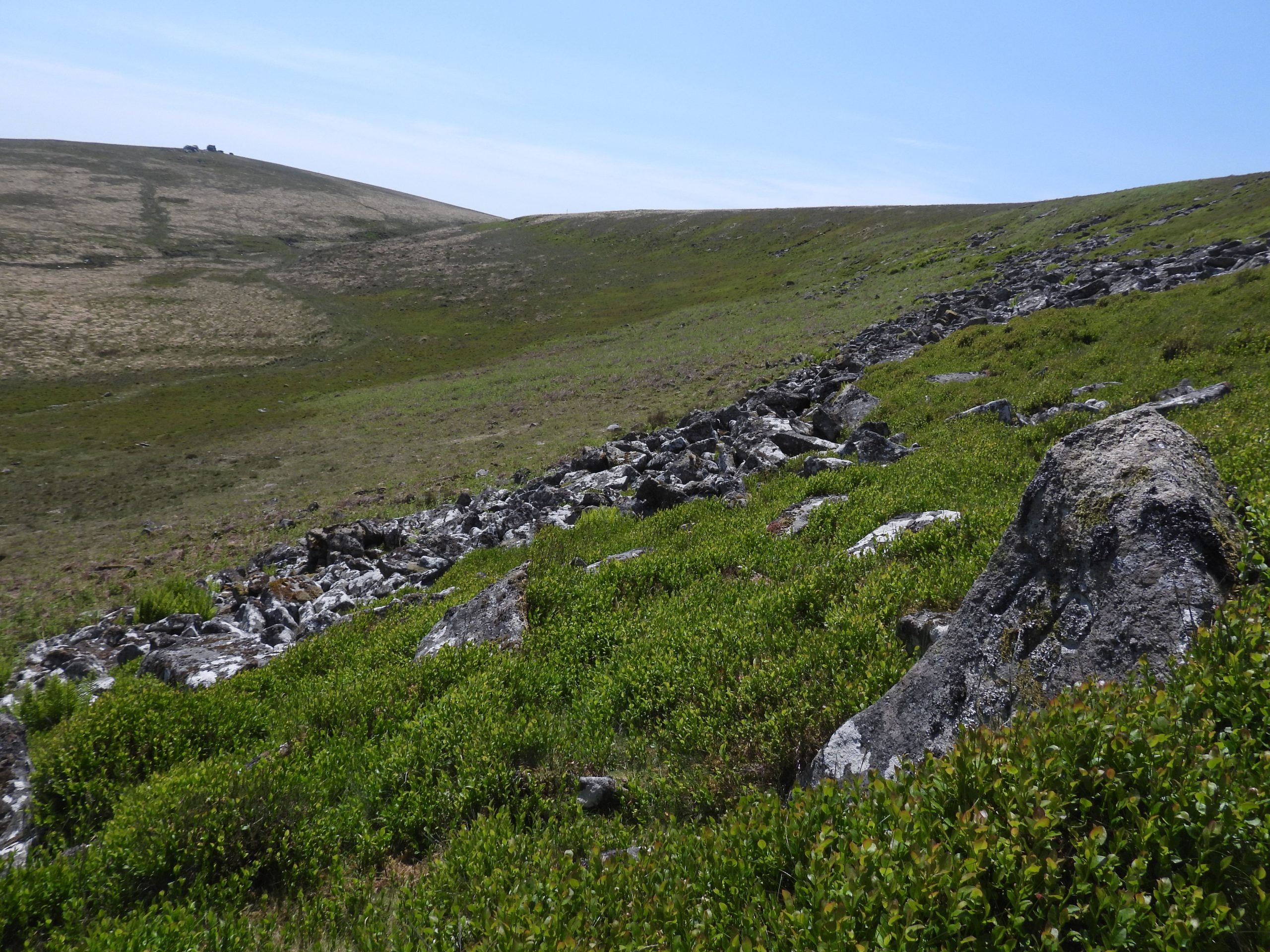
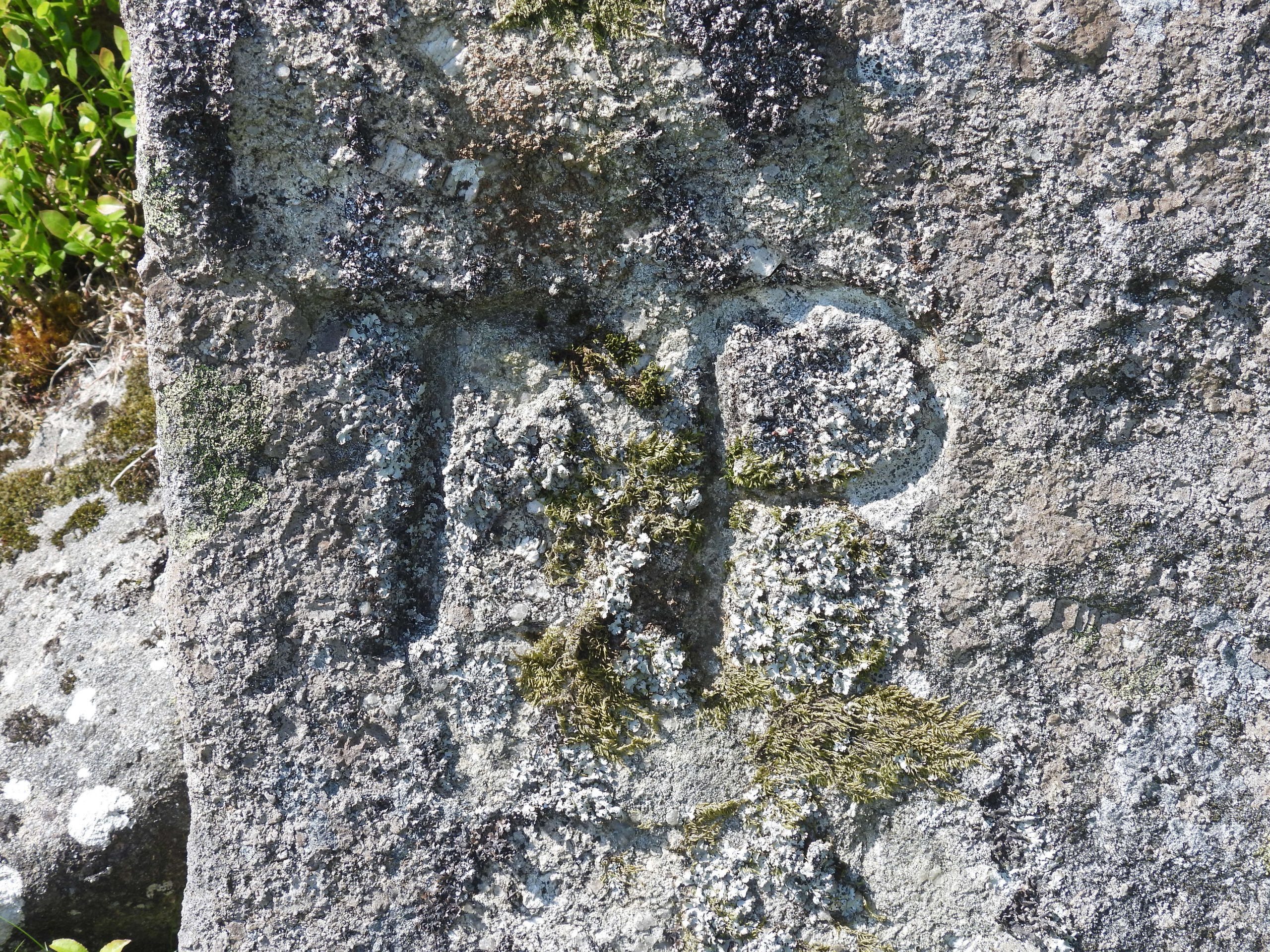
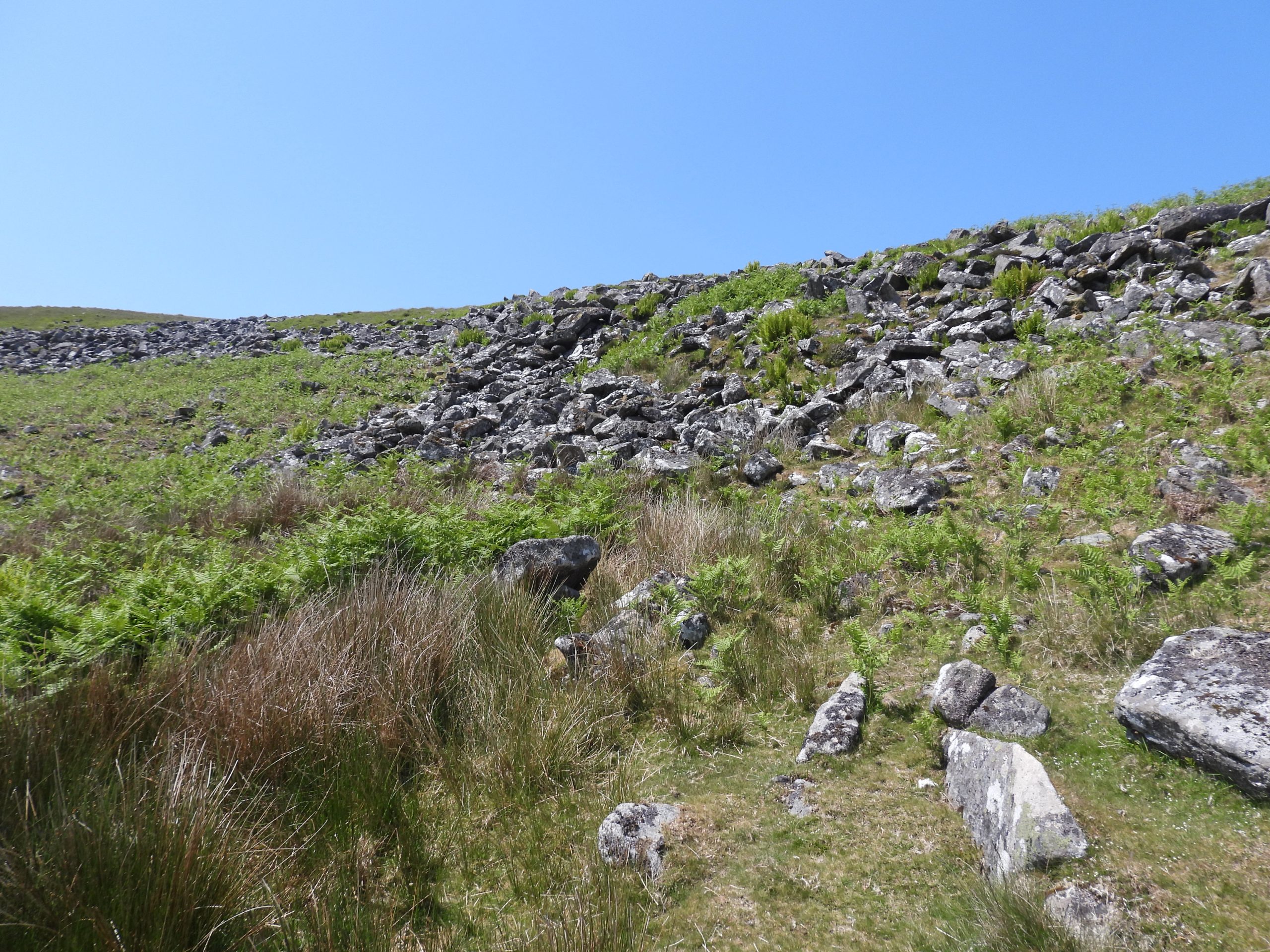
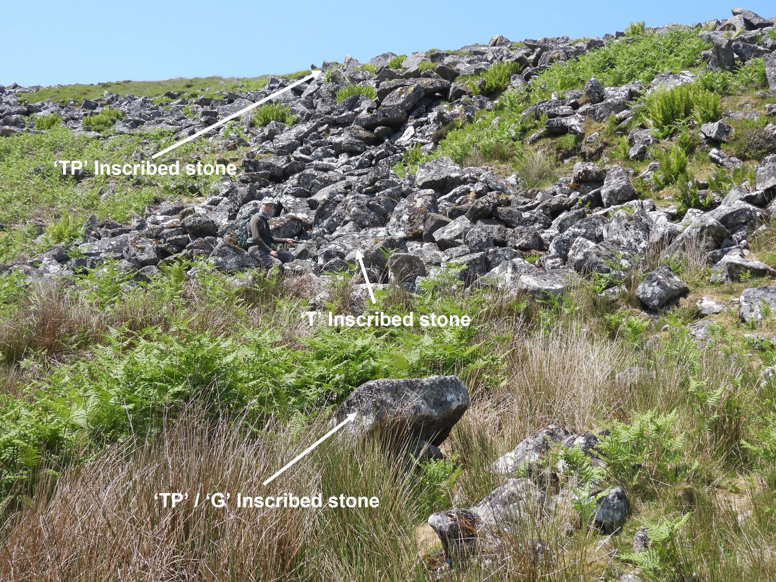
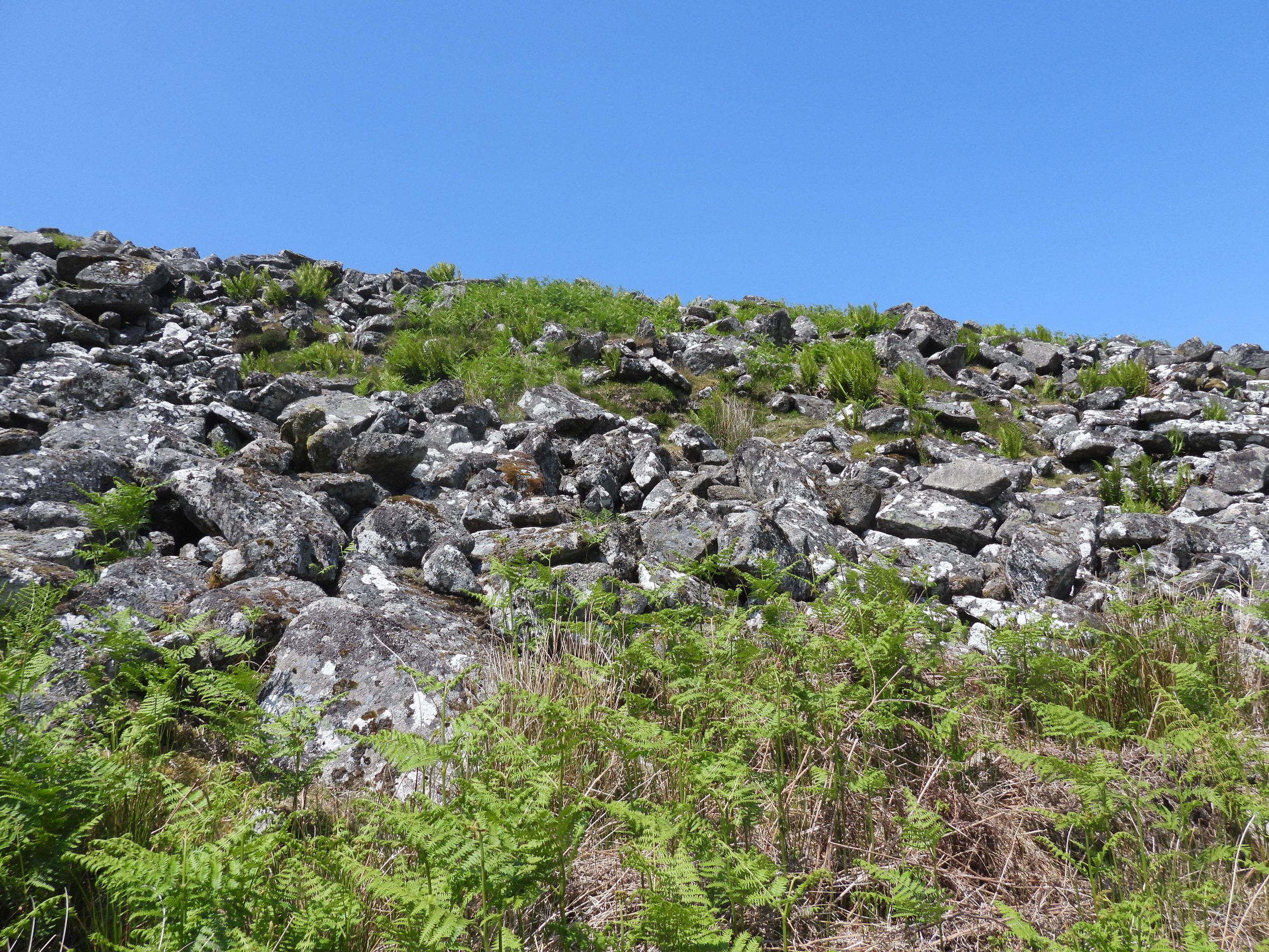
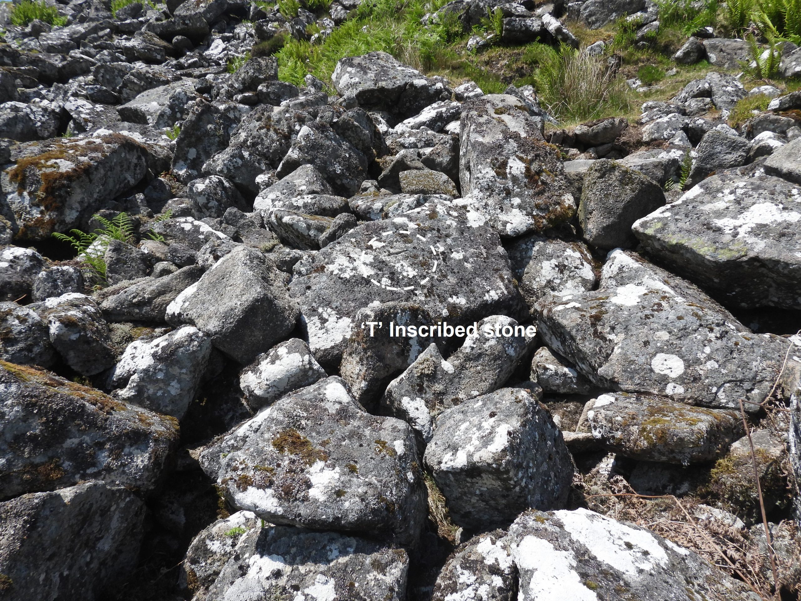
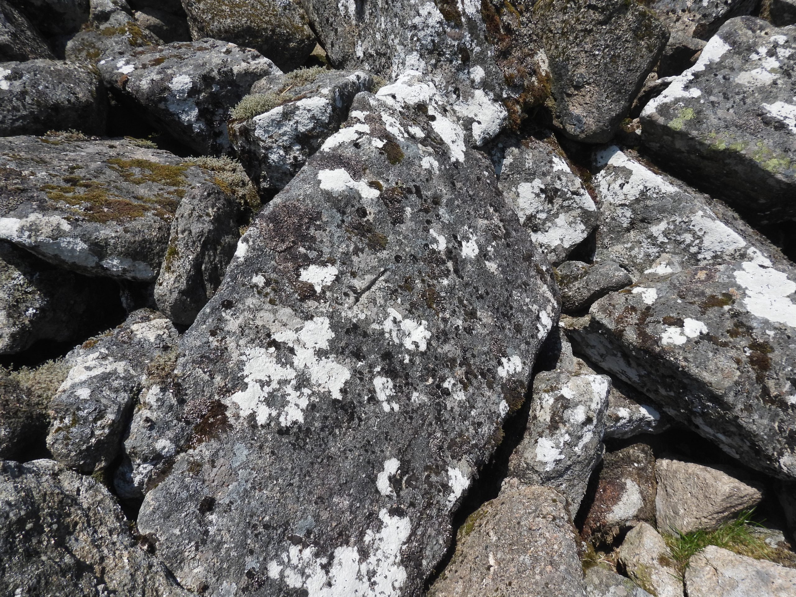
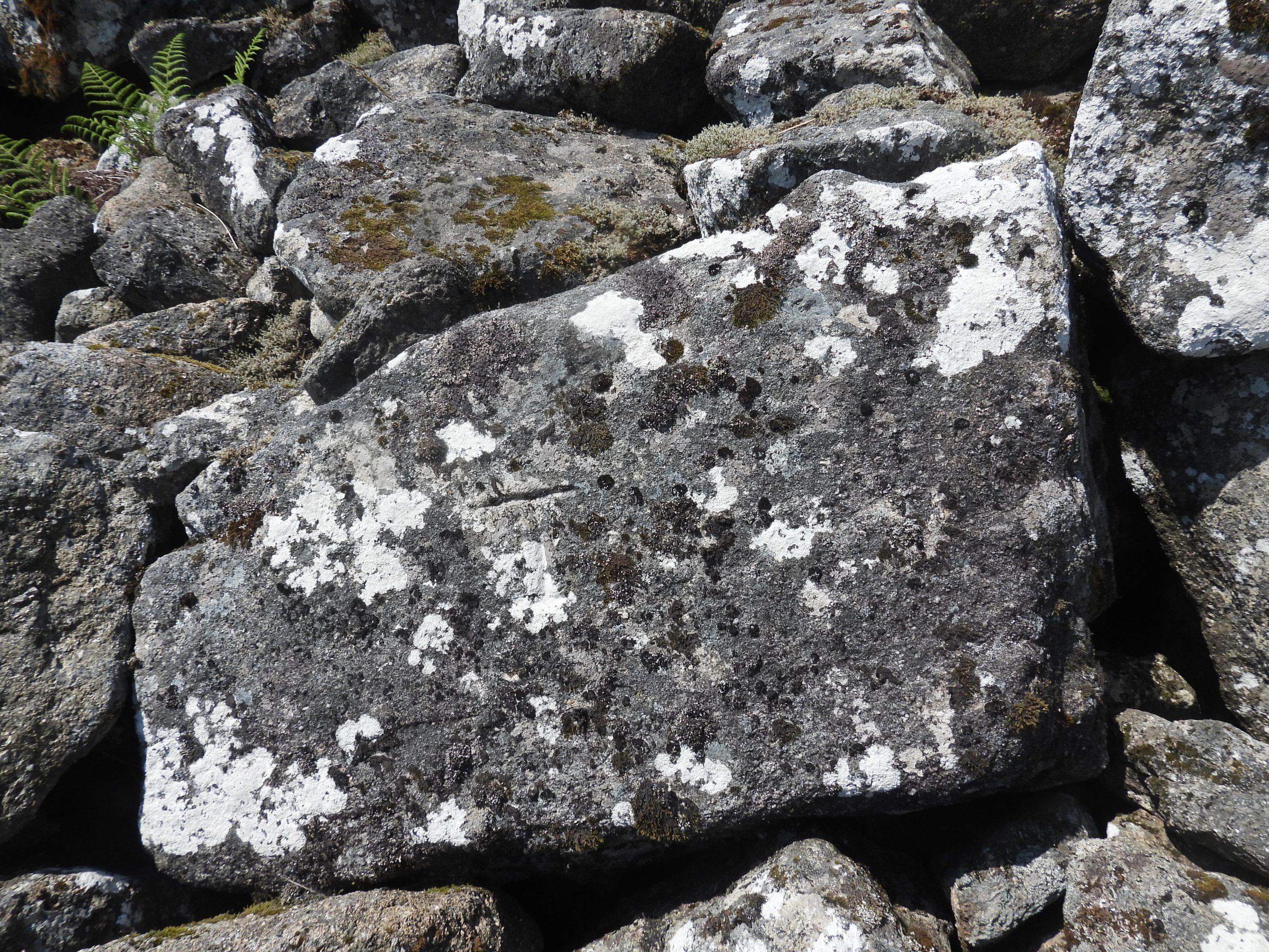
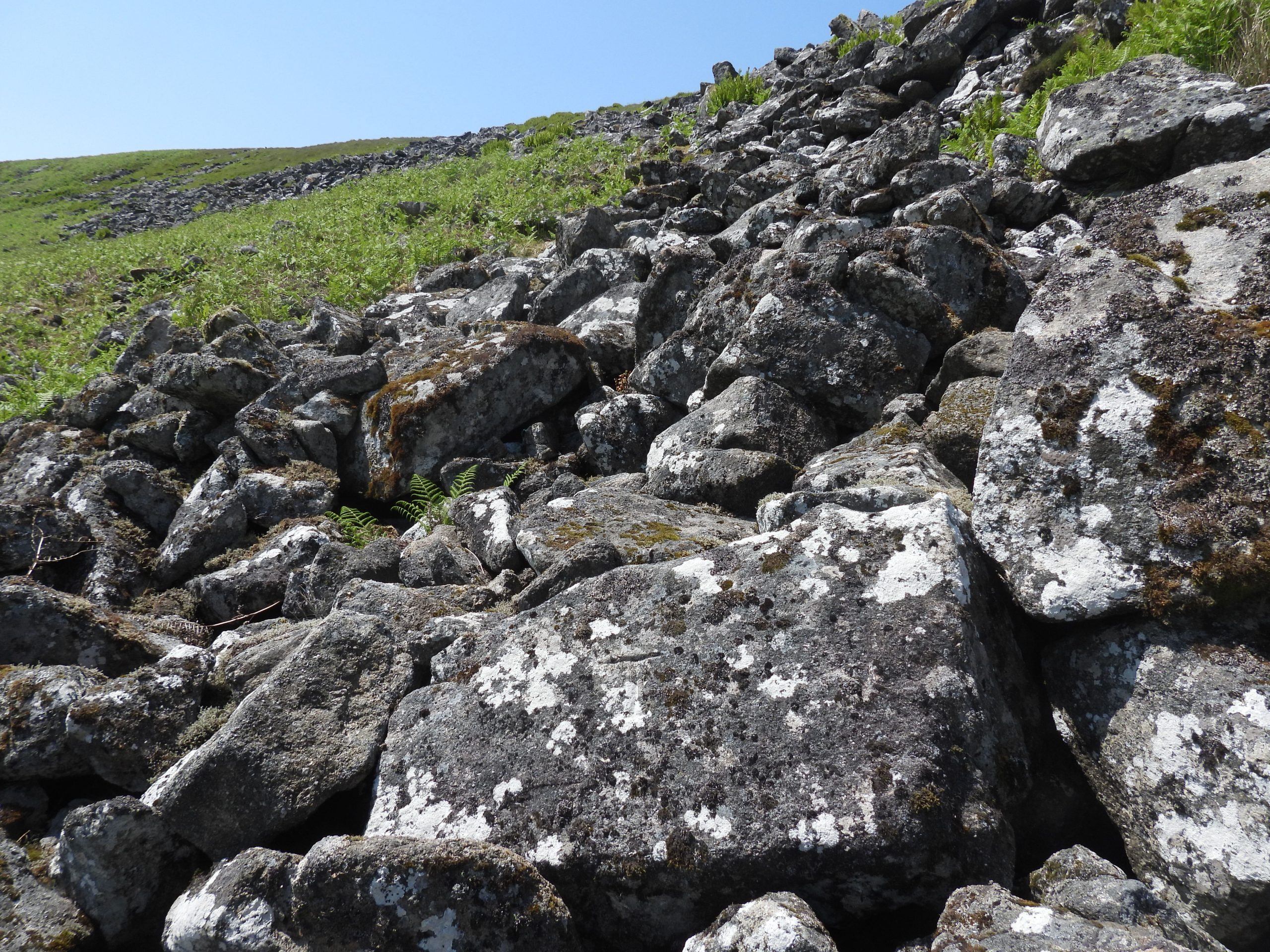
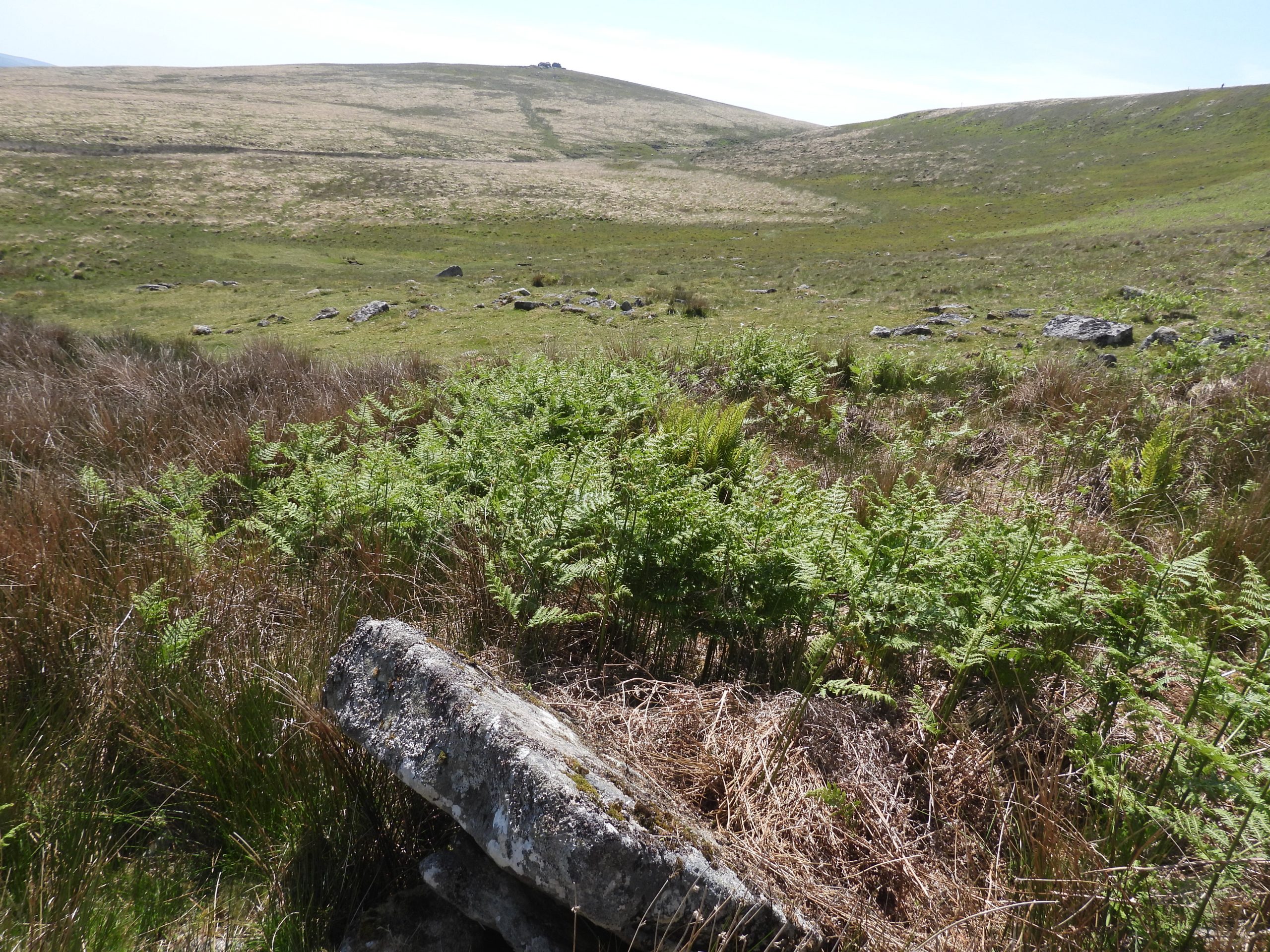
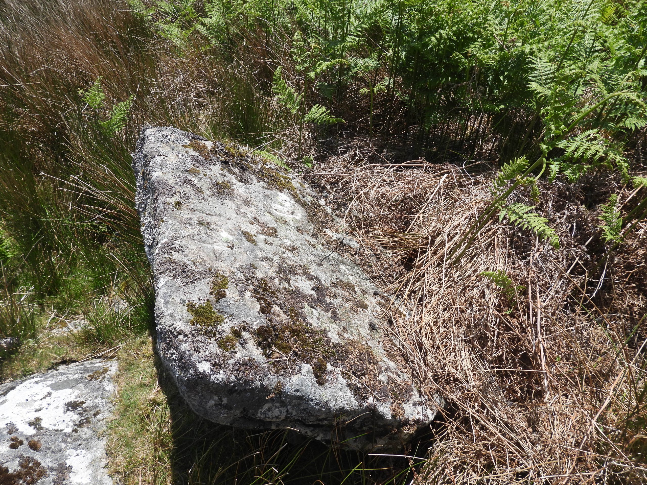
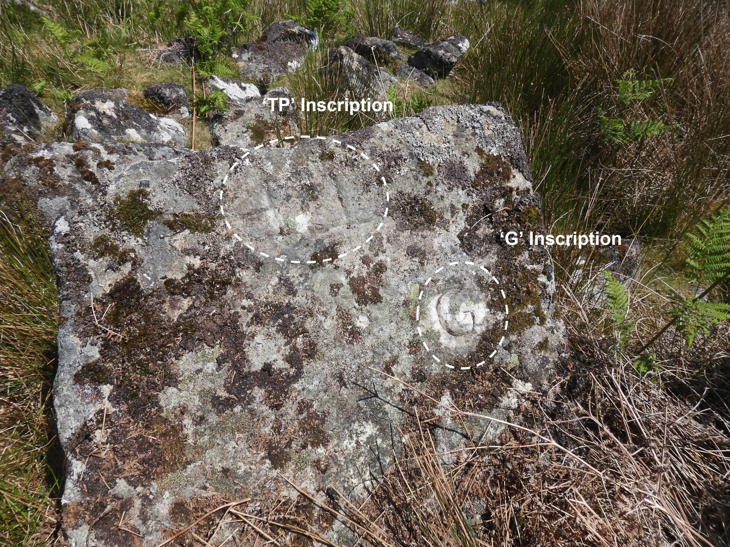
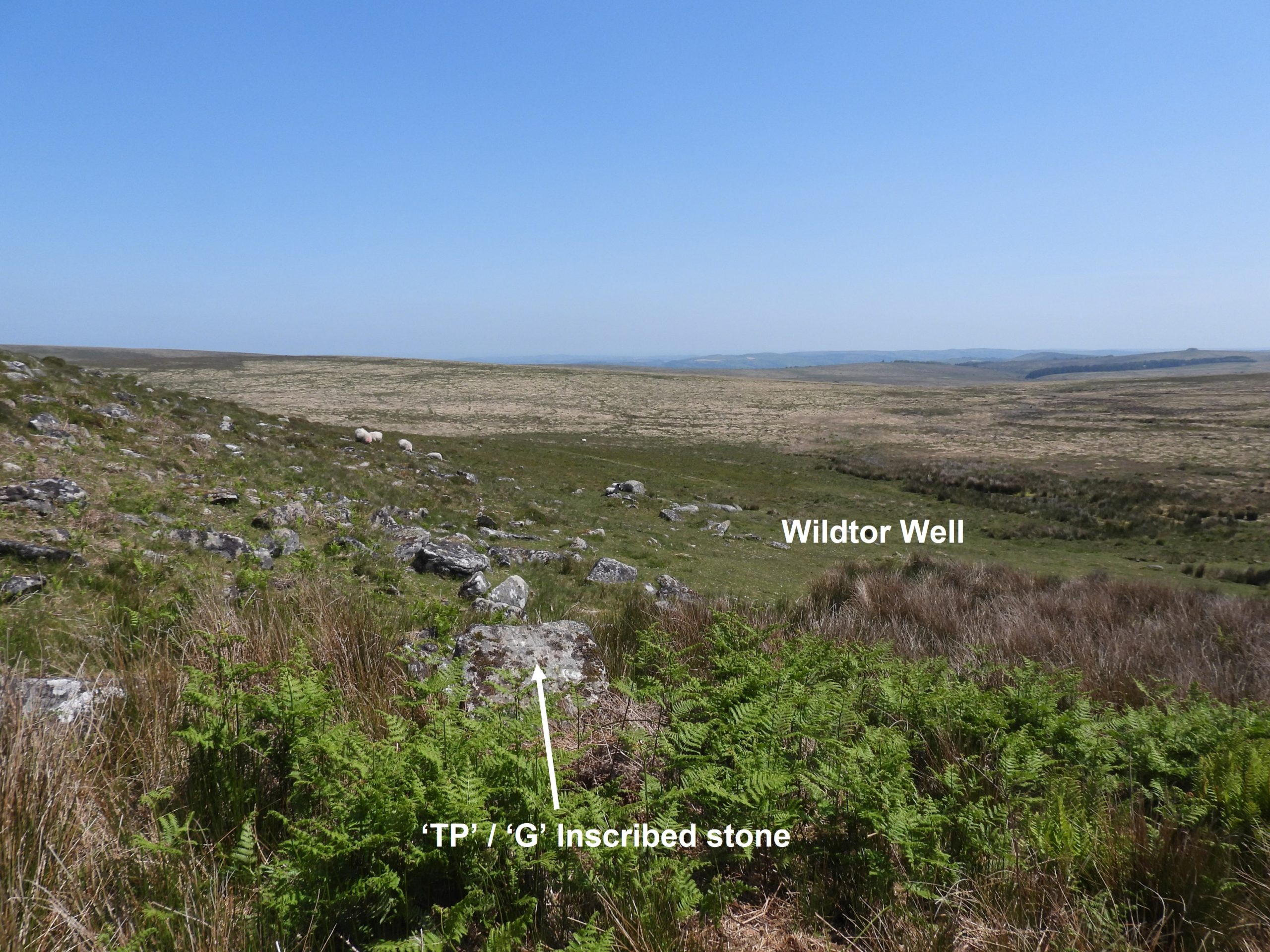
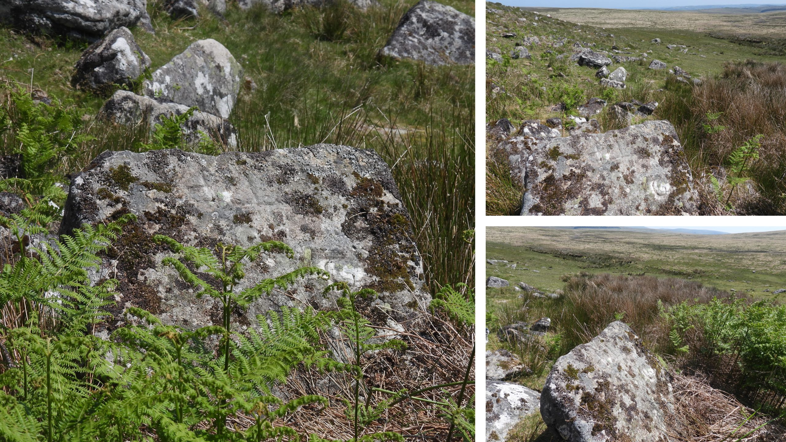
Sketch map of the area showing the Throwleigh incursion into the Forest of Dartmoor land. There are several inscriptions which evidence this incursion.The Throwleigh Parish Boundary showing the correct course (the ‘pointed’ shape on the far west boundary) from Hound Tor down to Wildtor Well (the end of the ‘point’).Hound Tor lies on the boundary of the Forest of Dartmoor, known as ‘Pava Hundetorre’ to the 1240 perambulatorsHound Tor up until the early 19th century was more commonly known as Round TorOn Hound Tor there is a TP’ inscription which stands for ‘Throwleigh Parish’. The inscription can be found on the eastern side of the outcrop, just below the summit.The ‘TP’ inscription is located at SX62884 89010Close up of the inscription. The author wonders whether the inscription was originally just a ‘T’ as the ‘P’ appears to be taller (both top and bottom). Was the ‘P’ a later addition ?View from the top of Hound (Round Tor) looking south. The track slightly left of centre in the photograph is the approximate line of the current / historical Forest of Dartmoor boundary heading off to Wildtor Well. The wider ‘double’ track slightly to the right of centre in the photograph is the course of the Throwleigh Parish incursion, which incidentally follows one of two routes of the South-Zeal to Hangingstone peat cutters track through to Wild Tor.View from the top of Hound (Round Tor) looking north to Little Hound Tor, Whit Hill and Cosdon.In the 1923 Throwleigh Parish ‘Beating the Bounds’, they described this as a “low stone with the letter ‘T’ on it about 100 yards from Round Tor”. The rock is actually inscribed ‘TP’ with the ‘P’ most probably added in 1923 (Brewer).Contextual picture of the upright natural boulder inscribed ‘TP’ in relation to Hound (Round) Tor.The ‘TP’ inscribed boulder is located at SX62825 88956. The ‘TP’ inscribed stone with Steeperton Tor in the mid distance and Bow Combe below.Heading south along the line of the Throwleigh Parish incursion in the ‘col’ between Hound (Round) Tor and Wild Tor is a narrow causeway.The causeway is quite wide and is likely to have been constructed as part of the South Zeal to Hangingstone Hill peat track to allow dry passage across the col for those on foot or horseback. The author can’t find any mention of this causeway on the Heritage Gateway or in Eric Hemery’s ‘Walking Dartmoor’s Ancient Tracks’ (which describes the South Zeal to Hangingstone Track) so has made the assumption of the reason for its construction.The causeway in the photograph is looking north with Hound (Round) Tor in the background.Approaching Wild Tor from the north. Wild Tor has also been known as Wills Tor. In the 1786 Throwleigh document and 1923 beating the bounds it was called Will Tor.On the west side of Wild Tor are some quite substantial foundations. Were they part of a building ?The author conjectures that these foundations might be related to the South Zeal to Hangingstone Hill peat track. Were these foundations for a peat cutters building or possibly is it a raised platform to store cut peat for drying. The author would welcome any information which confirms the reason for these foundations.The building foundations can be found at SX62280 87740The Throwleigh ‘TP’ inscription can be found on a vertical north east face on one of many outcrops of Wild Tor. This is without doubt evidence of the Throwleigh incursion.The ‘TP’ inscription is located at SX62325 87704Close up of the ‘TP’ inscription on Wild TorAnother outcrop of Wild TorWild Tor with Cosdon on the horizon to the northZoomed in view of Watern Tor to the south east from Wild Tor.Leaving Wild Tor. Described in the Brewer book thus: “from thence to the middle of Willtor Clitter (1786)”Heading towards Wild Tor Clitter. There are a few areas of sparse clitter before the main clitter-field above Wildtor Well.‘TP’ inscribed rock at the top of Wildtor Clitter. Described in the Brewer book thus: “from thence the party moved down to Willtor clitter where there is a stone high up on the clitter facing east bearing the Parish Boundary Mark (1923 Beating)” The ‘TP’ Throwleigh Parish marker is shown in the Brewer book on page 53. There are two pictures in the book annotated as ‘Higher Throwleigh B.S’ and ‘Lower Throwleigh B.S’ but they are the same stone, which is the one in the above photographs.Contextual view of the ‘TP’ stone in relation to Wild Tor clitter and Watern Tor in the background. Recorded in Mike Brown’s ‘Dartmoor 2001, A Dartmoor Diary of Yesteryear’: “On 2nd June 1923, James Dunning, Lord of Throwleigh manor, lead his tenants and other parishioners in a bound-beating of the commons of Throwleigh. At a meeting held previously ‘a sum not to exceed £1’ had been earmarked for re-inscribing and re-erecting boundstones”.Close up of the ‘TP’ inscription. The stone is located at SX62624 87657. This inscription is believed to date from 1923 (Brewer)At the bottom of Wild Tor clitter. There are three inscribed stones in this view !The three inscribed stones at the top, middle and bottom of Wild Tor clitter. Note the authors walking buddy pointing his walking pole at the ‘T’ inscribed stone.Approaching the ‘T’ stone in Wild Tor clitter.Brewer states that this ‘T’ inscribed stone was found during the 1991 beating of the bounds. This stone may well date from 1786.The author would like to thank Alan Endacott, for assisting him (by way of a 2019 photograph) in locating this stone. It is located at SX62655 87659The ‘T’ stone is well inscribed with the sun in the south east casts a shadow making it easily discernible.Contextual picture of the ‘T’ inscribed stoneThe final inscribed stone, or more accurately a square block about 1m x 1m and around 10cm thick is located at the bottom of Wild Tor clitter near Wildtor Well.The block is inscribed with ‘TP’ (facing north) and a ‘G’ (facing south). The ‘G’ is for Gidleigh. The block represents where the two parishes of Throwleigh and Gidleigh meet the Forest of Dartmoor boundary.The two inscriptions. The block is located at SX62666 87661. The block is believed to have been inscribed only with a ‘T’ and a ‘G’, thus the ‘P’ may have been added at a later date.Contextual view of the ‘TP’ / ‘G’ inscribed block / stone. In the 1923 beating of the bounds, lunch was taken at Wildtor well and afterwards pony races were held to the top of Headon Hill and backThe block is not shown on OS maps. However, ‘Willtorrwill’ (Wildtor well) was claimed to be on the Forest bounds by John Clement, yeoman of Fernworthy, in 1702 and Gidleigh claimed it on their bounds at least from 1639, when it was shown on a parish map of that date (Brewer).