A collection of walks, discoveries, insights and pictures of exploring Dartmoor National Park
July 17, 2021
Thomas Takfield Tin Blowing Mill
This post covers a ruined blowing house identified by Eric Hemery as Takfield Mill. It stands a little upstream of a water-board hut by a weir and approx. 100m downstream from Irishman’s Wall. An entry in the hundred rolls of 4th May 1521 states that: “3d for a myll called kakking myll and a myll called blowing myll, 2 acres of land lying in the forest in the w part of tawe, so let to thomas takfield”. In addition to this, a forest court roll of 1535 rates takfields’ blowing mill. It is thought that this may also be the site leased to Nicholas Tuckfield in 1608.
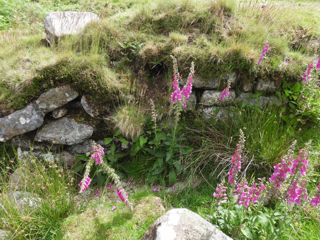
The mill comprises solid granite door jambs, an internal wheelpit, a possible furnace structure and a well defined leat. In 1986 tin slag was found in a nearby eroded river bank which suggests this was a Blowing House
Much of the source of information for this post was obtained from Historic England List Entry Number 1019228, dated 9th February 2001.
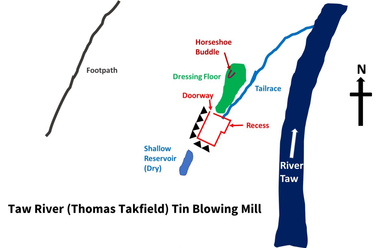
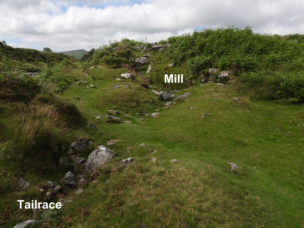
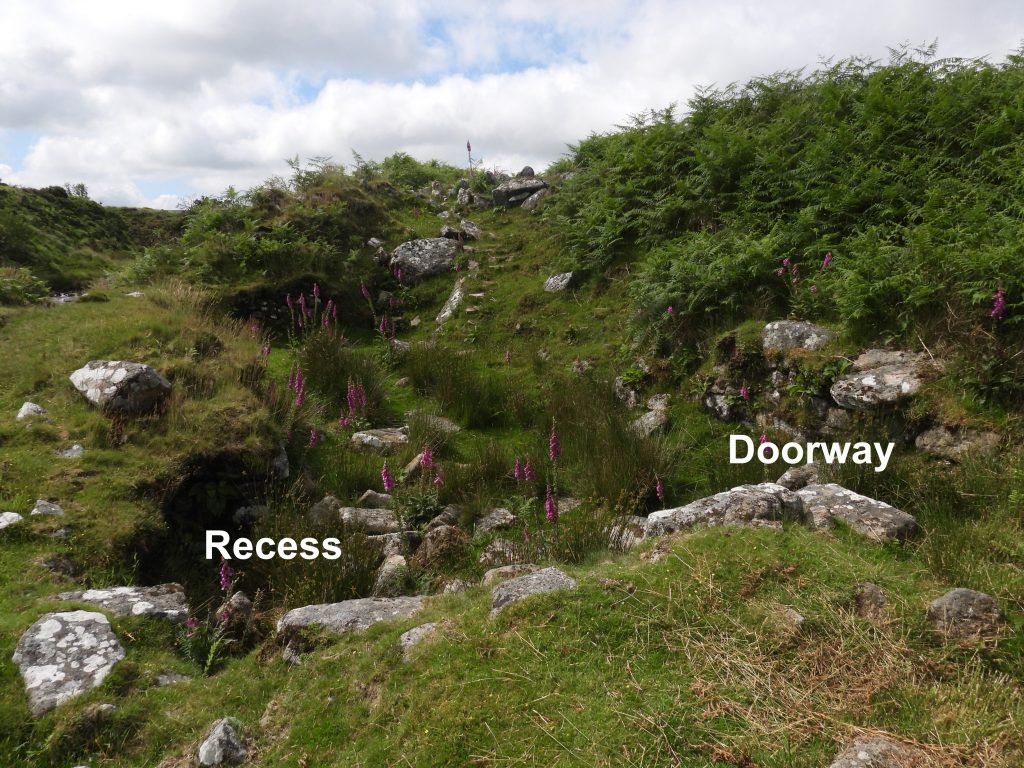
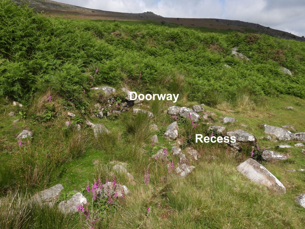
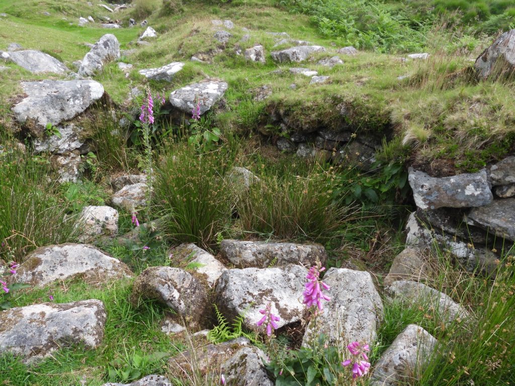
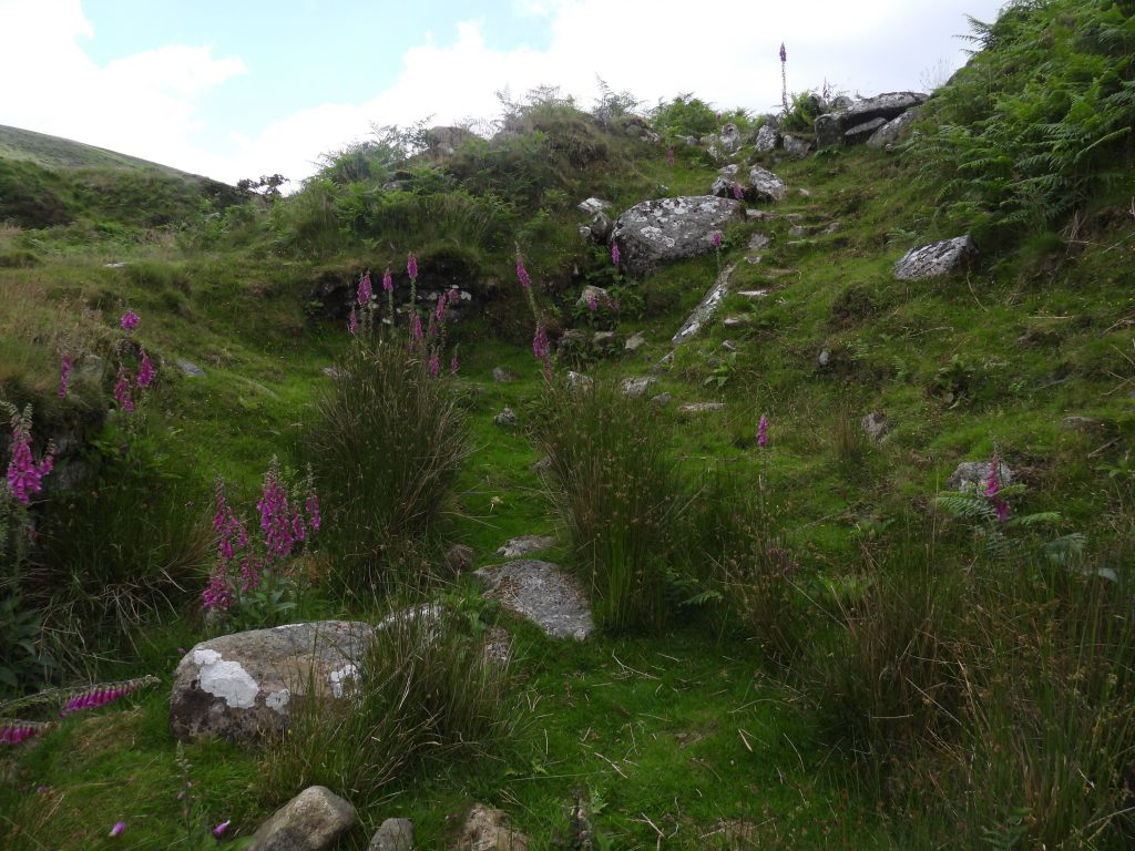
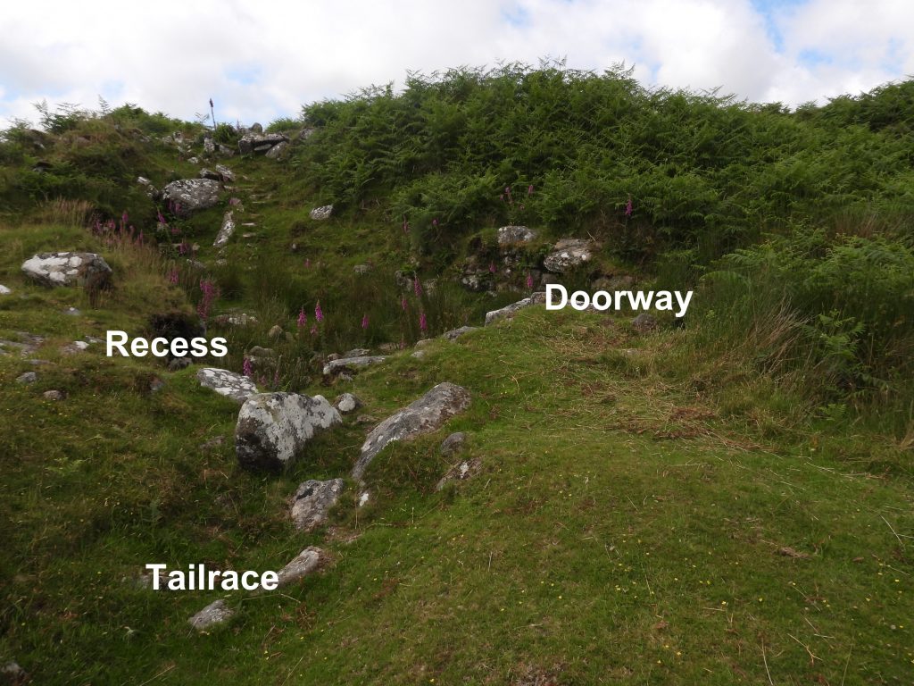
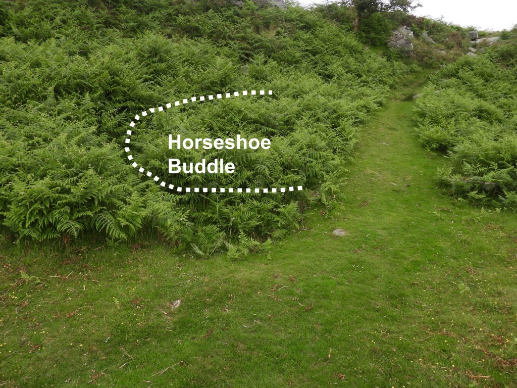
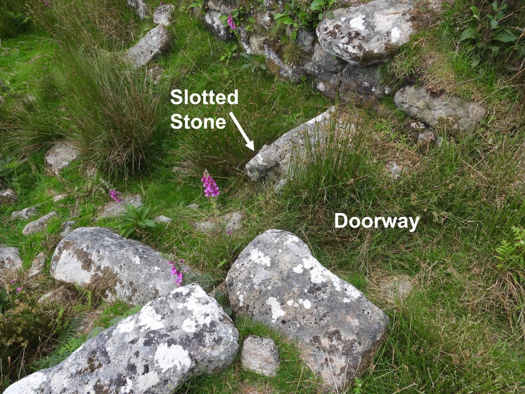
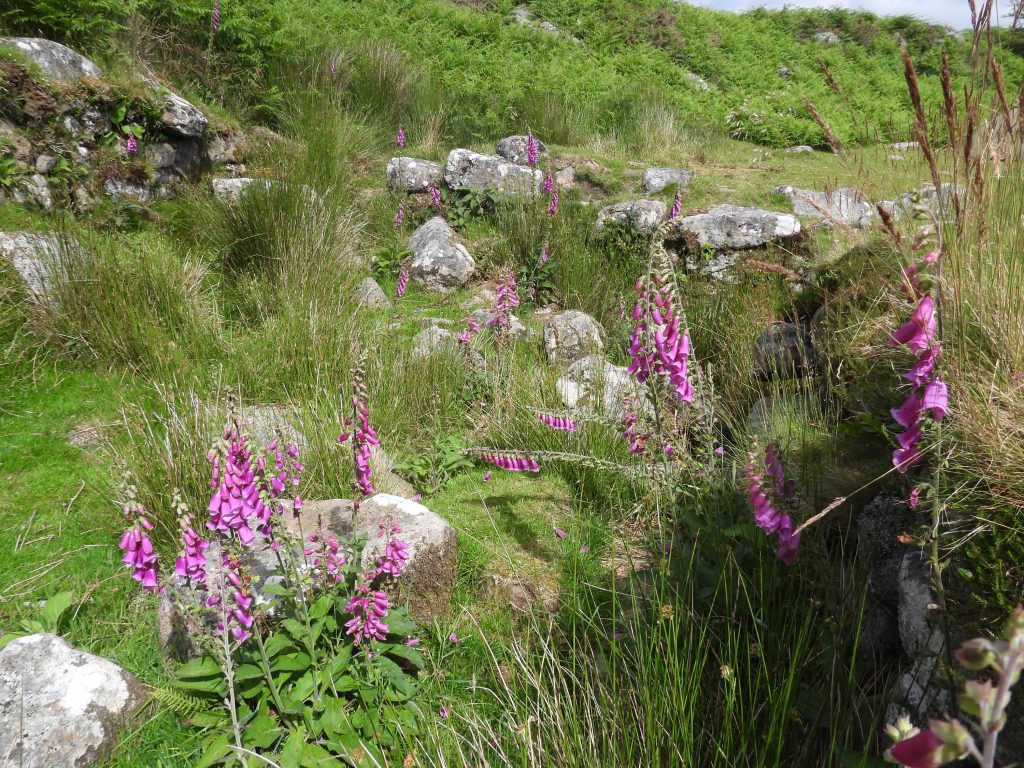
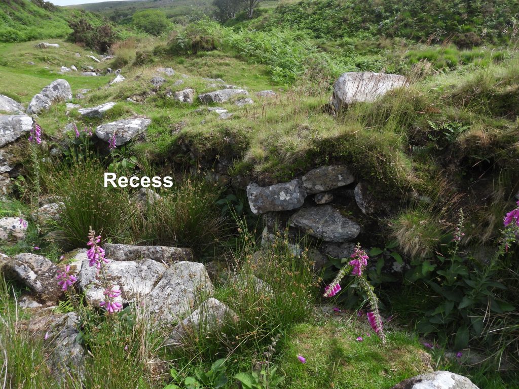
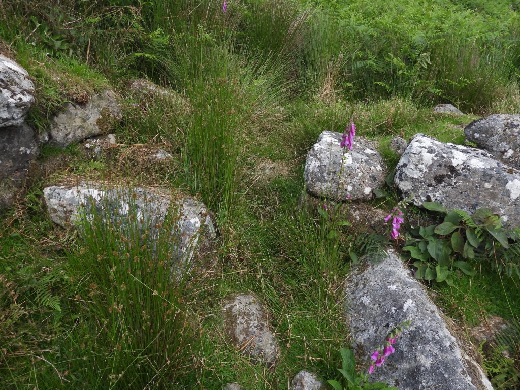
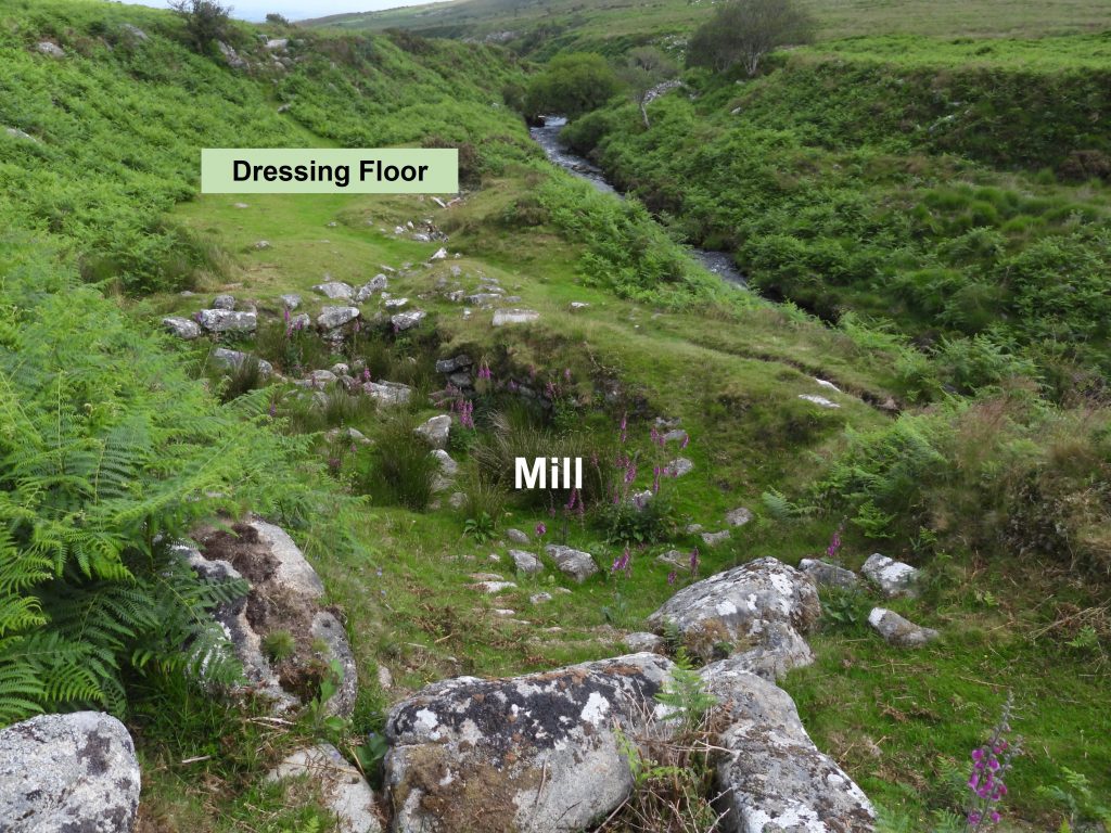
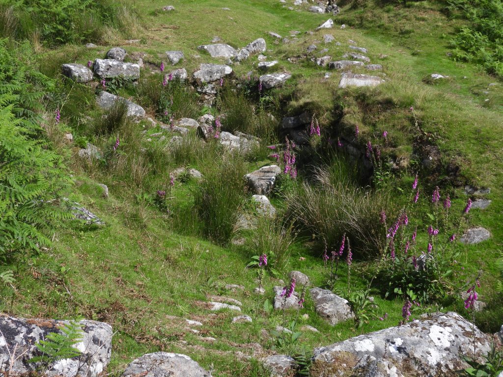
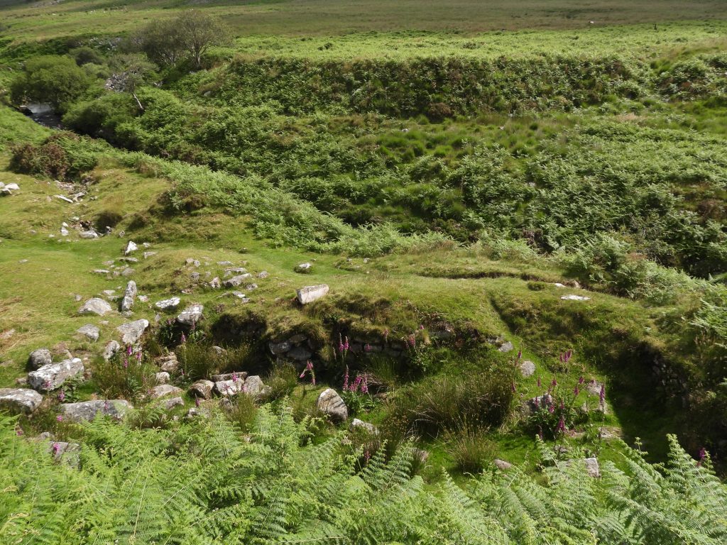
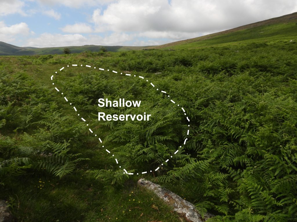
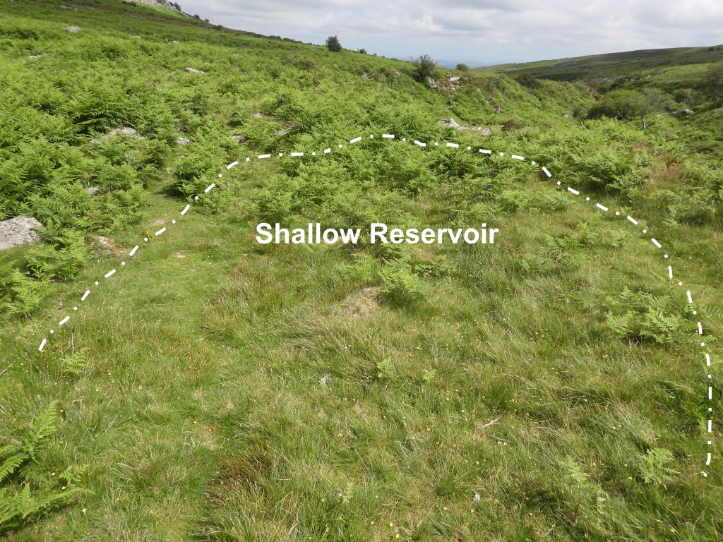
Sketch of the site and key features in relation to the River Taw and a footpath.The mill and tailrace approaching from the NorthThe interior of the mill is recorded as measuring 9.5m by up to 4.7m with access through a clearly defined doorway in the north western corner.The mill viewed from the South near the steep scarp leading up to a small shallow reservoirAlong the Eastern part of the mill there are two edge set stones which some observers state represent the site of the furnace. The author interpreted this location as being at SX62038 91961.Close up of recess in the Eastern wall (North East corner of the mill) is stated by some observers as denoting the position of the wheelpit in which a wheel powered by water from the nearby leat operated the furnace bellows. Other observers state that the furnace was probably located in the recess and outside it are signs of a wheel-pit. So, which interpretation is correct ? The recess can be located at SX62040 91968.View of the mill from the North wall. The mill is of drystone construction and the walls stand up to 1.4m highThe water from the wheelpit (possibly located in the recess) was carried to the river in a tailrace. This feature is a defined channel denoted on both sides by substantial banks.At the northern end of the dressing floor is a horseshoe shaped hollow which is believed may represent the site of a buddle, It can be located at SX62042 91990The doorway can be located at SX62036 91968. There appears to be a slotted (or worked) stone in area. Could this be possibly part of a mould stone ? Inside the mill, looking North. A plethora of foxgloves were evident when the author visited in July 2021.Recess with the tailrace beyond.A close up view of the mill doorway, which is located on the NW cornerTo the west of the tailrace a level area represents the site of a dressing floor.General view of the mill taken from near top of the scarp at a point where the water would have entered the site from the reservoir above.General view of the mill taken from on top of the steep scarp.A small reservoir (measuring 12.8m x 5.5m and up to 0.3m deep) is situated on top of the scarp immediately south of the mill.The reservoir NGR taken by the author was SX62030 91945.