A collection of walks, discoveries, insights and pictures of exploring Dartmoor National Park
July 16, 2021
An Exploration of Taw Plain
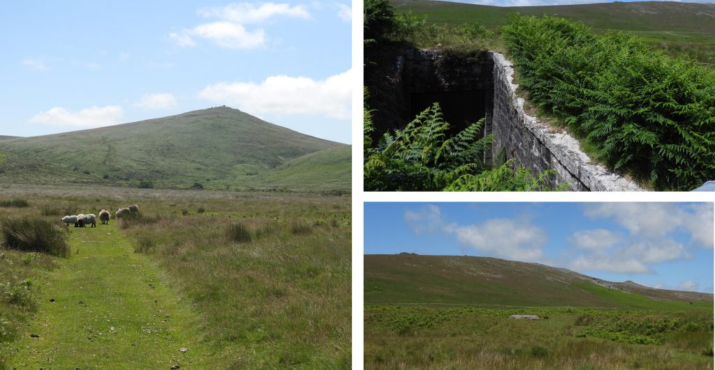
Described by Eric Hemery as “a wonderful place”, Taw Plain is a middle-reach basin and has a lot to offer the explorer. It is loosely known as Taw Marsh but in reality the marsh only occupies a portion of the plain at its southern end between the foot of Steeperton Hill and the locality of Small Brook Foot. The Belstone / South Tawton parish boundaries pass across the plain and three boundary stones defining them can be found near the river. Also in the area the explorer can find evidence of water extraction from the 1950s and four “shooting stands” which the author estimates date from late 19th / early 20th century.
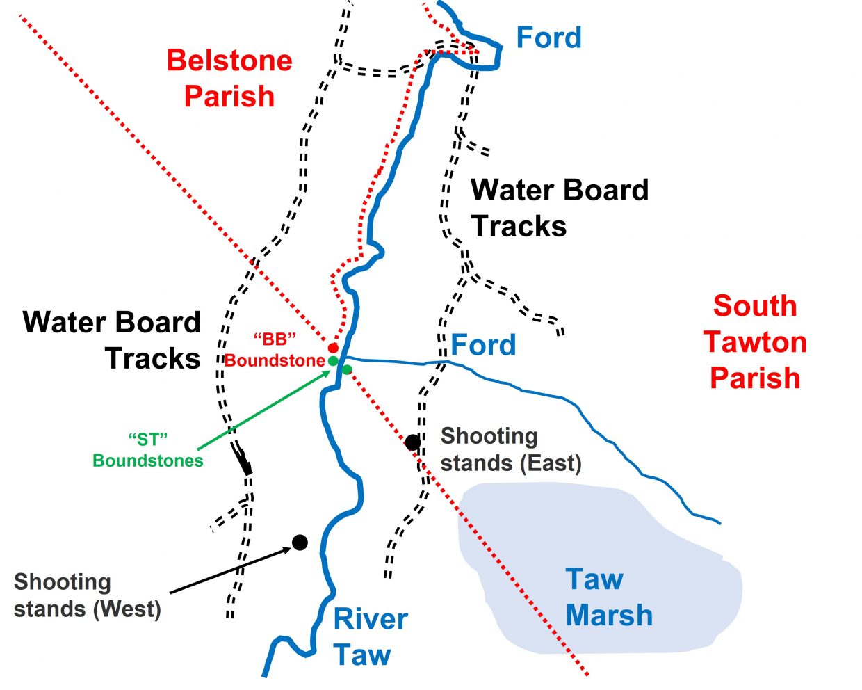
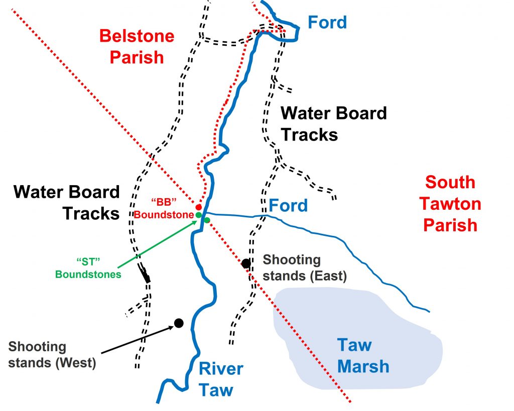
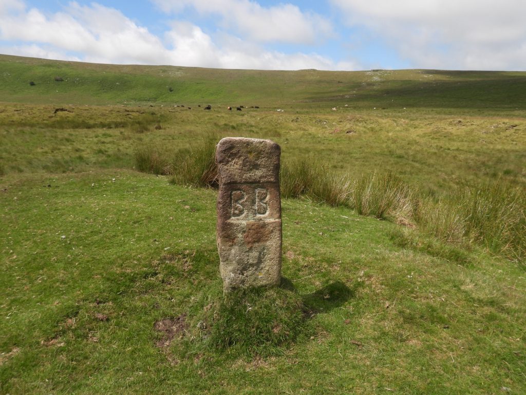
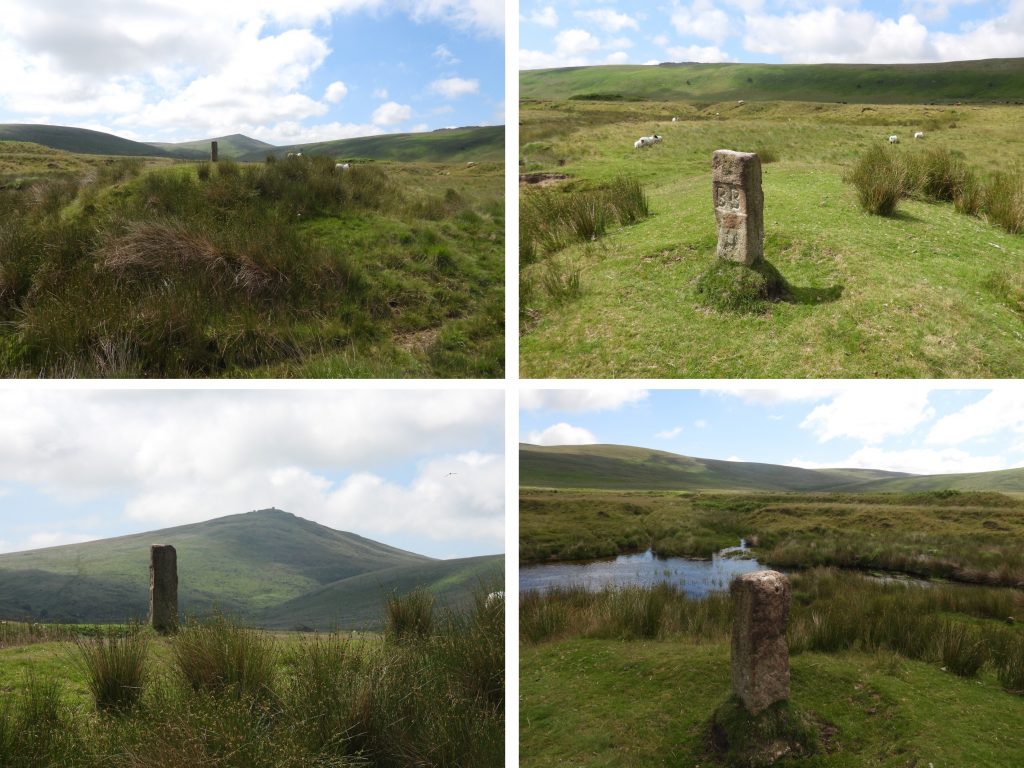
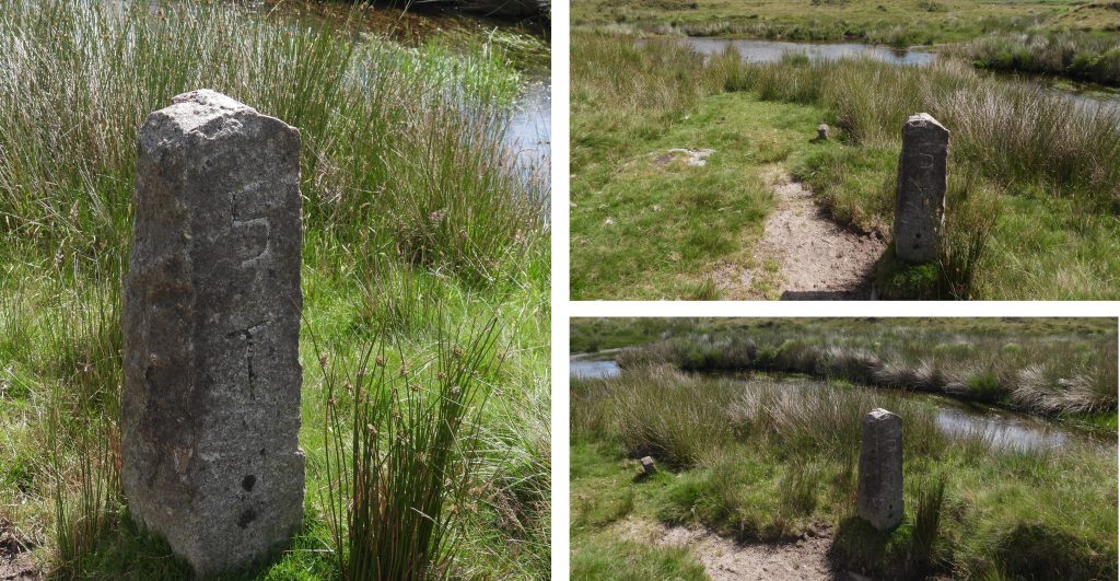
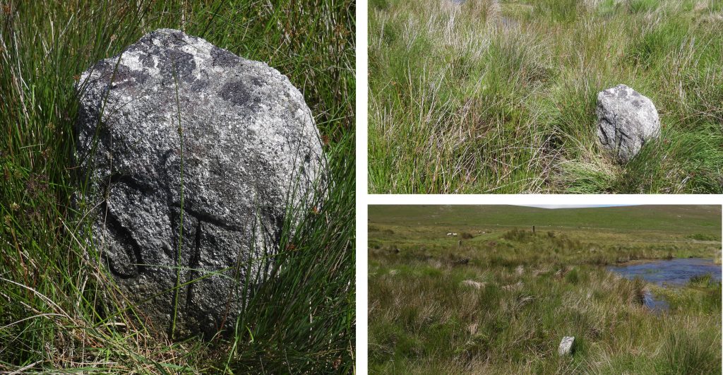
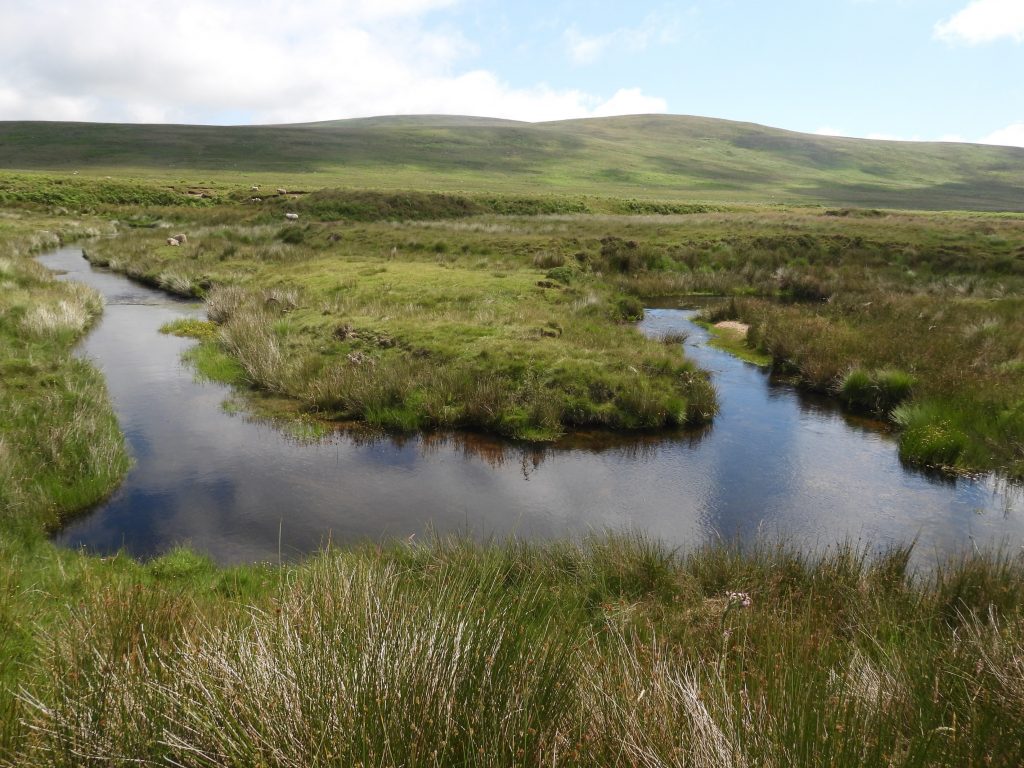
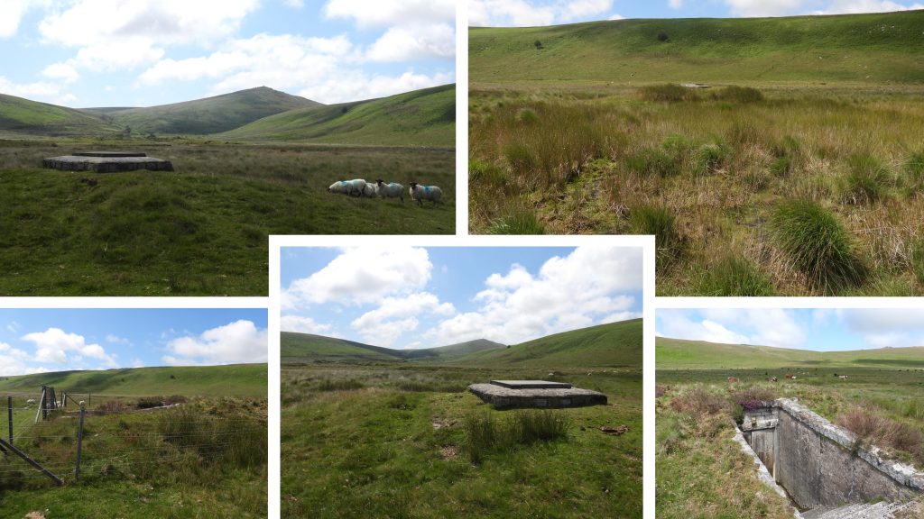
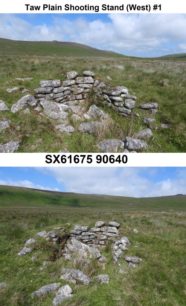
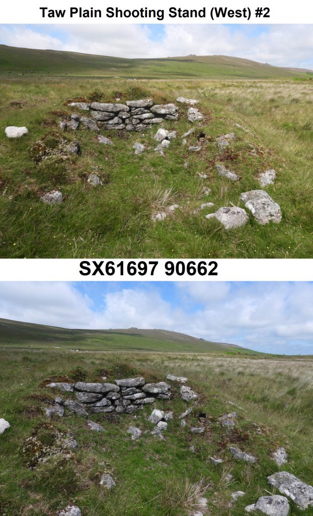
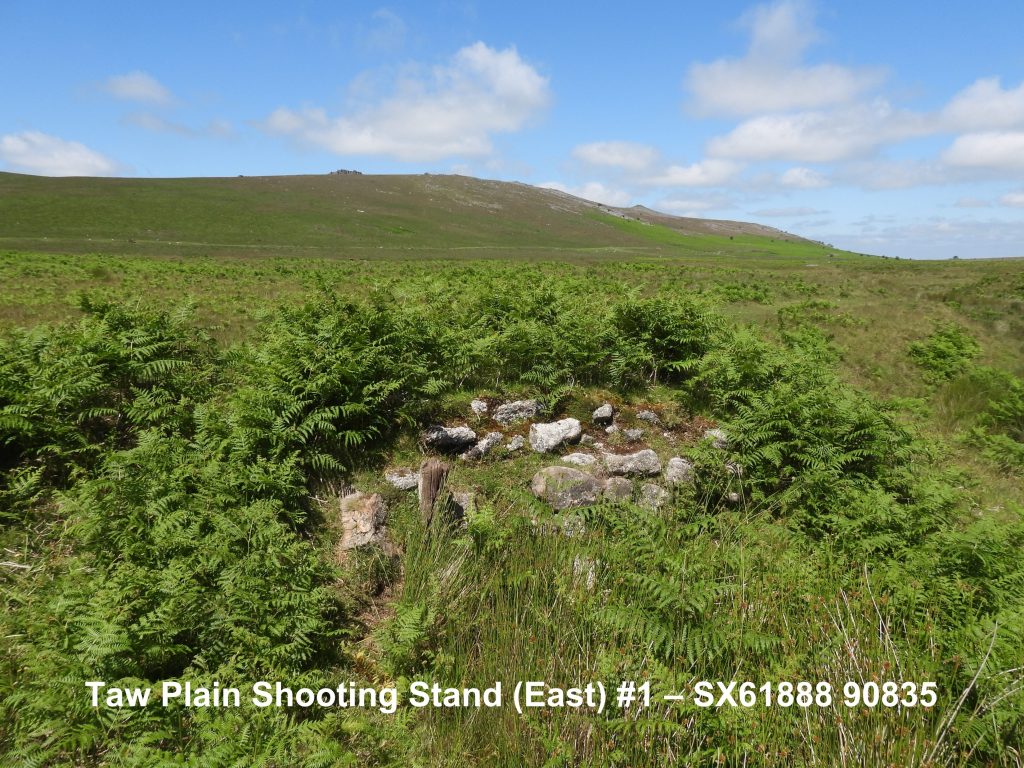
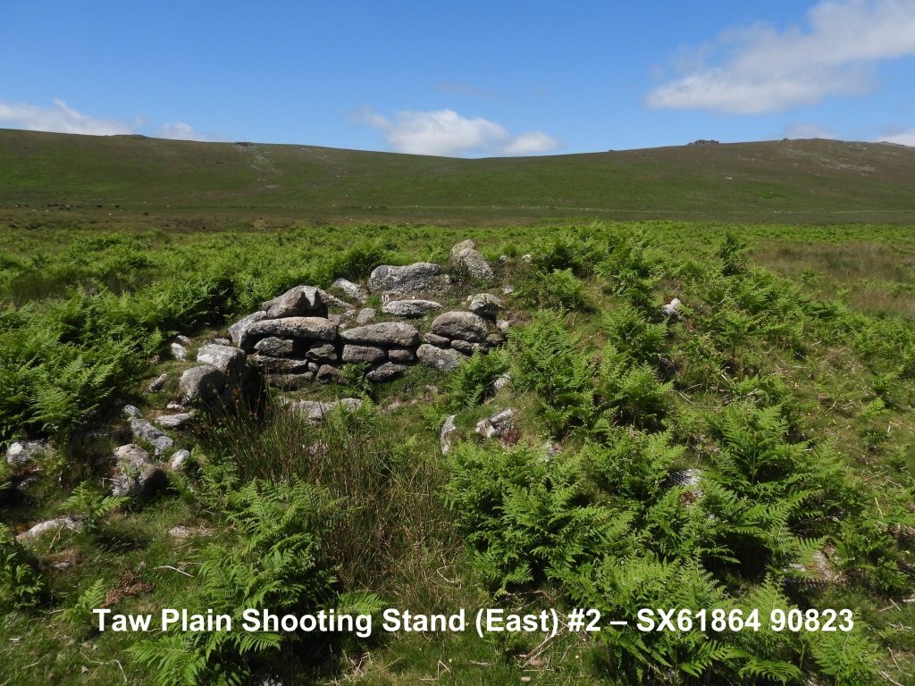
Sketch map of the parts of Taw Plain covered by this post“BB” (Belstone Boundstone) dating from 1968. It is located on a small “tump” as described by Dave Brewer in the Dartmoor Boundary Markers book (second edition). Close by are two South Tawton (“ST”) boundstones. The boundary between the two parishes was in dispute for many years and it is recorded that Belstone lays no claim to the river, which is emphasised by the sketch map in this post. The stone is located at SX61755 90949.General views of the “BB” boundstone. The historic dispute with South Tawton is recorded to be related to who had the right to remove gravel from the river.This “ST” (South Tawton) boundstone lies on the west bank of the river, which is evidence that the parish claimed the river within its bounds. It is located between the “BB” boundstone and the river at SX61754 90937.This “ST” (South Tawton) boundstone lies on the east bank of the river. The two “ST” stones may only be a few 10s of metres apart but the river is difficult to cross at this point and the explorer is advised to consider crossing at the horse shoe ford a few hundred metres downstream. The difference between the two “ST” stones is very evident with this one being barely a quarter the same height as its nearby neighbour. It is partially hidden by reeds. Only the top of the stone can be seen from the west side. It can be located at SX61777 90929.Horseshoe on River Taw looking NE towards Cosdon (or Cawsand) Beacon.In 1957, the North Devon Water Board sank trial boreholes in Taw Plain and the success led to the North Devon Water Act of 1959. However, the water was found to be radioactive (radon and carbon dioxide) which had to be removed in an aeration tank. Additionally, excessive acid meant lime had to be added at the Treatment Works in Belstone village. At this time nine wells were sunk by the Board with underground aeration and balancing tanks built. The pictures show some of the features on the west side of the river under the slopes of Oke and Knattaborough Tors.The pictures show some of the water board tracks and features from the late 1950s on the east side of the river.There are two shooting stands on the west side of the River Taw. Both structures are 3-sided, open to the SE and protected by turf and stone mounds. As they lie outside the military ranges it is believed they were probably constructed for recreational shooting. Source: Dartmoor HERBoth of the shooting stands on the west side of the River Taw are recorded as measuring 3.0m NE to SW by 1.75m with roughly coursed boulder and slab walls, 1.4m high maximum. The protective mounds measure approx 8.0m to 9.0m diameter by 1.5m high. Source: Dartmoor HER.There are also two shooting stands on the east side of the River Taw. Both structures are 3-sided of roughly coursed boulders and slabs open to the SE, measuring 3.1m NW-SE by 1.8m, with walls maximum 1.2m high. Source: Dartmoor HER.The shooting stands are protected on all sides other than SE by a stony mound 9.5m diameter and up to 1.4m high. Source: Dartmoor HER.