A collection of walks, discoveries, insights and pictures of exploring Dartmoor National Park
August 14, 2022
Powder Mills – Gunpowder Factory
The Powder Mills Gunpowder Factory was established in 1844 by George Frean at a cost in the region of £12,000 and was fully operational by 1846. It remained in use until 1897, when it closed as a result of increasing competition from dynamite and a slump in local mining activity. Gunpowder at that time was being used for the mines (e.g Birch Tor and Vitifer), the quarries (e.g Swell tor, Foggintor and Merrivale) and also by farmers to clear rocks from their land.
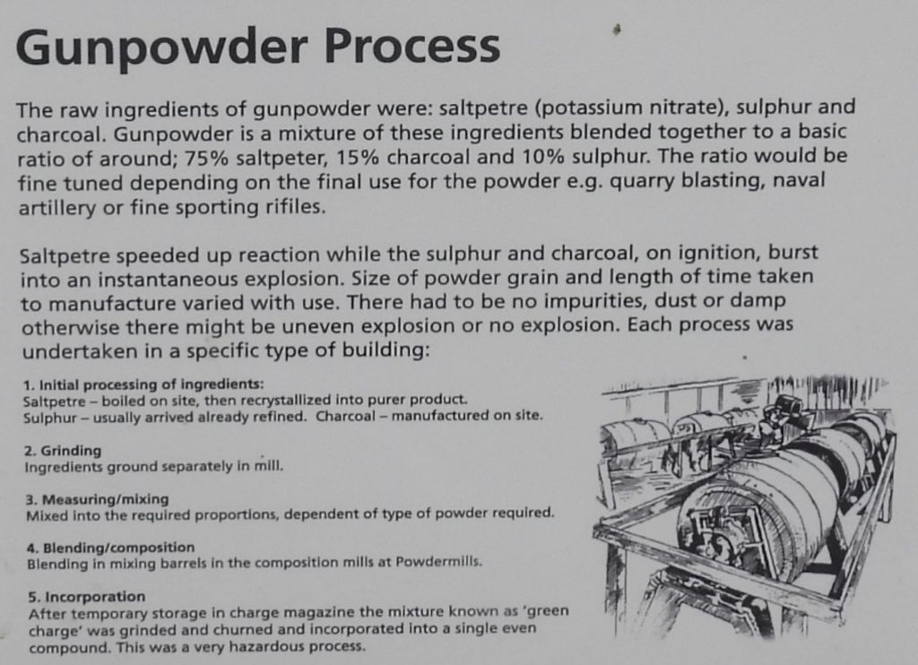
The production of gunpowder at that time was quite involved (and dangerous) and consisted of combining a mixture of saltpetre (75%), sulphur (15%) and charcoal (10%). The ruined buildings at the Powder Mills site tell the story in which the different stages of the process were carried out. The site is quite spread out and the distances between the buildings are indicative of the safety precautions taken at that time.
Unfortunately, records show there were accidents at the factory. There appeared to have been two explosions in 1857. Firstly, a Robert Northcote succumbed to his injuries on 21st Nov. 1857, the after another explosion occurred 17th Dec. 1857 another 2 men were killed, and one serious injured
This post is intended to provide a pictorial record and simple (hopefully) explanation of the site. The information contained here is by no means exhaustive and the author would like to acknowledge the following sources of information for the composition of this post which will provide more detail to the reader if required:
Bibliography
Powder Mills – The Story of the Dartmoor gunpowder factory by Drew Campbell
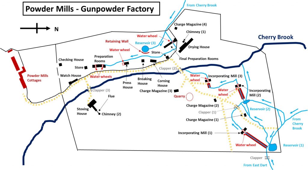
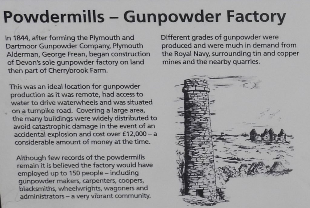
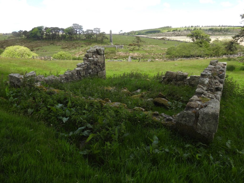
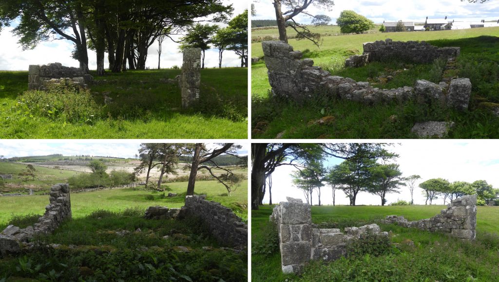
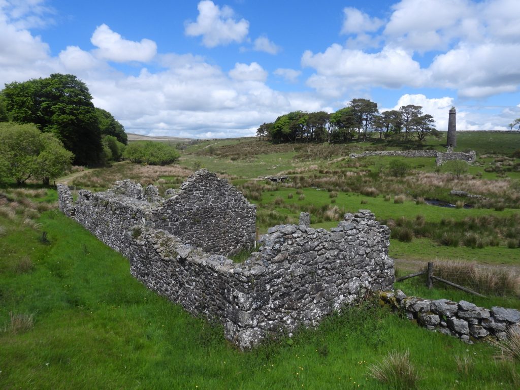
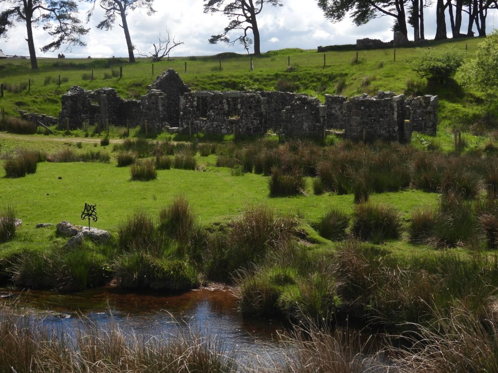
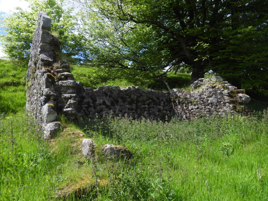
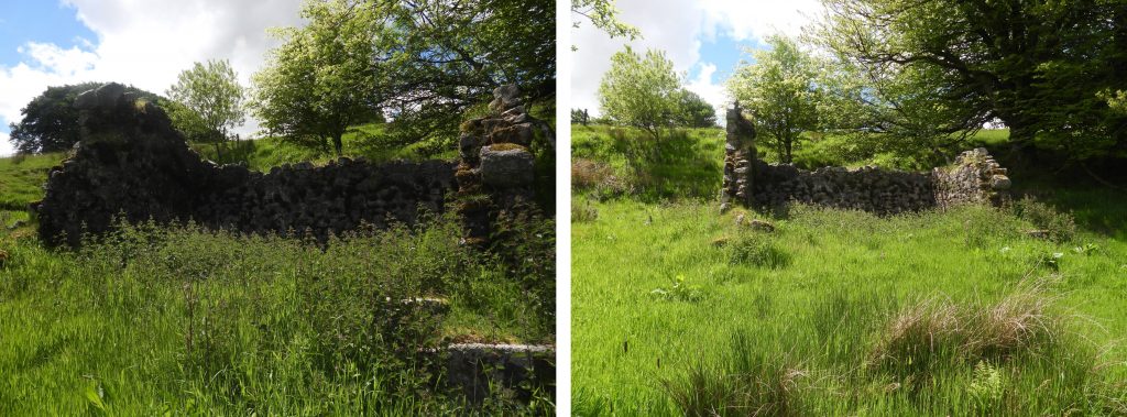
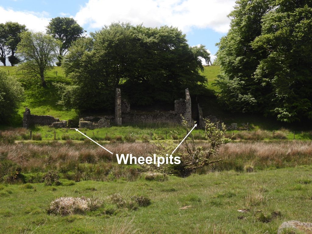
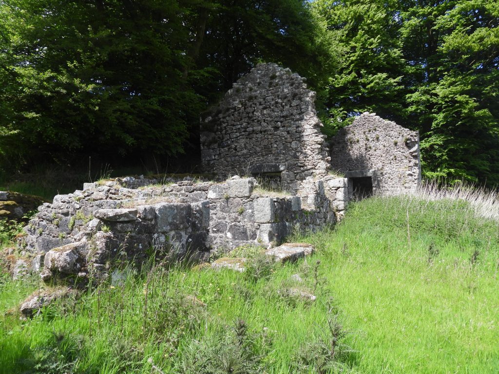
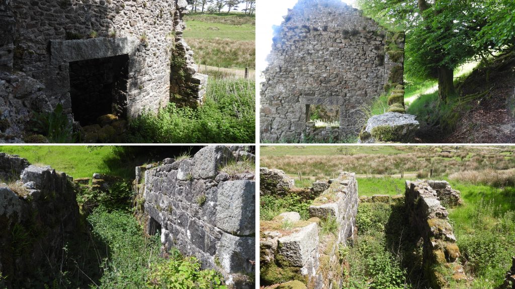
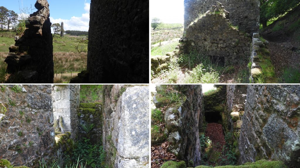
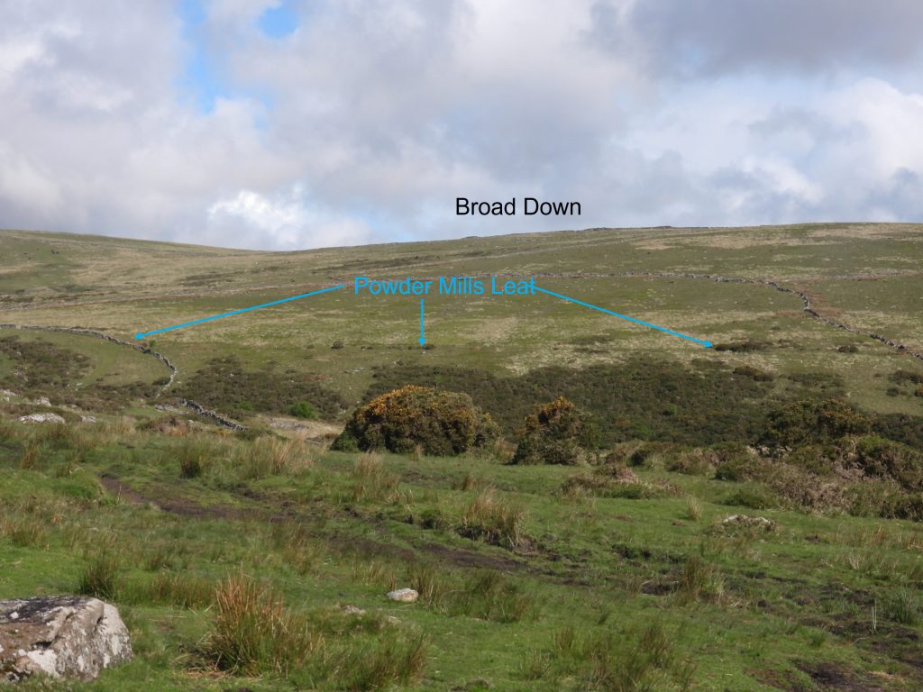
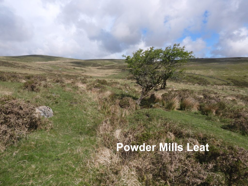
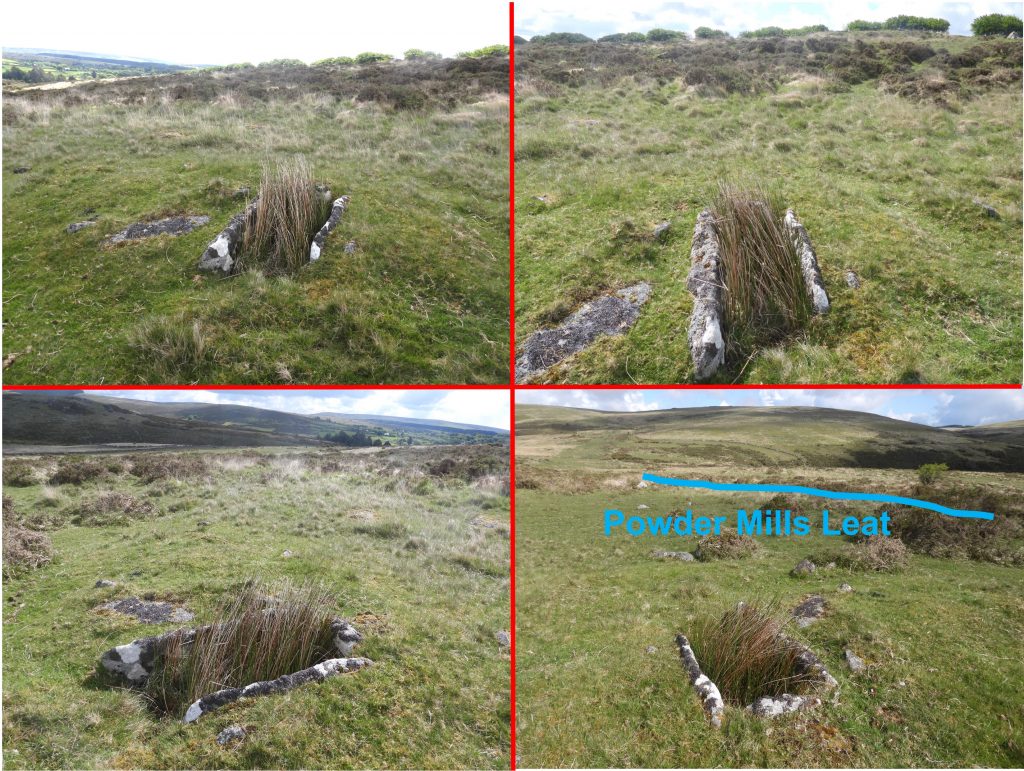
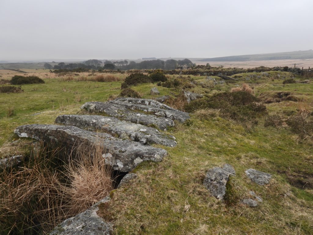
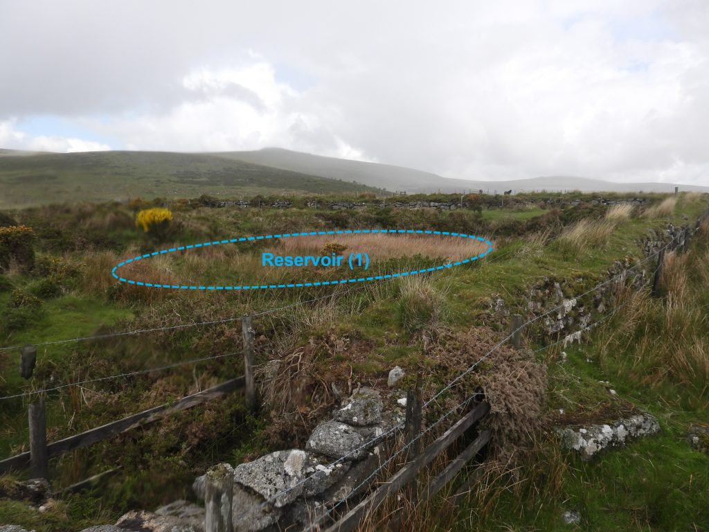
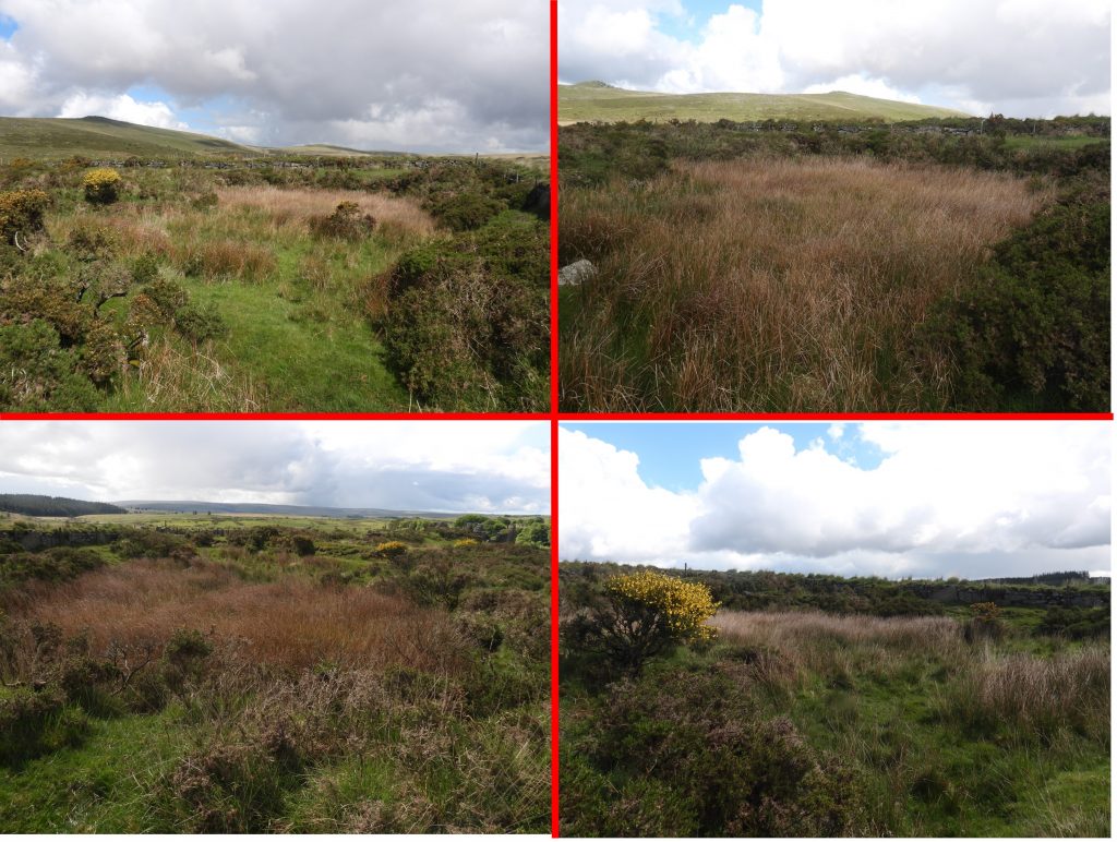
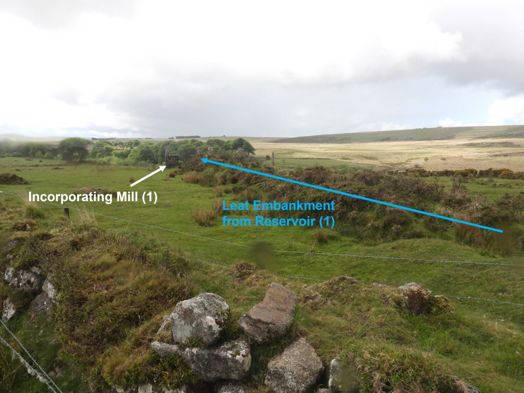
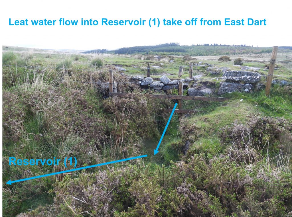
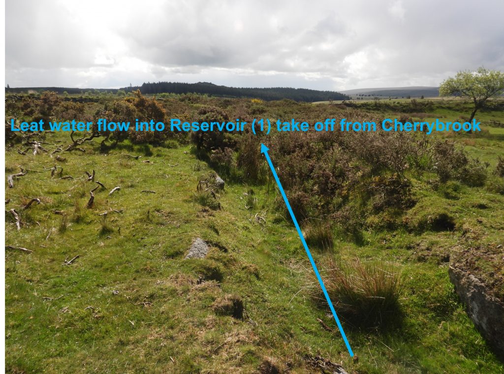
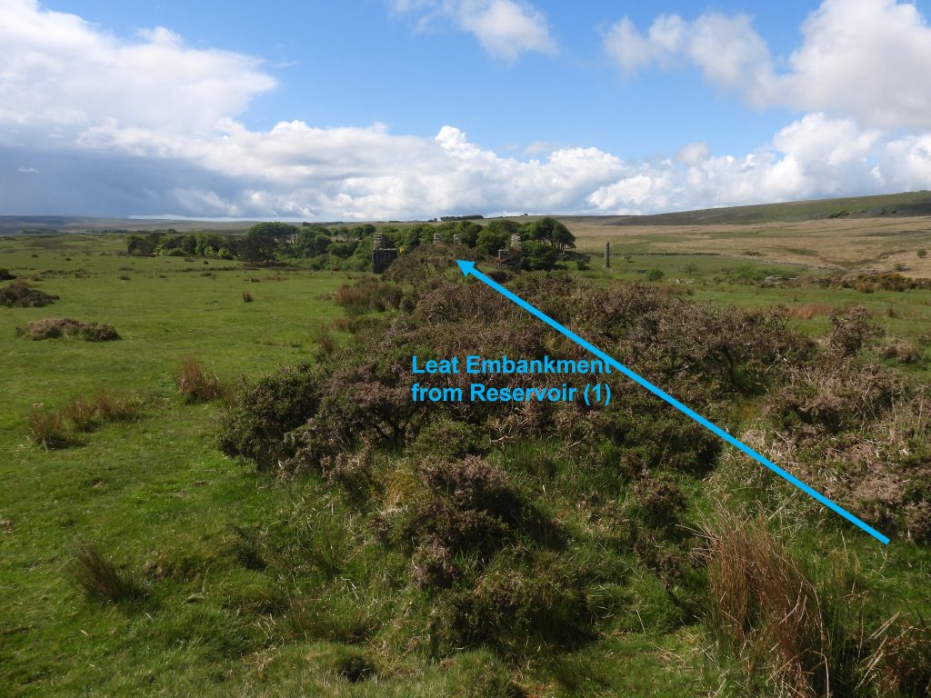
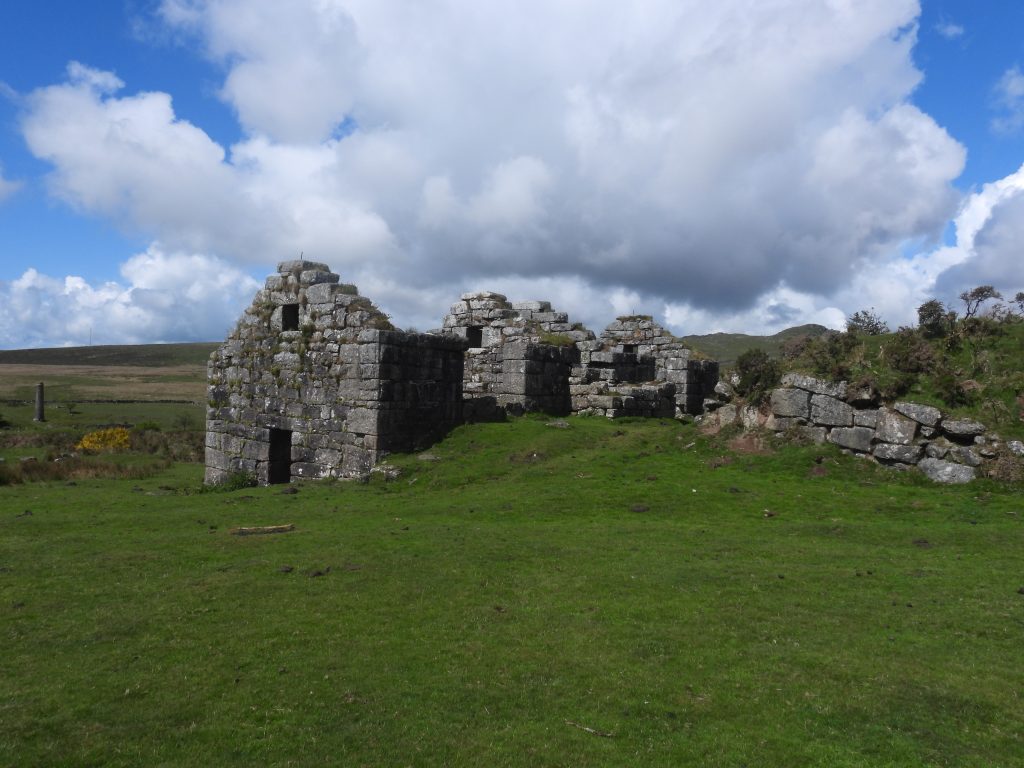
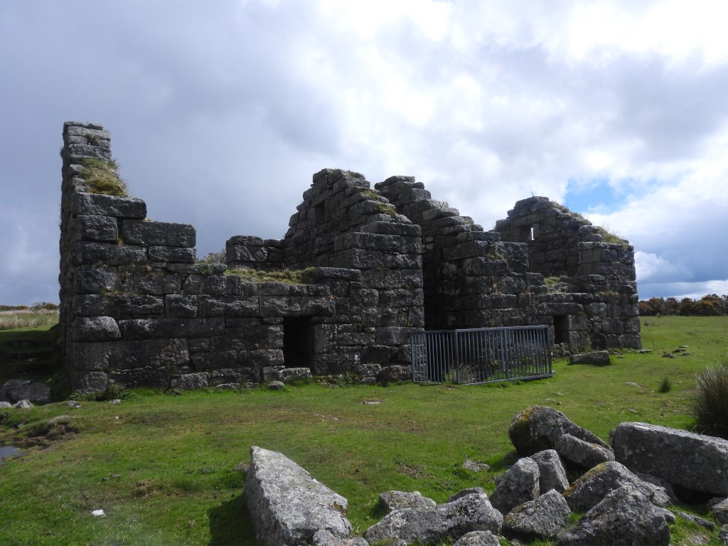
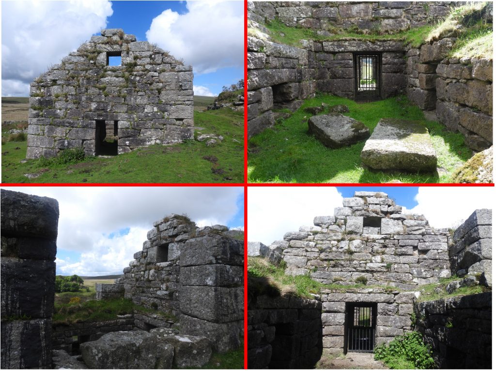
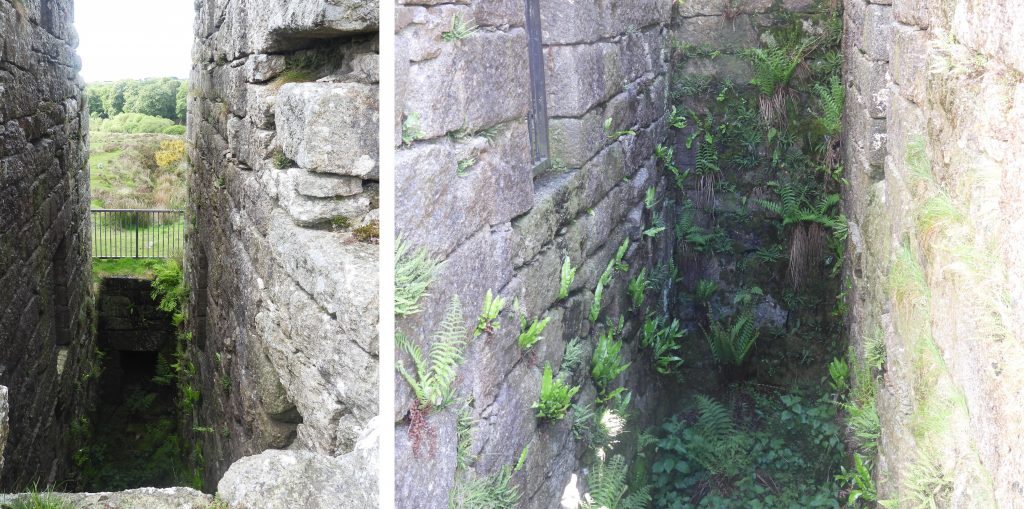
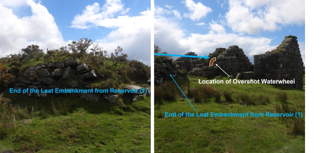
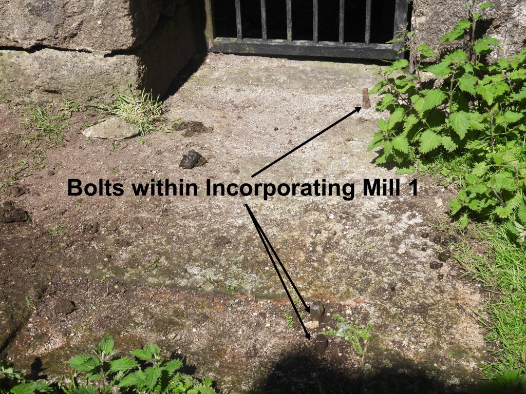
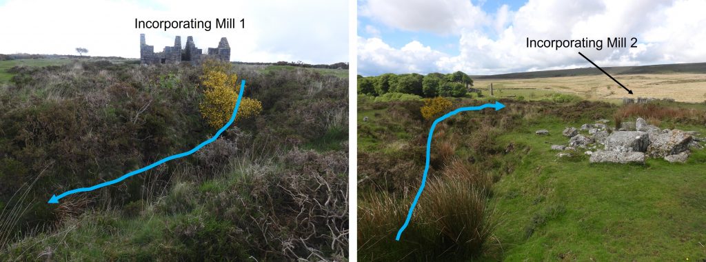
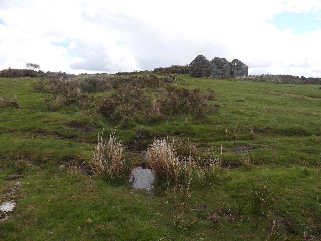
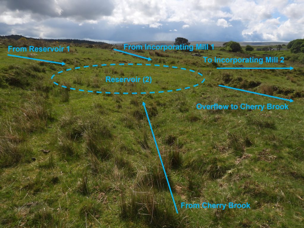
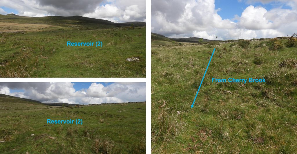
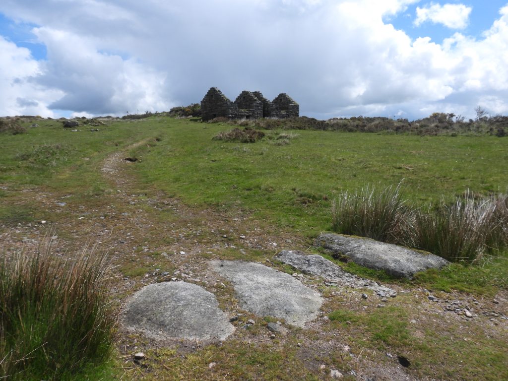
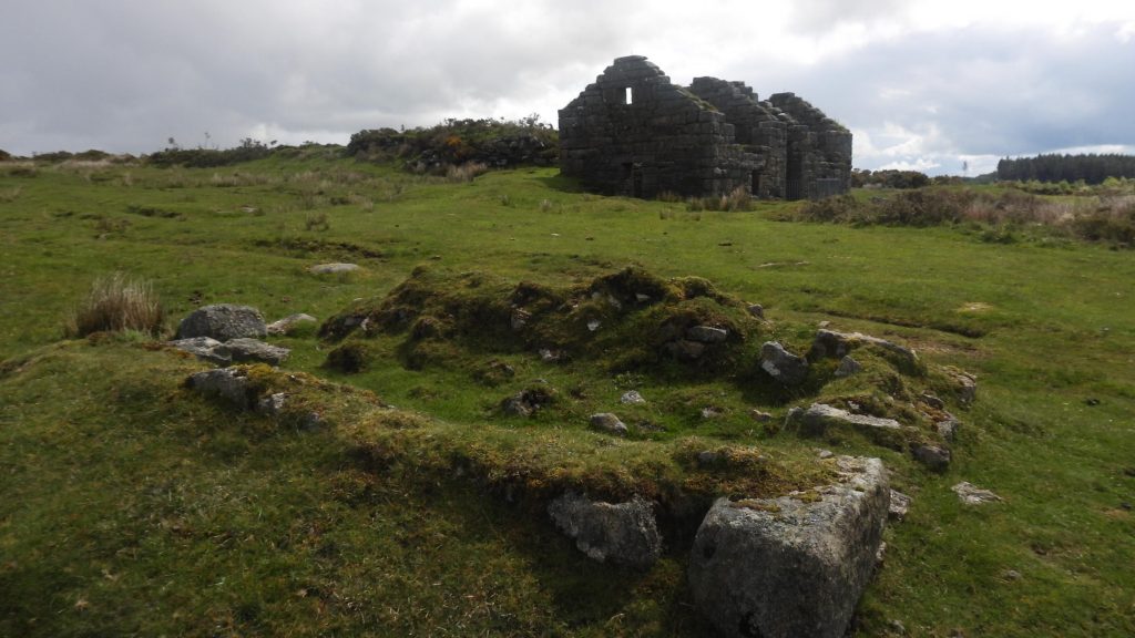
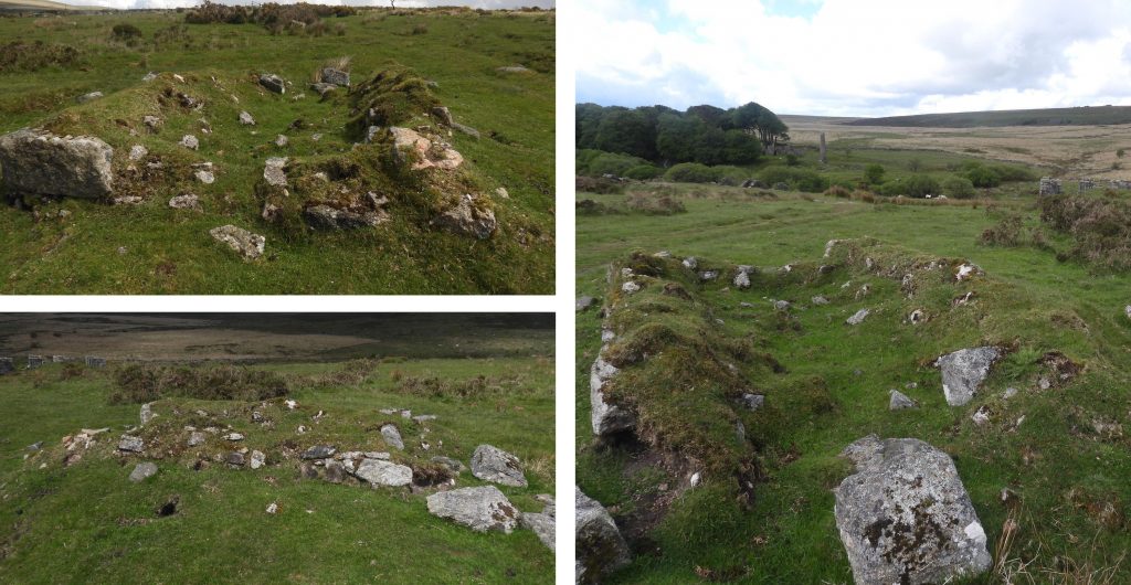
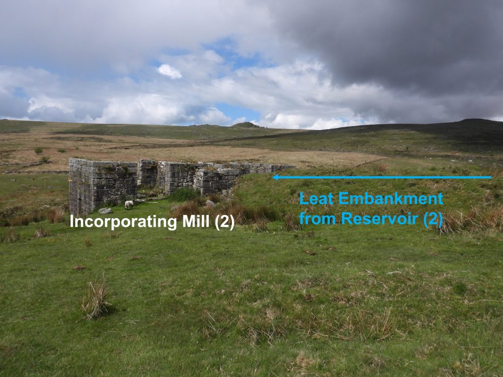
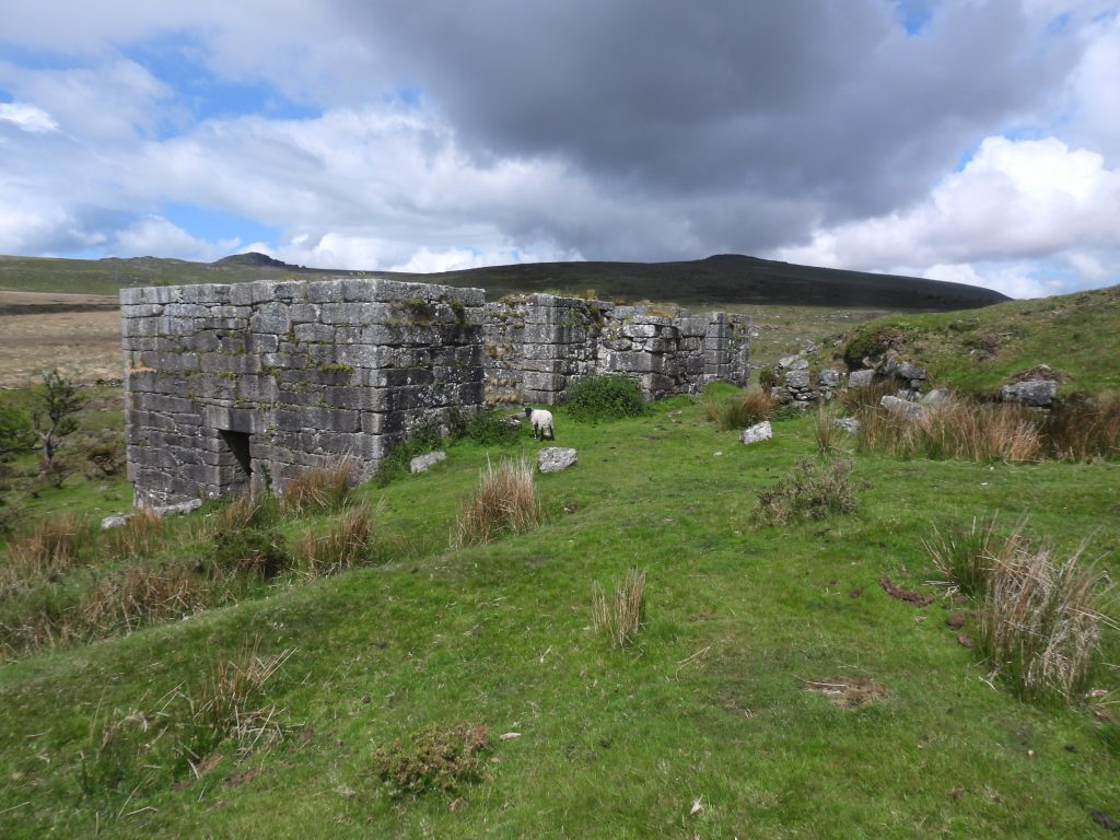
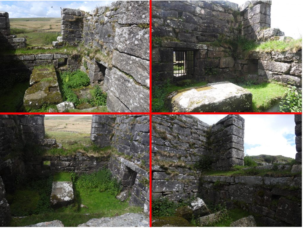
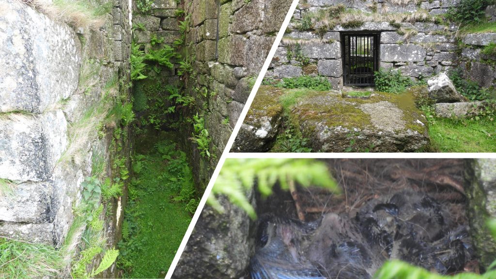
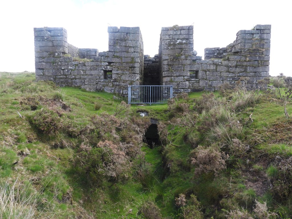
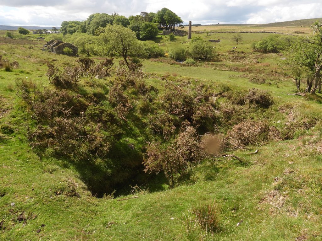
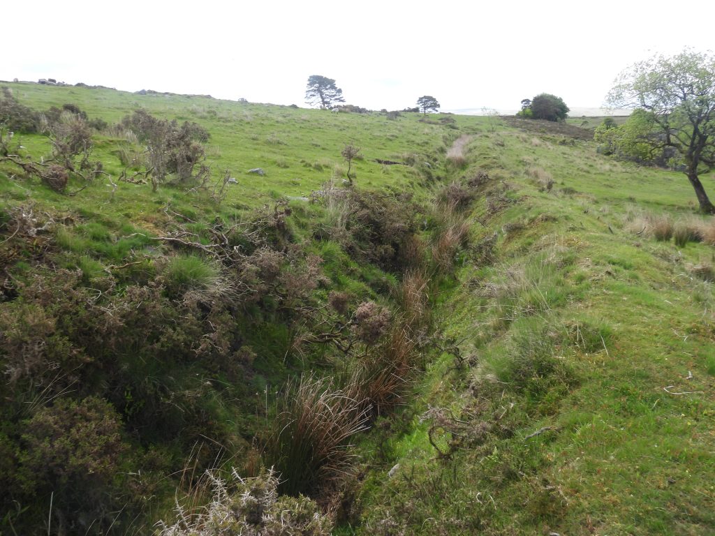
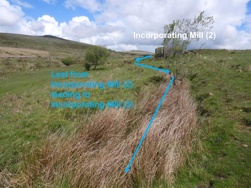
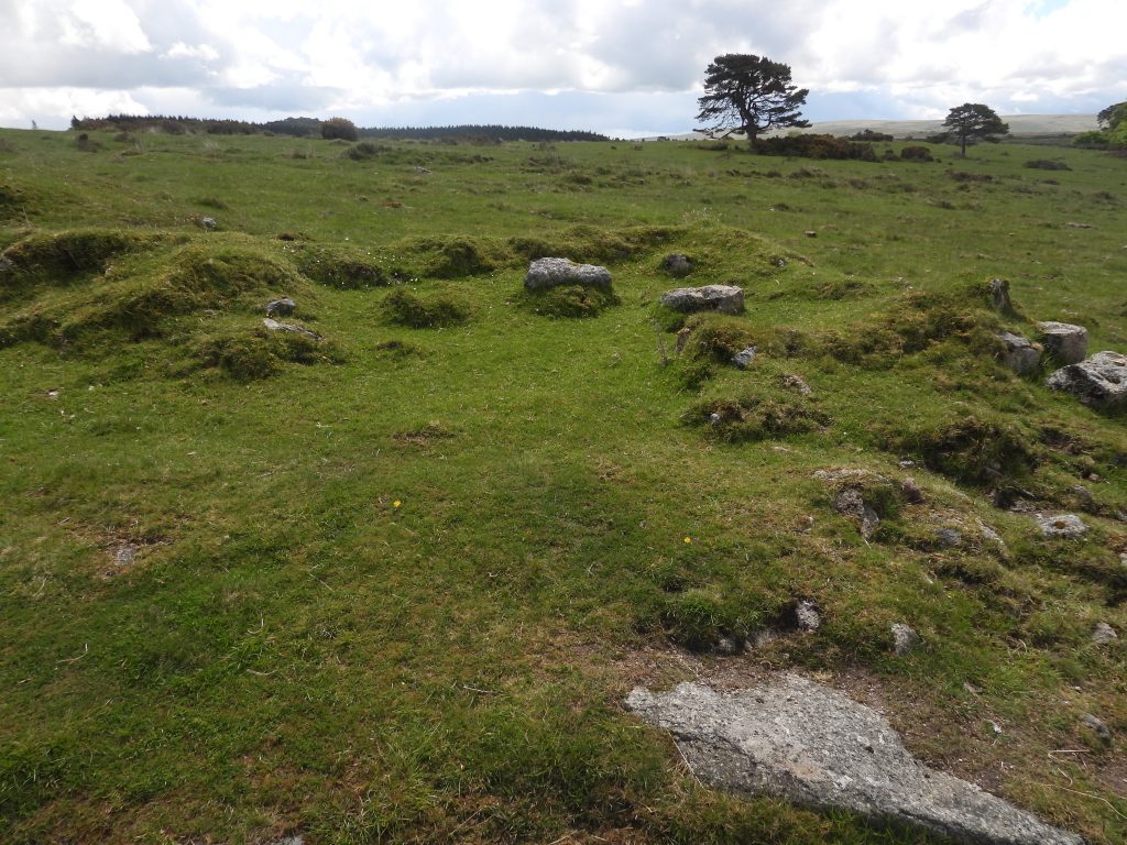
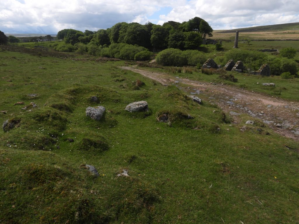
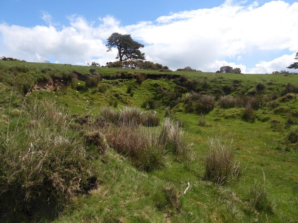
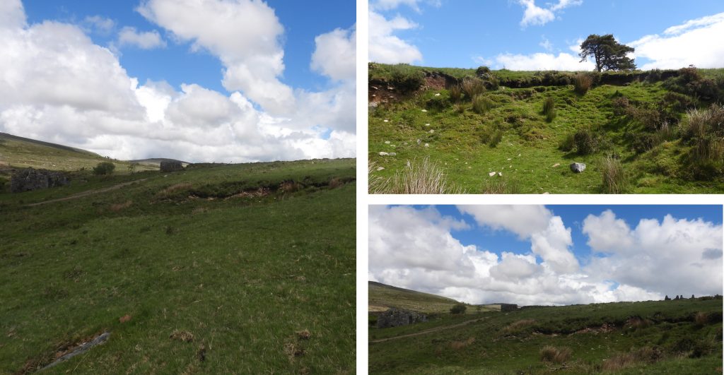
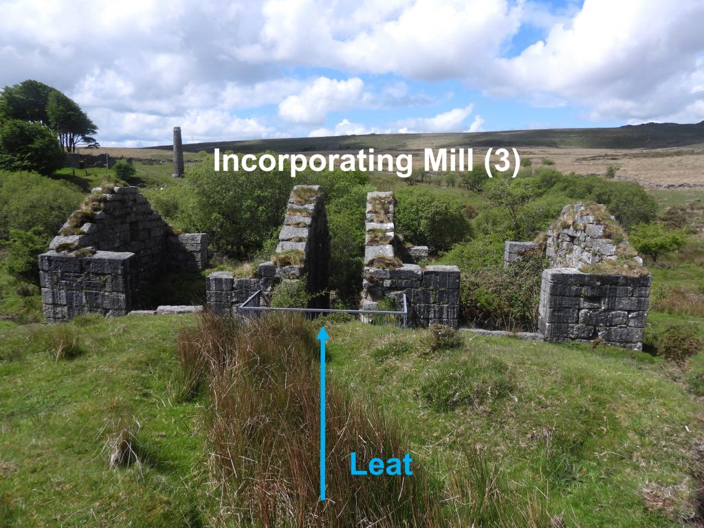
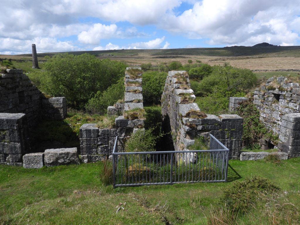
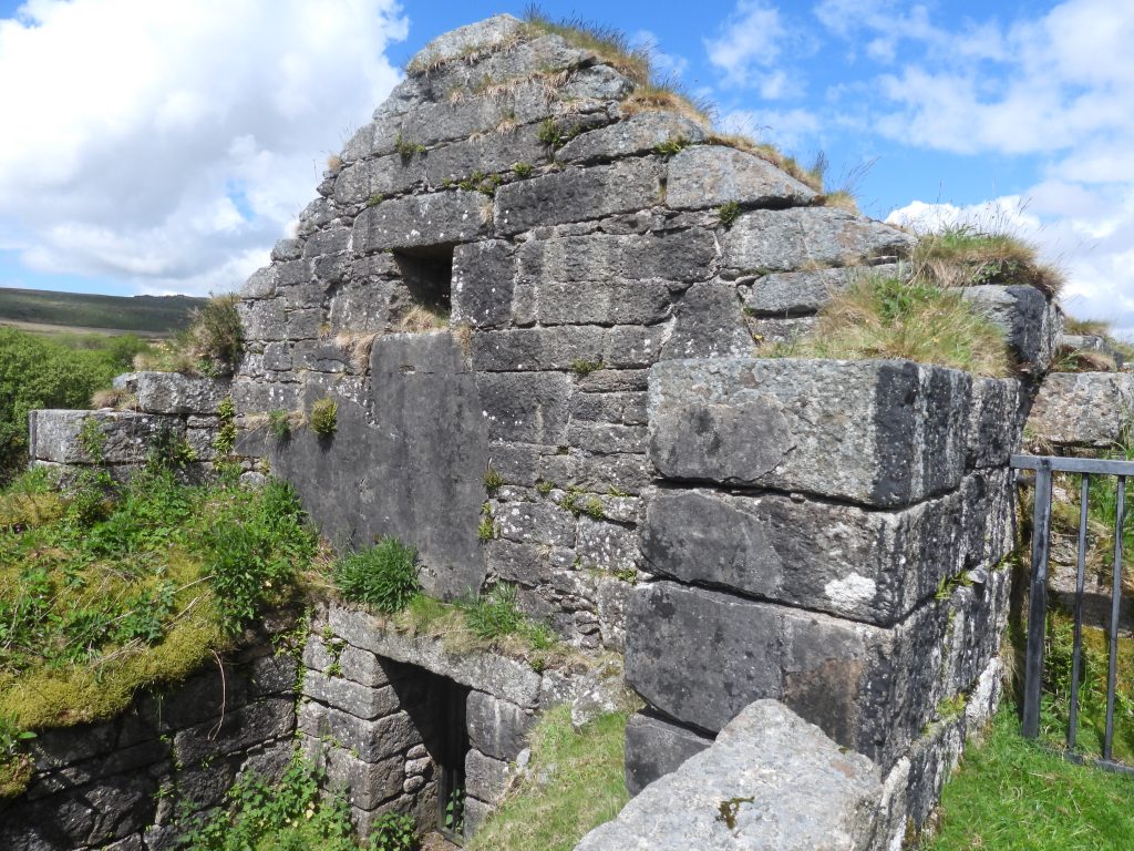
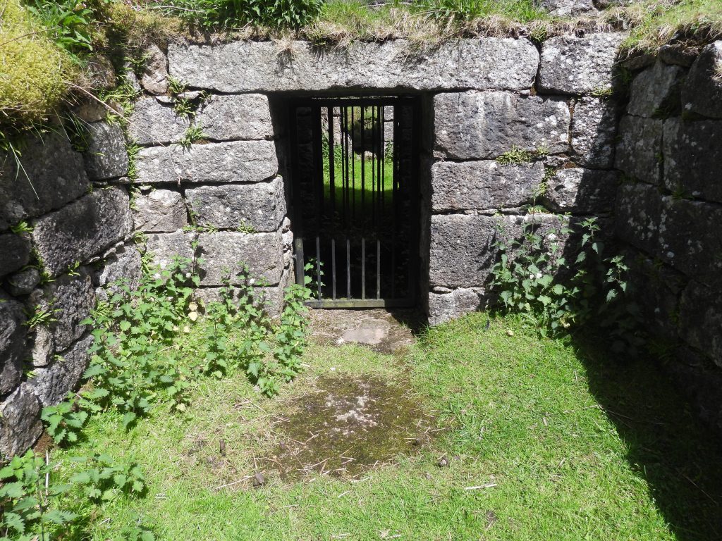
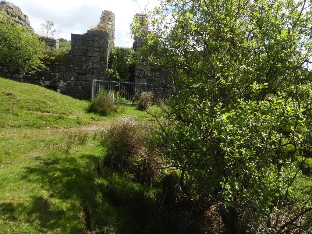
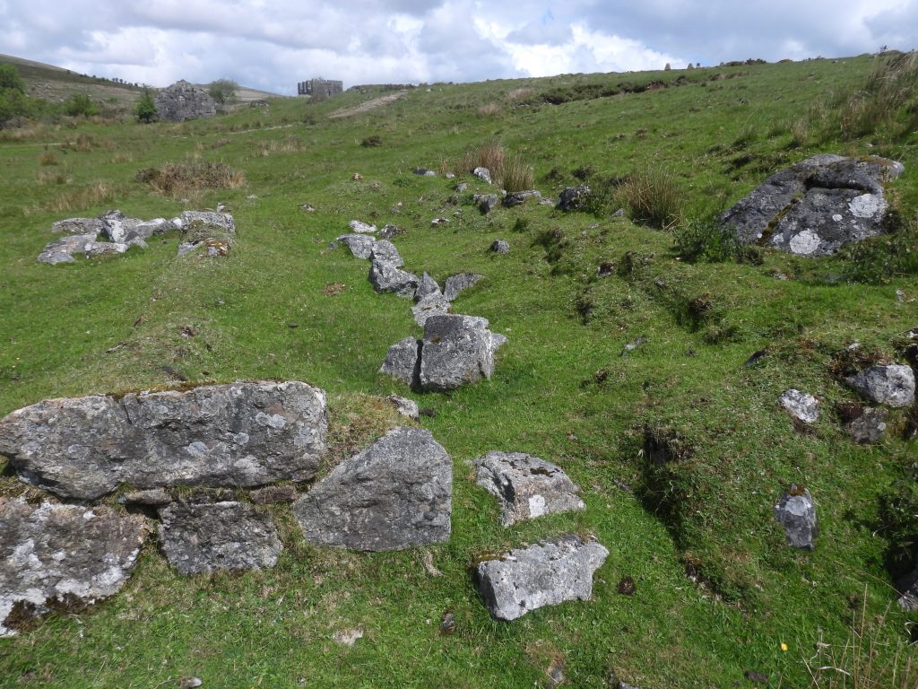
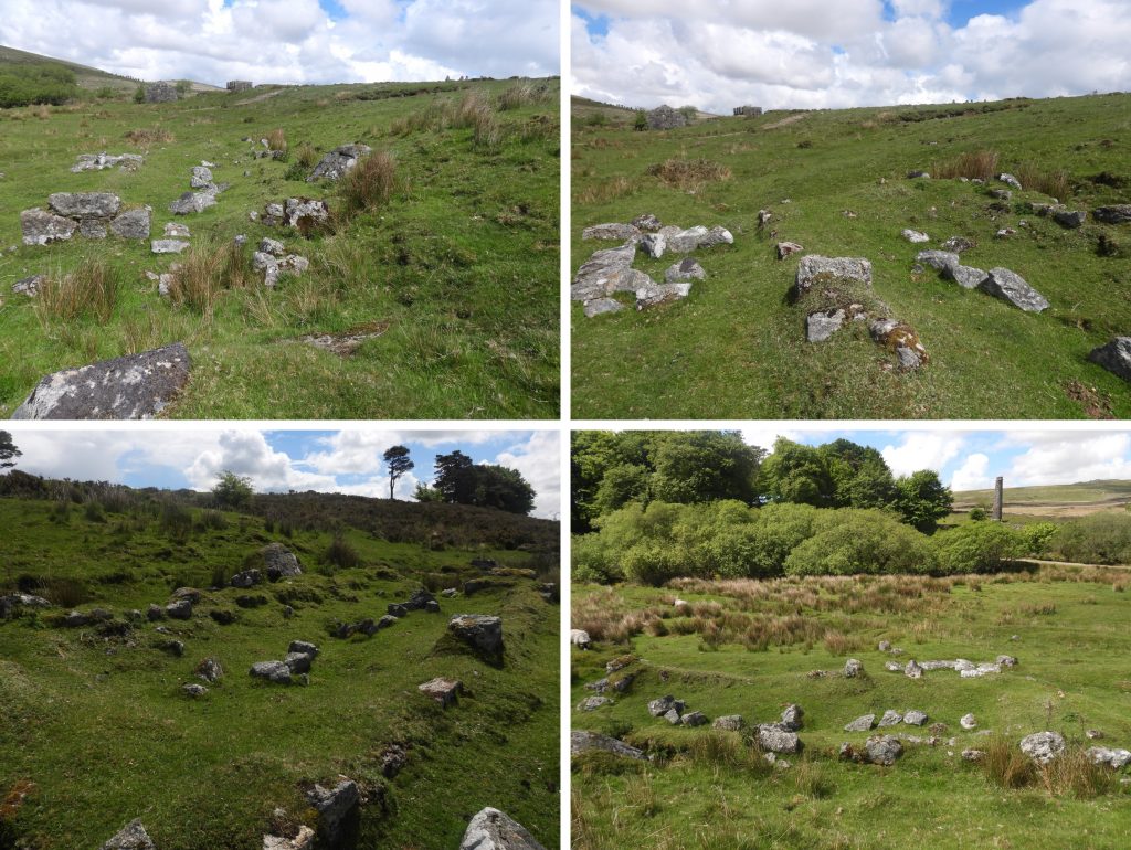
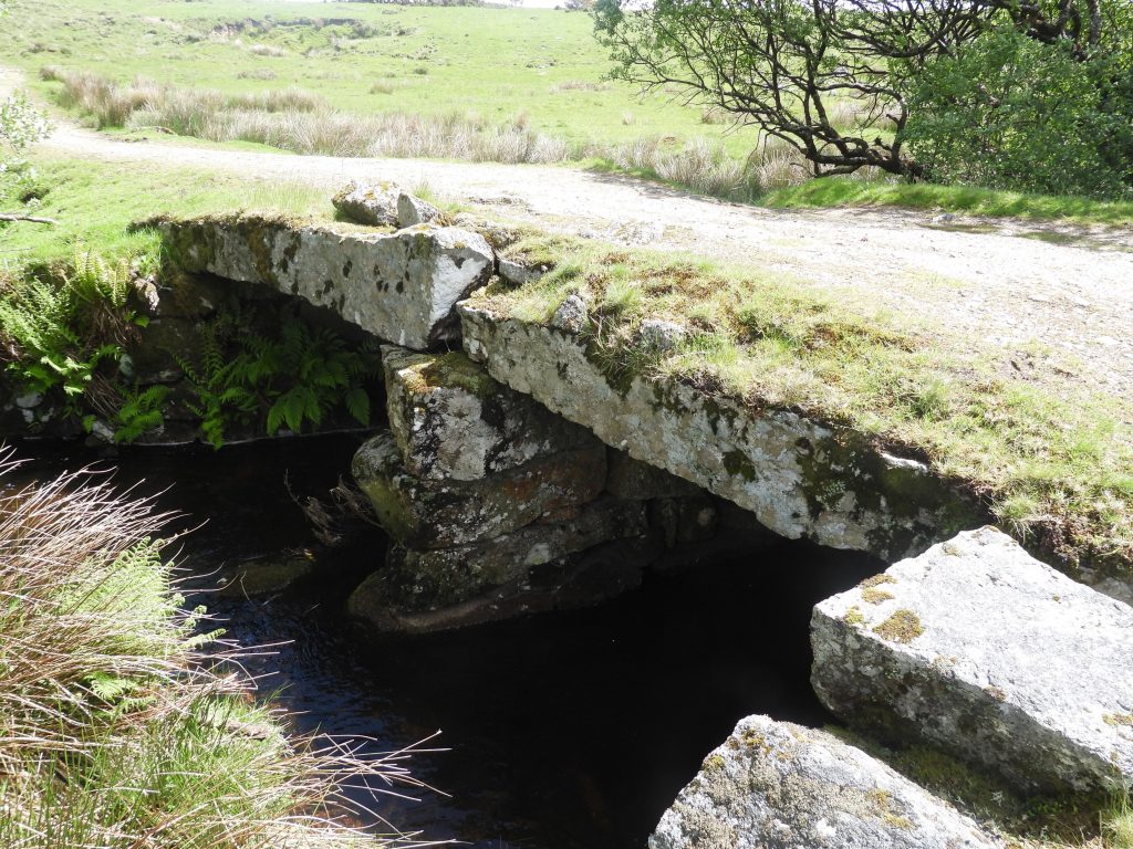
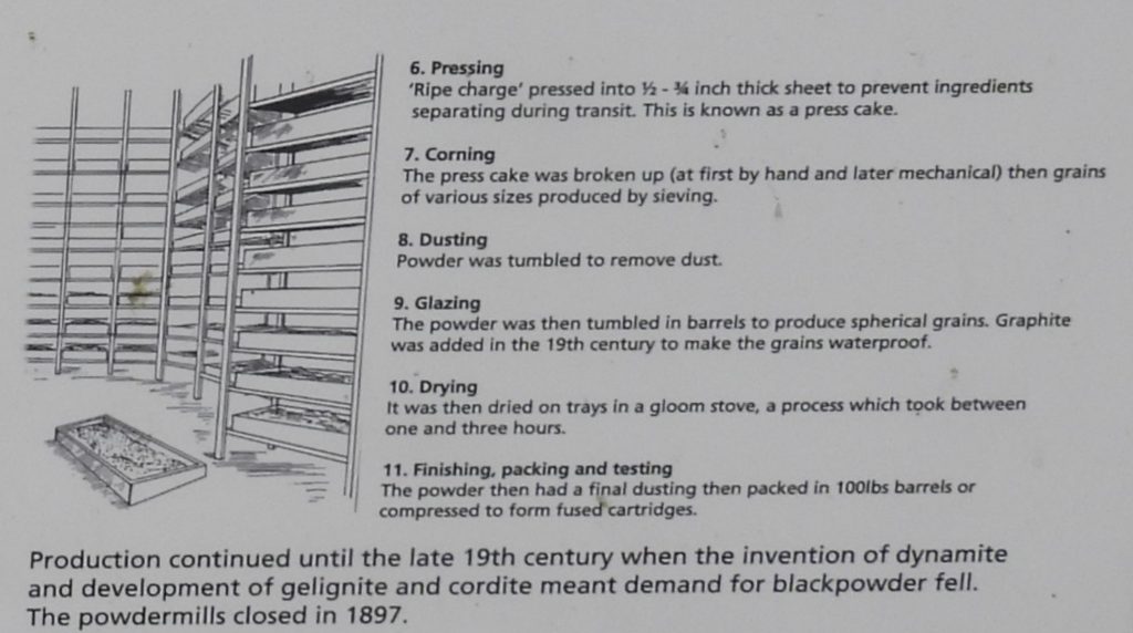
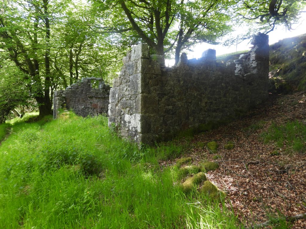
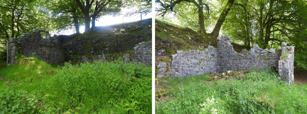
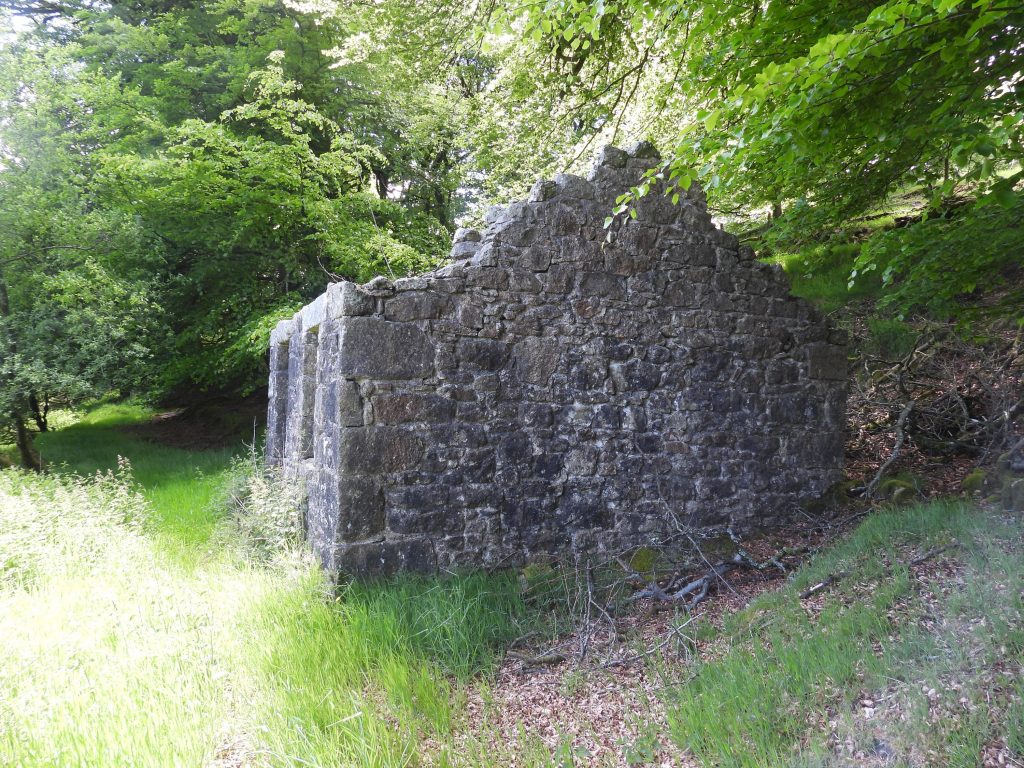
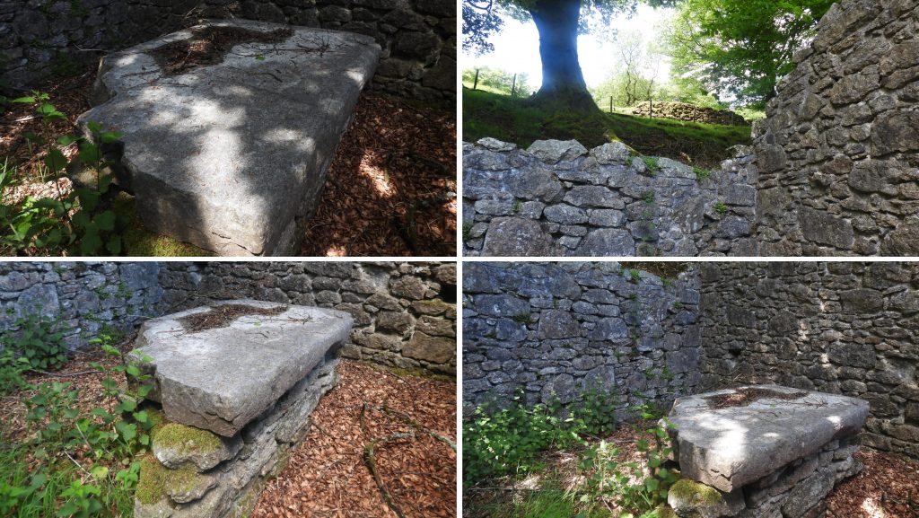
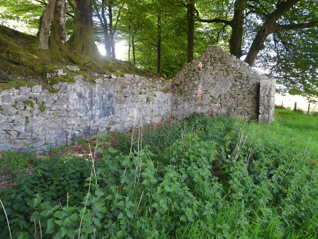
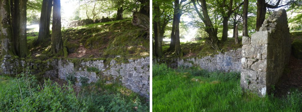
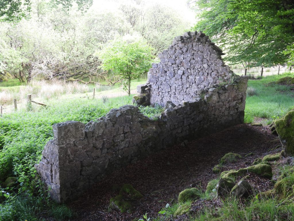
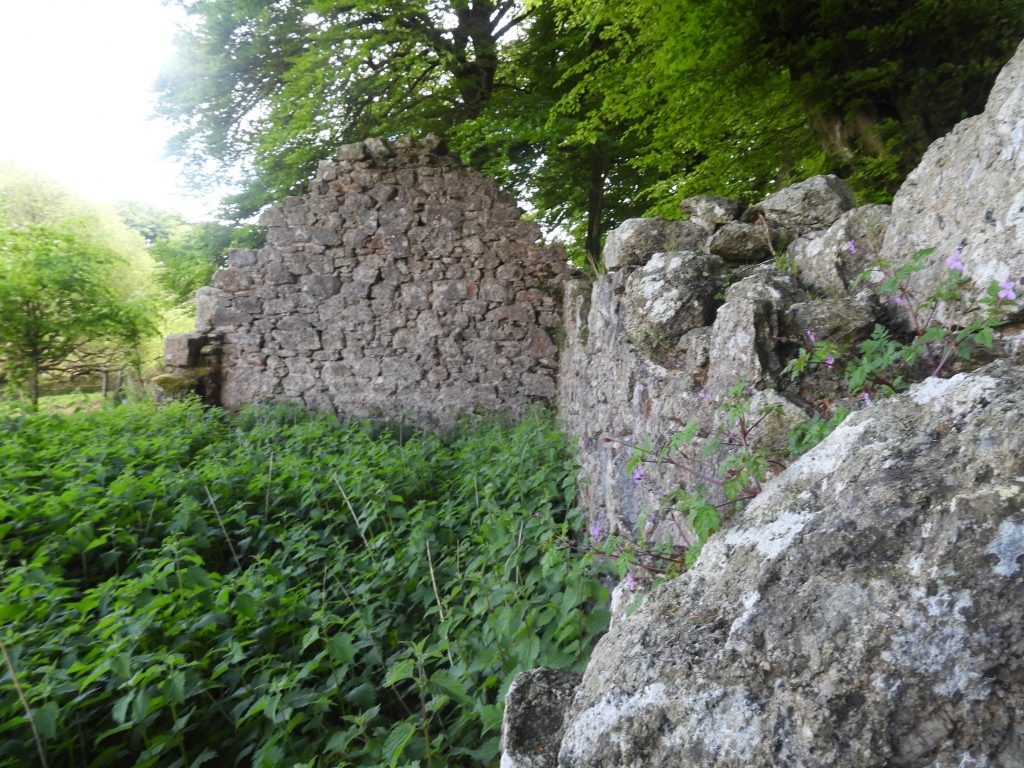
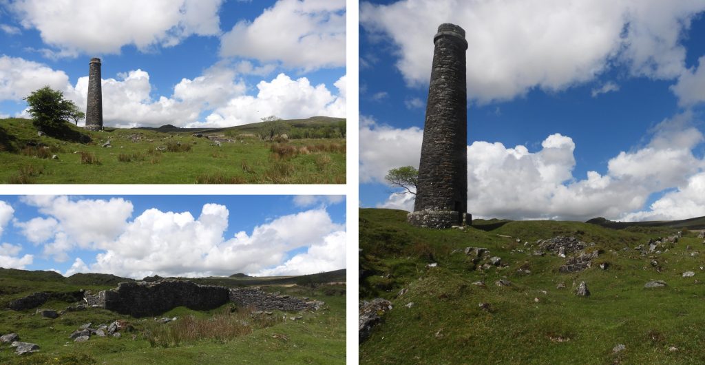
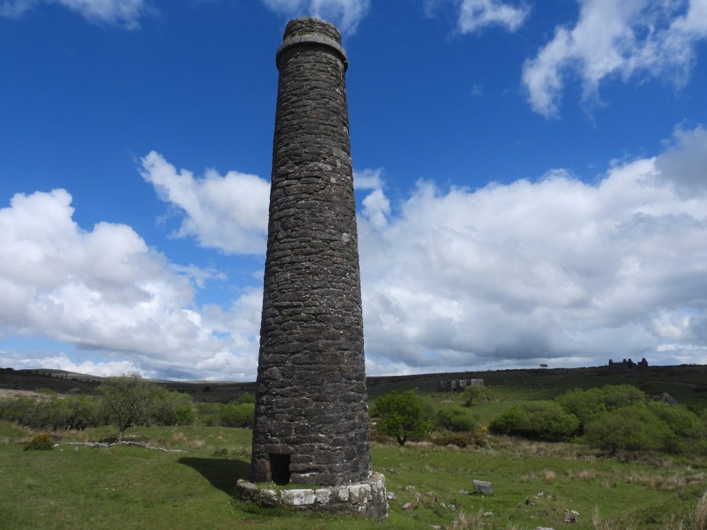
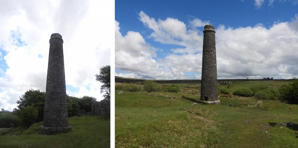
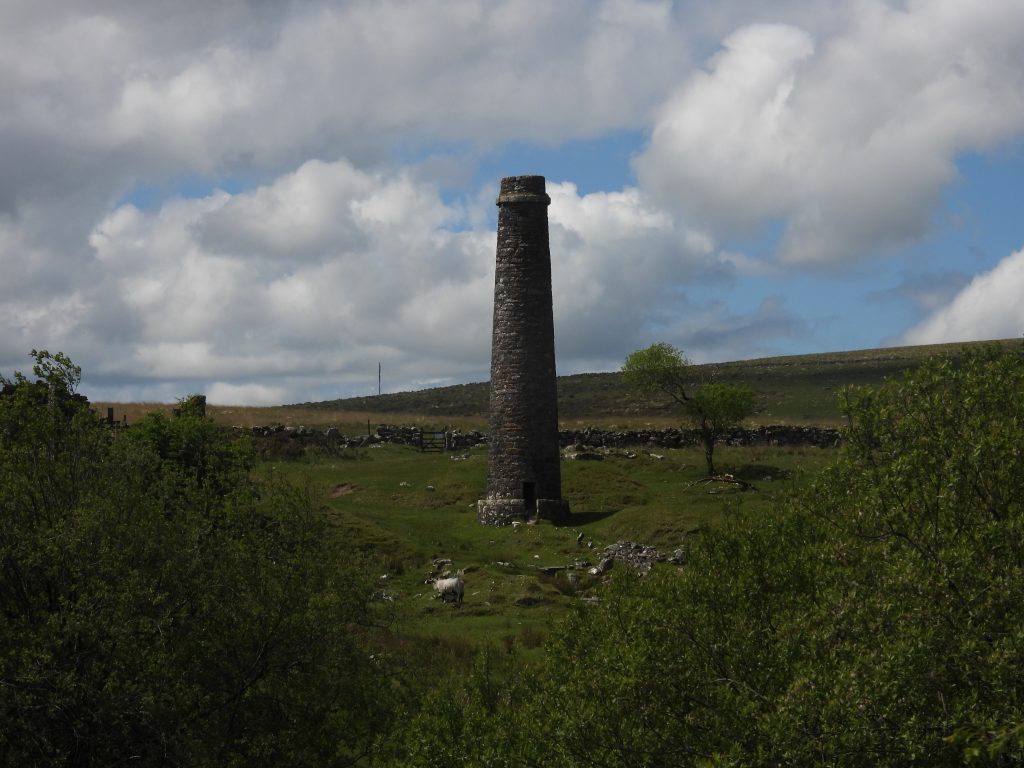
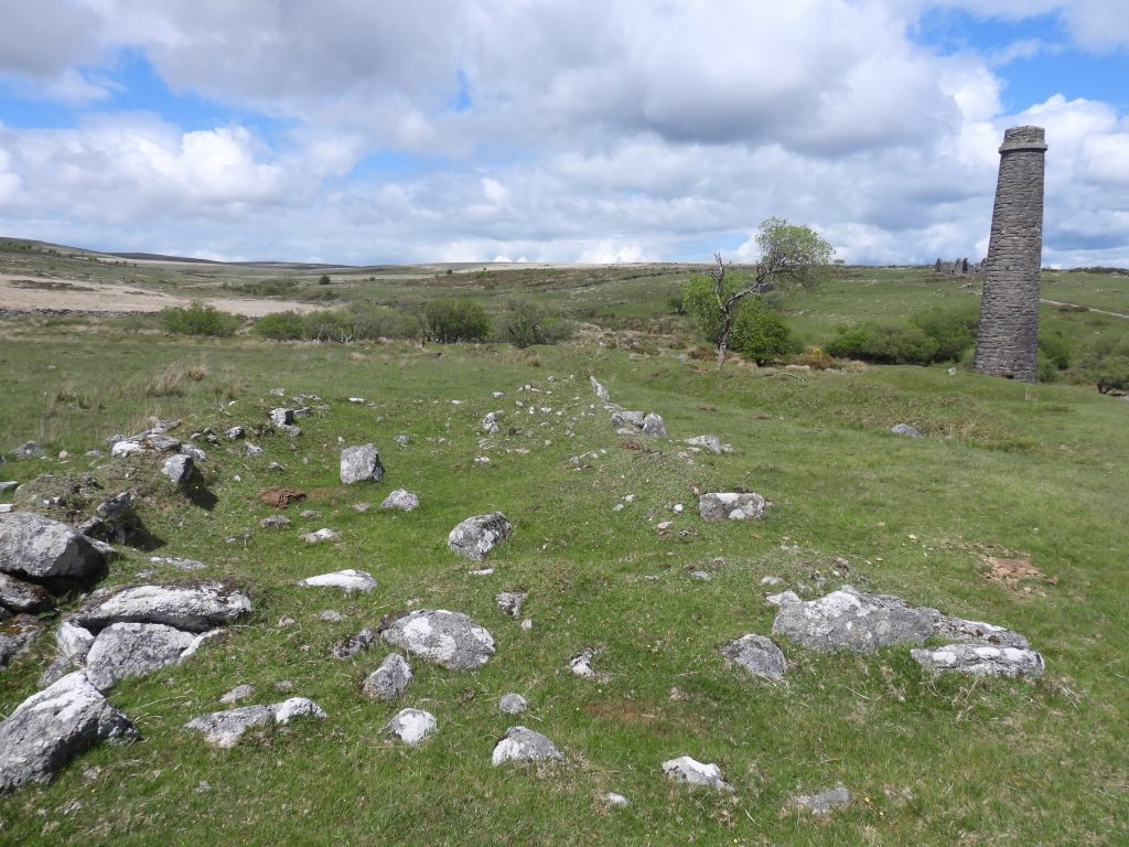
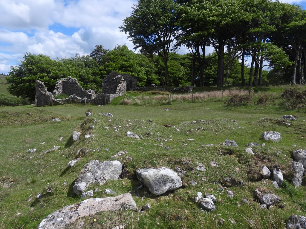
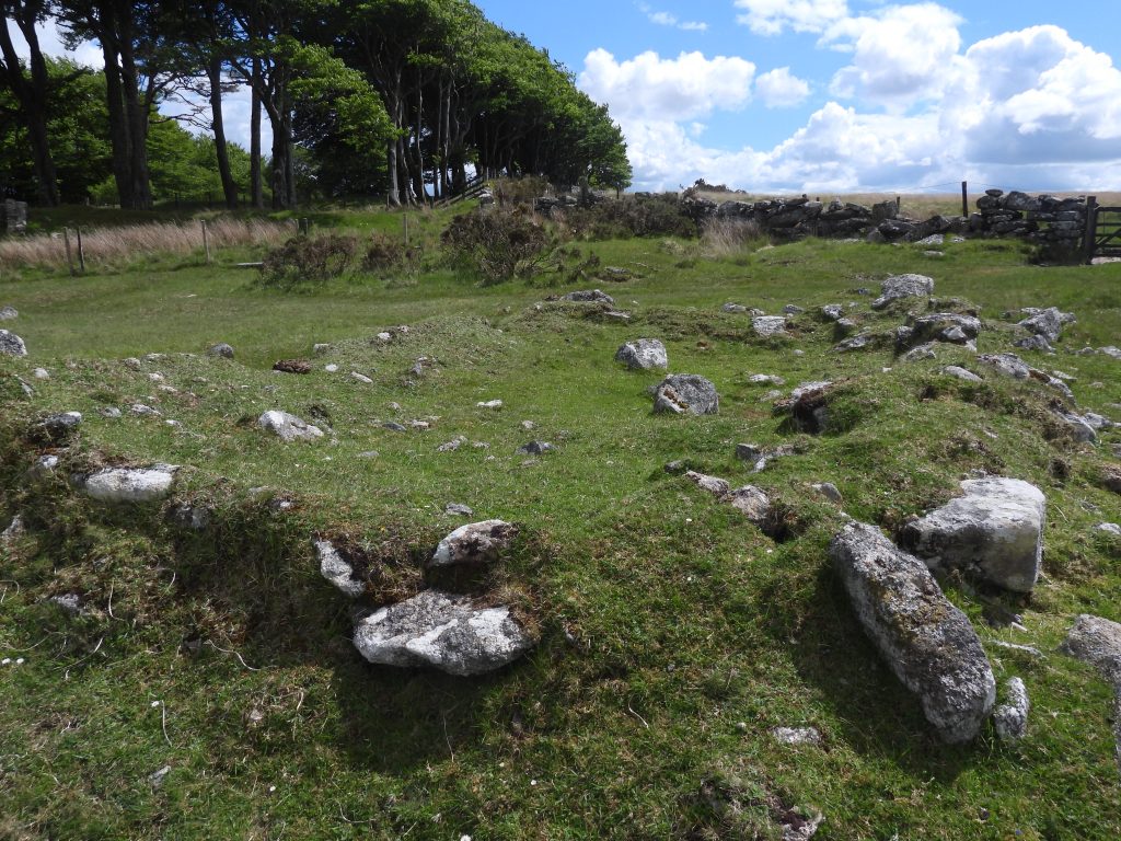
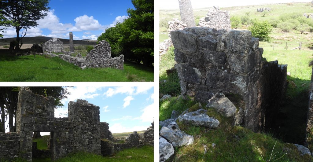
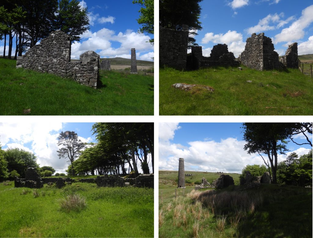
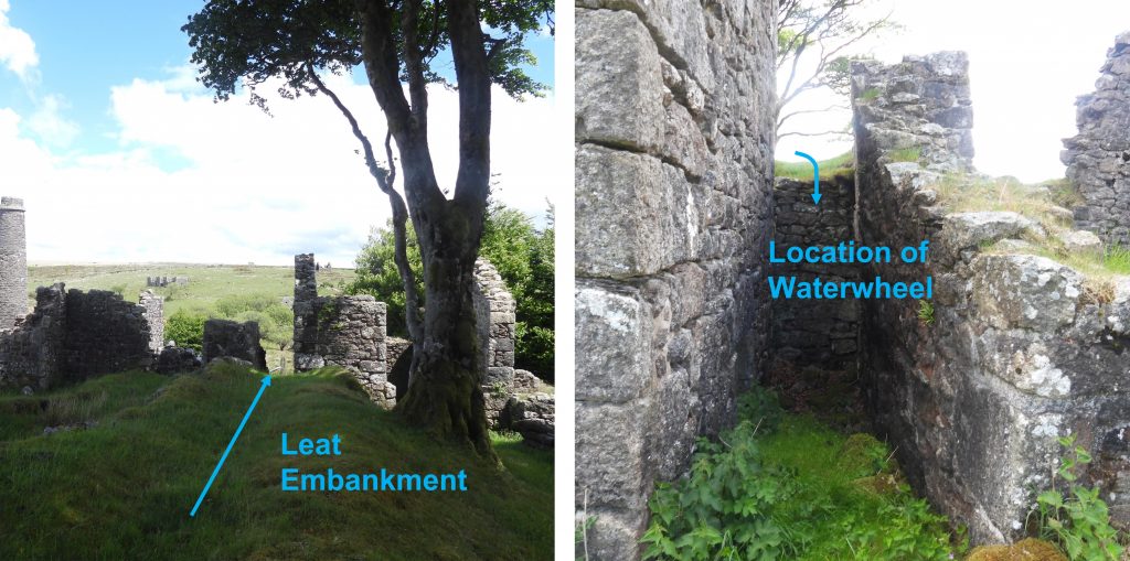
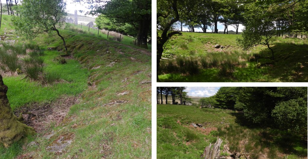
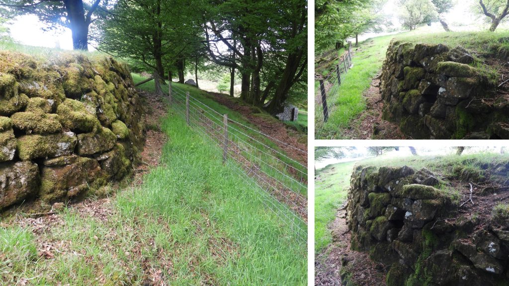
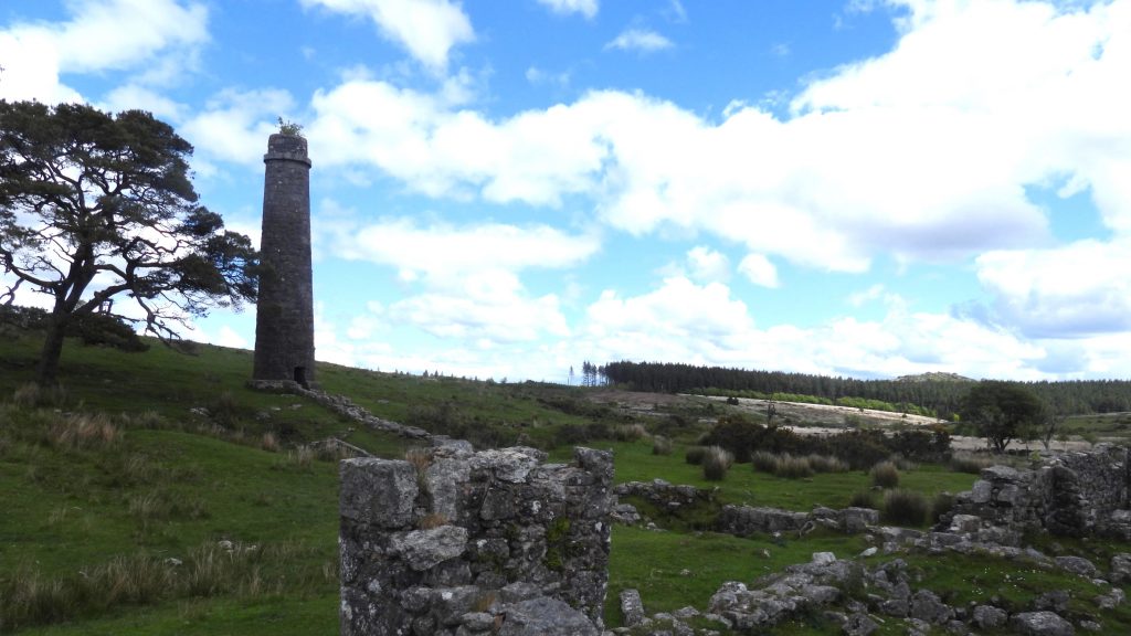
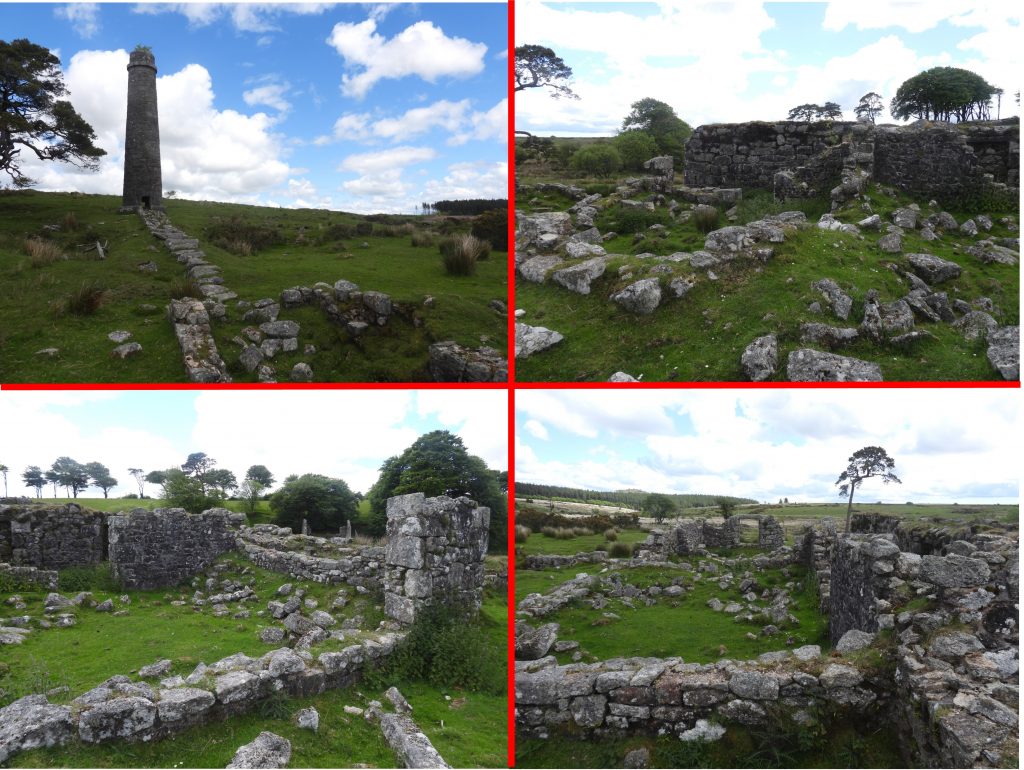
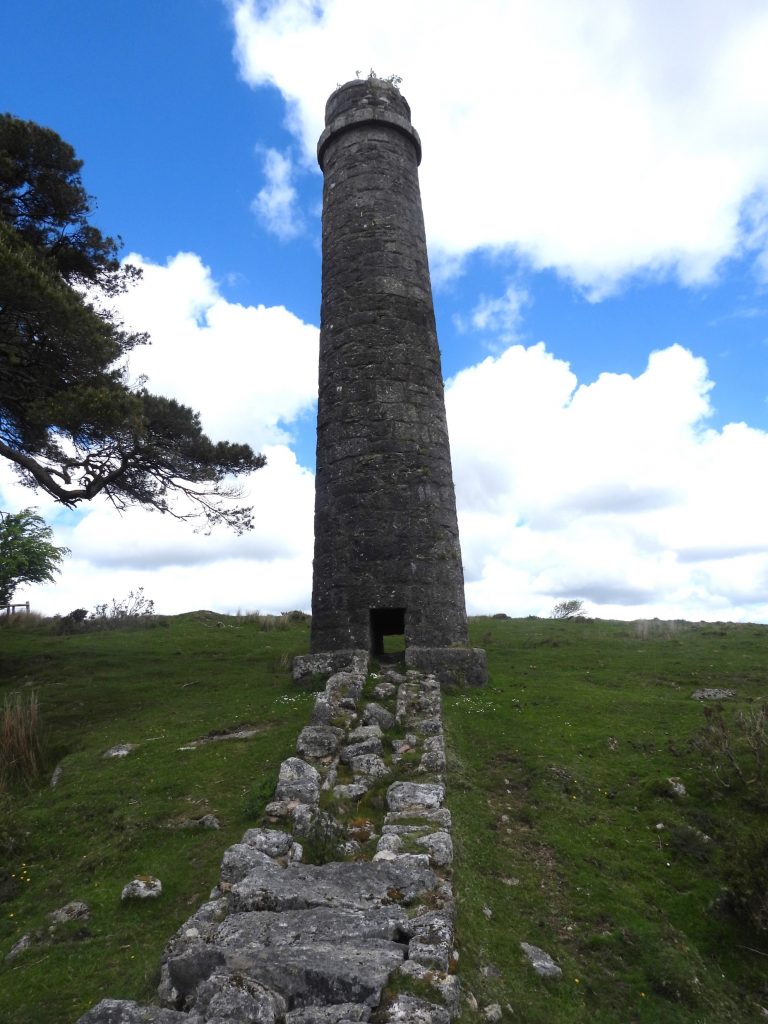
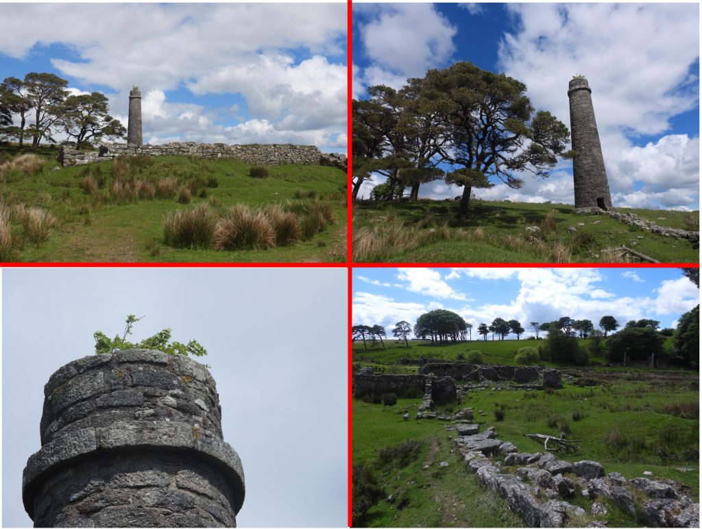
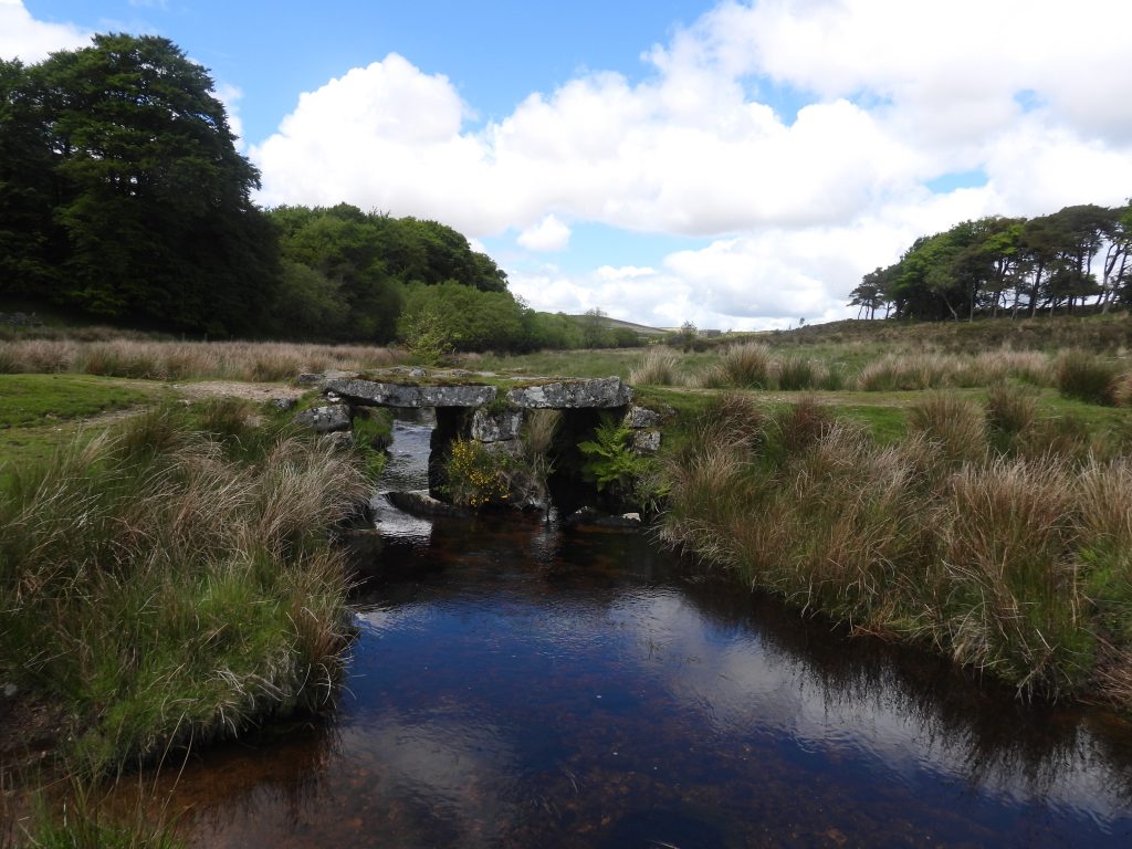
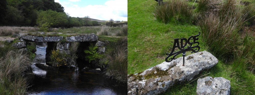
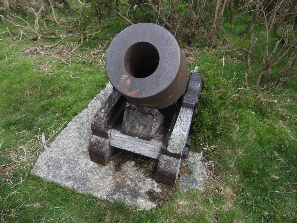
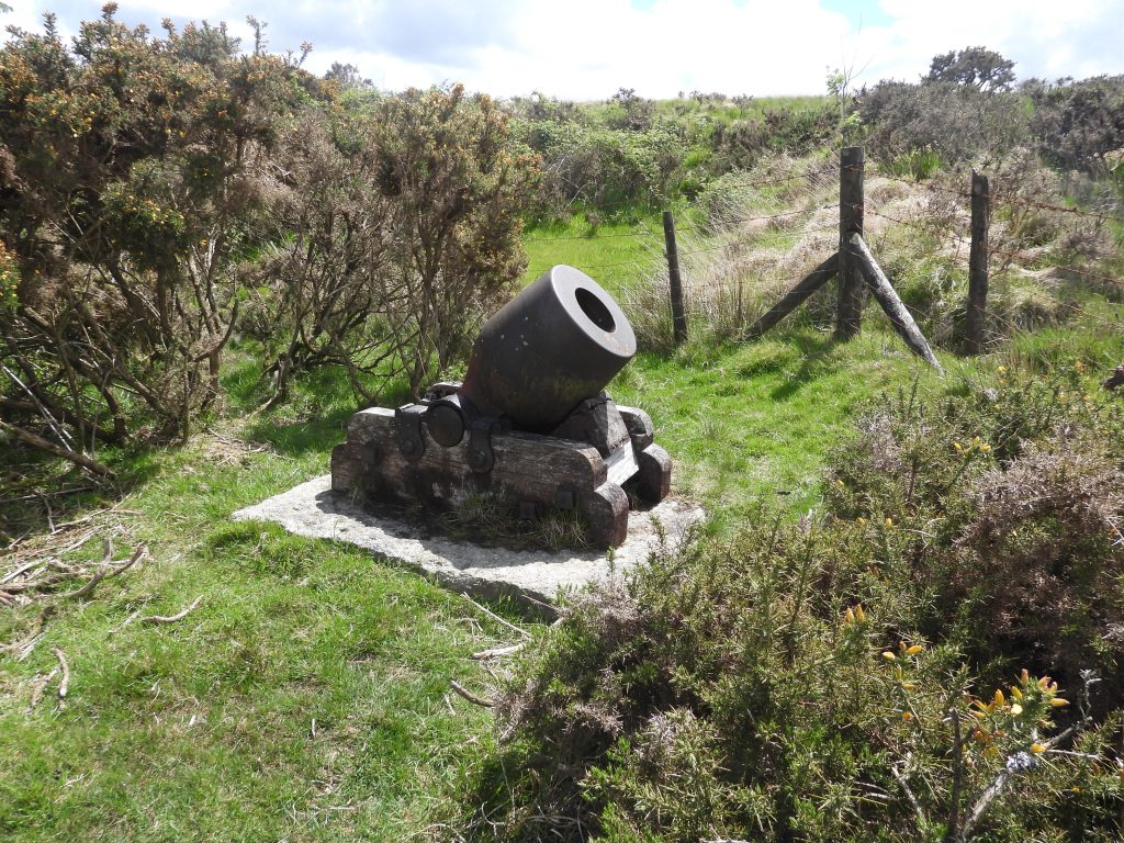
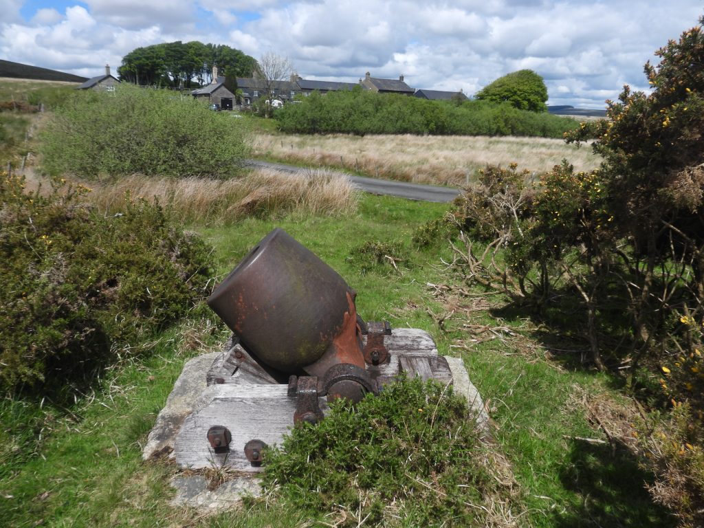
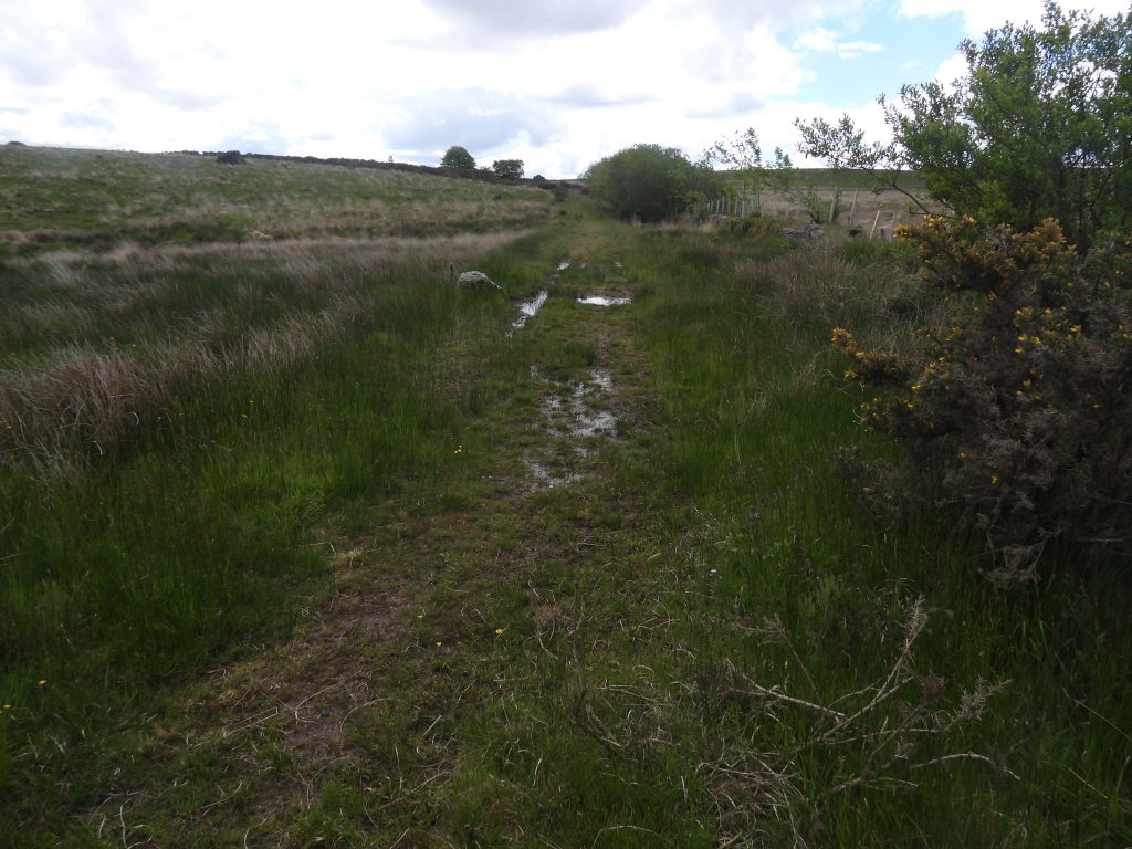
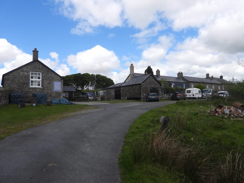
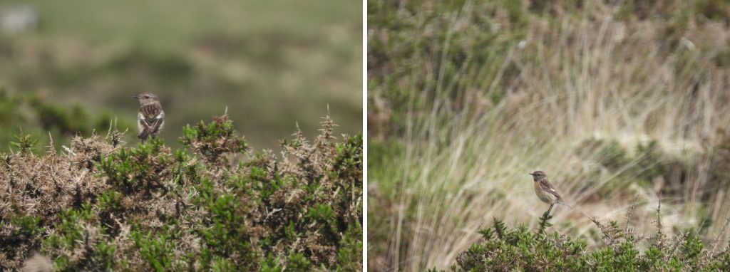
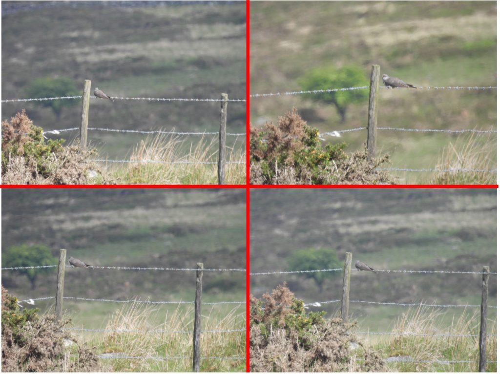
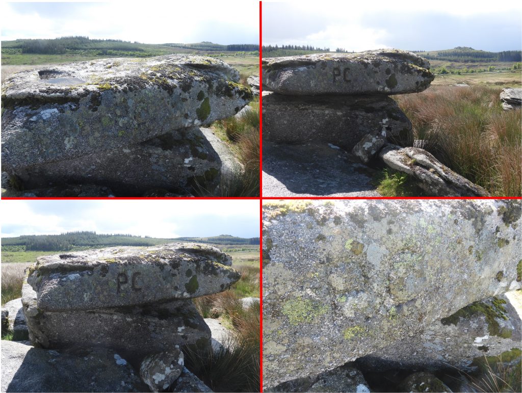
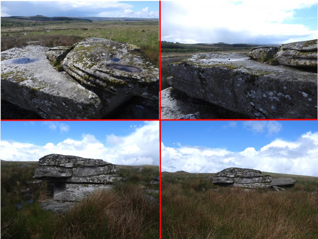
The layout of the Powder Mills site as interpreted by the author using a combination of the simplified plan from the Drew Campbell publication and the plan shown on the Legendary Dartmoor website. This post covers all the shown features plus some additional ones recorded following the dry leat feed from the East Dart to Reservoir (1). There is a conflicting numbering system of the buildings between the Drew Campbell publication, the dartmoor HER and the Legendary Dartmoor website. For this reason the author has not (pre-fix) numbered each building.History of the Powder Mills site as recorded on an information panel on site next to Incorporating Mill (1).Using the publication ‘Powder Mills – The Story of the Dartmoor gunpowder factory’ by Drew Campbell as a key reference in this post, the author has interpreted the production process (by building) as shown in the above diagram. This post records the site feature-by-feature following the process flow shown in the diagramThe Checking House is the most southerly building in the Powder Mills complex. The building was used to “check” workers into the site to ensure they didn’t have anything which would cause a spark (e.g Hob Nail Boots) and thus be a safety hazard. (Ref: Campbell)The Checking House originally had two doorways at each end of east wall, of which the southern one has been blocked. There was likely to have been a “signing in” process here and it may have also served as a changing area. (Ref: Campbell). The Dartmoor HER suggest this could have been and office or a store.The Watch House is a long rectangular single-storey building aligned north to south. It appears to have an extension at the south end. The Dartmoor HER records this building as being a possible saltpetre crystallising house. The Drew Campbell publication records this building as being used as the location where the movements of incoming raw materials and outgoing gunpowder was checked. Furthermore, materials might have been stored here. The Watch House was the location where the site was supervised. The southern part of the structure is believed to have been a cartshed, where items like hand barrows would have been stored. The southern extension may also have been used at one time as a waiting room / safe space for workers (Ref. Campbell)View of the Watch House from across the Cherrybrook, with the Checking House in the top right of the photograph amongst the trees. The ironwork “ADGE” next to the Cherrybrook is a memorial.This simple building is believed to have been a store or mixing house as it doesn’t appear to have had any windows. The Store has three walls remaining with the south end gable being the one that has survived the best over the years.The first part of the gunpowder manufacturing process as portrayed on an information panel next to Incorporating Mill (1). The Preparation Rooms were where the ingredients for making gunpowder were initially ground (milled), measured / mixed and blended. There were two wheelpits / wheelhouses associated with this building. These rooms were used for processes 2, 3 and 4 as shown on the site panel next to Incorporating Mill (1) and recorded on this post in the previous photograph.The Preparation Rooms at the south end were used to grind down sulphur and charcoal.The south part of the Preparation Rooms had its own waterwheel and the wheelpit / wheelhouse is easily interpreted. The section between the south and north ends of the Preparation Rooms was used to store , sieve and weigh the powder.The north portion of the Preparation Rooms where the mixture was put into barrels and churned into what was known as ‘Green Charge’. It is from this point onwards the production process starts to become dangerous. The ‘Green Charge’ was transferred to one of the three Incorporating Mills (via one of the three charge magazines, which are also known as expense magazines)The north part of the Preparation Rooms had its own waterwheel and the wheelhouse is easily interpreted. The next part of the story relates to the high moor where the supply of water for needed for the three very large waterwheels associated with the Incorporating Mills.It is thought that the Powder Mills site was originally designed so most buildings were located on the west bank of the Cherrybrook. That said, there was never enough water from the Cherrybrook alone to support all the waterwheels (at least 7) on the Powder Mills site, so the three Incorporating Mills had to be built on the north east corner of the site and additional water was sourced from the East Dart. The leat from the East Dart can be traced close to the point where the river changes from north/south orientation to a west/east orientation near the Beehive Hut.The Powder Mills Leat is around 5km long and only drops around 9m along its whole length. From the source, the leat runs through the East Dart valley before it begins to curve to the south west crossing Braddon Lake.The leat then crosses Chittaford Brook before running around the north east flank of Chittaford Down (see picture)There is a clapper bridge over the now dry leat on Chittaford Down.After leaving Chittaford Down the leat enters the enclosures of ArchertonNear to the Powder Mills Leat on Chittaford Down is a lovely example of a Cairn / Cist. It is recorded on the Dartmoor HER as follows: “The cairn is 8 metres diameter by 0.6 metres high with edge set stones denoting the survival of a kerb. The cist is 1.3 metres long, 0.5 metres wide and up to 0.65 metres deep”. The cairn was partially excavated by the Dartmoor Exploration Committee in 1900 and this work revealed a pit below the cist containing charcoal and a flint flake.Clapper Bridge over the Powder Mills Leat just before the leat enters the Powder Mills site from the north east. The clapper bridge is located at SX63027 77625After 5km, the water from the Powder Mills leat was temporarily stored in a reservoir (labelled no. 1 on the site plan). General views of Reservoir (1)Water course along a leat embankment from Reservoir (1) to Incorporating Mill (1)After the Archerton enclosures the leat course ran close (east) to Arch Tor. The water entered Reservoir (1) through a drystone wallReservoir (1) was supplied by two leats. The first leat was from the East Dart and also water was taken from the Cherrybrook. The leat is still discernible from Cherrybrook to Reservoir (1). The photograph shows the leat looking west with Longaford and Higher White Tors in the distanceThe Cherrybrook leat to Reservoir (1) – looking east with Bellever Tor in the distance (just above the plantation). The Legendary Dartmoor website records: “….in 1848, Frean was summoned to the Duchy to explain why he had leated water from the Cherrybrook without official permission”. Various views of the East Dart and Cherrybrook leats and Reservoir (1)A closer view of the water course along a leat embankment from Reservoir (1) to Incorporating Mill (1)Incorporating Mill (1). It is the most elevated of the three mills on site and would have received the ‘Green Charge’ via Charge Magazine (1). Incorporating Mill (1) is the location where an information panel is located (shown in previous photographs of this post)Incorporating Mill (1) was where water was added to the ‘Green Charge” and further milling took place. This was a dangerous part of the process, especially when the water driven machines were stopped and started.On the walls of Incorporating Mill (1) are drips of tar, which was part of the waterproofing process for the canvas roofAn over shot waterwheel provided power for the Incorporating Mill grinding process. The picture is over the wheelhouse at Incorporating Mill (1). Water for the overshot water wheel at Incorporating Mill (1) came from Reservoir (1), whose sources as previously indicated came from the East Dart and the CherrybrookInside Incorporating Mill (1) there is still evidence of where the grinding machines would have stood on a granite plinthThe water used by Incorporating Mill (1) was recycled and a leat run off (tail race) can be traced.The picture shows the remains of a bypass leat for Incorporating Mill (1), which would have supplied water to Incorporating Mill (2) via Reservoir (2).A small depression uphill (north-east) from Incorporating Mill (2) was once a small reservoir (labelled No.2 on the map). The reservoir was effectively a “junction” of water inflows and outflows, which was in the main was to supply water to the waterwheel at Incorporating Mill (2)Reservoir (2) received water from the Cherry Brook, Reservoir (1) and from the outflow from Incorporating Mill 1. The water then was fed by a leat embankment to Incorporating Mill 2. There appears to have been an “overflow” channel which fed excess water back to the Cherry Brook.The depression of Reservoir (2) can be difficult to (initially) discernClapper (1) over the overflow leat from Incorporating Mill 1 which fed Incorporating Mill 2 via Reservoir (2). Incorporating Mill 1 can be seen in the background. Charge Magazine (1), also known as an Expense Magazine with Incorporating Mill (1) in the background. This was a store for gunpowder before (Green Charge) and after (Ripe Charge) it was worked in the Incorporating Mills. Charge Magazine (1) as with the others on site was kept separate from the other buildings as a safety precaution. The ‘Ripe’ charge was transported from here back down the hill to the Press House (which was the building to the north of the Preparation Rooms) to continue the process.Incorporating Mill (2) with its Leat Embankment from Reservoir (2). Great views of Longaford Tor and Higher White Tor can be had from here.Incorporating Mill (2) was semi-built into the slope of the hillInside Incoporating Mill (2) with various shaped blocks still insitu which would have housed the grinding machines.The wheelhouse of Incorporating Mill (2). The bottom right picture shows a nest (from species unknown) – the down feathers of the young can just about be made outThe tail race of Incorporating Mill (2) includes a short tunnel from where water was recycled onto Incorporating Mill (3).Overlooking Incorporating Mill (2) tail race. Incorporating Mill (3) and Chimney (1) of the Drying House can be seen in this picture.The deep leat run off between Incorporating Mill (2) leading to Incorporating Mill (3)Leat direction down the slope between Incorporating Mills 2 and 3The remains of Charge Magazine (2). As previously described, this was a store for gunpowder before (Green Charge) and after (Ripe Charge) it was worked in the Incorporating Mills. Charge Magazine (2) – aka Expense Magazine is located next to the track leading down to the clapper bridge which crosses the Cherrybrook to link to the rest of the Powder Mills site.View of Charge Magazine (2) and the Incorporating Mill (2) with Longaford Tor and Higher White Tor beyondThere are said to be at least 3 quarries on site. This particular quarry is located between Charge Magazine (2) and Charge Magazine (3)More views of the quarry, which probably provided some of the stone used in the construction of the buildings on site. The quarry and others on site do not look big enough to have supplied all the stone for the site.Incorporating Mill (3) with leat intake shown. The Drying House chimney is shown in the backgroundIncorporating Mill (3) like the previous two had an overshot water wheel. Incorporating Mill (3) like number 2 was built into the hillsideLocation of where the grinding machines would have been in Incorporating Mill (3)General views of Incorporating Mil (3), where there is residual water in the wheelhouseIncorporating Mill (3) water tail race. The water would have been discharged into the Cherrybrook having been used by the three mills.Charge Magazine (3) is located downhill from Incorporating Mill (3) near to the clapper which crosses the CherrybrookGeneral views of Charge Magazine (3) is about 50m from Incorporating Mill (3) to which it is connected by an embanked track. This building is slightly larger than the other two magazines (1 and 2) being approx 3 metres wide by 5 metres long.The clapper bridge (marked as number 2 on the map of this post) connected the Incorporating Mills and associated Charge Magazines with the rest of the site. The construction uses drill split slabs and posts laid across crude drystone abutments and piers.The second part of the gunpowder manufacturing process as portrayed on an information panel next to Incorporating Mill (1). These processes took place after the ‘Ripe Charge’ had been created by the Incorporating Mills.The ‘Ripe Charge’ was delivered to the Press HouseThe press utilised in this building was water powered. The process was to remove more moisture from the product. As indicated on the information panel, the ingredients were pressed into a half to three quart inch (12.7 mm to 19mm) thick sheet to prevent the ingredients from separating during transit. This was called ‘Press Cake’The wheelhouse of the Press House is located at the southern end of the building. Water was supplied by Reservoir (3) located to the north west, which was fed by the Cherrybrook.The building to the north of the Press House is the Breaking House. It was here that slabs of compressed gunpowder were cut up into various sizesThe “cutting table” (or at least part of a table) is still extant in the Breaking House. The limestone table is 20-25 centimetres thick and lies on a masonry base. The south western edge has been broken off. To the north of the Breaking House is the Corning House (or Glazing Mill).The powder was “tumbled” in the Corning House in barrels to make the grains spherical. Graphite was added in 19th century production to make the gunpowder waterproof. The corning House does not have an associated wheelhouse, so the tumbling of the barrels would have been done by hand. The processes here were called ‘dusting’ and ‘glazing’. There would have been some re-processing required as undersized gunpowder was returned to the Press House and oversized gunpowder returned to the Breaking House.This Store building is located to the north of the Corning House and on a small terrace cut into the hillside The Store Building is probably where the corns (sieved gunpowder) would have been stored ahead of the next stage in the process.Drying House. Here the gunpowder was heated and dried out prior to packing. There are up to 5 ruinous structures here as recorded in the Dartmoor HER (MDV43181). The drying House is believed to have used either a ‘Gloom Stove” or a ‘Steam Stove’. Note: A ‘Gloom Stove’ is one which provided warm air which came from a convex metal wall-plate directly heated by an external fire.The chimney associated with the Drying House is an iconic part of the site. Behind the chimney all the Incorporating Mills can be seen (note: number 3 mill is only just discernible behind the trees on the right of the picture).The Drying House chimney has been conserved and is in very good condition. There are two openings at the base for the intrepid explorer to crawl into an look up the chimneyDrying House Chimney looking west. The North Hessary mast can be seen on the skylineCharge Magazine (4) lies adjacent to the Drying House Chimney and the Final Preparation RoomsCharge Magazine (4) looing towards the Final Preparation Rooms. This building as with most of the others on site is still depicted on modern OS maps.The Charge Magazine (4) remains also lies close to a gate where the Lych Path enters more open moorland. The author can remember passing through here on a few occasions around 0100-0200 in the morning on the moorland traverse between Widecombe and Lydford.Final Preparation Rooms where it is believed that gunpowder was also dusted, glazed, sieved and packed before being loaded onto carts. That said, the Drew Campbell publication “Powdermills – The story of the Dartmoor gunpowder factory” does state that ‘experts’ agree that this set of rooms / structures are difficult to interpret.The Dartmoor HER (MDV43183) states that there are five elements centred associated with the Final Preparations Rooms which are centred around two mills which were powered by a central waterwheel fed by a leat off the Cherry Brook. The central wheel house of the Final Preparation Rooms. As with other large waterwheel (ie at the Incorporating Mills) this appears to have been an over shot wheel. The tailrace is discernible running north-east and join a leat supplying other buildings (ie Press House and Preparation Rooms).This long rectangular stone building at the Final Preparation Rooms has a small loft entrance in south gable and is speculated as being a probable store (for fuel, barrels, wood and other materials) or a stable. Reservoir (3) whose water was sourced from the Cherrybrook. The leat which fed this reservoir also ran behind (to the south) of the Final Preparation Rooms and fed its central waterwheelA leat which ran immediately below (east) of this reservoir (to feed the Press House and the Preparation Rooms waterwheels) was probably originally partially fed from this reservoir. The map shown on this post should make this look a bit clearer.This circular reservoir is partially terraced into the hillside and on its downslope side it is dammed by a quite impressive stone faced bank, which is at least 1.5m high.View of the three Incorporating Mills, taken from the Drying HouseOn the East banks of the Cherrybrook towards the southern part of the site is a complex of buildings (Stoving House) and a chimney. the Drew Campbell publication “Powdermills – The story of the Dartmoor gunpowder factory” suggests that opinion differs as to what went on here. One theory is that if charcoal was made on site, it would have been at this location. It has also been suggested that ready made charcoal was brought in and this complex was used for processing and storing saltpetre.In the Dartmoor HER a record by Andrew Pye and R. Robinson 1990, An Archaeological Survey of the Gunpowder Factory at Powdermills Farm, (Ref: SDV254157) suggests that this complex comprises three phases of development, namely: Phase 1: a two-room single-storey structure for probable storage or industrial process. Phase 2: Addition of Units with a flue implying a process involving heat. Main flue and chimney probably belong to this phase. Phase 3: Various portion of units added and earthen mounds were heaped against several of the walls. The three phases indicate that the function of the building probably altered over the period of production. The flue to the chimney (2) is around 1 metre deep. Its eastern portion is open and rubble-filled, but the western portion is still capped. The flue enters the base of a chimney set on a plinth. The chimney is over 10 metres high and has been been conserved.Various views of the Stoving House and Chimney (2)Stoving House and Chimney (2) looking south east. Bellever forest can be seen in the background.Clapper (3) across the Cherrybrook connects the main site with the Stoving House and ChimneyNear to clapper (3) is a metal sign “ADGE”. The sign is in memory of Mike Steer who passed away in 2021 and permission was granted the sign at this location SX62858 77115Next to the driveway near to Powder Mills Cottages lies a rather splendid example of a “proving mortar”, which was used to check the efficiency of the gunpowder. This was a large mortar which would fire a 68lb shot over a measured distance, the calibration distance travelled would then indicate the strength of the powder. This large mortar would fire a 68lb (30.8kg) shot and the distance was measured distance. The distance travelled indicating the strength of the powder. There is a lovely story on the Legendary Dartmoor website which states: “During WWII the site (Powder Mills) was occupied by around 3,000 American troops who used it as a training camp prior to the D-Day landings. There is one story which suggests that some enterprising soldiers decided that the proving mortar may come in useful in the forthcoming engagements and stole it. Fortunately it was spotted at Plymouth docks about to be loaded onto a ship and was rescued and returned to the mills”.One of the original tracks which lead to Powder Mills which meets up with the main road (Two Bridges – Postbridge) further west that the modern tarmac driveway.View of what are now collectively known as Powdermills Cottages. On 19th century maps these are labelled as Powder Mills Farmstead with four buildings which included a Cooperage, a Manager’s House with a garden at the front and a range of cottages to the west. Today, the properties include a pottery and a bunkhouse. An interesting entry in the publication by Mary Stanbrook, 1991, Old Dartmoor Schools Remembered, is that : “Some time after the opening in 1844 (of the Gunpowder Factory), the owners provided a chapel which doubled as a school for the community at Powder Mills. It is believed to have been the small building on the left (west) of the houses, and was recently a forge. It is known that 8 children were entered at Postbridge school in 1880, but the Mills school may have been closed earlier”.Whilst the author was on site and following the leat from the East Dart a number of bird sightings were made. Cuckoo on fence close to Reservoir (1)Arch Tor. Below this tor the leat from the East Dart ran onto the Powder Mills site. The “PC” inscribed on the tor is thought to mean “Powder Mills Cottages” but this hasn’t been 100% verified.More views of Arch Tor
A couple of papers in the Transactions of the Devonshire Association describe the process at Dartmoor Powdermills and assign functions to each of the buildings.
Ashford, B. “Some thoughts on Dartmoor Powdermills”,
Volume 146, 2014, pp. 57–82
This paper presents a reassessment of the Dartmoor Powdermills plant both as a business and as an historic industrial site. In Devon, gunpowder was only used for quarrying and mining, so only blasting powder was made. The design and process technology for the plant probably came from the Fox and Perran Foundry in Cornwall and would have been of a typically Cornish design. It is proposed that sodium nitrate (from Peru), rather than potassium nitrate, was used in the gunpowder made at Powdermills. Arguments to support this theory are presented. The manufacturing process that would have been used is described and individual operations assigned to the different buildings.
Bob Ashford, “Further Thoughts on Dartmoor Powdermills”
Volume 149, 2017, pp. 37–46
Evidence has come to light that the charcoal used in the manufacture of gunpowder at Powdermills was not made on-site as previously thought, but at Plympton St Mary. It was supplied by the man who took over the company from the original owner. The allocation of manufacturing operations to the different buildings at Powdermills therefore needs correction. The building previously assigned to charcoal production is now believed to have been used for converting raw sodium nitrate into fine crystals suitable for blending directly with the other ingredients. This allows the charcoal and sulphur to have the exclusive use of two mills that form part of a second building. Other buildings and operations on the site are unaffected. An early photograph of the stoving house at Powdermills is included in this paper.


Bob Ashford September 1, 2024
A couple of papers in the Transactions of the Devonshire Association describe the process at Dartmoor Powdermills and assign functions to each of the buildings.
Ashford, B. “Some thoughts on Dartmoor Powdermills”,
Volume 146, 2014, pp. 57–82
This paper presents a reassessment of the Dartmoor Powdermills plant both as a business and as an historic industrial site. In Devon, gunpowder was only used for quarrying and mining, so only blasting powder was made. The design and process technology for the plant probably came from the Fox and Perran Foundry in Cornwall and would have been of a typically Cornish design. It is proposed that sodium nitrate (from Peru), rather than potassium nitrate, was used in the gunpowder made at Powdermills. Arguments to support this theory are presented. The manufacturing process that would have been used is described and individual operations assigned to the different buildings.
Bob Ashford, “Further Thoughts on Dartmoor Powdermills”
Volume 149, 2017, pp. 37–46
Evidence has come to light that the charcoal used in the manufacture of gunpowder at Powdermills was not made on-site as previously thought, but at Plympton St Mary. It was supplied by the man who took over the company from the original owner. The allocation of manufacturing operations to the different buildings at Powdermills therefore needs correction. The building previously assigned to charcoal production is now believed to have been used for converting raw sodium nitrate into fine crystals suitable for blending directly with the other ingredients. This allows the charcoal and sulphur to have the exclusive use of two mills that form part of a second building. Other buildings and operations on the site are unaffected. An early photograph of the stoving house at Powdermills is included in this paper.
SteveGriggDartmoor September 7, 2024 — Post author
Dear Bob,
Many thanks for this interesting additional information.
Kind Regards,
Dartmoor Explorations