A collection of walks, discoveries, insights and pictures of exploring Dartmoor National Park
November 18, 2020
PERAMBULATION OF THE FOREST OF DARTMOOR (WESTERN WELLA BROOK to WALLABROOK HEAD (NEAR KINGS OVEN))
Steve Grigg
The full Perambulation of the Forest of Dartmoor is around 50 miles. This post covers one leg (or around 20% of the route). The perambulation is being completed for the fourth time by the author as part of the 780th anniversary (1240-2020), having first completed it in 1990 (750th Anniversary). Each of the previous three perambulations were completed in a clockwise direction, this one being anti-clockwise.
The story of the Dartmoor Perambulation starts with King John in May 1204, when in a desperate attempt to raise funds for an army to for a war with King Phillip of France, he gave up his rights in Devon but retained the highlands of Dartmoor. It is believed it raised 5000 marks for the crown. In those times the term “forest” in this context was crown land, reserved for hunting comprised trees, turf and vegetation, where hunting would have included deer, hare, rabbit, pheasant, boar, wolf, fox, martin, partridge, quail, heron and mallard. The boundary was important as revenue could be derived from activities within the forest. King John failed (as with Saxon and Norman tradition) to order a “perambulation” to seal the boundary lines. However, in spite of this, it was not until his son, King Henry III came to the thrown that the first perambulation of Dartmoor was secured, this was in 1240. The perambulators completed their task on the 24th of July who were: William Brewer, Guy Breteville, William Wydeworthy, Hugo Bellay, Richard Gyppard, Odo Treverbyn, Henry the son of Henry, William Trenchard, Phillip Parrer, Nicholas Heamton, William Moreleghe and Durant the son of Boton.
The original 1240 perambulation was written in medieval latin and was subsequently open to interpretation for a few centuries. In 1608/9, a major attempt was made to clarify the boundary and later when OS mapped Dartmoor in 19th century, they relied on locals to define the boundary. Both these boundaries are shown in this post, however, the 1608/9 boundary is the one that most modern “perambulators” follow.
Note: The source of information for the above has been from: a) Dartmoor’s Greatest Walk by Bill Ransom (1987) – Devon Books, b) Dartmoor’s Greatest Long Distance Walk by Roland Ebdon (2016) – Halsgrove and c) Dartmoor Boundary Markers by Dave Brewer (2002) – Halsgrove
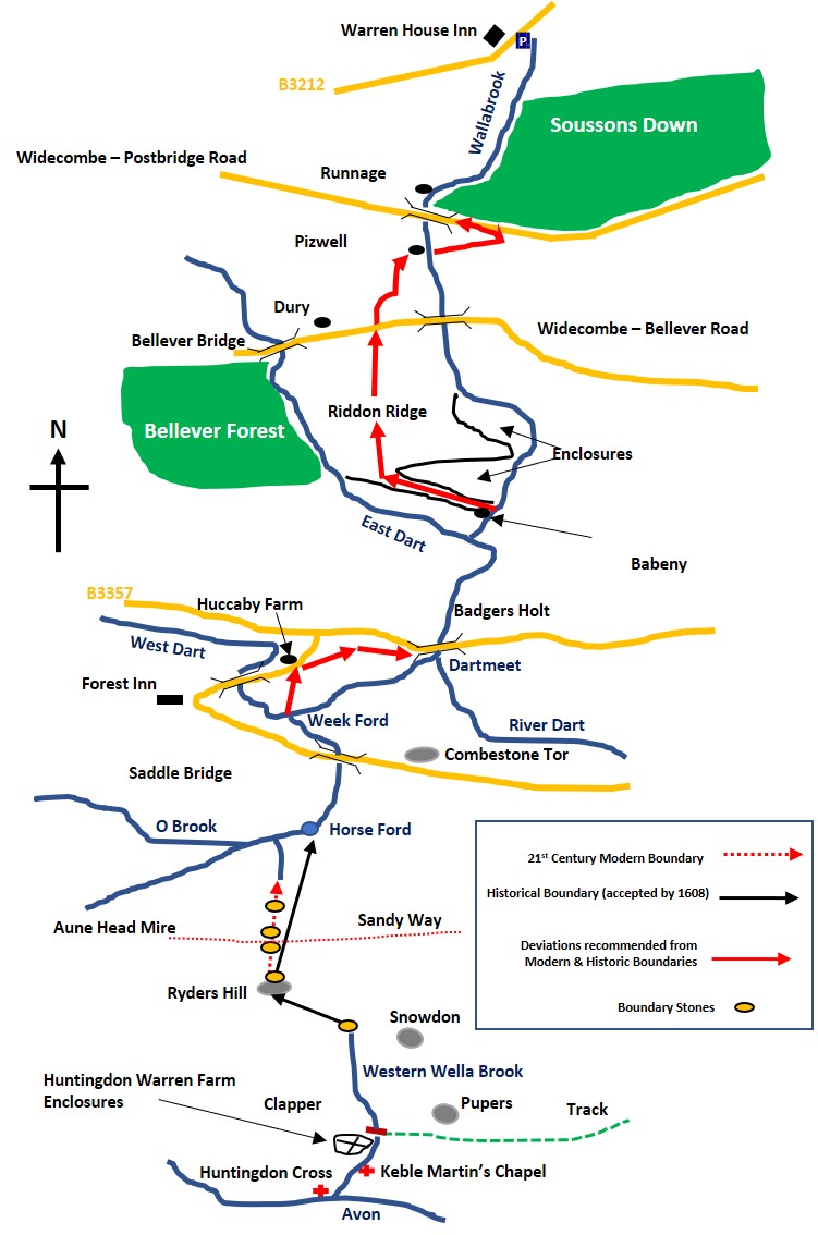
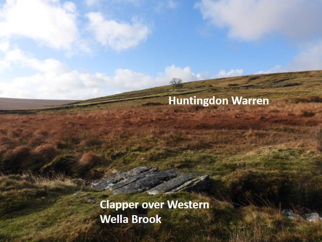
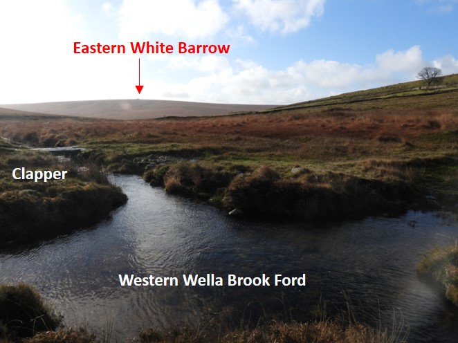
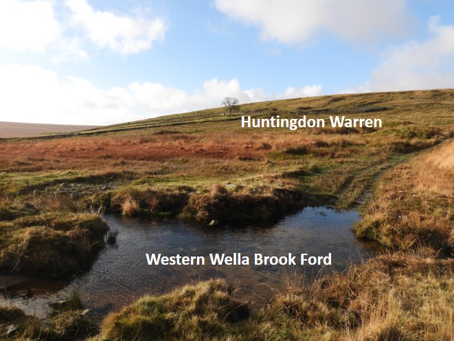
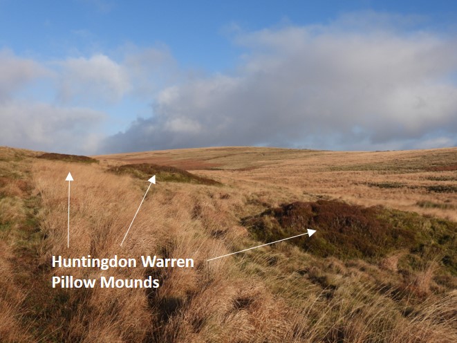
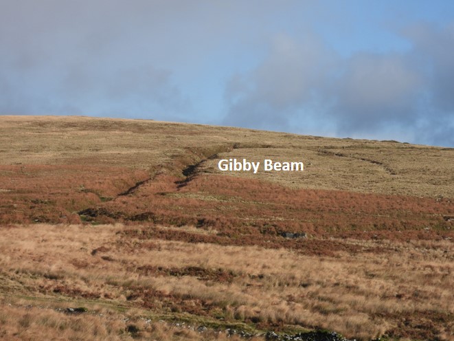
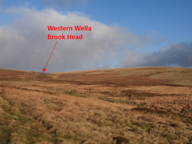
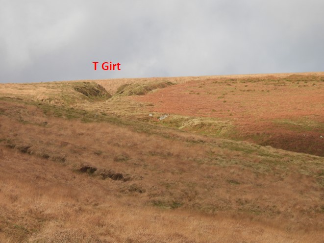
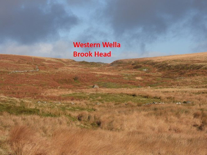
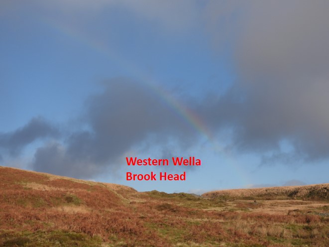
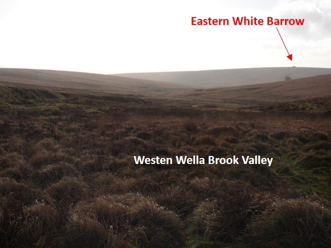
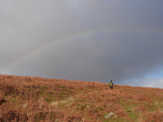
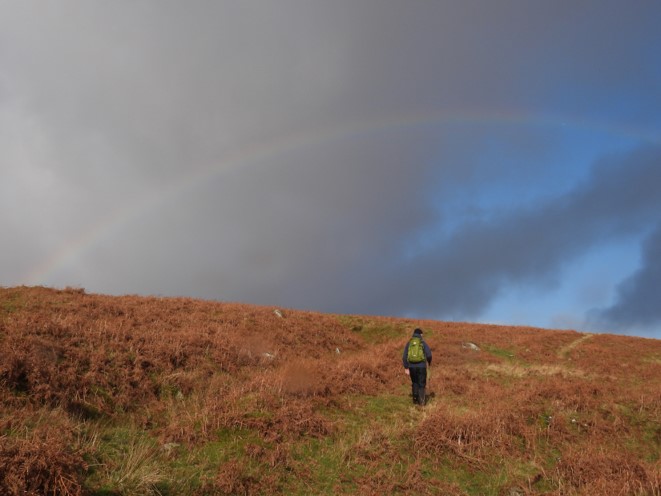
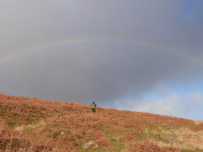
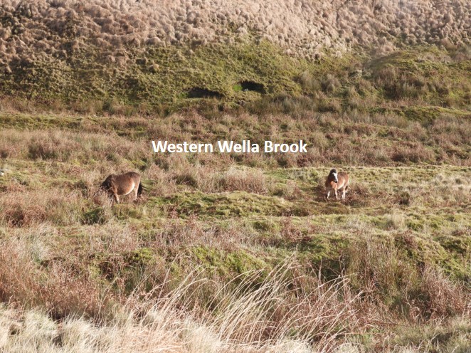
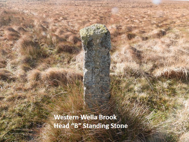
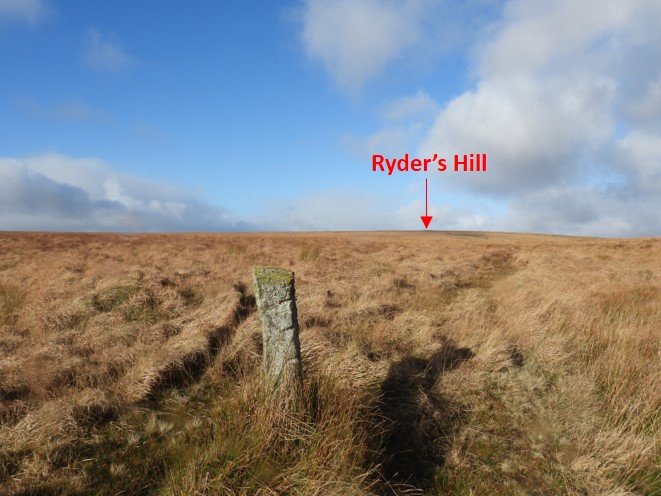
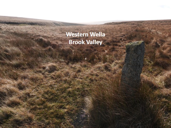
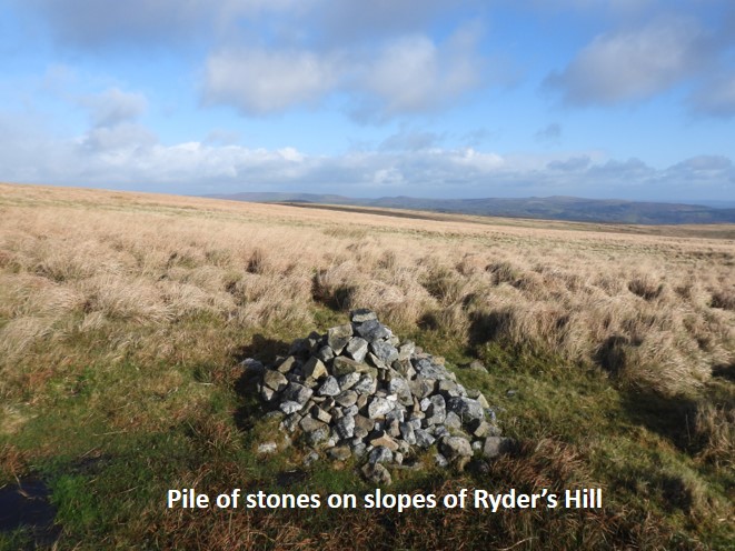
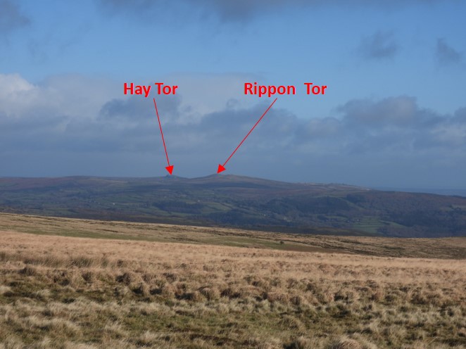
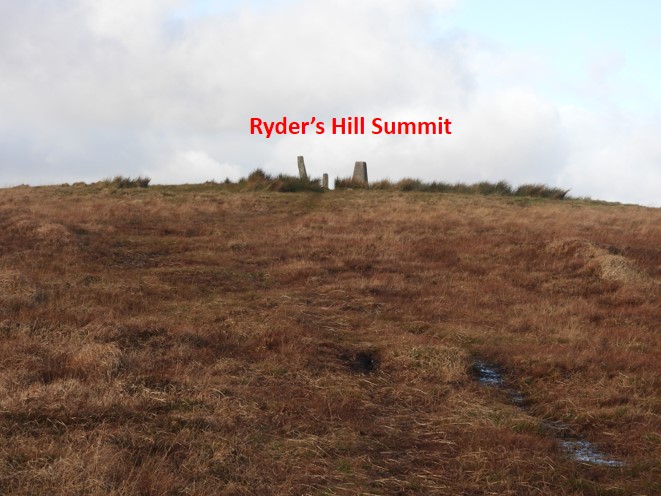
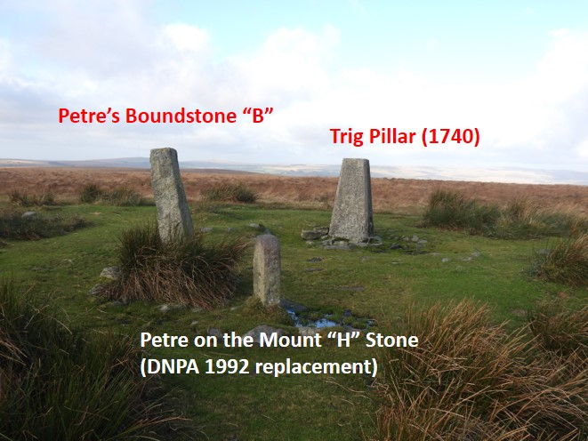
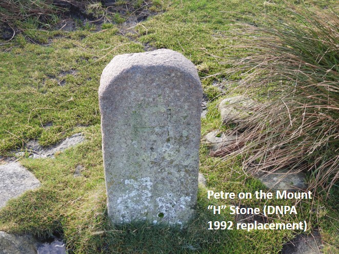
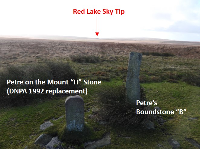
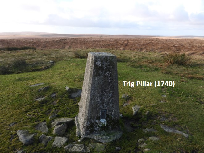
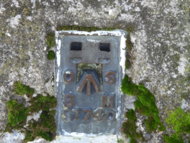
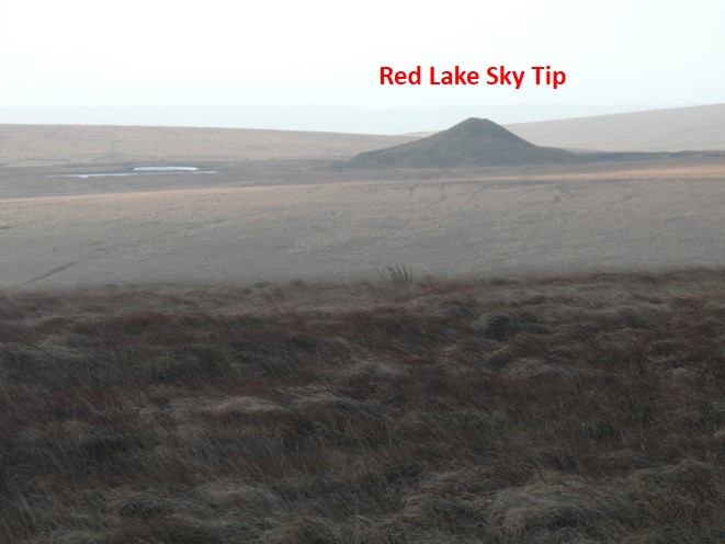
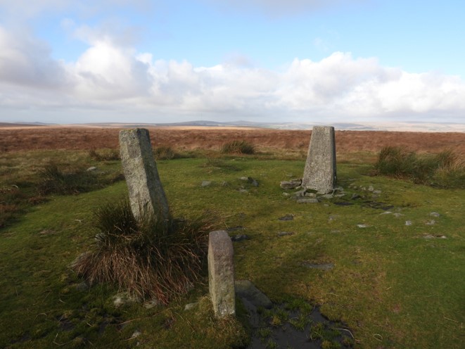
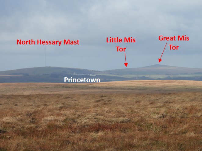
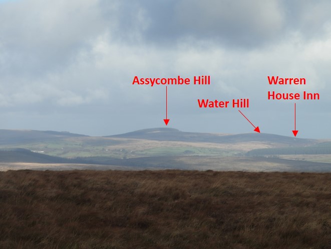
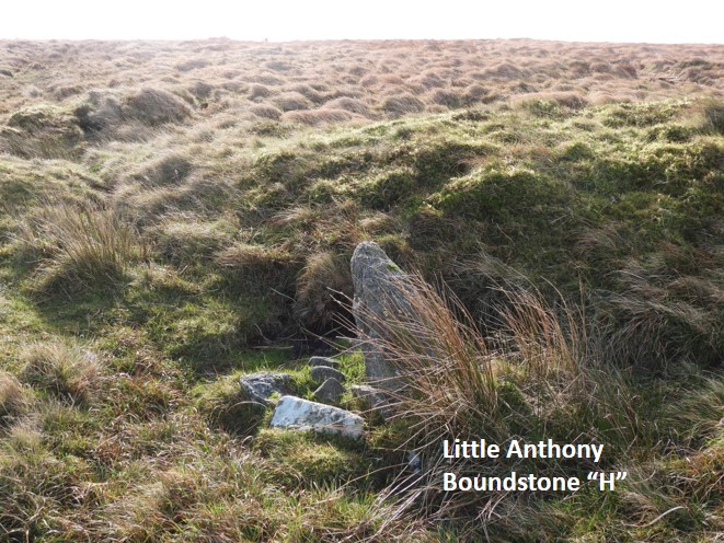
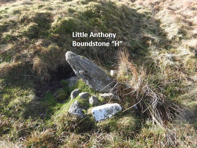
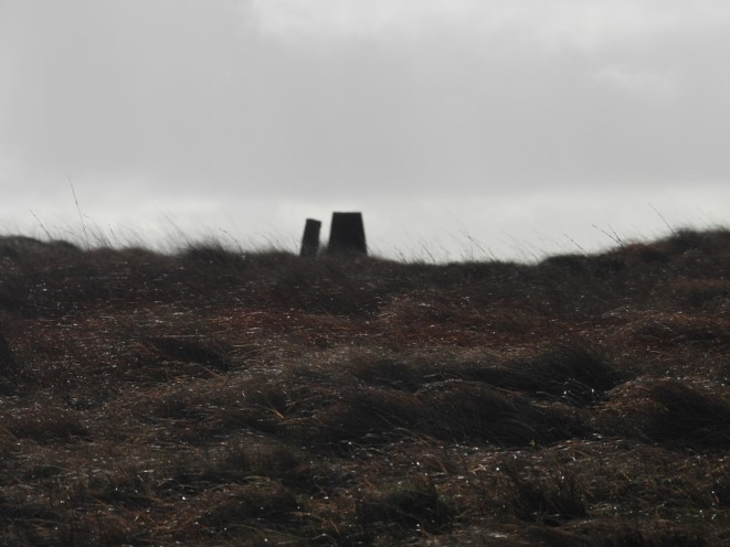
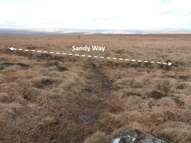
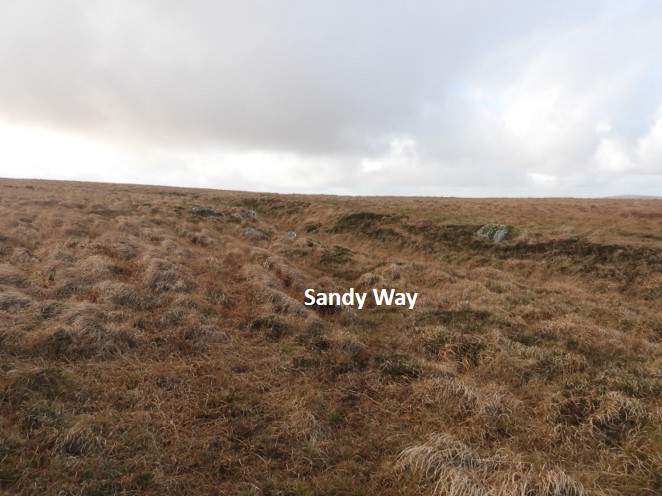
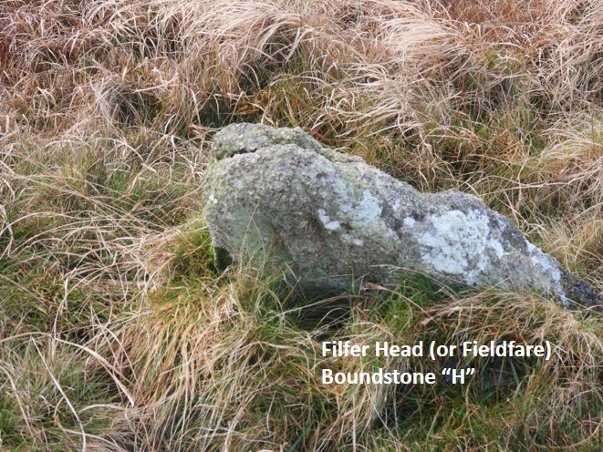
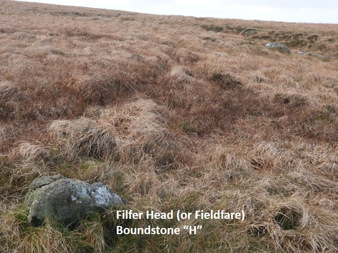
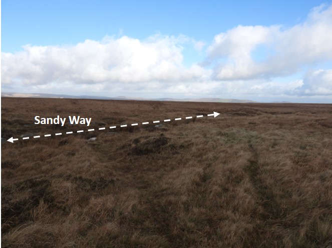
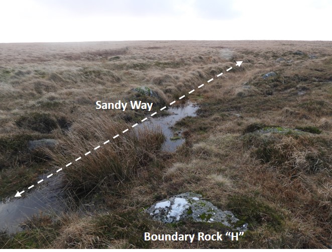
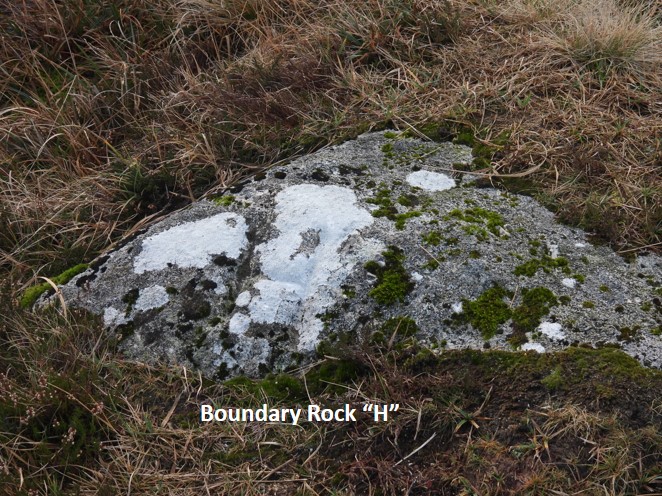
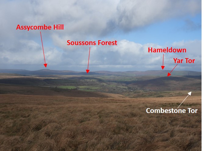
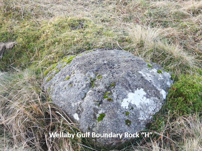
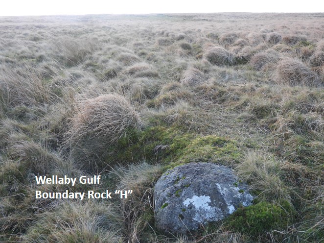
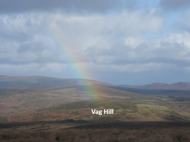
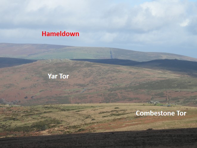
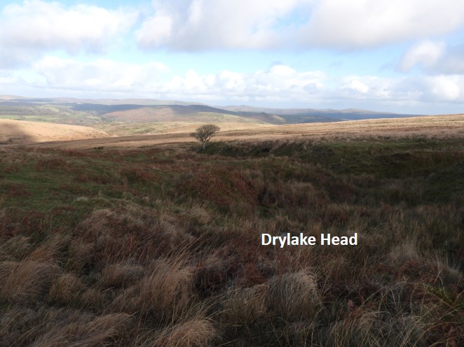
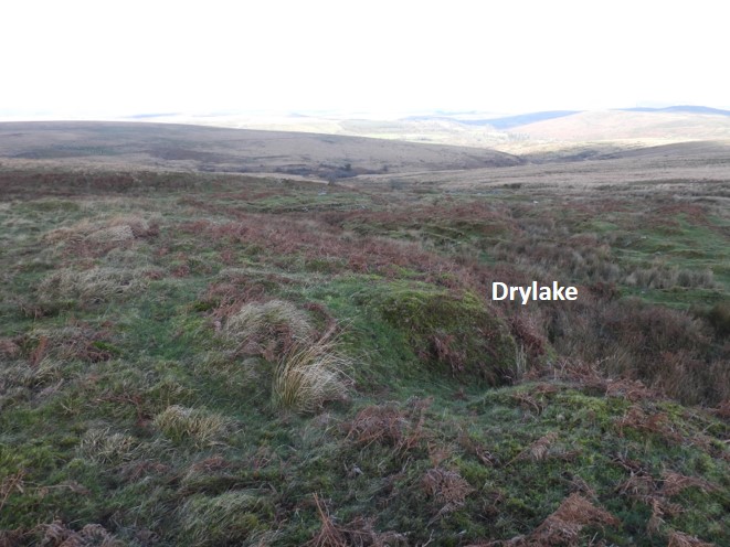
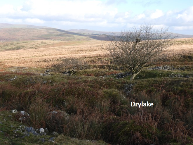
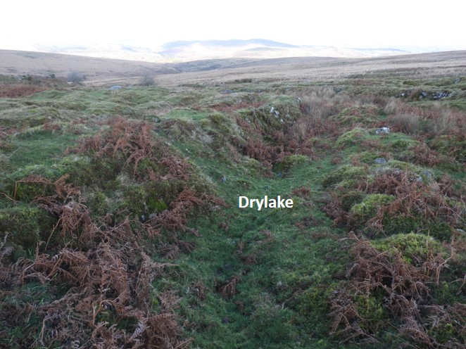
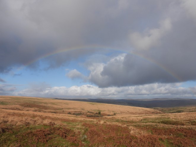
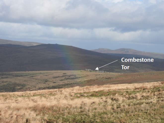
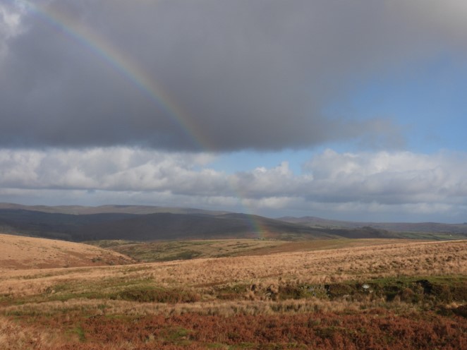
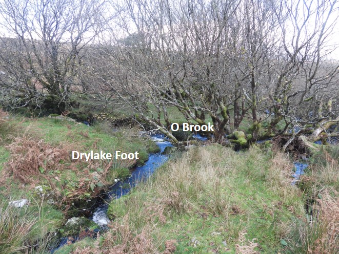
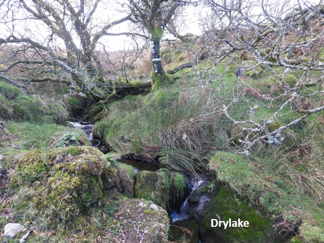
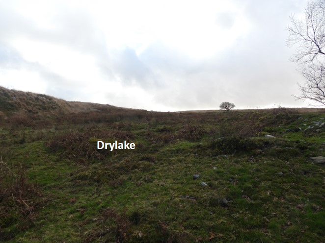
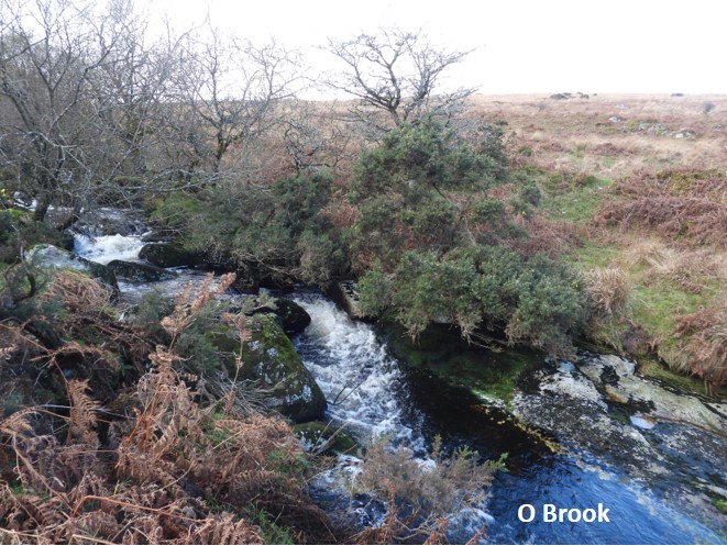
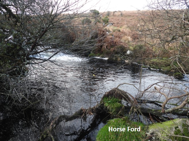
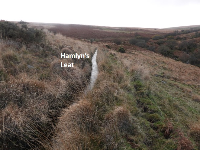
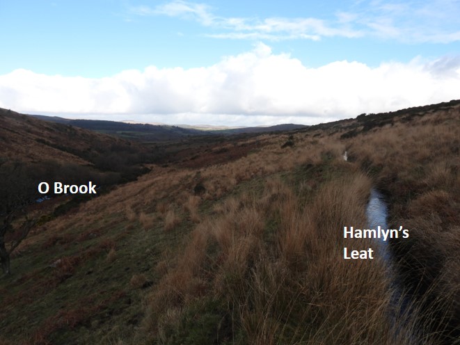
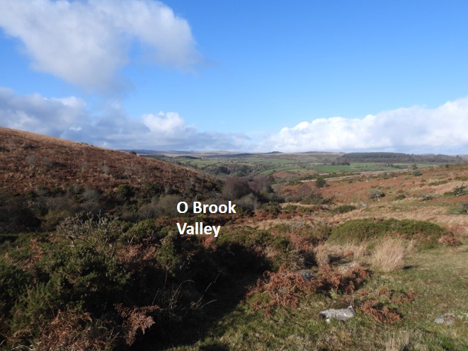
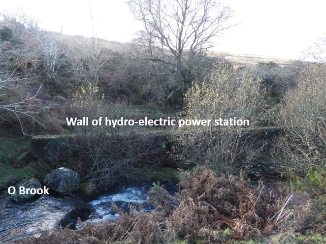
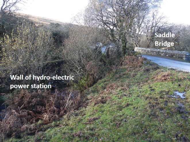
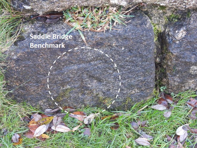
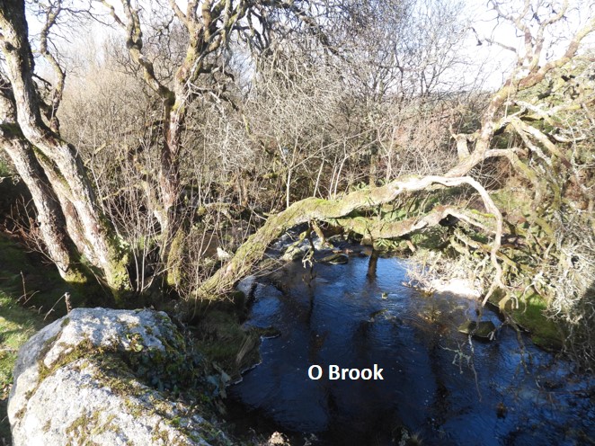
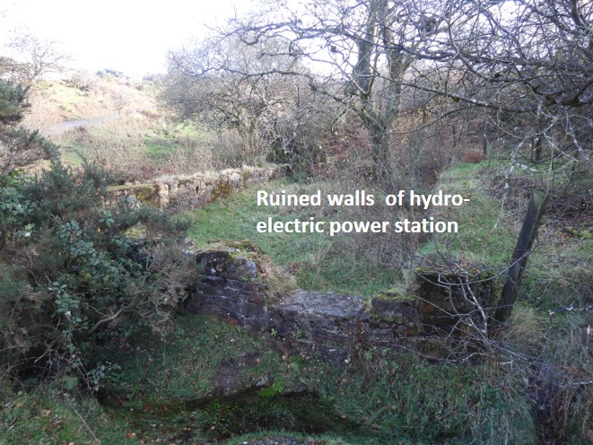
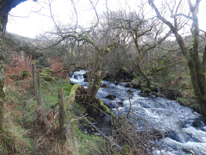
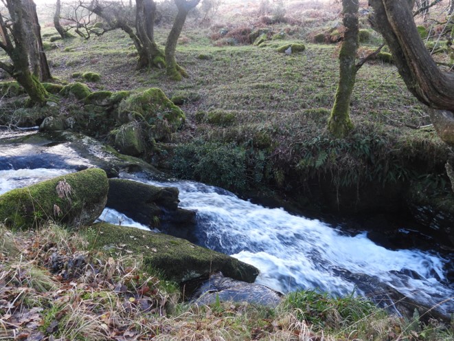
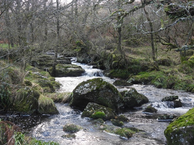
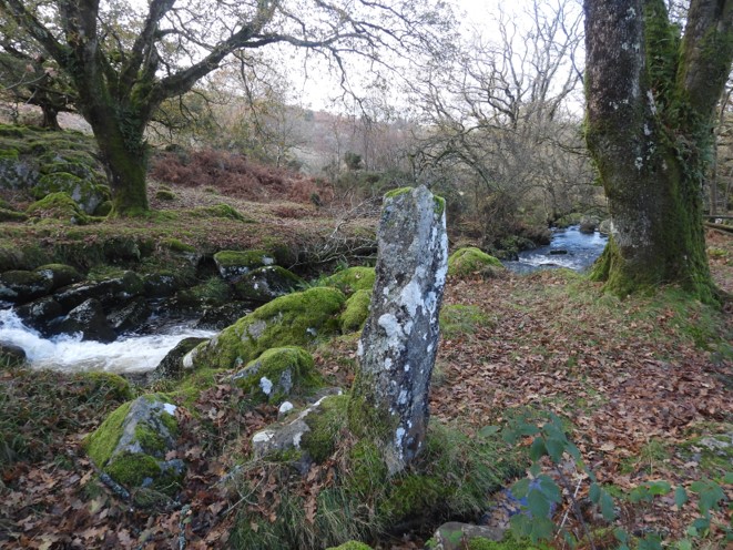
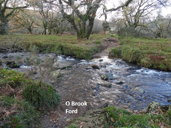
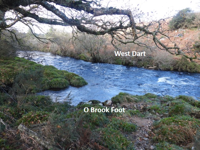
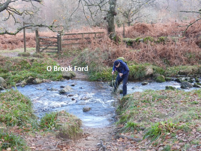
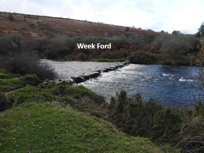
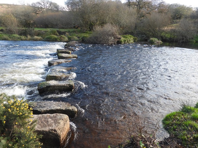
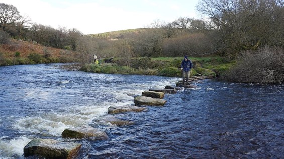
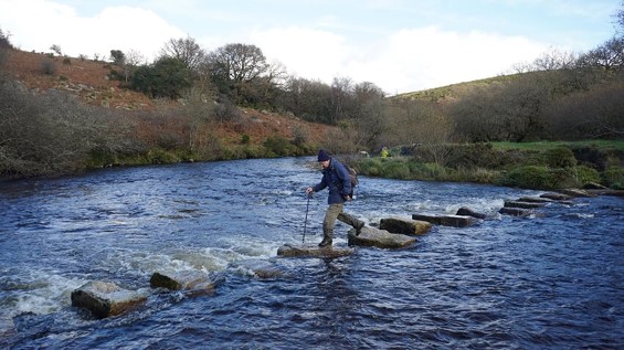
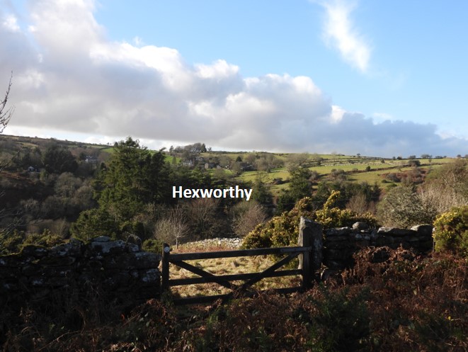
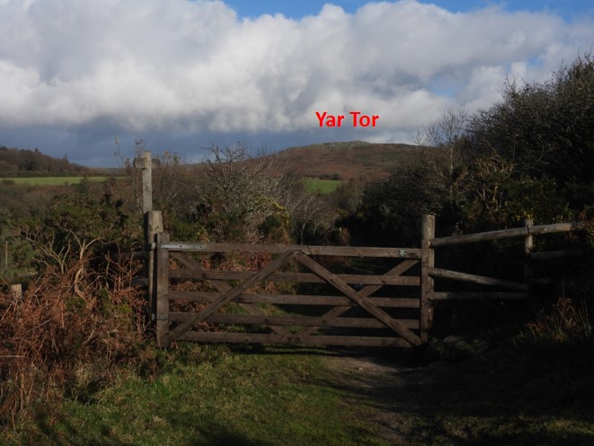
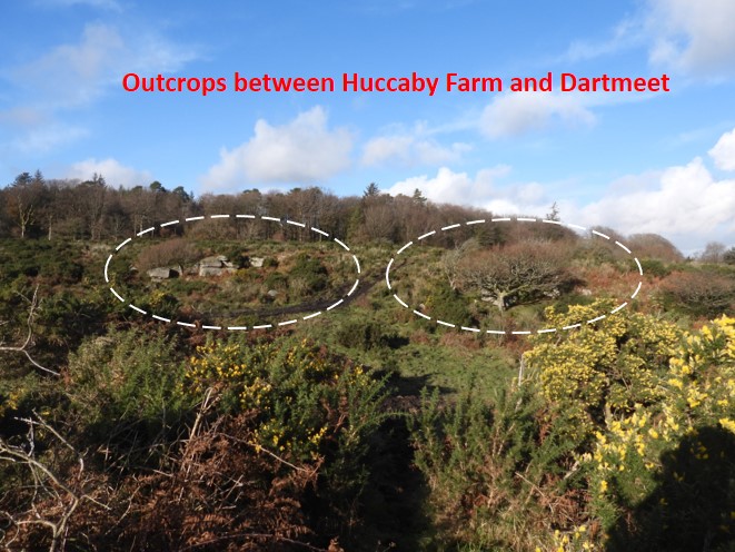
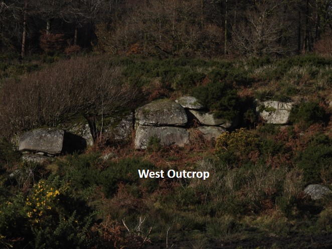
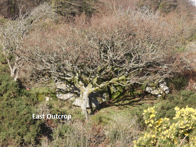
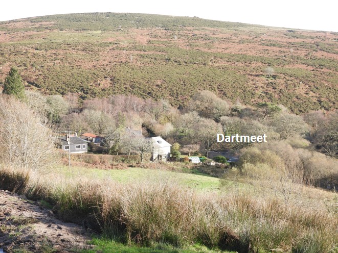
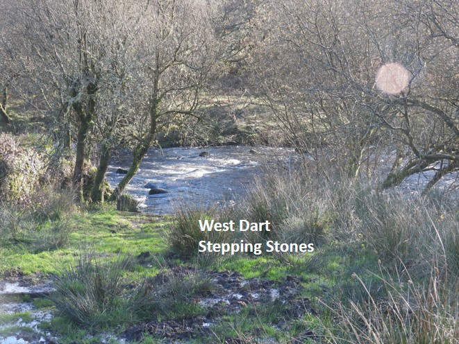
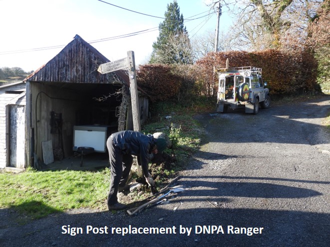
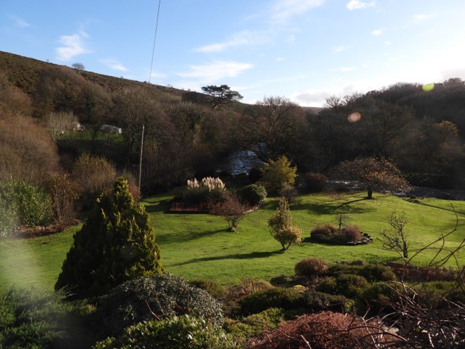
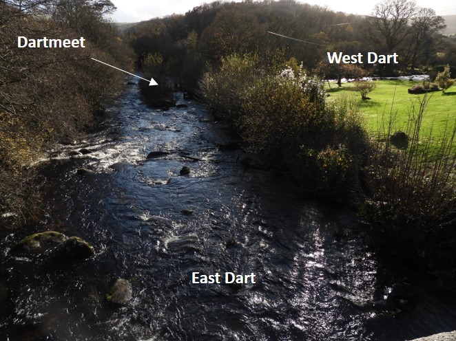
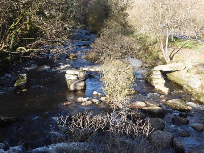
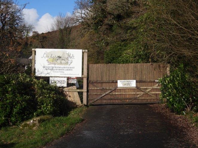
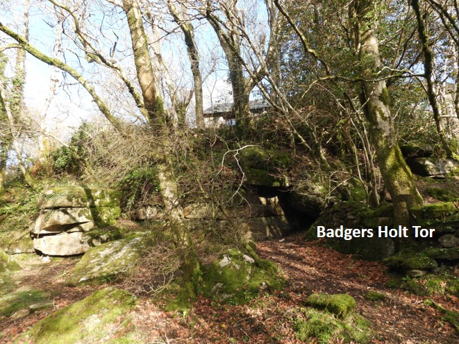
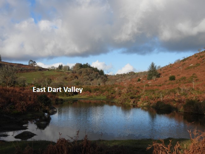
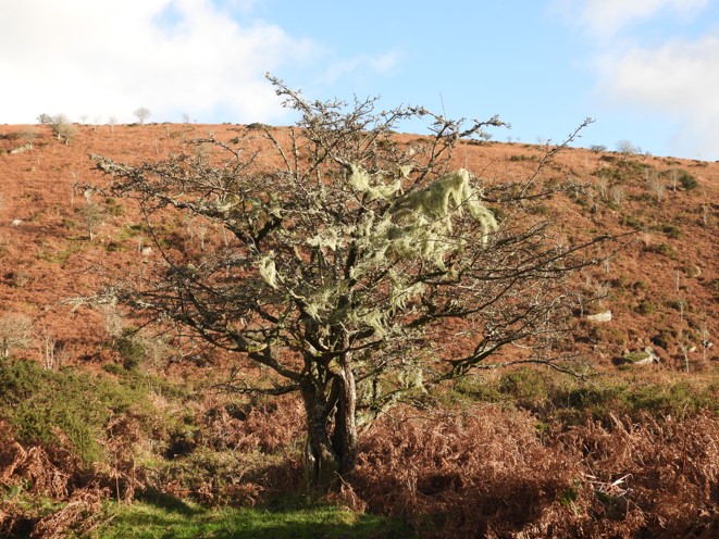
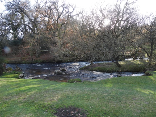
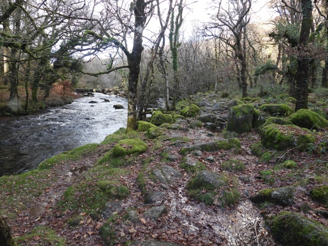
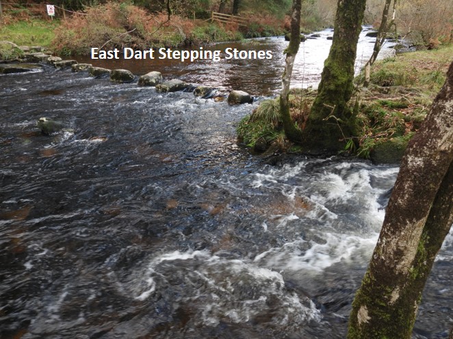
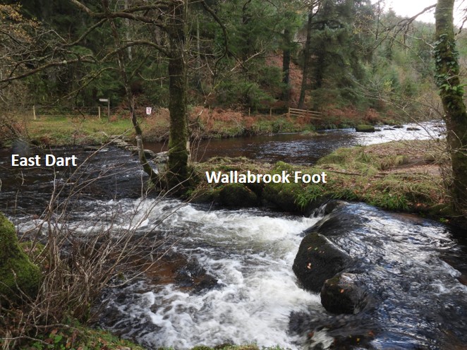
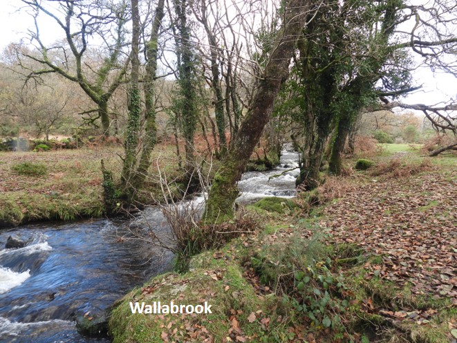
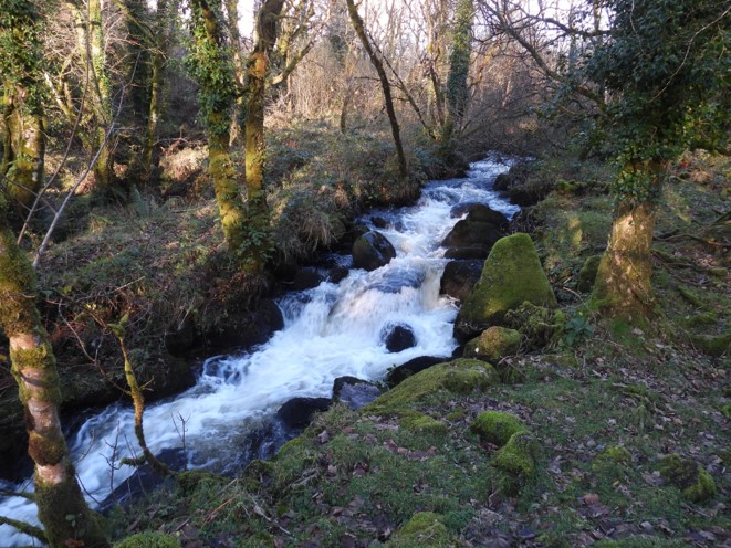
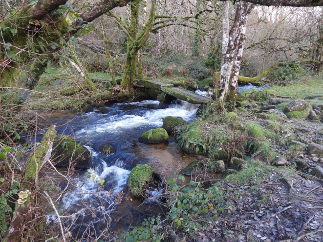
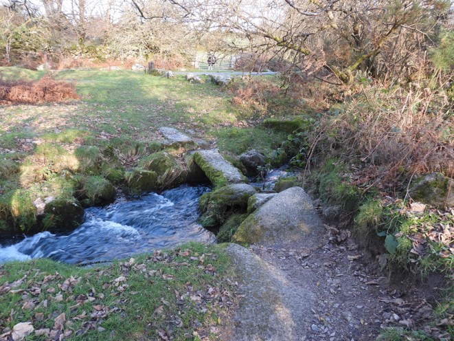
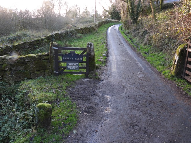
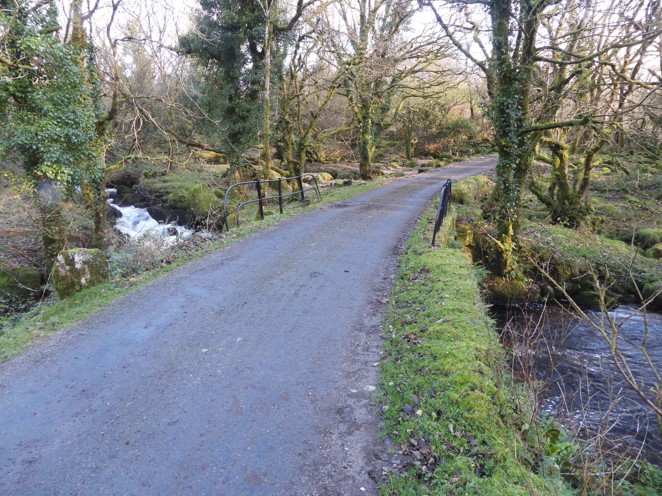
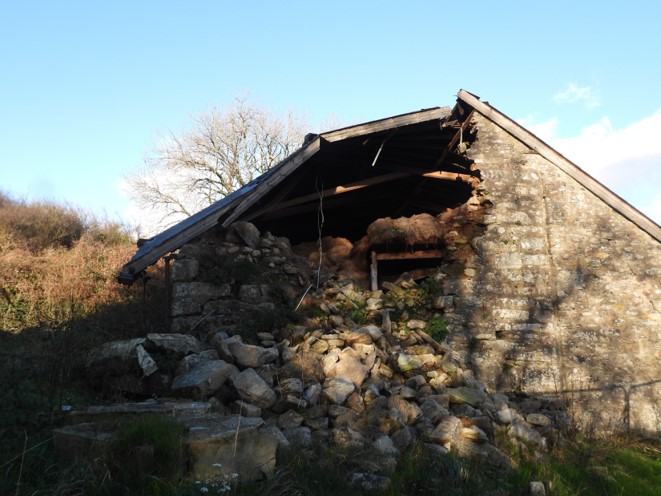
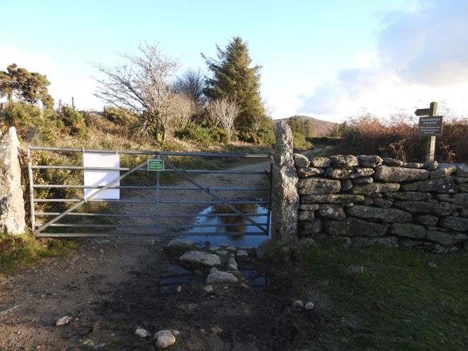
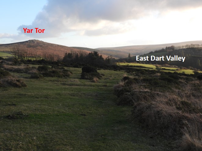
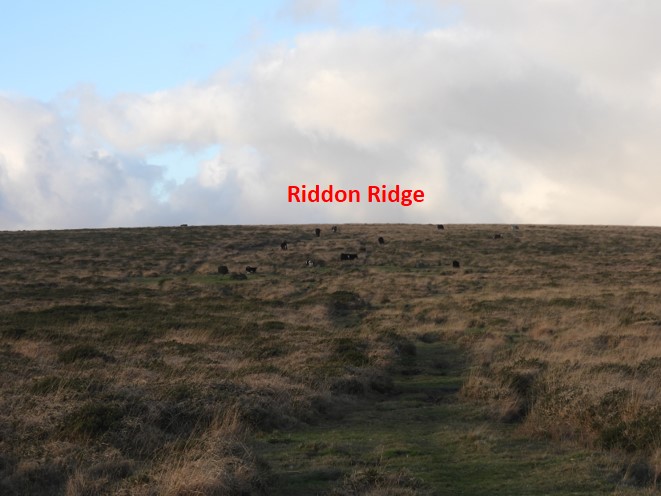
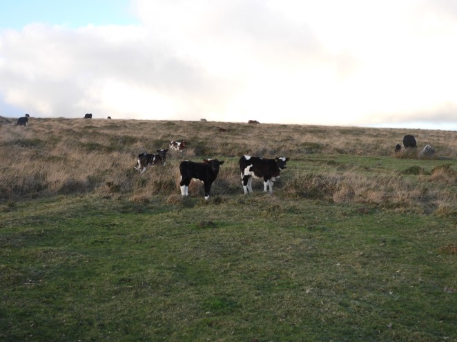
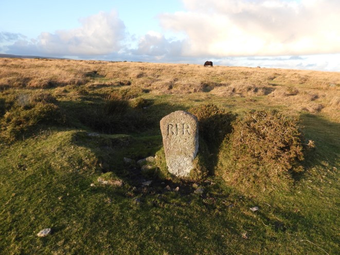
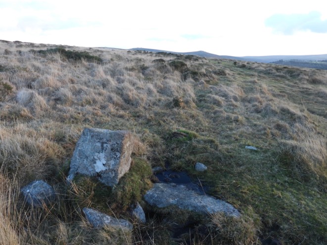
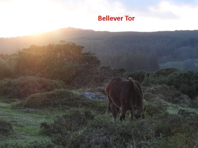
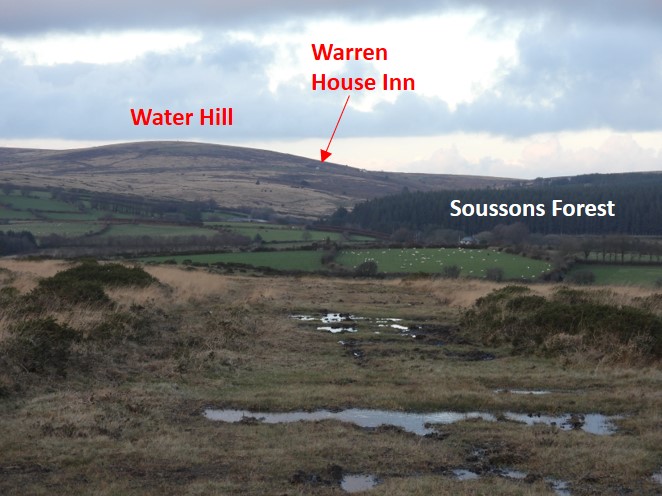
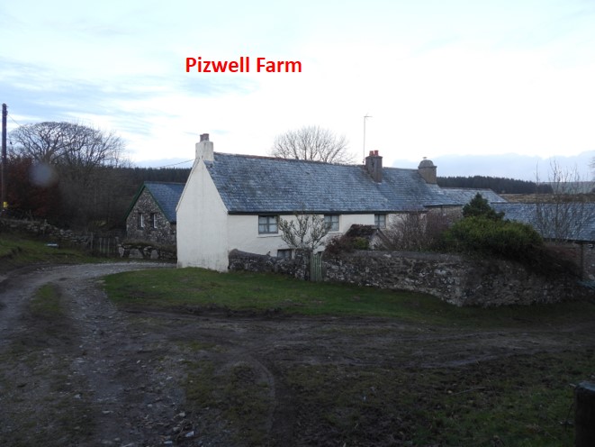
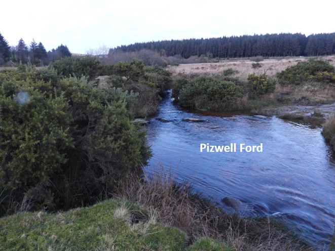
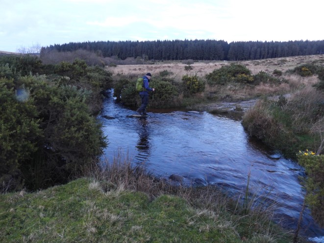
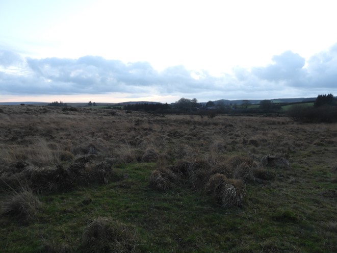
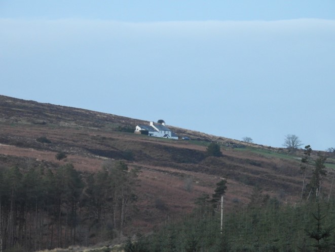
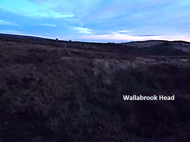
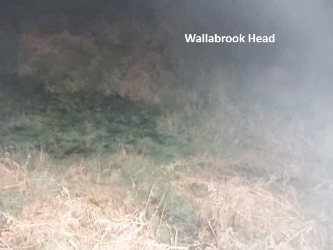
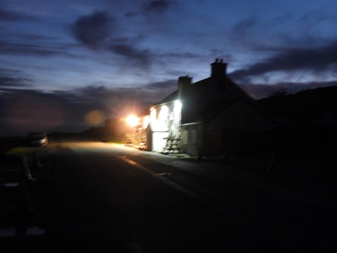
The route from Western Wella Brook to Kings Oven, adapted from the Bill Ransom publication. The route followed in this post mostly follows the 1608 accepted historic boundary. However, deviations are needed (solid red arrows) because of either avoiding private land or very poor ground. Where the boundary is not explicitly shown, river courses are followed (e.g O Brook and Walla Brook). NOTE: CLICK ON MAP TO OPEN IN NEW TABReturning to the clapper bridge over Western Wella Brook, where stage 3 was finished, with Huntingdon Warren in the backgroundWestern Wella Brook Ford a few metres up from the clapper. The silhouette of Eastern White Barrow can be seen on the horizon.Another view of the fordEvidence of Huntingdon Warren’s history, next to Western Wella Brook; three Pillow Mounds.Heading north up Western Wella Brook, there are lots of tinners workings. The scar of Gibby Beam is evident on the west side of the brookThe next waypoint, Western Wella Brook Head in the distance.More evidence of tinners workings. The scar of T Girt is evident on the east side of the brookApproaching Western Wella Brook HeadRainbow over Western Wella Brook HeadLooking back down Western Wella Brook Valley towards Eastern White BarrowWalking towards a rainbow near Western Wella Brook HeadClose up of rainbowGetting closerPonies by the brookWestern Wella BrookHead known as “capud de Westerewelebrok”. “B” stands for Buckfast.The next waypoint of Ryder’s Hill is just visible from Western Wella Brook HeadView down Western Wella Brook Valley from the Head.Climbing up Ryder’s Hill from Western Wella Brook Head a pile of stones are passedSuperb views from the southern slopes of Ryder’s HillApproaching the summit of Ryder’s HillRyder’s Hill summit. Known as “Cattyshill” or “Knattleborough” to the perambulators. This stone was replaced by DNPA in 1992, the original having disappeared in 1986. “H” stands for HolneAt 515m above sea level (highest point on the south moor) there are great views on a clear day. Beyond the “H” and “B” stones, Red Lake sky tip can be seen.The trig pillar was erected here in March 1937, exactly over the old, buried, triangulation markTrig Pillar bracket, showing the reference 1740Zoomed in view of Red Lake Sky Tip and the clay workings twin reservoir system, one was filled by a leat, the other by recycled water returning from Green Hill Mica’s.The summit provides great views to the northViews from the summit towards PrincetownFrom Ryder’s Hill, the finish point (approx 15km distant) at Warren House Inn (Wallabrook Head) can be seen to the northLeaving Ryder’s Hill a few hundred metres down the slopes a boundstone known as Little Anthony can be foundThe “H” (Holne) is discernible in this photographSilhouette to Ryder’s Hill summit from Little AnthonyThe perambulation route crosses perpendicular to a path known as “Sandy Way”Crossing the Sandy WayJust a few metres north of the Sandy Way, a boundstone known as Filfer Head with an “H” inscribed on it can be found.Location of Filfer Head boundstone in relation to Sandy Way (gully in top right part of the photograph)View of Sandy Way from Filfer Head boundstone. The perambulators knew this as “linea Dryefeldford or Creyselford / Drydelford”. Monks used the Sandy Way when traversing the moor between Buckfastleigh and Tavistock.Just north of Sandy Way (and only a few 10’s of metres from Filfer Head boundstone) lies an “H” inscribed rockClose up of the inscribed stone, the “H” is easily discernible.Approaching Drylake Head, expansive views to the north east can be hadBetween the Sandy Way and Drylake Head, the perambulator passes through Wellaby Gulf, in which another “H” rock can be found.Wider view of the Wellaby Gulf “H” boundary rock.View from Wellaby Gulf, a pot of gold on Vag Hill across the Dart ValleyAnother view of looking NE across the Dart Valley.The next waypoint of the perambulation, Drylake Head. Drylake is a wide shallow valley orientated north / south. Drylake has also been known as Yonder DrylakeOne of several trees in Drylake, this one has a nestEvidence of tinners working in DrylakeRainbow over O Brook as Drylake is descendedRainbow close to Combestone Tor as Drylake is descendedZooming out a better view of the rainbow could be had. The O Brook valley in the near distance can be seen.Drylake stream entering the O BrookDrylake near its foot.Looking back up DrylakeThe O Brook just down from Drylake FootHorse Ford, marked on OS MapsHamlyn’s Leat above the O Brook. This leat contours around the hills (including Combestone Tor) towards Venford Reservoir, eventually feeding the Holy Brook via Great Coombe.(The 1st stage of) Hamlyn’s Leat above the O Brook. The “2nd stage” of Hamlyn’s Leat leaves the Holy Brook and feeds a water wheel in Buckfast. Details can be found here: https://dartmoorexplorations.co.uk/hamlyns-leat-from-holy-brook-to-upper-hamlyns-mill-at-buckfast/Descending O Brook ValleyThe O Brook near Saddle Bridge, once the location of a hydro-electric plant, which served to power Hooten Wheals Mine. It dates from 1905Location of the hydro-electric power station in relation to Saddle Bridge.This benchmark can be found on the southern wall of the bridgeO Brook from Saddle BridgeThe power station had its water supplied by a 16 inch iron pipe to a Pelton Wheel, which took its supply off the Wheal Emma Leat at a point on the hillside above. For more information see: https://dartmoorexplorations.co.uk/saddle-bridge-hydro-electric-station/The O Brook just below Saddle BridgeA cascade on the O BrookThe O Brook is delightful as it descends from Saddle Bridge towards West DartAn old gatepost en-route O Brook Ford, with stones which can usually be used to aid crossing underwaterThe O Brook at its foot, feeding the West Dart. This point was known to the perambulators as “Okbrokysfote”. It is also known as “Wobrook Foot”(Frank Collinson) Gingerly crossing the O Brook Ford….and onto Week Ford stepping stones across the West Dart. The perambulators wouldn’t have crossed here but crossed near the lower stepping stones near Dartmeet. However, for the modern perambulator the latter stones are small and more often than not underwater. This crossing leads us onto a short diversion on a footpath.A few of the stepping stones were just underwater Here goes, one stone at a timeCrossing the first underwater stoneNearly there, the most difficult underwater stone to traverse. No stones were at all slippery and with care these stones are usually traversable most of the year,Taking to lane uphill from Week Ford towards Huccaby Farm. A view of Hexworthy can be had along the wayExiting the lane, a view of Yar Tor can be seenTraversing the hill between Huccaby Farm and Dartmeet, a plausible un-named tor can be seen from the footpath. Picture taken from SX66639 73269Zoom view of the west outcropZoom view of the east outcrop, partially obscured by a treeApproaching Dartmeet from the short diversion West Dart stepping stones near Dartmeet underwater, the reason why most perambulators cross at Week Ford and take the short diversionDNPA ranger undertaking a sign replacement. Had a chat with him and he was very meticulous in the work as to preserve the integrity of the small wall behind the post.Beautiful garden at the property at Dartmeet, bounded by West and East Darts.View of Dartmeet from the road bridge. Known as “aliam Dertam” Ruined clapper bridge across the East Dart from the road bridge.Badgers Holt alongside the East Dart can usually (when open), passed through for the perambulator. A well posted footpath around Badgers Holt was followed.On the footpath behind Badgers HoltThis is believed to have a tinners pool / reservoirTree with “Old man’s beard”An island on East DartWalking up the East DartEast Dart Stepping Stones (aka Babeny Steps), where Wallabrook enters from the north.This point also known as “cadit in Derta”. The perambulation route now follows the Wallabrook to its head (close to Warren House Inn)Not all of the Wallabrook can be followed by the modern perambulator as it passes through private land and enclosures.Some cascades on the WallabrookWallabrook clapperSmall clapper over a tributary of the WallabrookBabeny Farm entrance, the start of a diversion from the perambulation as the Wallabrook enters private land.From the entrance of Babeny Farm. The road crosses the Wallabrook. The brook to the left (north) enters the private landRuined barn at BabenyThe lane which takes the diversion through Babeny and onto Riddon Ridge. This gate is where the lane enters open moorland once more.Climbing onto open moorland looking back in a southerly direction with views to Yar Tor and East Dart ValleyApproaching Riddon RidgeYoungsters on the slopes of Riddon RidgeRHR Stone on top of Riddon Ridge, associated with Robert Henry Roberts (Babeny). The standing stones on Riddon Ridge are thought to delineate areas where permission was granted to cut peat.TS (Thomas Smeardon) stone on Riddon Ridge.Sun setting over Bellever Tor as viewed from Riddon Ridge. This perambulator better get a wiggle on as it’ll be getting quite dimpsy by the time Warren House Inn is reached.The final destination of this stage at Warren House Inn, still 4km away.Pizwell Farm, approached on a public footpath from the southThe footpath exits between two buildings at Pizwell FarmPizwell Ford, where the perambulator re-acquaints themselves with the WallabrookCrossing the ford in the semi-dark, some stones underwaterLooking back at Pizwell as darkness descendsView of Warren House Inn from Soussons Forest. This perambulator used the forest tracks in Soussons as close to the Wallabrook as possible because: a) It was getting dark and b) the Wallabrook on the edges of the forest can be very boggy even after a dry period. It is only a 100m or so from the original permabulation route.Wallabrook Head (Walebrokehenyd). It was very dark at this point and the picture has been “enhanced” as much as possible.Another picture of Wallabrook Head, this time not enhanced and taken using flashThe lights of Warren House Inn showing how dark it had got by the time the stage was completed. It was 1720 in mid-November.