A collection of walks, discoveries, insights and pictures of exploring Dartmoor National Park
November 12, 2020
PERAMBULATION OF THE FOREST OF DARTMOOR (PRINCETOWN TO WESTERN WELLA BROOK)
Steve Grigg
The full Perambulation of the Forest of Dartmoor is around 50 miles. This post covers one leg (or around 20% of the route). The perambulation is being completed for the fourth time by the author as part of the 780th anniversary (1240-2020), having first completed it in 1990 (750th Anniversary). Each of the previous three perambulations were completed in a clockwise direction, this one being anti-clockwise.
The story of the Dartmoor Perambulation starts with King John in May 1204, when in a desperate attempt to raise funds for an army to for a war with King Phillip of France, he gave up his rights in Devon but retained the highlands of Dartmoor. It is believed it raised 5000 marks for the crown. In those times the term “forest” in this context was crown land, reserved for hunting comprised trees, turf and vegetation, where hunting would have included deer, hare, rabbit, pheasant, boar, wolf, fox, martin, partridge, quail, heron and mallard. The boundary was important as revenue could be derived from activities within the forest. King John failed (as with Saxon and Norman tradition) to order a “perambulation” to seal the boundary lines. However, in spite of this, it was not until his son, King Henry III came to the thrown that the first perambulation of Dartmoor was secured, this was in 1240. The perambulators completed their task on the 24th of July who were: William Brewer, Guy Breteville, William Wydeworthy, Hugo Bellay, Richard Gyppard, Odo Treverbyn, Henry the son of Henry, William Trenchard, Phillip Parrer, Nicholas Heamton, William Moreleghe and Durant the son of Boton.
The original 1240 perambulation was written in medieval latin and was subsequently open to interpretation for a few centuries. In 1608/9, a major attempt was made to clarify the boundary and later when OS mapped Dartmoor in 19th century, they relied on locals to define the boundary. Both these boundaries are shown in this post, however, the 1608/9 boundary is the one that most modern “perambulators” follow.
Note: The source of information for the above has been from: a) Dartmoor’s Greatest Walk by Bill Ransom (1987) – Devon Books, b) Dartmoor’s Greatest Long Distance Walk by Roland Ebdon (2016) – Halsgrove and c) Dartmoor Boundary Markers by Dave Brewer (2002) – Halsgrove
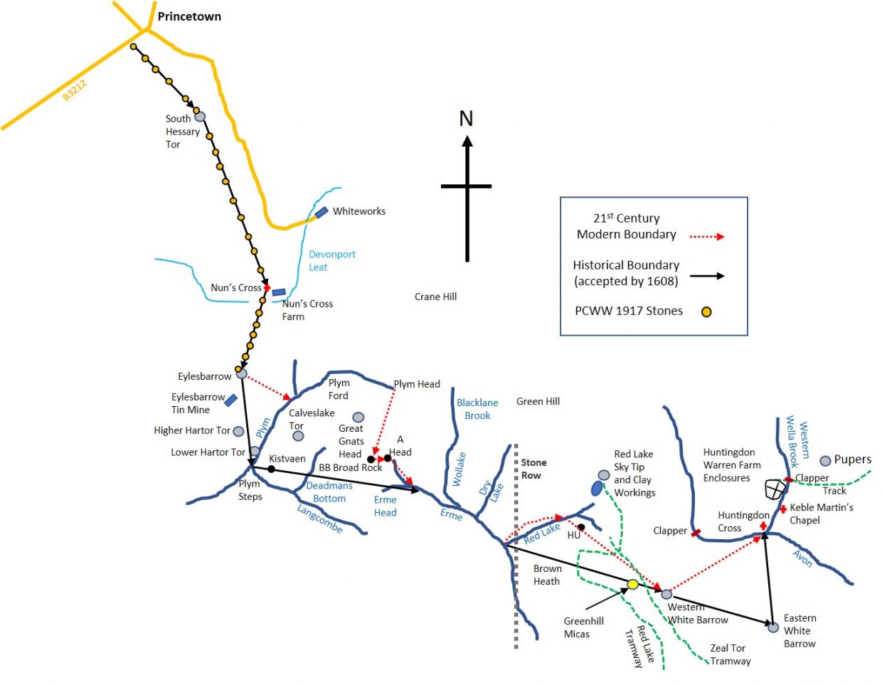
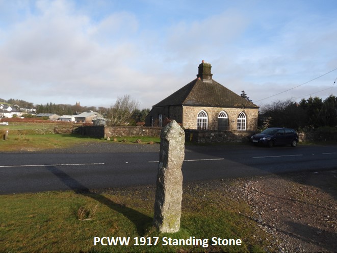
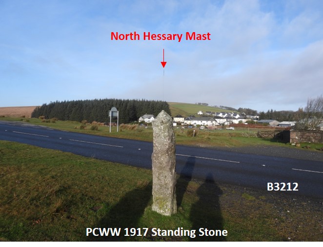
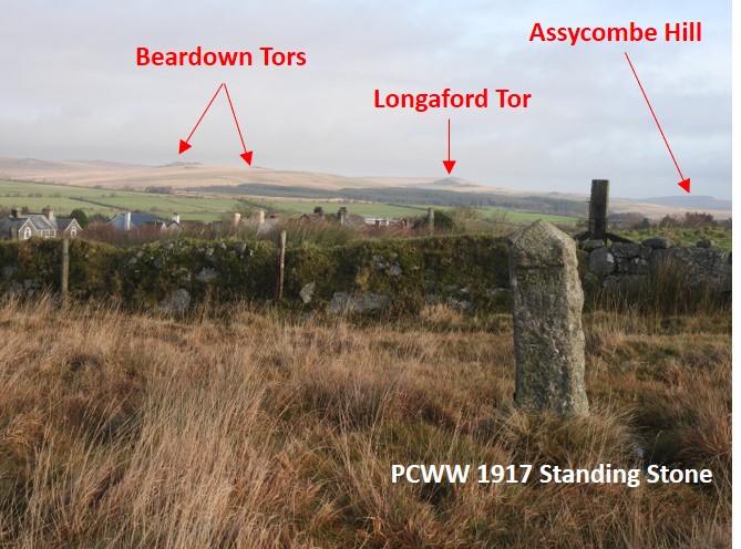
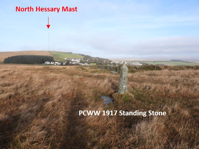
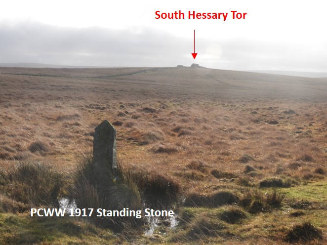
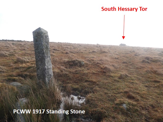
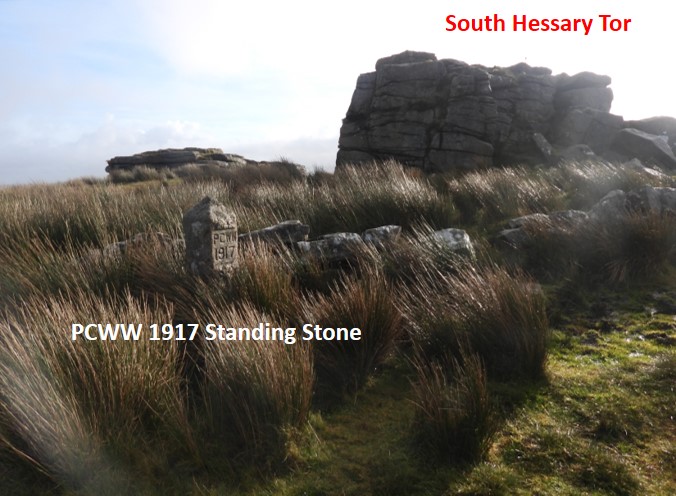
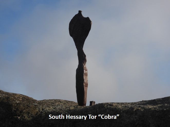
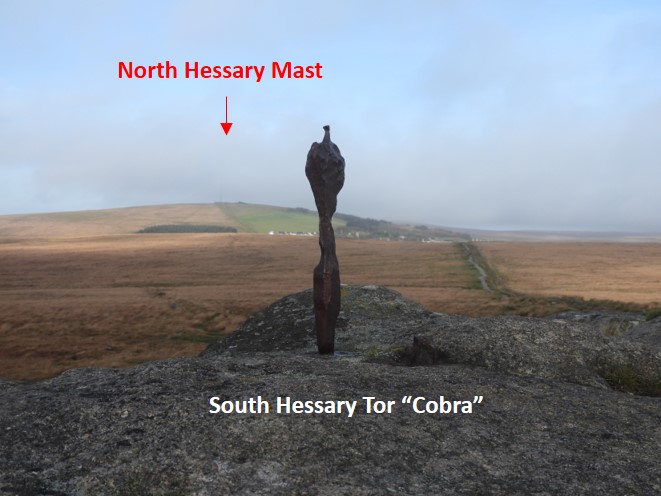
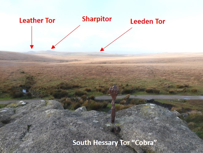
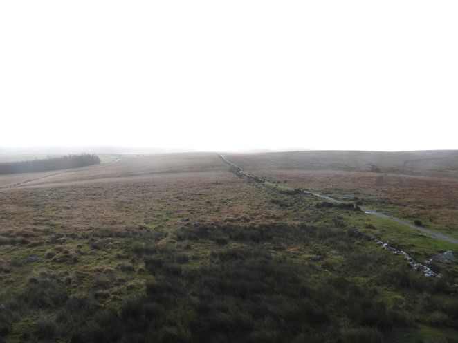
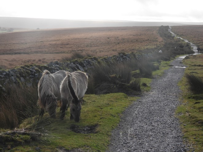
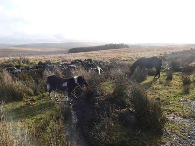
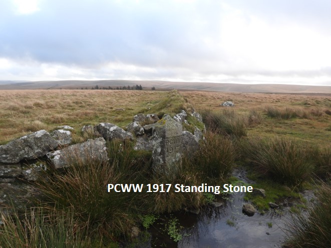
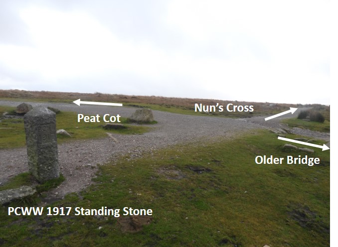
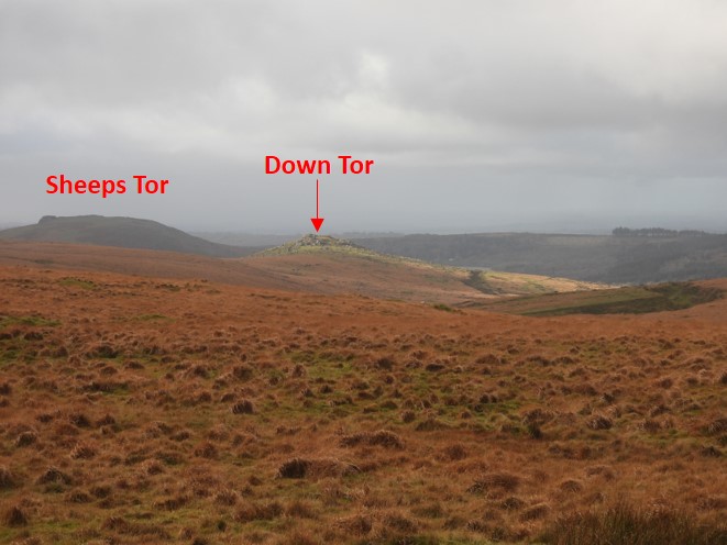
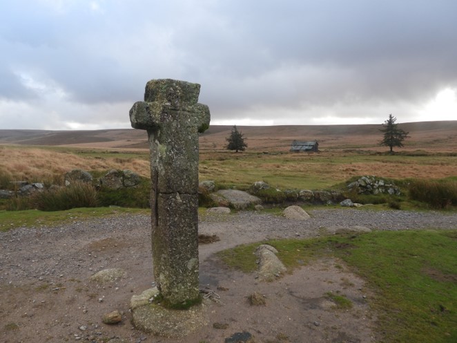
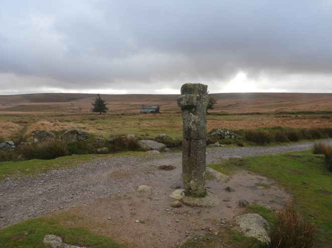
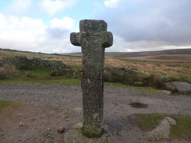
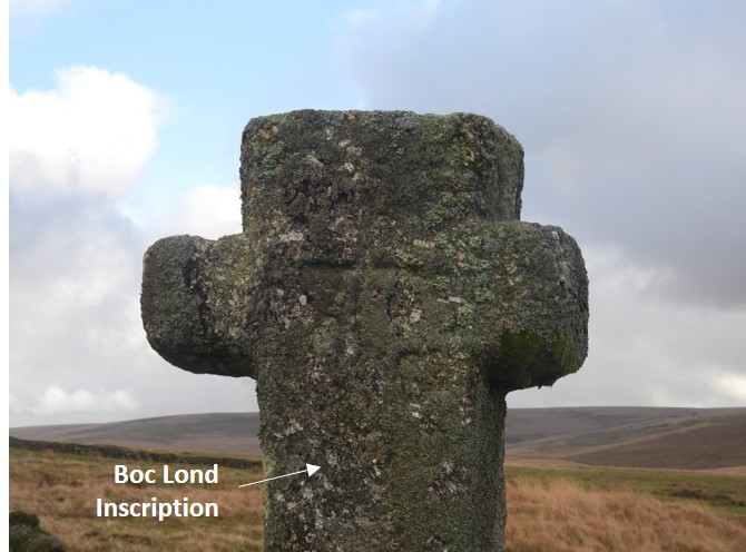
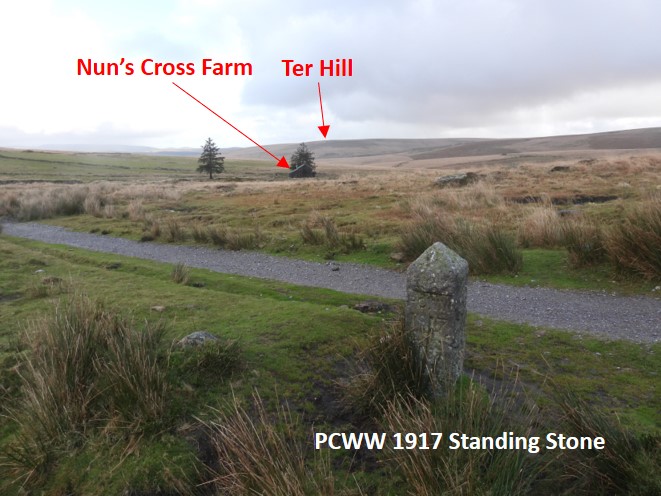
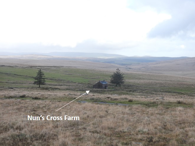
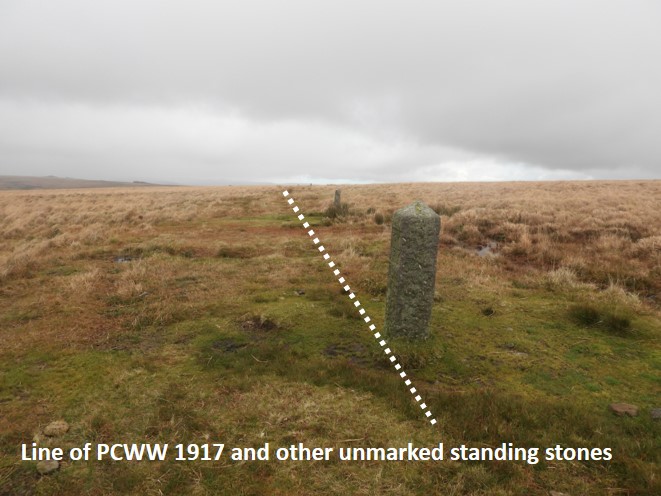
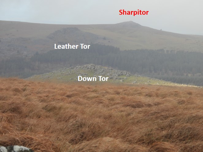
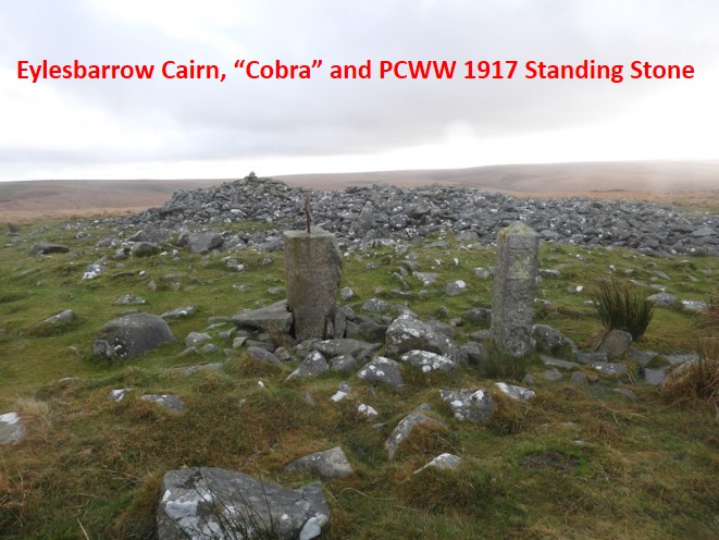
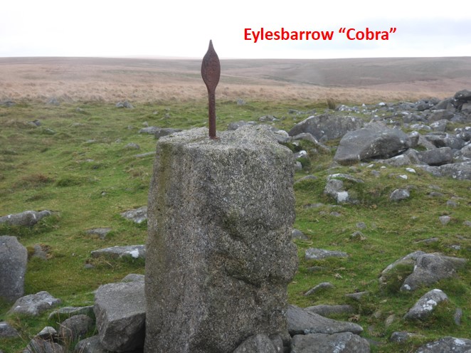
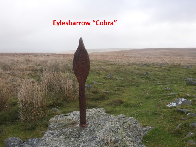
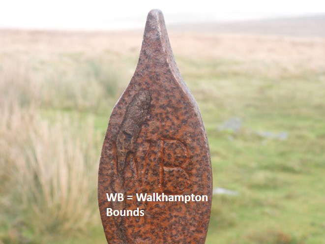
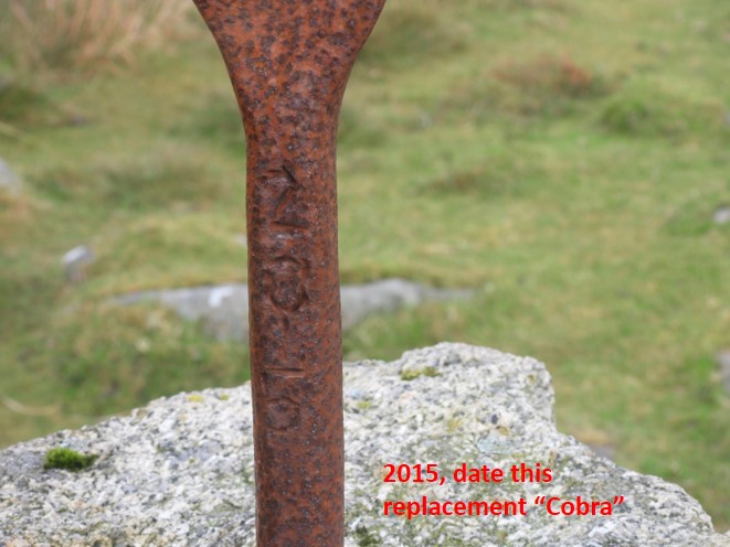
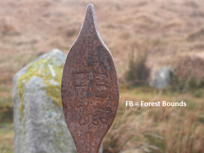
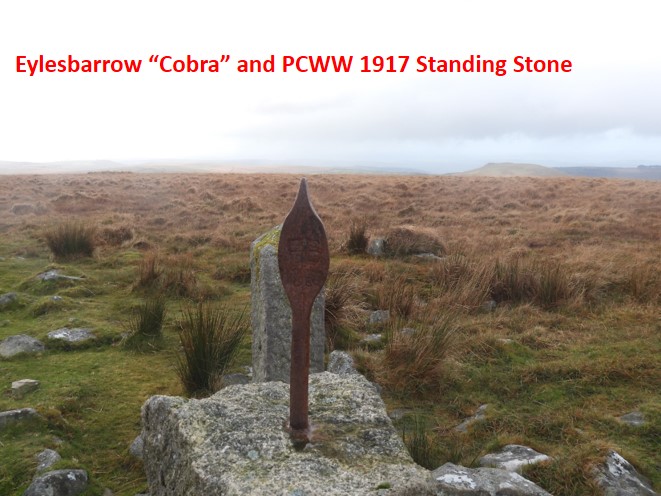
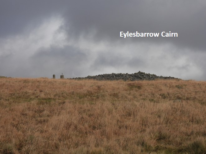
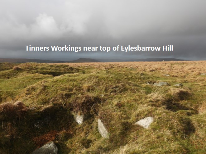
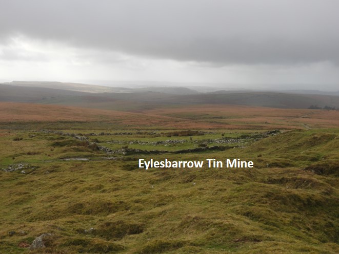
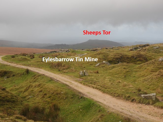
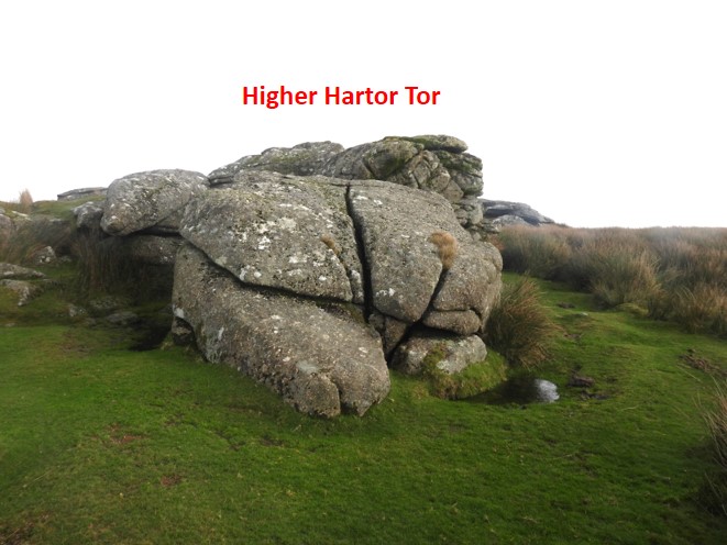
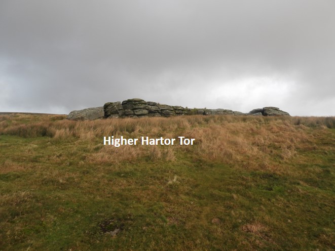
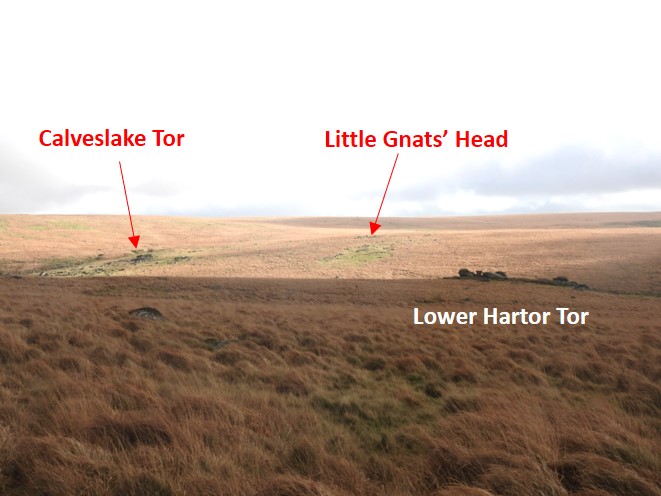
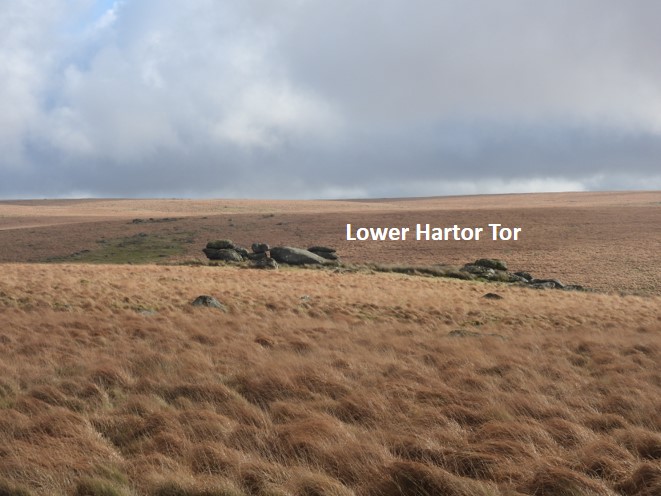
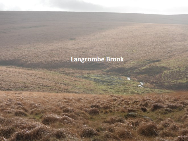
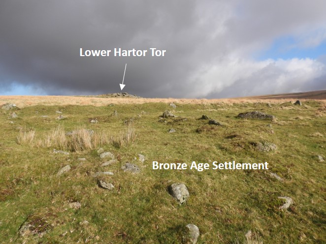
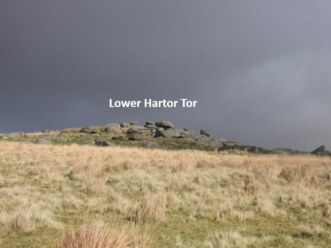
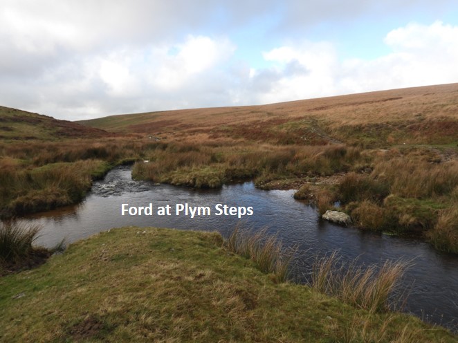
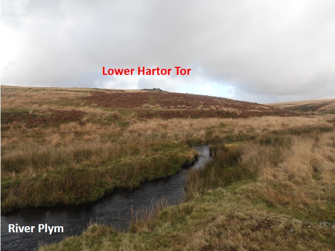
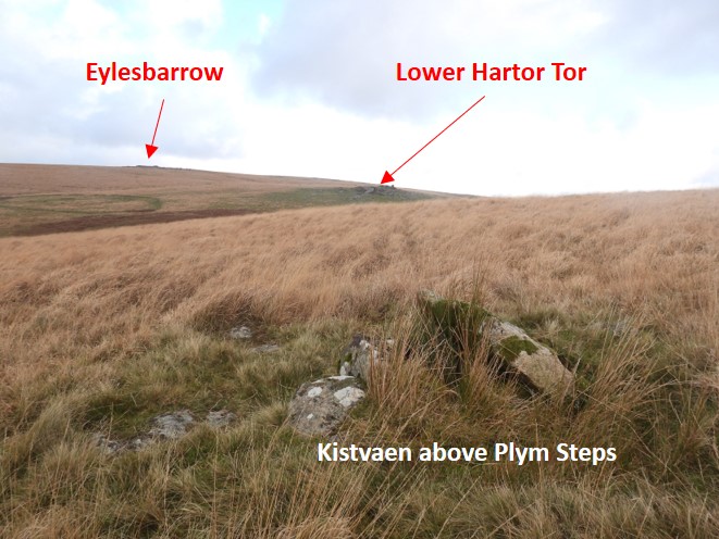
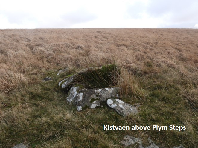
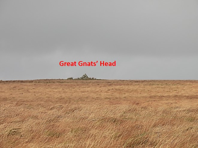
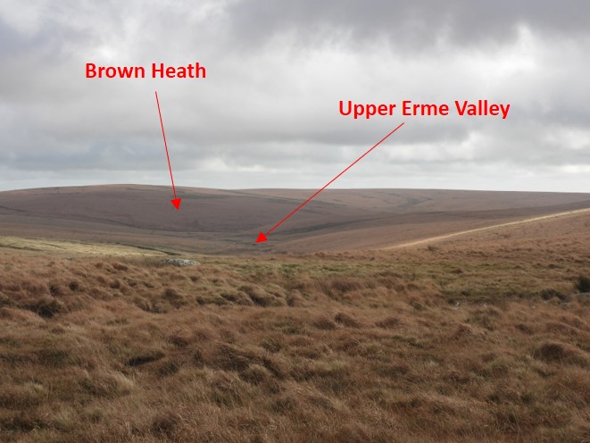
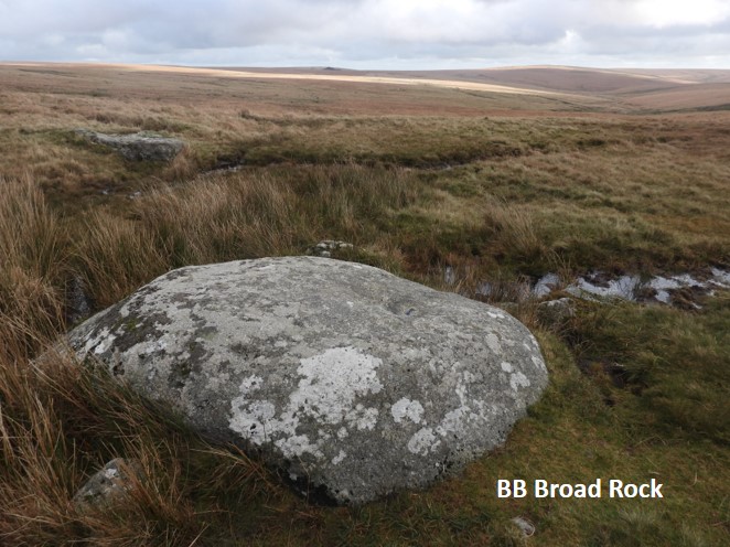
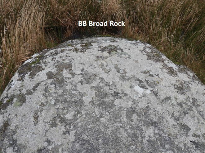
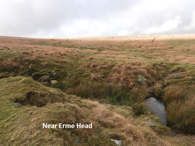
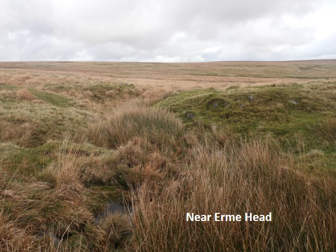
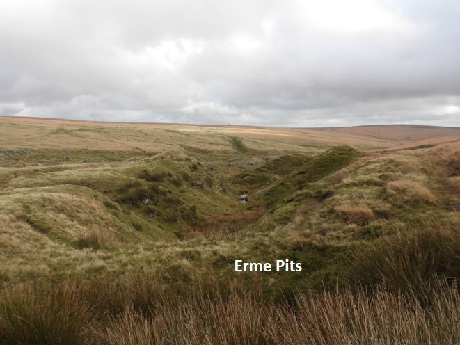
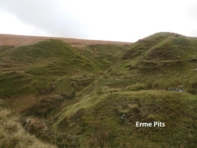
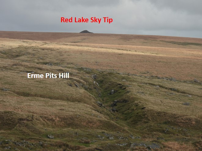
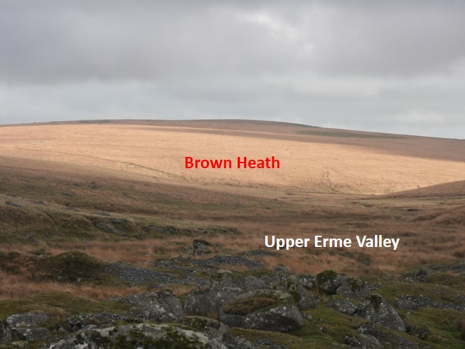
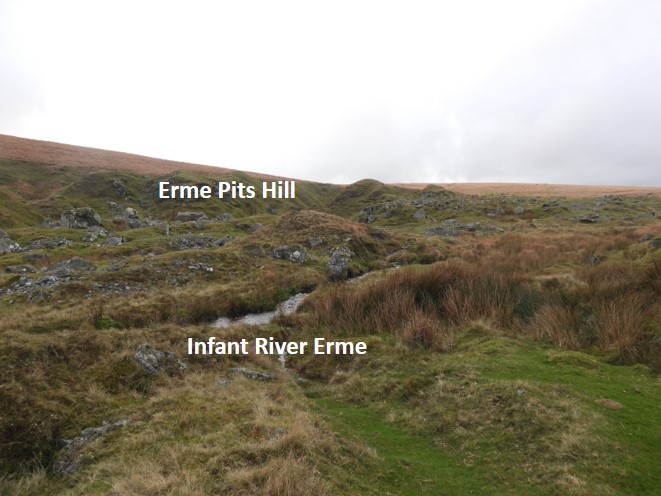
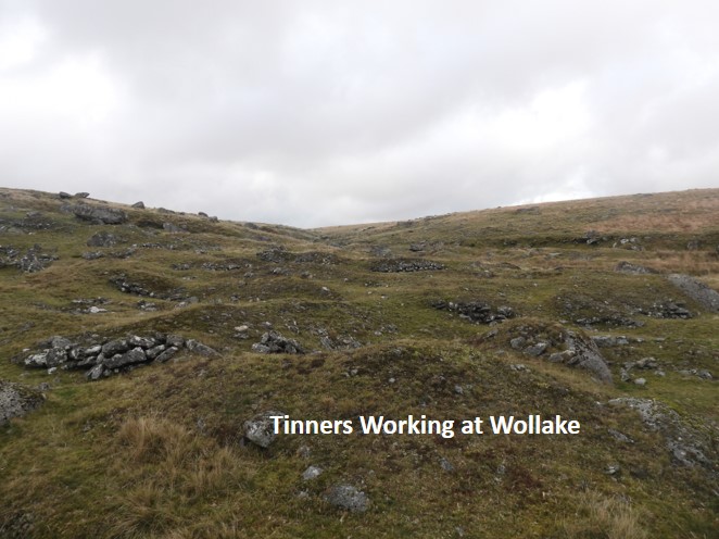
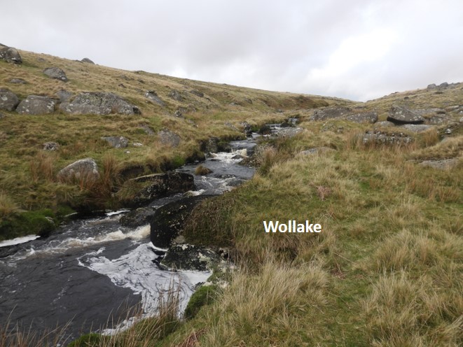
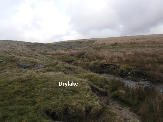
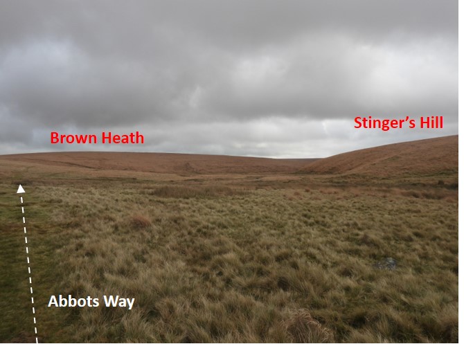
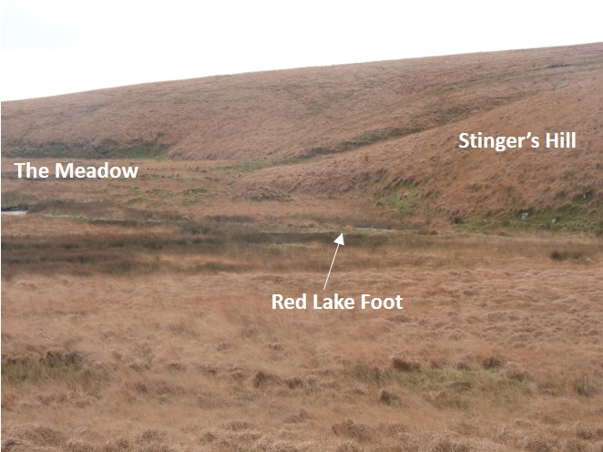
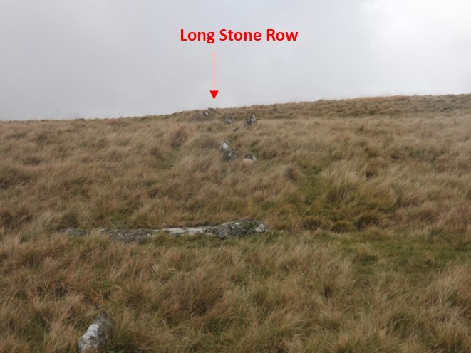
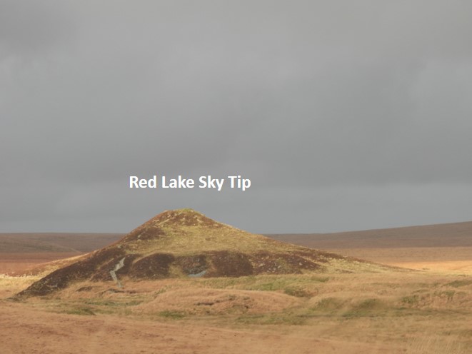
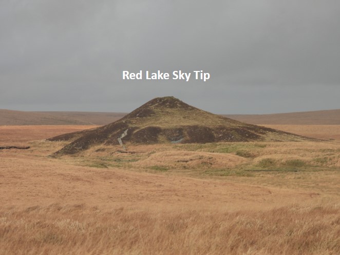
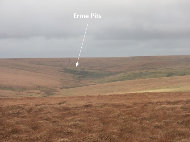
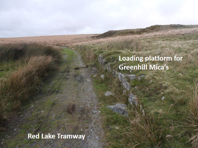
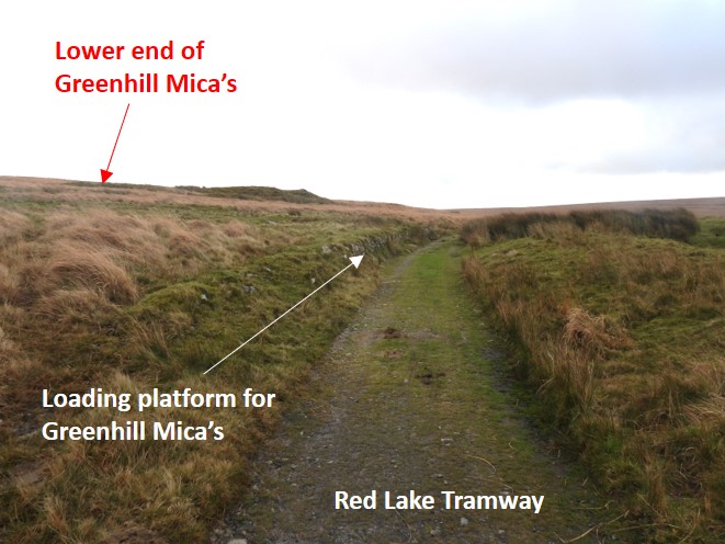
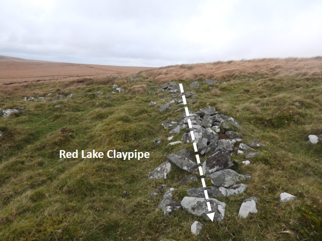
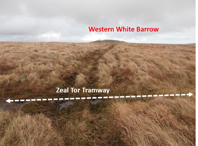
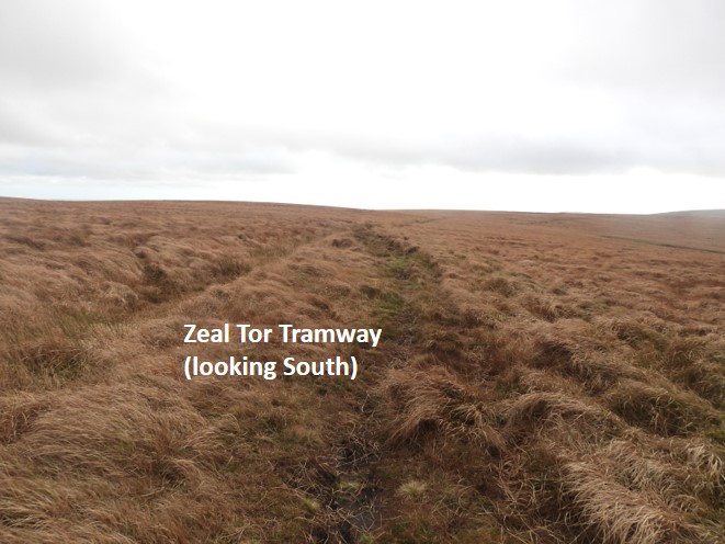
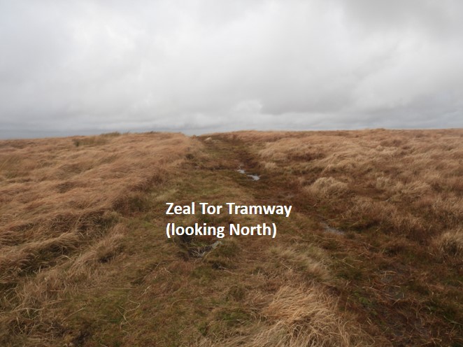
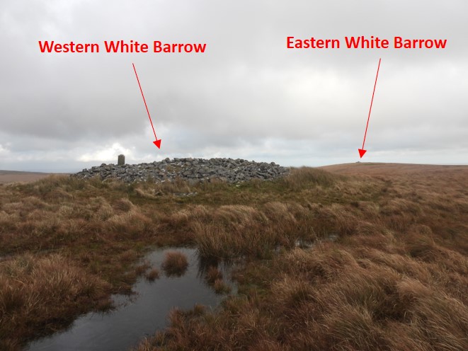
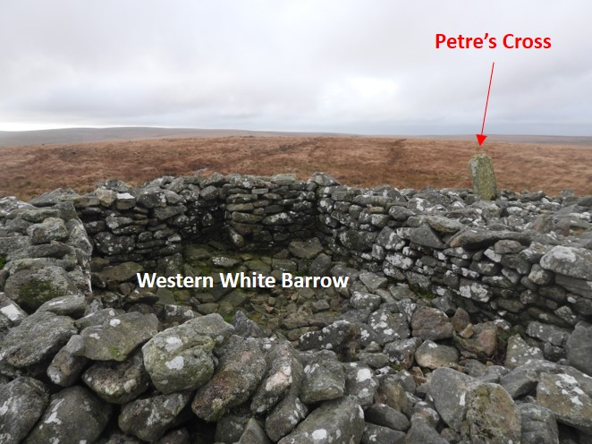
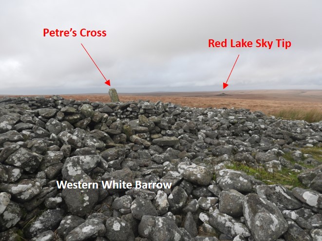
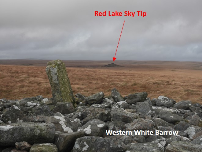
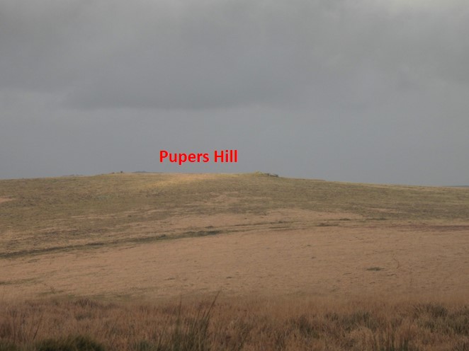
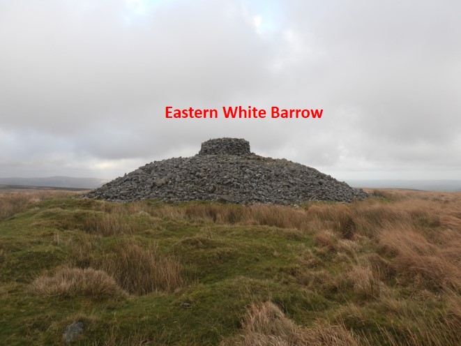
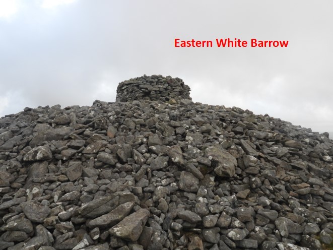
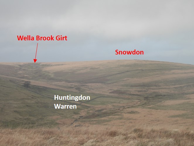
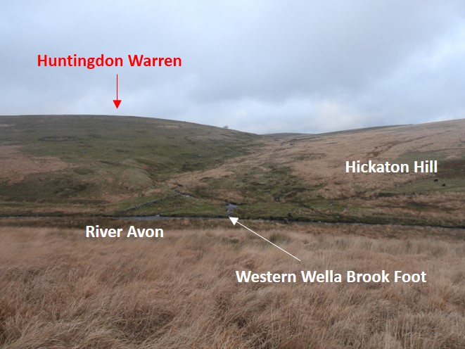
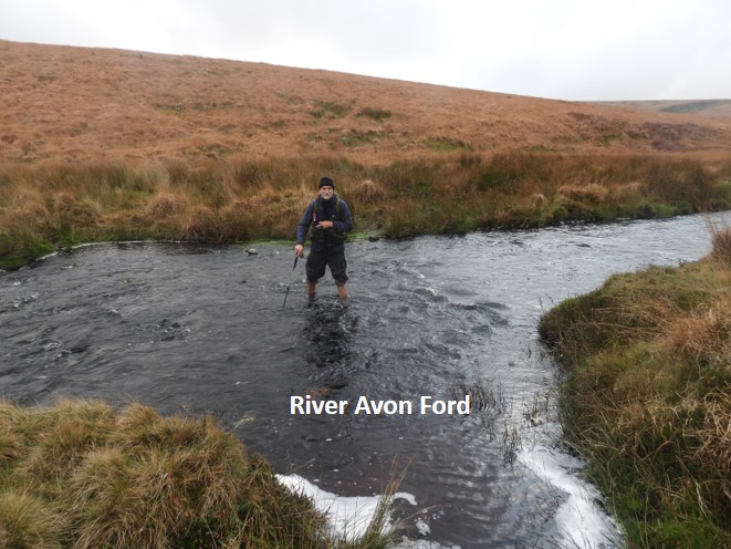
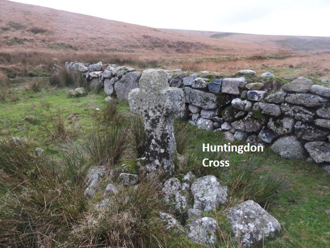
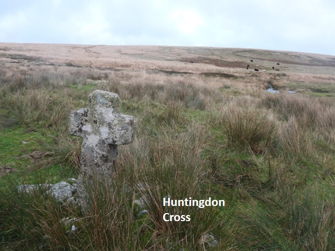
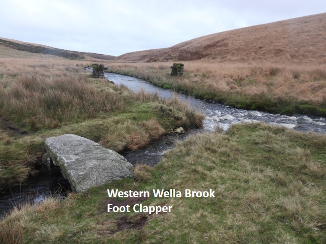
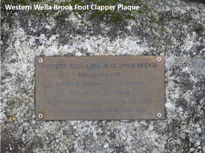
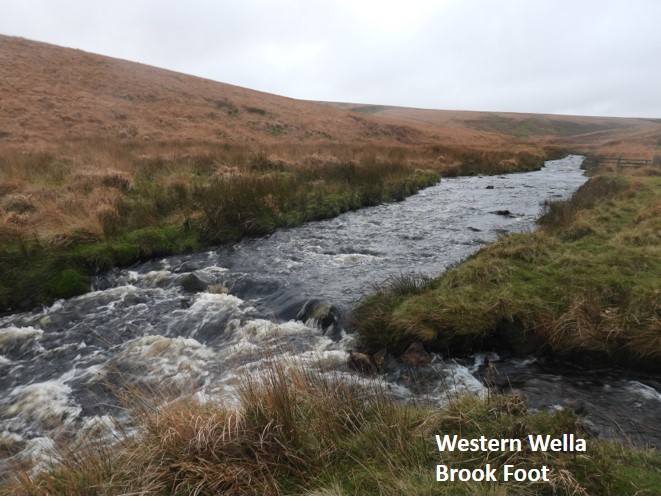
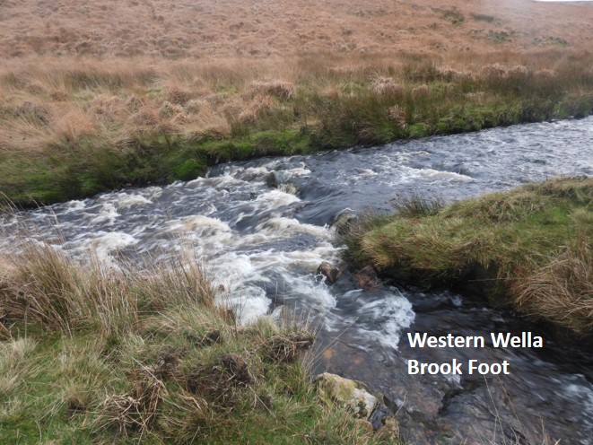
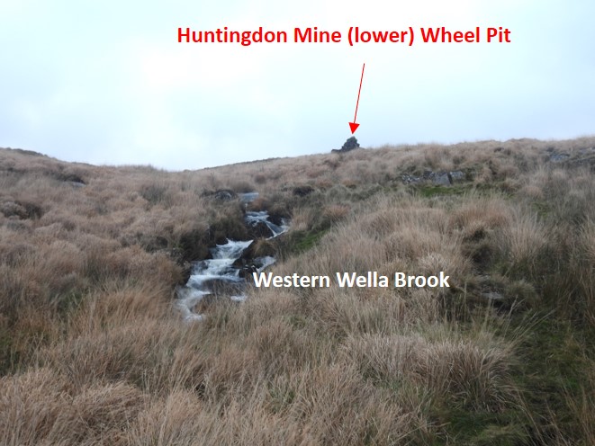
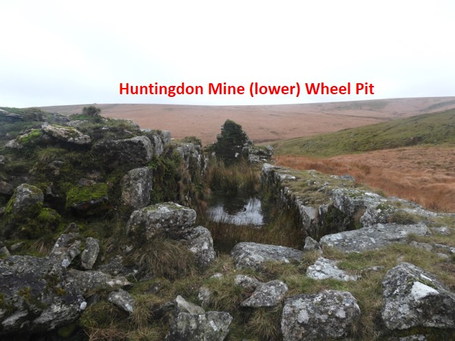
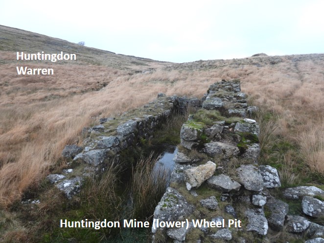
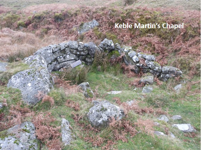
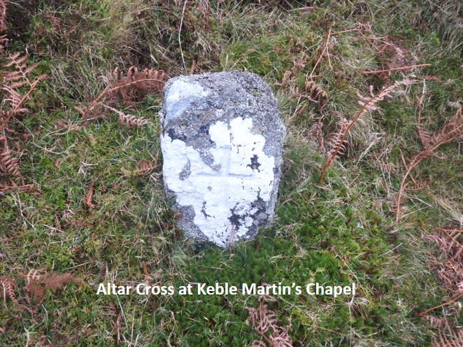
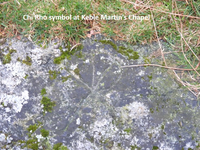
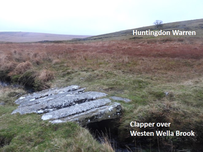
The route from Princetown to Western Wella Brook, adapted from the Bill Ransom publication. The route followed in this post follows the 1608 accepted historic boundary. Where the boundary is not explicitly shown, the river course is followed (e.g River Erme). NOTE: CLICK ON MAP TO OPEN IN NEW TABThe first PCWW 1917 stone next to the B3212 on the edge of Princetown. After the construction of the Burrator Reservoir (from 1893-1898), Plymouth Corporation Water Works (PCWW) placed numerous markers on south west Dartmoor. Farms within the water catchment area were purchased and cleared after 1916. The original PCWW 1917 stones (like the one shown) follow the line of the Forest of Dartmoor boundary from North Hessary through to Eylesbarrow. From this point there are 21 such stones the perambulator can follow all the way to Eylesbarrow.View back to the previous waypoint, North Hessary Tor, known to the original perambulators as aliam Ysfothere (aka another Hisworthy)As the perambulator leaves Princetown, there are extensive views to the East.View back to PrincetownFollowing the PCWW stones, South Hessary, the perambulators next waypoint is approachedApproaching South Hessary TorSouth Hessary Tor known to the original perambulators as Ysfothere. It is also known as Lookout Tor, Tor Royal, Little Hisworthie and Histworthy Tor (amongst others). South Hessary “Cobra”. In 1867, the manor of Walkhampton was under the ownership of Sir Massey Lopes. He was in dispute with the Duchy regarding the Forest bounds and a deed of agreement dated 10th August 1867 confirmed the agreed boundary. Taken from the Dave Brewer Dartmoor Boundary Markers book, the agreement read : “From Deadlake Foot in a straight line to the summit of Great Mis Tor to be marked by an iron cross; thence in a straight line to North Hessary Tor (iron cross); thence similarly to South Hessary Tor (iron cross); thence similarly to Nun’s Cross; thence similarly to Eylesborough (iron cross)” There were 4 “cobra’s” originally. The one on Great Mis Tor has been covered by the flagpole and the one on North Hessary is covered by the Trig Point. During the summer of 2006, vandals broke off this cobra. This view from the top of the tor is looking West.View from the top of South Hessary Tor looking south down the track towards Nun’s Cross Farm. When the author first completed the perambulation this track was a grass one, which after rain became very muddy.A couple of Dartmoor ponies eating in symmetry next to the Princetown / Nun’s Cross trackMore ponies alongside the trackPCWW 1917 standing stone at corner of old stone wallThe forest boundary is crossed by paths to Older Bridge (West) and Peat Cot (East)Looking West from the Princetown / Nun’s Cross trackNuns’s Cross and FarmAnother view of Nun’s Cross and FarmThe West side has an incised cross. The cross is also known as Siwards Cross (crucem Syward)The West side also has a faint inscription “Boc Lond” believed to the old spelling of Buckland.Following the track south of Nun’s CrossView over Nun’s Cross Farm and Fox Tor mire beyond, which was the “Grimpen Mire” in Sir Arthur Conan Doyle’s “Hound of the Baskervilles”.Climbing Eylesbarrow HillClimbing Eylesbarrow Hill, great views to the West can be had for the perambulatorTop of Eyelsbarrow Hill, the next waypoint for the perambulator. Known as Elesburghe.The Eylesbarrow “Cobra”. The original became loose, then was vandalised (in 2014) before being replaced in 2015. The cobra has been also nicknamed “excalibur”. In February 2015 this replica ‘Cobra’ was made at the Princetown forge. The cobra was instated on 25th March 2015, the cost borne by the Duchy of Cornwall and the Dartmoor National Park Authority.One side of the cobra has the inscription “WB”The year of manufacture“FB 1867” inscriptionLooking West with the distinctive shape of Sheeps Tor in the distanceLeaving EylesbarrowEylesbarrow Hill is full of evidence of the tinners The remains of the 19th century tin mine buildingsMore remains of the tin mine buildingsEn-route to Plym Steps, Higher Hartor Tor is passedAnother view of the tor.Looking East over the Upper Plym Valley, several rock piles are seenPassing Lower Hartor TorLangcombe Brook leading off the River Plym, close to Plym StepsAs Plym Steps is approached a sizable Bronze Age settlement is crossedA close up of Lower Hartor TorPlym Steps, easy to ford in Summer, but more difficult at any other time of yearFor the energetic the Plym can be “leaped” across a little way upstream from Plym StepsThe kistvaen between Plym Steps and Deadmans Bottom is believed to have been a waypoint for the original perambulators.This kistvaen is a great exampleEn-route to the next wayoint (Erme Head), the perambulator passes close to the South of Great Gnats’ Head Cresting the hill from the Upper Plym Valley to the Upper Erme Valley, the easier going ground to use is the Abbots WayDuring this stage, the easier ground (Abbots Way) uses part of the 21st century boundary and passes BB Broad RockClose up of BB Broad Rock. The inscription is quite faded and best viewed when the sun is out and low in the sky casting shadows across the rock. BB = Blachford BoundsErme Head was known as Grymesgrove to the original perambulatorsAnother view of the south moor wildernessErme Pits, an ideal place for a break or lunch During the authors first perambulation in July 1990, the author completed the route over a weekend, starting and finishing at Belstone. The author camped overnight at Erme Pits. Looking across from Erme Pits two former industries (tin and clay) can be captured in one shot. The perambulator will pass close to the Red Lake (china clay) Sky Tip as Western White Barrow is approachedBrown Heath in the sunshine, just beyond Red Lake Foot (which the perambulator needs to traverse).Leaving Erme Pits, the infant River Erme is crossedWalking alongside the Erme downstream, the Wollake with its tinners workings are reachedLooking up the Wollake. A short distance from this point is Phillpotts cave, Grants Pot and Ducks Pool, which make for interesting side excursions.The next stream as the perambulator descends the Erme is called DrylakeThe Abbots Way path makes for easy goingAt the base of Stingers Hill near a place on the Erme known as “The Meadows”, Red Lake Stream enters the main river at Red Lake Foot. Known as linea Rode Lake cadit in Erm to the original perambulators (Red Lake Foot, where it falleth into Erme).A 2 mile (3km) long stone row is crossed near Red Lake. This stone row runs from Green Hill to the “Dancers” stone circle. This is the longest stone row on Dartmoor.Crossing Red LakeCrossing Brown Heath, and approaching the Red Lake tramway, the sky tip at the clay operations can be seen to the North. These operations ran from around 1911 through to 1932Another view of Red Lake Sky Tip. For more information on the clay extraction visit: https://dartmoorexplorations.co.uk/red-lake-china-clay-workings-extraction/Looking back west along the Upper Erme Valley to Erme PitsTaking advantage of the disused Red Lake Tramway en-route to the perambulators next waypoint at Western White Barrow. The tramway was opened on 11th September 1911. This loading platform was built adjacent to the nearby Greenhill Mica’sThe loading platform in relation to the location of Greenhill Mica’s. For more information on Greenhill Mica’s visit: https://dartmoorexplorations.co.uk/red-lake-china-clay-works-greenhill-micas-an-exploration/Climbing the hill from the tramway heading towards Western White Barrow, a line of stones are crossed, under which is the dual clay pipeline which carried the clay in suspension from the Red Lake Operations. The clay was first processed at Greenhill Micas before being sent (by gravity) down along the pipeline to Cantrell (between Ivybridge and Bittaford), a distance of over 8 miles.As Western White Barrow is approached, the Zeal Tor Tramway is crossed. This tramway is 3 miles long and runs from Shipley Bridge to Red Lake Mire. It was for horse drawn wagon operations (granite sleepers and wooden rails) constructed around 1847 for the peat extraction operations. Peat was extracted at Red Lake mire and nahptha was extracted at a processing plant at Shipley Bridge.Looking along the tramway in southern directionLooking along the tramway in northern direction. Western White Barrow, with Eastern White Barrow behind about 1km awayWestern White Barrow and Petre’s Cross. A stone shelter (believed to be a peat cutters shelter) has been built in the barrowRed Lake Sky Tip viewed from Western White Barrow.Petre’s Cross is set upside down in the barrow. Sir William Petre acquired the lands of Buckfast Abbey after the dissolution of the abbeys (circa 1530-1540) amongst which was the Manor of Brent. He marked his lands of Brent Manor with four crosses. including this one. At some point the cross was moved but re-erected upside downWalking the ridge between Western White Barrow and Eastern White Barrow there is a view of Pupers Hill to the north.Eastern White Barrow, the perambulators next waypoint. Nicknamed “the submarine” for obvious reasons. Close up of Eastern White Barrow, known to the perambulators as Estere Whyteburghe.Descending Eastern White Barrow. This is the turning point of the perambulation as we are now heading north.Approaching the Avon, where the perambulator needs to cross the river.Crossing the River Avon. This ford is just up from Western Wella Brook Foot and as can be seen from the photograph can be paddled across.Huntingdon Cross looking up the River Avon. The wall behind the cross is a recent addition from late 20th century.It is believed that this cross was originally erected as a waymarker for the Abbots’ Way. However, it was utilised by Sir William Petre, as one of four crosses used to mark the boundary of the manor of Brent (as previously mentioned). The other three crosses were sited at Three Barrow, Western White Barrow and Buckland Ford.Western Wella Brook Clapper, an addition to the landscape in 2018. The aim of the clapper with some drainage improvements was to improve access for the Abbots Way and the Two Moors Way.Plaque on the clapper. The project was led by Dartmoor National Park and jointly sponsored by Totnes Ramblers and South Devon Ramblers. Cavit in Avena (falleth into Avon or Owen).Another view of Western Wella Brook Foot. From this point the perambulator will follow this water course to its head, as it ascends up towards Ryders Hill. Ascending the Wesern Wella Brook, a ruin comes into view, which is the remains of a 40ft wheel pit / house associated with the nearby Huntingdon MineThis 40ft wheelpit is at SX66586 66507. There is a further wheel pit upstream near the main mine workingsThe launder embankment for this wheel can be seen as a “mound” near the top right of this picture. For more information on the mine: https://dartmoorexplorations.co.uk/huntingdon-mine-and-its-leat-systems/The Chapel at Mattins Corner were built in 1909 by Rev Keble Martin and his companions. Ironically it is located at SX666 666. Of note is that Rev Keble Martin, wrote the book The Concise British Flora in Colour, which is beautifully illustratedRev. Keble Martin in his autobiography (1968, p66) wrote: “Each year we blocked the tumbling brook, the Warren Stream, with rocks in order to make a bathing pool, into which we could take headers, i.e. dive in the early morning sunshine. The stream and the pool were full of trout. And after catching about a hundred, there were nearly as many in the pool on the last day. We also had permission from the Duchy of Cornwall to shoot rabbits… We had a little sheltered gulley in the rocks, which was our church, and Arthur inscribed a cross at one end on an erect stone. We had morning service here and called it Mattins Corner“. This symbol (Chi Rho) is a modern addition at Keble Martin Chapel. The “Chi-Rho” symbol ☧, is a christogram formed from the first two Greek letters of the word “Christ” (Greek: ΧΡΙΣΤΟΣ, or Χριστός) — Chi (χ) and Rho (ρ). It was first used by the Roman emperor Constantine the GreatWe leave stage 3 at the clapper over the Western Wella Brook, which lead to Huntingdon Warren and Farm.