A collection of walks, discoveries, insights and pictures of exploring Dartmoor National Park
November 26, 2020
PERAMBULATION OF THE FOREST OF DARTMOOR (KINGS OVEN TO CULLEVER STEPS)
Steve Grigg and Frank Collinson
The full Perambulation of the Forest of Dartmoor is around 50 miles. This post covers one leg (or around 20% of the route). The perambulation is being completed for the fourth time by the author as part of the 780th anniversary (1240-2020), having first completed it in 1990 (750th Anniversary). Each of the previous three perambulations were completed in a clockwise direction, this one being anti-clockwise.
The story of the Dartmoor Perambulation starts with King John in May 1204, when in a desperate attempt to raise funds for an army to for a war with King Phillip of France, he gave up his rights in Devon but retained the highlands of Dartmoor. It is believed it raised 5000 marks for the crown. In those times the term “forest” in this context was crown land, reserved for hunting comprised trees, turf and vegetation, where hunting would have included deer, hare, rabbit, pheasant, boar, wolf, fox, martin, partridge, quail, heron and mallard. The boundary was important as revenue could be derived from activities within the forest. King John failed (as with Saxon and Norman tradition) to order a “perambulation” to seal the boundary lines. However, in spite of this, it was not until his son, King Henry III came to the thrown that the first perambulation of Dartmoor was secured, this was in 1240. The perambulators completed their task on the 24th of July who were: William Brewer, Guy Breteville, William Wydeworthy, Hugo Bellay, Richard Gyppard, Odo Treverbyn, Henry the son of Henry, William Trenchard, Phillip Parrer, Nicholas Heamton, William Moreleghe and Durant the son of Boton.
The original 1240 perambulation was written in medieval latin and was subsequently open to interpretation for a few centuries. In 1608/9, a major attempt was made to clarify the boundary and later when OS mapped Dartmoor in 19th century, they relied on locals to define the boundary. Both these boundaries are shown in this post, however, the 1608/9 boundary is the one that most modern “perambulators” follow.
Note: The source of information for the above has been from: a) Dartmoor’s Greatest Walk by Bill Ransom (1987) – Devon Books, b) Dartmoor’s Greatest Long Distance Walk by Roland Ebdon (2016) – Halsgrove
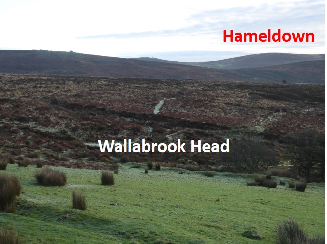
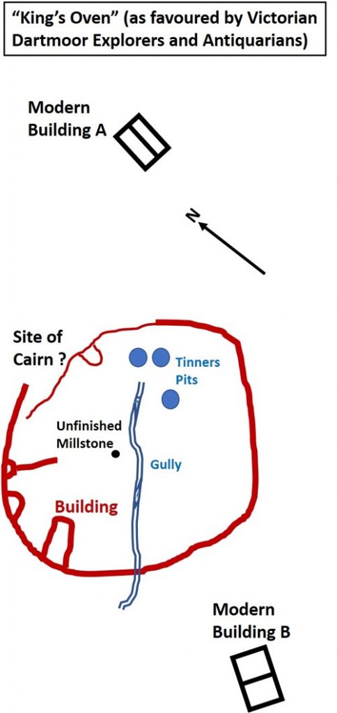
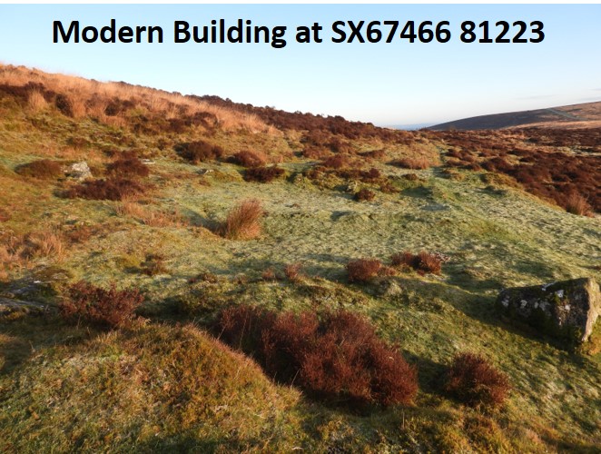
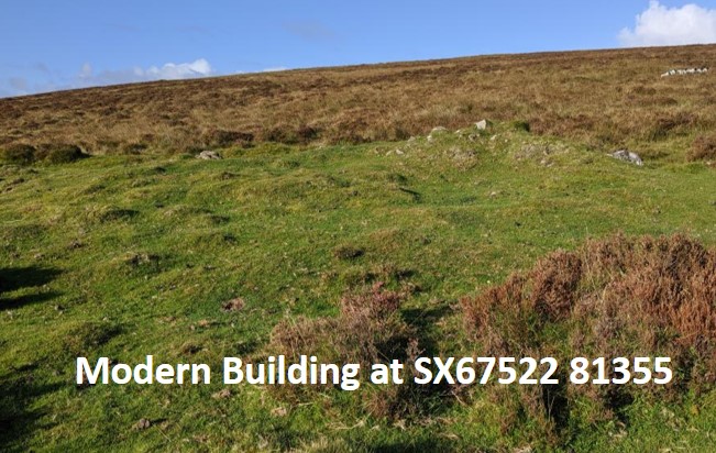
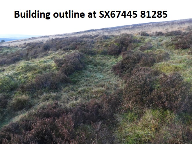
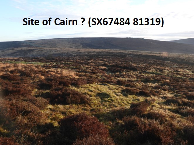
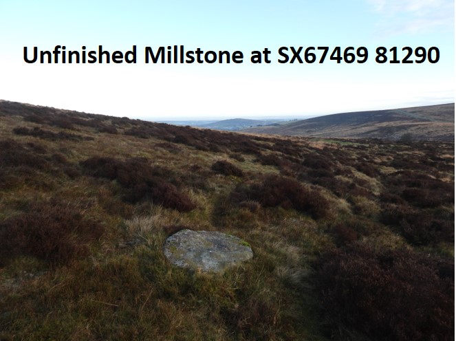
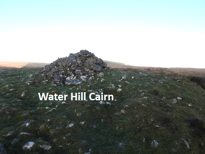
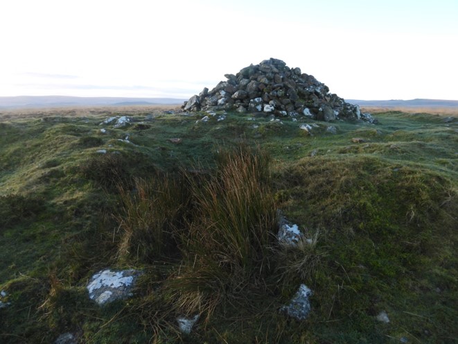
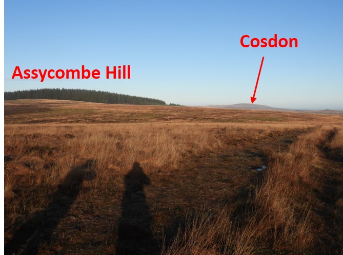
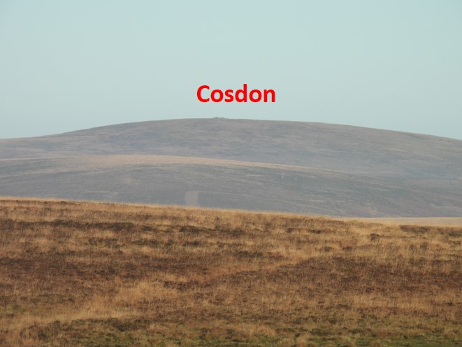
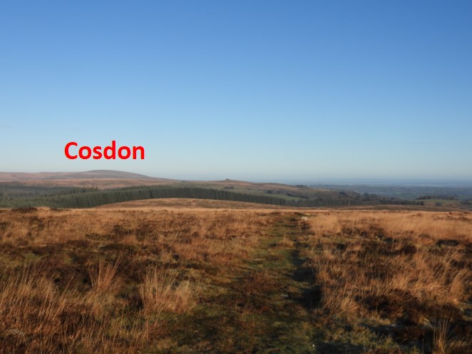
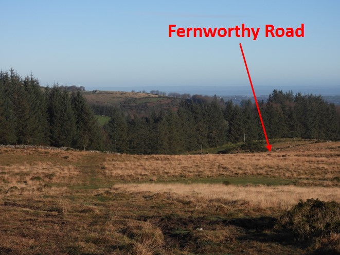
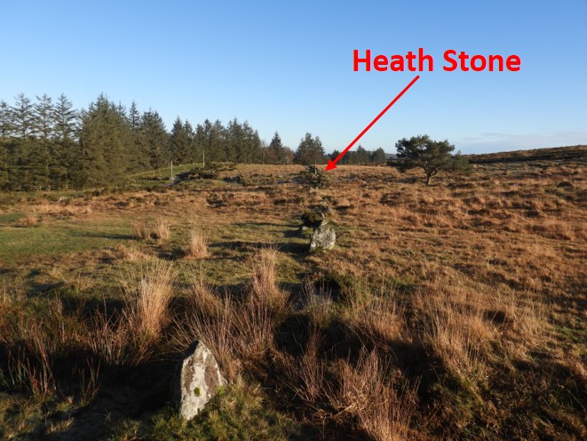
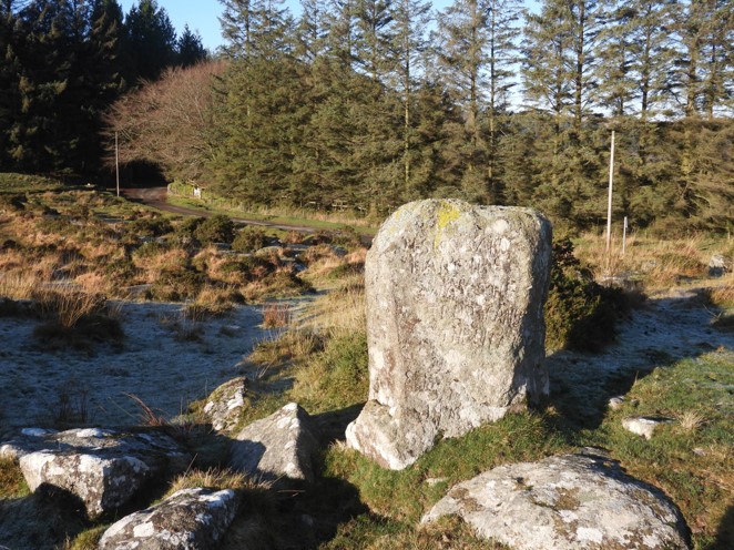
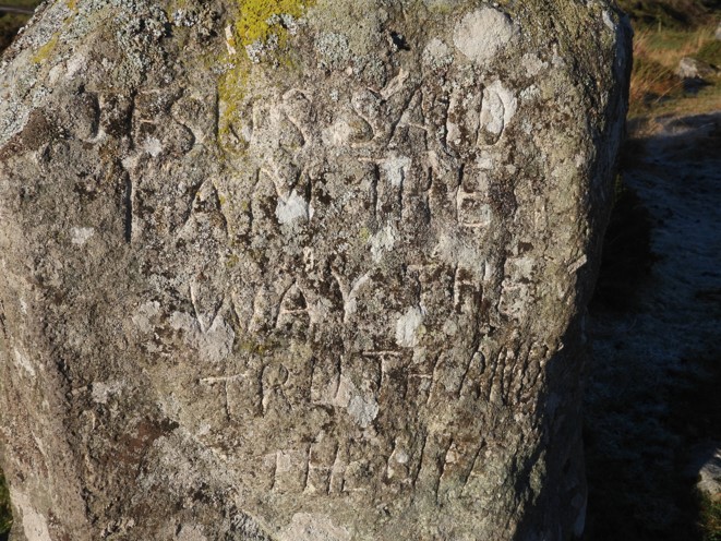
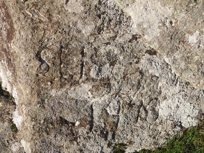
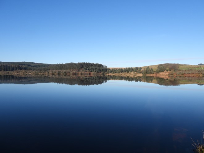
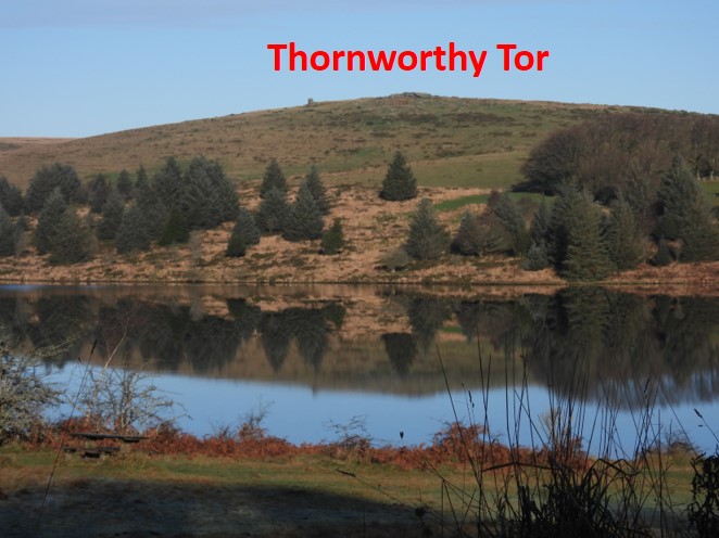
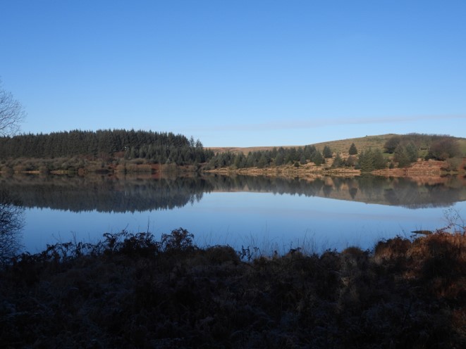
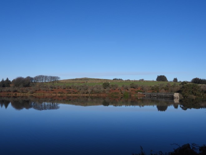
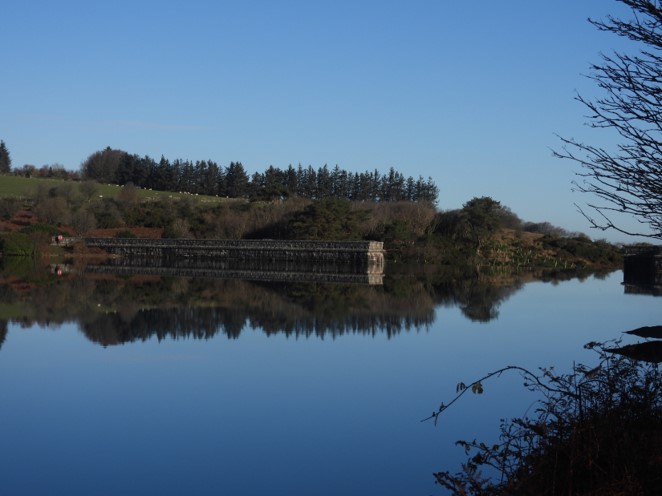
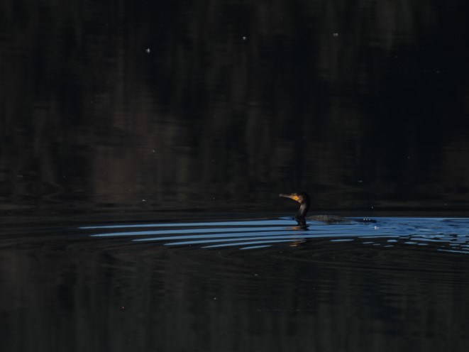
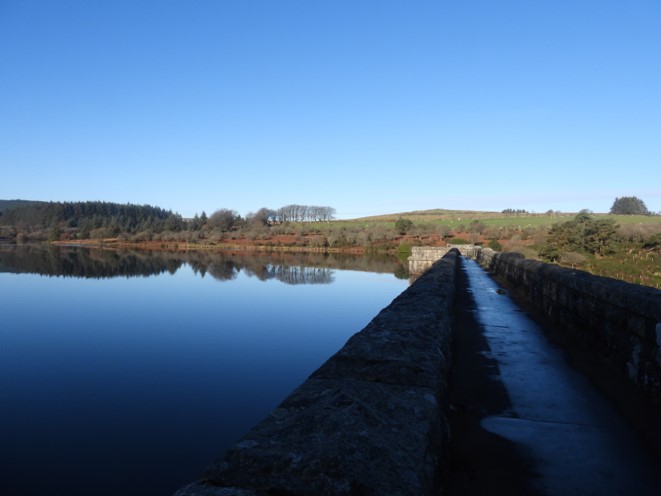
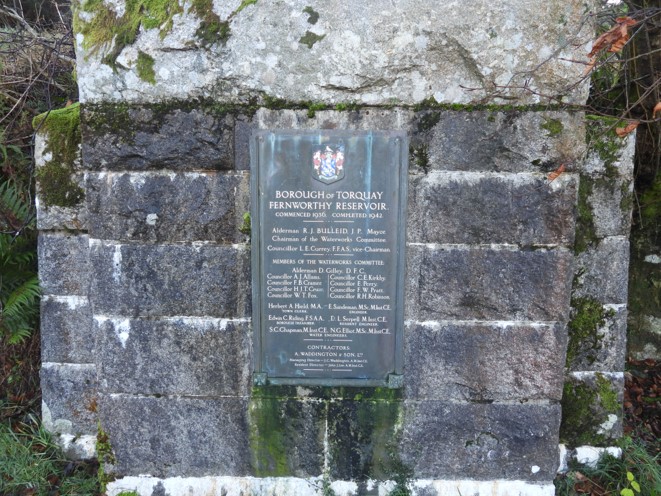
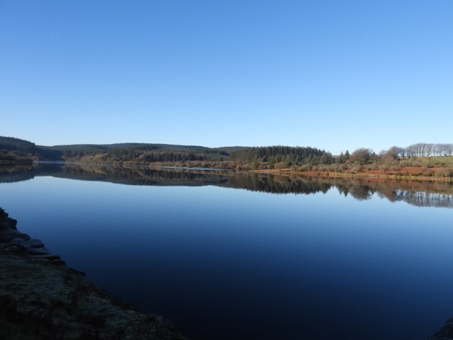
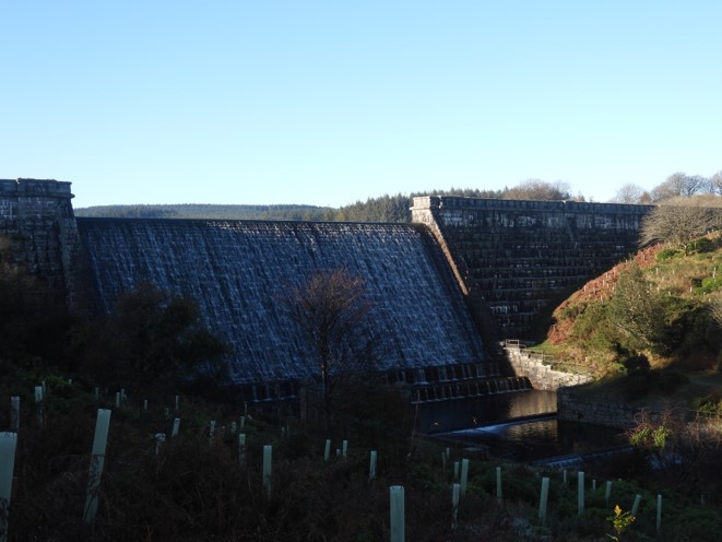
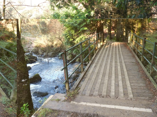
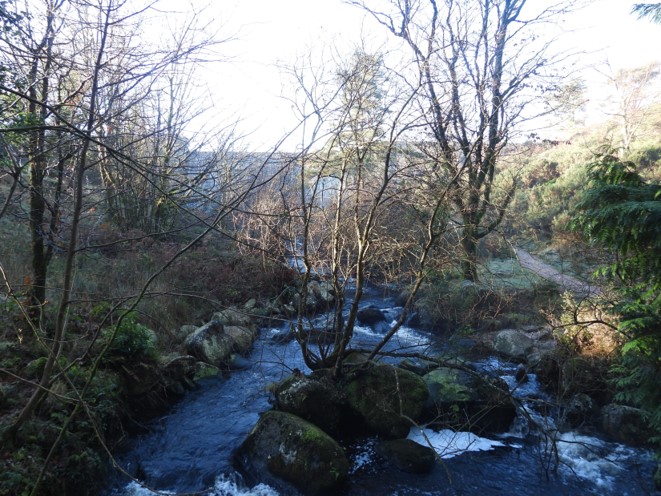
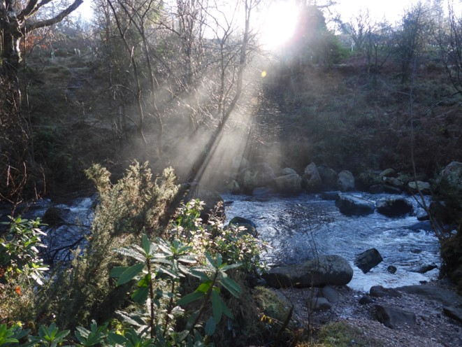
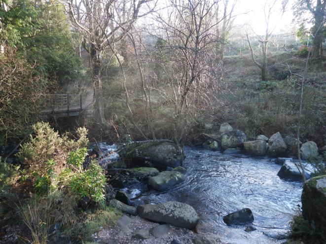
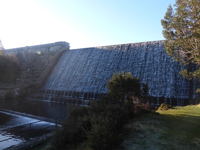
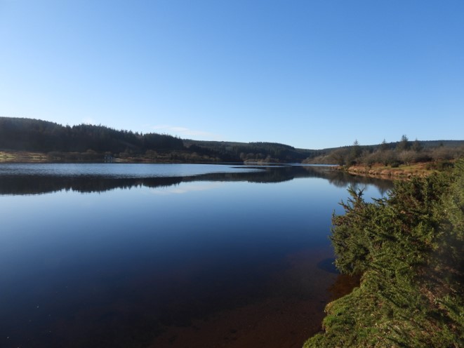
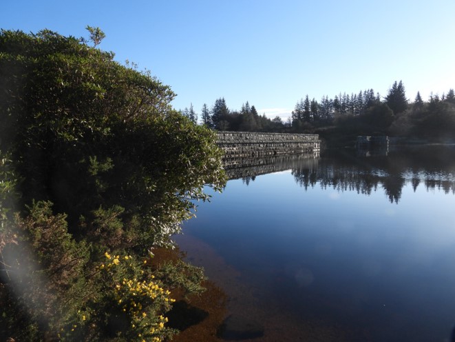
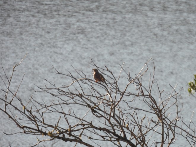
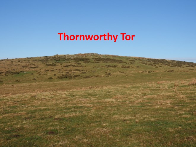
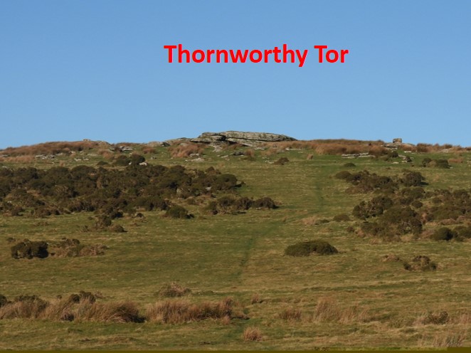
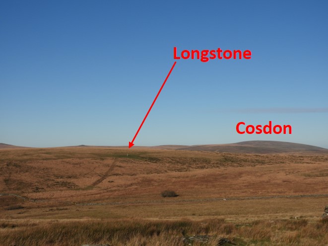
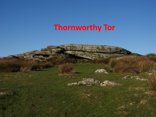
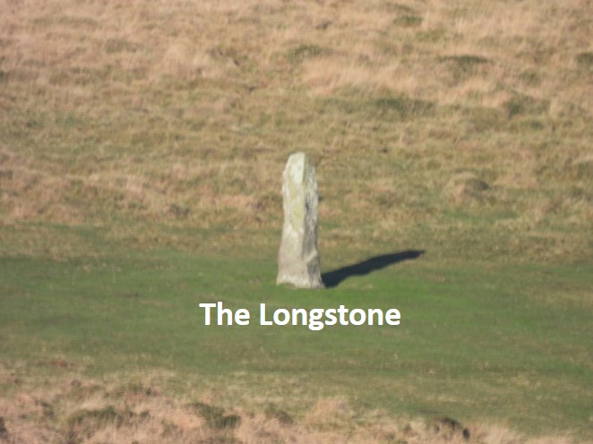
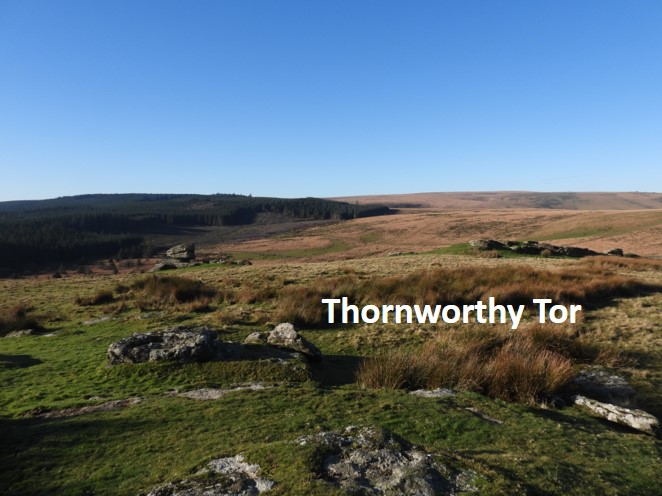
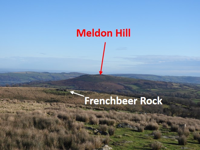
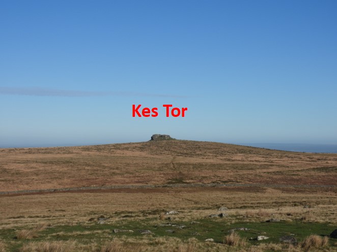
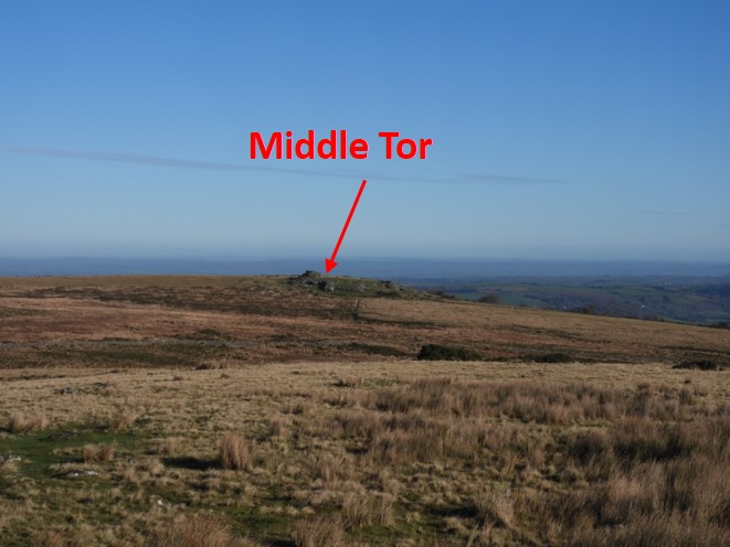
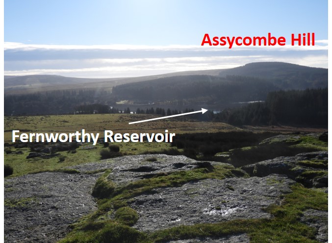
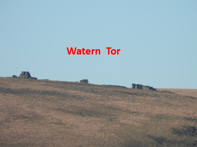
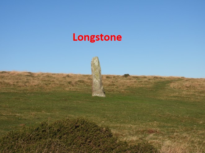
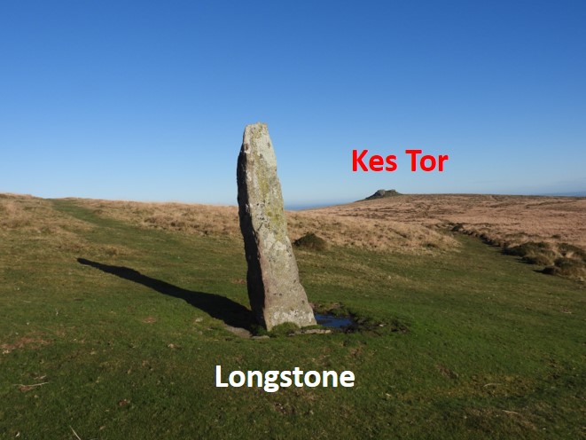
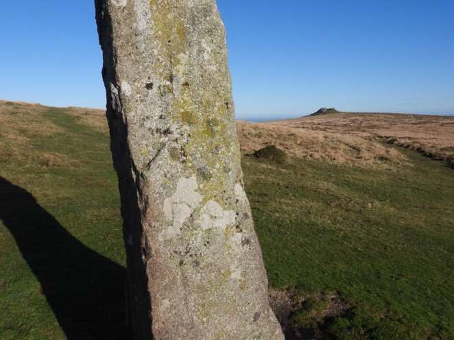
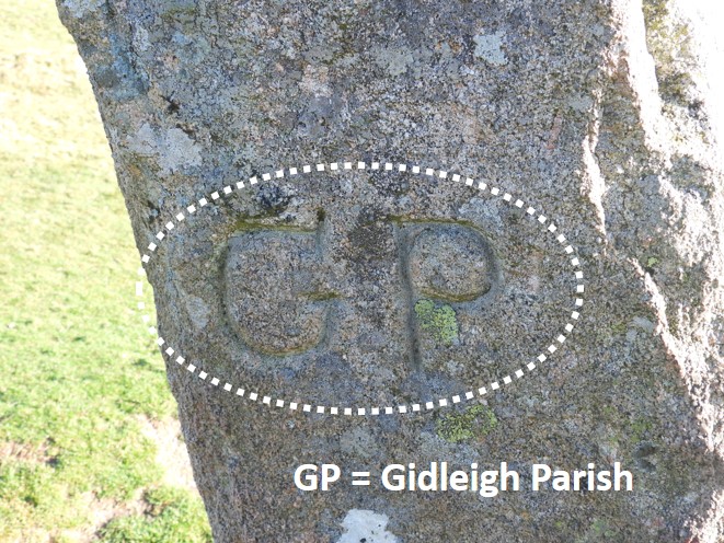
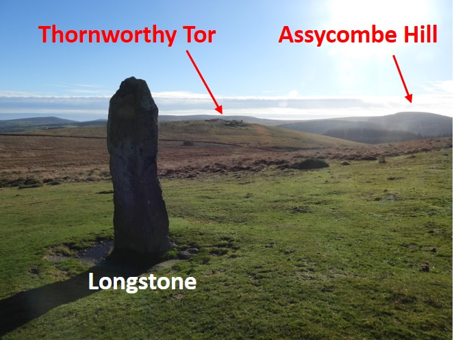
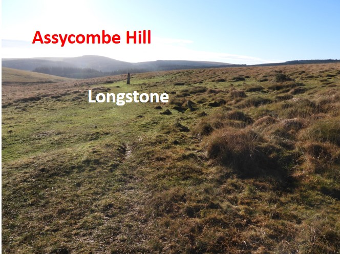
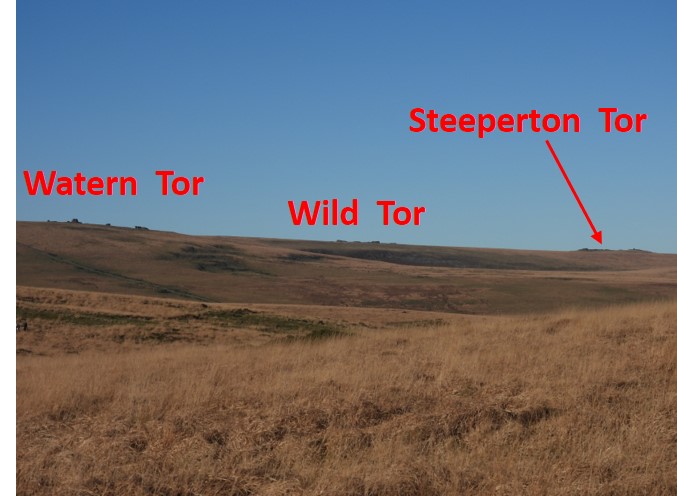
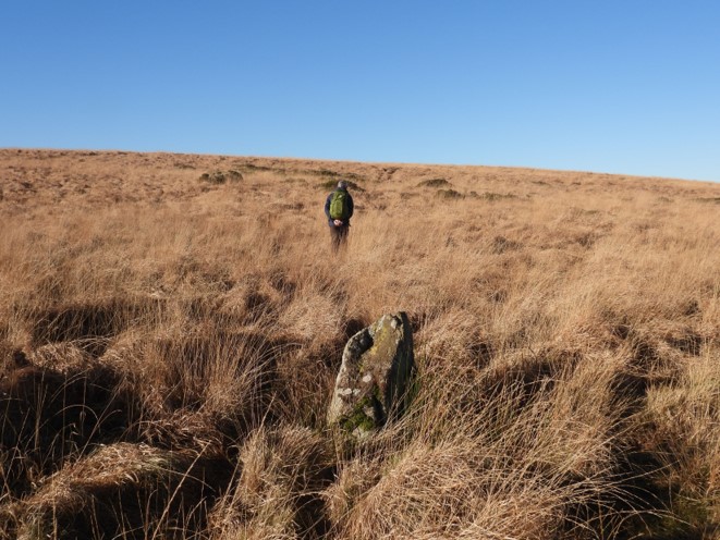
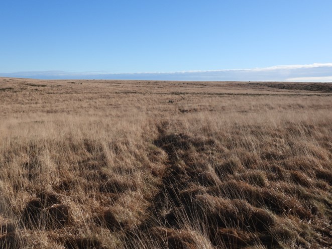
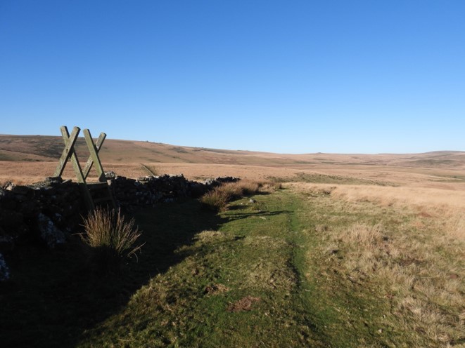
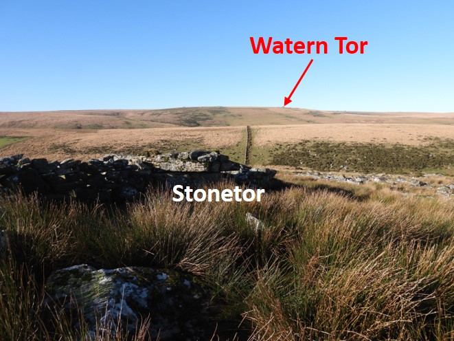
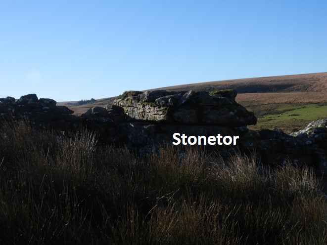
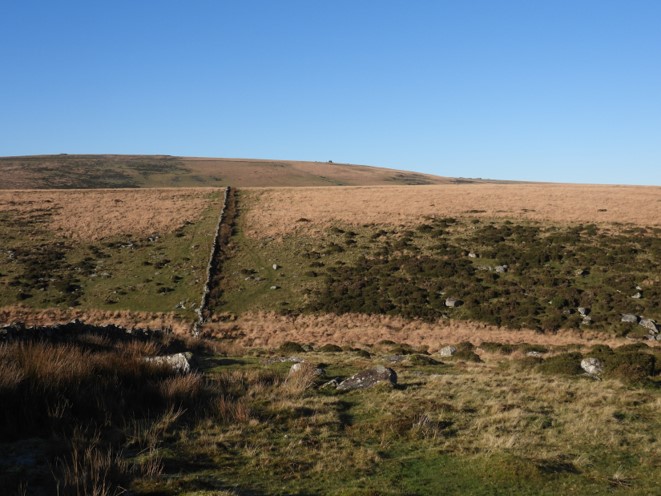
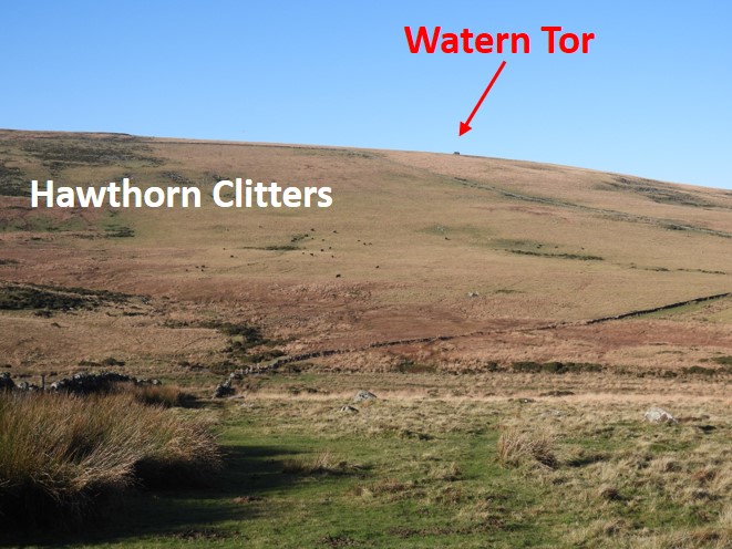
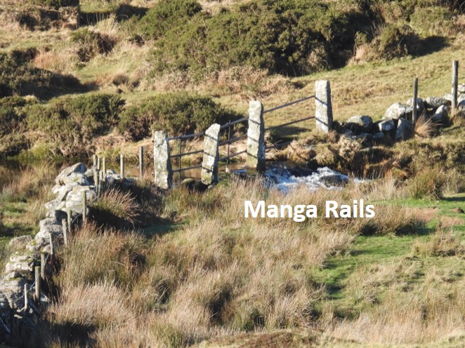
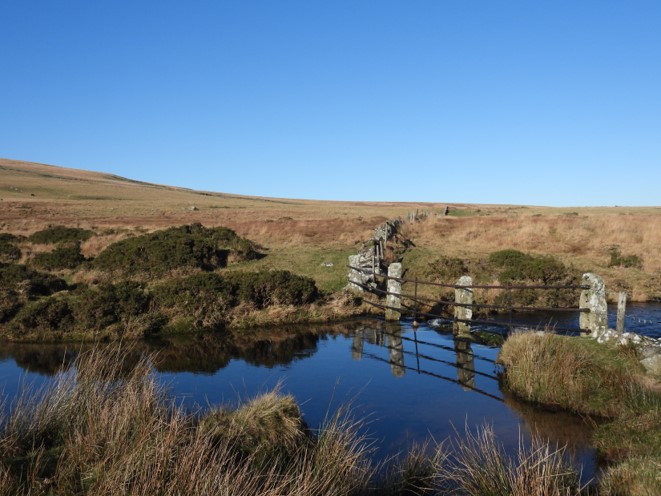
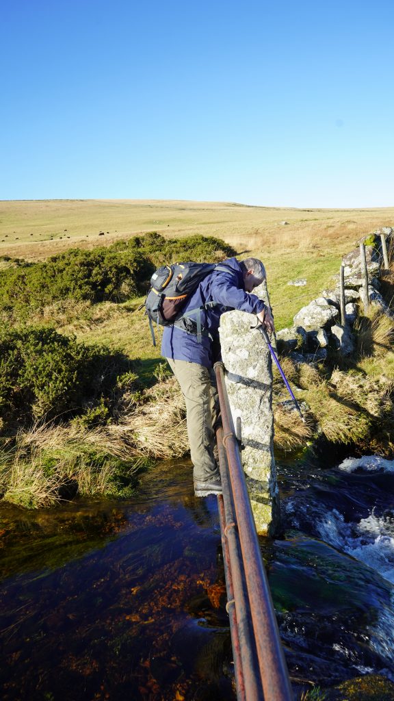
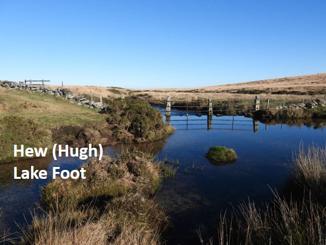
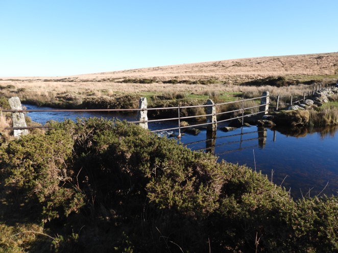
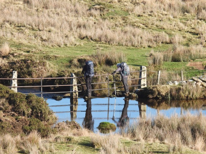
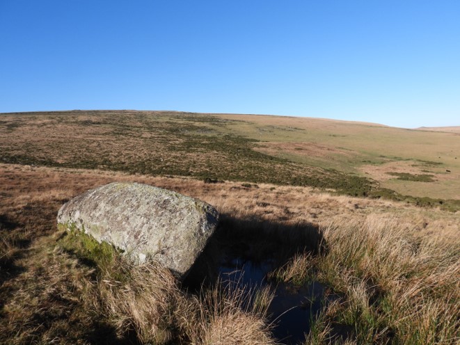
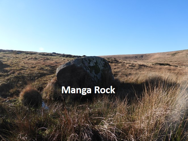
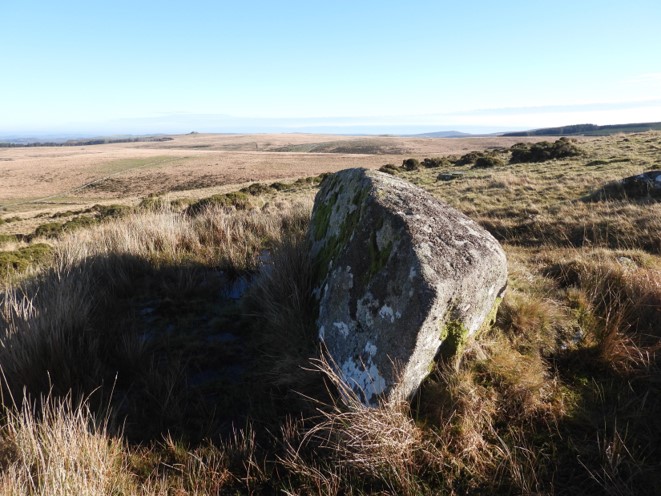
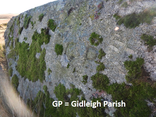
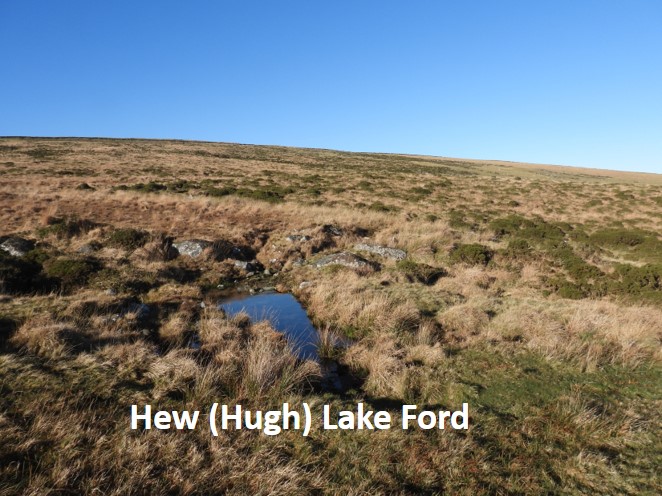
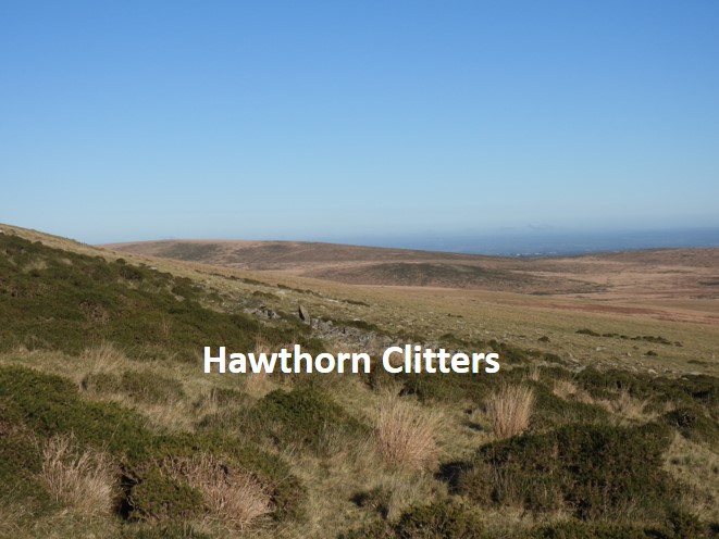
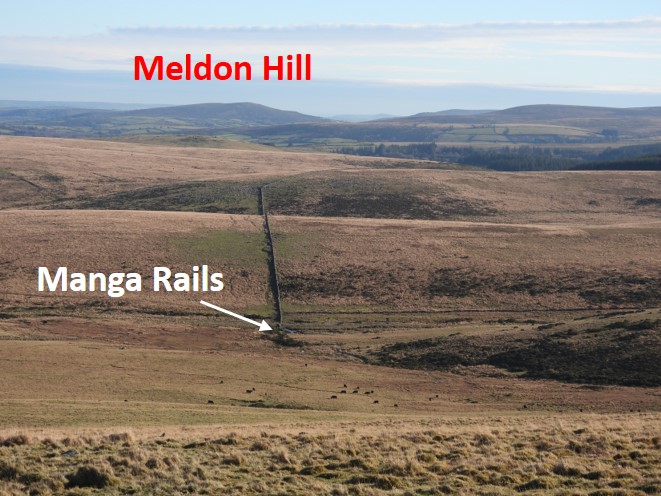
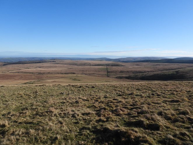
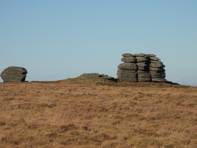
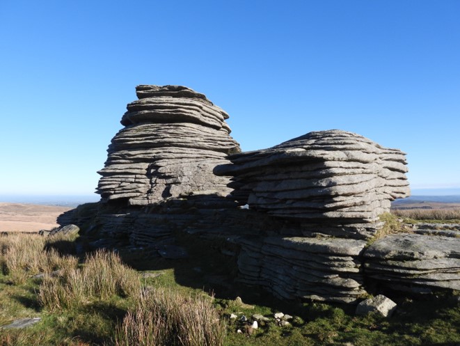
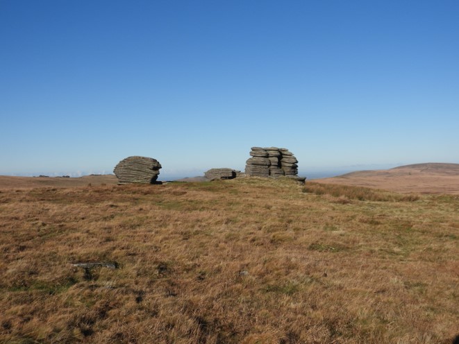
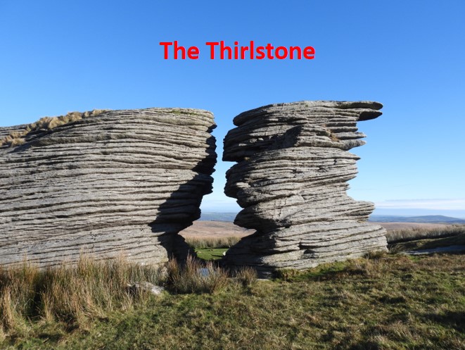
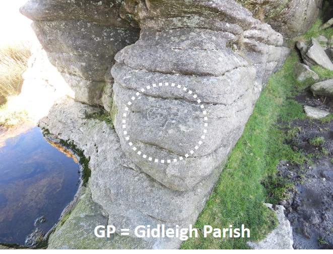
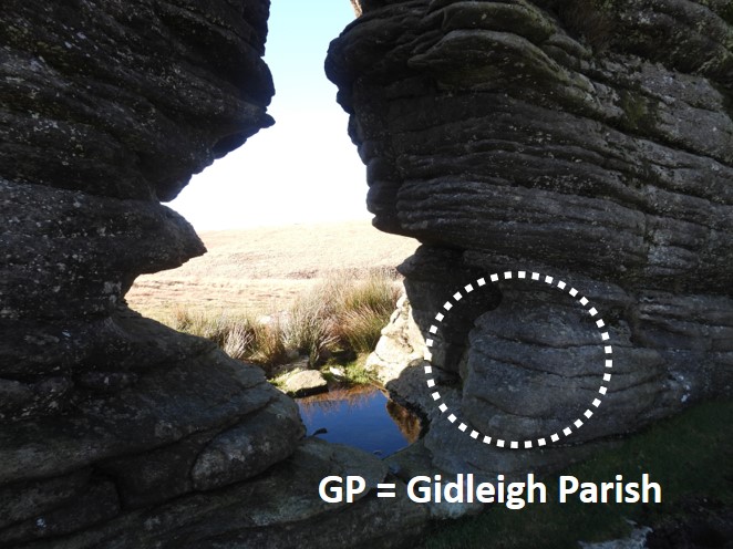
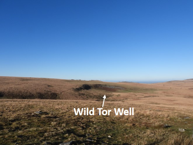
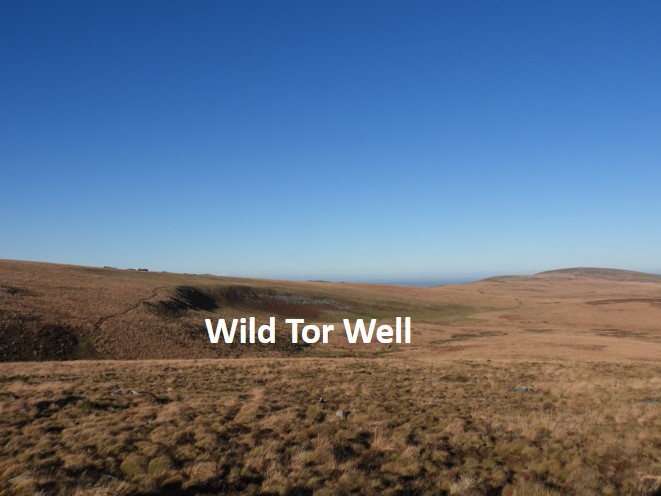
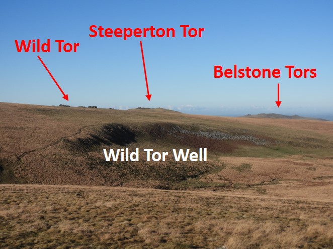
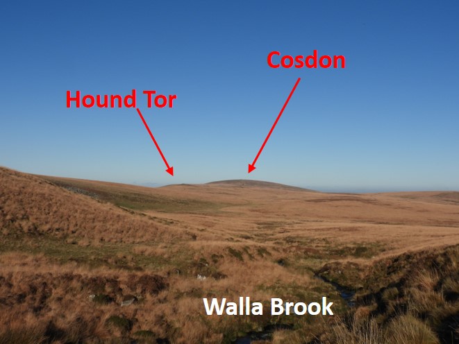
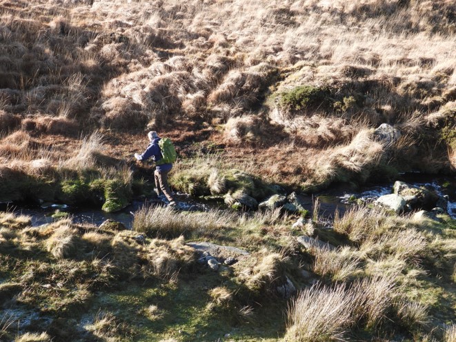
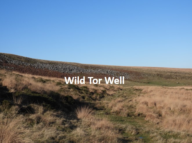
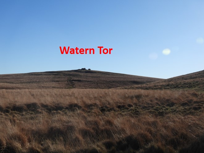
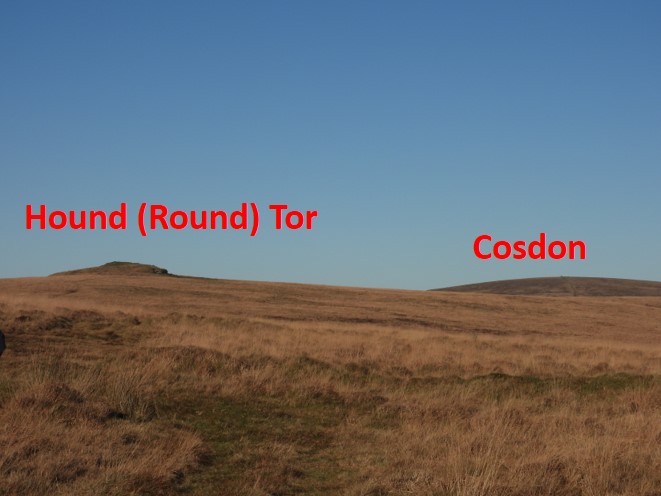
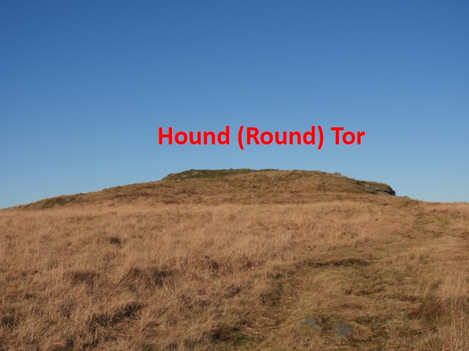
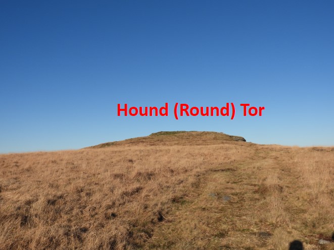
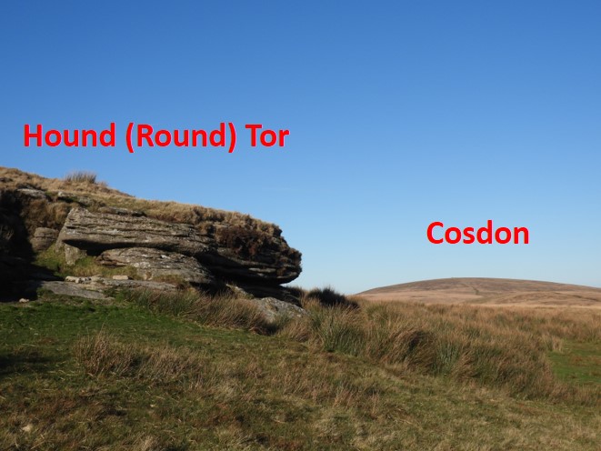
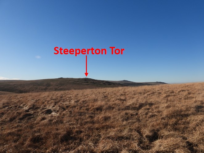
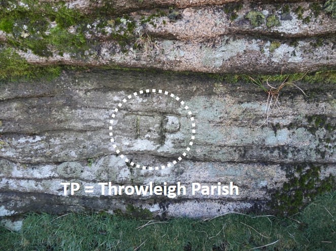
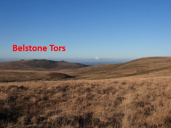
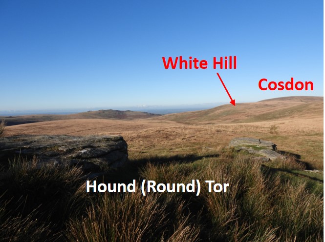
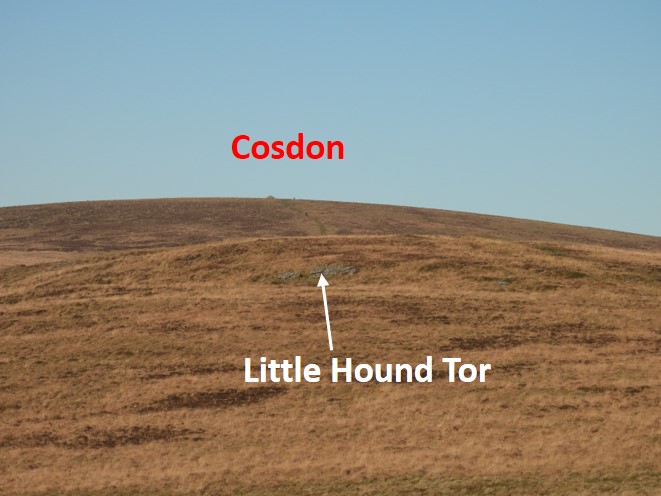
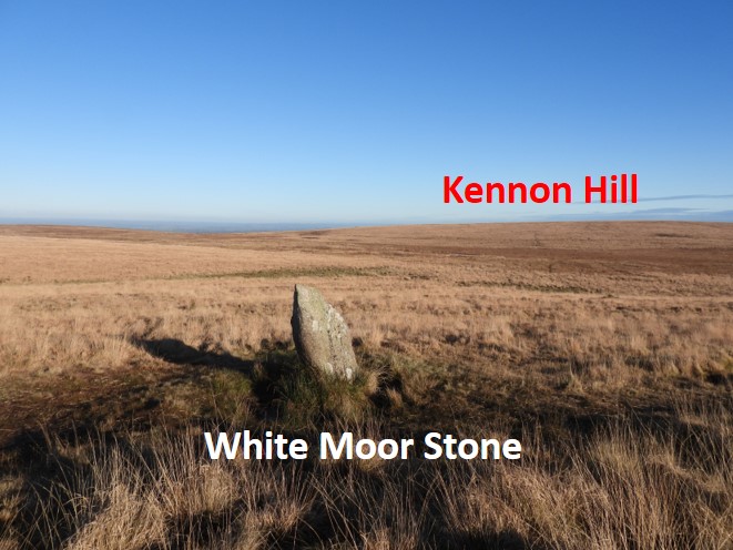
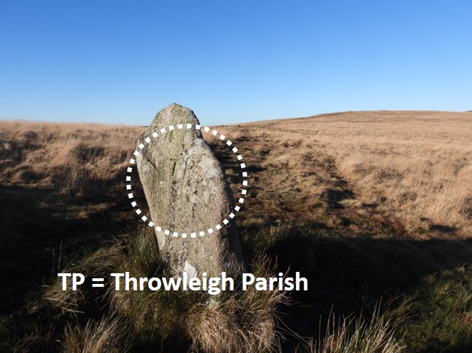
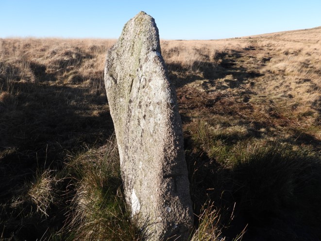
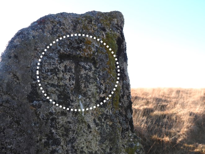
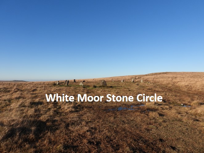
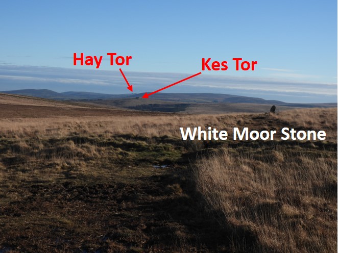
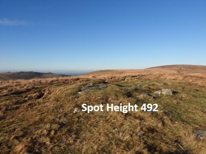
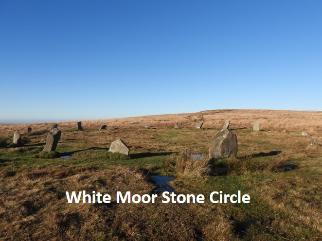
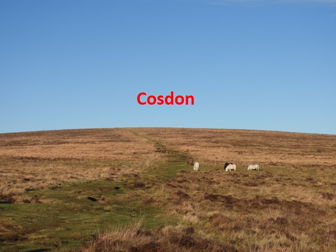
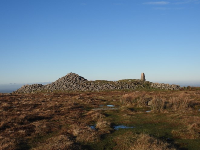
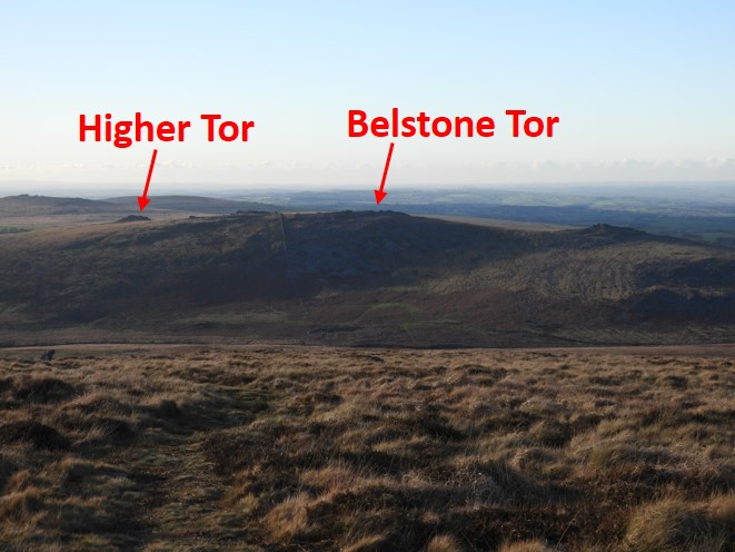
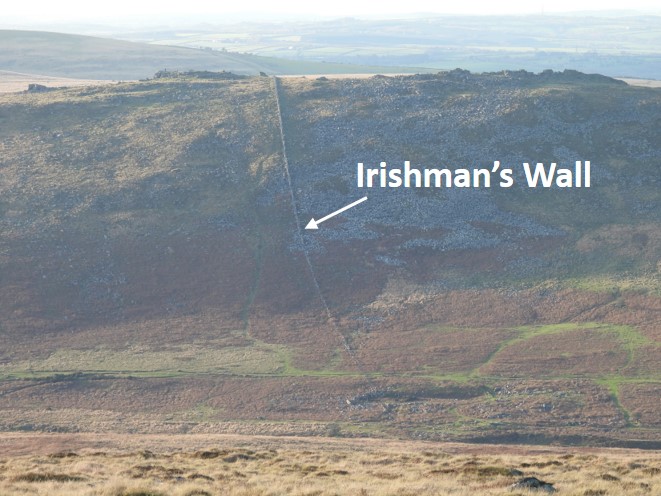
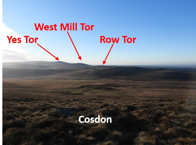
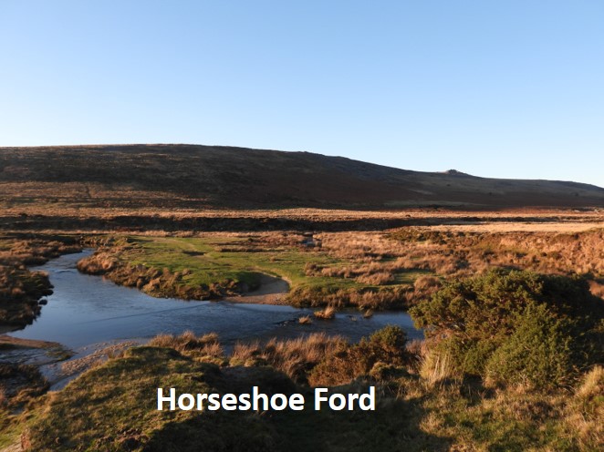
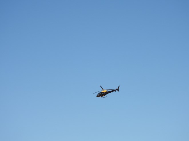
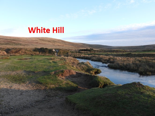
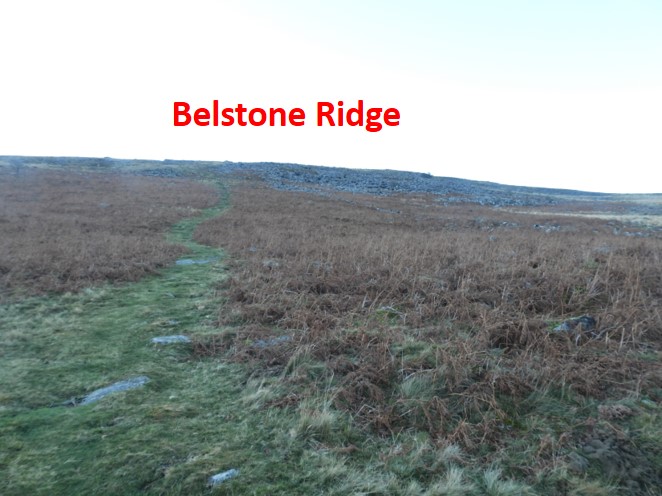
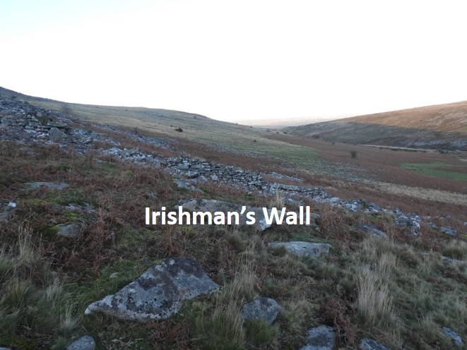
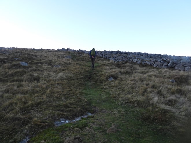
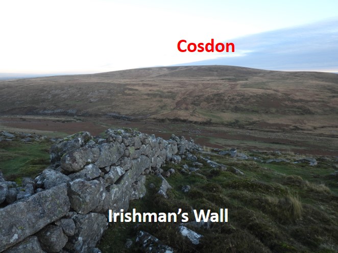
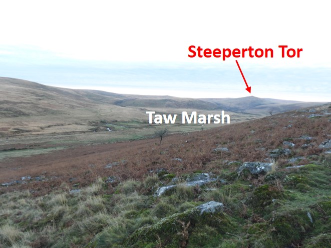
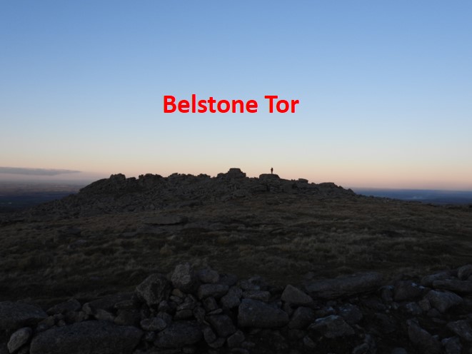
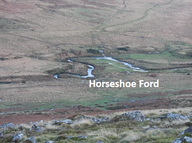
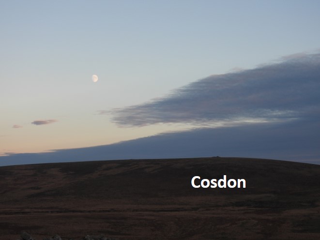
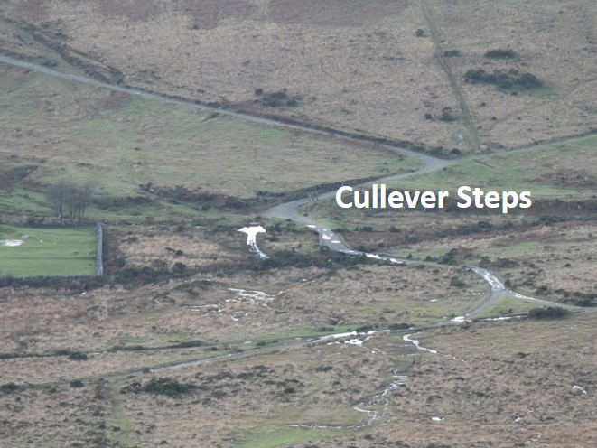
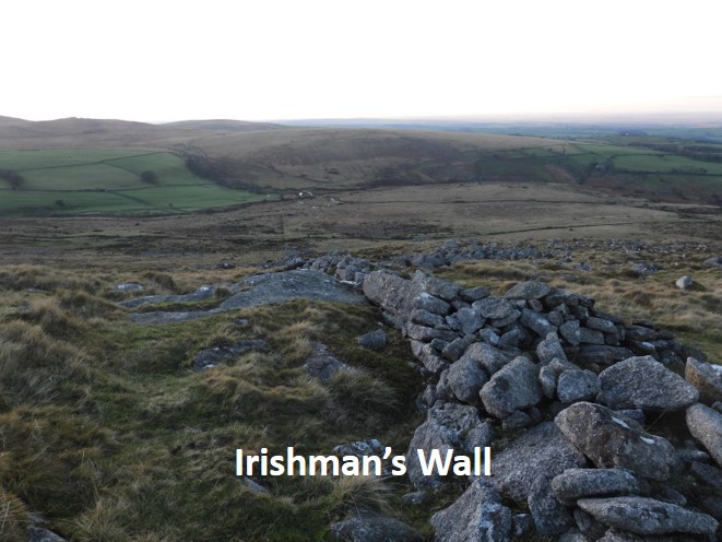
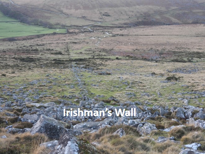
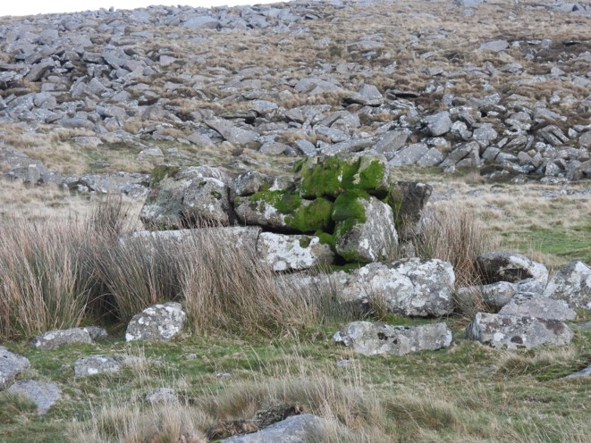
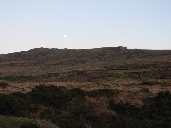
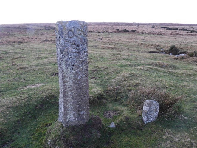
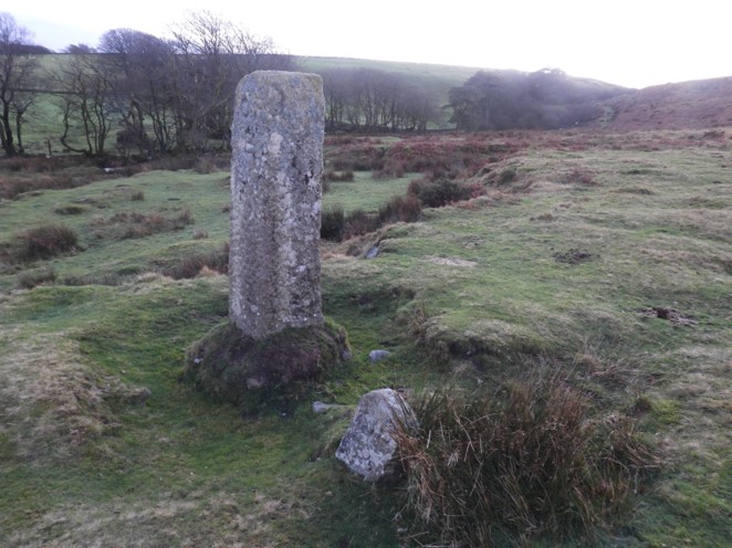
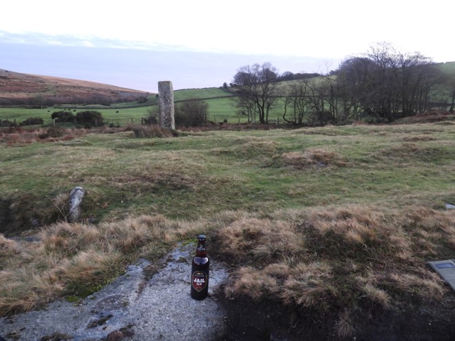
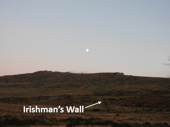
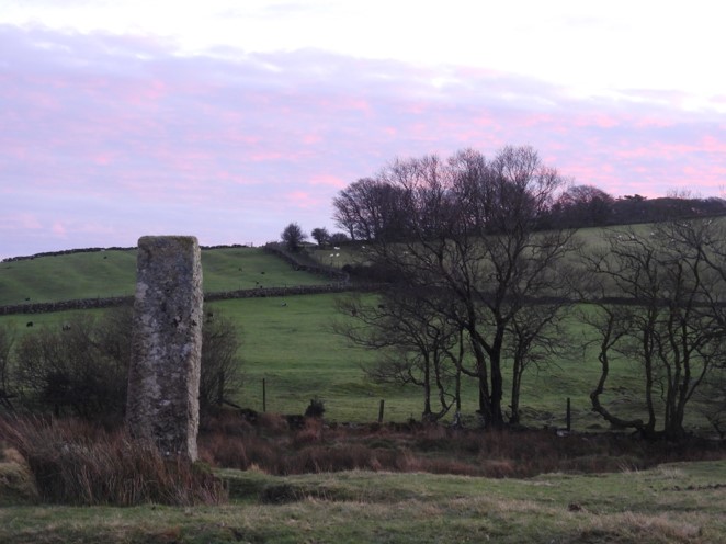
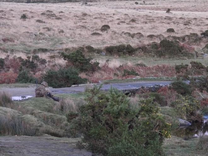
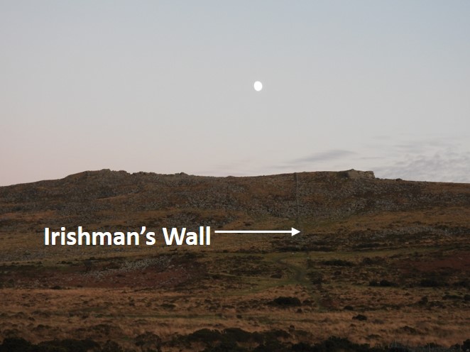
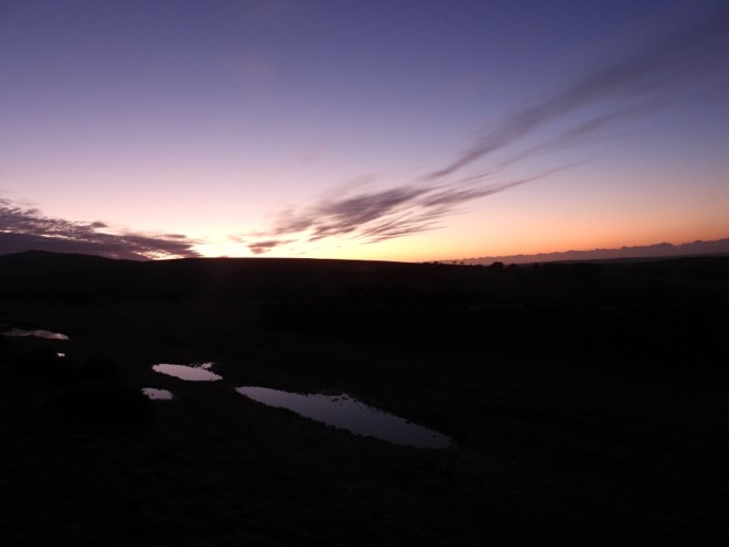
The route from Kings Oven to Cullever Steps, adapted from the Bill Ransom publication. The route followed in this post mostly follows the 1608 accepted historic boundary, except between Longstone and White Moor Stone, where the route via Watern Tor was taken. There is some debate as to what the 1608 Perambulators and 1609 Survey Court took as “Thurleston” – did they mean Watern Tor ? NOTE: CLICK ON MAP TO OPEN IN NEW TABWallabrook Head, near Warren House Inn. This was the end point of the previous stage, which was arrived at in the dark on the last stage.The first waypoint on this stage is King’s Oven (Furnum Regis), however there is some conjecture as to its precise location. Most of the Victorian Antiquarians and the modern OS map place it on the eastern slopes of Water Hill, whereas some evidence suggests it is the cairn on Water Hill. This sketch is of the area on the eastern slopes of Water Hill. For more information: https://dartmoorexplorations.co.uk/kings-oven-furnum-regis/Foundations of the modern building (B) to the south of the “Kings Oven” enclosure. It is believed that this is a mine building and the stones for its construction would have been robbed from the enclosure.Modern Building A, north of the enclosure. Eric Hemery in High Dartmoor (P706) states that: “Due east of the cairn on Water Hill (E.Dart), and on a shelf about 150 feet below it, is the ruin traditionally known as “Furnum Regis”, “Kings Oven”. A rectangular building, with a central partition and some corner stones, still in-situ, it has external dimensions of 41′ x 16′. Whether this was the smelting-house it was thought to be….” This is most likely the building Hemery was referring to as it has corner stones, unlike the Modern Building B shown previously in this post.This building outline is within the enclosure wall. Some have ventured to believe this was the where the furnace of the Kings Oven had been located.Possible cairn on the edge of the “Victorian Kings Oven”Unfinished millstone at the centre of the enclosure. This is at the centre of what is shown as Kings Oven on modern OS Maps.The cairn on Water Hill, which a lot of experts believe to be the original Kings Oven (Furnum Regis)Another angle of the cairn. The day was to be a gloriously sunny one, but wasn’t quite high enough when this picture was takenLeaving Water Hill Cairn en-route to Hurston Ridge. Cosdon some 15km away was to be visited, some 5 hours after this photograph was takenCosdon looked so close when zoomed in.Crossing Hurston Ridge, once a place where locals would have cut peat. Called “mediam turbarium de Alberesheved” or “Turbary of Alberyshede”.Approaching the Fernworthy Reservoir road, close to which is the next waypoint of the Heath Stone (Langestone or Hethstone)Reave leading up the the Heath Stone.Heath Stone (Langestone or Hethstone)Heath Stone (Langestone or Hethstone) with its inscription: “Jesus said I am the way, the truth and the light”. It was cut in 1970 by Sydney Potter, the then supervisor of the Fernworthy Reservoir.Heath Stone (Langestone or Hethstone) date: “Sept 1970”Fernworthy Reservoir, like a millpondThornworthy Tor reflecting in Fernworthy ReservoirFernworthy Reservoir. The original perambulation route went in a straight line towards Thornworthy TorFernworthy Reservoir, with dam and Thornworthy TorFernworthy Reservoir Looking like an infinity pool over the dam spillwayBird life on the reservoirThe damFernworthy Reservoir plaque commemorating its completion in 1942Mirror finishThe spillwayCrossing the South Teign below the dam, the short diversion required by the modern perambulatorView of the South Teign from the bridgeSun filtering through over the South TeignThe bridge over the South TeignThe spillway from the north side of the riverLooking up the reservoir from the north side, en-route to Thornworthy Tor.The dam from the north sideMore bird life before heading off towards Thornworthy TorLeaving the reservoir, the path takes the perambulator to a gate with open moorland beyond. Thornworthy Tor offers the perambulator superb views on a clear dayFollowing the path to the summitView from Thornworthy Tor summit. The next waypoint for the perambulator, the Longstone can be seen.Summit rocksZoomed in view of the LongstoneLooking west from the summitGreat views to the east from Thornworthy TorKes Tor from Thornworthy TorFrenchbeer Rock from Thornworthy TorLooking south from the summit, back to the reservoir and Assycombe HillWatern Tor some 4km away, the lunch spot for today. The perambulators stated one of the waypoints was “Thurleston” – did they mean Watern Tor, which has a Thirlstone ?Having crossed a boggy section below Thornworthy Tor, the next waypoint the Longstone is approached. Classic picture of the Longstone with Kes Tor behind. Known to the perambulators as Hengheston or Heighstone .Close up of the Longstone reveals the inscribed initials “DC”, which stands for Duchy of Cornwall.The Longstone also has the inscription “GP”Looking back to Thonworthy Tor and Assycombe Hill from the LongstoneWalking away from the Longstone, a small rather indistinct stone row can be followedFrom the Longstone, the perambulator needs to cross some featureless moorland en-route to Hew (Hugh) Lake Foot on the River Teign (North Teign)Approaching Stonetor Hill across some featureless ground, albeit there is a prominent rock or two Looking back from whence we came. A faint track was followed from the Longstone.The wall at Stonetor Hill makes for a guide down to the Teign.An outcrop in the wall, known to the author as StonetorThe outcrop on Stonetor HillSteadily moving west, a little “undulation” in the terrain when following the Stonetor Hill wall. Watern Tor lies on the far horizon.A final descent to the North Teign, with Hawthorn Clitters and Watern Tor beyondManga Rails, a great crossing point of the North Teign, adjacent to Hew (Hugh) Lake Foot.Getting ready to cross, best done on the south side to avoid stretching out around the granite posts.Slowly does it…..Hew (Hugh) Lake Foot (Wotesbrokelakesfote) next to Manga RailsThese rails have been replaced in the 1990’s and the 2010’s to the authors knowledge. Eric Hemery, in High Dartmoor (P819) stated: “The ancient Mangersford (Manga Ford) is known, from the granite posts that once supported horizontal timbers, as Rails” Hemery suggests these were put in place around 1780 in order to prevent livestock straying away from Teignhead Newtake.Looking down on the rails from the Manga Rock area, two more intrepid walkers crossing the rails, preferring the “feet in water” method.Manga Rock. Shown on modern OS maps. View overlooking Hew (Hugh Lake) towards Hawthorn Clitter.Another view of the rock, this time from the east.Manga Rock from the westManga Rock is inscribed with a “GP”If the perambulator contours towards Hawthorn Clitter a ford across Hew (Hugh) Lake is reached.Passing Hawthorn Clitter en-route to Watern TorAbove Hawthorn Clitter looking east back towards Manga Rails and Stonetor Hill. Meldon Hill can be seen beyond.Another expansive view from above Hawthorn Clitter.Approaching Watern Tor from the south, which was to be the lunch spot for this perambulatorThe southerly outcrops of Watern TorA panned out view of Watern Tor from the southThe Thirlstone at the north end of Watern Tor. There is some debate as to what the 1608 Perambulators and 1609 Survey Court took as “Thurleston” – did they mean Watern Tor ?In the Thirlstone, lies the inscription “GP”Panned out location of the “GP” inscriptionA view towards Wild Tor Well from the north end of Watern Tor, the location of lunch!The pathway below Wild Tor Well leads to Hound Tor, the next waypoint the thence onto Cosdon. Between Watern Tor and Wild Tor Well, the perambulator must cross the Walla Brook.Beyond Wild Tor Well, the rocky outcrops of Wild Tor, Steeperton Tor and Belstone Tors can be seen. The perambulator will need to cross Belstone Tors at Irishman’s Wall to get to Cullever Steps, some 10km distant.Crossing the Walla Brook and Hound Tor (Hundetorre) with Cosdon (Cosdonne) beyond,. From this point Cosdon is about 90 minutes steady walk away.Action shot – crossing the Walla Brook in a single stepApproaching Wild Tor Well on a wide pathLooking back at Watern Tor from Wild Tor WellHound Tor is also known as Round Tor. This view is from Wild Tor WellApproaching Hound Tor from the south along a wide pathGetting tantalisingly closerClosing in on the torFrom Hound Tor looking westInscription on Hound Tor, one for “beating the bounds” of Throwleigh ParishView looking North-West from top of Hound Tor. To the right in the photograph is White Hill, with the Flock o’ Sheep rocks on its slopesAnother view from the top of Hound TorLeaving Hound Tor along the wide path the diminutive rocks below spot height 492 of Little Hound Tor (Little Houndetorr) can be seen to the north of White Moor Stone CircleThe White Moor Stone, where the ancient and modern boundaries re-join.Close up of the White Moor Stone, with another inscription.The angle of the sun, making the “TP” inscription very discernibleA “T” on the White Moor Stone stands for TawtonA short distance from the White Moor Stone is its namesake circle.Looking back from the White Moor Stone Circle towards White Moor Stone. Expansive views to the east can be seen as far as Hay Tor.Spot Height 492 near White Moor Stone Circle, not to be confused with Little Hound Tor which lies a few 10’s of metres away.The stone circle looking towards spot height 492Leaving spot height 492, a log wide track leads uphill to Cosdon (Cosdonne or Hogam de Costdonne), the penultimate waypoint on this stage of the perambulation,The top of Cosdon (Cosdonne or Hogam de Costdonne), with its cairn and 1930’s trig point. Reached at 1445, enabling this perambulator to get to Cullever Steps in the light!Leaving Cosdon on its west side, great views of the Belstone Ridge can be had, beyond which lies Cullever Steps, the completion point for this perambulator.Zooming in on Belstone Ridge, the “sting in the tail” of this stage of the perambulation can be seen, namely: Irishman’s Wall. A steep climb up and over is required !Zoomed out descent of Cosdon as the sun gets lower in the sky, casting shadows on the east side of Belstone Ridge.The final river crossing. The Taw is best crossed at Horseshoe Ford with its hard base. Most of the year this can be simply walked across without getting wet feet.A police (?) helicopter over Taw MarshThe ford safely crossed, looking back to the heights of White HillApproaching Irishman’s Wall. “The only way was up!”The Irishman’s Wall, looking north up the Taw valleySlowly, slowly climbing the hill next to the wall.Approaching the crest of the hill, looking back at CosdonLooking south from Irishman’s Wall across Taw Marsh to Steeperton TorOn the crest of Belstone Ridge. A lone walker is seen on Belstone Tor, who was setting up a tripod to take pictures of the sunsetZooming in back to the Taw river crossingCosdon from Belstone Ridge with a waxing moon.Zoomed in view of the end of this stage and of the whole perambulation for the author, Cullever Steps.Descending the west side of Belstone Ridge alongside Irishman’s WallThe perambulator will need to avoid some clitter on this side of Belstone RidgeLooking back up to top of Belstone Ridge. By far and away the most granite seen on this stage of the perambulationThe Historic Environment Record, HER (MDV105280) has this as a ‘firing platform’. Next to Irishman’s Wall. SX61125 91998Looking back from the descent alongside Irishman’s Wall. Moon rise above Belstone RidgeThe end. The two OP B standing stones at Cullever Steps, which this perambulator left two months and over 50 miles ago. Time to take a short rest…………and have some liquid refreshment (cheers!)Supping the ale, watching the moon over Belstone RidgeLooking south west at the sunset beyond the OP B standing stonesTwo Rifles were training at Cullever Steps and looked like they were in for a cold nightA lone member of Two Rifles, looking cold at Cullever Steps bridge.En-route back to the car at Belstone, starting to get darkThe last view of sunlight from the track over Watchet Hill, taken just before 5pm