A collection of walks, discoveries, insights and pictures of exploring Dartmoor National Park
November 6, 2020
PERAMBULATION OF THE FOREST OF DARTMOOR (RATTLEBROOK FOOT TO PRINCETOWN)
Steve Grigg
The full Perambulation of the Forest of Dartmoor is around 50 miles. This post covers one leg (or around 20% of the route). The perambulation is being completed for the fourth time by the author as part of the 780th anniversary (1240-2020), having first completed it in 1990 (750th Anniversary). Each of the previous three perambulations were completed in a clockwise direction, this one being anti-clockwise.
The story of the Dartmoor Perambulation starts with King John in May 1204, when in a desperate attempt to raise funds for an army to for a war with King Phillip of France, he gave up his rights in Devon but retained the highlands of Dartmoor. It is believed it raised 5000 marks for the crown. In those times the term “forest” in this context was crown land, reserved for hunting comprised trees, turf and vegetation, where hunting would have included deer, hare, rabbit, pheasant, boar, wolf, fox, martin, partridge, quail, heron and mallard. The boundary was important as revenue could be derived from activities within the forest. King John failed (as with Saxon and Norman tradition) to order a “perambulation” to seal the boundary lines. However, in spite of this, it was not until his son, King Henry III came to the thrown that the first perambulation of Dartmoor was secured, this was in 1240. The perambulators completed their task on the 24th of July who were: William Brewer, Guy Breteville, William Wydeworthy, Hugo Bellay, Richard Gyppard, Odo Treverbyn, Henry the son of Henry, William Trenchard, Phillip Parrer, Nicholas Heamton, William Moreleghe and Durant the son of Boton.
The original 1240 perambulation was written in medieval latin and was subsequently open to interpretation for a few centuries. In 1608/9, a major attempt was made to clarify the boundary and later when OS mapped Dartmoor in 19th century, they relied on locals to define the boundary. Both these boundaries are shown in this post, however, the 1608/9 boundary is the one that most modern “perambulators” follow.
Note: The source of information for the above has been from: a) Dartmoor’s Greatest Walk by Bill Ransom (1987) – Devon Books, b) Dartmoor’s Greatest Long Distance Walk by Roland Ebdon (2016) – Halsgrove and c) Dartmoor Boundary Markers by Dave Brewer (2002) – Halsgrove
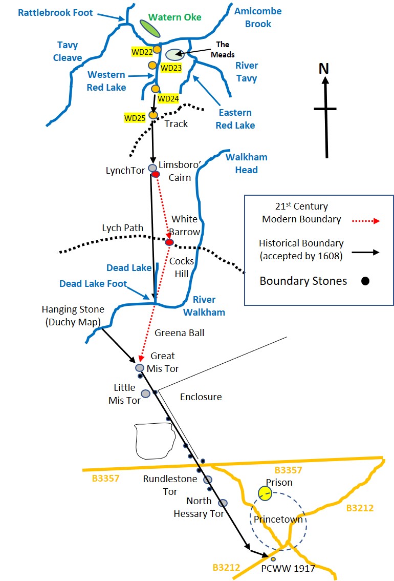
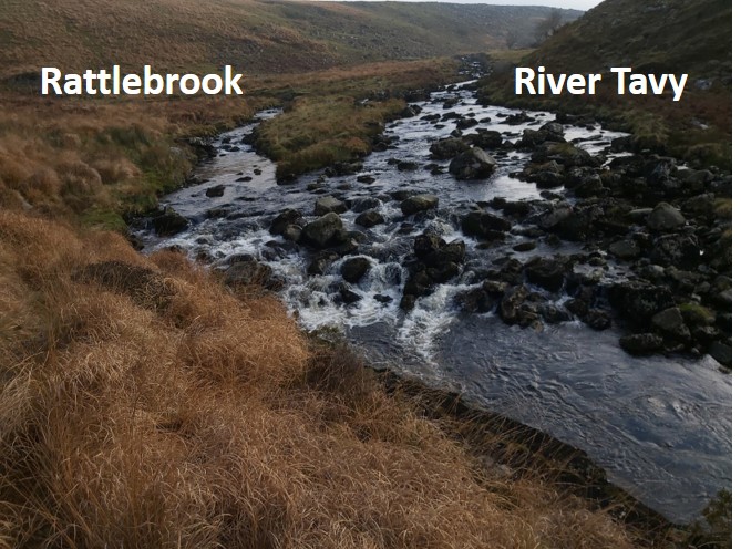
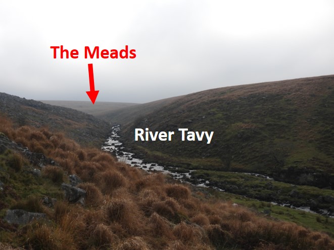
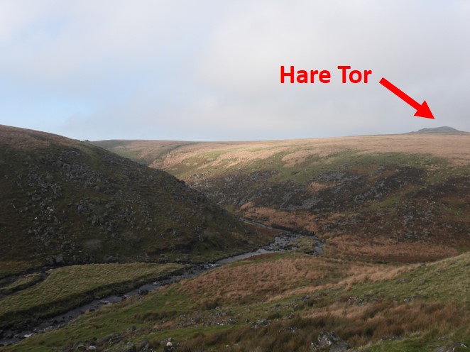
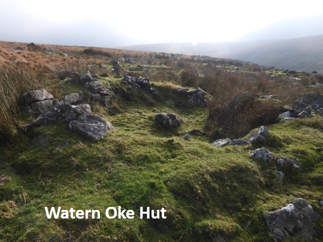
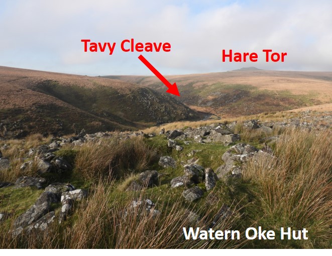
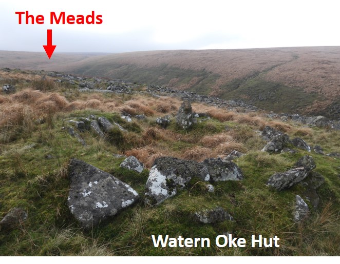
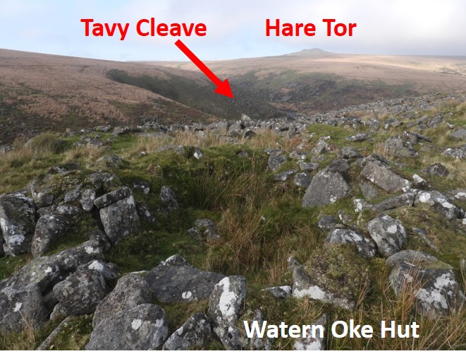
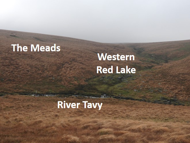
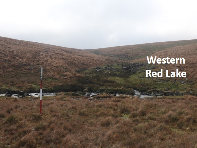
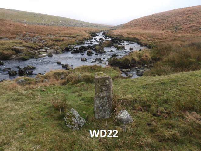
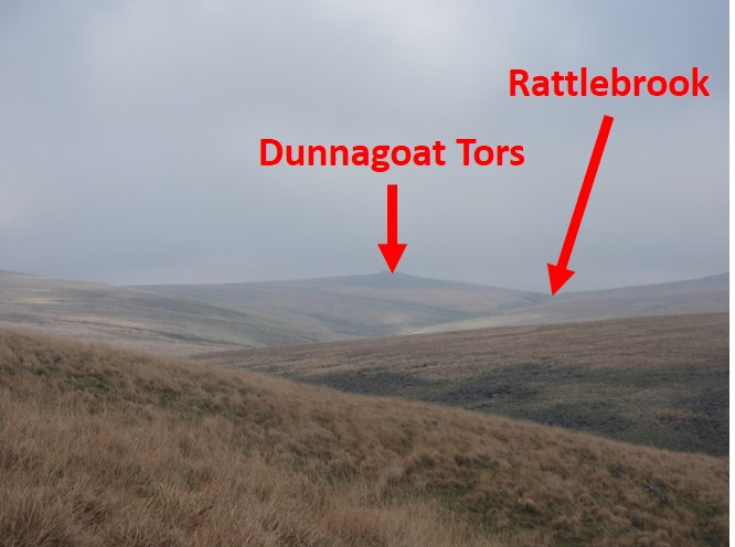
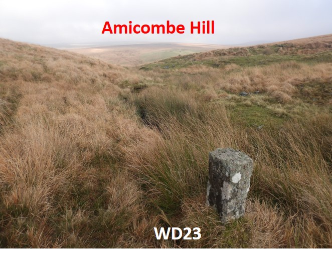
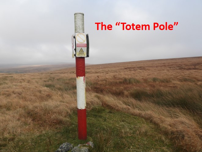
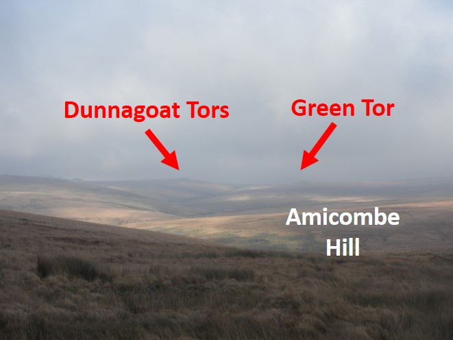
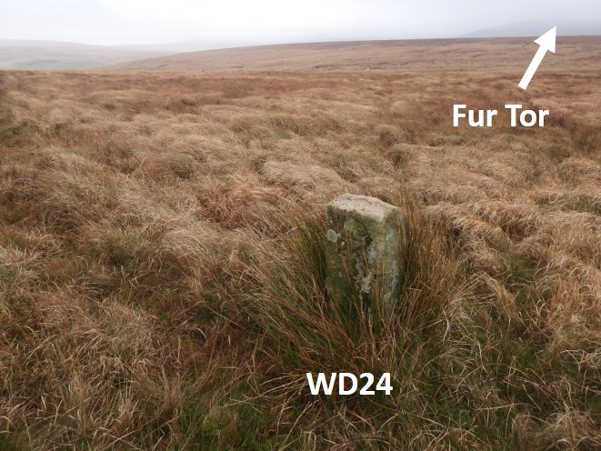
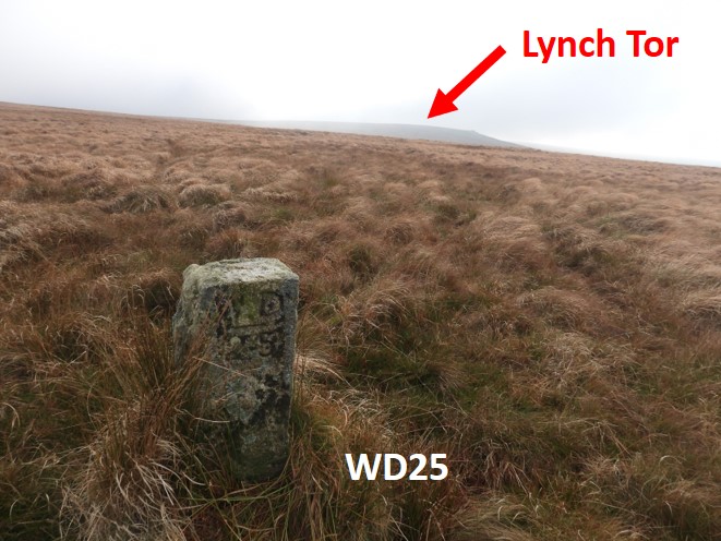
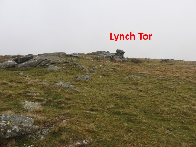
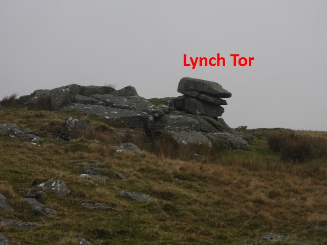
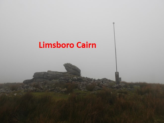
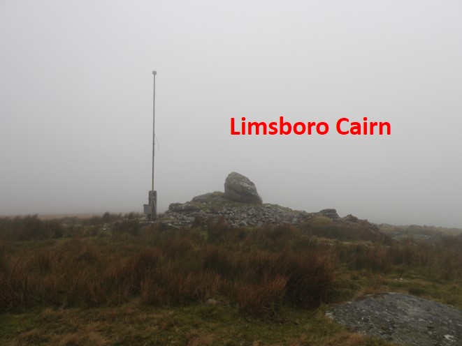
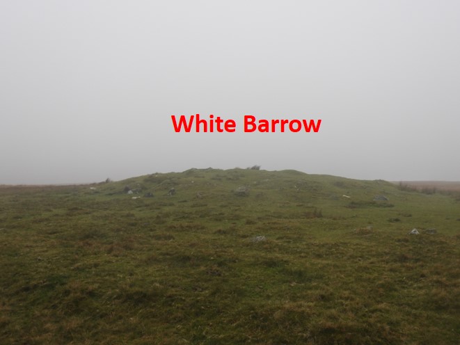
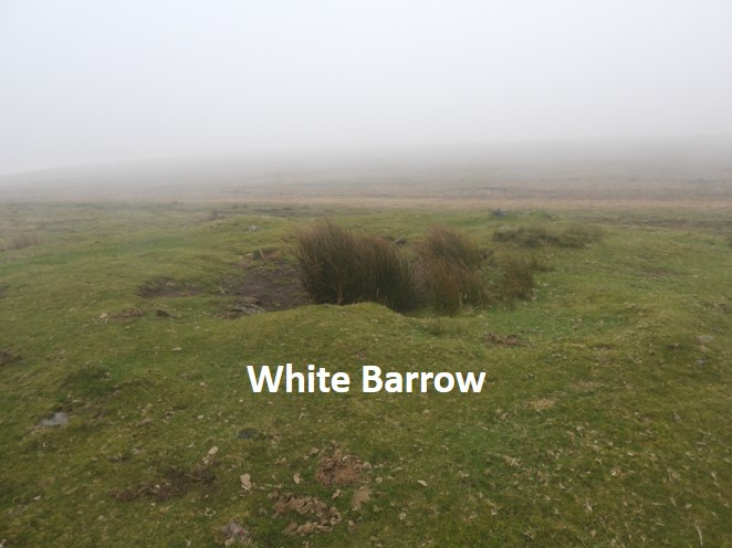
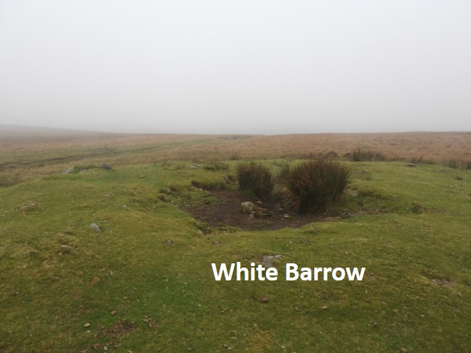
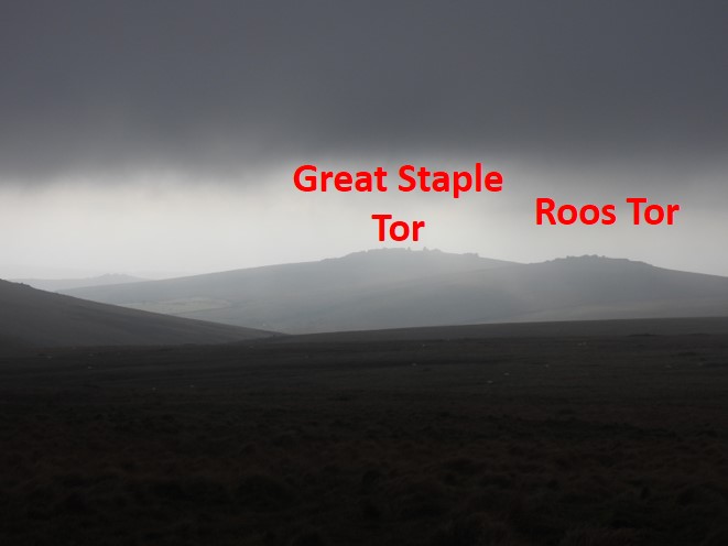
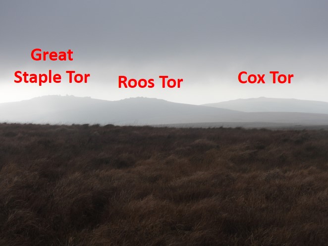
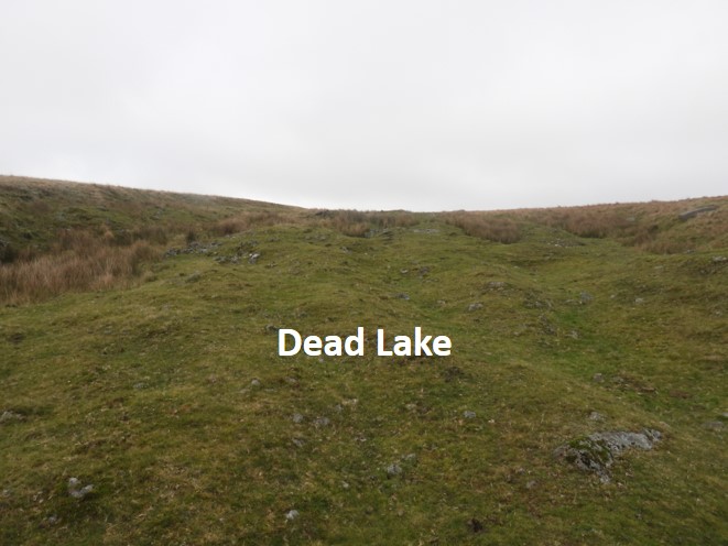
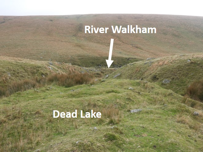
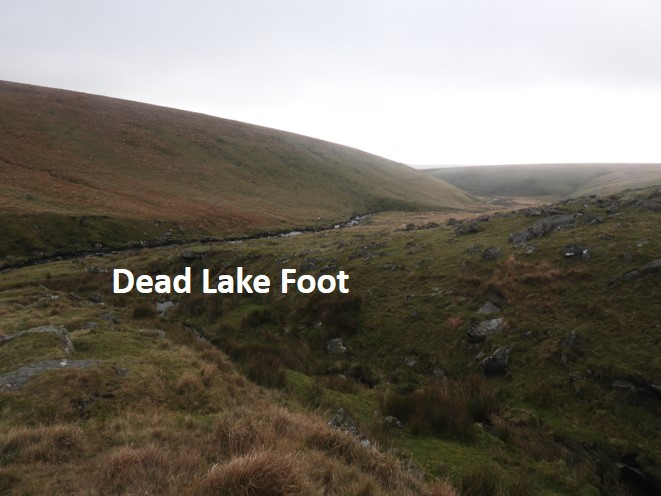
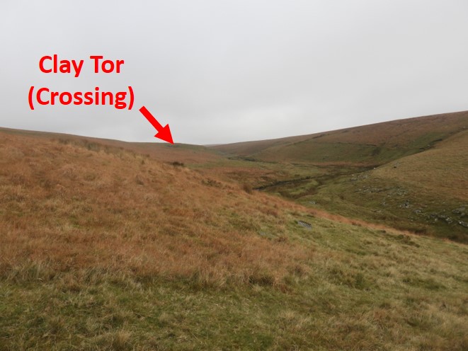
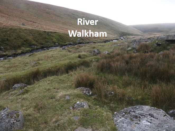
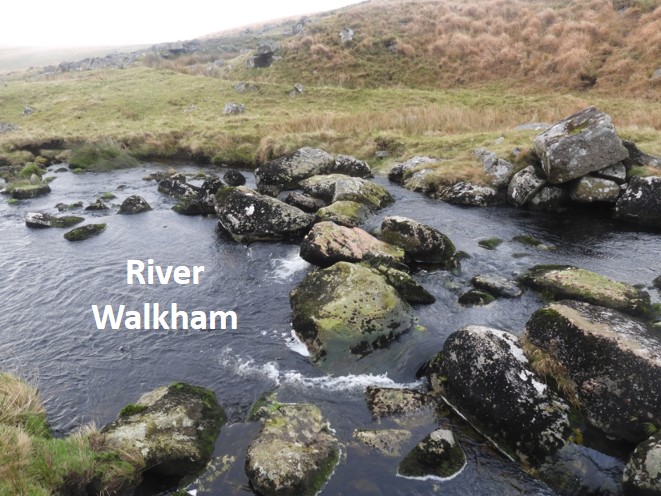
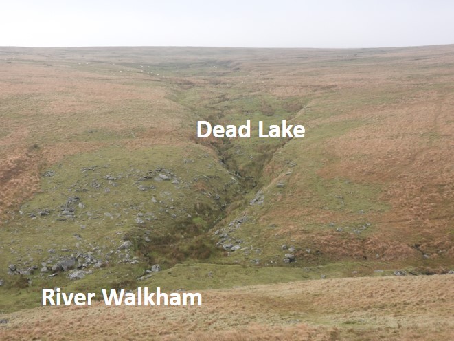
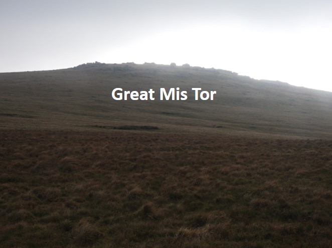
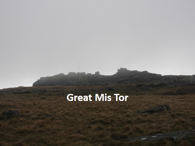
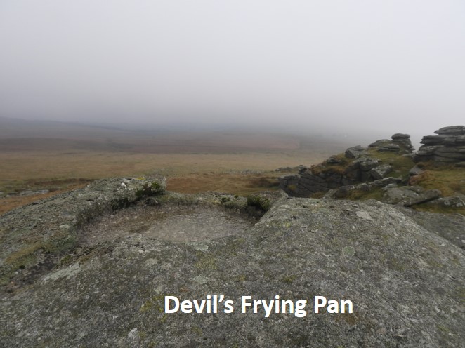
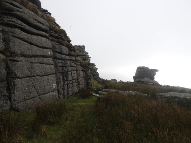
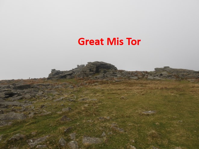
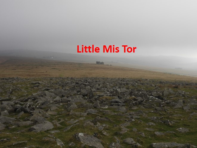
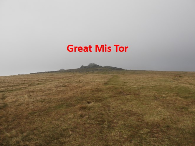
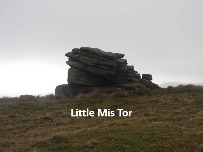
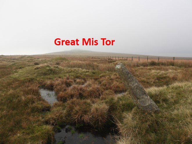
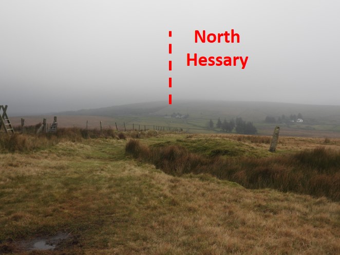
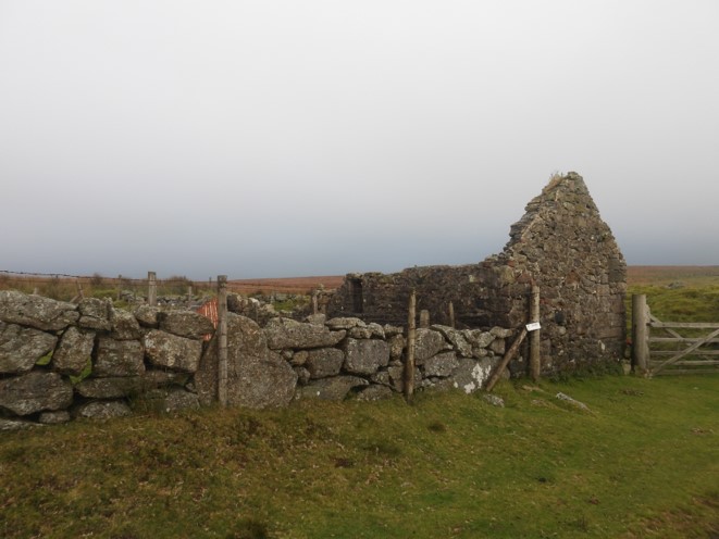
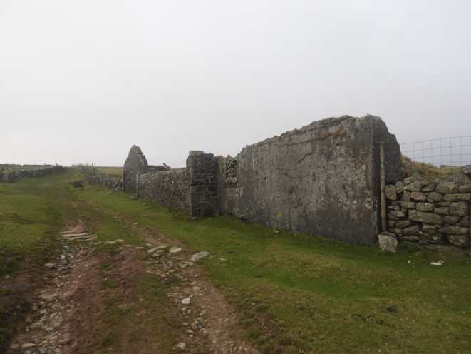
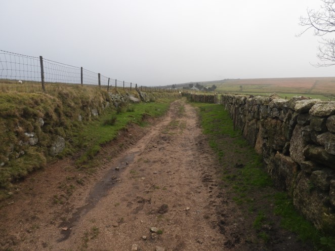
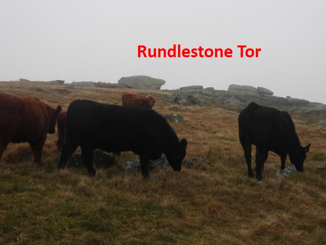
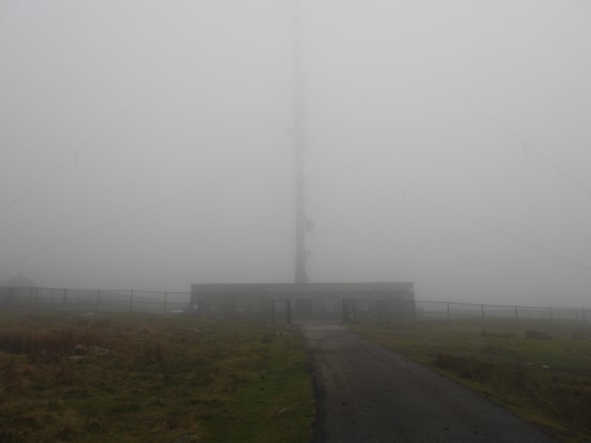
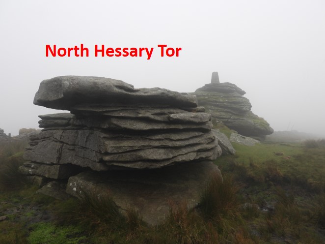
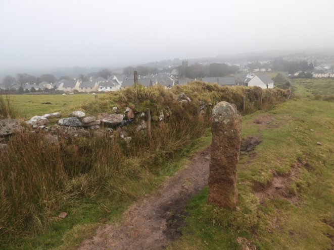
The route from Rattlebrook Foot to Princetown, adapted from the Bill Ransom publication. Most of the route followed in this post follows the 1608 accepted historic boundary, with the exception of White Barrow, which most modern perambulators visit between Limsboro Cairn and Dead Lake Foot.Rattlebrook Foot – Rakernesbrokyfote to the perambulatorsThe route follows the Tavy upstream (to the left in the picture) from Rattlebrook Foot. Approx 1km upstream a small hillock called “The Meads” is the next port of call, which lies alongside the Western Red Lake, which the perambulator should follow.A distinct large mound / hill can be seen on the southern bank of the River Tavy, which is locally known as The Knoll or Lord Mayors Castle).Climbing the hill above the Tavy (to visit Watern Oke “village”), a fine view of Rattlebrook Foot and Hare Tor beyond can be seen.There are 94 huts at Watern Oke dating from 1500 B.CThere are fine views from the Watern Oke Huts. They were examined by the Exploration Committee of the Devonshire Association in 1905under the guidance of the rector of Mary Tavy, Rev. Irvine Anderson.During the 1905 exploration cooking stones, pottery, an arrowhead and a small glass bead were found here.Another wonderful view from Watern OkeDescending back to the River Tavy from Watern Oke huts, the perambulator must now cross the river and follow Western Red Lake in a southerly directionCrossing the River Tavy here can be a little difficult at times. Without taking a long detour, the author suggests paddling across as an option, taking extreme care in doing so. At the foot of Western Red Lake a War Department WD stone (WD22) can be located. The group of very large boulders shown in the picture is usually a good spot to attempt a crossing (even if a bit of paddling is involved).Climbing up Western Red Lake views of the Rattlebrook valley can be seenWD23. The WD stones mark the boundary of the land purchased in 1900 by the War Office from the Calmady-Hamlyn who were Lords of the Manor of Willsworthy.Continuing up the Western Red Lake an unusual range pole can be found, being larger than all the others on the moor. This is the point where the three Dartmoor ranges meet (Willsworthy, Okehampton and Merrivale). The miliatry call this “The Totem Pole”.Climbing up Western Red Lake once more enhanced views of the Rattlebrook valley can be seen, framed by Dunnagoat Tors and Green Tor near where Bleak House is located.WD24 is located around 100m from Western Red Lake. Fur Tor can be seen from this location.From WD25, Lynch Tor (with Limsboro Cairn), the permabulators next port of callAfter WD25 en-route to Limsboro Cairn and near the top of Western Red Lake, views to the South West include Bagga Tor and Cudliptown Down.Lynch Tor approaching from the NorthLynch Tor close up – a great place for a coffee break or a lunch stop.A hundred or so metres from Lynch Tor, Limsboro Cairn can be found, which is a also a popular checkpoint during Ten TorsThe military flagpole is a good navigation aid with good visibility (the cloud had descended by the time this picture was taken)White Barrow is accepted by Permabulators as part of the modern boundary. It is nothing more than a low grassy mound with a few stones and could easily be missed (in the mist!)Looking back (North) from White Barrow the line of the Lych Path / Way, (which has just been crossed) can be seen (light line of vegetation in the photograph). The Lych Path is a medieval track along which the dead were taken from the early settlements from the eastern part of the moor to Lydford ChurchWhite Barrow looking east. The Lych Path descends to the River Walkham valley from this point.Rounding Cocks Hill from White Barrow towards Dead Lake views to Great Staple Tor and Roos Tor can be seen. With the low cloud and Autumnal light the resultant picture is a typical “moody” Dartmoor vistaApproaching Dead Lake, with Cox Tor added to the vista alongside Great Staple Tor and Roos TorDead Lake. The Head of Dead Lake is sometimes taken as Meweyburghe of the 1240 perambulation (ref Bill Ransom). Descending Dead Lake, the perambulator is presented with the next obstacle (River Walkham). The way point is Dead Lake Foot.Dead Lake Foot looking west down the River Walkham valleyDead Lake Foot looking east down up River Walkham valley towards Clay Tor (named by William Crossing). NOTE: further downstream there is a Clay Tor named by Eric Hemery.Dead Lake FootJust upstream from Dead Lake Foot, there is a good river crossing point which the author uses. Usually, with care the river can be crossed here, with dry feet. Climbing the hill to Greena Ball and looking north, the perambulator can appreciate the extent of Dead Lake and its associated tinners workings. This is taking the modern boudary route. The accepted 1608 route, would have followed the River Walkham downstream to a Hanging Stone (Duchy Map). Dave Brewer in his Boundary Markers book (page 294), states the Hanging Stone is a “fractured boulder lying in the right side of the river, near the point where the dry Wheal Fortune tinners leat is taken off”Great Mis Tor the next port of callClosing in on Great Mis TorMis Tor Pan (aka Devil’s Frying Pan) atop Great Mis TorWest side of Great Mis TorView from the south as the perambulator leaves Great Mis TorCrossing the clitter bed to the South of Great Mis TorA final glimpse of Great Mis Tor as Little Mis Tor is passedPassing Little Mis TorThe perambulator now should make their way to the fence line to the east of Little Mis Tor, where a series of boundary stones can be found.Moving down the fence line, another standing stone boundary marker is shown in this picture. North Hessary is our goal, sadly in the low cloud on the day this picture was taken.The track takes the perambulator between a series of dry stone walls amongst which some old farm ruins are locatedAnother view of the farm building ruinLooking down the lane. Rundlestone Lodge and Rundlestone Tor can just be made out aheadClimbing up to North Hessary, Rundlestone Tor is passed on the wayNorth Hessary mast and transmission station appearing out of the Autumnal murkNorth Hessary Tor, known to the original perambulators as aliam Ysfothere (aka another Hisworthy). Apart from the trig point (circa 1930s), modern man has left another mark on this tor and a close examination on the south west side one can find an inscription “PCWW 1917”. (It is difficult to photograph in low light conditions and ideally needs sunlight with some shadows for best results) After the construction of the Burrator Reservoir (from 1893-1898), Plymouth Corporation Water Works (PCWW) placed numerous markers on south west Dartmoor. Farms within the water catchment area were purchased and cleared after 1916. The original PCWW 1917 stones follow the line of the Forest of Dartmoor boundary from North Hessary through to Eylesbarrow.Descending to Princetown, our destination for the completion of this stage