A collection of walks, discoveries, insights and pictures of exploring Dartmoor National Park
April 30, 2022
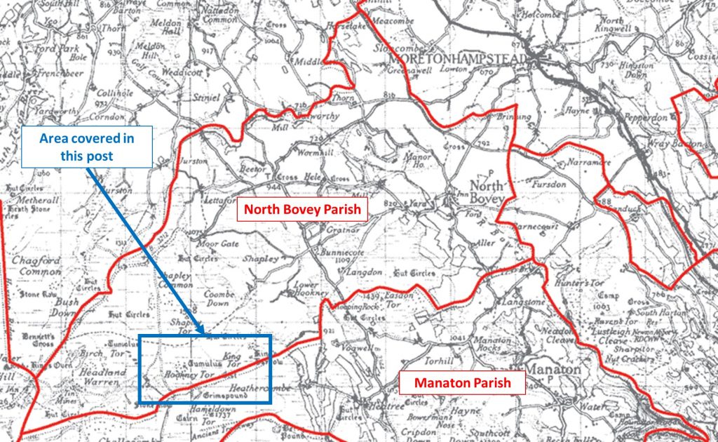
North Bovey / Manaton Parish Boundary Markers
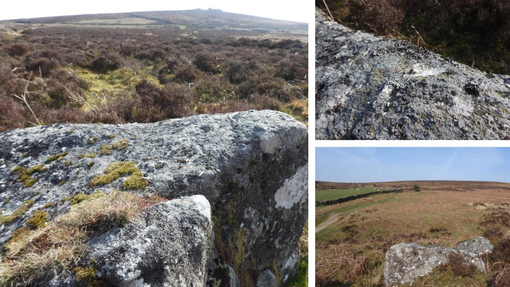
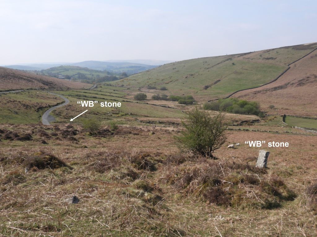
A part of the boundary separating the parishes of North Bovey and Manaton follows a course between the West Webburn valley and Heathercombe Valley. The route follows Grim’s (or Grimms) Lake below the tors of Hameldown and Hookney, then by way of a straight line below King’s Barrow to Smalecombe Head. There are a number of boundary markers along this route, which are a combination of upright set stones and variously sized earthbound stones, each of which is inscribed with the letter “B” (for Bovey). The area around this part of the parish boundaries, of course, is most well known for Grimspound, the prehistoric enclosed settlement. However, in addition to the prehistoric settlement and the parish boundary markers, the explorer can also find a number of Headland Warren upright and earthbound stones (marked “WB” and “Warren Bounds”), some benchmarks, a number of WWII anti-glider posts, an R.A.F memorial, a kerbed cairn / cist and a barrow. This post covers all the aforementioned features.
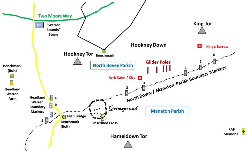
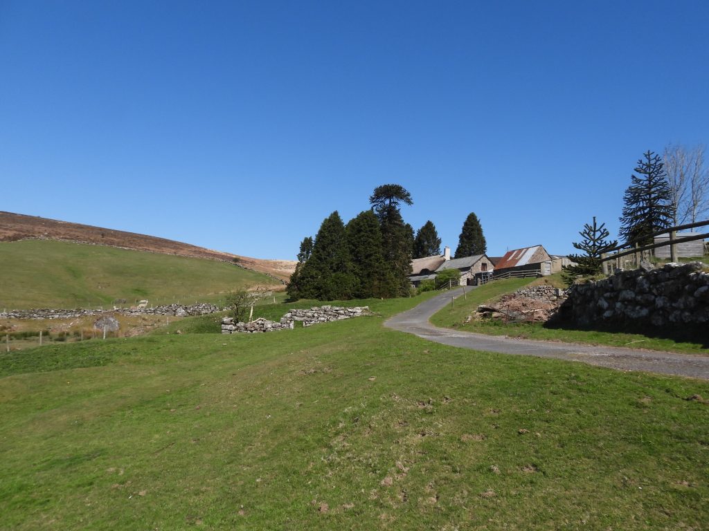
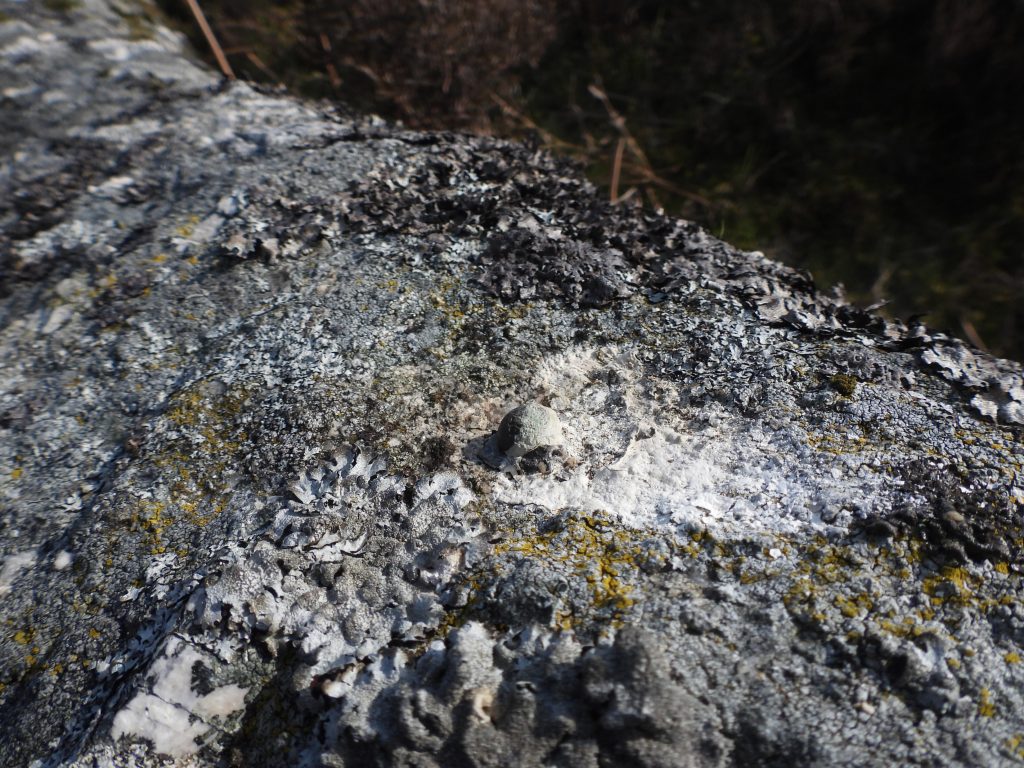
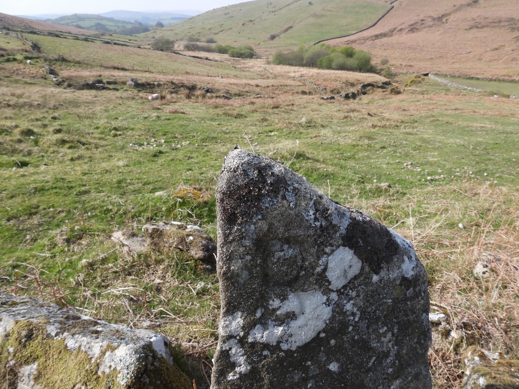
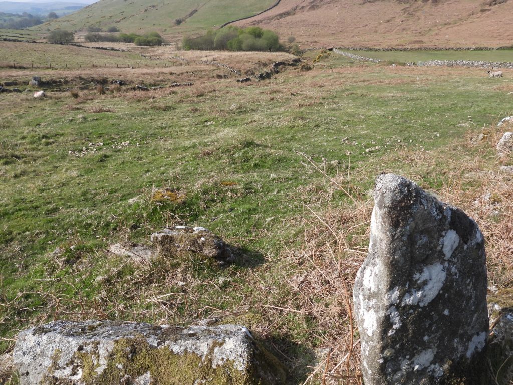
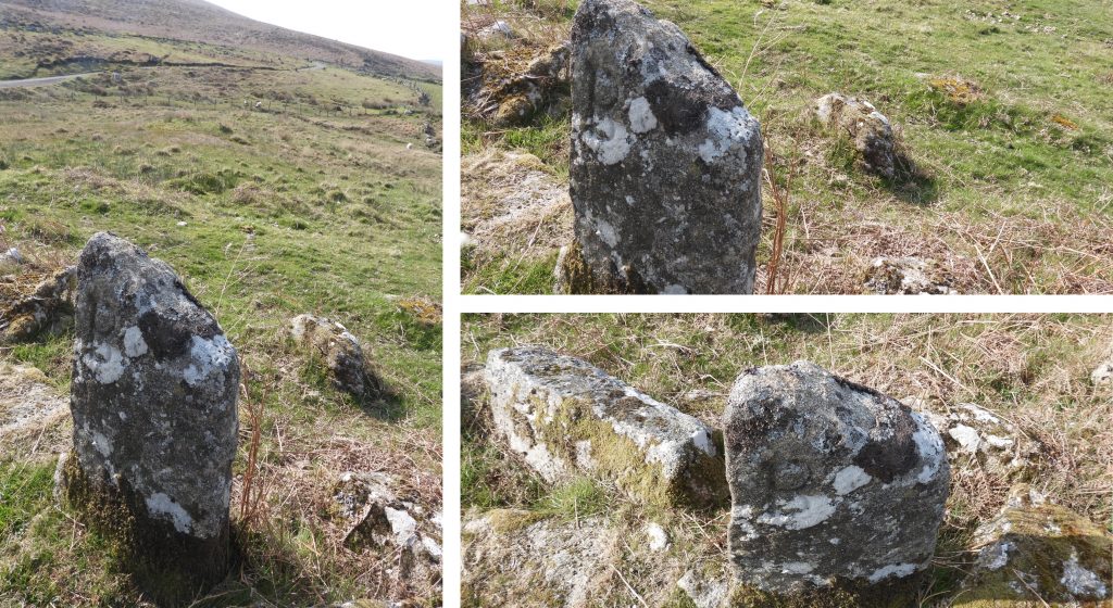
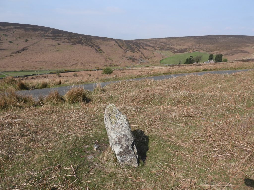
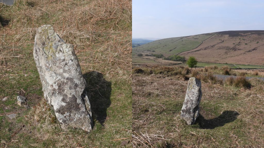
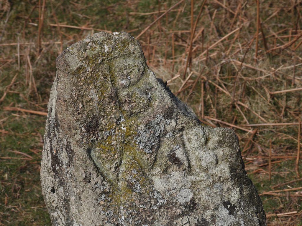
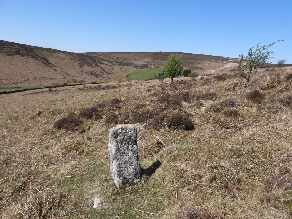
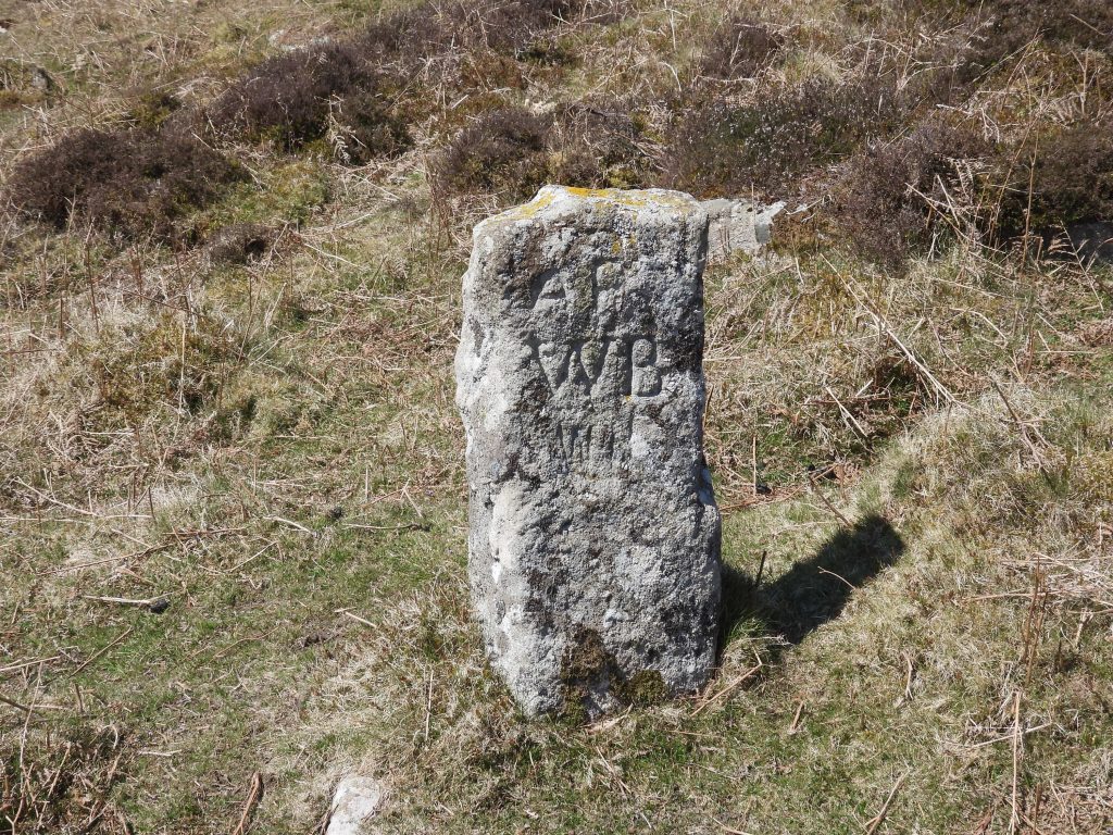
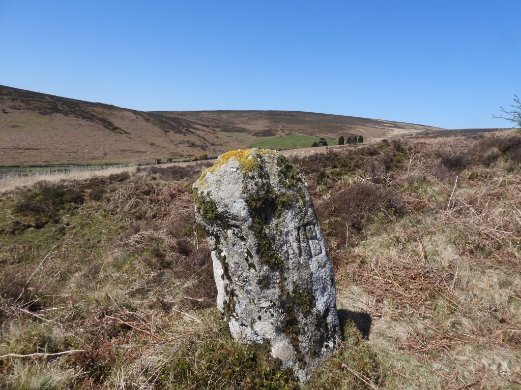
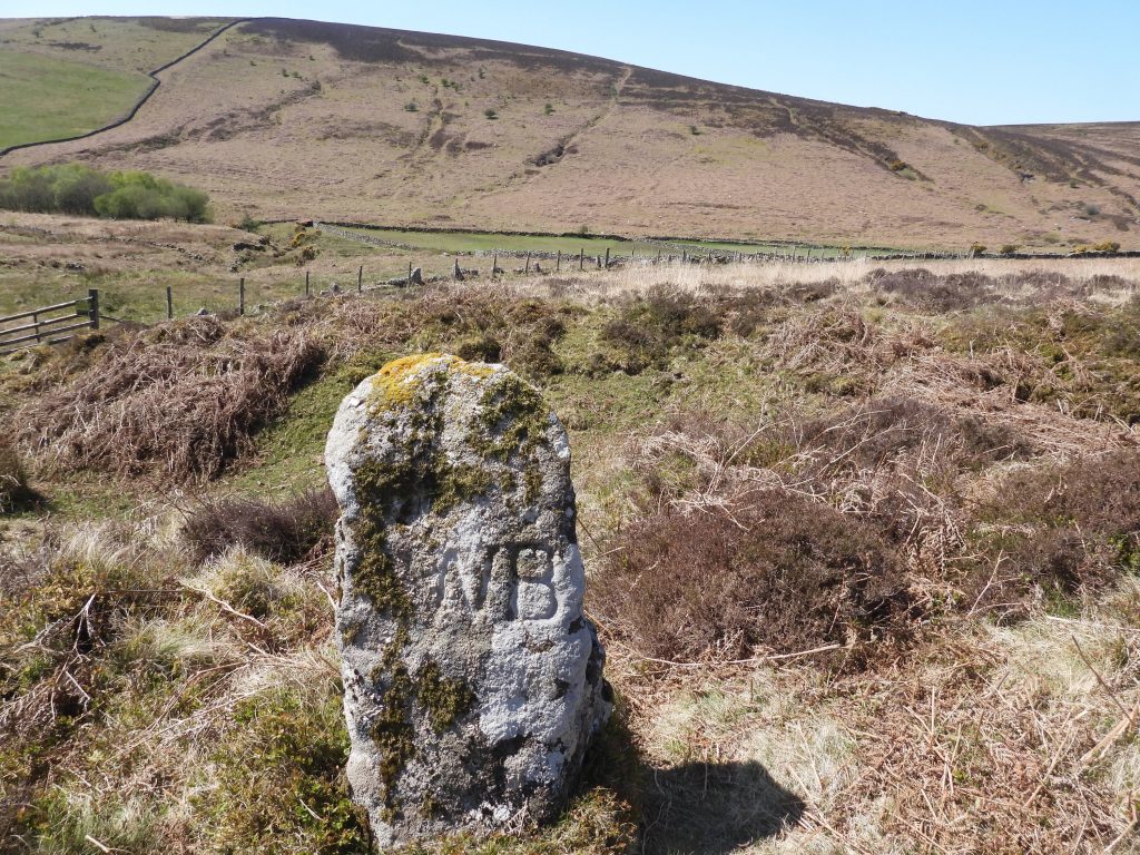
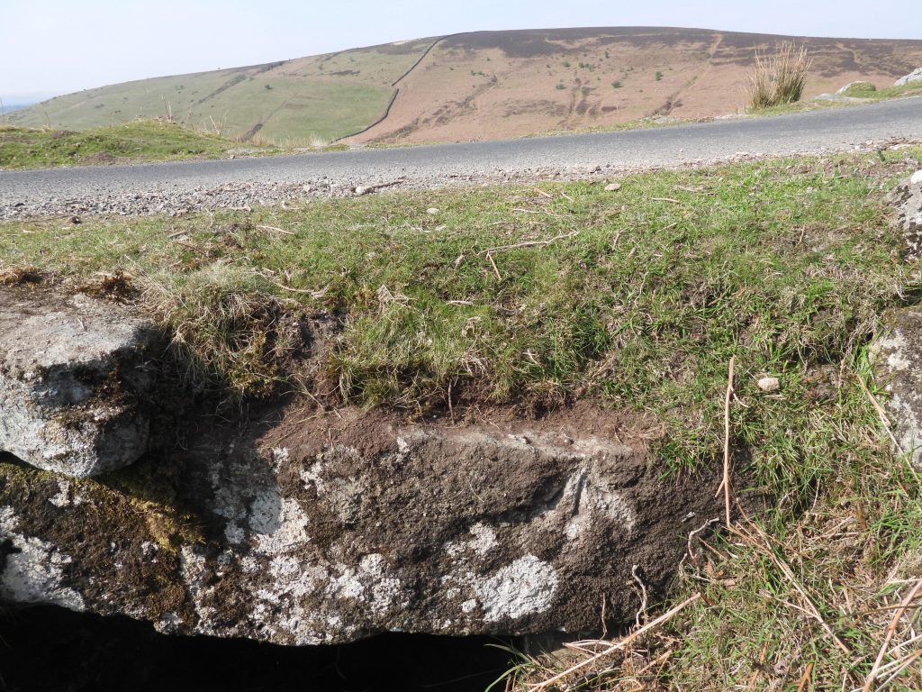
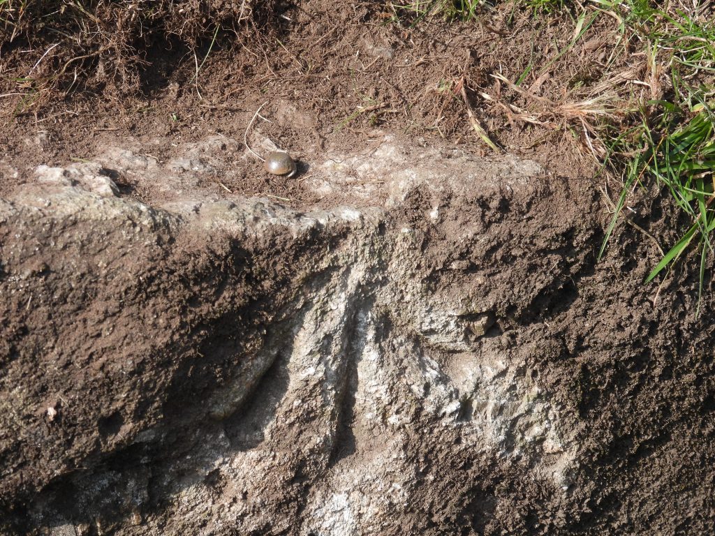
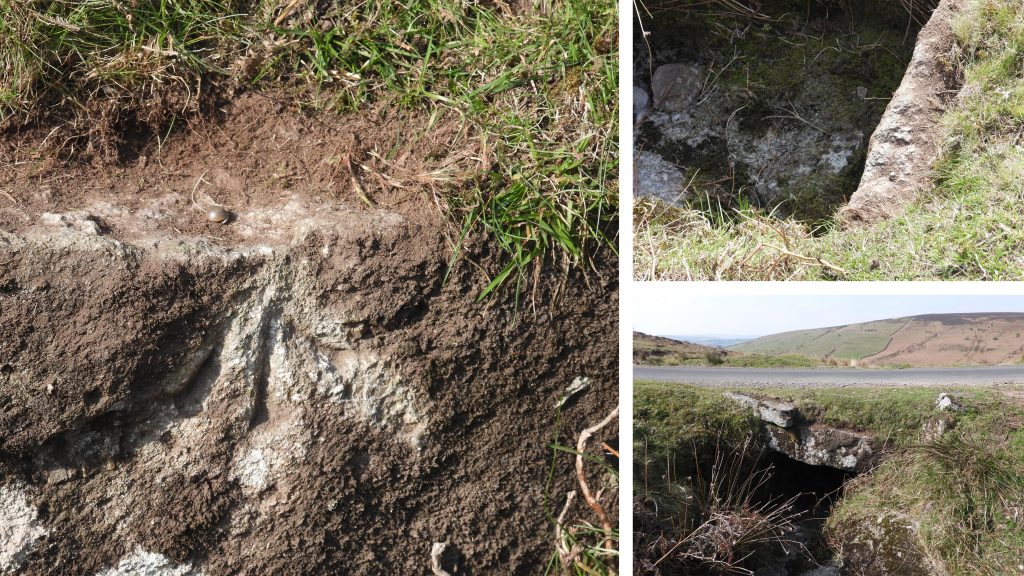
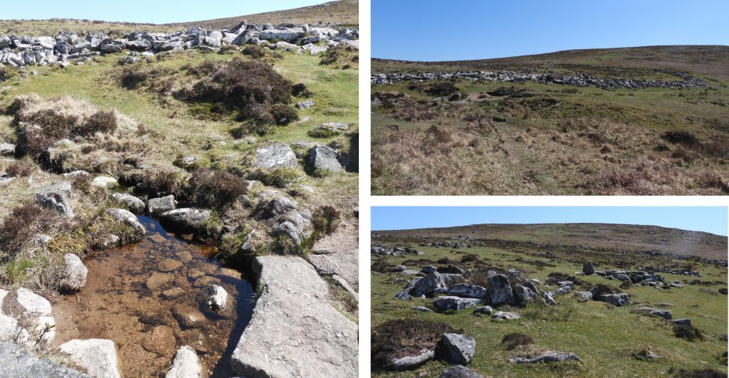
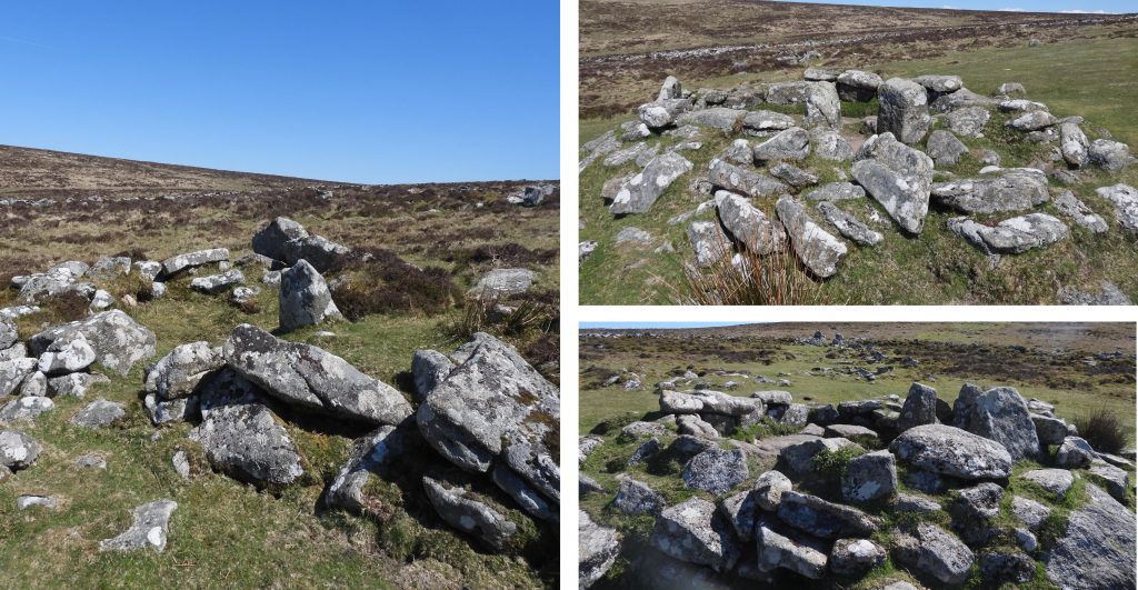
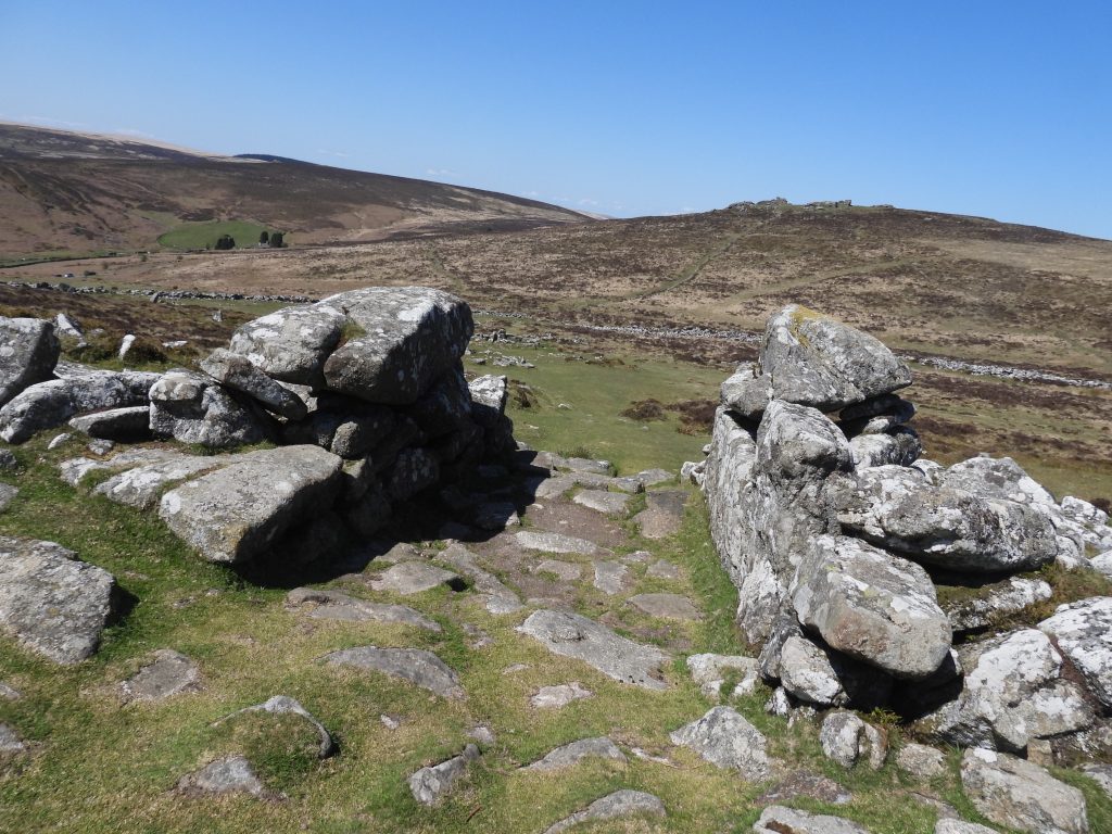
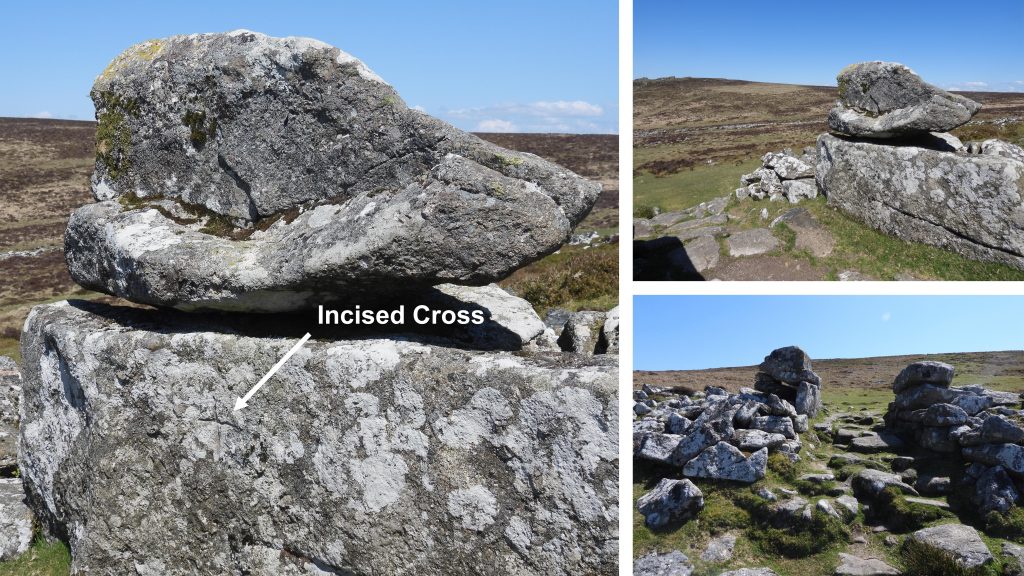
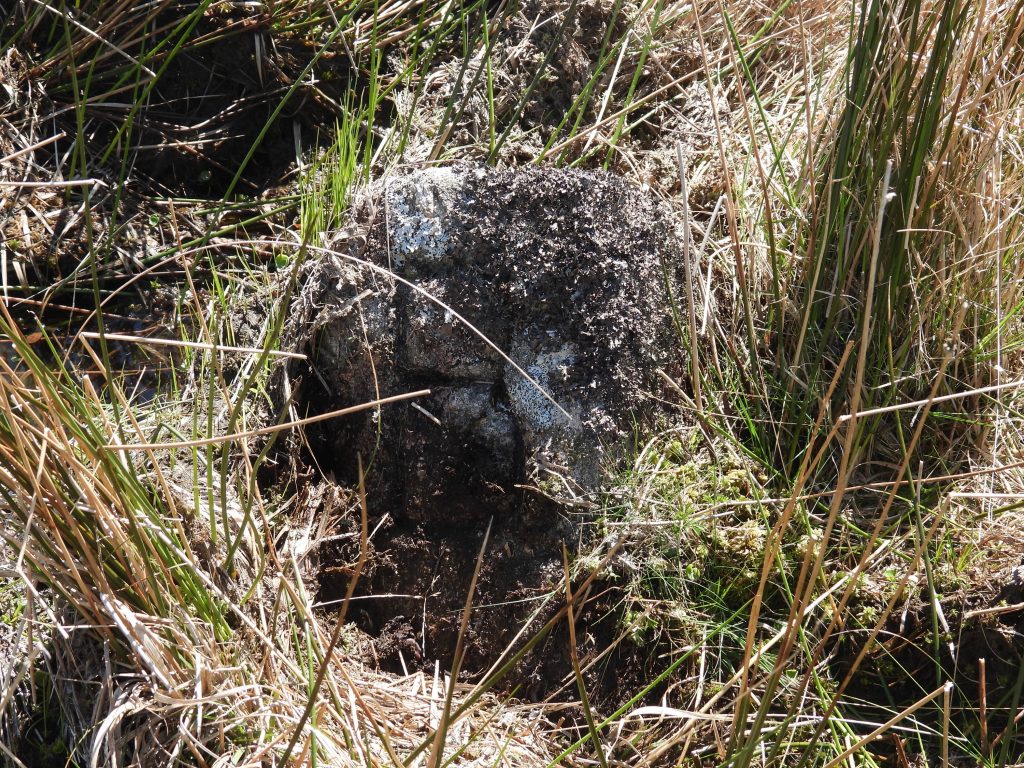
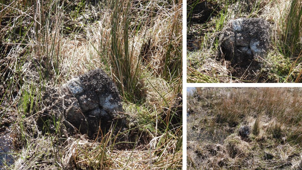
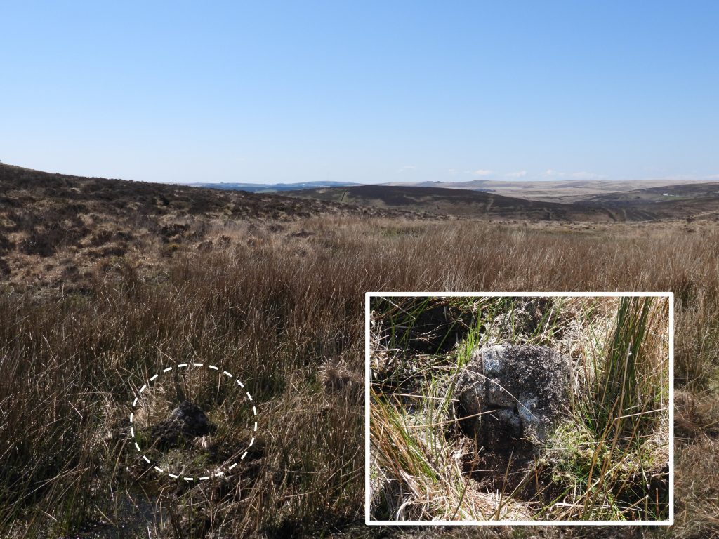
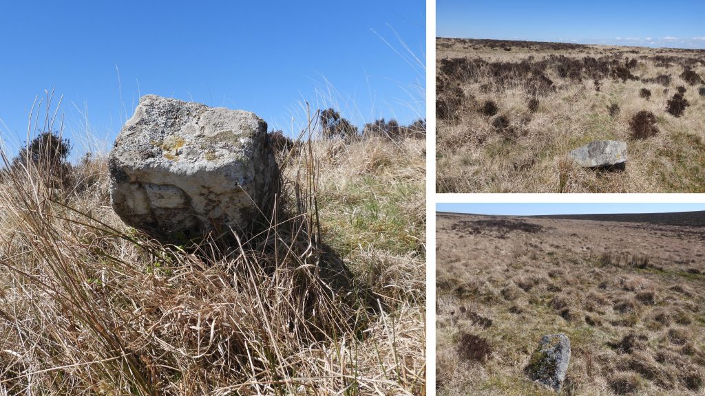
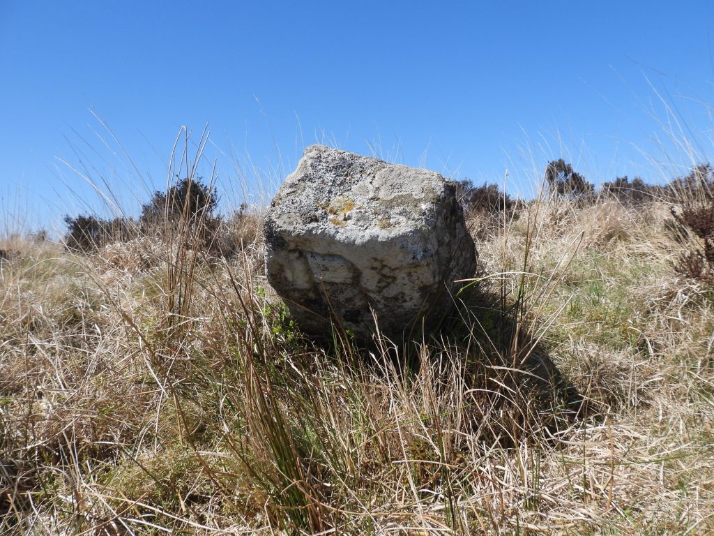
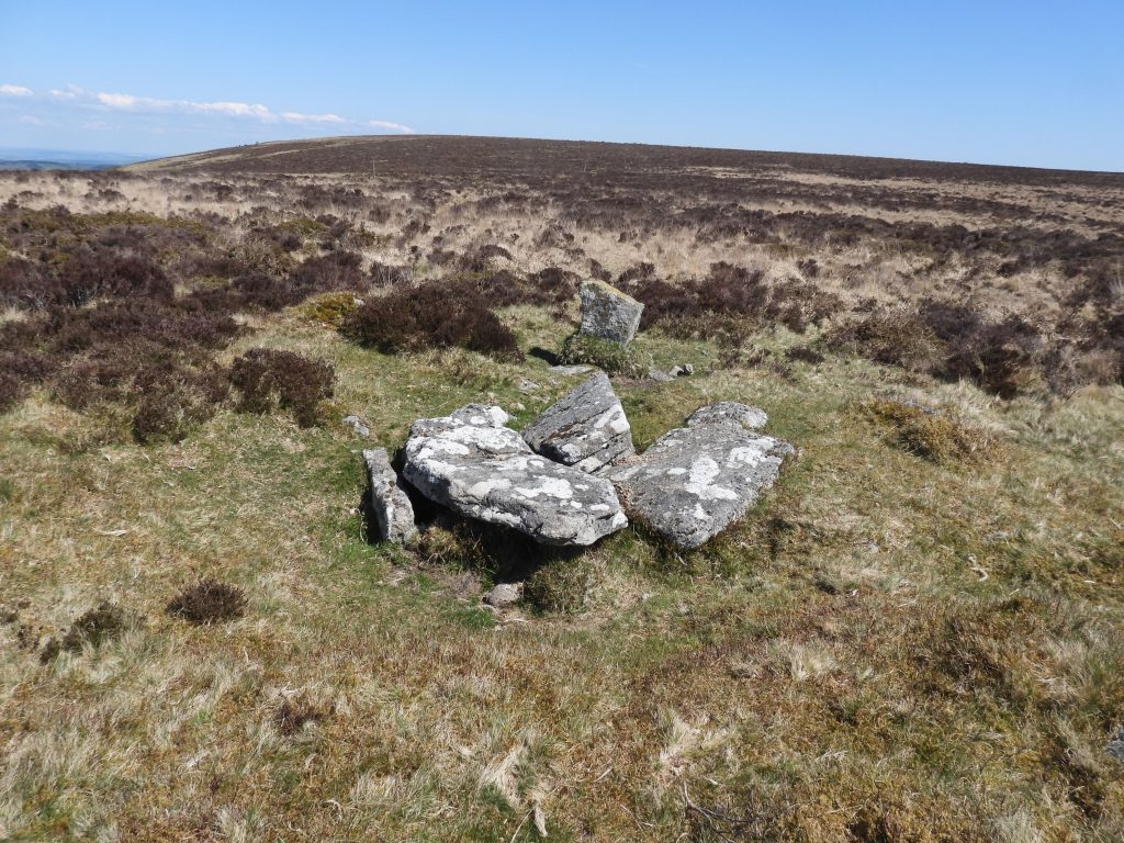
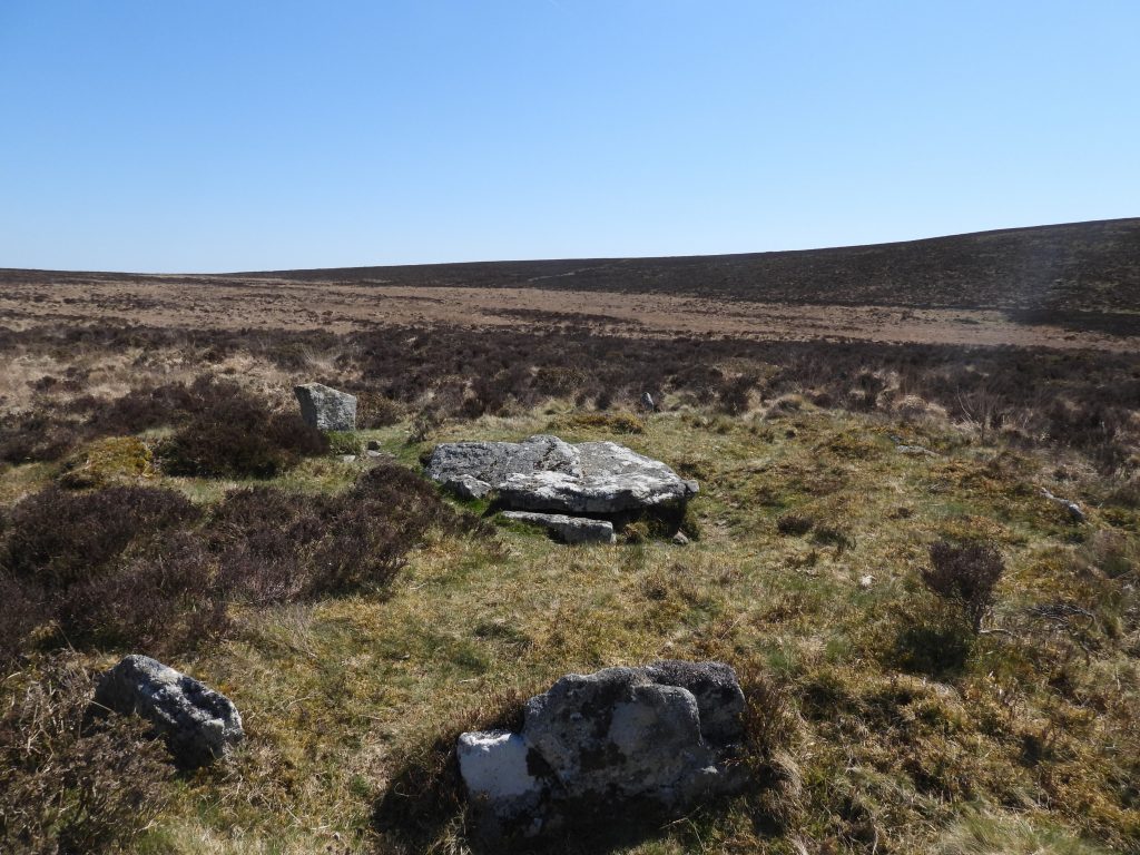
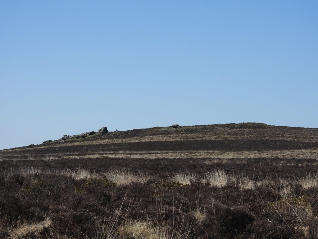
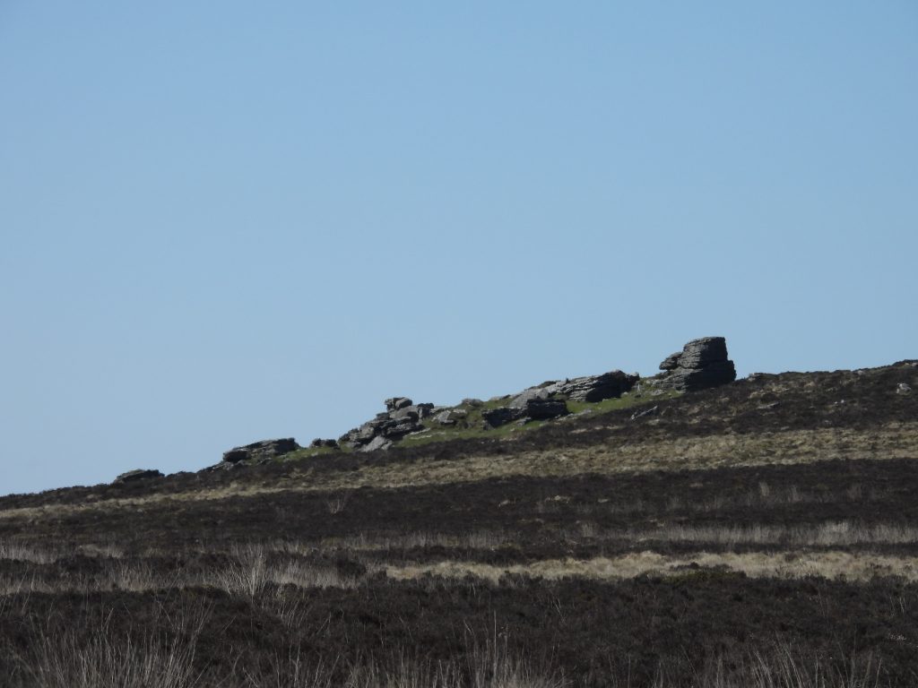
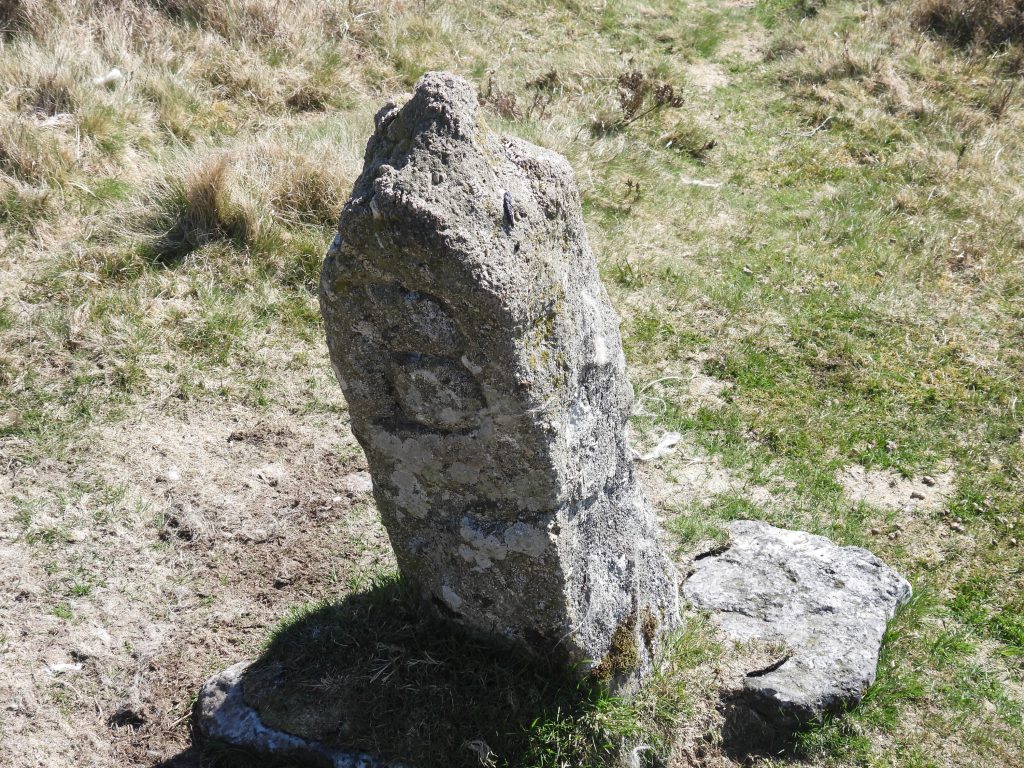
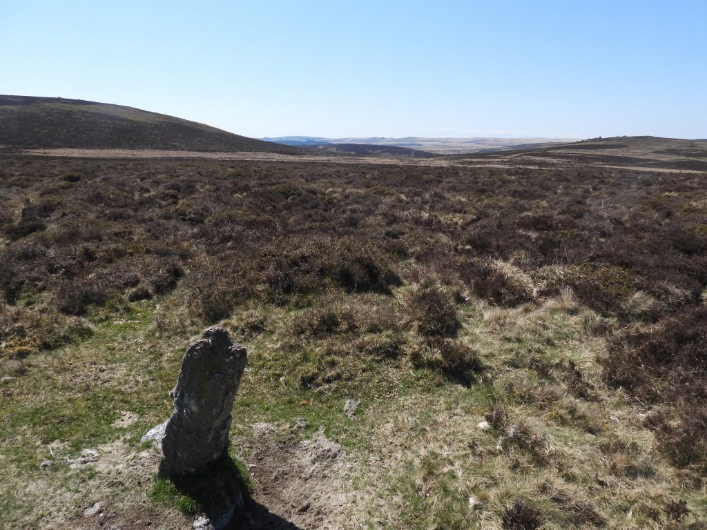
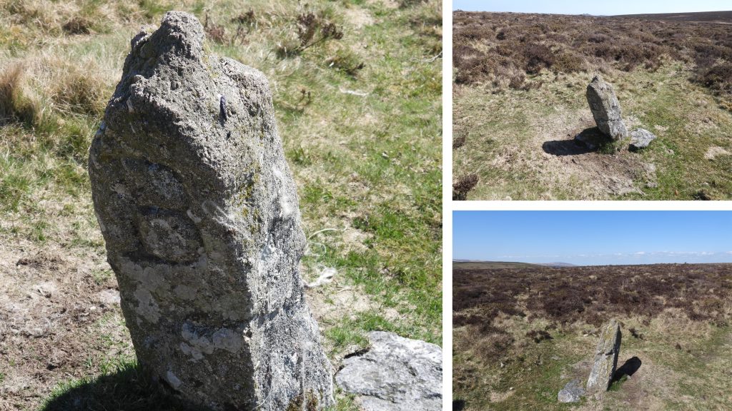
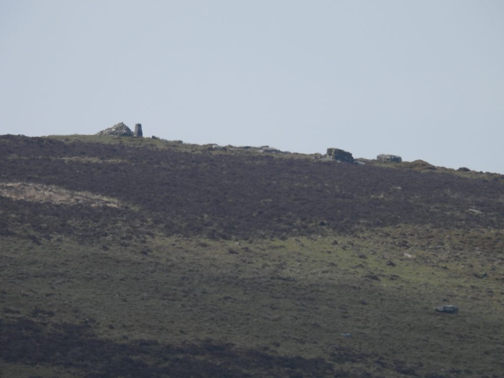
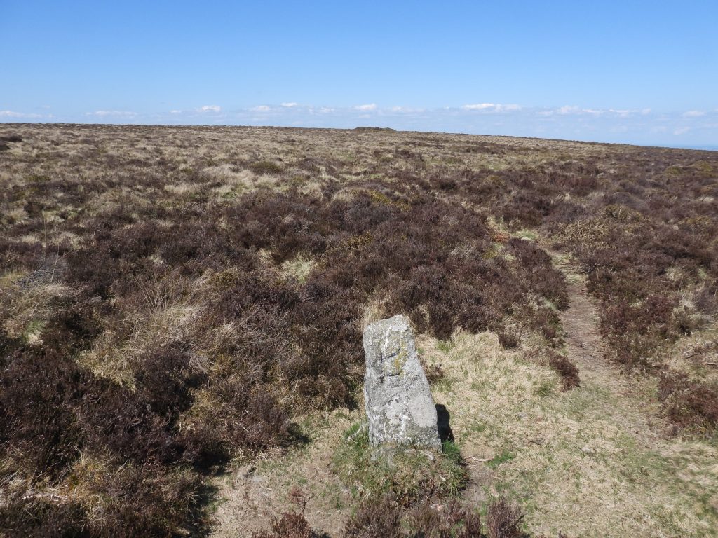
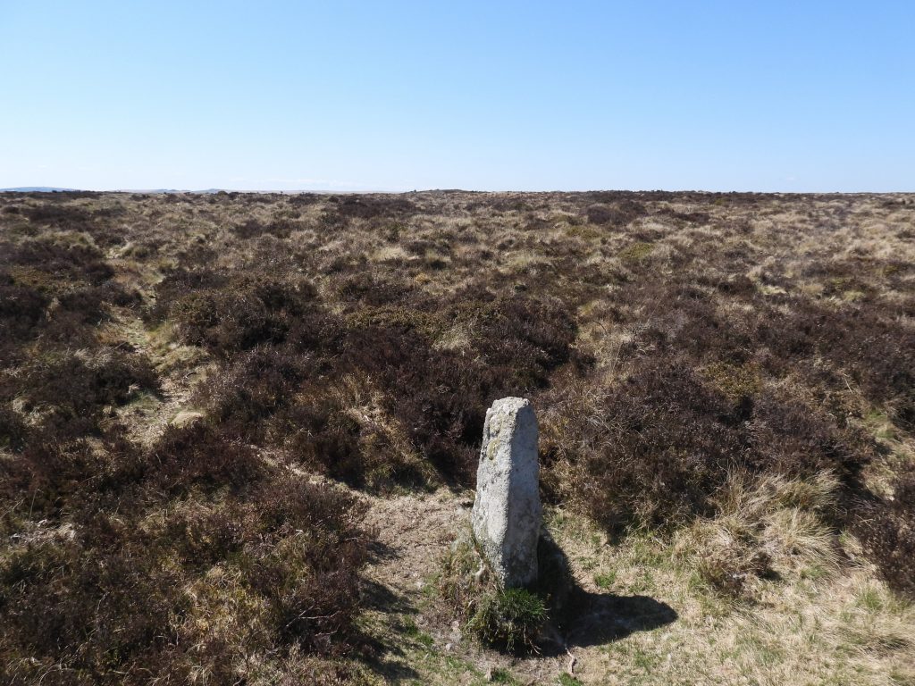
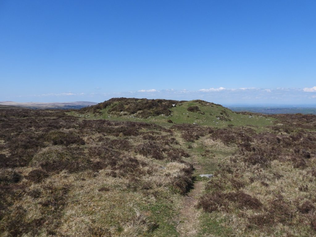
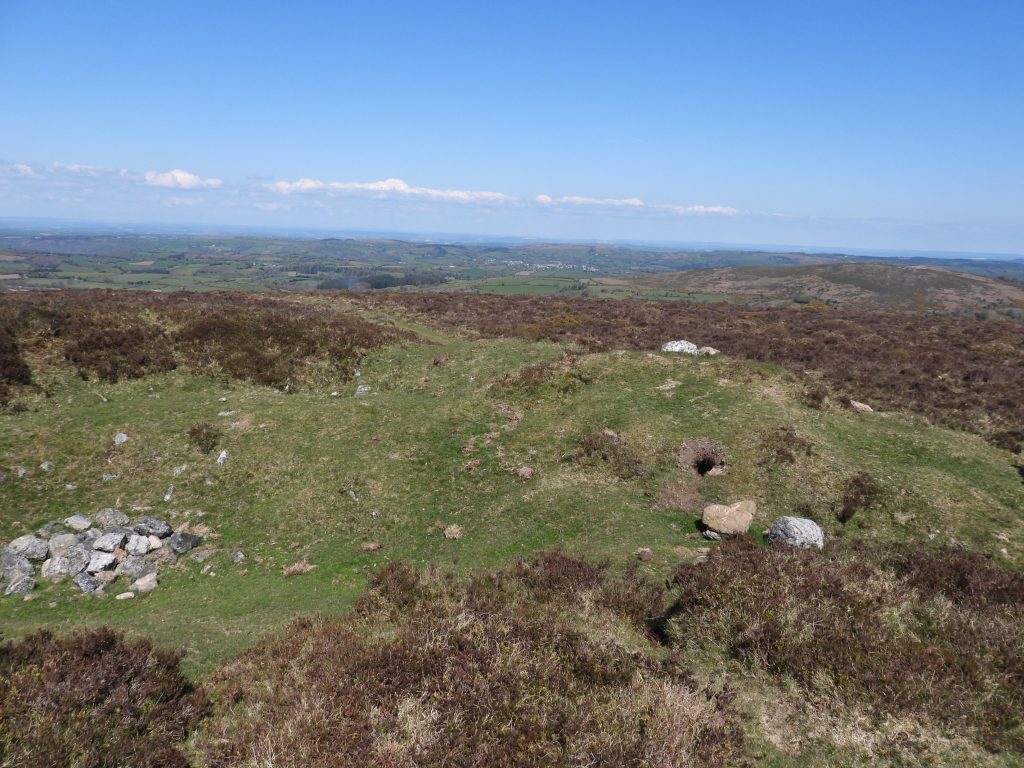
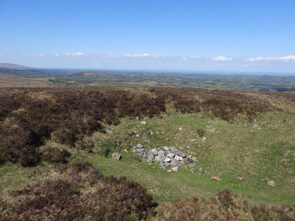
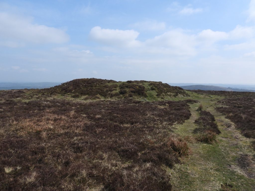
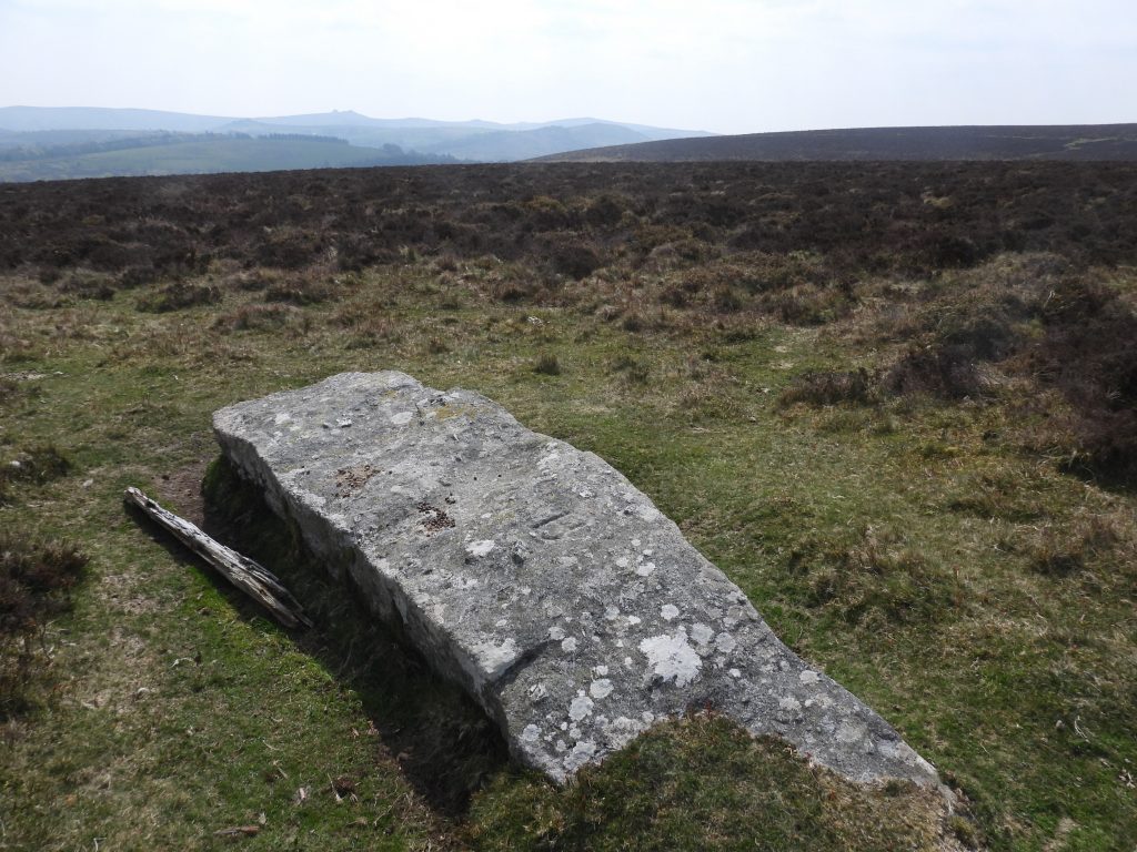
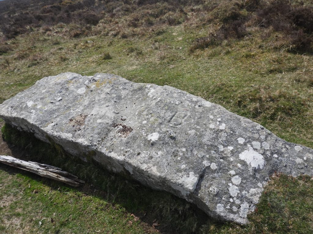
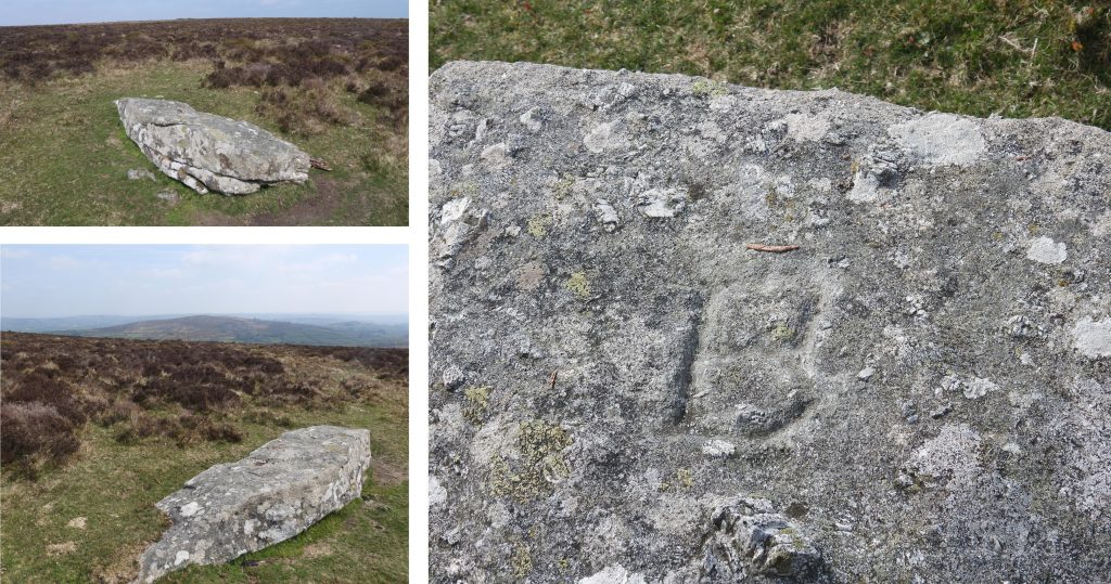
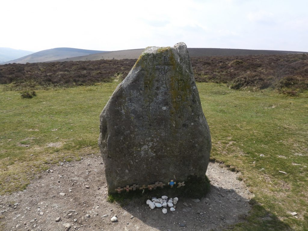
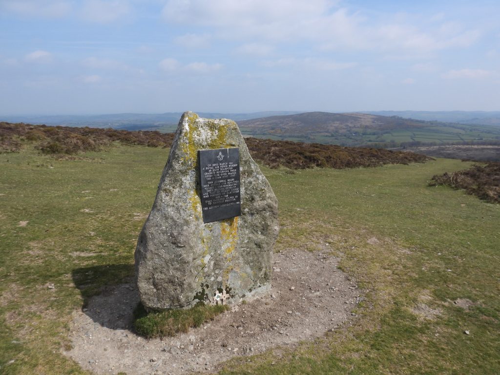
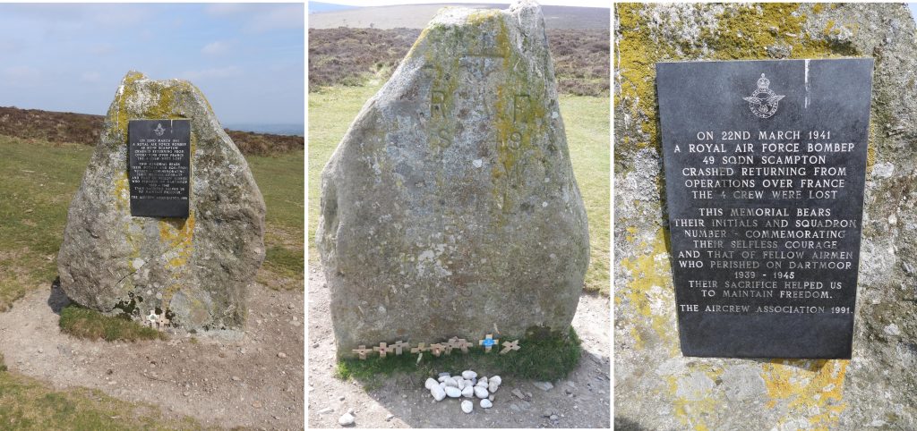
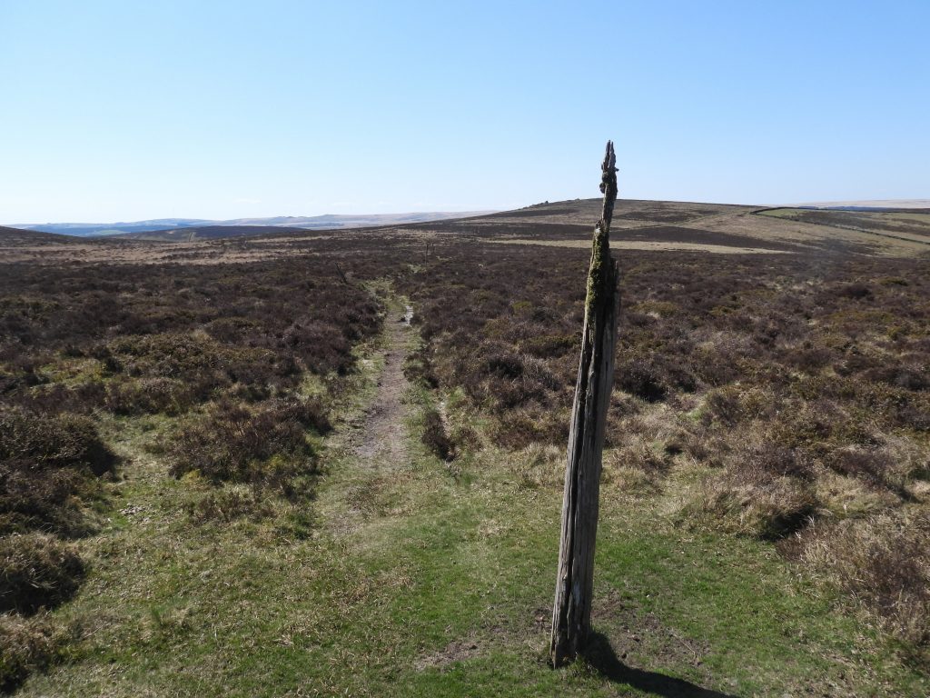
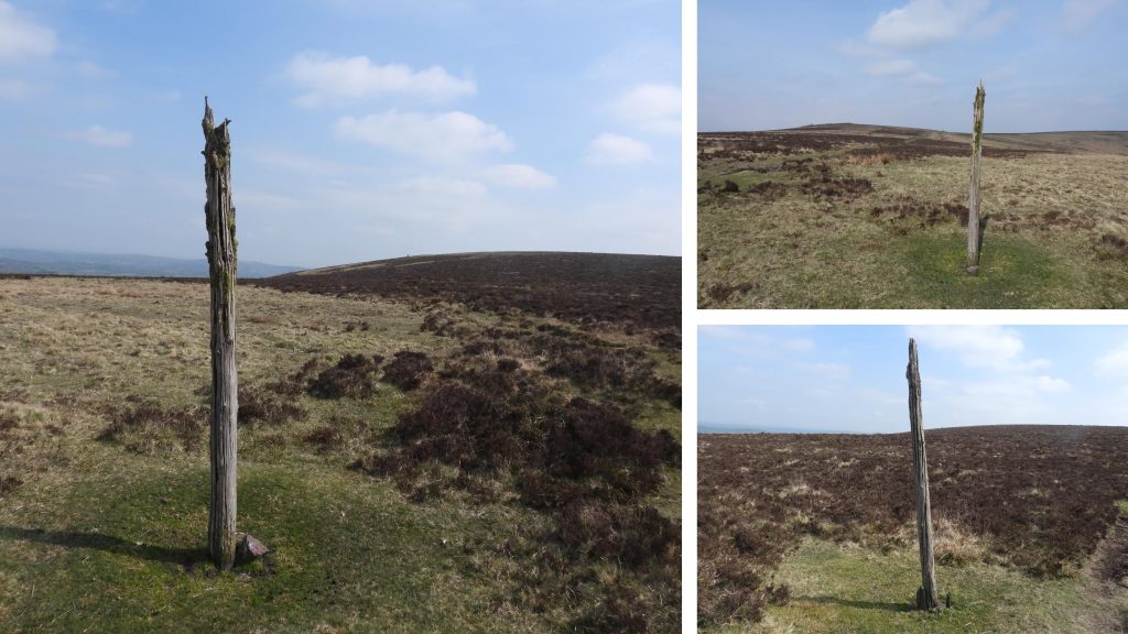
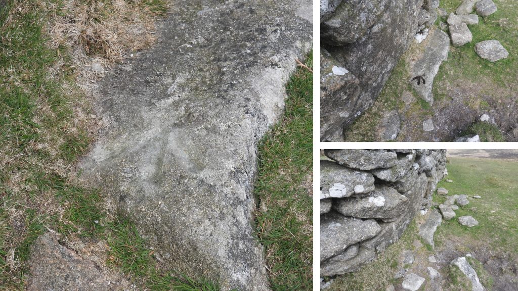
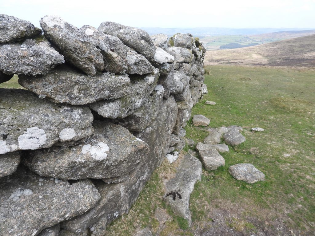
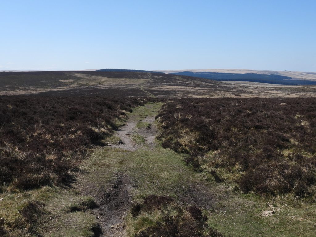
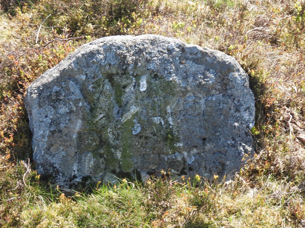
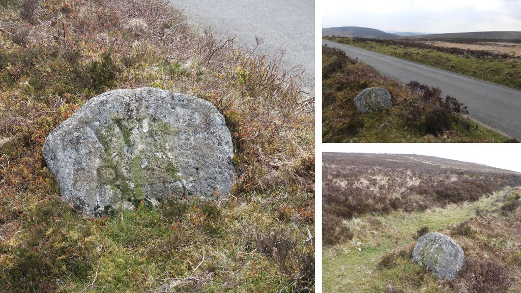
The map shows the area covered in this post between the West Webburn where it meets Grims Lake and Smalecombe Head above the Heathercombe Valley.Detailed sketch map of the features covered in this post. There are 6 North Bovey / Manaton Parish Boundary Markers, marked “B”.Headland Warren Farm comprises a small farmhouse with an adjoining barn. It was probably built in the late 16th/early 17th century but was considerably altered in the 20th century. As the name suggests, this farm was once used for the warrening activities in the area which date from the late 18th century.To the north of Headland Warren Farm near to a three way fingerpost are two large bounders, one of which has a benchmark (rivet/bolt) located on its top. With reference to the National Library of Scotland (side by side) maps, this is likely to be B.M. 1301.7B.M. 1301.7 is located at SX69289 81163.On the fence boundary of Headland Warren Farm road overlooking Grim’s Lake a upright boulder with a “B” inscribed on it can be located. It is built into and old wall.This “B” inscribed stone is labelled as “1” on the sketch map. The author believes this is a North Bovey / Manaton parish boundary marker, albeit it is not exactly on the boundary but is around 50m to the north of the boundary at Grim’s lake. The author speculates that at some point this stone was taken from the true boundary and placed here when the wall was either constructed or repaired.Boundary marker “1” can be found at SX69614 80836.This is the northern most of three boundary stones marking the eastern boundary of Headland Warren. It is marked as “a” on the sketch map. Boundary stone “a” is located above and to the east of the Widecombe road. The stone has two chunks taken out of it on the top right hand edge and bottom right side. The stone is inscribed “B” and “WB”, with “B” referring to North Bovey and “WB” for Warren Bounds. Although “B” refers to North Bovey the stone is located at least 100m from the parish boundary at Firth Bridge.Boundary stone “a” is located at SX69652 80981.View of the middle and southern most of the three “WB” stones marking eastern boundary of Headland Warren.The middle of the three “WB” stones marking the eastern boundary of Headland Warren can be found at SX69661 80922. It is marked “b” on the sketch map.Boundary marker “b” is inscribed “WB”, once again relating to the warren bounds. However, it also inscribed at the top with the letters “AP” and “WN” at the bottom. It has been speculated that the top and bottom inscriptions may refer to an past warreners (Dartmoor Boundary markers, 2nd Edition (page 266) Dave Brewer).The southernmost of the three “WB” stones marking the eastern boundary of Headland Warren can be found at SX69662 80844. It is labelled “c” on the sketch map.Boundary marker “c” is inscribed “WB”, once again relating to the warren bounds.A rather splendid benchmark with rivet/bolt can be located on Firth Bridge. The benchmark and rivet / bolt can be found at SX69745 80862.Grim’s Lake flows underneath the bridge and is usually dry in the summer months, the best time to access for pictures.Grimspound prehistoric enclosed settlement borders Grim’s Lake (and thus the North Bovey / Manaton parish boundary). Grimspound is recorded as containing 24 hut circles, as well as several ‘pens’ built into the enclosure wall. It was famously excavated by the Dartmoor Exploration Committee in 1894-5, albeit it was first planned by A. C. Shillibeer in 1829.Grimspound roughly paved entrance was exposed by the Dartmoor Explorations Committee 1894 excavation and is approx 2 metres wide between side walls up which are up to 2 metres high.On the east side of the entrance an incised cross can be found. The author cannot find any reference in any established published works about Dartmoor.The second “B” inscribed marker is located in a rather boggy area next to Grim’s Lake. The stone is rather small and can easily be missed. The picture was taken after a bit of “gardening” to remove some vegetation.This boundary marker is labelled “2” on the sketch map.Picture shows the location of boundary marker “2”. It can be found at SX70307 81028.The third “B” inscribed marker is located near the head of Grim’s Lake. This boundary marker is labelled “3” on the sketch map.This boundary marker “3” is leaning (almost totally recumbent) and the inscribed “B” is on the lowest face. The boundary marker can be found at SX70456 81081.A short distance to the north of boundary marker “3” lies a very well-preserved kerb cairn and cist. It is approx 5-6m in diameter.The Dartmoor HER records that the “intact cist oriented roughly north-west to south-east and measuring 1.1 metre by 0.6 metres and 0.6 metres deep”. It is located at SX70413 81160.Hookney Tor taken from the kerb cairn and cist.Hookney Tor, zoomed in.This upright boundary marker is labelled “4” on the sketch map. It is also deeply inscribed with a “B” (for North Bovey).This upright boundary marker “4” looking west with Hookney Tor (right), Hameldown Tor (left) and Challacombe Hill (centre, mid-distance)Boundary marker “4” is located at SX70805 81195.Hameldown Tor, trig and cairn zoomed in from near King’s Barrow.This upright boundary marker is labelled “5” on the sketch map and also is deeply inscribed with a “B” (for North Bovey).Boundary marker “5” is located at SX70936 81246.Boundary marker “5” is located approx 200m due south from King’s Barrow.King’s Barrow is a tumulus and is 20m diameter with a height 1.5m. View from King’s Barrow looking north east towards Easdon Down. The barrow is known to have been excavated about 1872 by Reverend R Kirwan. No artefacts were recovered during the excavation.King’s Barrow is located at SX70928 81440. The centre of the barrow appears to have been robbed with some of the material being piled around the rim of the barrow which makes it appear higher than it was historically.This final boundary marker is labelled “6” on the sketch map and also is deeply inscribed with a “B” (for North Bovey). It is described as a “granite longstone, 3.6m (length) by 0.93m (maximum width) by 0.6m (thick)”. Next to the boundary marker, the author found (see picture) of what appears to be an old anti-glider pole.This stone is known to have been documented in 1593 in a description of bounds of an estate at Kendon in North Bovey parish. The inscribed “B” has been measured as being 17cm by 12cm and is cut into its top surface. The stone is located at SX71043 81297.No trip to this area is complete without paying respects at the RAF Memorial at SX71280 80693. At 22:50, on 21st March 1941, six of 49 Squadron’s (Bomber Command) Hampden bombers took off from RAF Scampton. They set course for the German naval base at Lorient, in occupied France. On their return, Hampden X3054, experienced problems with a radio that was unable to receive. The aircraft struck Hameldown and caught fire. The memorial at the site was commissioned by Lady Marjorie Cecilia Wilson, the mother of the pilot (Robert Wilson). The memorial is dated 21.3.41 and contains the initials of the four your crew members who sadly perished. The crew were: Pilot Officer Robert David Wilson (R.D.W), Sgt Ronald Brames (R.B), Sgt Charles John Lyon (C.J.L) and Sgt Richard Leonard Ashburton Ellis (R.L.A.E) – R.I.PHaving taken off on the 21st March, the Hampden X3054, must have struck Hameldown in the early hours of 22nd March. The date on a plaque on the reverse of the memorial is 22nd March. Sgts Brames, Ellis and Lyon are believed to have died on impact. However, Pilot Officer Wilson, survived, presumably because he would have been strapped in. He died at Moretonhampstead hospital in the evening of 22nd March having briefly regained consciousness. He and Sgt Ellis, the second pilot, lie next to one another in Exeter’s Higher Cemetery, in plots set aside for military dead; the two air gunners are buried in their home towns, which one assumes was at the request of their families.The story of the crash of Hampden X3054 on Hameldown plus reflections and background stories of the young aircrew are told by John Lowe in his book “The Boys”, where much of the information for this post was obtained.Pine poles like the one shown in the picture were erected all over Hameldown and Hookney Down in 1939-40 to obstruct a glider-borne invasion.The anti-glider posts were randomly placed with 16 on Hamel Down and further five on Hookney Down.Benchmark B.M. 1567.7 can be found at the corner of the wall on Hookney Down. Unusually the inscription is not on the wall but on a small, flat granite slab on the ground.Benchmark B.M. 1567.7 can be found at SX70124 81398.Two Moors Way path looking west from near Hookney Tor.This boundary stone is located approx. 10 metres south of the Two Moors Way path on the east side of the Widecombe road. This stone is notable for the full inscription “Warren Bounds” which appears on its northern face. It is part of the Headland Warren boundary.The boundary stone is believed to have been inscribed / erected around 1870. It is located at SX69521 81647.