A collection of walks, discoveries, insights and pictures of exploring Dartmoor National Park
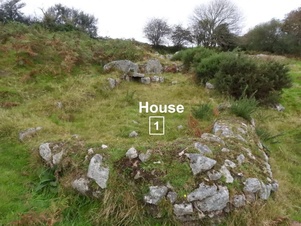
October 28, 2021
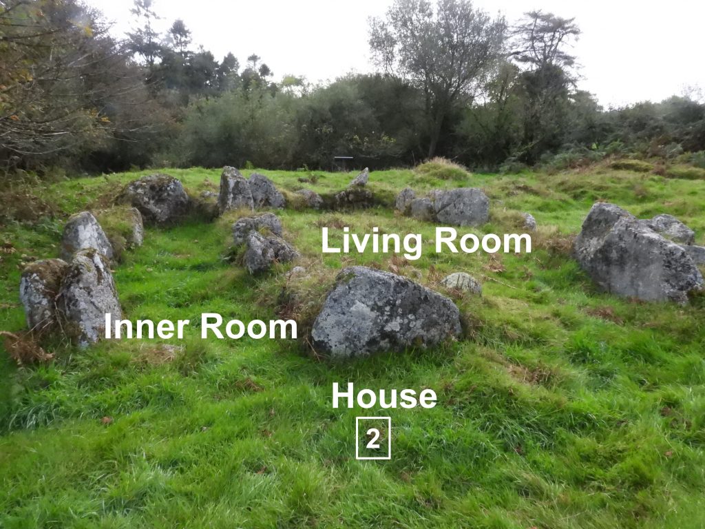
DARTMOOR EXPLORATIONS CALENDAR – DECEMBER
In 1991, the Dartmoor National Park Authority (DNPA) published a spiral bound diary to commemorate their fortieth anniversary (1951-1991), called “The Dartmoor Diary”.
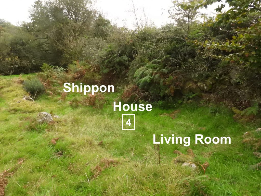
Inspired by this publication (and some of the entries in it) and to celebrate the DNPA 70th anniversary year in 2021, the “Dartmoor Explorations Calendar” records an event or story, complemented with photographs for each day of the year.
This page of the Dartmoor Explorations Calendar celebrates December on Dartmoor and its immediate borderland.
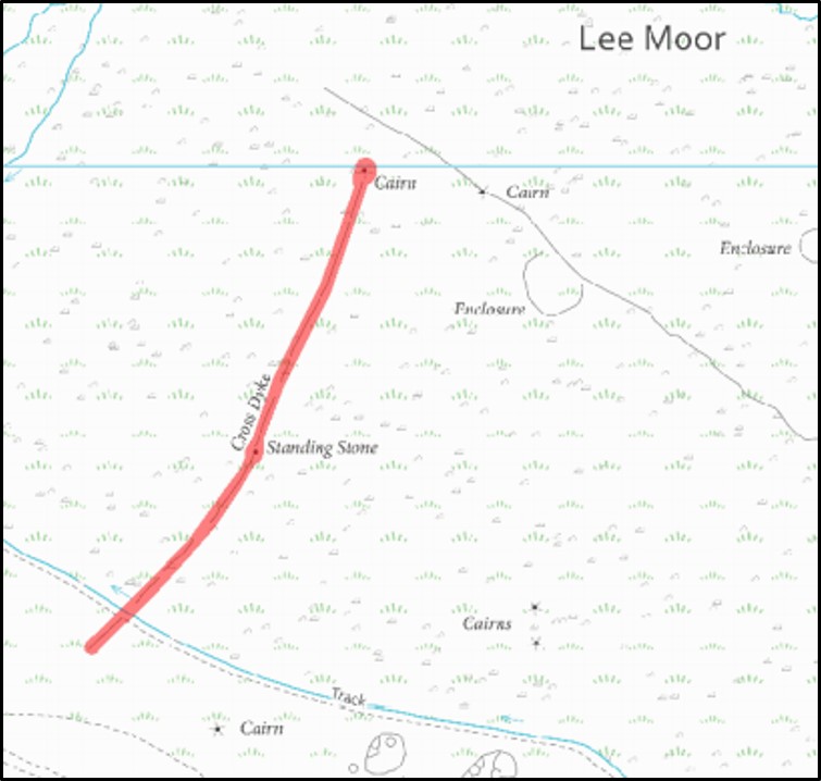
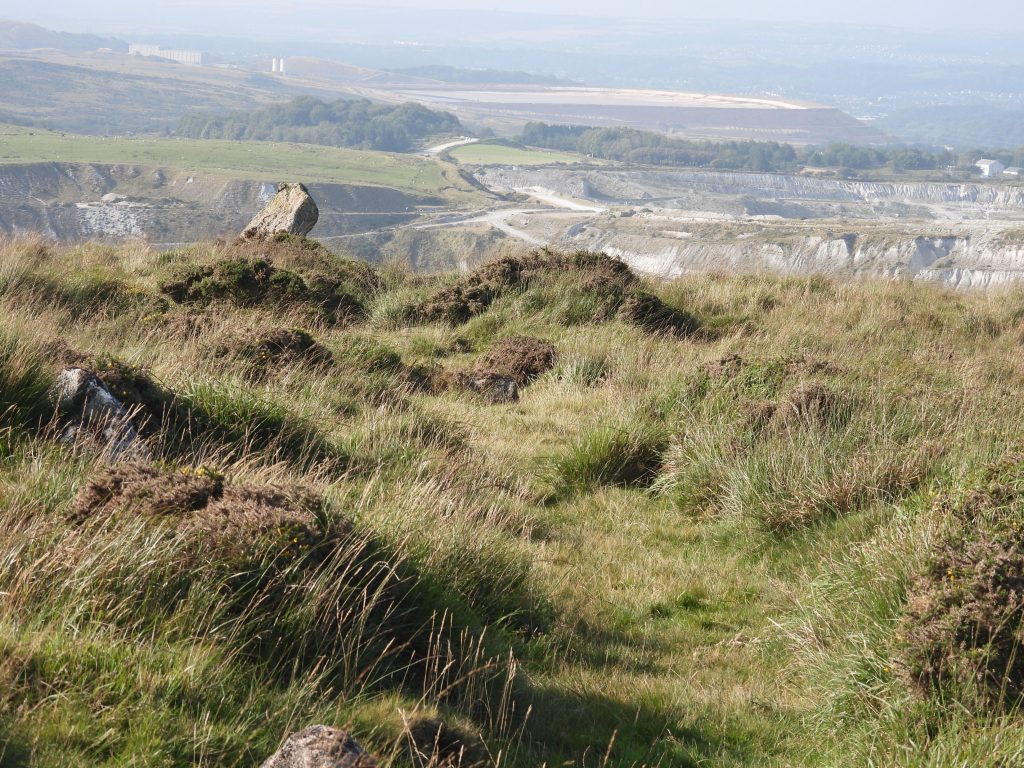
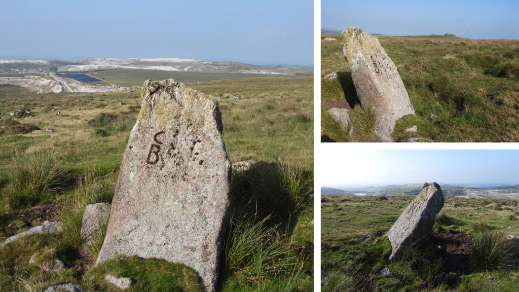
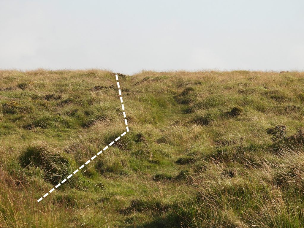
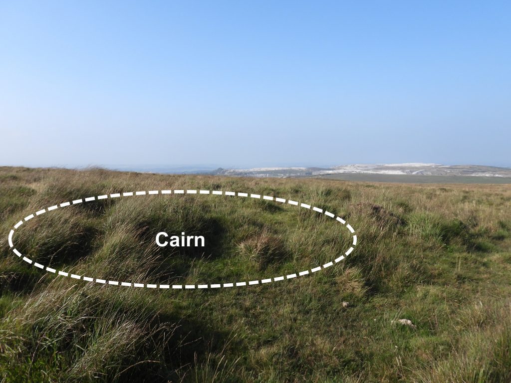
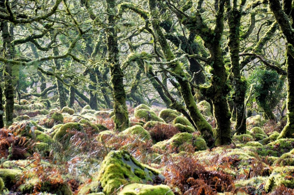
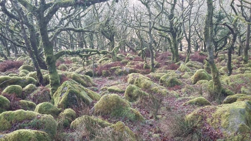
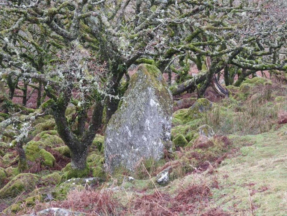
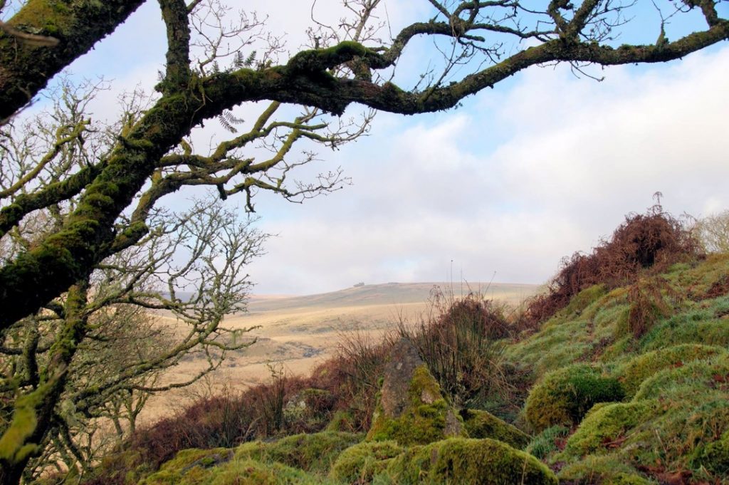
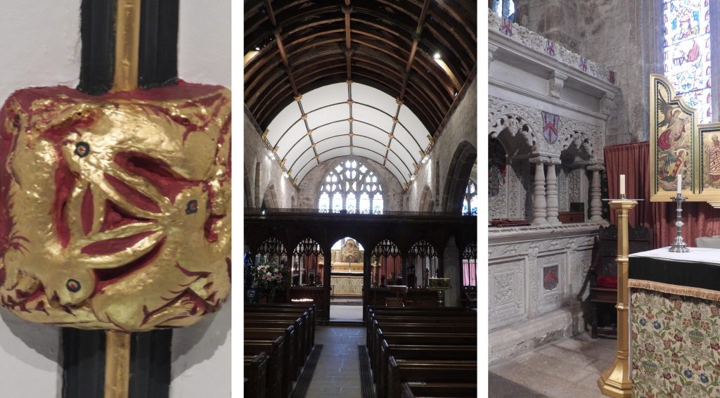
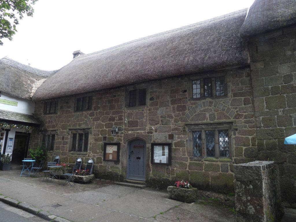
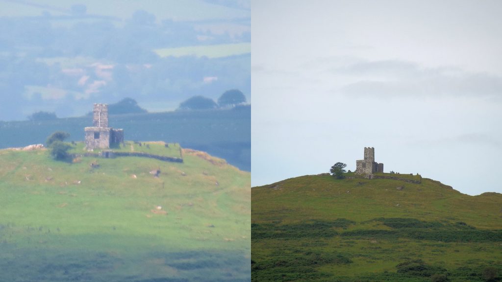
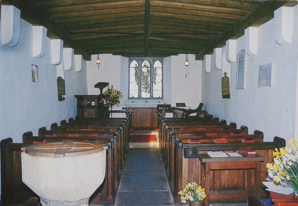
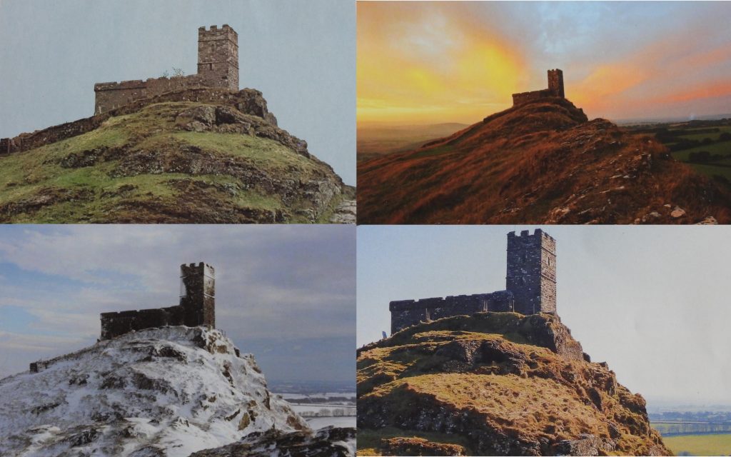
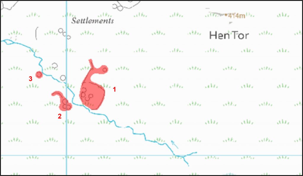
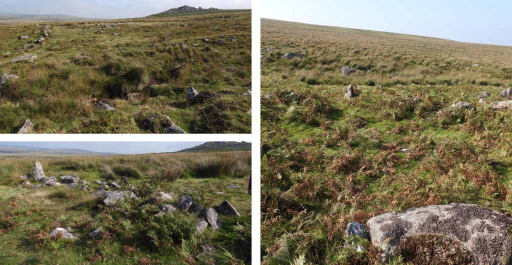
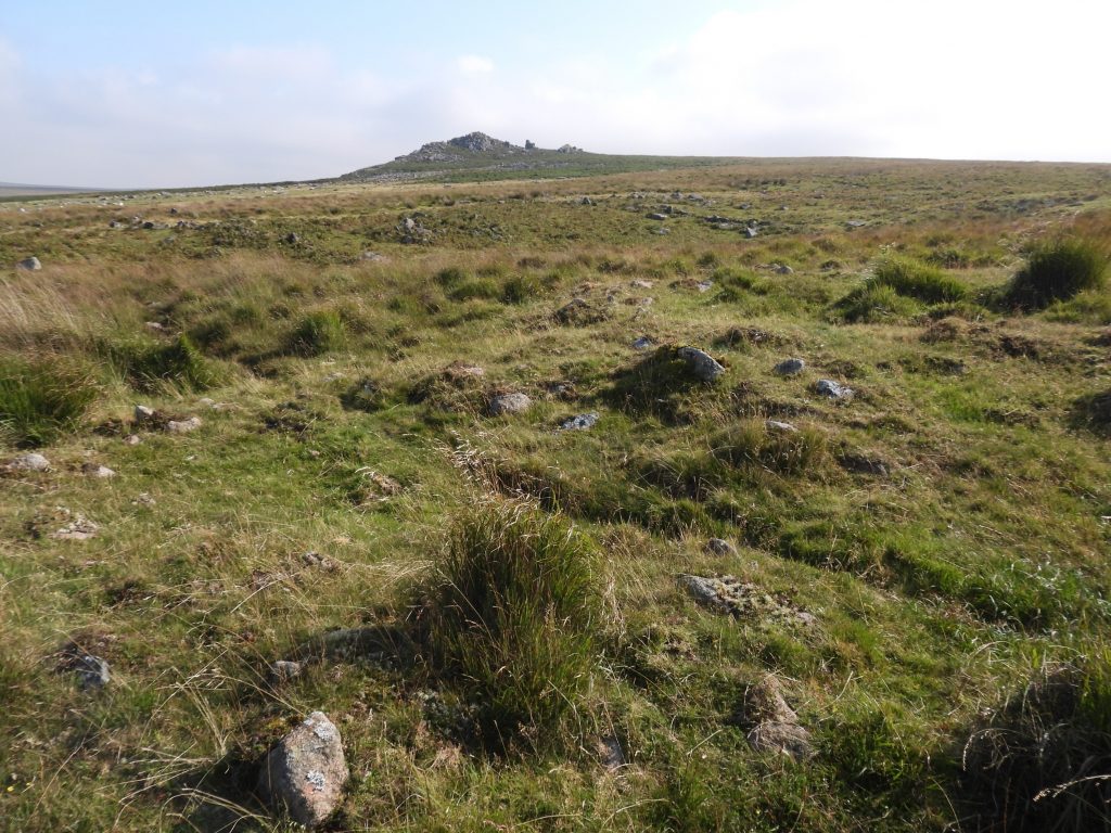
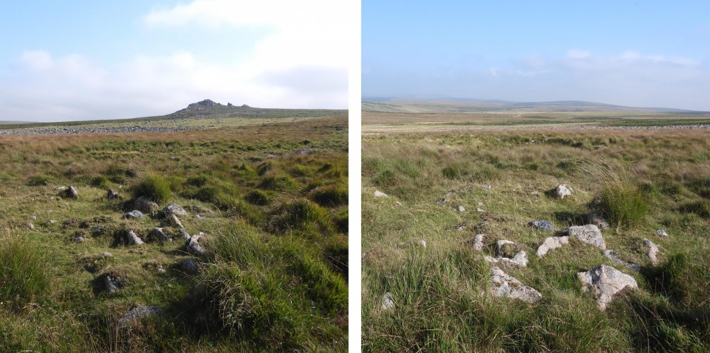
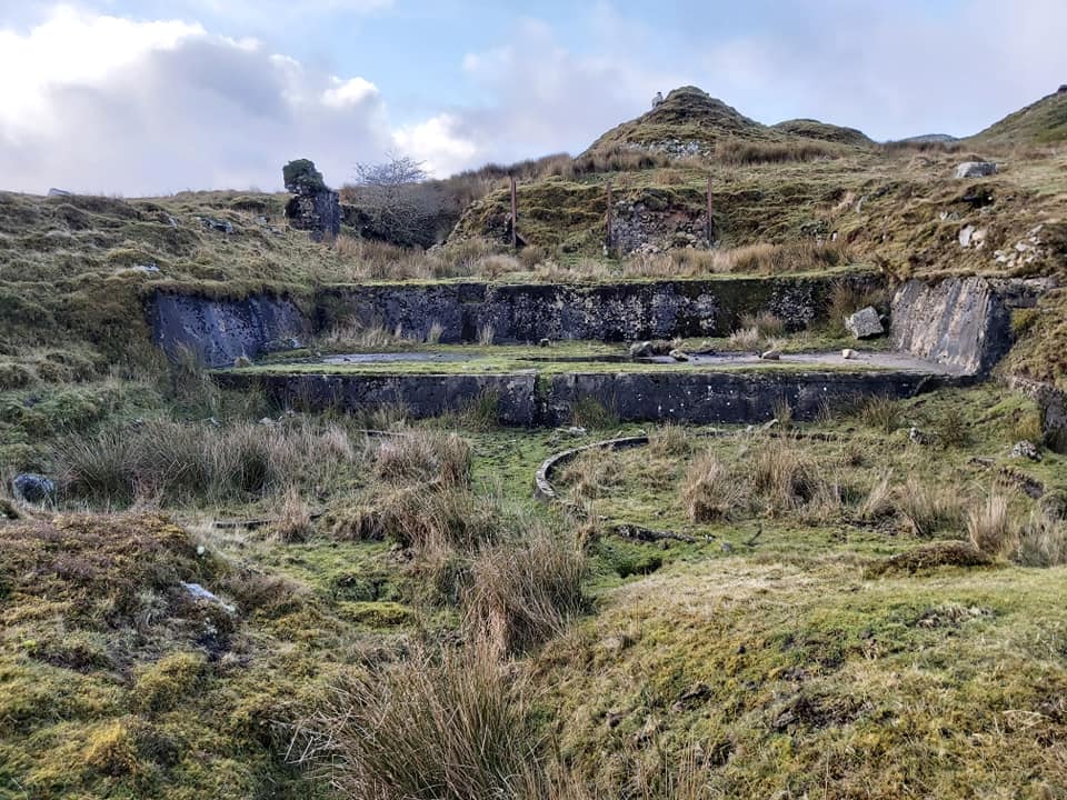
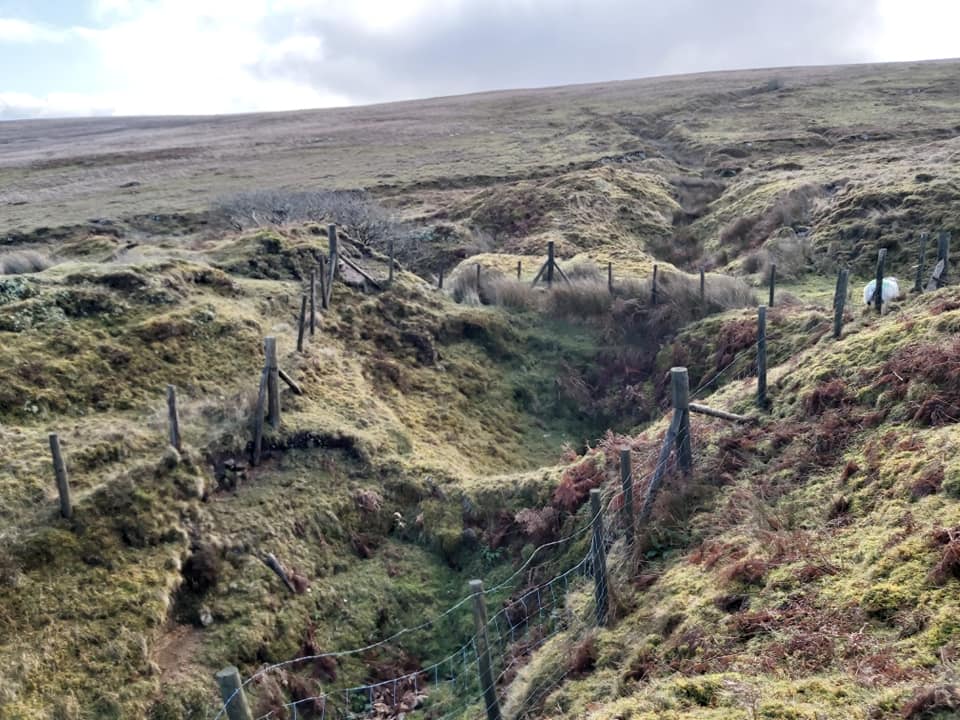
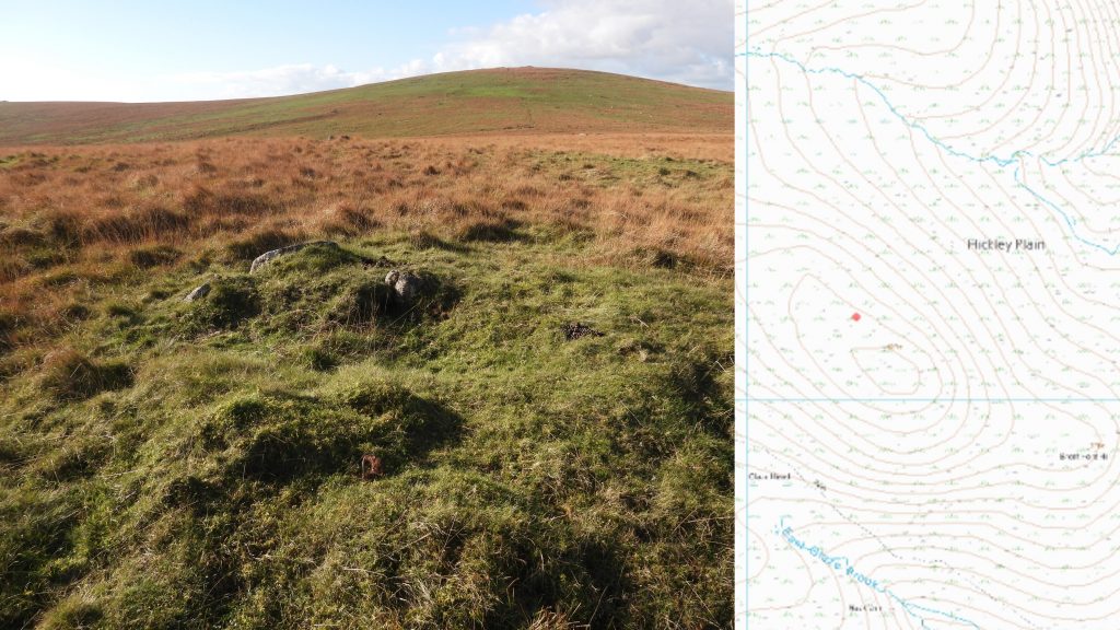
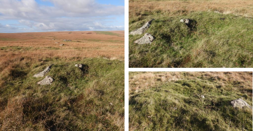
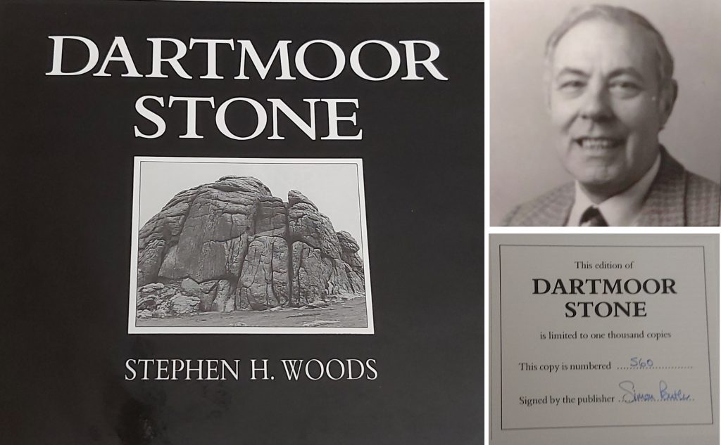
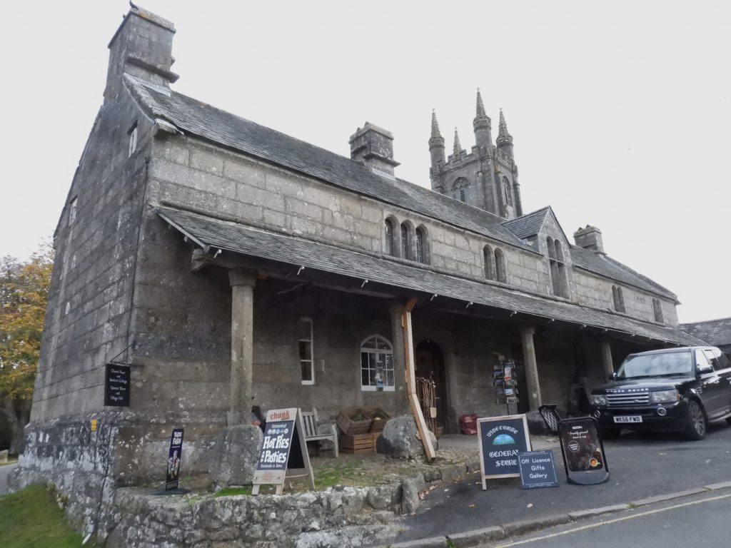
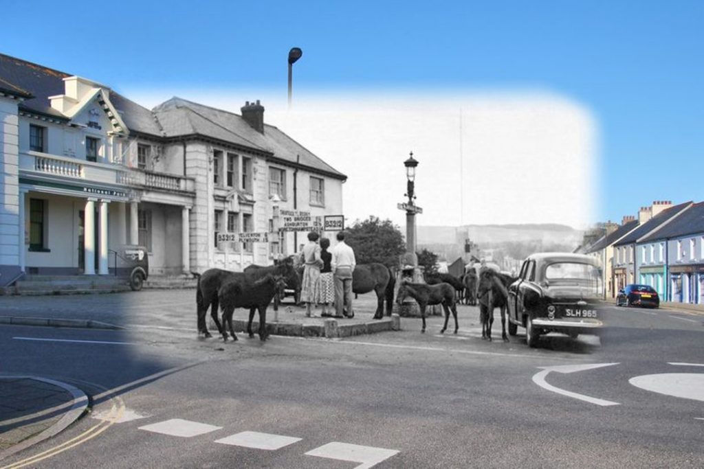
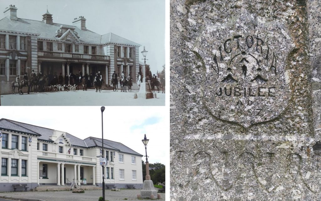
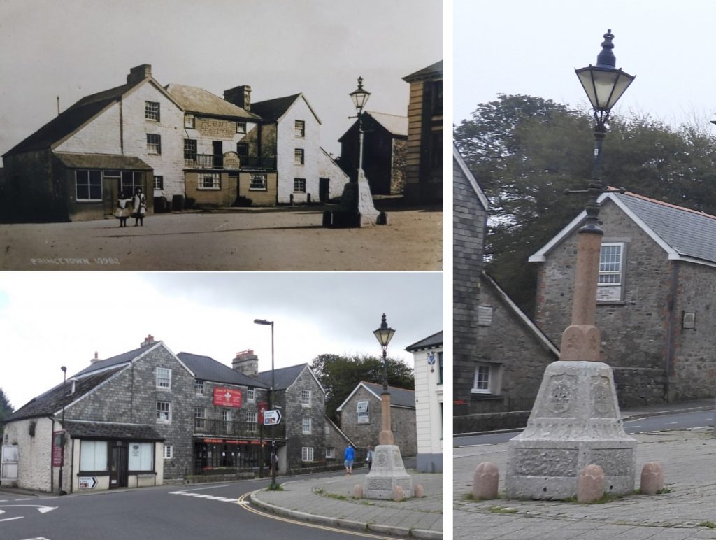
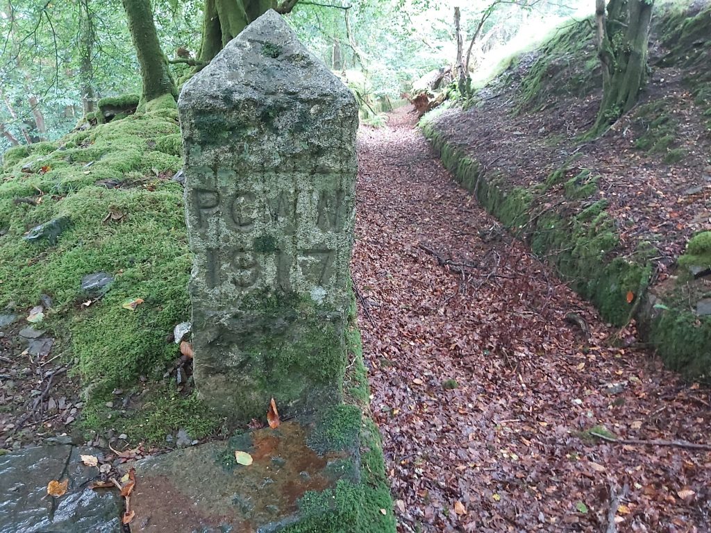
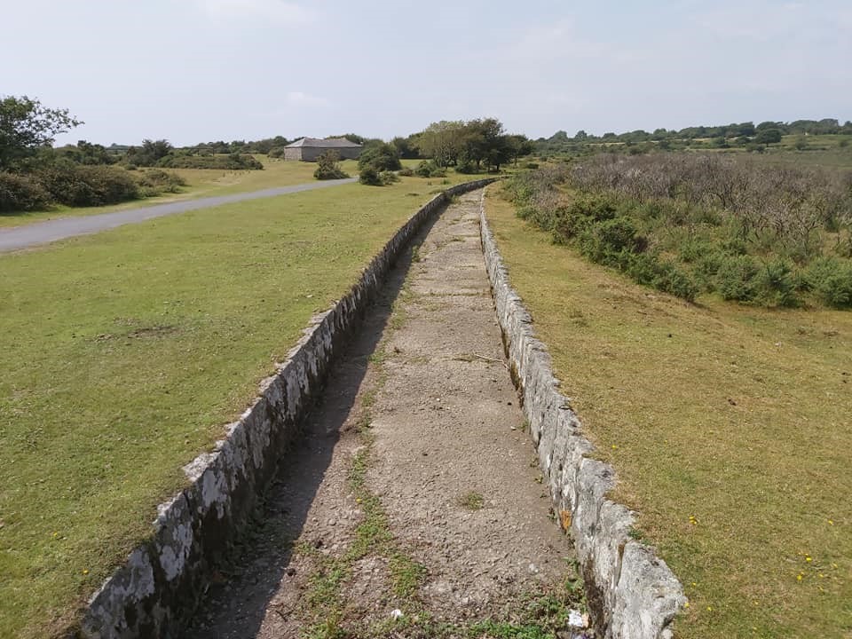
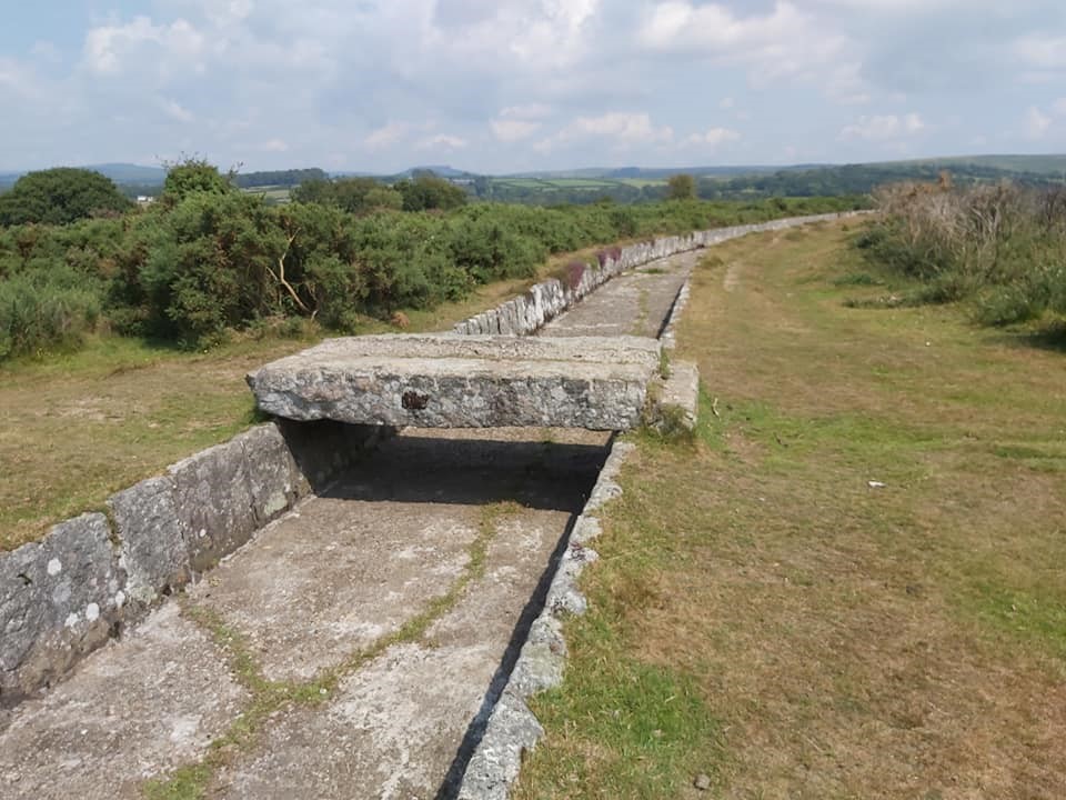
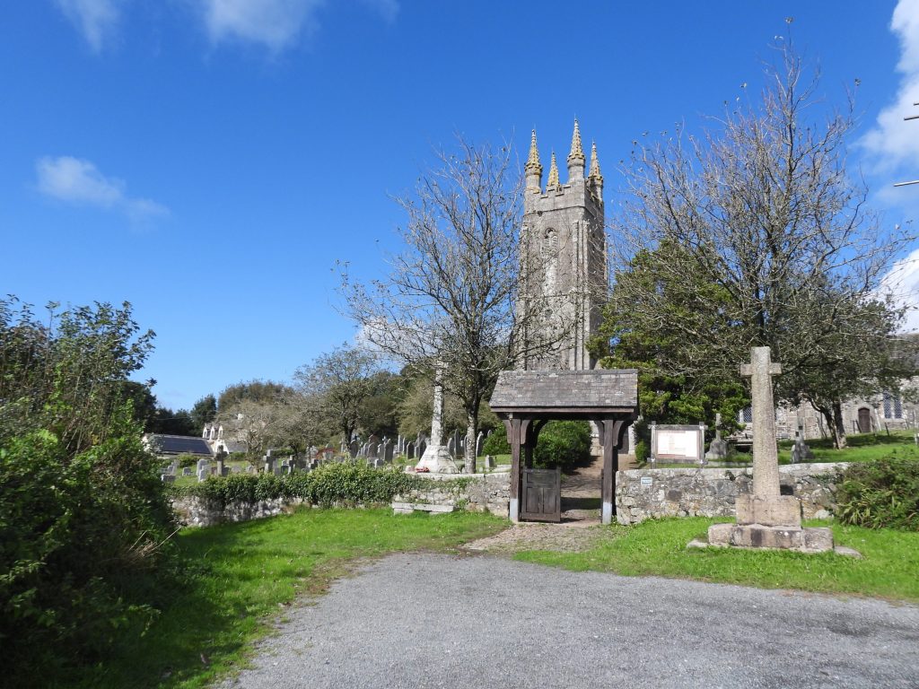
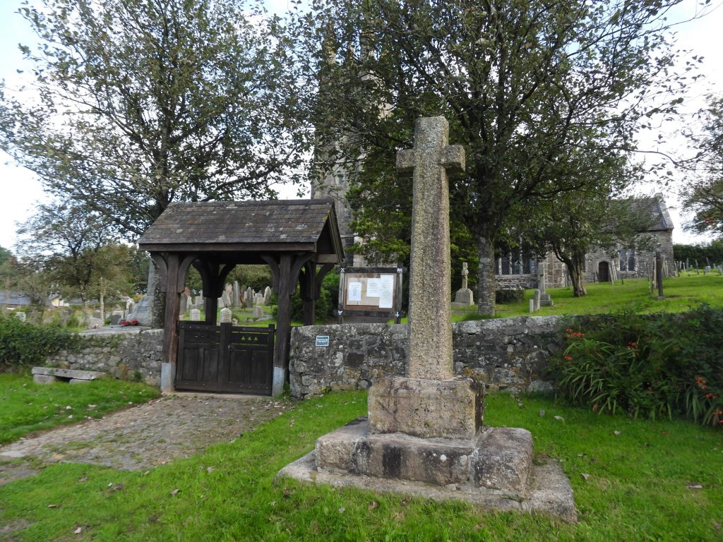
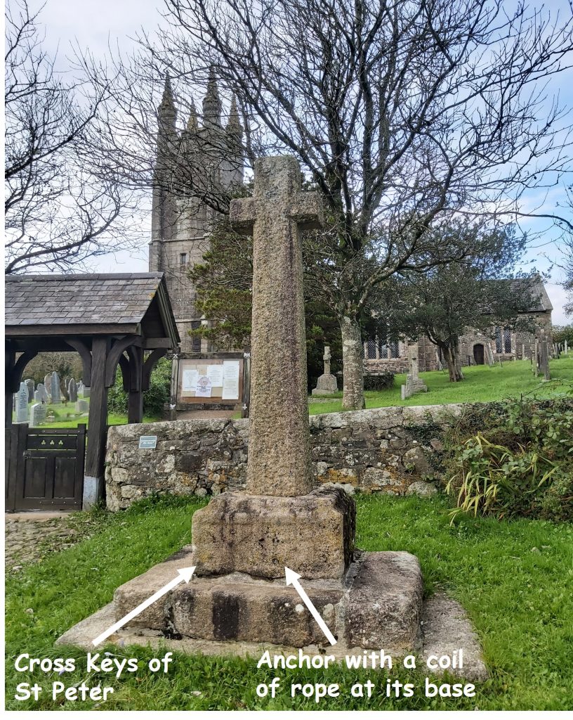
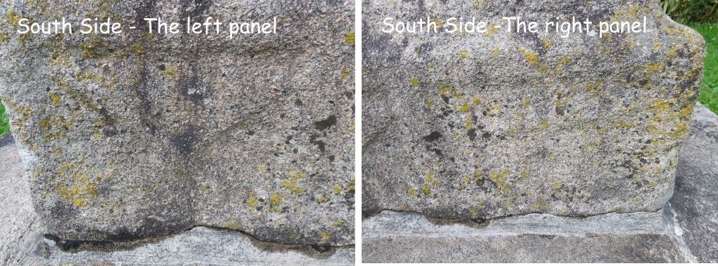
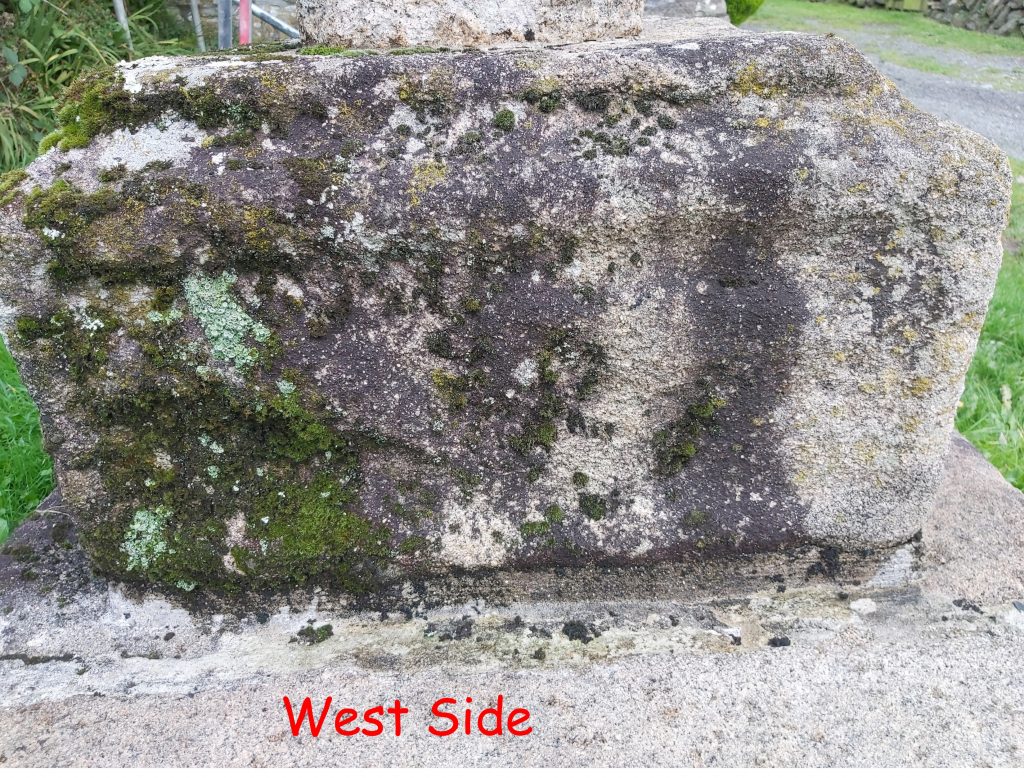
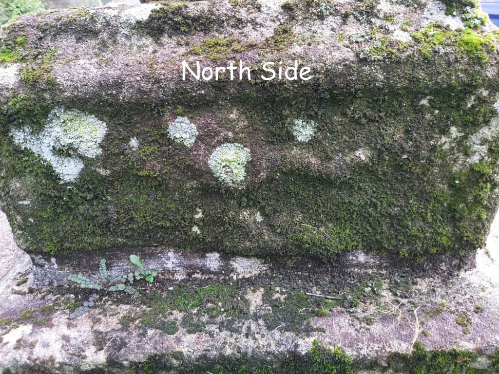
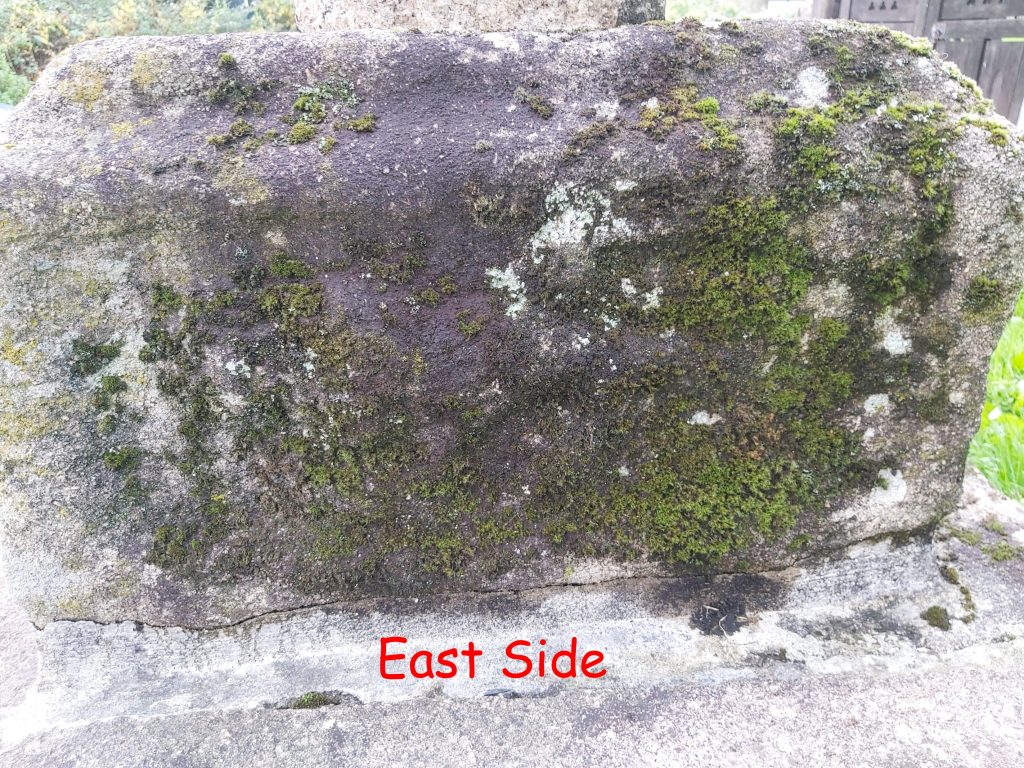
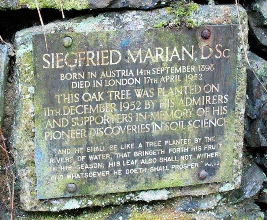
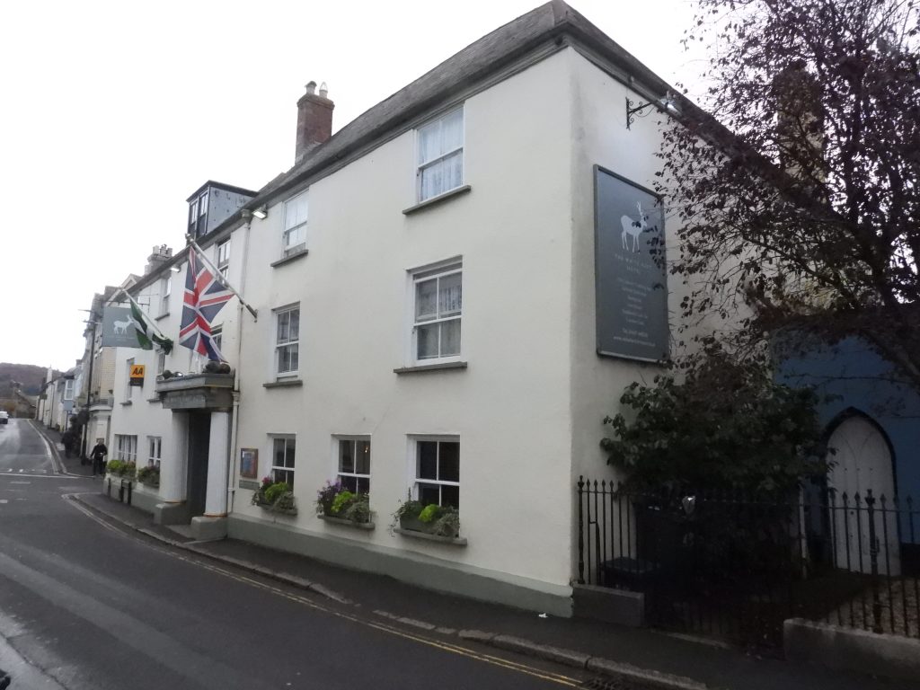
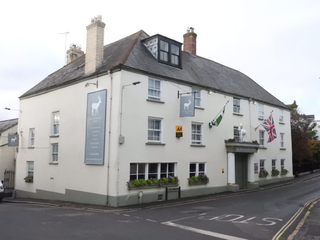
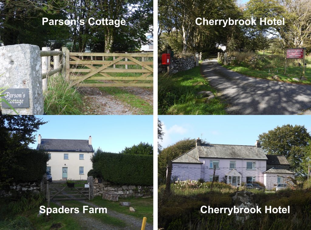
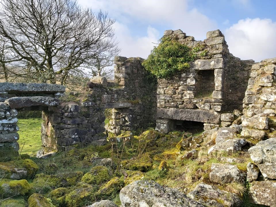
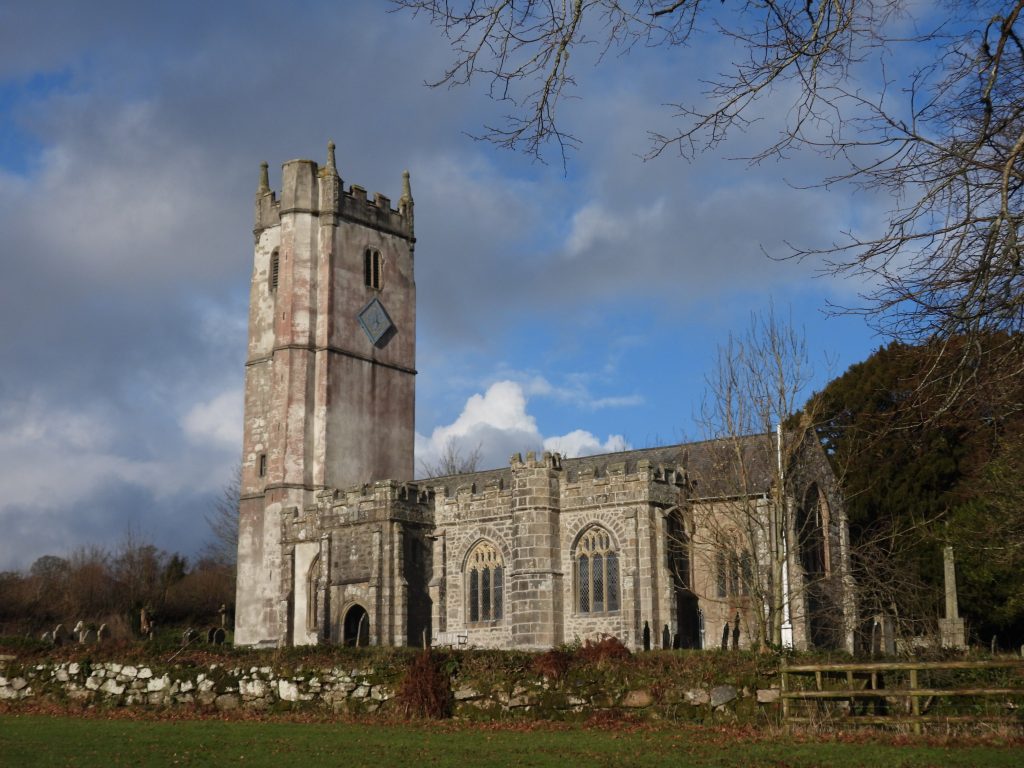
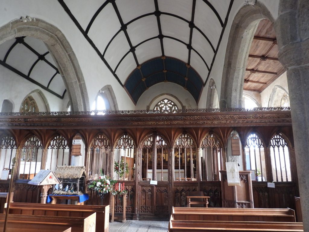
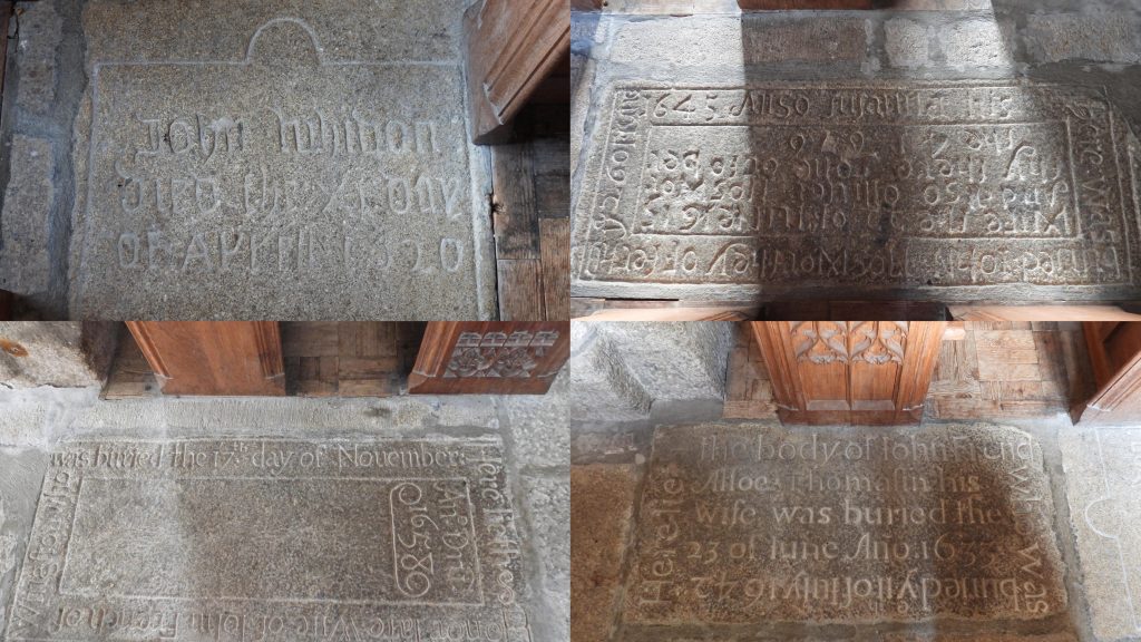
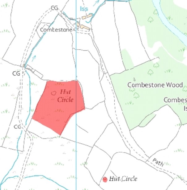
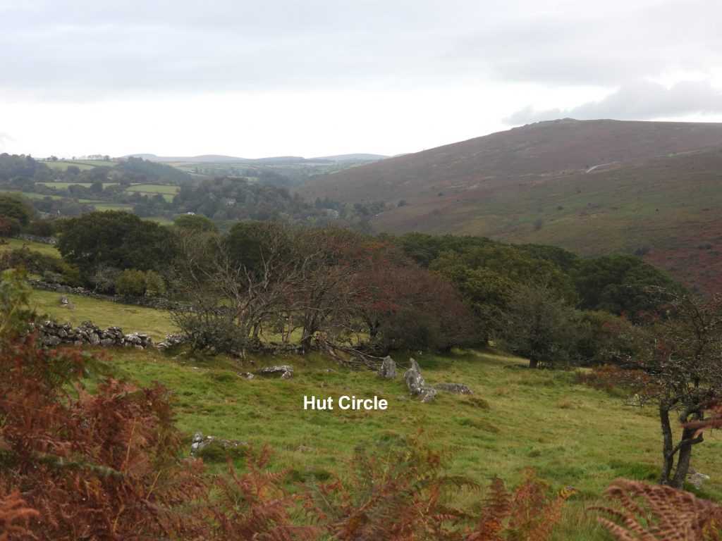
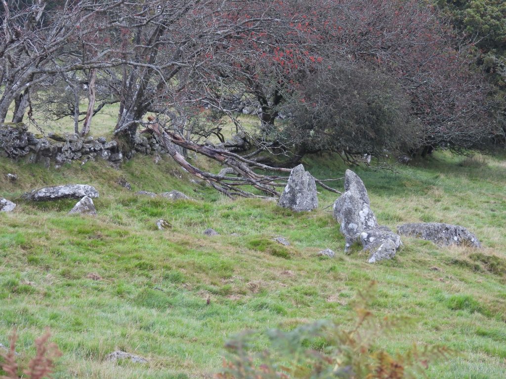
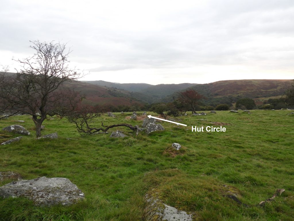
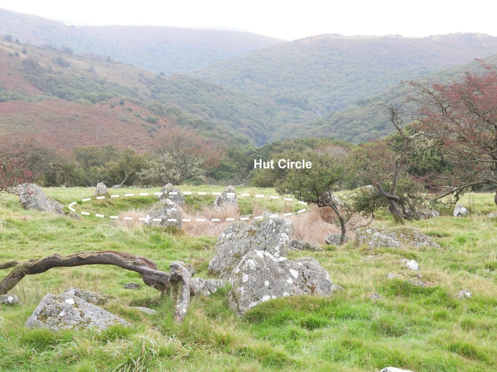
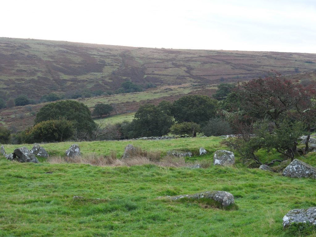
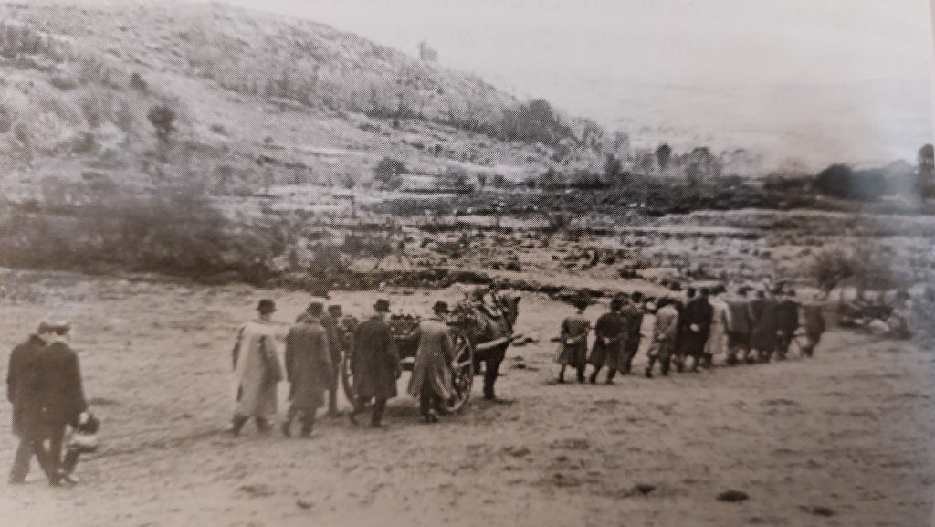
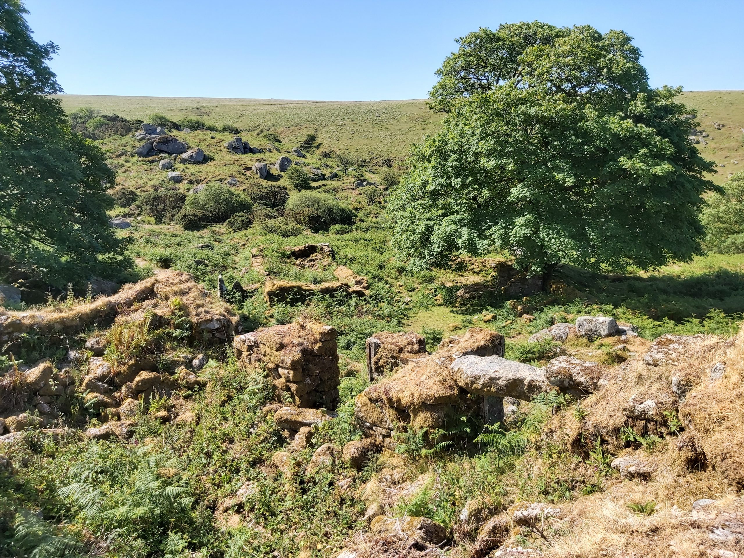
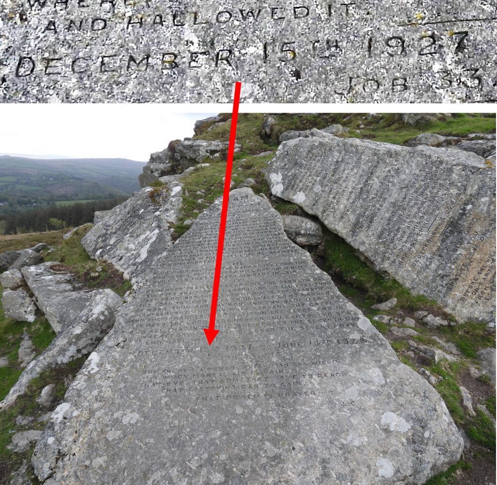
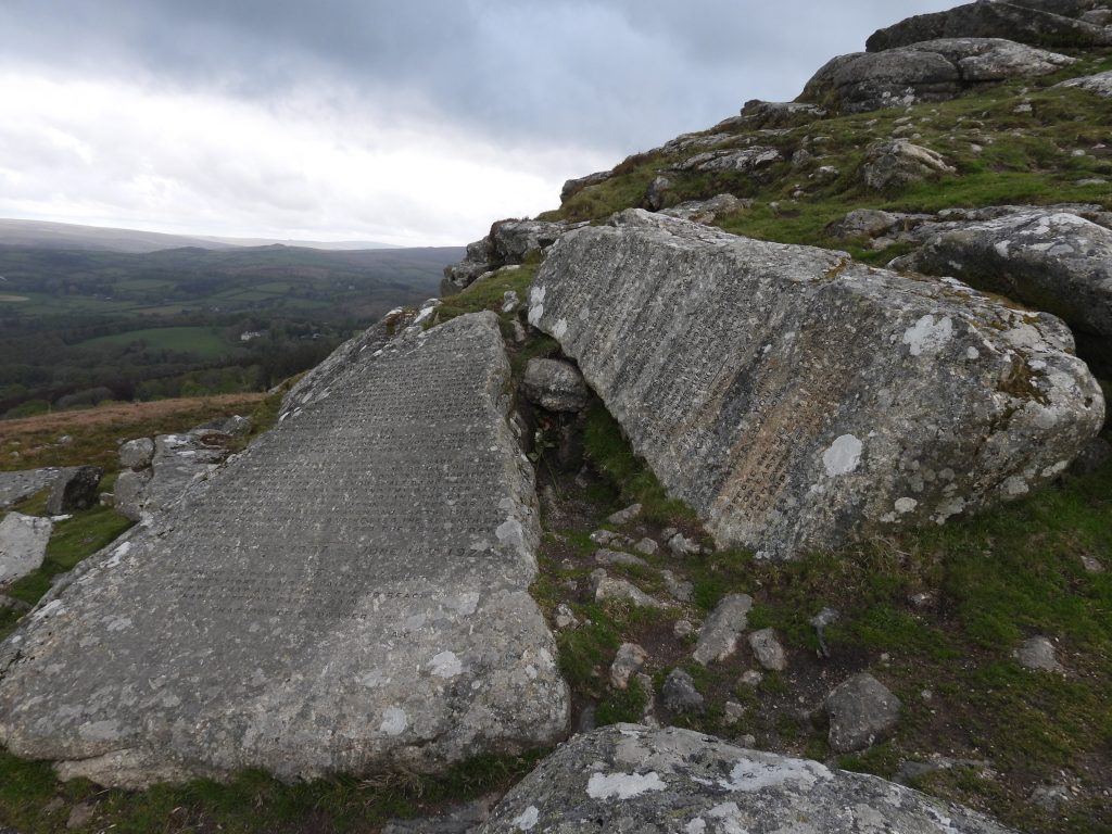
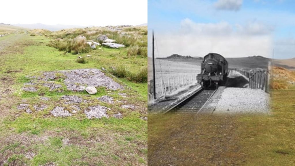
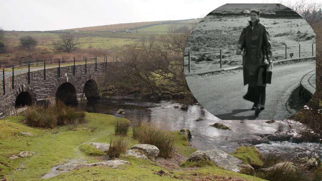
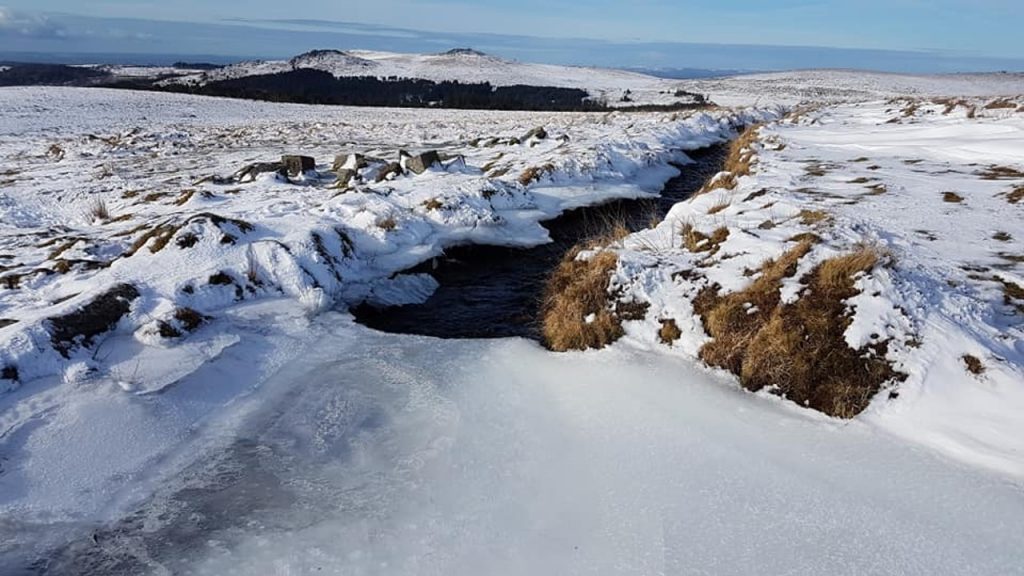
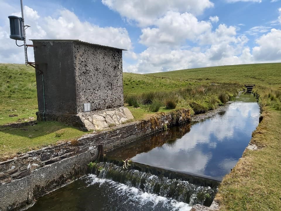
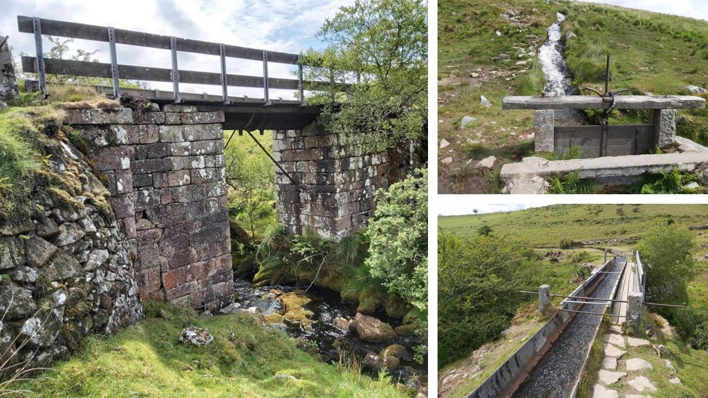
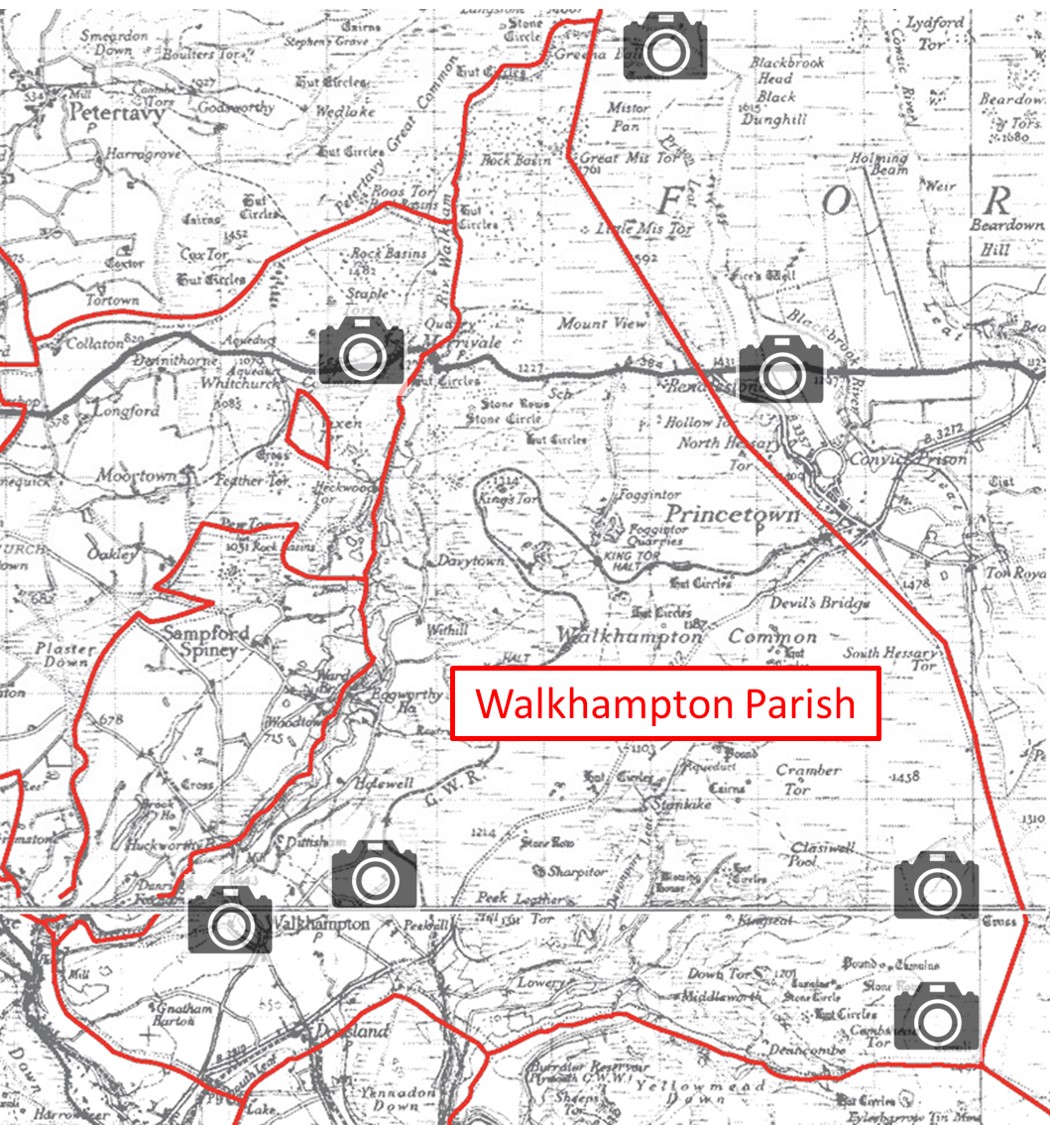
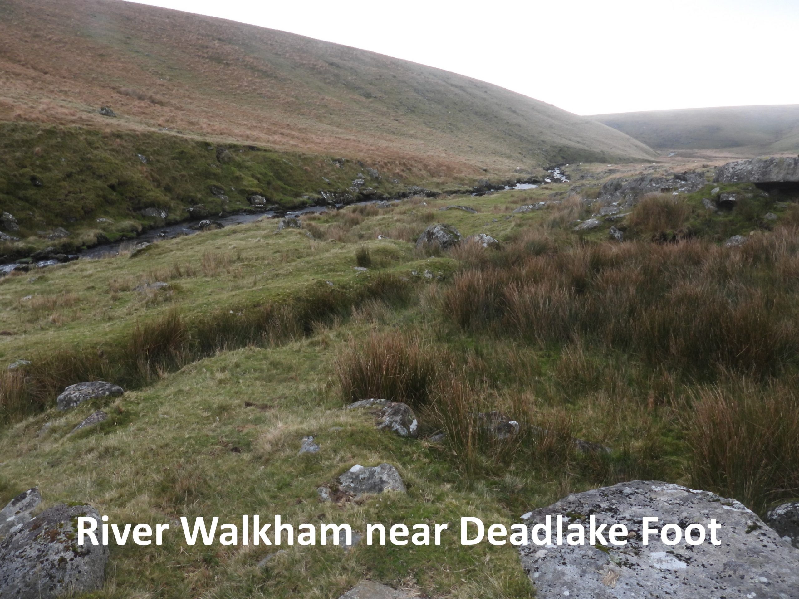
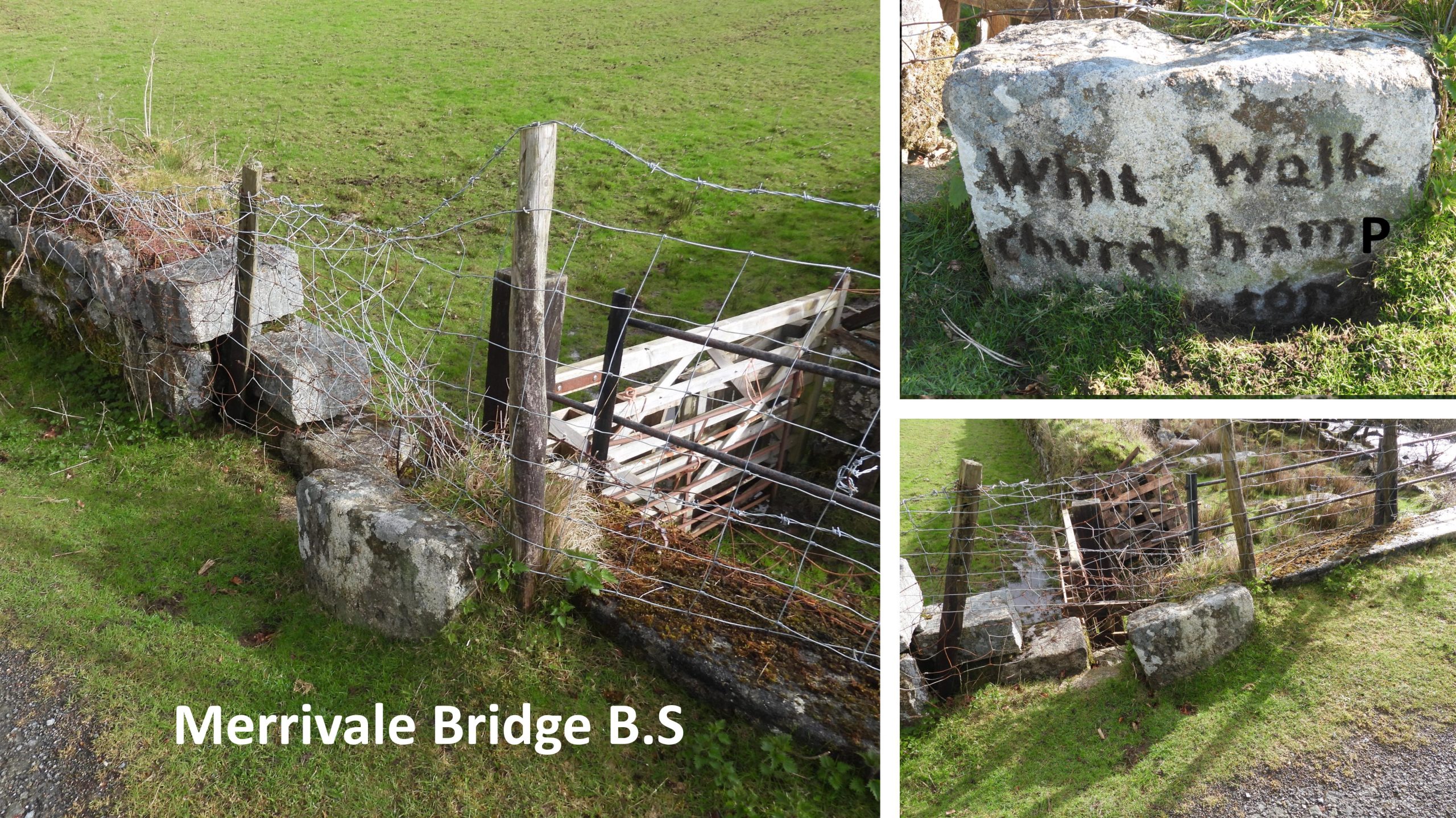
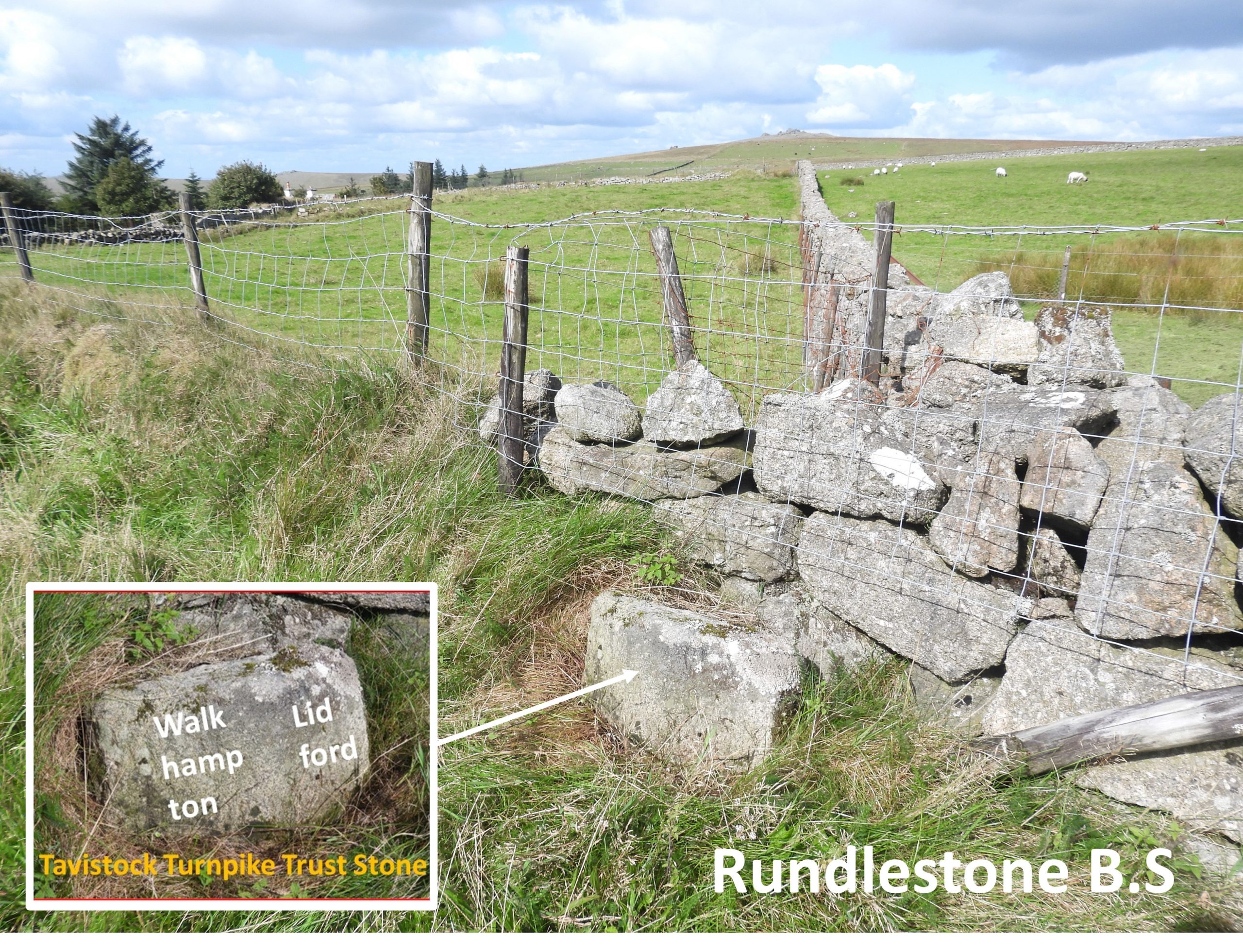
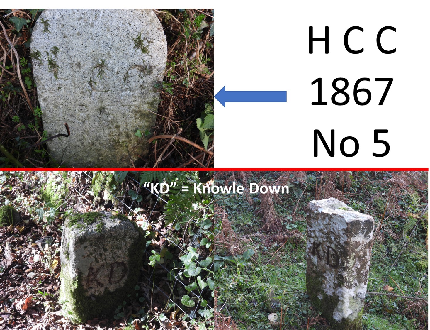
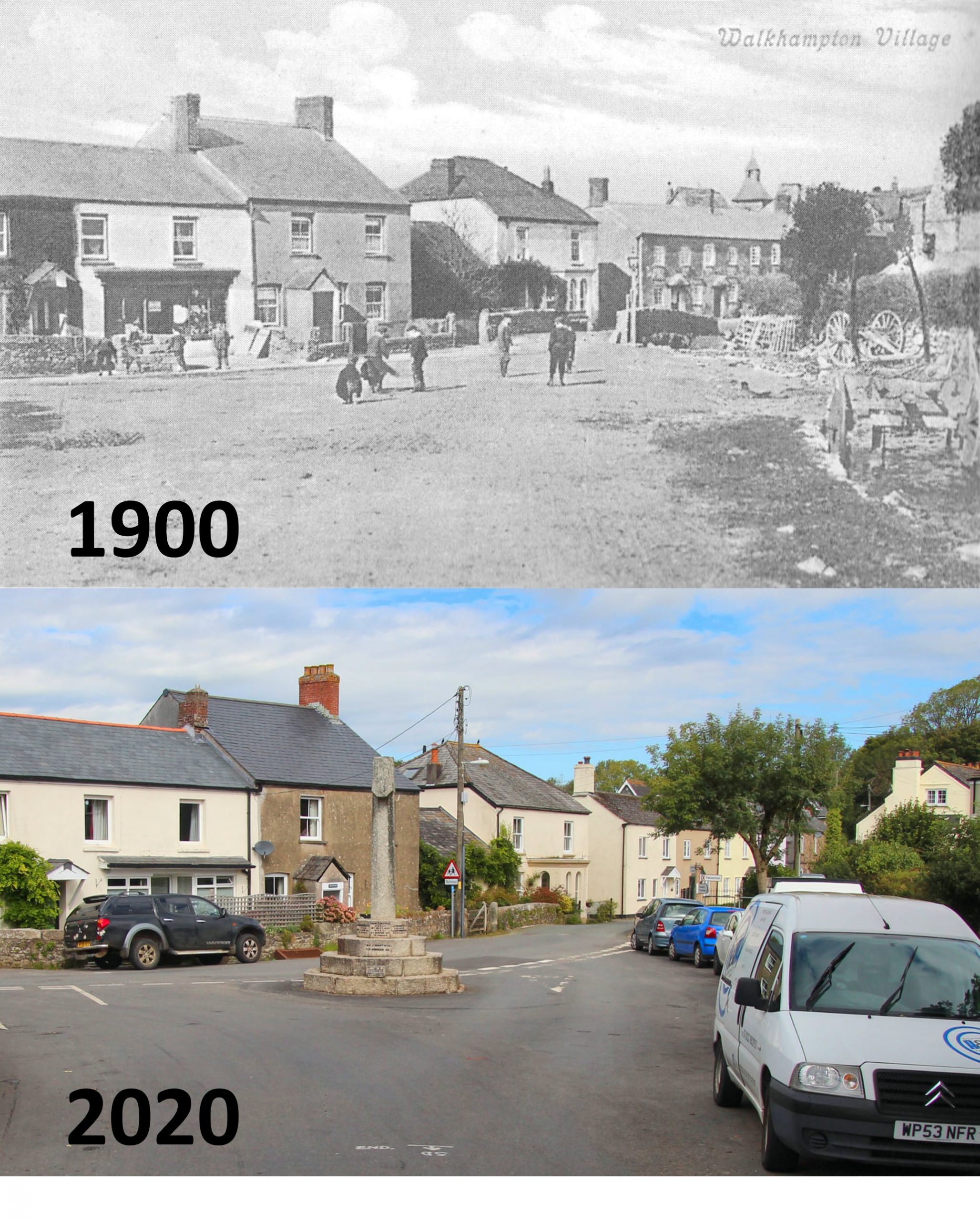
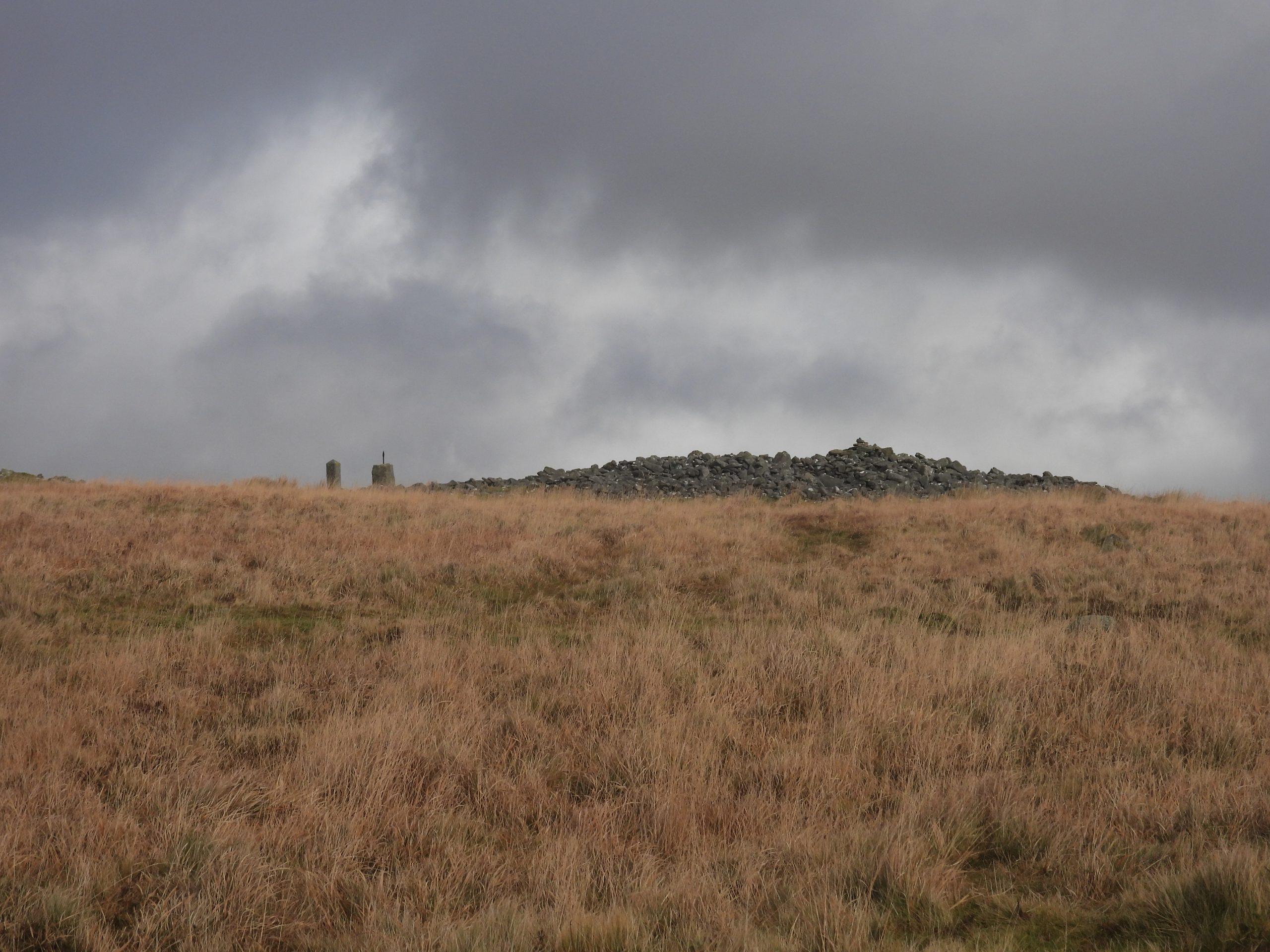
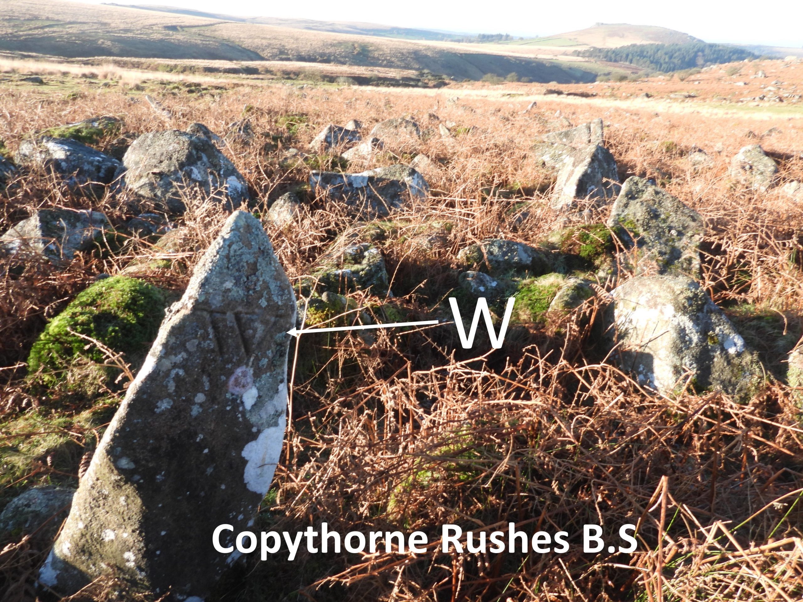
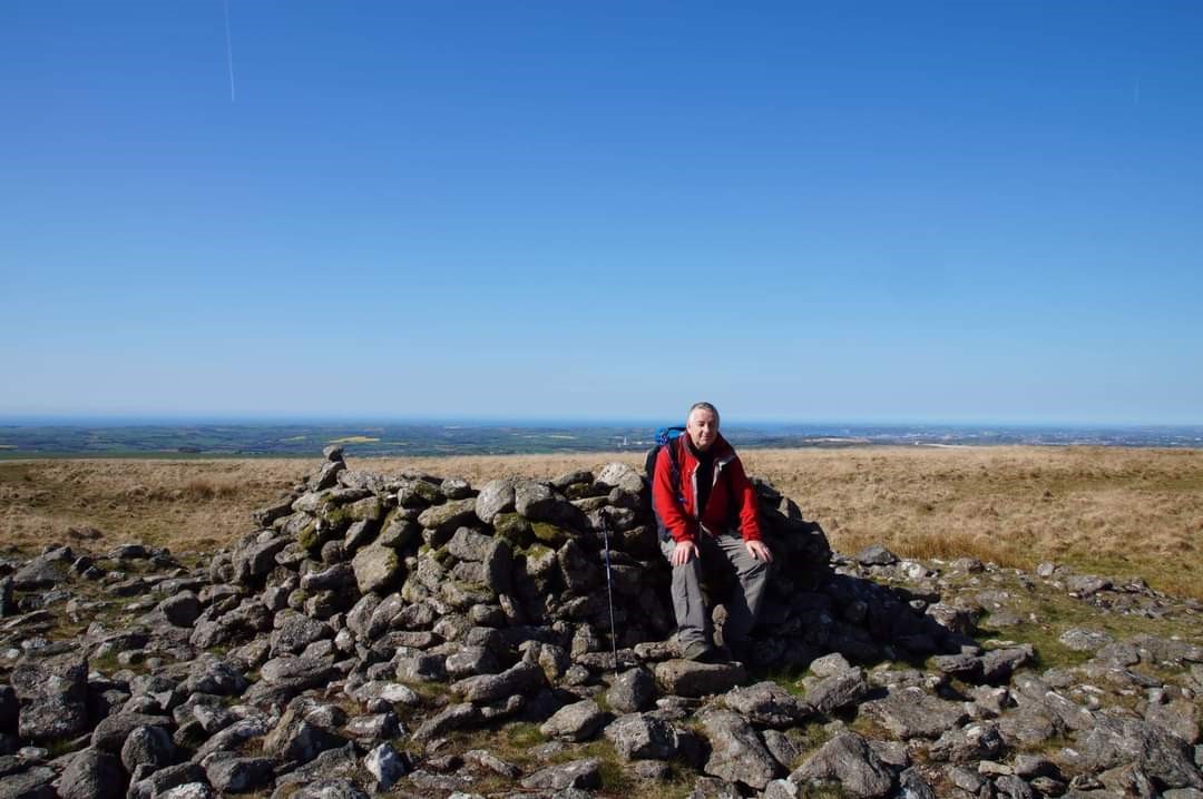
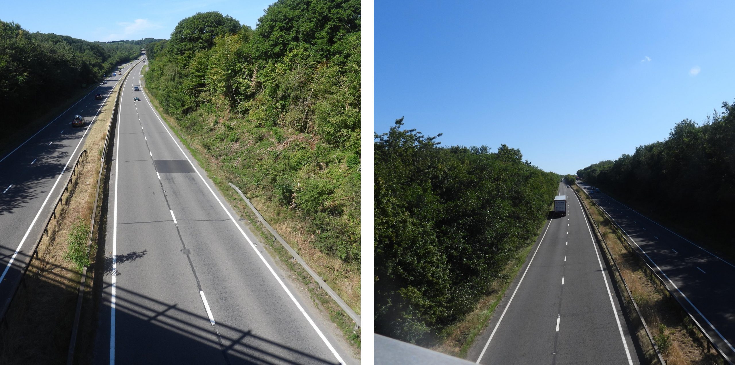
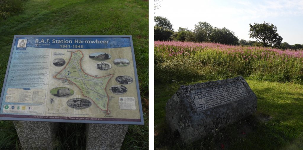
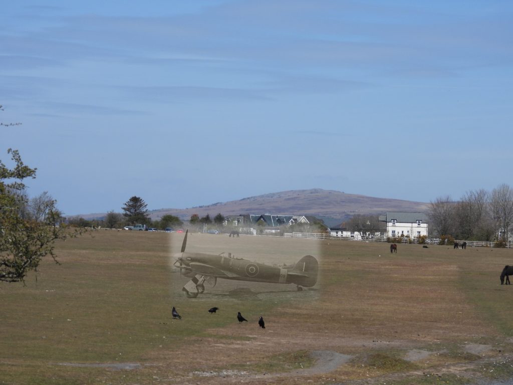
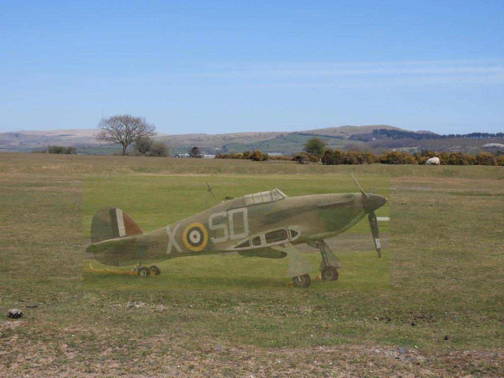
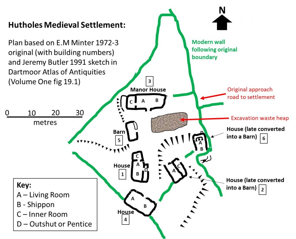
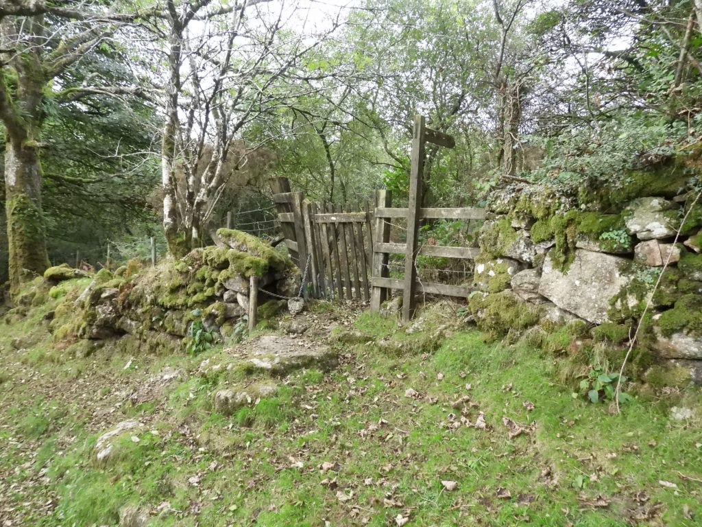
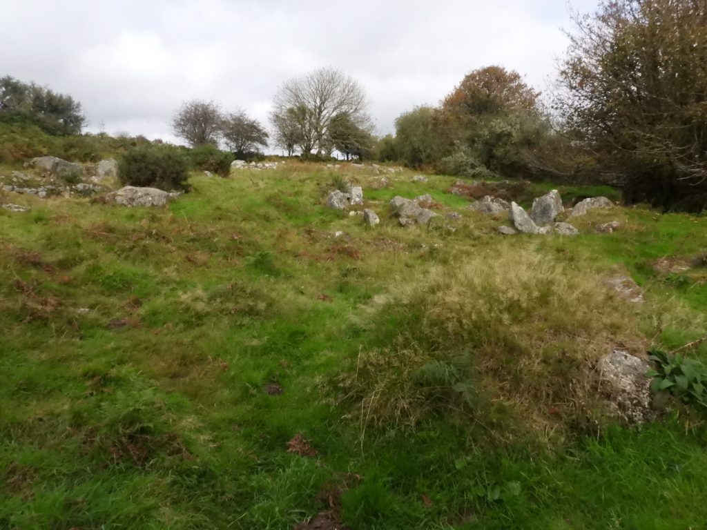
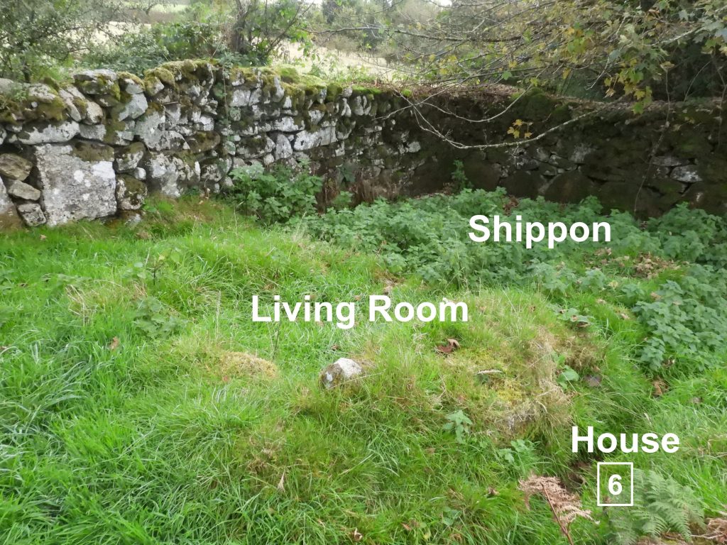
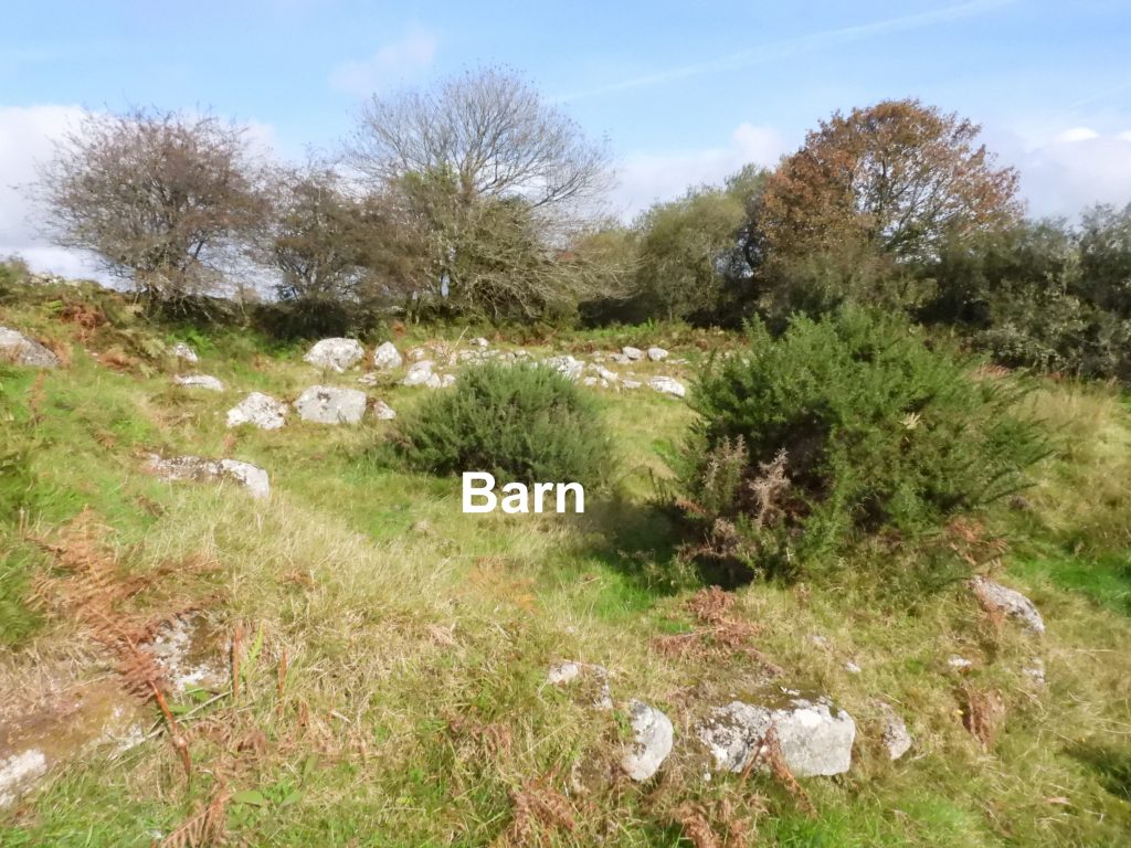
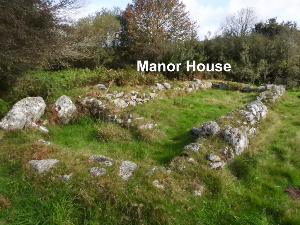
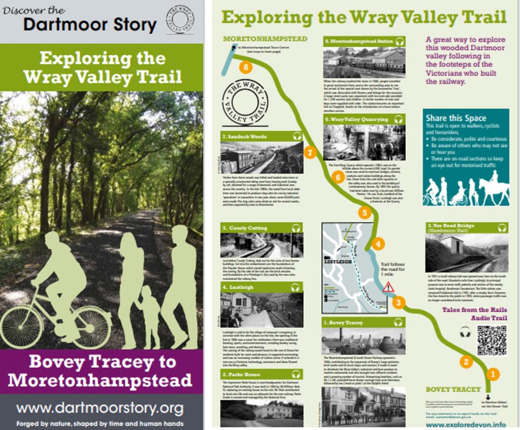
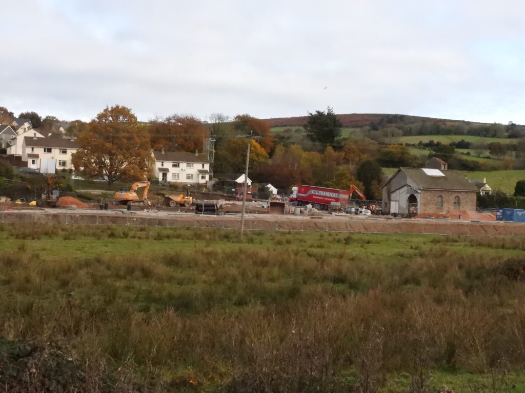
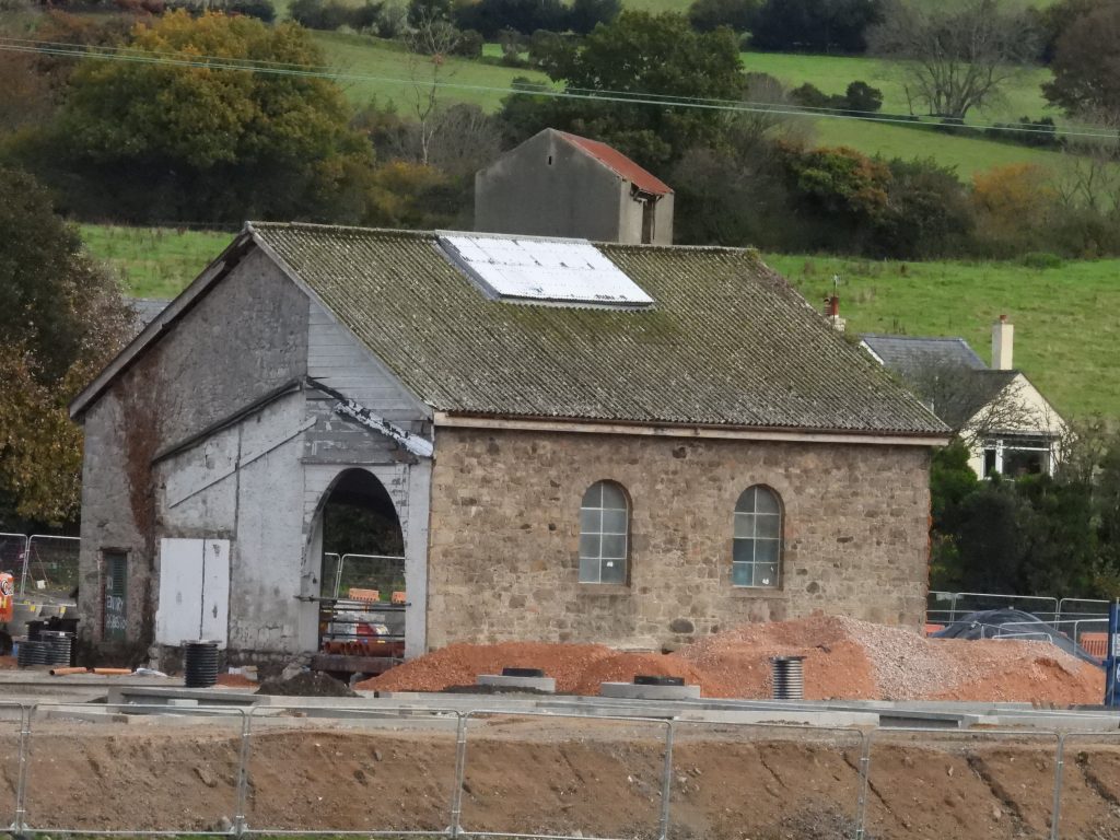
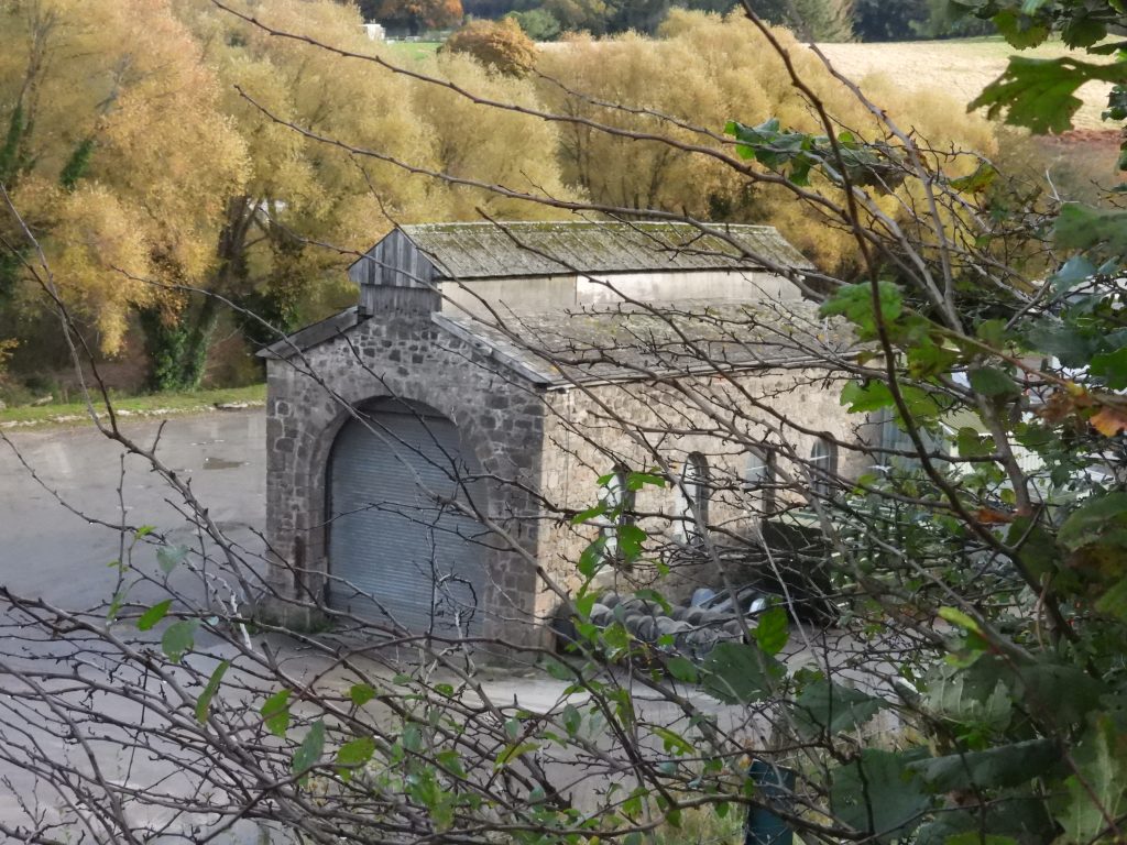
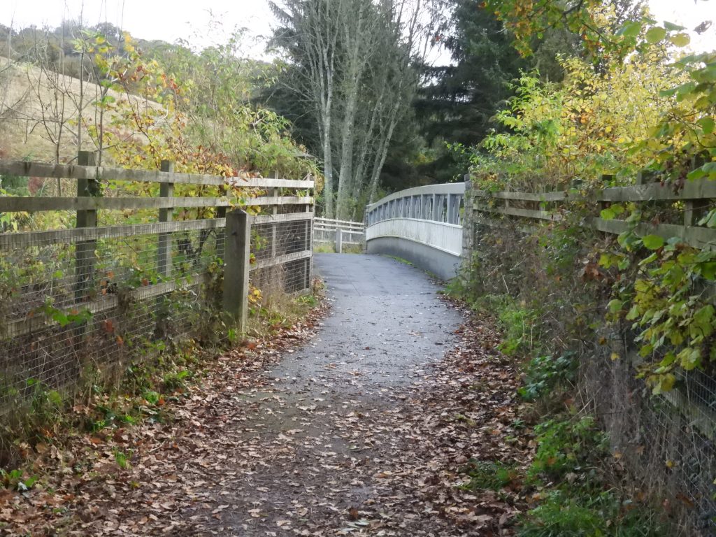
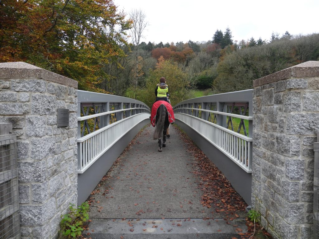
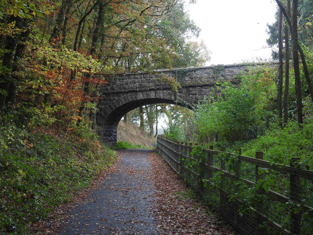
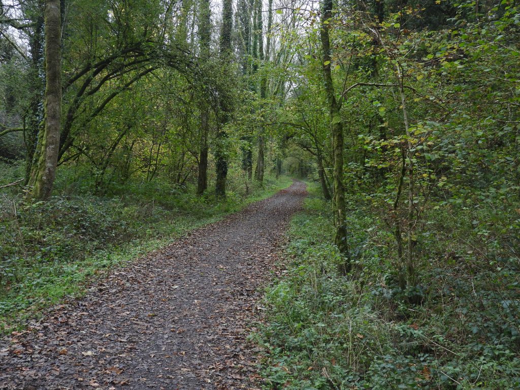
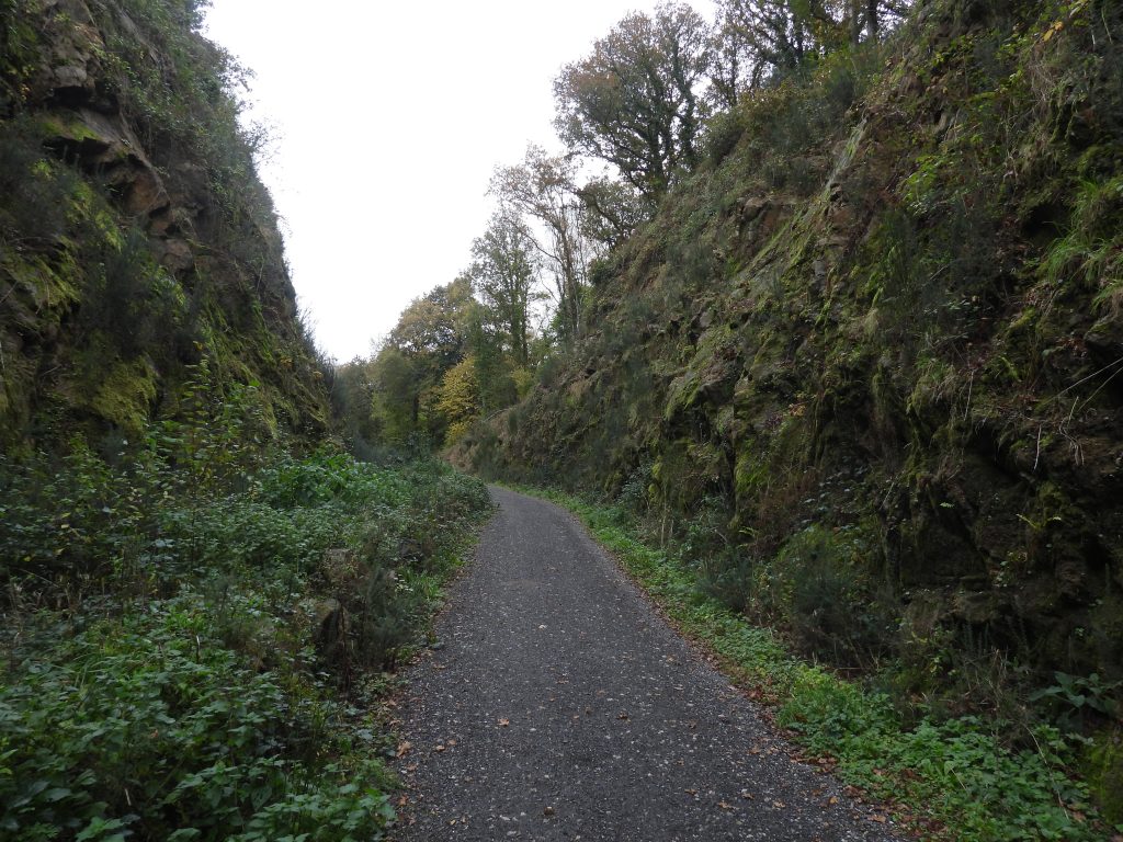
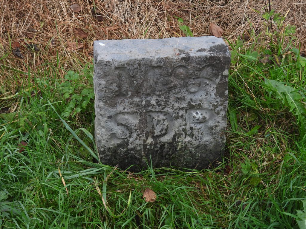
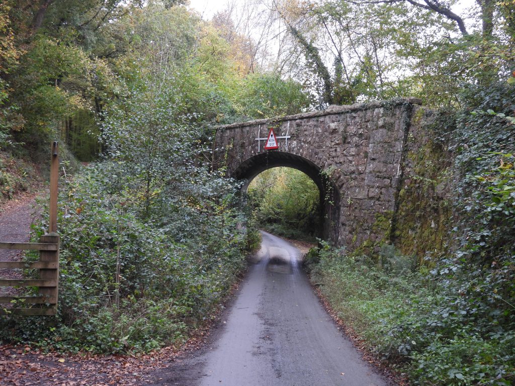
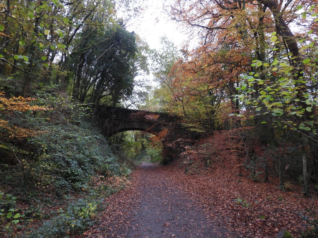
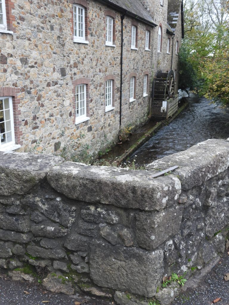
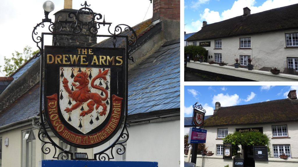
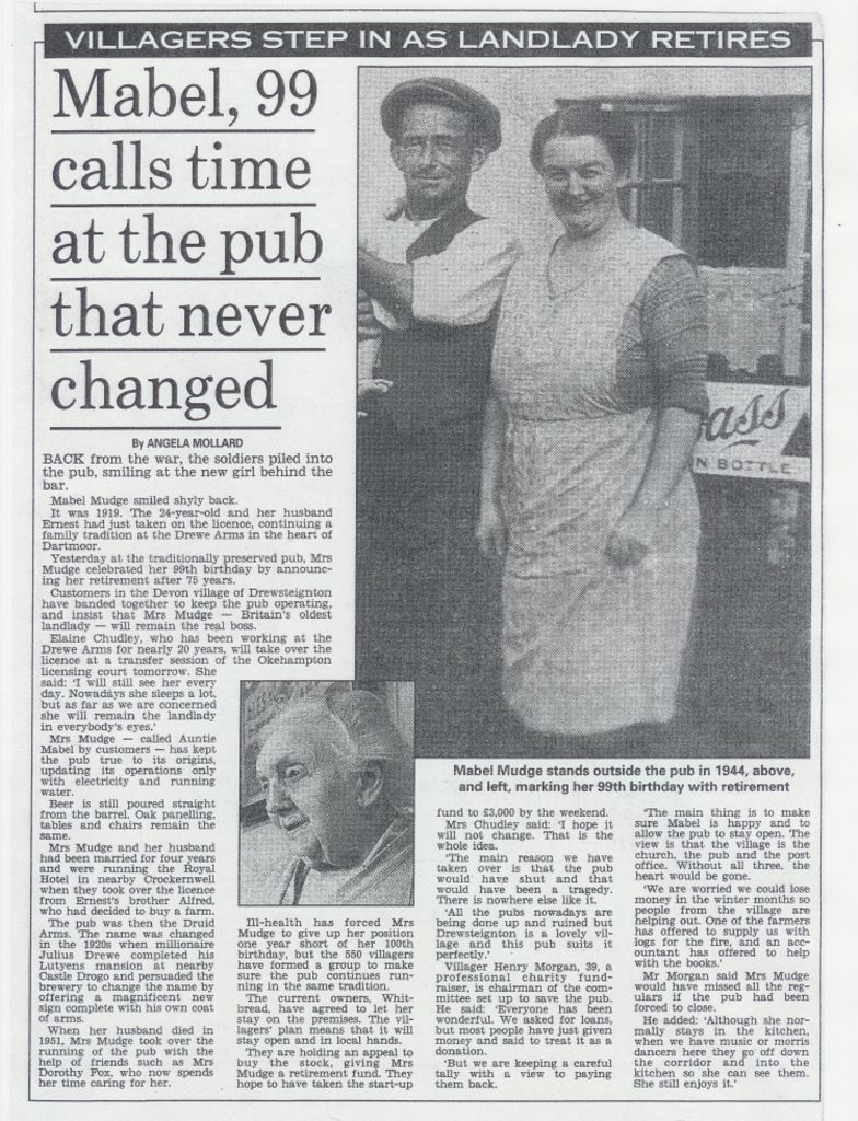
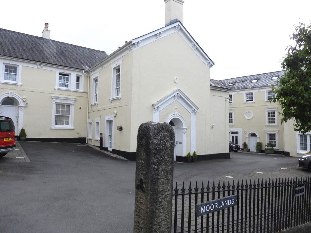
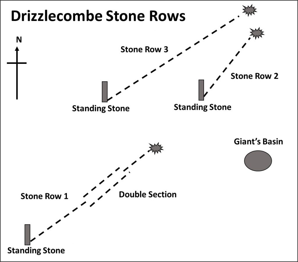
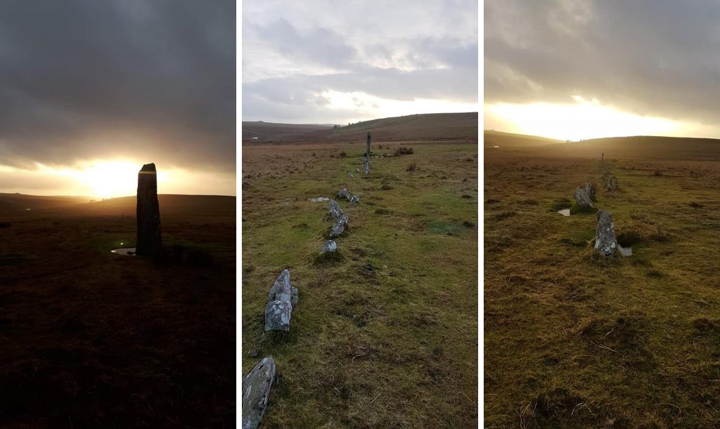
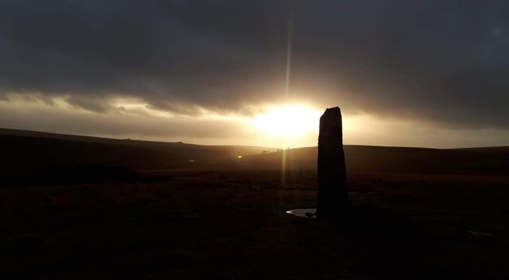
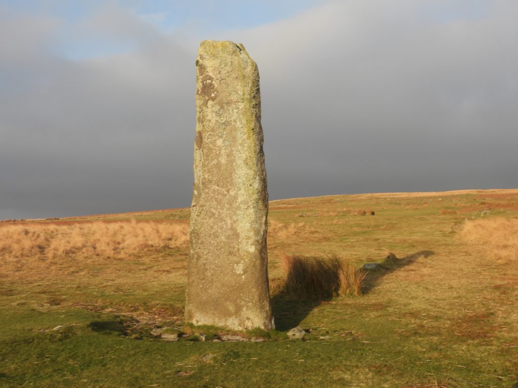
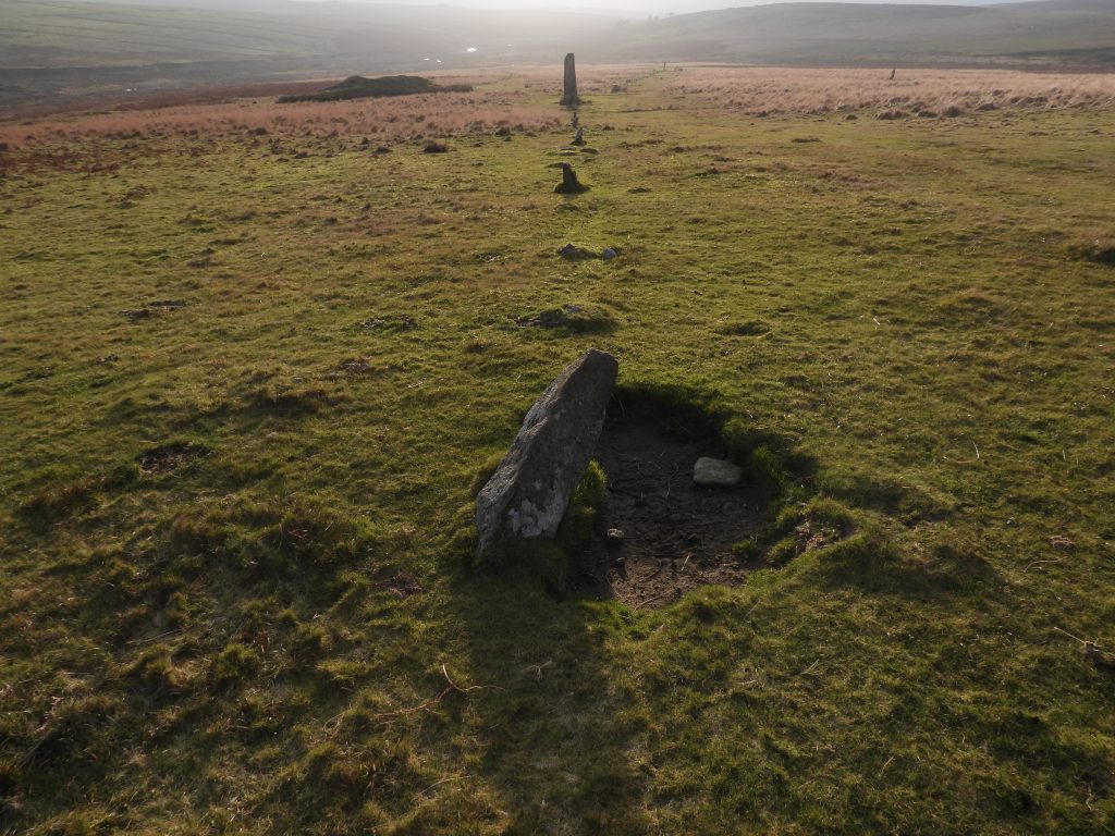
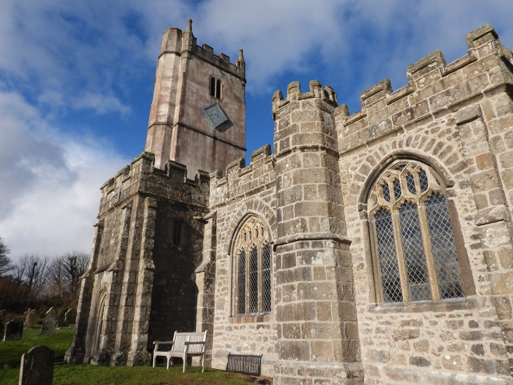
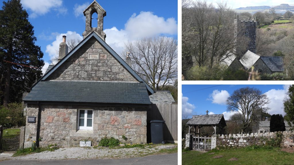
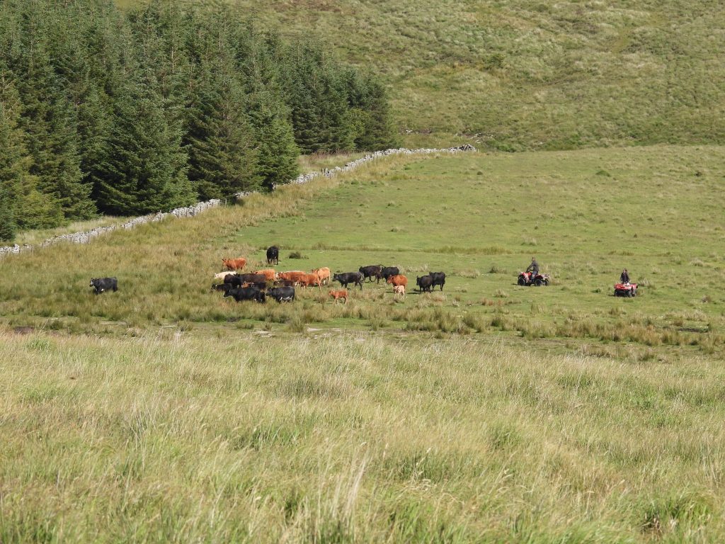
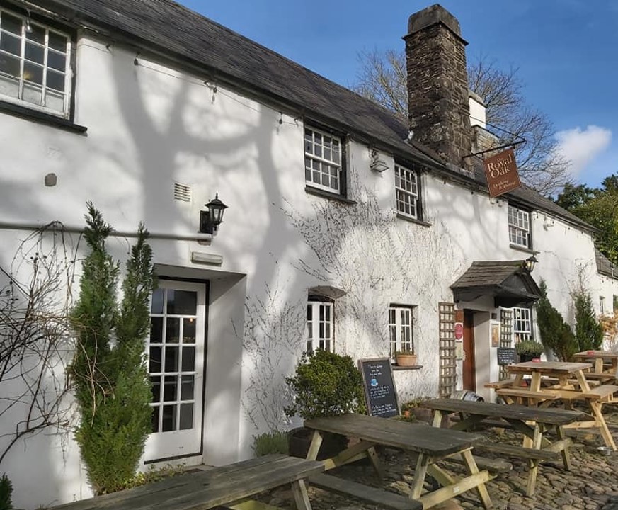
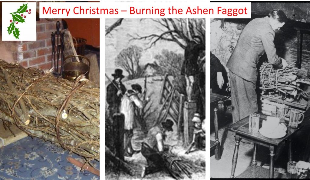
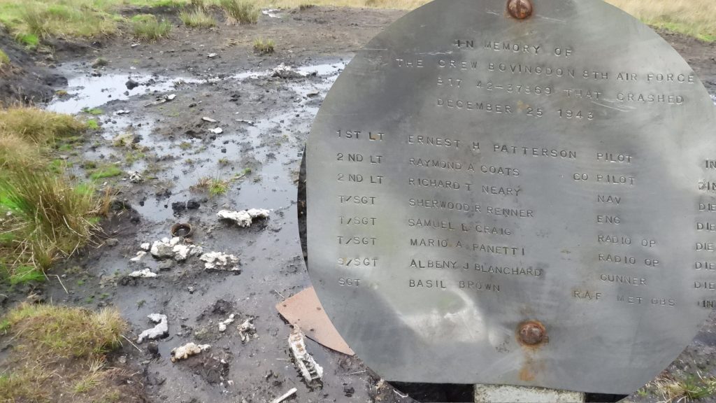
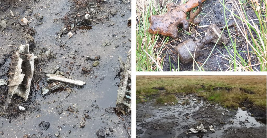
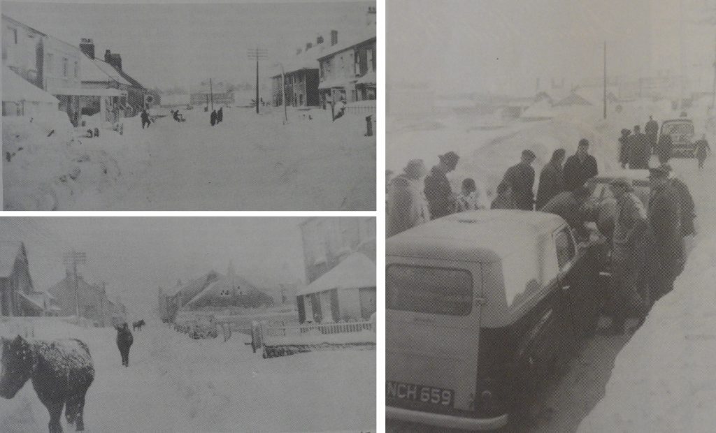
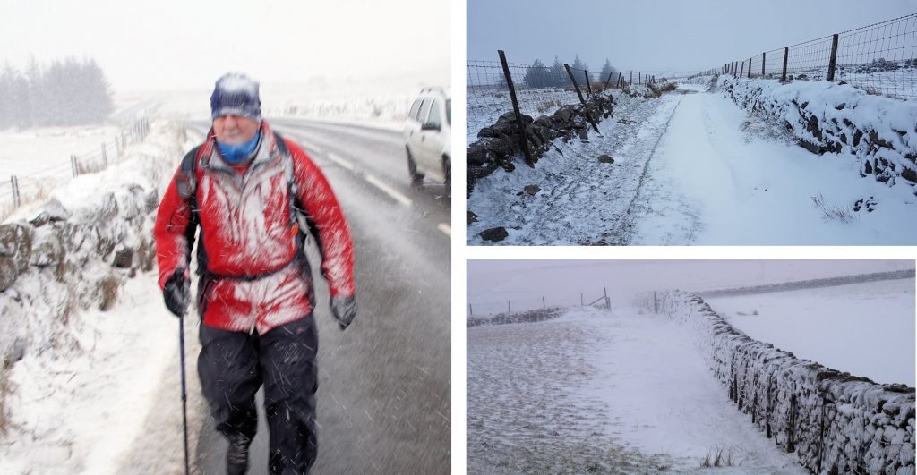
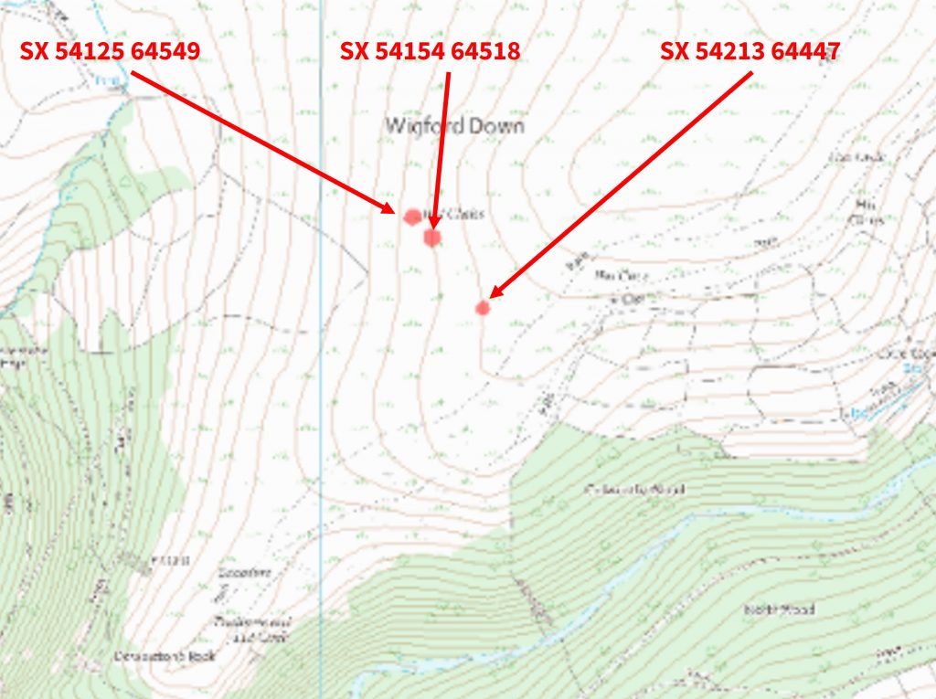
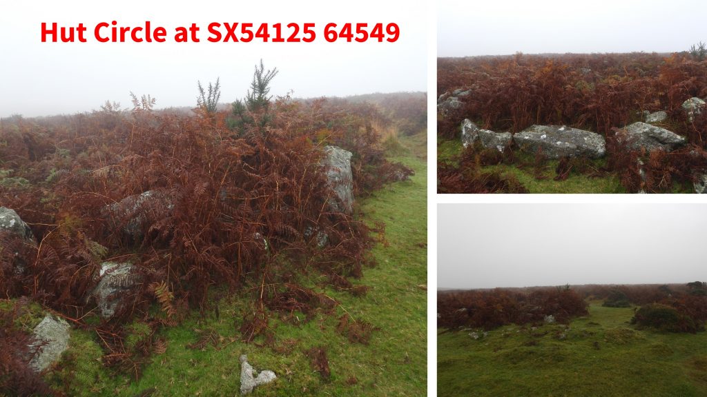
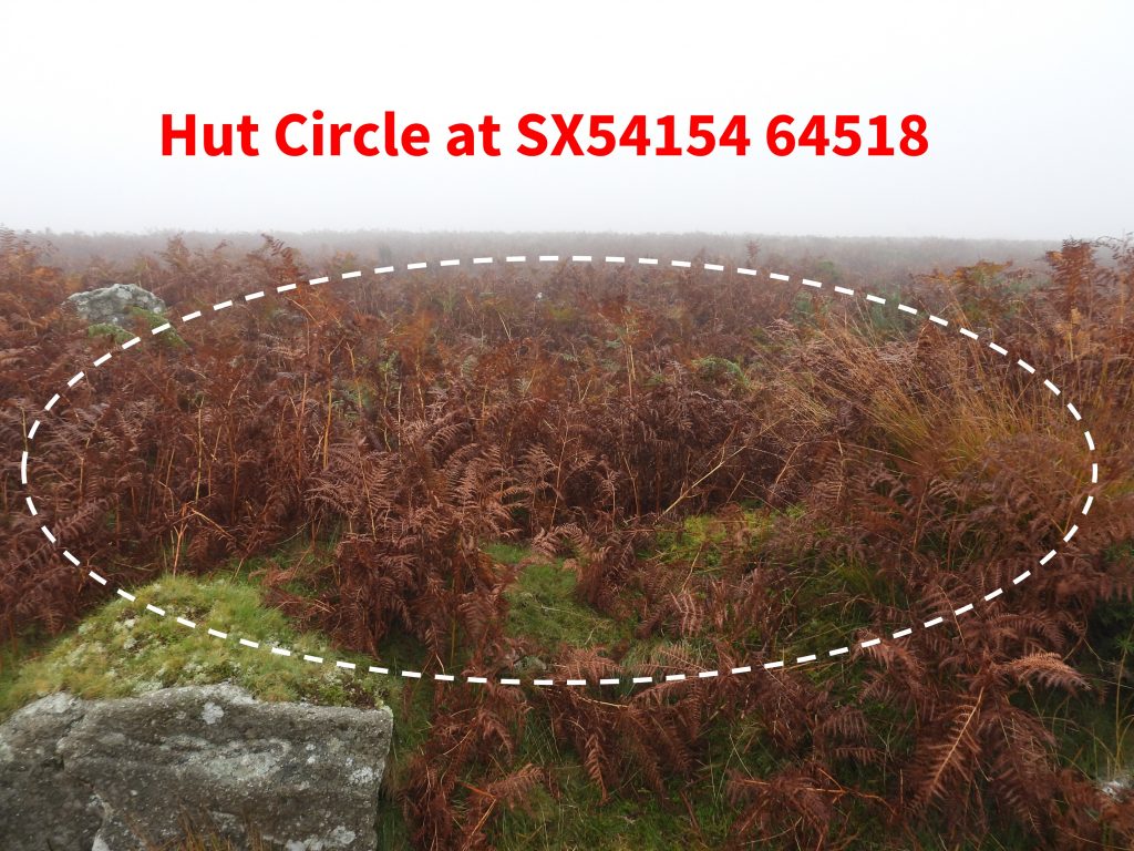
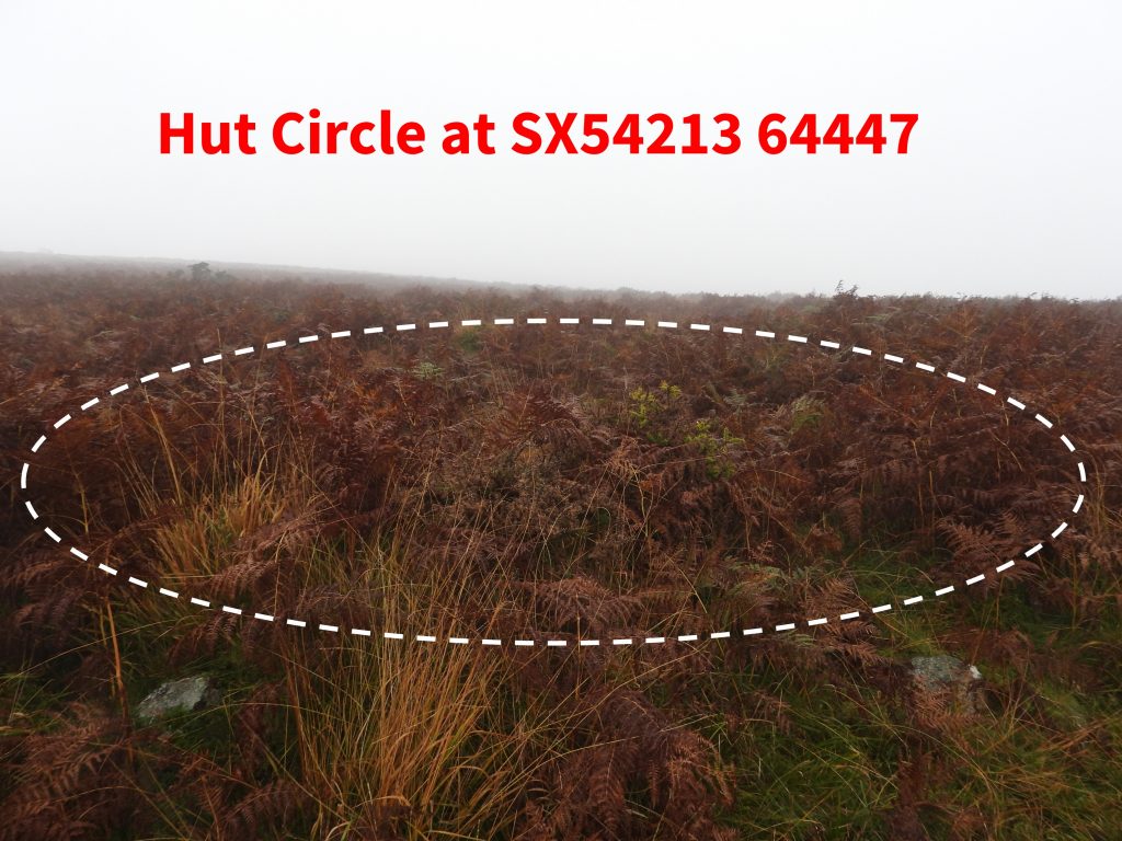
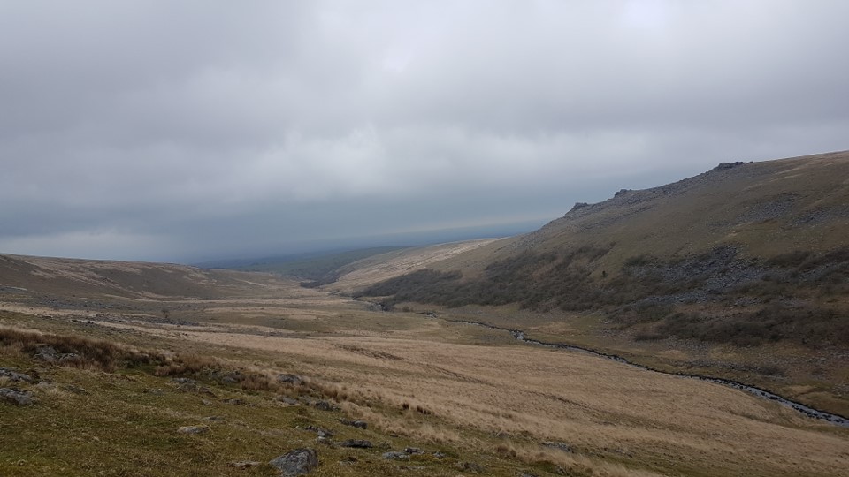
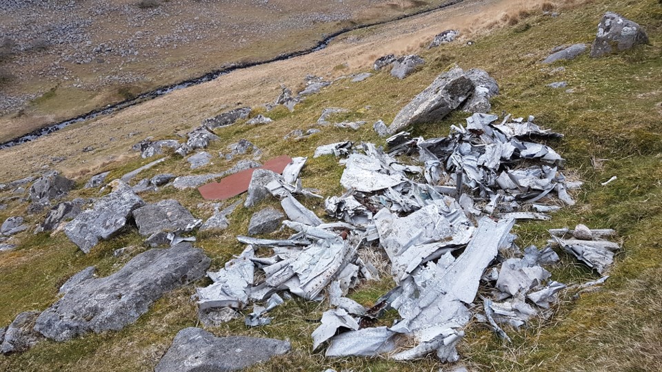
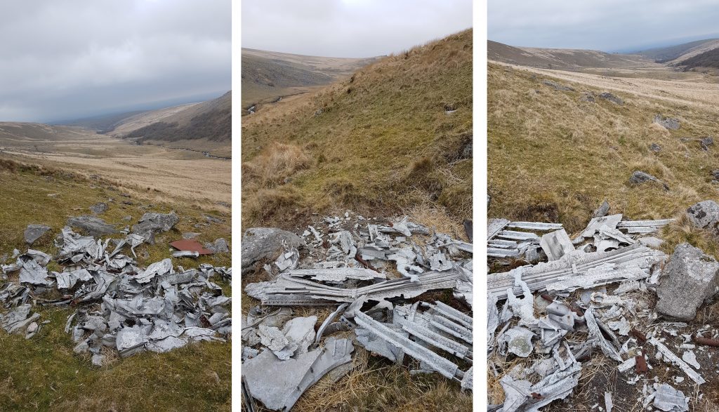
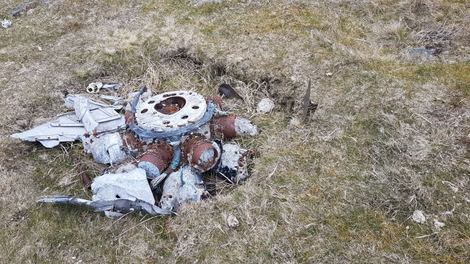
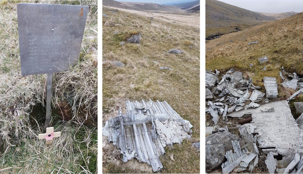
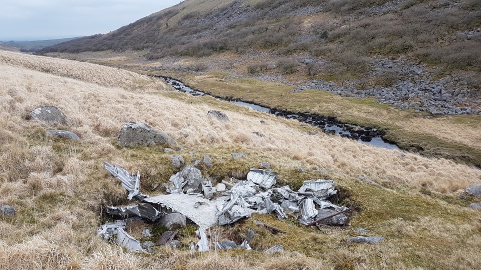
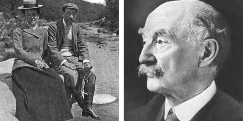
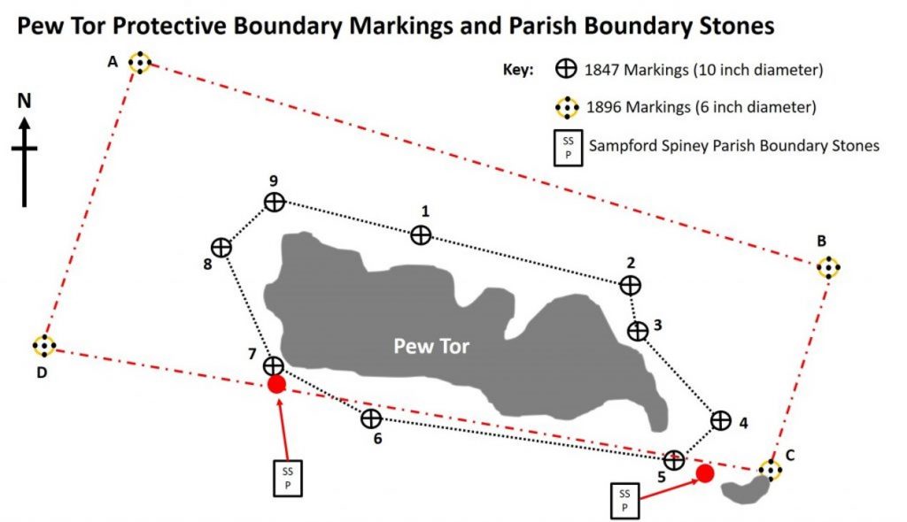
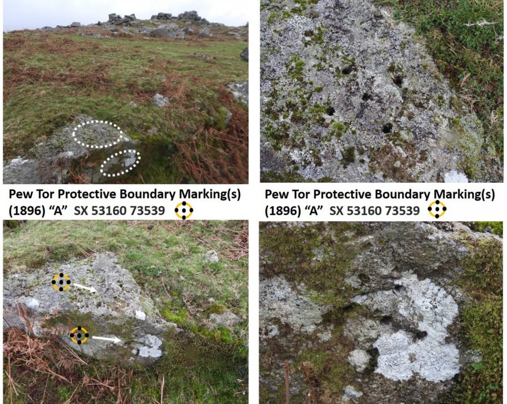
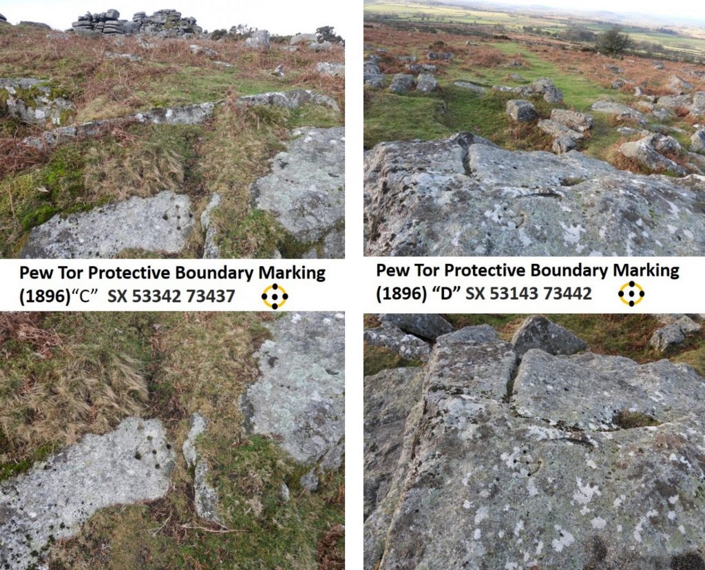
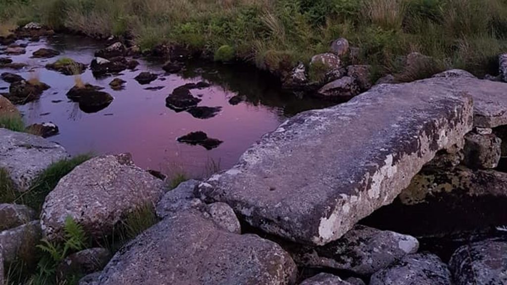
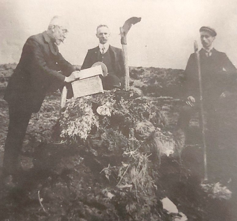
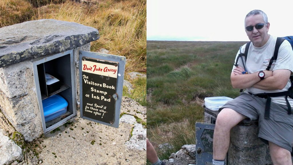
1st December 1965: Cross Dyke reave was first registered by Historic England. The registration number is 1010811. Historic England describe the Dyke as running “for some 600m up the southern slope of Lee Moor towards Cholwich Town Reave North, a major contour reave. It is a bank of earth and some stone, up to 2m in width and 0.5m in height, with a ditch on its eastern side”.1st December 1965: Cross Dyke reave was first registered by Historic England. Along the Dyke is a standing stone known as the Hanging stone.1st December 1965: Cross Dyke reave was first registered by Historic England. The Hanging Stone is inscribed with “C B”. In the “Dartmoor Boundary Markers” book (2nd edition) by Dave Brewer (page 235) it is suggested that this stone might relate to Cholwich.1st December 1965: Cross Dyke reave was first registered by Historic England. It is recorded that: “Cross Dyke is part of a parallel reave system and is considered to have had a territorial role, dividing the Cholwich Town reave territory from that of the Plym Valley”.1st December 1965: Cross Dyke reave was first registered by Historic England. Cross Dyke terminates at a cairn at its northern end. The cairn is very overgrown and quite hard to discern, it would be easy to walk past it without realising. The cairn is located at SX58488 640022nd December 2019: On this date the Countryfile Magazine published a walk relating to Wistman’s Wood. The article was written by Abigail Whyte, whose guide when researching for the article was Simon Dell, MBE. NOTE: The author did not enter the wood for any photographs contained in this post. All photographs were taken from the edge.2nd December 2019: On this date the Countryfile Magazine published a walk relating to Wistman’s Wood. The article includes a historical quote: “It is hardly possible to conceive anything of the sort so grotesque as this wood appears,” which was made by the local Reverend Swete about Wistman’s Wood in 1797. Abigail Whyte wrote: “Gazing into the twisted and gnarled branches of the stunted oak trees entwined with each other, grotesque isn’t really a word I’d use to describe this place. It is odd-looking, but it is beautiful”.2nd December 2019: On this date the Countryfile Magazine published a walk relating to Wistman’s Wood. The article states that there are more than 100 different species of lichen in Wistman’s Wood. On the day of the research walk, Simon Dell (on a single bough), identified 12 lichens. The picture above is the Wentworth Buller stone which can be found at the north end of the wood.2nd December 2019: On this date the Countryfile Magazine published a walk relating to Wistman’s Wood. The walk Abigail took with Simon Dell took in Longaford Tor, where they took in views of Cut Hill and Powder Mills and Simon related the tale of the “Hairy Hands” (Upper Cherrybrook Bridge). They returned via Crockern Tor and Simon told the story of the Stannary Court. The picture above was taken from alongside the Wentworth Buller stone and shows Crow Tor to the north. 3rd December 2011: Chagford held a Christmas Fair on this date. One of the venues for the fair was the Church (St. Michael the Archangel). The pictures are of : a wooden boss depicting the Tinners’ Rabbits* (left), main aisle (middle) and Sir John Whiddon memorial from 1575 (right). Sir John was a judge of the King’s Bench and was the first judge to ride to Westminster Hall on a horse rather than the traditional donkey! NOTE: * The Tinners’ Rabbits ears’ length are more in keeping with hares than rabbits. The symbol probably pre-dates Dartmoor Tinners’ as the symbol has been found on a Jewish Manuscript from 1309, a 13th century monastery in Germany and 13th-century copper coin with the hares motif on one side, and on the other, names of two Mongol leaders and Islamic references.3rd December 2011: Chagford held a Christmas Fair on this date. The second venue for the fair was Endecott House. The building dates back to the 16th century and was given its name in the early 1990s in honour of the Pilgrim father and Governor of Massachusetts Bay Colony, John Endecott, who lived in Chagford before leaving for the New World.4th December 1319: Brentor church of St. Michael de Rupe (of the rock) was re-dedicated by Bishop Stapeldon of Exeter. The church had been originally built as a small chapel before it was re-built as a church. Source: The Dartmoor Diary 1991 by DNP.4th December 1319: Brentor church of St. Michael de Rupe (of the rock) was re-dedicated by Bishop Stapeldon of Exeter. St Michael’s is the fourth smallest parish church in the UK. Source: https://brentorchurch.org.uk/about/st-michael-de-rupe/4th December 1319: Brentor church of St. Michael de Rupe (of the rock) was re-dedicated by Bishop Stapeldon of Exeter. Taken from the brentor church website: “Although the foundation is 12th Century, most of the church as you see it today dates to the 13th and 14th centuries, when the original chantry chapel was enlarged to act as a parish church”.5th December 1991: A partially enclosed stone hut circle settlement 330m south west of Hen Tor was first registered on this date. As shown on the map the monument straddles Hen Tor Brook. The registration number is 1015752.5th December 1991: A partially enclosed stone hut circle settlement 330m south west of Hen Tor was first registered on this date. The first part of the monument (north of Hentor Brook) is descibed thus: “The enclosure survives as a 55m long by 40m wide sub-rectangular area defined by a 2m wide and 0.5m high rubble bank with large boulders and occasional orthostats. The enclosure contains two stone hut circles and a third is linked to the circuit wall. A length of rubble bank leads north from the enclosure and to the east of this is a stone hut circle, which is itself attached to another short length of curved rubble bank”. The obvious standing stone in the bottom left picture can be found at SX59070 65141.5th December 1991: A partially enclosed stone hut circle settlement 330m south west of Hen Tor was first registered on this date. The second part of the monument is described as “a cluster of three stone hut circles, two of which are joined to each other. Three distinct lengths of rubble bank lead away from this group of huts and these may represent the remnants of another enclosure which survives largely beneath peat deposits”. The conjoined huts in the picture can be found at SX58992 65092.5th December 1991: A partially enclosed stone hut circle settlement 330m south west of Hen Tor was first registered on this date. The third element of the monument is an isolated stone hut circle which can be found at SX58941 65163.5th December 1895: All the machinery and equipment of Hexworthy Mine is advertised for sale by auction (ref: Mike Brown – Dartmoor 2001, A Dartmoor Diary of Yesteryear). The leasing of the mining sett was surrendered 4 weeks later. The licence for a mine in this area was first granted in 1845 with further licences granted between 1849 and 1854. The mine was active again in the 1880s and by 1891 it employed fifty men. The photograph is of Hooten Wheals buddles and dressing floors5th December 1895: All the machinery and equipment of Hexworthy Mine is advertised for sale by auction. The photograph is of the main lode at Hooten Wheals6th December 1991: Cairn near summit of Brent Fore Hill was first registered by English Heritage. Reference – National Heritage List for England. SDV350785.6th December 1991: Cairn near summit of Brent Fore Hill was first registered by English Heritage. The registered description states: “This cairn lies approximately 100m north-west of the summit of Brent Fore Hill, slightly to the north-east of the summit ridge. It is a small heather-covered mound 5m in diameter and up to 0.5m in height with a hollow in the centre leading in from the west side”. It can be found at SX66204 62162.6th December 1634: On this date, Justices Sir Edward Gyles, Sir Richard Reynell, Thomas Ford and Richard Cabell issued a warrant to the constables of Yealmpton to levy 7s 4d (36.5 pence) against the parish rates towards the repairing “the decayes of Dart Bridge and Church Bridg (sic) in the pishes of Ashbton and Buckfastleigh”. (Ref: Mike Brown Dartmoor 2001). The picture is Dart Bridge from pre-1905. The bridge was called ‘Dertebrygg’ in Assize Rolls for 1356. A few years later, in 1374 an indulgence of 40 days was granted by the bishop of exeter for building and repairs to the bridge, perhaps suggesting an upgrade on the 1356 version. The present structure seems to date from the 15th century or early 16th century, though it may incorporate some earlier work. The bridge was widened on both sides during the 19th century. 6th December 1634: On this date, Justices Sir Edward Gyles, Sir Richard Reynell, Thomas Ford and Richard Cabell issued a warrant to the constables of Yealmpton to levy 7s 4d (36.5 pence) against the parish rates towards the repairing “the decayes of Dart Bridge and Church Bridg (sic) in the pishes of Ashbton and Buckfastleigh”. The present structure dates from the 15th century or early 16th century, though it is thought that it may incorporate some earlier work. The bridge was widened on both sides during the 19th century. 6th December 1634: On this date, Justices Sir Edward Gyles, Sir Richard Reynell, Thomas Ford and Richard Cabell issued a warrant to the constables of Yealmpton to levy 7s 4d (36.5 pence) against the parish rates towards the repairing “the decayes of Dart Bridge and Church Bridg (sic) in the pishes of Ashbton and Buckfastleigh”. Church Bridge over the River Mardle is in Station Road. It was constructed circa 1749 from local limestone rubble and granite and has a single span with segmental arch. It would have replaced the 17th century version7th December 1984: On this date, Norsworthy Left Bank Stamping Mill (Report – Survey), SDV250470 as recorded on Heritage Gateway was surveyed. The Stamping Mill on the east bank of the River Meavy is recorded as having at least 11 mortar stones and a dressing floor to the south.8th December 1988: Dartmoor Stone by Stephen H. Woods was launched at the Church House, Widecombe-in-the-Moor. Stephen was a Royal Navy photographer and at the time of the book taught design photography to students at Southampton, living in Portchester at the time. The authors copy of this fabulous book is number 560 out of the limited edition of 1000.8th December 1988: Dartmoor Stone by Stephen H. Woods was launched at the Church House, Widecombe-in-the-Moor. Stephen’s passion for the moor started with holidays’ taken at his Grandparents’ at Widecombe. The Church House was therefore a good choice for the book launch. 8th December 1988: Dartmoor Stone by Stephen H. Woods was launched at the Church House, Widecombe-in-the-Moor. The Church House is thought to have been built around the same time as the Church Tower, c. 1540. 9th December 1992: The Jubilee Lamp in Princetown was switched on following a restoration by Dartmoor National Park Authority. The lamp was switched on by the DNP committee chairman, Councillor Jack Wigmore. The picture is taken from near the Plume of Feathers looking across the road towards the Jubilee Lamp and the Duchy Hotel / Visitors Centre. The “then and now” combination showing the centre from about 1960 and from 2020. Interesting to see the ponies visiting the town 60 years ago.9th December 1992: The Jubilee Lamp in Princetown was switched on following a restoration by Dartmoor National Park Authority. Attending the ceremony were Malcolm Waite, the Parish Council chairman, along with other representatives of the Parish Council, DNPA, Devon County Council and Duchy of Cornwall. The “then and now” pictures show the Duchy Hotel from 1st August 1909 with the Dart Vale Harriers outside compared with the 2020 view. The Jubilee Lamp was erected to celebrate Queen Victoria’s Golden Jubilee in 1887 (as the inscription on the picture on the right testifies).9th December 1992: The Jubilee Lamp in Princetown was switched on following a restoration by Dartmoor National Park Authority. Another view of the Jubilee Lamp with the Plume of Feathers, built in 1785. There used to be a small gift shop at the front / left of the building. The restoration of the Jubilee Lamp was part of a DNPA scheme to enhance the appearance of the centre of Princetown. The DNPA enabled the Parish Council to use an electricity connection from the Duchy Hotel / Visitors Centre. In 1992, the Christmas tree lights used the same electrical connection, which one assumes is still being used to this day.9th December 1994: The Lady Modiford’s Primary School, Wakhampton celebrated its 275th anniversary. To celebrate, a time capsule was buried in the school grounds. Contents of the time capsule included children’s work, pictures and photographs, video and cassette tapes, computer disks plus other items: Source: Dartmoor Magazine #38, Spring 1995.9th December 1994: The Lady Modiford’s Primary School, Wakhampton celebrated its 275th anniversary. The children and staff were dressed in Victorian costume for the event and each child and staff member was presented with a paperweight commemorating the occasion. The celebrations included a tea party at which the head teacher, Mr Jim Knight, cut the specially baked anniversary cake.10th December 1584: The Corporation of Plymouth’s Water Bill, allowing the construction of a leat (Drake’s Leat) from the River Meavy, received its first reading in parliament. The leat, also known as Plymouth Leat ran 17.5 miles (28.2 km) in order to supply Plymouth with water. The picture is of one of the Plymouth City Water Works (PCWW) standing stones dating from 1917 alongside the leat just below Burrator Dam. 10th December 1584: The Corporation of Plymouth’s Water Bill, allowing the construction of a leat (Drake’s Leat) from the River Meavy, received its first reading in parliament. The leat take off point is now submerged under Burrator Reservoir. The leat was one of the first municipal water supplies in the country. The picture shows the leat near Clearbrook with Tyrwhitt’s stable (building) from his 1823 tramway seen towards the top of the picture. The 18th century Devonport Leat ran parallel with Drake’s Leat for some of its course and can be found on the other side of the building 10th December 1584: The corporation of Plymouth’s Water Bill, allowing the construction of a leat (Drake’s Leat) from the River Meavy, The leat was first mooted in 1560 when a Mr Forsland of Bovey was paid 16s 10d (89p) to prepare a feasibility study. Source: Wikipedia 10th December 1584: The corporation of Plymouth’s Water Bill, allowing the construction of a leat (Drake’s Leat) from the River Meavy, In 1576, sixteen years after the first feasibility study, Walter Peperell became Mayor of Plymouth. It was at this time that the idea for the leat was resurrected by the Corporation of Plymouth. The Corporation paid Robert Lampen of St Budeaux 52s 5d (£2.62) to undertake a further survey. The final route of the leat was confirmed at this time but the first sod wasn’t dug until December 1590 after it gained Royal Assent in 1584. It was completed in April 1591.11th December 2000: Peter Tavy’s cross was erected on this date to mark the millennium. It had been dismantled 150 years earlier as horse drawn hearses needed extra room to turn around outside the church, so the cross was removed. The cross was laid in pieces outside the church wall but the shaft and cross were lost just leaving the socket. A new shaft and cross had to be made.11th December 2000: Peter Tavy’s cross was erected on this date to mark the millennium. The new shaft and cross was made by Messrs Pascoe of Gunnislake with granite being donated by DNPA which was quarried at Merrivale. A special service was held on 1st January and was attended by about 50 people. Source: Dartmoor Magazine (issue 63). Carvings on the socket stone include the Cross Keys of St. Peter, a Fish, a frontal view of a Rams head, a Salamander and a Rampant Lion.11th December 2000: Peter Tavy’s cross was erected on this date to mark the millennium. Facing South, there are two panels on the socket stone.11th December 2000: Peter Tavy’s cross was erected on this date to mark the millennium. The left panel shows the Cross Keys of St Peter, the Patron for St Peter’s Church, Peter Tavy. The right panel has an anchor with a coil of rope at its base – representing hope and salvation. This also links with St Peter’s occupation of a fisherman. Source: Dartmoor-crosses.org.uk11th December 2000: Peter Tavy’s cross was erected on this date to mark the millennium. The West facing side of the socket stone has two panels. The left panel shows a fish – representing the Eucharist or Jesus. In medieval times there were strict ‘fish days’, commonly on Friday, representing abstinence. On the right panel is a Ram’s Head – this connects with the rural work of agriculture and also indicates the sacrifice and the blessings of the lamb. Source: Dartmoor-crosses.org.uk11th December 2000: Peter Tavy’s cross was erected on this date to mark the millennium. The North facing side of the socket stone has only one panel which is of a Salamander – representing divine peace. This animal is said to have the ability to exude a mucus which was believed to have the effect of calming troubled waters. Source: Dartmoor-crosses.org.uk11th December 2000: Peter Tavy’s cross was erected on this date to mark the millennium. The East facing side of the socket stone has only one panel which is a Rampant Lion, representing courage and kingship. Source: Dartmoor-crosses.org.uk11th December 1952: An oak tree was planted in honour of Dr Sigfried Marian. A plaque commemorating this event can be located at Fingle Bridge. The 2nd world war witnessed a revival in the Dartmoor woodland charcoal burning industry as charcoal was needed for tempering specialist aircraft metal. Dr Sigfried Marian, an Austrian, was in charge of a company called Distillation Carbonisation Ltd, which was based near Fingle Bridge, where there was a grinding works. He was commemorated by the planting of the tree and erection of the plaque by his admirers and supporters in memory of his pioneer discoveries in soil science.11th December 1952: An oak tree was planted in honour of Dr Sigfried Marian. The charcoal revival during Dr Marian’s time in the 2nd world war was once a huge thriving industry in the Teign Valley. There are dozens of (now overgrown) levelled platforms in the valley, on which once were supported hearths on which the charcoal was burnt. Robert Burnard (Dartmoor Explorations Committee) witnessed the last days of the charcoal burning industry and his photographic images from near Hore Wood in 1905 show those scenes. Source: Dartmoor Magazine, issue 67 (pages 8 / 9).11th December 1952: An oak tree was planted in honour of Dr Sigfried Marian. Dr Marian had a base near Upperton Weir (in picture) which was accessible by lorry. There is evidence recorded in the Heritage Gateway (MDV29382) of the remains of a metal charcoal kiln, just to the west of Upperton Weir, which probably dates from the war period. The remains are recorded as consisting of “a very corroded iron sheet and reinforcing bars from metal charcoal kiln”. Was this kiln used by Dr. Marian ?11th December 1786: The last Stannary Parliament was held at the White Hart Inn, Moretonhampstead.11th December 1986: A two hundreth anniversary dinner celebrating the last Stannary Parliament was held at the White Hart Inn, Moretonhampstead. 12th December 1986: To provide remote properties between Two Bridges and Powder Mills with mains electricity supply, the NPA’s Conservation Works completed the trenching and laying of a cable. The length of the 11,0000 volt cable laid was 3.2km. Additionally British Telecom undertook the ducting of existing overhead telephone cables. Source: NPA 1991 Dartmoor Diary.12th December 1986: To provide remote properties between Two Bridges and Powder Mills with mains electricity supply, the NPA’s Conservation Works completed the trenching and laying of a cable. The properties between Two Bridges and Powder Mills are Parson’s Cottage, Spaders Farm and Cherrybrook Hotel. 12th December 1986: To provide remote properties between Two Bridges and Powder Mills with mains electricity supply, the NPA’s Conservation Works completed the trenching and laying of a cable. The project jointly involved South Western Electricity Board, British Telecom, the National Park Authority and the Duchy of Cornwall.13th December 1986: John Bishop’s House undertook stabilisation works. The works involved the door and windows to the front elevation.13th December 1986: John Bishop’s House undertook stabilisation works. The work was conducted by the NPA’s masons.13th December 1779: Lightning struck Manaton Church. A terrible thunderstorm with hail and lightning took place on this date and the East front of the Chancel was demolished, along with a new altar piece and the communion table. A large stone was hurled into the parsonage seat, which broke part of it. Source: DNPA Dartmoor diary 1991.13th December 1779: Lightning struck Manaton Church. The northern side of the tower was split from almost top to bottom. Some pinnacles broke into the Church on both the northern and southern sides and crushed some seats, near the singing seats.13th December 1779: Lightning struck Manaton Church. The damage caused was recorded in the parish register as ‘a sight shocking to all beholders.14th December 1976: Two hut circles and a field system SW of Combestone Wood was first registered on the Historic England database. The area of registration is as shown on the map and the registration number was 1002649.14th December 1976: Two hut circles and a field system SW of Combestone Wood was first registered on the Historic England database. The southern most hut circle is shown in the picture with the Dart gorge beyond.14th December 1976: Two hut circles and a field system SW of Combestone Wood was first registered on the Historic England database. This hut circle is defined as having a “circular interior up to 6.5m diameter and being defined by partially orthostatic faced walls standing up to 2m wide and 1m high, terraced into the slope with no clearly defined entrance”.14th December 1976: Two hut circles and a field system SW of Combestone Wood was first registered on the Historic England database. The picture shows the northern most hut circle in the field system which is part of the registration.14th December 1976: Two hut circles and a field system SW of Combestone Wood was first registered on the Historic England database. This hut circle is described as with “up to 10m internal diameter defined by partial faced orthostatic or rubble coursed walls standing up to 1m high”.14th December 1976: Two hut circles and a field system SW of Combestone Wood was first registered on the Historic England database. The registration description continues: “Its doorway is defined by two upright door jambs. This hut circle is built into an enclosure with some orthostatic blocks in its walls”.14th December 1931: The Western Morning News reported on the funeral of Richard Pengelly, the last moorman of Combeshead Farm. They recorded: “From the cottage, which is situated beneath Down Tor, high up the valley leading to the Burrator Reservoir, the funeral procession had necessarily to go slowly, because streams and boulders frequently to be surmounted”. (ref: Dartmoor 2001, a Dartmoor Diary of Yesteryear by Mike Brown)14th December 1931: The Western Morning News reported on the funeral of Richard Pengelly, the last moorman of Combeshead Farm. Richard Pengelly was running Combeshead farm from at least 1906 until his death. It is said he frequented the Park House Inn (near Sheepstor) twice a week, drinking cider before walking home again (ref: Exploring Around Burrator, 2nd Edition (2007) – Paul Rendell, where he is referred to as William (Bill))15th December 1927: On this date, Parliament first debated the bill for the adoption of the proposed new Book of Common Prayer. The date is recorded on the left slab of the Ten Commandments Stone on Buckland Beacon. In 1928 Parliament rejected the bill (14th June) and this date is also recorded on the slab. 15th December 1927: On this date, Parliament first debated the bill for the adoption of the proposed new Book of Common Prayer. The rejection of the bill was seen by many as a victory for Protestantism as the new book was considered a ‘popish trend’. The then lord of Buckland Manor – Mr William Whitely of Wellstor, celebrated this ‘victory’ by commissioning a sculptor called W. A. Clement to engrave the Ten Commandments on two ‘tables of stone’ . Source: Legendary Dartmoor website16th December 1954: A BBC TV documentary film called ‘Brief Journey’, was transmitted to mark the opening of the south-west’s first television transmitter. The full film was nearly 30 minutes long and followed a Royal Navy sailor on a weekend run ashore from Devonport. BBC Spotlight revisited the film in September 2018 and on one evening aired an extract from the journey the Royal Navy sailor took. It showed a train journey from Yelverton to Kings Tor Halt, where he alighted. The pictures show a still from the film plus a “then and now” overlay of the line as it passed Burrator Halt. The shortened, BBC Spotlight clip can be found here: https://www.youtube.com/watch?v=diIJ8Xdpx3I16th December 1954: A BBC TV documentary film called ‘Brief Journey’, was transmitted to mark the opening of the south-west’s first television transmitter. The picture is a still from the film as the train with the Royal Navy sailor on board approaching Kings Tor Halt. The Halt closed less than two years later on 3rd March 1956. It was here the Royal Navy sailor alighted for the next part of his journey on foot. The original film included a descriptive commentary from Charles Stidwell.16th December 1954: A BBC TV documentary film called ‘Brief Journey’, was transmitted to mark the opening of the south-west’s first television transmitter. The pictures are on King’s Tor Halt in 2020 (left) and an ‘then and now’ overlay of a train approaching the halt (right). The Royal Navy sailor was on his way to Merrivale Farm.16th December 1954: A BBC TV documentary film called ‘Brief Journey’, was transmitted to mark the opening of the south-west’s first television transmitter. BBC Spotlight extract film (see the You Tube link) created a fabulous ‘then and now’ reveal with the Royal Navy sailor passing the ruins at Foggintor Quarry. The picture above is a still captured from the film, showing the extent of the ruins in 195416th December 1954: A BBC TV documentary film called ‘Brief Journey’, was transmitted to mark the opening of the south-west’s first television transmitter. The final part of the Royal Navy sailor’s journey on foot shows him crossing the 18th century Merrivale Bridge. The modern road bridge was constructed between 1957 and 1958 and therefore wouldn’t have been around when the film was made. The sailor stayed at Merrivale Farm and during his time he witnessed a livestock sale.16th December 1777: Christopher Furneaux, a blacksmith from South Brent became the owner of “One Messuage* , six acres of land four acres of meadow, six acres of pasture, 6 acres of furze & heath and common of pasture with the Appurtences in hills Britchaland & Broadmoor” (ref: Mike Brown – Dartmoor 2001). * dwelling house with outbuildings and land assigned to its use. The Messuage was part of Bullhornstone (near Corringdon), which was named Bulson in the deed. The photograph is Little Bullhornstone and Bullhornstone from Owley Lane.17th December 1792: Royal Assent was given to an act enabling Devonport Leat to be constructed. The leat was required to carry fresh drinking water to the expanding dockyards at Plymouth Dock (which were renamed Devonport on 1st January 1824). The picture shows an unusual angle of the leat “S” bends with Sheepstor in the background.17th December 1792: Royal Assent was given to an act enabling Devonport Leat to be constructed. The leat was originally 27 miles (43 km) long . Its operational part now does not extend beyond the Burrator Reservoir area. Some of the water goes through underground pipes to the water treatment works at Dousland with the rest going into the Burrator Reservoir via an iron pipe which forms a cascade close to the dam. 17th December 1792: Royal Assent was given to an act enabling Devonport Leat to be constructed. The leat is fed by five Dartmoor rivers / brooks, namely: West Dart River, Cowsic River, Hart Tor Brook, River Meavy and the Blackabrook. The picture is a monitoring station to the west of where the leat exits the tunnel near Nun’s Cross Farm.17th December 1792: Royal Assent was given to an act enabling Devonport Leat to be constructed. The Leat was constructed from 1795 to 1802 and included a famous Dartmoor landmark (the iron shute or launder) which was constructed over the River Meavy. At its western end there is a pipe feeding water from the River Meavy and Hart Tor Brook.17th December 1840: On this day a W.J.Stentaford was paid for measuring and mapping Walkhampton Parish for the Tithe Commutation Act. The parish is approx a triangular shape with the three ‘points’ being at (or near) Dead Lake Foot, Copythorne Rushes and Magpie Bridge. The camera icons indicate the locations of pictures in this post17th December 1840: On this day a W.J.Stentaford was paid for measuring and mapping Walkhampton Parish for the Tithe Commutation Act. The photograph is the River Walkham, near Deadake Foot where the Forest of Dartmoor Perambulation route passes through.17th December 1840: On this day a W.J.Stentaford was paid for measuring and mapping Walkhampton Parish for the Tithe Commutation Act. This boundary stone can be found a few metres from the old Merrivale Bridge. The Left-hand face (west) is inscribed WHIT/CHURCH, and right-hand face WALK/HAMP/TON (east). These inscriptions are difficult to discern in the 21st century. The stone relates to the Tavistock Turnpike Trust road here which was built between 1772 to 1776. By an act of parliament, the Tavistock Trust (formed in 1762) were bound to erect suitable milestones and boundstones where their roads crossed a parish boundary. Tim Jenkinson (Dartmoor HER) dates the stone as c.1822.17th December 1840: On this day a W.J.Stentaford was paid for measuring and mapping Walkhampton Parish for the Tithe Commutation Act. At Rundlestone there is another Tavistock Turnpike Trust Boundary Stone. The inscriptions on the obtusely angled faces of this ‘turnpike’ stone, which is today is completely illegible reads: Walk / hamp / ton and Lid / ford (Ref: E.N Masson Phillips – 1943). It should be located on the parish boundary. However, Dave Brewer (in Dartmoor Boundary Markers, 2nd Edition) comments that it was the site of a large stone called the ‘Rundle Stone’ (which once stood near here), would have caused the Tavistock Trust to site this stone (incorrectly) as its 150m inside the Duchy (Lidford) / Walkhampton boundary. The actual boundary is near Rundlestone Cottage down the road.17th December 1840: On this day a W.J.Stentaford was paid for measuring and mapping Walkhampton Parish for the Tithe Commutation Act. Knowle Down is near the south west ‘point’ of the Walkhampton Parish Boundary. Located here are three boundary stones, two are inscribed “KD” (Knowle Down) on their east sides with, on the reverse (west side), being inscribed “FD” (Fillace Down). A third Boundary Marker is inscribed “HCC / 1867 / No5”. This stone is one of eight with “HCC” standing for Horrabridge Consolidated Chapelry which was created in 1867, when Horrabridge became an ecclesiatic parish in its own right.17th December 1840: On this day a W.J.Stentaford was paid for measuring and mapping Walkhampton Parish for the Tithe Commutation Act. The above photographs show Walkhampton in 1900 vs 2020 where very little seems to have changed in 120 years. The war memorial was obviously erected about 20 years after the first photo. The chances are that several of the young lads in the picture fought in the Great War and sadly some of their names may be on the memorial. C G Neal’s the grocer’s shop on the left was a shop until early this century but is now a private house. 17th December 1840: On this day a W.J.Stentaford was paid for measuring and mapping Walkhampton Parish for the Tithe Commutation Act. The photograph is Eylesbarrow, a well known point on the moor and shows one of the summit cairns, the boundary “cobra” and a PCWW upright granite post. Eylesbarrow is near the south east ‘point’ of the Walkhampton Parish Boundary.17th December 1840: On this day a W.J.Stentaford was paid for measuring and mapping Walkhampton Parish for the Tithe Commutation Act. This boundary stone is inscribed ‘S’ for Sheespstor and ‘W’ for Walkhampton. Historically, there is a record as early as 1626 when the bounds of the manor and free hamlet of Sheepstor were “presented” by 12 jurers’. The Sheepstor boundary was slightly changed in the late 19th century around the head weir / take off point of the Plymouth Leat from the River Meavy (Mew/Mewy). The only boundary stone known to still exist on the boundary is located at Copythorne (or Copothorne) Rushes, to the south east of Combshead Tor, where the boundary changes direction. This boundary stone seems to also mark the south east corner of the 1840 Walkhampton boundary.17th December 1991: Hillson’s House was registered on the Historic England website (List Entry Number 1012712). Hillson’s House is a large stone cairn, which is recorded by Historic England as being 17.5m in diameter and 2m high and has a (later) shelter built of stones from the cairn surmounting it. The photograph is the author taken in April 2017. The author (when parking was still available at New Waste) used to lead night walks to Cornwood Maidens (which are located nearby) and Hillson’s House.17th December 1985: The Okehampton Bypass (Confirmation of Orders) Act was published. This marked the final chapter in the town needing a by-pass. In July 1985 the Government had introduced its intention to deposit a bill (which reversed a Parliamentary Joint Committee’s decision and confirming the route through the National Park). The bill was considered by the House of Commons in November 1985 and by the House of Lords in December 1985. Construction works commenced around November 1986. The pictures are from the overbridge near the West Okement, which leads to Meldon Viaduct.18th December 1942: No. 193 Squadron was formed at R.A.F. Harrowbeer. On the north side of the airfield an information board can be found. Close to the information board is a granite memorial to commemorate the 40th anniversary (15th August 1981) of the opening of the airfield.18th December 1942: No. 193 Squadron was formed at R.A.F. Harrowbeer. The squadron motto “Aera et terram imperare” translates as: To govern the air and the earth.18th December 1942: No. 193 Squadron was formed at R.A.F. Harrowbeer. The squadron took delivery of three Typhoon aircraft on 14th January 1943.18th December 1942: No. 193 Squadron was formed at R.A.F. Harrowbeer. The squadron took delivery of four Hurricane aircraft on 14th January 1943. 19th December 1986: Hutholes Medieval settlement came under the care for conservation and maintenance by Dartmoor National Park. This followed an agreement with the late Mr Hermon French. The site had been excavated by a Mrs Minter in 1964 and 1965, who had also excavated Hound Tor Medieval village and Dinah Clark’s Longhouse (near West Shallowford). 19th December 1986: Hutholes Medieval settlement came under the care for conservation and maintenance by Dartmoor National Park. Hutholes is located in the Manor of Rowdon between Rowden Tor and Wind Tor. The entrance to the site can be found approx. 100m down the Dockwell road from the crossroads and is simply marked by a fingerpost alongside a gate.19th December 1986: Hutholes Medieval settlement came under the care for conservation and maintenance by Dartmoor National Park. The medieval settlement is also known as South Rowden and may have been where the original Dewdon or Jordan manor house was located. The manor is mentioned in the Domesday Book as held by Alric in 1066 who had been obliged to relinquish it in favour of Wliiam de la Falaise by 1086. Butler, J., 1991, Dartmoor Atlas of Antiquities: Volume One – The East, 141-219th December 1986: Hutholes Medieval settlement came under the care for conservation and maintenance by Dartmoor National Park. House number 4 is recorded as being split into the the traditional living room / shippon arrangement, with the latter being at the lower end of the slight slope. The entrance was along its longer (eastern) edge. The western wall acts as the foundation for the field wall. This house is centred at SX70188 7585219th December 1986: Hutholes Medieval settlement came under the care for conservation and maintenance by Dartmoor National Park. Moving northwards up the western field wall, house number 1 is reached. It is recorded by Butler as being 10.5 metres long by 3.7 metres wide and has a well preserved cooking pit alongside the hearth in the living room. As with building 4, the living room area occupies the upper end and the shippon (for cattle) the lower end.19th December 1986: Hutholes Medieval settlement came under the care for conservation and maintenance by Dartmoor National Park. Jeremy Butler’s description of this dwelling is that it is 6.5 metres long by 3.1 metres wide with a pentice along one side, although the information board describes this as an inner room. Butler does state, however that the building had been used as a barn during the last period of occupation but had probably been constructed as a dwelling house originally. As shown in the plan sketch in this post, there is a low linear wall (called a “mund” in the Heritage Gateway) connecting houses 2 and 4, which can just be seen in this photograph just above and to the right of the words “living room”19th December 1986: Hutholes Medieval settlement came under the care for conservation and maintenance by Dartmoor National Park. House number 6 was split into a living room / shippon. The information board on site (and Butler) state that at the living room end there was a kiln and oven. These would have been used to dry cereals as the worsening climate would have prevented this happening naturally.19th December 1986: Hutholes Medieval settlement came under the care for conservation and maintenance by Dartmoor National Park. The Barn is annotated as number 5 and is believed to have been associated with house 3 (the manor house). The reason for the designation as a barn is because no hearth or cooking pit was found.19th December 1986: Hutholes Medieval settlement came under the care for conservation and maintenance by Dartmoor National Park. The grandest of the houses is annotated number 3 and is believed to have been the original Dewdon or Jordan manor house as mentioned in the domesday book. However, as Butler describes being 14.2 metres long by 4.3 metres wide, it is much narrower than its turf walled predecessor and probably was no longer the Dewdon manor house by this time of the medieval settlement. 20th December 1773: On this date a new lease of the moiety was granted by Arthur Hooper to William Rice relating to Standon Farm. The consideration was £56 and was for 99 years at an annual rent of 17s. The old Standon farmhouse has a date plaque showing “1746” as can be seen in the photograph.20th December 2019: The Wray Valley Trail was officially opened. This is a fabulous walk, which (in the main) follows the old Moretonhampstead and South Devon Railway. There is a leaflet which can be downloaded which accompanies the trail.20th December 2019: The Wray Valley Trail was officially opened. Walking the designated route through Moretonhampstead, Pound Cottage is passed, which is recorded by Devon and Dartmoor HER and describes is as “Probably late 18th century, Pound Cottage is granite rubble construction with thatched roof with gabled ends. Roof to left (north) slopes up to higher level over the former outbuilding”. A pound (which was presumably for stray animals) is recorded at this location on 19th century maps.20th December 2019: The Wray Valley Trail was officially opened. Moving southwards, the trail passes to the south of the former Moretonhampstead station, which is being transformed into a housing development. The former Goods Shed and Engine Shed are being preserved as part of the project.20th December 2019: The Wray Valley Trail was officially opened. The former Goods Shed.20th December 2019: The Wray Valley Trail was officially opened. The former Engine Shed. 20th December 2019: The Wray Valley Trail was officially opened. Budleigh Bridge, which is dedicated to Arthur and Julie Harvey of Budleigh Farm in recognition of their part in encouraging and facilitating the construction of the Wray Trail.20th December 2019: The Wray Valley Trail was officially opened. This bridge is near Steward Farm and was built in 2016. It is dedicated to Professor Ian Mercer CBE, the first Dartmoor National Park Officer.20th December 2019: The Wray Valley Trail was officially opened. Bridge near Wray Barton.20th December 2019: The Wray Valley Trail was officially opened. Sanduck Woods.20th December 2019: The Wray Valley Trail was officially opened. Casely Cutting.20th December 2019: The Wray Valley Trail was officially opened. M&SDR (Moretonhampstead and South Devon Raiway) standing stone near the former Lustleigh Station.20th December 2019: The Wray Valley Trail was officially opened. Bridge near Rudge20th December 2019: The Wray Valley Trail was officially opened. Bridge near Parke.20th December 2019: The Wray Valley Trail was officially opened. Bovey Bridge, the end of the trail. Note the benchmark on the bridge. The Riverside Mill is a Grade II listed building with its waterwheel beyond the bridge.21st December 1996: Dartmoor’s most famous landlady, Auntie Mabel (Mudge) sadly passed away on this date. She was the landady of the Drewe Arms, Drewsteignton for 75 years. The pub was widely admired for its old fashioned ambience still having a tap room as opposed to a bar.21st December 1996: Dartmoor’s most famous landlady, Auntie Mabel (Mudge) sadly passed away on this date. The newspaper article appeared in the Herald & Express in 1994 when Mabel retired, aged 99. 21st December 1996: Dartmoor’s most famous landlady, Auntie Mabel (Mudge) sadly passed away on this date. Auntie Mabel moved to Moorlands Hotel (the old town mill) at Chagford when she retired. Her funeral was attended by over 200 people.21st December 1999: The touchstone was dedicated on this date (Winter Solstice) having been erected at the Summer Solstice, 6 months earlier. John Powls (poet in residence with the National Park) thought it would be a fitting monument to celebrate the new millennium and put his idea to the DNPA. John Powls wrote a poem to be inscribed on the stone. .22nd December 1991: Winter solstice occurred on this date and co-incided with the alignment of the three Stone Rows of Drizzlecombe with the setting sun. An article was written by Jack Walker in issue 69 (Winter 2002) of the Dartmoor Magazine recorded information relating to this phenomena. It was stated that the alignments occur at 1540 for row 1, 1500 for row 2 and 1550 for row 3. Of course most years the Winter Solstice occurs on 21st December22nd December 1991:Winter solstice occurred on this date and co-incided with the alignment of the three Stone Rows of Drizzlecombe with the setting sun. The above pictures were taken of row 2 on 21st December 2018 and show there is some semblance of an alignment at sunset. Row 1 is aligned to 228deg, row 2 is aligned to 222deg and row 3 is aligned to 232deg. The sun is recorded to set at approx 230deg at the Winter Solstice.22nd December 1991: Winter solstice occurred on this date and co-incided with the alignment of the three Stone Rows of Drizzlecombe with the setting sun. Picture shows row 2 menhir nearing sunset. It is interesting to conjecture that bronze age man engineered these rows to exactly co-incide with the Winter Soltstice, but for what purpose ? Or are the alignments purely just co-incidental ? It is interesting to note that not too far away, at the Summer Solstice the rising sun aligns with the Hingston Hill stone row.22nd December 1991: Winter solstice occurred on this date and co-incided with the alignment of the three Stone Rows of Drizzlecombe with the setting sun. The picture shows the Great Menhir (or ‘the bone’) casting shadow onto first two stones in row 2. Picture taken on 21st December 2021 at 1500. 22nd December 1991: Winter solstice occurred on this date and co-incided with the alignment of the three Stone Rows of Drizzlecombe with the setting sun. The picture shows row 2 shadow alignment from the Great Menhir, taken on 21st December 2021 at 1500.23rd December 1986: On this date the West Devon (Parishes) order was confirmed. This resulted in the Forest of Dartmoor Parish being created. Source: DNP Dartmoor Diary 1991. The map on the right was the parish council’s proposal to split the parish into three (Princetown, Postbridge and Huccaby) as part of the Neigbourhood Development Plan. The map on the left was created in 2016 by DNP.23rd December 1986: On this date the West Devon (Parishes) order was confirmed. The upshot of this was the Lydford Parish, which once incorporated the whole of the Forest of Dartmoor was greatly reduced. Additionally, Sticklepath Parish was newly created out of parts of Belstone, Sampford Courtney and South Tawton Parishes. The newly created Sticklepath Parish is outlined on the map above.23rd December 1986: On this date the West Devon (Parishes) order was confirmed. The pictures are from Sticklepath village and are of: Finch Foundary, the former Methodist Chapel and the information board celebrating the route of the 19th century Trafalgar Way.24th December 1923: A large area of Dartmoor and South Devon were disturbed by an earthquake at 7.35 p.m. In Manaton, it was reported that clock weights broke off. The picture is St. Winifred’s, Manaton.24th December 1923: A large area of Dartmoor and South Devon were disturbed by an earthquake at 7.35 p.m. In Harford, hanging lamps were said to have swung. The pictures are of the old School House and St. Petroc’s in Harford.24th December 1923: A large area of Dartmoor and South Devon were disturbed by an earthquake at 7.35 p.m. At Laughter Hole, pictures were said to have swung.24th December 1923: A large area of Dartmoor and South Devon were disturbed by an earthquake at 7.35 p.m. At Fernworthy, it was recorded that “the cows took a proper lot of notice of it”. The photograph was taken in July 2020 and shows cows being herded into Fernworthy forest by two farmers on quad bikes.24th December 1939: On this date, Meavy village held it last performance of the Dartmoor Broom Dance held at the Royal Oak. A You Tube video on the ‘Dartmoor Broom Dance’ can be found by clicking here: https://www.youtube.com/watch?v=OTRL-Hmc_dI25th December – Merry Christmas everyone. A Dartmoor tradition (Devon & Somerset also), which was a variation of the Yule log custom was to bring into the house on Christmas Eve (for lighting in the hearth on Christmas Day) a Ashen Faggot. The ‘Faggot’ was green ash sticks, held together with bands of ash or hazel. Source: DNPA Dartmoor Diary 1991.25th December 1943: A B17 Flying Fortress crashed in poor visibility at Tigers Marsh near the head of the river Lyd. Sadly, five of the eight crewmen died. There is a plate at the site bearing the names of the dead and injured airmen.25th December 1943: A B17 Flying Fortress crashed in poor visibility at Tigers Marsh near the head of the river Lyd. Given the date, this site has a special significance for remembrance and reflection for the author, whenever a visit is made. 26th December 1962: A long snowy period on Dartmoor started on Boxing Day 1962. The pictures are those chronicled in an article from Dartmoor Magazine, issue 17 (Winter 1989) and are from Princetown in late 1962 / early 1963.26th December 1962: A long snowy period on Dartmoor started on Boxing Day 1962. The pictures are from March 2018 from near Rundlestone just as the snow was being whipped up by a very strong wind. The author left the area before the snow got too heavy and started to lay on the road.27th December 1998: C.A (Courtenay Arthur) Ralegh Radford, the last of Dartmoor Explorations Committee passed away. He was born after the Dartmoor Explorations Committee had been formed (b: 7th November 1900) and is recorded as being an English archaeologist and historian who pioneered the exploration of the Dark Ages of Britain and popularised his findings in many official guides. He would have known Richard Hansford Worth who was the secretary of the Dartmoor Exploration Committee and which was disbanded after his death in 1950.27th December 1998: C.A (Courtenay Arthur) Ralegh Radford, the last of Dartmoor Explorations Committee passed away. A few years after the disbandment of the committee he wrote a book called ‘Prehistoric Settlement on Dartmoor and the Cornish Moors’ in 1952, which is still referenced today by entries in the Heritage Gateway. The map is from the book, in which C.A Ralegh Radford wrote: “The material on which my interpretation is based is largely the result of work carried out by the Dartmoor Exploration Committee of the Devonshire Association. Beginning in 1894 this Committee, in addition to other work, explored some 20 settlements excavating nearly 150 hut circles. The objects discovered are mostly in the City Museum at Plymouth and some of the pottery is now illustrated for the first time. Most of the Committee’s work was carried out in the first ten years of its existence, but the excavation of a site now flooded by the Torquay Corporation’s reservoir was undertaken as late as 1933 and the Committee remained in existence until 1950, when the Association reconstituted its arrangements in respect of Dartmoor. As the last surviving member of the old Dartmoor Exploration Committee it is perhaps fitting that it should fall to my lot to interpret the results then obtained in the light of more modern knowledge and methods”.27th December 1998: C.A (Courtenay Arthur) Ralegh Radford, the last of Dartmoor Explorations Committee passed away. In the Heritage Gateway (List Entry Number: 1002549) the C.A. Ralegh Radford publication ‘Prehistoric Settlement on Dartmoor and the Cornish Moors’ is referenced. It is described as falling “into three areas of protection, including three stone hut circles with associated enclosures forming part of a stone hut circle settlement within the coaxial field system situated on the southern side of Wigford Down overlooking the Plym Valley”.27th December 1998: C.A (Courtenay Arthur) Ralegh Radford, the last of Dartmoor Explorations Committee passed away. The first hut circle mentioned in Heritage Gateway (List Entry Number: 1002549) is located at SX54125 64549. The hut circle is partially enclosed within small irregular shaped enclosure and forms part of the Wigford Down coaxial field system.27th December 1998: C.A (Courtenay Arthur) Ralegh Radford, the last of Dartmoor Explorations Committee passed away. The second hut circle mentioned in Heritage Gateway (List Entry Number: 1002549) is located at SX54154 64518. As can be seen from the photograph, this hut circle is very overgrown with bracken. The hut circles are described as having “rubble built walls measuring up to 2m wide and 1.1m high which enclose circular internal areas of up to 10.5m in diameter”. This hut circle does meet that description very well.27th December 1998: C.A (Courtenay Arthur) Ralegh Radford, the last of Dartmoor Explorations Committee passed away. The third hut circle mentioned in Heritage Gateway (List Entry Number: 1002549) is located at SX55213 64447. It is the most overgrown of the three recorded.28th December 1943: US Navy PB4Y-1 Liberator 63926 of VB-110 crashed in West Okement Valley. The aircraft came down between the Slipper Stones and Steng-a-Tor on the west side of the valley, opposite the south end of Black-a-Tor copse. Source of information: Dartmoor Air Crashes by Robert Jones.28th December 1943: US Navy PB4Y-1 Liberator 63926 of VB-110 crashed in West Okement Valley. Wreckage from the aircraft is strewn from near the top of the ridge down the hill almost down to the river. The aircraft had taken off that morning from Dunkeswell along with 14 others of Air Wing 7, their target being destroyers in Bay of Biscay. There were 10 crew members on board.28th December 1943: US Navy PB4Y-1 Liberator 63926 of VB-110 crashed in West Okement Valley. The mission had failed to locate the destroyers and on the return journey, the bomber was contacted by another bomber, warning of enemy aircraft. Two Dornier 17 long-range fighters appeared and shots were exchanged but it seems no strikes were made on either side. The two bombers then started their return to base independently. The weather was poor and navigation had to be made by “dead reckoning”. 28th December 1943: US Navy PB4Y-1 Liberator 63926 of VB-110 crashed in West Okement Valley. At 22:15, flying control and Dunkeswell received a message from the pilot Lieutenant William Parish to advise their estimated time of arrival as 22:20. However, minutes later the aircraft struck the hill above the valley. It is reported that it must of hit the hill at a shallow angle ploughing a furrow for a quarter of a mile before going over the edge of the ridge descending down the steep side of the valley. Sadly all 10 crew members were killed.28th December 1943: US Navy PB4Y-1 Liberator 63926 of VB-110 crashed in West Okement Valley. The fact that Lieutenant William Parish advised Dunkeswell they were 5 minutes from the arriving suggests he must have thought they were only 15 miles away. The reality is they were probably three times that distance away. The ten crew members are commemorated on a plaque. They were: The crew of PB4Y-1 63926/B-5 E consisted of: W. W. Parish (Pilot), D. M. Lyons (Co-pilot), R. W. Lovelace, Jr. (Navigator), A. J. Stork (Engineer), J. E. Shaffer (Engineer), L. M. Davenport (Radio operator), J. F. Benson (Radio operator), A. J. Roddy, Jr. (Ordnance Operator), C. A. Reynard (Gunner) and D. E. Nash (Gunner). 28th December 1943: US Navy PB4Y-1 Liberator 63926 of VB-110 crashed in West Okement Valley. Much of the wreckage was removed in the 1960’s but as can seen from the photographs, quite a lot remains and is an extremely sad reminder of this tragic event, which happened only 3 days after the B-17 bomber crashed only a mile or so to the west at Tigers Marsh. This is another location for remembrance and reflection for the author, whenever a visit is made. 29th December 1960: Eden Phillpotts passed away. He was 98 years old and during his prodigious literary career he wrote 86 novels, including 18 relating to Dartmoor. The pictures on the left is Phillpotts with his wife29th December 1960: Eden Phillpotts passed away. His novel ‘The Thief of Virtue’ is centred around the clapper bridge at Postbridge.30th December 1896: It was reported in the local press that Mr Duke of Merrivale Quarry had drilled holes in some boulders around Pew Tor to indicate new protective limits. Mr Duke needed to renew his licence and the Duchy would only offer him a fresh lease provided even more extended protective limits were set up around Pew tor than those previously set up in 1847. The protective marks set up indicated limits for the stone cutters. It was reported, that there were four locations of marks, each being 5 holes (4 on a circle perimeter and 1 in the centre on a 6” diameter), each hole being around 1” deep. The sketch map show schematically where the 1847 and 1896 marks were set up.30th December 1896: It was reported in the local press that Mr Duke of Merrivale Quarry had drilled holes in some boulders around Pew Tor to indicate new protective limits. Only three of the four 1896 markings have been found in recent times. The one which alludes many searches is on the North East Corner (labelled “B”). That said, in the Helen Harris document in 1981 only two of the markers had been found. Pew Tor Protective Boundary Marking(s) (1896) “A” are unusual insofar as these are two of them on a rock, one on the horizontal face and one on the vertical face.30th December 1896: It was reported in the local press that Mr Duke of Merrivale Quarry had drilled holes in some boulders around Pew Tor to indicate new protective limits. Pew Tor Protective Boundary Markings (1896) “C” and “D” are relatively easy to locate.31st December 2000: The Avon (Huntingdon) clapper was partly swept away following a flash flood. Source: Dartmoor Magazine, Issue 63, 31st December 2000: The Avon (Huntingdon) clapper was partly swept away following a flash flood. The picture was taken close to mid-summer in 2018 at sunset. 31st December 2000: The Avon (Huntingdon) clapper was partly swept away following a flash flood. The picture shows a lovely pink tinge at sunset, June 2018.31st December 1905: Six hundred and nine signatures were recorded for this year at Cranmere Pool. Source: The Dartmoor Diary 1991 by DNPA. The picture shows three gentlemen signing the book around 1920.31st December 1905: Six hundred and nine signatures were recorded for this year at Cranmere Pool. The number of signatures rose to 962 in 1906, then 1352 in 1907 and 1741 in 1908. The picture shows the author at the pool in August 2013 on a walk between Meldon and Postbridge taking in Dartmoor’s five 600m peaks.31st December 1857: A document issued on this date ruled that three thousand pairs of breeding rabbits had to be left at the expiry of the Ditsworthy Warren lease for the landlord or incoming tenant. Source: The Dartmoor Diary 1991 by DNP/