A collection of walks, discoveries, insights and pictures of exploring Dartmoor National Park
September 13, 2022
H1 Battalion Anti-Tank Range and Medium Anti-Tank Range, south of Rowtor (with target railway)
The H1 Battalion Range is believed to have been first established in the mid 20th century for anti-tank training. It is often referred to as simply as the “Rowtor Target Railway”.
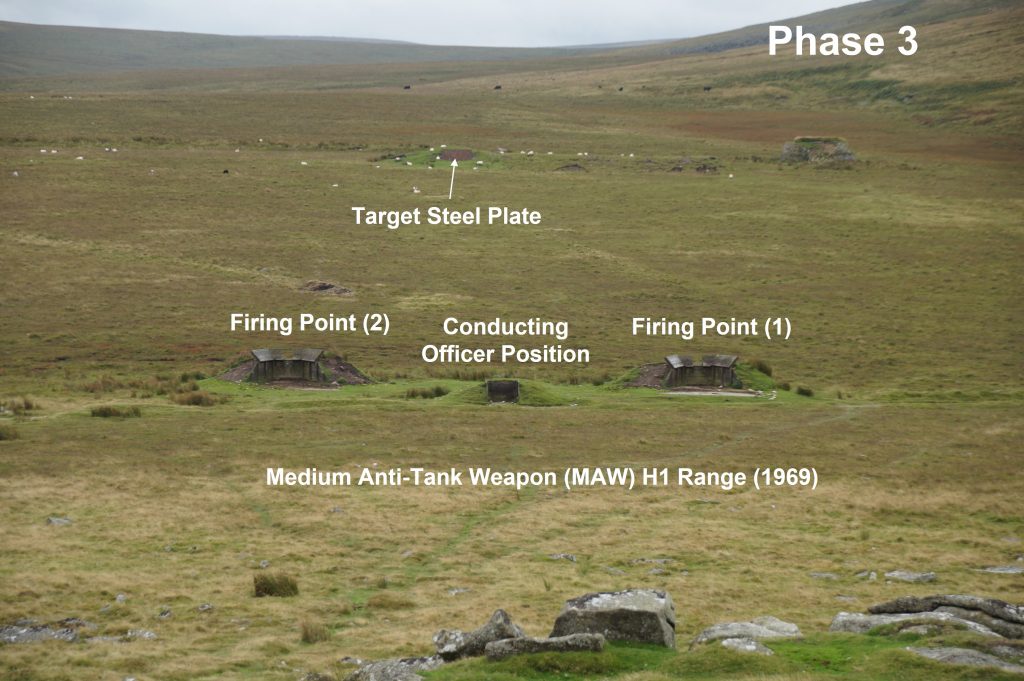
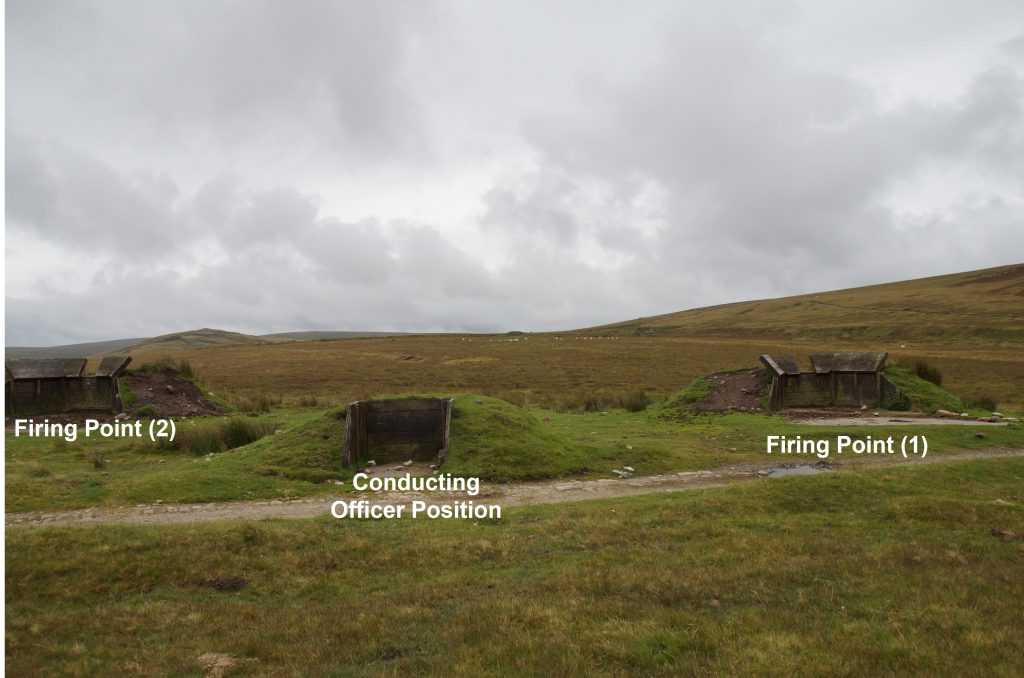
The range has three distinct phases of development: The first phase was the construction of a v-shaped moving target range (pre-1958). The second phase was from around 1959 when one of the ‘arms’ of the original moving target range was re-used as a Battalion Anti-tank (BAT) Range when the track bed was widened and a new railway was laid. Finally, the third phase was for Medium Anti-Tank Weapon (MAW) training around 1969 with the construction of three earthen mounds with timber revetments being two firing emplacements and a rear conducting officer’s position.
This post covers features from the three stages of development of the range with annotated pictures. The author has referenced the documents detailed in the bibliography and is particularly grateful to Nigel Sharpe for sending him to the Historic England schedule document (pdf format).
Bibliography
Okehampton Artillery Range: H1 Battalion Anti-Tank Range and Medium Anti-Tank Range schedule document by Historic England – September 2015
Measured survey North Dartmoor Military Range Okehampton Range: 2003 / 4 by S.A.J Probert and Dr P. Newman
Details on Wickham Trolley (Un-published) by N. Sharpe – 2017
Okehampton Artillery Range – by P. Francis – 2002
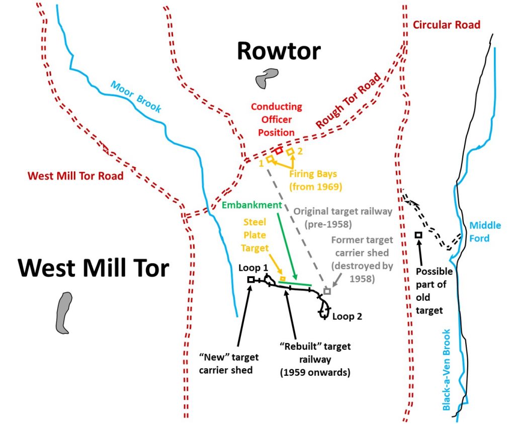
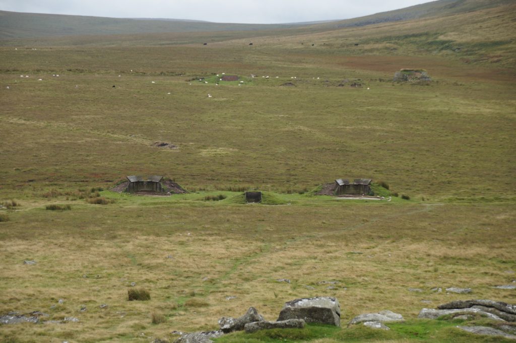
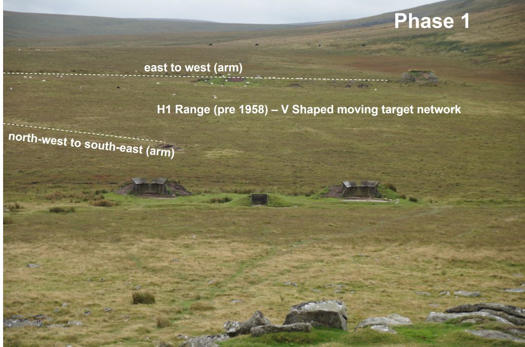
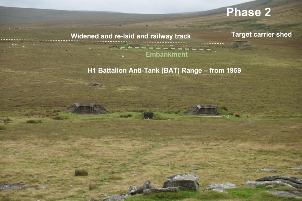
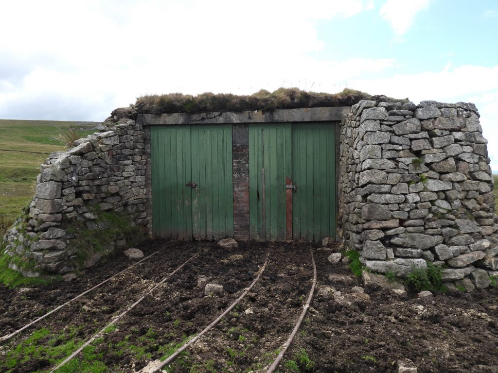
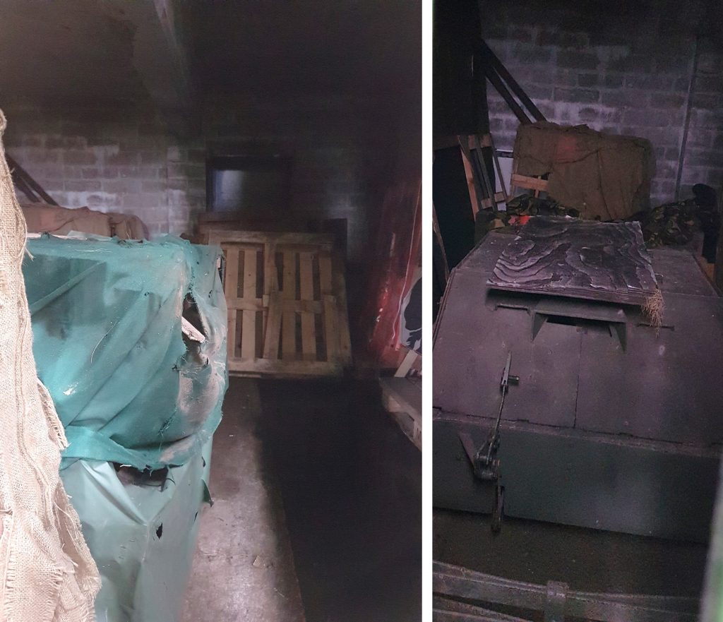
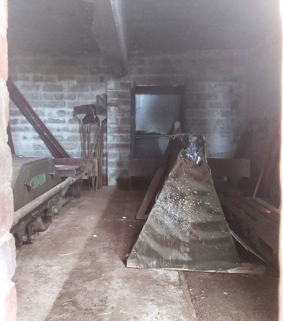
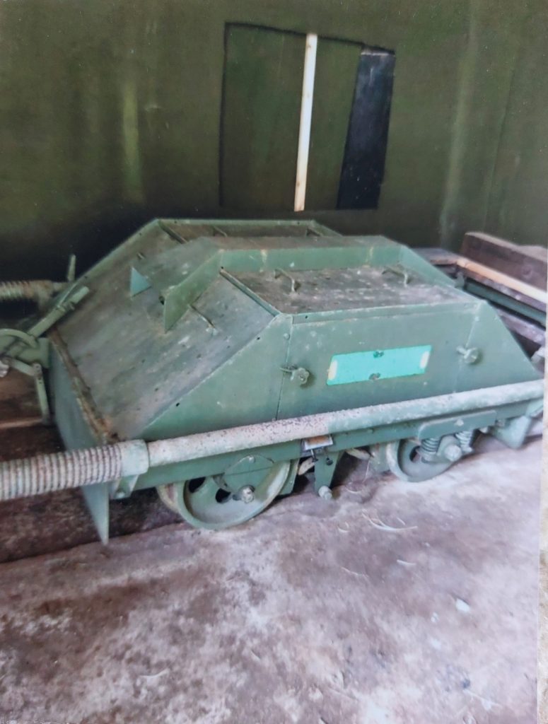
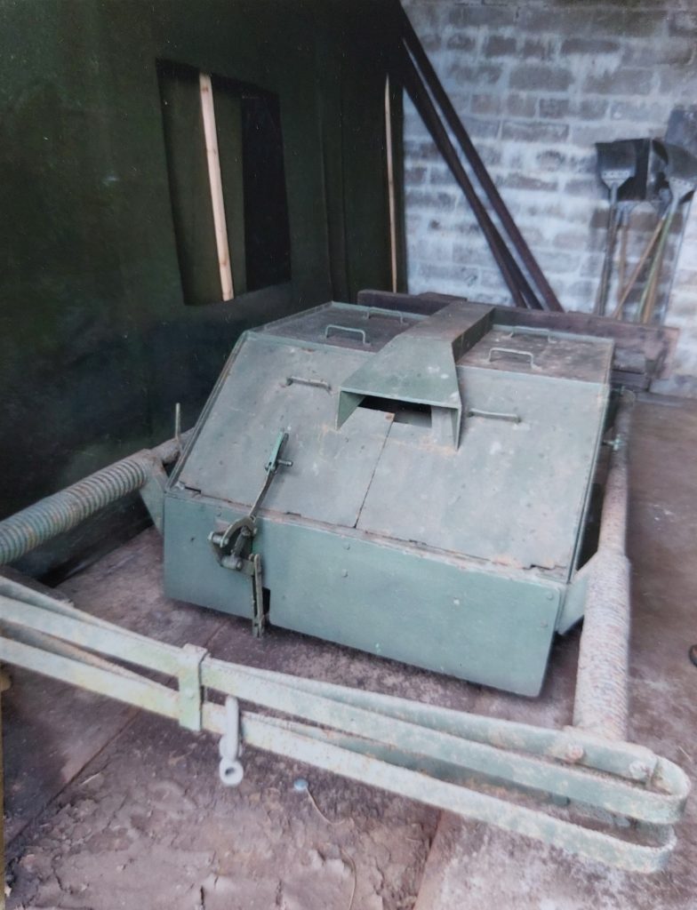
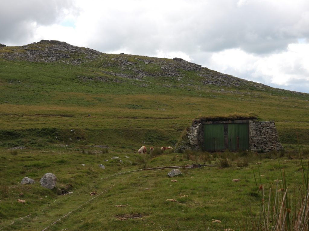
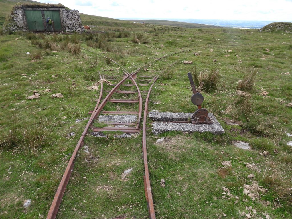
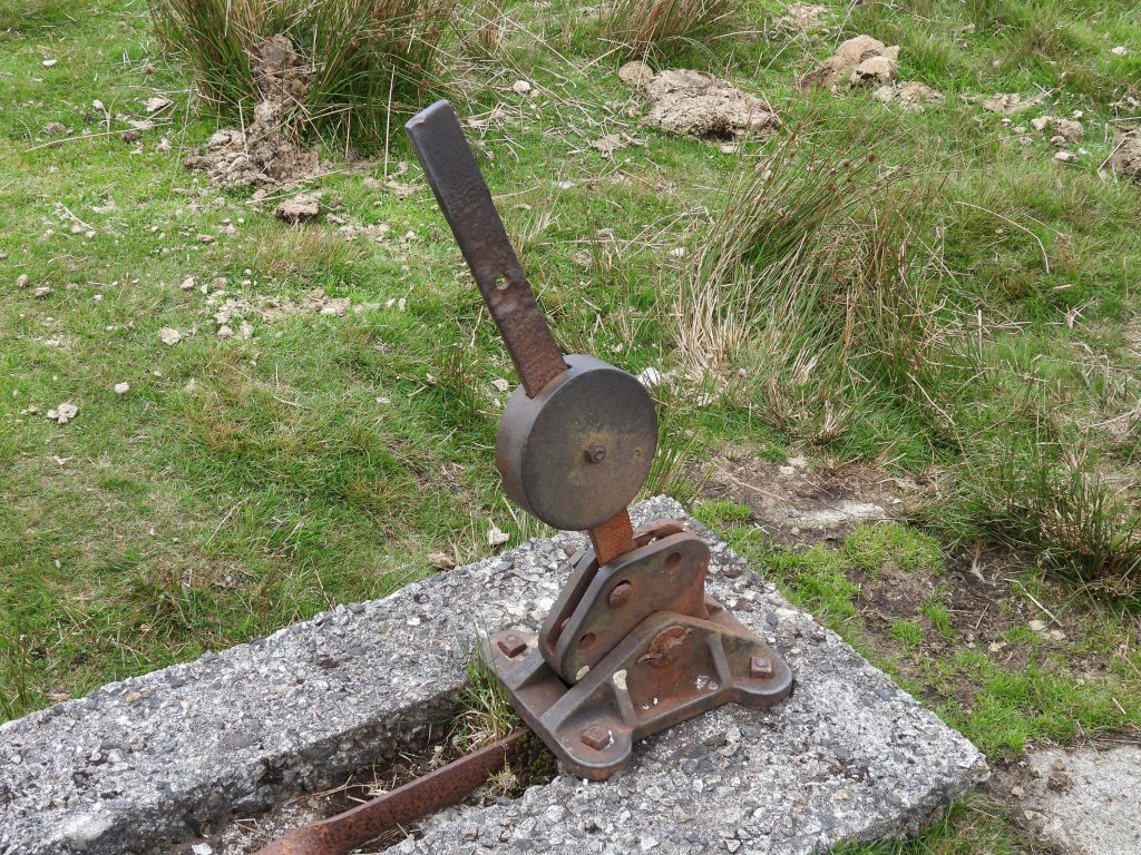
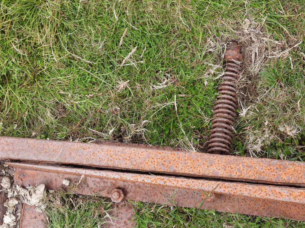
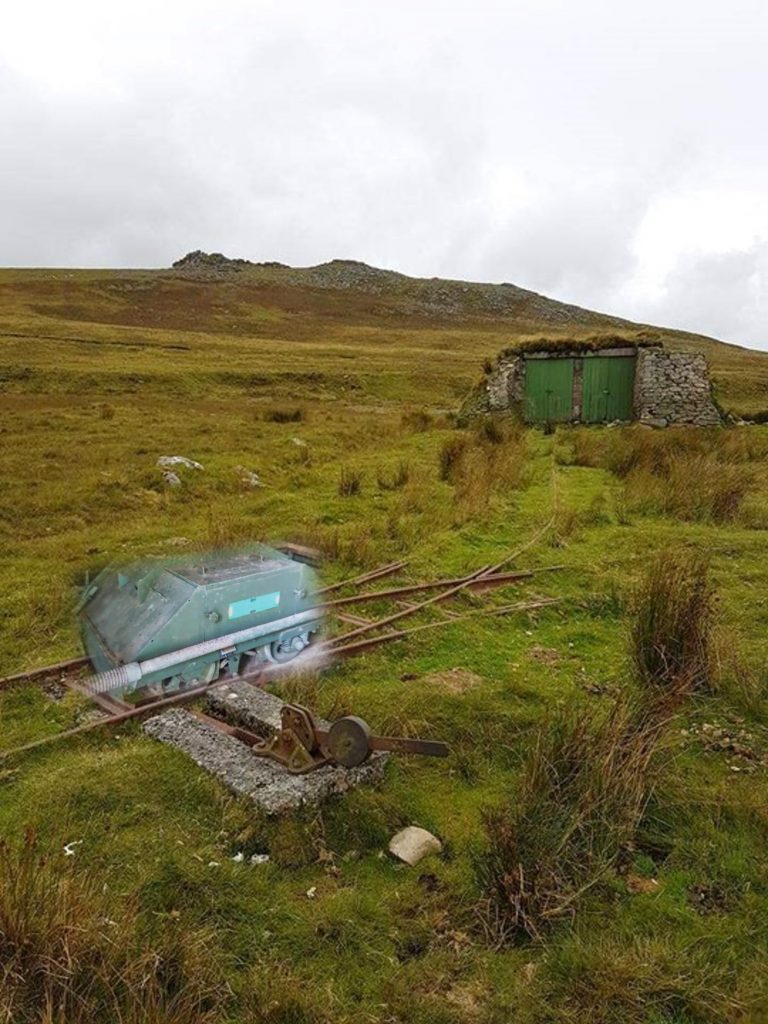
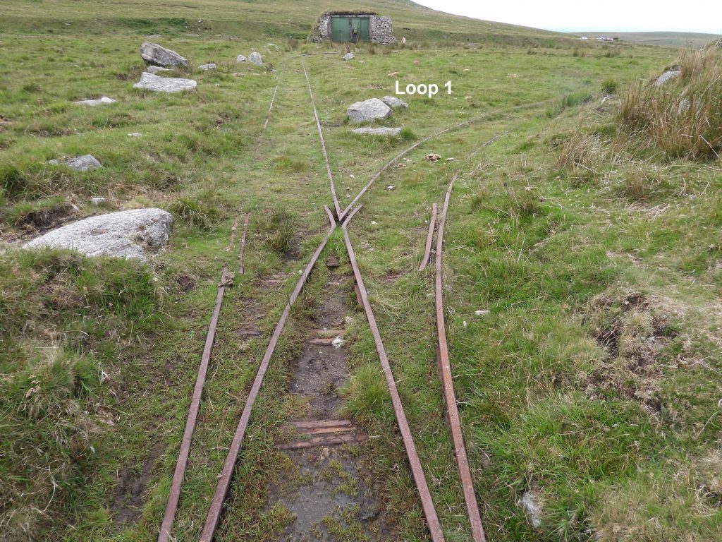
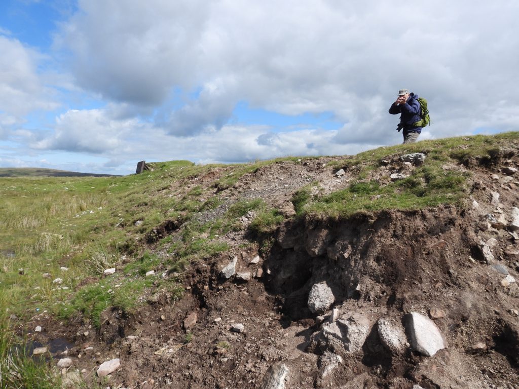
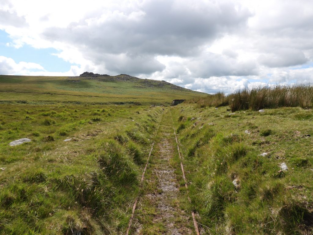
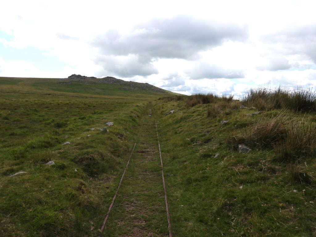
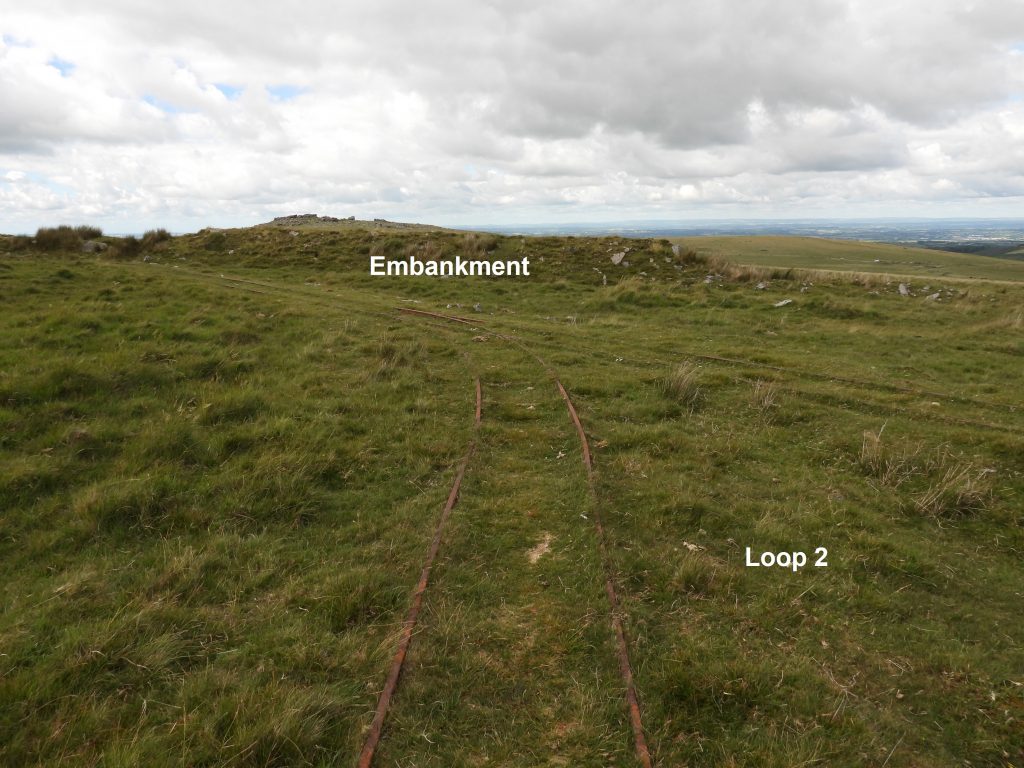
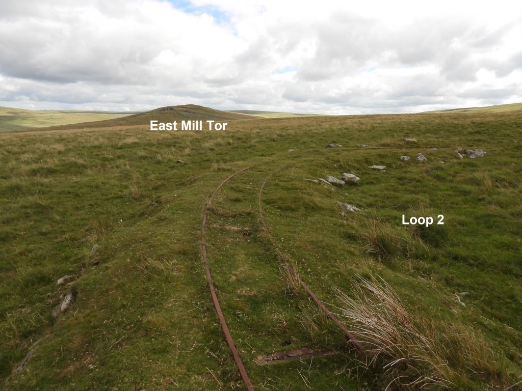
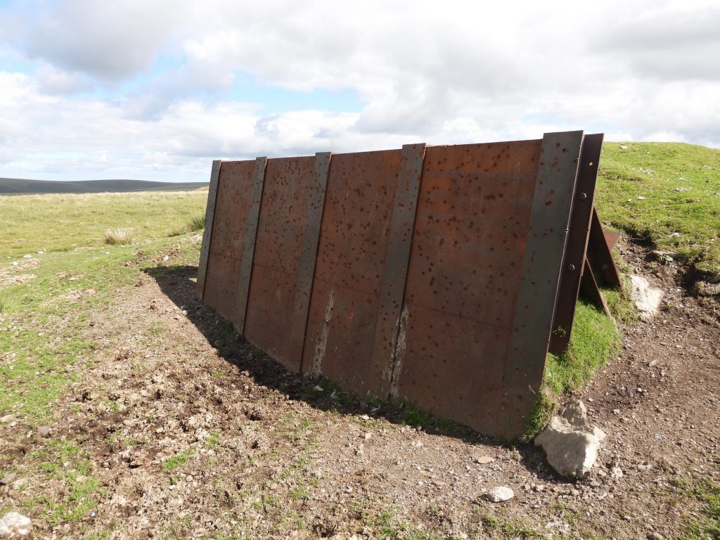
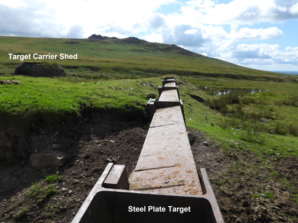
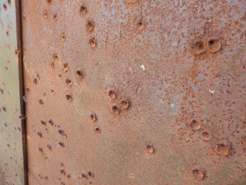
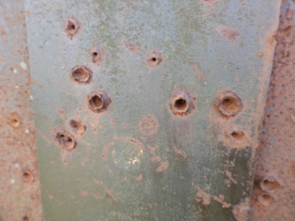
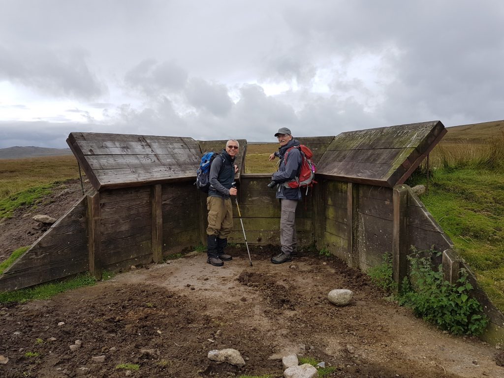
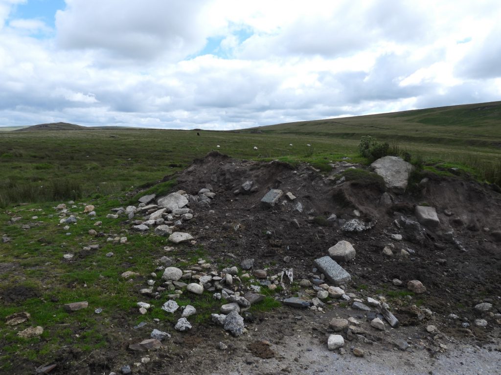
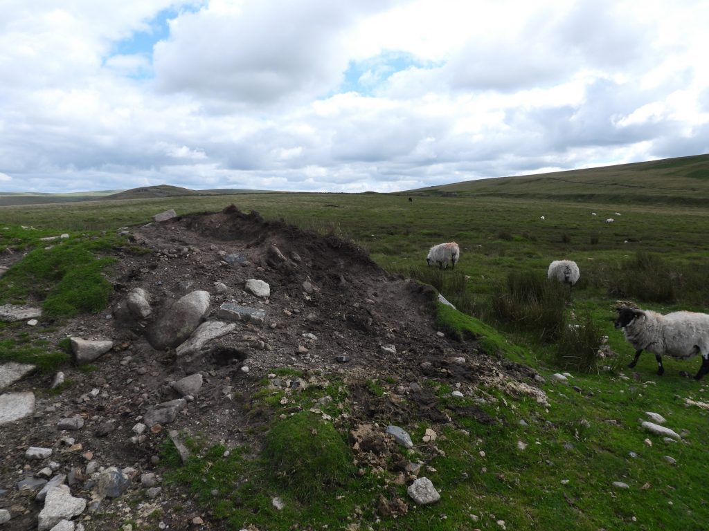
Sketch map of the features covered in the post from the H1 battalion range. The road names are those used by the military.General view of the range taken from Rowtor (sometimes called Rough Tor) from 2017. The firing positions and conducting officers earthen mounds with timber revetments in the foreground have since this picture was taken, been destroyed. Photograph courtesy of Frank Collinson.Phase 1 of the H1 range was originally a V shaped layout of two track beds aligned NW-SE and E-W appears to conform to other anti-tank moving targets found on other artillery ranges. The NW-SE arm comprises between SX5933 9136 and SX5948 9107 a straight, flat-bottomed trench 1.2m wide and around 0.4m deep. There is a low bank, 2.5m wide with 0.3m high flanks the eastern edge of the trench suggesting the firing took place from that side. The end of the trench (close to the word “arm” in the photograph) shows ground disturbance where there may have been an operating mechanism. Where the two “arms” meet there was a target-carrier shed built of limestone blocks, but this is reported as having been destroyed by gunfire before 1958.After 1959, the east-to-west track bed from phase 1 was widened to 6ft and new railway tracks were laid. As shown on the sketch map at either end of the straight section the track there were two loops to allow continuous operation. A new target carrier shed was built at this time. The author is unsure whether the embankment was built circa 1959 when phase 2 was constructed or later in 1969 when phase 3 was completed for Medium Anti-Tank training.The phase 2 target carrier shed was built around 1959 and was originally planned to be built at the eastern end of the railway track, near to the old carrier shed. There was, however, a change in design, which meant that a new one was built at the western end. The target carrier was a Wickham trolley. Note the two lines into the shed as two target carriers were in operation. The two loops of the railway were necessary as the Wickham trolley does no have a reverse gear !Inside the target carrier shed, taken through a small gap in the door. A Wickham’s trolley still in situ at the time photograph was takenInside the target carrier shed, taken through a second small gap in the door. A close up of the Wickham trolley. Photograph courtesy of Pauline Waldron. Below is a link to a Youtube video showing a demonstration of the Wickham trolley at Amberley Museum.
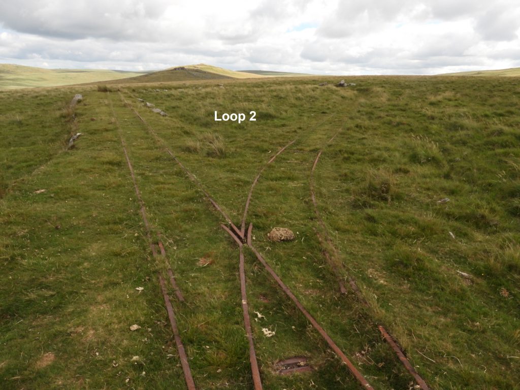
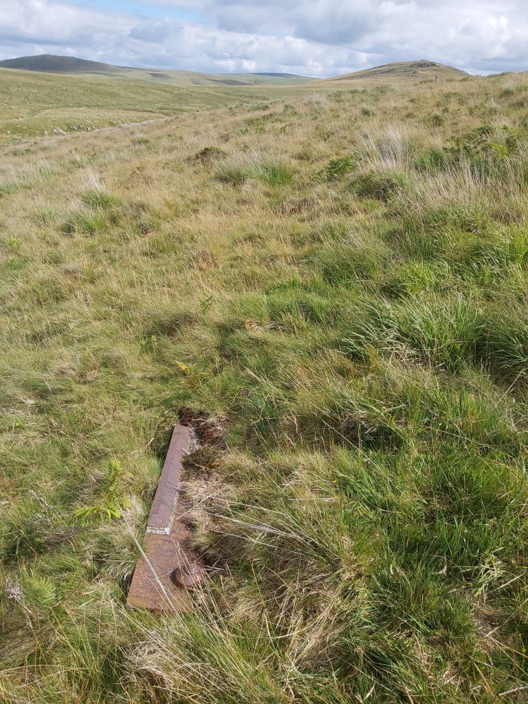
There were a pair of trollies used for training on Dartmoor from the 1940s-1970s. They left the range in the 1980s, with one going to a museum. One was later returned to the shed. Nigel Sharpe writes: “The Wickham Trolley was restored by by Dick Burt who worked on the Ranges, during the period when training was suspended due to Foot and Mouth outbreak in 2001. The intention was to get the Range working again, and quite a lot of work was done on the infrastructure at the time. A Wickham Trolley was obtained from Lydd Ranges in Kent and restored, but found to have a different width than H Range track! So at short notice, the original Wickham Trolley (which was at the Museum of Dartmoor Life at Okehampton) was restored with a mix of original parts and those sourced from the Lydd Ranges donor. The following link was provided by Dick Burt to the Dartmoor Railway Association for their visit in 2018 which gives detail of his restoration”. https://www.dartmoor-railway-association.org/rowtorhistoryThe target carrier shed with West Mill Tor in the background.The railway points to Loop 1. Points leverPoints with spring mechanismA superimposed picture of a Wickham trolley on the points near to loop 1 and the target carrier shed.The point where the 40ft radius loop (1) leads onto the main straight section.The protective embankment for the target railway. The steel plate target can be seen at the eastern end of the embankment.The straight section of the railway with the protective embankment to the right.The length of the track is recorded as being 112m. The embankment on the northern edge of the railway is between 10m to 12m wide and up to 2m high.The start of the south easterly loop (2) is close to where the embankment ends.Loop 2 at the south eastern end of the track.The furthest point of loop 2In 1969, phase 3 was established with for a Medium Anti-Tank Weapon (MAW) range. Three earthen mounds with timber revetments were built which comprised two firing emplacements and a rear conducting officer’s positionSteel plate target set into the embankment near its eastern end.Steel plate target in relation to the target carrier shedThe angled steel plate target is approx. 300m to the south of the firing points. The range was originally a Battalion Anti-tank (BAT) Range. Later it became a Motorized Offensive Battalion Anti-Tank (MOBAT) and finally Weapons of Magnesium Battalion Anti-Tank (WOMBAT) were used. All these weapons are variations of the recoilless rifle (RCLR).Details of the significant holes in the steel plate from 300m ! It is recorded that there are other metal plates here which were taken from ‘F range’ (on Black Down) in 1969 and are understood to be buried in front of the current target plate. F range post can be found here: https://dartmoorexplorations.co.uk/black-down-f-range-target-railways/The firing points and conducting officer position. Firing point 2 is at GR SX59337 91443 with the other at GR SX59314 91441 with the conducting officer position (Observation post) between the two at GR SX59326 91453. These 1969 firing points have undergone alterations over the years, which includes rebuilding and the replacement of the timber plank revetments in 1998 with further remodelling in 2002. These firing points were dismantled around 2019. Picture courtesy of Frank Collinson from 2017. Inside firing point 2. This picture taken at the start of a hike to Postbridge, where the author guided friends to the five Dartmoor 600m peaks (Yes Tor, High Willhays, Hangingstone Hill, Whitehorse Hill and Cut Hill). Dismantled firing point 1Dismantled firing point 2A metal structure, possibly part of an old target (?) was found by the author just to the west of Middle Ford at SX59730 91181