A collection of walks, discoveries, insights and pictures of exploring Dartmoor National Park
September 11, 2022
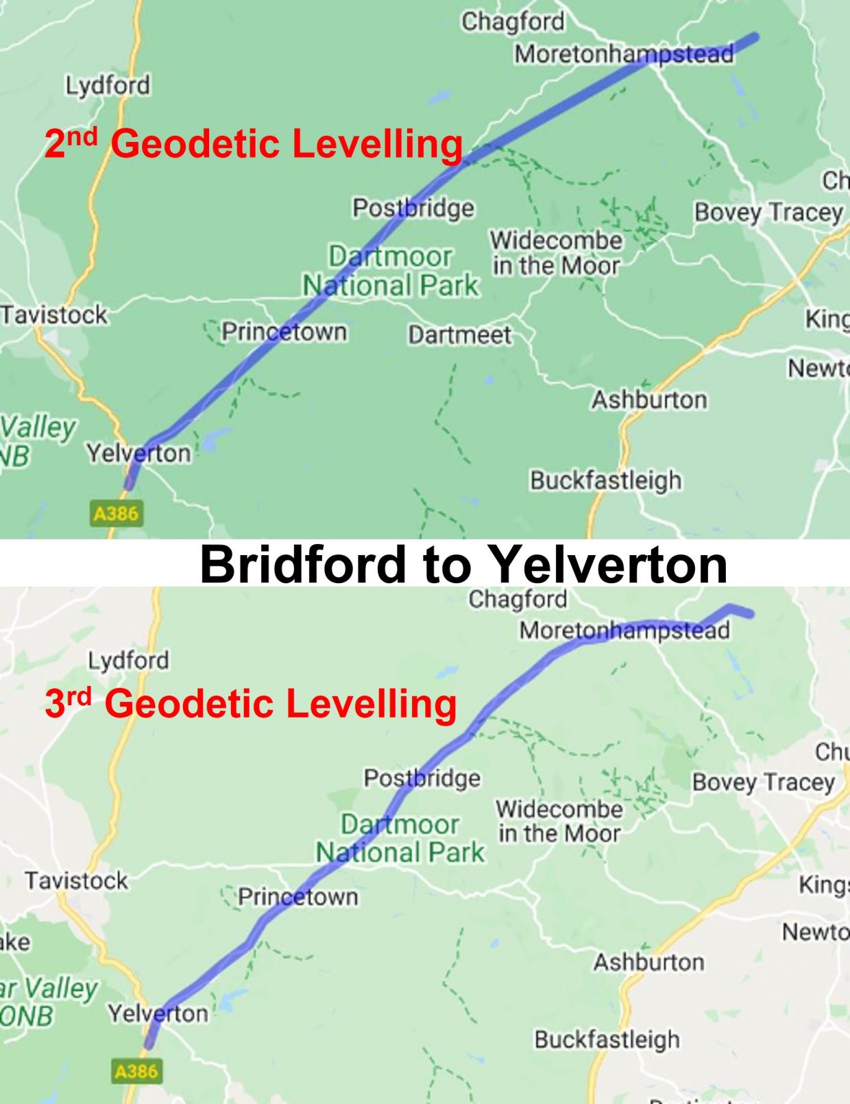
Bridford to Yelverton – the 2nd and 3rd Geodetic Levelling by Ordnance Survey
The origins of Ordnance Survey (OS), the national mapping agency for Great Britain is based on a military purpose, which started with mapping of Scotland in the wake of the Jacobite rising of 1745. In 1747, George II charged Lieutenant-Colonel David Watson with making a military survey of the Highlands under the command of the Duke of Cumberland. The survey was produced at a scale of 1 inch to 1000 yards.
Fast forward to 1801, with theodolites improving, the first one-inch-to-the-mile map was published, detailing the county of Kent. In the next 20 years about a third of England and Wales was mapped at the same scale. From the 1840s, Ordnance Survey concentrated on the Great Britain “County Series”, modelled on an earlier Ireland survey in the 1830’s.
Between 1840 – 1860, the ‘First *Geodetic Levelling’ survey took place, using engraved ‘cut’ marks, bolts and rivets which were typically 100m apart. Today, there are an estimated half a million engrave ‘cut’ marks left but there were over a million at one point. The surveying process was very labour intensive, using a theodolite and posts, by knowing the height of one mark, setting up at a known height above that mark, and working out the relative height of the next mark. The sequence of marks were referenced to a ‘Fundamental Benchmark’, of which there were 250 across the UK.
Between 1912 – 1921, the ‘Second *Geodetic Levelling’ survey took place, using numbered flush-brackets supported by more engraved marks. On Dartmoor, the main “levelling line” was between Bridford and Yelverton. From Bridford, there were also “levelling lines” to Beer and Dulverton. From Yelverton, there was also a “levelling line” to Liskeard.
Between 1950 – 1968, the ‘Third *Geodetic Levelling’ survey took place, using flush-brackets and bolts, with more engraved marks and rivets. Many of the flush brackets from the second levelling survey were (re) used.
*Note: ‘Geodetic’ means that the surveying took account of the Earth’s curvature.
Between 1935 – 1962, Triangulation pillars were established which not only assisted with surveying heights but also assisted with improved accuracy of locations. Many of these pillars, of course use flush brackets which had been used since 1912.
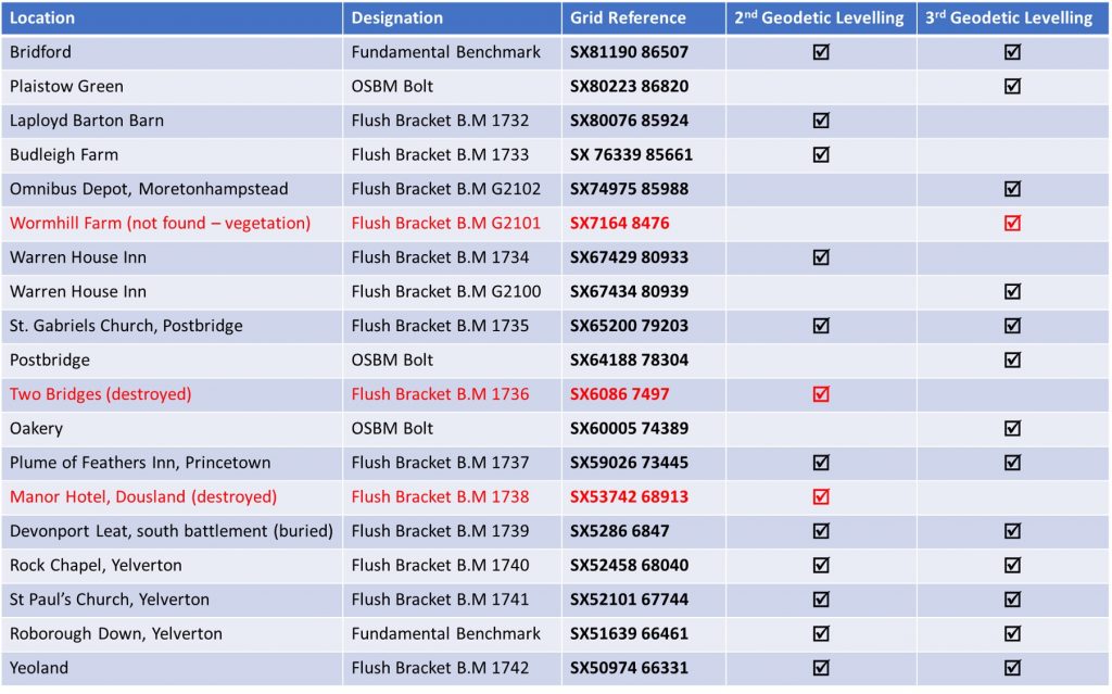
This post covers the Fundamental Bench Marks, Flush Brackets and Bolts which are known to be still extant along the 2nd and 3rd Geodetic “levelling line” survey route between Bridford and Yelverton. It also, records the first flush bracket west of Yelverton en-route to Liskeard.
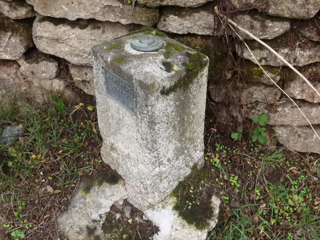
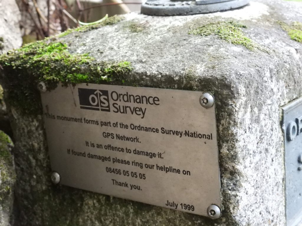
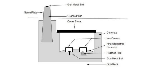
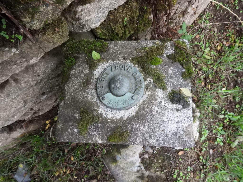
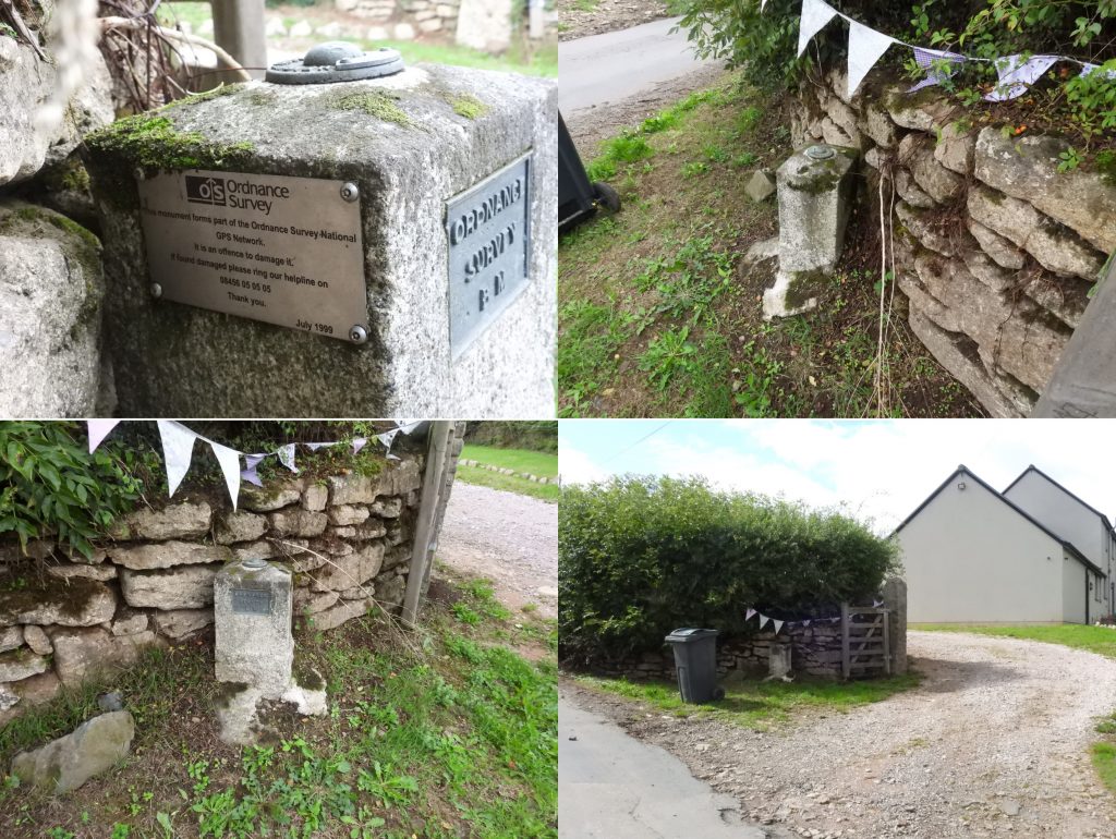
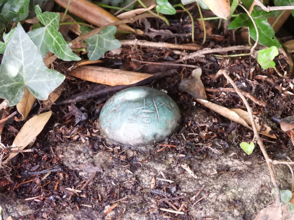
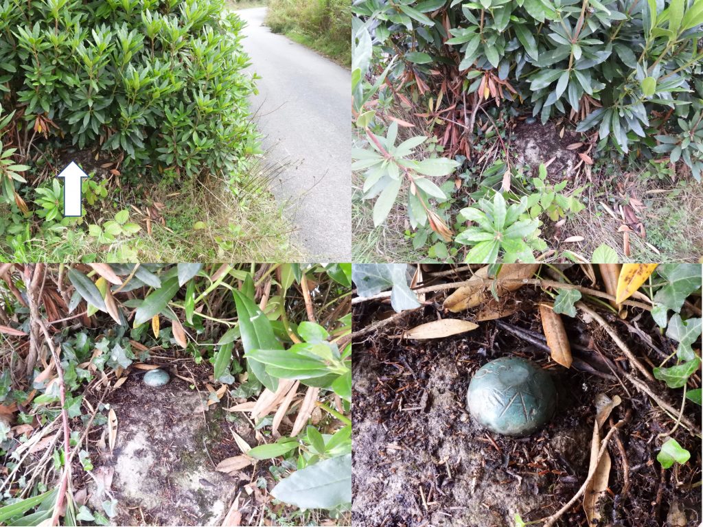
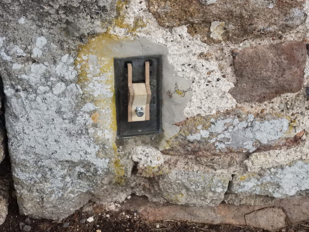
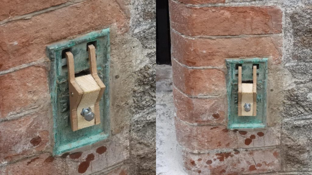
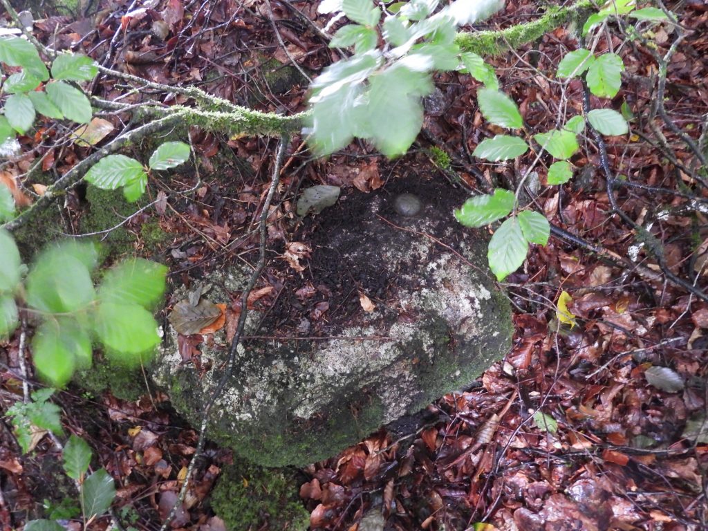
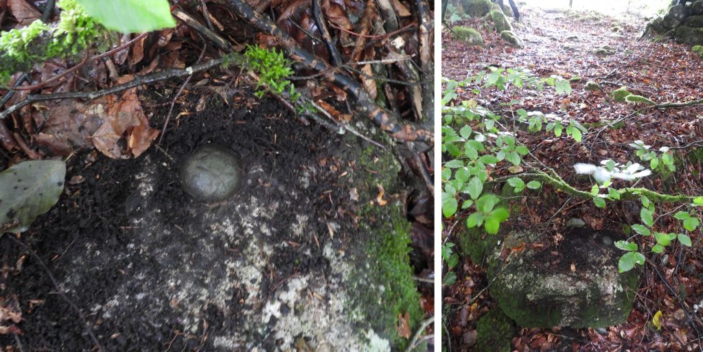
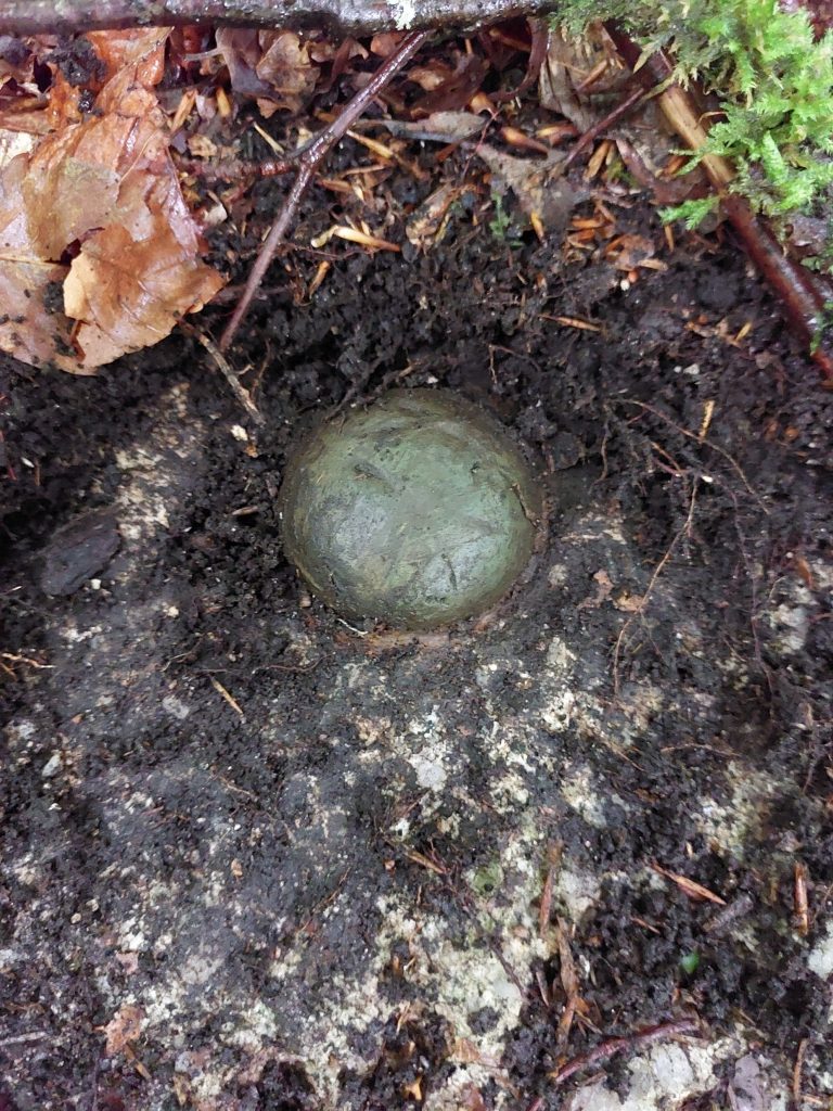
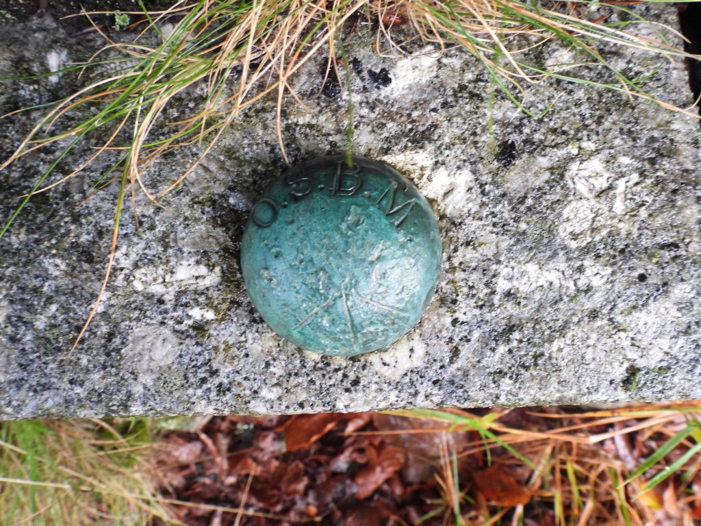
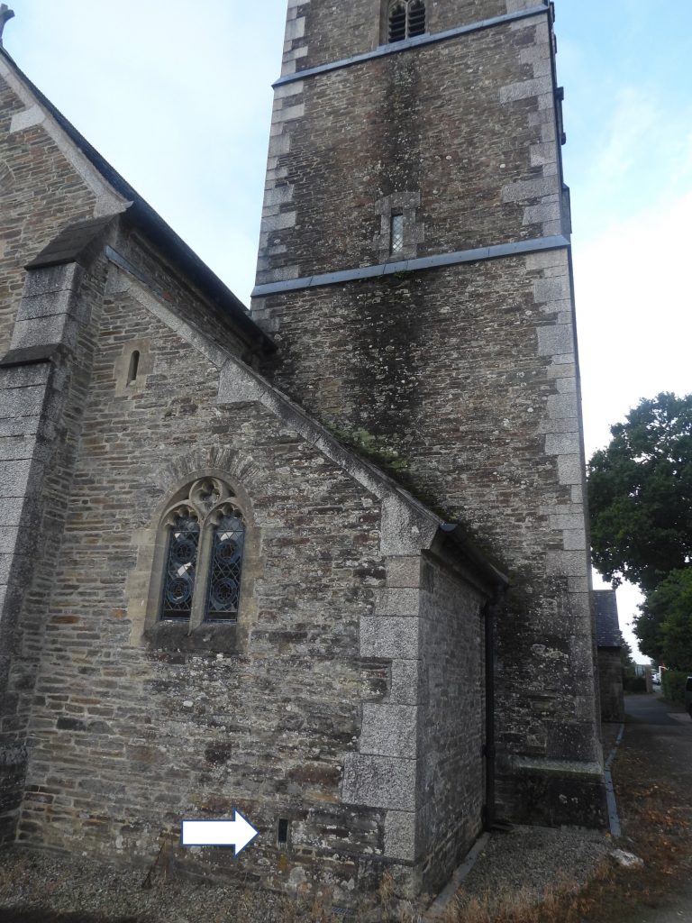
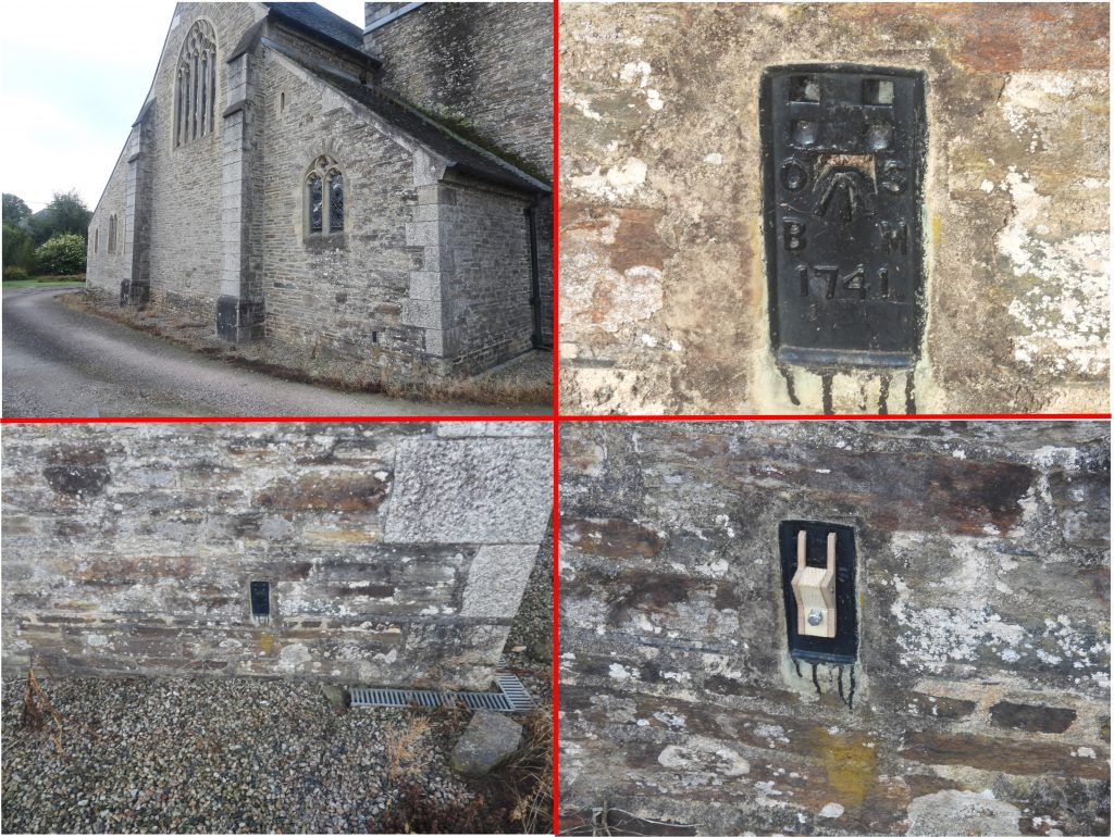
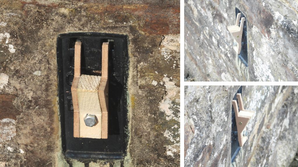
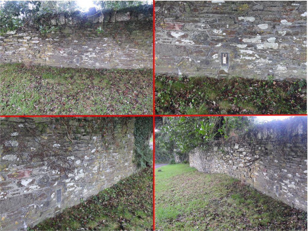
Maps showing the route of the 2nd and 3rd Geodetic Levelling between Bridford and Yelverton. The main difference between the two routes appears to be from Postbridge onto Bridford.Table of the extant 2nd and 3rd Geodetic Levelling items (plus the lost / destroyed flush brackets on the route)This is the granite pillar and gun metal bolt of the Bridford Fundamental Benchmark. There were at one point around 250 of these across the UK on specially selected sites where foundations were set on stable strata such as bedrock so that movement of the mark is minimised. They provide a stable network for levelling and there is one approx. every 40km. On Dartmoor, there is (buried) another FBM near YelvertonSign on the back of the Bridford FBM.Fundamental Benchmark construction. Note that there is a chamber next to the granite pillar. (Source: Site Engineering Guide ORDANCE SURVEY: NATIONAL GRID & BENCH MARKS Andrew Burgess B.Sc Hons)The Bridford Fundamental Bench Mark is 843.145 ft above sea level. There is a UK Fundamental Benchmark at Newlyn, Cornwall. At Newlyn there is a brass bolt for the whole of the United Kingdom, that is, all heights are referenced to this point. The height of the benchmark (bolt) at Newlyn was established over a six year period from 1915 to 1921, when mean sea level was found and this vertical level transferred to the head of the bolt. The bolt head was 4.751 metres above the 1915/1921 mean sea level and is now 4.551 metres above mean sea level as sea levels have risen.Contextual views of the Bridford Fundamental benchmark. It was used for both the 2nd and 3rd Geodetic LevellingNear Plaistow Green is a large brass bolt benchmark with a mushroom shaped head and engraved with O.S.B.M.On the brass bolt there is an arrow pointing to the centre of the head. It is at 290.481m above sea levelContextual views of the Plaistow Green brass bolt which was used for 3rd Geodetic levelling. The route from Bridford being slightly different from the 2nd Geodetic levelling.The first “flush bracket” on the Bridford to Yelverton line can be found on the barn at Laployd Barton.Flush Bracket and how the surveyors would have used a detachable bracket to enable the levelling of their surveying poles
The author is no Tarantino or Spielberg but hopes the attached You Tube video explains how a flush bracket was used
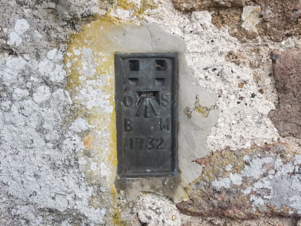
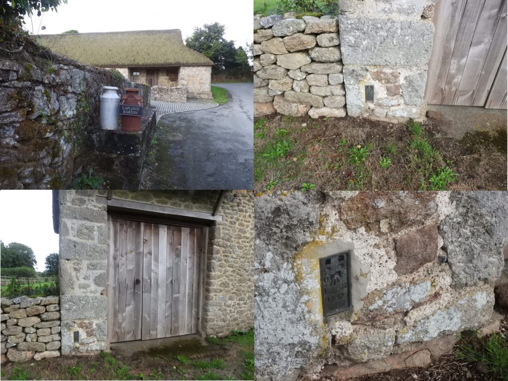
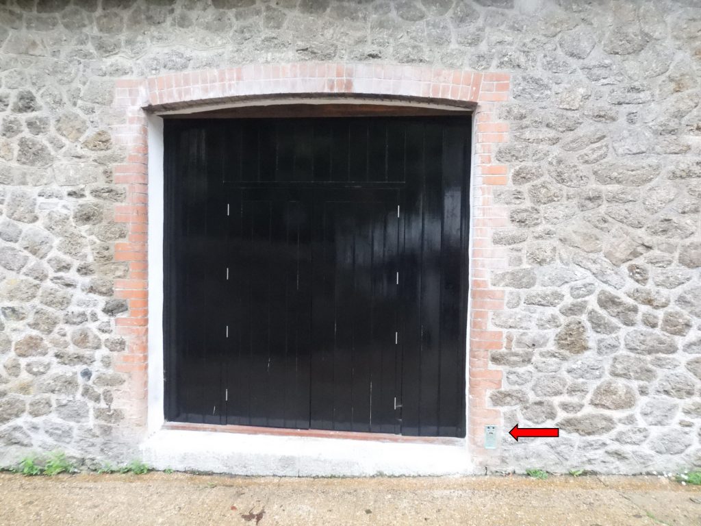
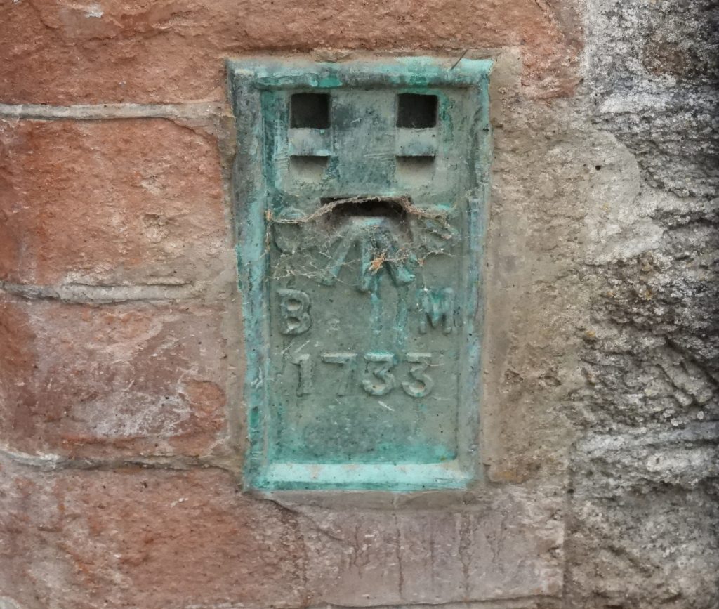
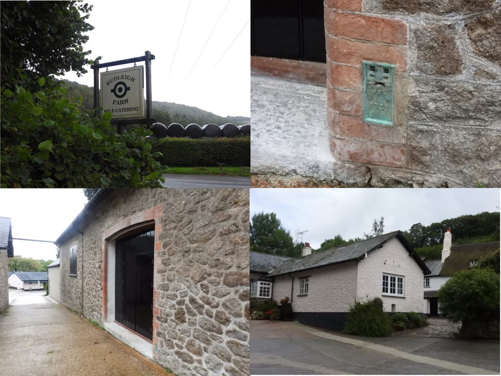
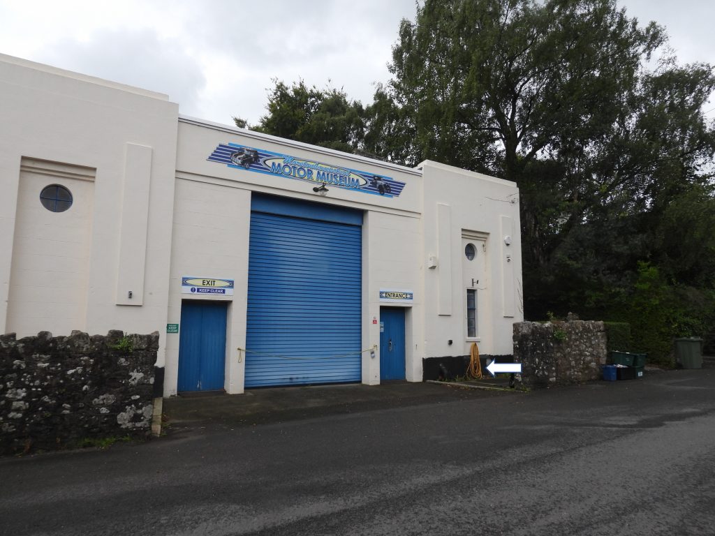
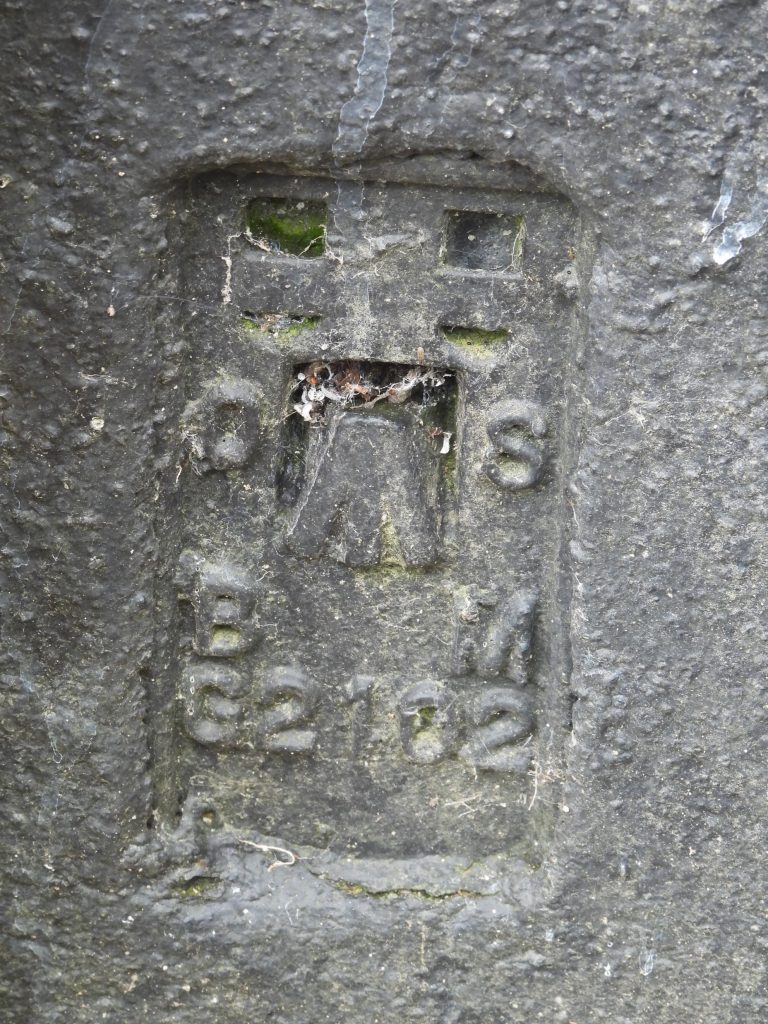
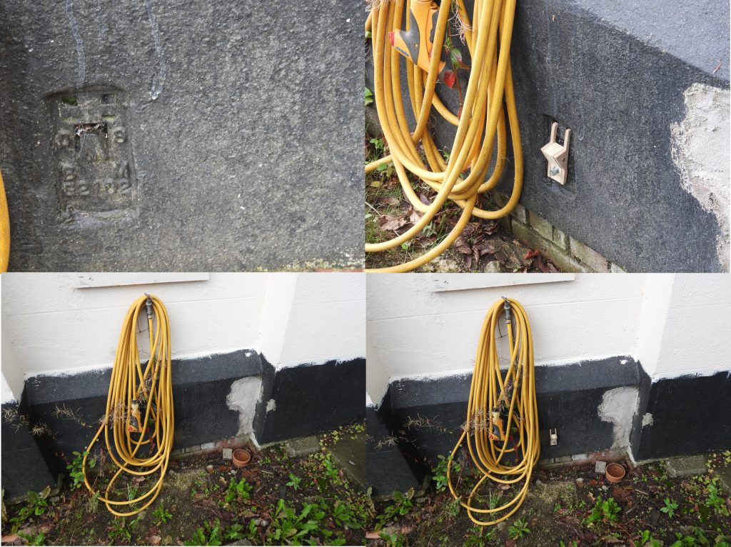
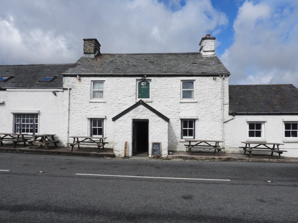
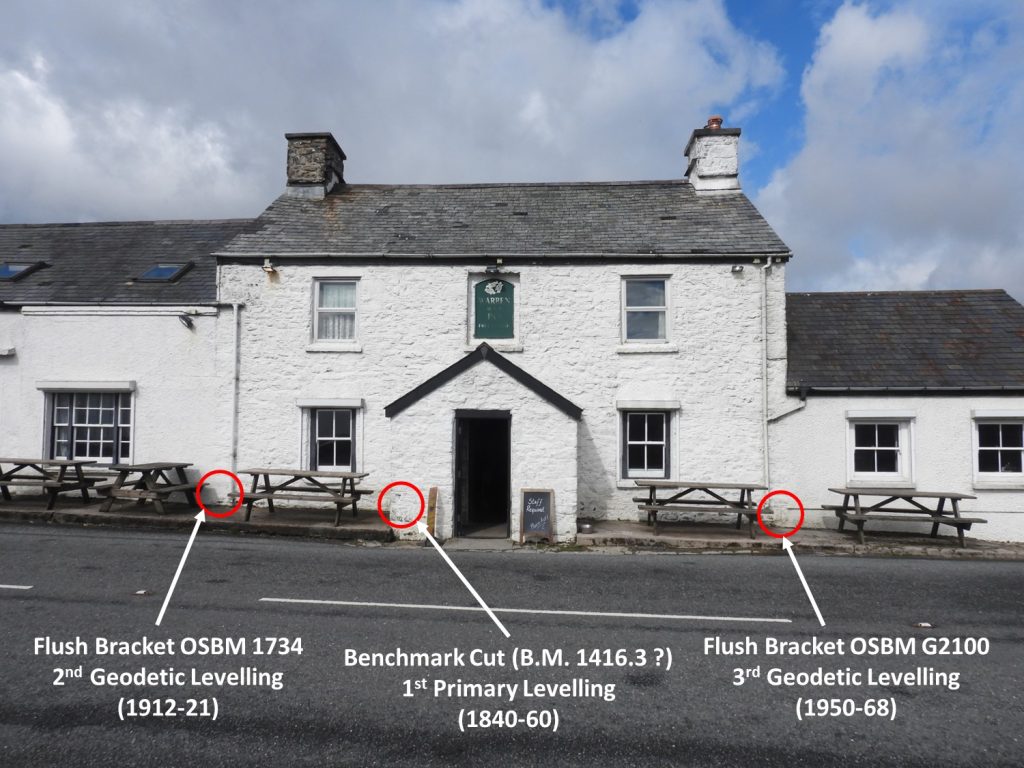
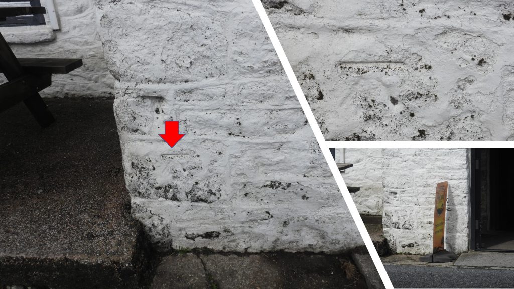
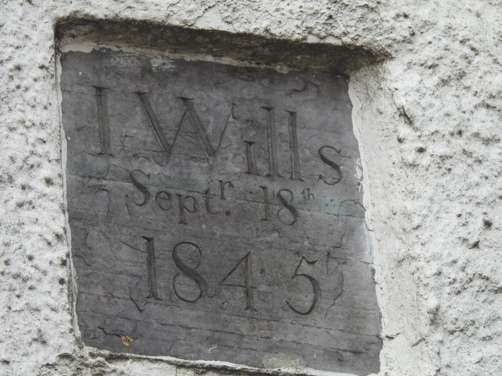
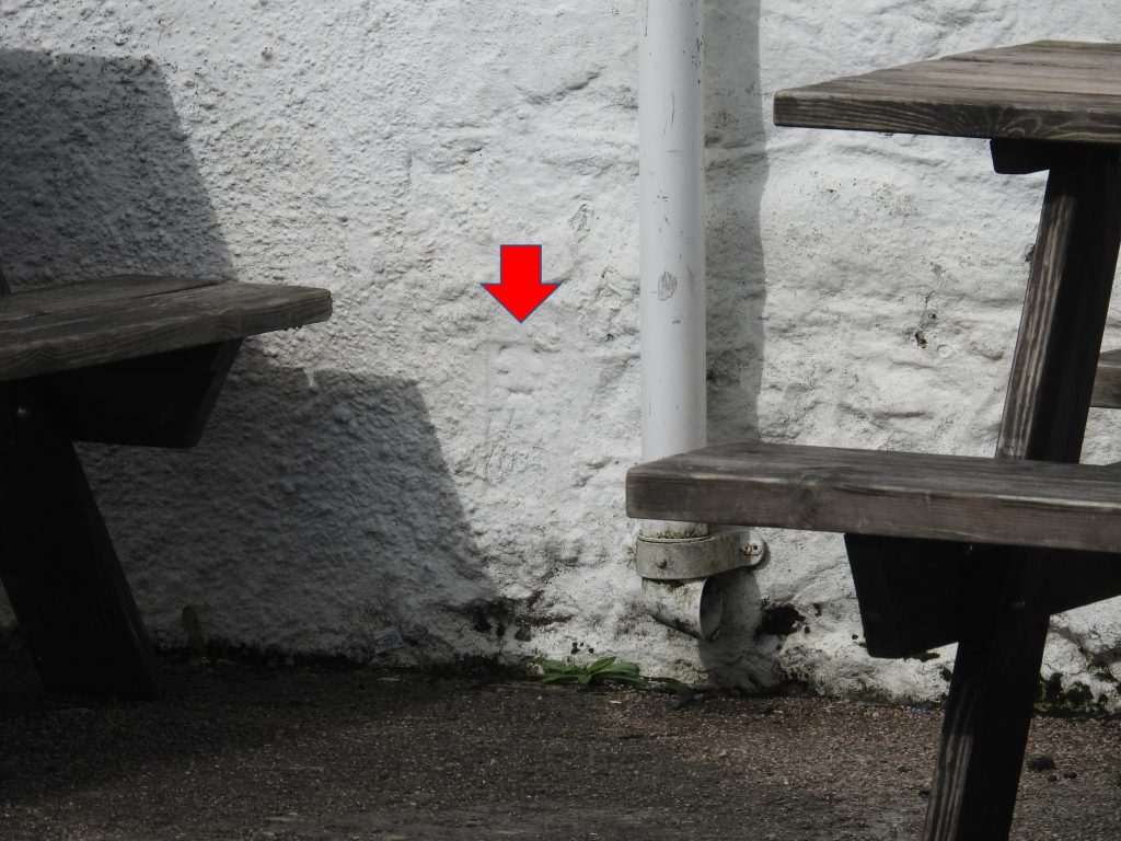
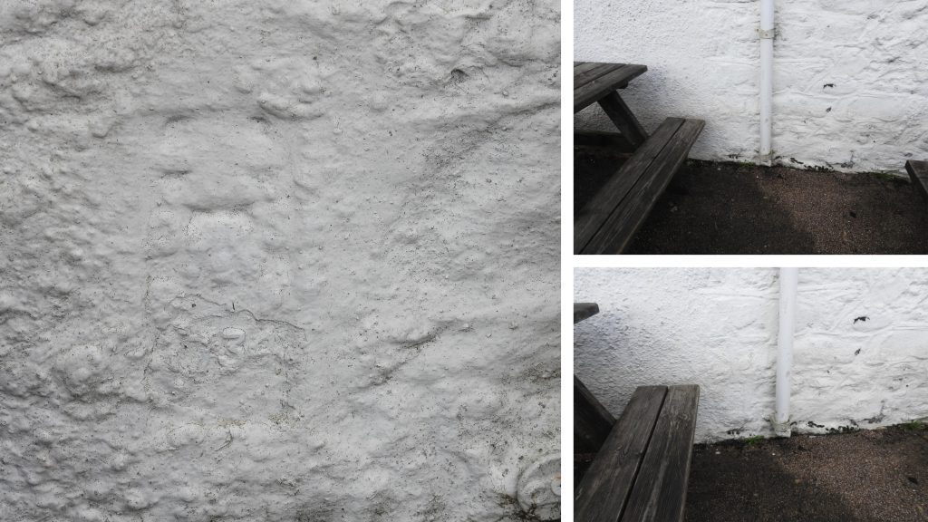
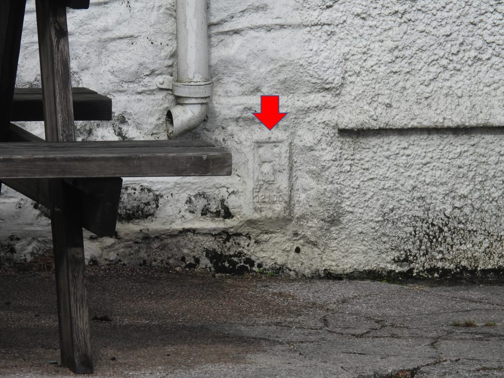
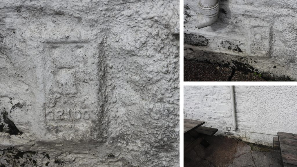
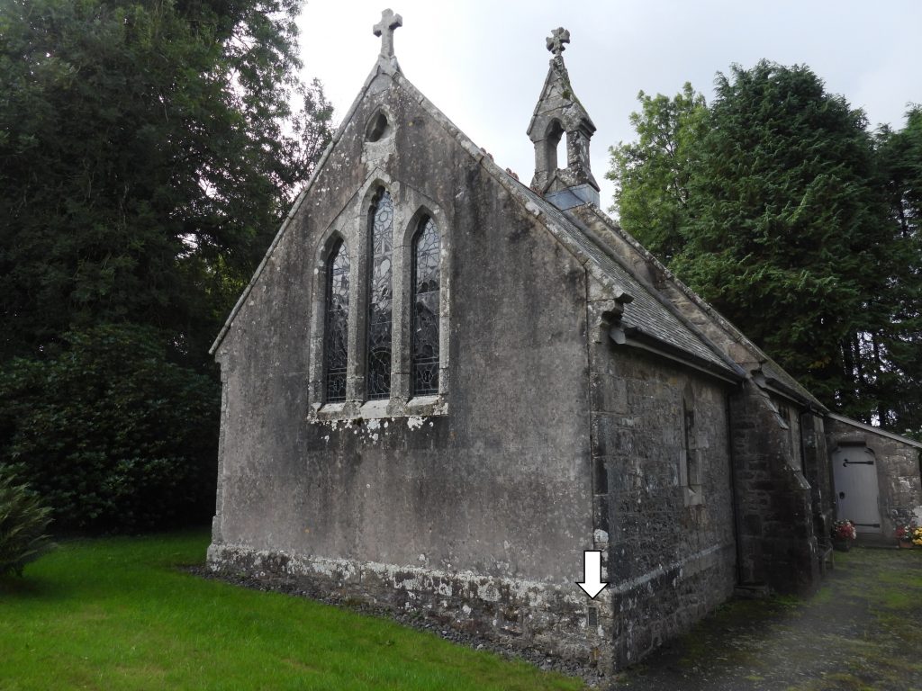
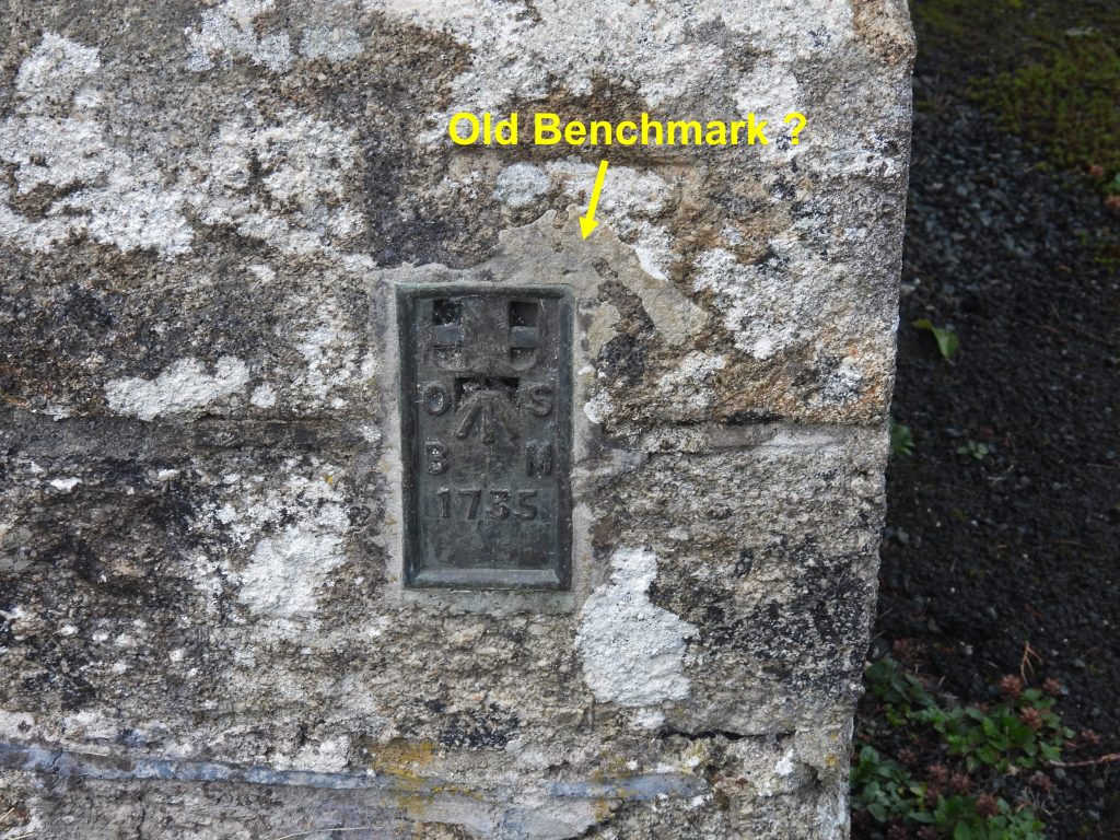
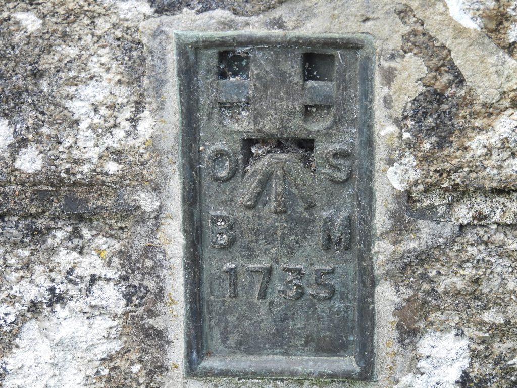
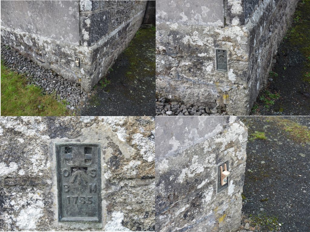
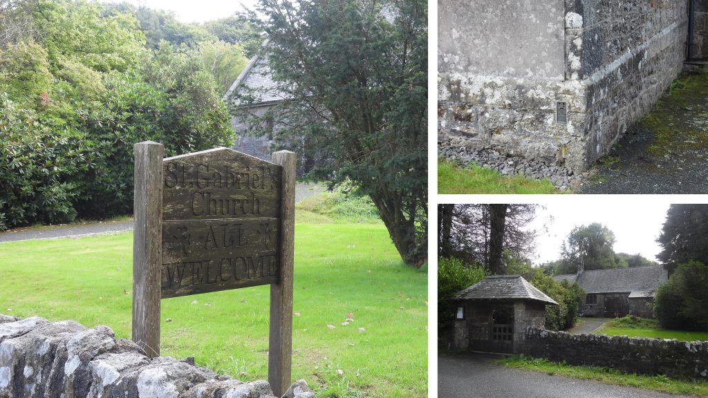
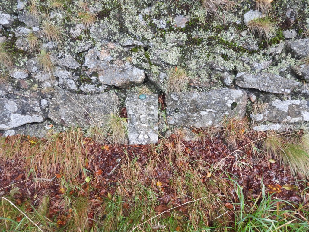
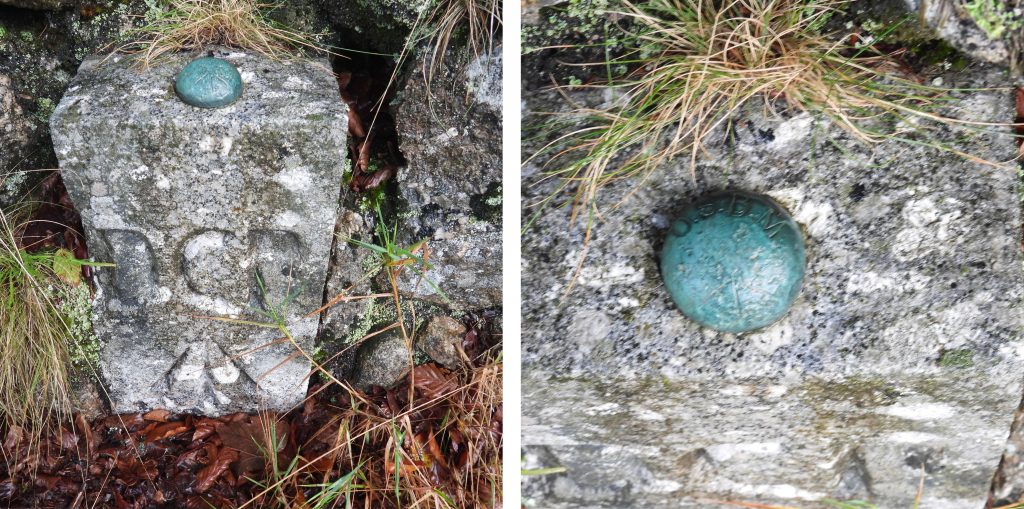
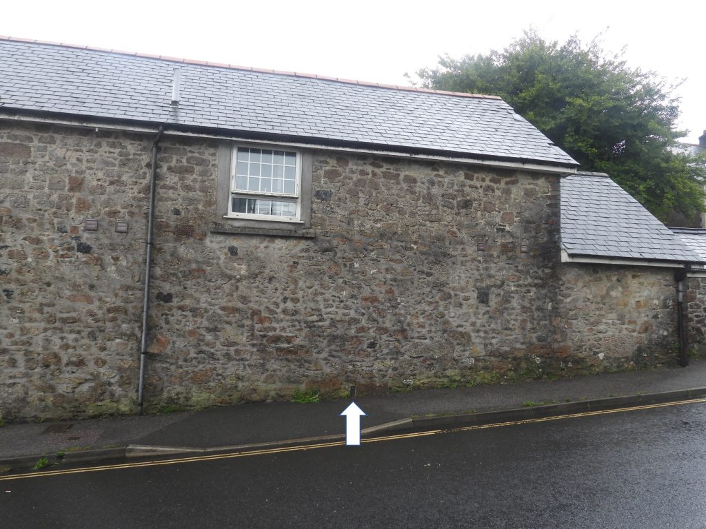
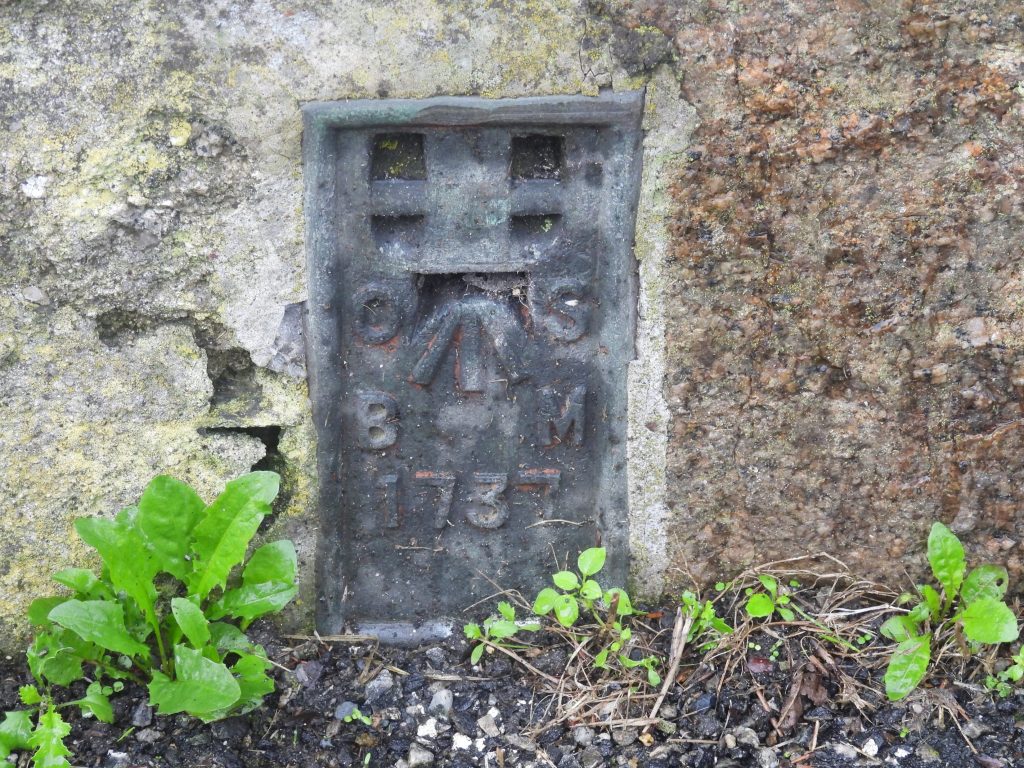
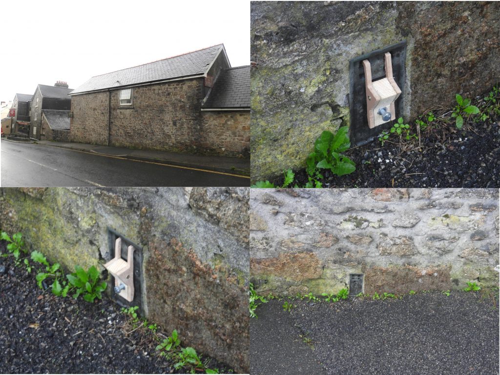
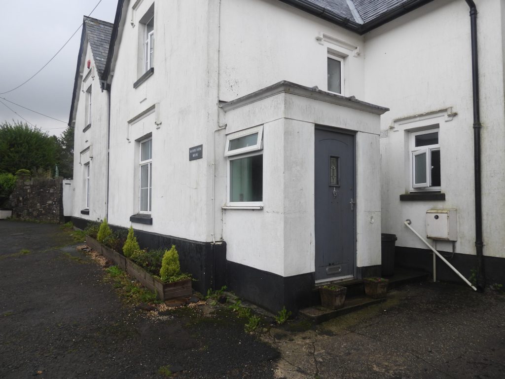
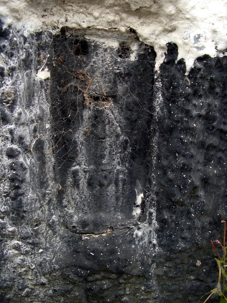
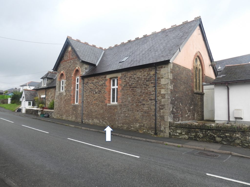
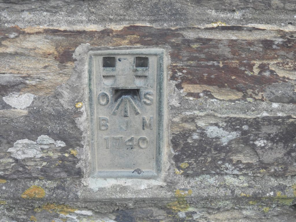
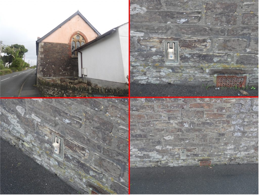
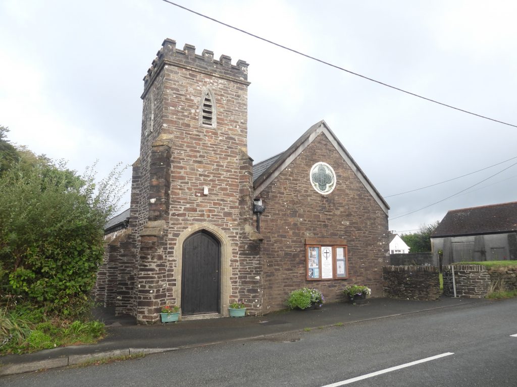
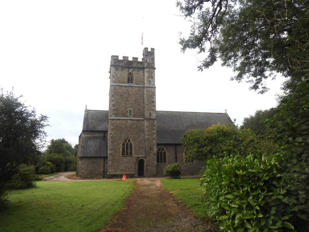
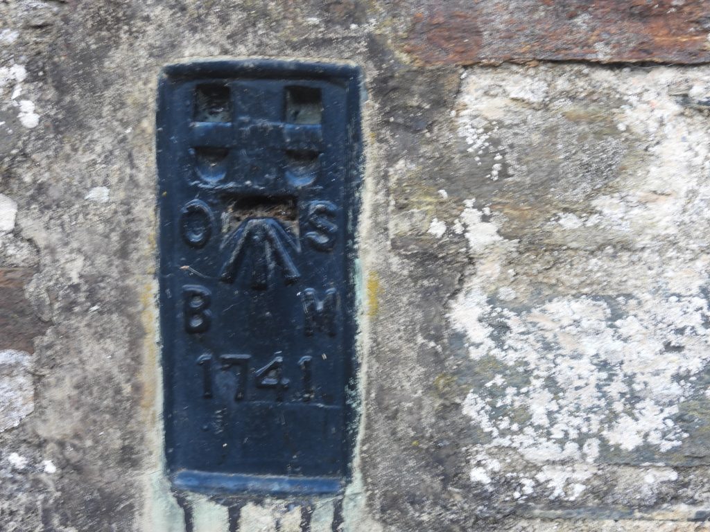
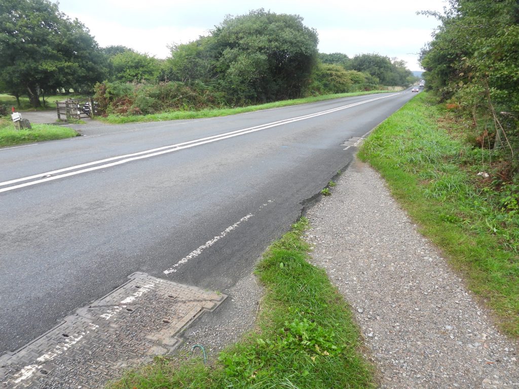
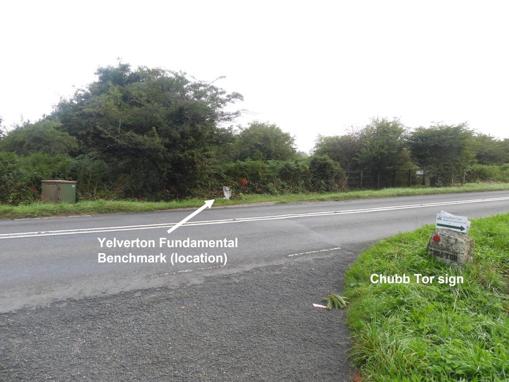
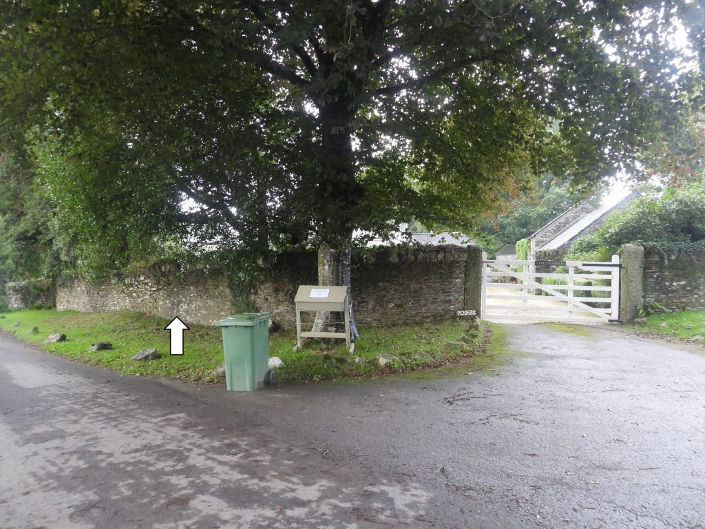
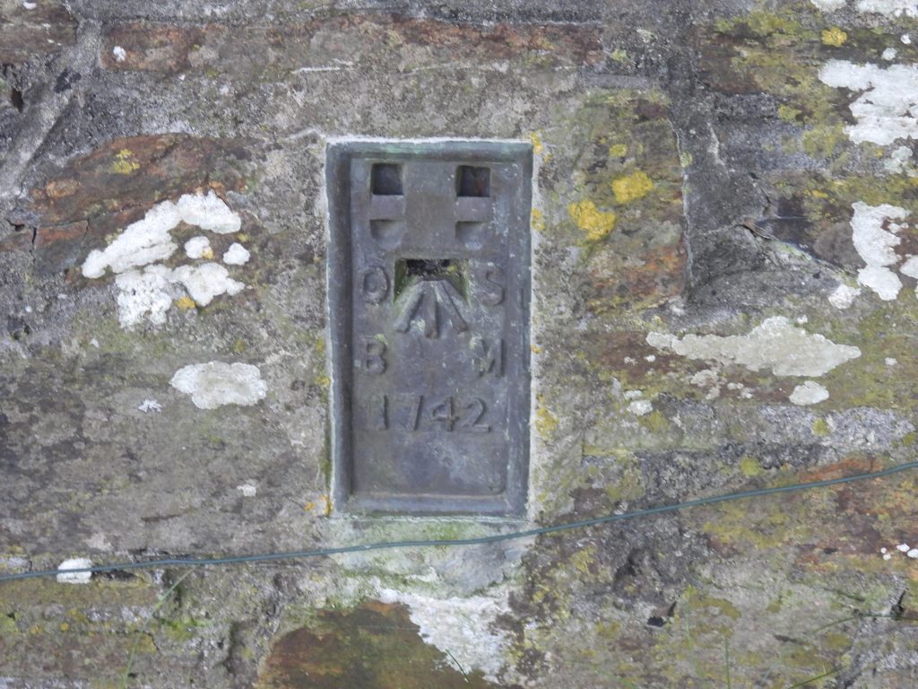
Flush Bracket OSBM 1732 on Laployd Barton Barn. It was used for the 2nd Geodetic Levelling.Mock up of the surveyors detachable bracketGeneral views of the Flush Bracket on Laployd Barton Barn. It is at 275.740m above sea levelThe second “flush bracket” on the Bridford to Yelverton line can be found on the barn at Budleigh Farm. The author is grateful to (presumed) owner who he met and who showed him where this feature was located.Flush Bracket OSBM 1733 on Budleigh Farm Barn. It was used for the 2nd Geodetic Levelling.General views of the Flush Bracket on Budleigh Farm Barn, the entrance and the farm itself. The flush bracket is at 180.021m above sea level.Mock up of the surveyors detachable bracketThe third “flush bracket” on the Bridford to Yelverton line can be found on the Motor Museum (former Omnibus Depot) in MoretonhampsteadFlush Bracket OSBM G2102 on the Motor Museum at Moretonhampstead. It was used for the 3rd Geodetic Levelling. Note the prefix “G” which seems to have been used for the 3rd survey. The flush bracket is at 210.479m above sea level.General views of the Flush Bracket and the mock up of the surveyors detachable bracket. Warren House Inn – the only place (probably) within the Dartmoor National Park where there is three different pieces of evidence of the three periods of Ordnance Surveys, namely: First Primary Levelling (1840-60), Second Geodetic Levelling (1912-21) and Third Geodetic Levelling (1950-68). All can be seen in one picture !The locations of the two “flush brackets” and a cut benchmarkThis is possibly B.M. 1416.3 from the 1st Primary Levelling (1840-60) albeit it is not quite in the expected location as per 19th Century Maps. To the left of the main door at SX67431 80933. This mark will have been made between 1845 and 1860. It does look a modern (ish) cut though ! Some observers believe the original ‘cut’ mark was lost to rendering and this is a replacement.This is the reason why the benchmark was cut between 1845 and 1860. The plaque on the east end of the building identifies John Wills as being the landlord when the inn (re)opened having been across the road beforehand. The date the inn (re)opened was September 18th 1845.The flush bracket to the left of the door way is OSBM 1734. It was put in place between 1912 -1921 and was part of the 2nd Geodetic Levelling on the line between Bridford and Yelverton.OSBM 1734 can be found at SX67429 80933The flush bracket to the right of the door way is OSBM G2100. It was put in place between 1950 -1968 and was part of the 3rd Geodetic Levelling on the line between Bridford and Yelverton. Why the survey didn’t re-use OSBM 1734 remains a mystery. Other flush brackets were re-used between the 2nd and 3rd Geodetic Levelling. According to the benchmark database the probable date this was put in place was 1952.OSBM G2100 can be found at SX67434 80939. The new flush brackets used for the 3rd Geodetic Levelling appear to have a prefix “G” before the number.There is a 2nd / 3rd Geodetic Levelling Flush Bracket at St. Gabriel’s Church in PostbridgeThe Flush Bracket is OSBM1735 and looks like it make have been built into the wall over an older ‘cut’ benchmark (possibly B.M 1155.2) as shown on old 19th century maps.Flush Bracket OSBM 1735 on St. Gabriel’s Church was used for both the 2nd and 3rd Geodetic Levelling.General views St. Gabriel’s, Postbridge and the Flush Bracket (with the detachable mock up bracket)General views St. Gabriel’s, Postbridge Just up the hill (west) of Postbridge on the south side of the road another large brass bolt benchmark with a mushroom shaped head and engraved with O.S.B.M. can be found. It is well hidden in the undergrowth.The bolt can be best found by locating a gap in the wall above it, which is about 4m awayThis bolt was used for the 3rd Geodetic Levelling and is at 366.727m above sea level.The milestone is on the north side of the road a few hundred metres from the OSBM bolt. It is opposite a field gate and was erected around 1772. The milestone inscription is faint but according the 19th century maps it may state: Tavistock 11, Moretonhampstead 9. It can be found at SX64083 78161Between Two Bridges and Princetown (not far from Ockery / Oakery) on top of a DCP (Director of Convicts Prisons) stone pillar.The top of the mushroom shaped head is beautifully engraved with O.S.B.M. and has the trademark arrowContextual view of the DCP stone and bolt.This bolt was used for the 3rd Geodetic Levelling and is at 394.535m above sea level.There is a 2nd / 3rd Geodetic Levelling Flush Bracket on the wall of the former bunkhouse of the Plume of Feathers Inn at PrincetownFlush Bracket OSBM 1737 is located at 419.821m above sea levelGeneral contextual views of the Plume of Feathers Inn, Princetown Flush Bracket (with the detachable mock up bracket)The Flush Bracket at the Manor Farm, Dousland appears to have been rendered over. The author looked at the two buildings on the corner of the Dousland Road (opposite the Burrator Inn), both of which have smooth rendering. The flush bracket has previously been located here within the last 20 years.Flush Bracket OSBM 1738 before being destroyed. Picture courtesy of Rob Woodall with thanks.There is a 2nd / 3rd Geodetic Levelling Flush Bracket on the wall of Rock Chapel (Masonic Hall) in Yelverton. It was formerly a Bible Christian Chapel Flush Bracket OSBM 1740 is located at 193.001m above sea levelGeneral contextual views of the Rock Chapel, Yelverton Flush Bracket (with the detachable mock up bracket)Opposite Rock Chapel, Yelverton is Holy Cross a Roman Catholic ChurchSt. Pauls Church, Yelverton was built in the early 20th centuryThe final (most westerly) Flush Bracket on the Bridford / Yelverton 2nd / 3rd Geodetic Levelling line is on the east wall of St. Paul’s Church in Yelverton.General contextual views of the St. Paul’s, Yelverton Flush Bracket (with the detachable mock up bracket)Flush Bracket OSBM 1741 is located at 186.270m above sea levelClose up of the mock up detachable bracketThe Fundamental Benchmark at Yelverton is buried under a grass verge alongside the A386, next to where the golf players cross the road.Using a photograph of the Bridford Fundamental Benchmark, it has been superimposed onto the location of where the Yelverton Fundamental Benchmark should be. Further information can be found at: https://www.jonglew.com/Walking/Benchmarks/2018/20180624-YelvertonFBM_OS_Sketch.jpgAnother contextual view of the location where the Yelverton Fundamental Benchmark should beYeoland HouseFlush Bracket OSBM 1742 is located at 162.992m above sea level and is on the Yelverton to Liskeard 2nd and 3rd Geodetic Levelling lineGeneral contextual views of the Yeloand House Flush Bracket (with the detachable mock up bracket)


Steve Bennett August 2, 2024
Brilliant!
SteveGriggDartmoor August 2, 2024 — Post author
Thank you
Kind Regards,
Dartmoor Explorations