A collection of walks, discoveries, insights and pictures of exploring Dartmoor National Park
August 22, 2023
Evidence of Devonport Leat in the centre of Yelverton
If one studies a map of central Yelverton from the late 19th / early 20th century, it reveals two major Dartmoor Leats (Devonport and Plymouth (aka Drake’s Leat)) would have been still very much discernible straddling St. Paul’s Church and both crossing Meavy Lane from east to west.
Today, in this area it is not too difficult to find Plymouth Leat and see where it flowed between 1591 and 1898 providing fresh water from the River Meavy along a 17 mile to Plymouth. Devonport Leat on the other hand appears to be virtually obliterated over the last century. That said, with a observant eye, there is evidence that Devonport Leat once flowed in this area. This post explores the evidence of the leat which is now ‘Hidden – in plain sight”.
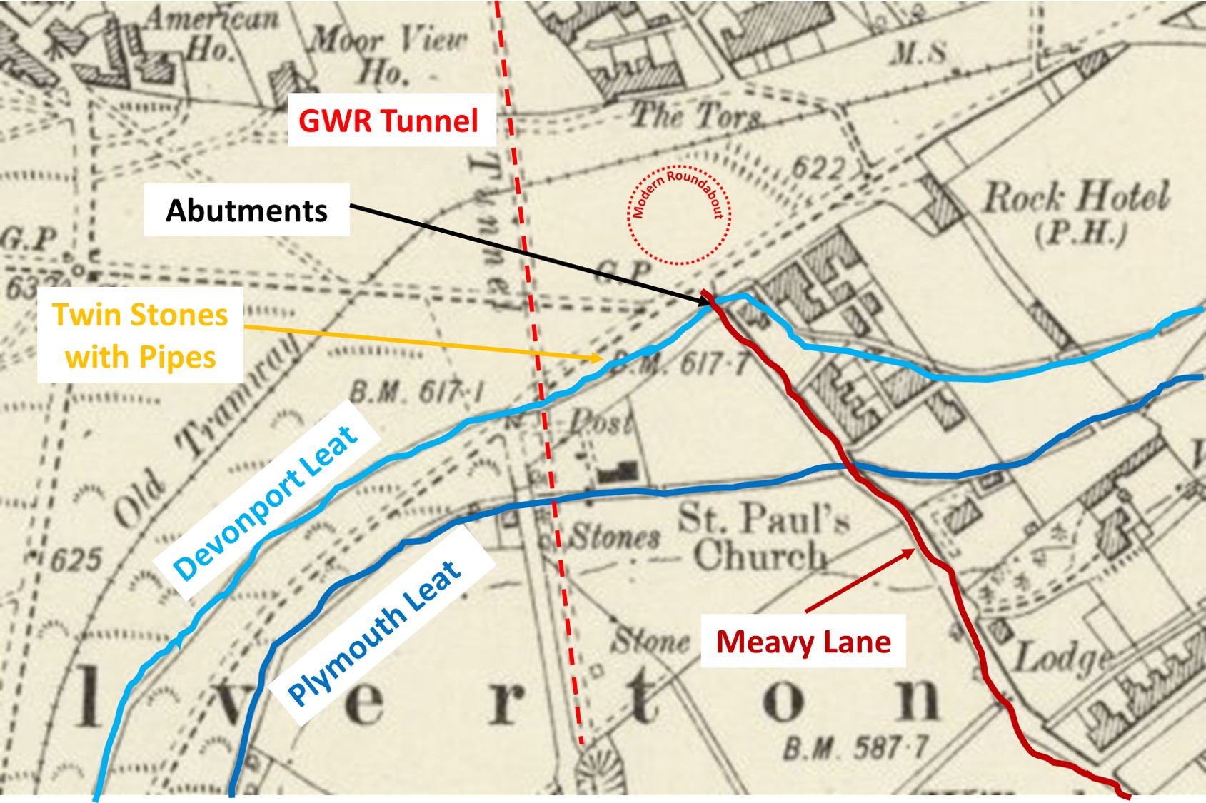
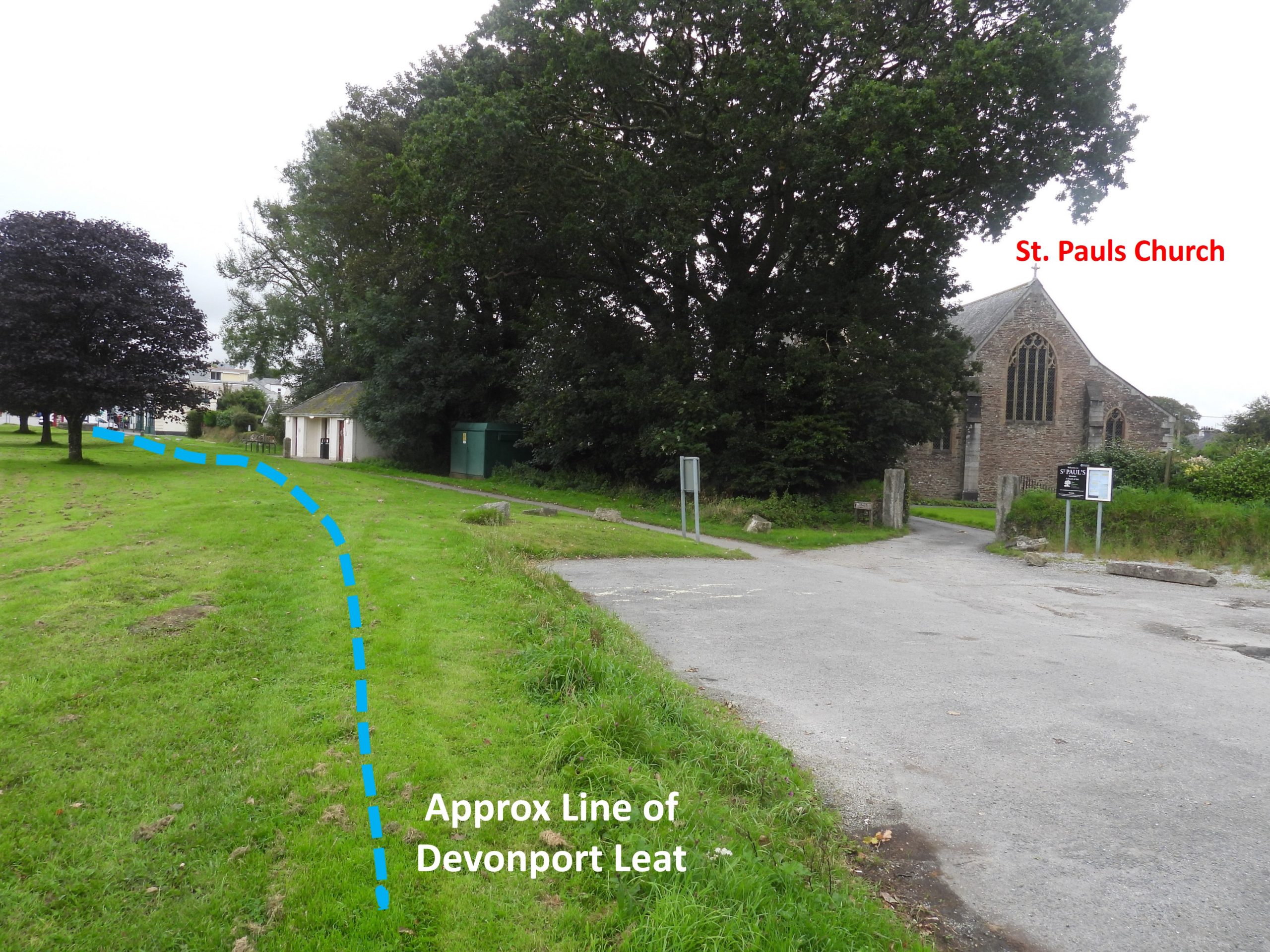
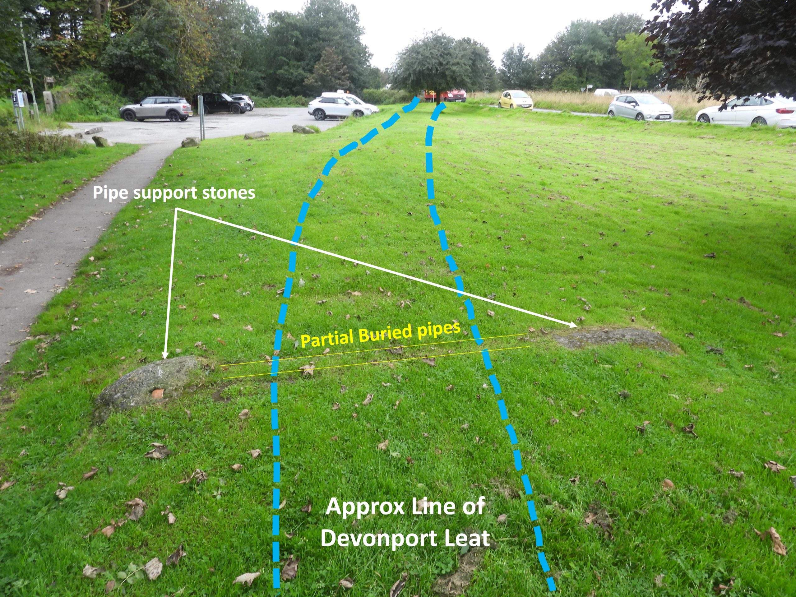
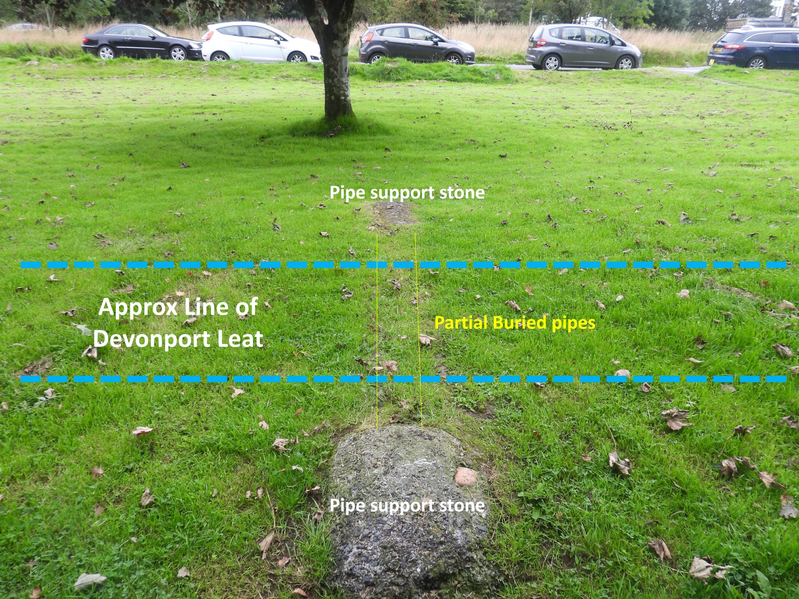
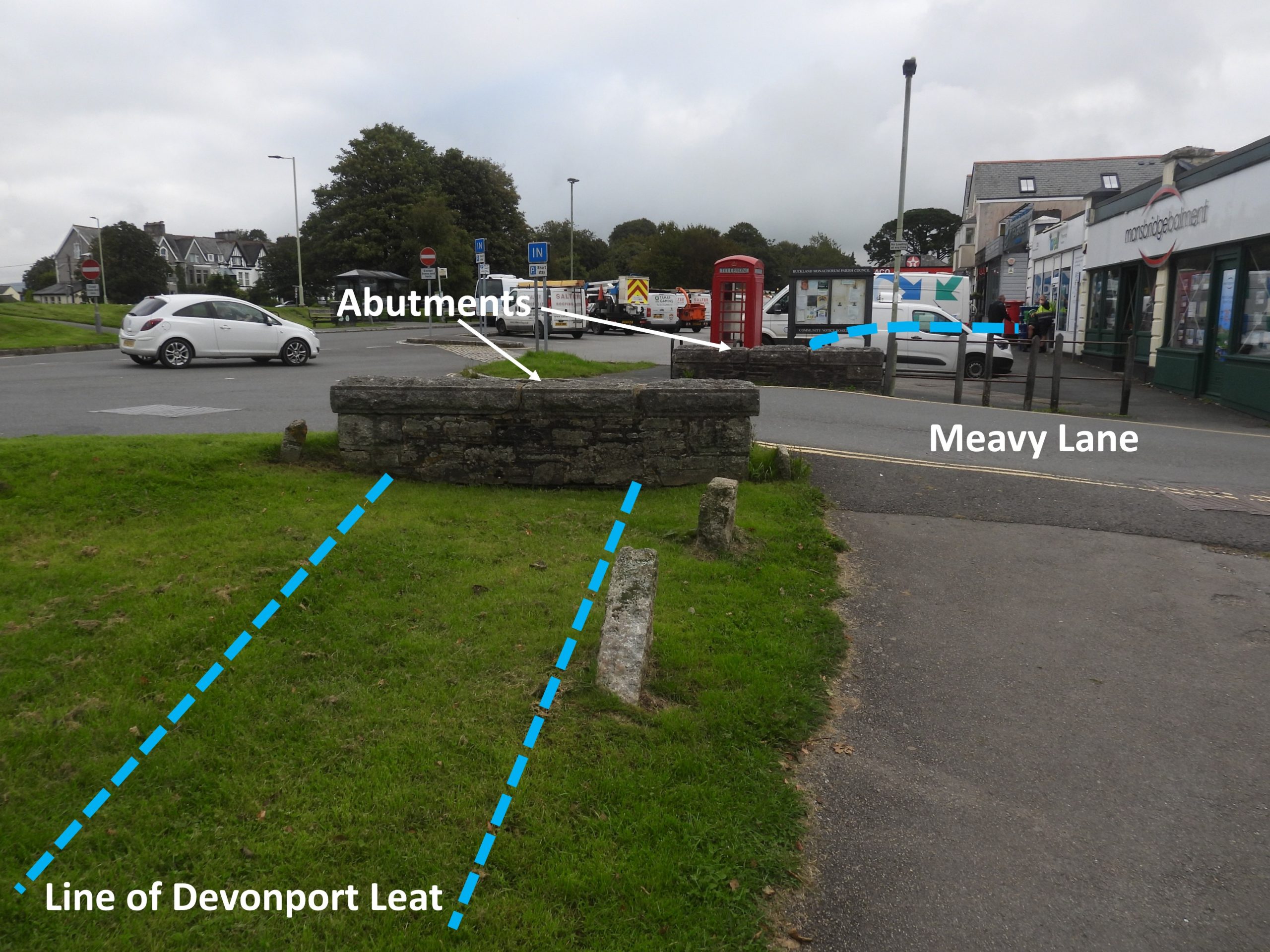
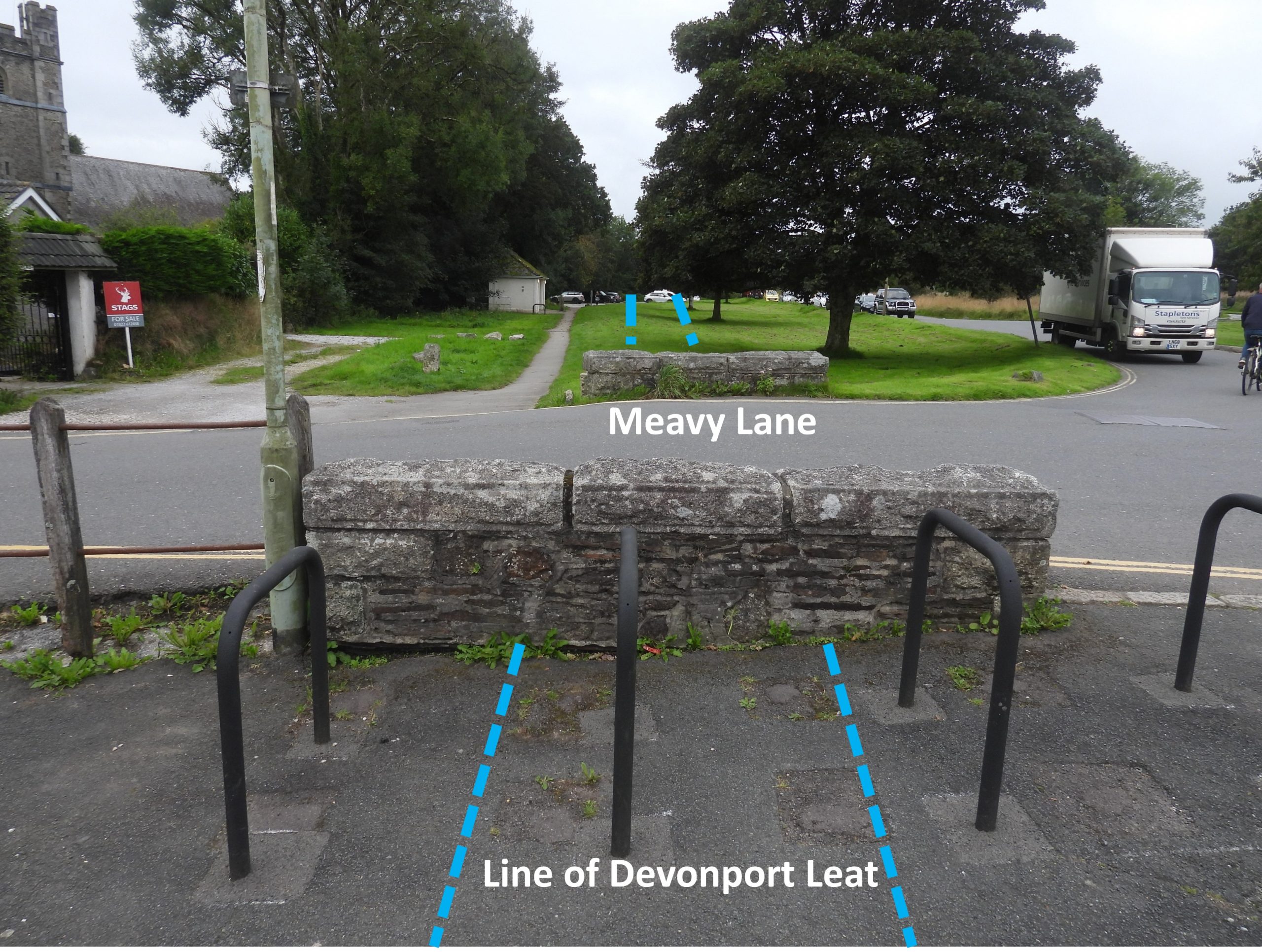
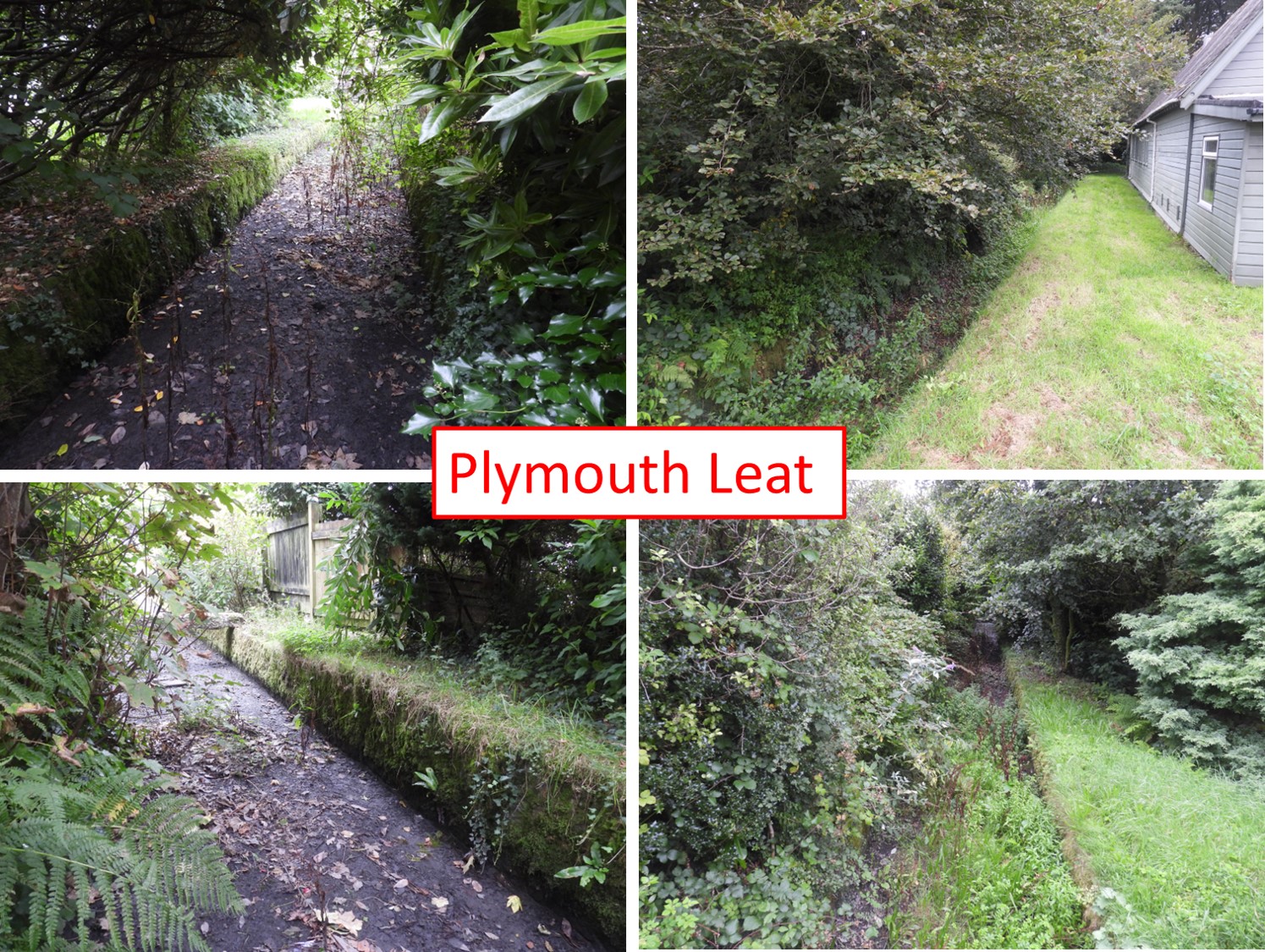
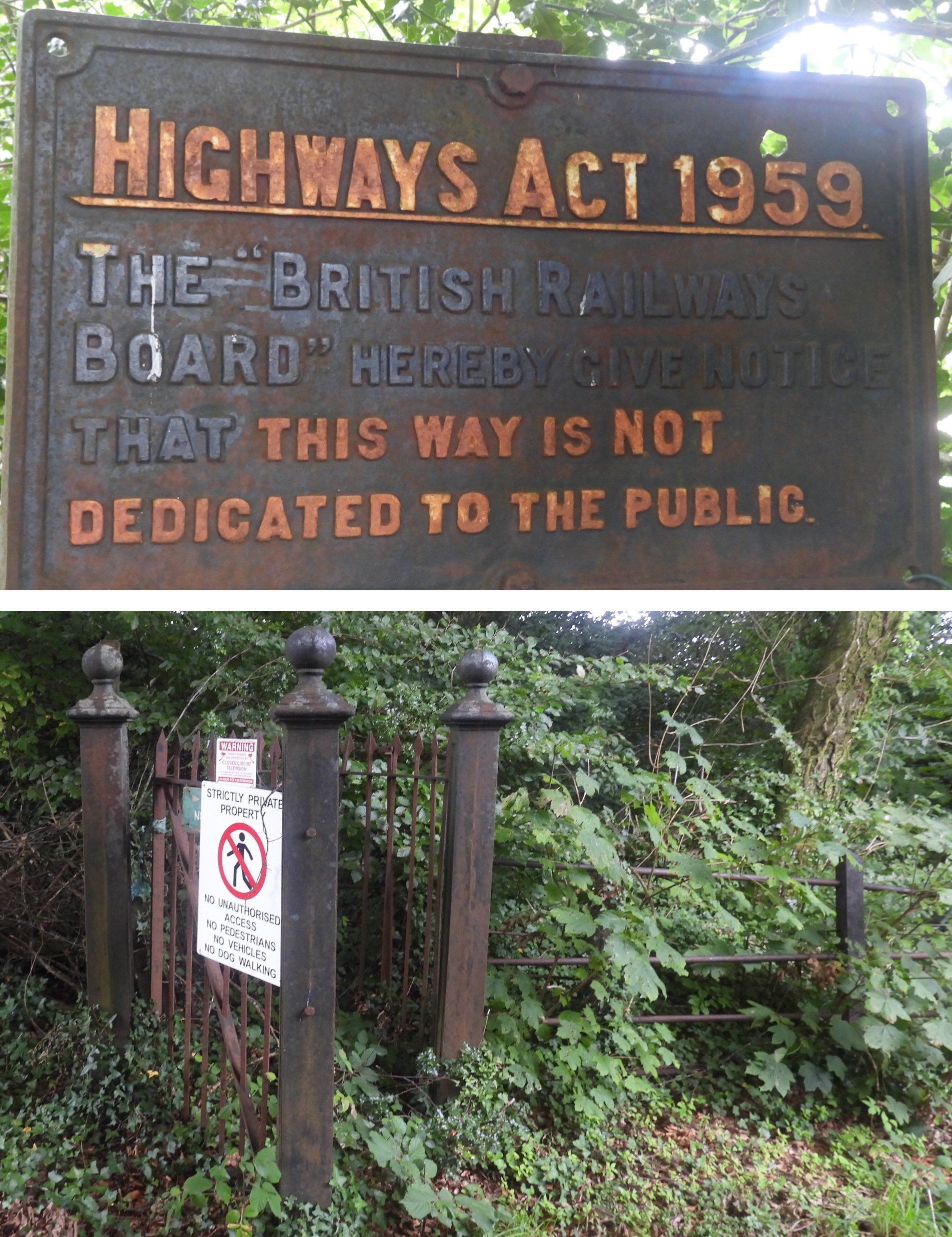
Annotated map of Yelverton from late 19th / early 20th century showing the course of the two major Dartmoor Leats (Devonport and Plymouth). The Plymouth and Dartmoor Railway (old Tramway) would have also been still in situ (albeit disused). Also of interest is that a GWR tunnel runs under this area south to northThe line / course of Devonport Leat would have run from close to the shops, crossed Meavy Lane, then past public toilets and onwards towards the small car park outside St. Paul’s. Devonport Leat was constructed in the 1790’s to carry fresh drinking water from the higher ground of Dartmoor to the dockyards at Plymouth Dock (renamed as Devonport on 1st January 1824)Close to a electricity box and the public toilets in the grass, there are two partially buried stones which appear to be the supports for two partially buried pipes. Due to the distance between the stones and their location, the author strongly speculates this construction was necessary to straddle line / course of Devonport LeatSide on view of the two support stones and the partially buried pipes. The author speculates that the pipes may well have lead to the electricity box or even St.Paul’s beyond the nearby treelineThe clearest evidence that Devonport Leat flowed in this area is the two abutments to the top of Meavy Lane, which were once part of a bridge crossing the Leat. The Leat was (and still is) fed by five Dartmoor rivers: the West Dart, the Cowsic, Hart Tor Brook, River Meavy and the Blackabrook. The 27 miles course is today, of course, shortened with water from the aforementioned rivers feeding Burrator Reservoir. Of interest is that the leat would have flowed through the lane where the car repair / servicing business is now located !Today, there are bike racks where once previously water would have flowed !Plymouth Leat can be seen sandwiched between St. Paul’s and the Rectory. There are a couple of bridges which straddle the leat here. Plymouth Leat would have been redundant after Burrator Reservoir was completed in 1898.At the head of the lane which once lead to the former Yelverton Junction Railway Station and also sandwiched between the two leats there is still evidence of the old railway line. Near to the “Highways Act 1959”, there is a very overgrown cutting which would have lead to the GWR tunnel, which leads northbound towards Horrabridge, Grenofen and Tavistock