A collection of walks, discoveries, insights and pictures of exploring Dartmoor National Park
November 26, 2021
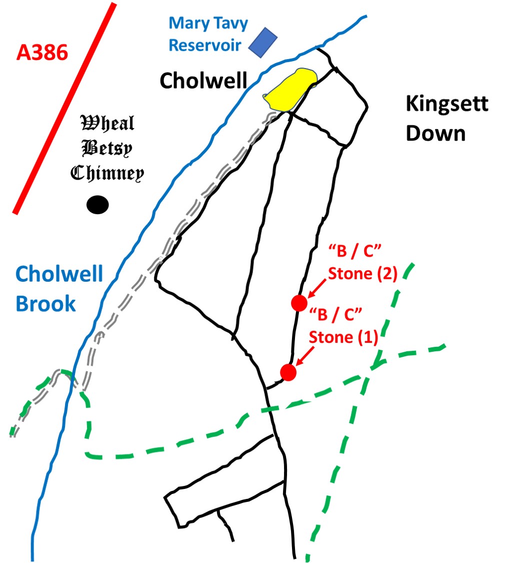
Cholwell Boundary Stones
Cholwell Farmstead dates from at least the early-mid 19th century, based on cartographic evidence, but may be older according to the entry on the Dartmoor HER. It is situated on the eastern side of the Tavistock-Okehampton road (A386) near the well known landmark of Wheal Besty (Engine House and Chimney). The eastern boundary of the farm enclosure is defined by a post and wire fence along the the line of an old reave.
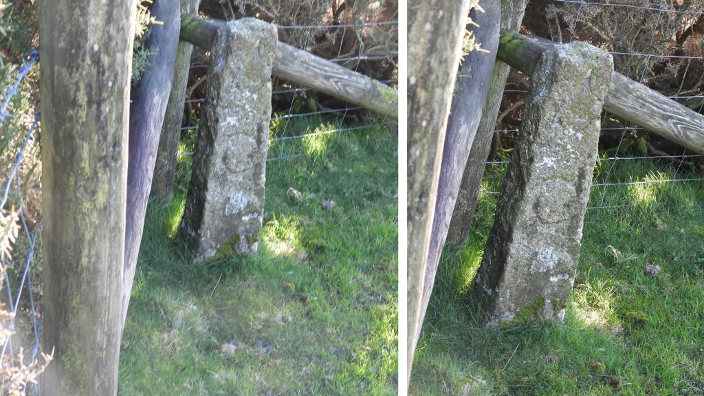
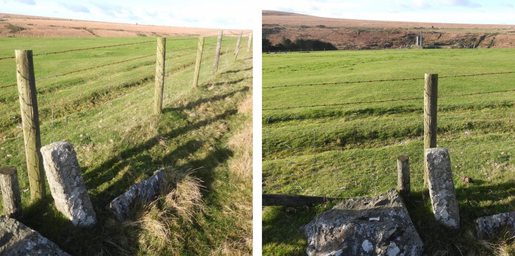
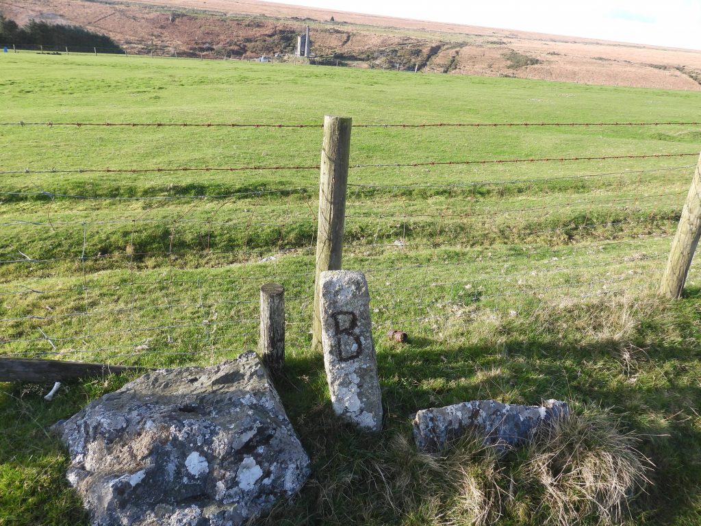
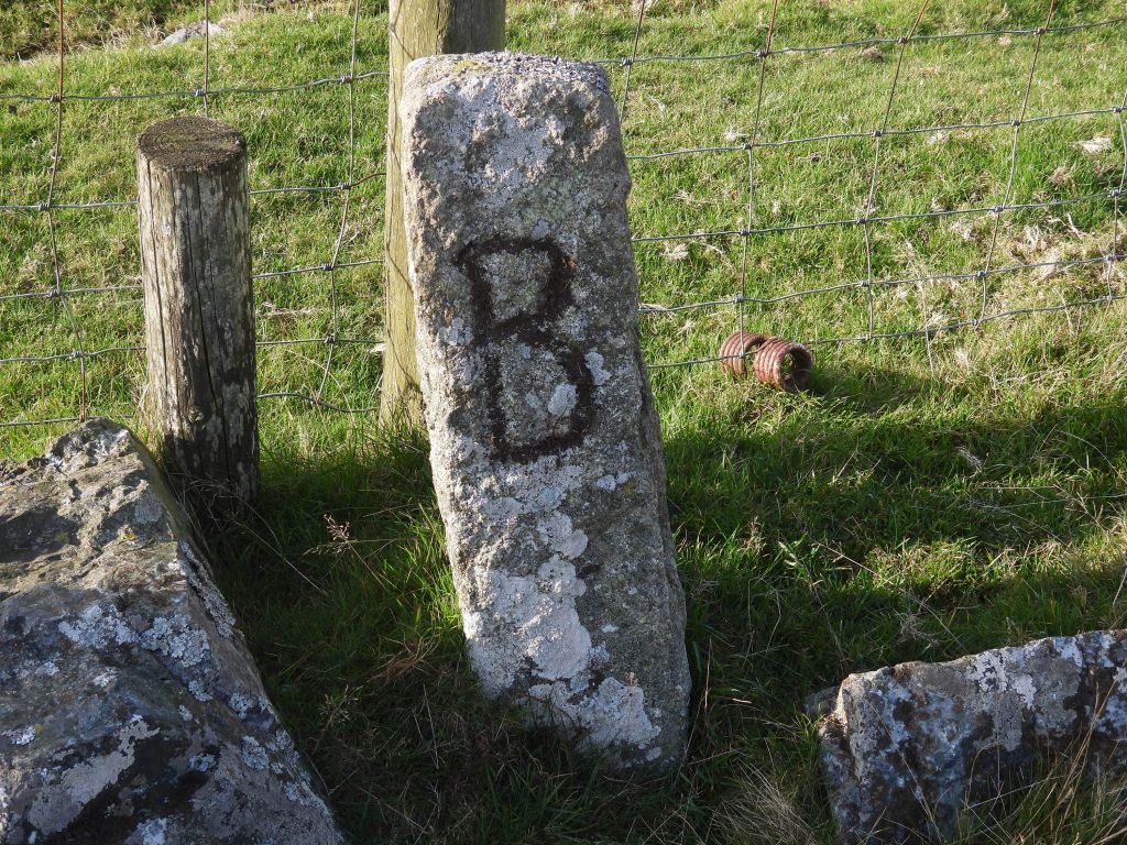
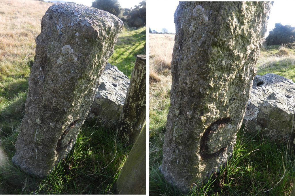
Dave Brewer in his 2nd edition (2002) Dartmoor Boundary Markers book (p197), mentions there is a small inscribed boundstone located on this eastern boundary, which is approx. 18 inches (0.45m) tall. On researching the location for this boundstone, the author found there were actually two marked on the OS 1873-1888 (National Library of Scotland).
On searching the boundary, two boundstones were located, each with an inscribed “B” on one face and “C” on the reverse. Dave Brewer speculates that these inscriptions stand for Cholwell (“C”) and Buller (“B”). John Buller esq. was a considerable land owner in the area with extensive mining interests around Mary Tavy.
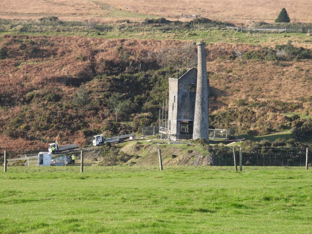
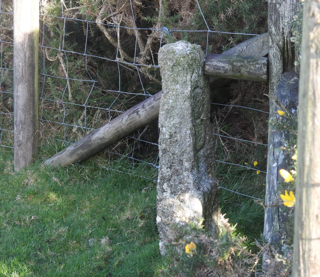
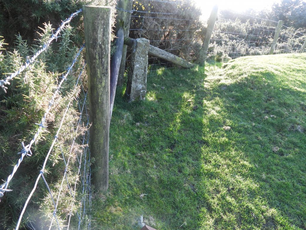
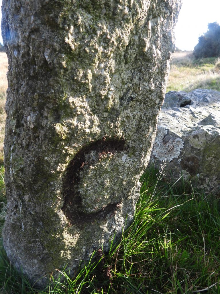
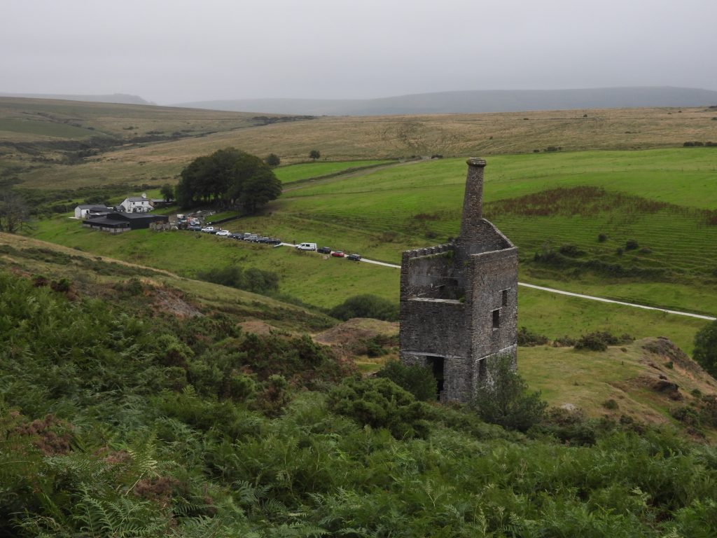
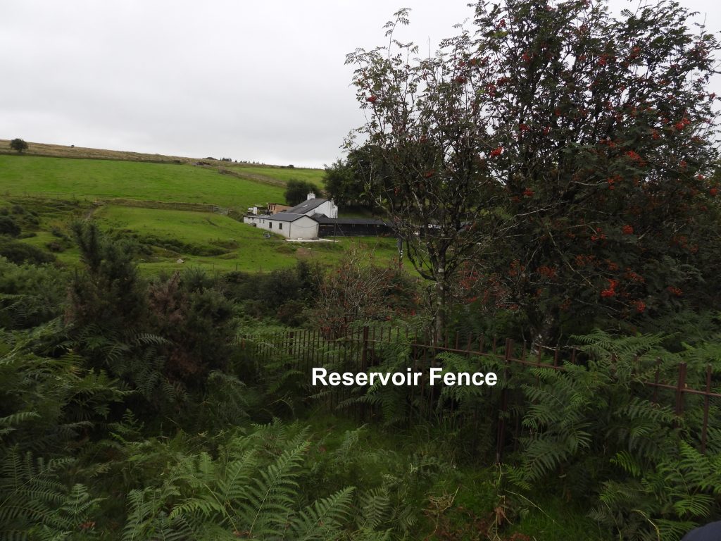
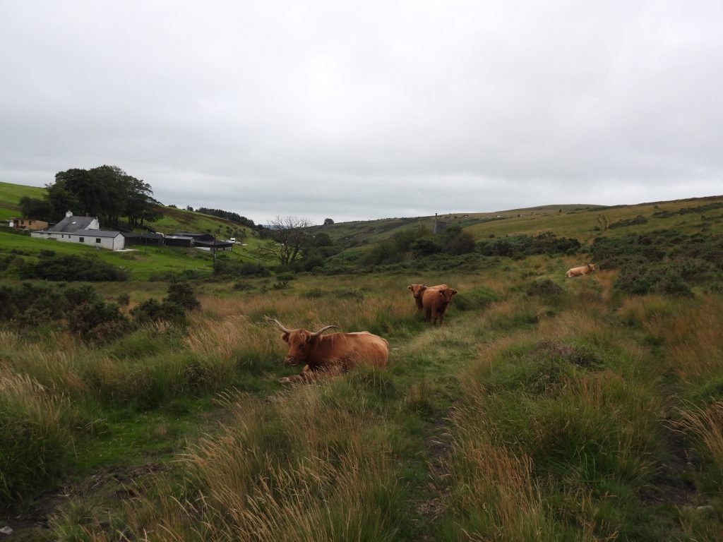
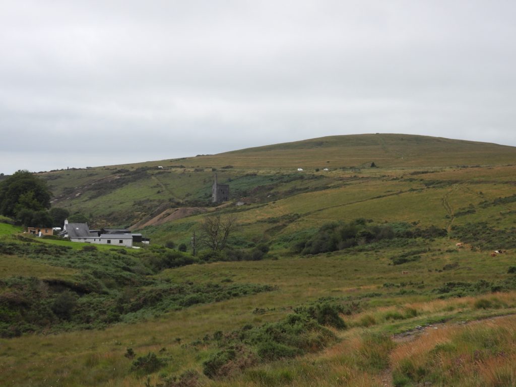
Sketch map of the locations of Cholwell Boundary StonesView of Wheal Betsy from Kingsett Down with scaffolding being erected. The engine house / chimney was built from locally quarried and roughly dressed granite in 1868 to house a Cornish beam pumping engine. The engine house remained in use until the mine closed in 1877. The mine itself produced lead, copper, silver, arsenic and zinc and was known variously as Prince Arthur Consols, North Wheal Friendship and Wheal Betsy. Source: Historic England.The “B” / “C” stone which is not mentioned in the Dave Brewer publication (Dartmoor Boundary Markers) is located at the corner of the fenceline near the point where a footpath descends from Kingsett Down to Cholwell Brook. Close up of “B / C” Stone (1) with the “B” inscription facing southThe “C” inscription on the “B / C” Stone (1) on its north face. To be fair to Dave Brewer, he would not have had access to the National Library of Scotland maps (side-by-side) and this stone is hidden behind quite substantial gorse bushes. “B / C” Stone (1) can be found at SX51333 81113. “B / C” Stone (2) is the boundstone mentioned (and photographed) by Dave Brewer in Dartmoor Boundary Markers (2nd edition). “B / C” Stone (2) is 18 inches (0.45m) tall and on a clear day there are great views to Wheal Betsy with Gibbet Hill beyond. Close up of “B / C” Stone (2) with its mud makeover, showing the “B” inscription which faces east (towards Kingsett Down). “B / C” Stone (2) with a mud makeover, showing the “C” inscription which faces west, towards Cholwell enclosures. “B / C” Stone (2) can be located at SX51349 81228.A well recognised view with Wheal Betsy engine house / chimney in the foreground and Cholwell Farm (which is now a very popular riding stables)To the north west of Cholwell farm lies a fenced off enclosure which is marked as “Mary Tavy Reservoir” on OS maps from circa 1949. It doesn’t feature on 19th century or early 20th century maps.Looking down the Cholwell valley with some local residentsCholwell Valley with Gibbet Hill beyond, being bisected by the A386.