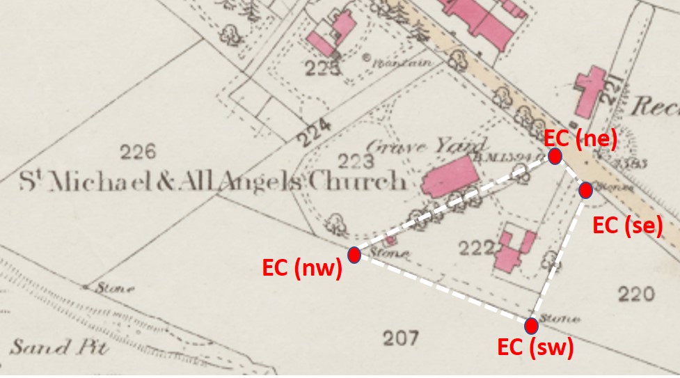
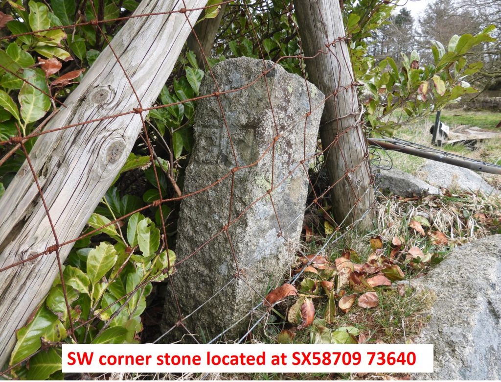
In 1860, Princetown declared a separate ecclesiastical chapel, but it wasn’t until 1868 that the parsonage (or Glebe House) was conveyed by the Duchy of Cornwall to the Ecclesiastical Commissioners under the Church Buildings Act. The adjacent buildings (three cottages) to Princetown Church had been built in around 1813 and under the act in 1868 were: “to be appropriated as and for the residence or site for the residence of the Minister who may serve the Church of Princetown”. This was purely the buildings and garden (the original Glebe lands extended over some 42 acres from the prison boundary in the west to the Plymouth 15 / Moreton 13 milestone in the east). The boundary was defined by four boundstones, which had the letters “EC” (Ecclesiastical Commissioners) carved in relief within small sunken panels. The souce of information for this post obtained from Dartmoor Boundary Markers (2002) by Dave Brewer and Guide to Dartmoor CD (2001) by Mike Brown.
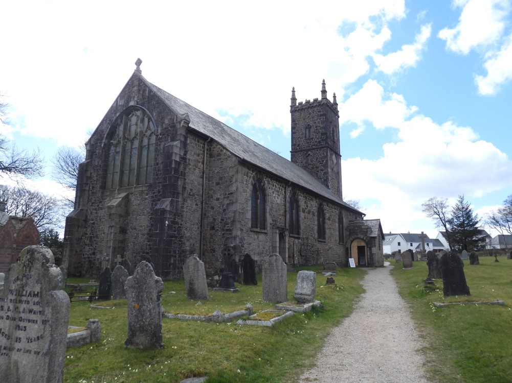
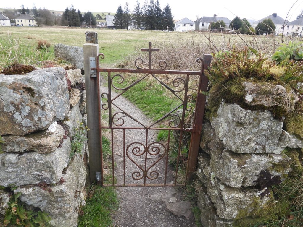
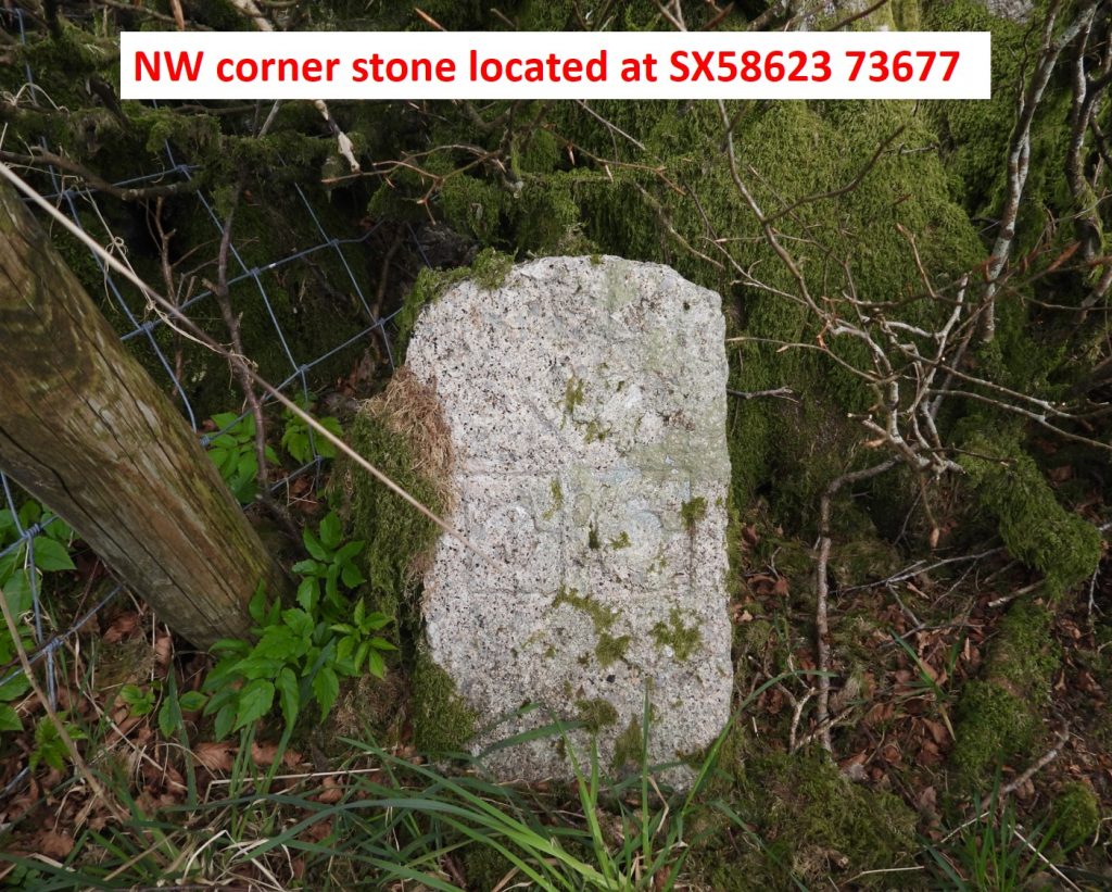
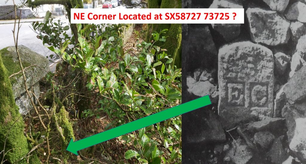
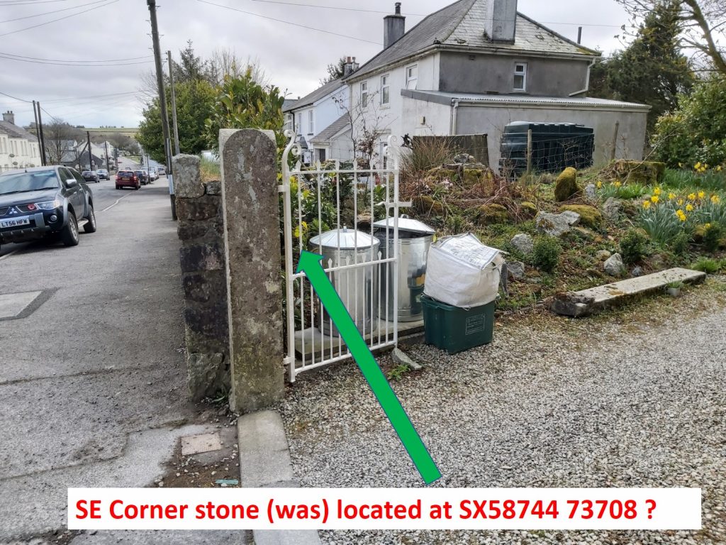
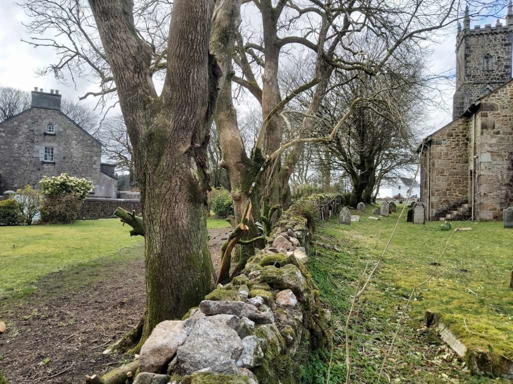
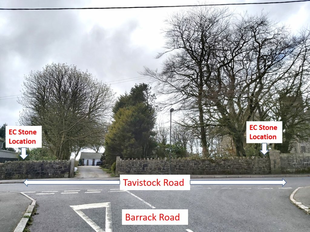
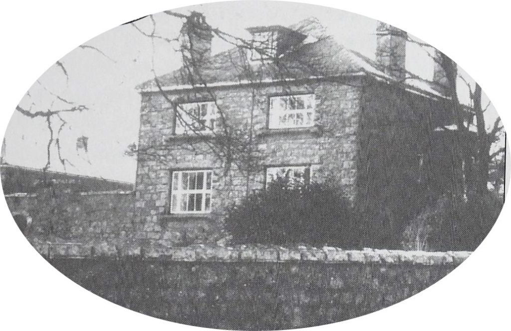
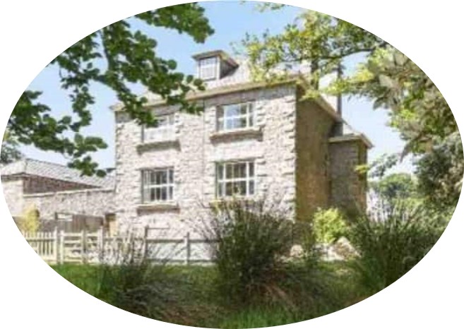
The boundary of the small plot adjoining the churchyard, marking the bounds of Glebe House, defined by the four “EC” stones.St.Michael’s and All Angels Church was started in 1810 and the shell was completed by 1814. The built was assisted between 1812-14 by prisoners captured in the Napoleonic Wars with France, and the War of 1812 with the United States – they were held at Dartmoor prison. The church was declared redundant on 1 November 1995, and was vested into trust in early 2001. The Glebe House can’t be seen in this picture and is to the left (south west) of the church.Access to the westerly “EC” boundstones can be gained through a field, either via the churchyard and passing through the rear gate, or from the North Hessary track and through the gate in the field wall. The picture shows the rear gate from the churchyard.The “EC” stones are approx. 9″ (23cm) in section. The north west corner stone is approx. 2 feet (60cm) tall.The south west corner stone is approx. 3 feet (90cm) tall.The north east corner stone couldn’t be located by the author (in spite asking someone at the property). The black and white of the stone is from the Dave Brewer book and is described as being approx. 1 feet (30cm) tall. It is possible that it is still in situ beneath the undergrowth in this corner of the plot of land.The south east corner stone couldn’t be located by the author or Dave Brewer (who described the location as “under a pile of stones and turf”).The boundary in 2021, with the church on right and old Glebe House on left.Location of the east boundary taken from Barrack RoadPicture of the old Parsonage (aka Chaplains House) or Glebe House from circa 2002Picture of the old Parsonage (aka Chaplains House) or Glebe House from circa 2017