A collection of walks, discoveries, insights and pictures of exploring Dartmoor National Park
November 27, 2021
Creason Wood Environs – an exploraton
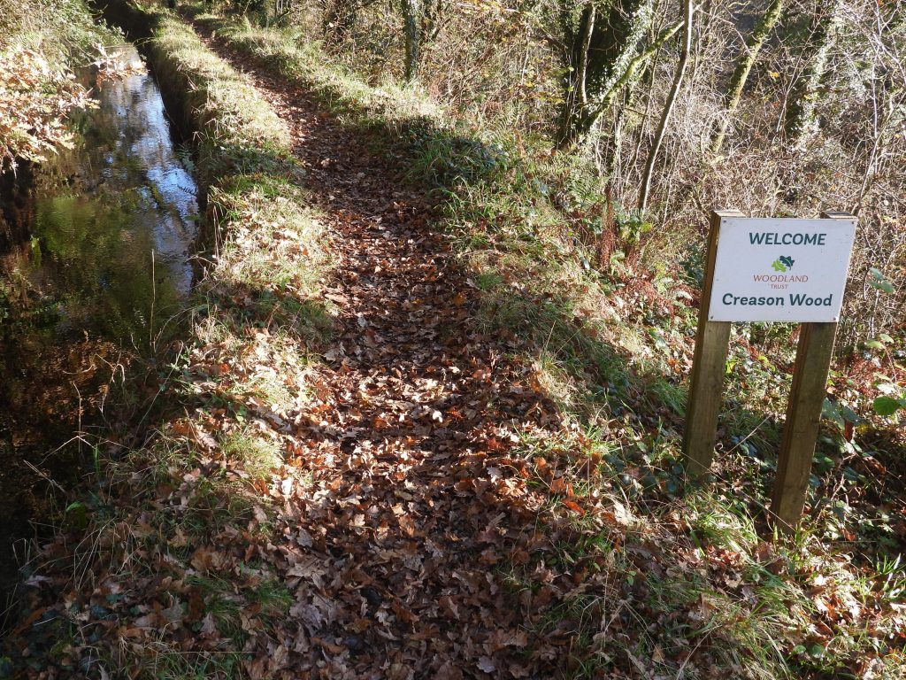
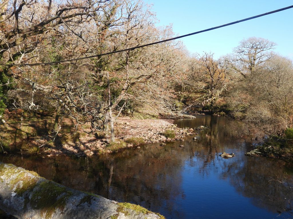
Creason Wood lies on the slope of the banks of the River Tavy and is owned by the Woodland Trust. It is described as being predominately middle-aged, principally of Sessile Oak standards with a few small pockets of planted conifer. The main path through the wood is alongside the mine leat leading from Hill Bridge through to Horndon Lane. The leat continues through farmland to Mary Tavy hydro-electric power station downstream. Additionally, there is a (non sign-posted) path which can be followed alongside the river. This post covers some of the main features in this area, which is approx only 1km sq. in size. Walking directly between the mine leat and the river Tavy is not advised as the ground is very wet and sodden and covered in tree branches and overgrown vegetation.
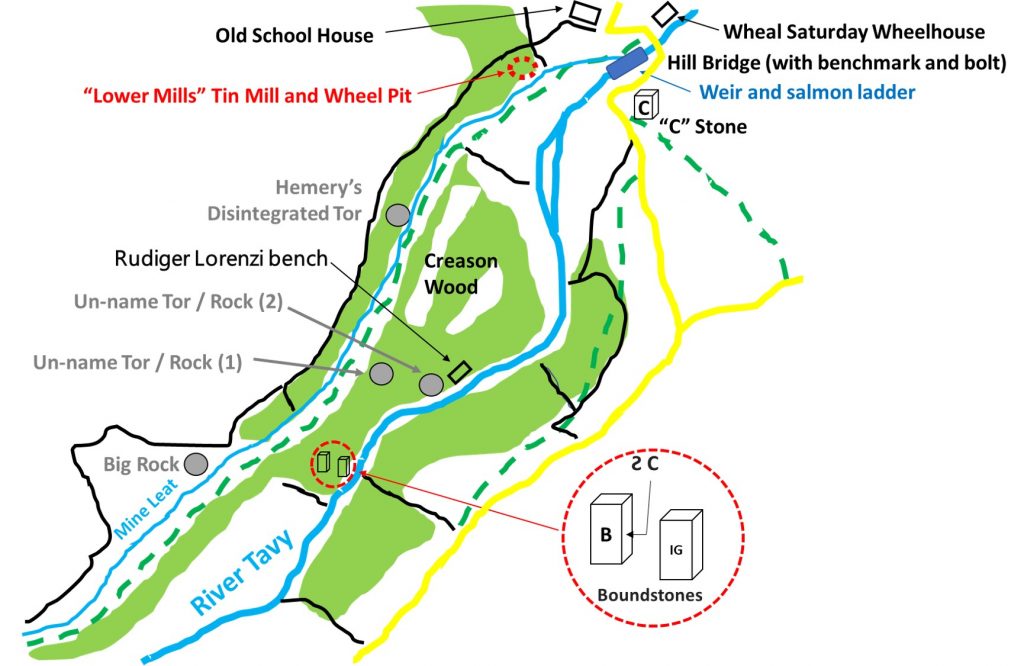
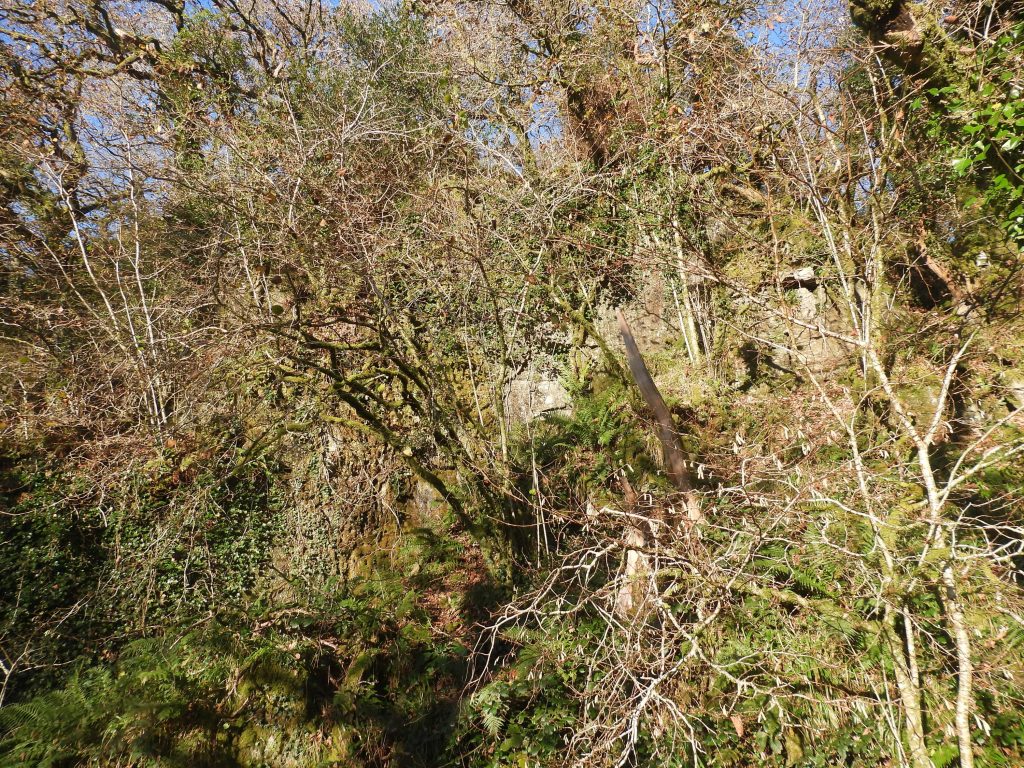
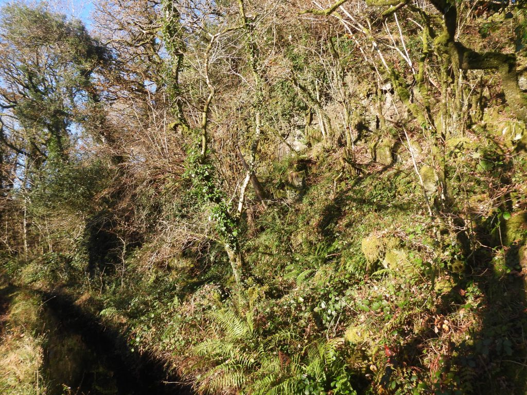
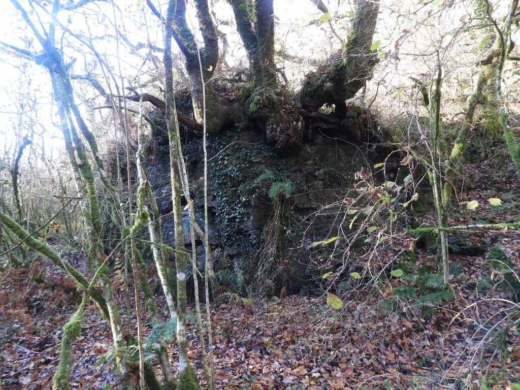
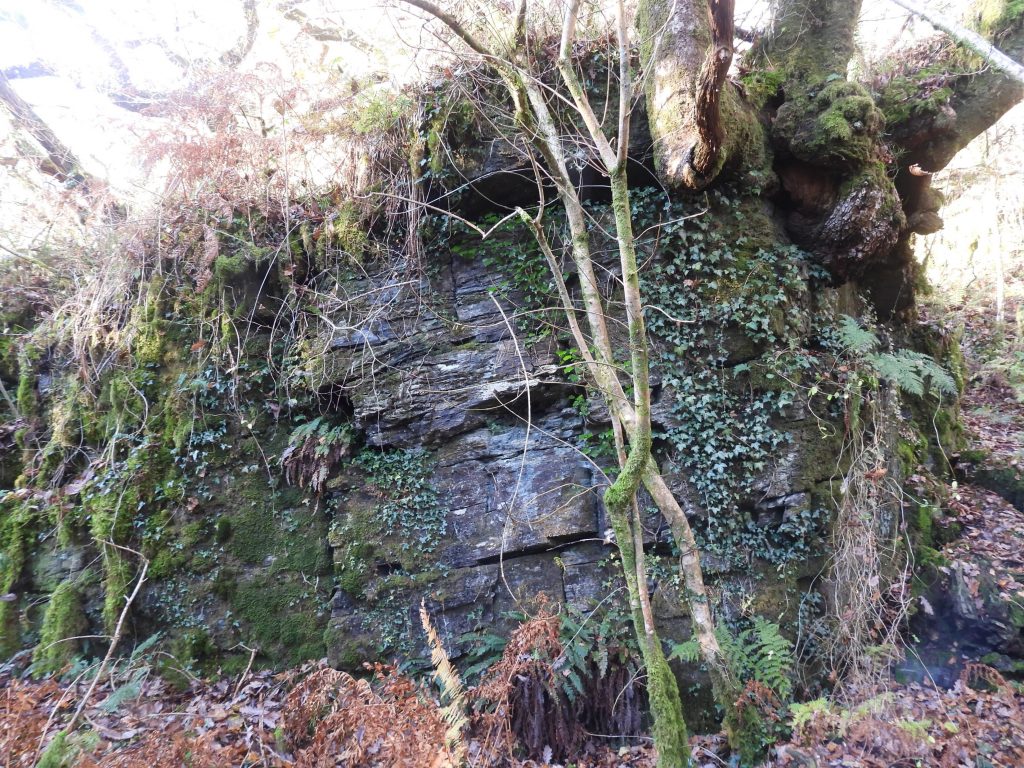
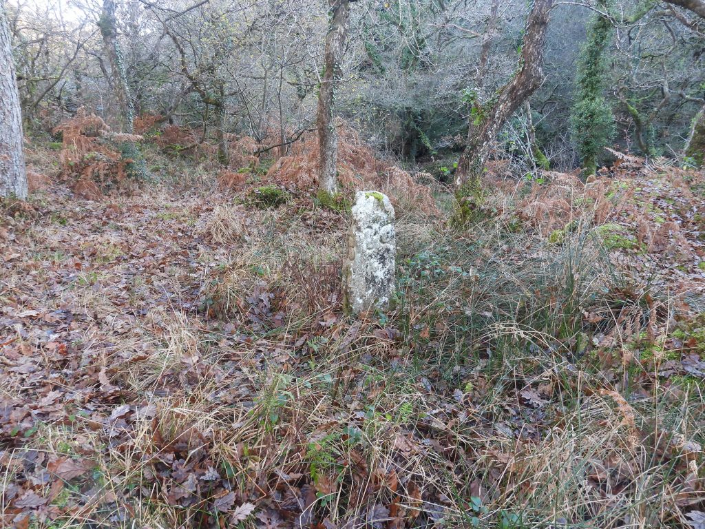
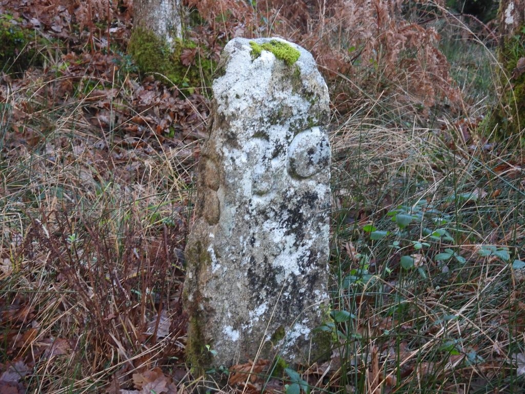
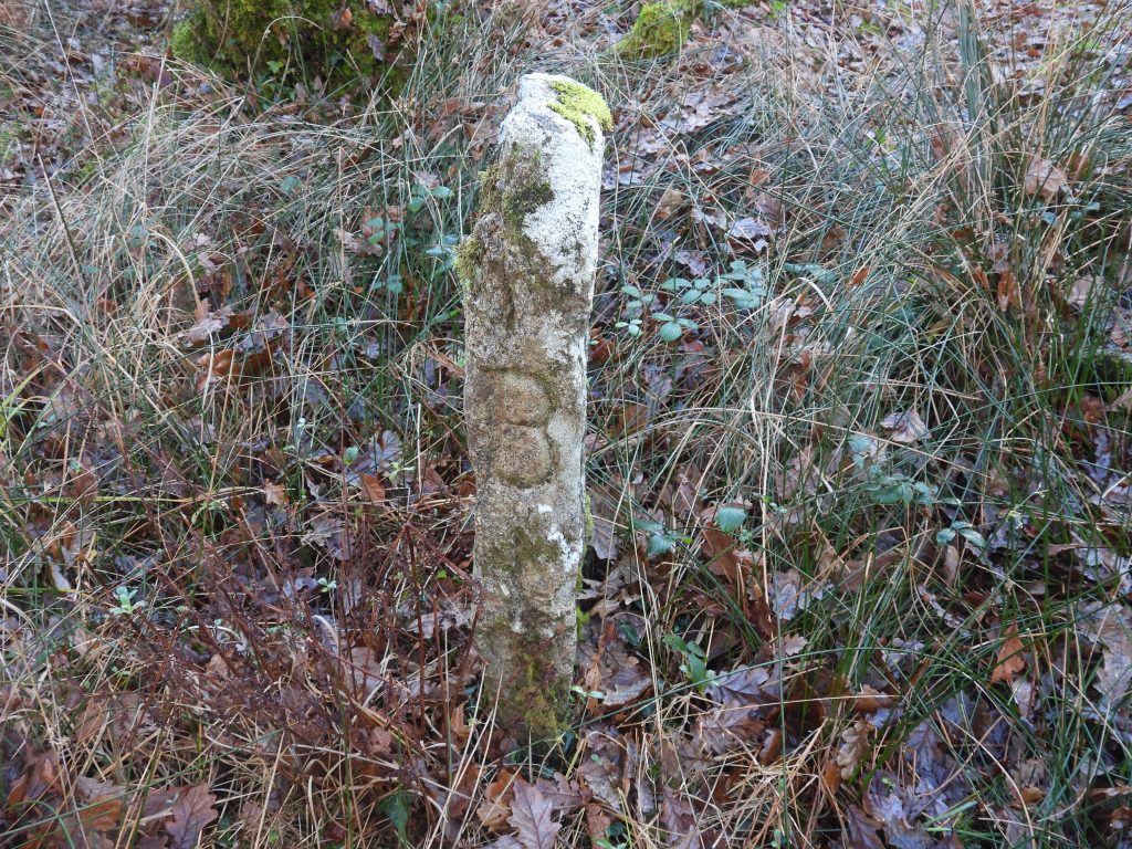
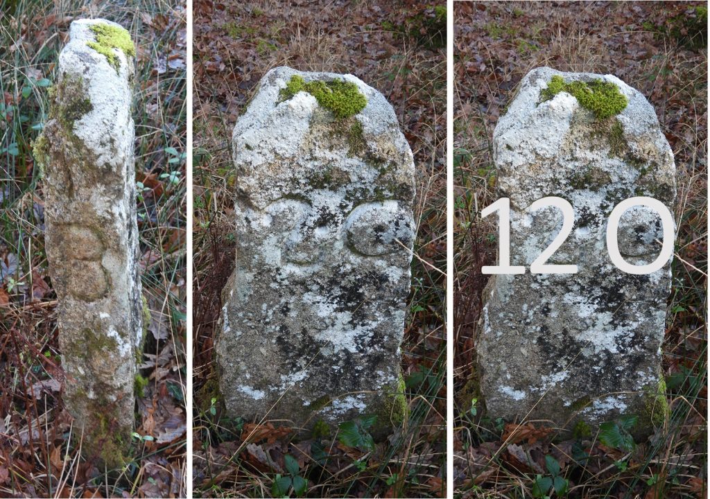
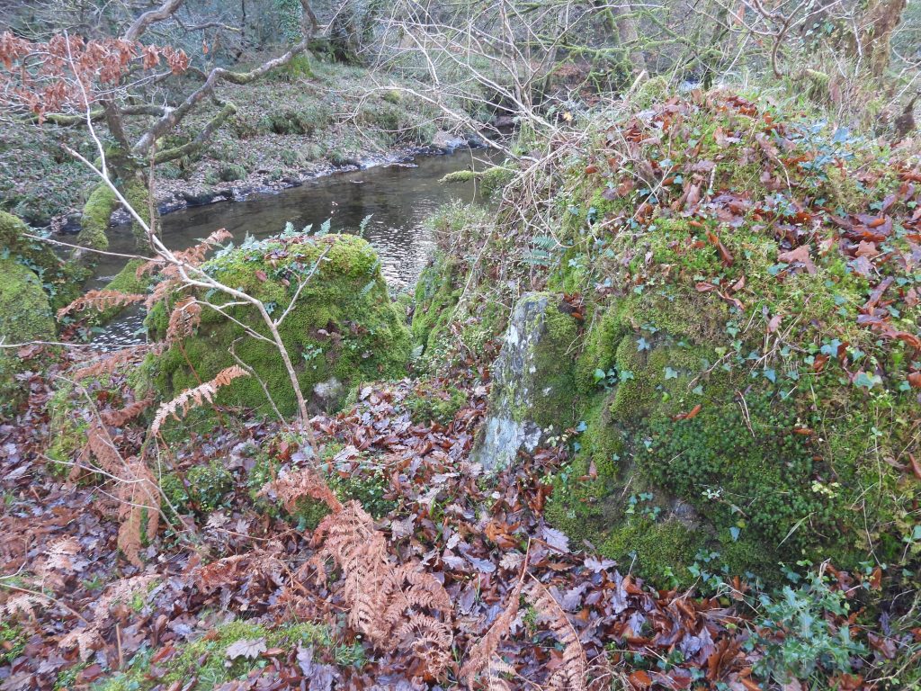
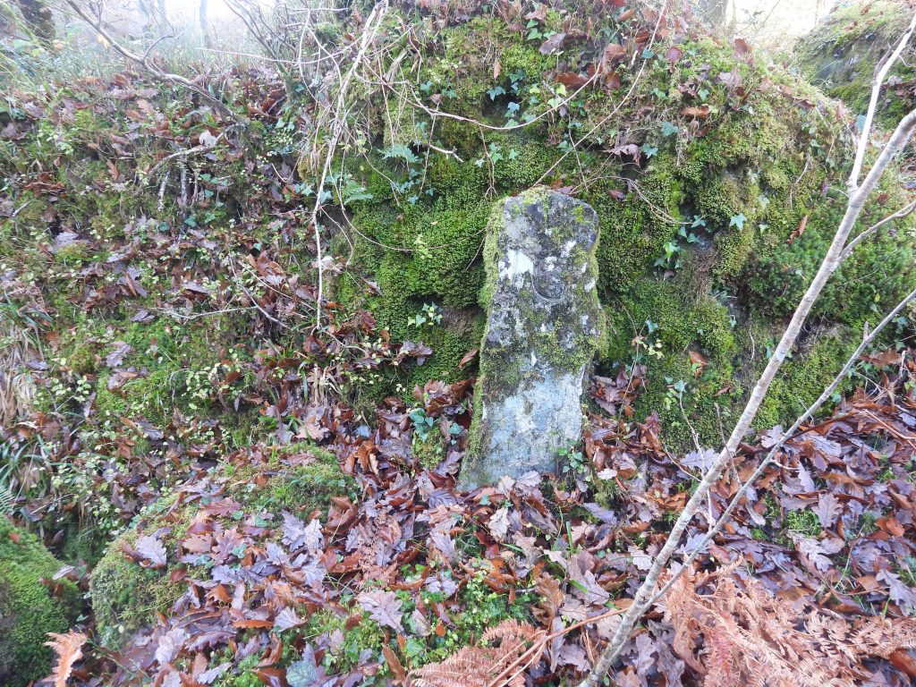
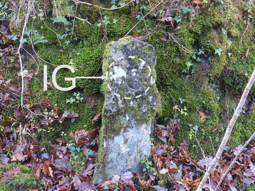
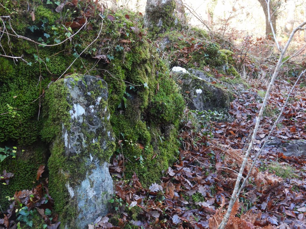
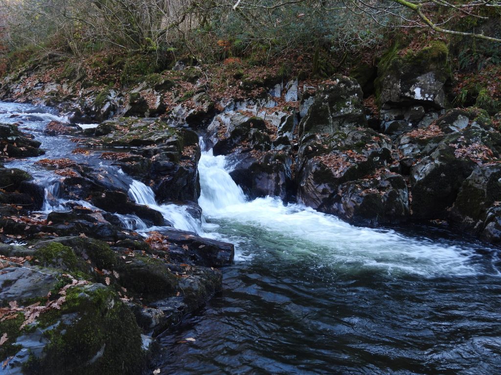
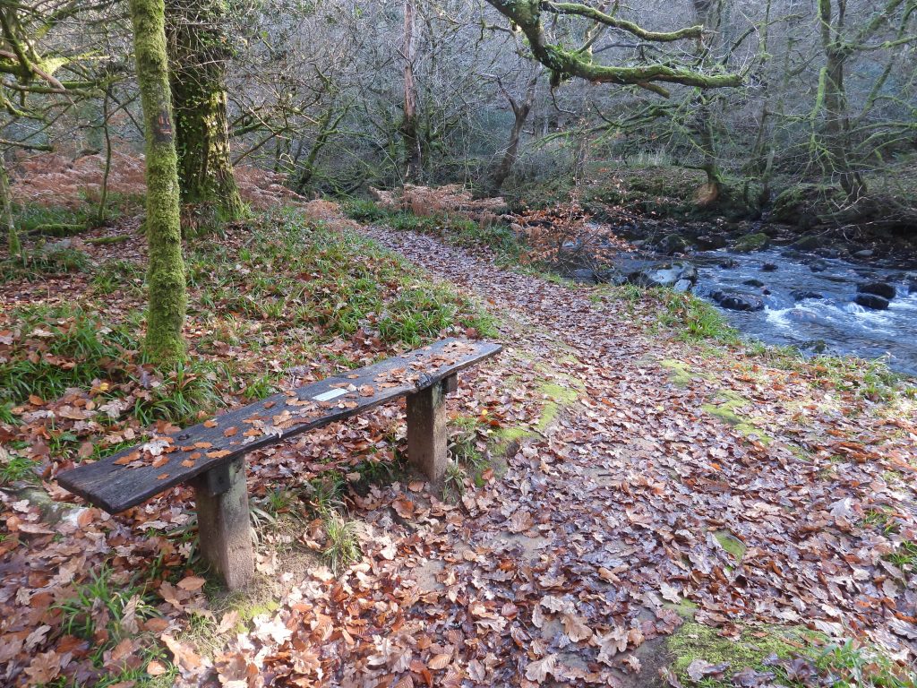
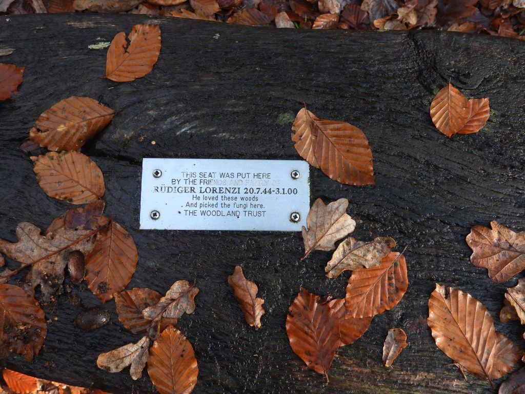
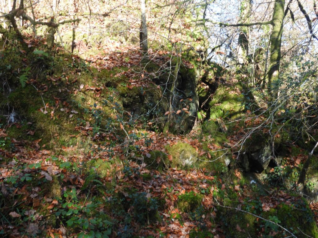
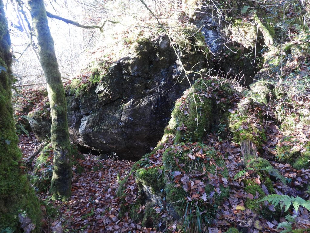
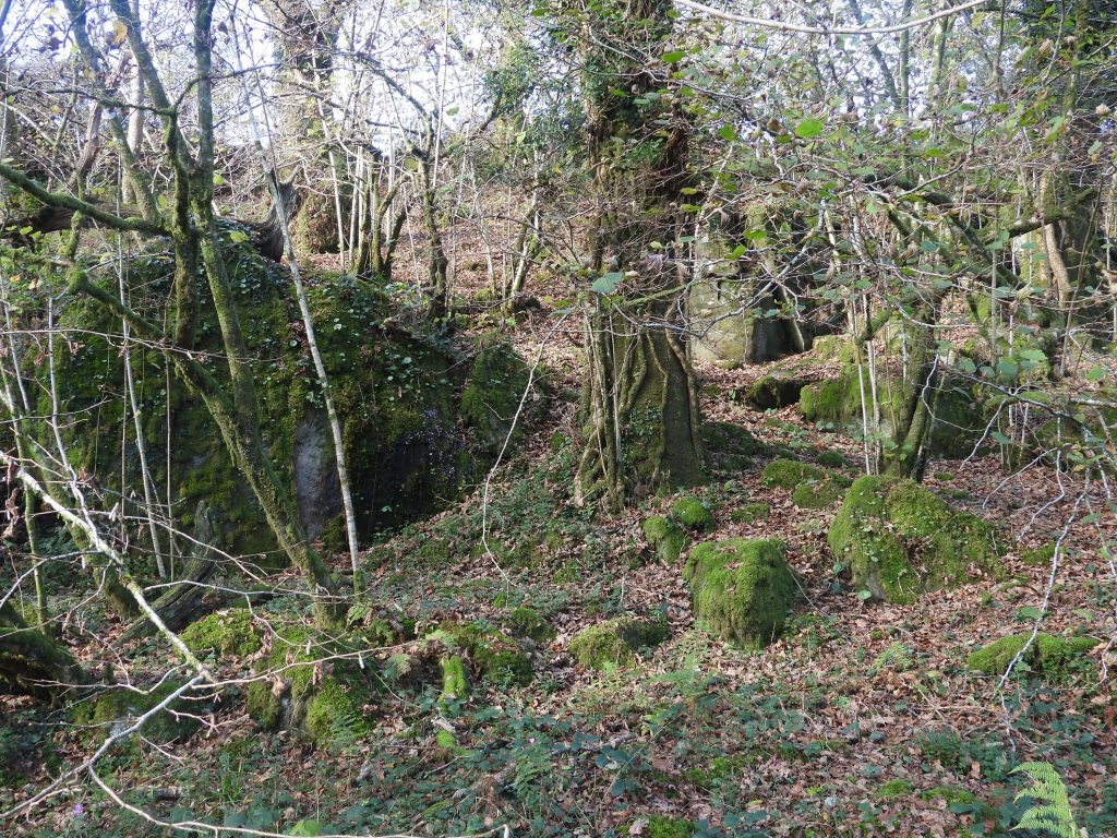
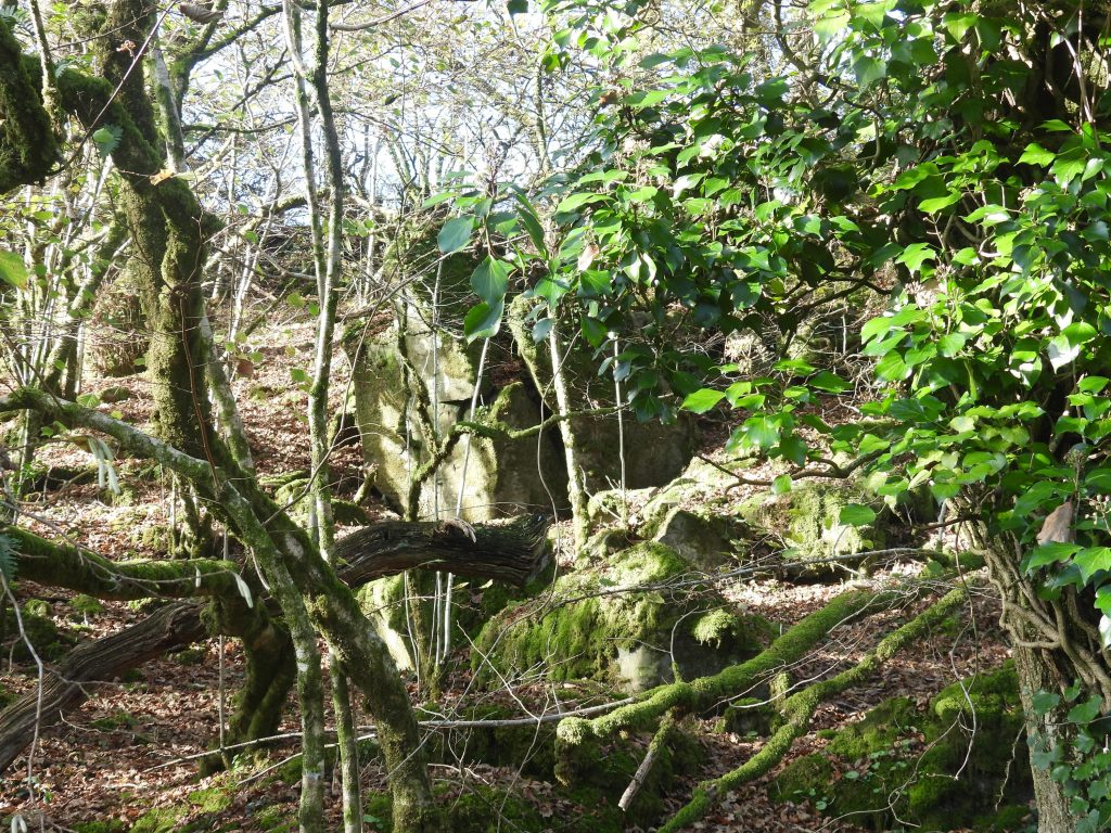
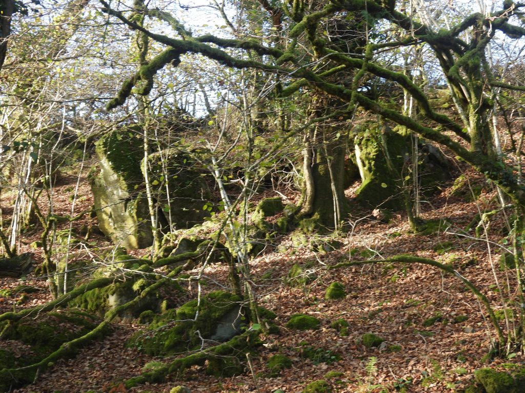
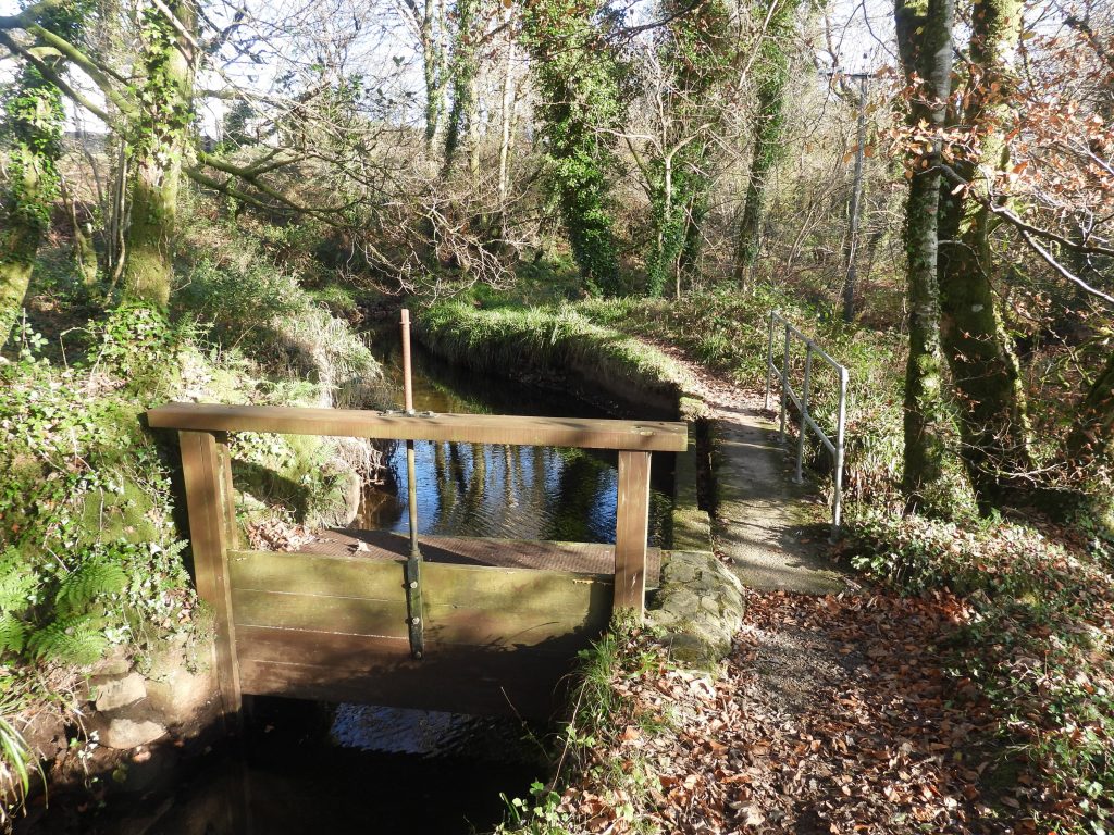
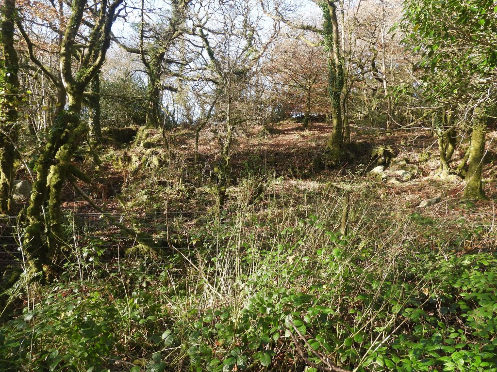
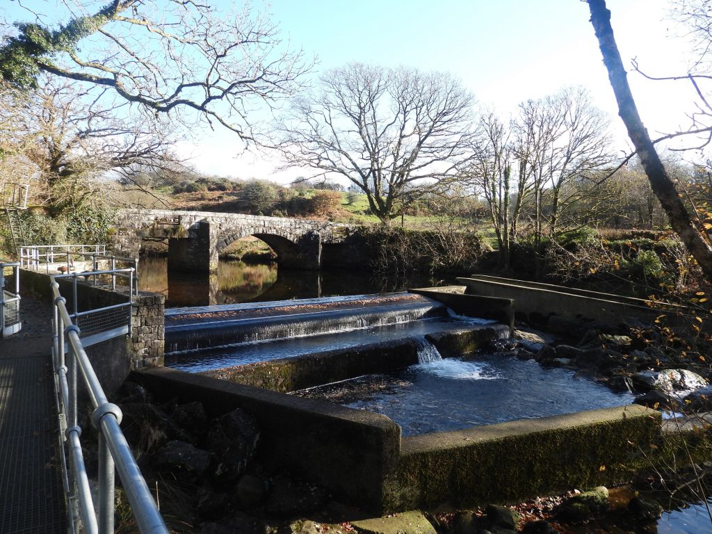
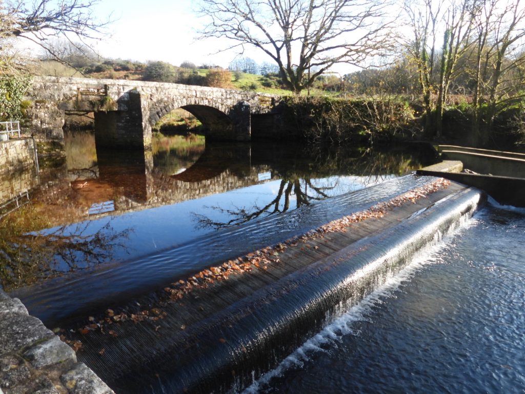
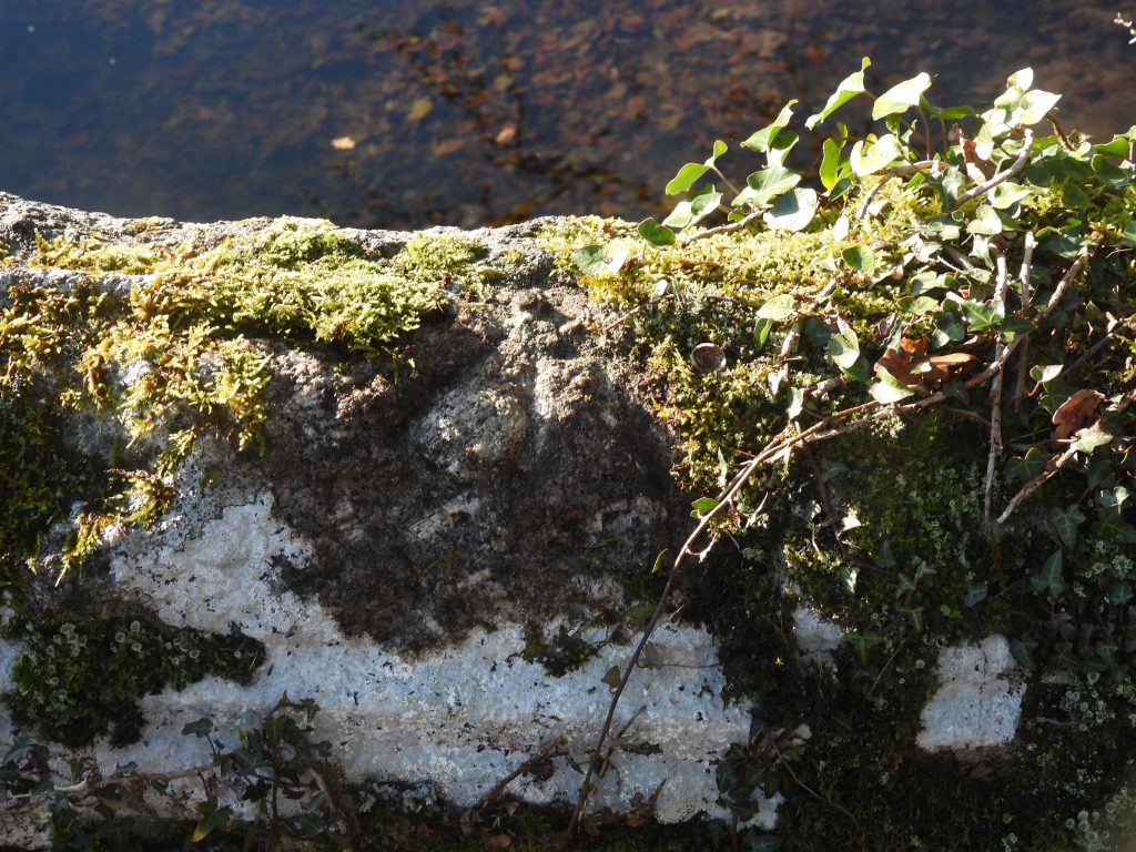
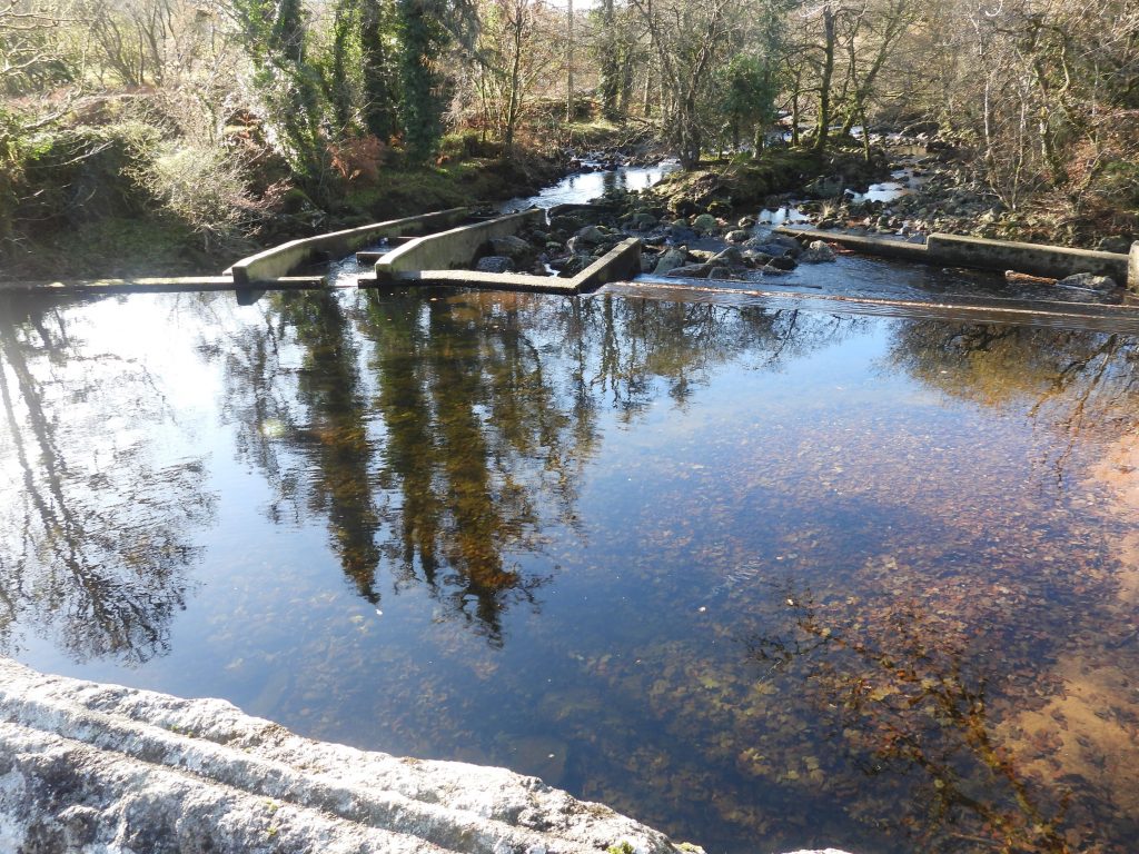
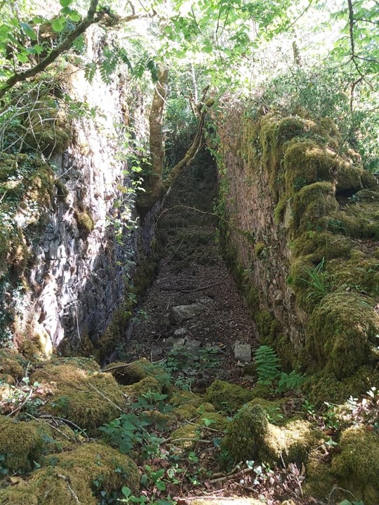
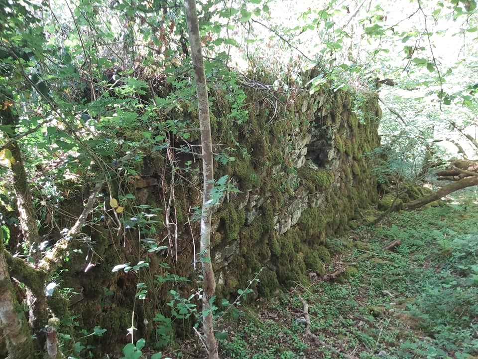
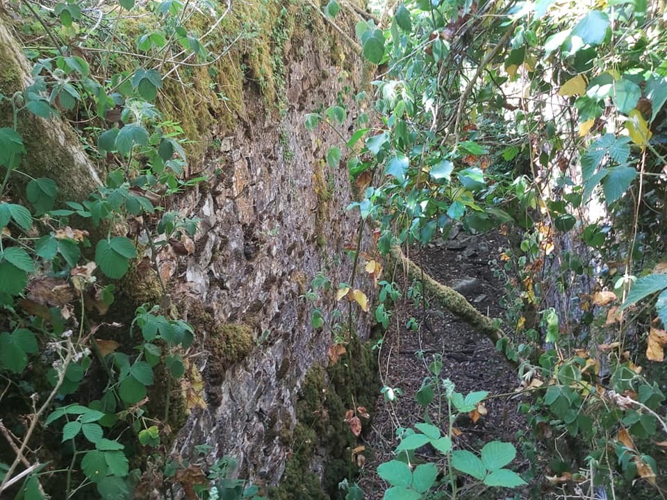
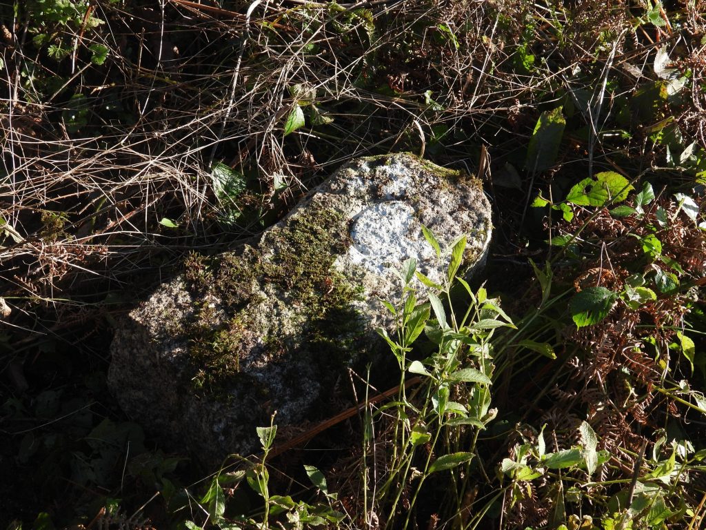
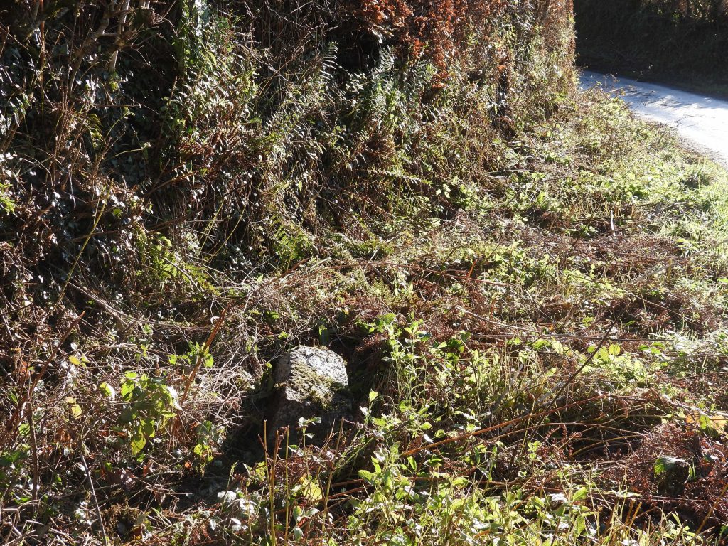
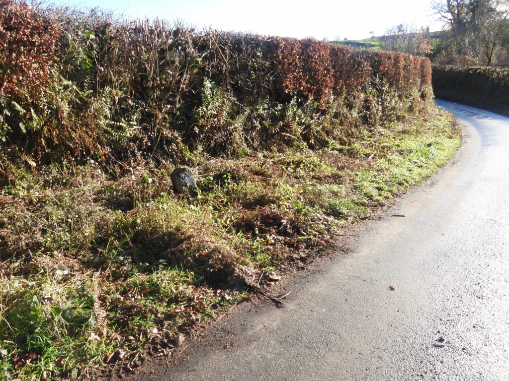
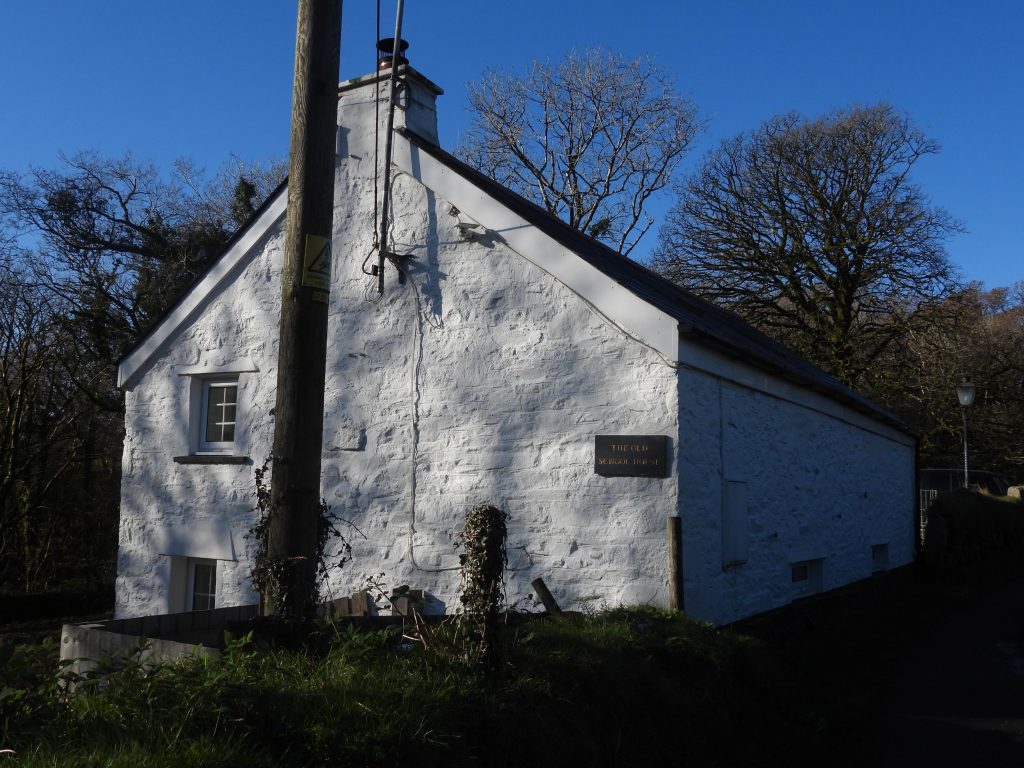
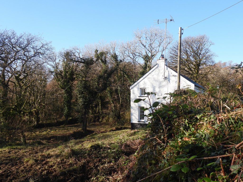
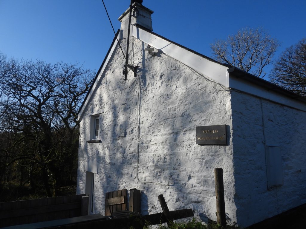
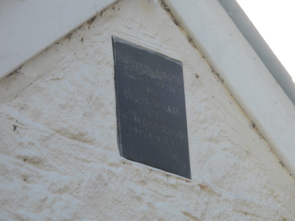
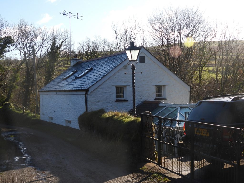
Sketch map showing the approx. location of features covered in this post. NOTE: The un-named Tor / Rock (1) lies in deep undergrowth and is difficult to access, Lower Mills is on private land and Wheal Saturday now has a barbed wire fence preventing access.Welcome to Creason Wood – sign is on the southern boundary coming in from Horndon Lane alongside mine leat. The leat is one of two sources of water for the Mary Tavy power station (built in 1930’s). The leat feeds Wheal Bennetts reservoir before entering a 36in pipe and descending the 230 ft to the station to feed #1 plant. Originally water from the leat would have been usedto feed the south area of the Wheal Friendship complex in Mary Tavy.Lower sections / outliers of “Big Rock” which lie close to the mine leat on its north west side.Eric Hemery, described in his book, Walking the Dartmoor Waterways (page 51); “At the south end of Creason Wood a huge crag towers above the leat known locally as ‘Big Rock’, this forms a dramatic climax to the glen upstream.” More information can be found at: https://www.torsofdartmoor.co.uk/tor-page.php?tor=big-rockUn-named Tor / Rock (1), just below the Leat – difficult to access due to the high embankment on the leat path.The author is unsure if this outcrop has a name but Lower Creason Wood Tor / Rock might fit? It can be found at SX52870 80009.Within 100m of the River Tavy lies two boundary stones mentioned by Dave Brewer in his Dartmoor Boundary Markers book, second edition book (2002) on pages 196/7. The stone furthest from the river is just over 1m high and is inscribed on two of its faces. The boundstone is located at SX52820 79901.The south face of the stone appears to be inscribed with “Ƨ C “ on its south side and “B” on its western side. Dave Brewer speculates that this is a stone which has been re-purposed.The “B” on the western face has been cut on a relatively smooth face. It is suggested that “B” stands for either “Buller” or just “Bounds”. John Buller esq. was a considerable land owner in the area with extensive mining interests around Mary Tavy.Dave Brewer in his publication speculates that the “Ƨ C” could actually be “12 O” meaning 12 miles from Okehampton, with the “1” missing (where the “B” is now inscribed) and the end of the “C” missing from the original “O”. His theory is based upon the fact that the original “12 O” stone that used to be sited in Mary Tavy was missing and that other milestones in the Dartmoor environs (from old drawings) also appear to the a “lazy 2” which looks like an “Ƨ”. Thus, could this boundstone have formally been a turnpike stone which has been re-purposed?The second boundstone in the area is approx 20-30 metres nearer the river from the “Ƨ C / B” boundstone. It can be found at SX52829 79891.This boundstone is very round set and is inscribed on its north face.The boundstone is inscribed “IG”. Dave Brewer states that the land between the line of the stone and Horndon Lane was given to help support the needy of Horndon.The reason or meaning behind the inscription “IG” is unknown.Small waterfall on the River Tavy to the north of the “IG” inscribed stone.This bench is dedicated to Rudiger Lorenzi and is located at SX52936 79982.The plaque of the Rudiger Lorenzi bench, which is inscribed: “This seat was put here by the friends and family of RUDIGER LORENZI 20.7.44 – 3.1.00 He loved these woods And picked funghi here. THE WOODLAND TRUST”A second un-named Tor / Rock is located near the bench dedicated to Rudiger Lorenzi. The author is unsure if this tor / rock has a name but Lorenzi Tor / Rock seems fitting?This outcrop can be found at SX52938 79981.This small ruined tor is also described by Eric Hemery in his book on Walking the Dartmoor’s Waterways. Hemery’s description states: “A concrete bridge between field paths is succeeded by another cascading affluent under the rocky hillside right. This soon becomes higher and the left bank steeper as the leat enters Creason Wood. There is enchantment in this ancient woodland of time and storm battered oaks with twisted trunks and limbs swathed in epiphytes. The hillside above the leat is spattered by the clitter of an almost totally disintegrated tor”. Taken from page 51 “Walking the Dartmoor Walkways” More information can be found at: https://www.torsofdartmoor.co.uk/tor-page.php?tor=creason-wood-torThere are several sluice gates to be found along the route of the mine leat.Just to the west of the mine leat near to Hill Bridge and the Old School House (on private land) lie the ruined remains of a building approximately 10 metres by 5.0 metres, with a possible wheelpit on the south-western side. Tin slag was found in the vicinity of the wheelpit in 2019, confirming its likely identification as a former tin mill. The author couldn’t access or explore the area further as it was fenced off. Taken from the Dartmoor HER: “The Tithe Apportionment records ‘Lower Mills’ for this plot (295). The site is very likely to be that of a mill as it lies beside a packhorse track leading to Lower Creason and close to Hill Bridge over the River Tavy. A tin mill is also probable as Chilly Wood nearby contains extensive tin streaming”.The weir at Hill Bridge was originally 19th Century, the one in the picture was constructed circa 2000.Hill Bridge is described as being a substantial 19 Century bridge of central arch flanked by lintels made from semi-ashlar granite construction throughout with carved coping stones.Benchmark and rivet on the south west parapet of Hill Bridge.View of the River Tavy salmon ladders next to the weir on the south side of Hill Bridge.Looking upstream from Hill Bridge. Wheal Saturday wheel house / pit is amongst the trees on the far left of the photograph.Wheal Saturday wheel house / pit. The wheel is said to be 40′ in diameter. NOTE: The photographs were taken before the area was fenced off near Hill Bridge, so there appears to be no access now Wheal Saturday – Side of wheel house / pit. The indentation in the wall appears to have been caused by a tree growing in the wall on the other side Another (leafy) view of the wheel house / pit.Recumbent “C” (County) stone on the east side of Hill Bridge. This stone represents that the bridge was either constructed by the county or taken over by them and henceforth maintained by them and sited within the County of Devon. There are usually two stones (one each side of the bridge). “C” stones date from around 1841.It is possible that this “C” stone was amongst a lot of undergrowth and was knocked over when the vegetation was cleared ?The “C” stone was placed upright by the author, but will easily fall over again if not properly set into position.“This building was constructed in 1856 as a chapel of ease. Up until 1872 the only schools in the area were at Peter Tavy and Mary Tavy, which were hard to reach for the children living at isolated farms in the area so The Managers’ Committee of Peter Tavy School raised subscriptions to support a school to be held at Hillbridge Chapel”. Source : Mary Stanbrook, Old Dartmoor Schools Remembered More information from the Mary Stanbrook publication: “There was only a single room to accommodate 30-40 children, some as young as 3 years old. Attendance could be poor and this affected the mistresses (already low) wages. Mrs Elizabeth Ladd was school mistress from 1906 until the school closed in 1924 and she lodged at Wapsworthy with her three children”.In 1974 the building was sold and transformed into the two storey dwelling we see today.Plaque on the west gable end states: “HILLBRIDGE OLD SCHOOL HOUSE 1856. CHAPEL OF EASE 1872. HILLBRIDGE SCHOOL 1985. REBUILTAn interesting story from the war years: “In 1941 Hillbridge had an unexpected new lease of life due to an influx of evacuees which resulted in overcrowding at Peter Tavy and Hillbridge was reopened. Initially there were 14 pupils, rising to 45 over the following 5 years. The conditions were not much improved (still no water or electricity) but Miss Kathleen Taylor managed the children single-handedly over the next five years”.