A collection of walks, discoveries, insights and pictures of exploring Dartmoor National Park
May 8, 2022
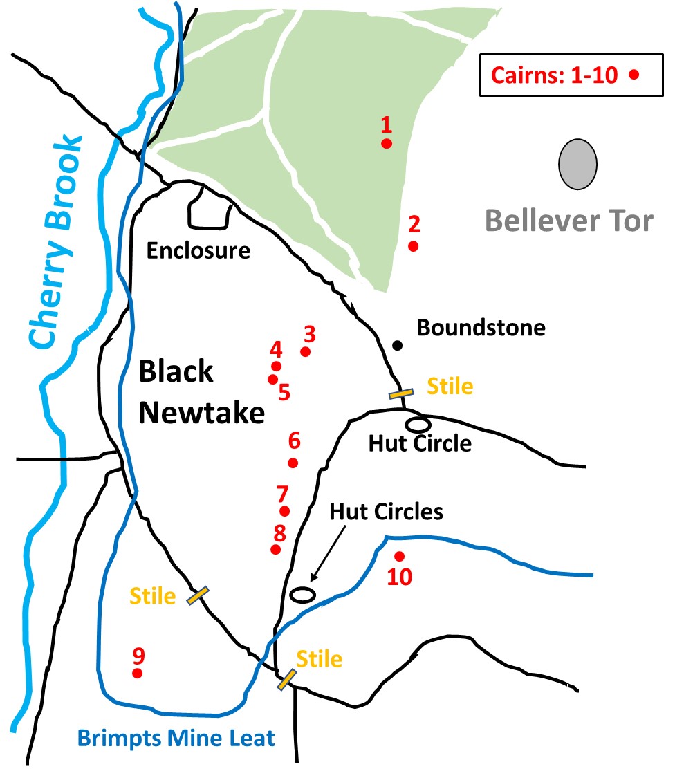
Antiquities of Black Newtake and environs
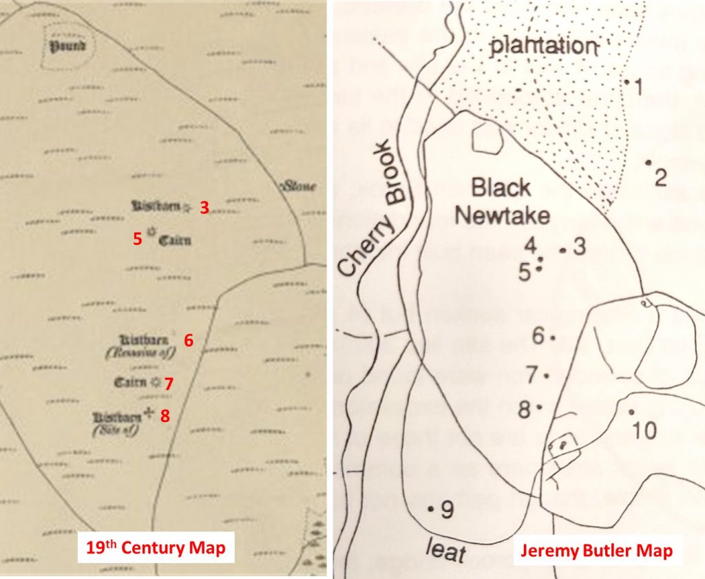
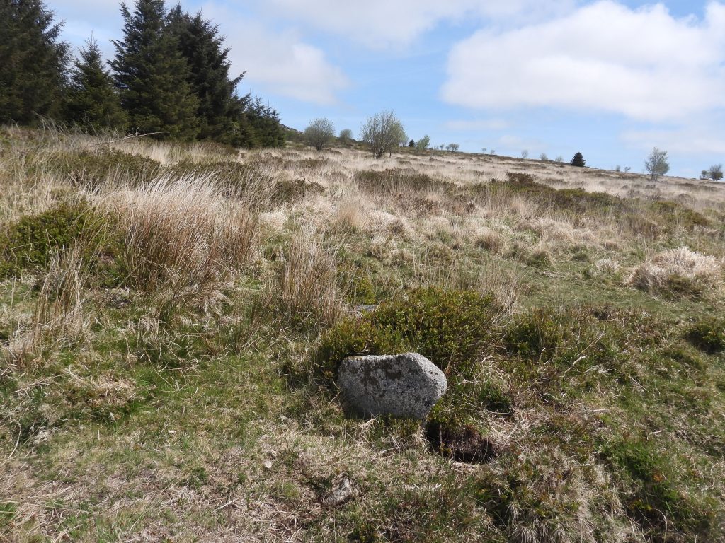
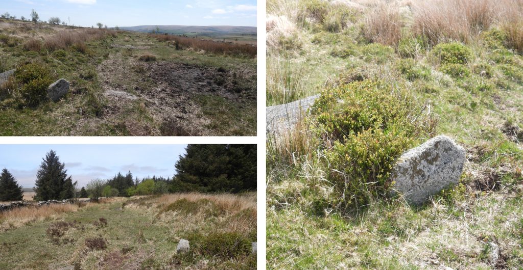
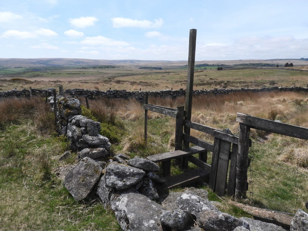
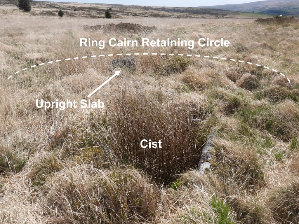
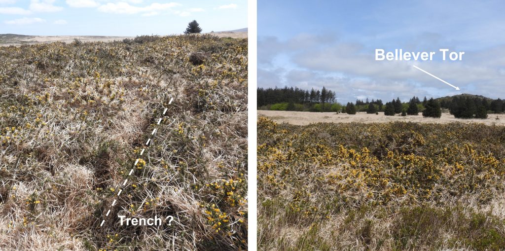
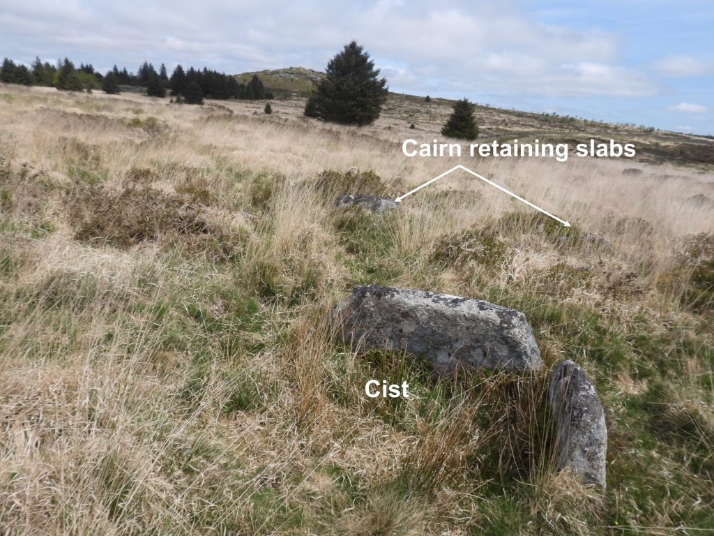
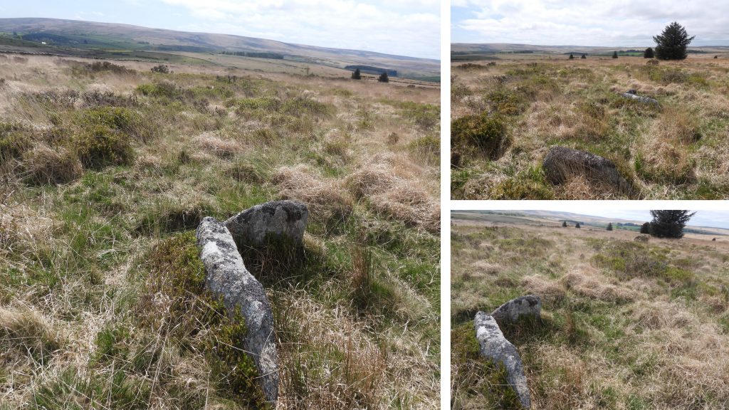
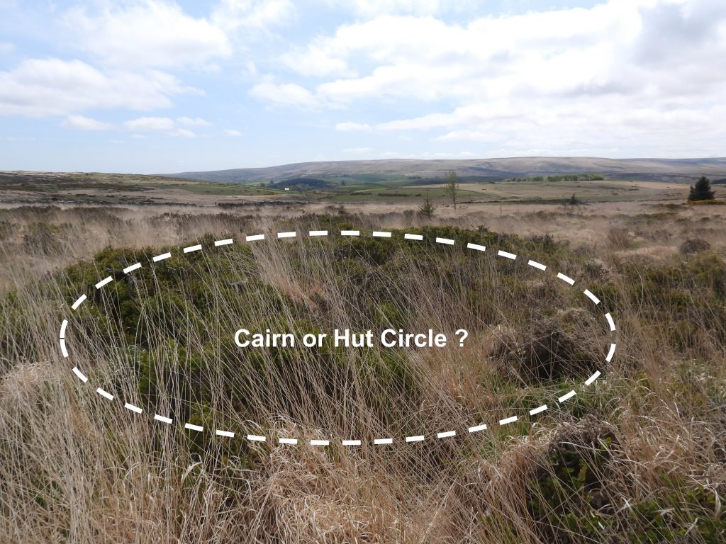
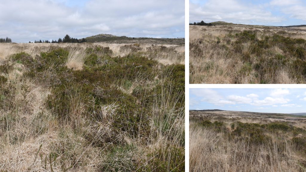
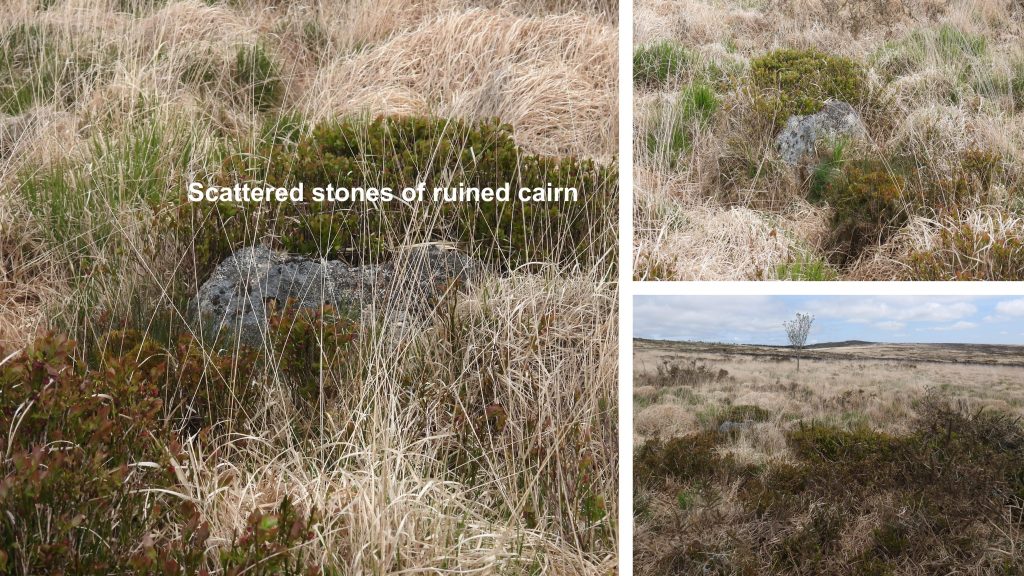
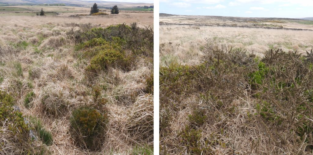
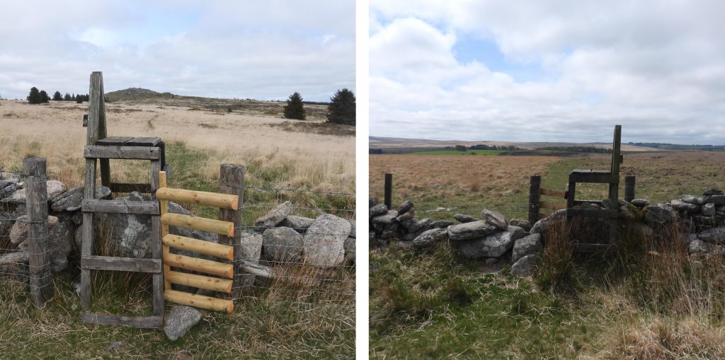
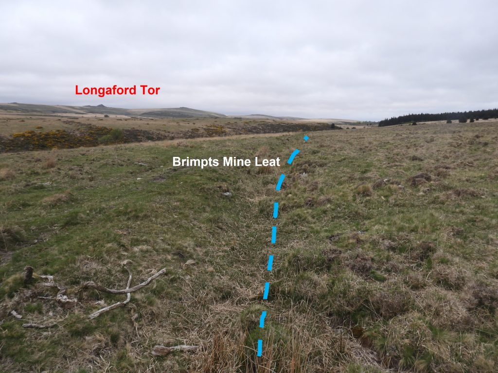
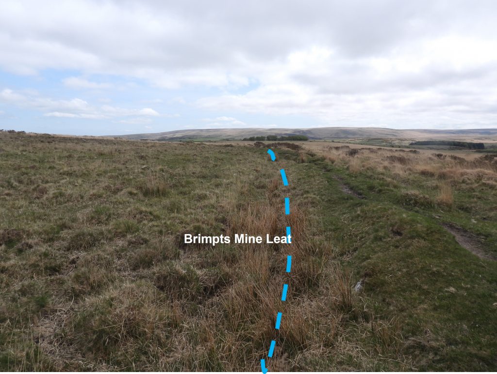
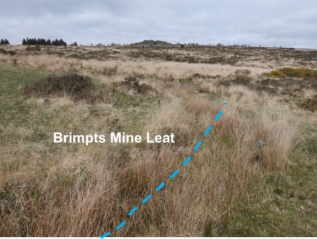
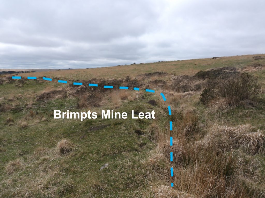
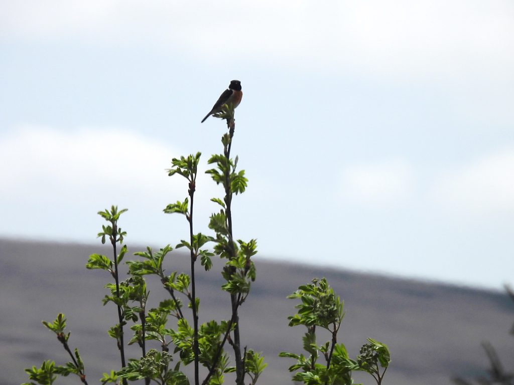
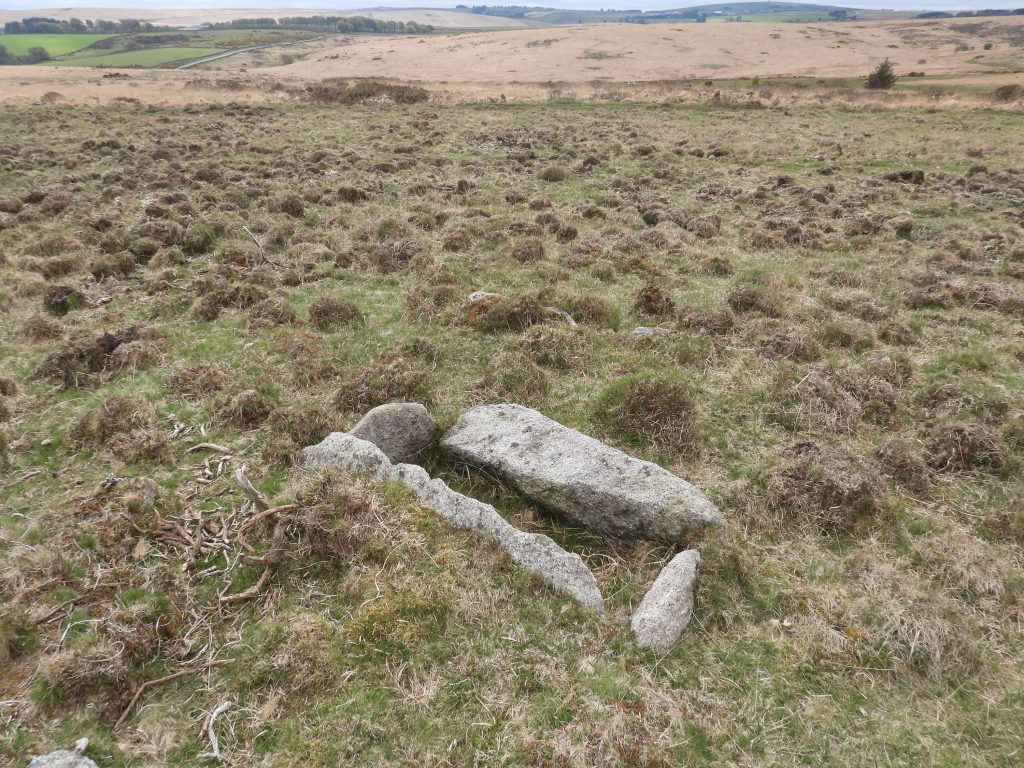
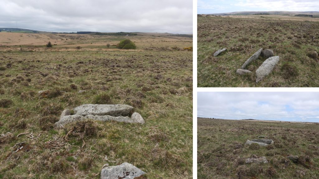
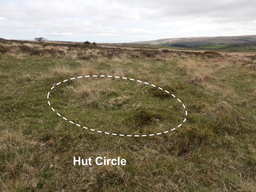
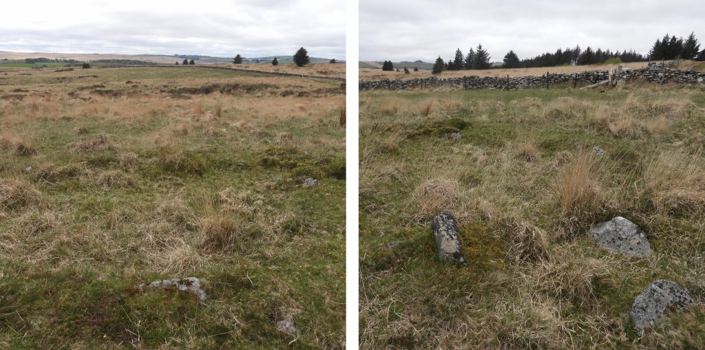
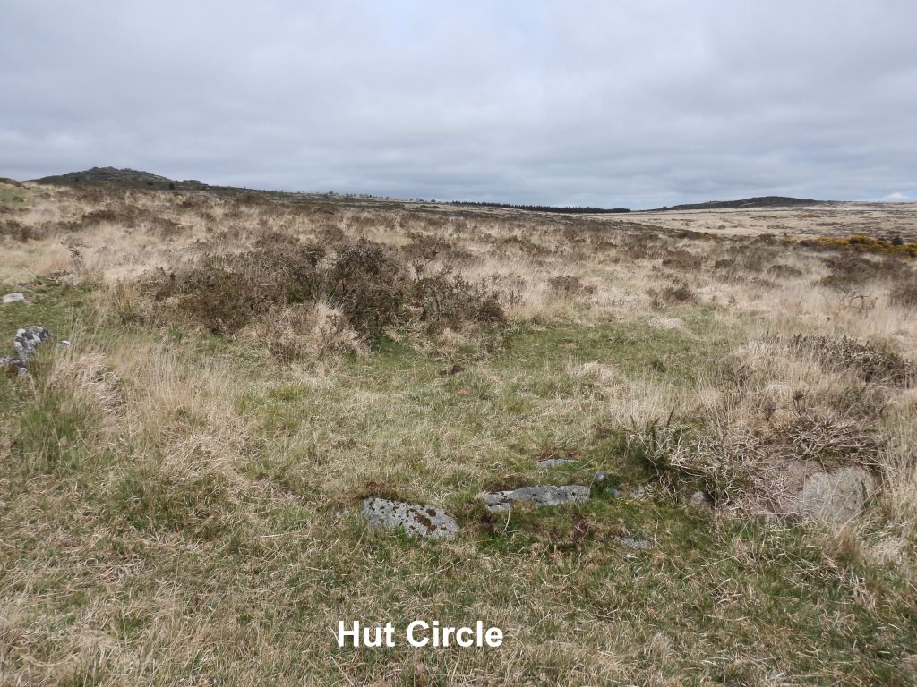
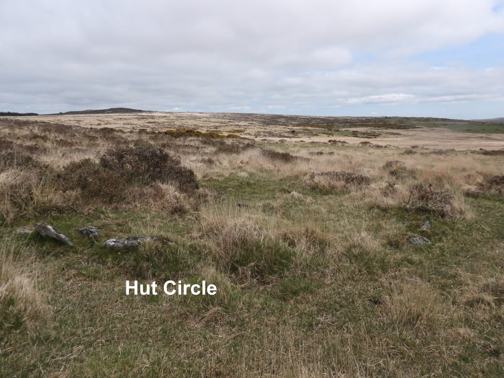
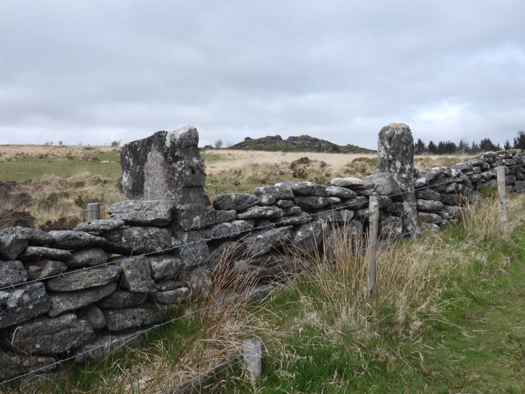
The pentalogy of Jeremy Butler books titled Dartmoor Atlas of Antiquities provides a rich source of information to any Dartmoor enthusiast. Published over 30 years ago, these books provided fabulous details of antiquities across the national park and were invaluable (especially pre-internet day) for any explorations. Volume two (the north), covers the commons of South Tawton, Belstone and Okehampton southwards to the Tavistock – Moretonhampstead road and Dartmeet. This post was inspired by map 27 (figure 27.14) within the aforementioned volume which described the distribution of cairns (and cists) to the south and south west of Bellever Tor especially inside Black Newtake. Also within the environs of Black Newtake there in a boundstone and the (now dry) course of Brimpts Mine Leat. The author was fortunate enough to see a young deer and a cuckoo whilst taking photographs for this post.
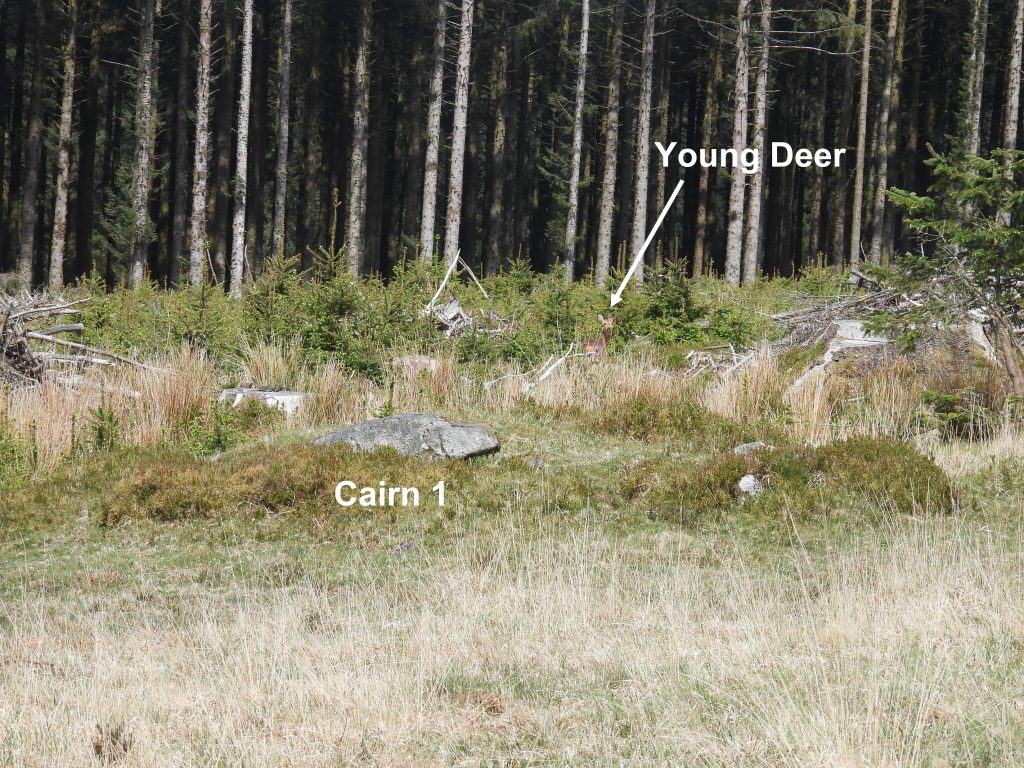
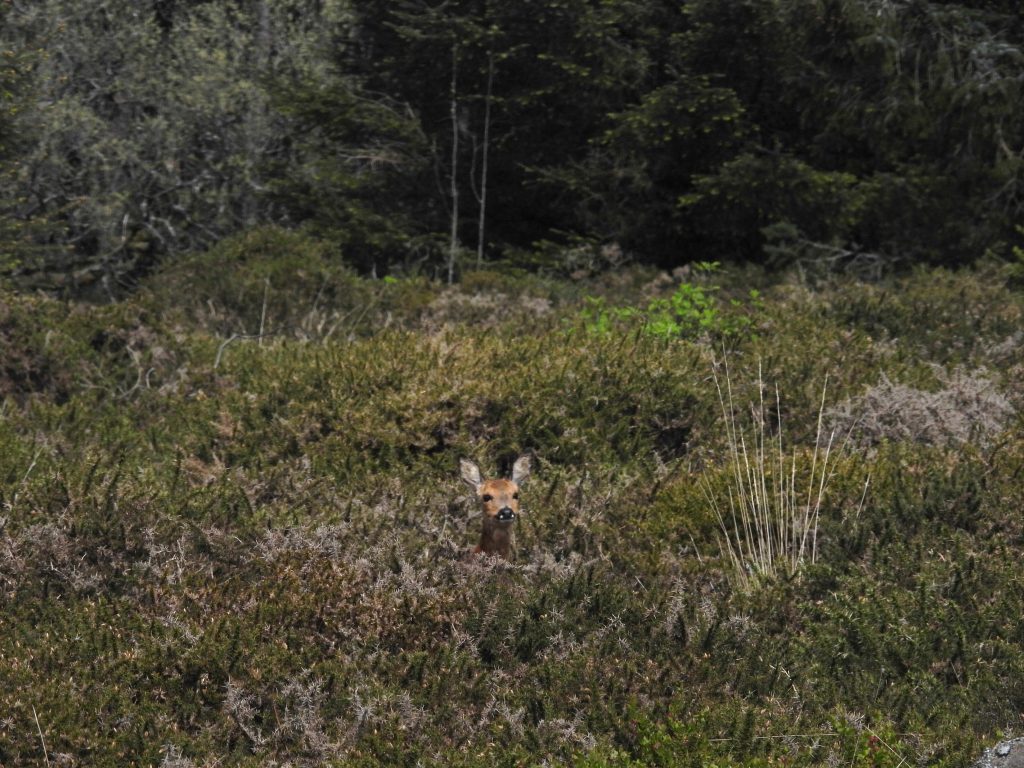
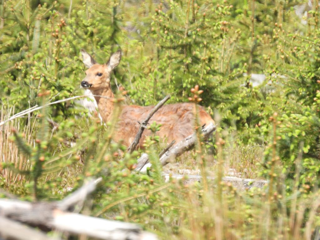
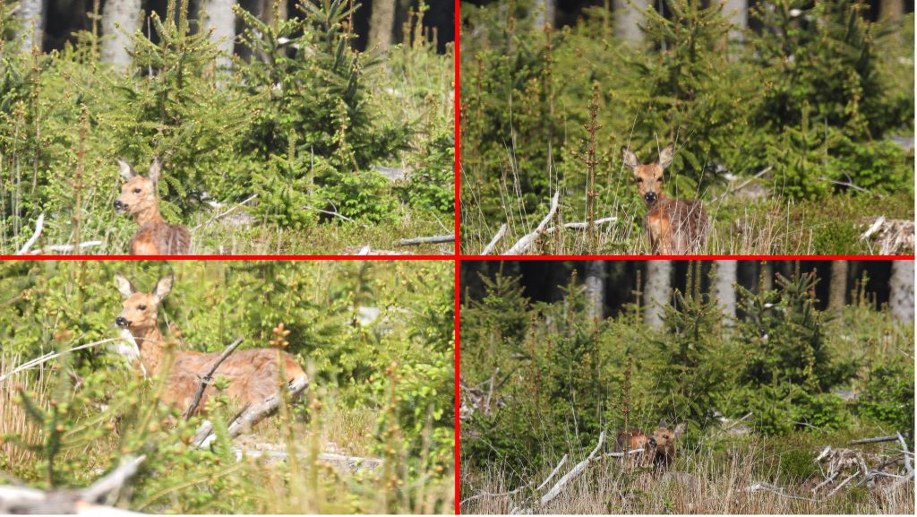
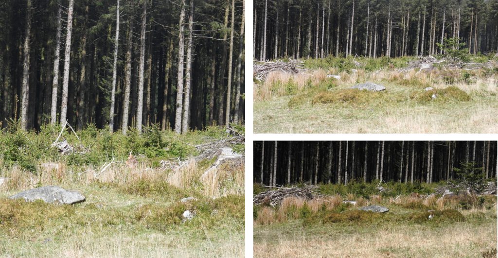
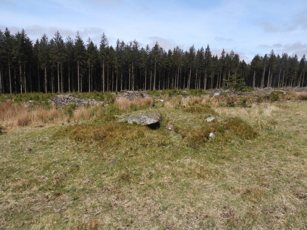
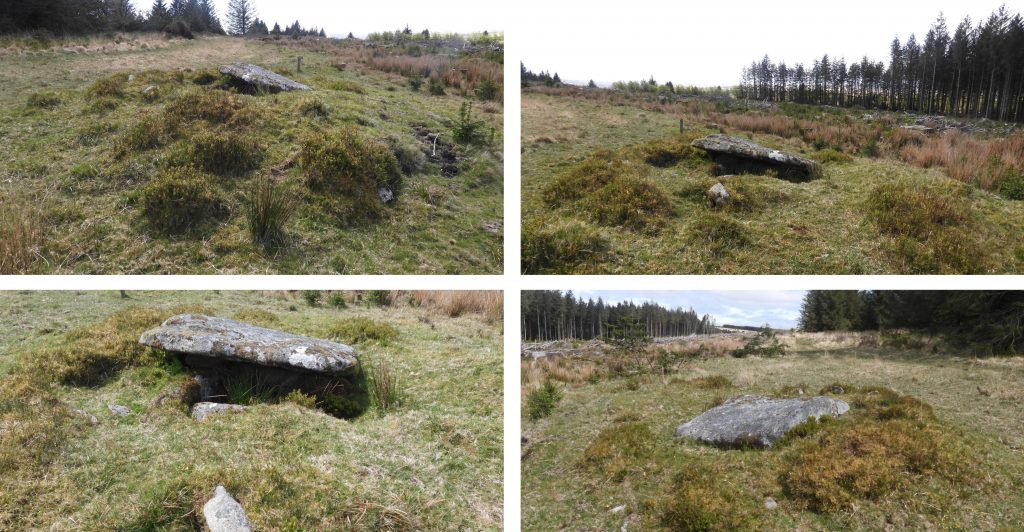
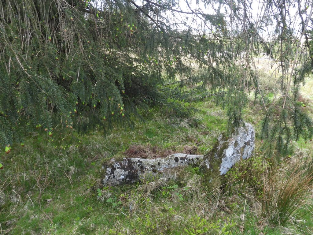
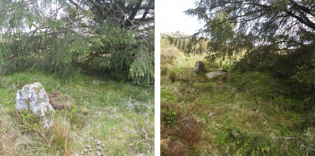
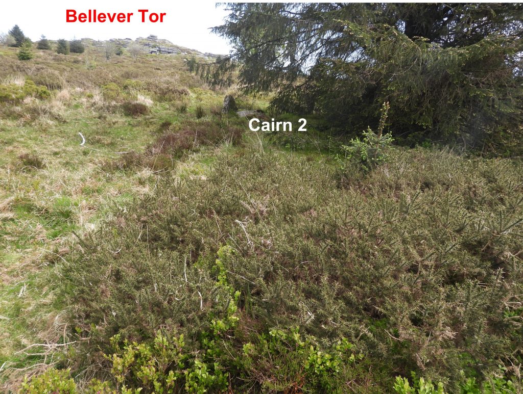
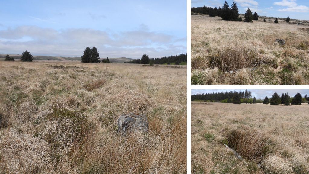
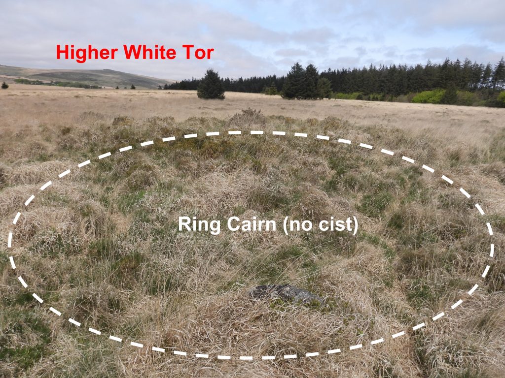
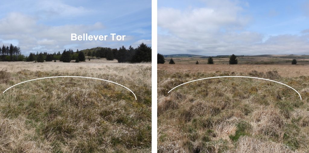
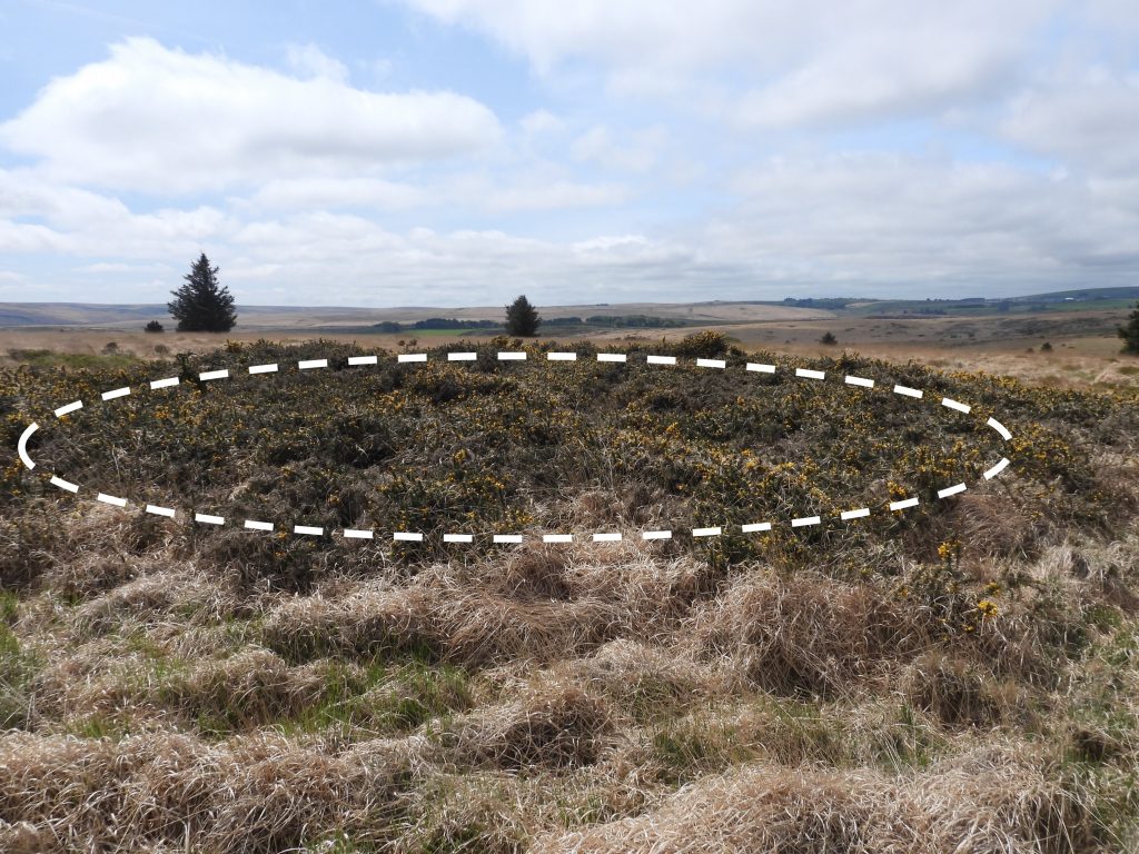
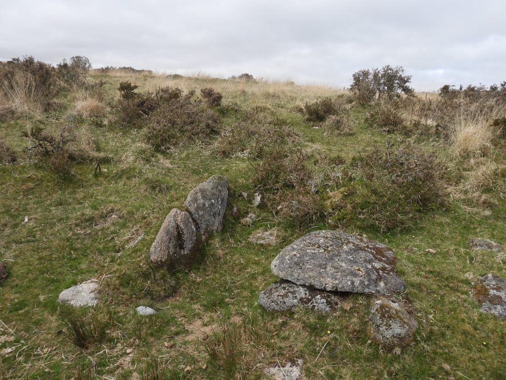
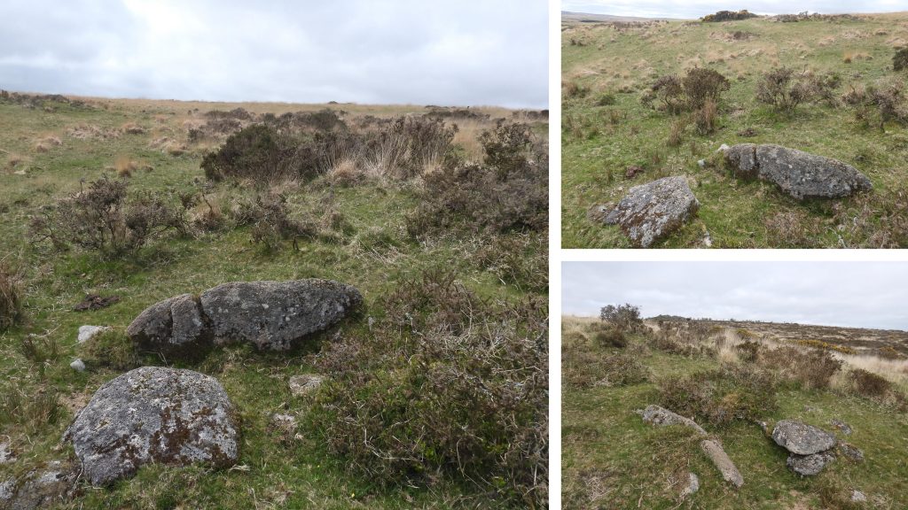
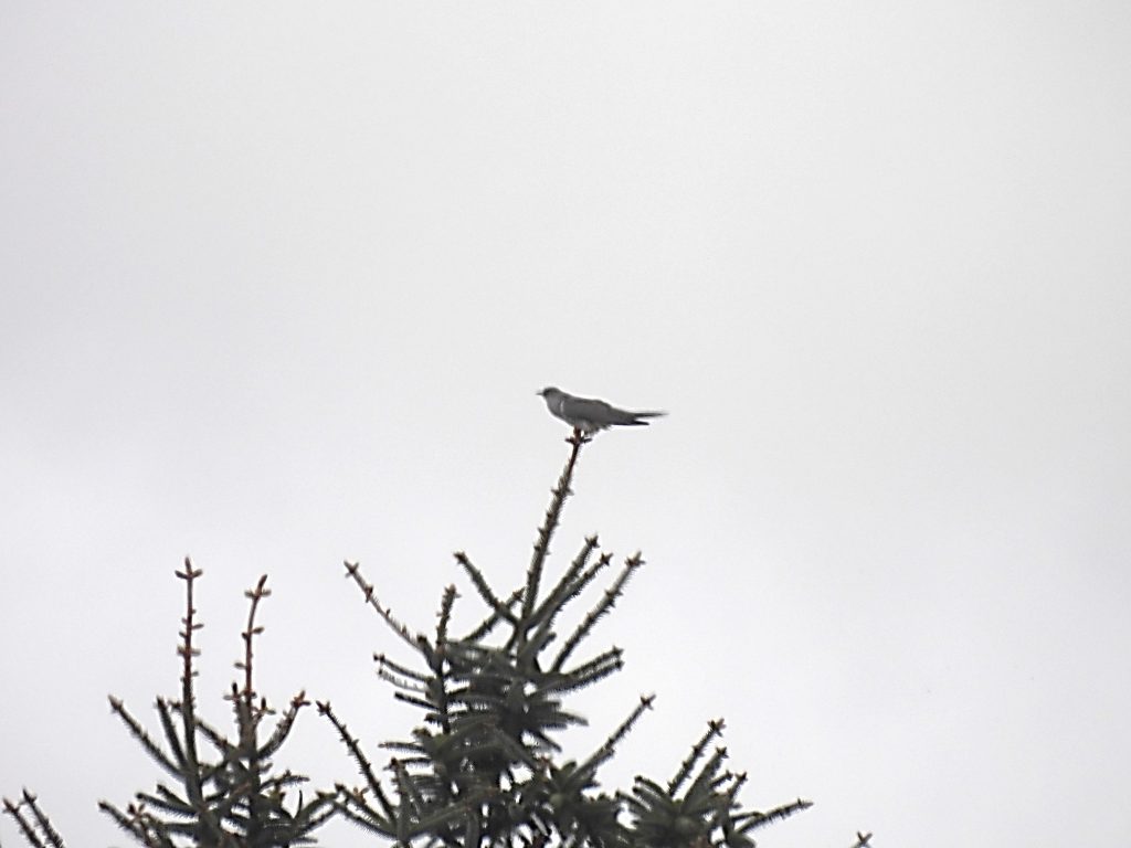
Black Newtake is located to the south west of Bellever Tor and contains 6 of the 10 cairns (numbered 3-8) covered in this post. The sketch map shows the approx. location of the stiles in the area, which allows access to the various newtakes. The author has kept the same numbering convention as Jeremy Butler in his publication.En-route to cairn 1, the author spotted a young deer, who didn’t appear that timid. That said, when approached (as he/she was in the direction to locate the cairn), the young deer headed towards the forest and kept looking back. Eventually, the cairn was found with the young deer behind it. It was as if the deer was showing the author the way to the antiquity.Peek-a-boo.Beautiful colours and shiny nose.Not in a hurry to leave. The author was only 50-100m away.Cairn 1 lies on the edge of the plantation and was first recorded in 1890. At that time, it had already been dug into with the upcast being thrown out on the north side.The cairn has been recorded as being 7.7 metre diameter with a 0.8 metre high mound. It is aligned NNW to SSE. It can be found at SX64081 76469.Detail of cairn 1.Butler states that cairn 2 (which is still shown on OS Maps) is possibly not an artificial mound but merely heather covered rocks. An “un-natural” upright slab, stated as being 6m from the cairn (as show in picture) completes the description.The upright stone lies under the branches of a large conifer.The probable cairn is the heather covered mound in the foreground. It is located at SX64144 76275These two maps compare the 19th century OS map and the Jeremey Butler map of the cairns in Black Newtake. Of interest on the 19th century map is that cairn “4” is not recorded and a “stone” is marked just outside the newtake wall.The boundstone as marked on the 19th century map is still in situ.The boundstone is not recorded on the Dartmoor Environment Record (HER) and is not inscribed. The author is unaware of the reason why this boundstone was placed here at SX64074 76095.Stile for access into Black Newtake can be found at SX64105 75977Cairn 3 lies within Black Newtake. It has two “pairs” of stones on opposite sides which mark the ring cairn. The central cist is rather quite complete, except for the cover stone. Cairn 3 can be found at SX63915 76072.Cairn 4 is a ring cairn, a circular rubble bank about 11 metres across and 0.5 metres high surrounding an interior raised slightly above the outside ground surface. Butler records a single slab which faces the circle 4.5 metres away to the south-east, which can be seen in the foreground of the picture.Cairn 4 is located at SX63852 76027Cairn 5 is a substantial mound a metre high. It has a covering of gorse.Cairn 5 is further described as being trenched at ground level from the north edge into the centre but with no sign of a cist. The cairn can be found at SX63854 75987.Jeremy Butler described cairn 6 as having seven slabs remaining around the north-east edge. These were located by the author, albeit some are turfed over. One side and one end slab of the central cist are missing.Cairn 6 can be found at SX63887 75863Butler states that cairn 7 is a doubtful site as being a cairn. In fact, referring to the Dartmoor HER, this site was re-classified by the Ordnance Survey (1979) and Royal Commission (1989) as a hut circle. It has an internal diameter 8.5m but is very overgrown as can be seen from the picturesCairn 7 can be found at SX63858 75782.The last antiquity in Black Newtake is labelled as cairn 8. The cist in this cairn was described as being an imperfect ruin as far back as 1890. As described by Butler, only a few scattered stones mark and approximate site today.Cairn 8 is located at SX63848 75729Stile at southern end of Black Newtake can be found at SX63723 75567Brimpts Mine Leat is around 4 miles in length from a headweir on the Cherry Brook, just below Higher Cherrybrook Bridge. It was used to supply tin mining activities near Brimpts Farm. The picture shows a section of the leat above Smith Hill farm looking towards the Cherry Brook.The picture shows a section of Brimpts Mine Leat above Smith Hill farm looking east.Brimpts Mine Leat snakes around the contours to the east of Black Newtake near cairn 10. The picture shows the section of the leat above cairn 10. looking north to Bellever Tor.The picture shows the section of the Brimpts Mine leat above cairn 10, snaking around the hill contours looking west.StonechatCairn 9 lies outside and to the south of Black Newtake. It has a very slight mound with a small central cist with all four stones in place but with the cover slab missing.Butler describes Cairn 9 as having no trace of the retaining circle but the two stones outside the long sides of the cist probably form part of an inner ring. Cairn 9 can be located at SX63588 75465.There is a settlement at Dunna Brook enroute to cairn 10 which is centred around a square enclosure containing a medium sized free standing hut of 6 metres diameter. The hut circle in the picture is located at SX63888 75594.All that remains of Cairn 10 is a single side slab of a cist and can be found a few metres (downhill) from Brimpts Mine leat.The cist has clearly been robbed cist and is (was) circa 0.6 metres by 1.4 metres. There is no evidence of a cairn (which was mentioned by Worth). It is located at SX64072 75691Cuckoo. Not a pin sharp picture as this was over 200m away.Butler describes the Dunna Brook head (northern) settlement as including a single oval shaped hut 4.5 metres by 3 metres with a yard attached to the perimeter wall. The hut circle can be found at SX64113 75945.Leaving the area, this walled in gate made a great frame for Bellever Tor in this picture.