A collection of walks, discoveries, insights and pictures of exploring Dartmoor National Park
March 29, 2021
AN EXPLORATION OF BELSTONE CONSOLS SETT (GREAT COPPER HILL MINE)
The inspiration for this exploration was an article written in the Spring 2006 of the Dartmoor Magazine by Chris Walpole titled “Skaigh Waterwheel”. The article described the waterwheel as once being the largest on mainland Britain (second largest in the UK behind the Lady Isabella wheel) and caught the imagination even though only the wheel pit / wheel house only remain. Further information in this post was obtained from Heritage Gateway (Hamilton Jenkin, Dr. A. K., 2005, Mines of Devon, 102-3 (Monograph) SDV282410) and from Dartmoor Boundary Markers, Belstone Consols, Sticklepath by Dave Brewer. The Belstone Consols sett incorporated the farm of Greenhill. Work was originally started in 1829 under the name of Sticklepath Hill Mine when a local company of mainly farmers, drove an adit which intersected several favourable copper lodes.
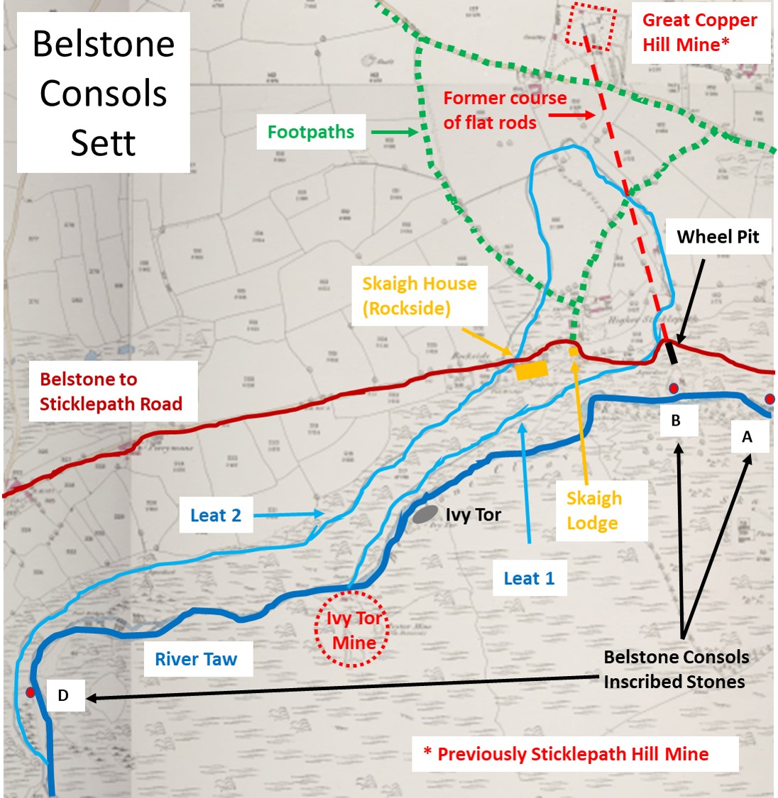
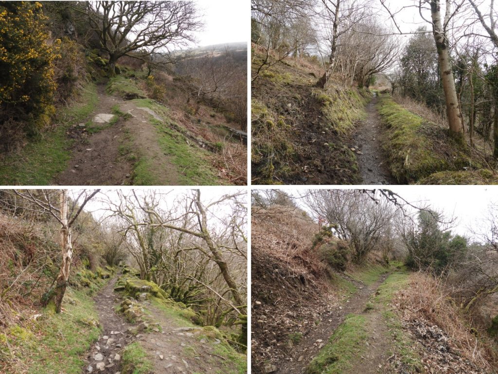
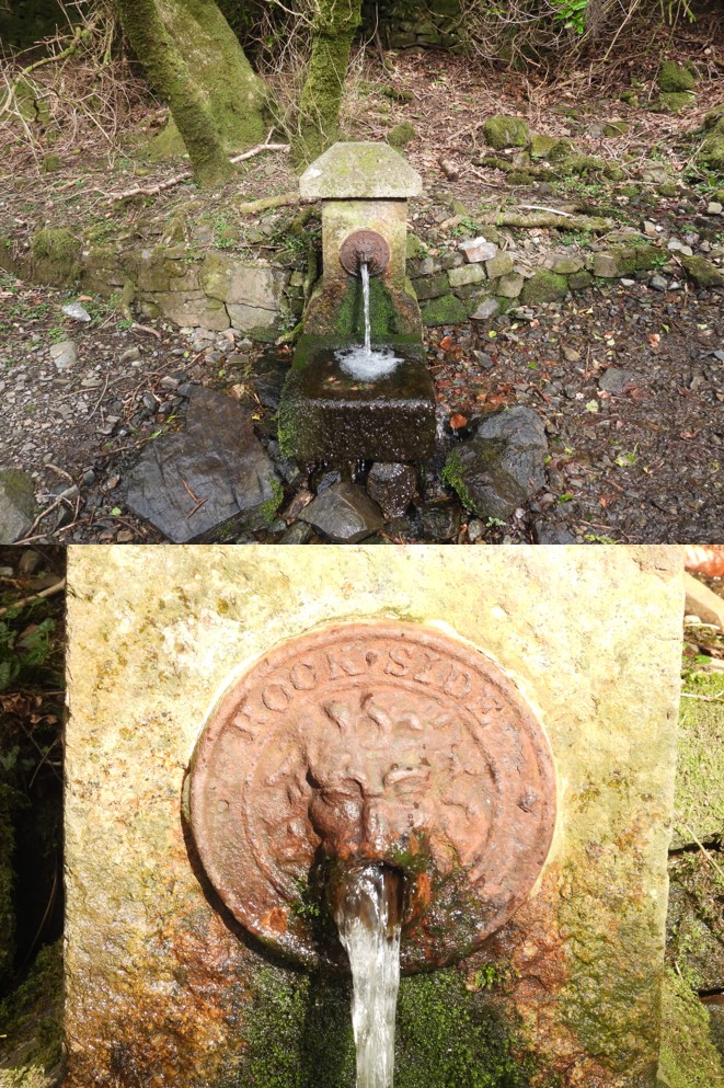
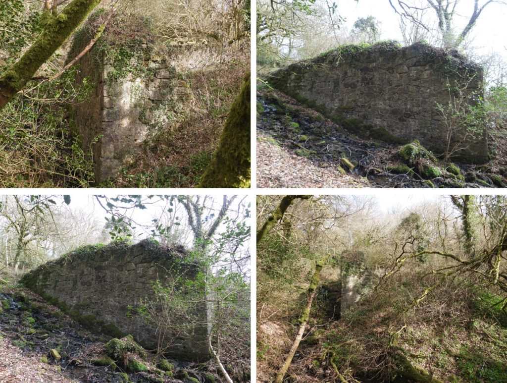
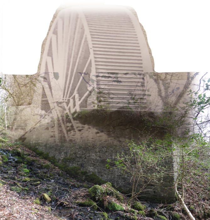
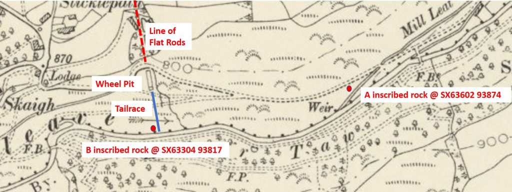
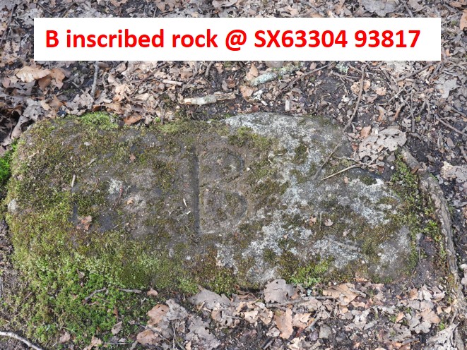
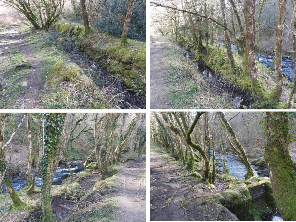
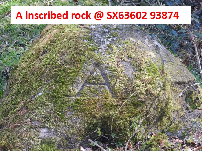
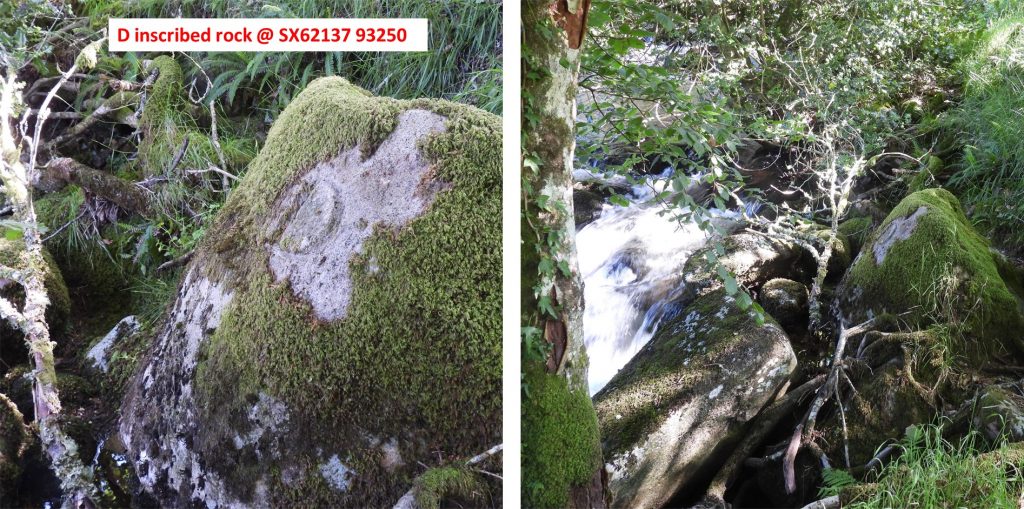
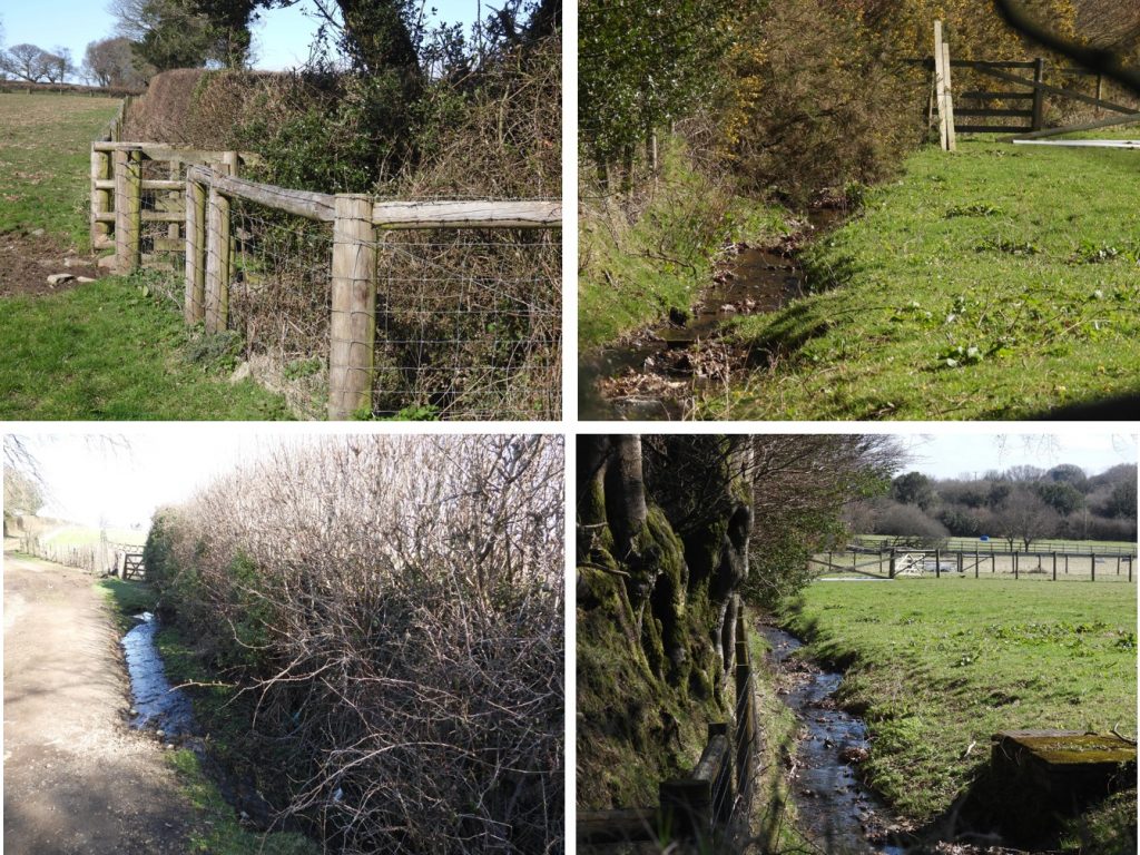
The area of exploration in this post covers the points of interest north of the River Taw centred around Skaigh House and Skaigh Lodge. Although the Great Copper Hill Mine is on private land, the workings can be seen from a nearby footpath.Two leats served the Belstone Consols wheel as shown on the previous map. Both leats remain traceable on the ground for most of their lengths. The upper one (labelled leat 2 in this post) ran for more than a mile upstream right around the bend in the river to a point below Birchy Lake. Its route was traversed a small gorge by means of a launder. The lower leat (labelled leat 1 in this post) was much shorter (and rather broader) and departed from the river only about half a mile upstream from the wheel. Nowadays, several hundred metres of the upper leat is used as a footpath as can be seen in the photographs. Below Skaigh House this Lion Mouth fountain can be found. The name “Rockside” was the original name for Skaigh House. The fountain dates from the 1870s. It can be located at SX63074 93881.The huge Belstone Consols waterwheel was believed to be around 70ft in diameter (just over 21m) and was erected to drain the mine sometime around 1878. The wheel pit (wheel house) in which the wheel turned can be found just below Higher Sticklepath (Skaigh Lodge). It is recorded that the wheel was painted bright red and was an “object of such terror to horses that it was almost impossible to ride or drive them past it”. The wheel pit can be located at SX63267 93914.After the closure of the mine in 1891, the wheel gradually fell into decay and was eventually broken up for scrap in Finch’s Foundry at Sticklepath during the First World War. The wheel was designed to drive flat rods of around 2000 ft (over 600 m) to the mine.The wheel pit (wheel house) is pretty impressive even today. The above picture with its superimposed wheel shows what it may have looked like.Detail of the area around the wheel. Below the wheel (to the south) the tailrace can be traced down to the River Taw. Just upstream from where the tailrace water enters the Taw, a slab of stone inscribed with a “B” can be found. The grid reference is SX63304 93817. Just downstream from the “B” stone a weir can be found, which is the take off point for the Mill Leat.Near the Belstone / Sticklepath road and alongside the Mill Leat, a second inscribed rock can be found. The “A” inscribed rock can be found at SX63602 93874. It is believed (Brewer) that the bounds of the mining sett (Belstone) by the “A” and “B” rocks. It is believed there may be more stones to the north of the mine itself near the Tongue End – Belstone road.A third inscribed rock inscribed “D” can be found approx 100m upstream from the footbridge across the Taw just below the village. This rock complements the “A” and “B” rocks further down the Taw. One assumes there is or was a “C” stone next to the Taw somewhere between the “B” and the “D” stones.Whilst the mine was known as Sticklepath Hill Mine, 38 tons of ore were returned and a winze* put down but a lack of funds to purchase machinery caused the project to be abandoned. At a later date the sett was renamed Copper Hill and by 1865 four mineralised beds / lodes, were developed. In 1866, the mine incorporated the nearby Ivy Tor mine and production at Copper Hill continued well until 1878 when a breakdown in the pumping machinery caused the property to be transferred to the Mid Devon Mining Company. After this it became known as the Great Copper Hill Mine. It was at this final stage in the life of the mine that the wheel was constructed in order to drain the mine (*NOTE: A winze is a minor connection between different levels in a mine. When worked upwards from a lower level it is usually called a raise; when sunk downward from a higher level it may be called a sump).Returning from the mine along a series of footpaths back towards Skaigh Lodge, further parts of leat 2 can be located.