A collection of walks, discoveries, insights and pictures of exploring Dartmoor National Park
May 20, 2020
WHEAL FREDERICK
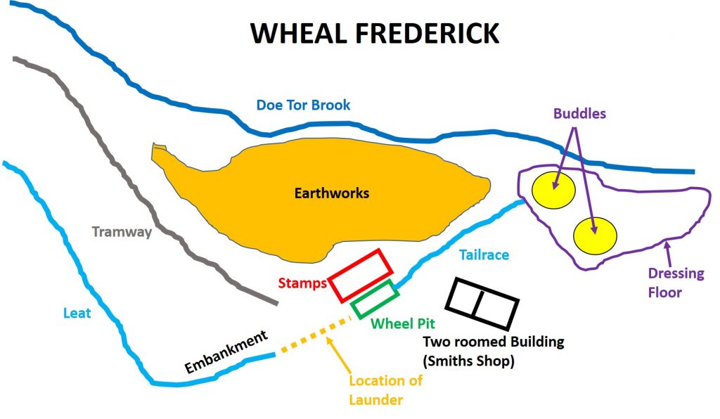
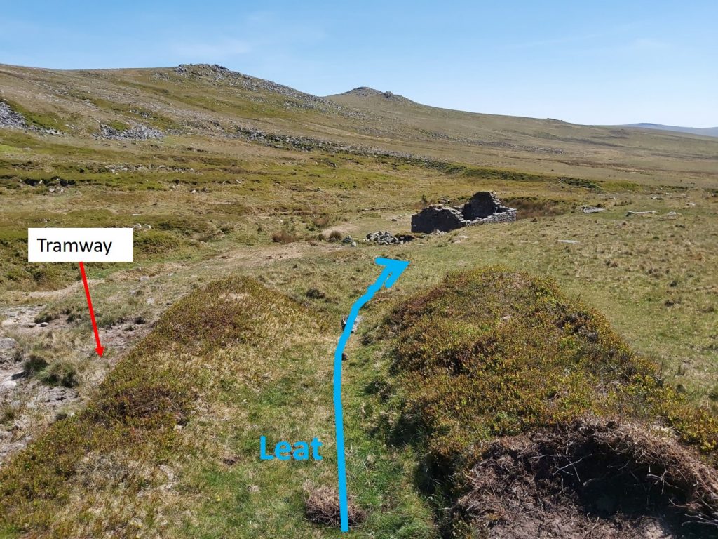
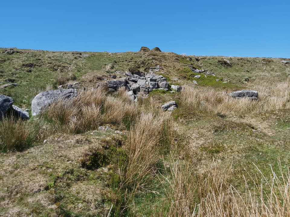
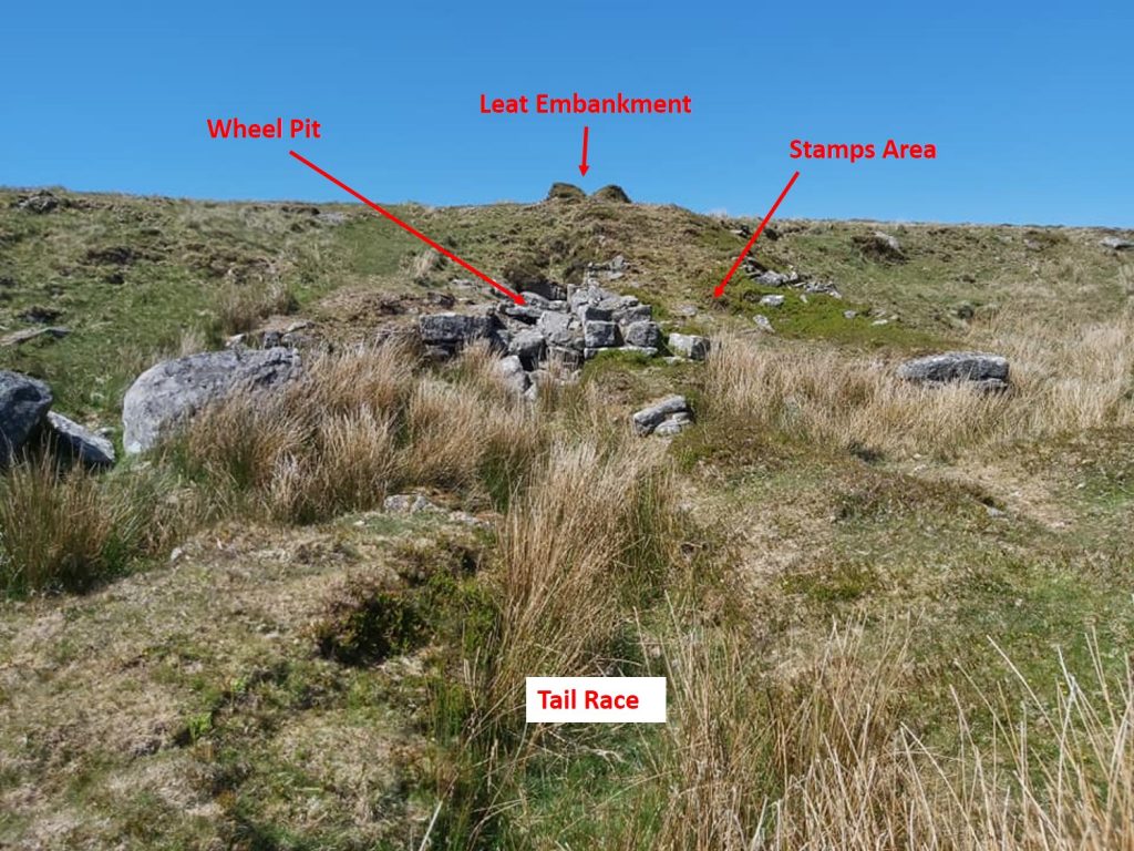
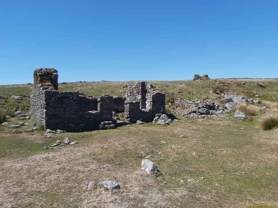
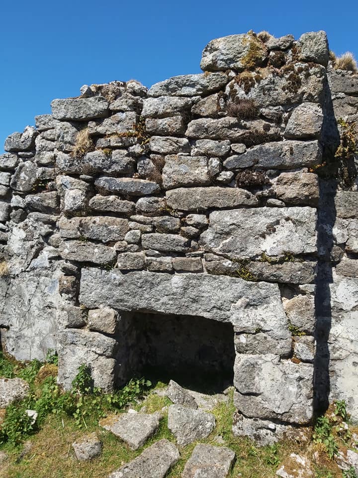
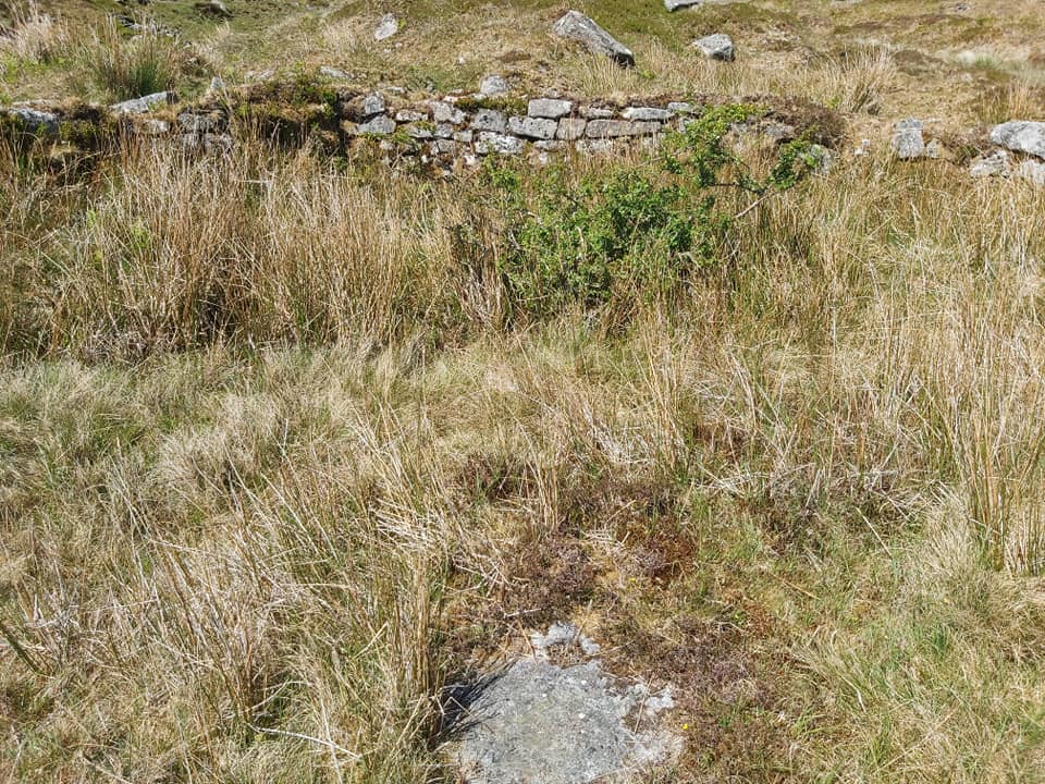
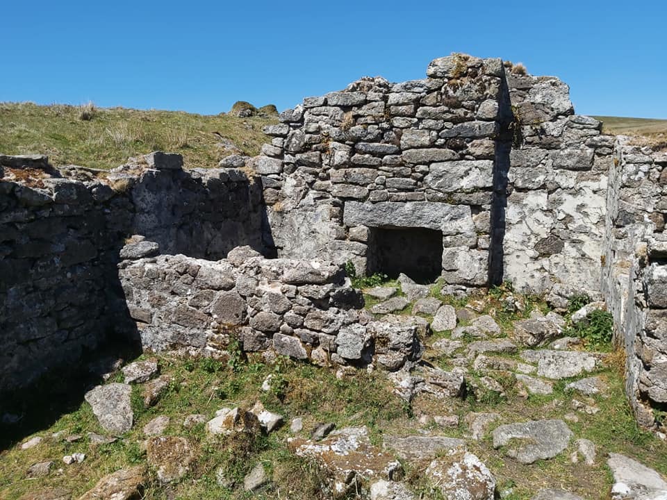
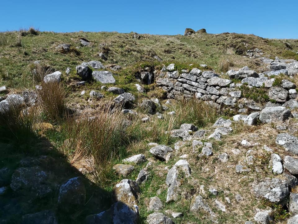
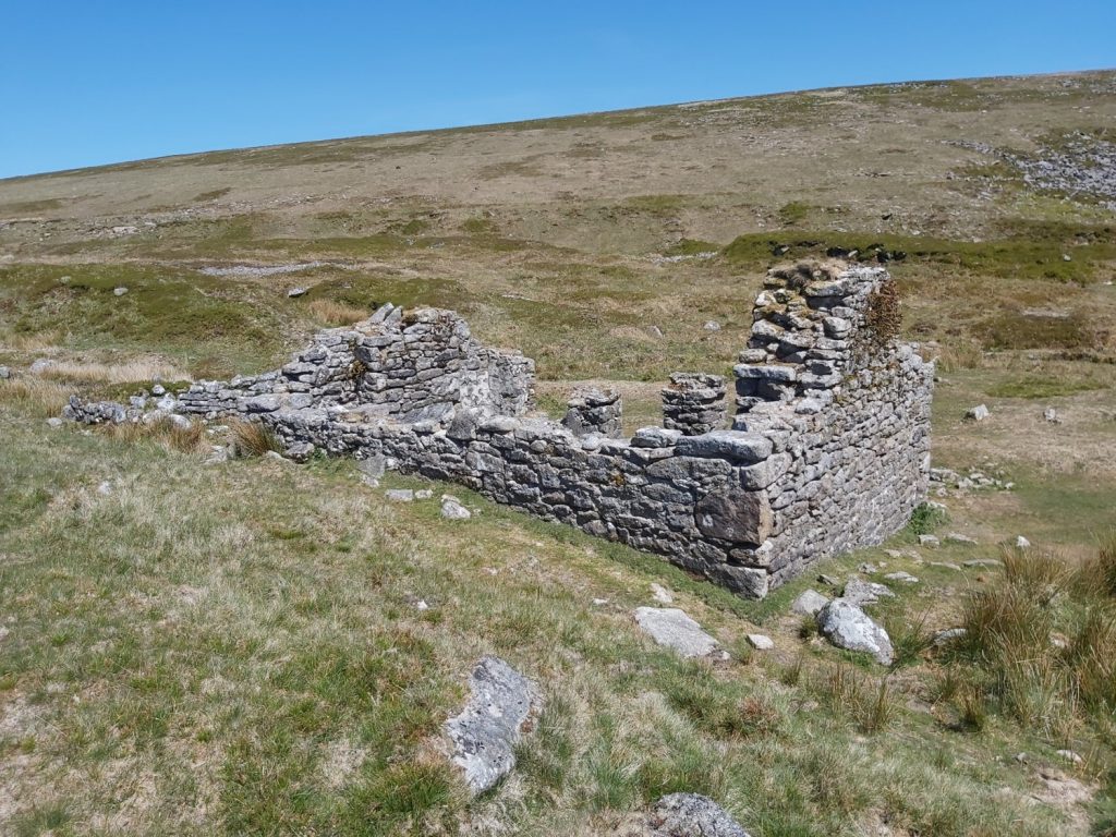
Wheal Frederick, a Victorian Tin Mine, is located next to Doe Tor Brook (or Doe Brook as it should be called). It is remarkably well preserved with a two room building (with gable ends and fire places), a wheel pit, stamps area, a leat with embankment, a tramway and a dressing floor containing two buddles.
There is an excellent article penned by Dr Tom Greeves in the Dartmoor Magazine, No. 73 – Winter 2003, which has a very detailed account of the sett and the licenses granted. Shares in Dowbroke (Doe Brook) tin works are known to have been issued in 1598. However, the mine itself didn’t really come to the fore until the 1840’s.
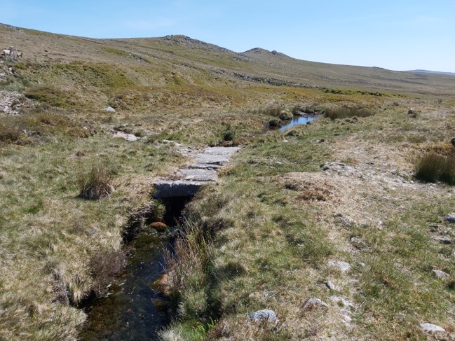
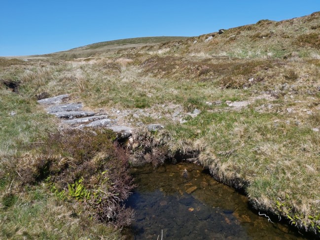
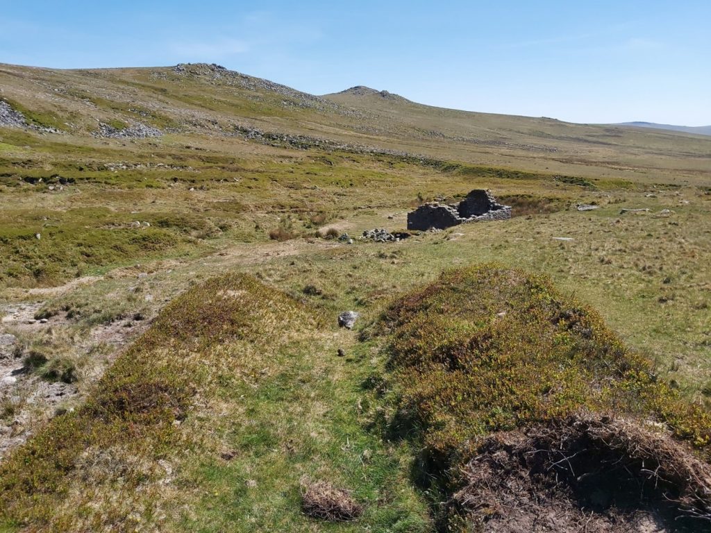
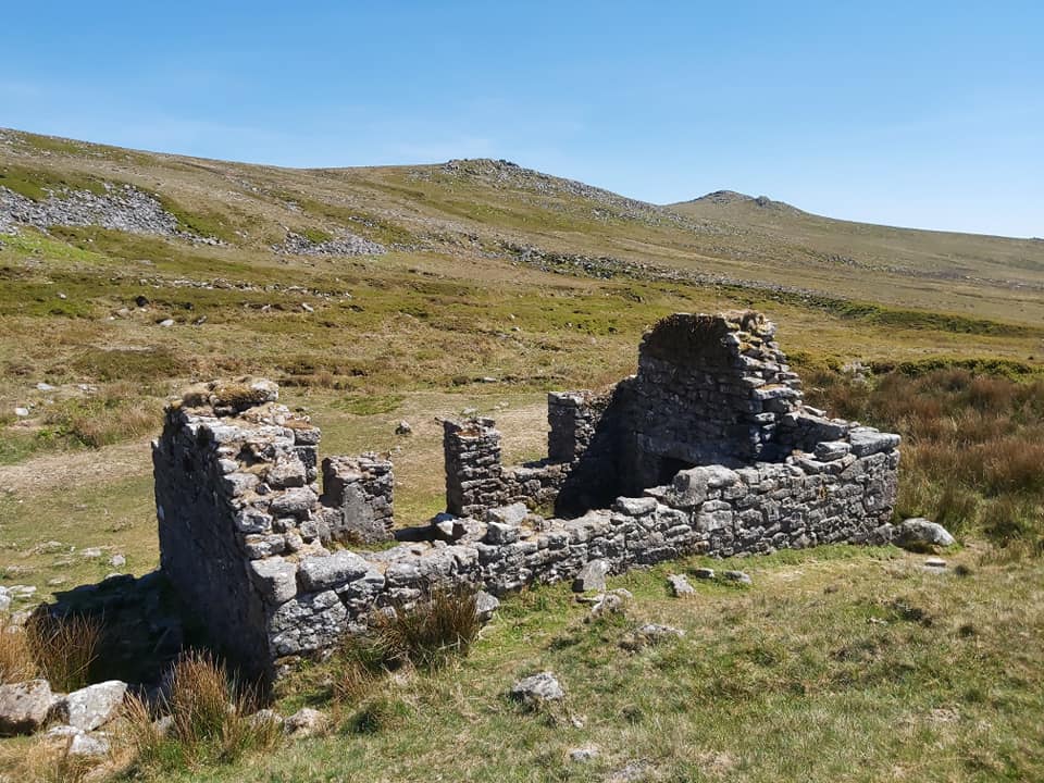
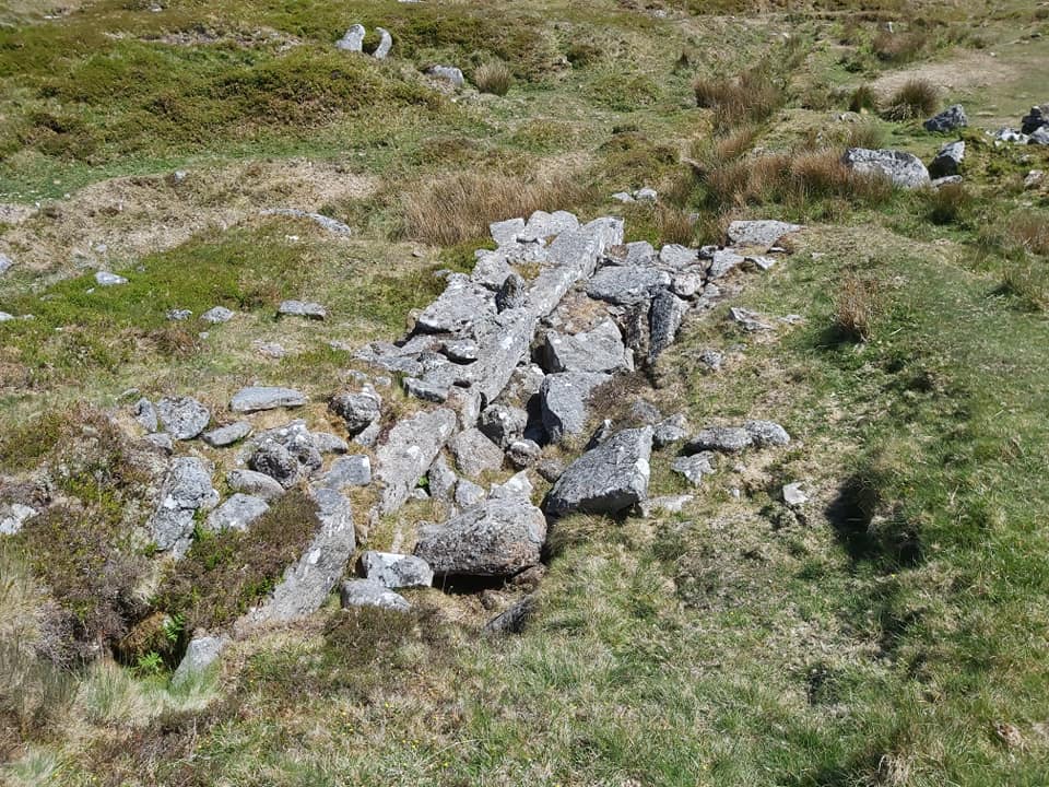
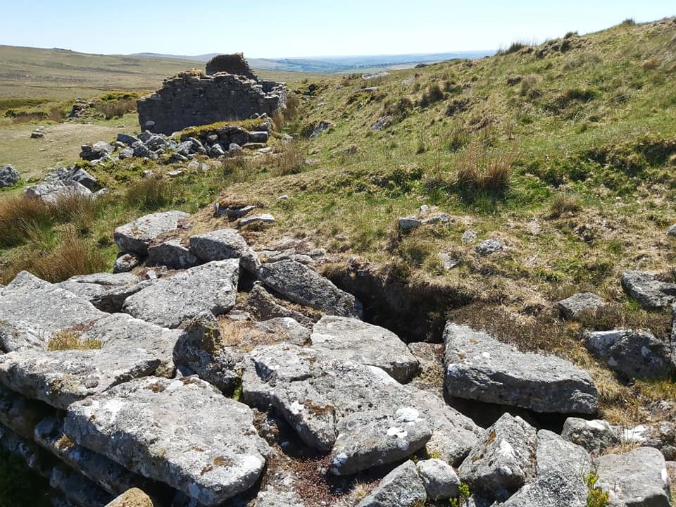
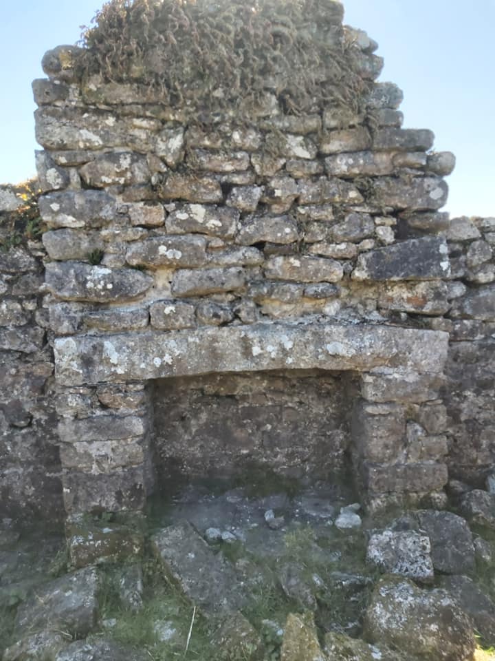
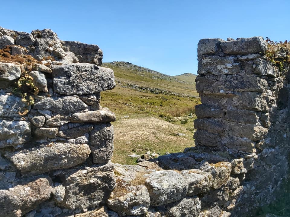
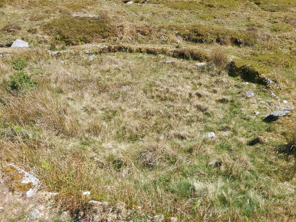
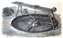
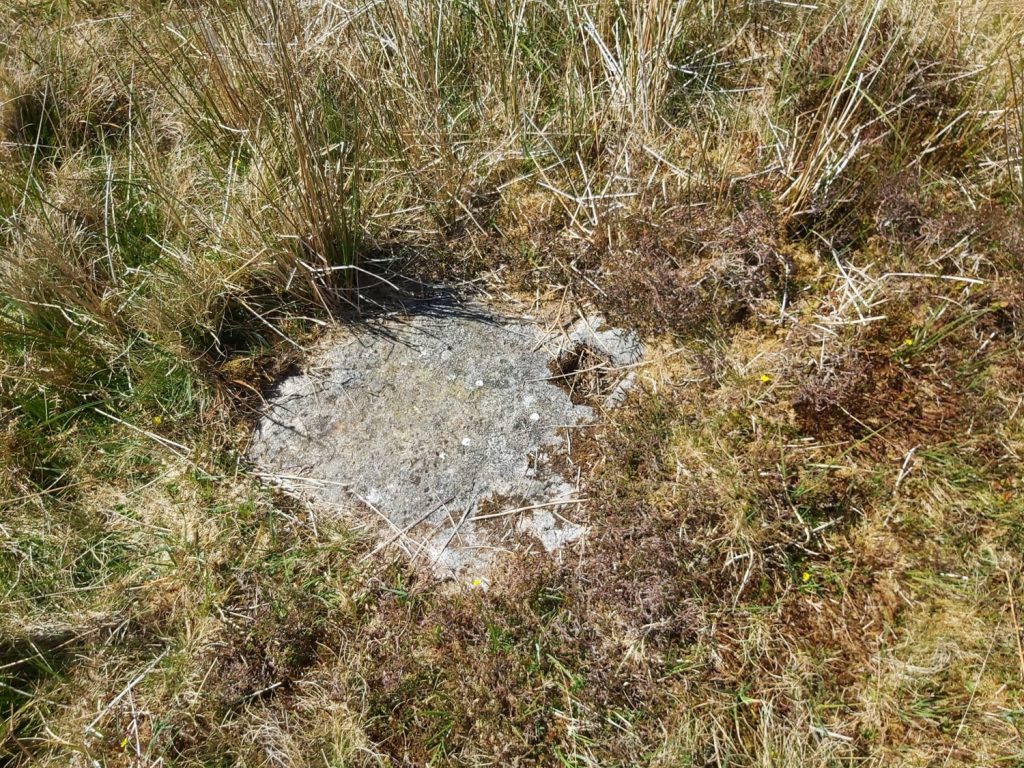
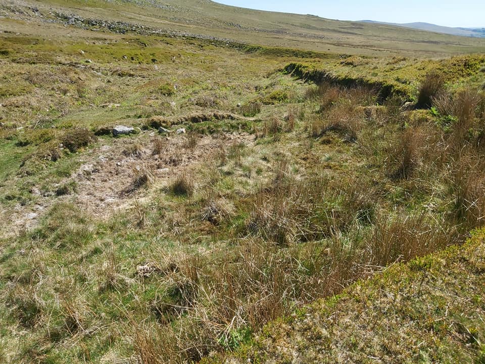
The mine layout orientated North (left) and South (right)Approaching from the north, just north or the mine is a clapper at SX54623 85469. Sharp Tor and Hare Tor can be seen in the background. It is roughly at this point the tramway starts.The clapper looking northApproaching the mine from the north along a leat embankment, which would have carried water onto an over fed water wheel. SX54566 85416. There was a tramway belowHighlighting the leat and the tramwayA view of the two roomed mine building believed to have been a smiths shop. The sett was first recorded in 1845 in the Duchy of Cornwall mineral grantsWheel pit below the embankment. SX54576 85394. The wheel was approx 8m x 1.5m. The wheel is known to have still been in position in late 1879.A view of the mine building from the stamps area looking across the wheel pit. Stamps were water powered (hence alongside the wheel pit) and were used to crush the ore.Embankment (leat) at top (double hump on horizon), wheel pit in centre with stamps area alongside it plus evidence of a tail race (water run off) in foregroundLabelling of Leat Emabankment, wheel pit and stamps areaThe embankment and wheelpit in relation to main building. The mine appears to have operated on one year licences between 1850 and 1854. In 1853, the mine was part of the grandly named “Duke of Wellington consols”. Was this name part of sentimental patriotism with the Duke’s death on 14th September 1852Fireplace in room at North endFireplace in room at south endSharp Tor and Hare Tor can be seen from the window of the buildingEvidence of two buddles close by main building. This is buddle 1, the northerly of the two.A buddle was a purpose-built circular pit, constructed from stone or brick, cement and mortar, contained water, and a set of brushes, often powered by a water wheel, which rotated in the water in order to agitate the mixture, the result of which was that the heavier and denser material – i.e. the tin ore – tended to collect at the centre of the pit, from where it could be retrieved. The worthless “gangue” was then disposed of, often by draining. You will notice in this post that one of the buddles still retained its central holed concrete “boss”Buddle 1 with central holed stone. SX54594 85369Close up of the central holed stoneBuddle 2. No holed stone here. SX54584 85366General view of the two rooms of main building (smiths shop). The activity in the mine are known to have ceased by November 1887. Was this an outbuilding next to north end of main building. The embankment also seen in this picture. SX54576 85376SW corner of the Black Smiths Shop
This has been a scheduled monument since December 2003, Royal Commission for the Historical Monuments of England so unlikely to get approval for any modification or change.
I have searched in Mining Journals, DTRG Newsletters and the Devon HER amongst other places and cannot find any records of people employed there. My speculative guess would have been around 20 but I have no evidence to back that up.

Kim Jackson May 4, 2025
could we repair this building and make a bothie?
SteveGriggDartmoor May 4, 2025 — Post author
Hi Kim,
This has been a scheduled monument since December 2003, Royal Commission for the Historical Monuments of England so unlikely to get approval for any modification or change.
Kind Regards,
Dartmoor Exploration
Lotti Rains July 20, 2025
Do we know how many people worked at Wheal Frederick in it’s hayday at all?
SteveGriggDartmoor July 21, 2025 — Post author
Hi Lotti,
I have searched in Mining Journals, DTRG Newsletters and the Devon HER amongst other places and cannot find any records of people employed there. My speculative guess would have been around 20 but I have no evidence to back that up.
Kind Regards,
Steve (Dartmoor Explorations)