A collection of walks, discoveries, insights and pictures of exploring Dartmoor National Park
March 10, 2024
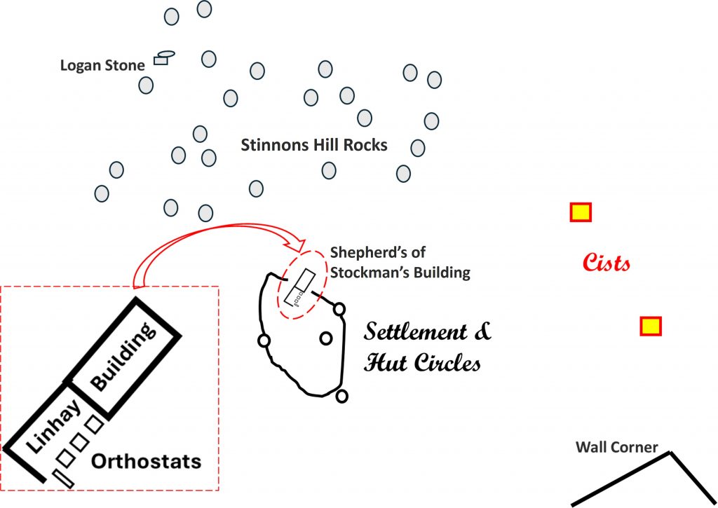
Stinnons Hill Shepherd’s / Stockman’s Building and Linhay
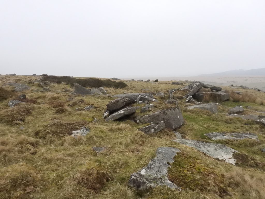
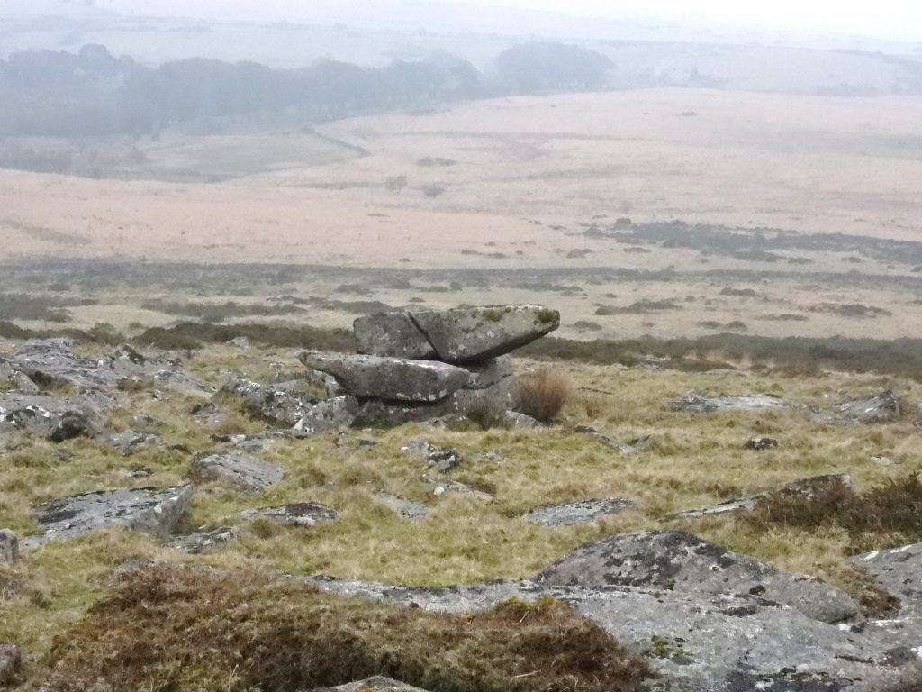
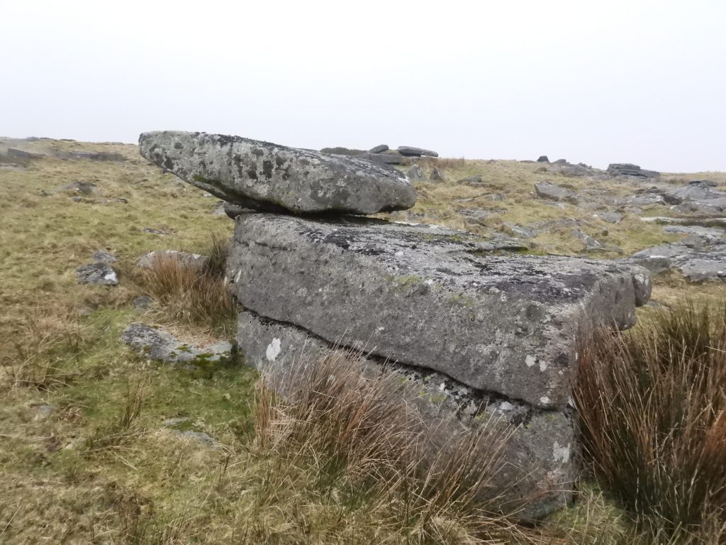
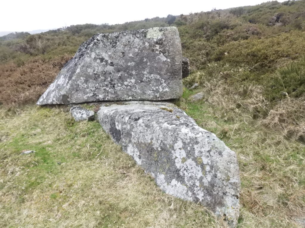
Stinnons Hill is mentioned in Mike Brown’s Gazzetteer (circa 1993) and by Eric Hemery in High Dartmoor (pages 435). Jeremy Butler calls the hill ‘Stennen’ in his Dartmoor Atlas of Antiquities, the North (map 29). Although the hill is located only a short distance (about 0.5km) to the north west of the Powder Mills ruins, it appears to be a little visited area most probably due to the boggy terrain (Stinnons Brook mire) immediately to the south of the hill and the limited access through the walling of Stinnons Newtake. The hill mainly comprises a rock field, which Hemery describes as “considerable”. Of particular note on the west side of the rock field is a logan stone, which is still a ‘rocker’.
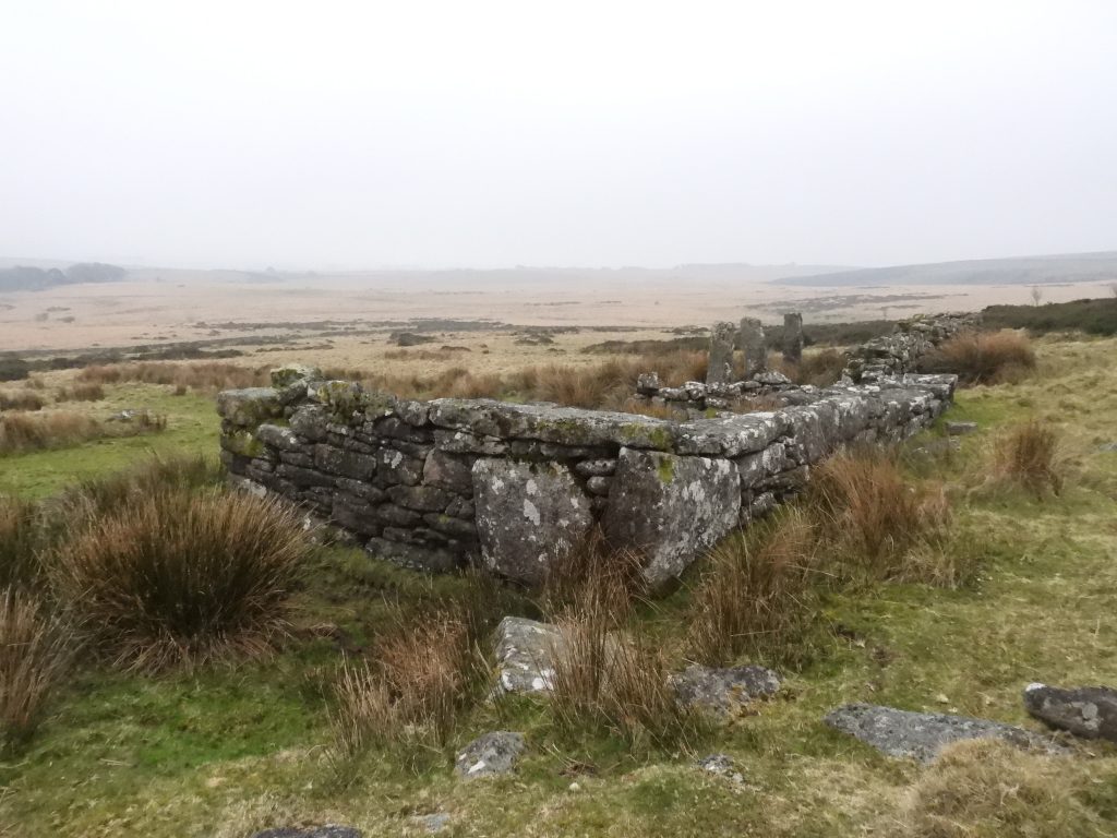
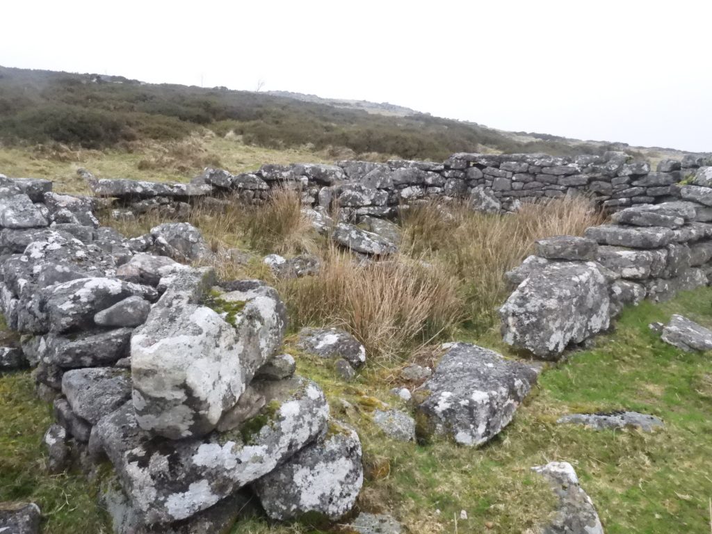
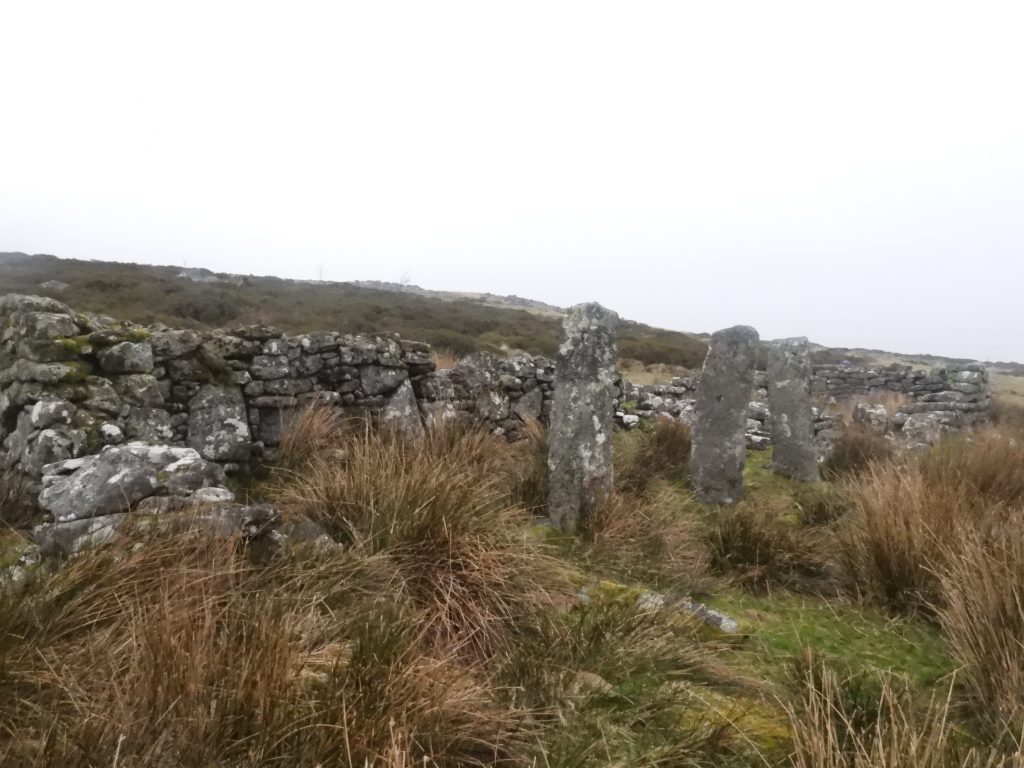
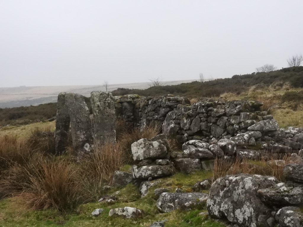
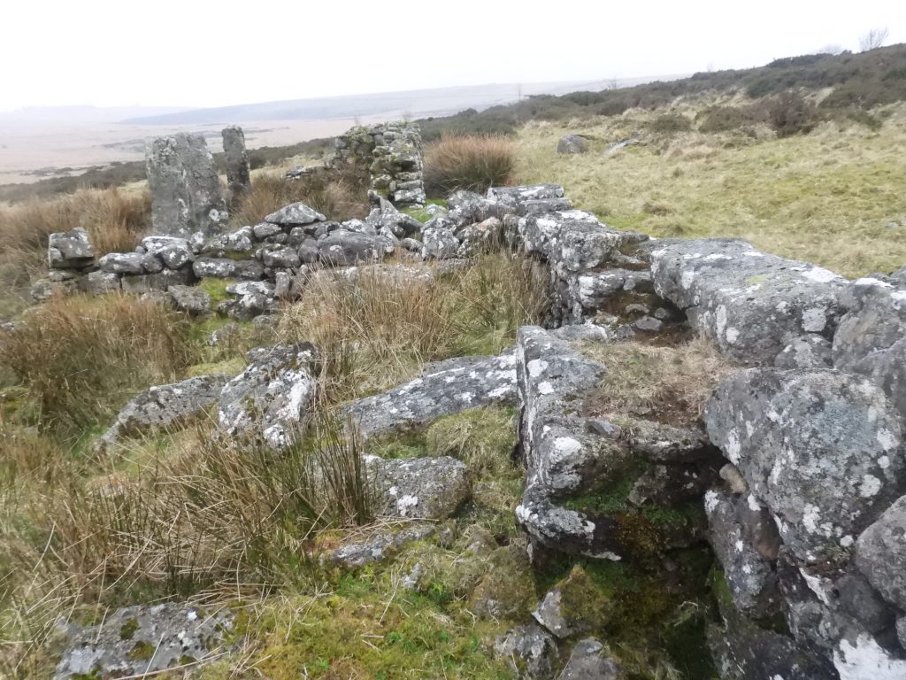
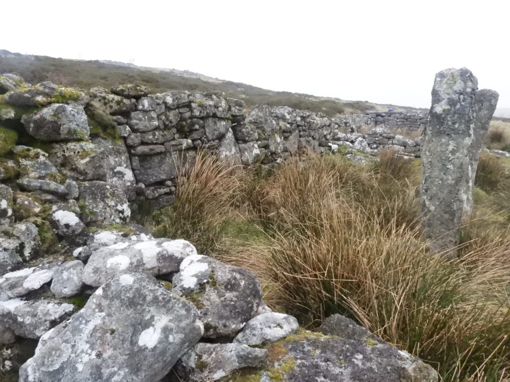
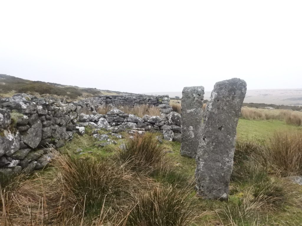
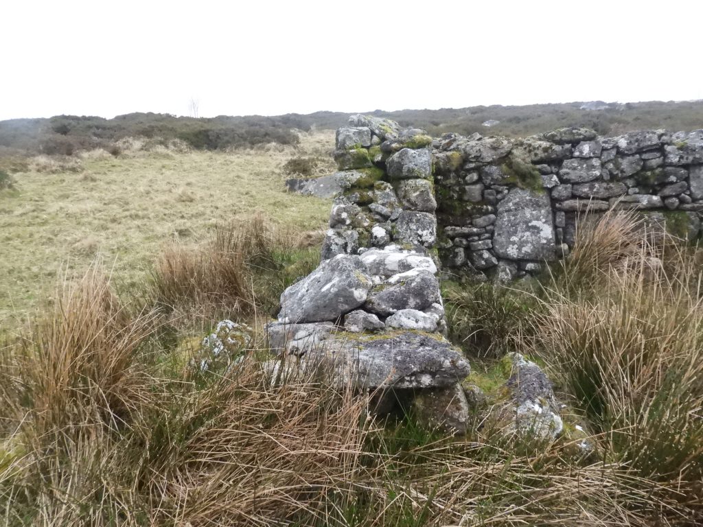
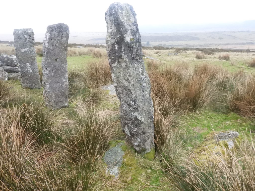
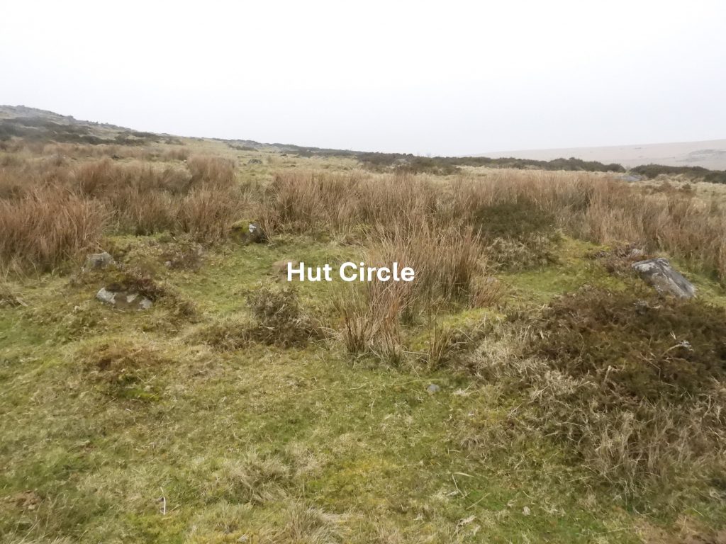
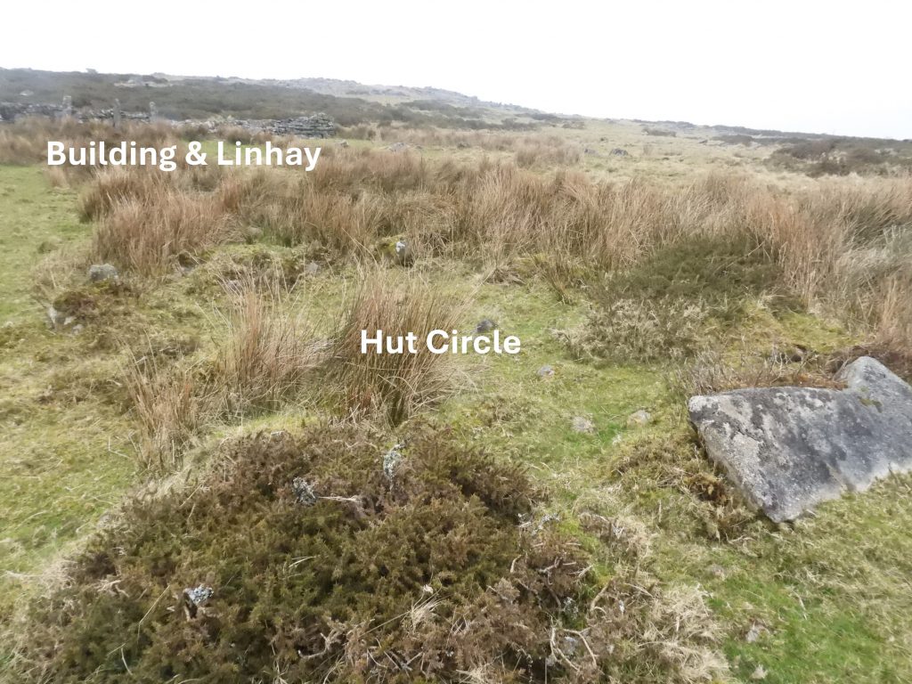
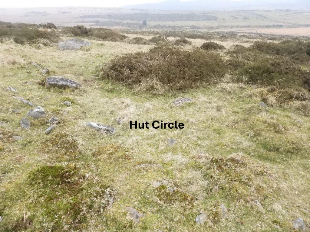
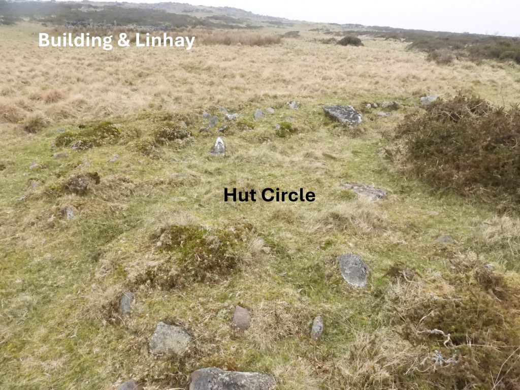
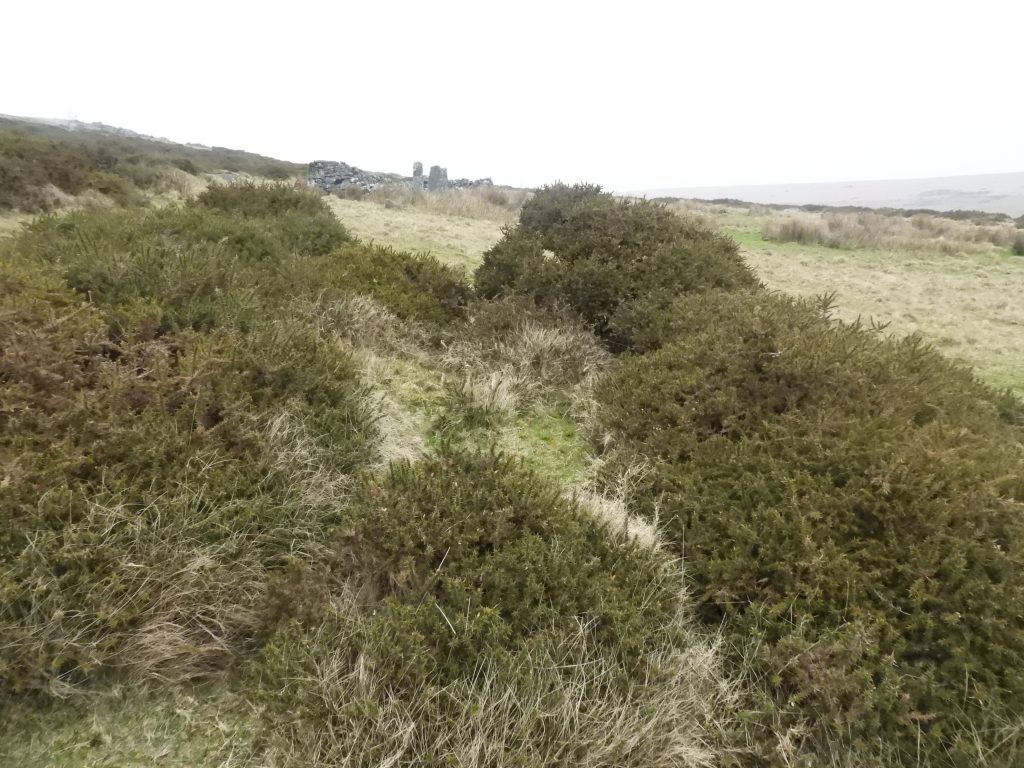
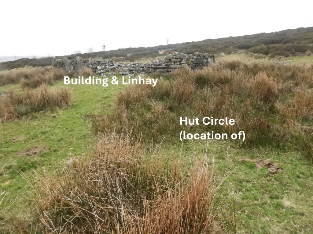
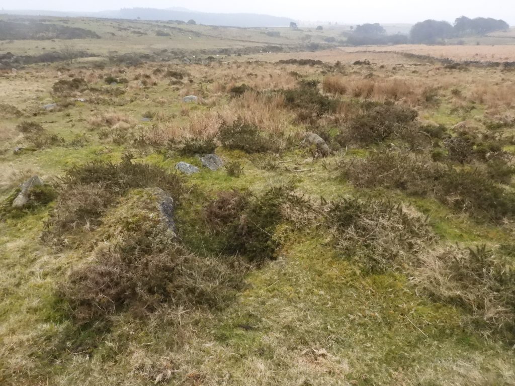
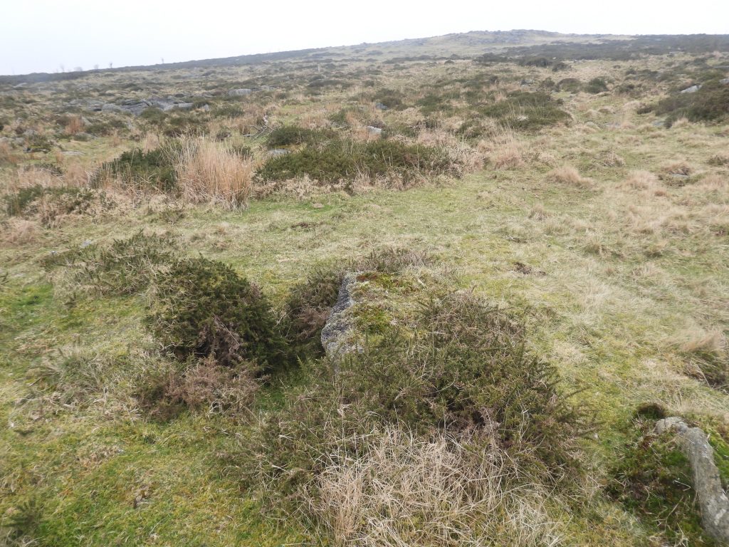
To the south of the rock-field is a settlement with four hut circles, which in comparison with other similar Dartmoor antiquities is rather underwhelming. However, of interest is that a ruin of a Shepherd’s or Stockman’s building (with probable linhay or byre) which has been constructed across the northern wall of the prehistoric enclosure / settlement. Unusually, there doesn’t appear to be any mention of this substantial ruin by Hemery. The ruin was recorded, however, by Butler in his Dartmoor Atlas of Antiquities and by R.G Haynes from a visit in May 1968, where he (Haynes) stated the building was likely to pre-date 1830.
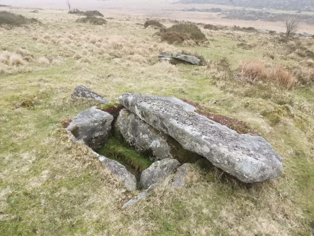
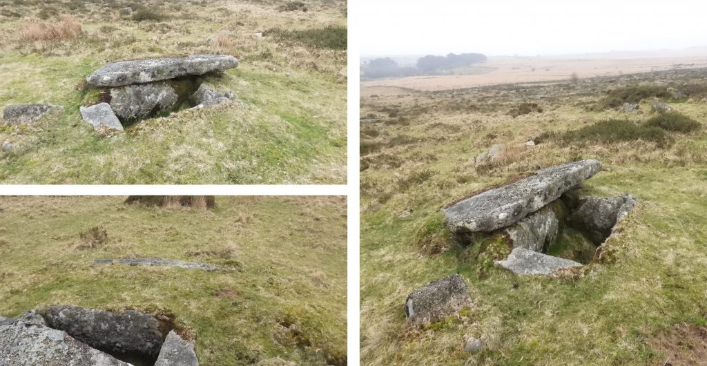
To the east of the settlement and ruins are two cists, one of which is a great specimen with a cover-stone moved aside, with a retaining circle of stones set on edge like a kerb.
This post covers the aforementioned features, with a focus on the Shepherd’s / Stockman’s building and linhay.
Bibliography:
Royal Commission for the Historical Monuments of England, (1987-1993), Duchy Farms Project Survey Visit
R.G Haynes, (1966-1969), Ruined Sites on Dartmoor
Jeremy Butler, (1991), Dartmoor Atlas of Antiquities: Volume Two – The North, 64, Map 29
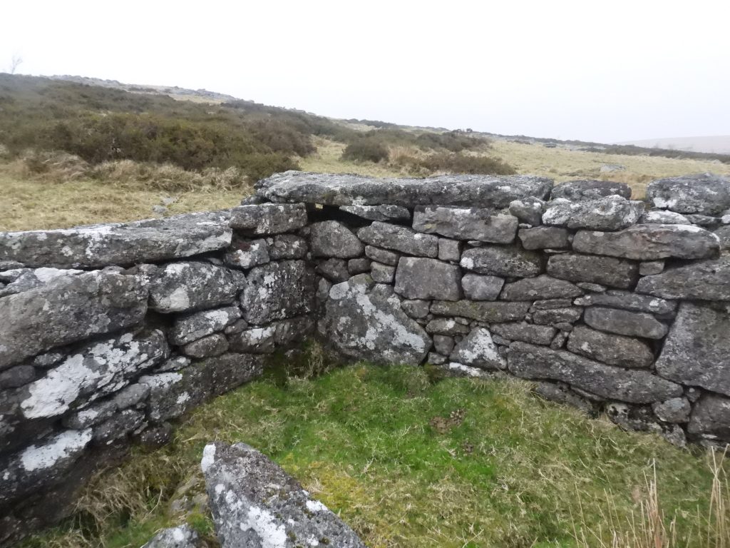
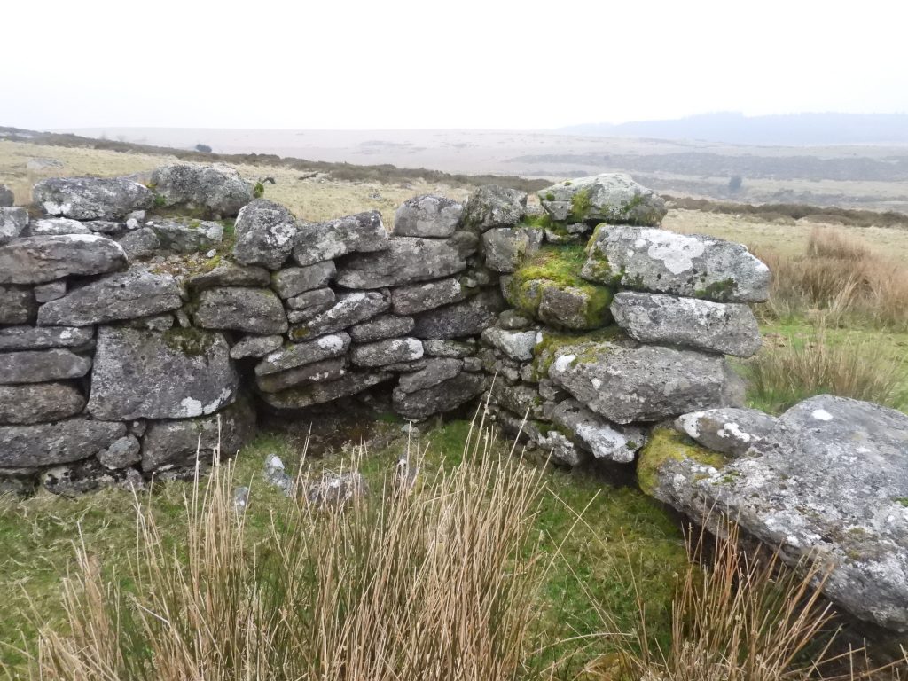
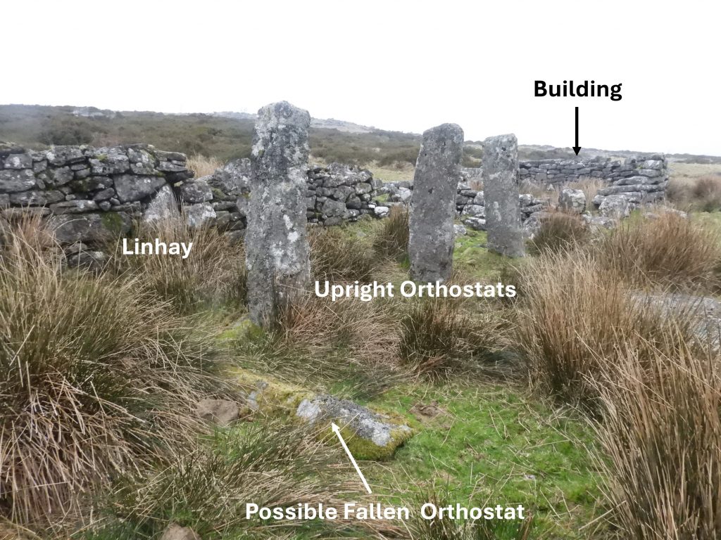
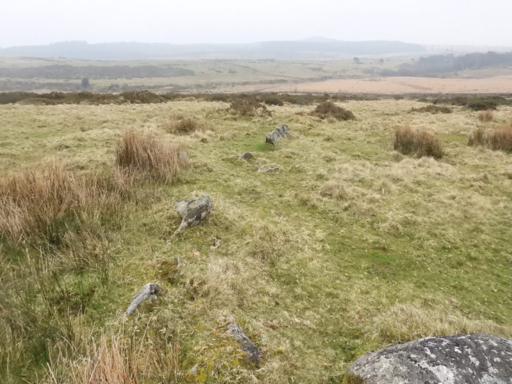
Sketch map of the features covered in this post.Stinnons (or Stennen) Hill rock-fieldLogan stone at west side of the Stinnon Hill rock-field. The trees at Powder Mills can be seen in the distance.The logan stone is located at SX62310 77990The author’s attention was drawn to this combination of rocks, which looked like a lounger.The remains of a small building and linhay as viewed from the north east. The walls are very substantial for a structure which is 200 years old.The north east end of the ruins has been described as a dwelling house. It measures around 6.7m long by 4m wide. The centre if the dwelling is at SX62400 77851At the south west end of the ruins are three massive upright posts (around 1.8m to 2m tall), which has been described as fronting a linhay or byre. The linhay or byre measures around 8.8m by 2.7mInternal north east corner of the dwelling. The construction is a random coursed drystone ranging from small stones to very large slabs. The north east end of the ruins is most likely to have been a dwelling but there is no visible fireplace.The buildings are depicted as unroofed on the 1890 OS map. The ruins are believed to have been connected with the establishment of the Newtakes in the area, which enclosed the area in the first decade of the 19th century.The Royal Commission for Historical Monuments of England (RCHME) record that the ruins were most likely used by a shepherd or stockman looking after animals at the turn of the 18th century / 19th centuryThe centre of the linhay is at SX62394 77845View of the linhay through to the dwelling from south west end of the ruins. Butler records the three uprights as being formerly for supporting the roof. He further states that as there are no drill marks here this dates the building before 1830. This side on view of the south west end of the linhay indicates how substantial the walls area, which are around 1m thick.All records of the linhay (or byre) end of the ruin only mentions three uprights (or orthostats). However, on the ground to the south west of the last upright, there appears to be a 4th orthostat.There does appear to be a ‘gap’ where a 4th orthostat may have once stood. Is the stone annotated in the picture this orthostat.Part of the sub-oval, prehistoric enclosure / settlement wall joining the ruins at their east side. The enclosure measures 84m by 58m (approx. 0.5 hectare)One of the four hut circles associated with the settlement. This is the only one not attached to the external walling of the settlement.This hut circle is located at SX62415 77819Second hut circle joining the external settlement wall. The second hut circle is located at SX62425 77786The third hut circle is now engulfed by gorseThere is very little evidence of the 4th hut circleThis cist is oriented north – south and is in very good condition with the capstone resting on the east side. In the authors humble opinion, this is one of the best preserved cists on the moor. It is located at SX62569 77898The depth of the cist is 0.6m and is about 1.1m long by 0.65m wide. The cist forms part of a cairn / circle which has a diameter of 5.5m. Powder Mills can be seen in the right hand photograph around 500m awayThe second cairn with cist in the area is located at SX62609 77827. There is only one stone on one side of a cist, which is likely to have been damaged by partial excavation or even robbingThe cairn is 5.8 metres diameter. The central pit (cist) stone is 1.4 metres long by 0.55 metres