A collection of walks, discoveries, insights and pictures of exploring Dartmoor National Park
October 17, 2021
Hutholes Medieval Settlement
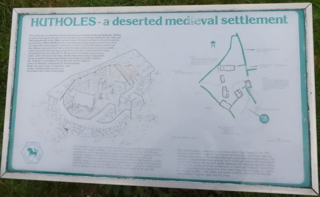
The Hutholes Medieval settlement has been under the care for conservation and maintenance by Dartmoor National Park since 19th December 1986, following an agreement with the late Mr Hermon French. The site had been excavated by a Mrs Minter in 1964 and 1965, who also had excavated Hound Tor Medieval village and Dinah Clark’s Longhouse (near West Shallowford). The settlement comprises six buildings and is believed to have been founded some time in the late Saxon period and was abandoned in the 14th century. The information for this post has been obtained from Dartmoor Atlas of Antiquities, volume one (the east) by Jeremy Butler, the Heritage Gateway (HER) and from the information board found on the site.
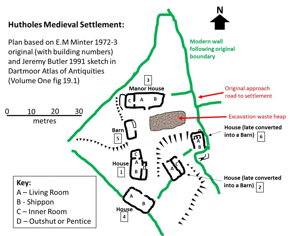
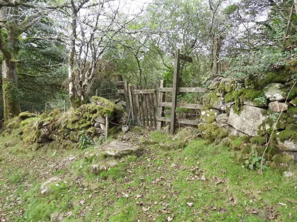
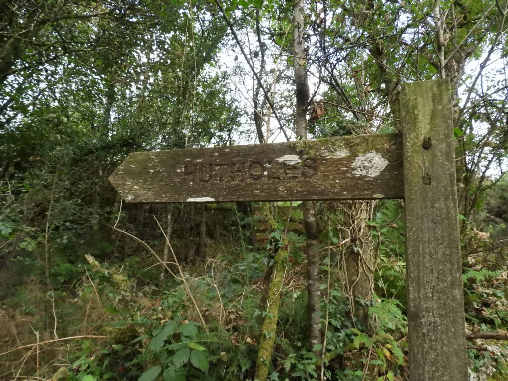
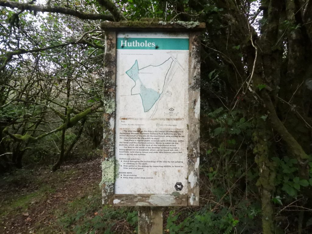
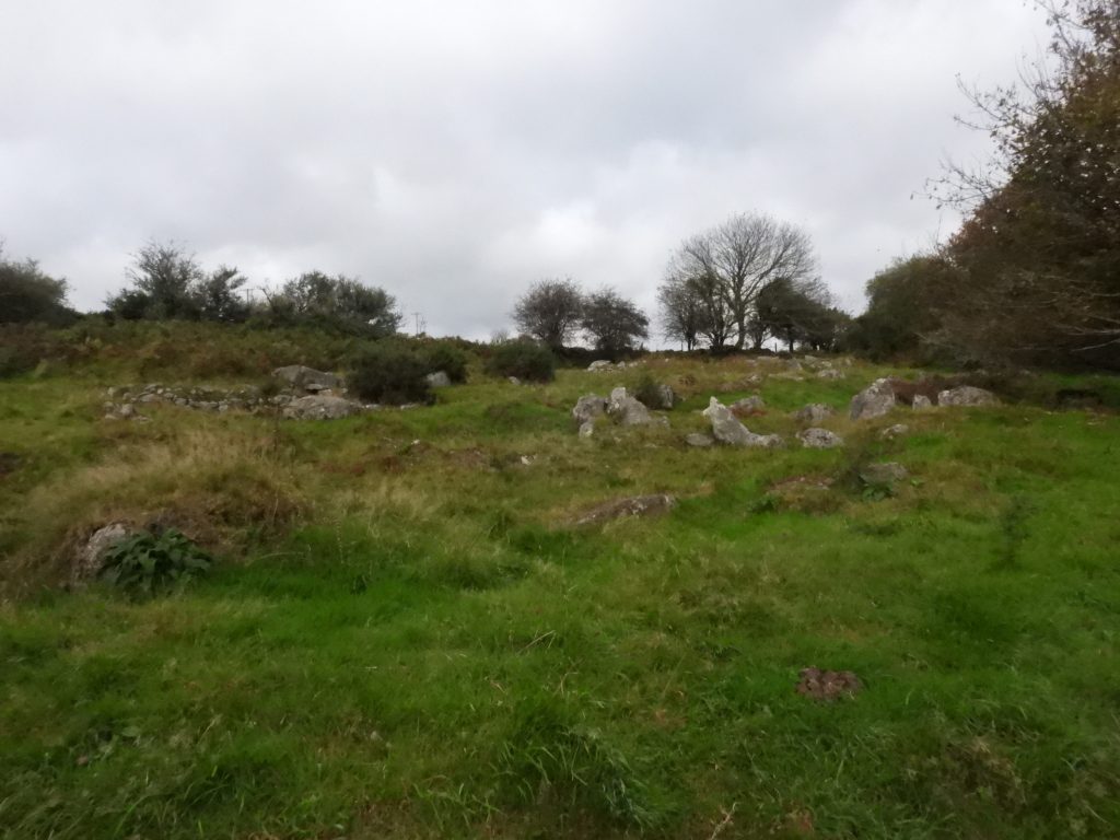
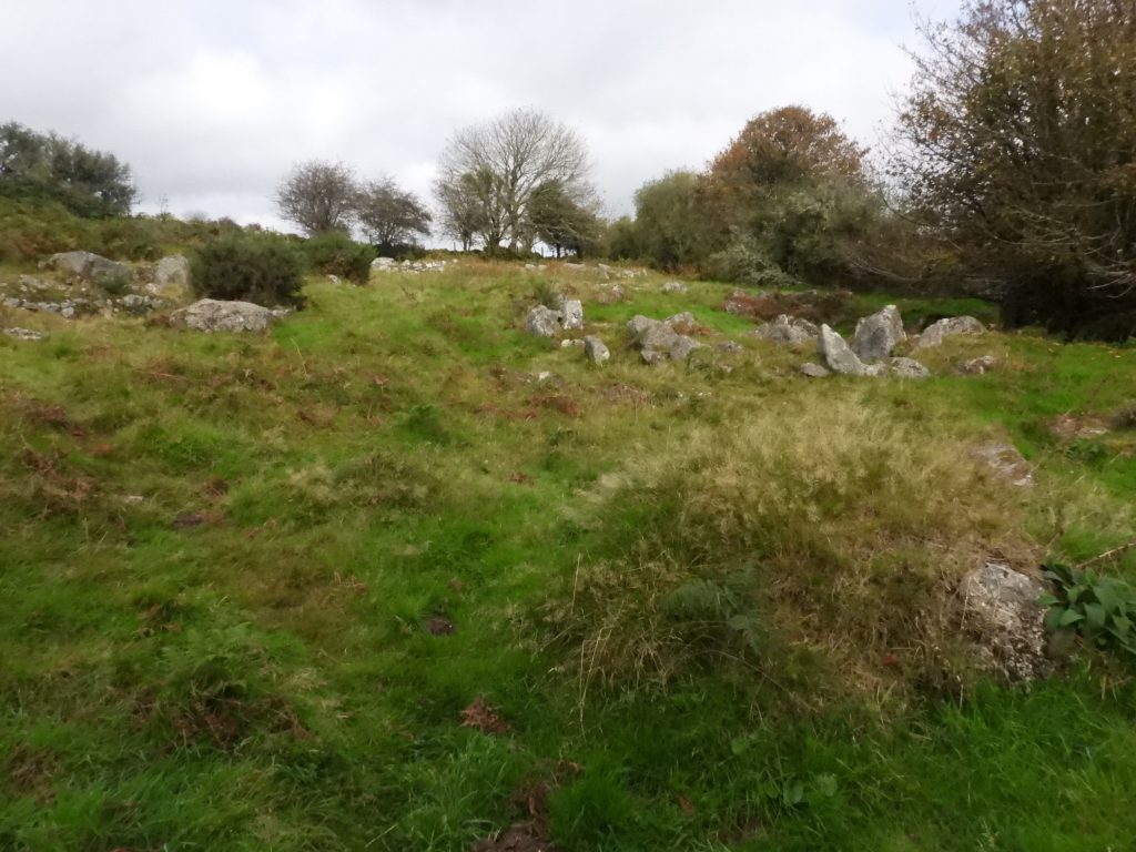
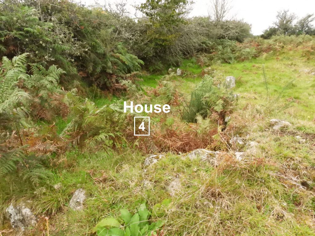
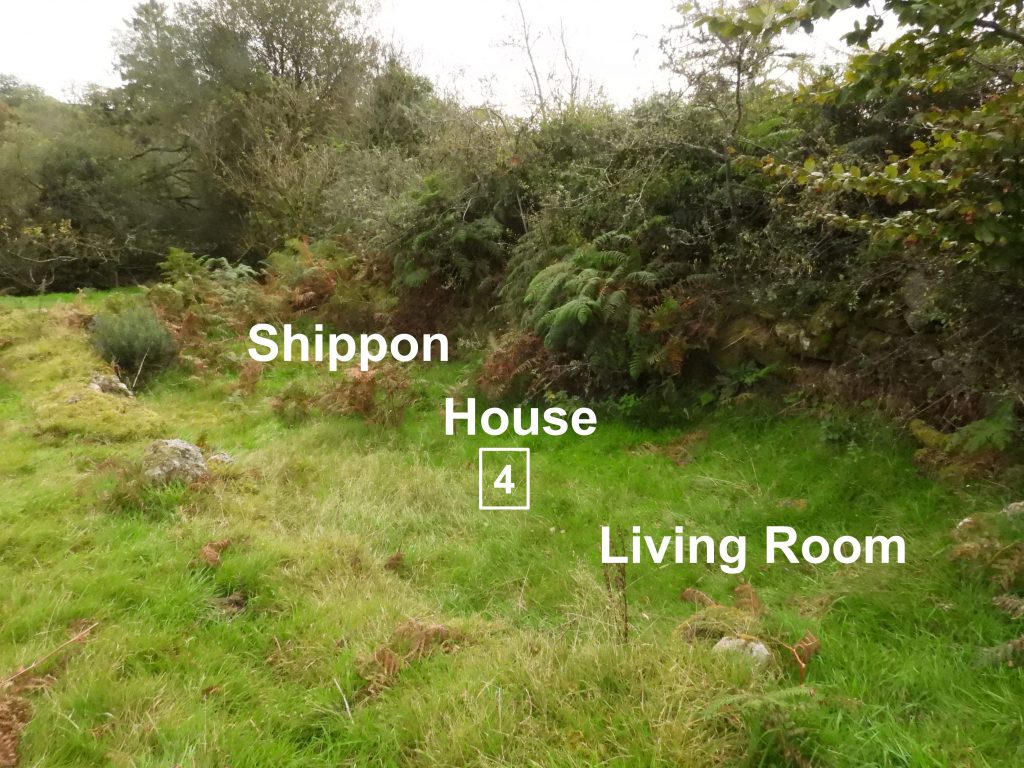
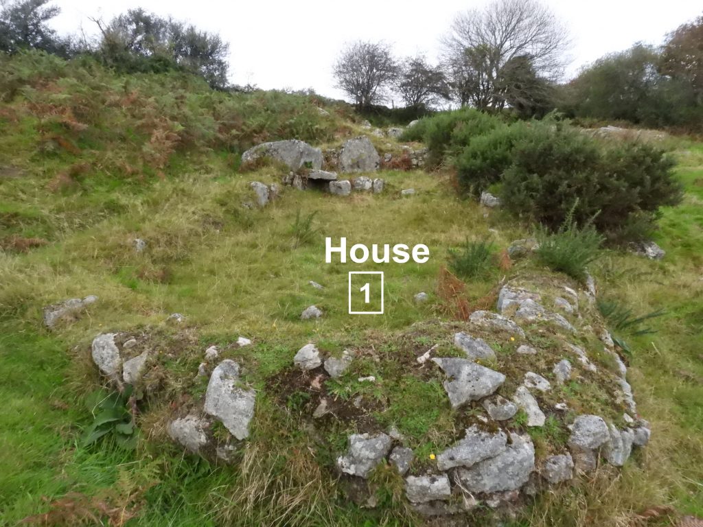
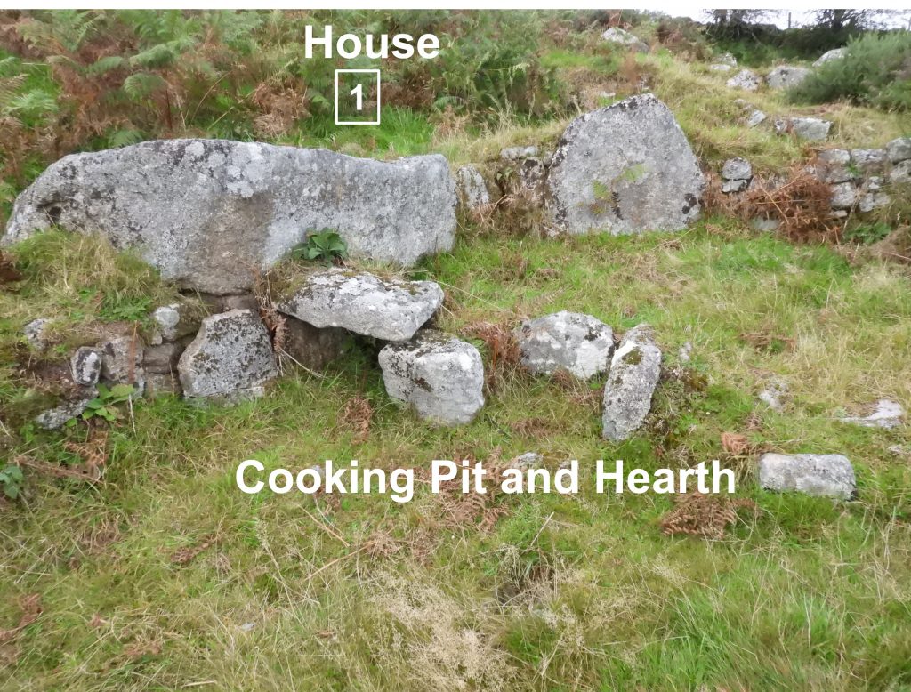
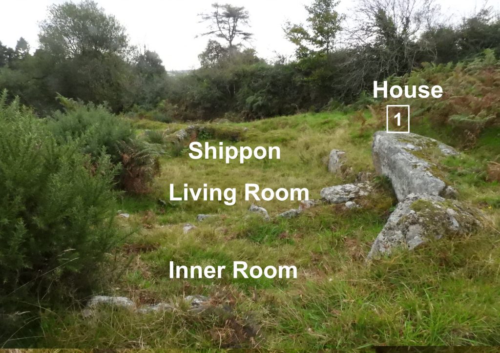
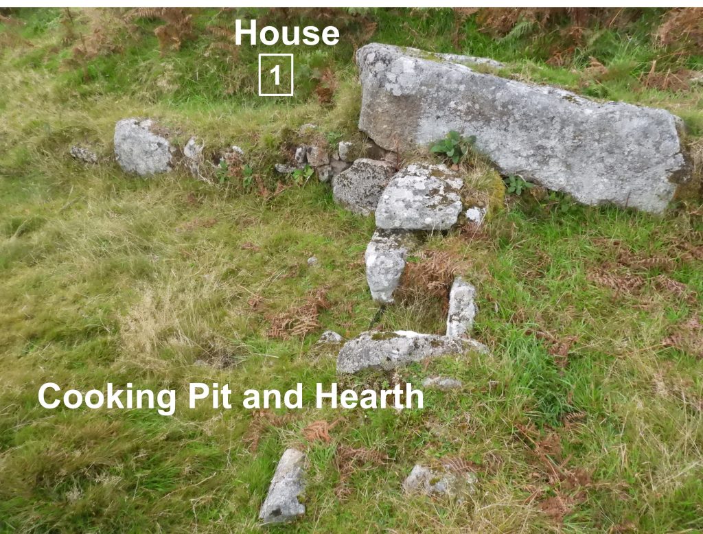
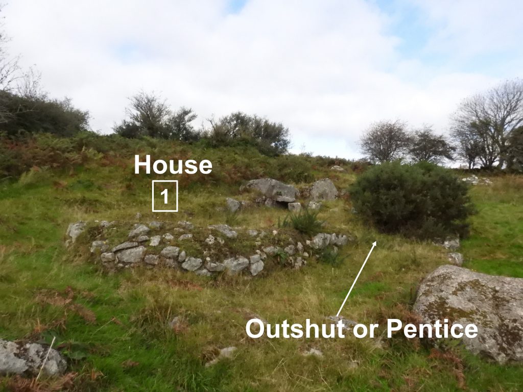
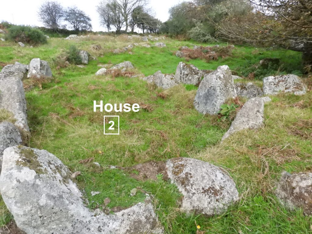
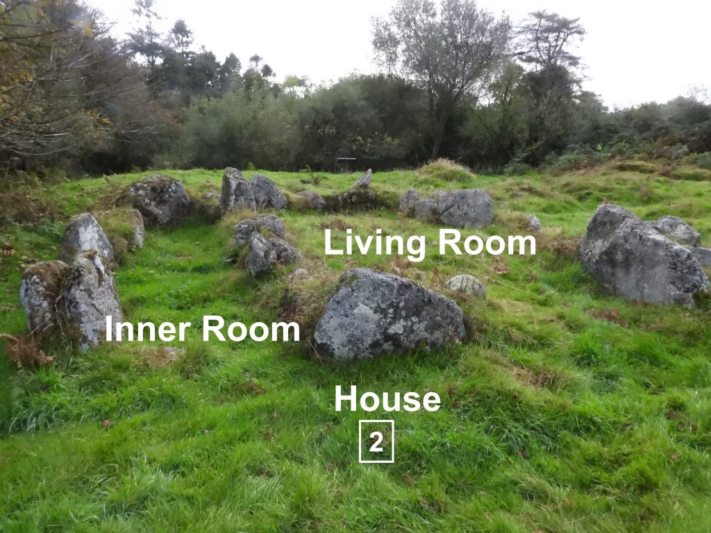
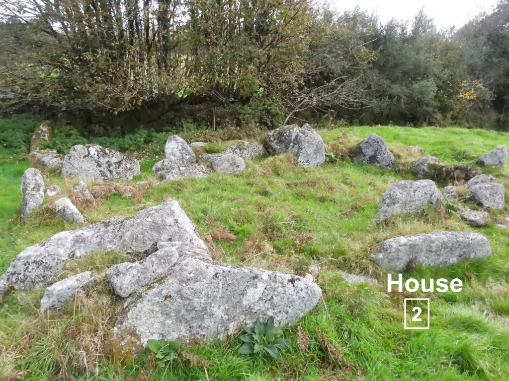
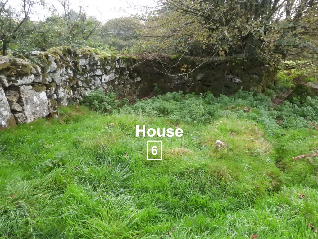
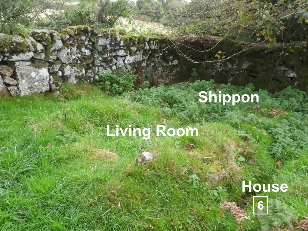
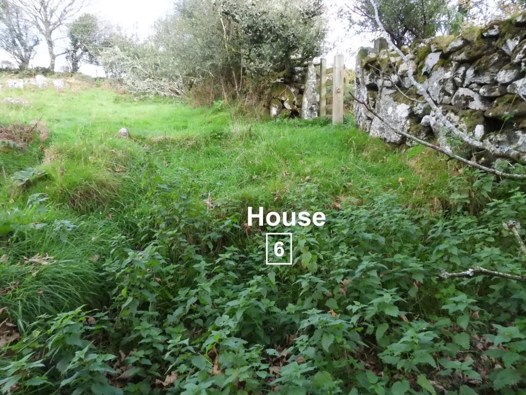
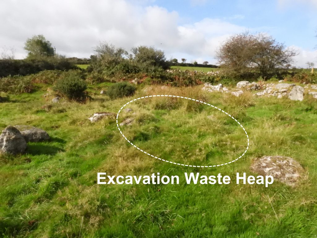
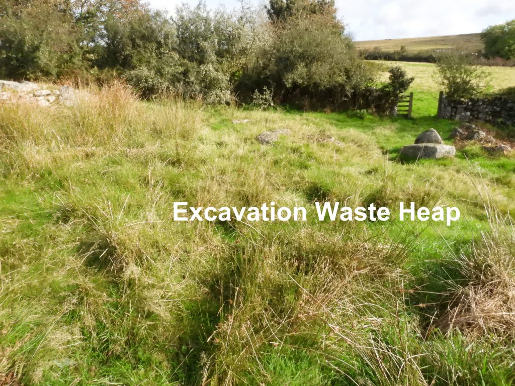
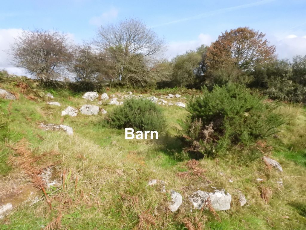
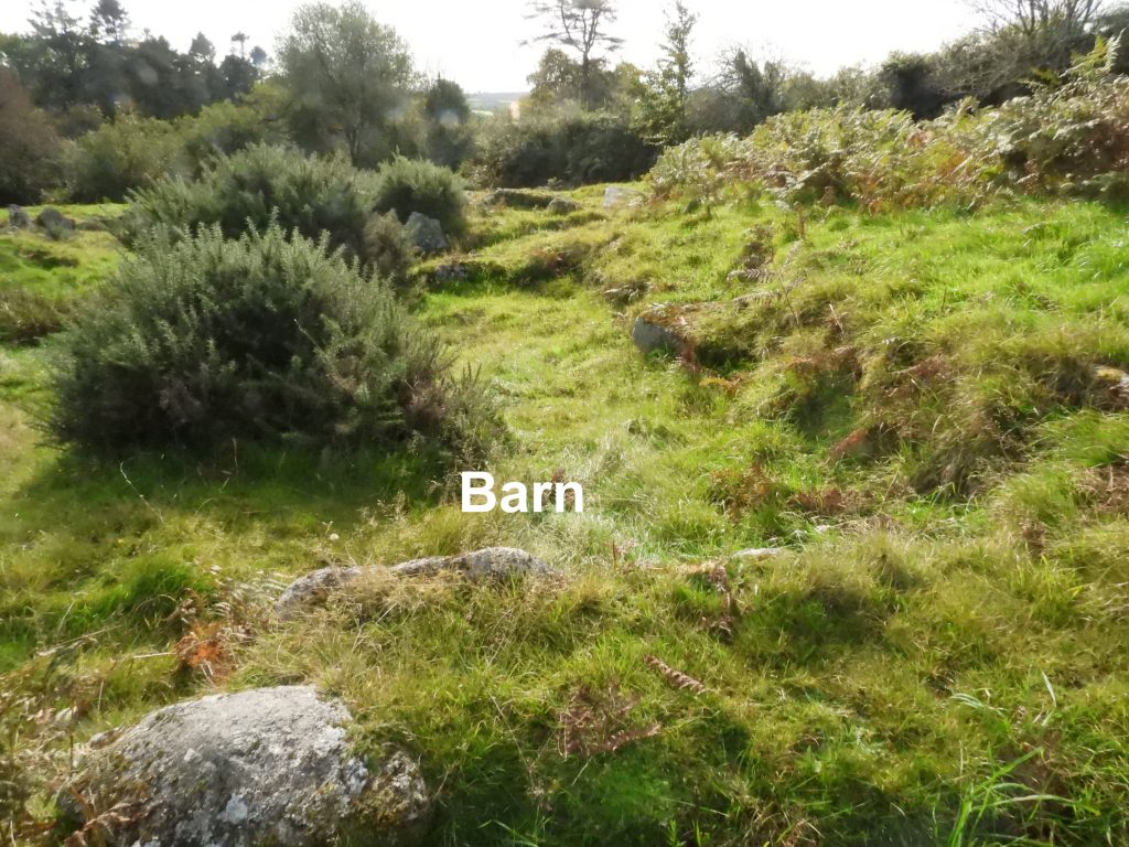
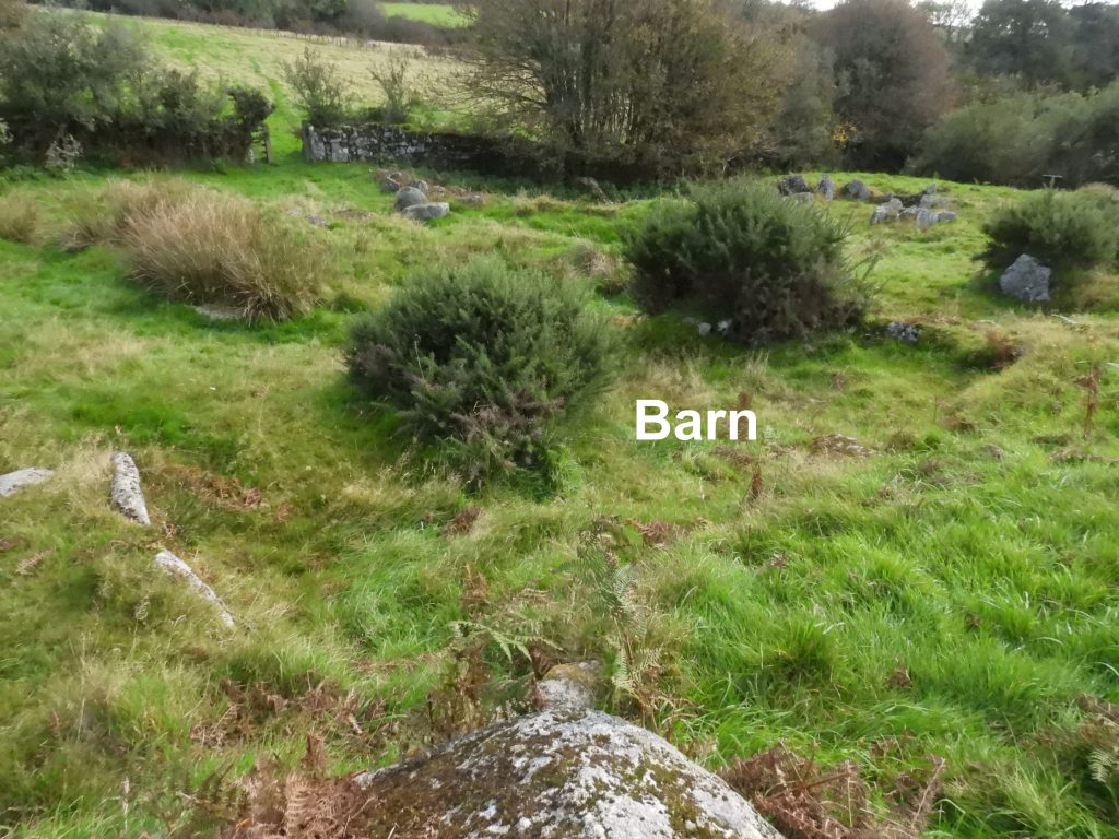
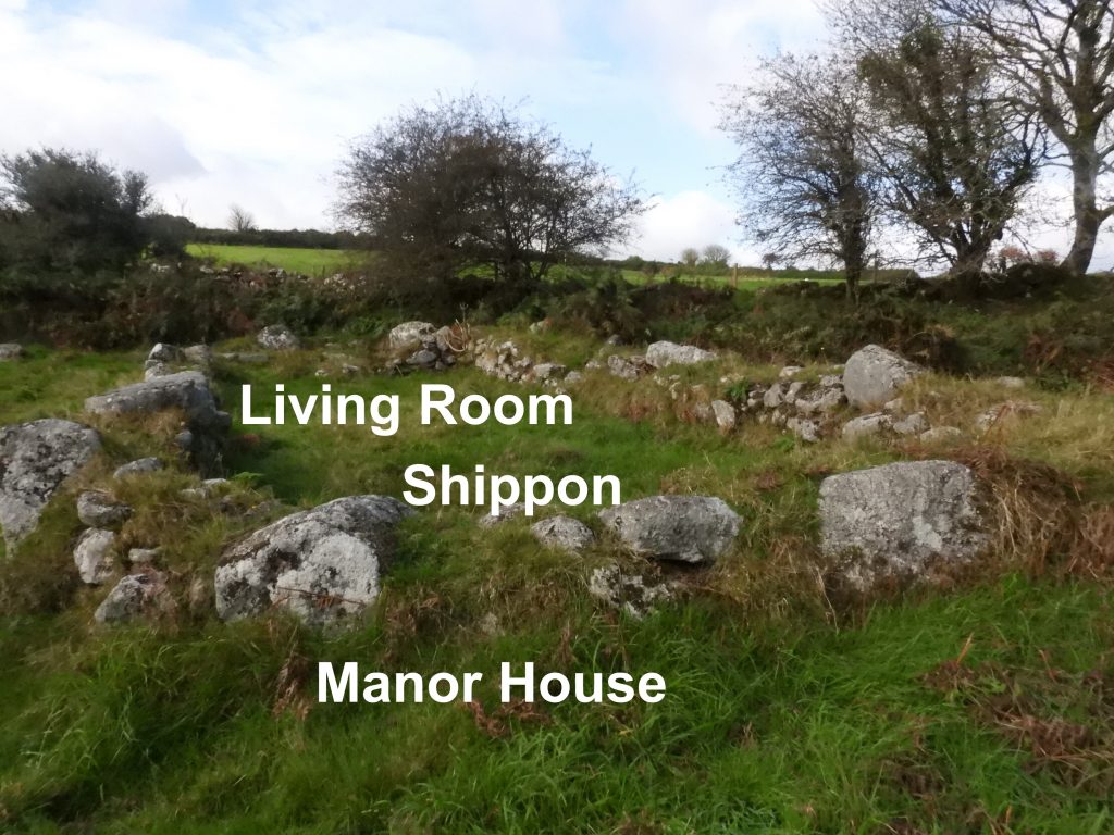
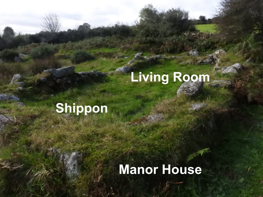
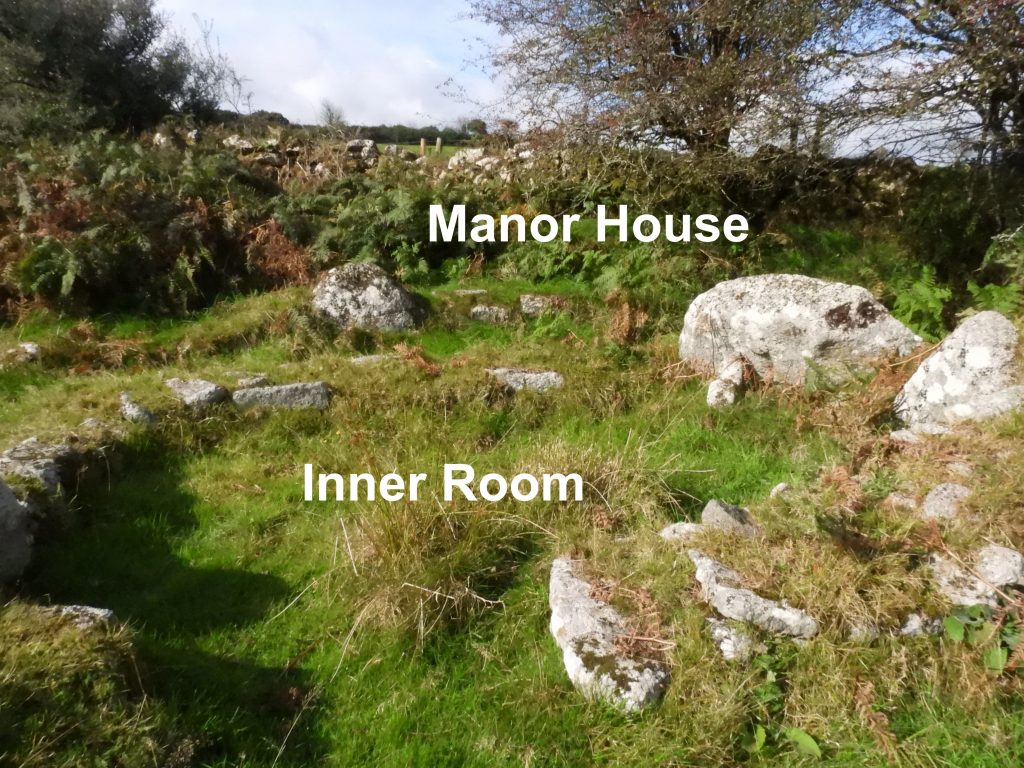
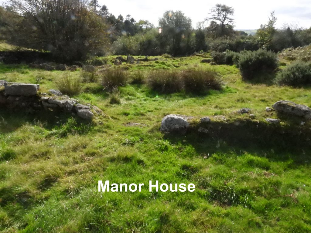
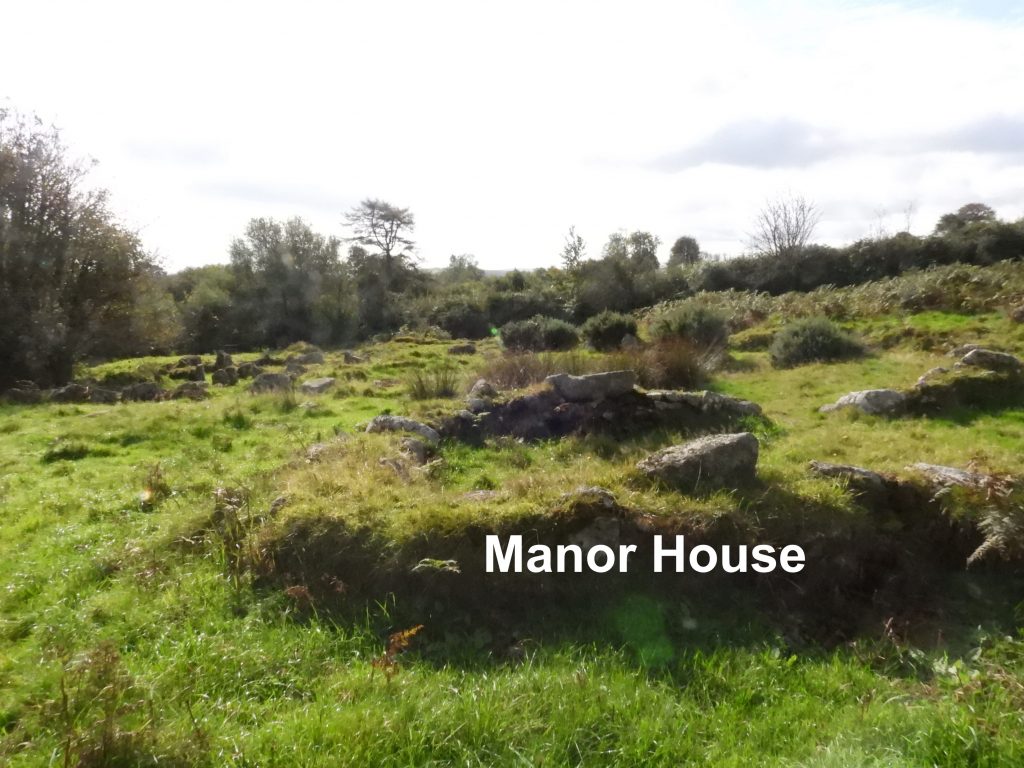
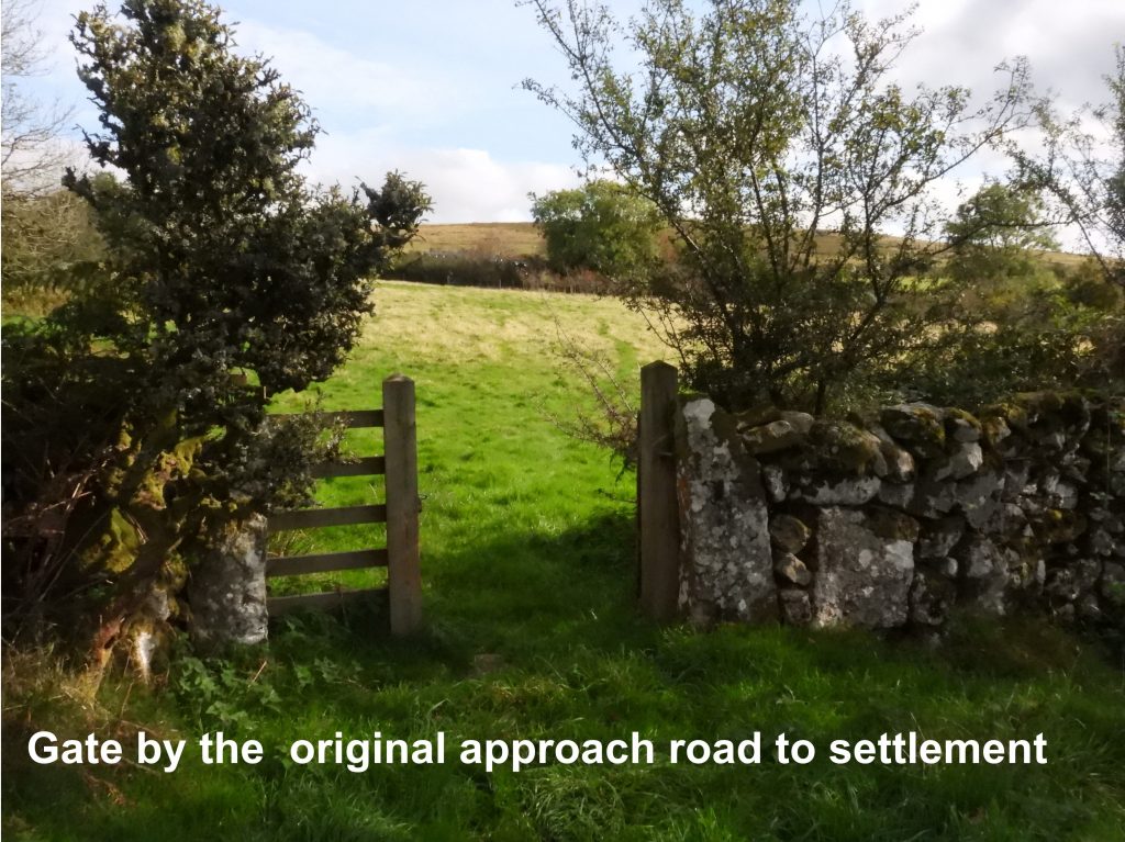
This sketch has been created using information from the original E.M.Minter plan plus the plan found in Butler (fig 19.1). The sketch uses the same building annotations as Butler and to Mrs Minter (and subsequently those found on the information board on site).Hutholes is located in the Manor of Rowdon between Rowden Tor and Wind Tor. The entrance to the site can be found approx. 100m down the Dockwell road from the crossroads and is simply marked by a fingerpost alongside a gate.The simple Hutholes fingerpost now showing its age being partially covered in lichen.Just inside the gate is an information board, which has seen better days, now covered in dirt and lichenApprox 100m from the gate into the site (having walked through a small copse), the settlement can be found. The information board is very good and enables the visitor to get a good perspective of the “deserted medieval settlement”.General view of the settlement, looking north. It occupies approx an acre of waste ground known as Old Walls. (Linehan, C. D., 1965, Deserted Sites on Dartmoor, Devon)The medieval settlement is also known as South Rowden and may have been where the original Dewdon or Jordan manor house was located. The manor is mentioned in the Domesday Book as held by Alric in 1066 who had been obliged to relinquish it in favour of Wliiam de la Falaise by 1086. Butler, J., 1991, Dartmoor Atlas of Antiquities: Volume One – The East, 141-2The closest house to the information board (in NW direction) is annotated number 4. Butler describes this building as being 10.5 metres long by 4.6 metres wide and being wider than usual in proportion to its length. House number 4 is recorded as being split into the the traditional living room / shippon arrangement, with the latter being at the lower end of the slight slope. The entrance was along its longer (eastern) edge. The western wall acts as the foundation for the field wall. This house is centred at SX70188 75852Moving northwards up the western field wall, house number 1 is reached. It is recorded by Butler as being 10.5 metres long by 3.7 metres wide and has a well preserved cooking pit alongside the hearth in the living room. As with building 4, the living room area occupies the upper end and the shippon (for cattle) the lower end. Close up of the cooking pit and hearth in house number 1.From the cooking pit / hearth there is a step led up from the living room into an inner chamber where an unbroken pane of green glass was found (ref Butler).Side on view of the cooking pit and hearth.As indicated on the information board, house number 1 had an outshut or pentice ( ie a narrow, sloping extension of a building’s roof, providing cover to a porch). House number 1 is centred at SX70193 75856House number 2 is just a few metres east of building number 1. It is believed to have been converted to a barn at some point. Butlers description of this dwelling is that it is 6.5 metres long by 3.1 metres wide with a pentice along one side, although the information board describes this as an inner room. Butler does state, however that the building had been used as a barn during the last period of occupation but had probably been constructed as a dwelling house originally. As shown in the plan sketch in this post, there is a low linear wall (called a “mund” in the Heritage Gateway) connecting houses 2 and 4, which can just be seen in this photograph just above and to the right of the words “living room”House number 2 is centred at SX70200 75857.House number 6 is located on the eastern wall of the settlement. Butler describes this house as being 9.2 metres long by 3.7 metres wide which was originally a two roomed house but which was later converted into a corn-drying barn.House number 6 was split into a living room / shippon. The information board on site (and Butler) state that at the living room end there was a kiln and oven. These would have been used to dry cereals as the worsening climate would have prevented this happening naturally.House number 6 is centred at SX70214 75868.Shown in Butlers Dartmoor Atlas of Antiquities, volume one (the east), figure 19.1 is an area marked as “excavation waste heap”. It is not shown on the information board on site.After the original excavation the site was not backfilled. the excavation waste heap is centred at SX70200 75875.The Barn is annotated as number 5 and is believed to have been associated with house 3 (the manor house). The reason for the designation as a barn is because no hearth or cooking pit was found.The Barn is recorded as being 7.7 metres long by 3.1 metres wide.The Barn is centred at SX70187 75877The grandest of the houses is annotated number 3 and is believed to have been the original This may have been the original Dewdon or Jordan manor house as mentioned in the domesday book. However, as Butler describes being 14.2 metres long by 4.3 metres wide, it is much narrower than its turf walled predecessor and probably was no longer the Dewdon manor house by this time of the medieval settlement. The Manor House is centred at SX70193 75884.The Manor House had a shippon at its eastern end and a living room in the middle.At the western end of the Manor House was an inner room.View of the settlement looking south from inside the Manor House. To the north of the Manor House (behind the camera), is a very overgrown area which is recorded as containing the concrete foundations of a modern barn. Another general view of the settlement looking south from the Manor House. In the Heritage Gateway according to “a study of the surrounding hedges points to the probability that the village had been encroached upon by the cultivated fields. In several places the hedges appear to be reconstructions, so that the village may have been somewhat larger”. Linehan, C. D., 1965, Deserted Sites on Dartmoor, Devon,According to the information board the original approach road to the settlement was from the east.


Vanessa Jordan Abee May 16, 2025
I am interested in anything to do with Jordan my father was a Jordan
SteveGriggDartmoor May 22, 2025 — Post author
Thank you for reading the post