A collection of walks, discoveries, insights and pictures of exploring Dartmoor National Park
November 25, 2021
Hawns and Dendles Waste – An exploration
This exploration of Hawns and part of Dendles Waste includes the Hawns Medieval Farmstead, a number of hut circles, a cider press and a kerbed cairn / cist. The area was afforested with conifers in the late 1950s after much protest. These conifers were cut down after the Dartmoor National Park acquired the area in 1997. There are a few tree stumps remaining in the area and at the time of writing this post, there appears to be a program of re-planting on a limited scale of what looks like broad leaf trees (with deer proof fencing). The features of this post now all lie in relative open moorland, albeit OS maps suggest part of the area (e.g Farmstead) is still afforested.
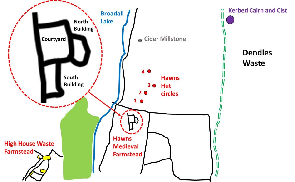
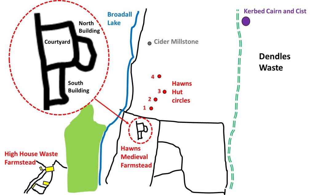
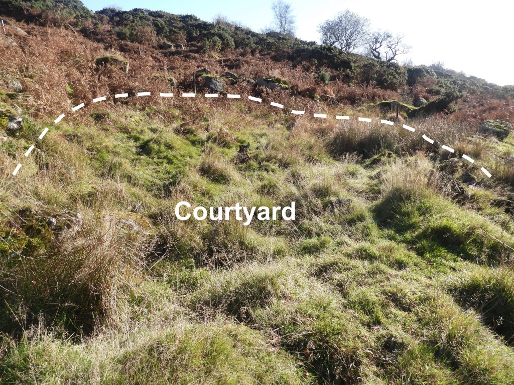
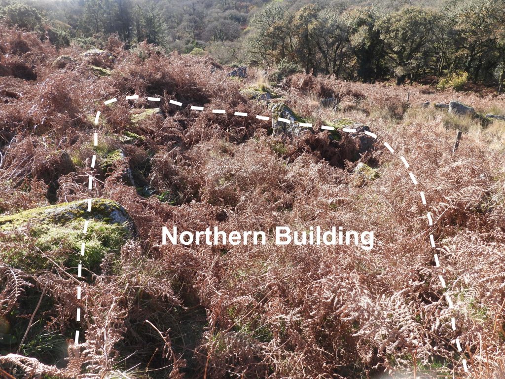
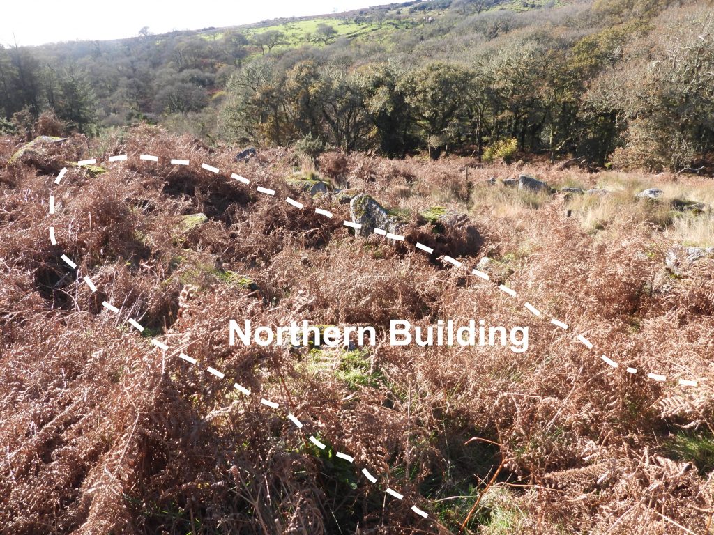
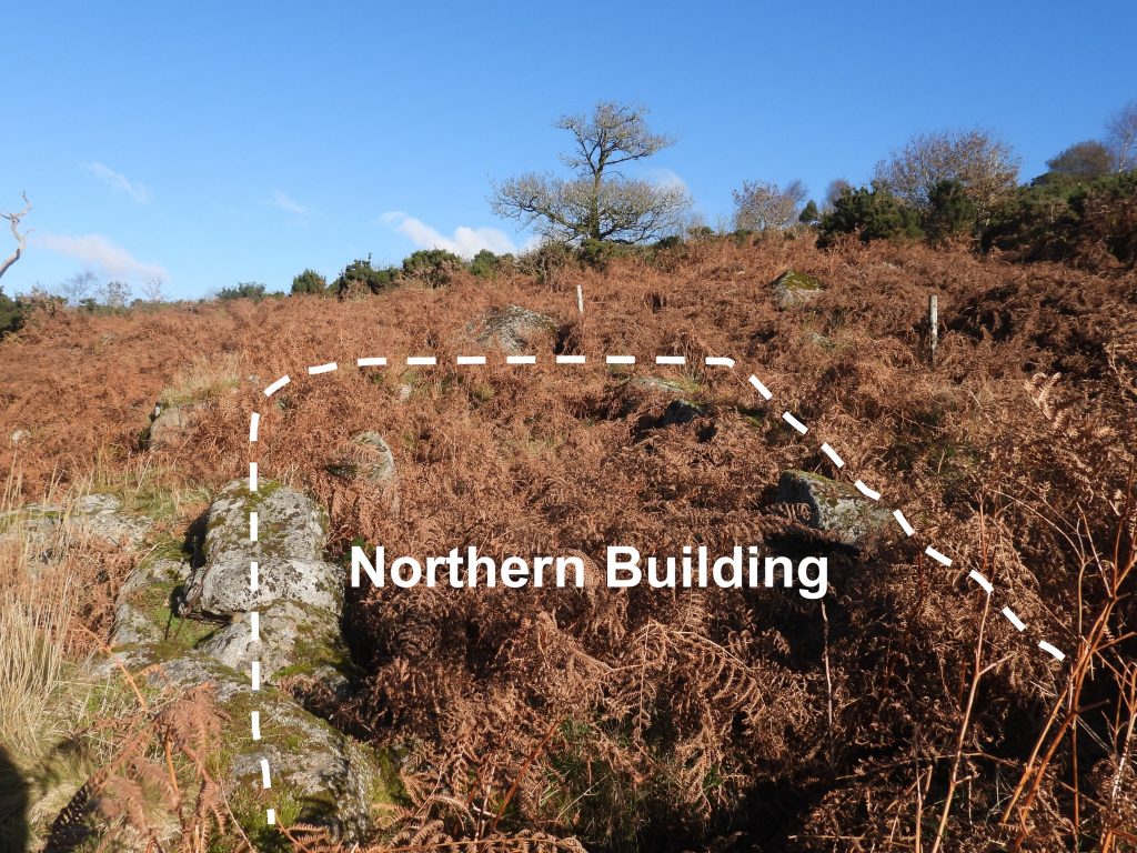
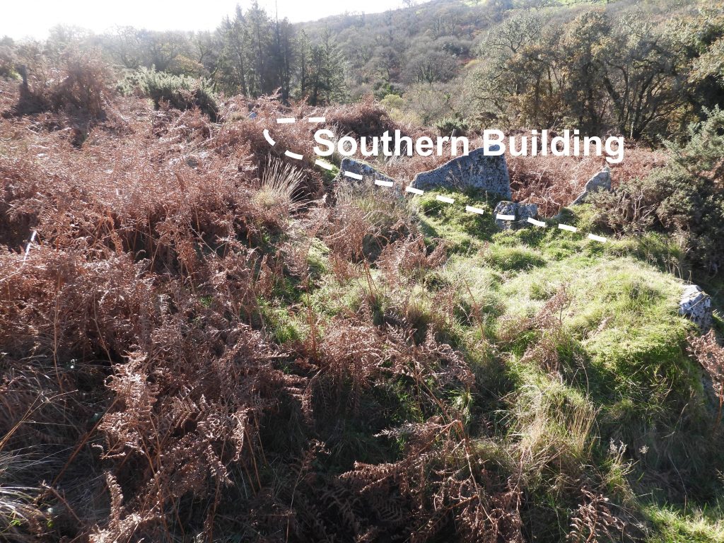
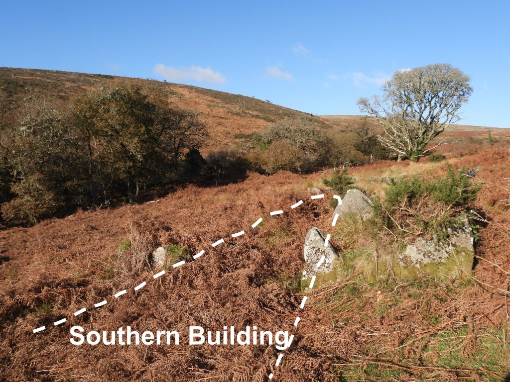
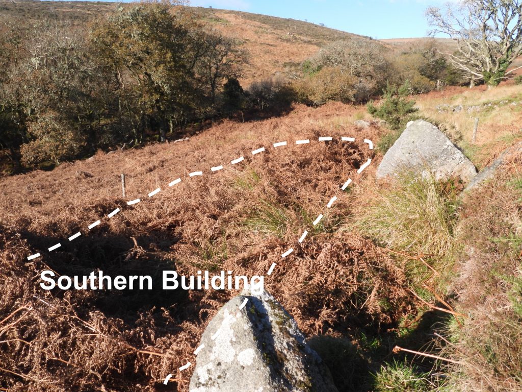
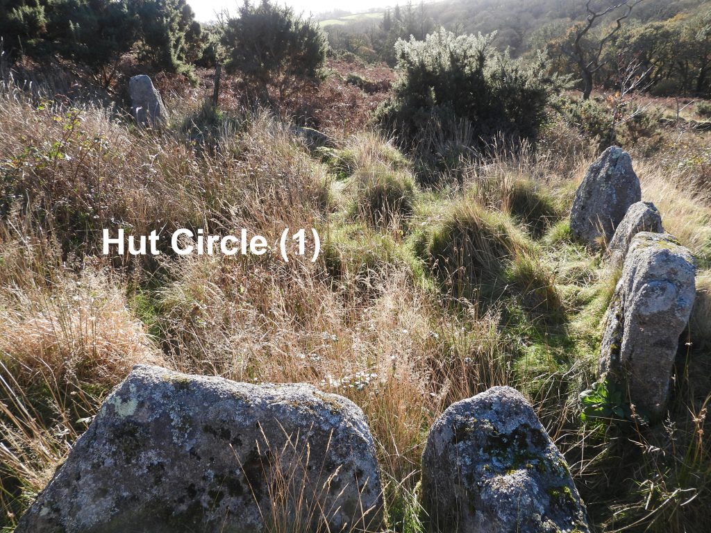
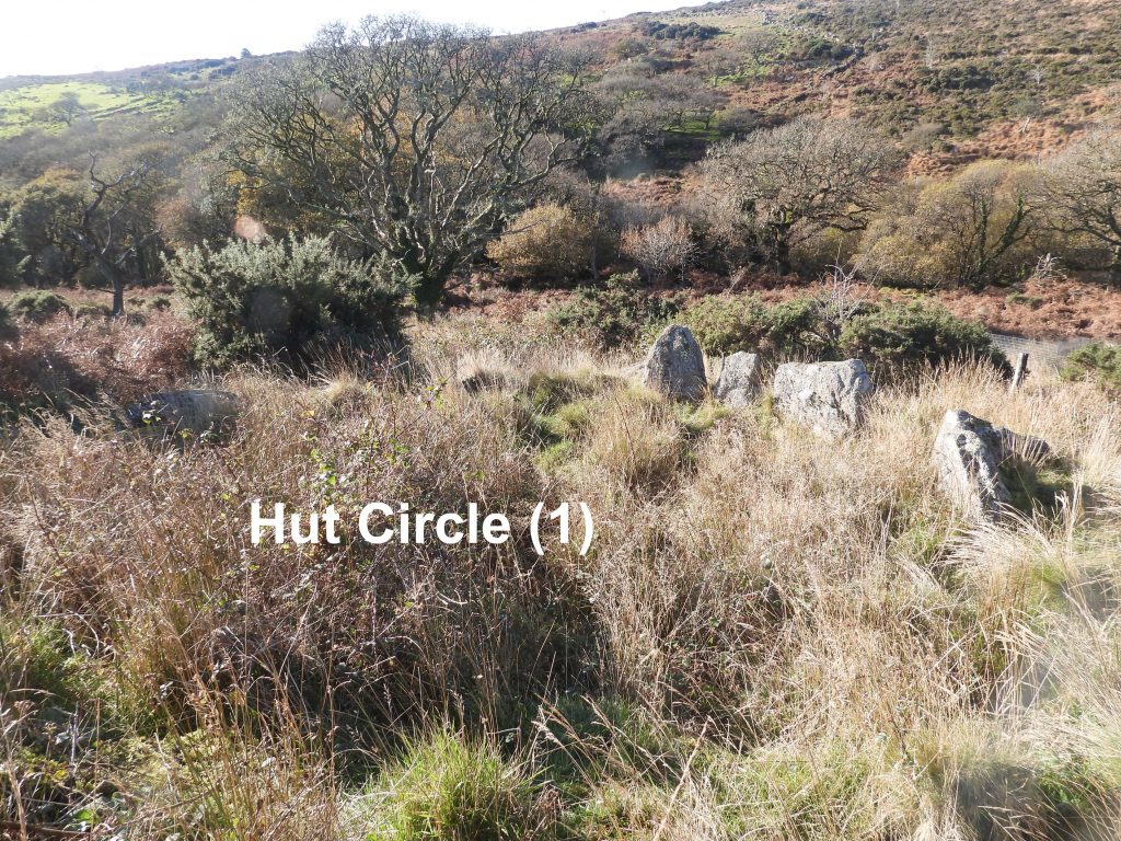
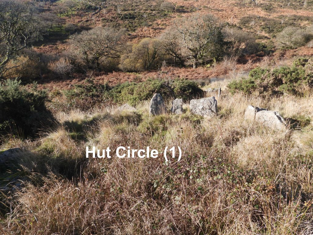
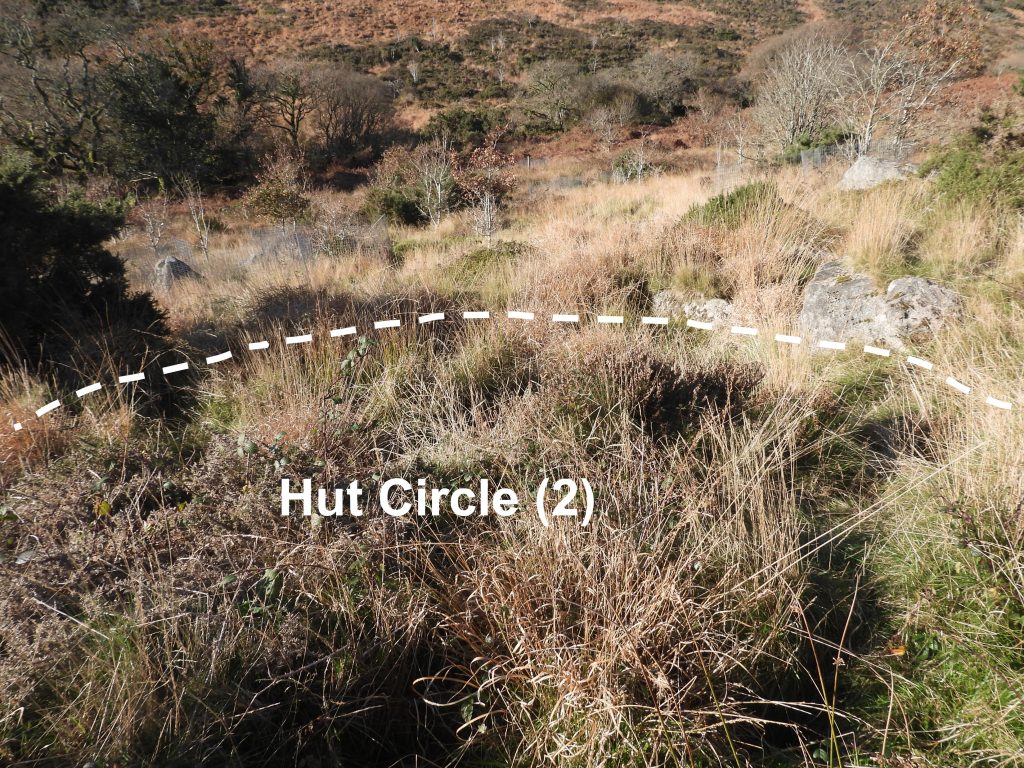
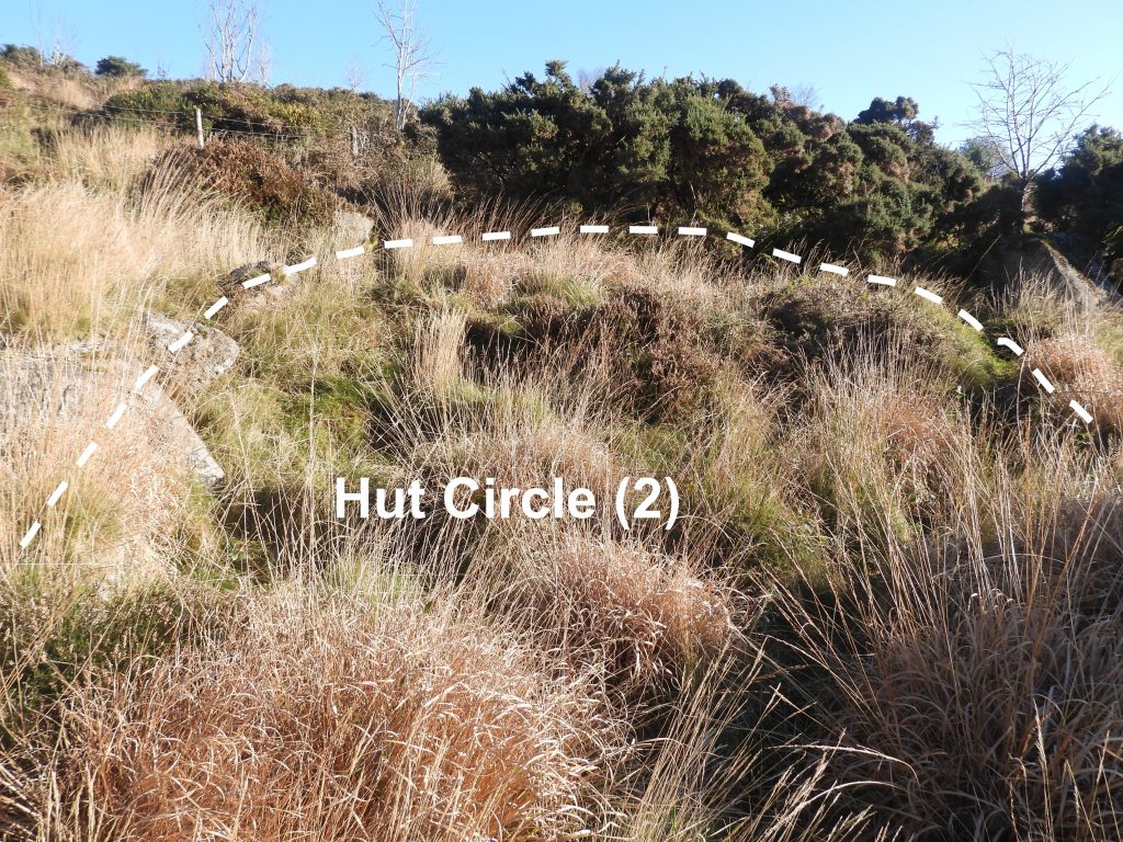
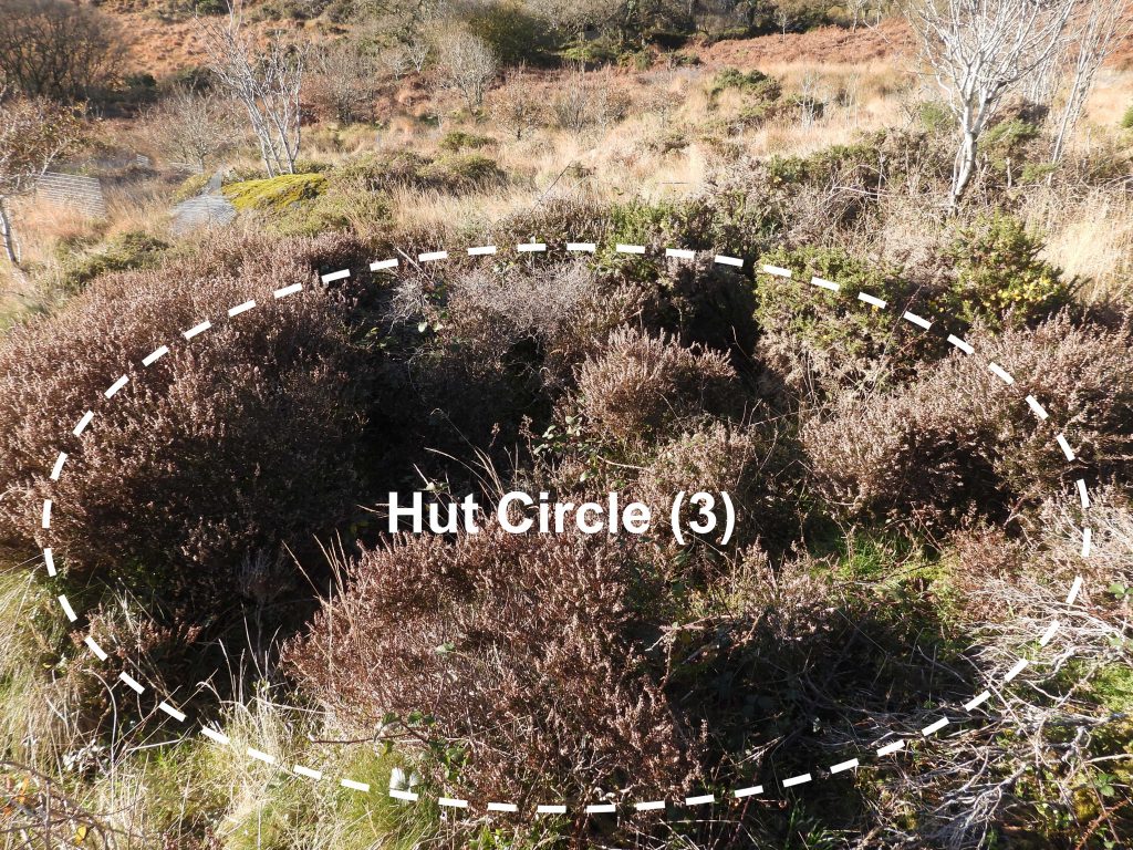
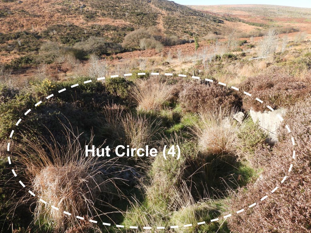
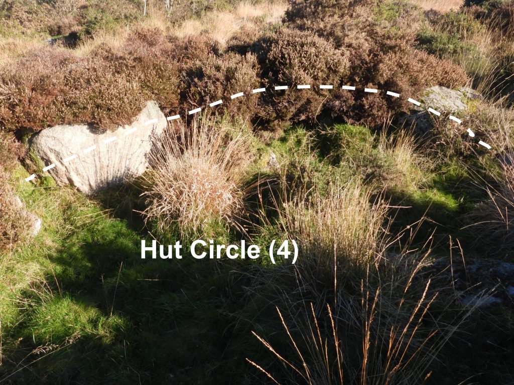
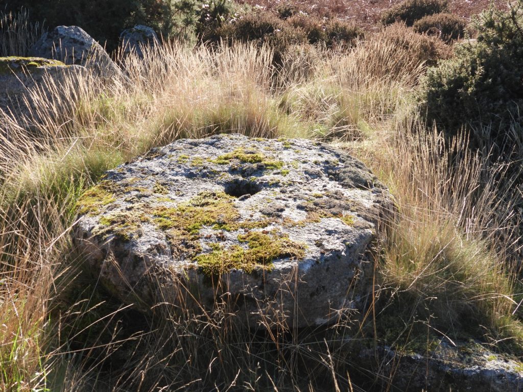
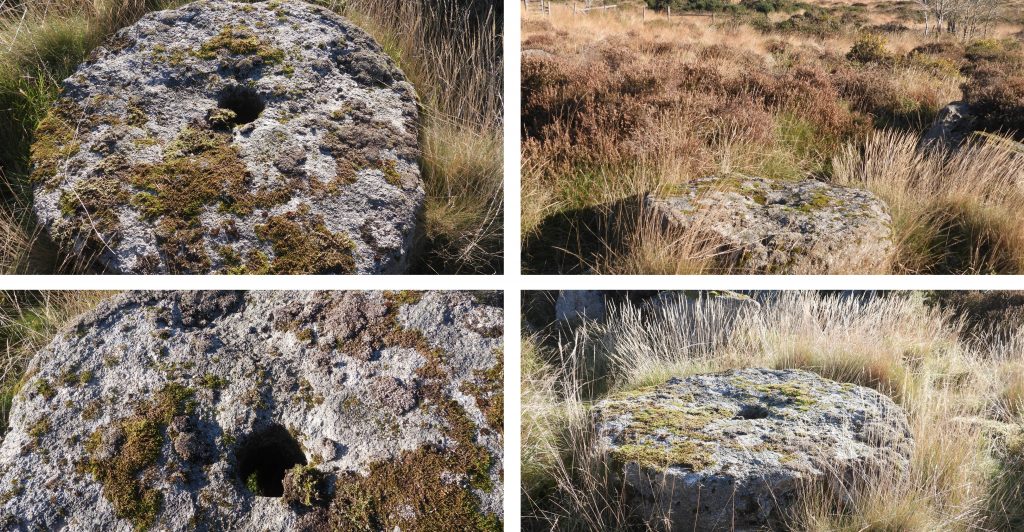
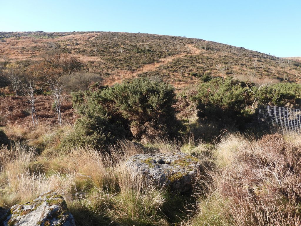
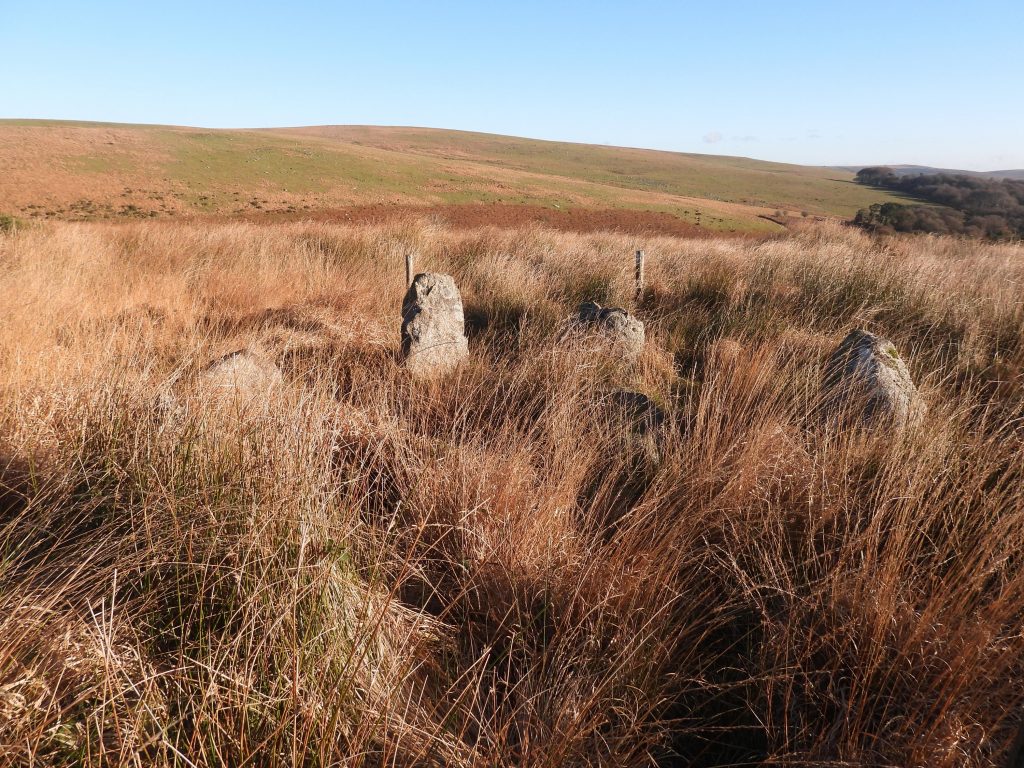
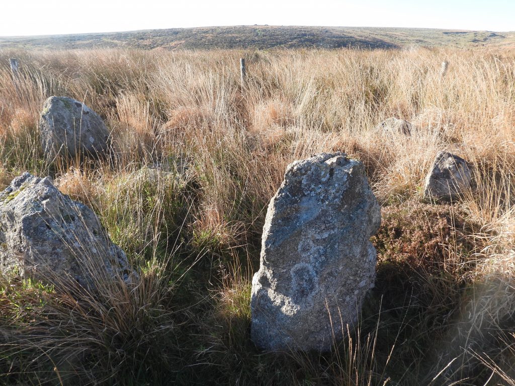
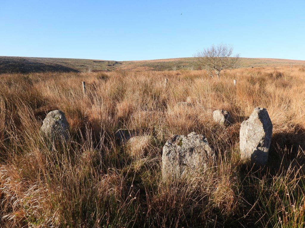
Sketch Map of features covered in this post with the exception of High House Waste Farmstead, which is covered in a separate post: https://dartmoorexplorations.co.uk/category/farming/high-house-waste-farmstead/Hawns Medieval Farmstead Courtyard.Hawns farmstead comprises two ruined buildings connected by and built into a small courtyard enclosure which is roughly trapezoidal in shape. The centre of the courtyard is located at SX61290 62566The northern building of Hawns Farmstead is one of two rectilinear buildings, aligned with the contours of the slope.The Dartmoor HER records the northern building as: “The most substantial (building) and is orientated north-north-west to south-south-east, with an entrance midway along the western wall, opening into the courtyard”.The Dartmoor HER further states: “The building measures 10.6 by 3.8 meters and the walls are 1.2 meters thick on average, surviving to a maximum height of 1.15 meters. Some unusually large granite boulders are included in the walls”.The Northern Building is located at SX61303 62557From the Dartmoor HER: “The southern building is located 8.0 meters south-west of the first and is connected by a short section of enclosure wall. It is orientated north to south and is more irregular in form, being wider at the southern end”.The southern building is located at SX61294 62544.Another quote from the Dartmoor HER: “No north-eastern corner of the structure exists, rather the eastern wall curves gently into the western side, forming a semi-circular section of wall. The structure measures 11.4 meters internally, by up to 4.6 meters, the walls are 1.0 meter thick, standing to a height of 1.4 meters”. It is located at SX61294 62544. To the north of Hawns Farmstead, crossing an old boundary wall. there are four Hut Circles. The first hut circle has eight orthostats in situ although the position of the entrance is not evident.Hut Circle (1) has an internal diameter of 6.6 metres with a wall circa 2 metres thick.Hut Circle (1) looking across Broadall Lake. It is located at SX61323 62601.Hut Circle (2) is 6.2 metres internal diameter with only four surviving stones and no apparent entrance. Hut Circle (2) is located at SX61331 62621Hut Circle (3) is a rather ill defined ring of rubble and tumbled stones covered in vegetation and is around 6 metres internal diameter and no apparent entrance. It can be found at SX61341 62669. Hut Circle (4) has an internal diameter of circa 6.5 metres.Hut Circle (4) has five orthostats on the north-east side and two other slabs which have collapsed inwards. The position of the entrance is not evident. It can be located at SX61352 62644.North of the hut circles lies a rather impressive abandoned granite cider press millstoneor ‘edge runner’.The Dartmoor HER states: “The abandoned and unfinished granite cider mill stone or ‘edge runner’ is 40 metres east of Broadall Lake. The circular stone has a flat upper surface with a diameter of 1.33 metres by approximately 0.26 metres thick”. The abandoned granite cider press millstone has “a central hole of 0.13 diameter tapers slightly to 0.09 metres. The stone was probably abandoned when a large section of the circumference fractured off”. It can be located at SX61315 62746.On the top of the ridge by Dendles Waste is a cairn circle and cist which (Dartmoor HER) “consists of eight flat slabs, set on edge and has an internal diameter of approximately 3.4 metres. Some of the stones from the western quadrant of the circle are missing, a single earthfast stone is all that survives”.The Dartmoor HER states: “The rectangular cist lies roughly centrally within the circle and is oriented east to west. It measures 1.2 metres long by 0.6 metres and 0.5 metres deep with slabs still in place both sides. All traces of the cairn material which would have originally formed a small mound over the cist have been removed”.This monument is mentioned by Jeremy Butler, in Dartmoor Atlas of Antiquities, Volume Three – The South-West (1994), 194. It is further described as “partial kerb of nine large orthostats standing up to 1.1m high forming an incomplete ring measuring approximately 4m in diameter internally which surround a centrally placed rectangular cist which measures 1.2m long, 0.6m wide and 0.5m deep. The coverstone is missing”. It can be located at SX61531 62796.