A collection of walks, discoveries, insights and pictures of exploring Dartmoor National Park
July 3, 2020
FOGGINTOR QUARRY
Steve Grigg and Frank Collinson
For those amateur Dartmoor industrial archeology enthusiasts Foggintor Quarry and its environs are an absolute treasure trove. Kath Brewer wrote two articles for the Dartmoor Magazine in Spring and Autumn 1987 on the area as well as an excellent book called “The Railways, Quarries and Cottages of Foggintor”, without which much of this area would still remain a mystery to me. This post is an attempt to photograph all the main elements of the area
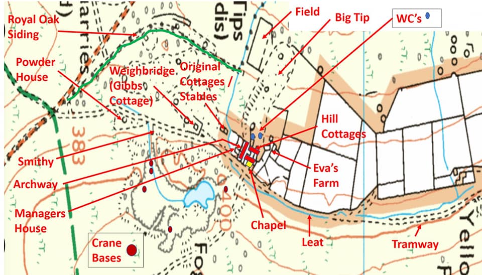
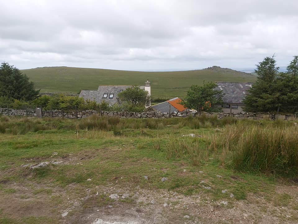
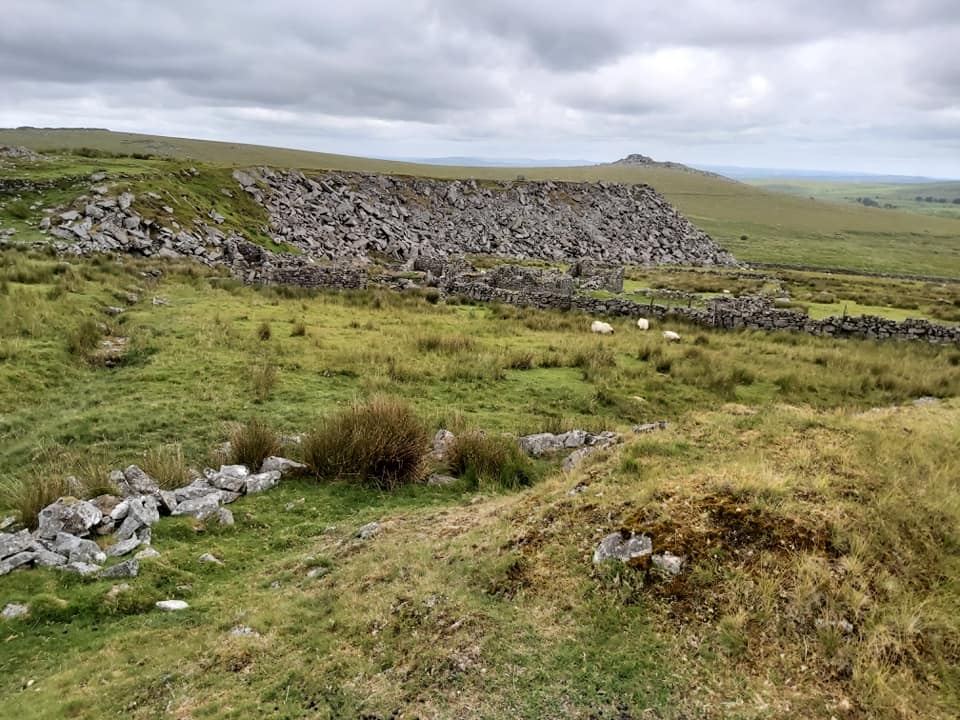
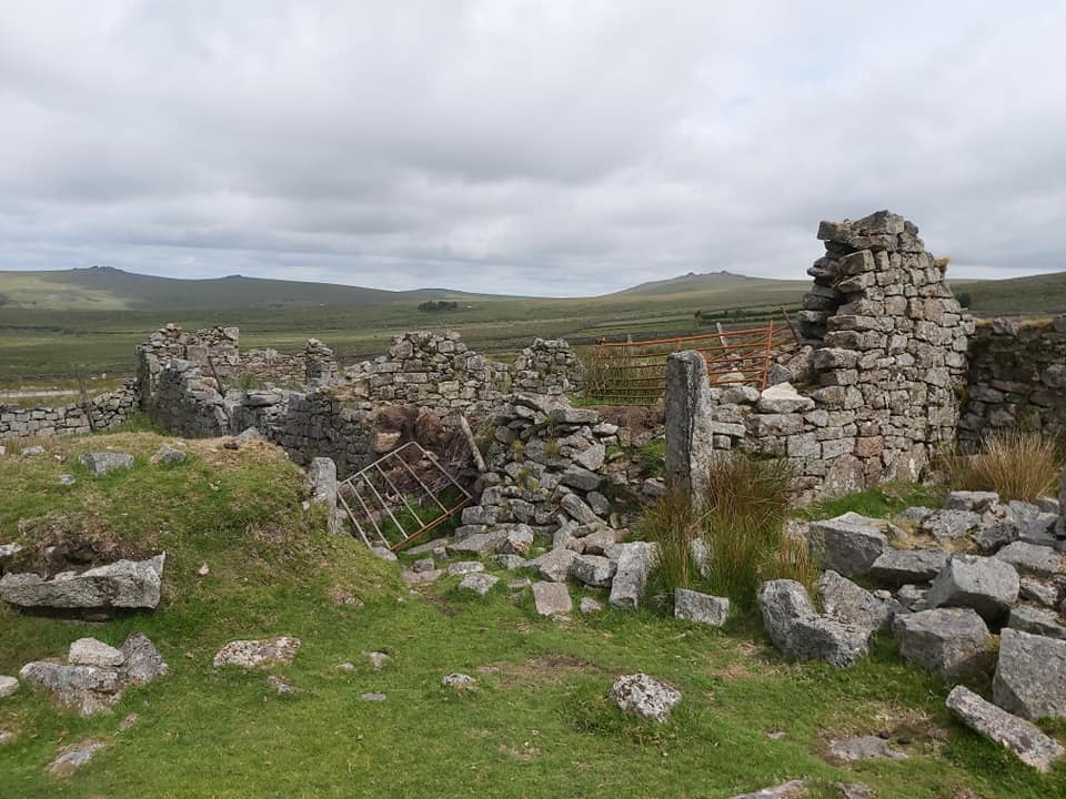
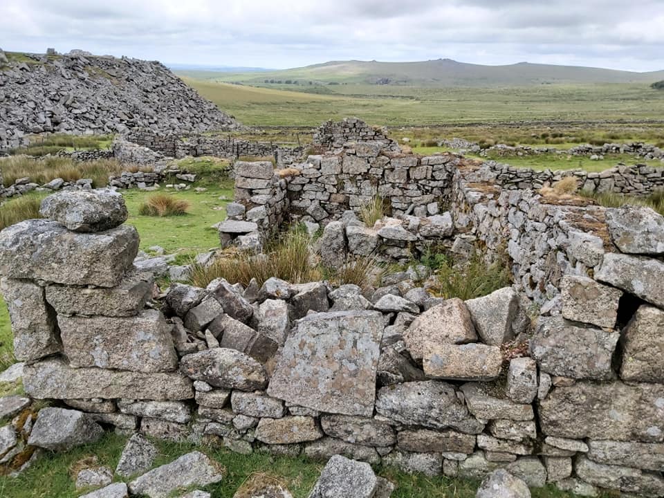
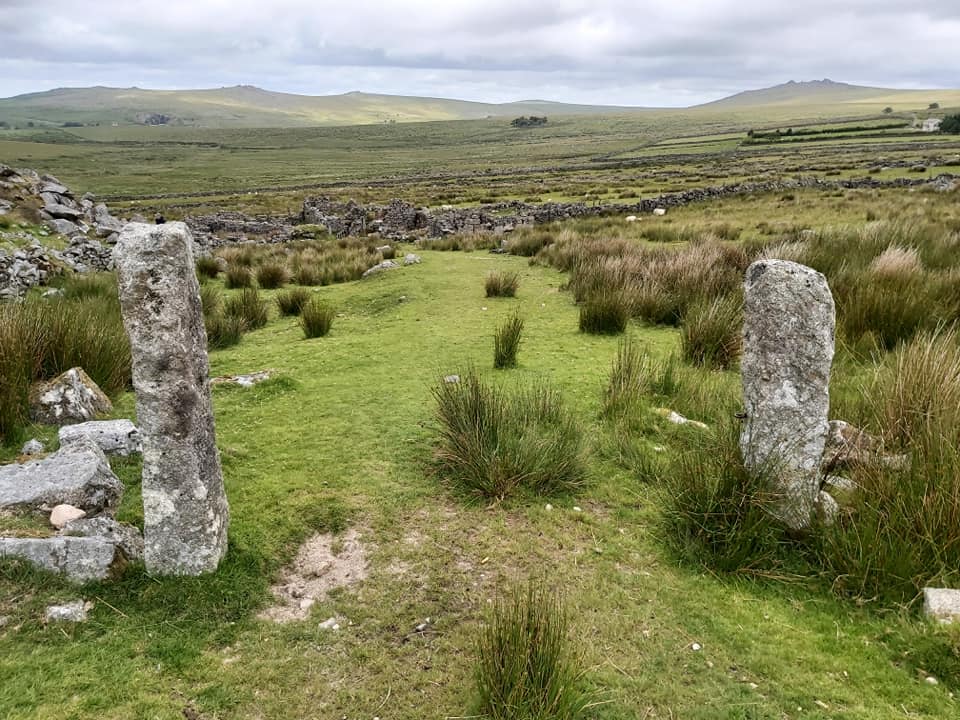
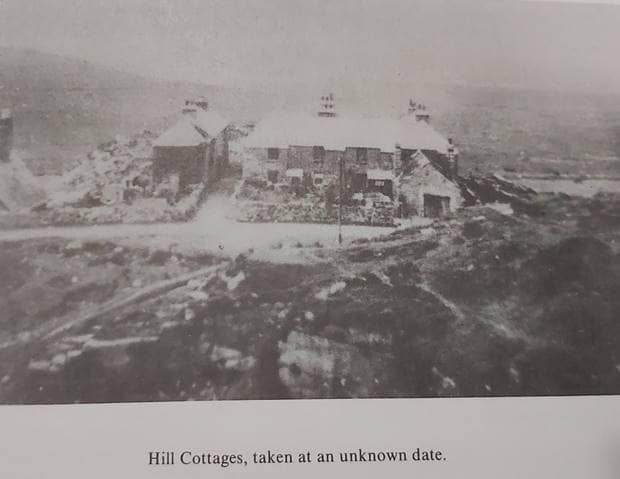
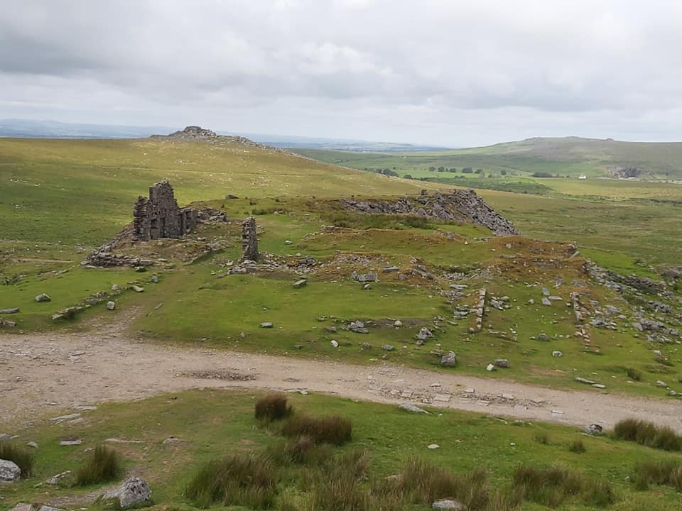
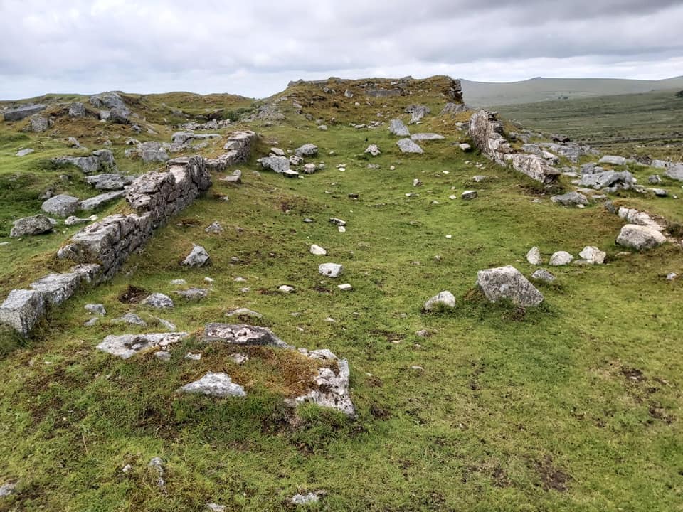
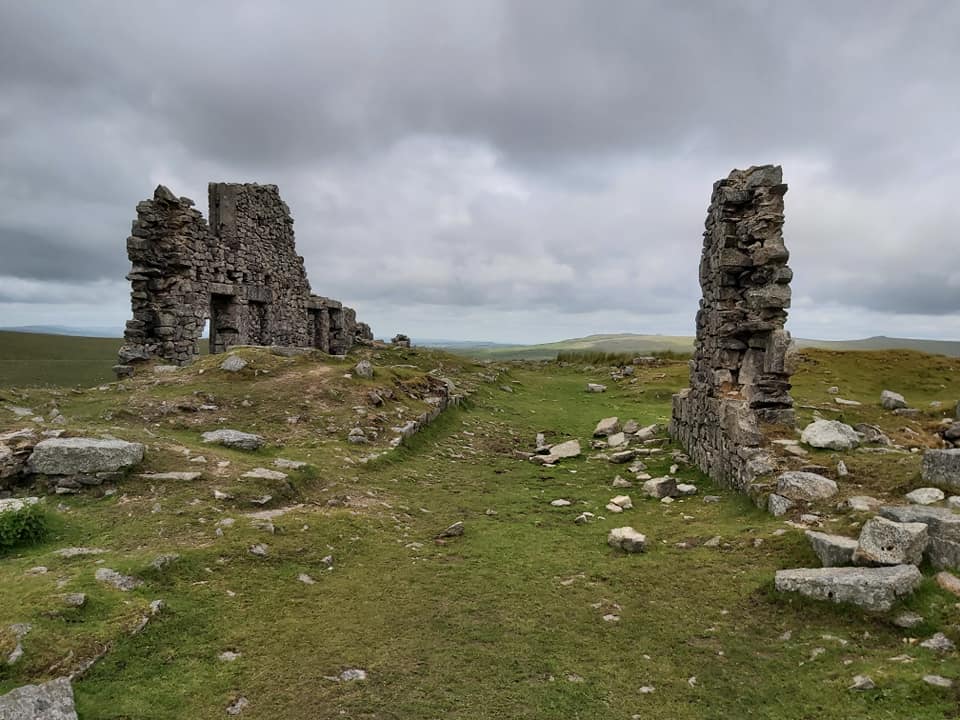
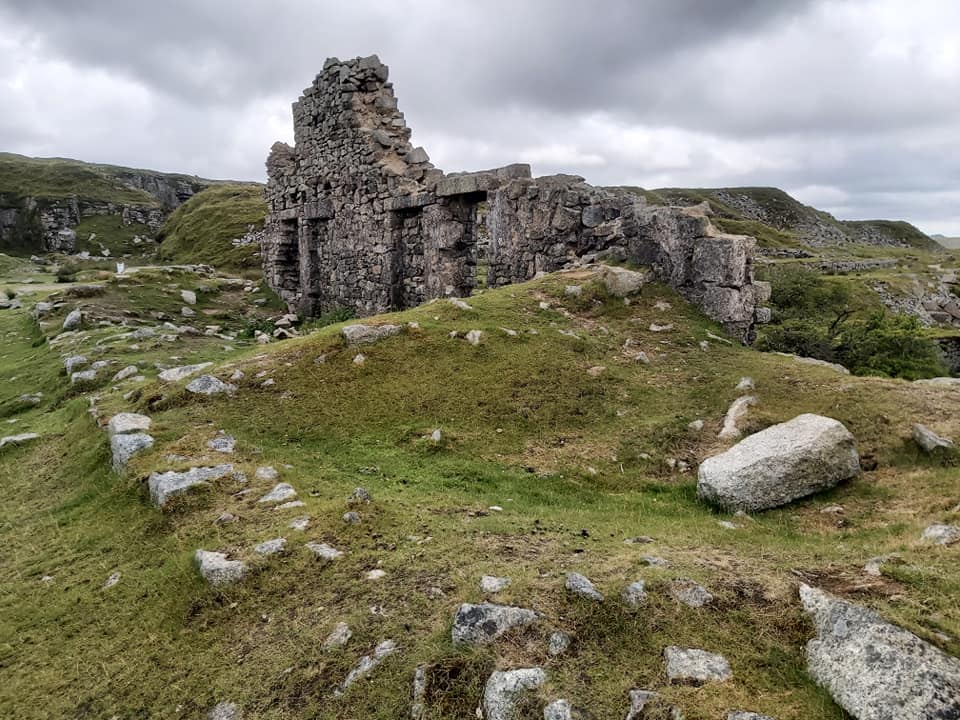
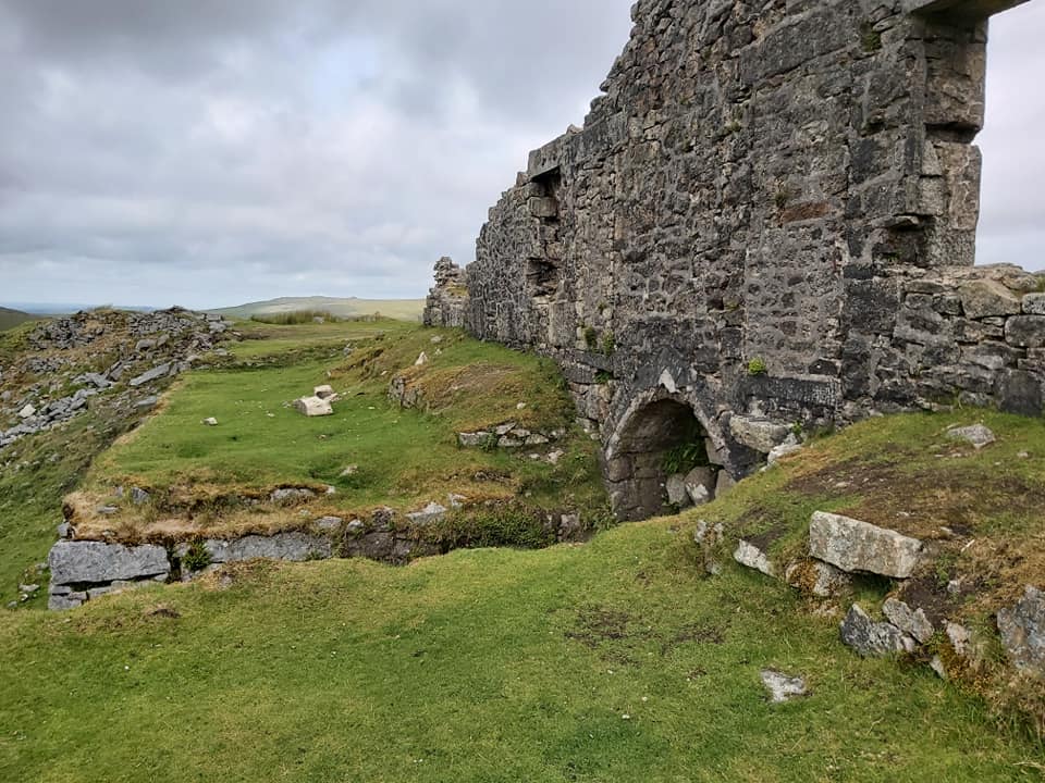
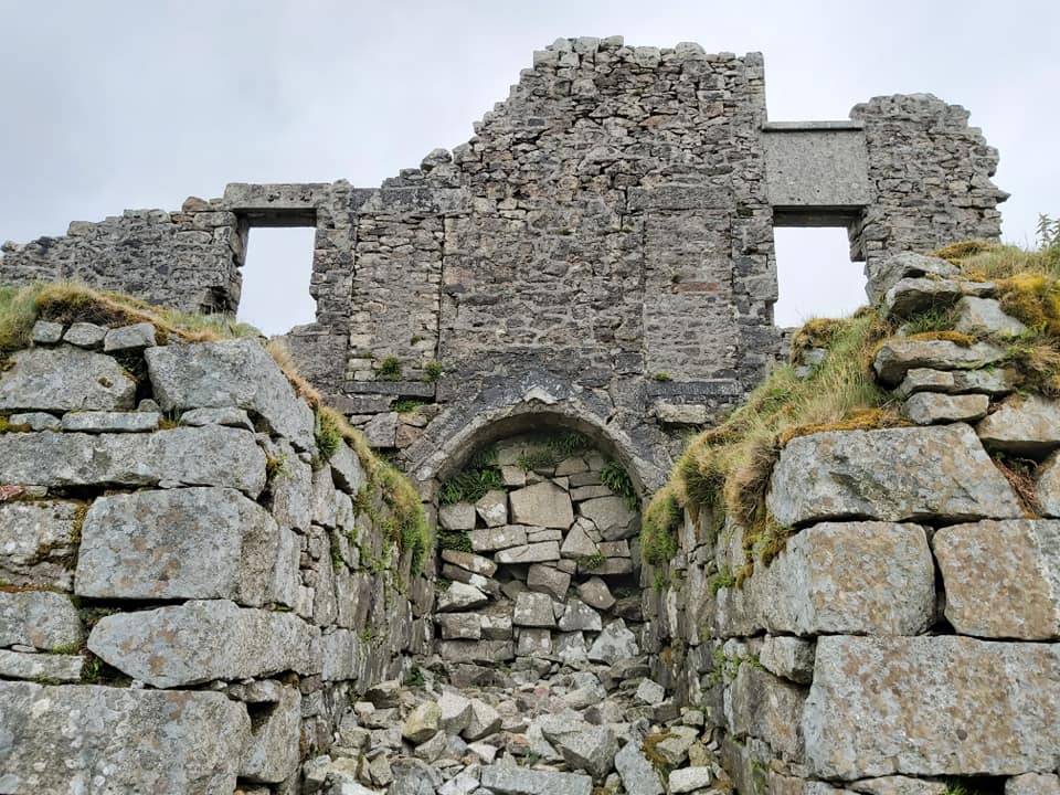
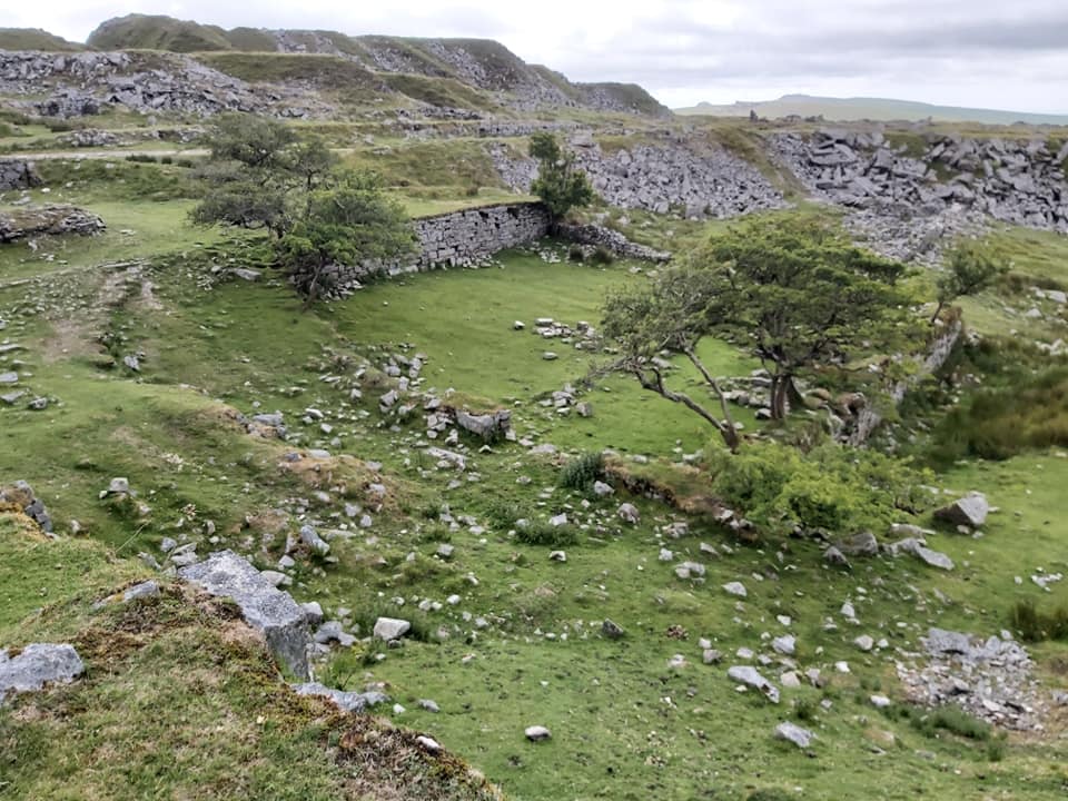
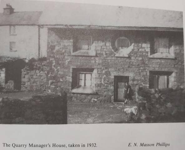
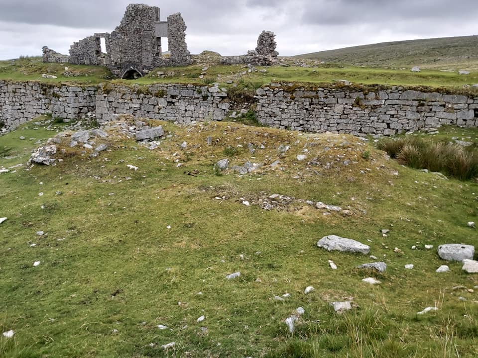
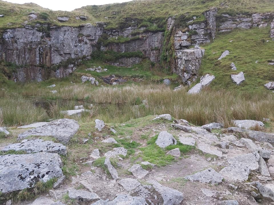
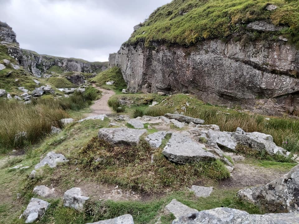
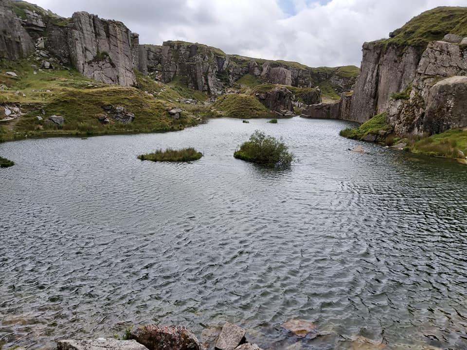
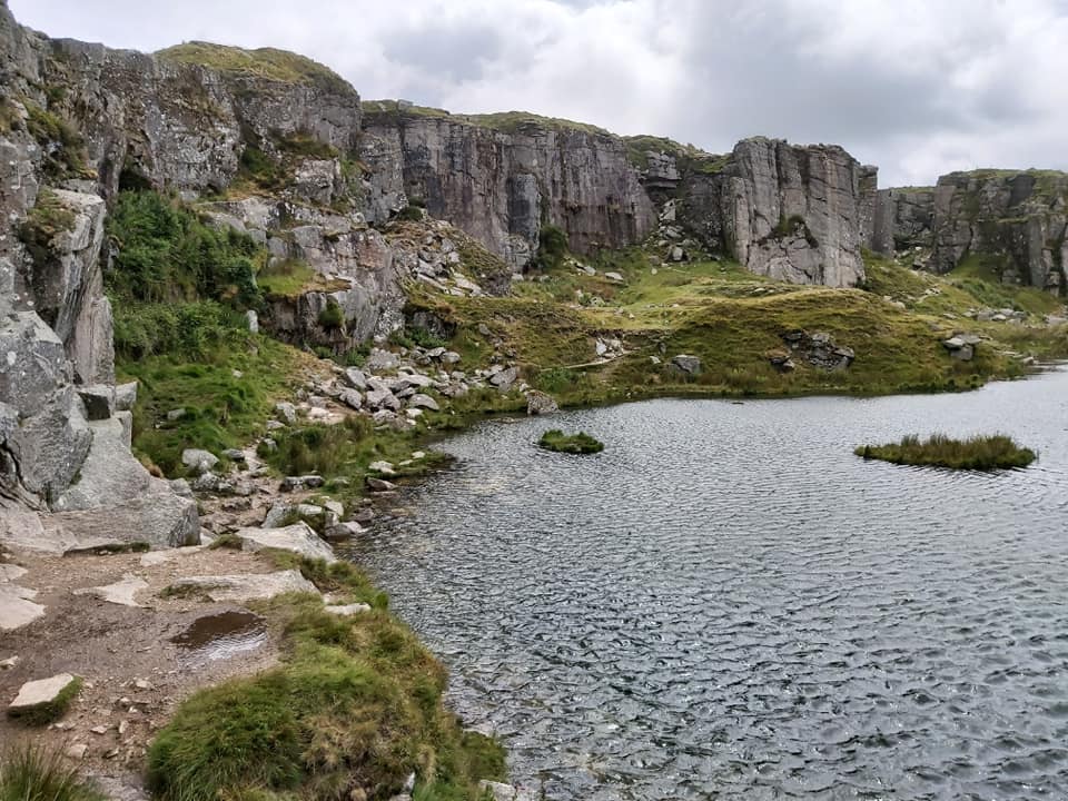
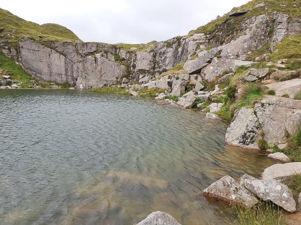
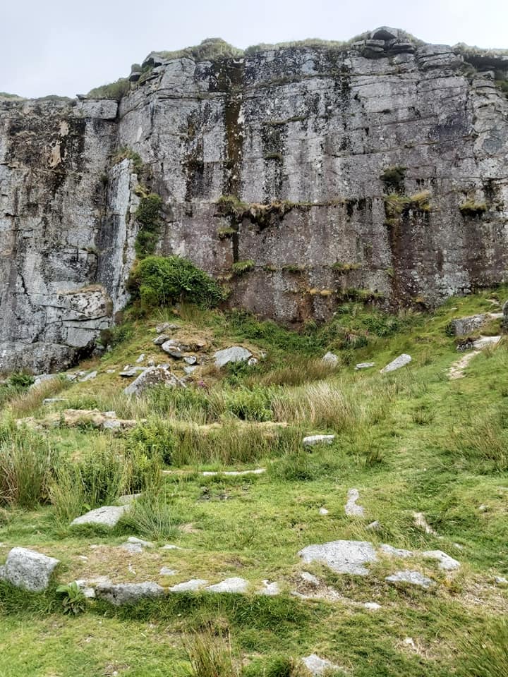
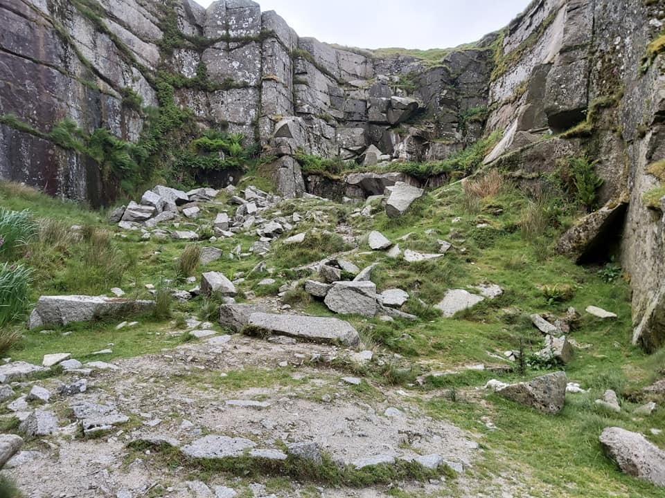
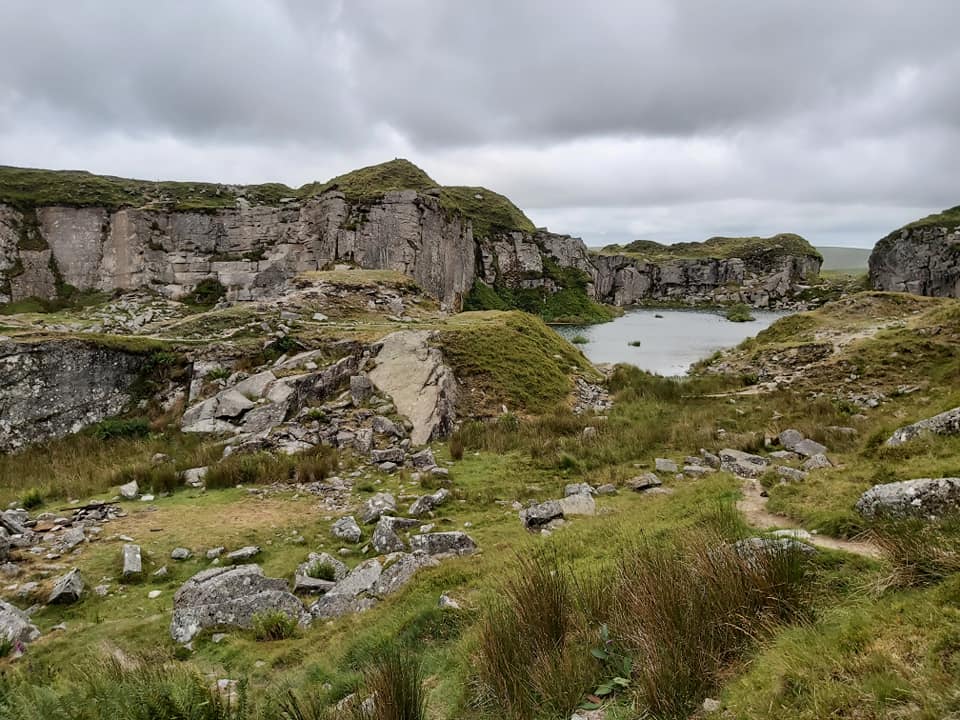
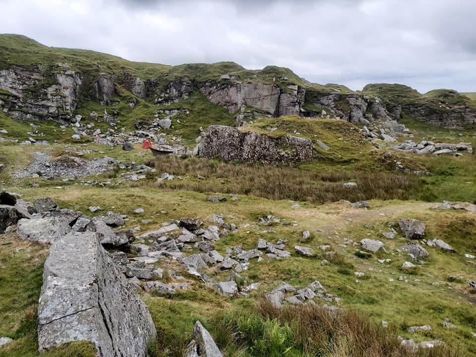
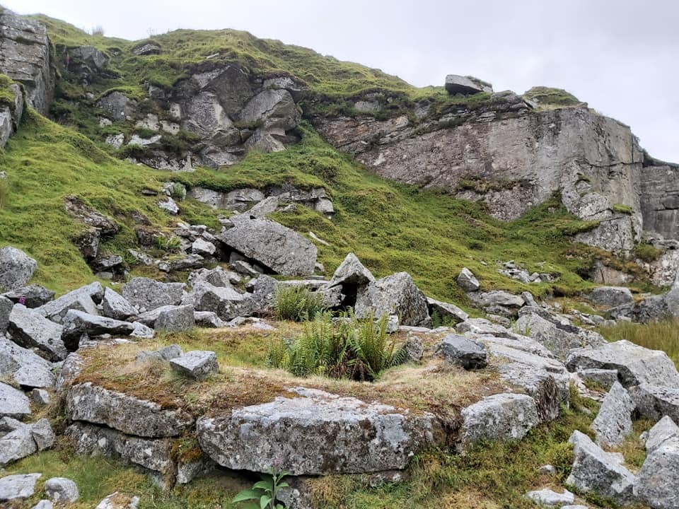
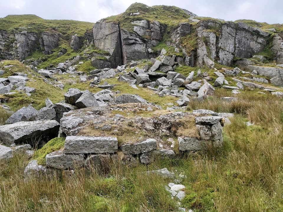
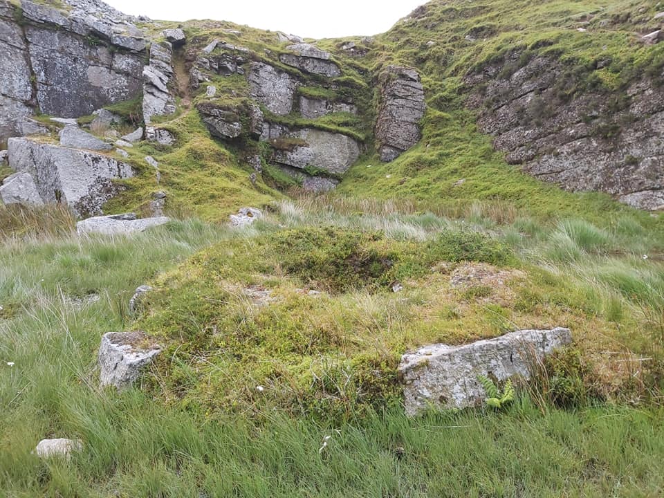
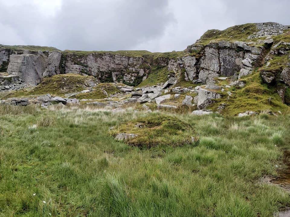
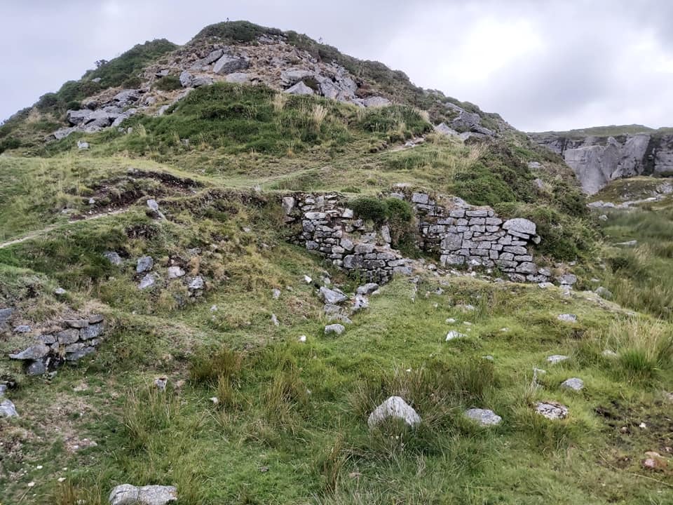
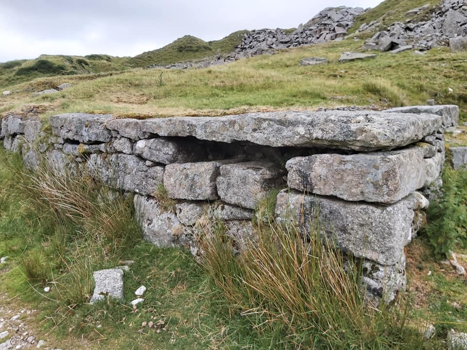
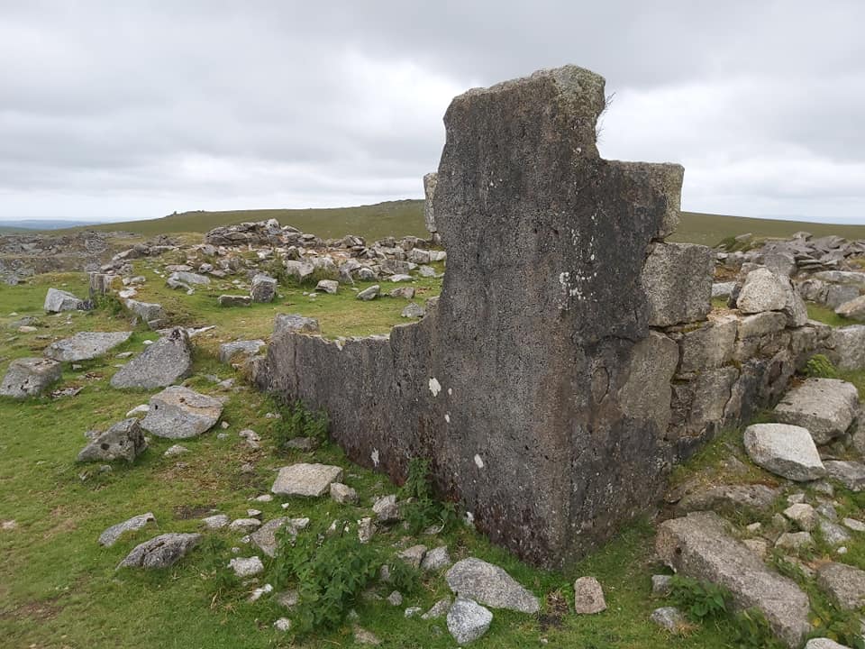
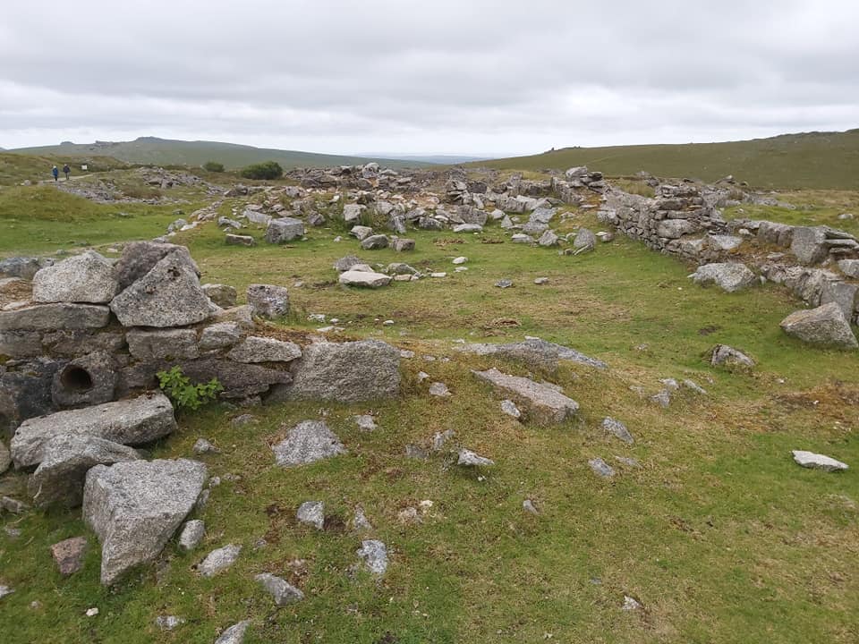
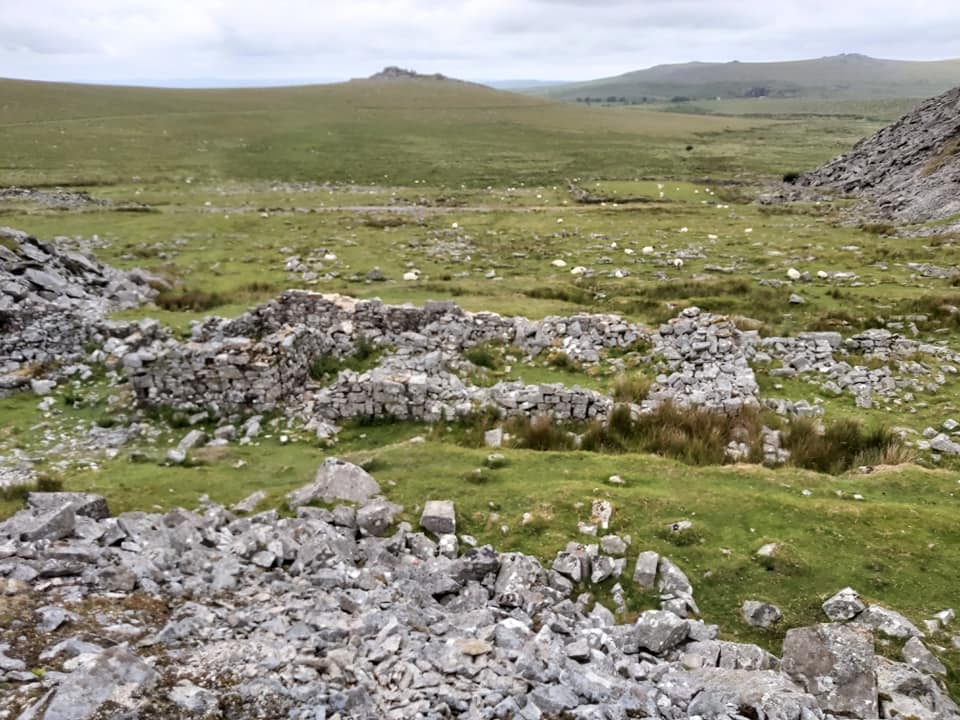
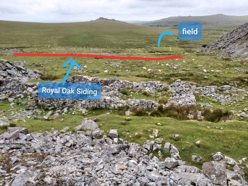
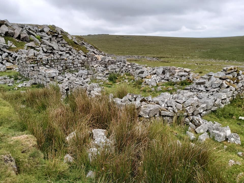
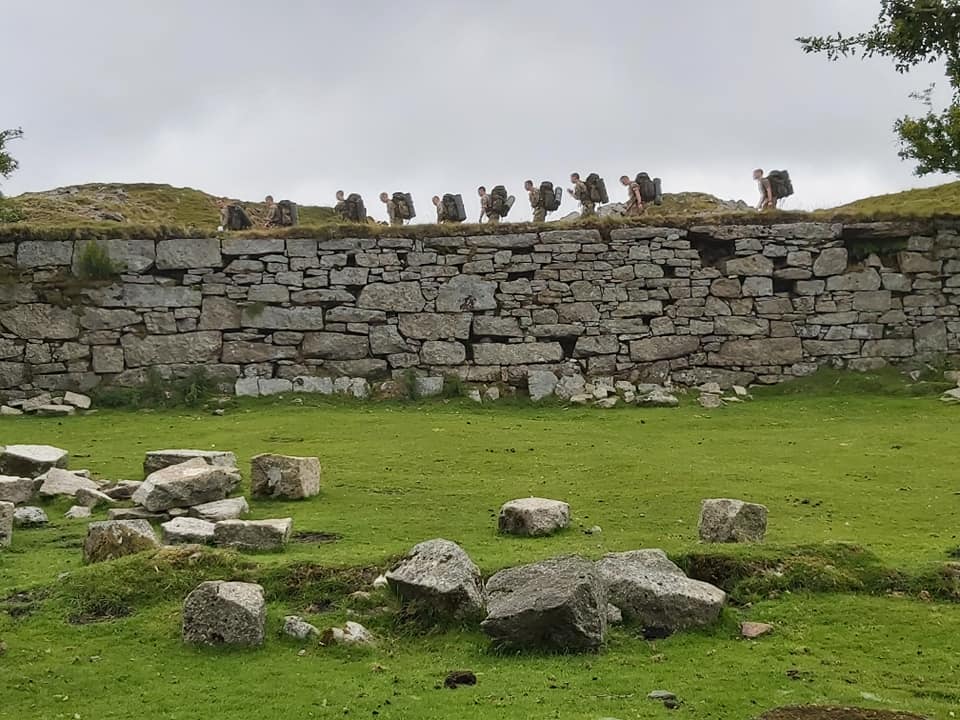
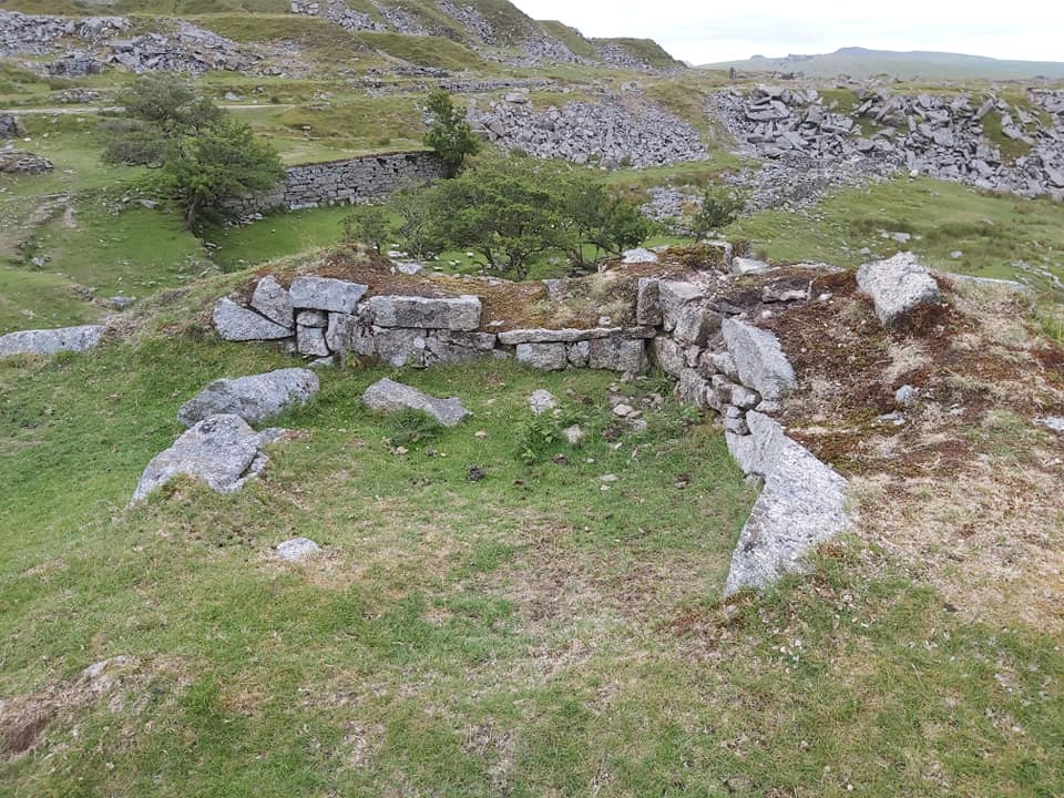
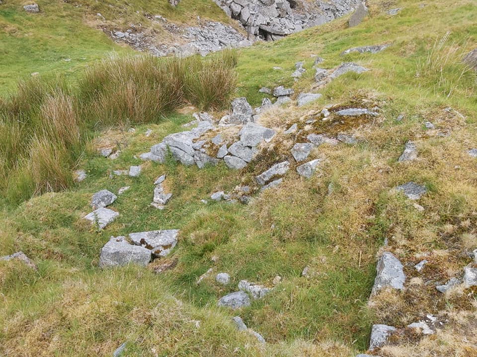
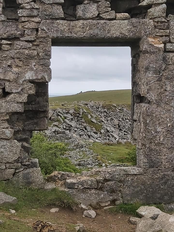
Mapped out points of interest covered in this post.Yellowmeade Farm with Swell Tor or Crip Tor from 1840 Tithe Map (left) and Kings Tor (right) on the horizon.Granite setts of the tramway, adjacent to Yellowmeade FarmThis is Big Tip, aptly named . Eva’s Farm is in the foreground and Kings Tor on the Horizon.Eva’s FarmEva’s Farm showing the proximity to Big Tip. Grid is SX56590 73758Gateposts at entrance to Eva’s Farm at SX56630 73715Hill Cottages. The Chapel was the wide entranced building at the front on the right. The managers house can just be seen in very left edge of this photograph.Hill Cottages in 2020. Picture taken from more or less the same position as the black and white one.Chapel Ruins. This was used pre 1895 as a school before the Mission Hall was used until 1902, when the school came back to this location. The final school was, of course at “Four Winds”, which opened in 1915. Grid is SX56609 73707Pathway between Hill Cottages, easily seen from the black and white photograph.More views of Hill Cottages, the grid at the centre of the Cottages is SX56590 73702To the south and adjacent to Hill Cottages was a tramway, which ran to Big Tip. SX56588 73688. You can see an archway below which appears to go underneath the cottages.View of the blocked in archway. It is conjectured by Chris Stone in the Kath Brewer book that this was the site of a very early water wheel. SX56582 73690Looking south from Hill Cottages.The managers house. Hill Cottages can be seen behind, to the left.The managers house in 2020. Grid SX56590 73670North end of the quarry with a crane base in foregroundAnother view of the crane base approaching the flooded quarry. SX56647 73651Flooded quarry. There is a sign (from Maristow Estates) warning people to enter at own risk.There is a pathway around the quarry, but care must be takenA swimming spot apparently.Sheer granite walls with evidence of foundations in foreground. A side section of the quarry with a crane base in the foreground at SX56747 73508Looking north back towards the flooded section of quarryLooking south at dry section of quarry.Another crane base. SX56664 73421A fourth crane base near the southern entrance to the quarry. SX56630 73459A fifth (rather overgrown) crane base at the southern entrance. SX56608 73455Last view of the quarry from the southern entrance. The fifth crane base just discernable in the grassy / boggy section in the foreground.Southern entrance to the quarry with ruins of the Smithy. SX56550 73460Loading platform at SX56558 73540Corner of Gibbs Cottage (former site of weighbridge) at the end of a tramway siding.Another view of Gibbs Cottage. SX56542 73573Site (mid picture) of the original cottages which were also used as stables. Big Tip to the right, Kings Tor in the distance.Same view as previous picture but showing the Royal Oak siding and the field below Big Tip The Powder House. SX56534 73430Back to the original Cottages / Stables. Swell Tor just visible to the right of the spoil tip. SX56549 73644Whilst having lunch, this was a reminder that this area is also used by the military. I think this flat area (just to south of managers house) was the location where Bear Grylls and Gareth Southgate camped during a recent tv show.I’ve left the W.C’s until the end. This room with a views is at SX56554 73705And more W.C’s at SX56545 73726And one final framed view from Hill Cottages looking towards Swell Tor Quarries. The tor on top of the hill is called Crip Tor on the 1840 Tithe, the name of the farm in the valley behind.
Hi,
Having just lead a group of walkers around Swelltor and Foggintor Quarries, it was very refreshing to see the photographs of yesteryear and present day photographs. Also the naming of various buildings has given me more of an insight into the area. The book by Kath Brewer is very usefull to know and I shall be trying to obtain a copy. We will return again and explore the sight more comprehensively, with more knowledge now to hand. Excellent work.
Hi Steve, its been more than three years since my first comment and since then, I have bought Kath Brewers book and what a find!
I’ve been back a few times since, learning more every time, with the valuable photographic information that you’ve produced being a great assistance to my continued learning. Thank you.
Just found this page accidently. We walk the dogs around here most weekends. Thanks very much for sharing the pics, very interesting. Great to see how it once was. My visits will now take on a whole different perspective.

Dave Pinkham April 21, 2022
Hi,
Having just lead a group of walkers around Swelltor and Foggintor Quarries, it was very refreshing to see the photographs of yesteryear and present day photographs. Also the naming of various buildings has given me more of an insight into the area. The book by Kath Brewer is very usefull to know and I shall be trying to obtain a copy. We will return again and explore the sight more comprehensively, with more knowledge now to hand. Excellent work.
SteveGrigg1961 April 22, 2022 — Post author
Hi, many thanks for your comments. I can recommend the Kath Brewer book. Kind Regards, Dartmoor Explorations
Dave Pinkham October 12, 2025
Hi Steve, its been more than three years since my first comment and since then, I have bought Kath Brewers book and what a find!
I’ve been back a few times since, learning more every time, with the valuable photographic information that you’ve produced being a great assistance to my continued learning. Thank you.
Dave.
SteveGriggDartmoor October 12, 2025 — Post author
Hi Dave,
Thank you for your comment. Kath Brewer’s book is great and certainly brings things to life.
Happy exploring
Kind regards,
Dartmoor Explorations (Steve)
Matt October 17, 2025
Just found this page accidently. We walk the dogs around here most weekends. Thanks very much for sharing the pics, very interesting. Great to see how it once was. My visits will now take on a whole different perspective.
SteveGriggDartmoor October 17, 2025 — Post author
Hi Matt,
Thank you for your kind comment
Regards,
Steve (Dartmoor Explorations)