A collection of walks, discoveries, insights and pictures of exploring Dartmoor National Park
June 27, 2026
Exploring the Tinners’ Workings in the upper reaches of Bledge Brook
Virtually all of Dartmoor’s rivers, brooks and streams (some known as ‘lakes’) have been exploited by the Tinner’s in the medieval and / or post-medieval period. Tinners’ streamworks were a common method of tin resources being exploited.
Bledge Brook, a tributary of the River Erme in the wilds of the south moor is once such brook, which has evidence of the Tinners’ exploits. Tinstreaming remains are spread along both sides of the tributary and are over 1km long and only 80m wide. The workings lie between the 330m and 455m contours in a rough south-north then south-east / north west orientation.
Aside the boulder strewn streamworks, there are other features of interest which include a ruined Tinners’ Hut built into waste heaps, another possible (less distinct) Tinners’ Hut, a possible circular Shallow Trough and a large ruinous Building of unknown origin close to the very upper end of the working at Bledge Brook Head.
Bibliography
Dr Phil Newman – (2018) – The Upper Erme Valley, Dartmoor National Park, Devon: An Archaeological Survey (SDV362921)
T.A.P Greeves – (2006) – Granite trough (SDV350062) and two Tinners’ buildings (SDV350060 and SDV350063) in Bledge Brook
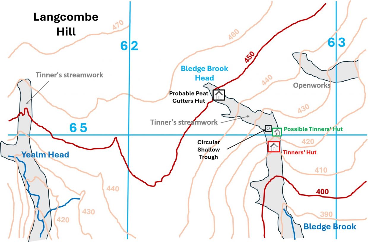
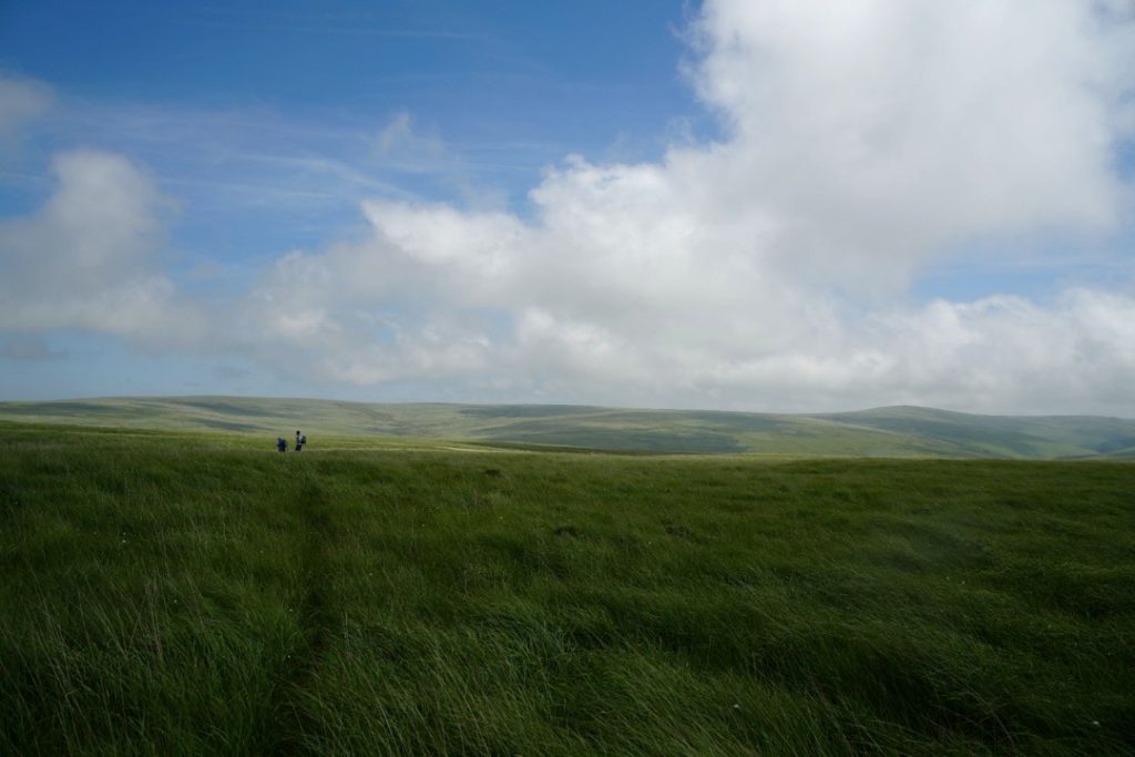
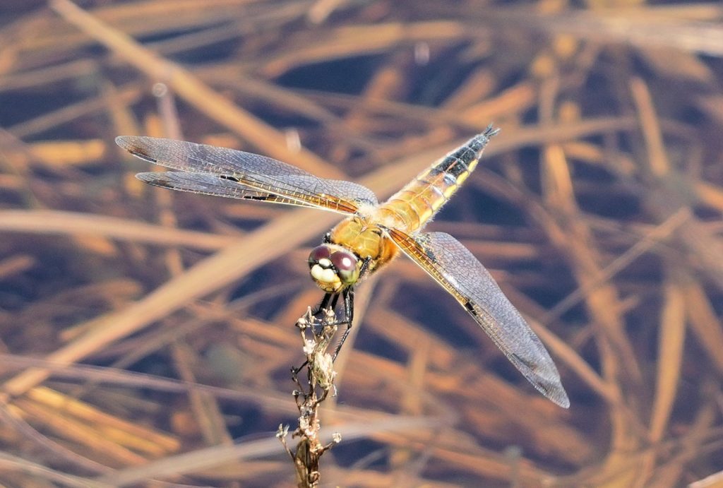
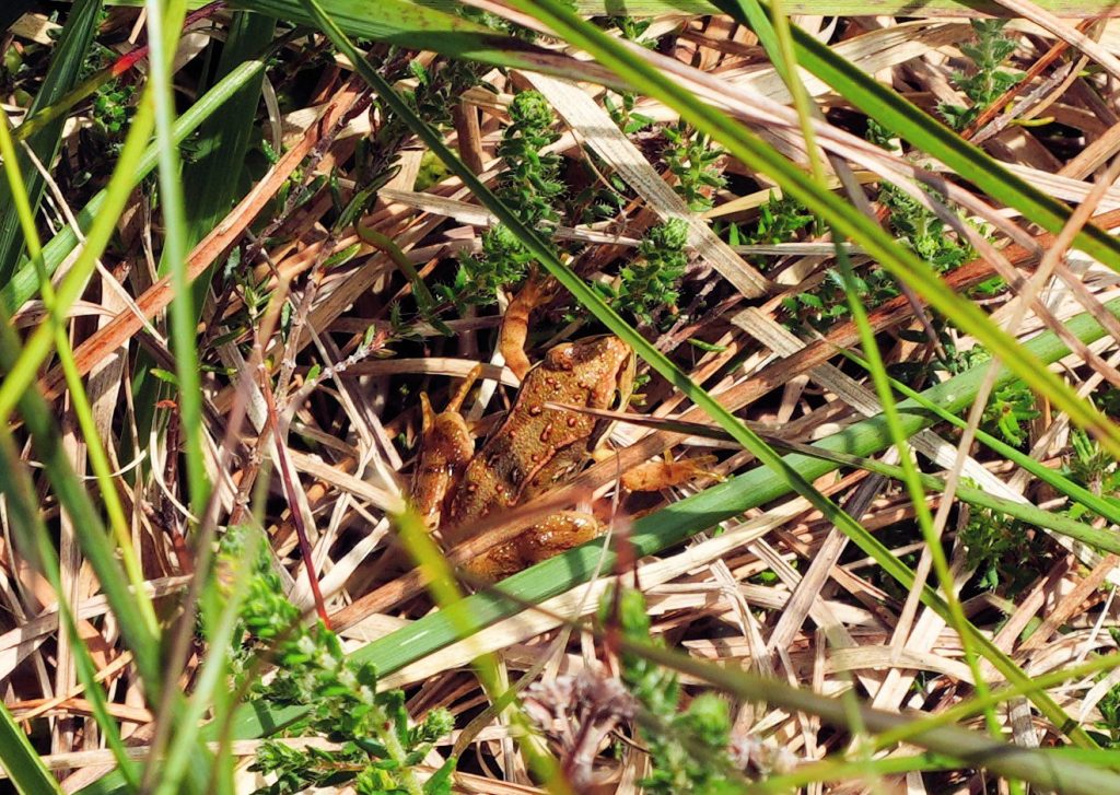
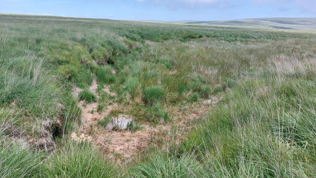
Sketch Map showing the key features in the upper Bledge Brook covered in this post. Interestingly, OS maps show the water from the brook only starting about 750m below the true ‘head’, which is located just above the 450m contour lineEnroute to Bledge Brook upper reaches via a difficult route across Langcombe Hill. There are a few animal tracks and farmers ‘ATV’ tracks here which can be followed. The Erme Valley can be seen in the distance. Picture by Frank Collinson – the author is the left person of the two figures in this compositionDragonfly from around the Langcombe Hill area. Picture courtesy of Frank CollinsonMore wildlife – a Frog from around the Langcombe Hill area. Picture courtesy of Frank CollinsonBledge Brook Head. Like a lot of heads of Dartmoor stream and rivers, it is punctuated into the landscape with a distinct area of peat banks. The point of the photograph was taken at SX62366 65231
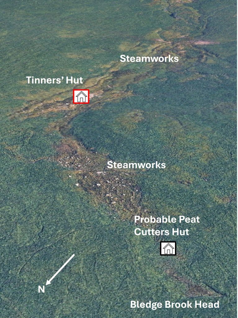
Google Earth view of the Tinners’ Workings and locations of two Buildings (Huts) in the upper reaches of Bledge Brook
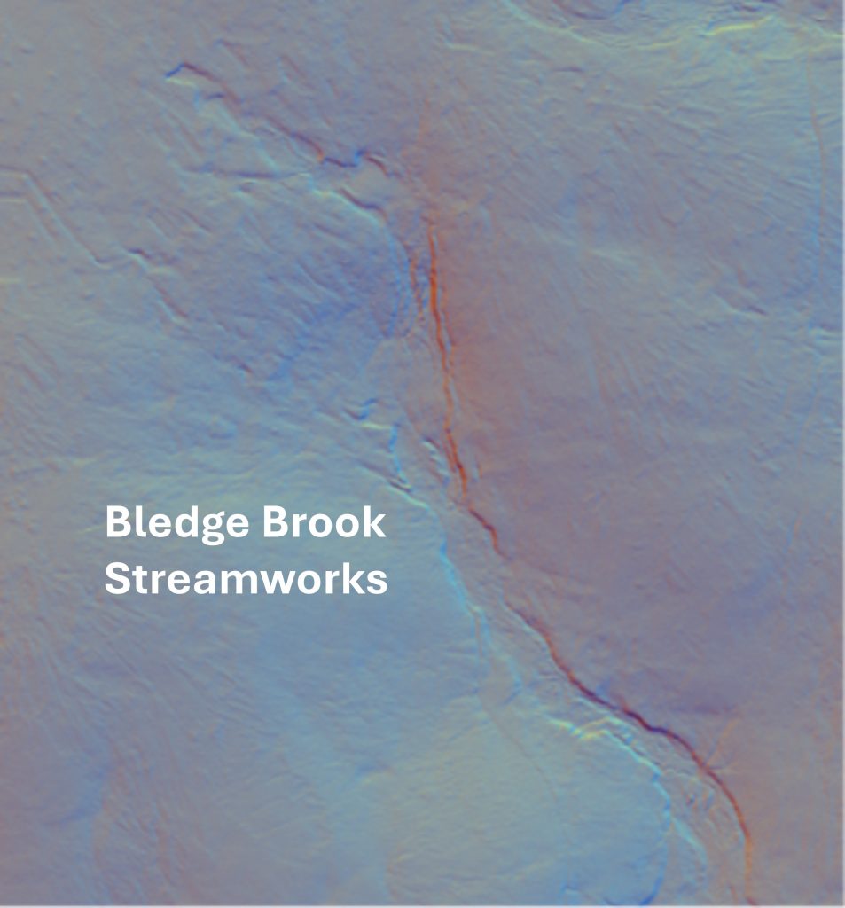
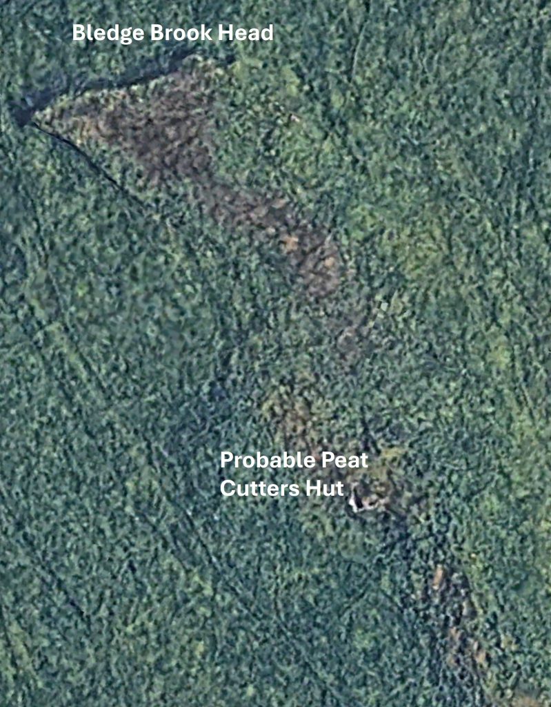
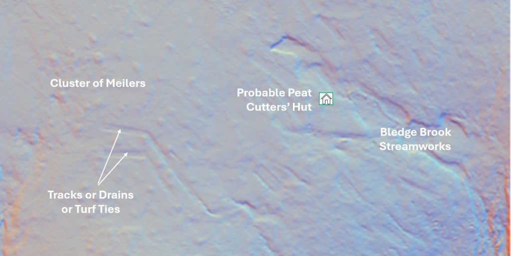
LiDAR Plot of the Tinners’ Workings in the upper reaches of Bledge Brook. Note the ‘square’ shaped head of the Brook in the top left corner. Phil Newman records that there are “13 hectares of tin streamworking here which follow the course of the Bledge Brook, a western tributary of the River Erme”. Around 75m below Bledge Brook Head is a building. Two sides appear to be a relatively ‘modern’ reconstruction with the other two sides being barely above turf. The building looks too large to have been a Tinners’ Hut but may well have been part of the workings. Alternatively, it may have been a shelter for the Blatchford Estate or possible a shepherds shelter. There is no reference to it on the Devon Historical Environment Record. The most likely use of this building is that of a Peat Cutters’ HutContextual view of the Probable Peat Cutters’ Hut near Bledge Brook Head. The building (estimate as not measured) is around 5m x 5m. It is located at SX62432 65196. Sharp Tor, Three Barrows and Piles Copse can just be seen in this composition
The Probable Peat Cutters’ Hut near Bledge Brook Head can be seen using Google Earth
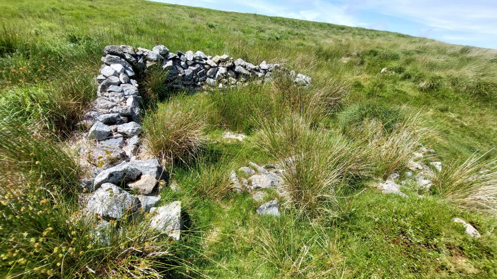
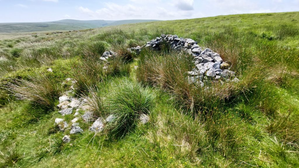
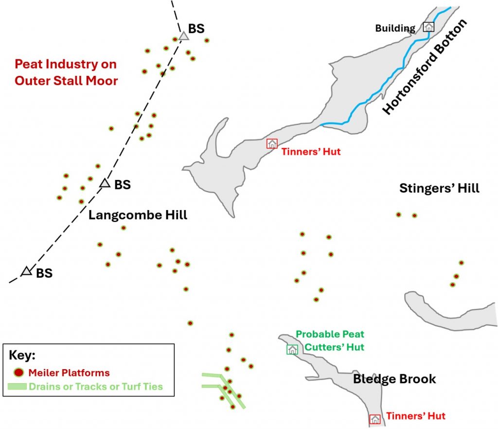
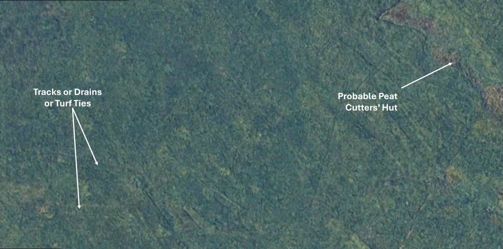
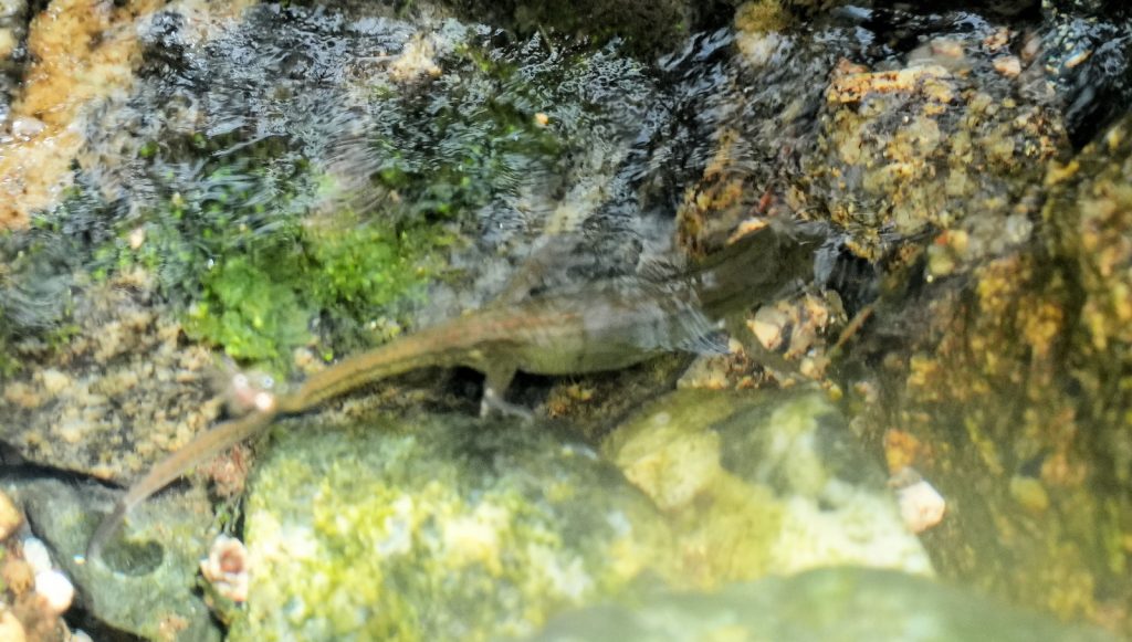
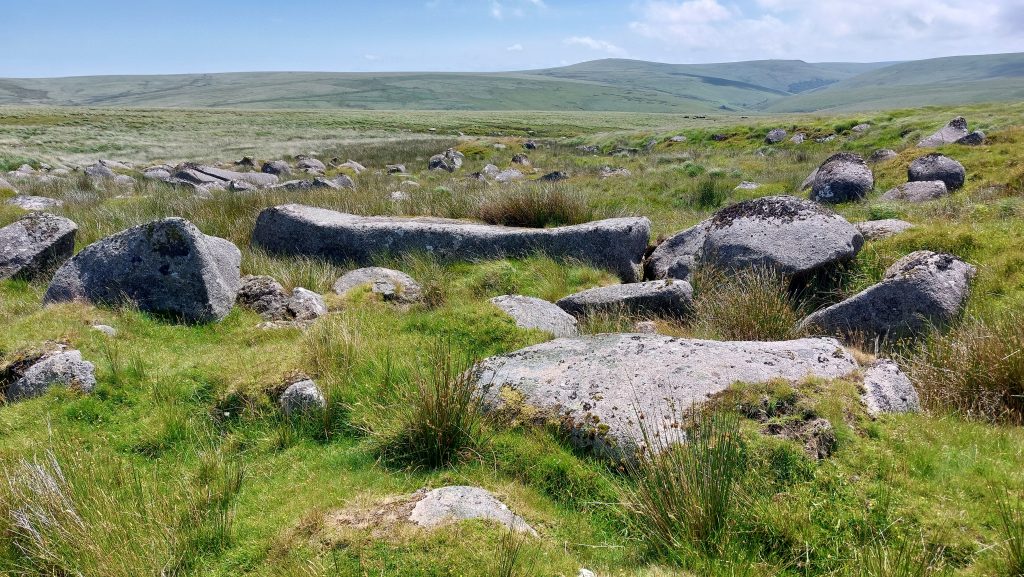
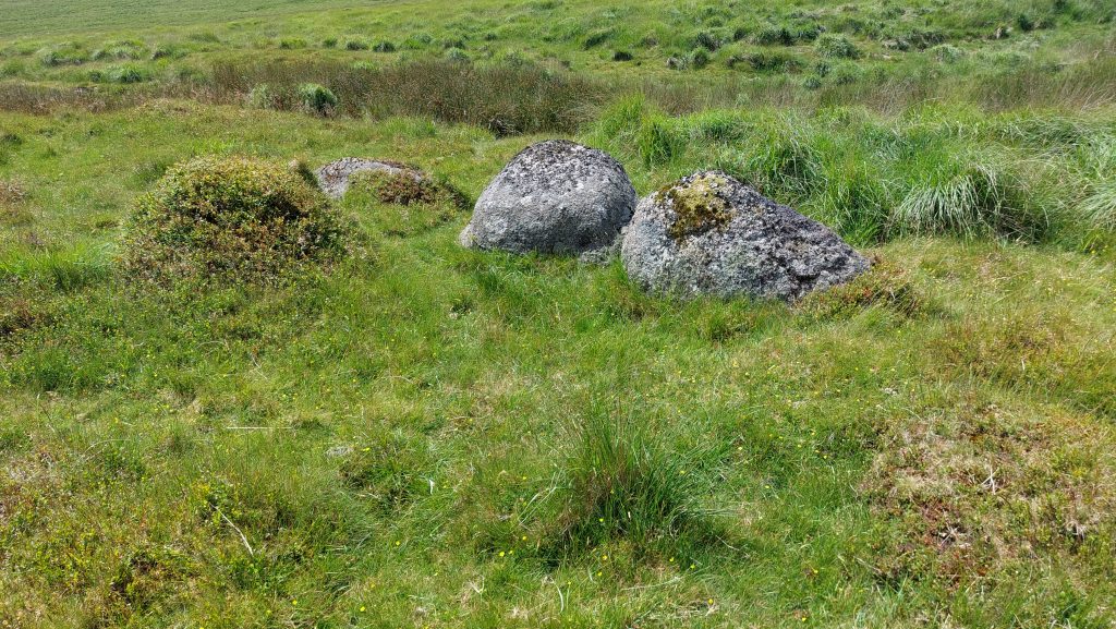
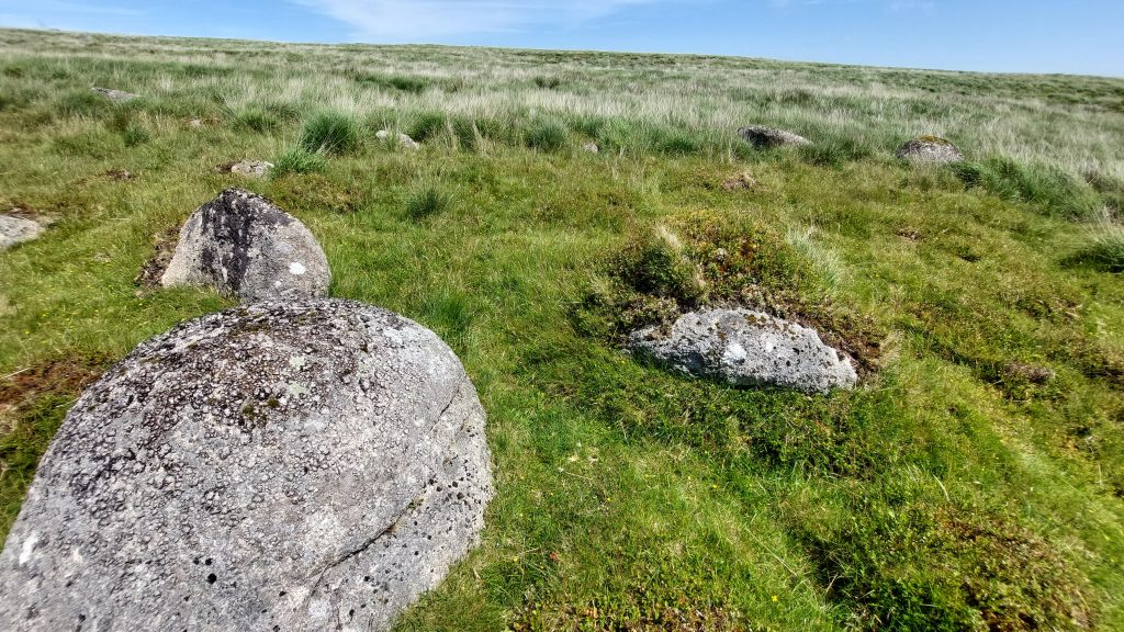
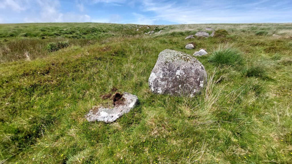
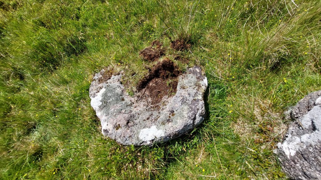
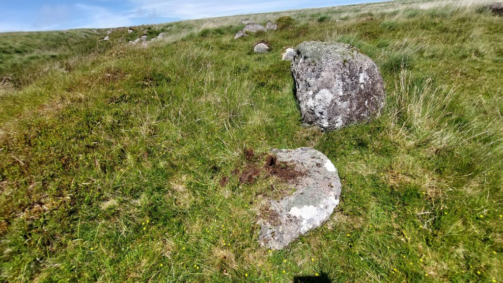
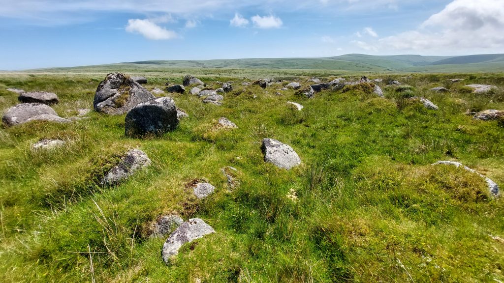
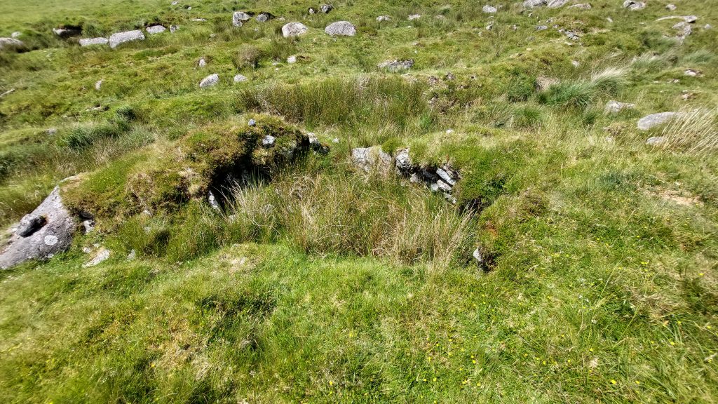
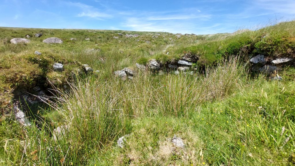
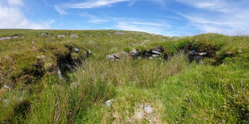
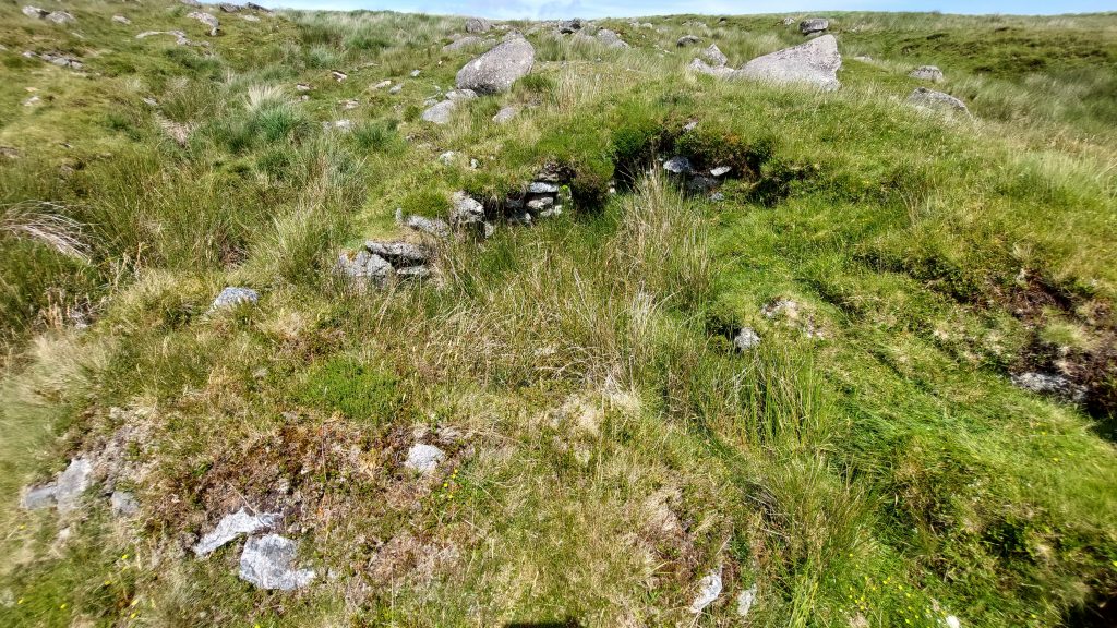
To add credence to the origin of the building at the head of Bledge Brook, there is a plethora of Meiler Platforms* in the area (ref: Newman). There are also a couple of possible Drains or Tracks or Turf Ties which can be identified on Google Earth or by using LiDAR. *Meiler platforms are the physical remains left by the burning of peat to produce a carbonized product, using a similar method to that used for the production of wood charcoal.To the west and south west of the Probable Peat Cutters’ Hut near the head of Bledge Brook, a LiDAR plot reveals a Cluster of Meilers and a couple of possible Tracks or Drains or Turf Ties. It is most likely that the latter are Drains as although there have been long Turf Ties (where peat was cut) found nearby at Stingers Hill (measured examples of 150m long by 16m) the more usual dimensions (rows of 36.5m long known as ‘Journeys’) suggest otherwise.Google Earth also shows the Probable Peat Cutters’ Hut near the head of Bledge Brook and the couple of possible Tracks or Drains or Turf Ties.More wildlife – a Newt. There are pockets of water amongst the streamworks, where little fellow was spotted. Picture courtesy of Frank CollinsonLarge granite boulders amongst the streamworks. The very long boulder in the composition is located at SX62564 65100. The features of Three Barrows, Sharp Tor and Piles Copse becoming clearer as the hill is descendedPossible Tinners’ Hut. Measuring approximately 4.0 by 1.5 metres internally as recorded by Greeves. It is located at SX62673 65034Possible Tinners’ Hut. Newman describes it as “…..comprising of several large boulders arranged in an ‘L’ shape projecting from the bank and heavily turf covered”. The author isn’t 100% convinced if he has captured what Greeves and Newman recorded as the features aren’t that obvious. That said the NGR given by Newman takes the explorer to this locationAbout 15m downhill from the Possible Tinners’ Hut is a half-exposed circular shallow granite trough – also recorded by Greeves and Newman. The trough is in the foreground next to the large boulder. The Possible Tinners’ Hut is by the next set of boulders up the hillThe stone trough is around 1m in diameter and includes an outer rim around 0.15m wide. The stone is about 0.3m thick.The Shallow Trough is located at SX62677 65026Another view of the Bledge Brook boulder-strewn StreamworksA well-preserved Tinners’ Hut / Building with walls more or less intactThe Tinner’s Hut measures approximately 4.5 by 3.5 metres internally. It is probably post-medieval in date The Tinners’ Hut is effectively ‘sunk’ into an area of tinwork, which may account for its preservation. The walls are around 1m high. The entrance (in the foreground) is on the south sideThe Tinners’ Hut (Building or Lodge) is located at SX62707 64937