A collection of walks, discoveries, insights and pictures of exploring Dartmoor National Park
June 11, 2021
Duchy of Cornwall claims to parts of Okehampton Hamlets
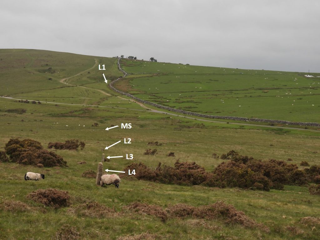
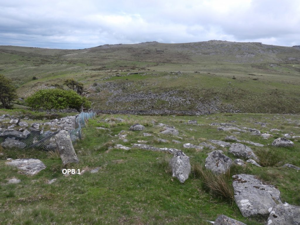
There are six boundstones, four dressed and inscribed, one just dressed and one a rough moor stone, on open moorland between Okehampton Camp and Black-a-Ven brook, which provide evidence that at one time the Duchy of Cornwall has laid claim to parts of Okehampton Hamlets. None of the boundstones appear on the modern OS map.
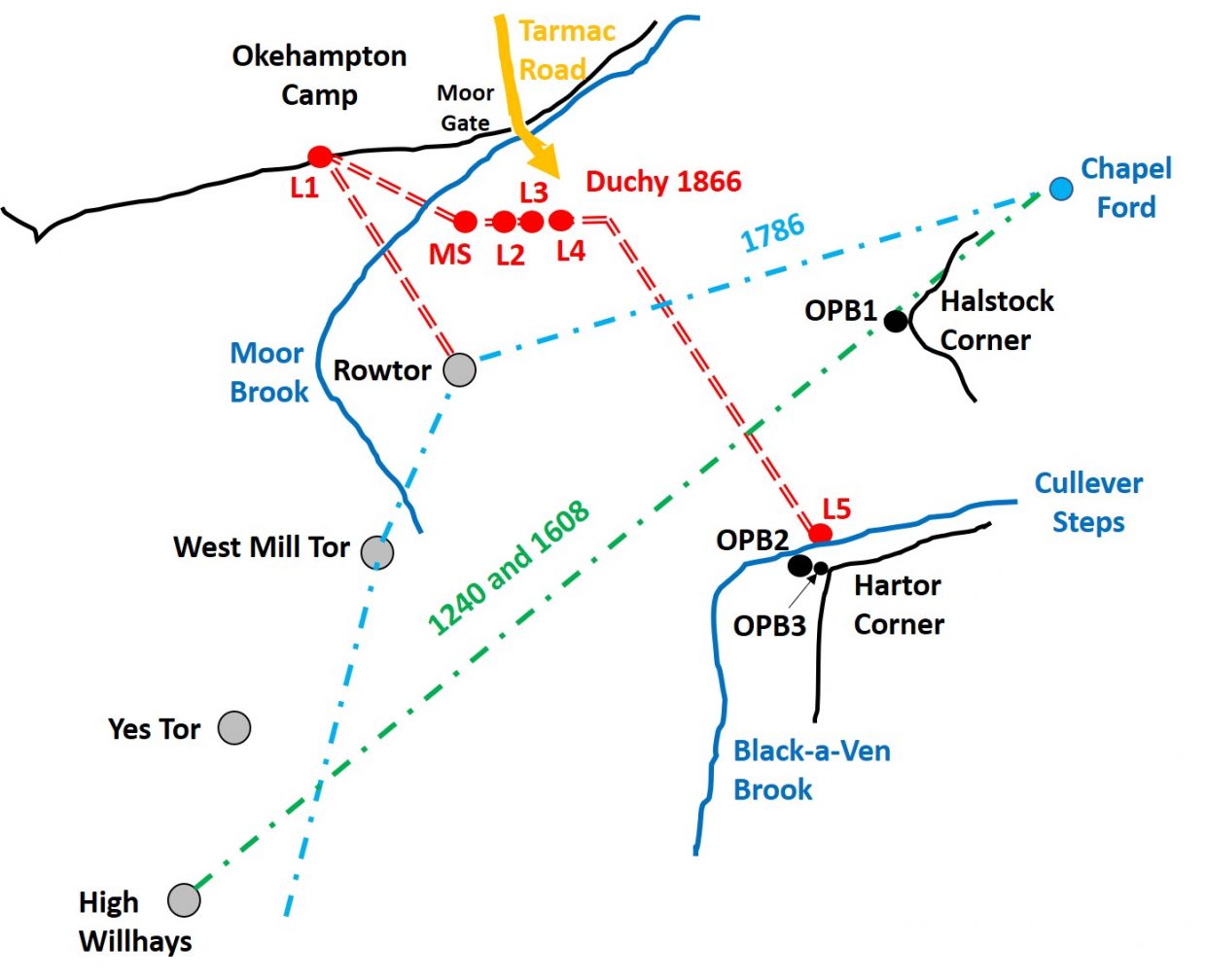
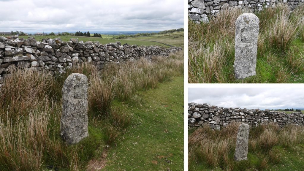
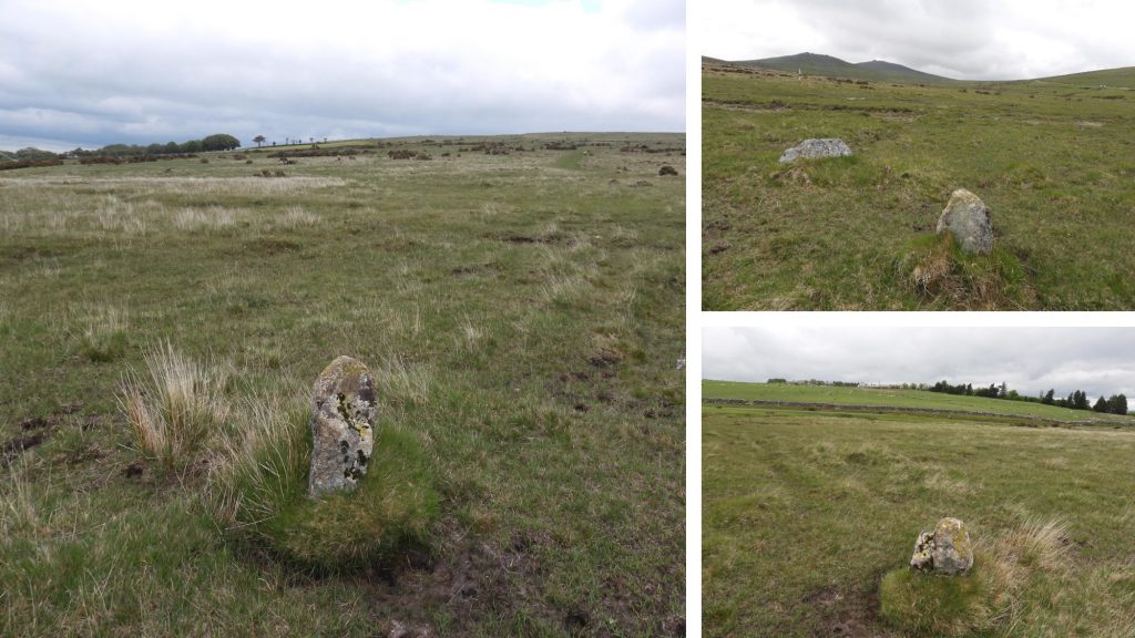
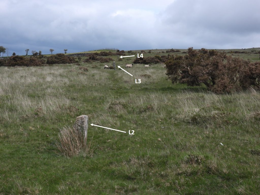
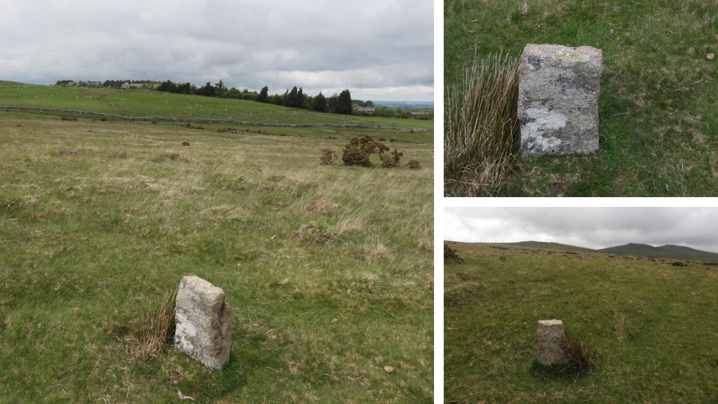
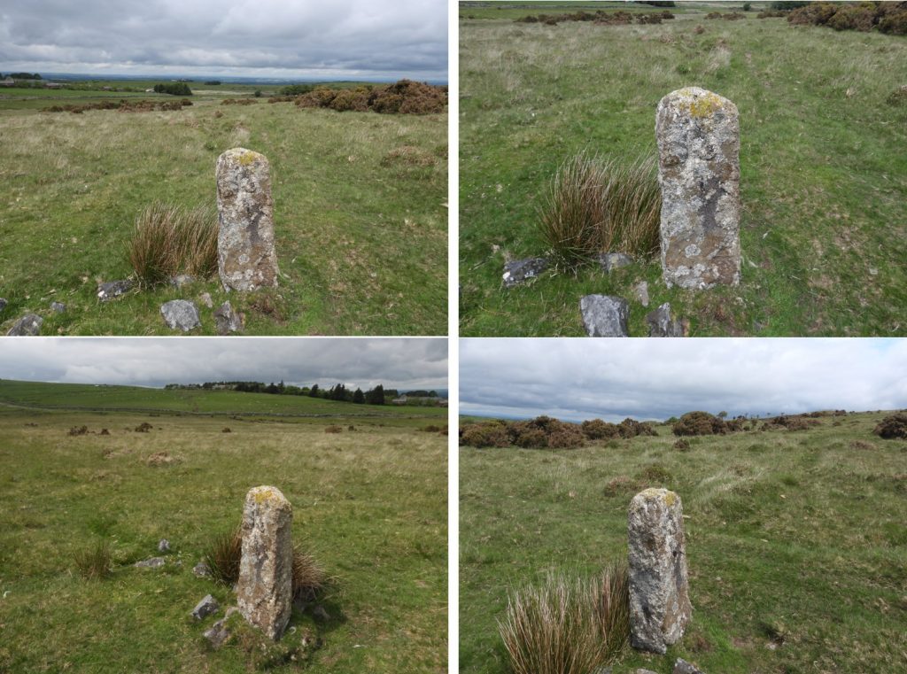
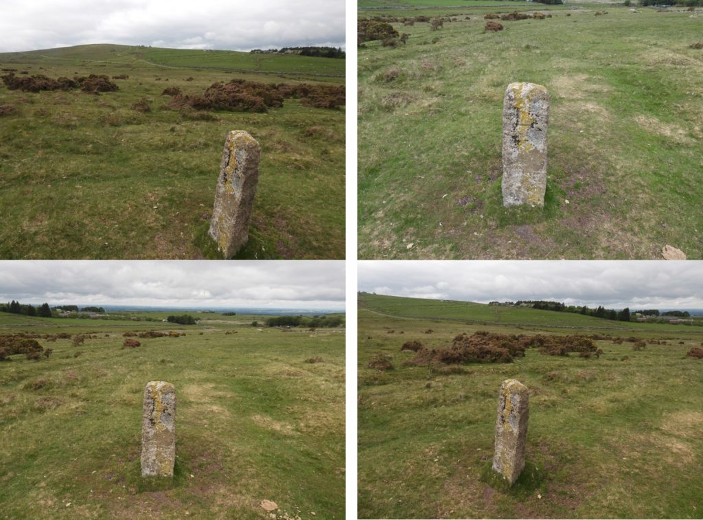
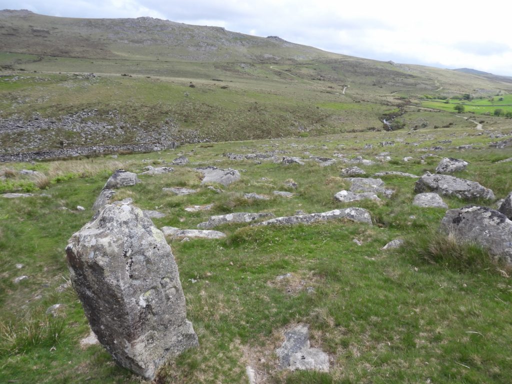
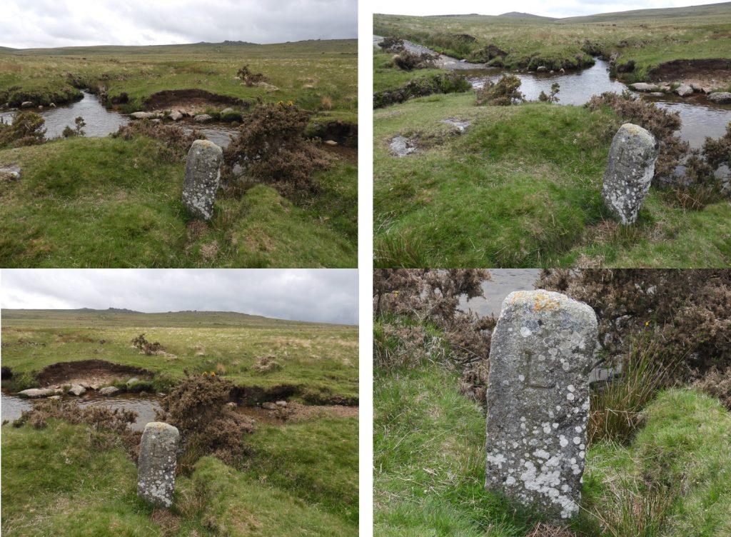
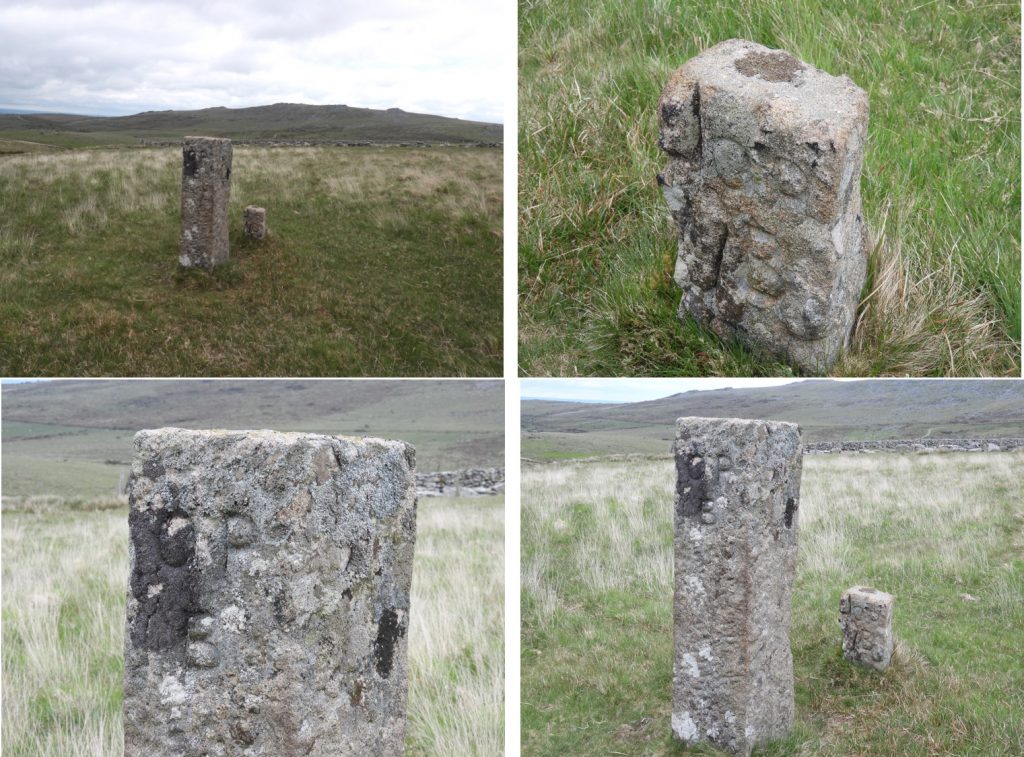
This map is a modified version of that found in the Dave Brewer, Dartmoor Boundary Markers (2nd edition). It shows the Duchy boundaries of the 1240, 1608 and 1786 perambulations (in green and light blue). Further to these boundaries there is also a 19th century boundary (not shown on this map) which runs from Sandy Ford on West Okement to Cullever steps. The main part of this post relates to the red “double dash” line, which connect the 6 boundstones which provides evidence that at one time the Duchy of Cornwall has laid claim to parts of Okehampton Hamlets.This boundstone (marked L1 on map) is inscribed with “L” for Lydford. It is said to be a 19th century erection as it shows evidence of tare and feather marks. It is located just outside the enclosures of Okehampton Camp SX58677 92547. This appears to be the most northerly point of the Duchy claims to land within Okehampton Hamlets.This boundstone (marked MS on map) is described as a rough undressed granite block with no inscription by the Dartmoor HER. It is included as part of the story alongside other dressed stones in both the Dartmoor HER and in the Dave Brewer publication as it appears to be part of late 19th century maps of the area. The boundstone is located at SX59024 92633.Continuing in a north east direction from the rough moor stone, the next three stones are encountered and align with the edge of the Moorgate Farm enclosures.This boundstone (marked L2 on map) is not inscribed, albeit it is dressed. The Darmoor HER describe is as “0.7 metres high, 0.3 metres wide and 0.2 metres thick. A broken stone with no inscription”. Dave Brewer marks it as an “L” stone in his book. Is it possible that as the stone is broken, that it used to have an inscription on it ? The stone can be located at SX59185 92673.This boundstone (marked L3 on map) is dressed and inscribed with an “L”. The Dartmoor HER describe is as “1.2 metres high, 0.35 metres wide and 0.2 metres thick. The letter ‘L’ is inscribed on its southern side”. The stone can be located at SX59231 92693.This boundstone (marked L4 on map) is dressed and inscribed with an “L”. The Dartmoor HER describe is as “1.1 metres high, 0.3 metres wide and 0.15 metres thick. The letter ‘L’ is inscribed on its southern side”. It can be located at SX59281 92701.Looking in a south west direction from near the Moorgate enclosure the alignment of the stones is evident.There is an OPB (Okehampton Parish Bounds), which is marked as OPB 1 on the map, is referred by Dave Brewer in his publication. Intriguingly it appears to be on the 1240 / 1608 perambulation boundary line between High Willhays and Chapel Ford (on East Okement). This boundstone can be found at SX60377 92557.The Dartmoor HER describe this rock as “Boundary stone marking the edge of Okehampton Hamlets and Belstone Parishes lies adjacent to the unmetalled track on the eastern edge of Halstock Down. The crudely shaped moorland post measures 1.0 metres high and 0.4 metres square. The letters ‘O, P and B’ are inscribed on its western face”.The final “duchy” stone (marked L5) can be found adjacent to a bridge and ford on the Black-a-Ven Brook. It is not mentioned in the Dartmoor HER or shown on the modern OS map. It is inscribed with an “L” and can be found at SX60018 91912.Just across the Black-a-Ven near Hartor Corner are two OPB boundstones (marked OPB 2 and OPB 3) on the map. The OPB boundstones can be found at SX60135 91896. The Dartmoor HER describe these as “two granite boundary stones 1m apart. The larger is 1.5m high. The smaller, western one is 0.5m high. Both inscribed ‘OPB’ (Okehampton Parish Bounds) on NW face in letters 0.1m high. Mark boundary between Okehampton and Royal Forest of Dartmoor. The larger stone is probably a replacement for the older, smaller one, which was never removed. These and other OPB boundstones will be the subject of a future post by the author.
Always enjoy your fieldwork Steve. This seems a funny ‘kink’ for the Duchy to claim. What do you think to the idea that the ‘L’ stones were for Luxmore as owners of the Deer Park, rather than for Lydford?
Hi Nigel,
Many thanks for your response, which poses an interesting debate.
It is possible that these stones might relate to the Luxmoore family. Cornydon Luxmoore purchased an eighth part of the Manor of Okehampton in 1759, including Okehampton Park and who held the Manorial Rolls of the Court of Okehampton for the years 1581 to 1759… In the years 1790 to 1796 Cornydon Luxmoore was Mayor of Okehampton. There is a boundary stone relating to this at SX 56957 92013 above the Red-a-Ven with “CL” inscribed upon it.
Personally I go along with Dave Brewer that these stone relate to Lydford (“L”) for four reasons;
1. The stones are described in the HER as being dressed and modern, which I believe is is line with the Duchy claim (ie 19th century) and a century after Coryndon Luxmoore. They are very different from the “CL” stone.
2. The “CL” stone at Red-a-Ven is more crude albeit a nice shape and the inscription is on the north face (into the land claimed?)
3. The “L” stones have their inscriptions facing south (into land claimed ?)
4. Why would Luxmoore have “CL” on one stone and “L” on others ? Unless of course, the stones post date his life.
I would be delighted if there was any other evidence to support either the Luxmoore or the Duchy story. Until then, I’m sticking with the Dave Brewer information.
Nigel Machin June 15, 2021
Always enjoy your fieldwork Steve. This seems a funny ‘kink’ for the Duchy to claim. What do you think to the idea that the ‘L’ stones were for Luxmore as owners of the Deer Park, rather than for Lydford?
SteveGrigg1961 June 16, 2021 — Post author
Hi Nigel,
Many thanks for your response, which poses an interesting debate.
It is possible that these stones might relate to the Luxmoore family. Cornydon Luxmoore purchased an eighth part of the Manor of Okehampton in 1759, including Okehampton Park and who held the Manorial Rolls of the Court of Okehampton for the years 1581 to 1759… In the years 1790 to 1796 Cornydon Luxmoore was Mayor of Okehampton. There is a boundary stone relating to this at SX 56957 92013 above the Red-a-Ven with “CL” inscribed upon it.
Personally I go along with Dave Brewer that these stone relate to Lydford (“L”) for four reasons;
1. The stones are described in the HER as being dressed and modern, which I believe is is line with the Duchy claim (ie 19th century) and a century after Coryndon Luxmoore. They are very different from the “CL” stone.
2. The “CL” stone at Red-a-Ven is more crude albeit a nice shape and the inscription is on the north face (into the land claimed?)
3. The “L” stones have their inscriptions facing south (into land claimed ?)
4. Why would Luxmoore have “CL” on one stone and “L” on others ? Unless of course, the stones post date his life.
I would be delighted if there was any other evidence to support either the Luxmoore or the Duchy story. Until then, I’m sticking with the Dave Brewer information.
Many thanks once again,
Regards,
Steve