A collection of walks, discoveries, insights and pictures of exploring Dartmoor National Park
January 23, 2021
DARTMOOR EXPLORATIONS CALENDAR – MARCH
In 1991, the Dartmoor National Park Authority (DNPA) published a spiral bound diary to commemorate their fortieth anniversary (1951-1991), called “The Dartmoor Diary”.
Inspired by this publication (and some of the entries in it) and to celebrate the DNPA 70th anniversary year in 2021, the “Dartmoor Explorations Calendar” records an event or story, complemented with photographs for each day of the year.
This page of the Dartmoor Explorations Calendar celebrates March on Dartmoor and its immediate borderlands
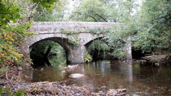
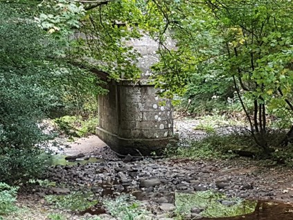
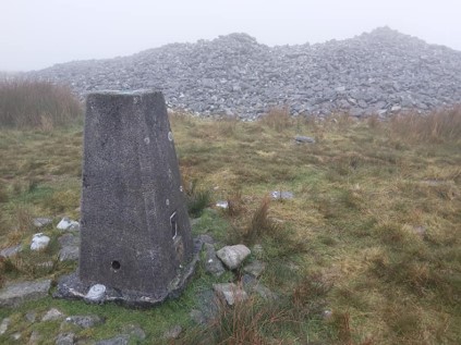
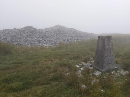
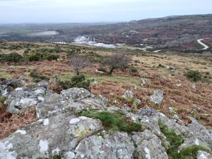
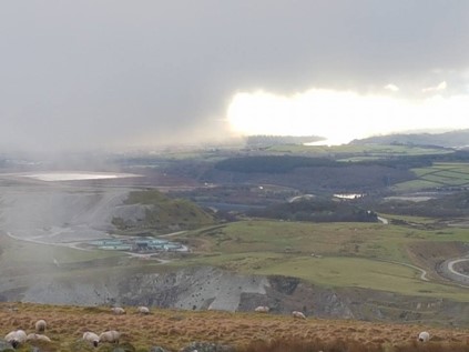
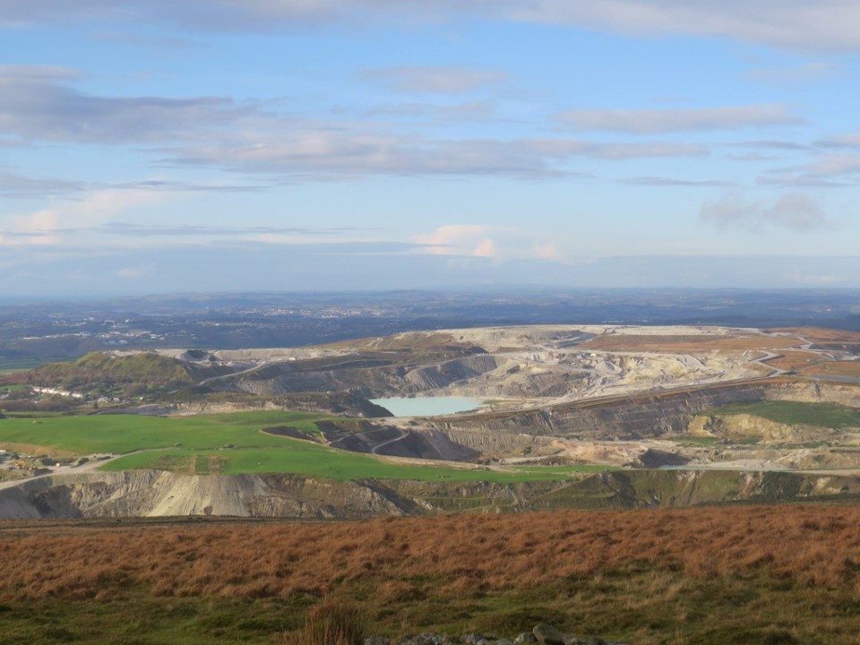
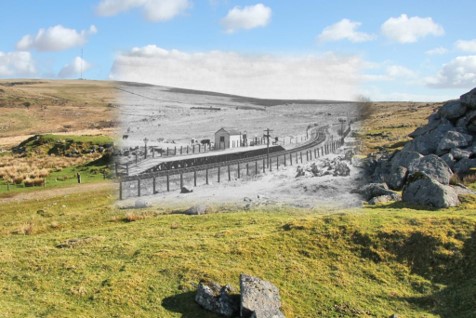
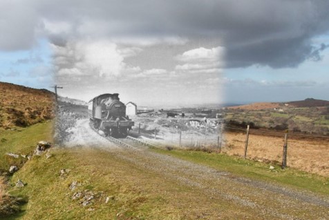
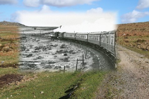
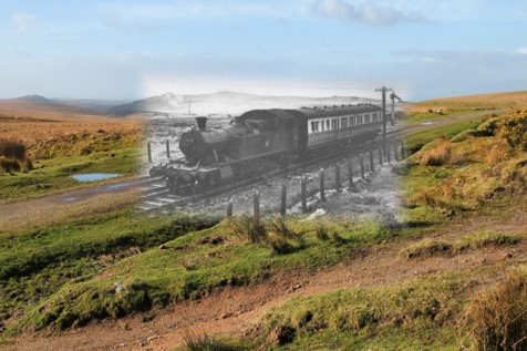
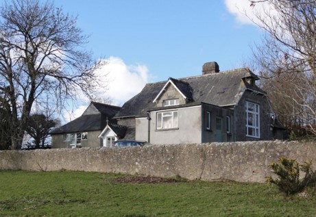
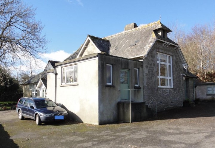
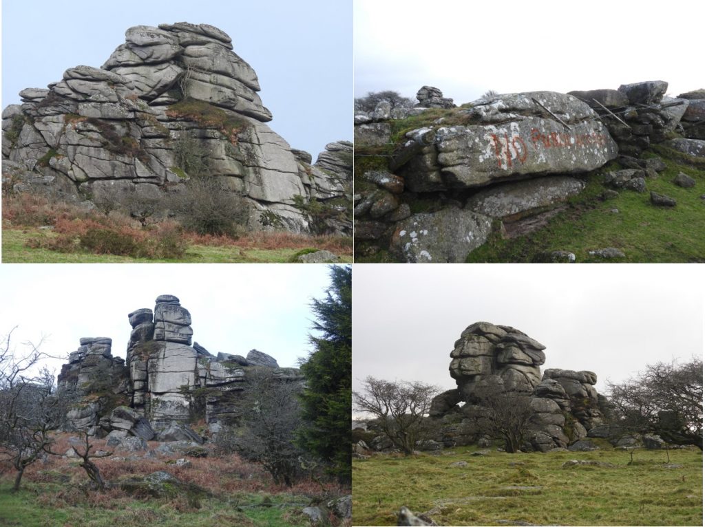
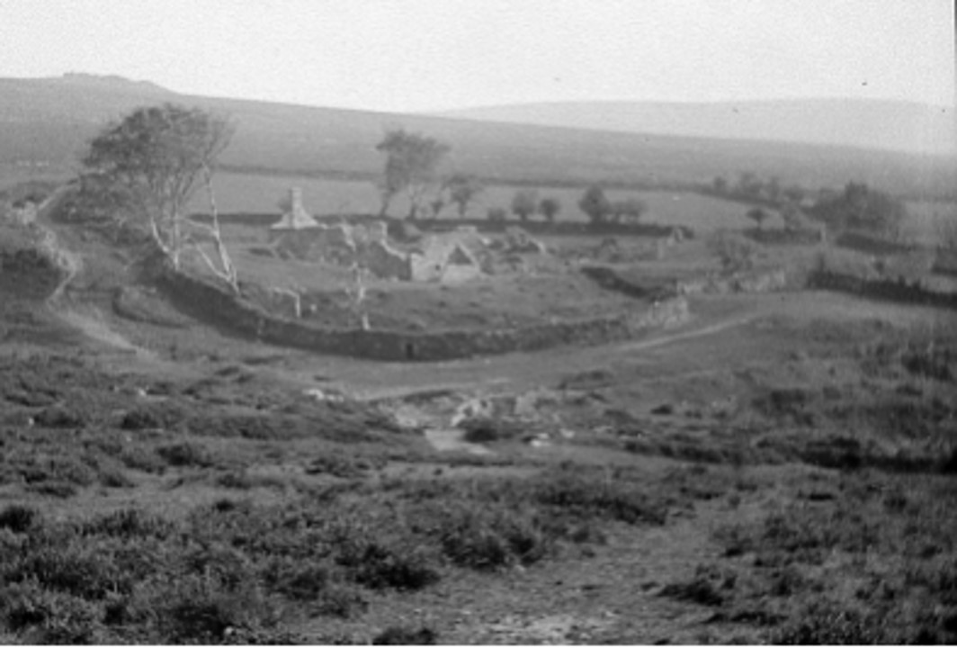
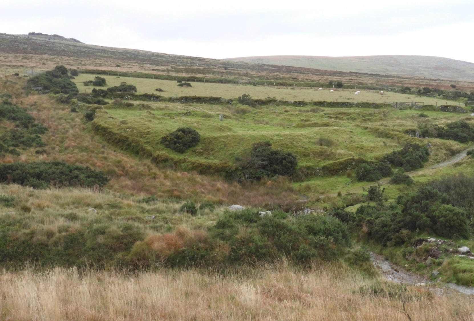
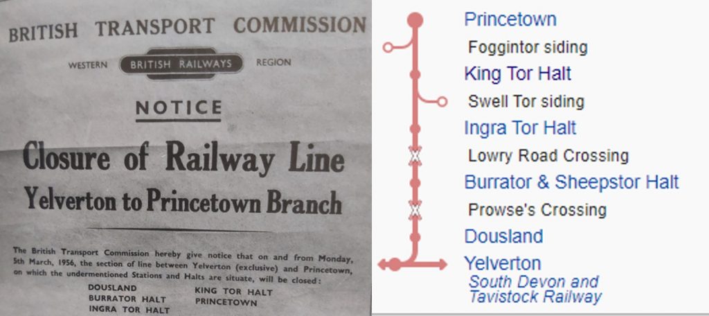
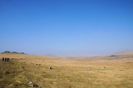
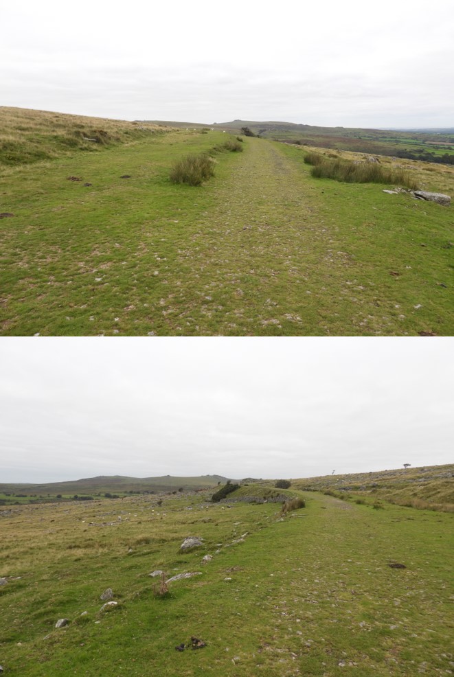
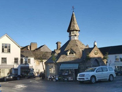
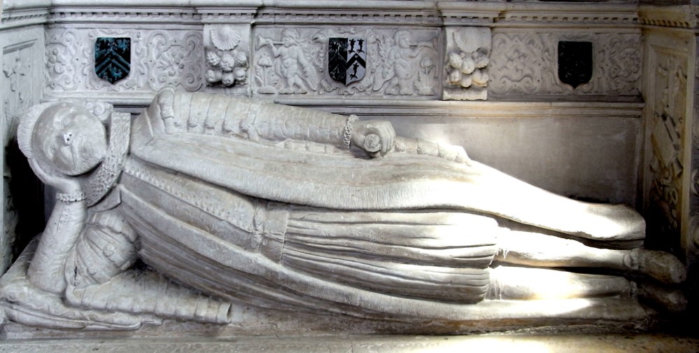
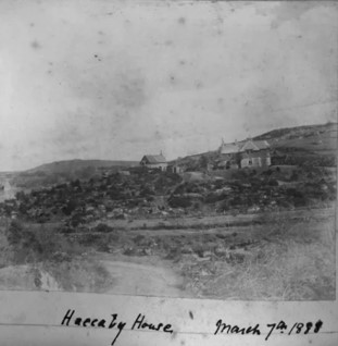
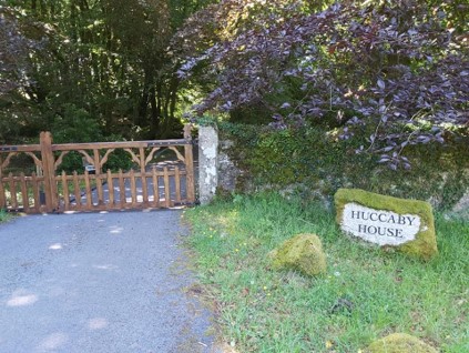
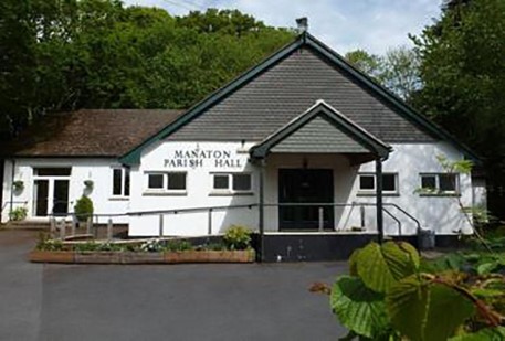
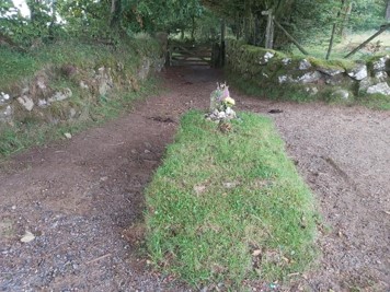
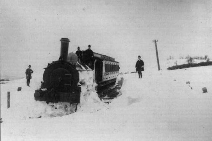
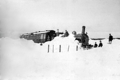
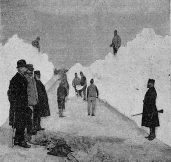
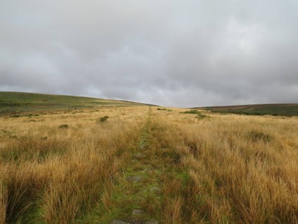
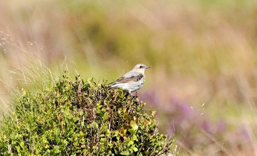
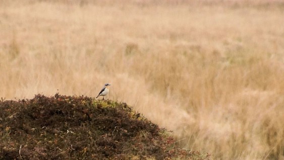
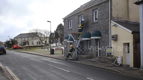
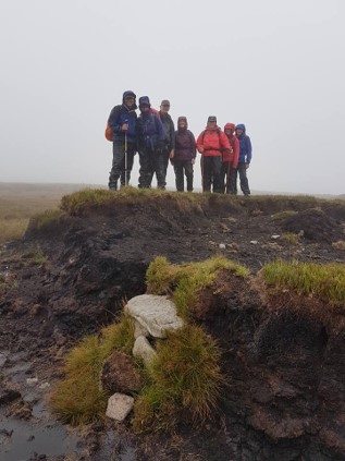
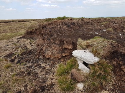
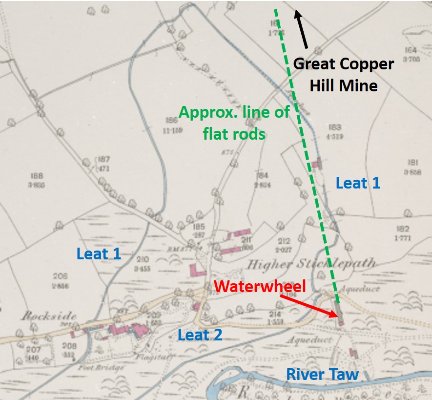
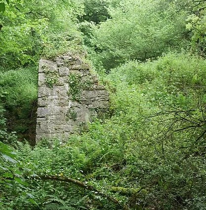
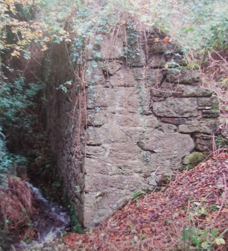
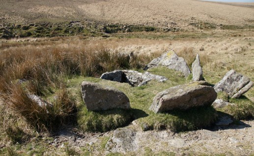
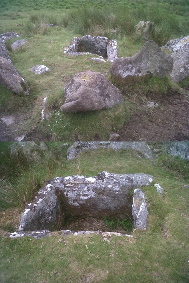
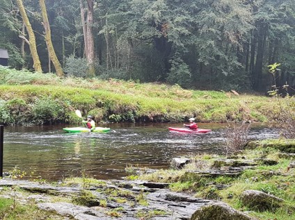
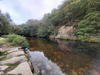
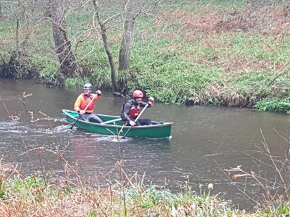
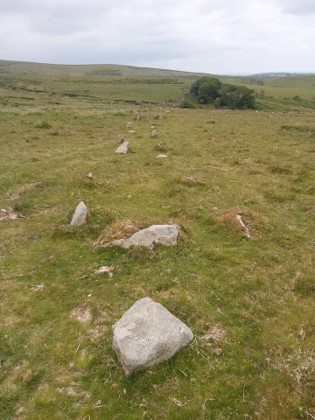
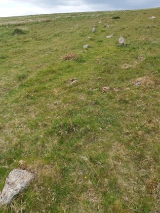
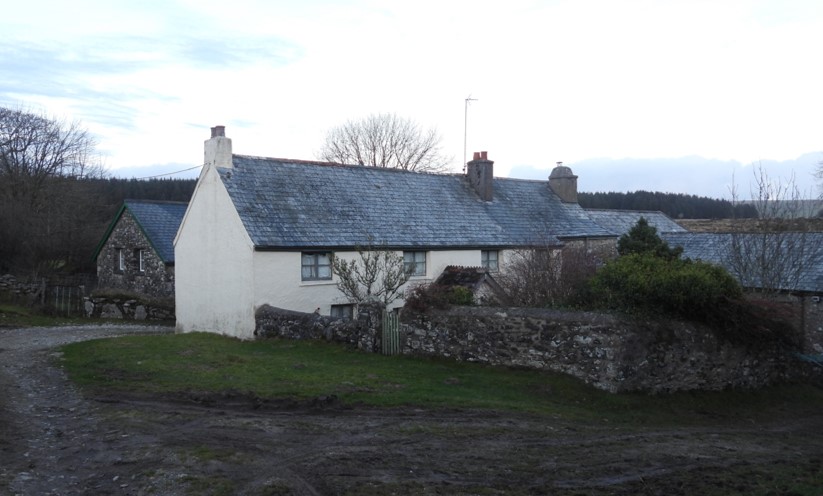
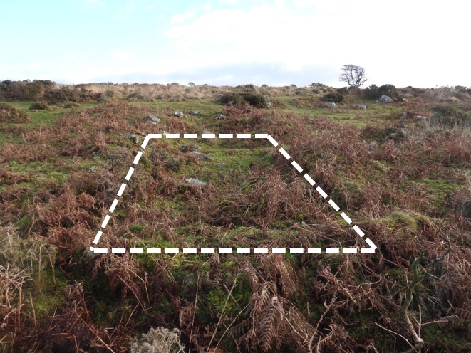
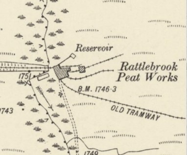
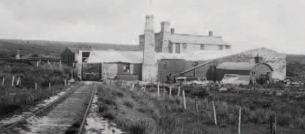
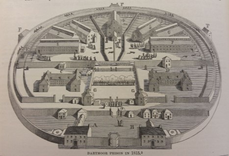
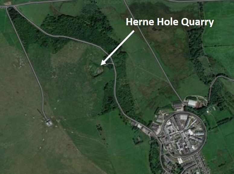
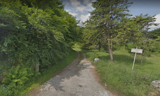
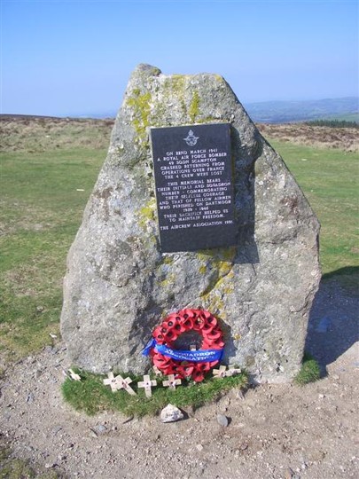
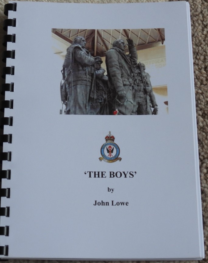
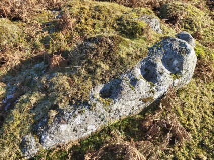
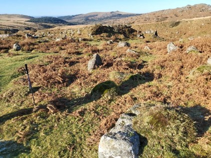
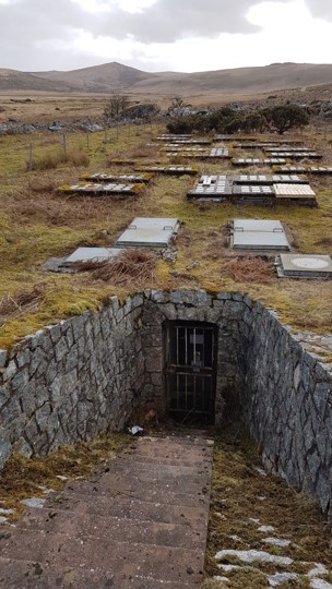
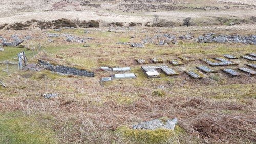
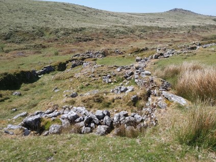
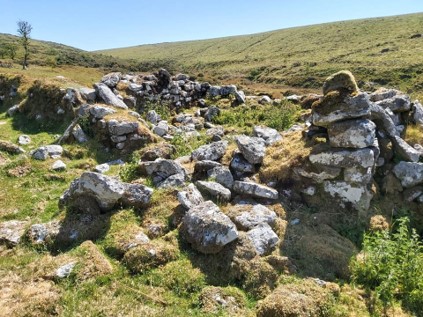
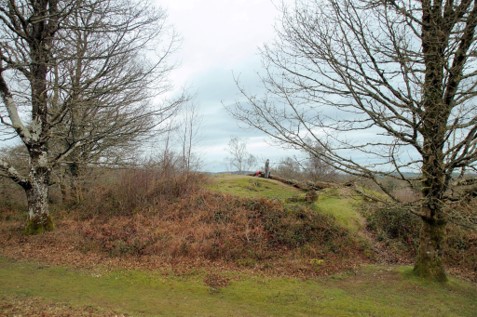
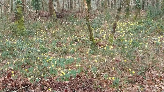
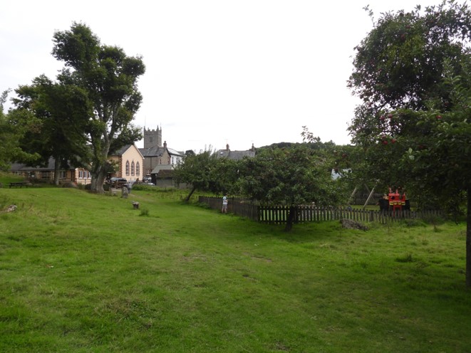
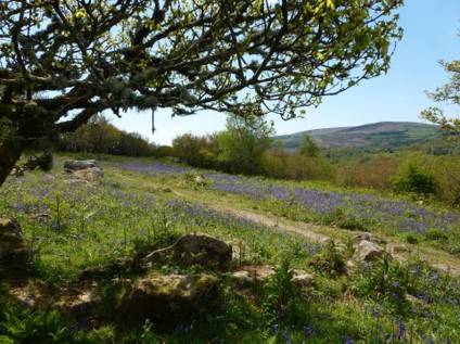
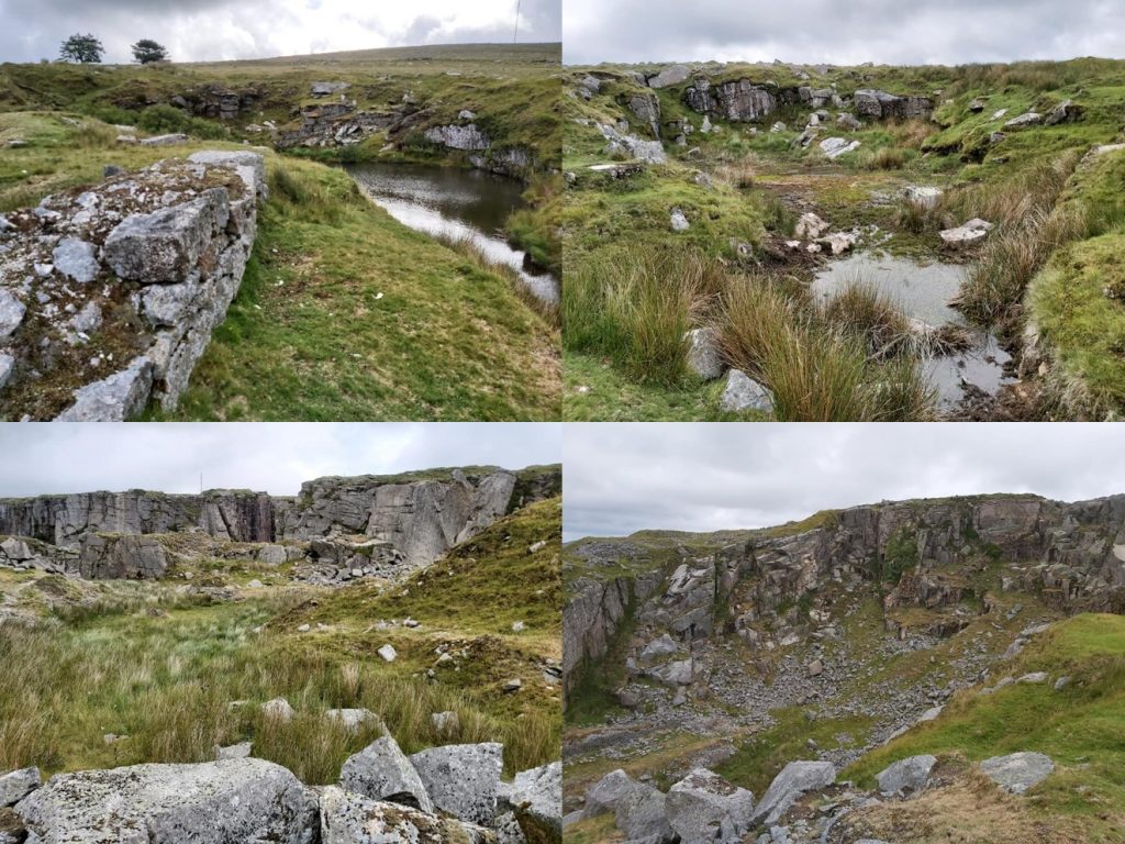
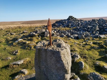
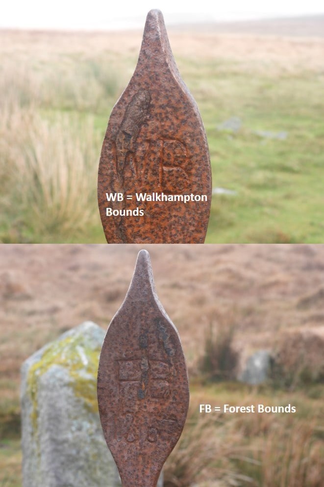
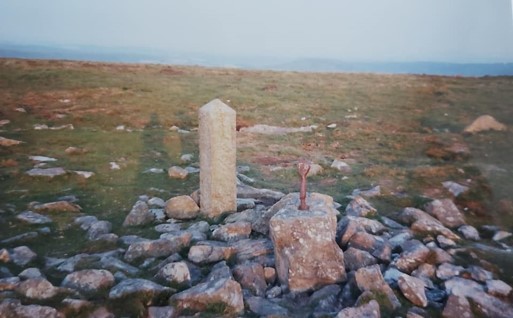
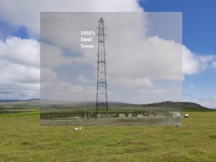
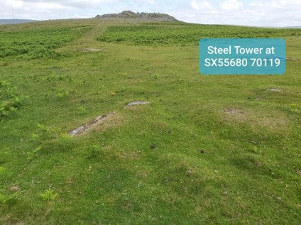
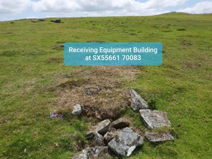
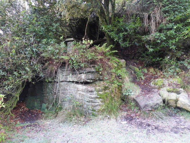
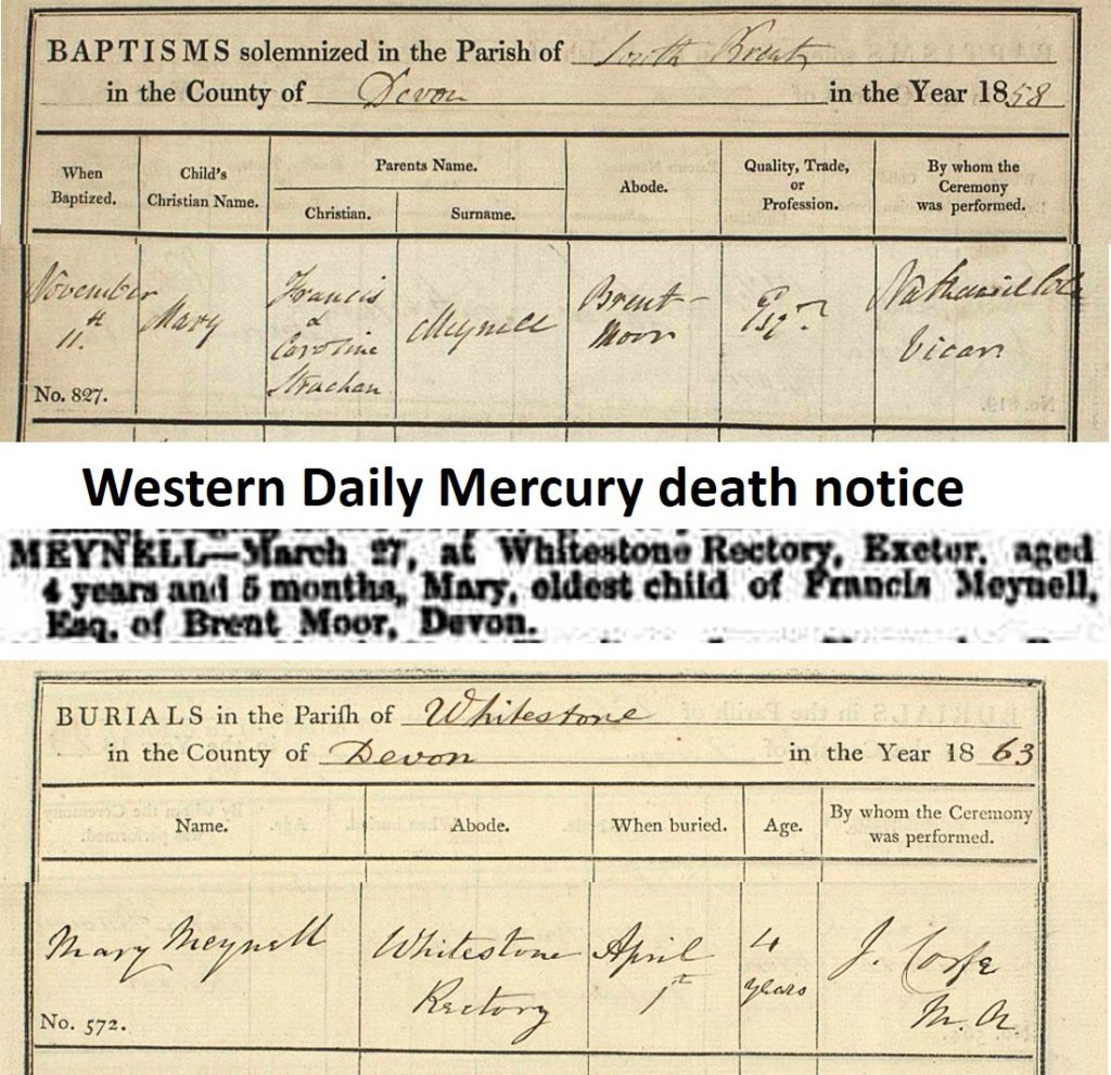
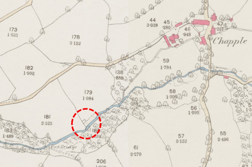
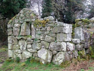
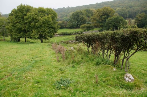
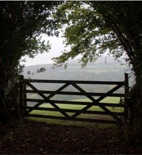
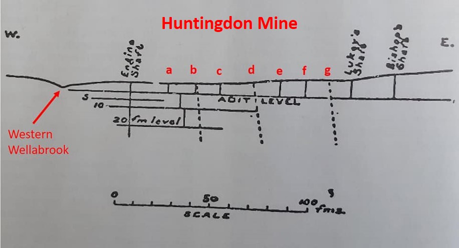
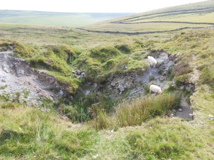
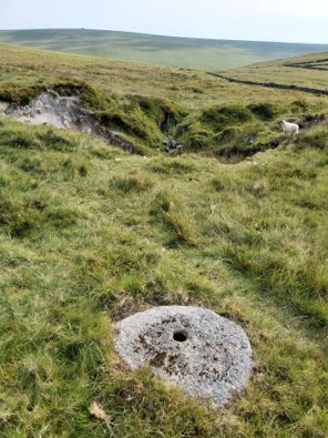
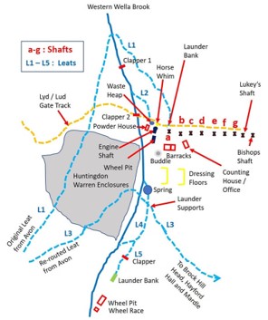
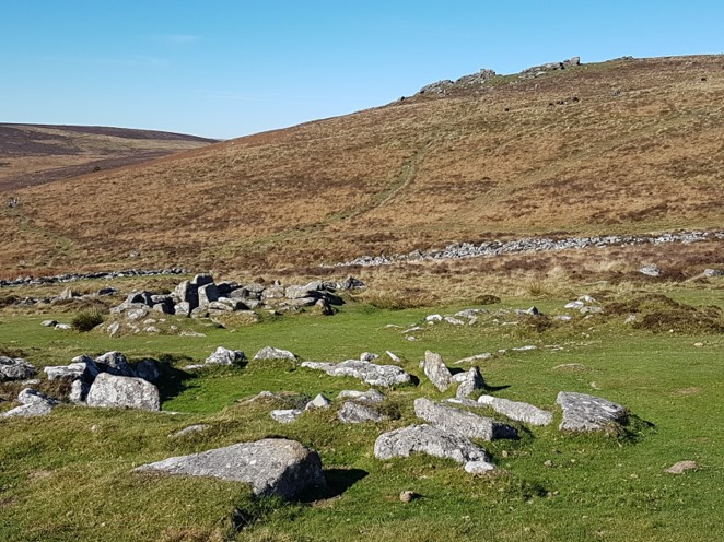
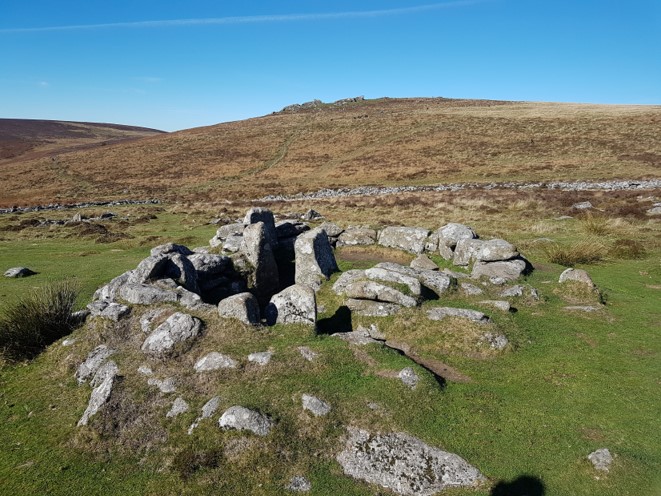
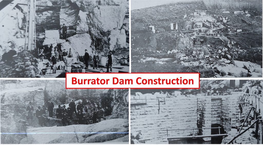
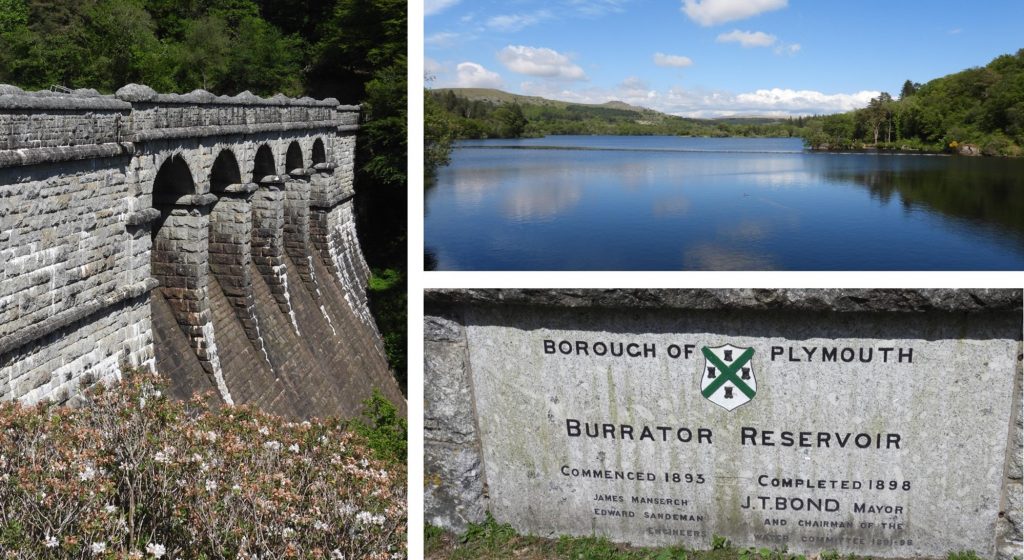
1st March 1815: Dunsford to Moretonhampstead turnpike road opened. The picture is the River Teign and Steps Bridge about a mile from Dunsford.1st March 1815: Dunsford to Moretonhampstead turnpike road opened. The picture is another one of the River Teign and Steps Bridge about a mile from Dunsford.1st March 1944: Vickers Wellington 10 LN775 crashed at Three Barrows1st March 1944: Vickers Wellington 10 LN775 crashed at Three Barrows2nd March 1852: The Lee Moor Porcelain Company was formed on this date. The picture was taken from Crownhill Tor.2nd March 1852: The Lee Moor Porcelain Company was formed on this date. The picture is Cholwichtown, from footpath when leaving Penn Beacon.2nd March 1852: The Lee Moor Porcelain Company was formed on this date. The picture was taken from Shell Top through some low cloud2nd March 1852: The Lee Moor Porcelain Company was formed on this date. The picture was taken from Penn Beacon2nd March 1936: Ingra Tor Halt was opened. The “then and now” picture of the Halt is looking ENE towards Princetown. You can just spot a train in the middle distance above the shelter trundling its way down from Princetown.2nd March 1936: Ingra Tor Halt was opened. A train just leaving Ingra Tor Halt and heading towards Kings Tor Halt and Princetown. Looking W with Ingra Tor on the left and probably Pew Tor on the right. The concrete base of the shelter is still in place.3rd March 1956: The last train ran from Yelverton to Princetown. The line was operated by the Great Western Railway, but owned by the Princetown Railway until 1 January 1922 when the Company amalgamated with the GWR. The line passed to British Railways in 1948 and the last train (the 2.51pm from Yelverton) ran on 3rd March 1956. For the railway enthusiasts the two engines were 4568 and 4583. The picture is the last train passing Routrundle heading N to Ingra Tor. The last train to run on the line had lots of carriages and needed two engines to climb up to Princetown. It didn’t normally look like this!3rd March 1956: The last train ran from Yelverton to Princetown. The picture shows a train approaching Princetown station – looking SW to Sharpitor with its RAF mast. Note, a single engine and carriage.3rd March 1971: The small primary school at Throwleigh closed, having first opened in 1877. Mentioned in the Dartmoor HER: “School opened in June 1877, replacing the schoolhouse at the Bible Christian Chapel (MDV6204). The building of the school was troubled and money was still owed to the builders at the end of the century.” 3rd March 1971: The small primary school at Throwleigh closed, having first opened in 1877. Details of the school mistresses and pupil teachers, included Ellen Ellston, who stayed with the school for many years. In 1966 it was described by the Secretary of State as a ‘lovely little school’, and was very popular, drawing pupils from a wide area due to the excellence of its teaching. Unfortunately it was still closed in 1971, which was a bitter blow to the community.3rd March 1971: The small primary school at Throwleigh closed, having first opened in 1877. When being sold recently, a part of the agents (Stags) description was: ” …….of typical Victorian style with granite elevations under a slate roof. The property was subsequently extended on the south side and more recently was used as a field study centre. In 2000, further dormitory accommodation was added on the western side (providing a total of 20 dormitory places). The centre has been closed since 2013, and is in need of a complete renovation to comply with relevant regulations and standards”.4th March 2005: Meeting held by members of Dartmoor National Park Authority regarding appeals relating to Merrivale Newtake and the land at Vixen Tor Farm. The meeting related to the Countryside and Rights of Way Act 2000, Section 6 (3). Reported in Dartmoor Magazine (#79), it was stated: “The Inspector determined that the vegetation in field 7 at Vixen Tor Farm (the one which contains Vixen Tor itself), does not meet the criteria for inclusion of the land of Conclusive Maps of Open Country. This means that the land legitimately remains closed to the public , and that the new right of access on foot to open country will definitely not apply to this land”. The picture was taken in early 2021.4th March 2005: Meeting held by members of Dartmoor National Park Authority regarding appeals relating to Merrivale Newtake and the land at Vixen Tor Farm. The report in Dartmoor Magazine (#79), further stated: “Authority members recognised that members of the public still regard Vixen Tor as a special Dartmoor landmark to which they would like access. Accordingly (DNPA) members instructed the Chief Executive to discuss, with the owners, the circumstances under which they might agree to public access being permitted and the owners have since indicated they are willing to talk”. The pictures were taken in early 2021, nearly 16 years after that meeting – clearly access by the public is still not permissible.4th March 1870: Mr Palmer of Riddeford, Peter Tavy won the first prize of £1 8s in a ploughing match at Horndon. Riddeford has been also known as Reddaford or Redford. The picture is from 1920.4th March 1870: Mr Palmer of Riddeford, Peter Tavy won the first prize of £1 8s in a ploughing match at Horndon. The picture is from 2020. 5th March 1956: The GWR line between Yelverton and Princetown officially closed, albeit the last train was two days earlier. The notice in the picture above detailing the closure from Monday 5th March 1956.5th March 1956: The GWR line between Yelverton and Princetown officially closed. The picture is of the author in March 2016, when, with some friends conducted a walk between Yelverton and Princetown to commemorate the 60th anniversary of the line closure.5th March 1956: The GWR line between Yelverton and Princetown officially closed. The picture is from the March 2016, 60th anniversary walk, taken near Kings Tor Halt.5th March 1956: The GWR line between Yelverton and Princetown officially closed. The above two pictures were taken at junction of the line with the Swell Tor siding in Autumn 2020.6th March 1618: Collapse of the market house, Chagford, killing 10 people. The building on the site today, known as “The pepperpot”, has been built on the site of several former market houses, with the earliest first recorded in 1574. In the 16th Century, the buildings on the site were not only a market house but also a courtroom where the Stannary Courts were held. The Stannary Court was in session, at the time of the tragic event.6th March 1618: Nicholas Eveleigh of Parke died in the tragic accident at the Chagford Stannary Court. He lived in the parish of Bovey Tracey and was an utter barrister. He also served as Steward of the Stannary Court of Ashburton. He died aged 56 (born 1562) when the roof of Chagford Stannary Courthouse collapsed, killing him and nine others. He has rather a “sumptuous“ monument in Bovey Tracey Church as can be seen from the picture. Ref: https://en.wikipedia.org/wiki/Nicholas_Eveleigh_(died_1618)7th March 1888: Picture from Robert Burnard collection taken on this date of Huccaby House. The lack of trees in the area is quite stark.7th March 1888: Picture from Robert Burnard collection taken on this date of Huccaby House. A modern picture of the gates shows how many trees are now in the area.7th March 1810: Dutch Lieutenant Johannis Schinddeberth married Elizabeth Parker in Moretonhampstead. Enemy officer P.O.W.s paroled in the town were accepted into the community by the local inhabitants as evidenced. 7th March 1810: Dutch Lieutenant Johannis Schinddeberth married Elizabeth Parker in Moretonhampstead. (Source: Mike Brown’s Dartmoor CD – recorded in Moretonhampstead marriage registers of 1810).8th March 2014: “Chasing Kitty Jay” was a community play performed at Manaton Parish Hall by MED Theatre on this date. Chasing Kitty Jay described by the MED Threatre as “the creation of a wartime myth got to the heart of Dartmoor’s Kitty Jay legend, exploring how the grave of a unknown suicide became a shrine for grief in a community suffering the impact of a brutal yet remote World War.” 8th March 2014: “Chasing Kitty Jay” was a community play performed at Manaton Parish Hall by MED Theatre on this date. In the advertising for the play, the MED Theatre stated: “Writers Beatrice Chase (author of The Heart of the Moor) and John Galsworthy (Nobel prize winner and author of The Apple Tree, a short story based on Kitty Jay) lived in the Dartmoor parishes of Widecombe and Manaton during World War One. Both had come from London where they had witnessed the poverty of the East End and developed a vocation for social reform. It was through their creative intervention that Kitty Jay myth was born.”8th March 2014: “Chasing Kitty Jay” was a community play performed at Manaton Parish Hall by MED Theatre on this date. The picture of Kitty Jay’s Grave was taken in August 2019.9th March 1891: The great blizzard lasted between Monday 9th and Friday 13th March 1891. South West England was struck by a storm so ferocious that more than 200 people and 6,000 animals died. There were reports of snowdrifts up to 15 feet high. The Synoptic chart is from midnight on March 10th 1891. There was a deepening depression, bringing heavy, persistent snow and widespread gales, drifted east across the south of Britain and through the English Channel. (Source: www.wetterzentrale.de)9th March 1891: The great blizzard lasted between 9th Monday and 13th Friday March 1891. The picture is the trapped 6.34pm evening (9th March) mail train from Princetown to Yelverton. The photograph was taken on 14th March.9th March 1891: The great blizzard lasted between 9th Monday and 13th Friday March 1891. The passengers on the train were trapped from the Monday night (9th) until Wednesday (11th) morning, Local pack-horse drivers reached the train on the Tuesday. They provided the passengers with a small amount of cocoa, bread and cake. They had to stay on the train as the wind kept blowing and conditions got worse. The passengers were four men and two women and were finally rescued on the Wednesday. The photograph shows the state of the train on the 14 March. The train, however, was not freed from the snow until 19 March.9th March 1891: The great blizzard lasted between 9th Monday and 13th Friday March 1891. The picture shows convicts clearing the snow in Princetown.10th March 1960: Giant Ploughshare on the peaty moor above Hawns and Dendles. From 0730 on this date a giant ploughshare was launched. The picture is of the “causeway” above Hawns and Dendles as it leads to Penn Moor.10th March 1960: Giant Ploughshare on the peaty moor above Hawns and Dendles. In the wake of the launch ten men recruited from Plymouth and Plympton employment exchanges, planted sitka spruce. The picture taken in Autumn 2020, shows the area, zoomed in from near Penn Beacon.10th March 1960: Giant Ploughshare on the peaty moor above Hawns and Dendles. The picture was taken from near the Yealm looking west at the wall separating the Hawns and Dendles “newtake” and Penn Moor.11th March 2011: The average arrival time of wheatears back to Dartmoor as recorded in “A Dartmoor Blog” by Adrian Colston. According to the blog, the first emigrating birds to arrive back are wheatears. They are described as lovely grey, black and amber birds with a white rump. In 2011 the first wheatears arrived back in the country on the 15th February! This picture was taken on 20th July 2020.11th March 2011: The average arrival time of wheatears back to Dartmoor as recorded in “A Dartmoor Blog” by Adrian Colston. According to the blog, one of the best places for the wheatear is Trowlesworthy Warren just up from Cadover Bridge on the River Plym. The picture was taken at Fox Tor on 7th May 2017.11th March 2013: Reported by “newsflare” in a video with this caption: “Firemen from Tavistock Devon, battle strong winds in Princetown, Dartmoor to stop sign of the Old Police Station falling on public, they were battling winds up to 60 mph on the moors”. It might have been a slow news day on this day in 2013 ?12th March 2003: The cist on Whitehorse Hill, 910m south east of Taw Head, first recorded on Historic England database on this date. The registration number is 1020871. The picture is a group during a hike of the five 600m peaks on the moor. Whitehorse Hill is 602m above sea level.12th March 2003: The cist on Whitehorse Hill, 910m south east of Taw Head, first recorded on Historic England database on this date. The registration number is 1020871. The entry on the database states: “The monument includes a cist situated near the summit of Whitehorse Hill. The cist was, until 2001, visible in the edge of an irregularly shaped island of peat standing above its surroundings. Only the western edge of the cist was exposed, the remainder, including the cist’s original contents, being sealed beneath peat deposits. The cist measures 0.3m deep by 0.4m wide and its capstone remains in its original position. Early in 2001 a protective drystone wall measuring 3m long by 0.9m high was built in front of the western edge of the cist, which as a result is no longer visible. The drystone wall is included in the scheduling. This cist stands at a considerable height above sea level and, perhaps as a consequence, no broadly contemporary settlements are known to survive within its vicinity”.13th March 1886: Mining Journal record shows the water course feeding the 70ft waterwheel associated with Great Copper Hill Mine was filled with snow. The journal also stated there were severe snow storms leaving 10-12 inches of surface snow. They also had a surface rod breakage delaying pumping by 4.5 hours. All these delays meant they could only work three days that particular week. (Source: Article by Chris Walpole in DM issue #82). The wheel was fed by two leats as shown on the map.13th March 1886: Mining Journal record shows the water course feeding the 70ft waterwheel associated with Great Copper Hill Mine was filled with snow. The waterwheel is reputed to have been the largest on mainland Britain. It was built around 1878 to deal with pumping. Assuming the size is correct, this would have made it the largest waterwheel to be erected on mainland Britain, with Lady Isabella wheel at Laxey Mine on the Isle of Man which measures 72½ feet, being the largest in the whole of Britain.13th March 1886: Mining Journal record shows the water course feeding the 70ft waterwheel associated with Great Copper Hill Mine was filled with snow. Apparently the wheel was painted bright red and “was an object of such terror to horses that it was almost impossible to ride or drive them past it”. After the closure of the mine in 1891, the wheel gradually fell into decay and was eventually broken up for scrap in Finch’s Foundry at Sticklepath during the First World War. (Source: Heritage Gateway).14th March 1962: Grim’s Grave cairn with a cist, Langcombe, first registered on Historic England database, reference 1018591. The entry states: “This cairn lies close to the northern bank of Langcombe Brook, a tributary of the River Plym. It consists of a retaining kerb of nine, possibly ten, stones up to a metre in height, surrounding a mound 5.5m in diameter and 0.5m in height, with a central cist.”14th March 1962: Grim’s Grave cairn with a cist, Langcombe, first registered on Historic England database, reference 1018591. The entry further states: “The cist is 1m in length and up to 0.8m in width, and 0.9m in depth. Both side and end slabs are in place and the coverstone has been replaced in position. The ground outside the retaining kerb is badly eroded, leaving the monument standing above the surrounding ground level. There are several other cairns with cists in Langcombe.”15th March – This is the last date of the Winter season that canoeing can take place on the Dart. The Dart Fisheries Association and the BCU (British Canoe Union) have an agreement permitting access to the river from Newbridge from 1st October to 15th March, and from Dartmeet from 15th October to 15th March. The photograph is from near “Lower” Buckland Bridge where East Webburn enters the Dart, taken September 2017 (a few weeks earlier than the agreement).15th March – This is the last date of the Winter season that canoeing can take place on the Dart. Picture is Deeper Marsh just north and downstream of New Bridge.15th March – This is the last date of the Winter season that canoeing can take place on the Dart. The picture was taken near Uppaton Weir on Teign in April 2018.16th March 1964: The Stone alignment and terminal cairns south-west of Glasscombe Corner first registered on Historic England database, ref 1012476. The Historic England website states: “This alignment and its associated cairns lie south-west of Glasscombe Corner and the West Glaze Brook, on the lower eastern slope of Piles Hill.” The picture is from June 2020 showing the top of stone row looking towards Glasscombe Corner at SX66016 60693. 16th March 1964: The Stone alignment and terminal cairns south-west of Glasscombe Corner first registered on Historic England database, ref 1012476. The Historic England website further states: “The alignment runs south-west/north-east for 174 metres down across the slope and is single for about one third of its length and double for the southern two thirds”. The picture is from June 2020 and shows the stone row changing from single row to double row at SX66055 60745.17th March 1337: King Edward III granted the Forest of Dartmoor to his son Edward the Black Prince. At the same time as he created him the first Duke of Cornwall, and today, the forest still belongs to the Duchy of Cornwall. Ancient Tenements, such as Pizwell (aka Pushylle), were founded within the Forest. The first mention of Pizwell was circa 1260.17th March 1337: King Edward III granted the Forest of Dartmoor to his son Edward the Black Prince. One of the more well visited Perambulation waypoints is Siwards Cross.17th March 1337: King Edward III granted the Forest of Dartmoor to his son Edward the Black Prince. Another well known Perambulation waypoint is The Longstone (with Kes Tor in background).17th March 1337: King Edward III granted the Forest of Dartmoor to his son Edward the Black Prince. Mysteriously, there is a kistvaen near Foxes Holt, known as Black Princes’ Tomb, but there is no known link with Edward. It was named thus by: Ruth St. Leger-Gordon in 1972 in her book “The Witchcraft and Folklore of Dartmoor“, but no reason was given.17th March 1834: Thomas Greep and Simon Willcocks are paid the final instalment on their contract of £21 2s 1d “for making 101.5 yards of Hedge to inclose a Newtake on Peek Down”. (Ref Dartmoor 2001 – A Dartmoor Diary of Yesteryear by Mike Brown). This hedge / wall is adjacent to B3212 and will be familiar to drivers climbing the Peek hill between Yelverton and Princetown.17th March 1834: Thomas Greep and Simon Willcocks are paid the final instalment on their contract of £21 2s 1d “for making 101.5 yards of Hedge to inclose a Newtake on Peek Down”. The newtake was built in order to provide Thomas Vogwell of Babyland (a farmstead near Routrundle) a change of pasture for his stock17th March 1834: Thomas Greep and Simon Willcocks are paid the final instalment on their contract of £21 2s 1d “for making 101.5 yards of Hedge to inclose a Newtake on Peek Down”. The newtake is probably plot 724.1 as recorded on the tithe which was recorded as being just over 12 acres. The tithe records the occupier as ‘Thomas Vogwill’ (here and at Babyland). That said there is also a ‘Thomas Vogwell’ mentioned, which does suggest a transcription error.18th March 1965: Settlement on Wigford Down, first mentioned on Historic England database, reference, 1002550. The entry describes the settlement as: “A stone hut circle settlement with associated enclosures and a medieval long house within part of the Wigford Down coaxial field system, 700m south west of Durance”. The picture was taken in December 2020 and is of the Longhouse in the area at SX54292 65121. Jeremy Butler, in his Dartmoor Atlas of Antiquities describes this area thus: “The ancient field pattern is confused by banks and ditches of medieval date, cutting across the site, probably associated with the two longhouses). 18th March 1965: Settlement on Wigford Down, first mentioned on Historic England database, reference, 1002550. The database entry states: “The longhouse survives as a rectangular building defined by low walls measuring up to 1.5m wide and 0.6m high. The interior of the building is 12.5m long by 3.8m wide. There is an entrance on the south side and an interior cross wall. A 3m long flanking wall outside the entrance represents the upstanding remains of a porch with a further yard and garden plots beyond”.19th March 1881: On this date an article about Rattlebrook Peat Works was published in Berrows Worcester Journal. It was titled ‘Serious Charges Against Directors’, which made allegations about the financial management of the company. (Source: Domestic and Industrial Peat Cutting on North-Western Dartmoor, Devonshire: An archaeological and historical investigation by Dr. Phil Newman).19th March 1881: On this date an article about Rattlebrook Peat Works was published in Berrows Worcester Journal. It was titled ‘Serious Charges Against Directors’. From the Dr Newman paper: “……..it was claimed by a committee of shareholders, that the company had purchased the licence to cut peat at Rattlebrook from Frederick Thomas, paying him £8000 for it in shares. They then paid Howard a further £8000 for his patent peat drying and compressing machine, although it was reported that no such machine was present at the works.20th March 1806: The foundation stone of Dartmoor Prison was laid by Sir Thomas Tyrwhitt. Between 1803 and 1815 Britain was at war with Napoleonic France. The prisoners taken were sent to redundant warships commissioned as floating prisons known as ‘the hulks’. Several hulks were at anchor at Plymouth among other places. Conditions were so bad with poor sanitary arrangements, little exercise, lack of fresh air and a poor diet, the death rate rose to an unacceptable level and a prison on land was decided upon. Princetown on Dartmoor was considered a suitable location and that is how Dartmoor Prison came to be built. (Source: Dartmoor Museum website). The picture is the prison depicted in 1815.20th March 1806: The foundation stone of Dartmoor Prison was laid by Sir Thomas Tyrwhitt. The first prisons were constructed from stones obtained by breaking up the boulders lying around the site supplemented by dressed stone from nearby Herne Hole quarry (ironically owned by Sir Thomas Tyrwhitt !).20th March 1806: The foundation stone of Dartmoor Prison was laid by Sir Thomas Tyrwhitt. The planned construction was 18 months but it took twice as long due to labour disputes and the notorious Dartmoor weather. The picture is the entrance to Herne Hole quarry.21st March 1941: At 22:50, on this date 80 years ago, six of 49 Squadron’s (Bomber Command) Hampden bombers took off from RAF Scampton. They set course for the German naval base at Lorient, in occupied France. On their return, Hampden X3054, experienced problems with a radio that was unable to receive. The aircraft struck Hameldown and caught fire. The memorial at the site was commissioned by Lady Marjorie Cecilia Wilson, the mother of the pilot (Robert Wilson). The memorial is dated 21.3.41 and contains the initials of the four your crew members who sadly perished. The crew were: Pilot Officer Robert David Wilson (R.D.W), Sgt Ronald Brames (R.B), Sgt Charles John Lyon (C.J.L) and Sgt Richard Leonard Ashburton Ellis (R.L.A.E) – R.I.P 21st March 1941: Having taken off on the 21st, the Hampden X3054, must have struck Hameldown in the early hours of 22nd March. The date on a plaque on the reverse of the memorial is 22nd March. Sgts Brames, Ellis and Lyon are believed to have died on impact. However, Pilot Officer Wilson, survived until the following day, presumably because he would have been strapped in. He died at Moretonhampstead hospital in the evening of 22nd March having briefly regained consciousness. He and Sgt Ellis, the second pilot, lie next to one another in Exeter’s Higher Cemetery, in plots set aside for military dead; the two air gunners are buried in their home towns, which one assumes was at the request of their families.21st March 1941: The story of the crash of Hampden X3054 on Hameldown plus reflections and background stories of the young aircrew are told by John Lowe in his book “The Boys” (see photograph).21st March 2002: “Unusual mortar stone at Eylesbarrow”. Reported in Dartmoor Magazine #67 (Summer 2002 edition) that on 21st March that year Elisabeth Stanbrook found a very unusual mortarstone when walking around Eylesbarrow Mine as part of an “Interest Holiday” led by Dr Tom Greeves. The author has recorded the mortarstone at SX59135 6819121st March 2002: “Unusual mortar stone at Eylesbarrow”. Reported in Dartmoor Magazine #67 (Summer 2002 edition). The article in the magazine states “It is about 75m SE from Deep Adit. Its location is surprising, being near the head of tin workings rather than close to a stream.” (where a stamping mill would have been located).21st March 1850: Recorded in timber sales from Buckland-in-the- Moor estate for the East Birch Torr Mining Company was 732ft of scotch for the value of £18 6s and 6d. The Birch Tor and Vitifer Mines were by far the largest customers of the Buckland estate. There must have been huge difficulties hauling and delivering large quantities of timber to Dartmoor Mines in the 19th Century along narrow, rough and unmetalled track. The picture is a boundary marker for the mine at the western side of the sett. 21st March 1850: Recorded in timber sales from Buckland-in-the- Moor estate for the East Birch Torr Mining Company was 732ft of scotch for the value of £18 6s and 6d. In a publication by Mike Brown, there is a fabulous record of timbers sales in the mid-19th century from the Buckland estate, giving an insight into the supply chain for Dartmoor Mines. Other mines who were customers included: Arundel Mining Company, Bowden Hill Iron Mining Company, Bulkamore Iron Mining Company, Dart Leat Mining Company, Devon Great Tin Craft Mining Company, Devon New Copper Mining Company (Druid), Devon Tin Mines Company, East Brook Mining Company (Holne), Gobbett Mining Company, Golden Dagger Mining Company, Haytor Consols Mining Company, Holne Moor Mining Company, Owllicombe Mining Company, Queen of the Dart Mining Company, Ripping Tor Tin and Copper Mining Company, Sigford Consols Tin and Copper Mining Company, Silver Brook Mining Company, Silver Hill Mining Company, South Plain Wood Mining Company, Victoria Mining Company, West Beam Mining Company, Wheal Emma Mining Company and Wheal Hazel Mining Company21st March 1850: Recorded in timber sales from Buckland-in-the- Moor estate for the East Birch Torr Mining Company was 732ft of scotch for the value of £18 6s and 6d. The record shows the cost of the timber was 6d per foot. In 2025, the sale would have an equivalent value of £3,150.22nd March 2018: Sale of Taw Marsh waterworks facility. Amongst many newspapers running the story, on this day the Daily Mirror published an article under the headline “See inside the creepy underground bunker left abandoned for 50 years that could be yours for just £28,000“. They described the facility as “A former underground water treatment plant …… the property called The Water Works, at Taw Marsh on Dartmoor”. The facility supplied water to Exeter and was decommissioned in the 1960s. It is said that when bought in 2014, the new owner (Neil Worrell) planned to turn it into a hostel for ramblers or a mausoleum to store the ashes of dead people. 22nd March 2018: Sale of Taw Marsh waterworks facility. Amongst many newspapers running the story, on this day the Daily Mirror published an article under the headline “See inside the creepy underground bunker left abandoned for 50 years that could be yours for just £28,000“. Full article can be found at : https://www.mirror.co.uk/news/uk-news/see-inside-creepy-underground-bunker-1223280223rd March 1839: John Hamlyn was paid £5 by the Maristow Estates for damages sustained at Newlacombe (Newleycombe) Farm from the working of a Tin Mine whilst in the two last years of his holding there. In a letter written by the manor steward to Capt Joseph Cullum of Bedford Bridge, Horrabridge in May 1838, he stated: “I must say the premises are greatly damaged in various ways — by the cutting of four different channels for water, by the destruction of Fences [walls] — by Roads [tracks] — Rubbish Heaps etc. The Meadow and one other of the best plots are, by the means aforesaid, utterly spoiled for any useful purpose. Mr Hamlyn claims an allowance for these damages, which the Adventurers certainly ought to make to him.” (Source Mike Brown Dartmoor CD). Newleycombe Farm was ifrst recorded 1584 and abandoned around 1839. It can be found at SX58764 6993623rd March 1839: John Hamlyn was paid £5 by the Maristow Estates for damages sustained at Newlacombe (Newleycombe) Farm from the working of a Tin Mine whilst in the two last years of his holding there. The manor steward’s letter to Capt Joseph Cullum, further stated: “If the (mine) workings be resumed, the adventurers ought to hire the land, and do the best they can by it — as I despair of finding any Farmer that will hire it…under such circumstances.” Mike Brown comments: “Whether the mine adventurers eventually compensated Hamlyn for these damages is not known.” Pictures of Newleycombe Farm are from May 2020.23rd March 1762: An interesting recorded advert in the Sherborne Mercury: “On Monday 23rd Day of March, Instant, at Two of the Clock in the Afternoon, A publick survey will be held at the House of the Widow Bale, the Exeter Inn, in Ashburton, in Devon, for selling 1,329 Oak Trees, now growing in Hembury Woods, in the Parish of Buckfastleigh, within two Miles of Ashburton” (Source: Mike Brown Dartmoor CD). The picture of Hembury Motte is from March 2017.23rd March 1762: The recorded advert in the Sherborne Mercury further stated: “And also for selling several Lots of the said Coppice Wood, finely grown, and the Bark remarkably clean.” The picture from Hembury Woods is from March 2017.24th March 2017: On this date, a free talk was held at Lustleigh village hall (19:30) on “How to help turn Dartmoor into a Bee Nature Reserve”. The talk was given by expert ecologist Cathy Horsley of the Bumblebee Conservation Trust. The picture is Lustleigh Town Orchard and the pink building is the village hall.24th March 2017: On this date, a free talk was held at Lustleigh village hall (19:30) on “How to help turn Dartmoor into a Bee Nature Reserve”. In the advert for the event it stated: “This talk will introduce the subject, including bumblebee lifecycle and ecology, threats and bumblebee decline, and how to recognize different bumblebee species. Cathy will also talk about what bee friendly flowers you can plant so you can attract more to your land”. The picture of the bluebells is from Lustleigh Cleave.25th March 1833: In just one twelve-month period alone, to Lady Day (March 25th) in 1833, when the quarrying activities were at their height, Messrs Johnson paid dues of £69 15s 8d on a total of 8,374 tons of granite taken from their quarries on the Walkhampton Commons (Source: Mike Brown Darmoor CD).25th March 2015: In February 2015 this replica ‘Cobra’ was made at the Princetown forge and was instated at Eylesbarrow on 25th March 2015, the cost was borne by the Duchy of Cornwall and the Dartmoor National Park Authority. The “Cobra” original had became loose, then was vandalised (in 2014) before being replaced. The cobra has been also nicknamed “excalibur”.25th March 2015: Replica ‘Cobra’ instated at Eylesbarrow. These close up photographs were taken in November 202025th March 2015: Replica ‘Cobra’ instated at Eylesbarrow. This picture is of the original taken in July 1990 (taken early on a Sunday during the authors first Forest of Dartmoor Perambulation).25th March 1975: Castle Drogo opens to public. The picture is from October 2018 during the refurbishments26th March 1985: The Duchy of Cornwall announced details of a new 7 year lease for MOD training purposes on parts of Dartmoor. The licence reflected the agreement reached 3 years earlier and included the policy of benign neglect on the loop road and other military tracks. The picture is OP15 at the end of the loop road on Okement Hill, which at one point a 2 WD car could be driven.26th March 1970: The Gee signals from RAF Sharpitor were stopped. The Gee Master Transmitting Station was located at Peek Hill and was established in 1942. The station was part of the Gee system that allowed Royal Air Force (RAF) bomber crews to navigate at night by fixing their position on route to a target. A steel transmitting aerial was erected and a new transmitter block was constructed in the 1950s. (Source: DM 44 and Heritage Gateway). Picture shows an overlay from 1950s onto a 2020 picture.26th March 1970: The Gee signals from RAF Sharpitor were stopped. There is very little evidence of the station today, but with careful exploration, the outline of buildings and the two original towers (one wooden and one steel) can be located. 26th March 1970: The Gee signals from RAF Sharpitor were stopped. The picture shows the remains of one of the buildings.27th March 1863: Mary Meynell, a little girl from Brent Moor house died aged 4 years of tonsillitis and laryngitis on this date. She was the daughter of Francis and Caroline who set up the memorial to her in the grounds of Brent Moor House. William Crossing (1889) first mentions the location of the memorial in his book “Amid Devonia’s Alps“. The memorial is inscribed with the following: M.M 27th March 1863 My lovely little Lily Thou wert gathered very soon, In the fresh and dewy morning Not in the glare of noon The saviour sent His angels To bear thee hence his own And they’ll plant thee in that garden Where decay is never known.27th March 1863: Mary Meynell, a little girl from Brent Moor house died aged 4 years of tonsillitis and laryngitis on this date. It would appear that many mistakes in recording the details of this event have appeared in many publications over the last 30 years or so. The author has read that the girl has on occasions been called Margaret, her year of death being recorded as 1865 and that she died in a riding accident. The author has taken the Tim Jenkinson article, in Dartmoor Magazine Issue 137 Winter 2019 as the most definitive.27th March 1863: Mary Meynell, a little girl from Brent Moor house died aged 4 years of tonsillitis and laryngitis on this date. She was baptised on 11th November 1858. Her death was recorded in Western Daily Mercury. She was buried on 1st April 1863.27th March 1825: John Giles, a carpenter and John Folland, a mason received payment of the final balance of their bill for £155 for “Building new dwelling house and repairing outhouses at Ditsworthy Warren”. In actual fact they were building extensions to the original house, which was basically everything to the right (east) of the middle chimney as seen in the photograph. The distinct line shows the division between the original house and the extension27th March 1825: John Giles, a carpenter and John Folland, a mason received payment of the final balance of their bill for £155 for “Building new dwelling house and repairing outhouses at Ditsworthy Warren”. The above plan shows which works were carried out in 1824 and 1825, leading to the aforementioned final payment27th March 1825: John Giles, a carpenter and John Folland, a mason received payment of the final balance of their bill for £155 for “Building new dwelling house and repairing outhouses at Ditsworthy Warren”. The photograph is the ground floor from during summer 202427th March 1825: John Giles, a carpenter and John Folland, a mason received payment of the final balance of their bill for £155 for “Building new dwelling house and repairing outhouses at Ditsworthy Warren”. The photograph is the first floor from during summer 2024, the doorway to the left of the chimney stack was part of the extension28th March 1328: Murder at Chapple (Chapel of la wallen) of a young girl. Documents from the Devon Record Office record the trial of a clerk called Robert de Middelcote who forced the pregnant daughter (called Agnes) of the miller (called Roger) from Gidleigh Mill in the chapel, violently raping her and killing her unborn baby. 28th March 1328: Murder at Chapple (Chapel of la wallen) of a young girl. The fate of Robert de Middlecote is not clear. His trial was held at Exeter Cathedral on June 1st 1329. The Devon record office also records that he stole from Robert Rossel at Fonhalle (probably Venn manor house in Bishopsteignton) on 27th April 1328 fled the area. He was finally caught on Haldon Hill and accused of murder and highway robbery although his case was eventually dismissed.29th March 1974: The National Park Authority purchased Wray Cleave, 76 acres, to help secure the long term future of the broadleaf character of the Wray Valley. The picture was taken from above Wray Cleave, whilst on a circumnavigation of Lustleigh Parish.29th March 1974: The National Park Authority purchased Wray Cleave. The picture was taken near Wray Barton at the north end of Wray Cleave.29th March 1974: The National Park Authority purchased Wray Cleave. The picture was taken from across the valley near Barne Cross with a view of the distant Wray Cleave.30th March 1807: Huntingdon Mine was first available for let from this date. Eventually the mine had at least 10 shafts (a–g, Engine Shaft, Lukey’s Shaft and Bishop’s Shaft) as shown in the sketch from 1912. (Source: Dave Brewer article from DM, issue 10).30th March 1807: Huntingdon Mine was first available for let from this date. The following announcement appeared in Trewman’s Exeter Flying Post on 2nd April 1807: “Tin Mines on Dartmoor. Several valuable tin lodes and mines near Huntingdon on Dartmoor, now to be let. The tin in these bounds is of very (?) quality, and some mines therein may be worked with immediate advantage. For viewing same, apply to Mr William Butcher at Holne; and for treating apply to Mr Meardon at Jump near Plymouth. Dated Mch 30th 1807″. The picture is the Engine Shaft from summer 202030th March 1807: Huntingdon Mine was first available for let from this date. The picture is a horse whim located next to the Engine Shaft.30th March 1807: Huntingdon Mine was first available for let from this date. The sketch is of the site as adapted from the Dave Brewer sketch in DM #10. With some exploration all the leats (now dry) can be discerned.31st March 1894: The newly formed Dartmoor Exploration Committee started their survey at Grimspound. 31st March 1894: The newly formed Dartmoor Exploration Committee started their survey at Grimspound, under the supervision of the Reverend Sabine Baring-Gould and Richard Hansford Worth31st March 1894: The newly formed Dartmoor Exploration Committee started their survey at Grimspound. The picture is a view of Grimspound taken from the southern slopes of Hookney Tor31st March 1894: The Dartmoor Exploration Committee started their survey at Grimspound. Their first report was published in August 1894 and was 121 pages long. An extract from the report (page 7) states: “The examination and excavation of the circles and wall of Grimspound were commenced in (sic) March 31, 1894, when five members of the committee were present. On that occasion, Mr R. Hansford Worth made a new survey of the enclosure. The hut circles were then numbered, and the general order of procedure determined on.”31st March 1894: The Dartmoor Exploration Committee started their survey at Grimspound. A further extract from the first report adds: “On that day, moreover, two of the rings, Nos 1 and 2, were explored, but no further works were carried on till April 20th, after which, excavation was recommended and prosecuted as weather permitted, and the arrangements of the committee allowed, till June 10th. This resulted in the complete exploration of all such huts as were believed to have been formally inhabited, and in the partial investigation of the rest, which had apparently served as cattle pens or store houses”.31st March 1894: The Dartmoor Exploration Committee started their survey at Grimspound, The committee members who contributed to that 1st report were: Rev. Sabine Baring-Gould, Robert Burnard, Richard Nicolls Worth, Rev. W. A. Gordon Gray and Richard Hansford Worth.31st March 1895: The Plymouth Corporation published its annual accounts, recording the wages of workmen at Burrator Dam as being £10,832 18s 7d. This would have been the first full year accounts during the period of the build, which started on 9th August 1893 and was completed on 21st September 1898 (opening ceremony). The pictures are top left; foundations from February 1896, top right; opening the trench for the dam (date unknown), bottom left; inspection of the trench (Sheepstor side) by Plymouth Water Committee wiht the Water Engineer, Edward Sanderman second from the left and bottom right; reservoir view of the dam from June 1897.31st March 1895: The Plymouth Corporation published its annual accounts, recording the wages of workmen at Burrator Dam as being £10,832 18s 7d. The Water Engineer was Edward Sanderman, who was newly appointed in 1893 when construction began. It was his appointment, which led to the local council agreeing that Burrator Gorge was the best compromise site for the new dam. At one time, the Meavy / Hart Tor valleys had been considered as a site for the dam. Sanderman would have been around 31 years old when the dam construction commenced.31st March 1895: The Plymouth Corporation published its annual accounts, recording the wages of workmen at Burrator Dam as being £10,832 18s 7d. Of interest is that the wage bill from the 19th century build in todays money would be in region of £1.85M per year (around £9.25M over the 5 years of construction assuming a ‘linear spend’). The dam was raised in the 20th century (started December 1923 and was completed 4.5 years later) at a cost £135k or around £10.7M in todays money. Therefore the total spend was around the equivalent of £20M+ in todays money (2024).