Dartmoor Explorations

A collection of walks, discoveries, insights and pictures of exploring Dartmoor National Park

Dartmoor 1000 – South

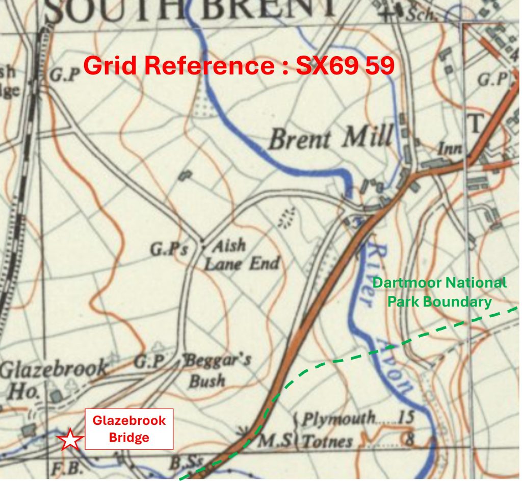
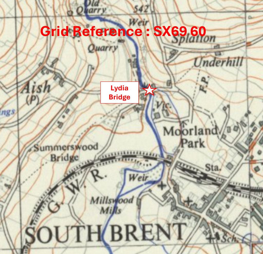
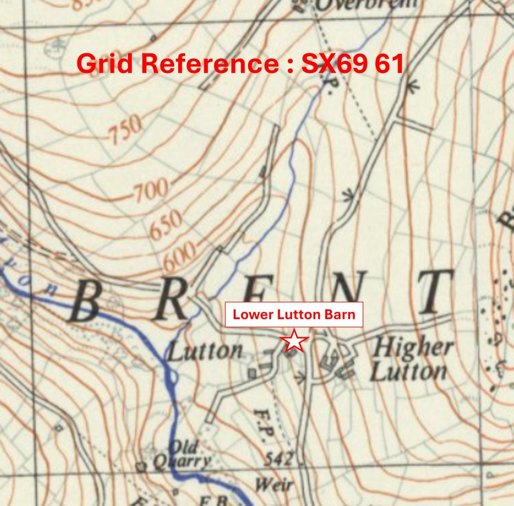
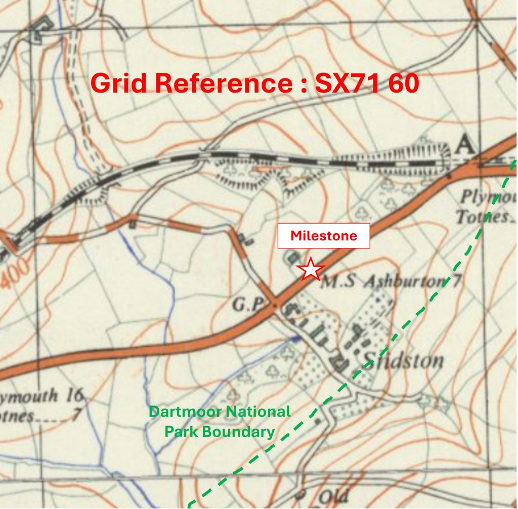
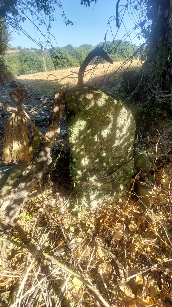
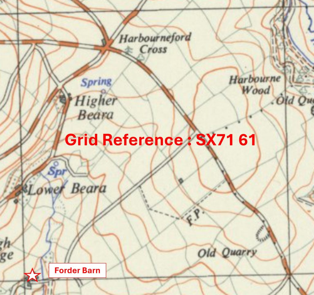
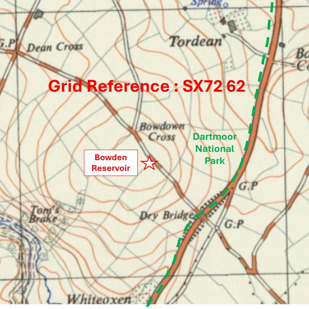
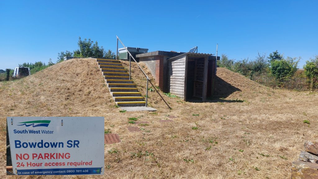
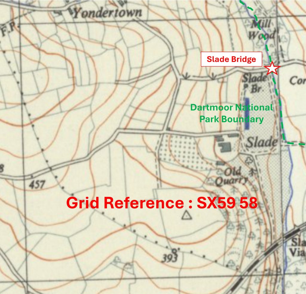
The recording of the ‘South’ area in the Dartmoor 1000 project is 90% complete, with just 8 photographs to collect in the total of 80. Each km square is referenced with: an annotated map ‘snippet’ showing the SX grid with the location of the chosen artefact to represent the square and a photograph of that artefact. The OS map ‘snippets’ are 70 years old and not subject to copyright
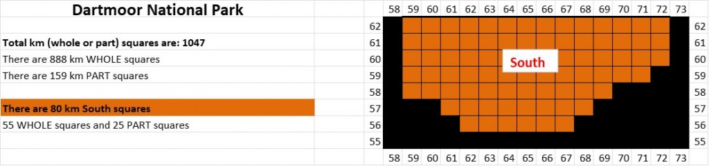
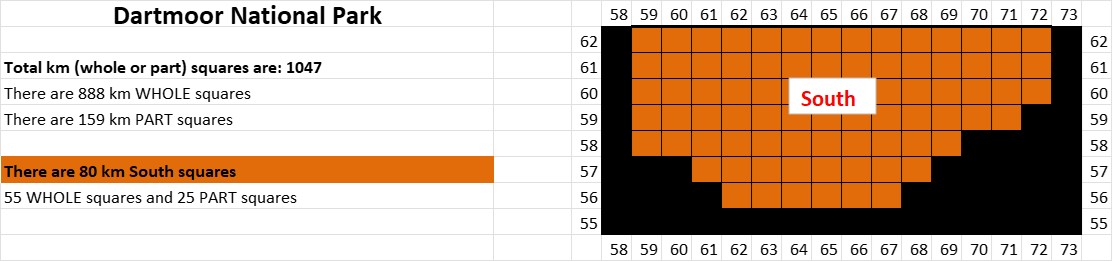
The ‘South’ area comprises 55 ‘Whole’ and 25 ‘Part’ km squares, which represents 7.64% of the total. The northwest corner is SX5962, the southern boundary is along ’56’ northings and the north east corner is SX7262.
5958 a
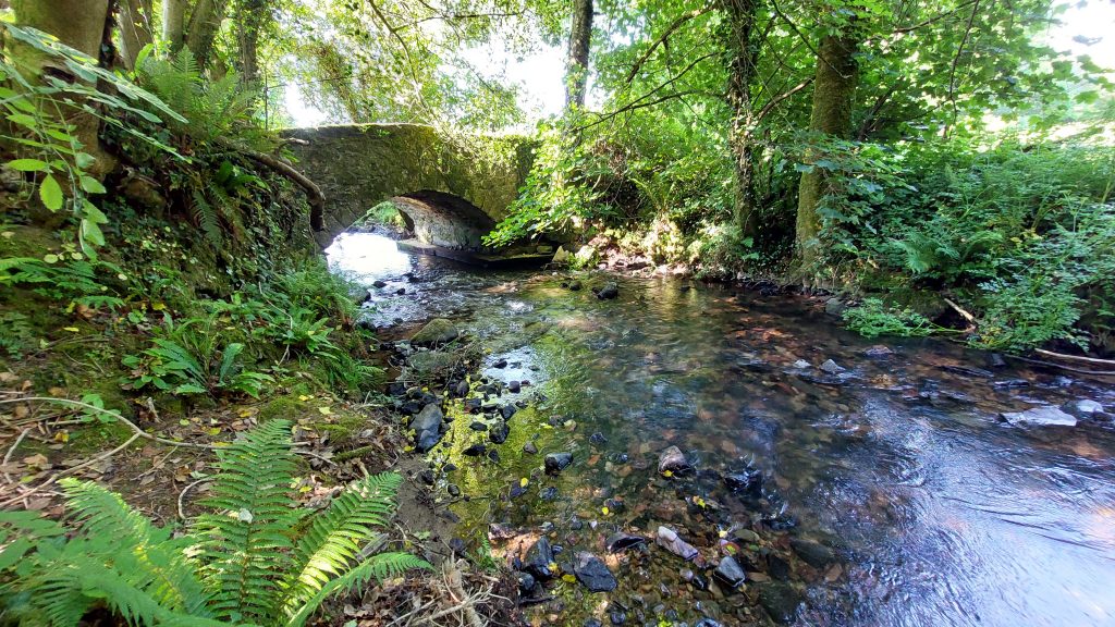
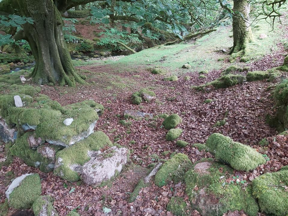
Grid Reference SX59 58. This is a ‘part square’ of the National Park. The item chosen to represent this square is a Slade Bridge (which lies on the boundary)
5958 b
Grid Reference SX59 58. This is a ‘part square’ of the National Park. This picture of Slade Bridge (which lies on the boundary) was taken from SX59973 58823
5959 a
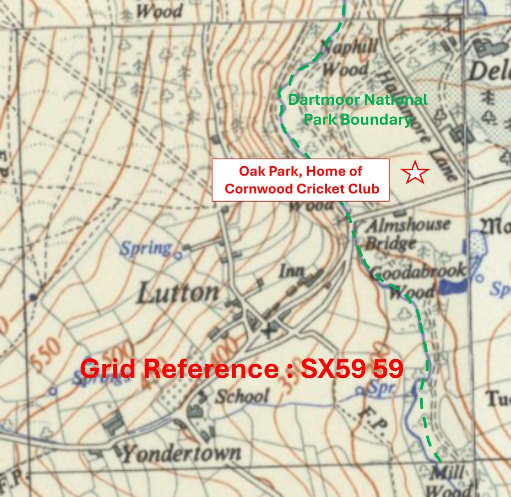
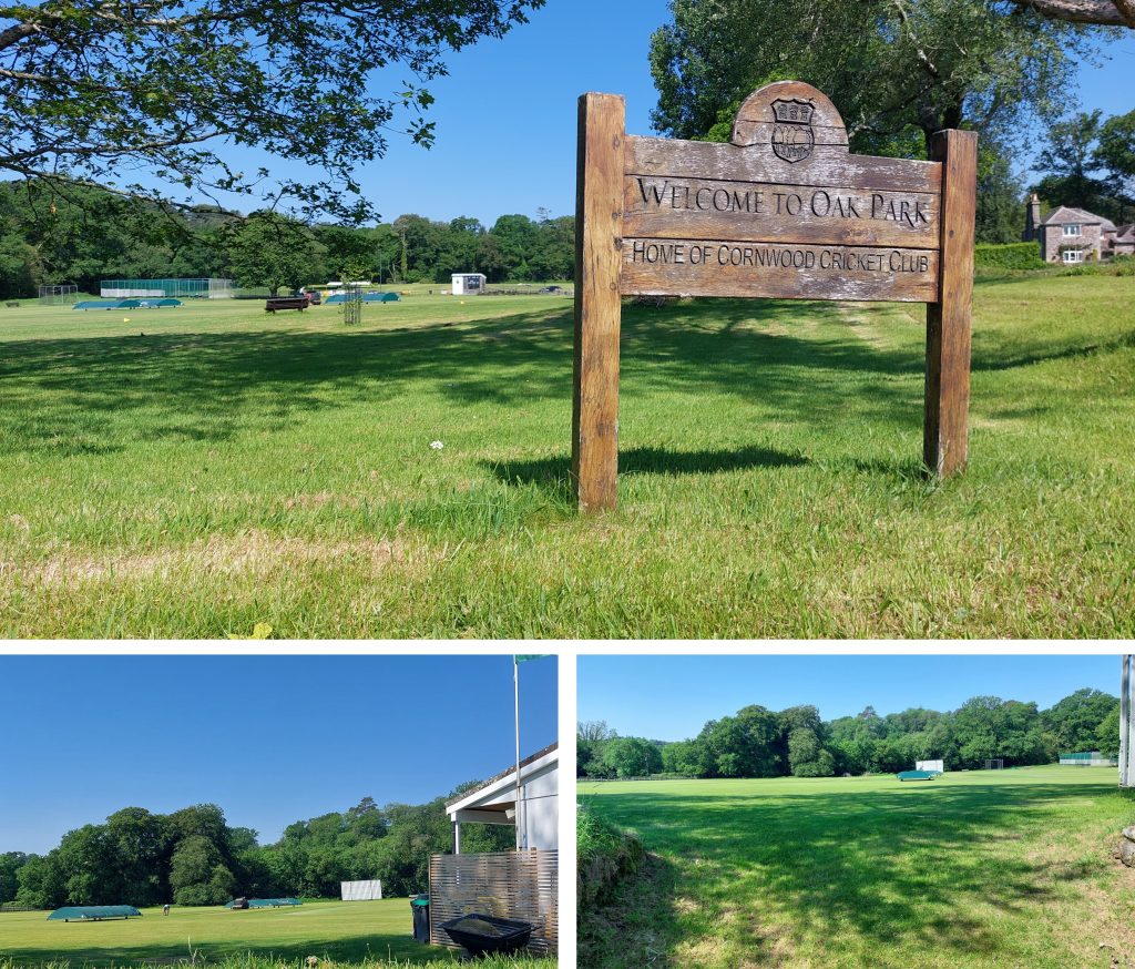
Grid Reference SX59 59. This is a ‘part square’ of the National Park. The item chosen to represent this square is Oak Park, Home of Cornwood Cricket Club
5959 b
Grid Reference SX59 59. This is a ‘part square’ of the National Park. Oak Park, Home of Cornwood Cricket Club is centred at SX599 596
5960 a
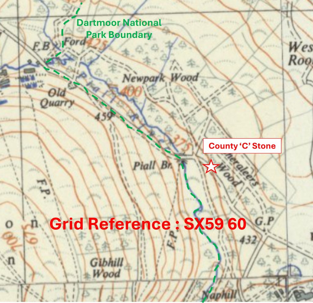
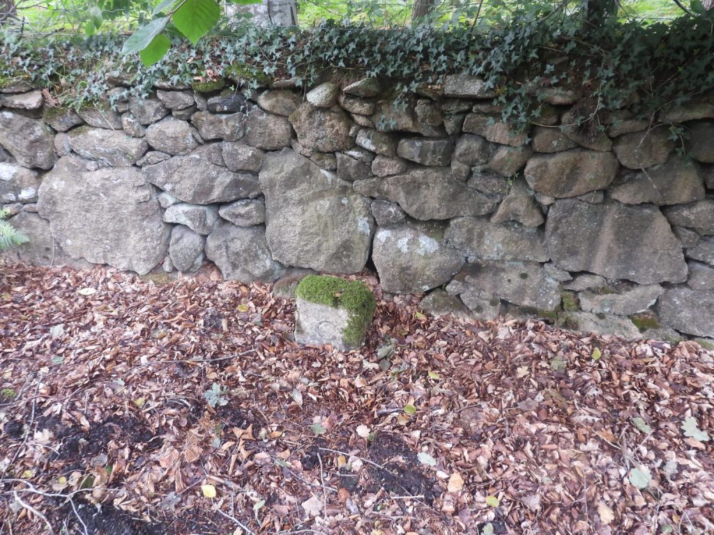
Grid Reference SX59 60 is a part square of the National Park. The item chosen to represent this square is a County ‘C’ Stone (associated with Piall Bridge)
5960 b
Grid Reference SX59 60 is a part square of the National Park. The County ‘C’ Stone (associated with Piall Bridge) is located at SX59709 60430
5961 a
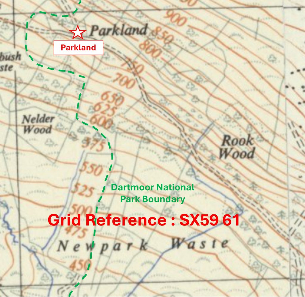
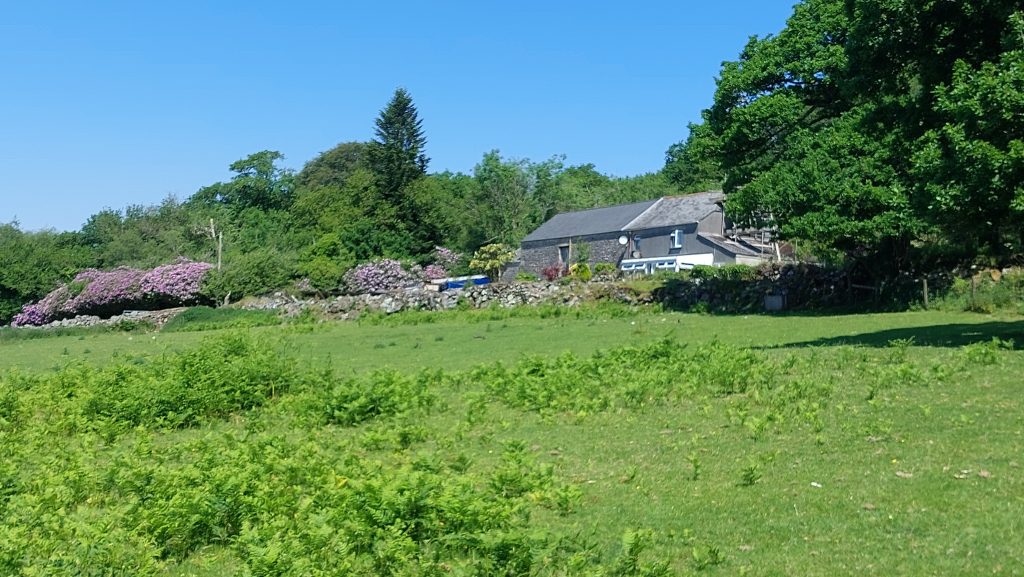
Grid Reference SX59 61 is a part square of the National Park. The item chosen to represent this square is Parkland
5961 b
Grid Reference SX59 61 is a part square of the National Park. Parkland is located at SX5924 6192
5962 a
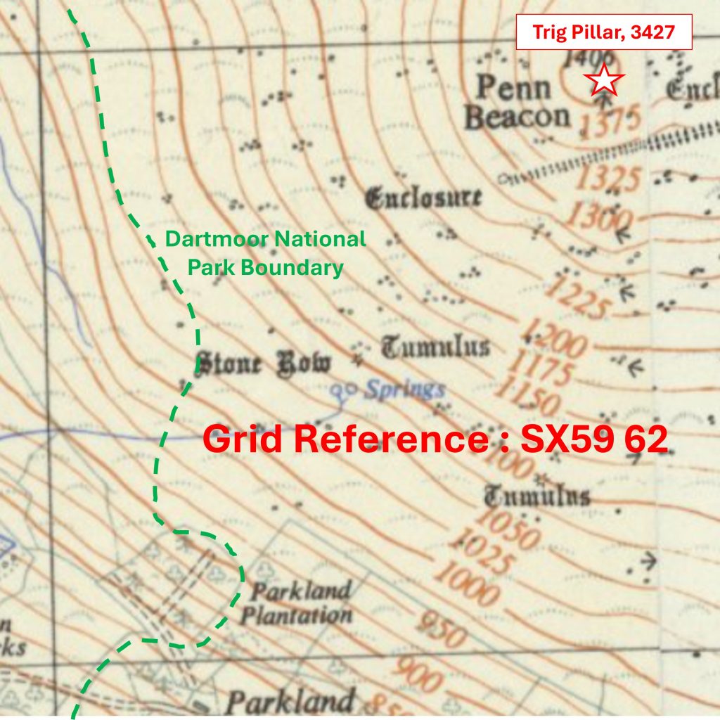
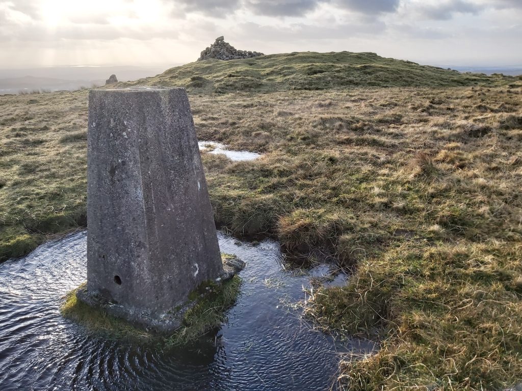
Grid Reference SX59 62 is a part square of the National Park. The item chosen to represent this square is Trig Pillar (3427) at Penn Beacon
5962 b
Grid Reference SX59 62. The Trig Pillar (3427) at Penn Beacon is located at SX59937 62940
6058 a
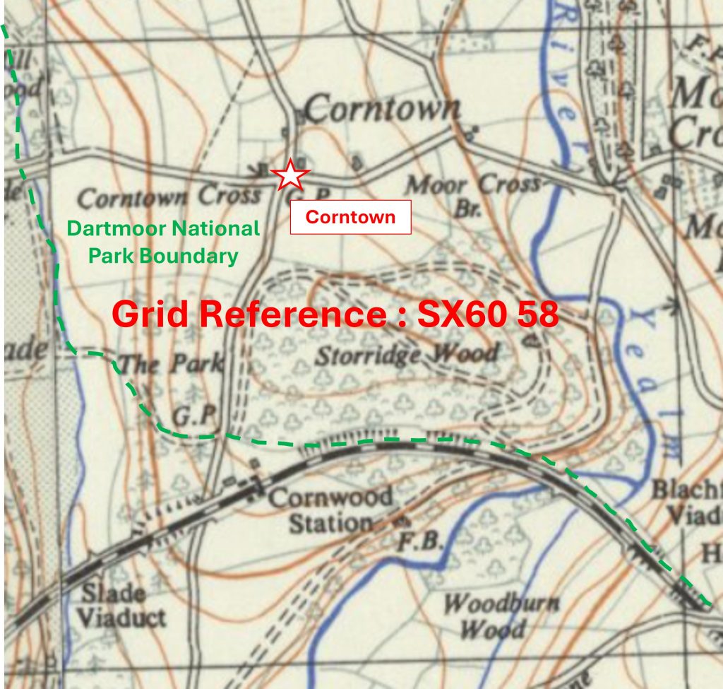
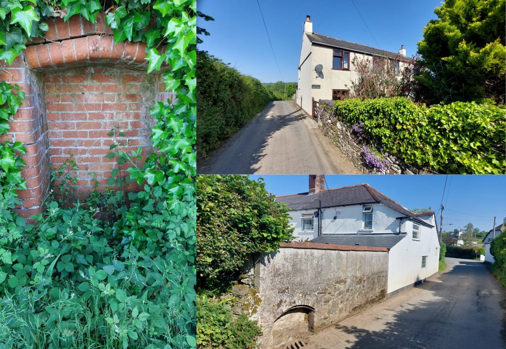
Grid Reference SX60 58 is a part square of the National Park. The item chosen to represent this square is Corntown
6058 b
Grid Reference SX60 58 is a part square of the National Park. Corntown (Cross)is located at SX6037 5878
6059 a
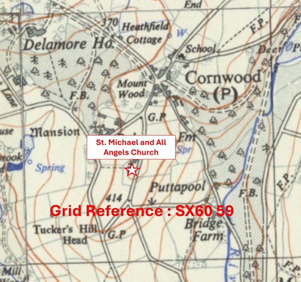
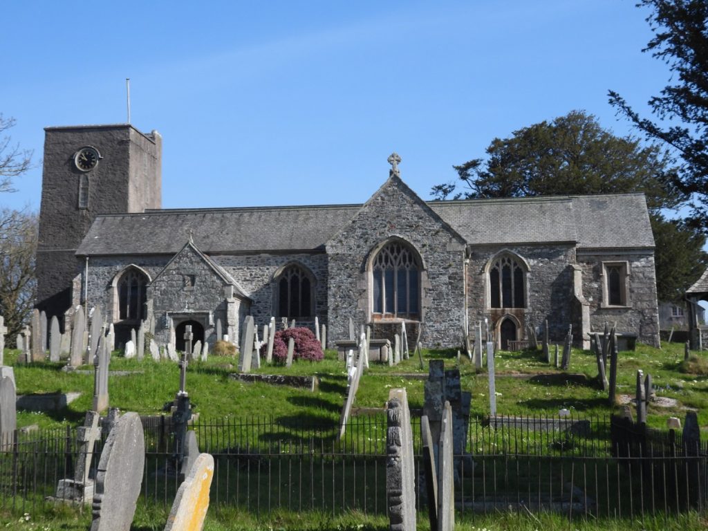
Grid Reference SX60 59. The item chosen to represent this square is St. Michael and All Angels Church
6059 b
Grid Reference SX60 59. St. Michael and All Angels Church is located at SX60429 59378
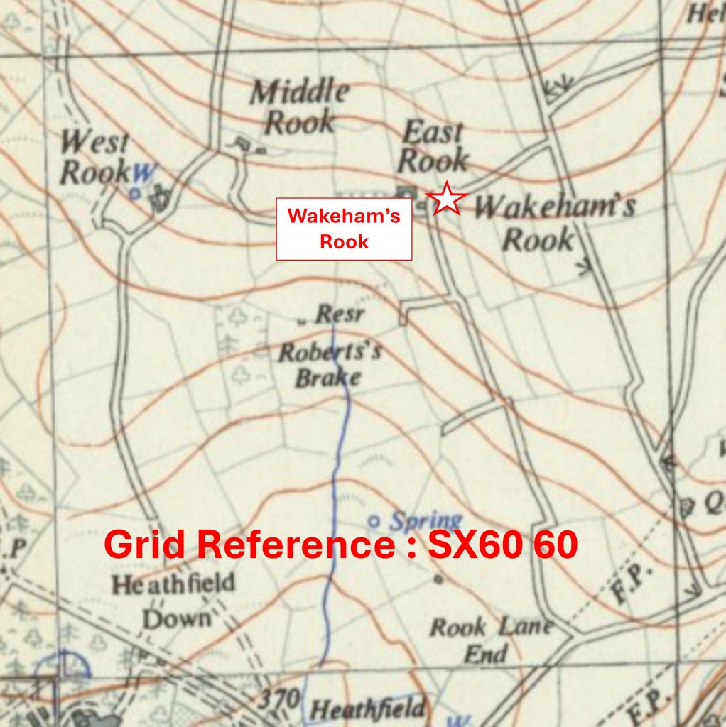
6060 a
Grid Reference SX60 60. The item chosen to represent this square is Wakeham’s Rook
6060 b
Grid Reference SX60 60. Wakeham’s Rook is located at SX60731 60763
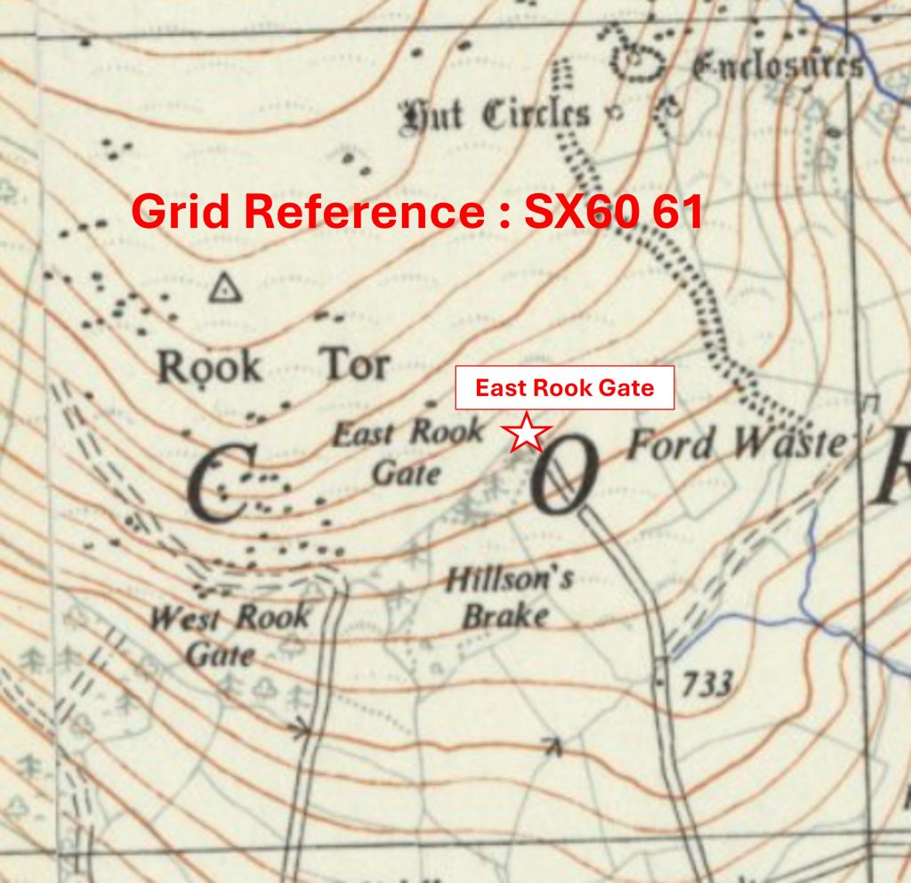
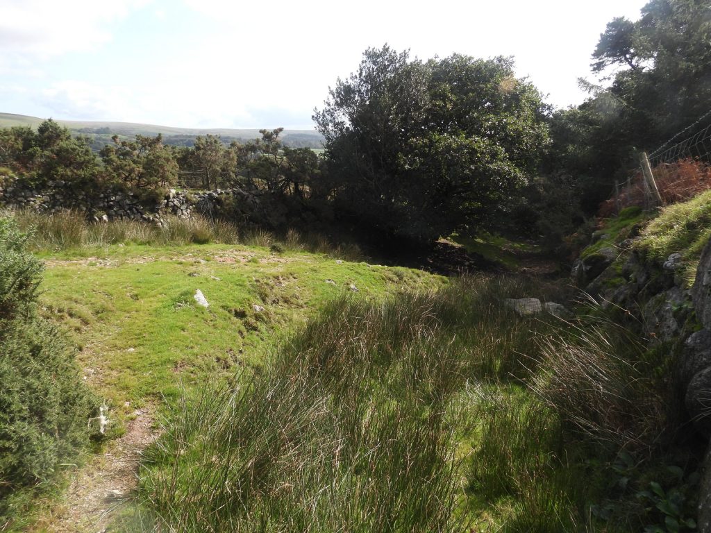
6061 a
Grid Reference SX60 61. The item chosen to represent this square is East Rook Gate
6061 b
Grid Reference SX60 61. East Rook Gate is located at SX60591 61511
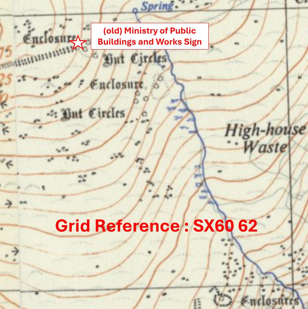
6062 a
Grid Reference SX60 62. The item chosen to represent this square is an (old) Ministry of Public Buildings and Works Sign
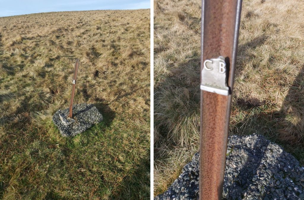
6062 b
Grid Reference SX60 62. The (old) Ministry of Public Buildings and Works Sign is located at SX60219 62900
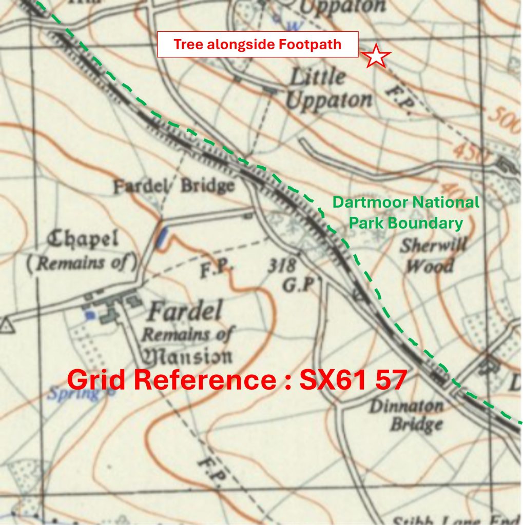
6157 a
Grid Reference SX61 57. This is a part square. The item chosen to represent this square is a large Tree alongside the Footpath
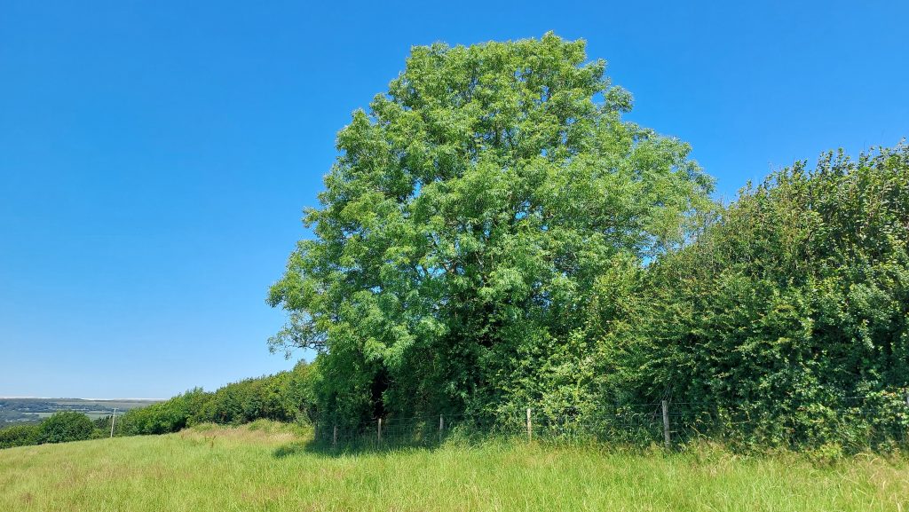
6157 b
Grid Reference SX61 57. This is a part square. The large Tree alongside the Footpath is located at SX61774 57960
6158 a
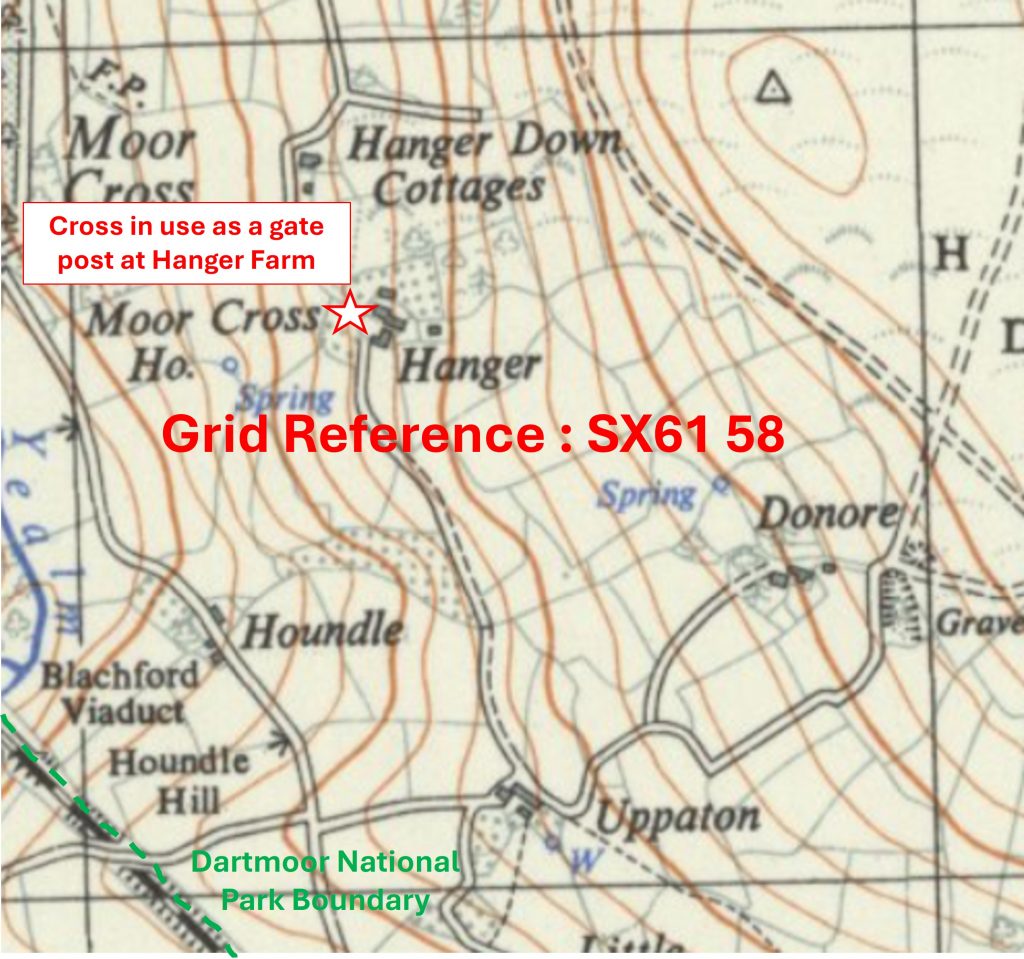
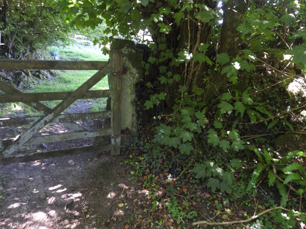
Grid Reference SX61 58. This is a ‘part square’ The item chosen to represent this square is a Cross in use as a gate post at Hanger Farm
6158 b
Grid Reference SX61 58. This is a ‘part square’. Cross in use as a gate post at Hanger Farm is located at SX61299 58703
6159 a
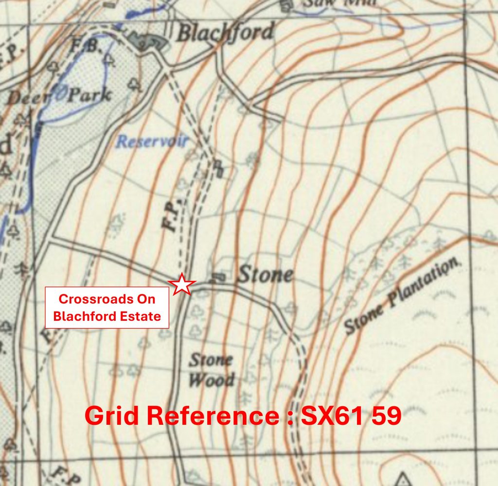
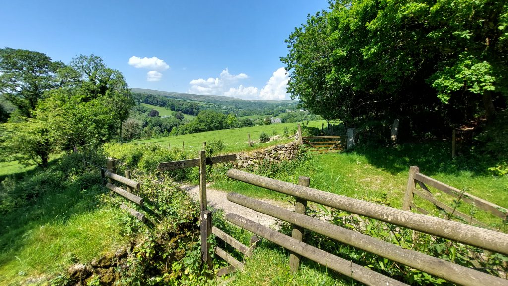
Grid Reference SX61 59. The item chosen to represent this square is a Crossroads on the Blachford Estate – (Footpath and Estate road near Stone)
6159 b
Grid Reference SX61 59. The Crossroads on the Blachford Estate – (Footpath and Estate road near Stone) is located at SX61499 59799
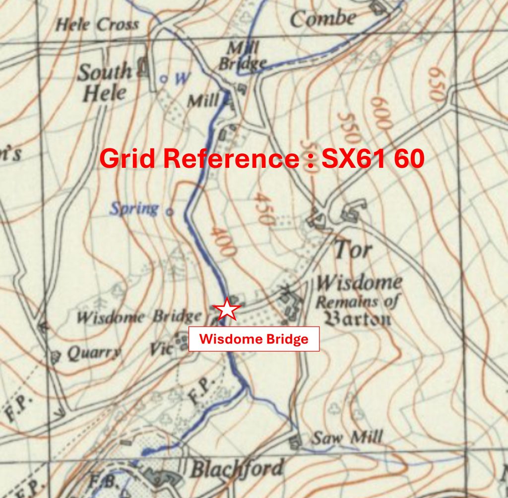
6160 a
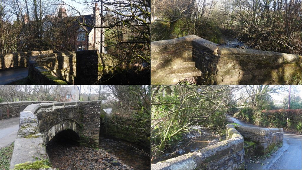
Grid Reference SX61 60. The item chosen to represent this square is Wisdome Bridge
6160 b
Grid Reference SX61 60. Wisdome Bridge is located at SX61421 60344
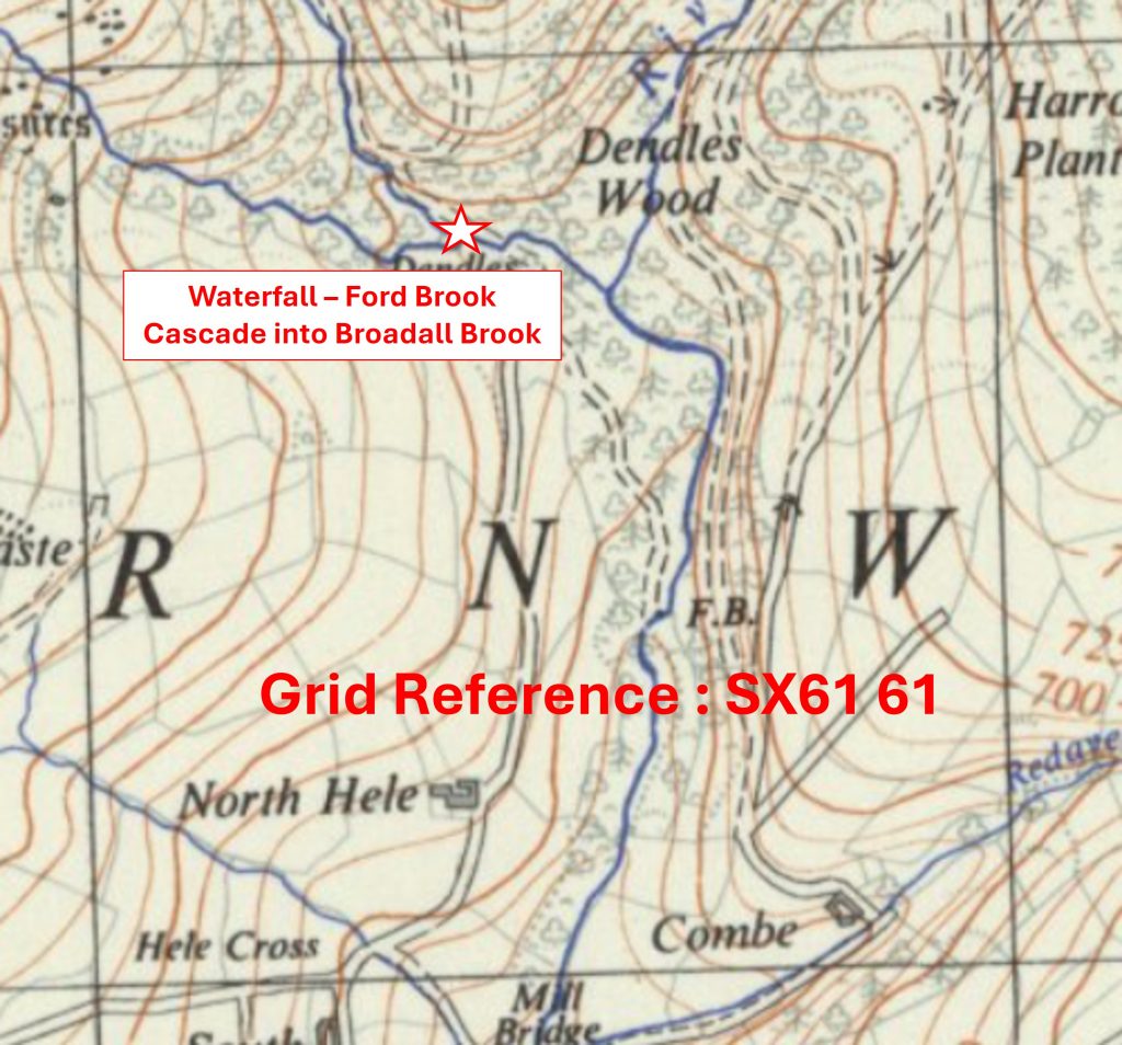
6161 a
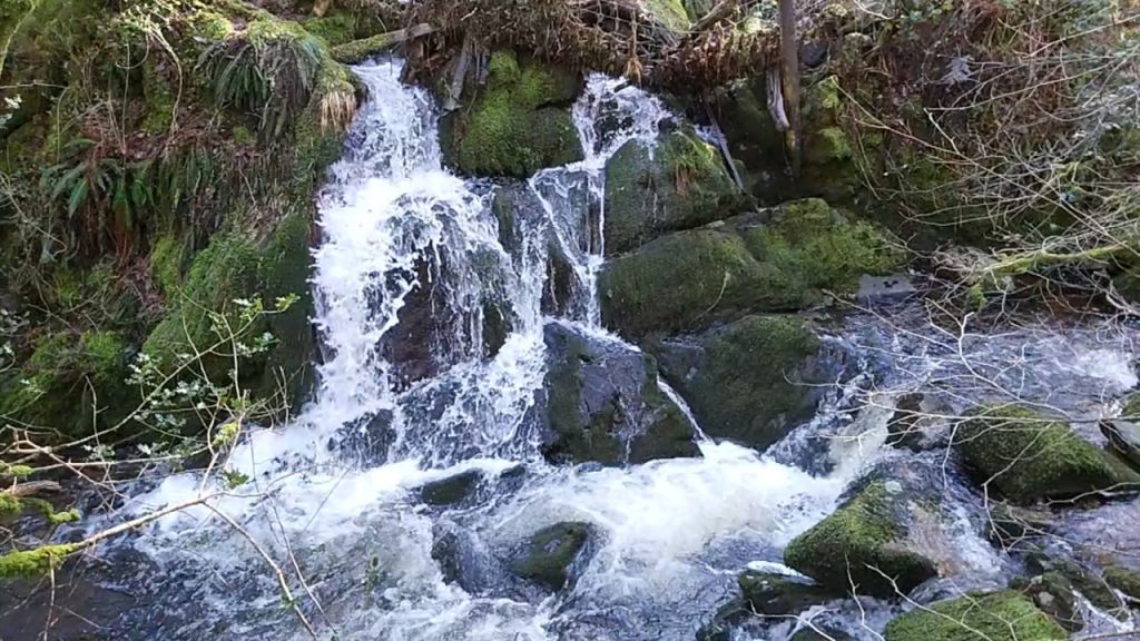
Grid Reference SX61 61. The item chosen to represent this square is a Waterfall – Ford Brook Cascade into Broadall Brook
6161 b
Grid Reference SX61 61. The Waterfall – Ford Brook Cascade into Broadall Brook is located at SX 61414 61809
6162 a
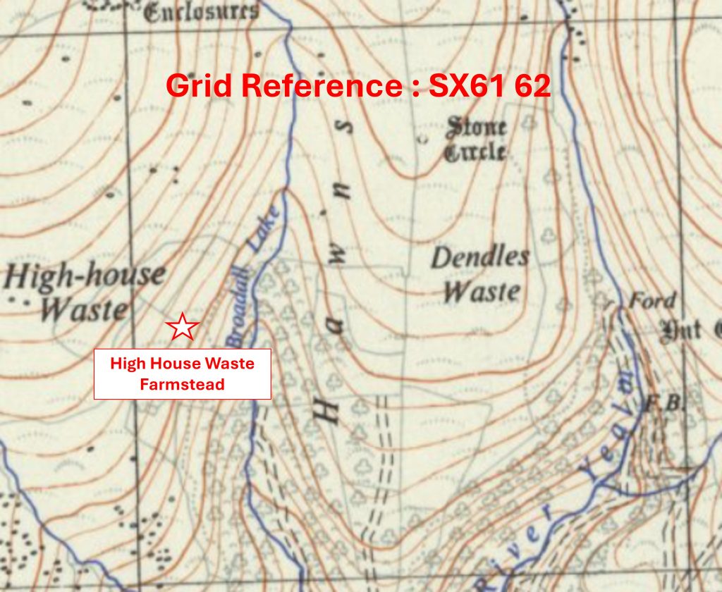
Grid Reference SX61 62. The item chosen to represent this square is High House Waste Farmstead
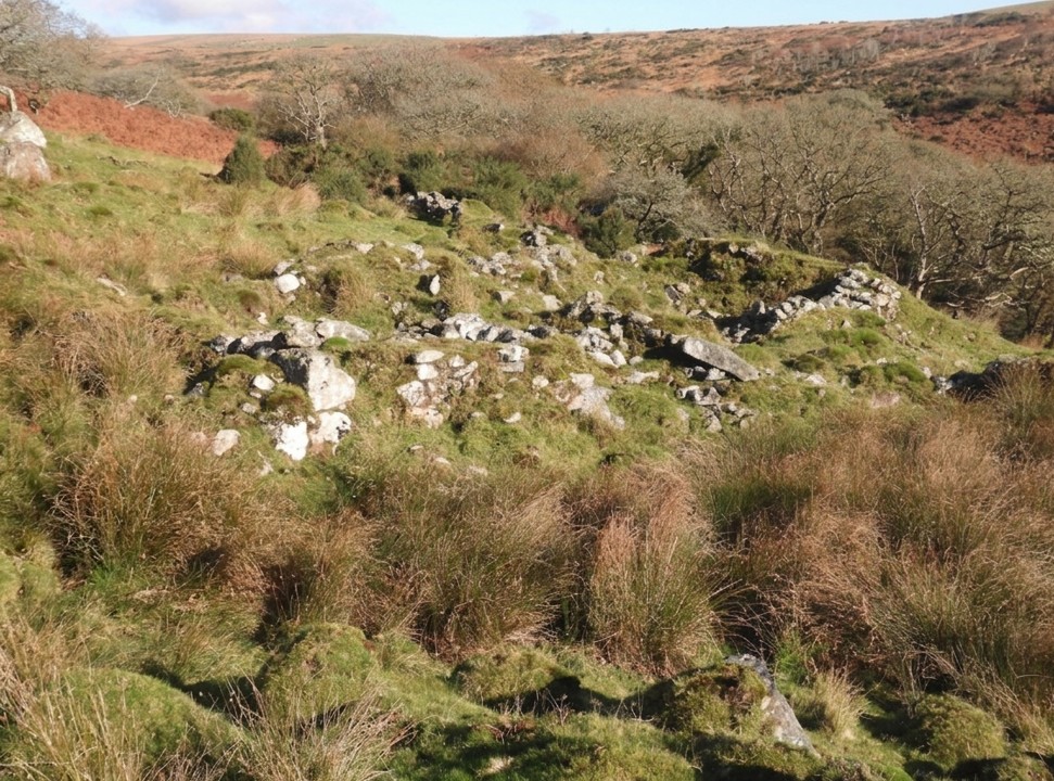
6162 b
Grid Reference SX61 62. High House Waste Farmstead is located at SX6109 6245
6256 a
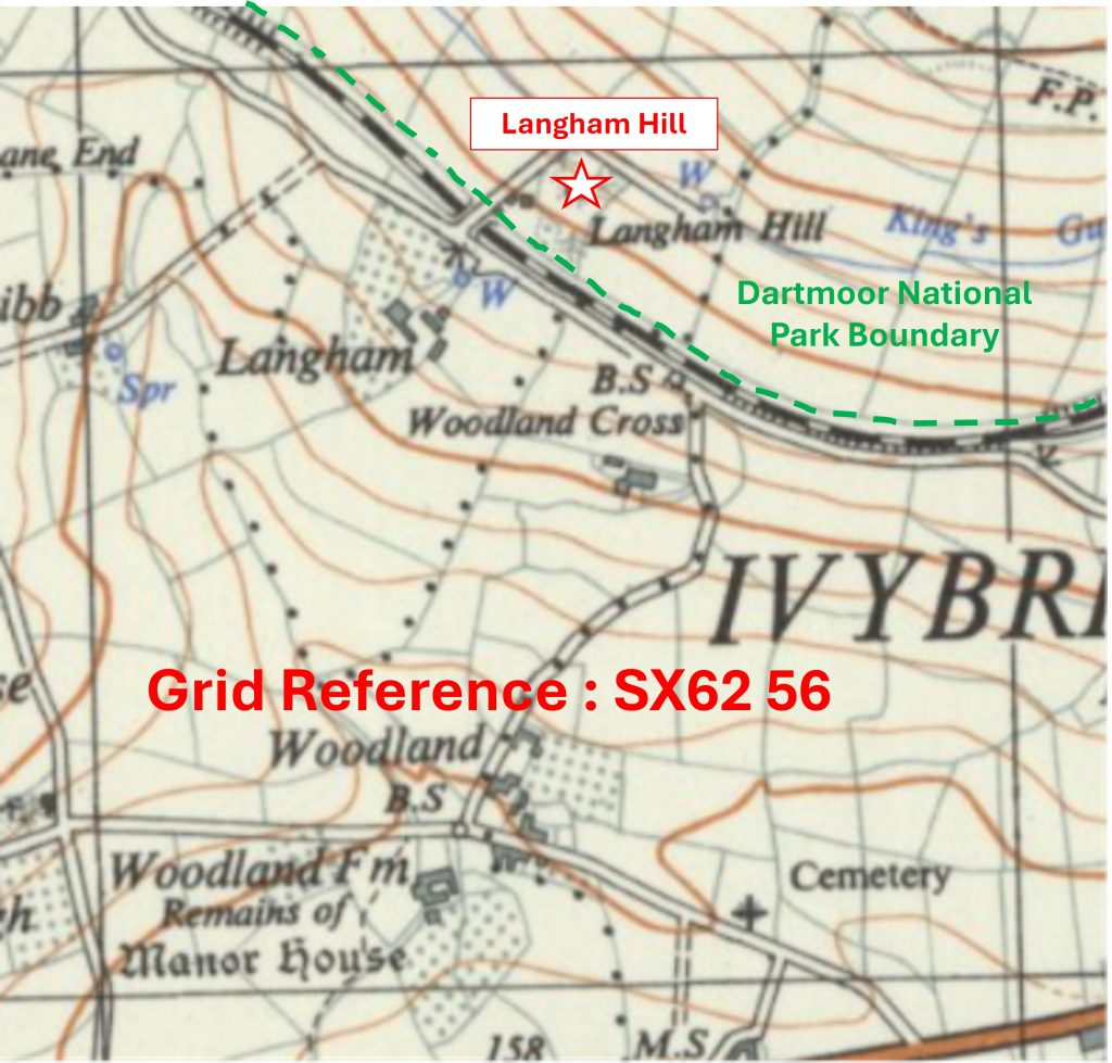
Grid Reference SX62 56. This is a part square. The item chosen to represent this square is Langham Hill
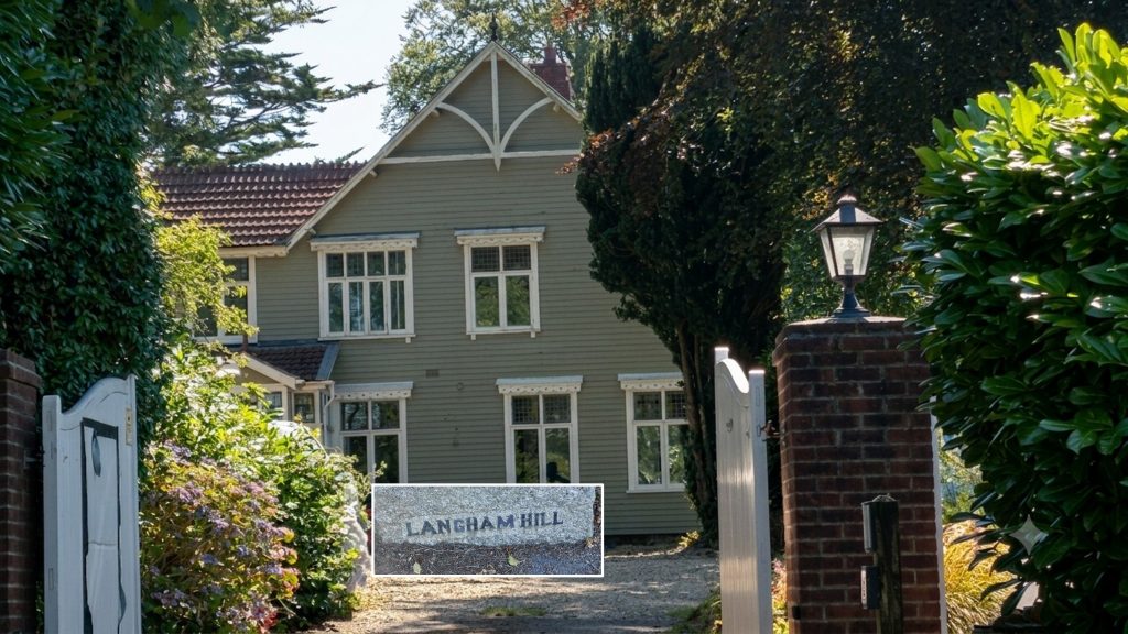
6256 b
Grid Reference SX62 56. This is a part square. Langham Hill is located at SX62536 56872
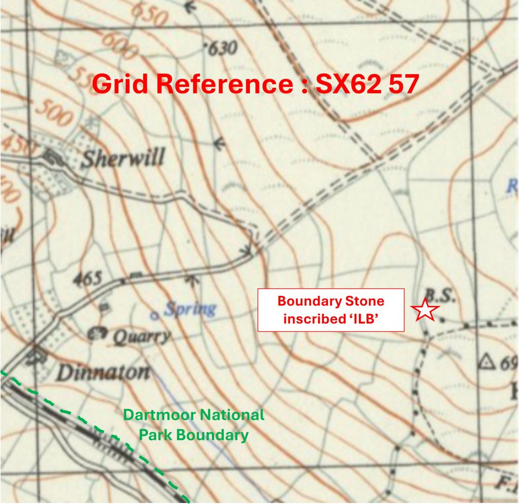
6257 a
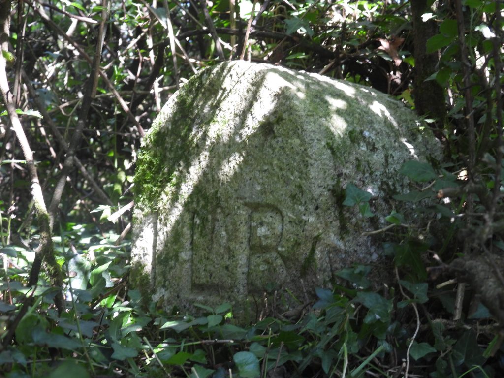
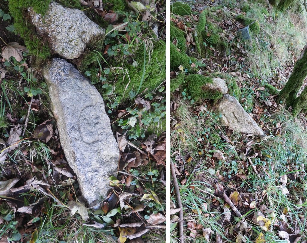
Grid Reference SX62 57. This is a part square. The item chosen to represent this square is a Boundary Stone inscribed ‘ILB’
6257 b
Grid Reference SX62 57. This is a part square. The Boundary Stone inscribed ‘ILB’ is located at SX62878 57342
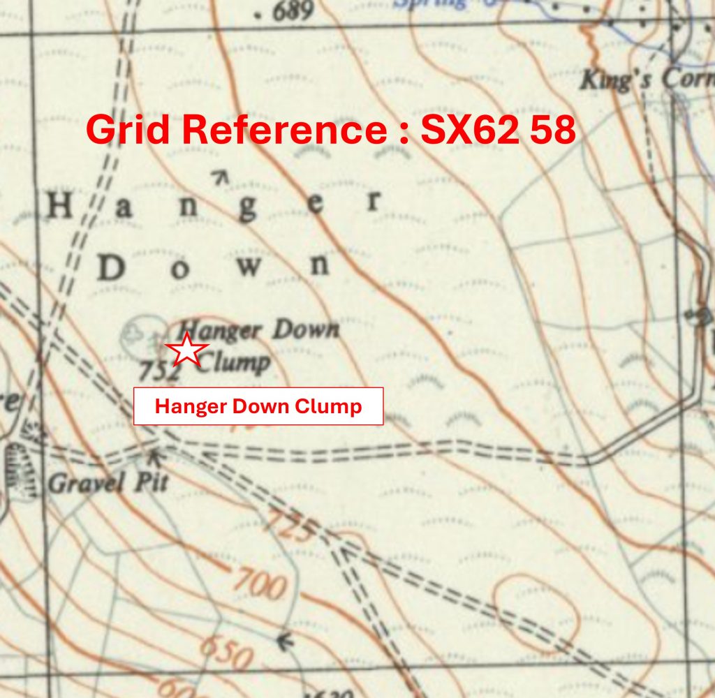
6258 a
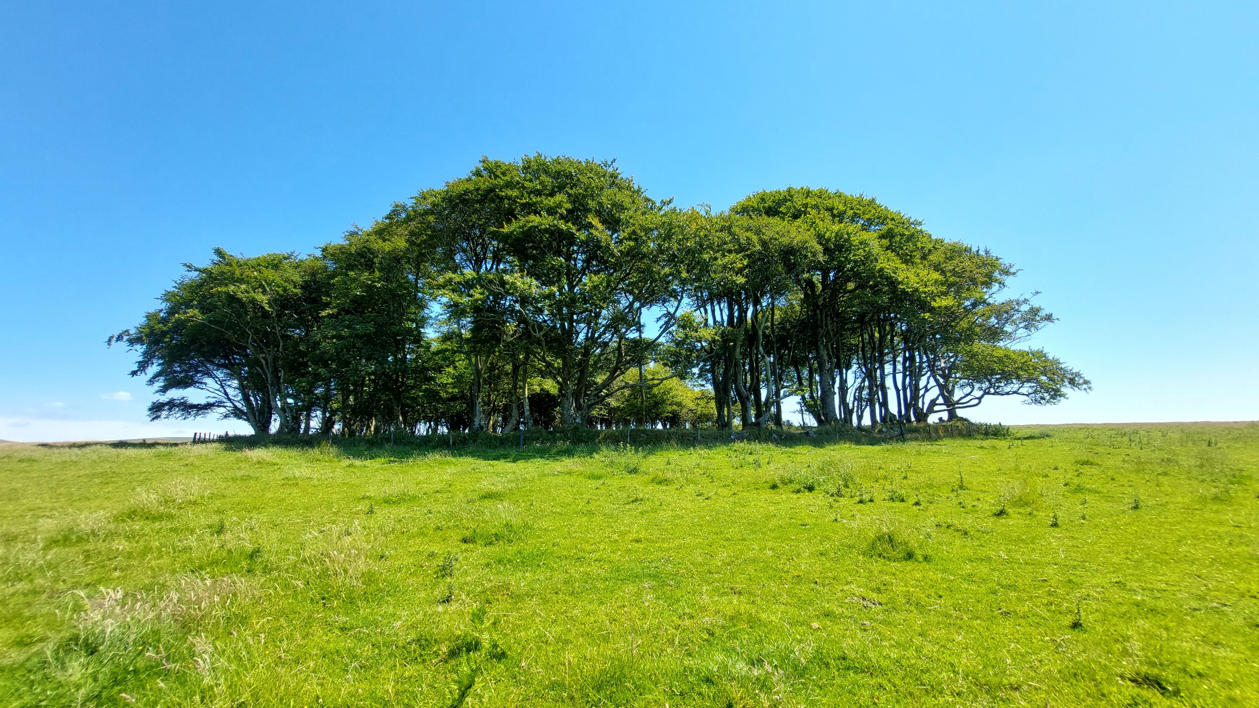
Grid Reference SX62 58. The item chosen to represent this square is Hanger Down Clump
6258 b
Grid Reference SX62 58. Hanger Down Clump is located at SX6215 5853
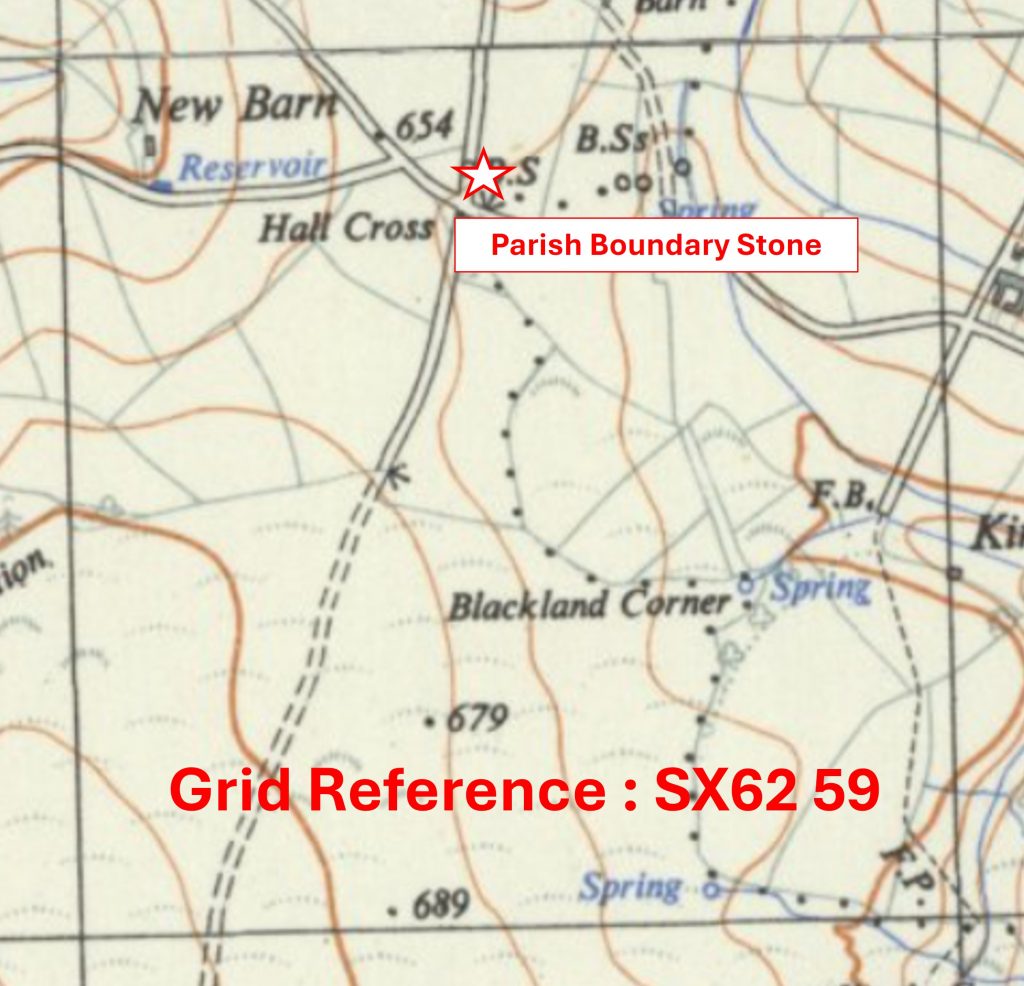
6259 a
Grid Reference SX62 59. The item chosen to represent this square is a Cornwood / Harford Parish Boundary Stone
6259 b
Grid Reference SX62 59. The Parish Boundary Stone is located at SX62462 59860
6260 a
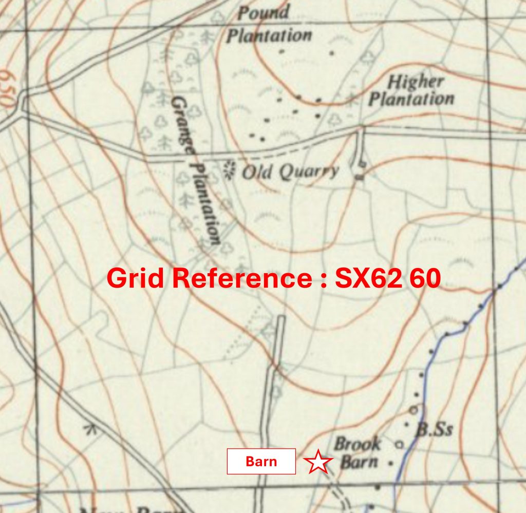
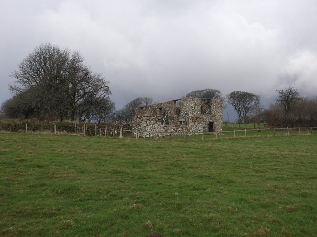
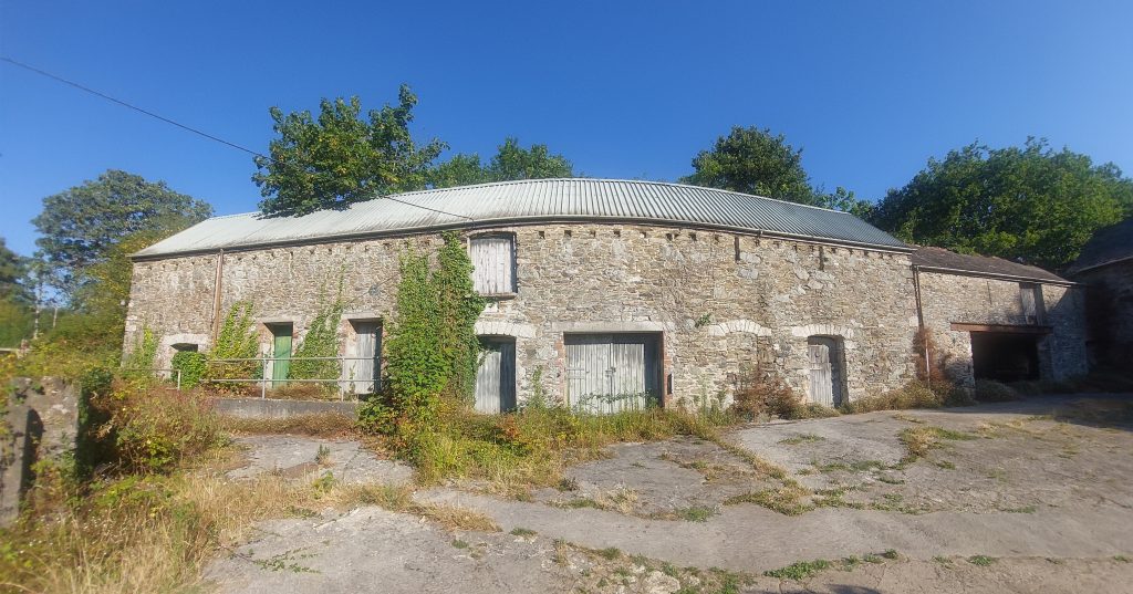
Grid Reference SX62 60. The item chosen to represent this square is Brook Barn
6260 b
Grid Reference SX62 60. Brook Barn is located at SX62611 60046
6261 a
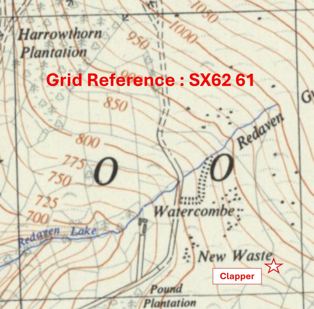
Grid Reference SX62 61. The item chosen to represent this square is a small clapper near the modern waterworks
6261 b
Grid Reference SX62 61. The clapper is located at SX62894 61107
6262 a
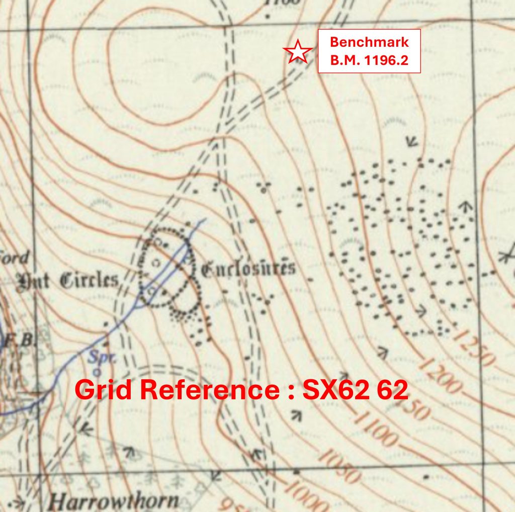
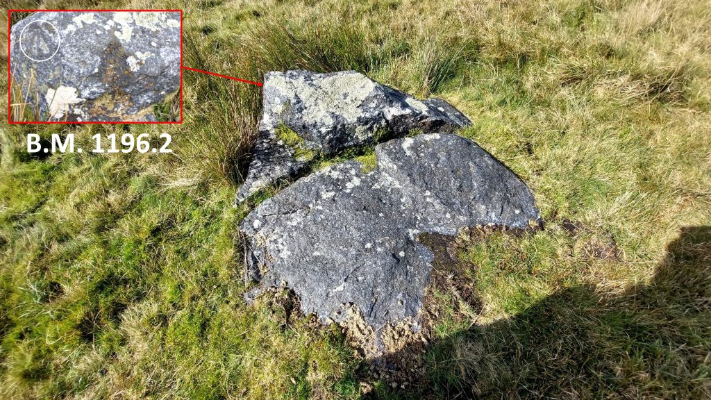
Grid Reference SX62 62. The item chosen to represent this square is Benchmark B.M. 1196.2
6262 b
Grid Reference SX62 62. Benchmark B.M. 1196.2 is located at SX62621 62930
6356 a
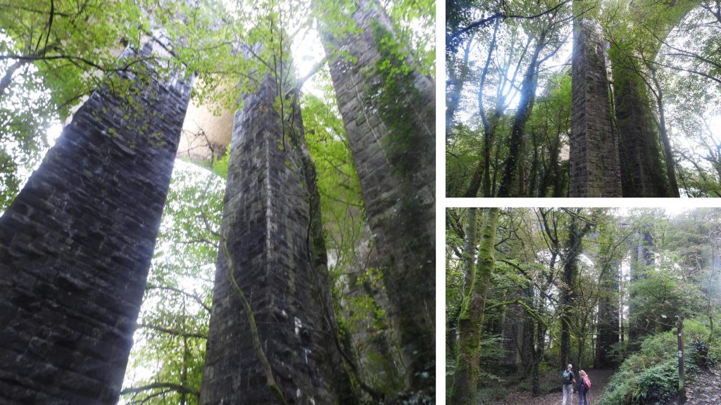
Grid Reference SX63 56. This is a ‘part square’. The item chosen to represent this square is Railway Viaducts from 1849 and 1893
6356 b
Grid Reference SX63 56. This is a ‘part square’. The Railway Viaducts from 1849 and 1893 are located at SX6355 5694
6357 a
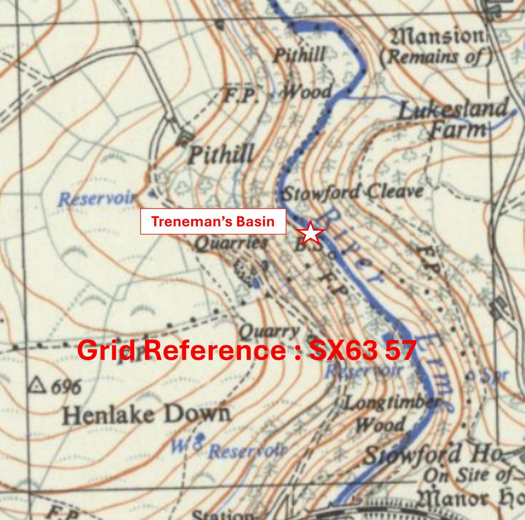
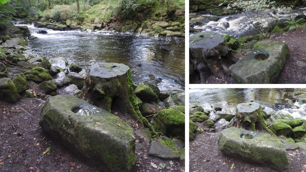
Grid Reference SX63 57. The item chosen to represent this square is Treneman’s Basin
6357 b
Grid Reference SX63 57. Treneman’s Basin is located at SX63595 57536
6358 a
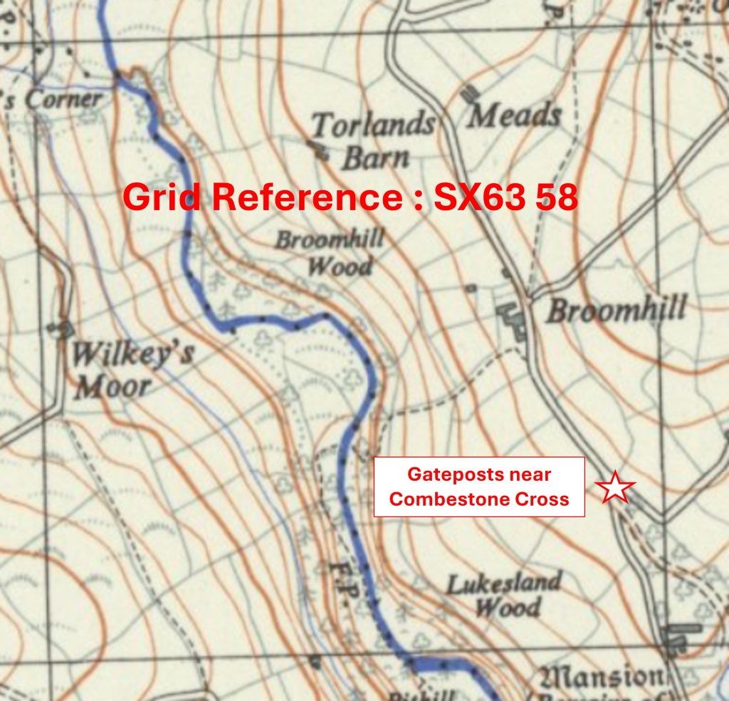
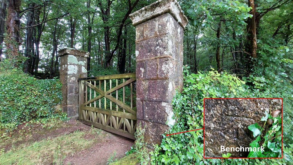
Grid Reference SX63 58. The item chosen to represent this square is Gateposts near Combestone Cross
6358 b
Grid Reference SX63 58. The Gateposts near Combestone Cross are located at SX63919 58242
6359 a
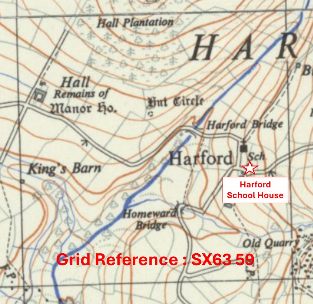
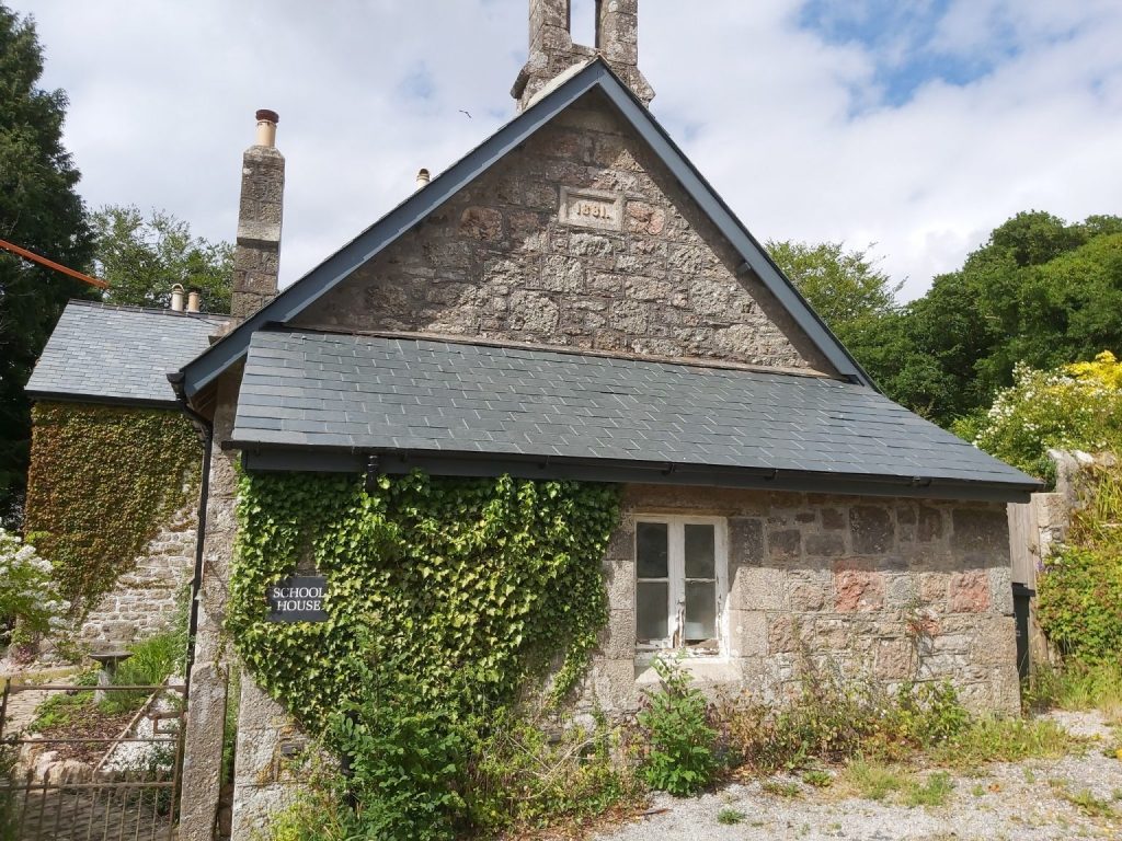
Grid Reference SX63 59. The item chosen to represent this square is Harford School House
6359 b
Grid Reference SX63 59. Harford School House is located at SX6385 5941
6360 a
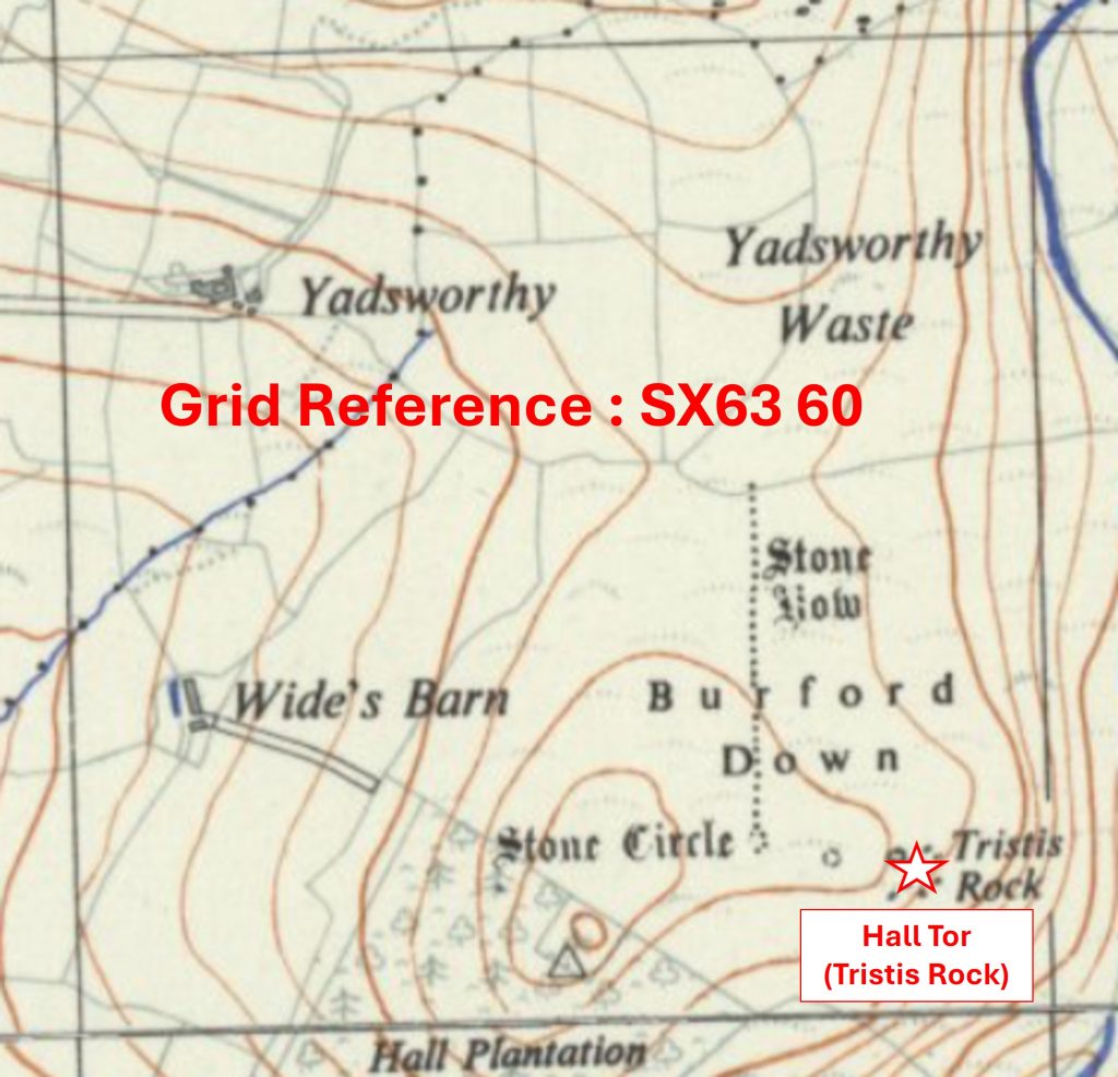
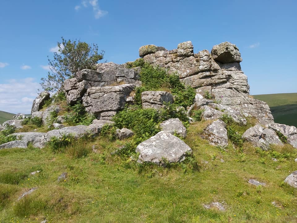
Grid Reference SX63 60. The item chosen to represent this square is Hall Tor (Tristis Rock)
6360 b
Grid Reference SX63 60. Hall Tor (Tristis Rock) is located at SX6383 6014
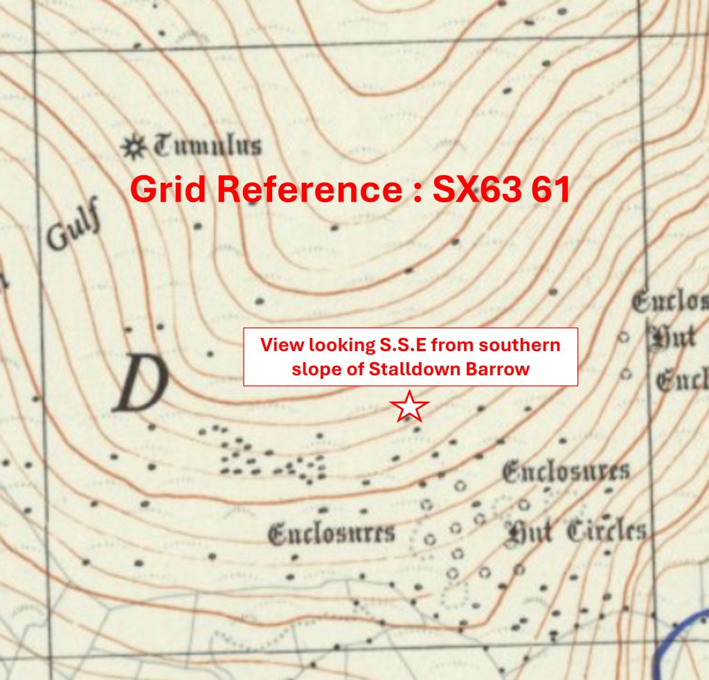
6361 a
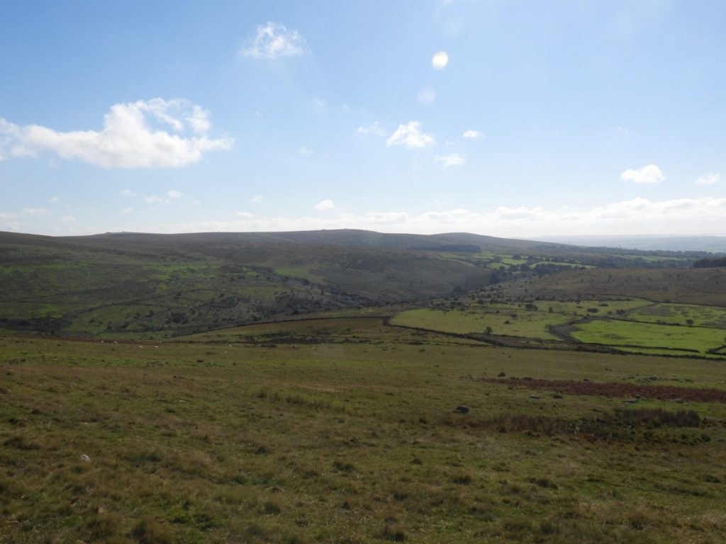
Grid Reference SX63 61. The item chosen to represent this square is a View looking S.S.E from southern slope of Stalldown Barrow
6361 b
Grid Reference SX63 61. The View looking S.S.E from southern slope of Stalldown Barrow was taken at SX636 614
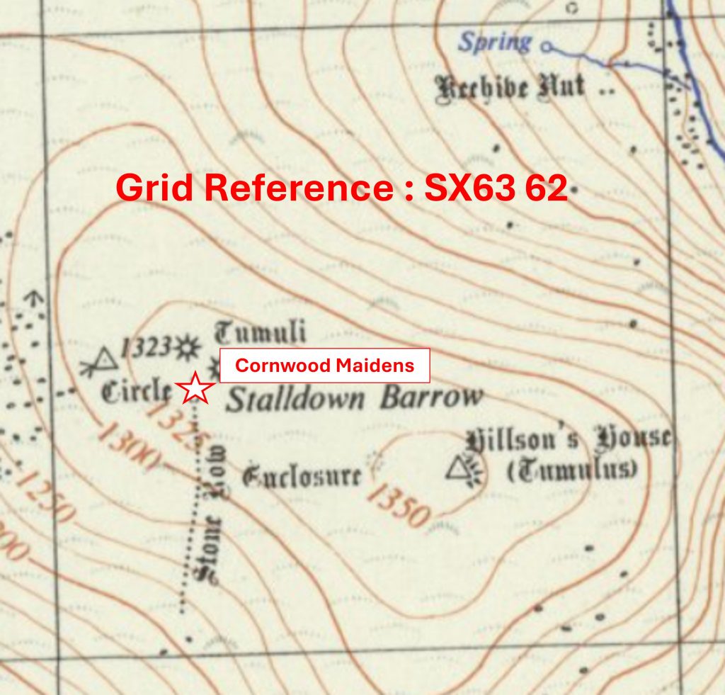
6362 a
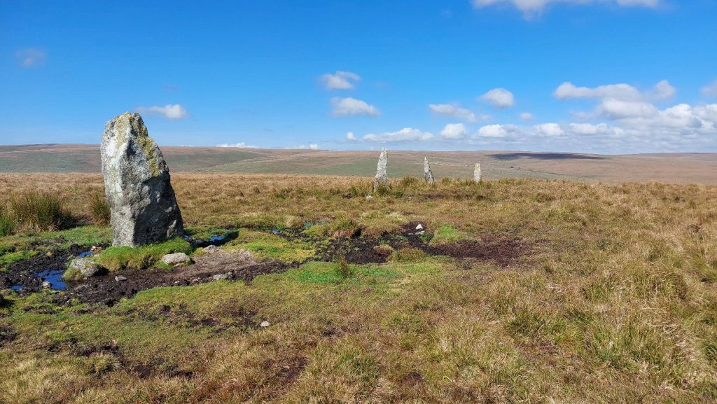
Grid Reference SX63 62. The item chosen to represent this square is Cornwood Maidens
6362 b
Grid Reference SX63 62. Cornwood Maidens are located at SX632 624
6456 a
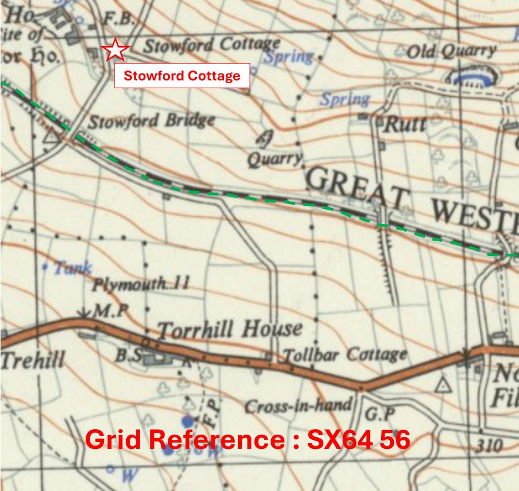
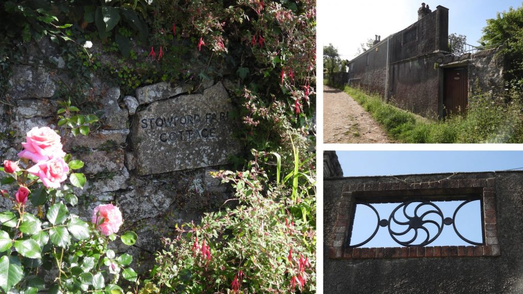
Grid Reference SX64 56. The item chosen to represent this square is Stowford (Farm) Cottage
6456 b
Grid Reference SX64 56 is a part square of the National Park – the boundary marked by the green dotted line. Stowford (Farm) Cottage is located at SX64196 56957
6457 a
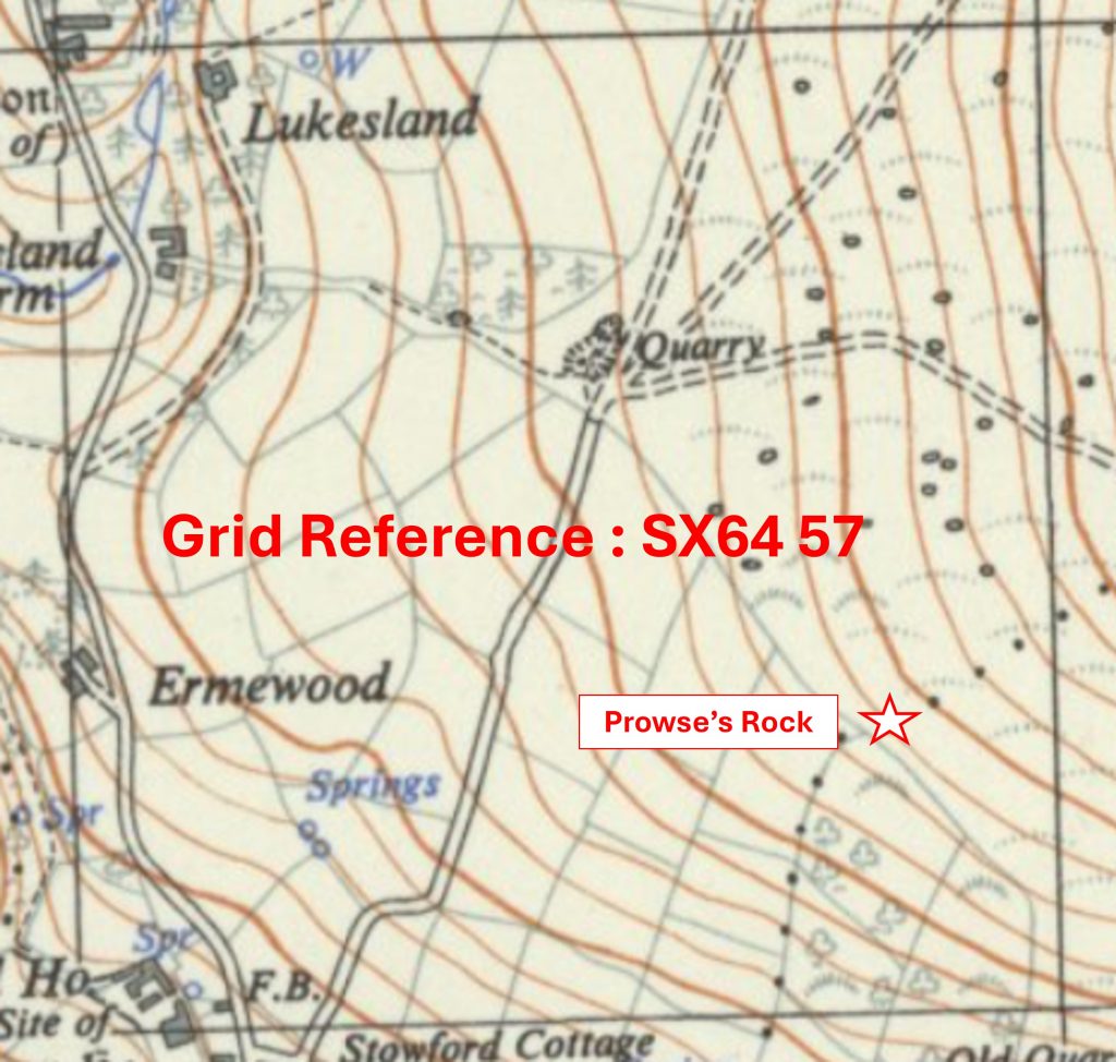
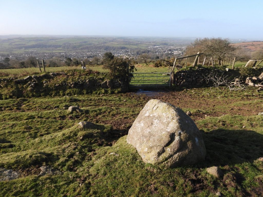
Grid Reference SX64 57. The item chosen to represent this square is a parish boundary marker called ‘Prowse’s Rock’
6457 b
Grid Reference SX64 57. Prowse’s Rock is located at SX6483 5730
6458 a
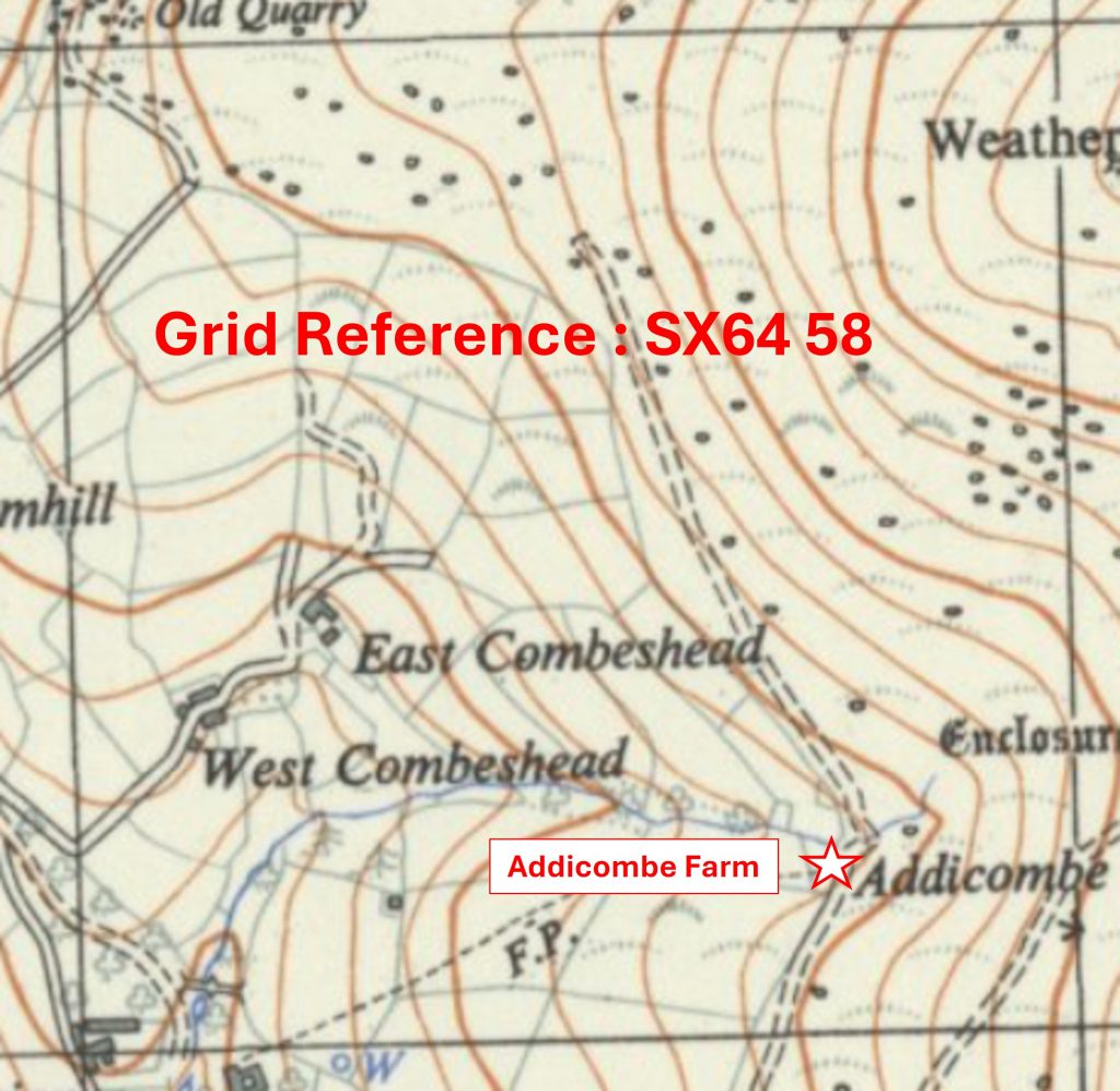
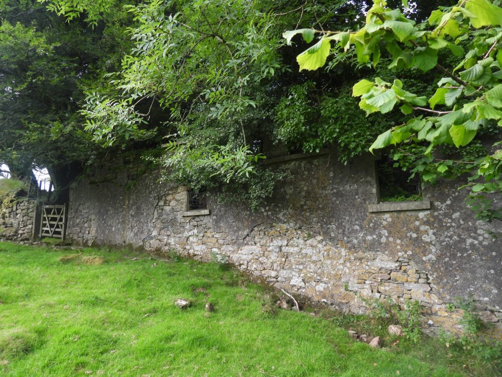
Grid Reference SX64 58. The item chosen to represent this square is Addicombe Farm
6458 b
Grid Reference SX64 58. Addicombe Farm (Lukesland) cottages is located at SX64750 58170
6459 a
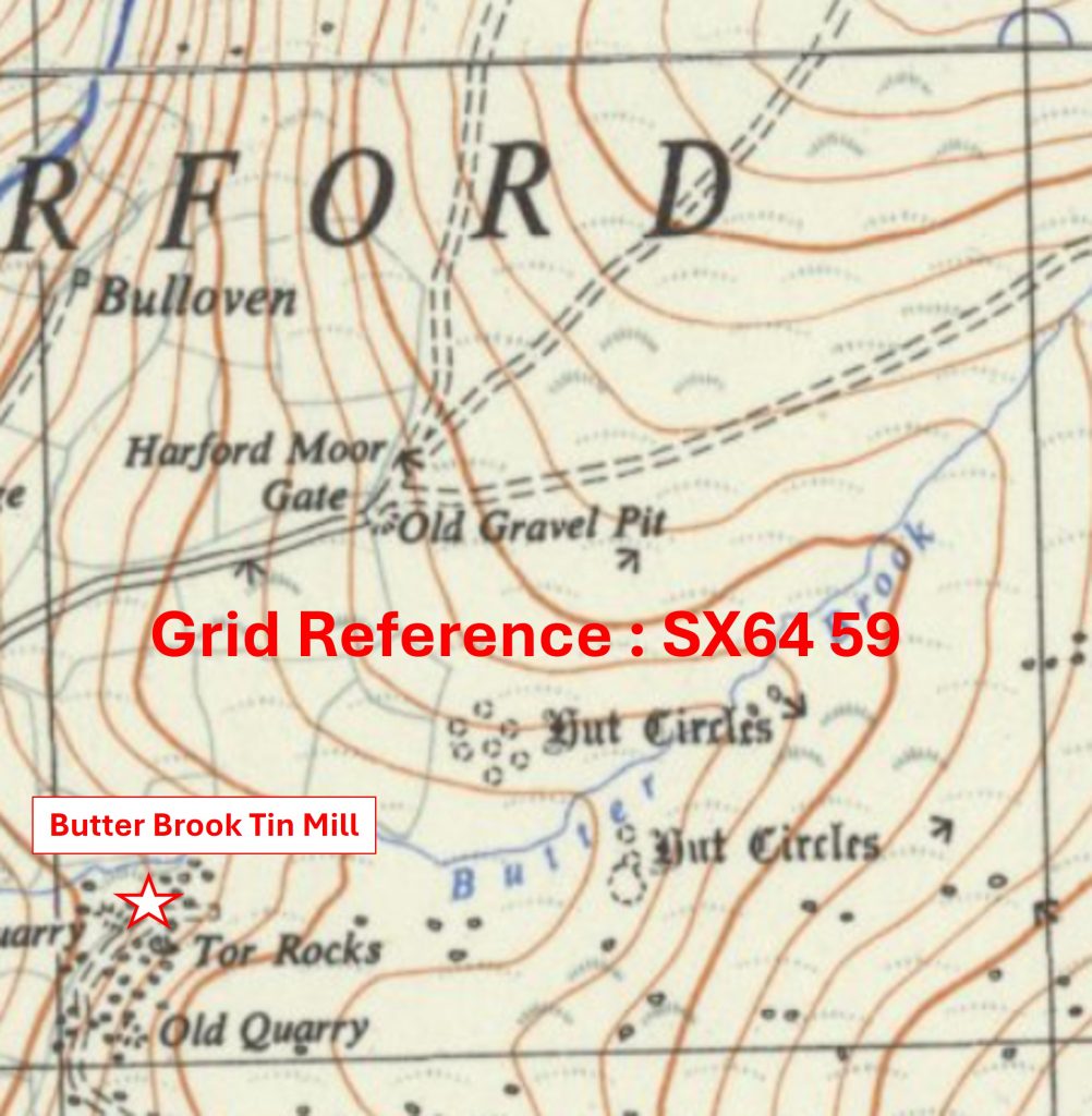
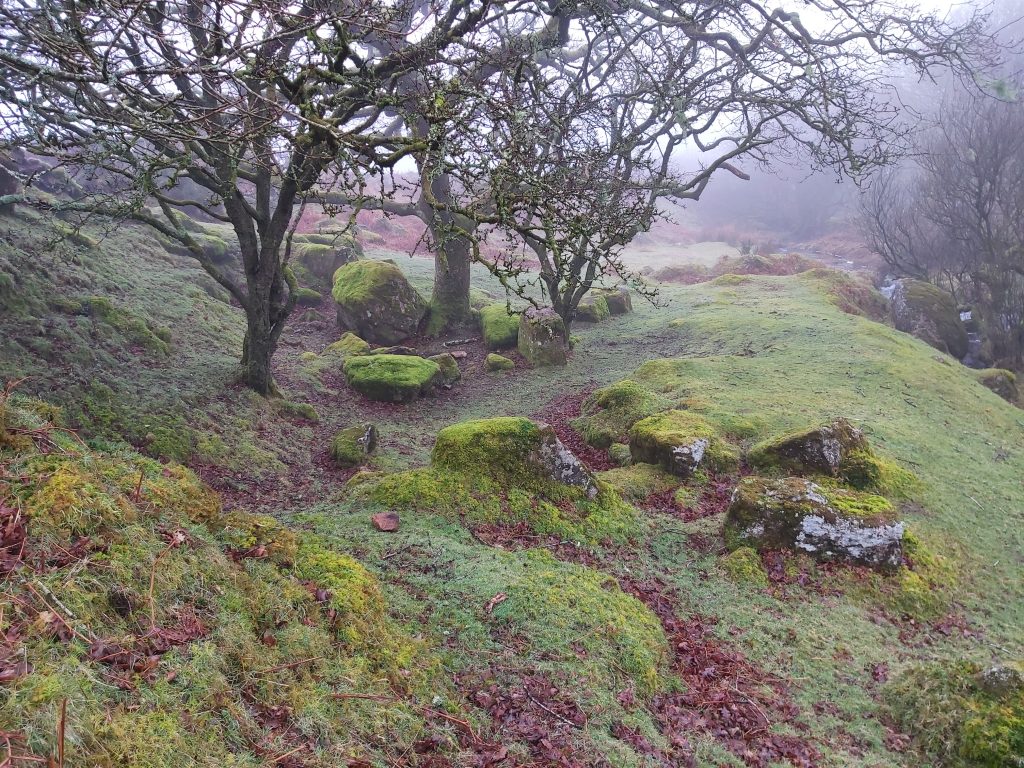
Grid Reference SX64 59. The item chosen to represent this square is Butter Brook Tin Mill
6459 b
Grid Reference SX64 59. Butter Brook Tin Mill is located at SX6420 5921
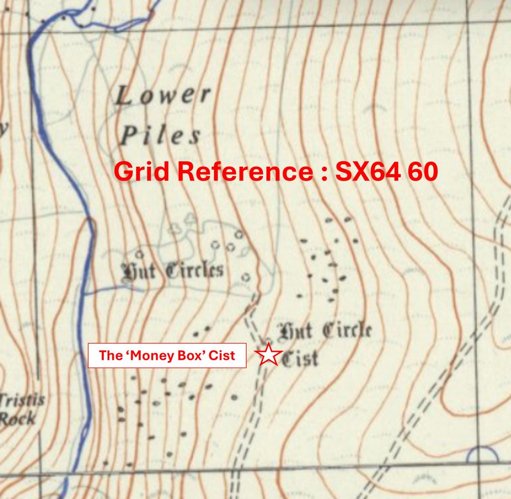
6460 a
Grid Reference SX64 60. The item chosen to represent this square is The ‘Money Box’ Cist
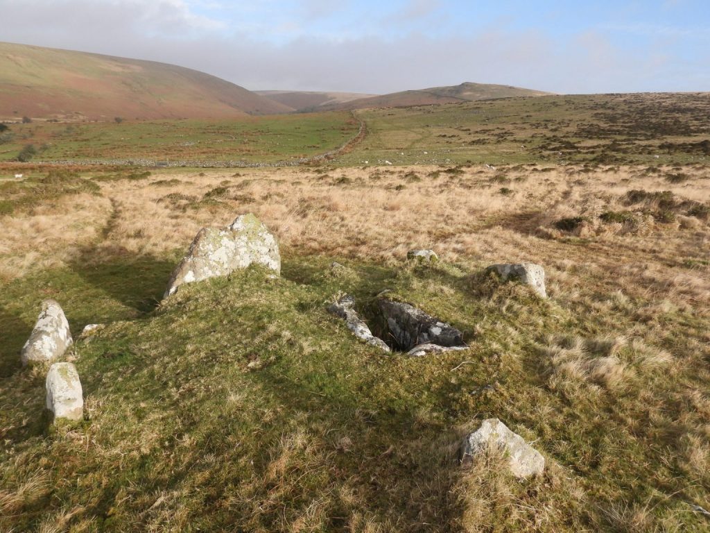
6460 b
Grid Reference SX64 60. The ‘Money Box’ Cist is located at SX64530 60250
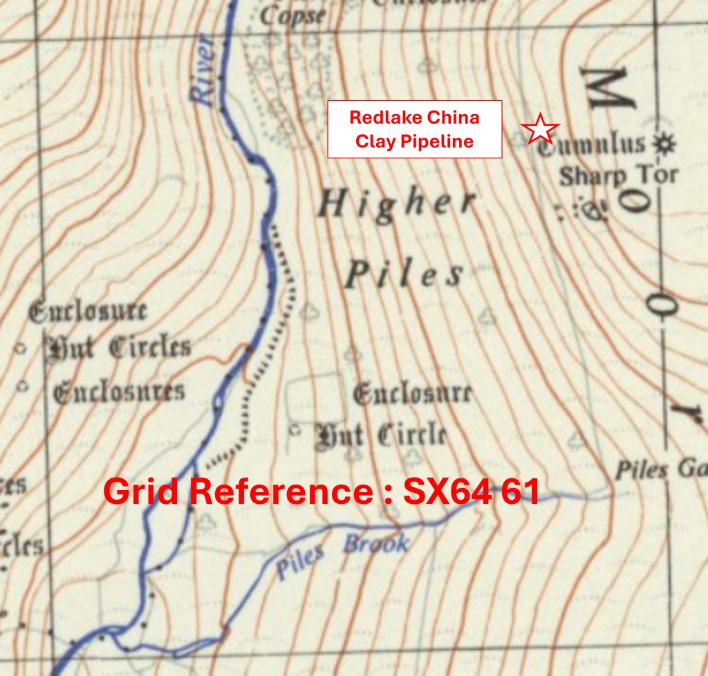
6461 a
Grid Reference SX64 61. The item chosen to represent this square is Red Lake China Clay Pipeline
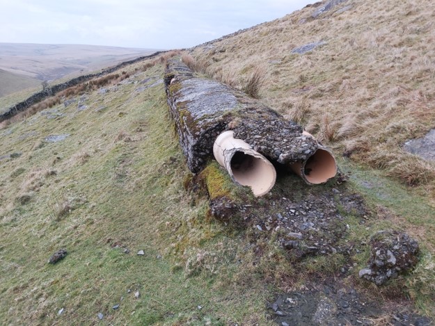
6461 b
Grid Reference SX64 61. The Red Lake China Clay Pipeline is located at SX6480 6183
6462 a
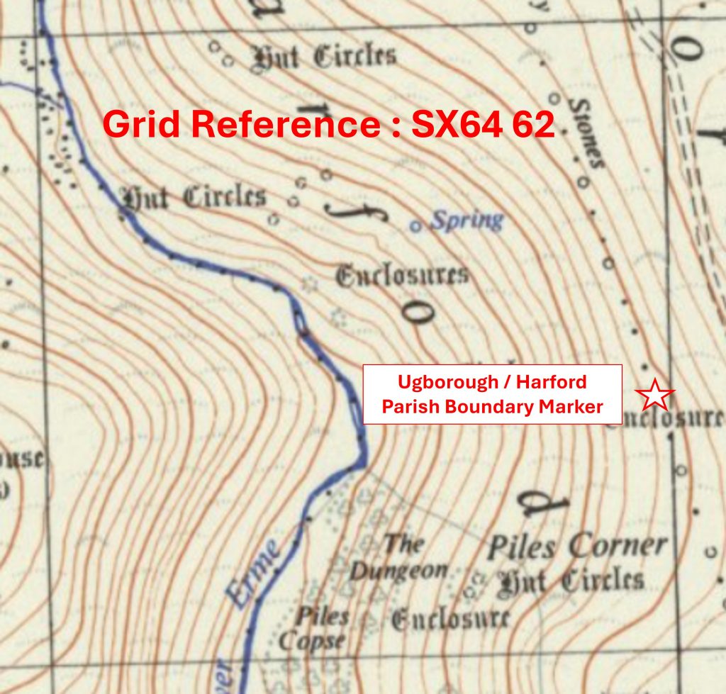
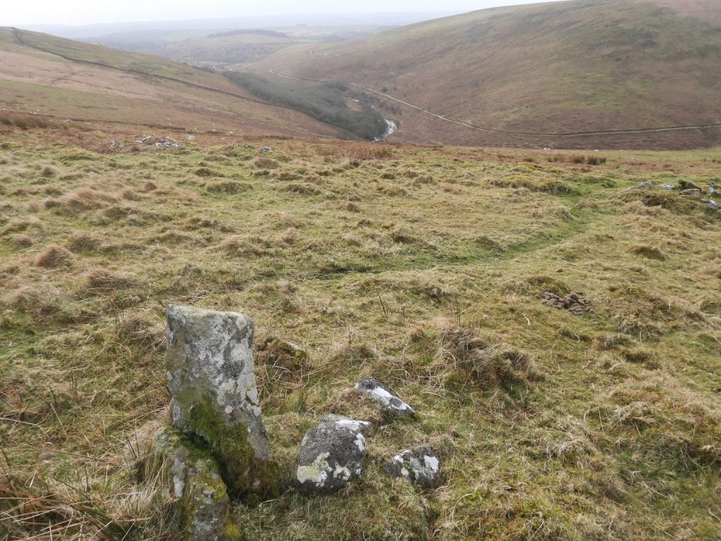
Grid Reference SX64 62. The item chosen to represent this square is Ugborough / Harford Parish Boundary Marker
6462 b
Grid Reference SX64 62. The Ugborough / Harford Parish Boundary Marker is located at SX64968 62411
6556 a
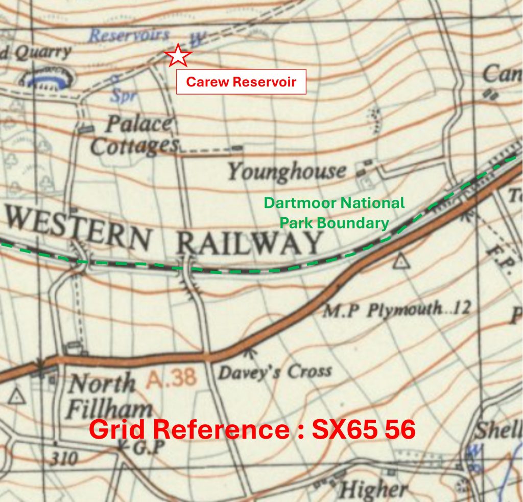
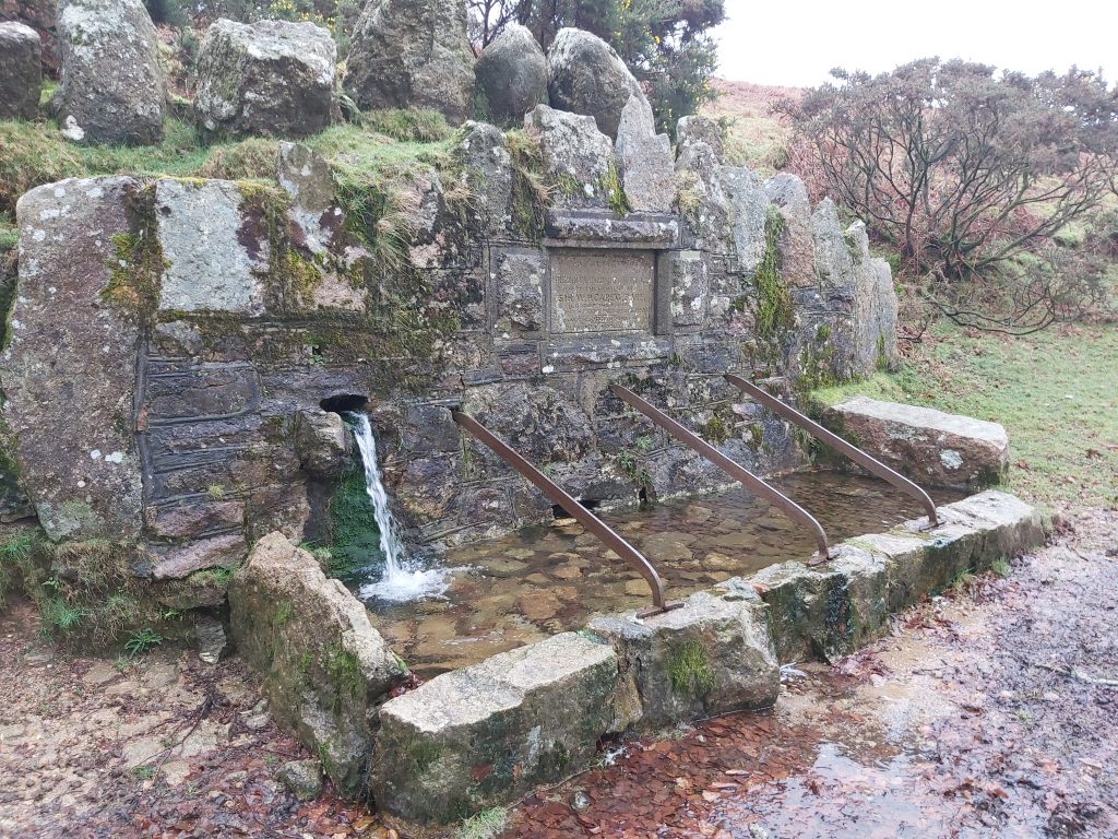
Grid Reference SX65 56 is a part square of the National Park – the boundary marked by the green dotted line. The item chosen to represent this square is the Carew Reservoir
6556 b
Grid Reference SX65 56. The Carew Reservoir is located at SX65327 56937
6557 a
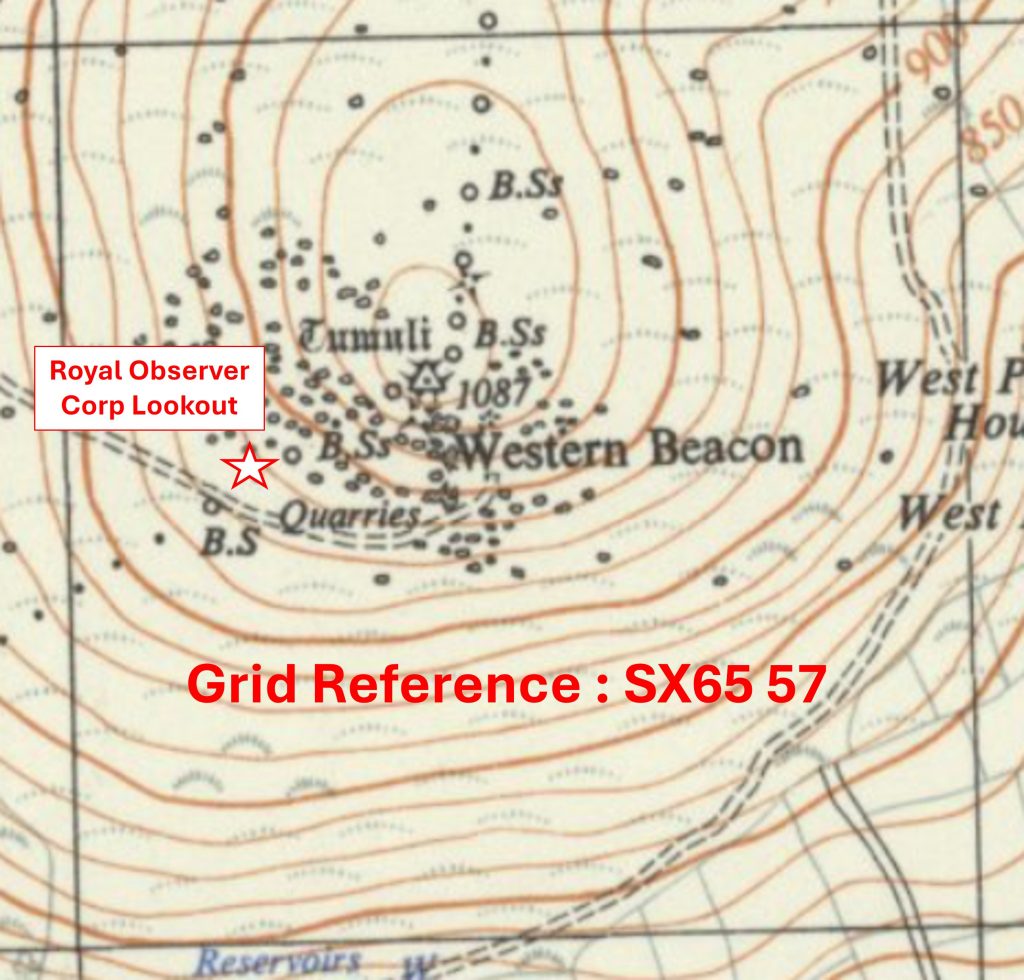
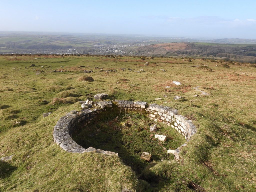
Grid Reference SX65 57. The item chosen to represent this square is Royal Observer Corp Lookout
6557 b
Grid Reference SX65 57. The Royal Observer Corp Lookout is located at SX65191 57529
6558 a
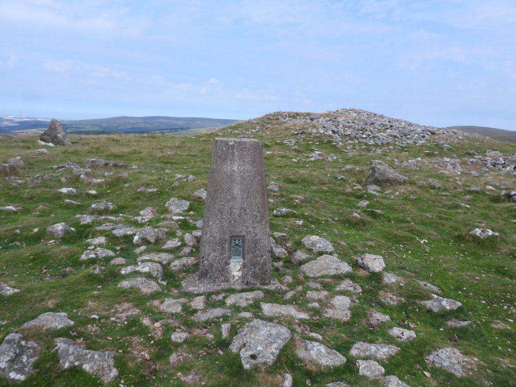
Grid Reference SX65 58. The item chosen to represent this square is Butterdon Hill Trig Pillar
6558 b
Grid Reference SX65 58. The Butterdon Hill Trig Pillar is located at SX65523 58645
6559 a
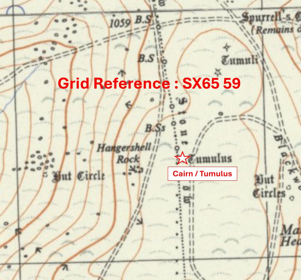
Grid Reference SX65 59. The item chosen to represent this square is a Cairn / Tumulus
6559 b
Grid Reference SX65 59. The Cairn / Tumulus is located at SX6566 5940
6560 a
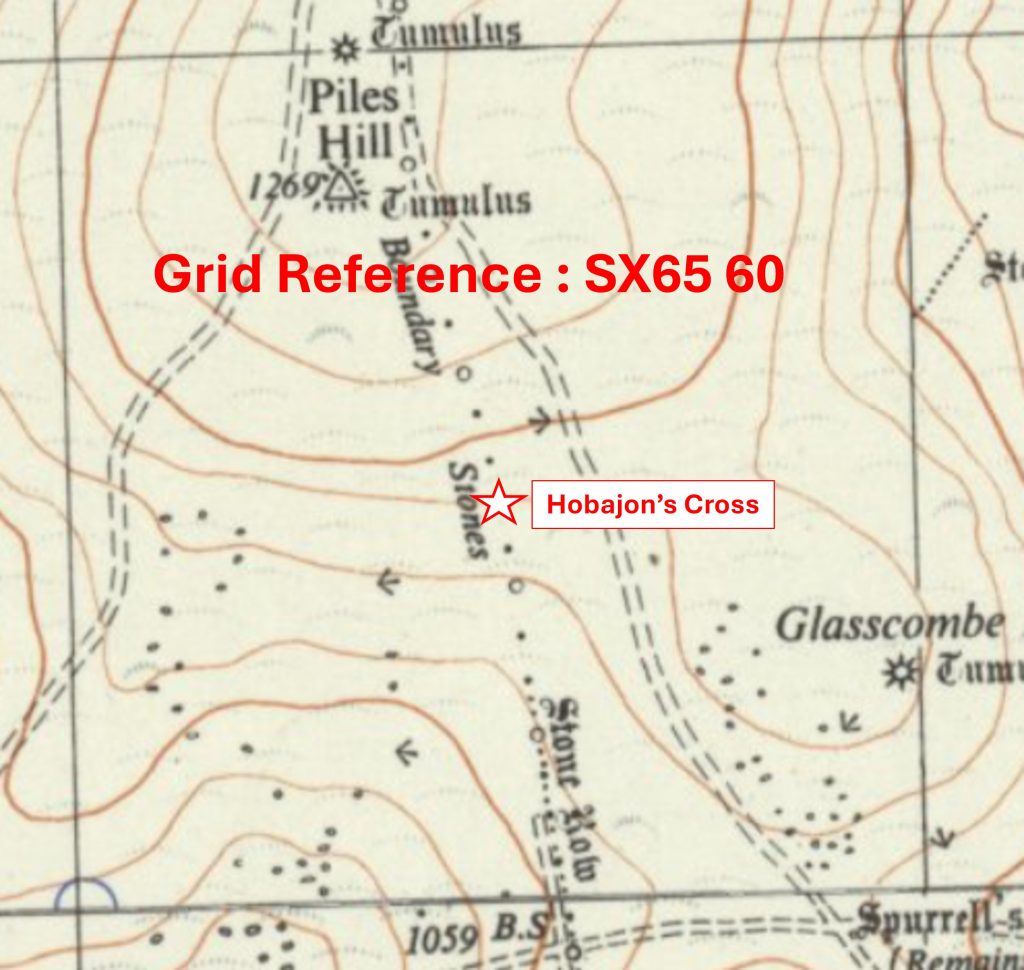
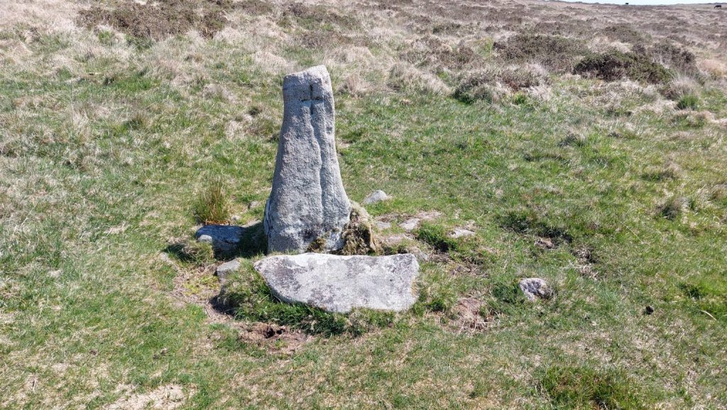
Grid Reference SX65 60. The item chosen to represent this square is Hobajon’s Cross
6560 b
Grid Reference SX65 60. Hobajon’s Cross is located at SX65509 60468
6561 a
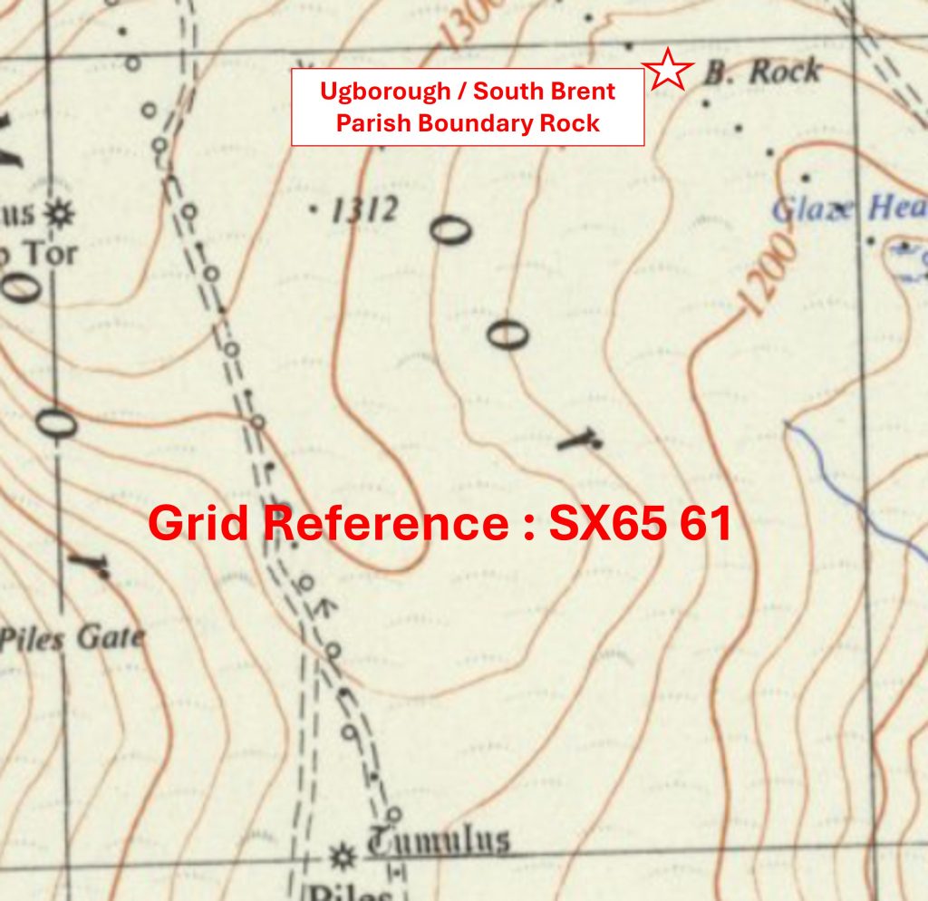
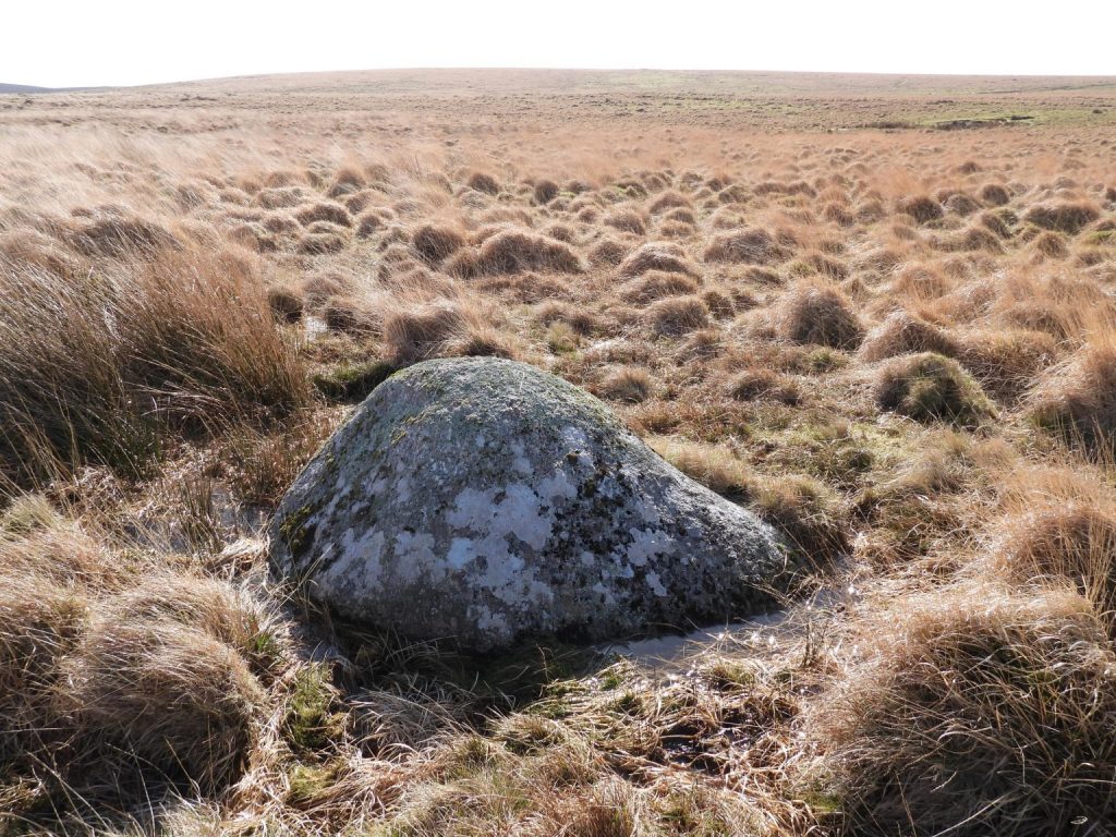
Grid Reference SX65 61. The item chosen to represent this square is Ugborough / South Brent Parish Boundary Rock
6561 b
Grid Reference SX65 61. The Ugborough / South Brent Parish Boundary Rock is located at SX65758 61965
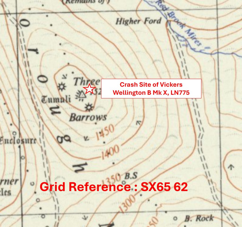
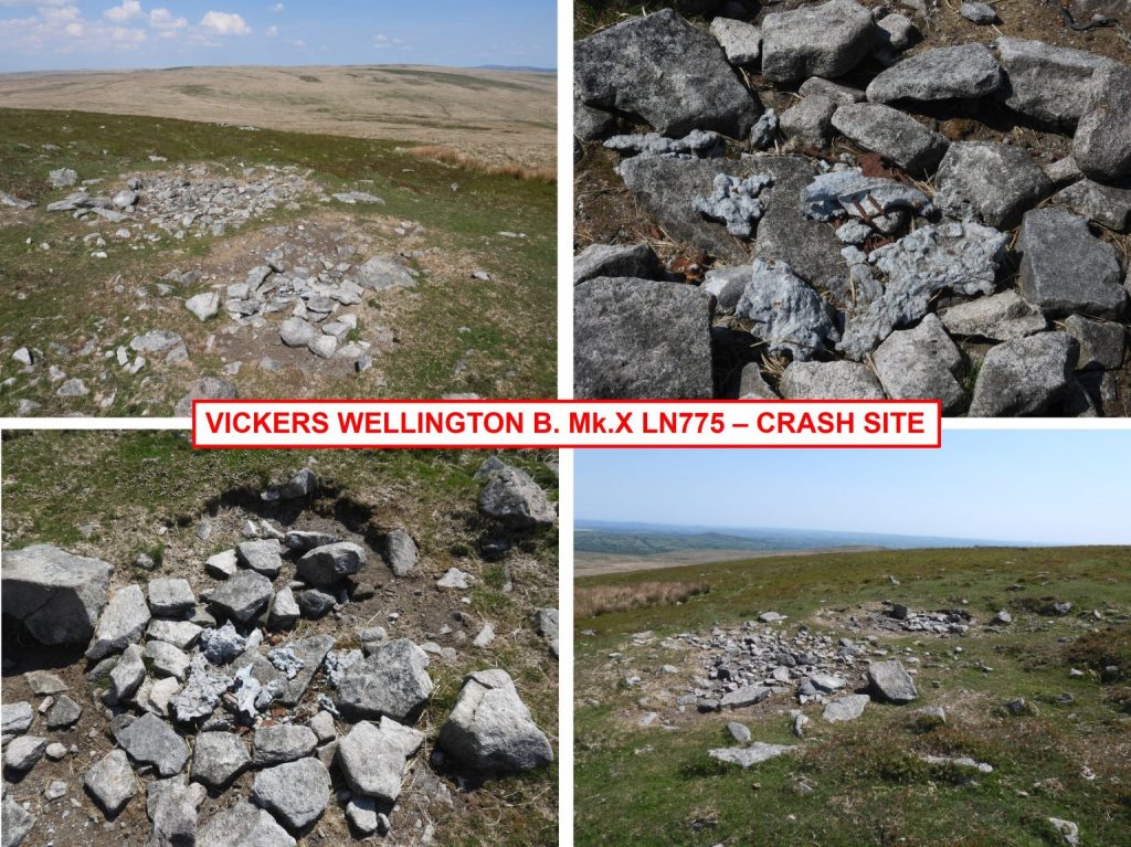
6562 a
Grid Reference SX65 62. The item chosen to represent this square is Crash Site of Vickers Wellington B Mk X, LN775
6562 b
Grid Reference SX65 62. The Crash Site of Vickers Wellington B Mk X, LN775 is located at SX653 626
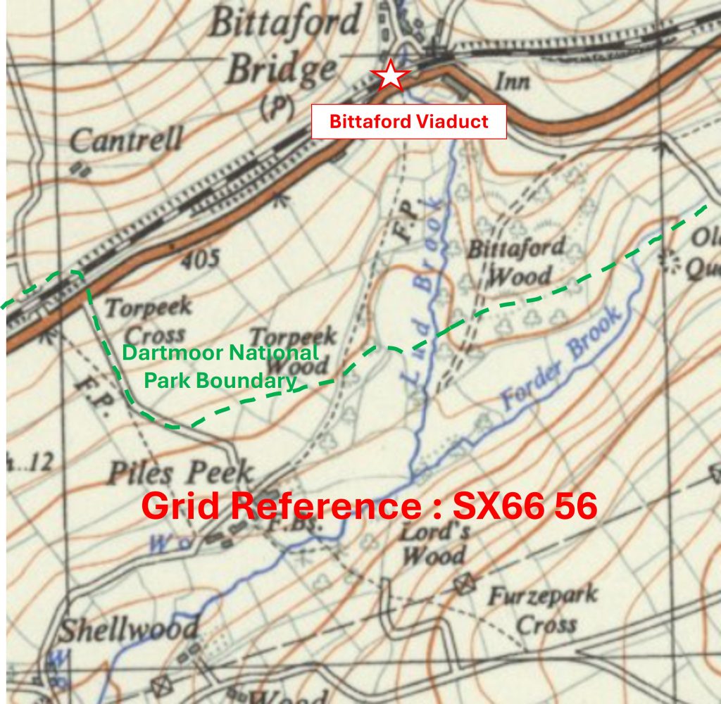
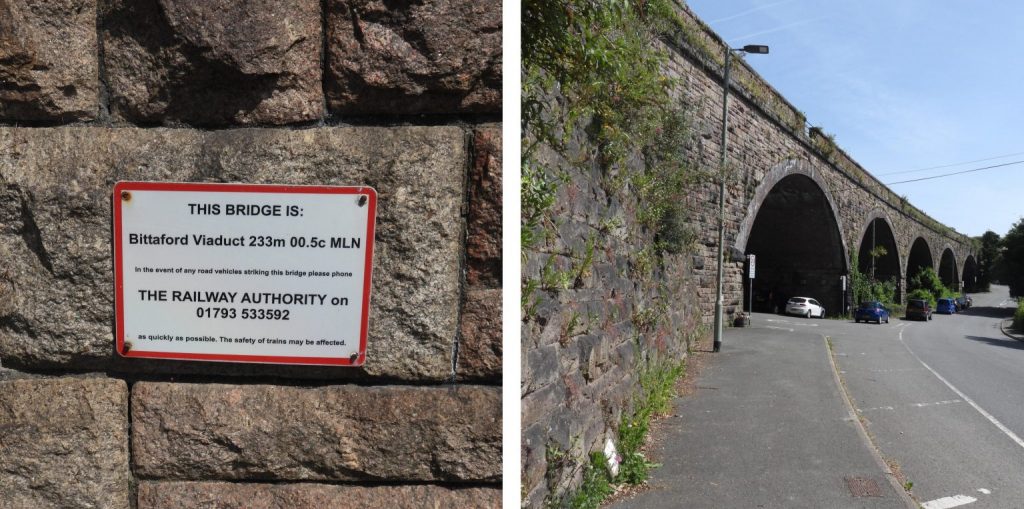
6656 a
Grid Reference SX66 56. This is a ‘part square’. The item chosen to represent this square is Bittaford Viaduct
6656 b
Grid Reference SX66 56. This is a ‘part square’. Bittaford Viaduct is located at SX6659 5695
6657 a
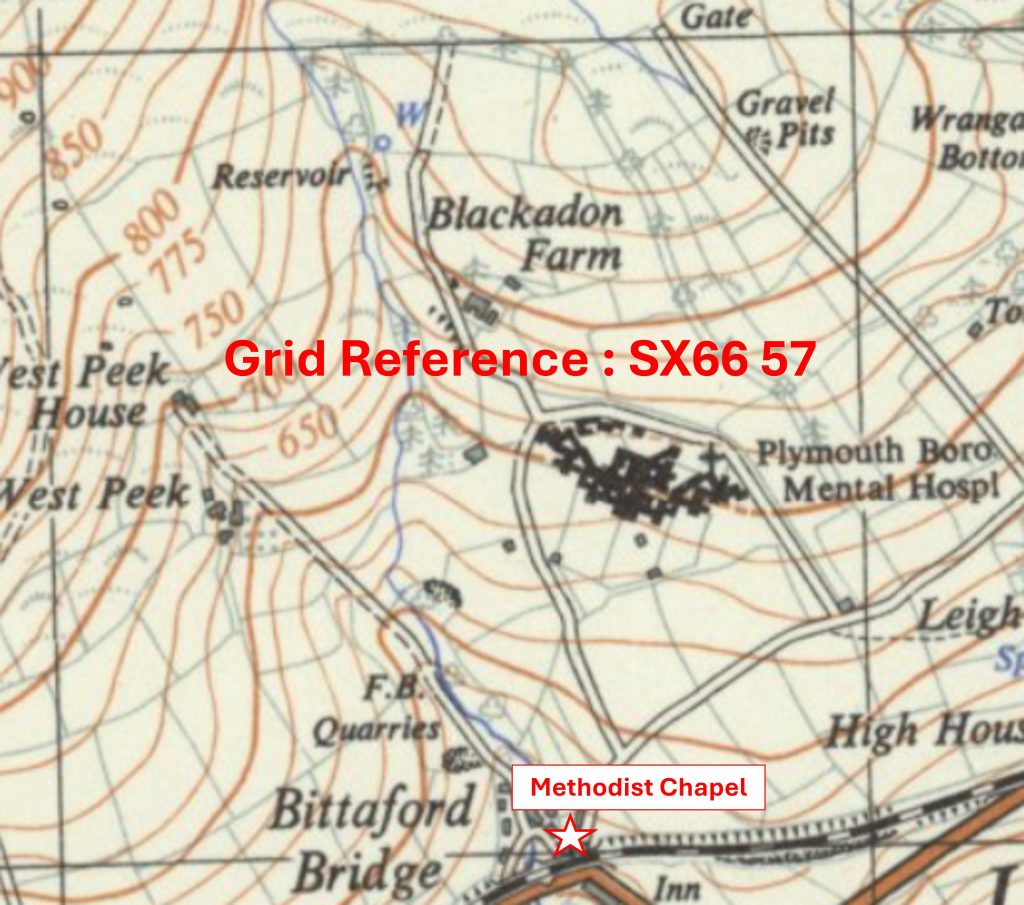
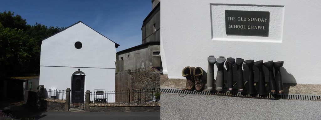
Grid Reference SX66 57. The item chosen to represent this square is a Methodist Chapel
6657 b
Grid Reference SX66 57. The Methodist Chapel is located at SX66629 57015
6658 a
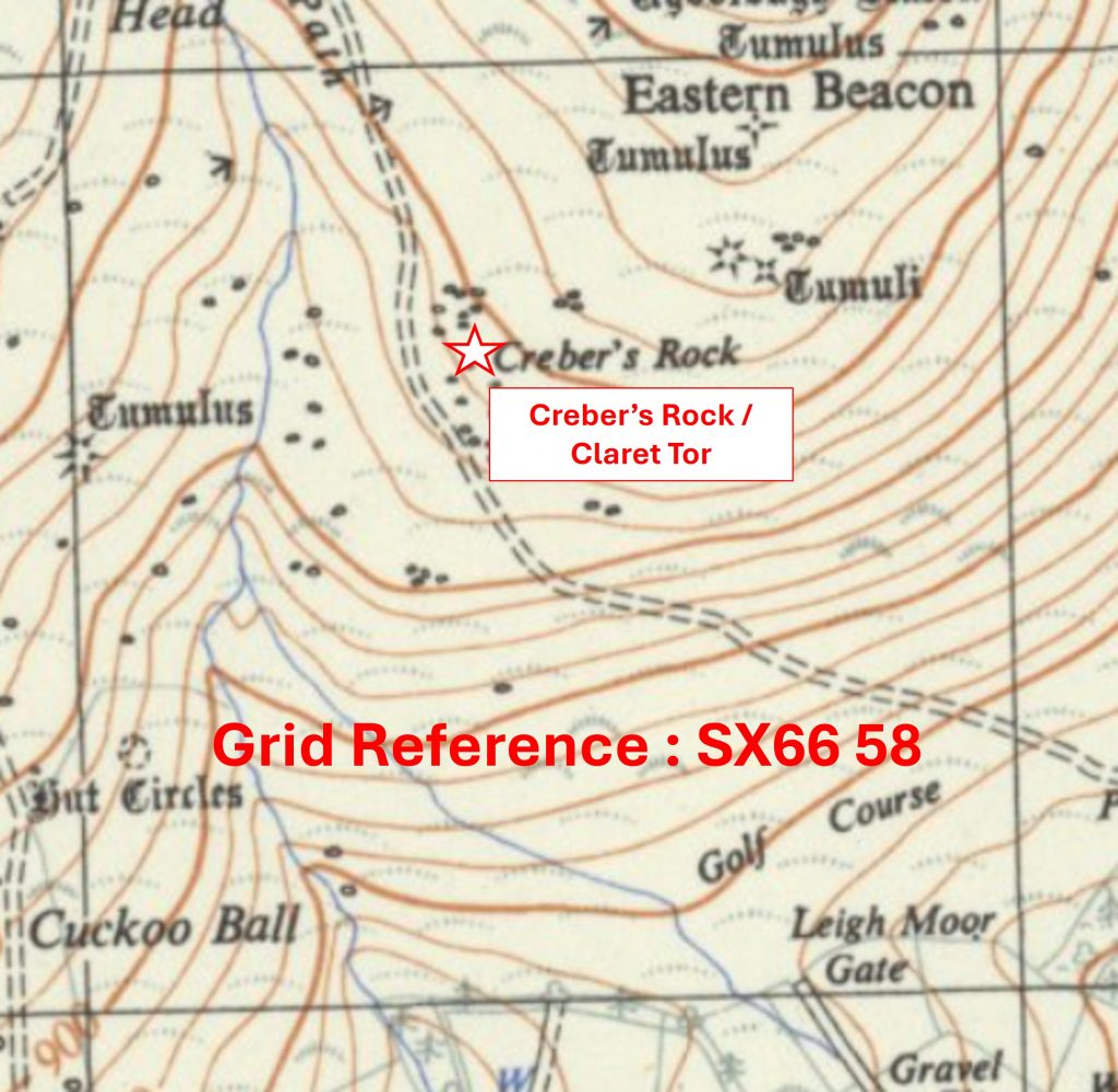
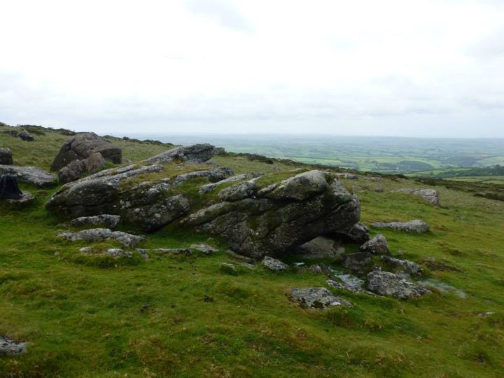
Grid Reference SX66 58. The item chosen to represent this square is Creber’s Rock / Claret Tor
6658 b
Grid Reference SX66 58. Creber’s Rock / Claret Tor is located at SX6645 5869
6659 a
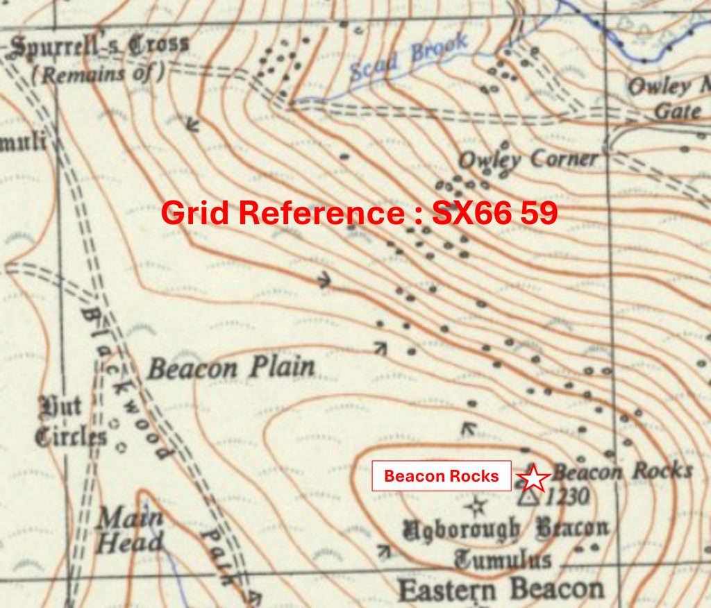
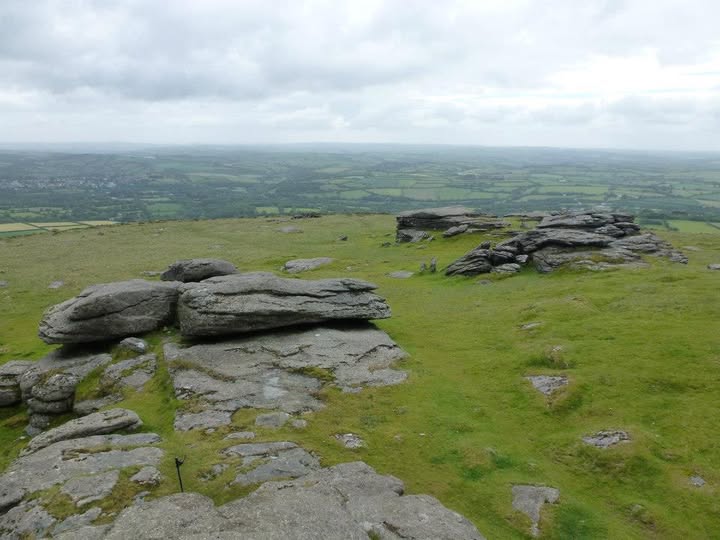
Grid Reference SX66 59. The item chosen to represent this square is Beacon Rocks
6659 b
Grid Reference SX66 59. Beacon Rocks are located at SX668 591
6660 a
Grid Reference SX66 60. The item chosen to represent this square is Glaze Tin Mill
6660 b
Grid Reference SX66 60. Glaze Tin Mill is located at SX6683 6030
6661 a
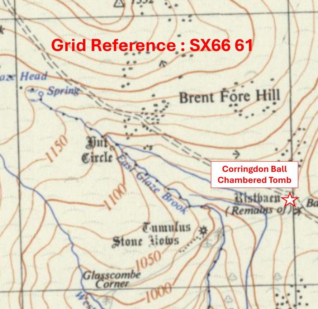
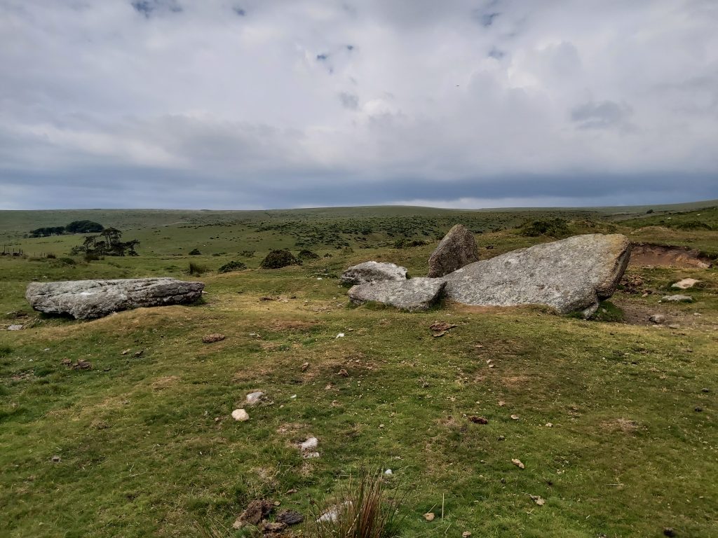
Grid Reference SX66 61. The item chosen to represent this square is Corringdon Ball Chambered Tomb
6661 b
Grid Reference SX66 61. Corringdon Ball Chambered Tomb is located at SX66956 61300
6662 a
Grid Reference SX66 62. The item chosen to represent this square is an Unfinished Millstone
6662 b
Grid Reference SX66 62. The Unfinished Millstone is located at SX66178 62213
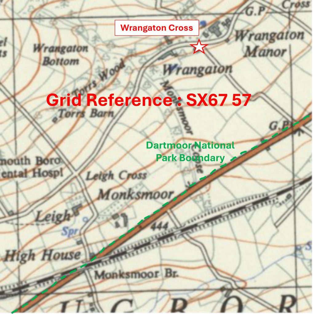
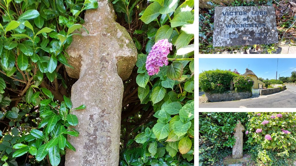
6757 a
Grid Reference SX67 57. This is a part square. The item chosen to represent this square is Wrangaton Cross
6757 b
Grid Reference SX67 57. This is a part square. Wrangaton Cross is located at SX67672 57884
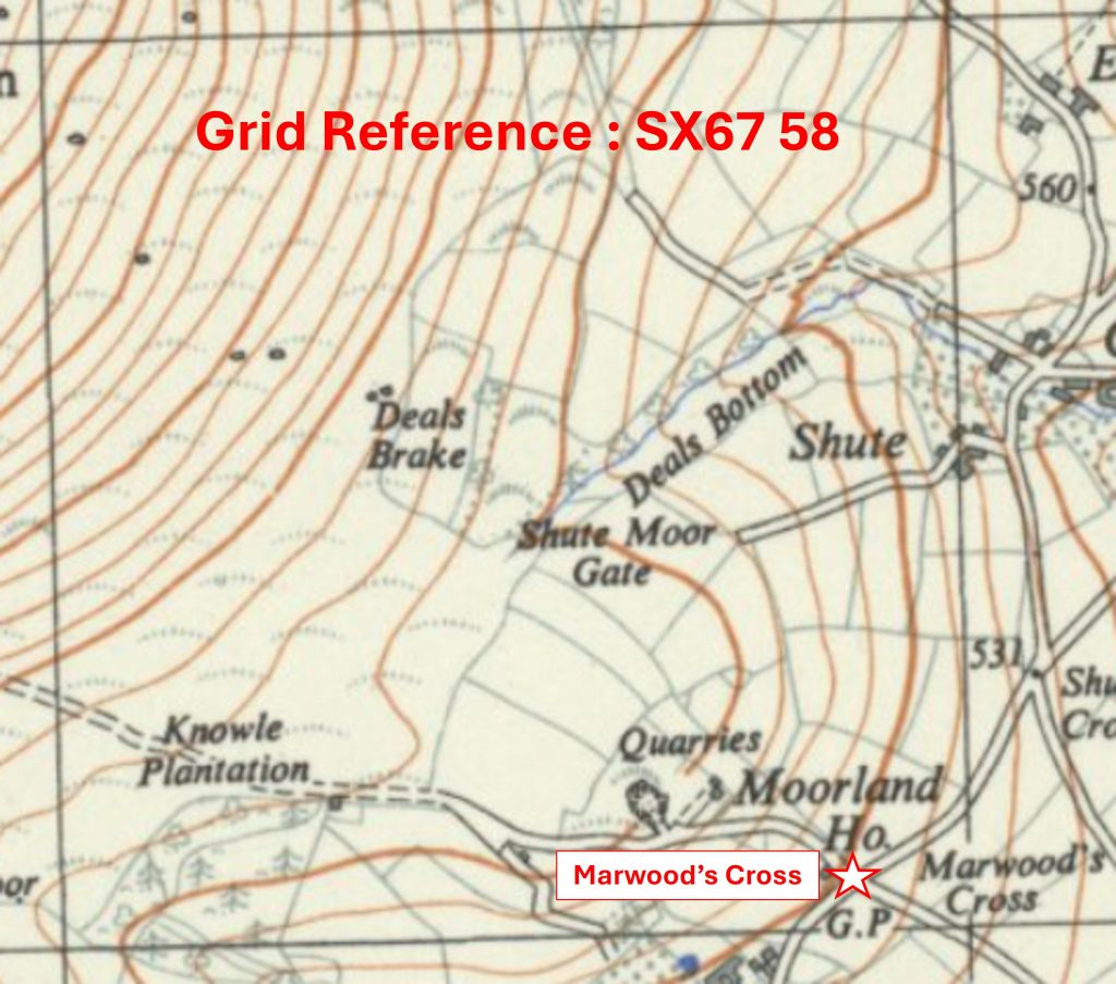
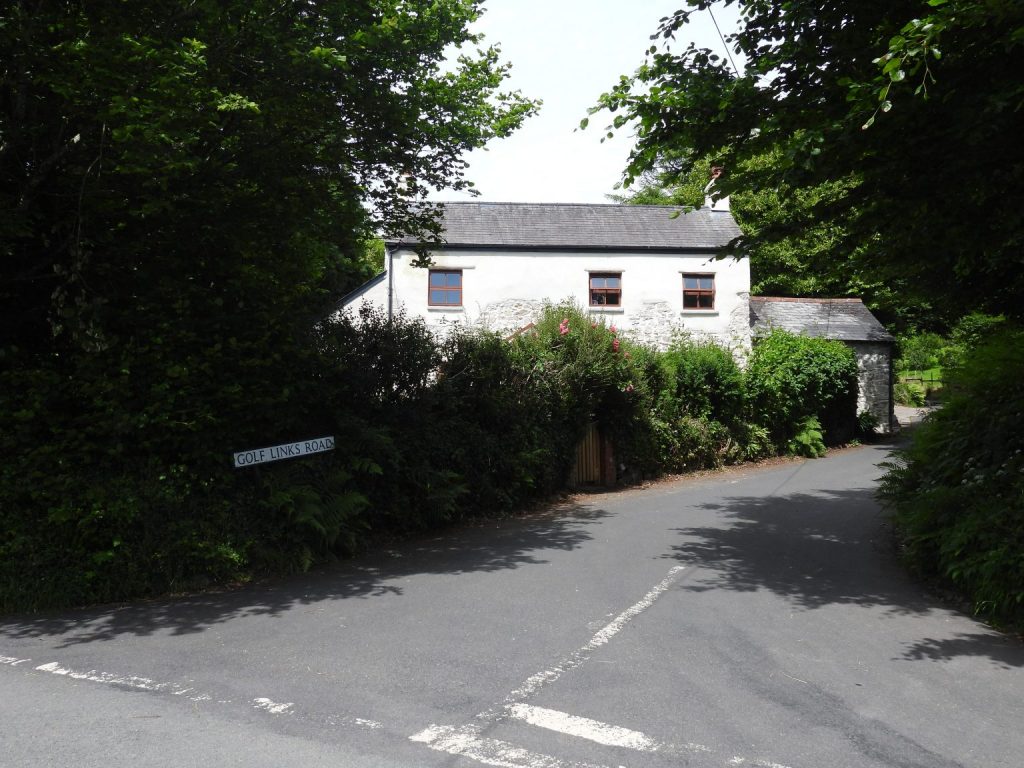
6758 a
Grid Reference SX67 58. The item chosen to represent this square is Marwood’s Cross
6758 b
Grid Reference SX67 58. Marwood’s Cross is located at SX6784 5806
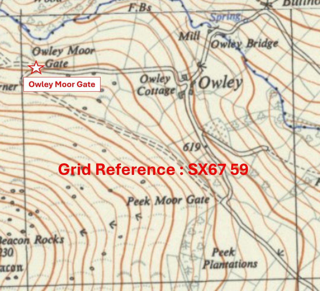
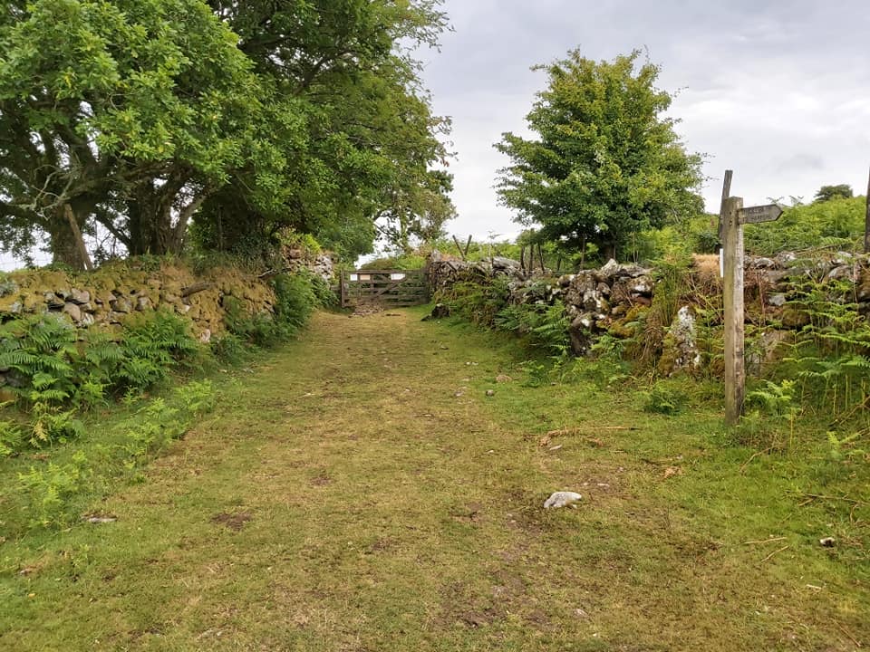
6759 a
Grid Reference SX67 59. The item chosen to represent this square is Owley Moor Gate
6759 b
Grid Reference SX67 59. Owley Moor Gate is located at SX6707 5980
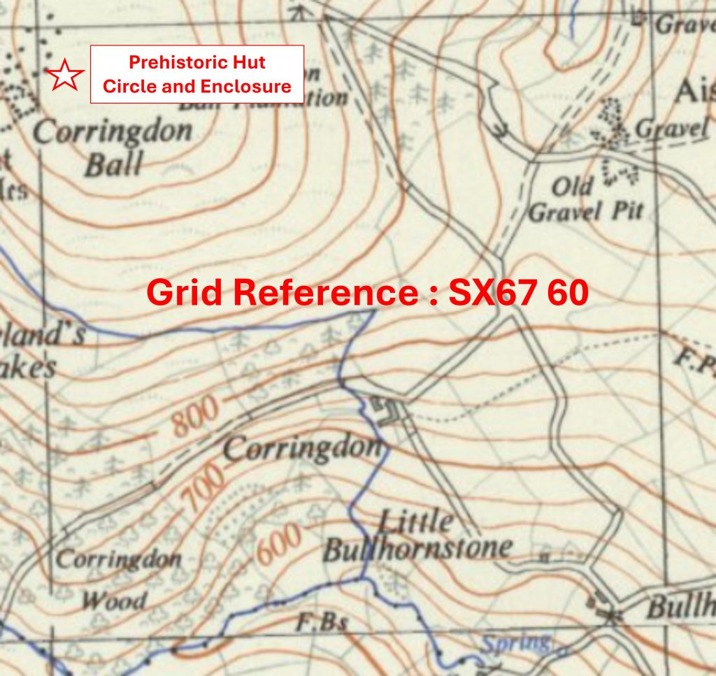
6760 a
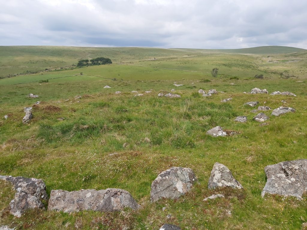
Grid Reference SX67 60. The item chosen to represent this square is a Prehistoric Hut Circle and Enclosure
6760 b
Grid Reference SX67 60. The Prehistoric Hut Circle and Enclosure is located at SX67049 60911
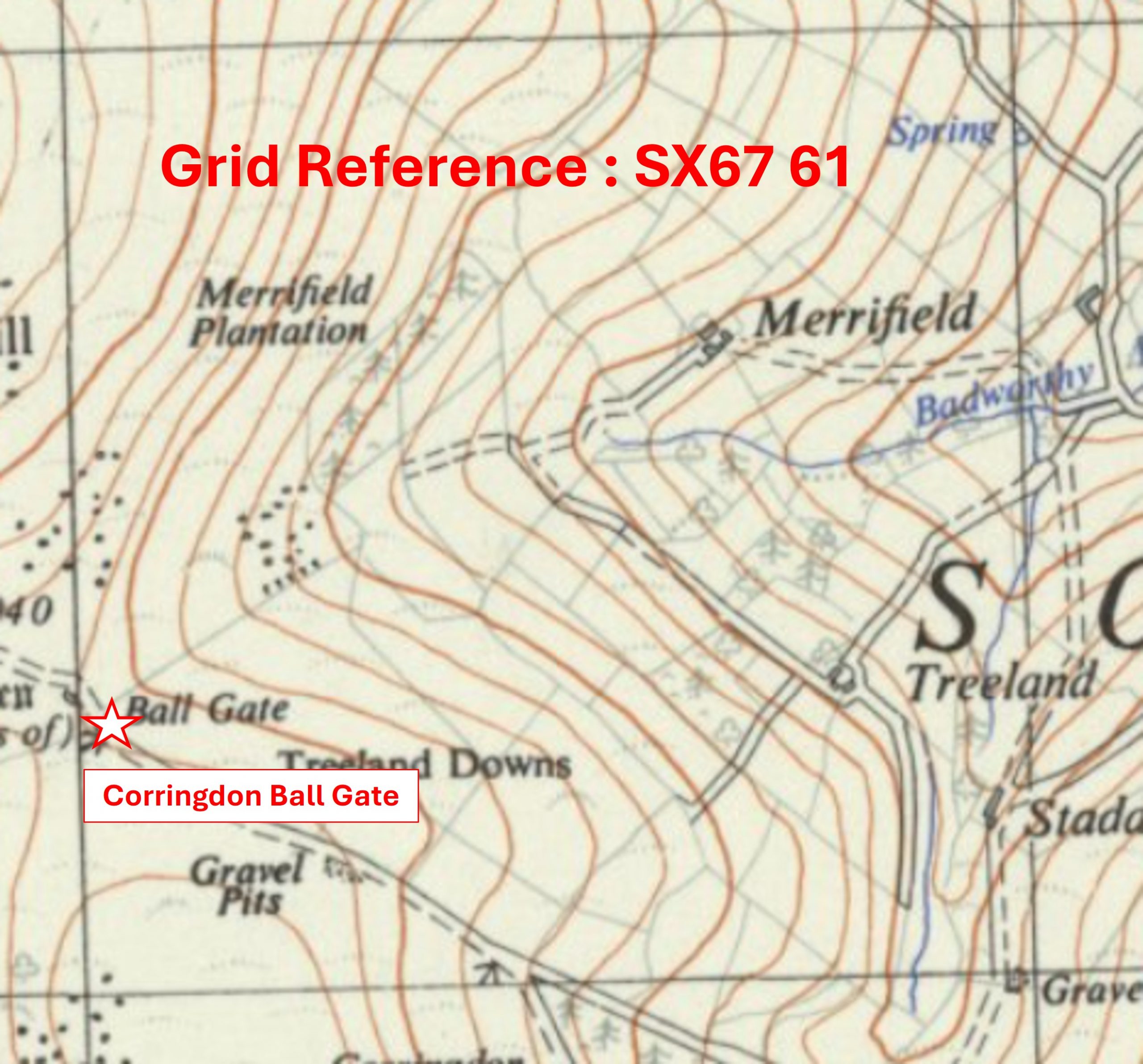
6761 a
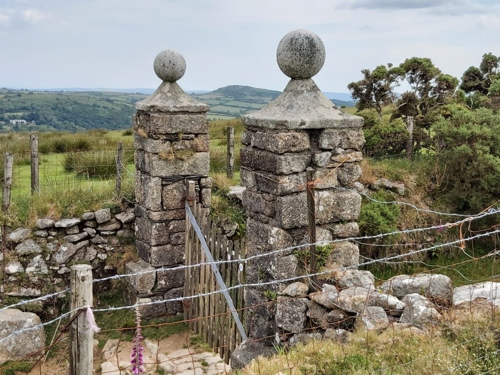
Grid Reference SX67 61. The item chosen to represent this square is Corringdon Ball Gate
6761 b
Grid Reference SX67 61. Corringdon Ball Gate is located at SX67014 61296
6762 a
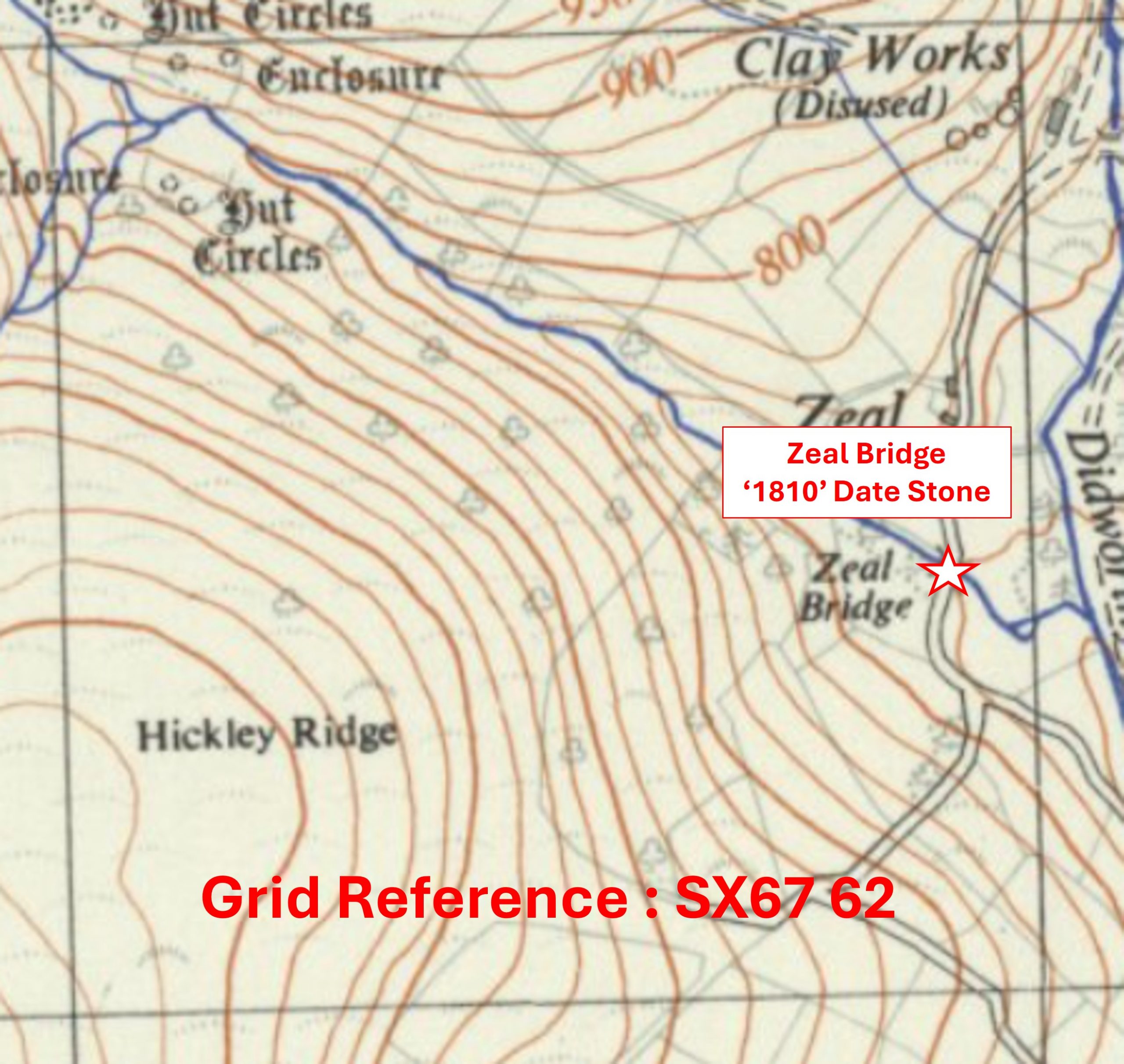
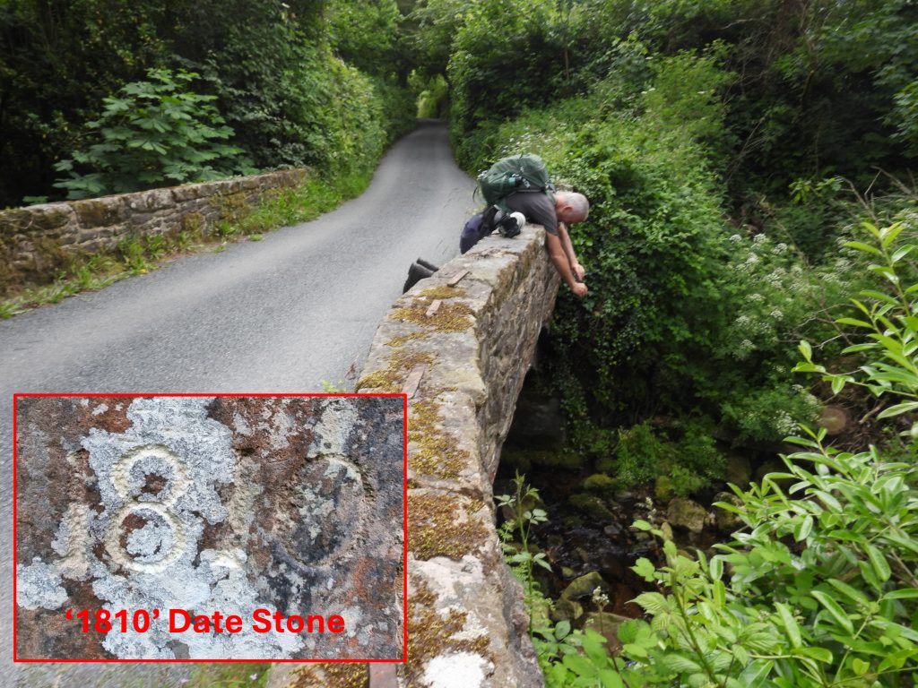
Grid Reference SX67 62. The item chosen to represent this square is Zeal Bridge ‘1810’ Date Stone
6762 b
Grid Reference SX67 62. The Zeal Bridge ‘1810’ Date Stone is located at SX67908 62448
6857 a
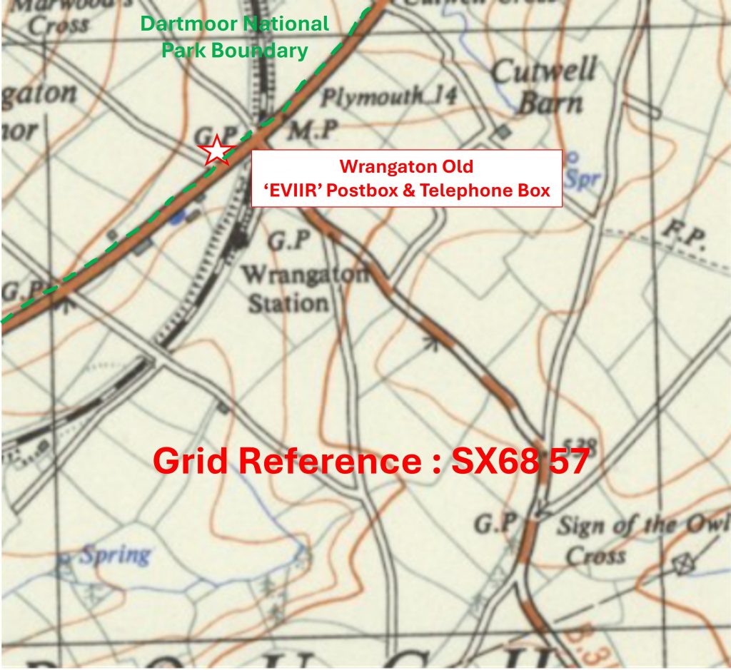
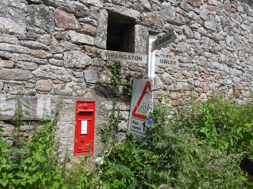
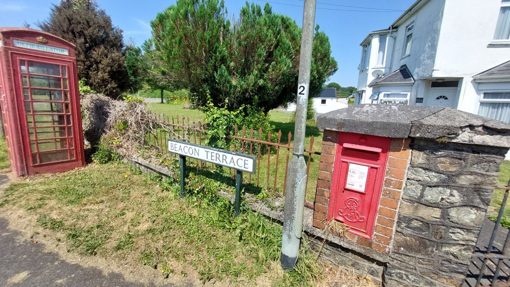
Grid Reference SX68 57. This is a part square. The item chosen to represent this square is Wrangaton Old
‘EVIIR’ Postbox & Telephone Box
6857 b
Grid Reference SX68 57. This is a part square. The Wrangaton Old ‘EVIIR’ Postbox & Telephone Box are located at SX68293 57792
6858 a
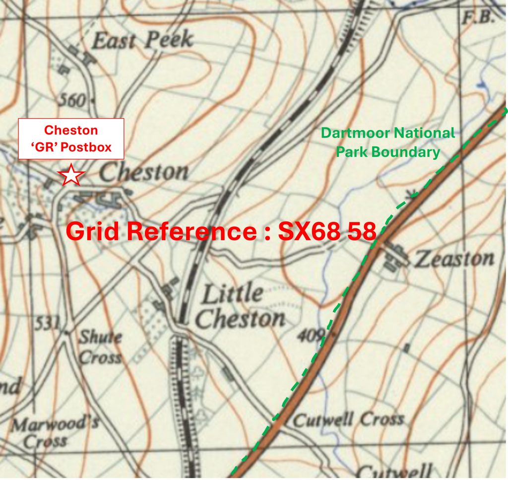
Grid Reference SX68 58. This is a ‘part square’. The item chosen to represent this square is Cheston ‘GR’ Postbox
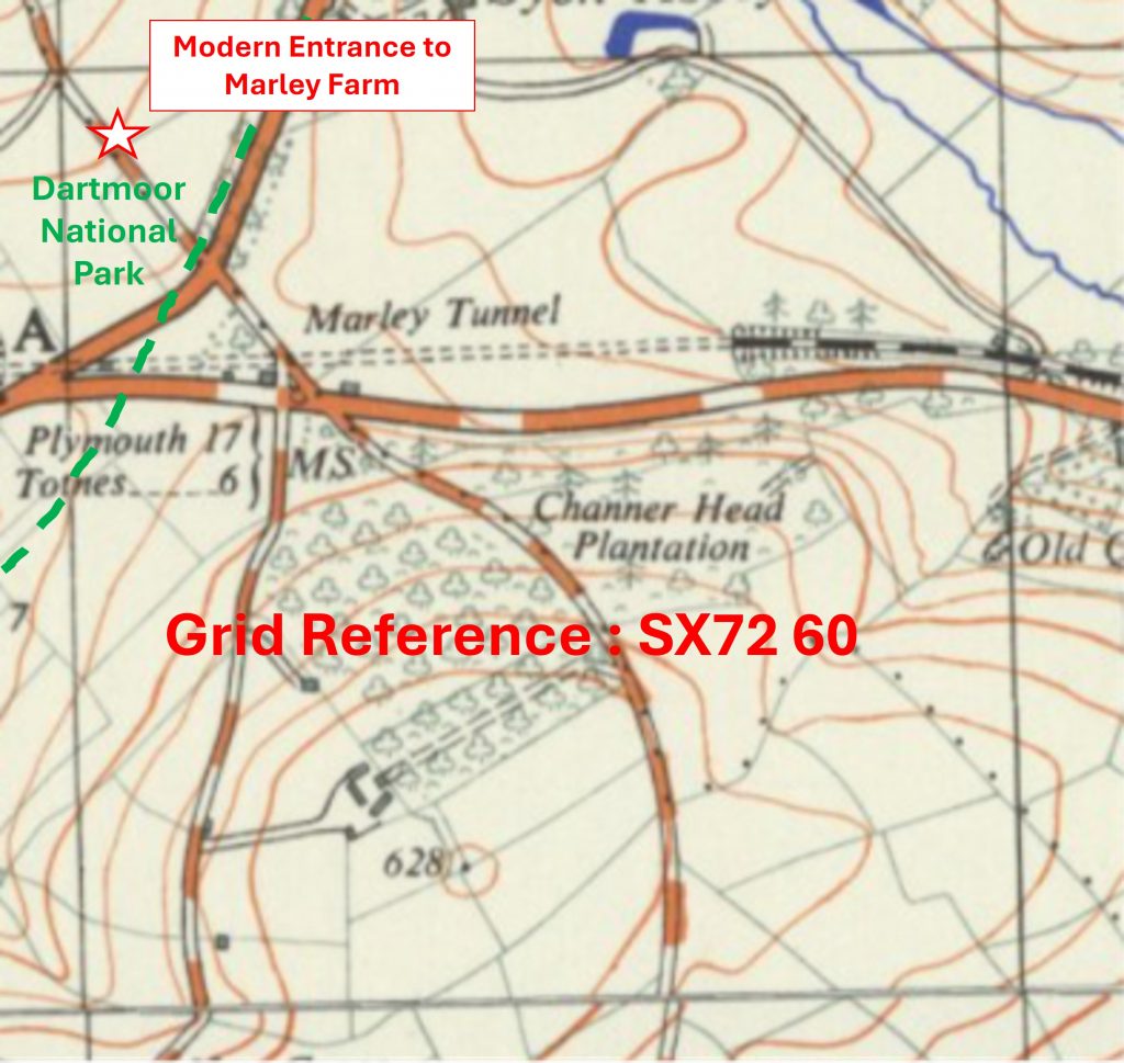
6858 b
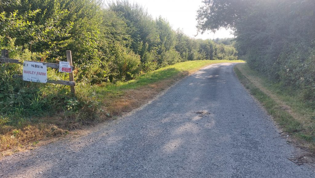
Grid Reference SX68 58. This is a ‘part square’. The Cheston ‘GR’ Postbox is located at SX68075 58622
6859 a
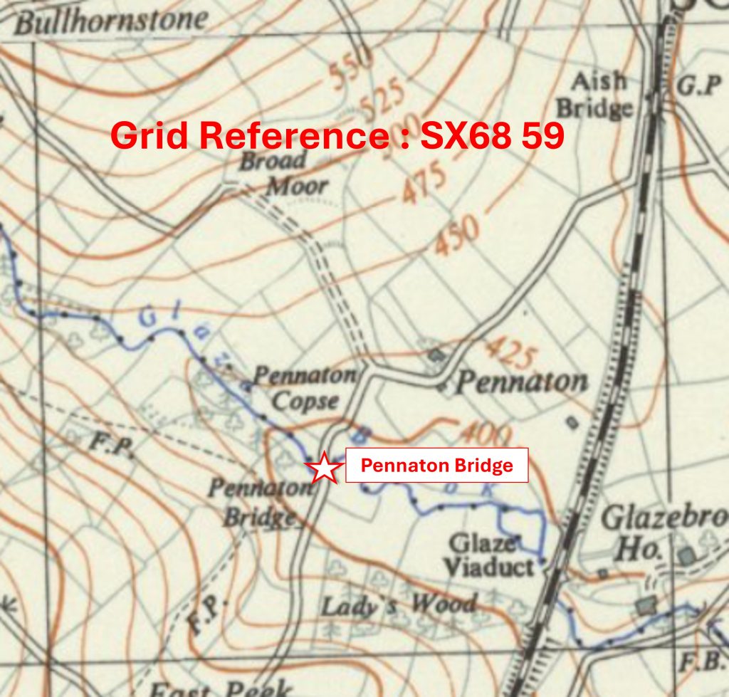
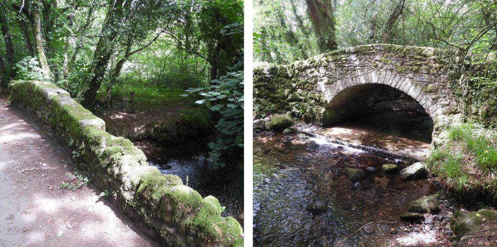
Grid Reference SX68 59. The item chosen to represent this square is Pennaton Bridge
6859 b
Grid Reference SX68 59. Pennaton Bridge is located at SX68435 59298
6860 a
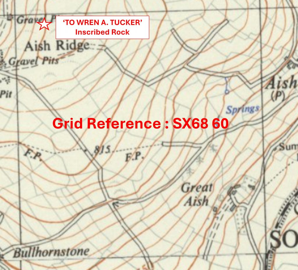
Grid Reference SX68 60. The item chosen to represent this square is ‘TO WREN A. TUCKER’ Inscribed Rock
6860 b
Grid Reference SX68 60. The ‘TO WREN A. TUCKER’ Inscribed Rock is located at SX68108 60963
6861 a
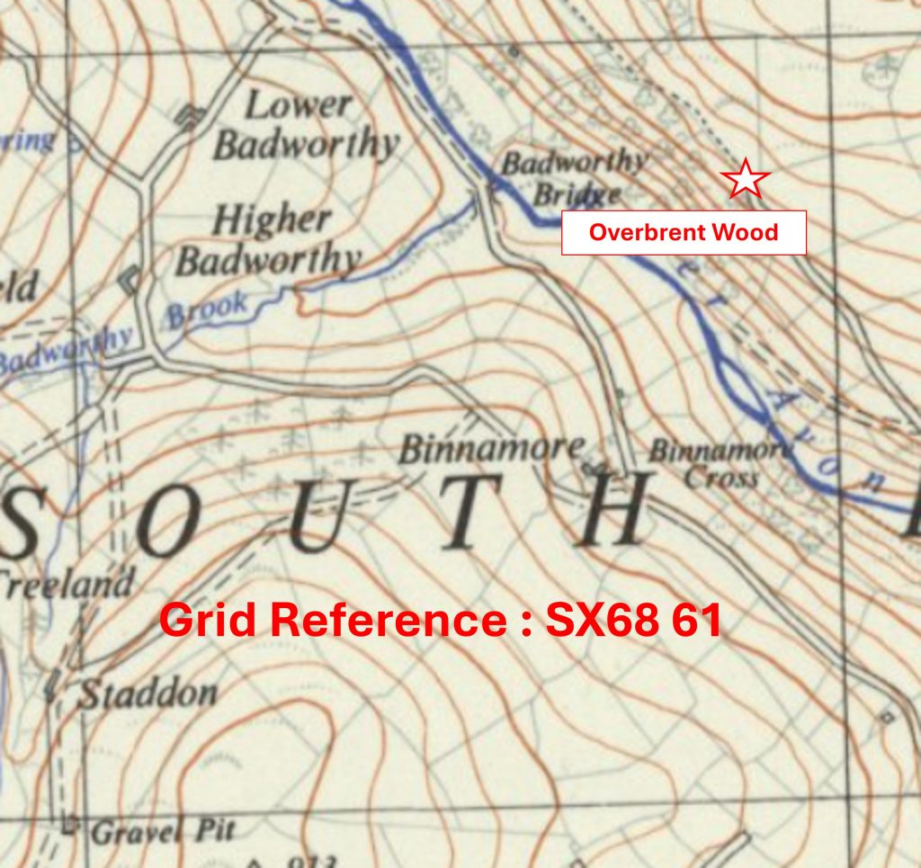
Grid Reference SX68 61. The item chosen to represent this square is Overbrent Wood
6861 b
Grid Reference SX68 61. Overbrent Wood is located at SX688 618
6862 a
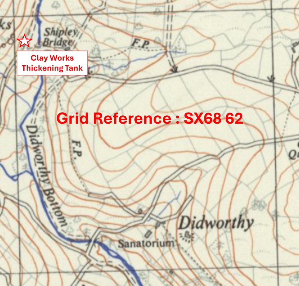
Grid Reference SX68 62. The item chosen to represent this square is Clay Works Thickening Tank
6862 b
Grid Reference SX68 62. The Clay Works Thickening Tank is located at SX68024 62916
6959 a
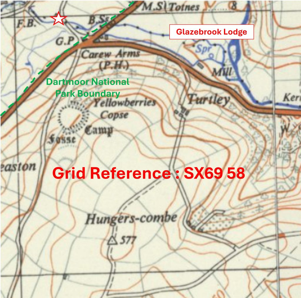
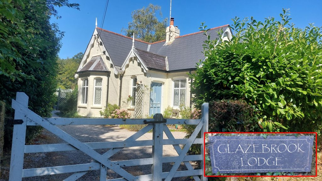
Grid Reference SX69 59. This is a ‘part square’. The item chosen to represent this square is Glazebrook Bridge
6959 b
Grid Reference SX69 59. This is a ‘part square’. Glazebrook Bridge is located at SX69039 59044
6960 a
Grid Reference SX69 60. The item chosen to represent this square is Lydia Bridge
6960 b
Grid Reference SX69 60. Lydia Bridge is located at SX69563 60675
6961 a
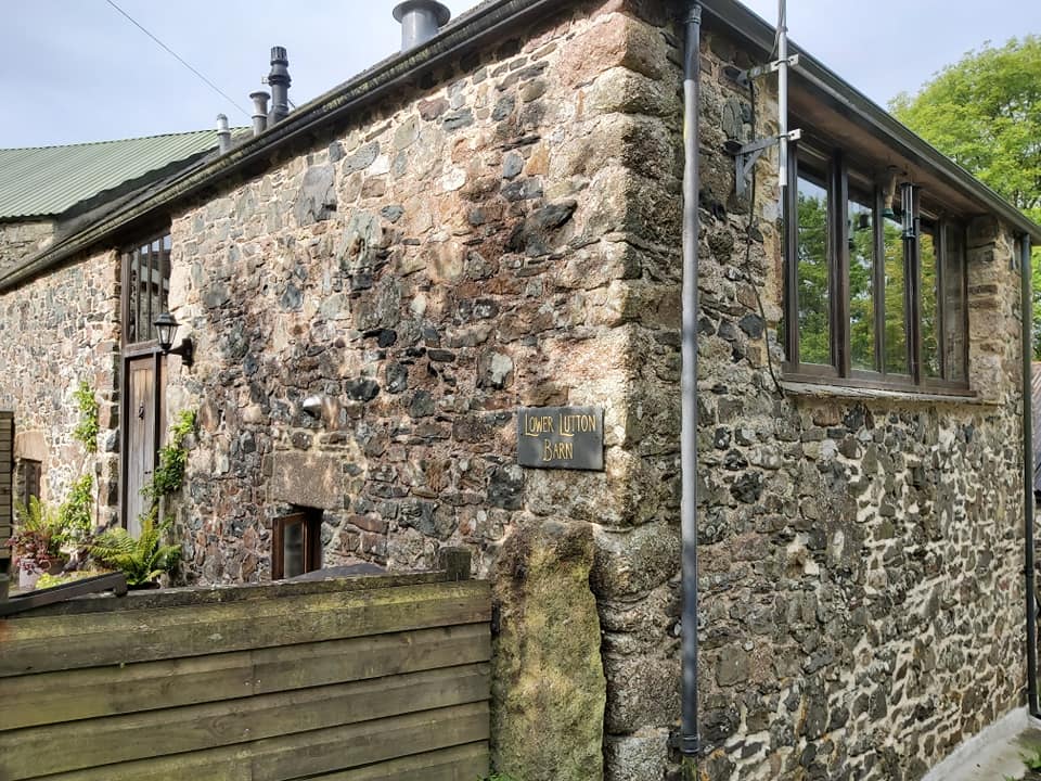
Grid Reference SX69 61. The item chosen to represent this square is Lower Lutton Barn
6961 b
Grid Reference SX69 61. Lower Lutton Barn is located at SX69581 61275
6962 a
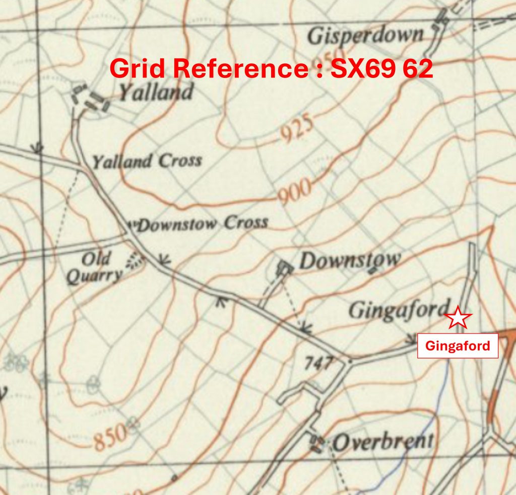
Grid Reference SX69 62. The item chosen to represent this square is Gingaford
6962 b
Grid Reference SX69 62. Gingaford is located at SX6995 6233
7061 a
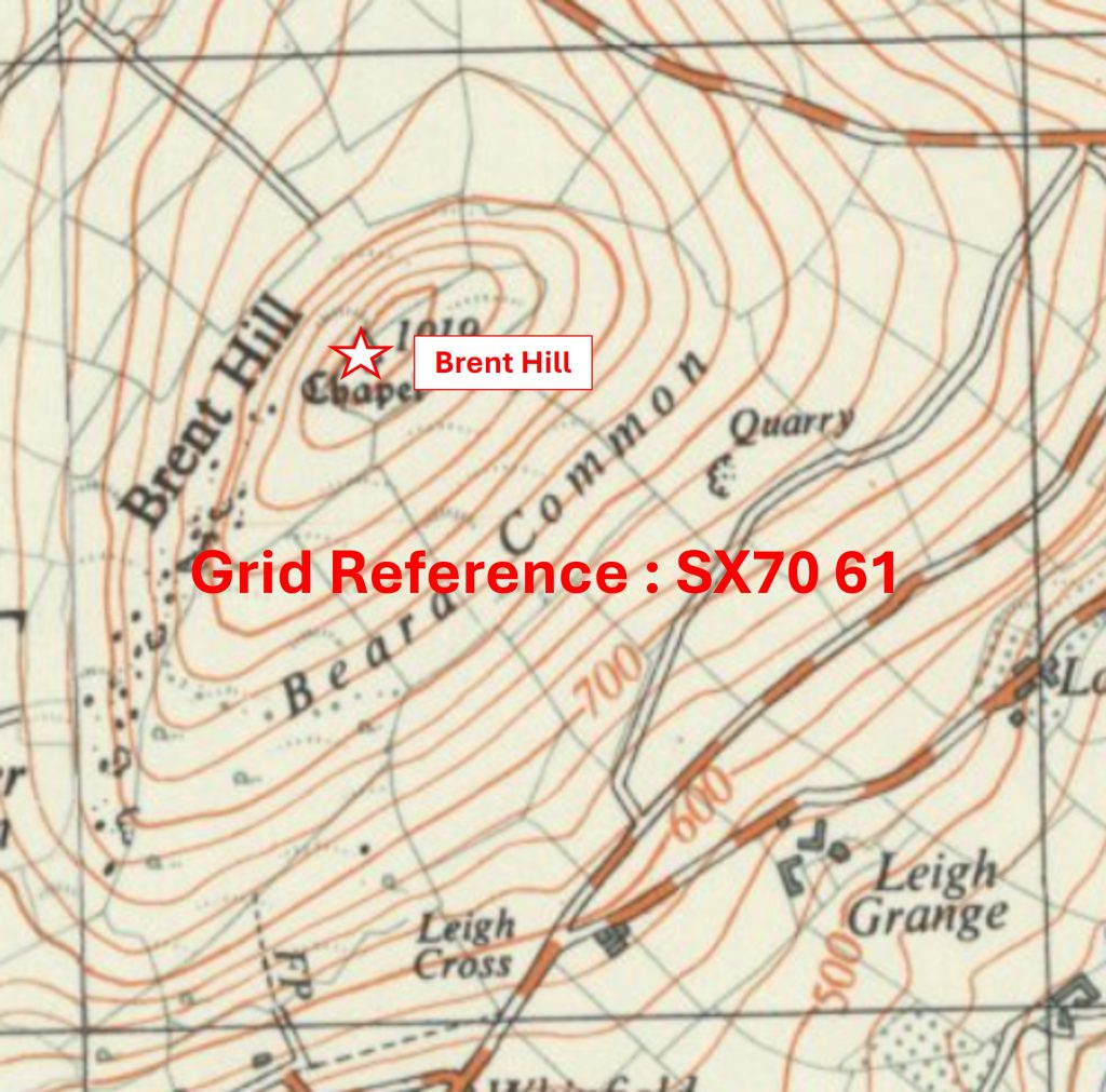
Grid Reference SX70 61. The item chosen to represent this square is Brent Hill
7061 b
Grid Reference SX70 61. Brent Hill is located at SX7026 6166
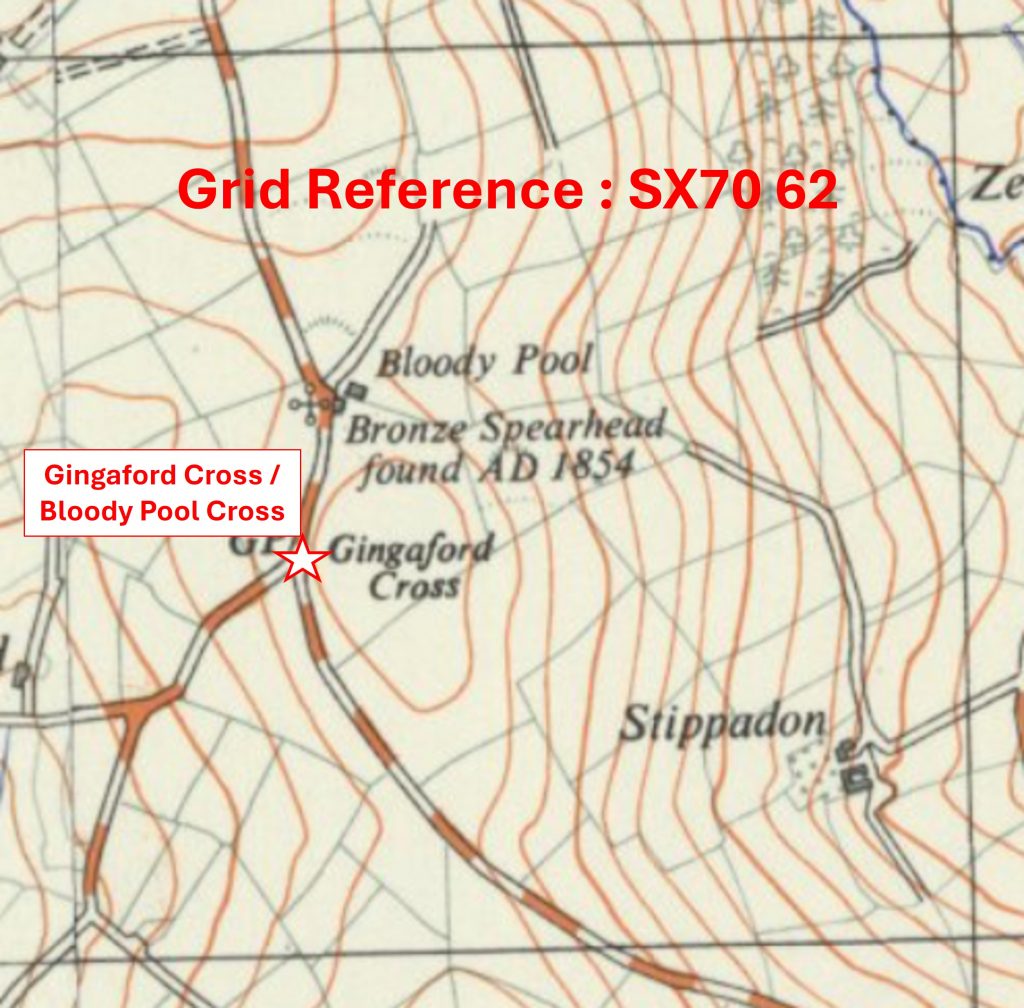
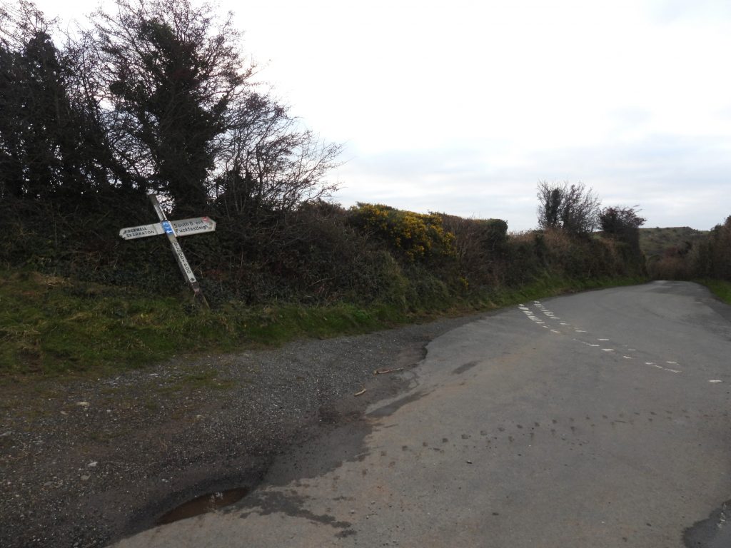
7062 a
Grid Reference SX70 62. The item chosen to represent this square is Gingaford Cross / Bloody Pool Cross
7062 b
Grid Reference SX70 62. Gingaford Cross / Bloody Pool Cross is located at SX70255 62447
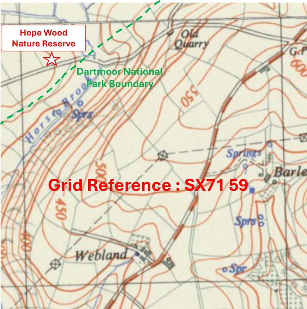
7160 a
Grid Reference SX71 60. The item chosen to represent this square is a Dartmoor National Park Sign
7160 b
Grid Reference SX71 60. The Dartmoor National Park Sign is located at SX71960 60886
7161 a
Grid Reference SX71 61. The item chosen to represent this square is Furze Pen Farm Sign
7161 b
Grid Reference SX71 61. The Furze Pen Farm Sign is located at SX71655 61546
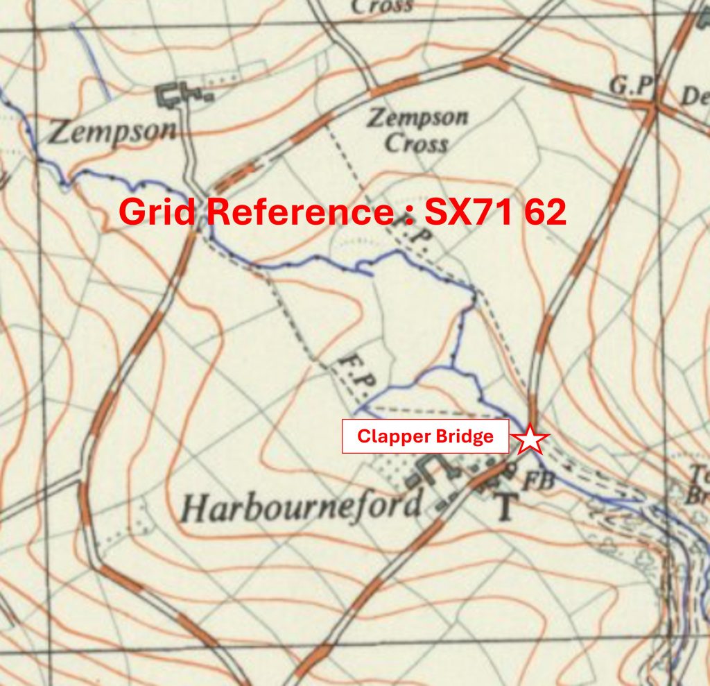
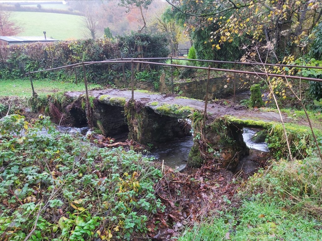
7162 a
Grid Reference SX71 62. The item chosen to represent this square is a Clapper Bridge
7162 b
Grid Reference SX71 62. The Clapper Bridge is located at SX71784 62311
Total Page Visits: 86 - Today Page Visits: 1

Next Post

Leave a Reply

© 2026 Dartmoor Explorations

Theme by Anders Norén

Social media & sharing icons powered by UltimatelySocial