Dartmoor Explorations

A collection of walks, discoveries, insights and pictures of exploring Dartmoor National Park

Dartmoor 1000 – North West

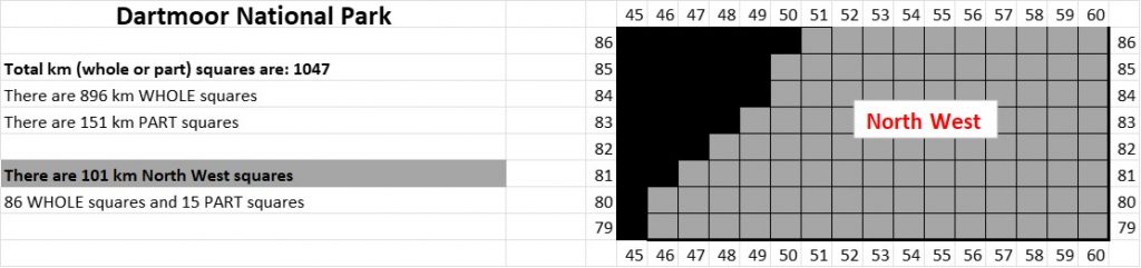
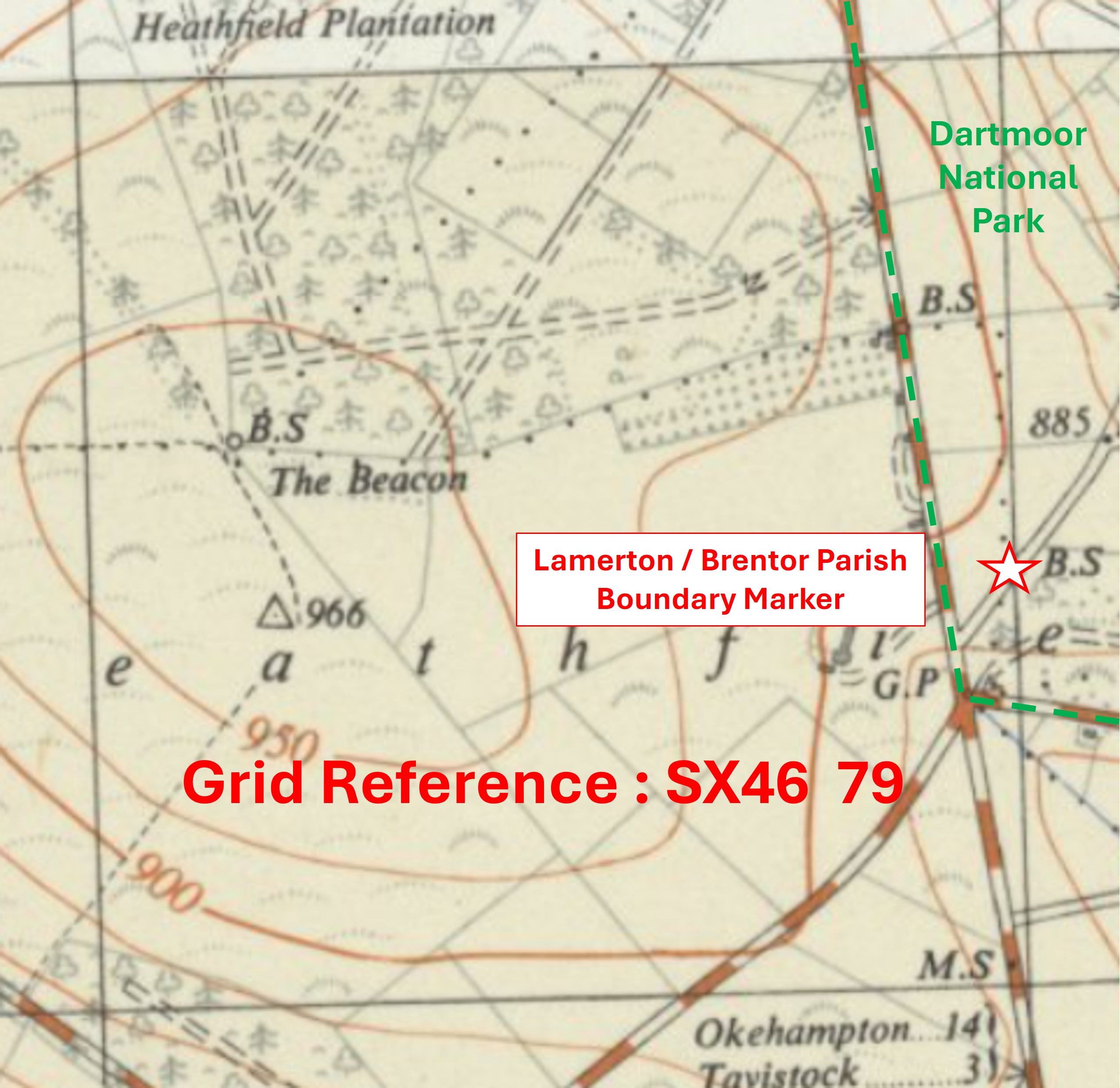
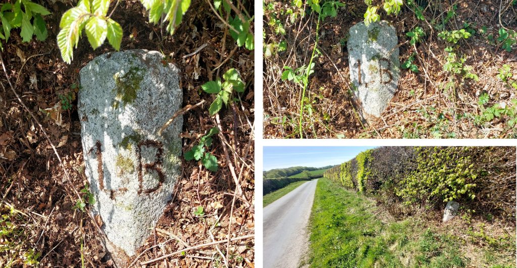
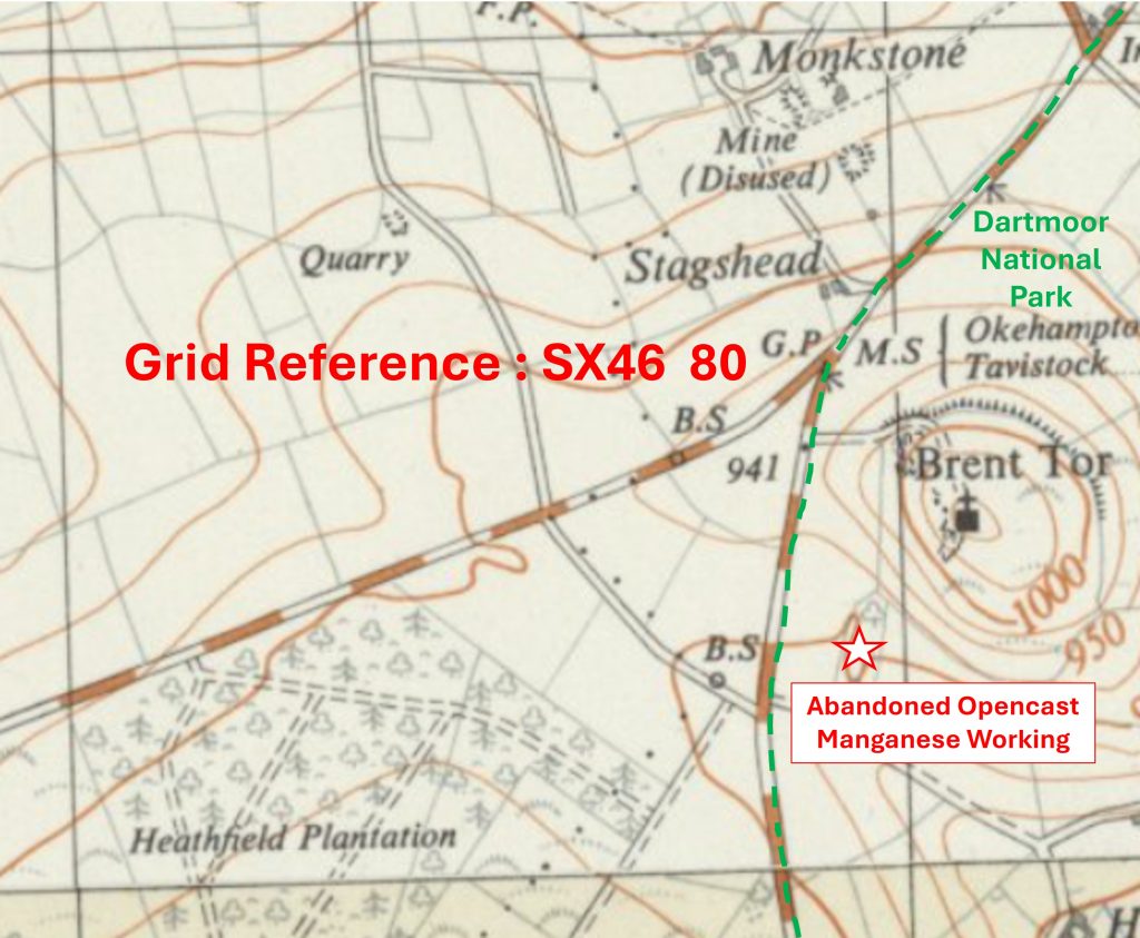
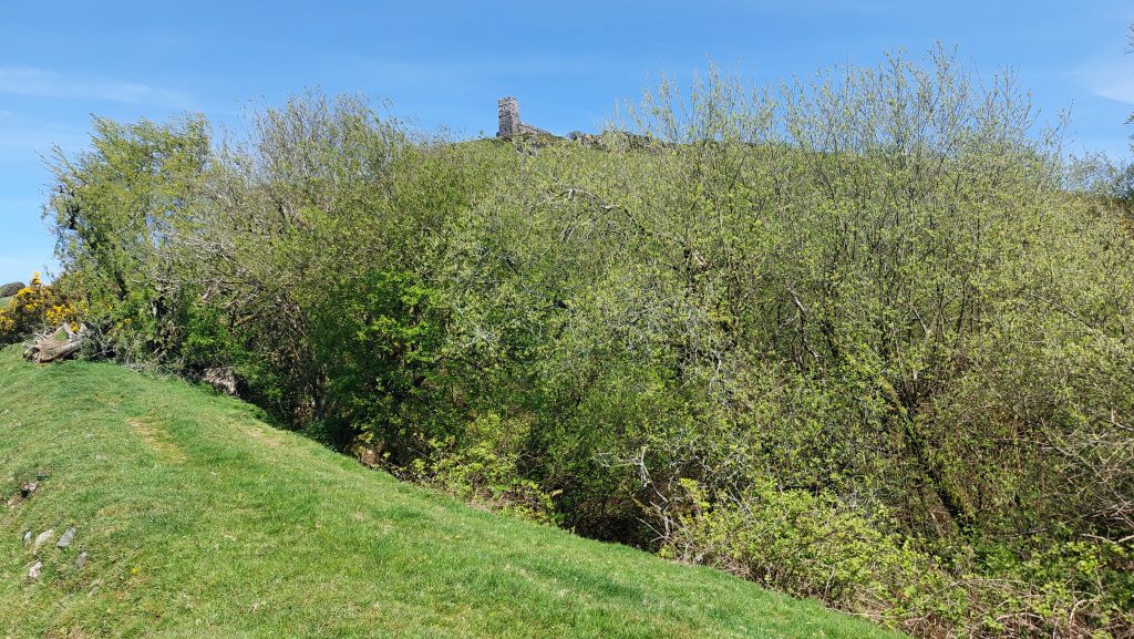
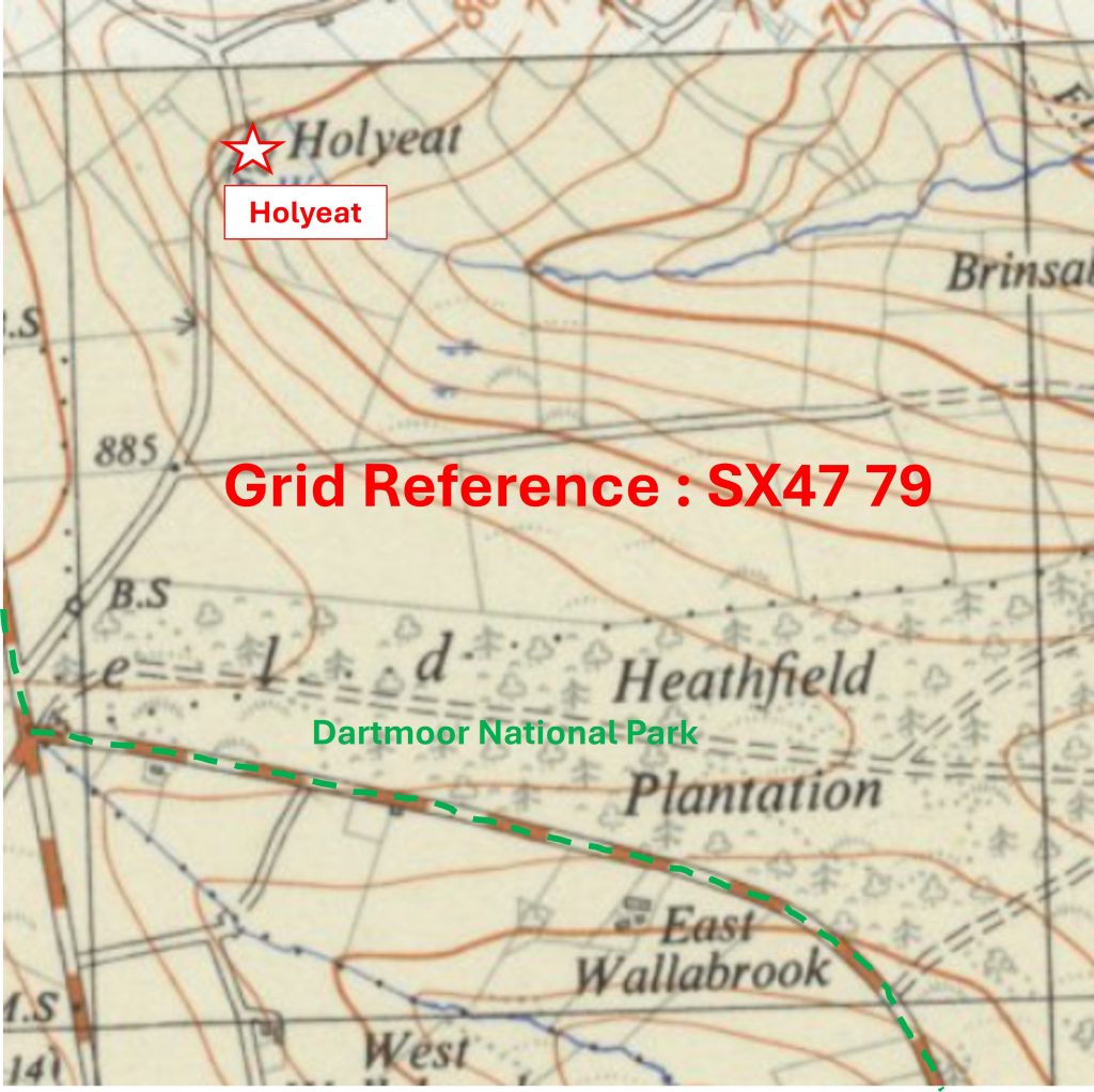
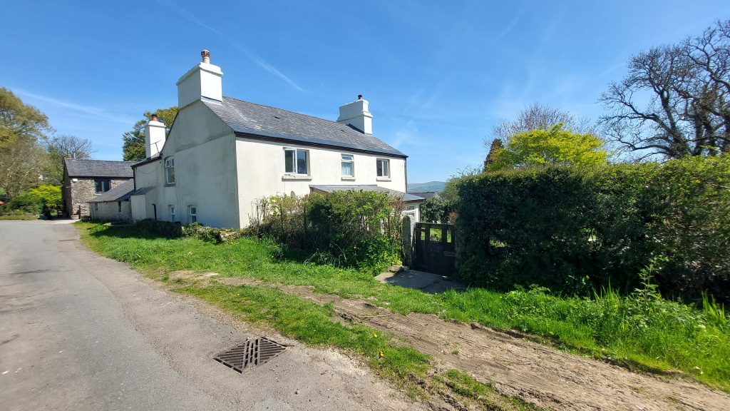
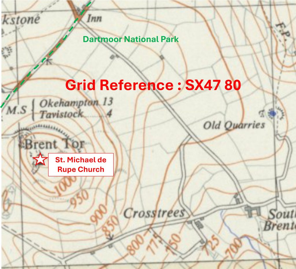
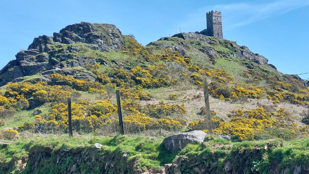
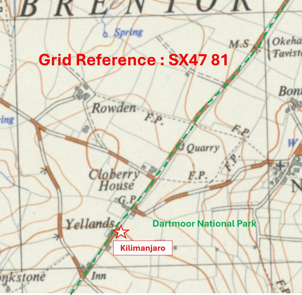
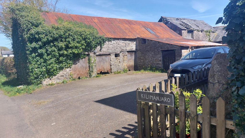
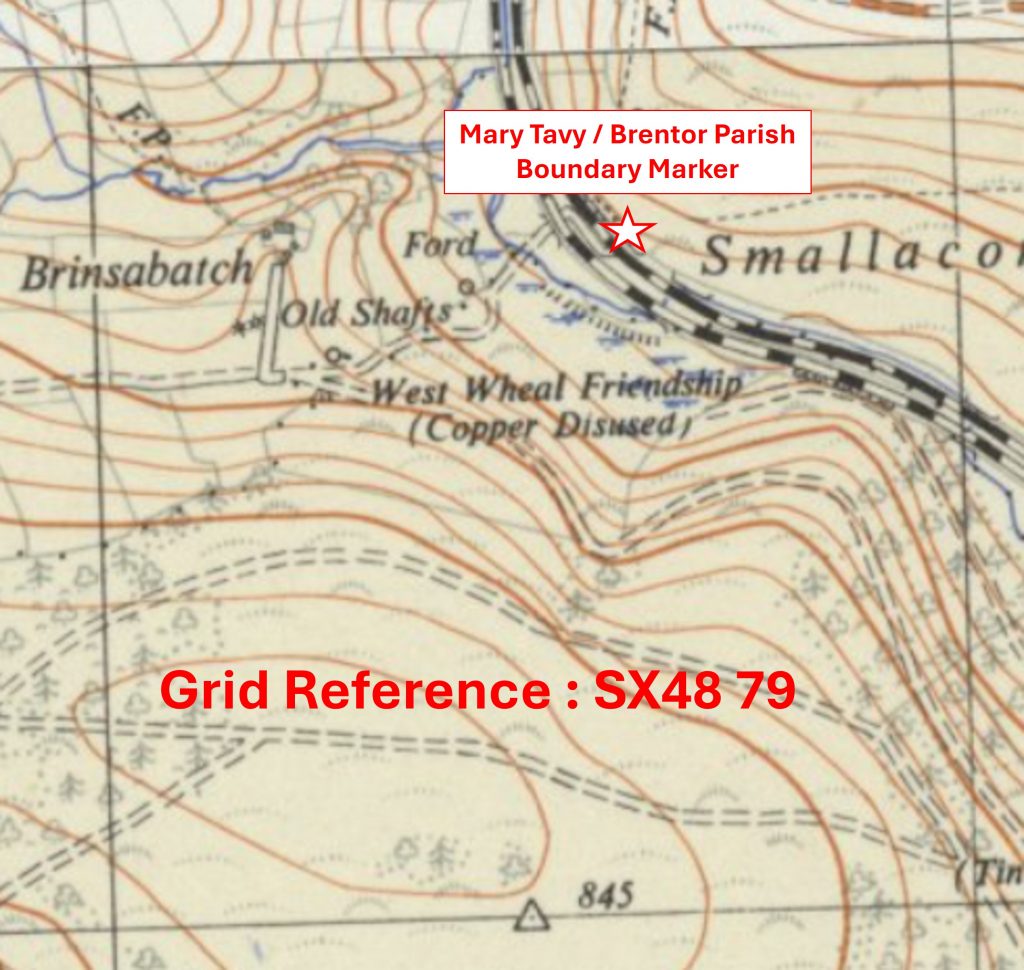
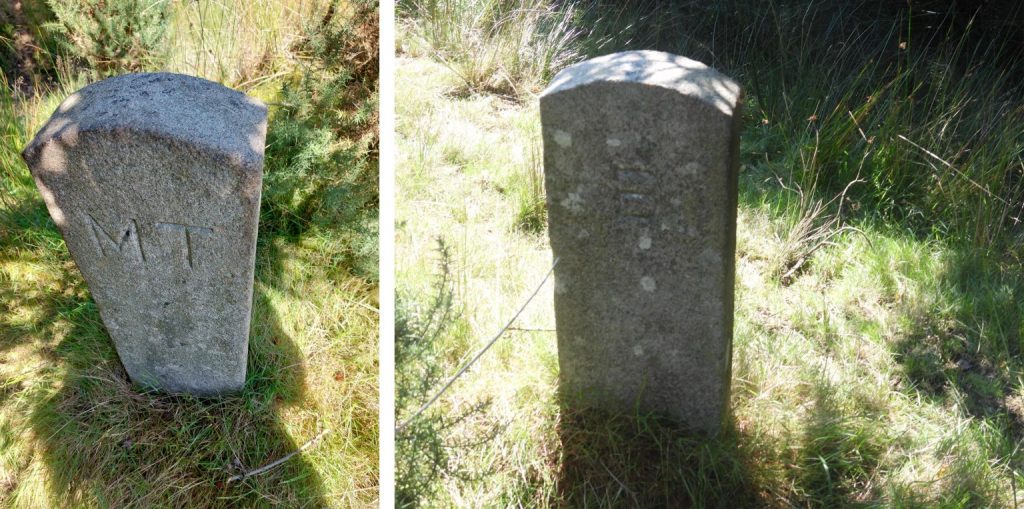
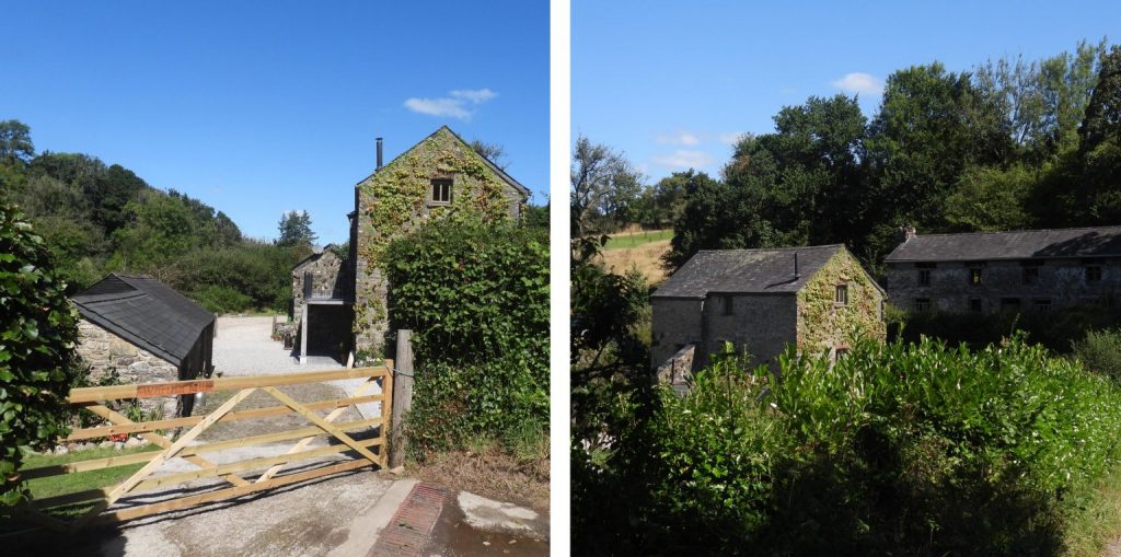
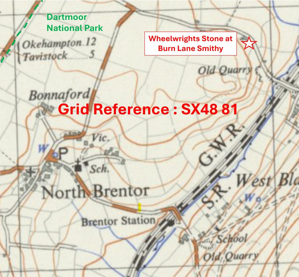
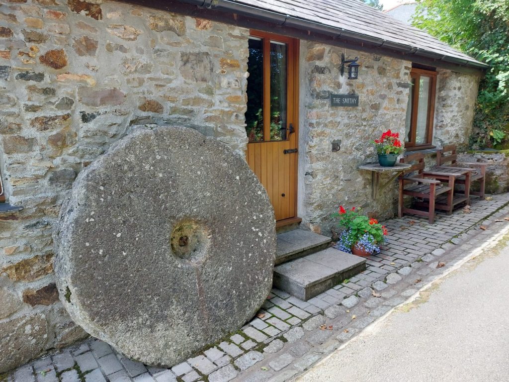
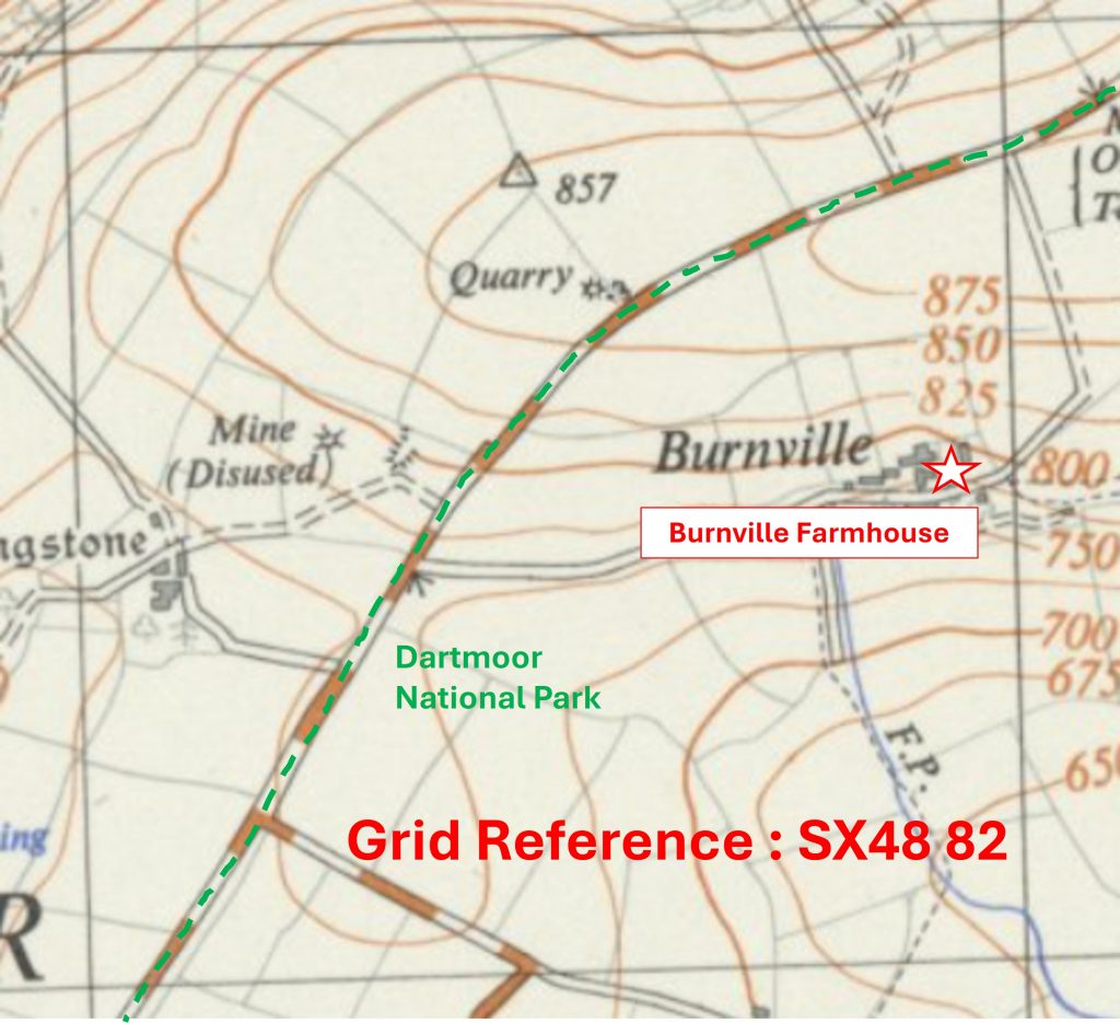
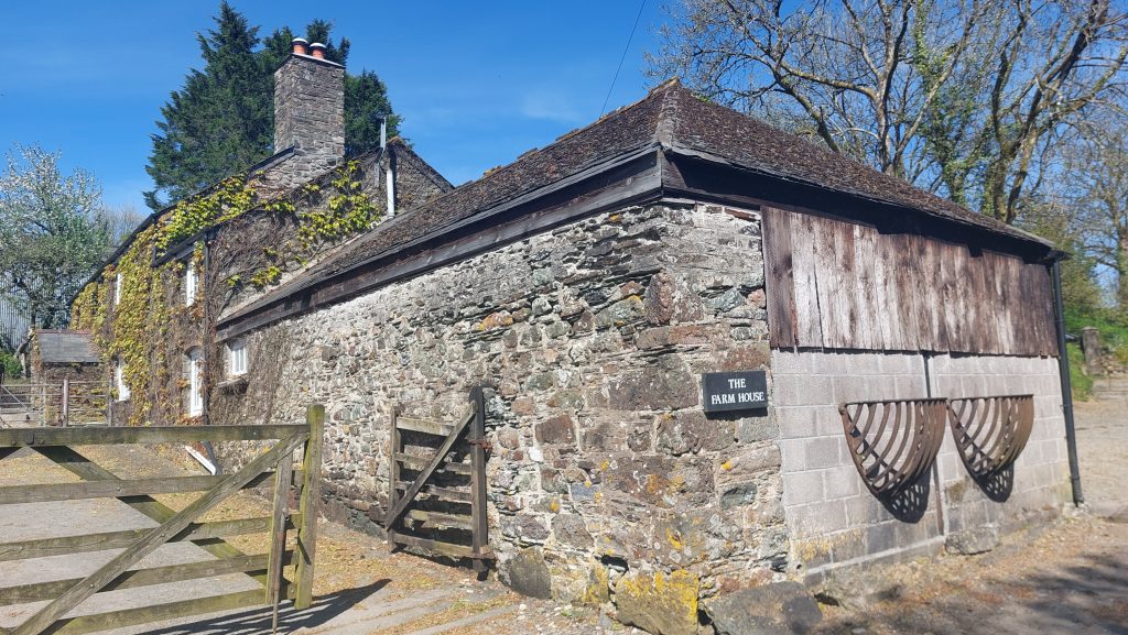
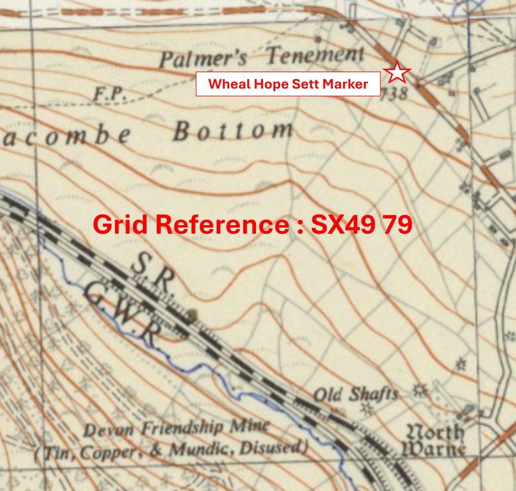
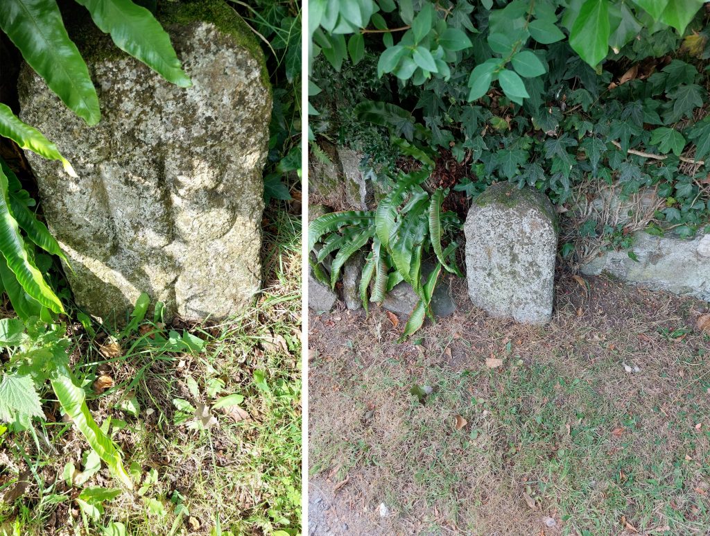
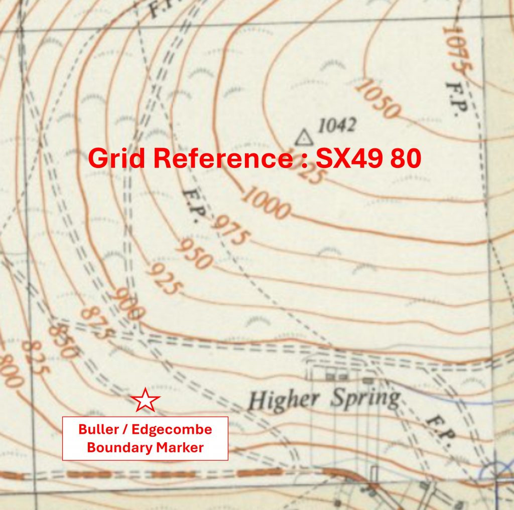
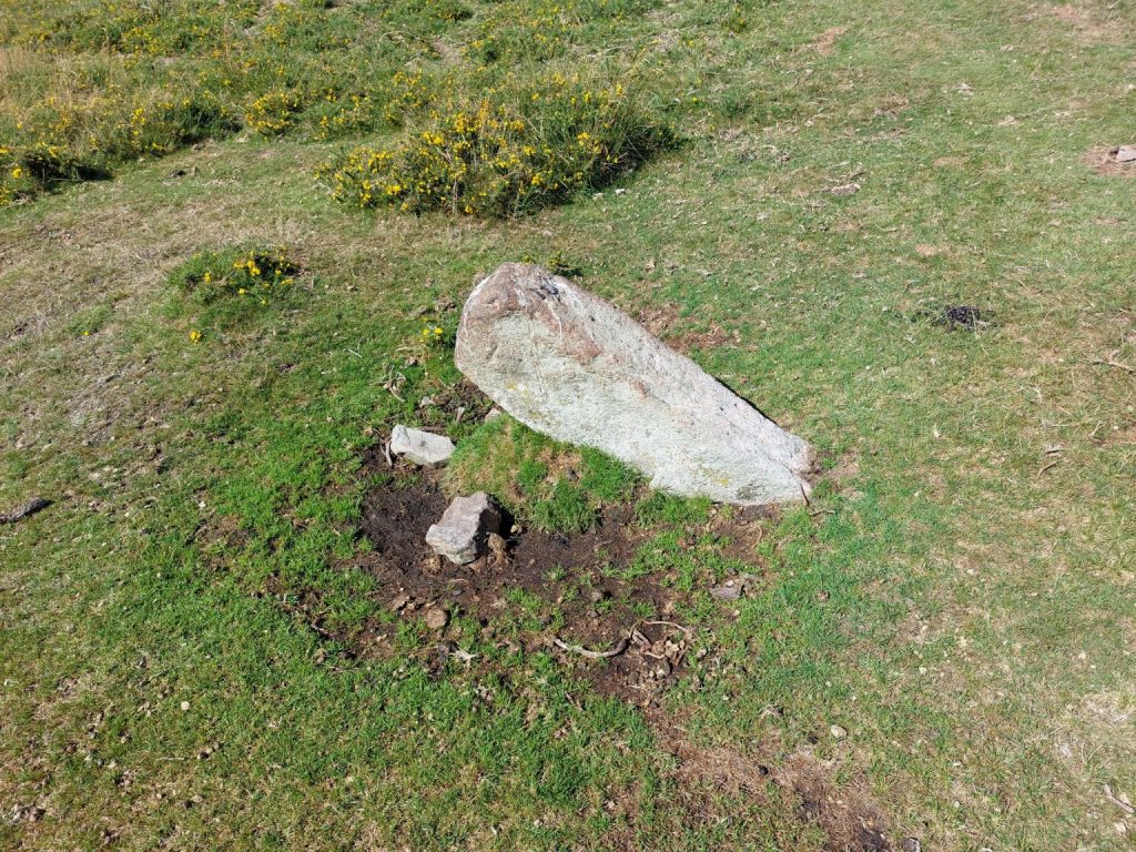
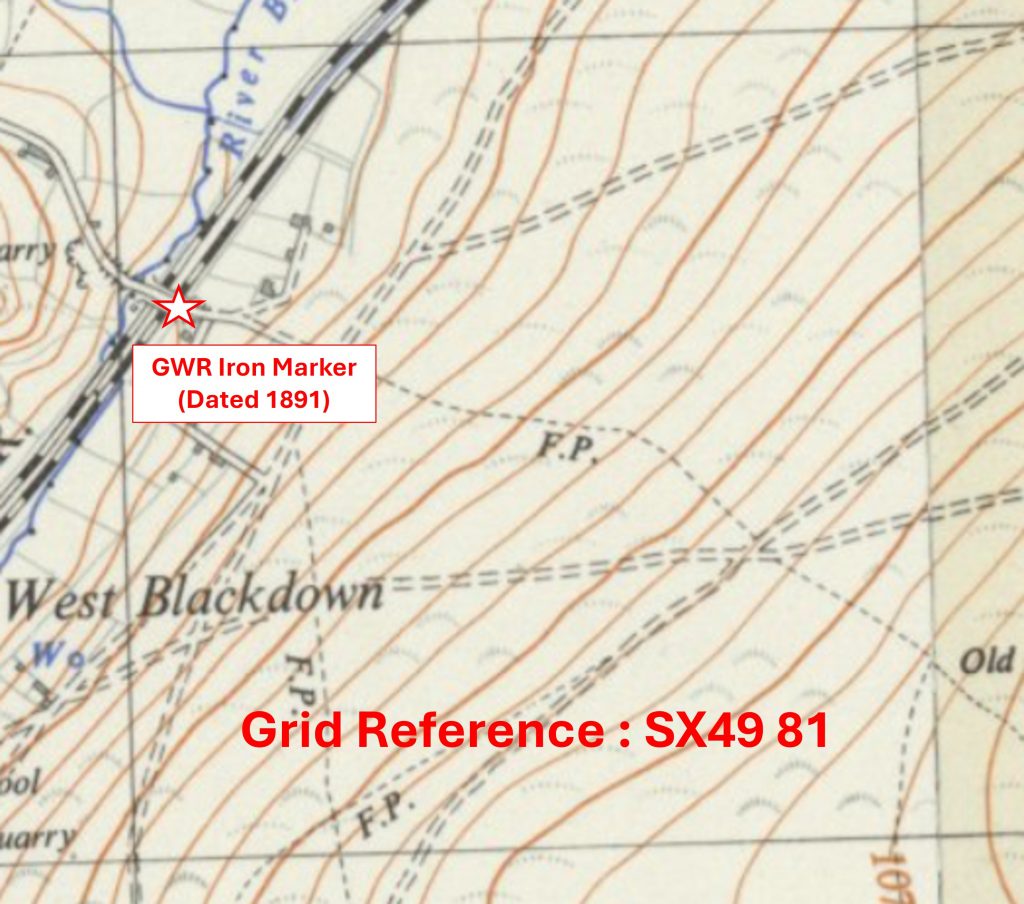
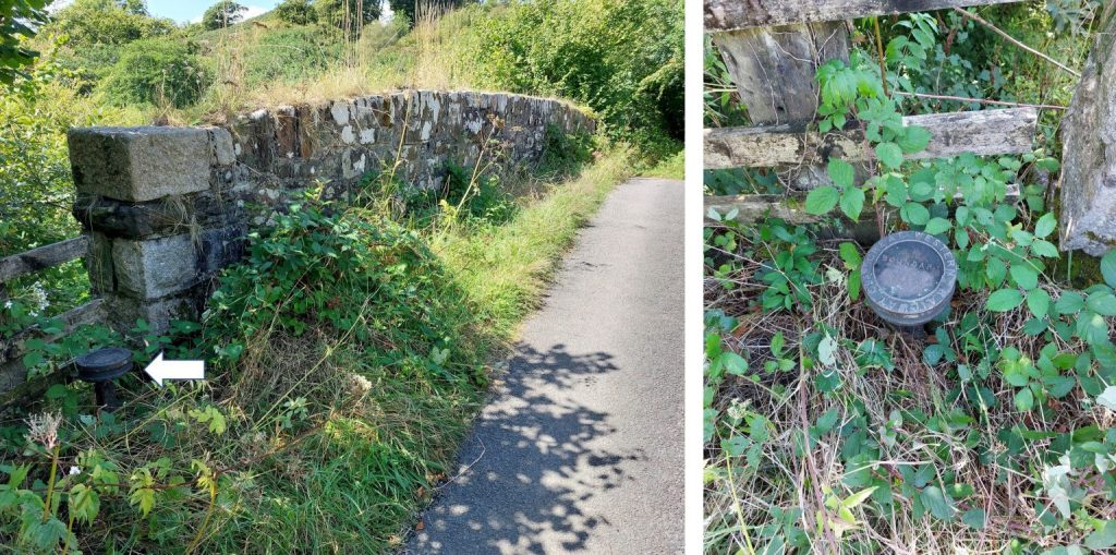
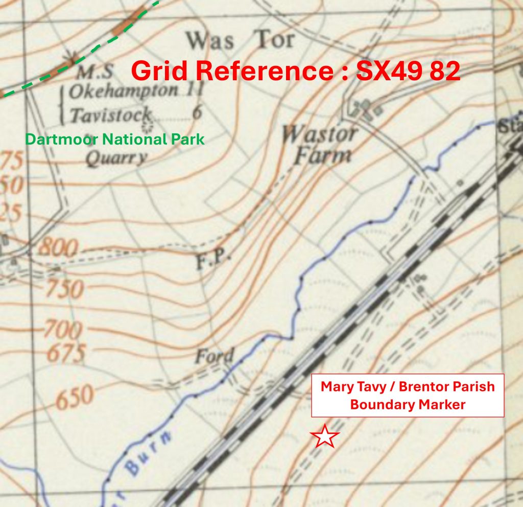
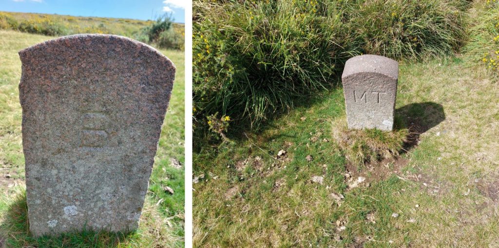
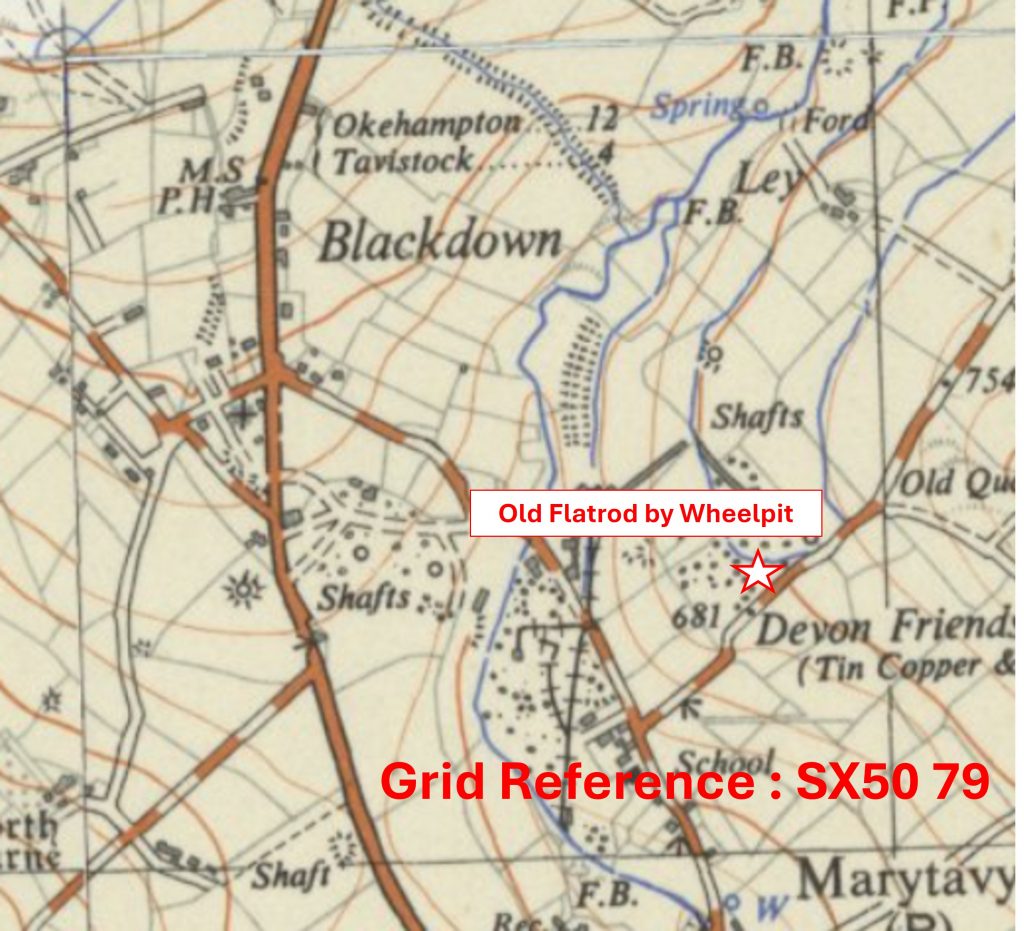
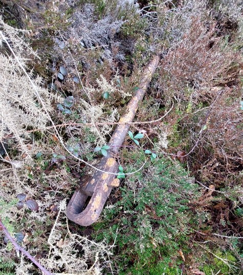
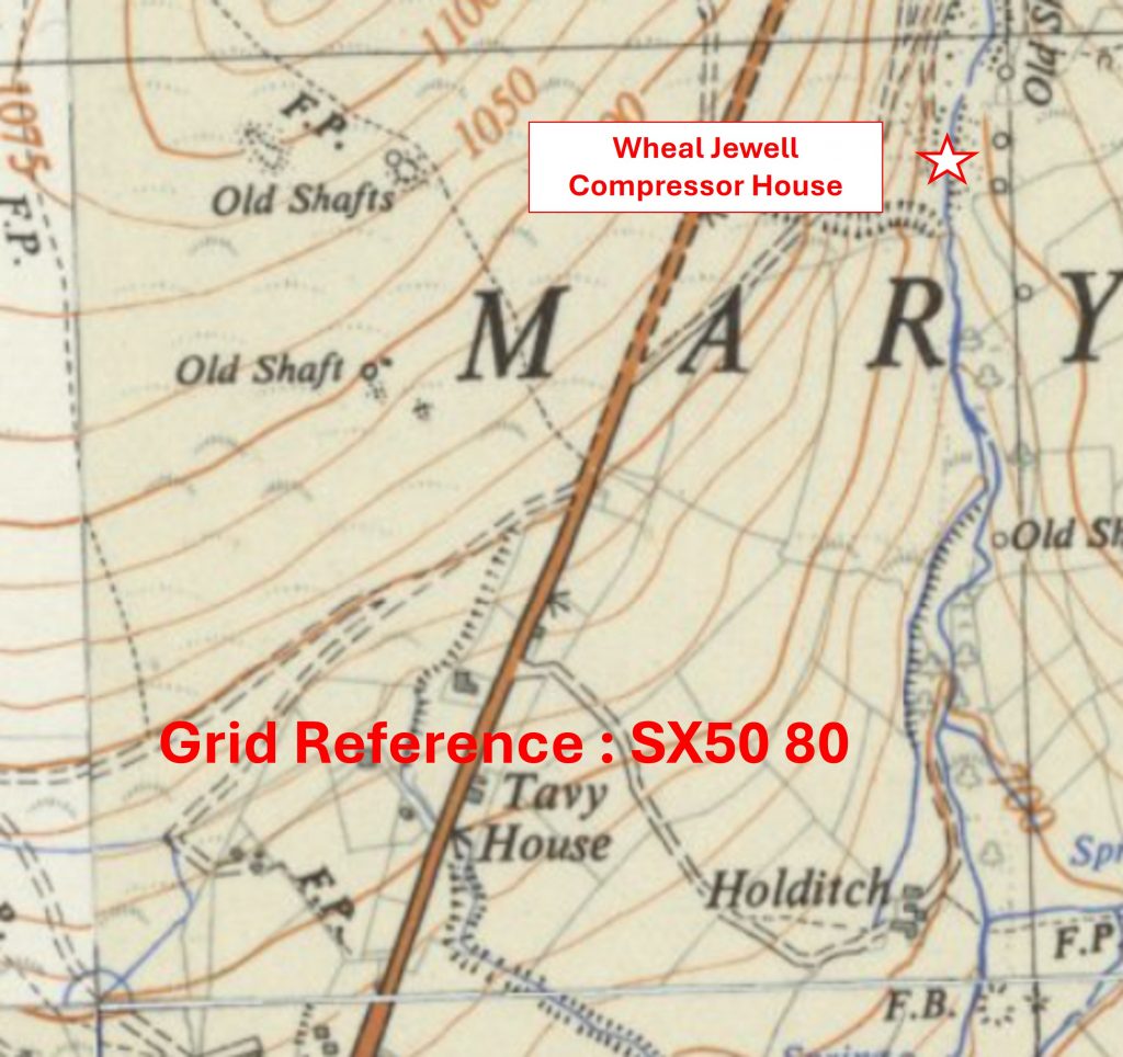
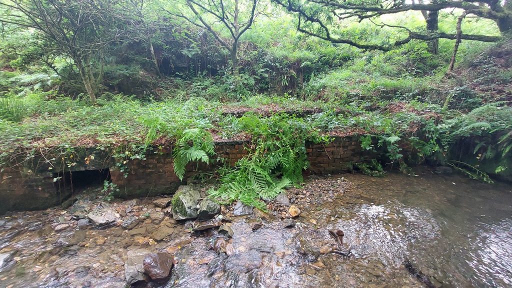
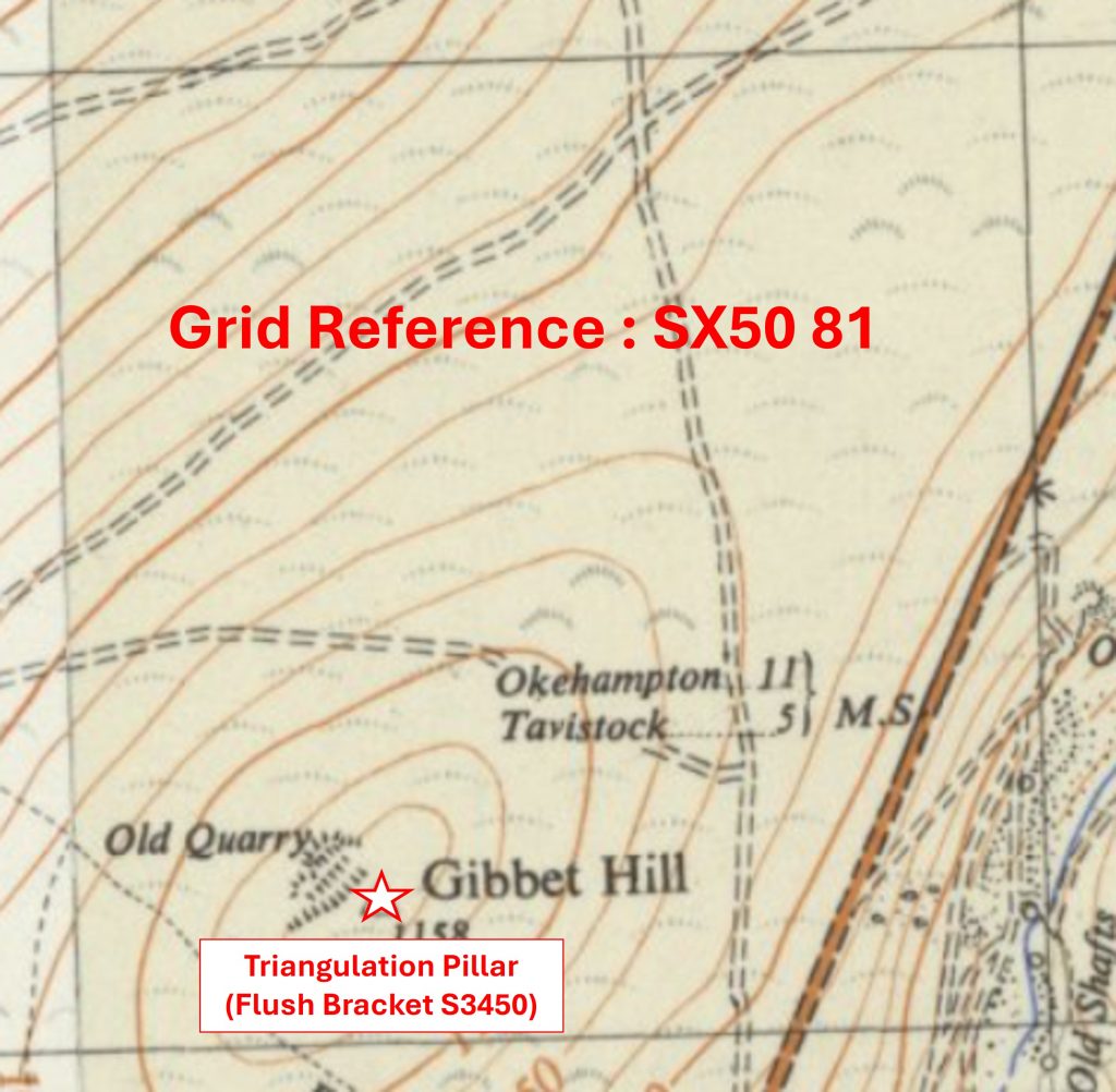
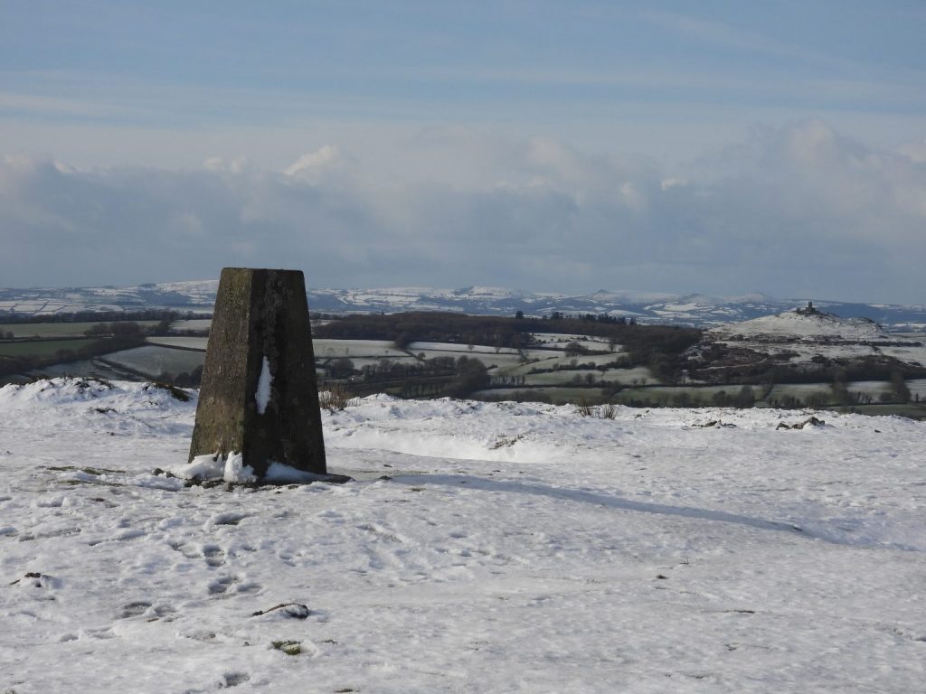
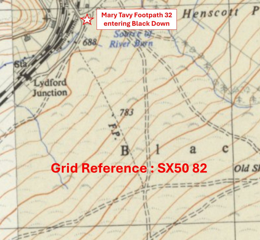
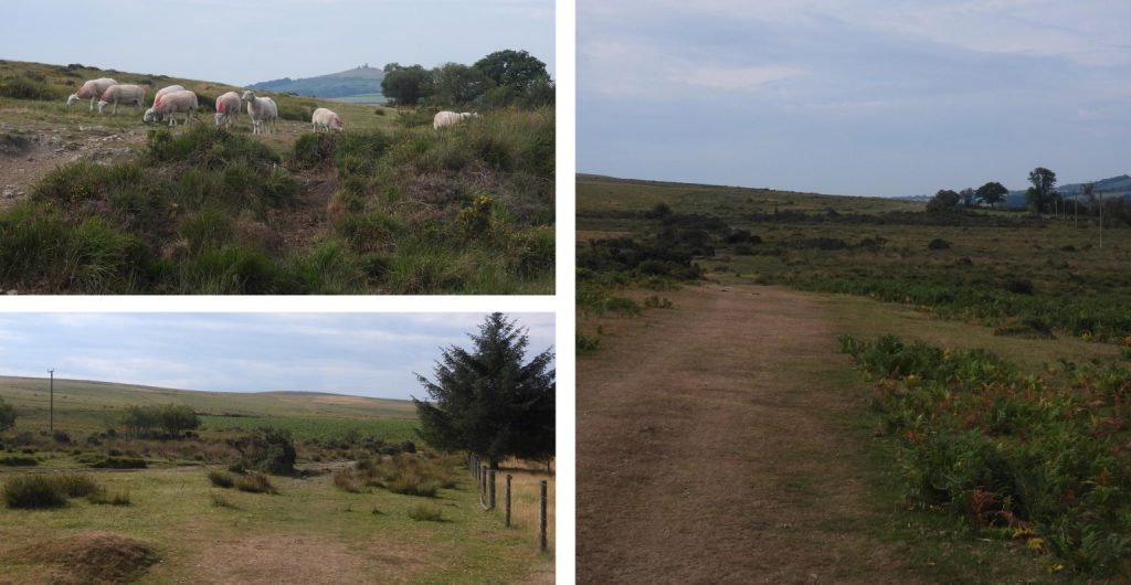
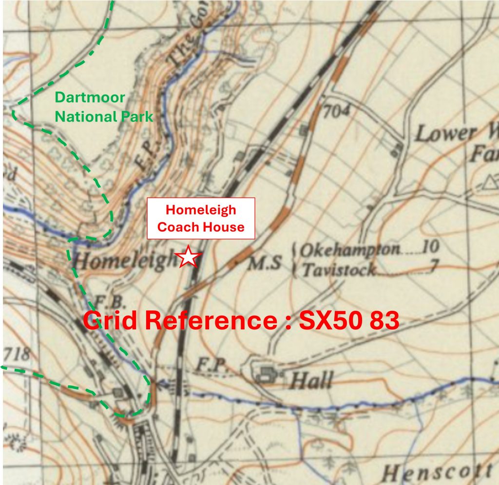
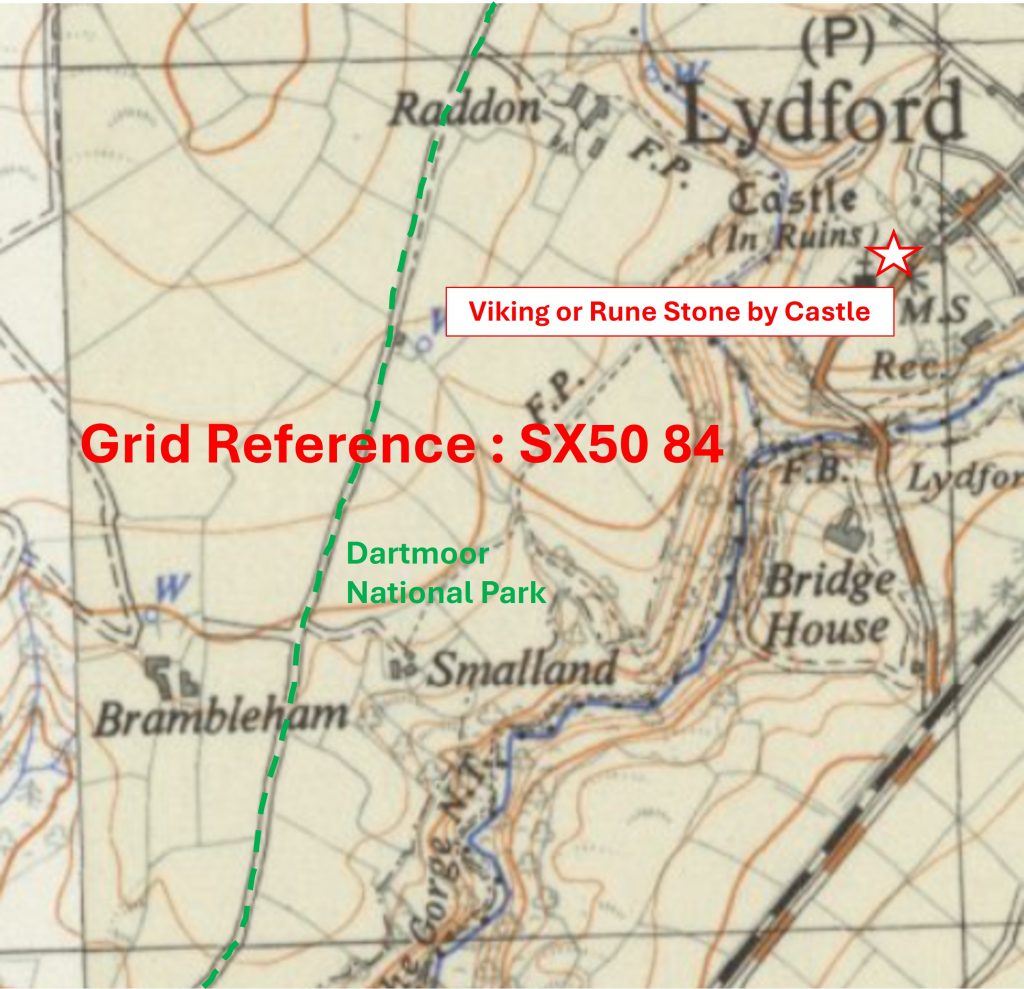
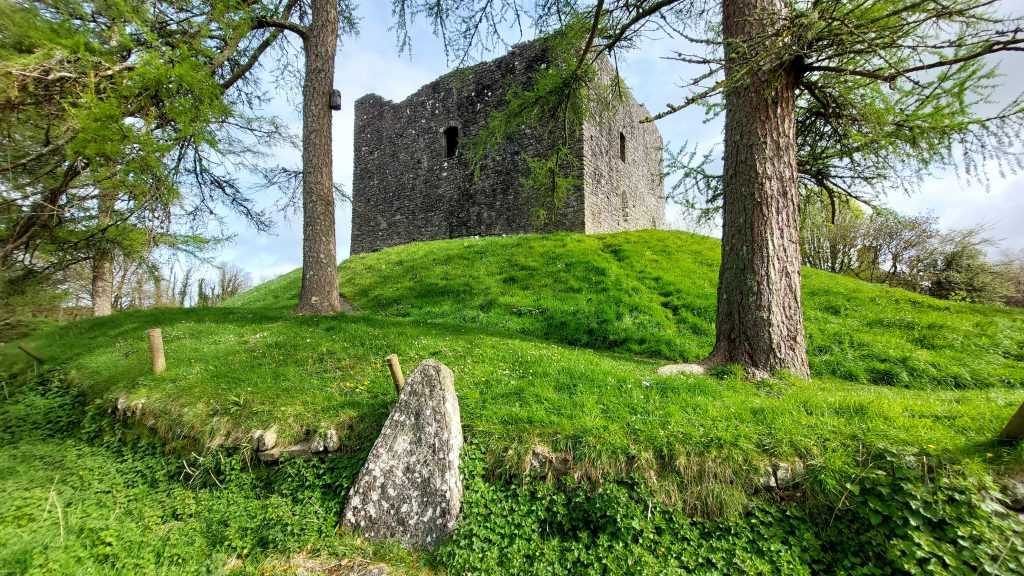
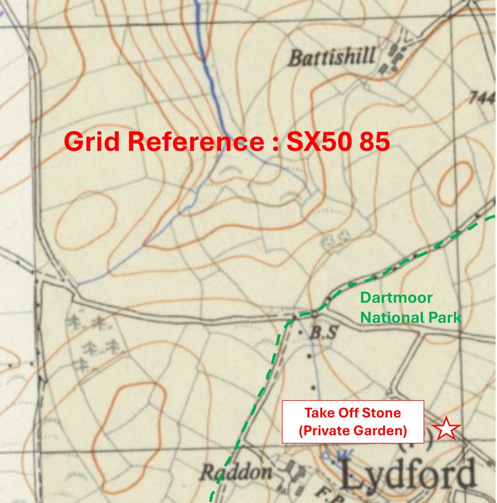
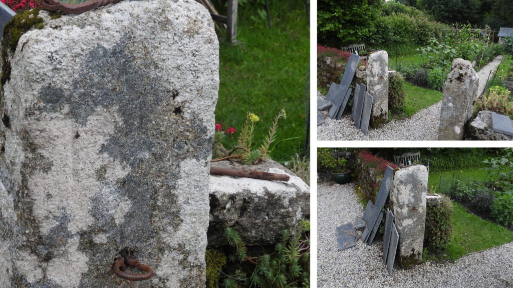
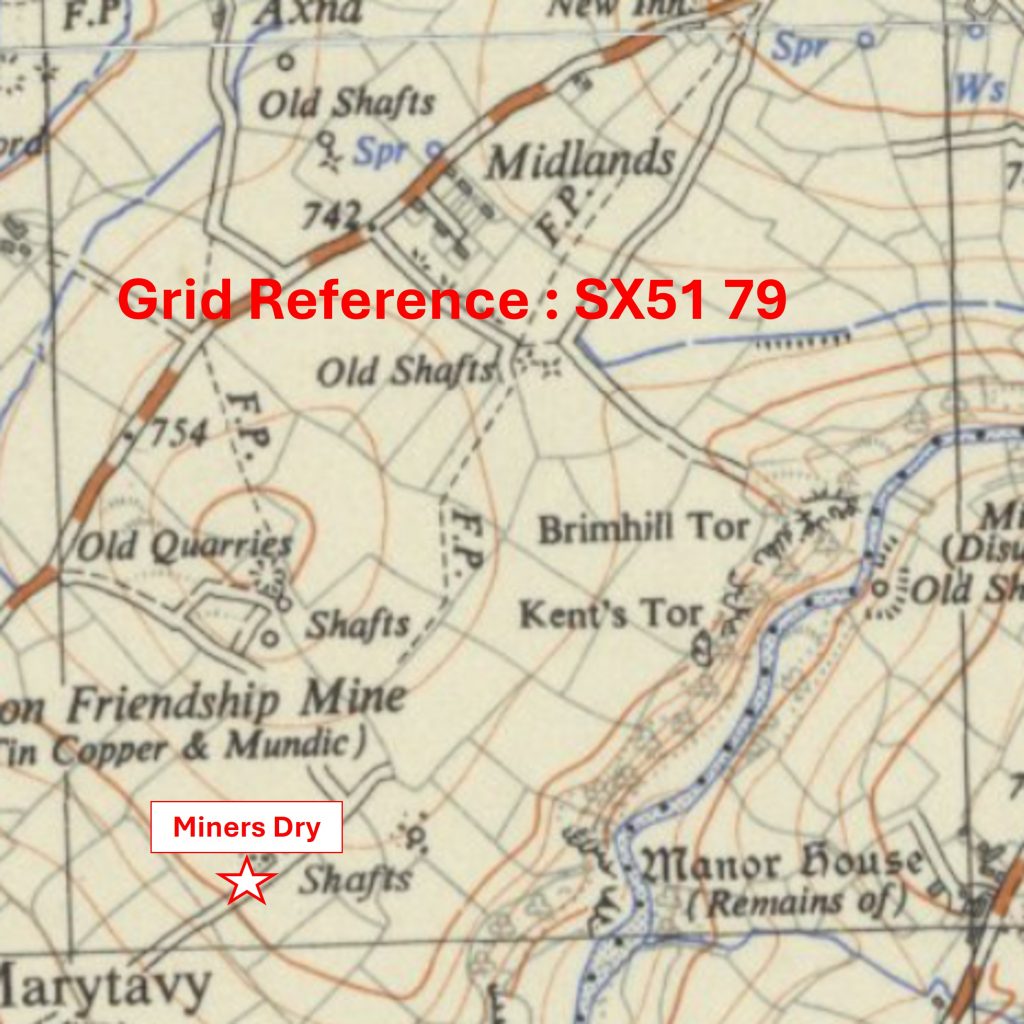
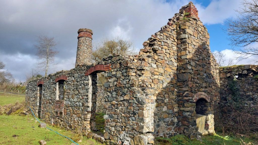
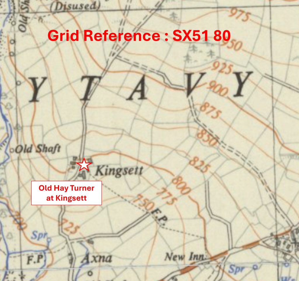
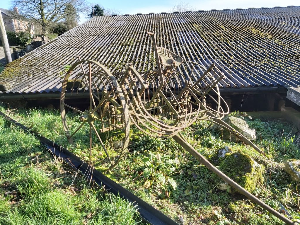
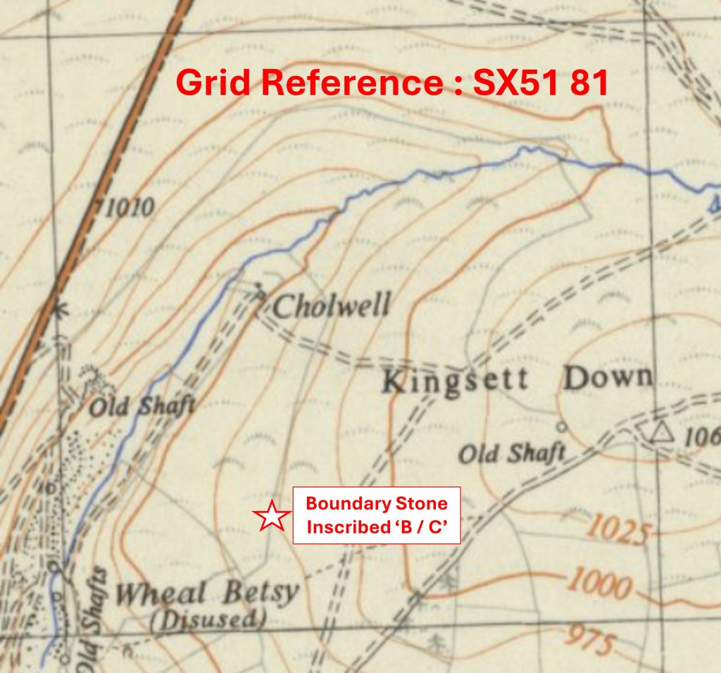
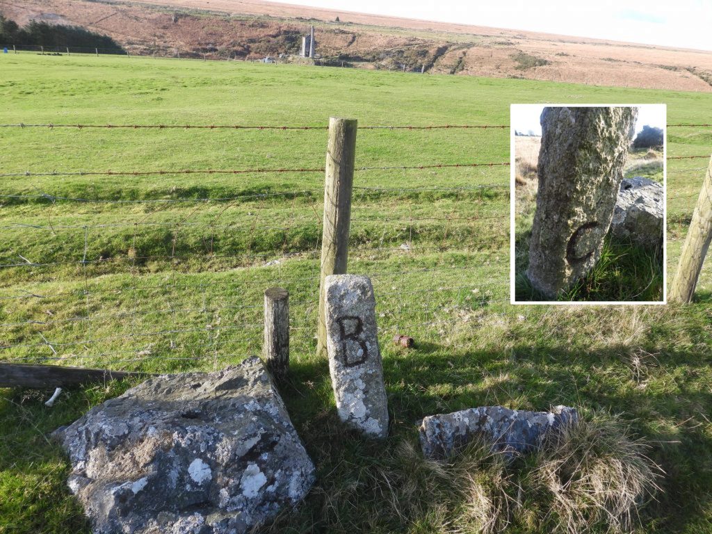
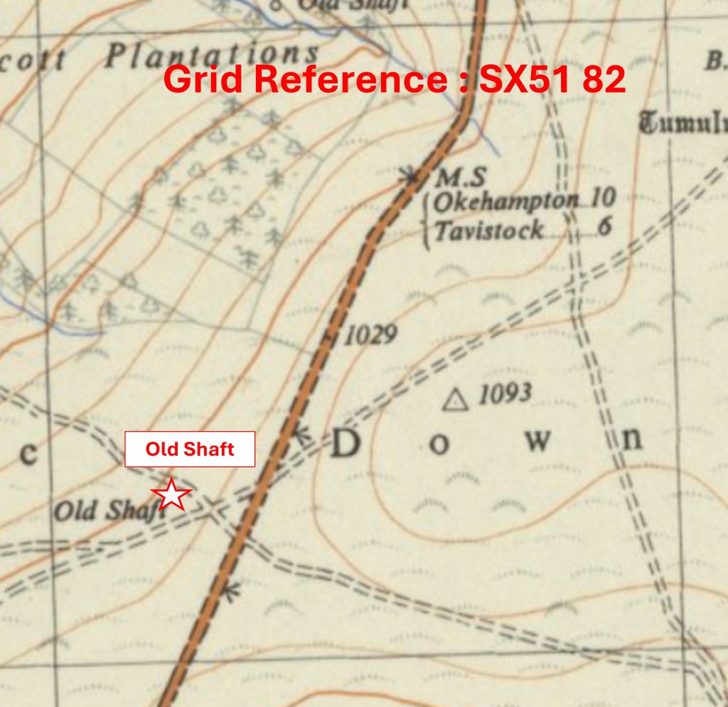
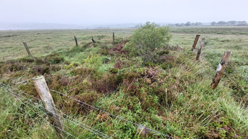
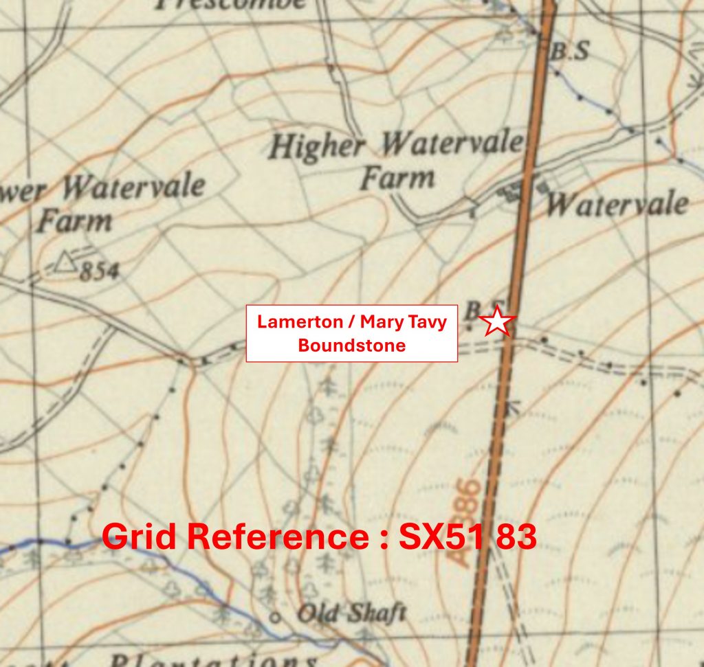
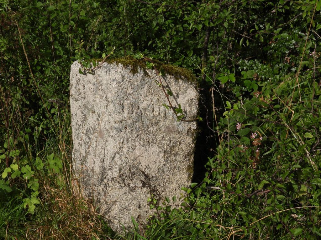
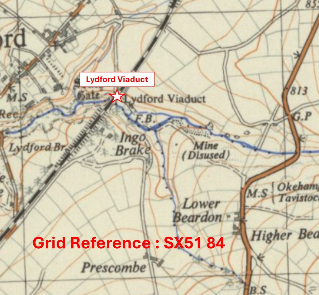
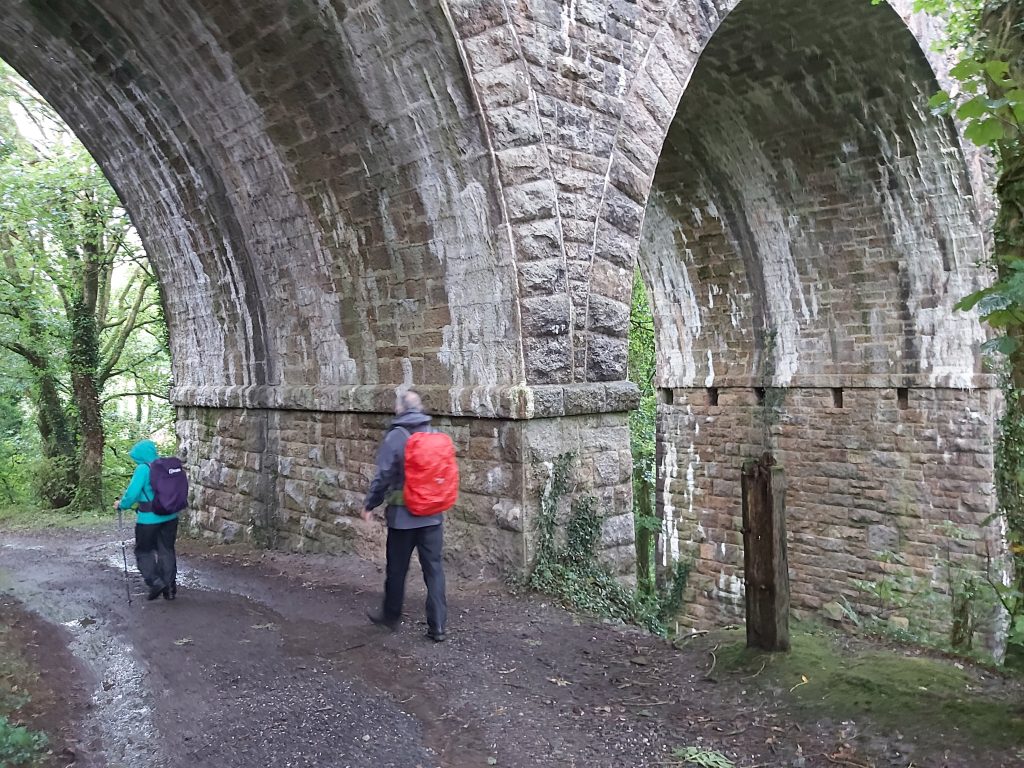
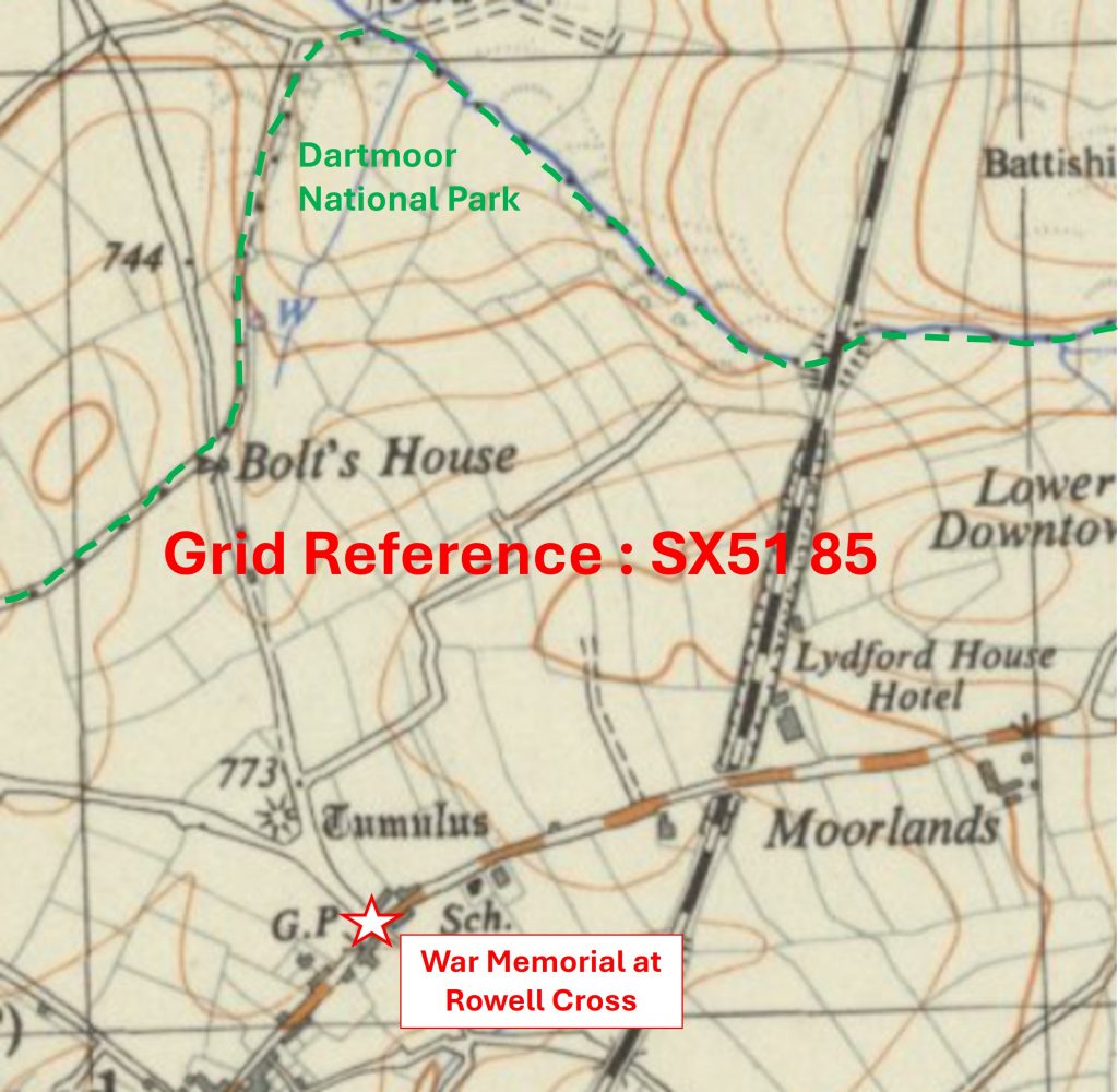
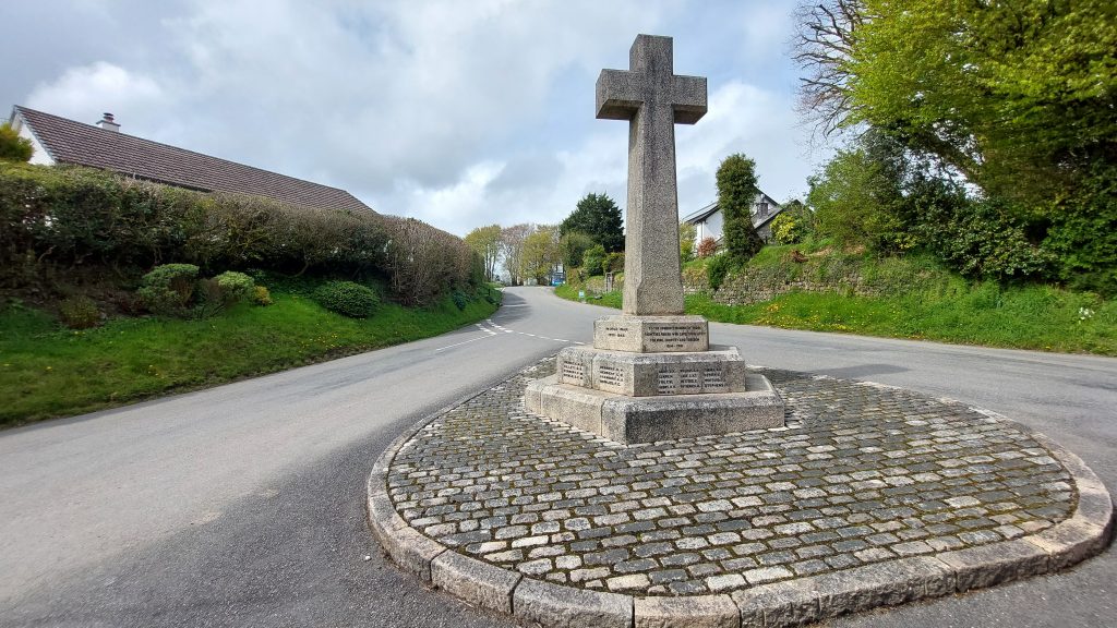
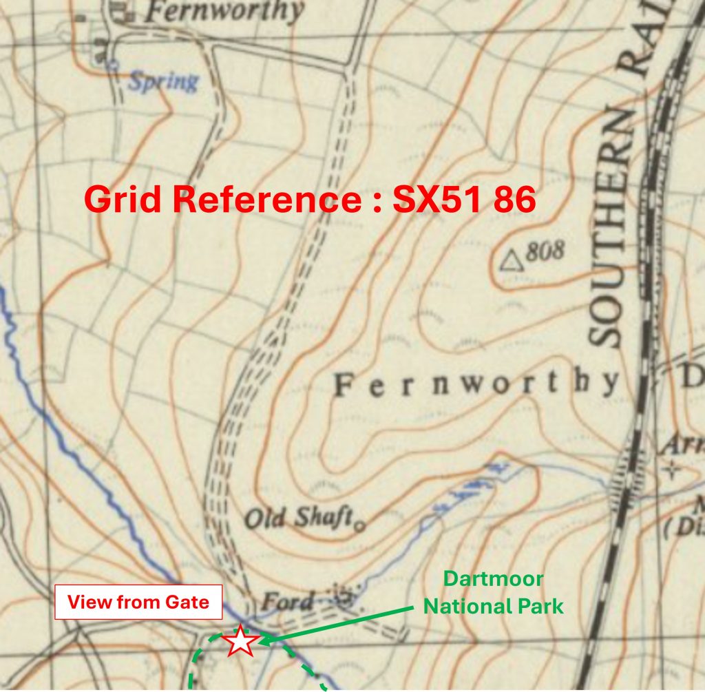
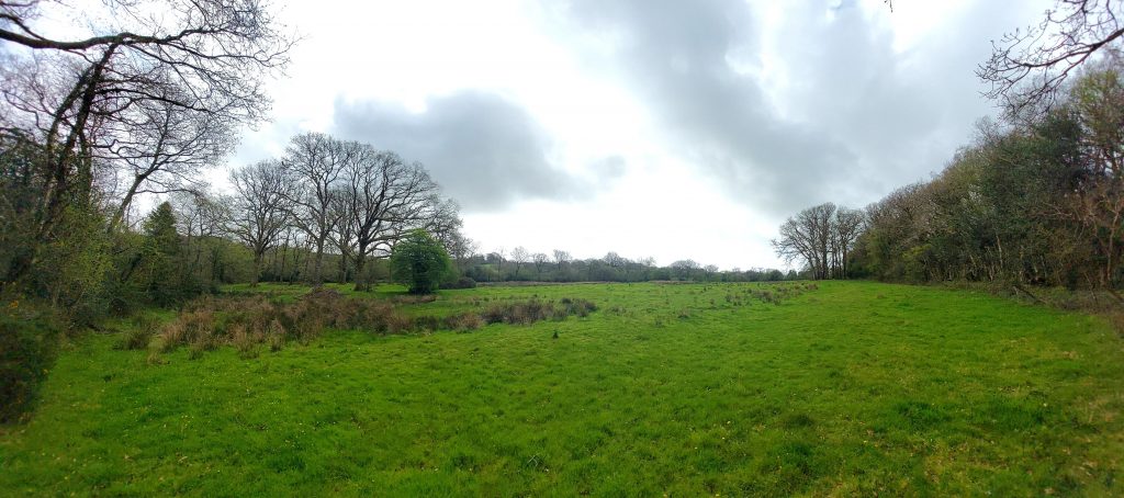
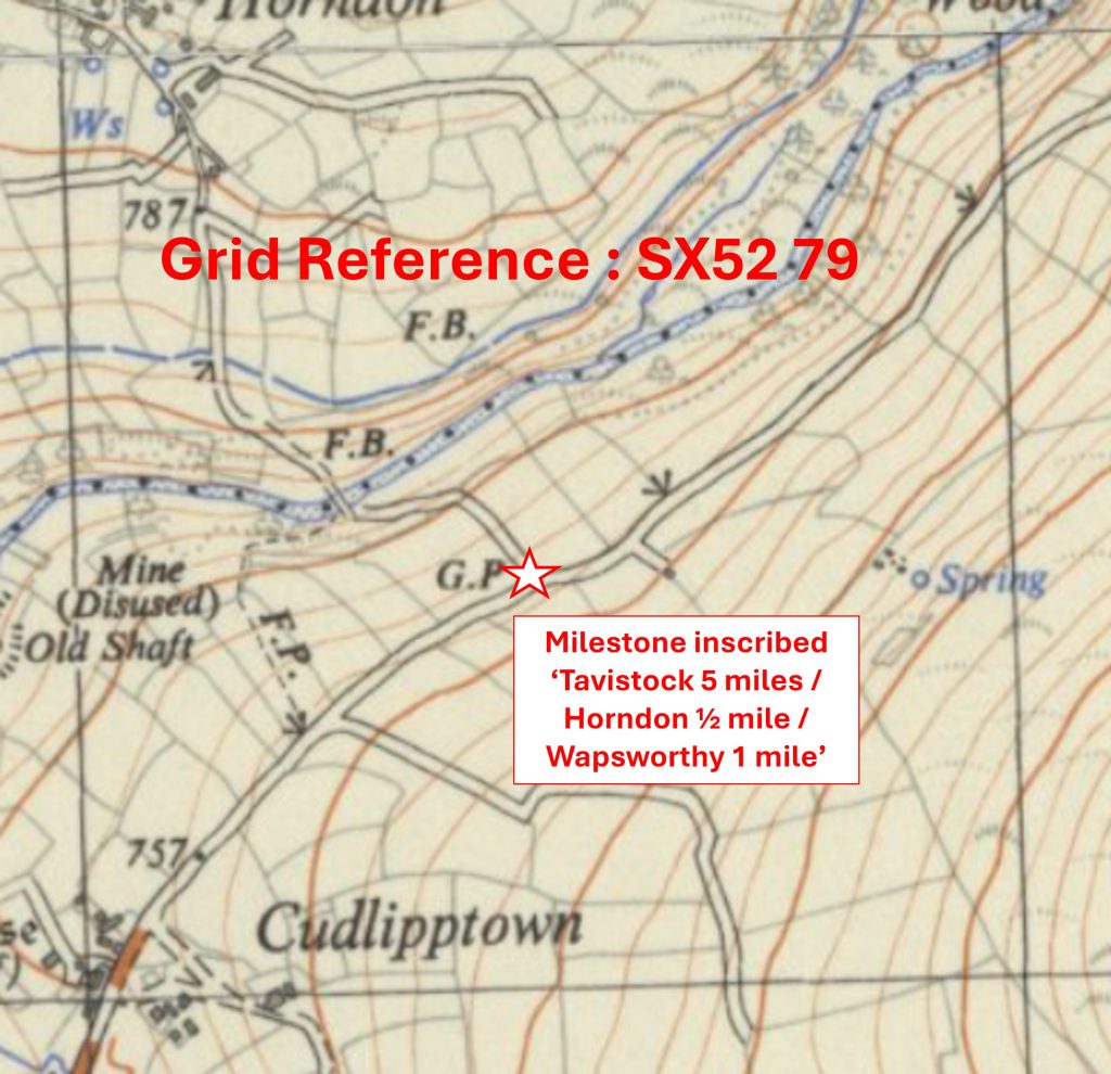
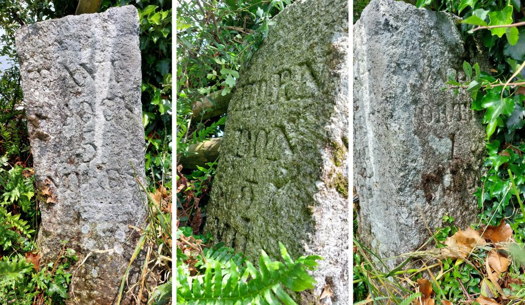
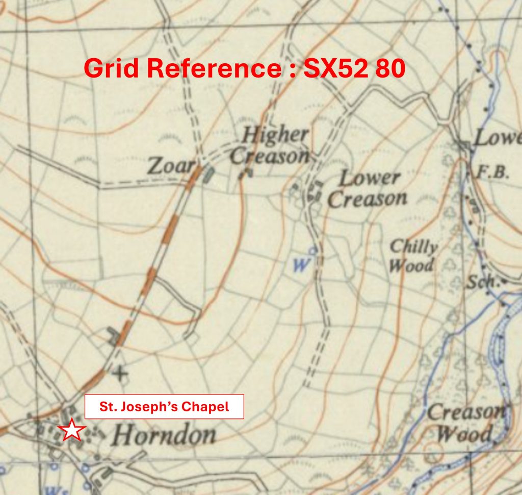
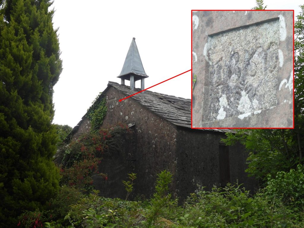
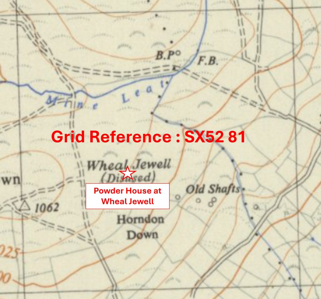
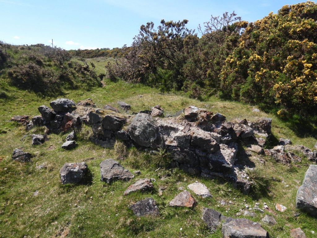
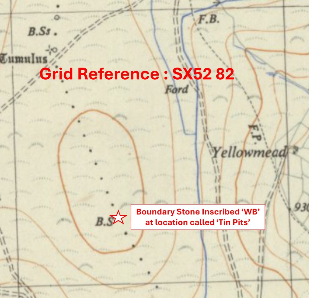
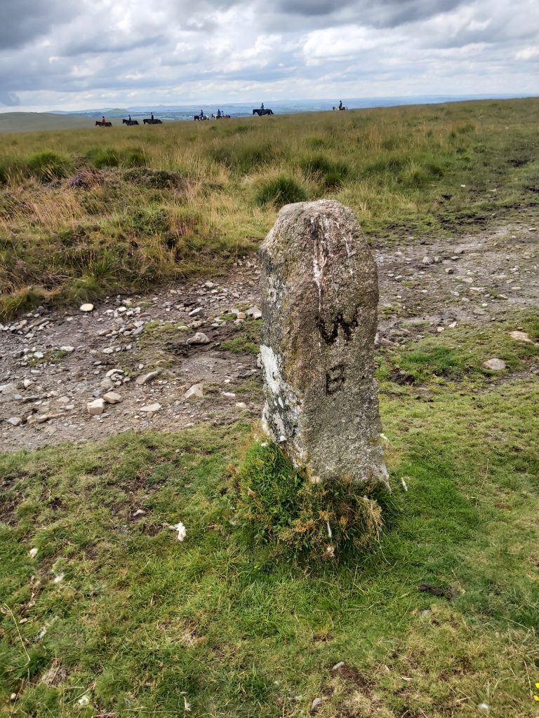
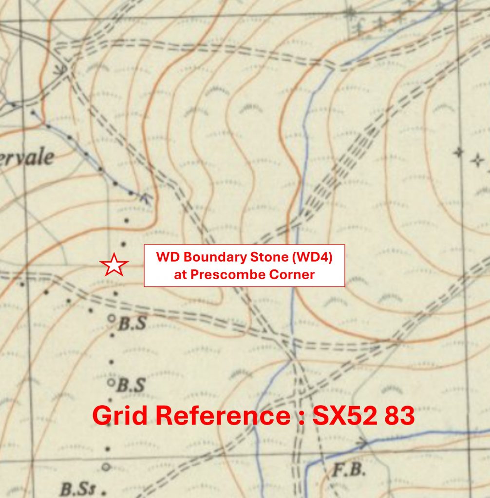
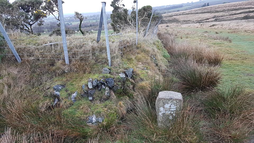
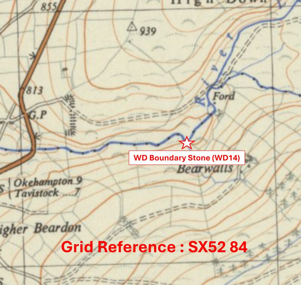
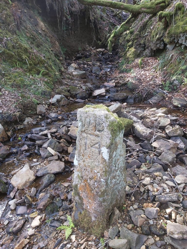
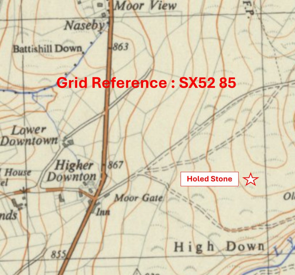
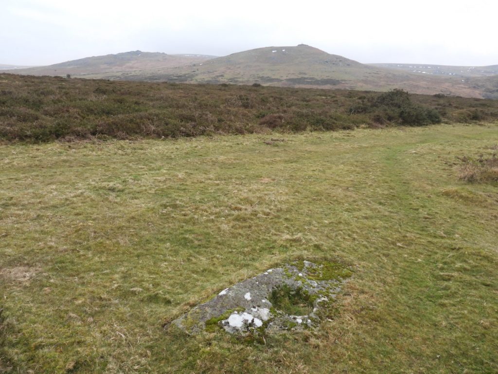
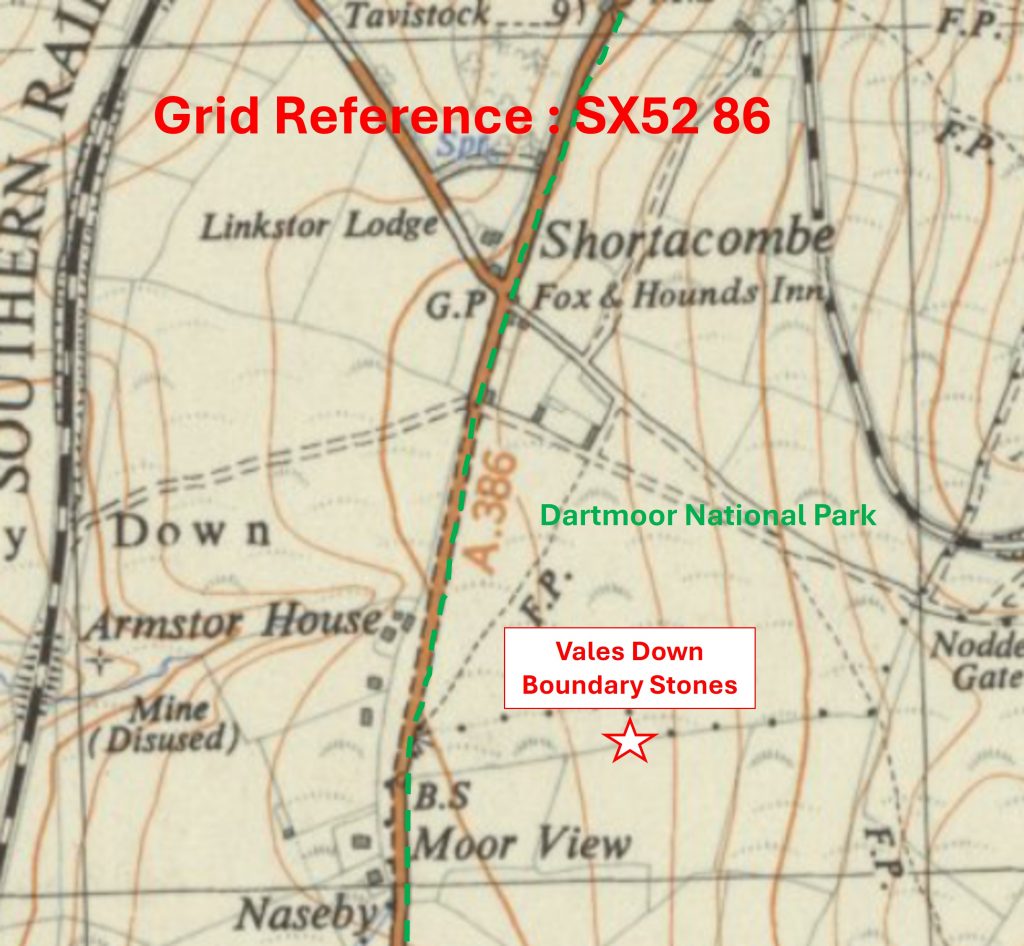
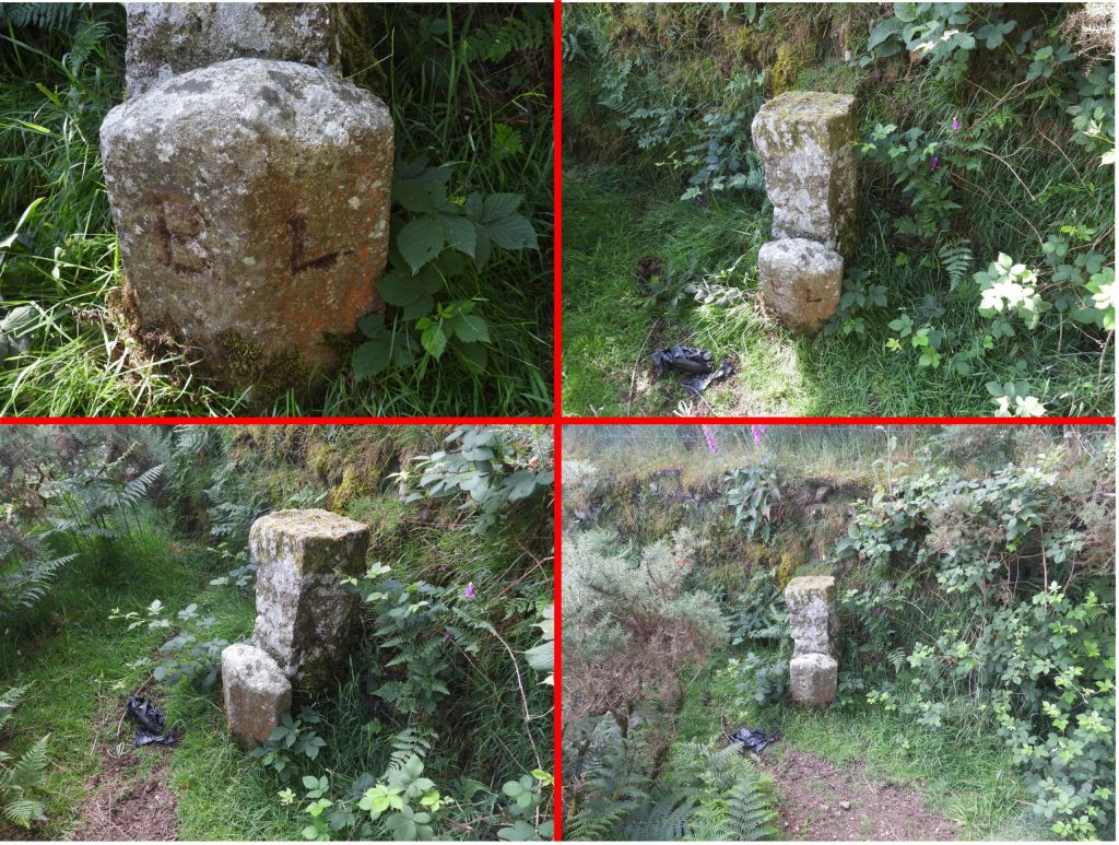
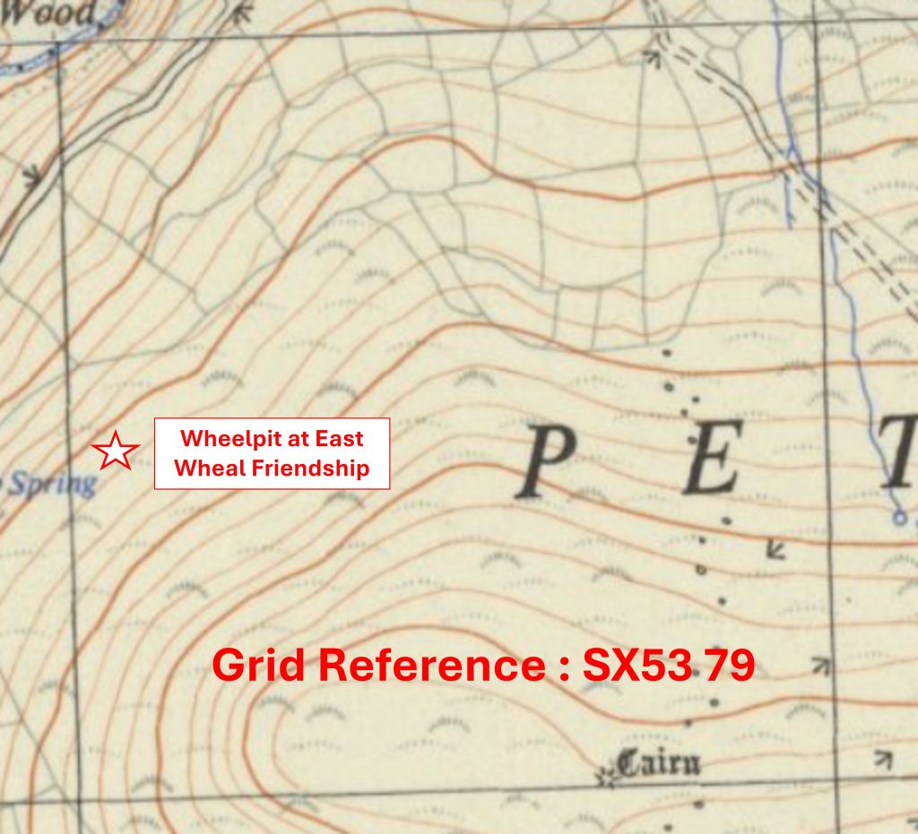
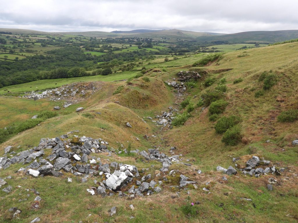
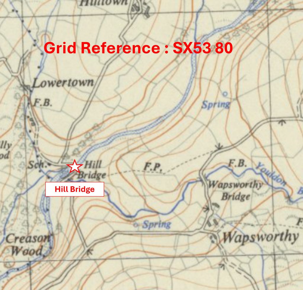
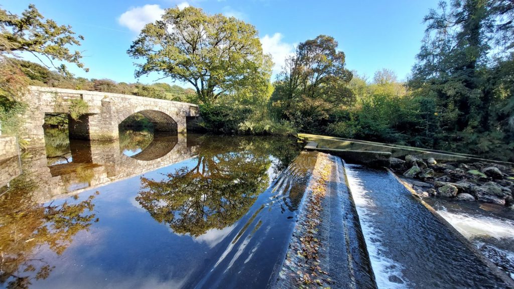
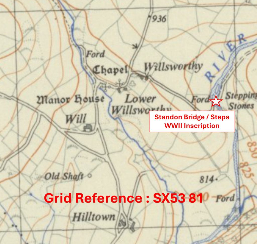
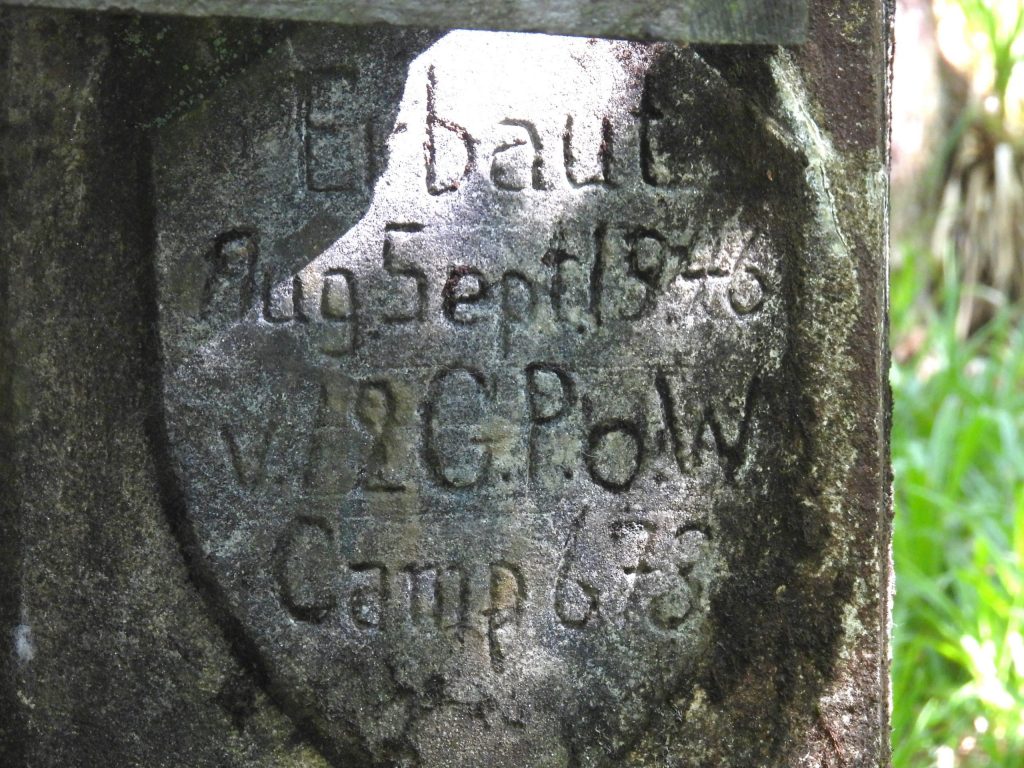
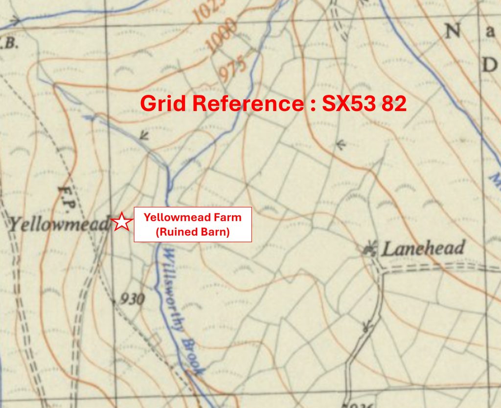
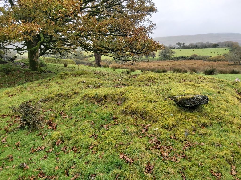
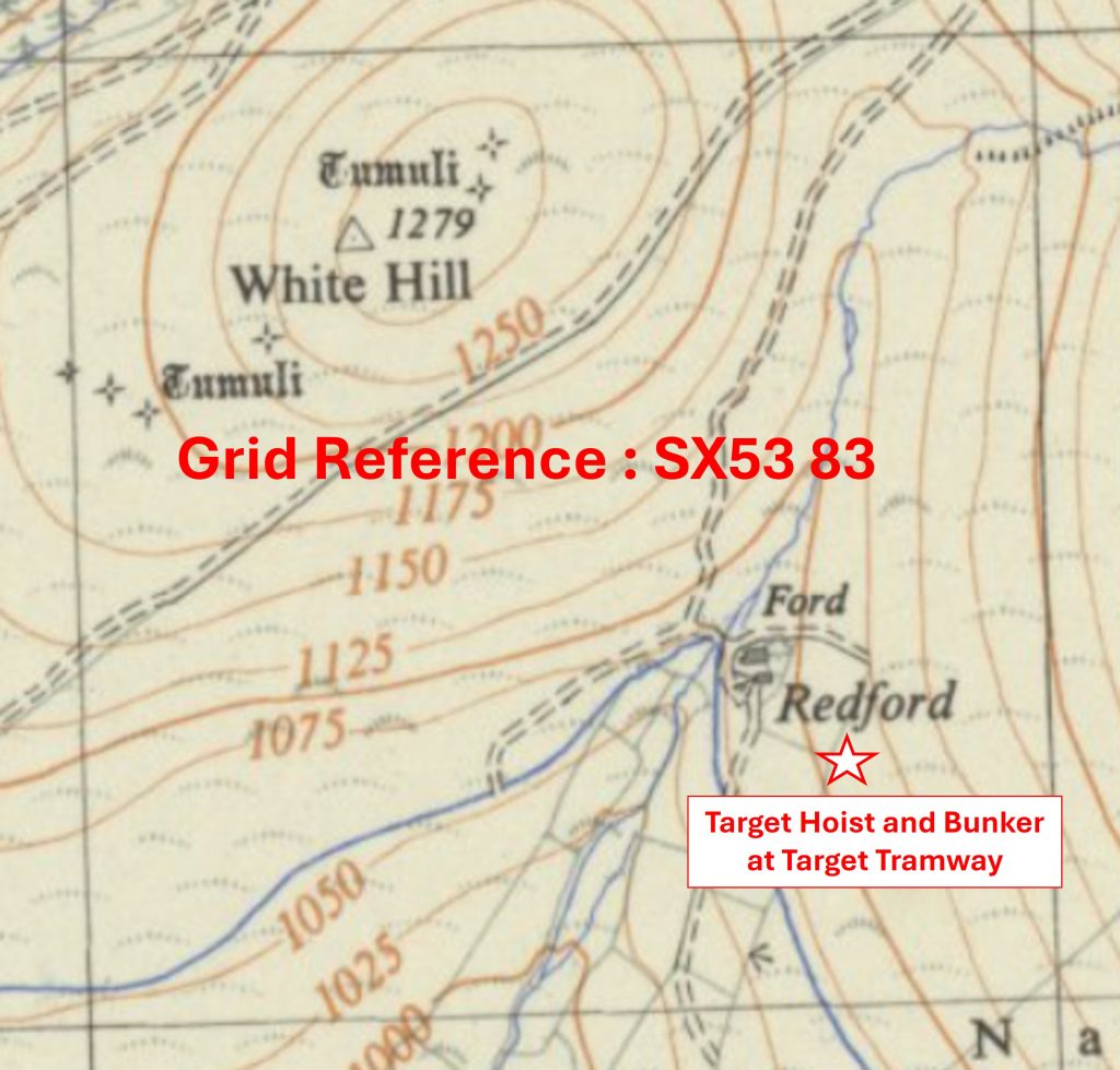
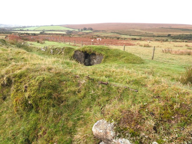
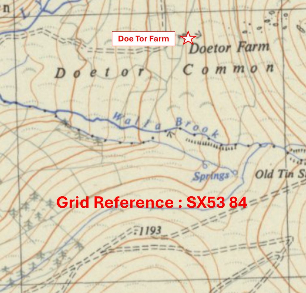
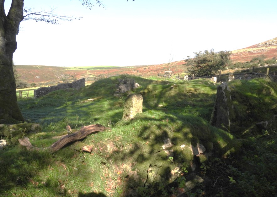
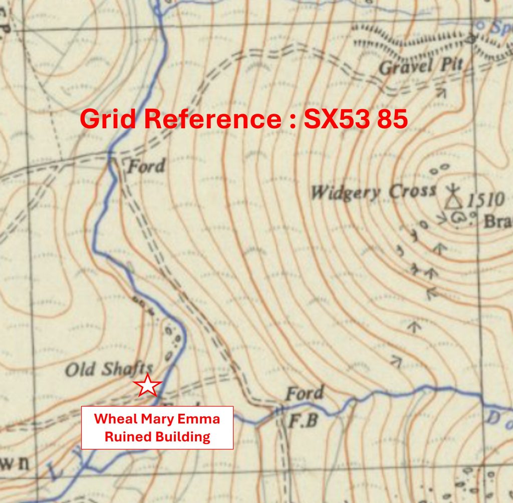
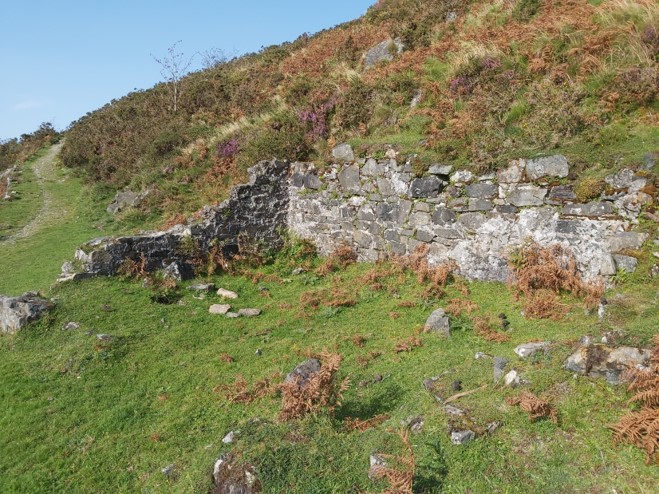
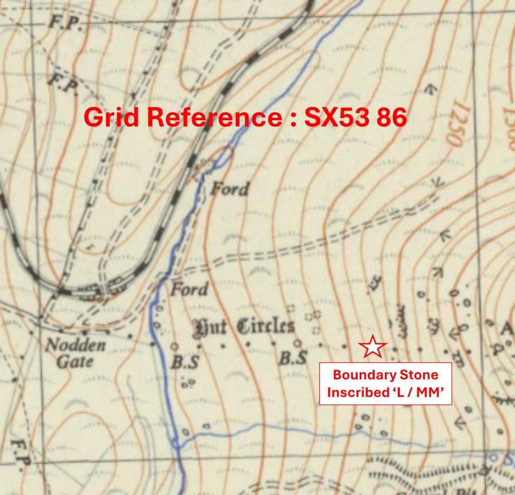
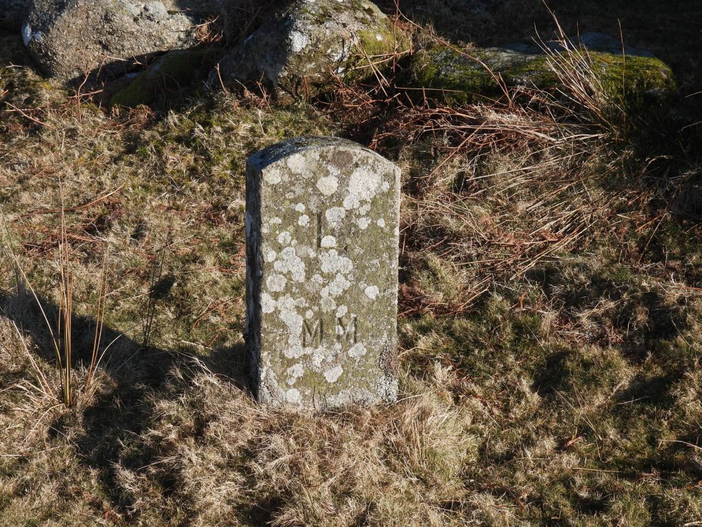
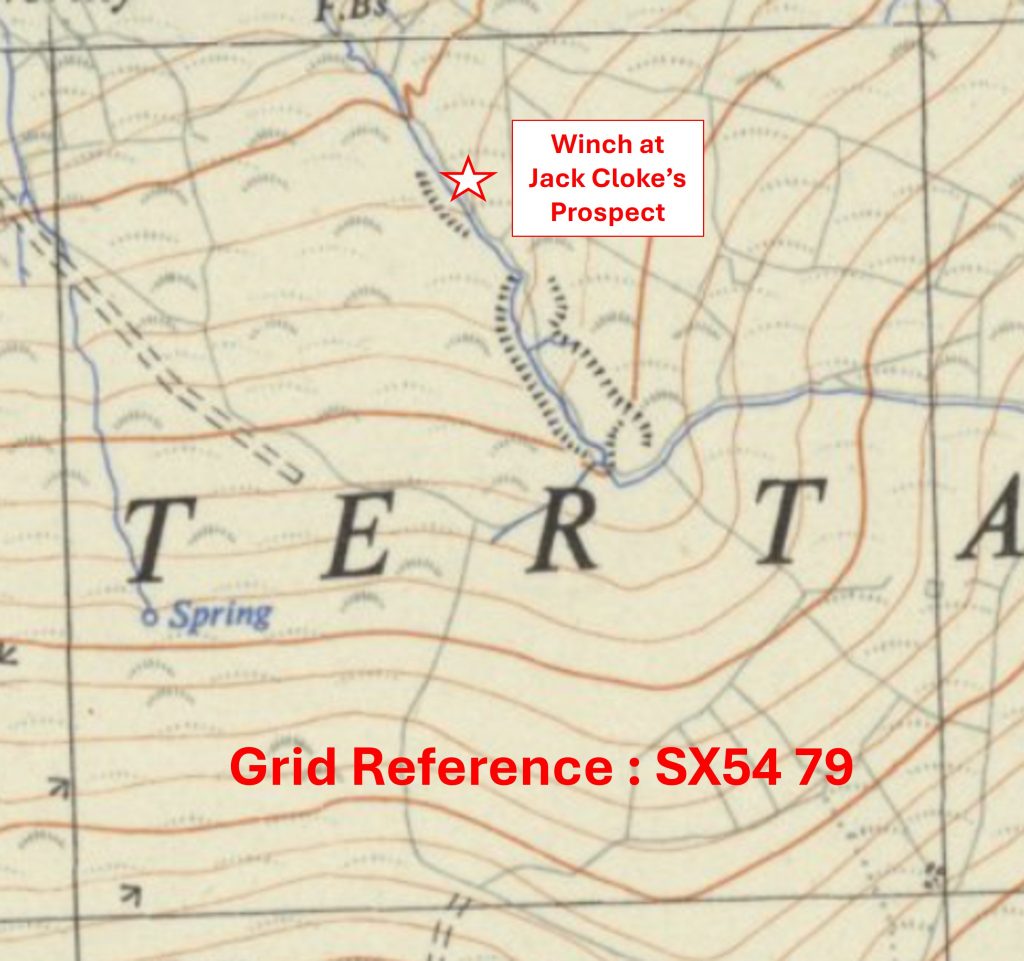
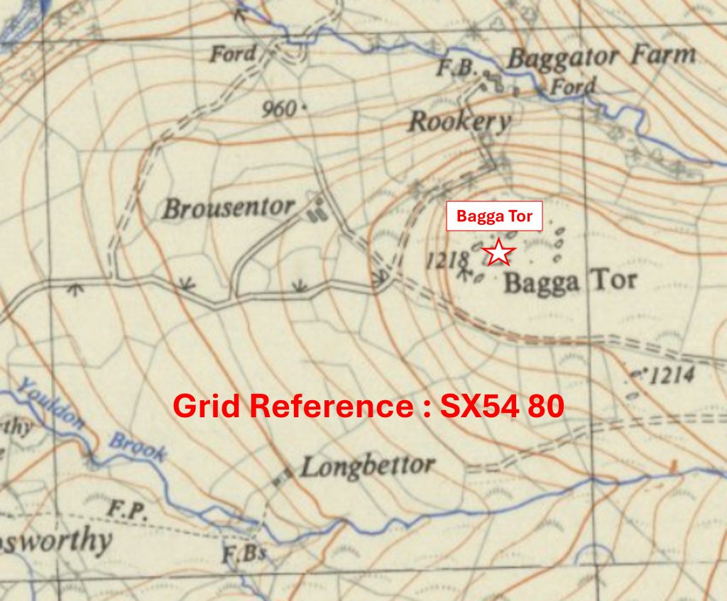
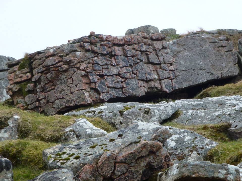
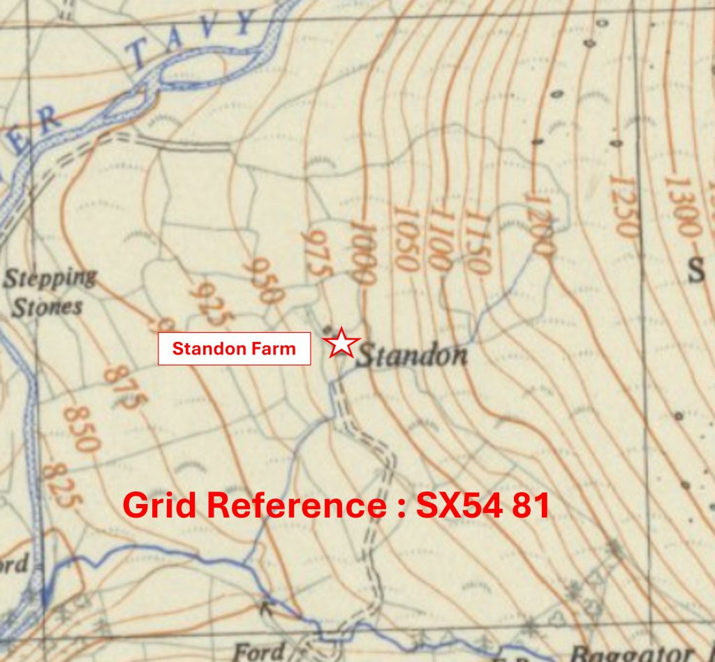
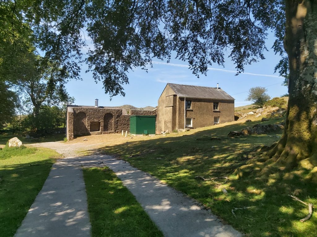
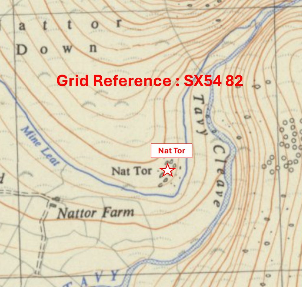
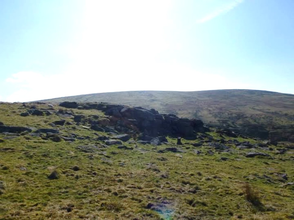
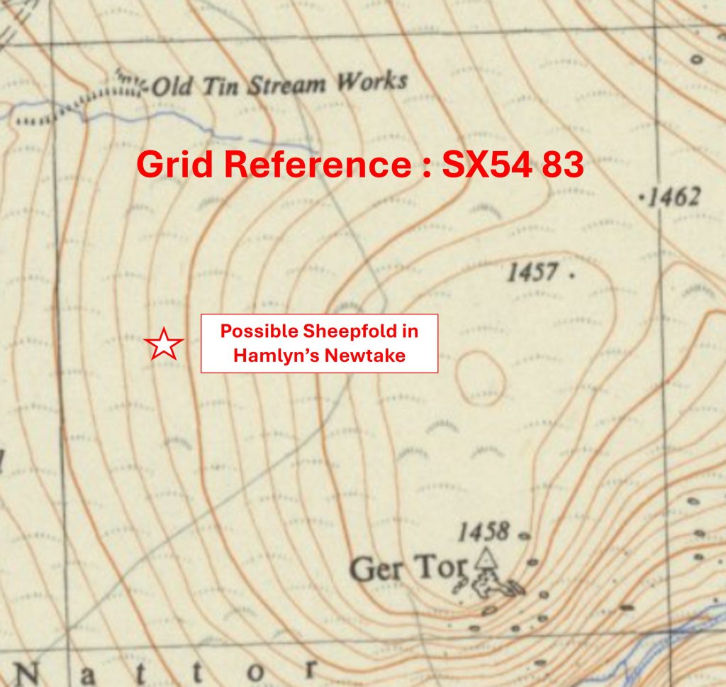
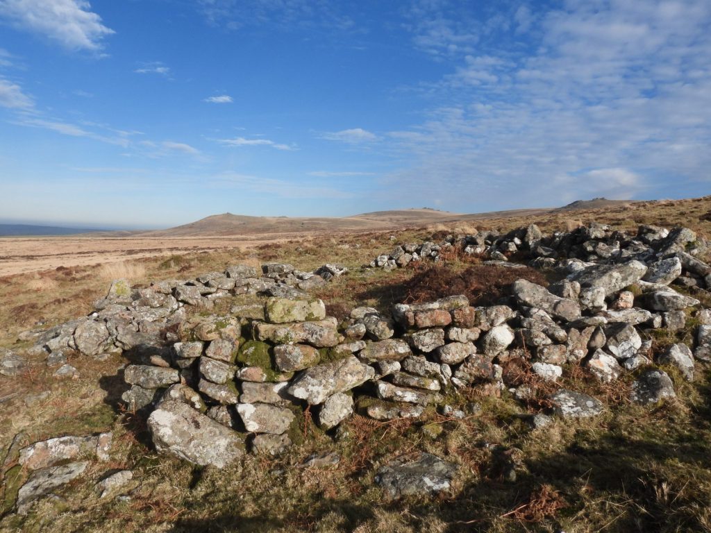
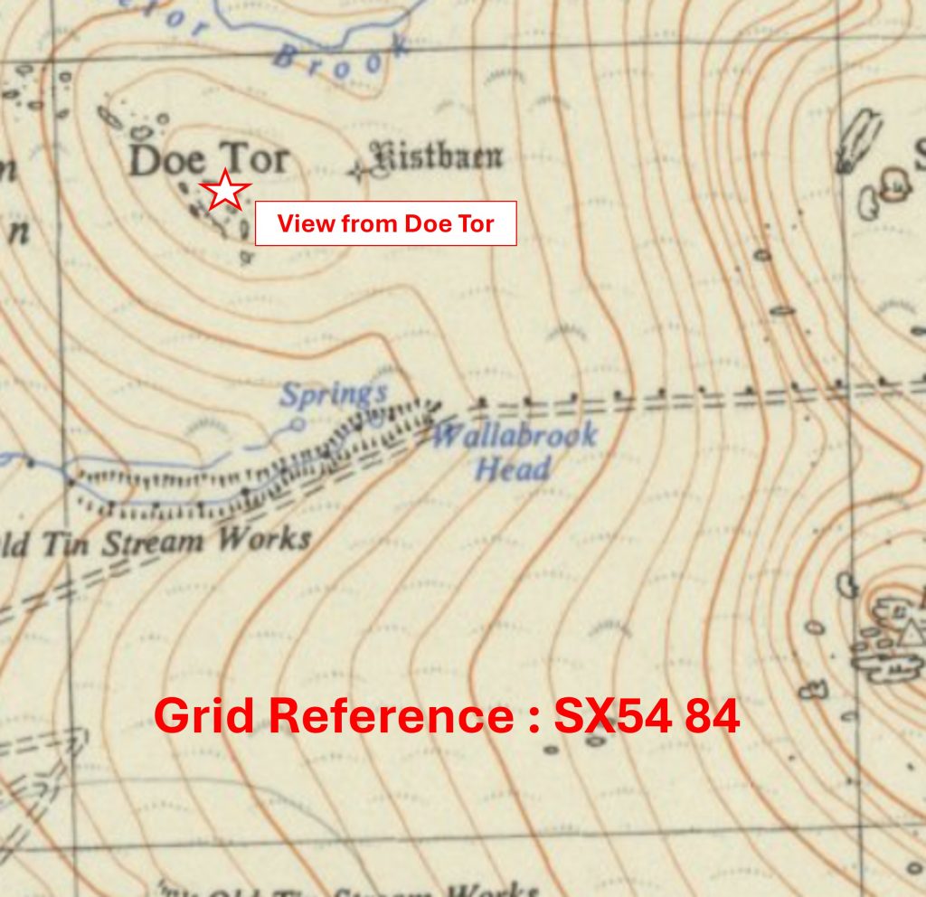
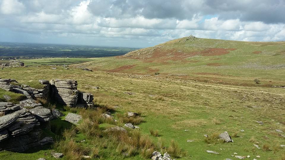
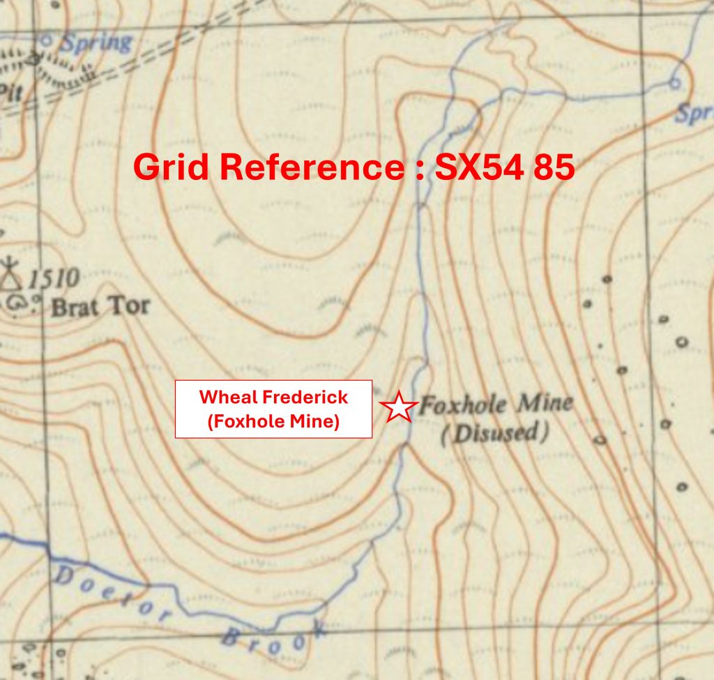
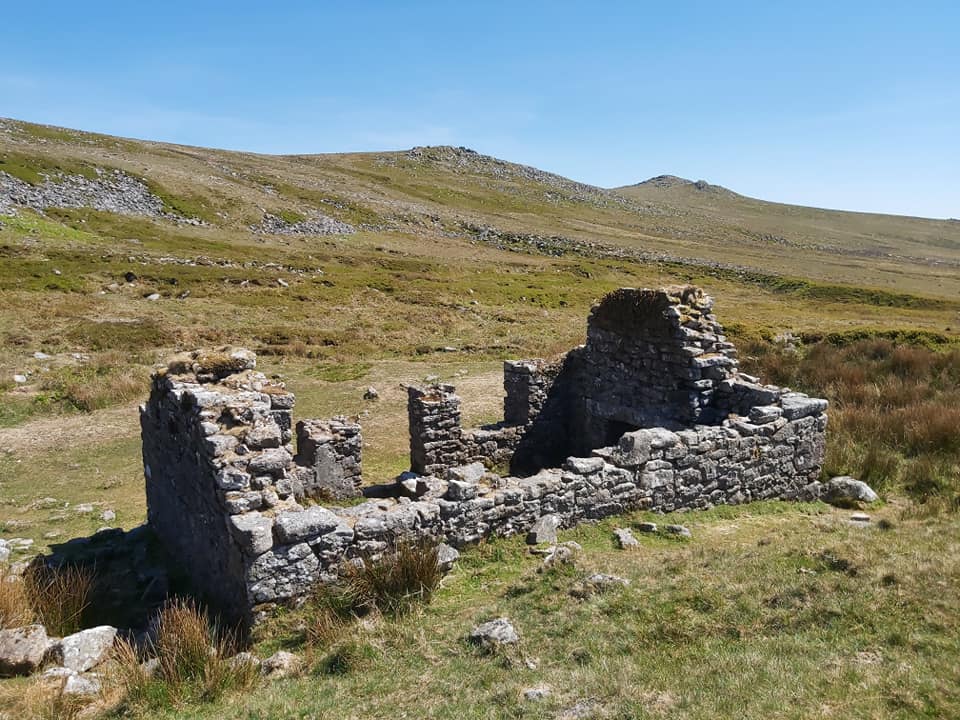
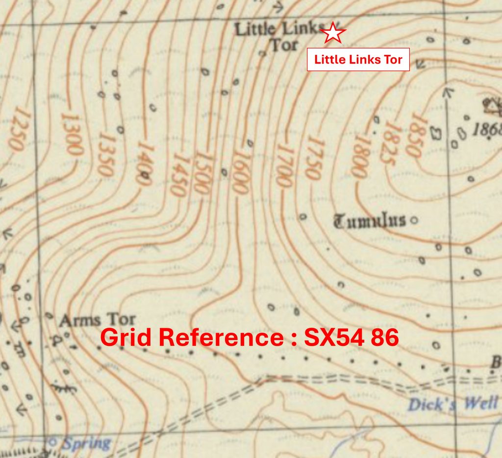
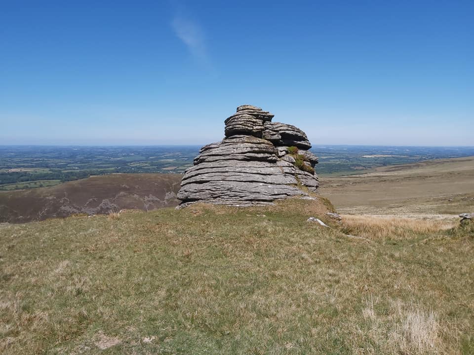
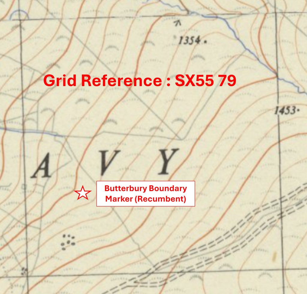
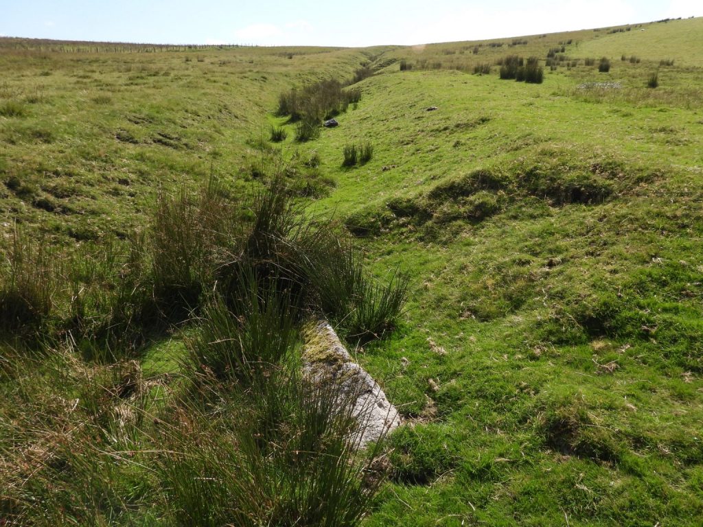
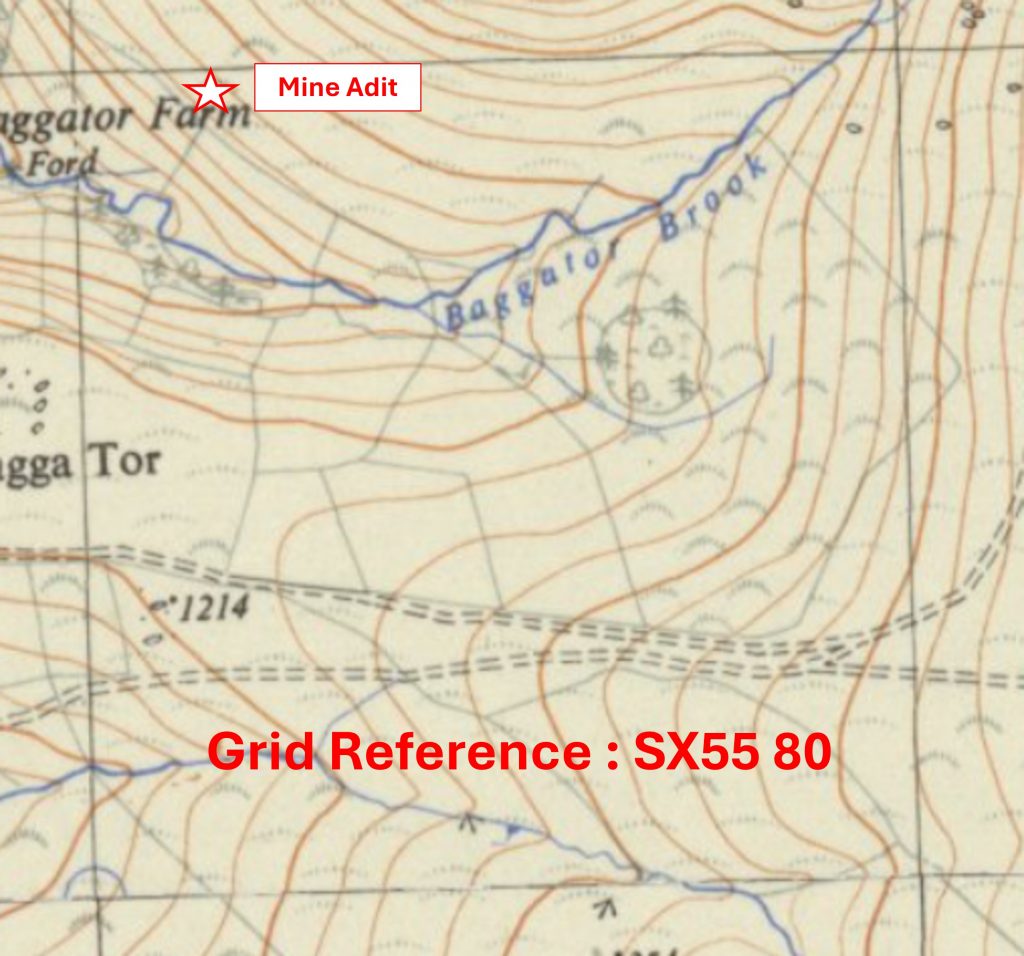
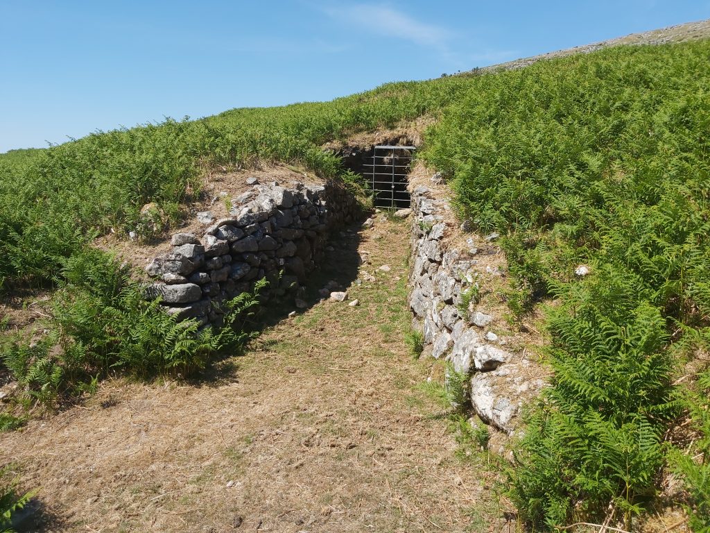
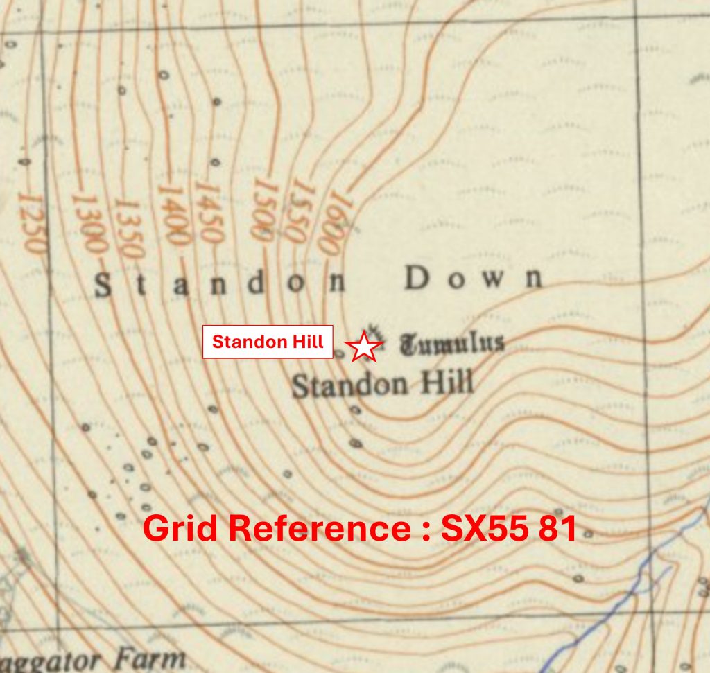
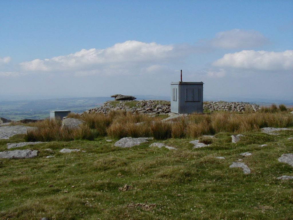
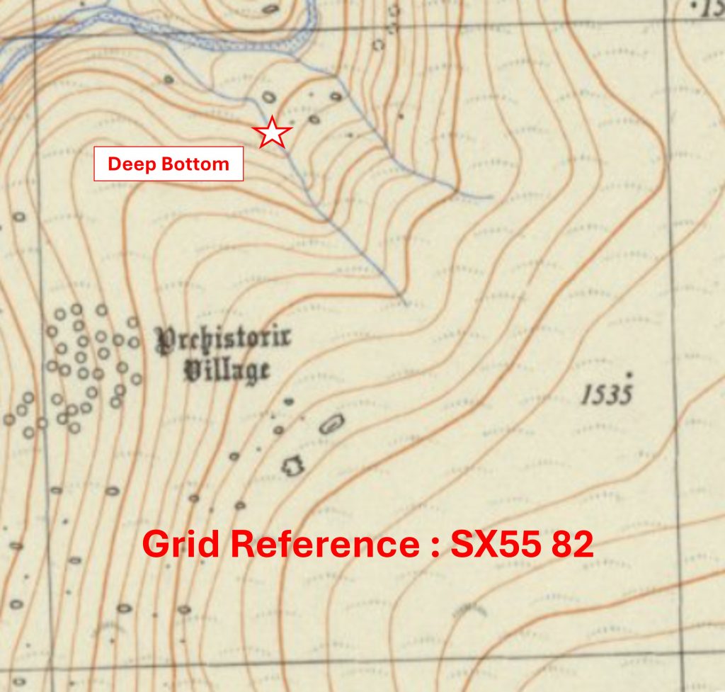
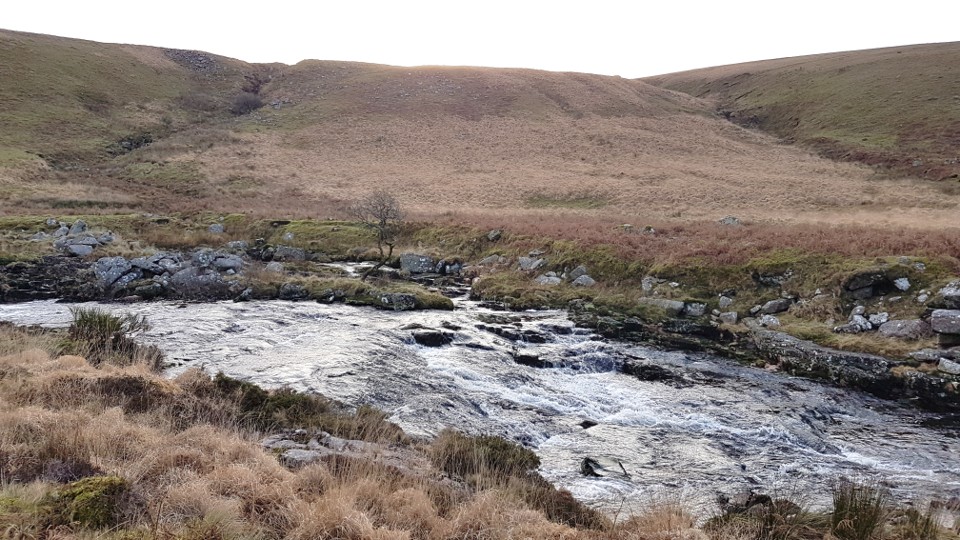
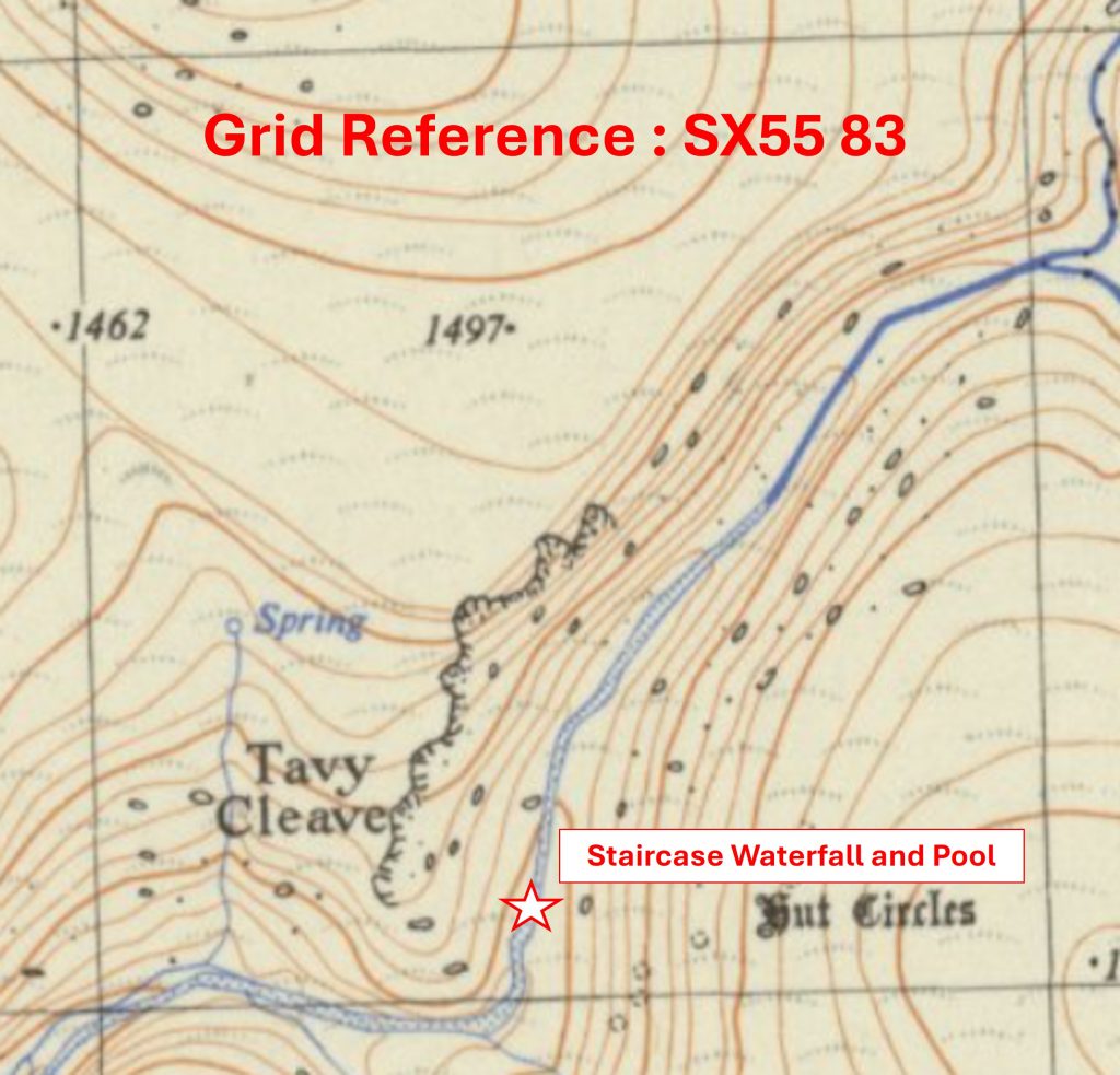
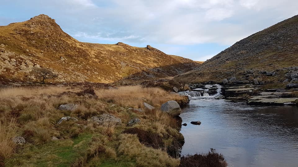
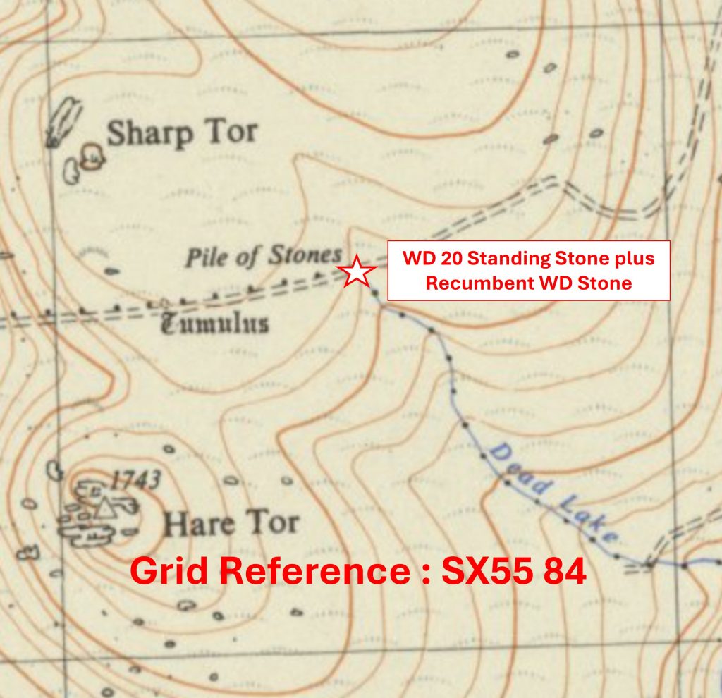
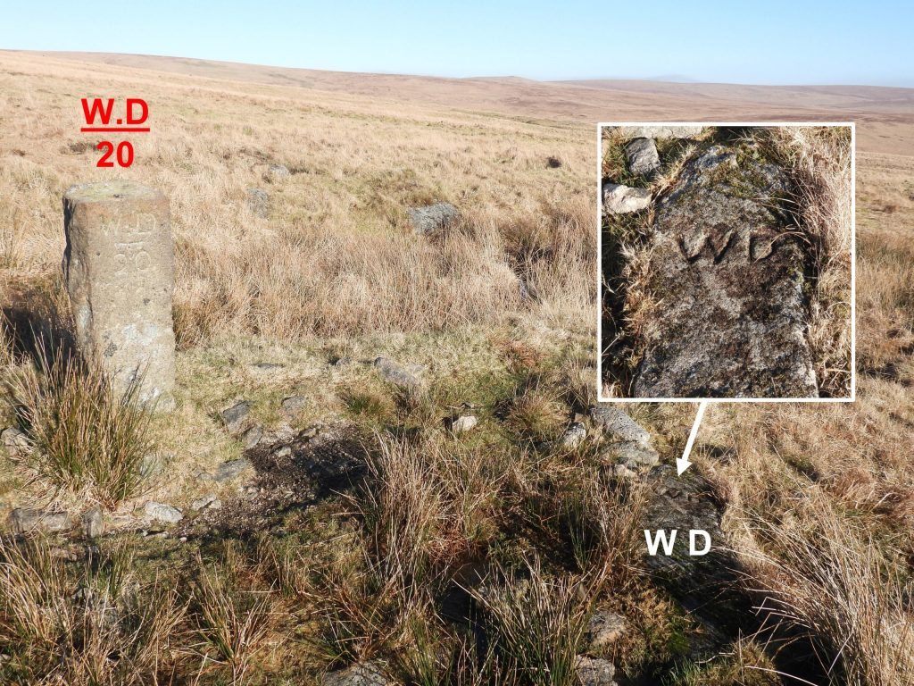
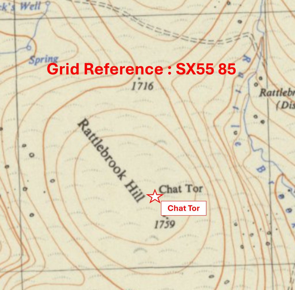
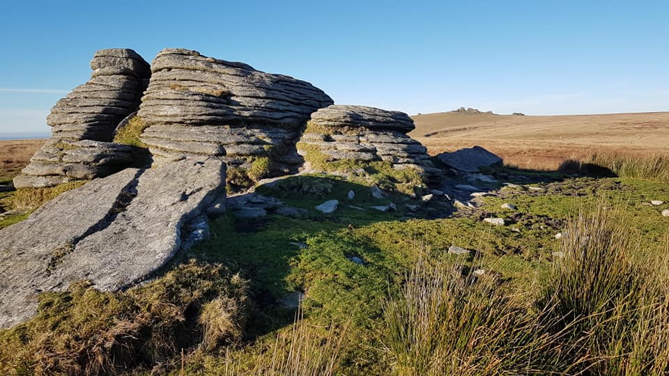
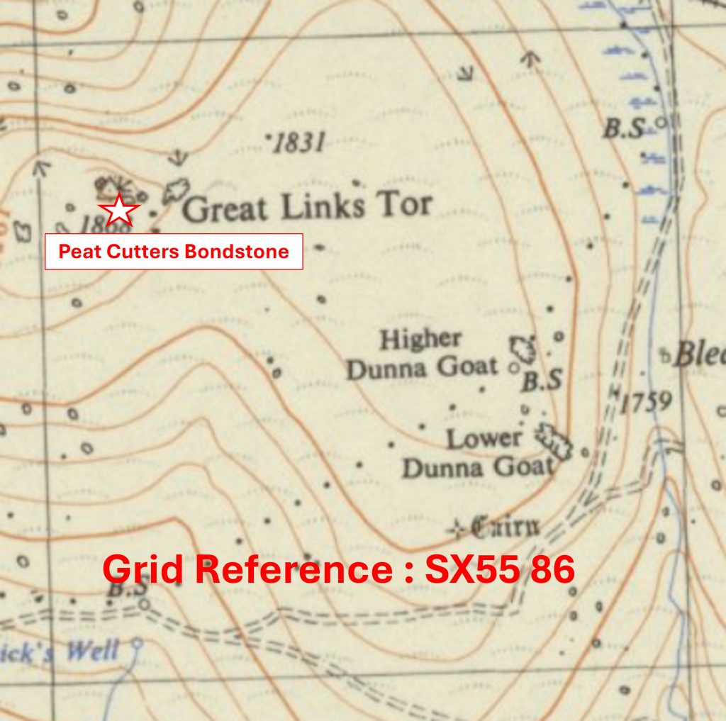
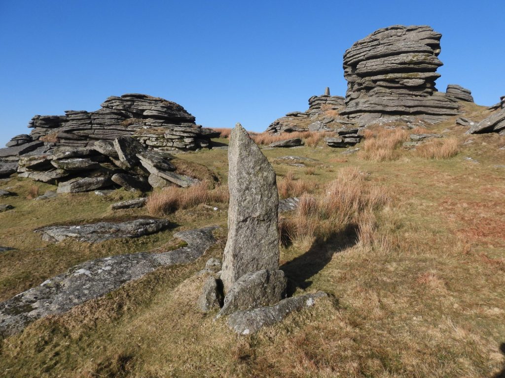
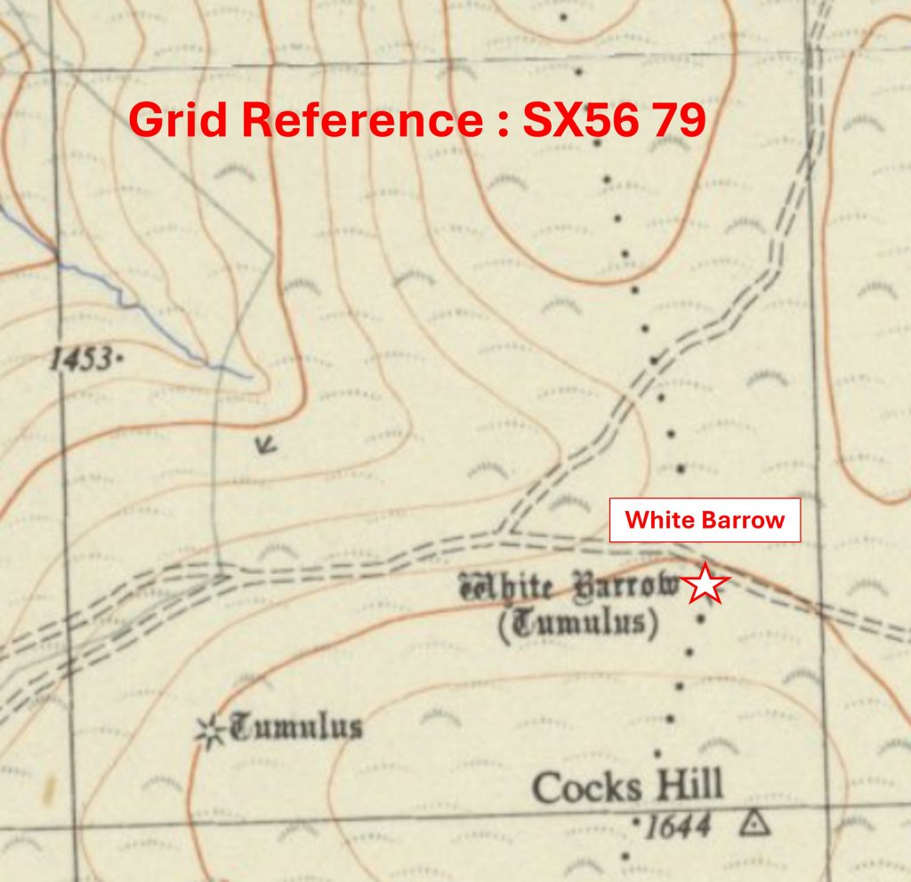
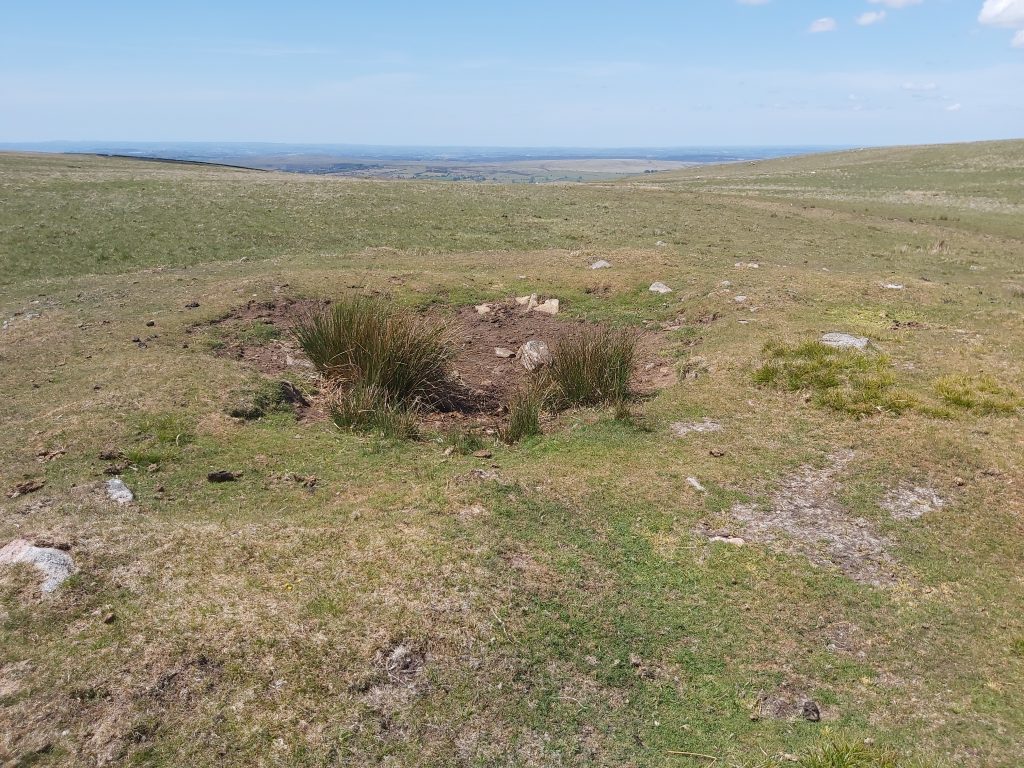
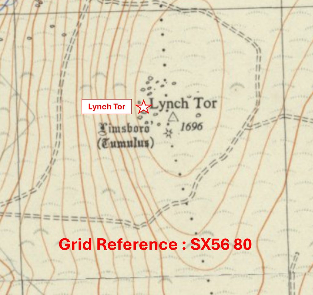
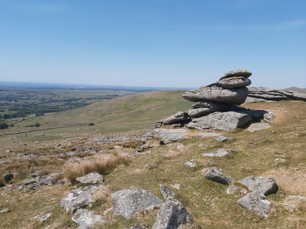
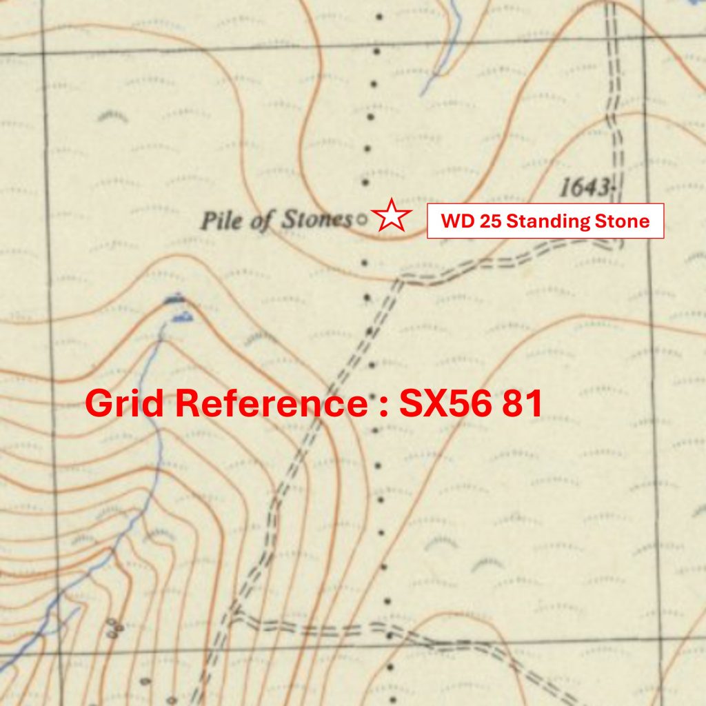
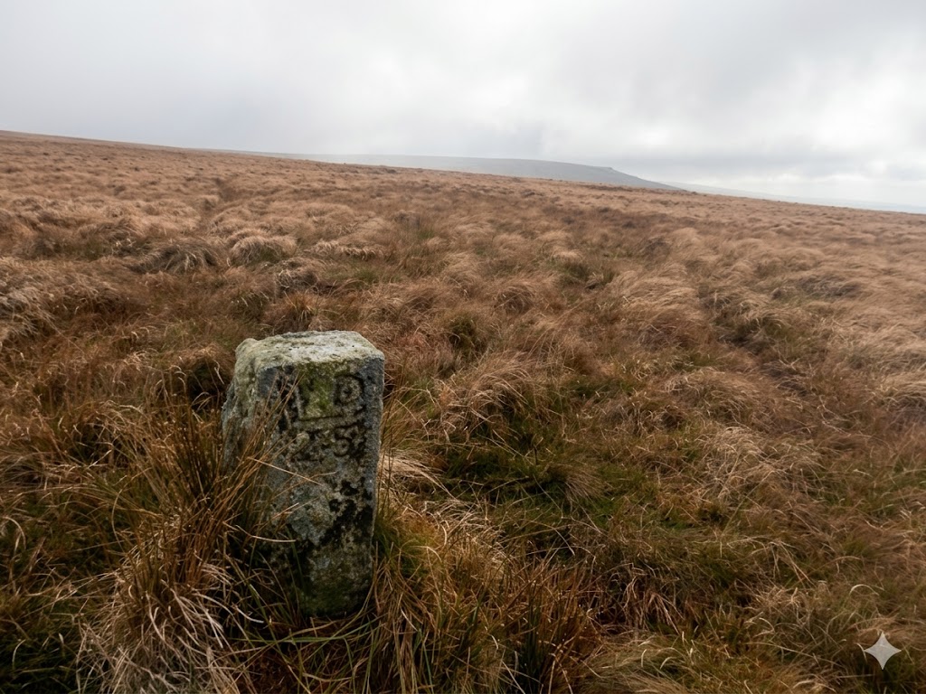
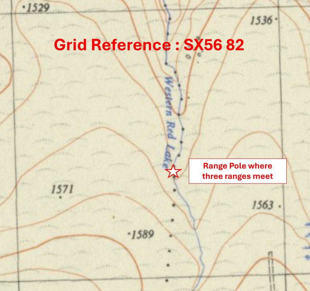
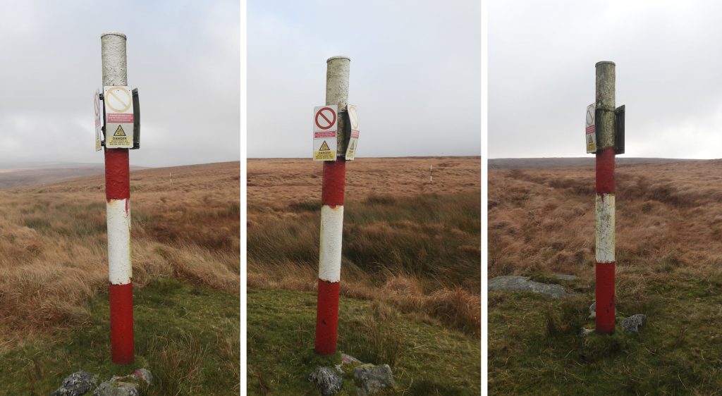
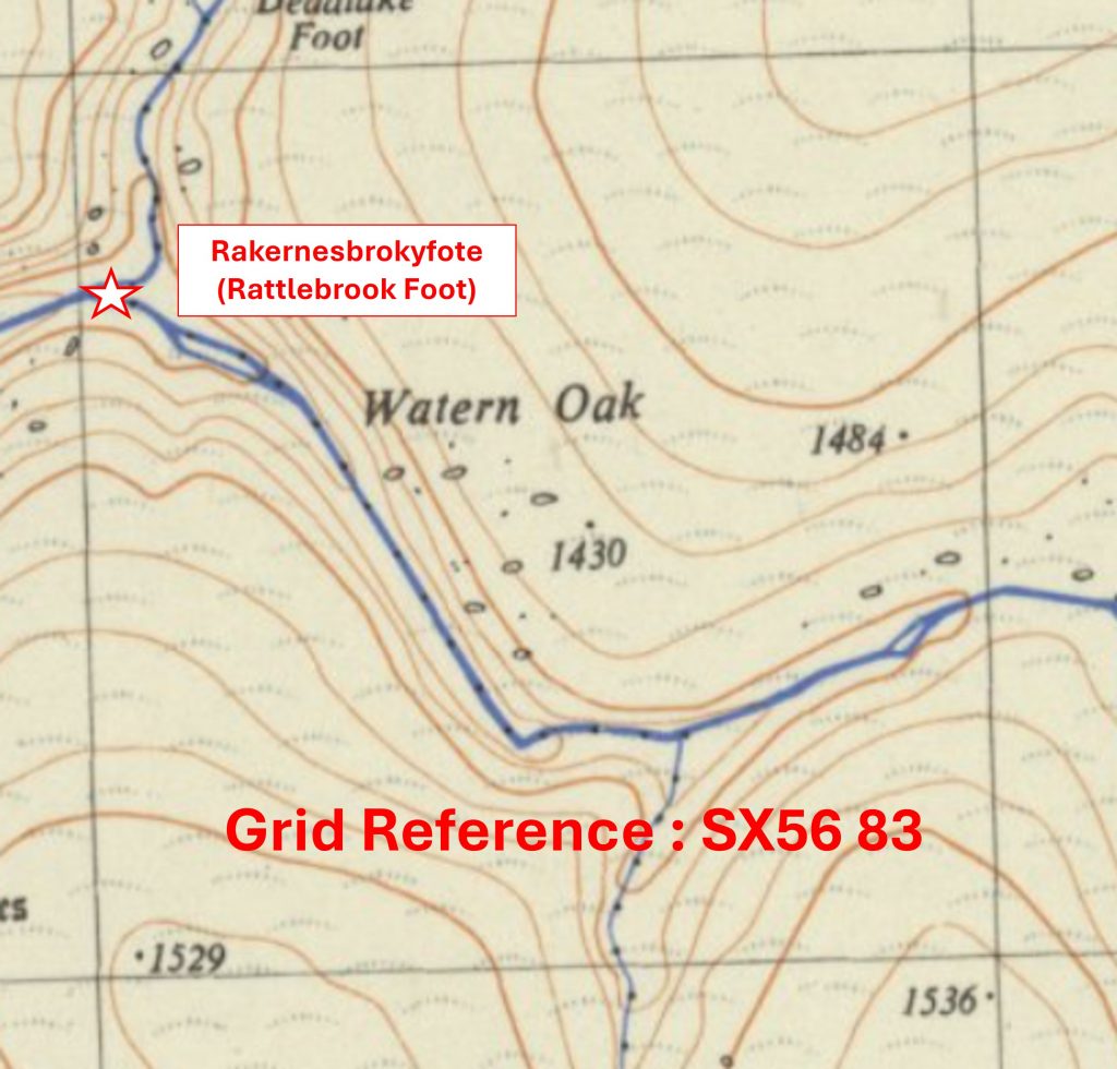
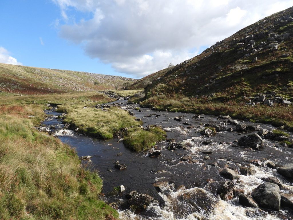
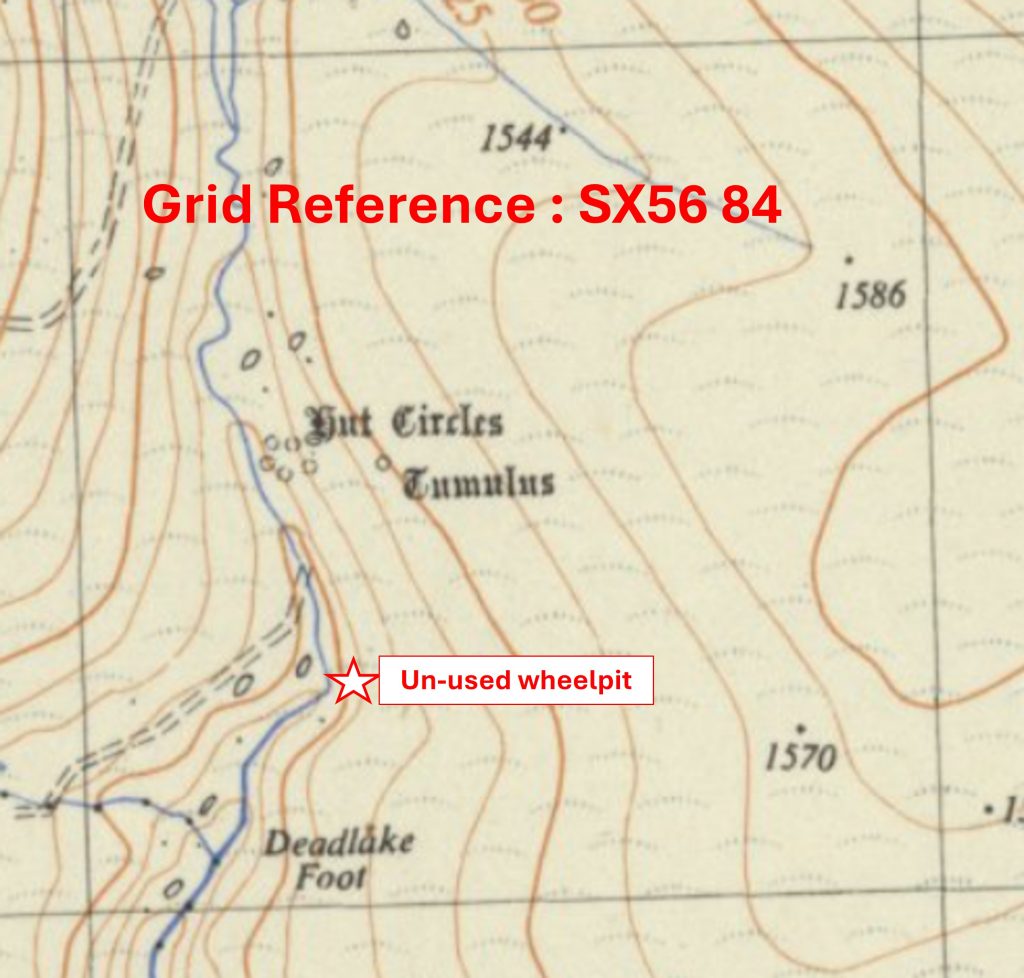
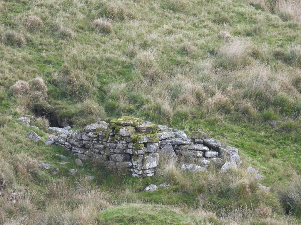
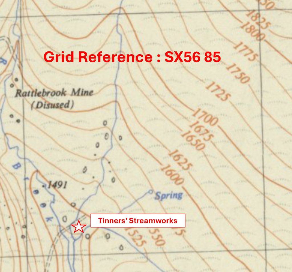
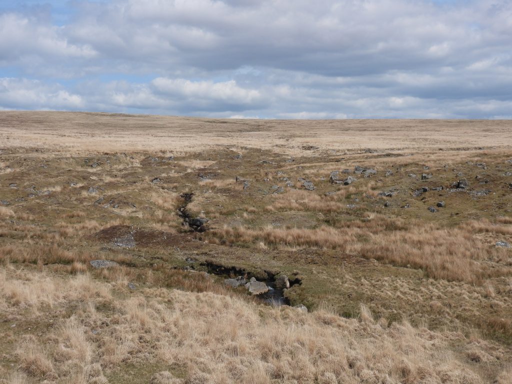
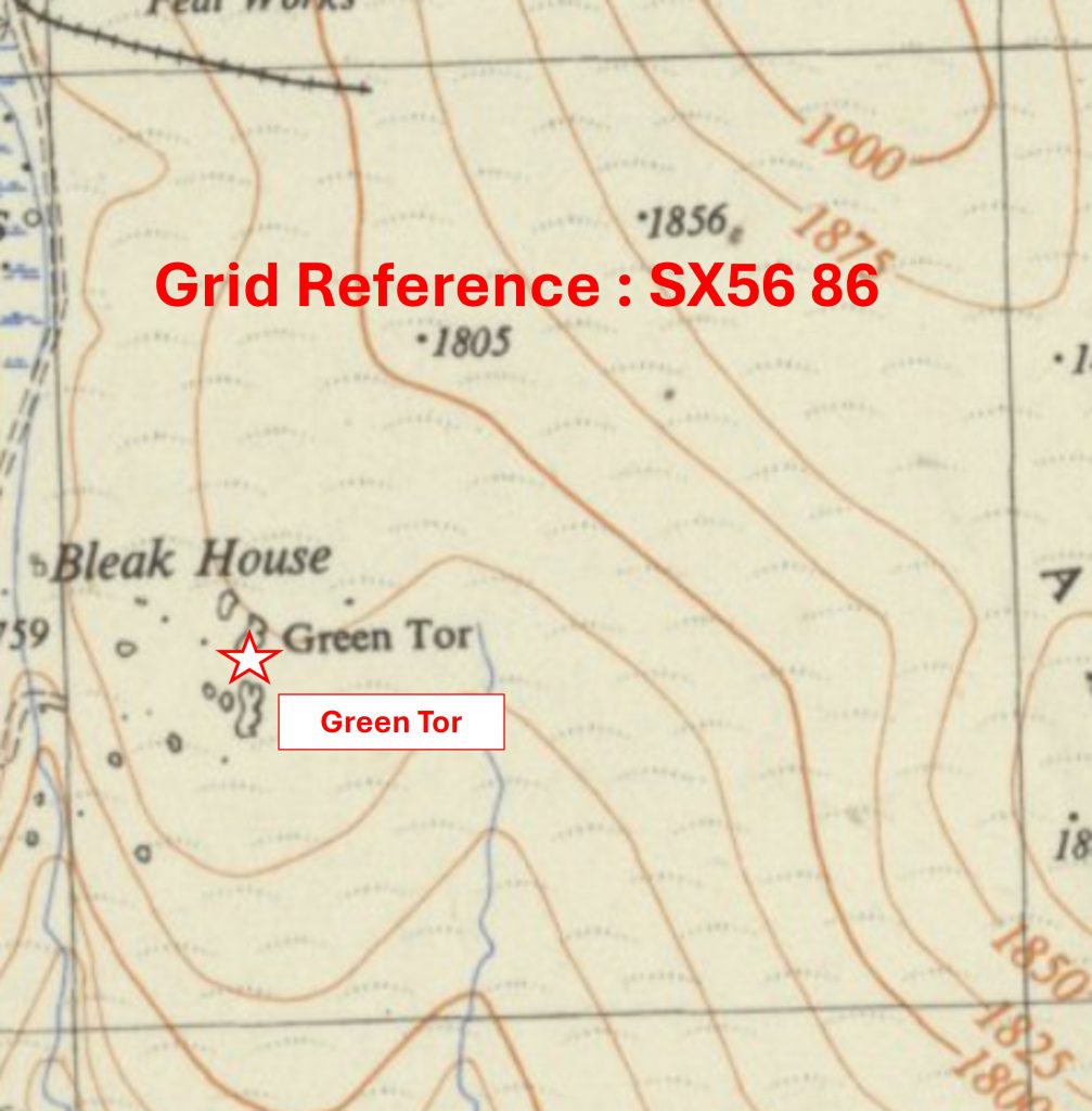
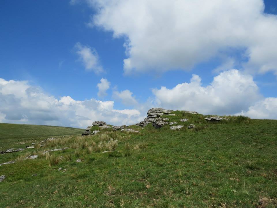
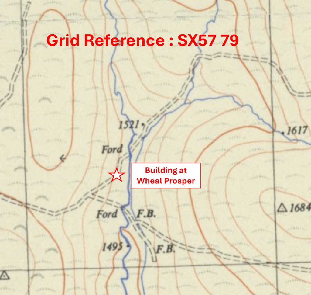
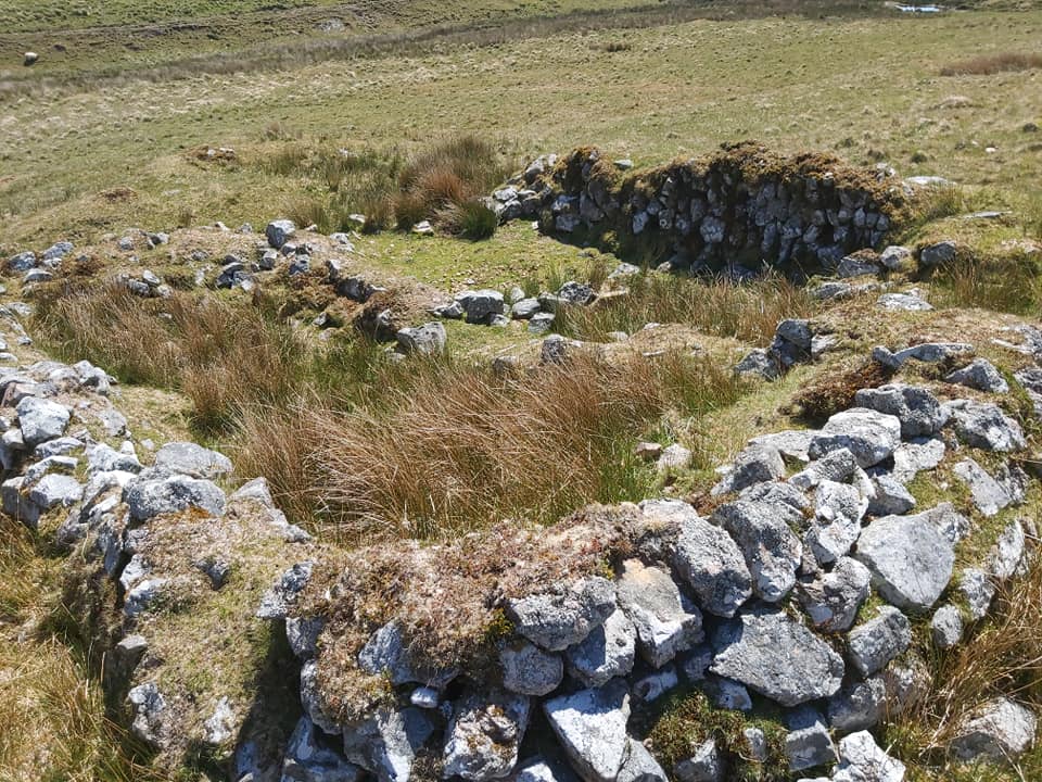
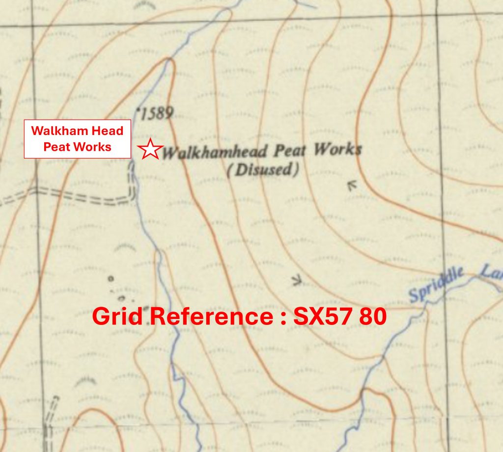
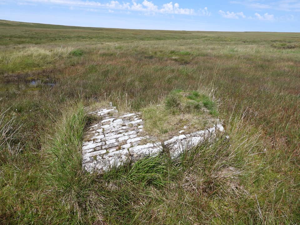
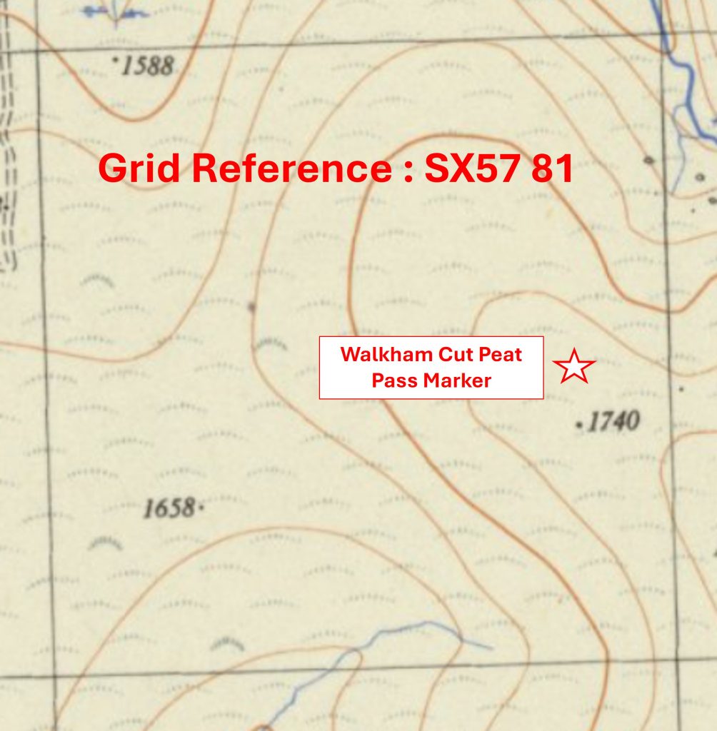
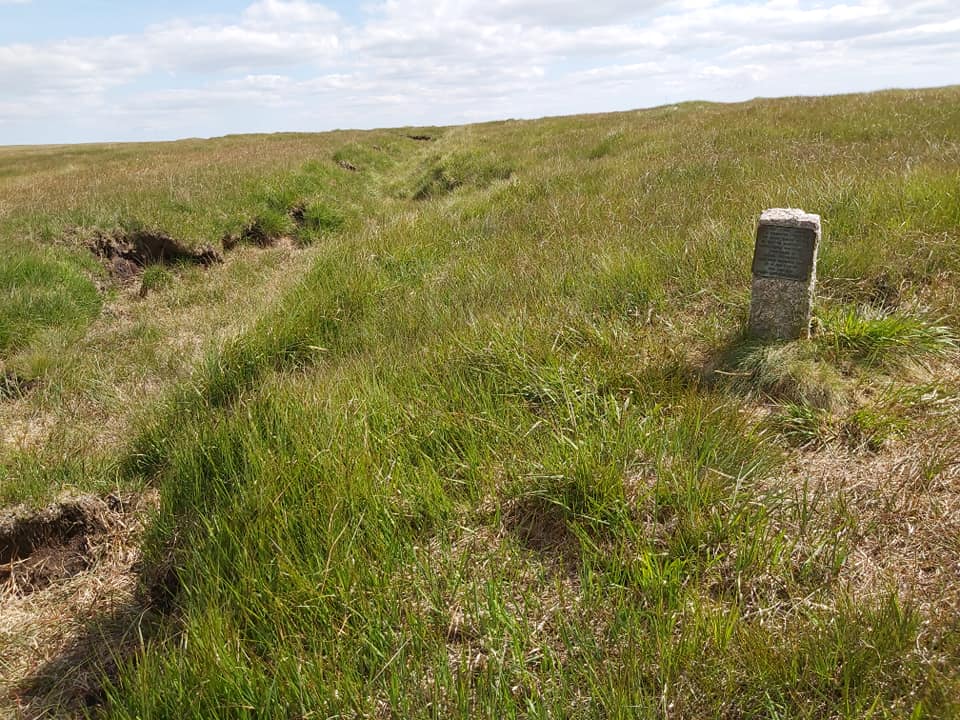
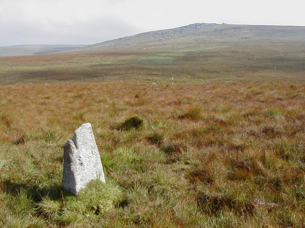
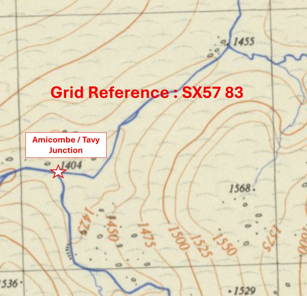
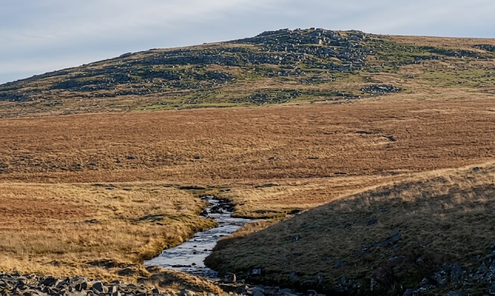
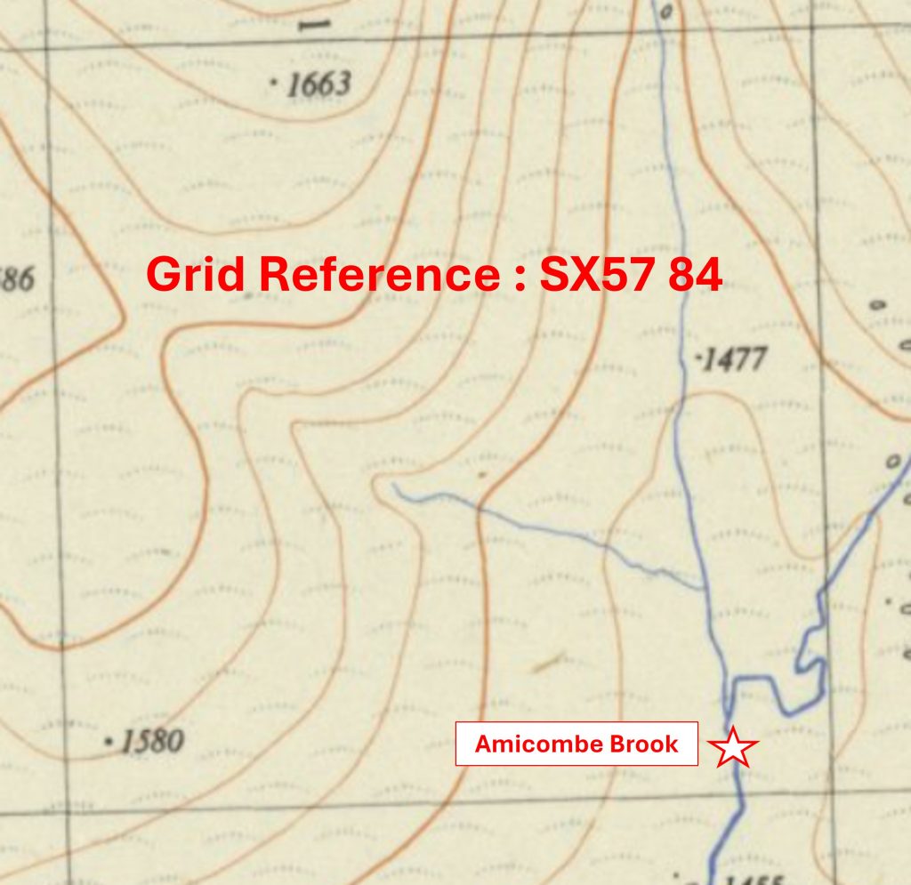
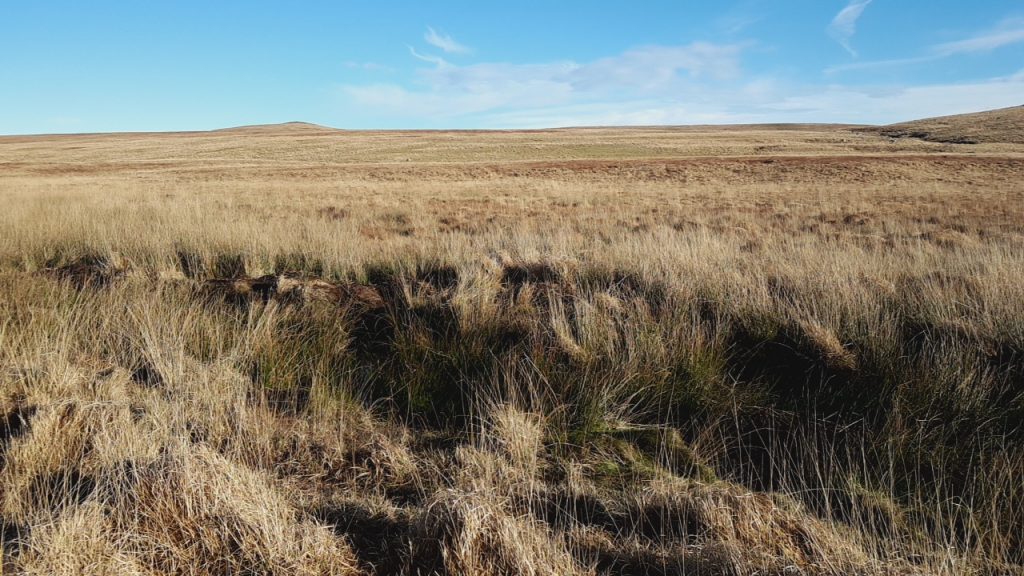
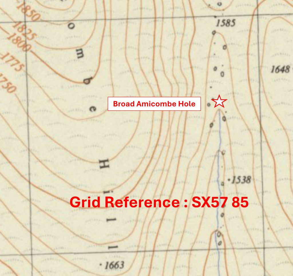
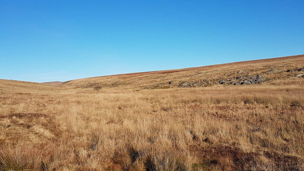
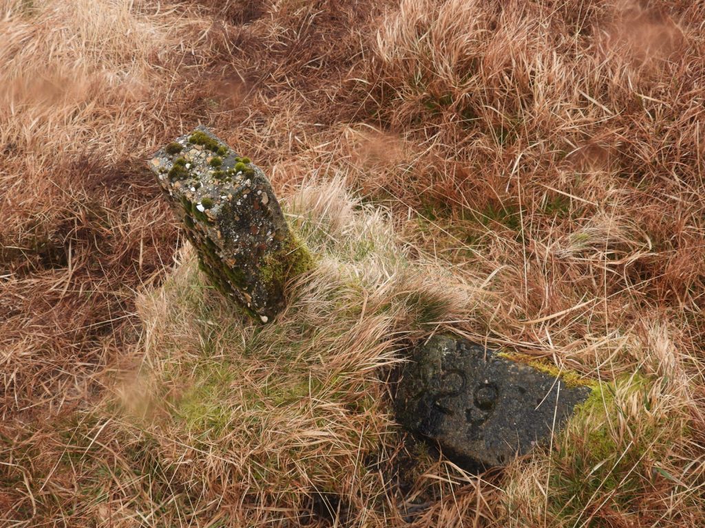
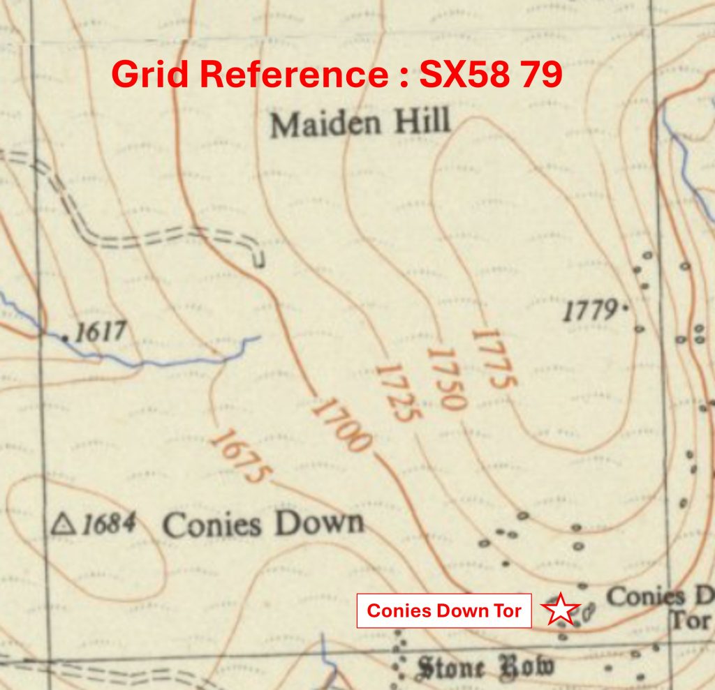
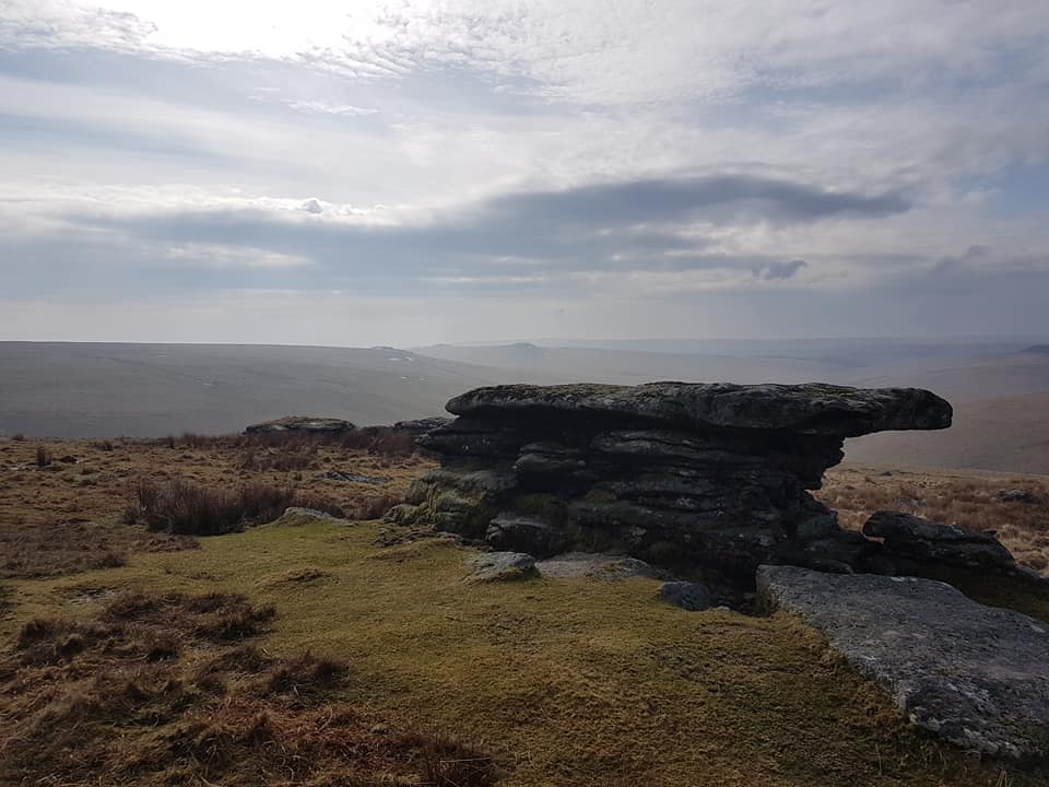
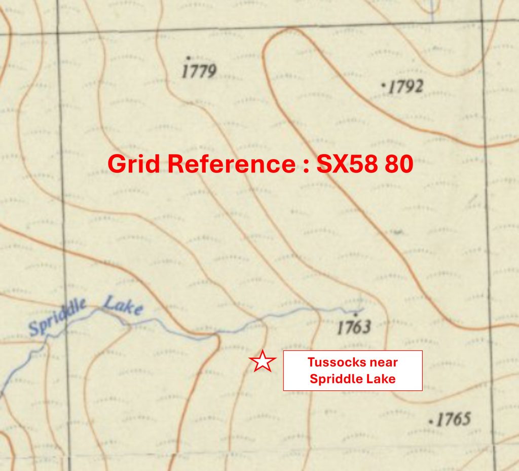
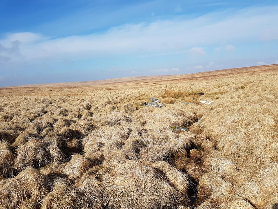
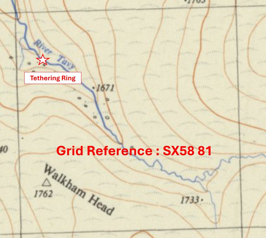
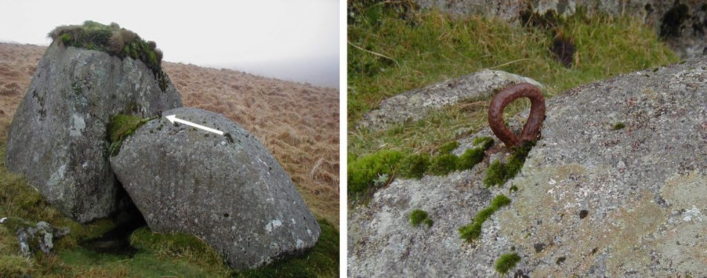
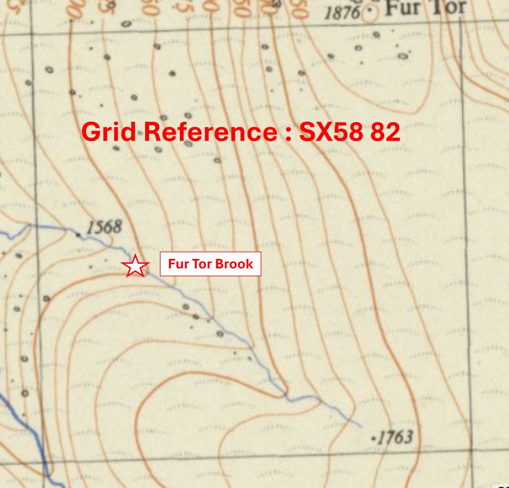
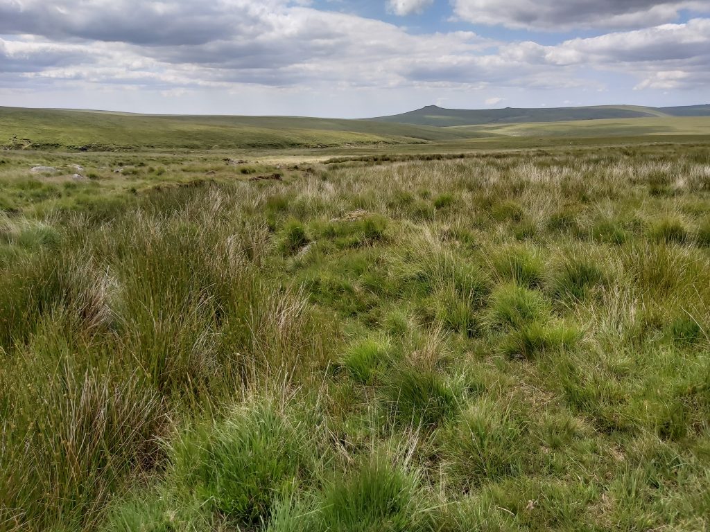
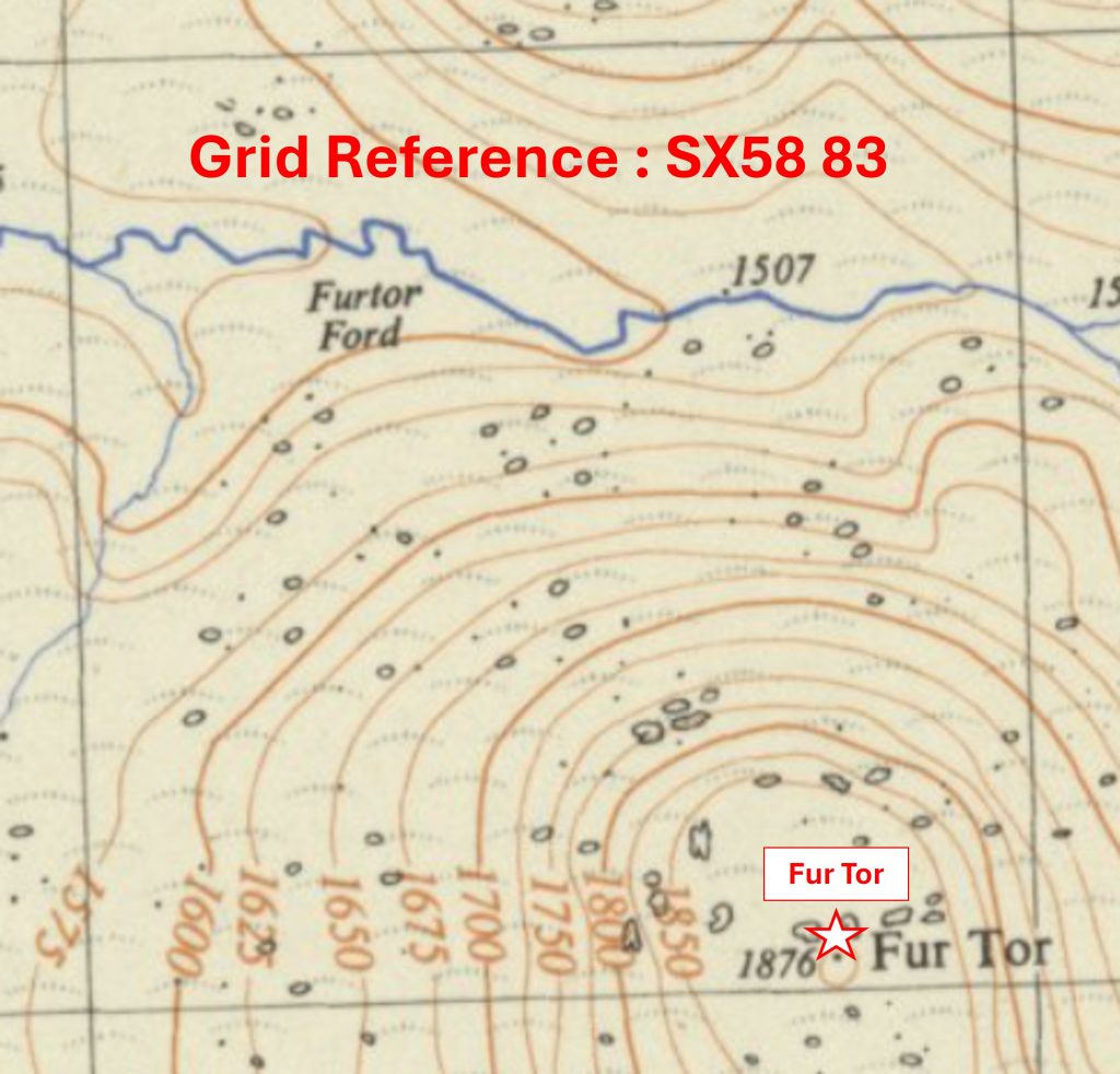
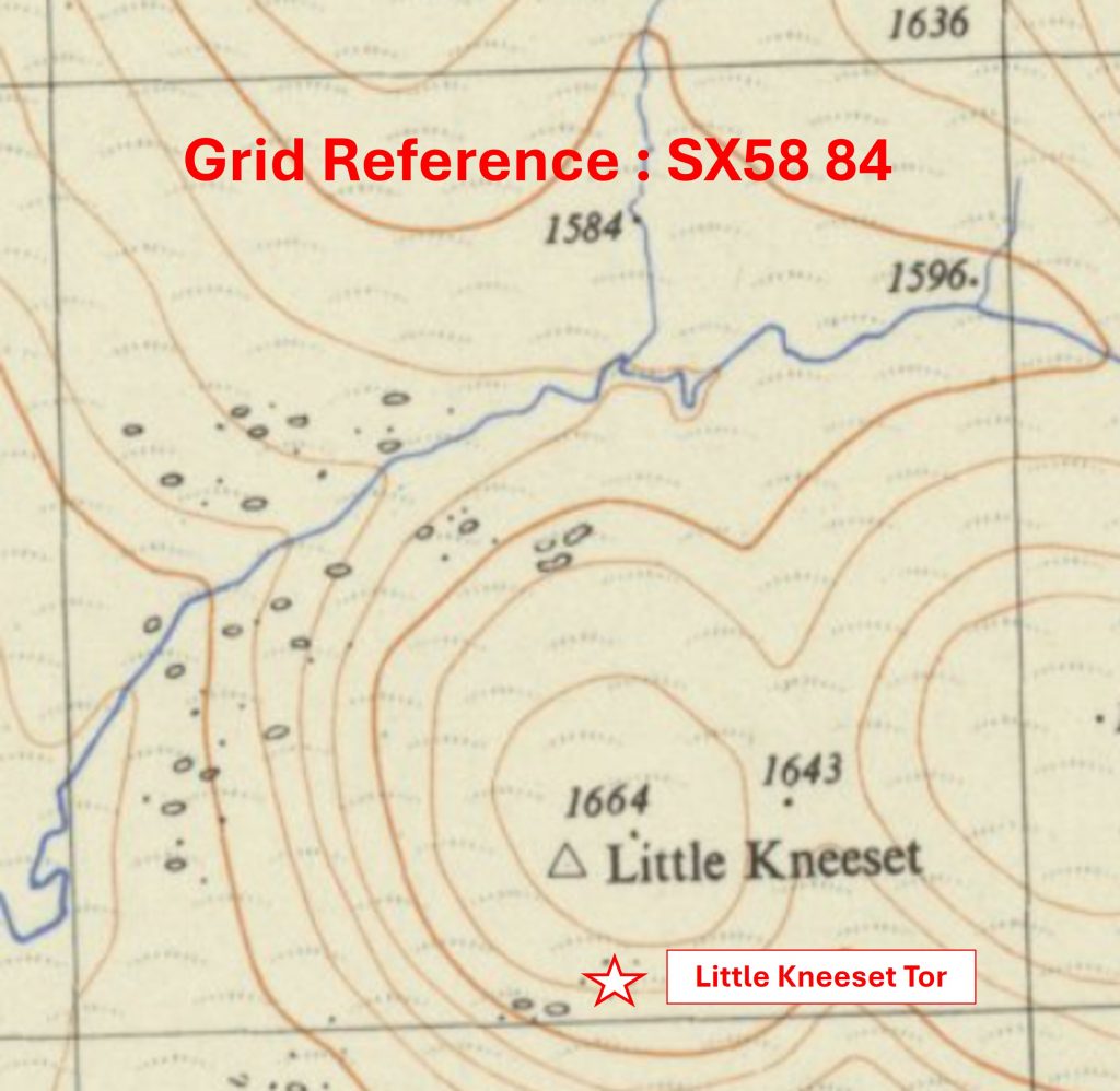
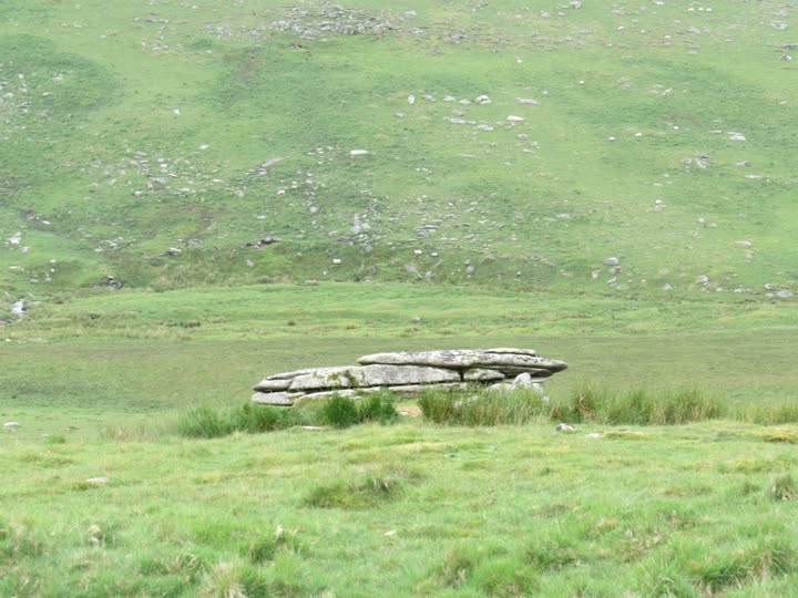
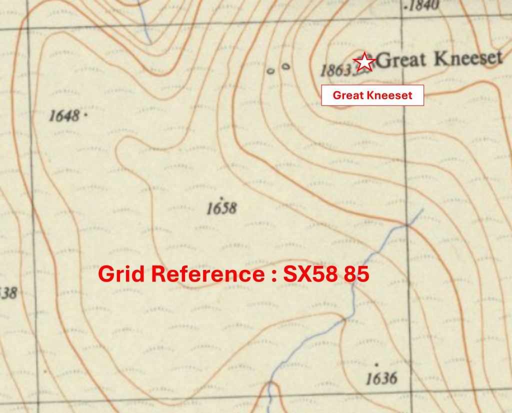
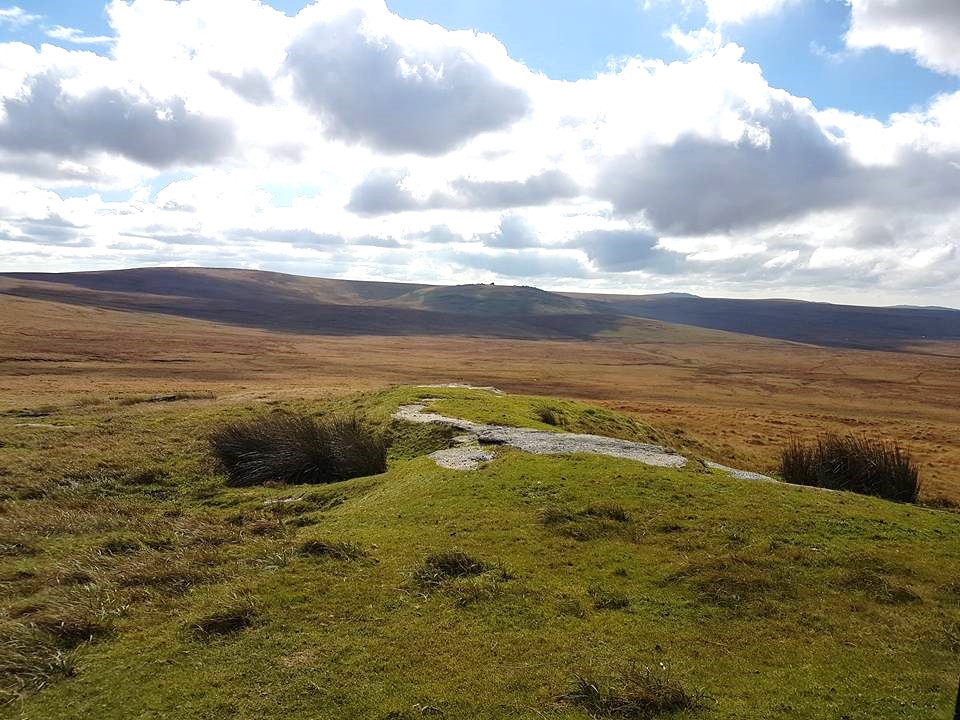
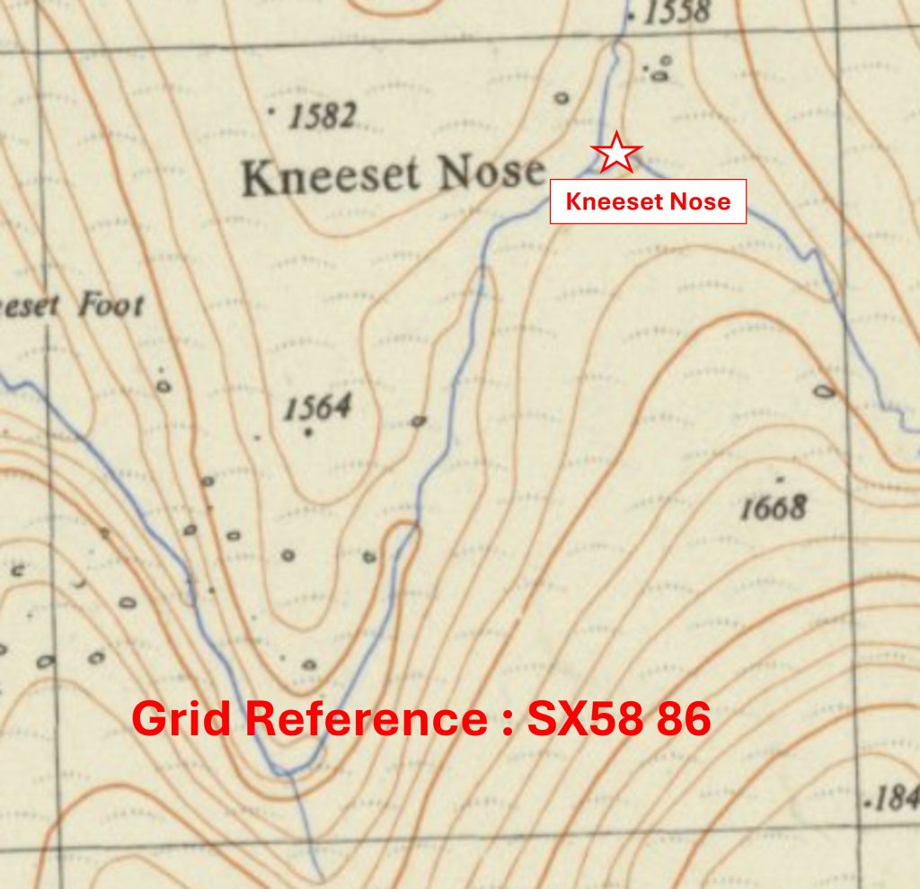
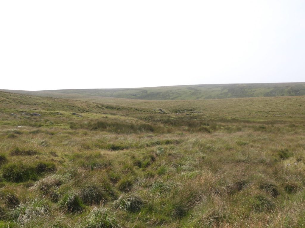
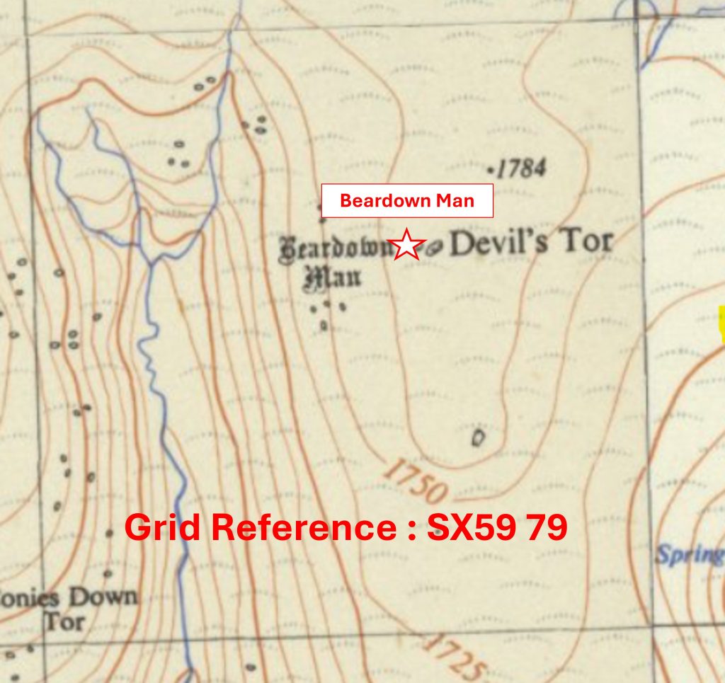
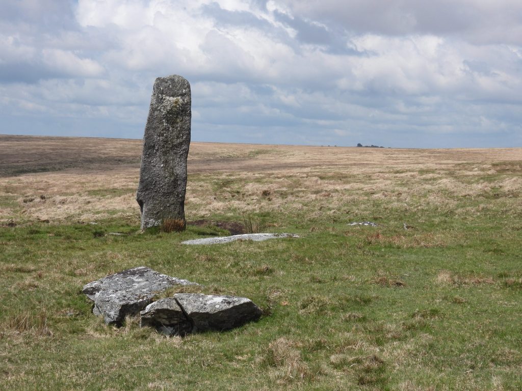
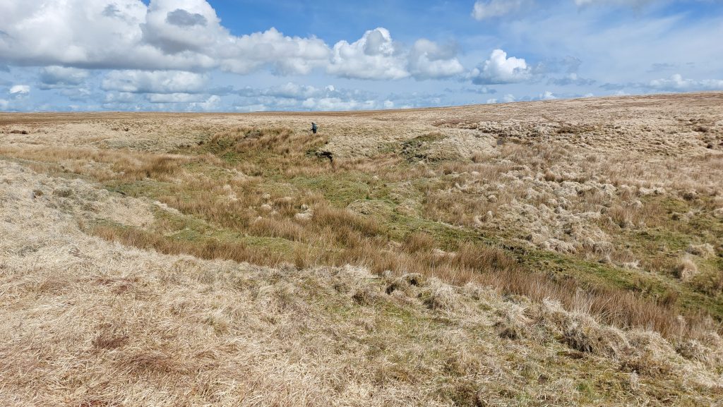
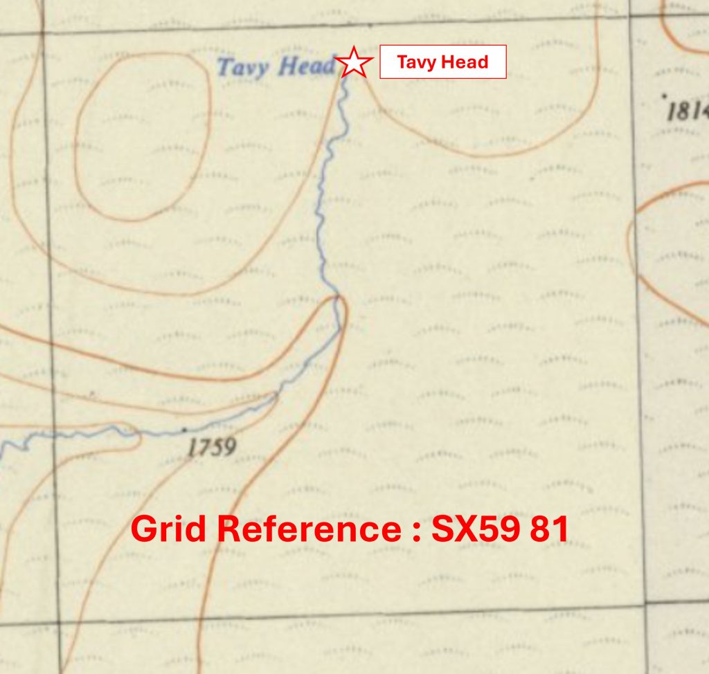
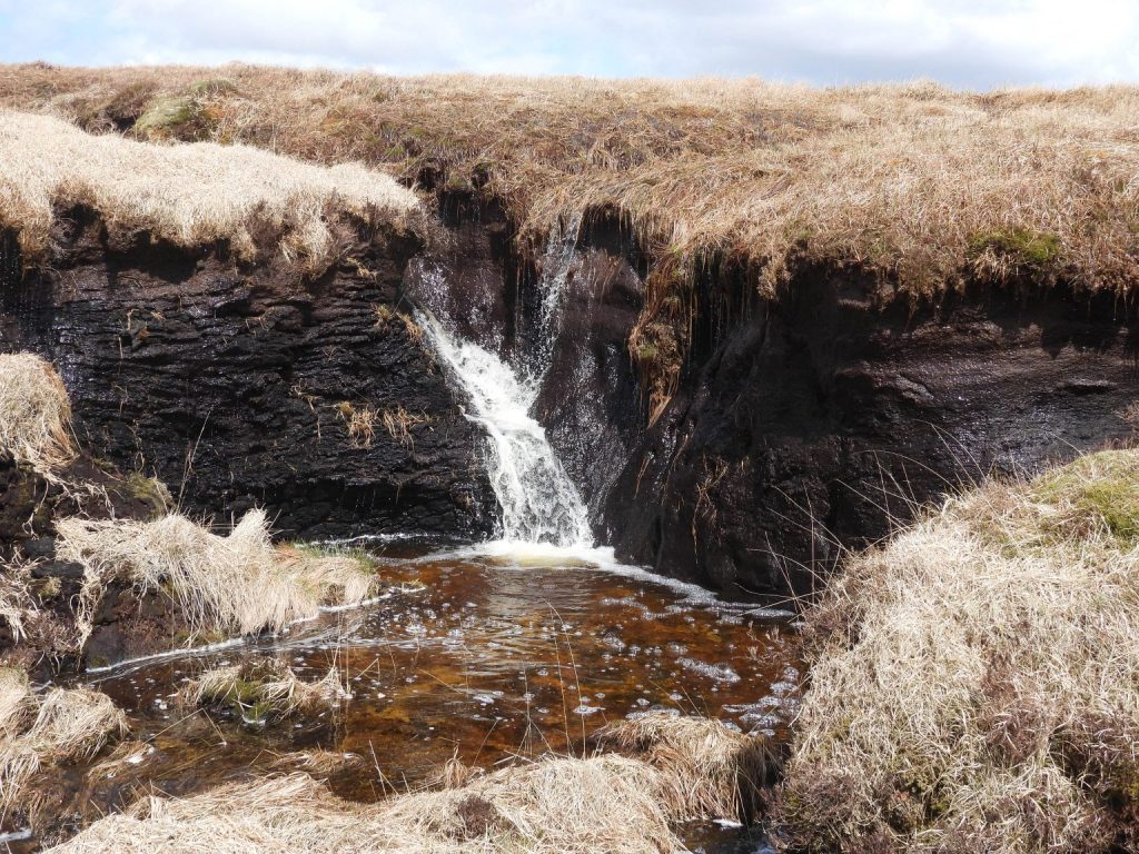
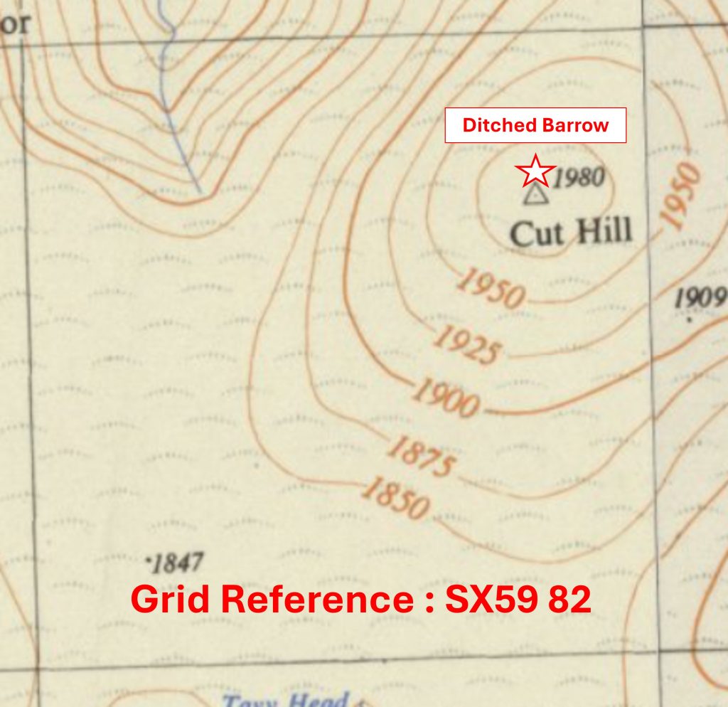
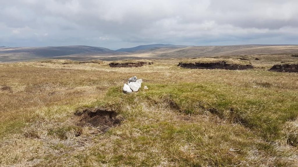
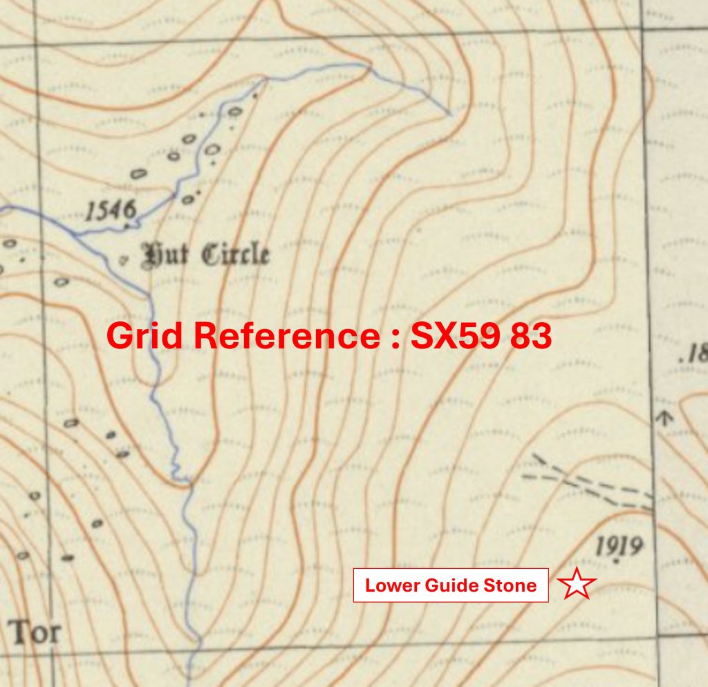
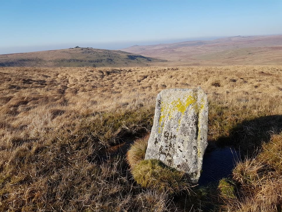
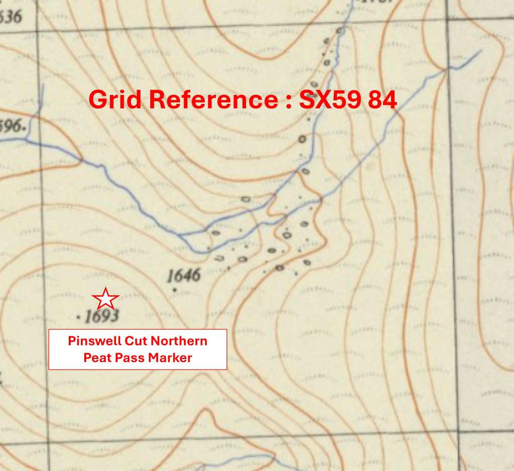
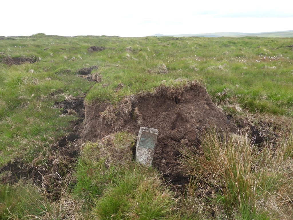
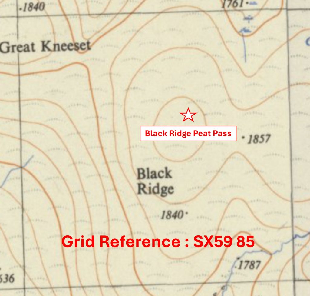
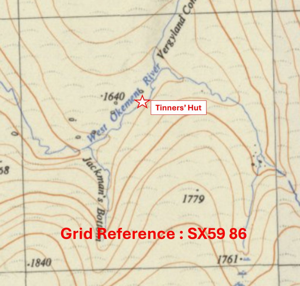
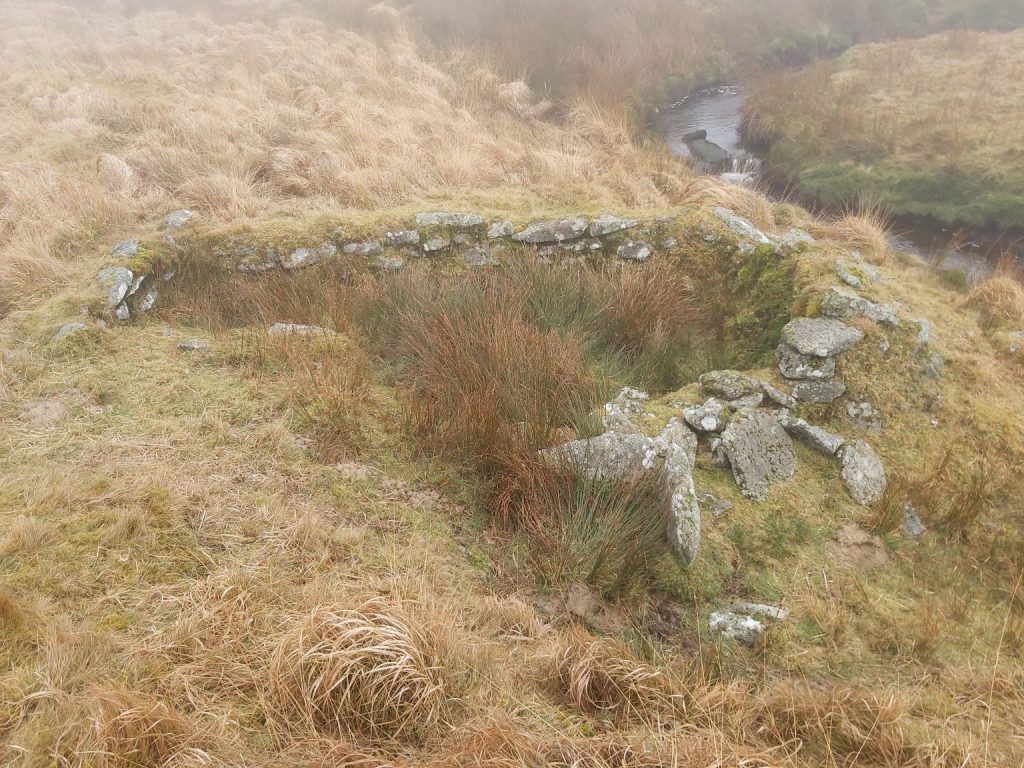
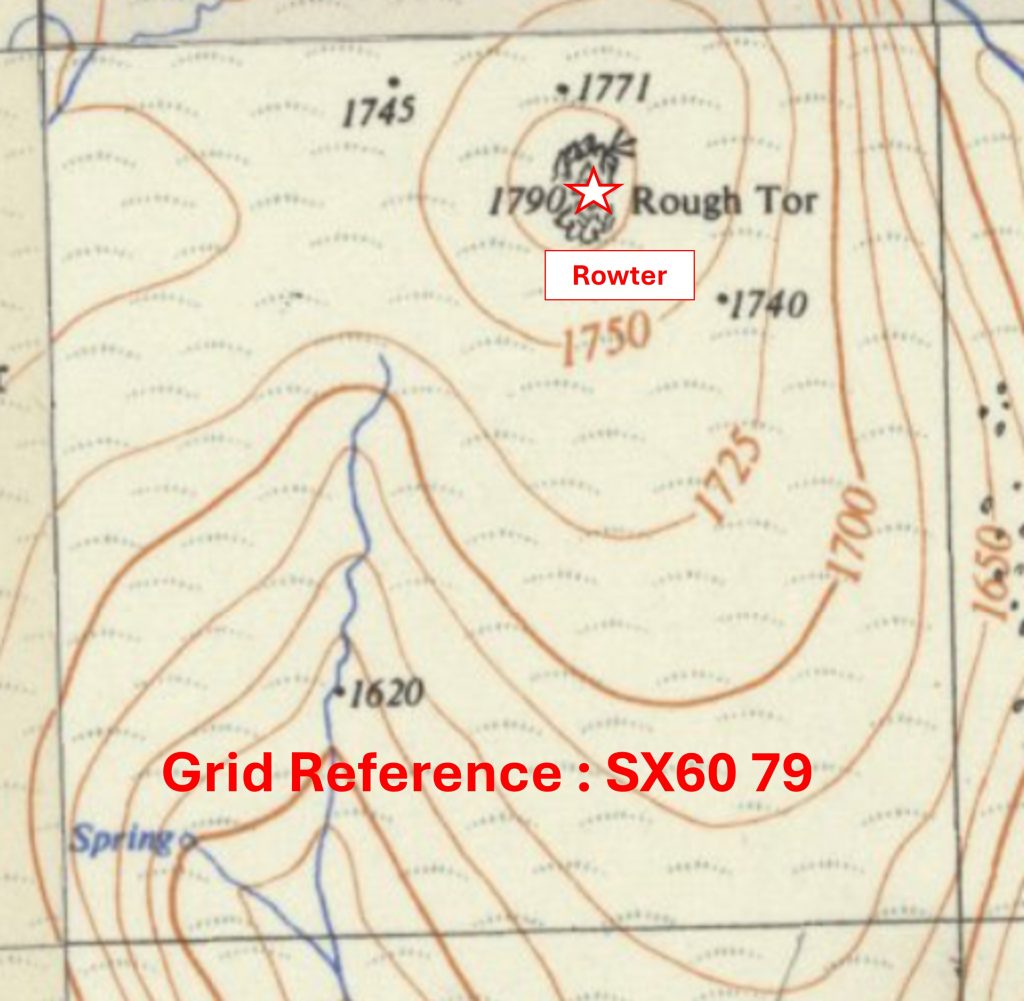
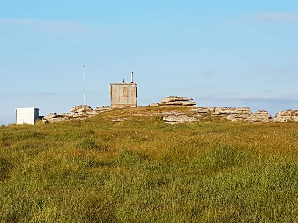
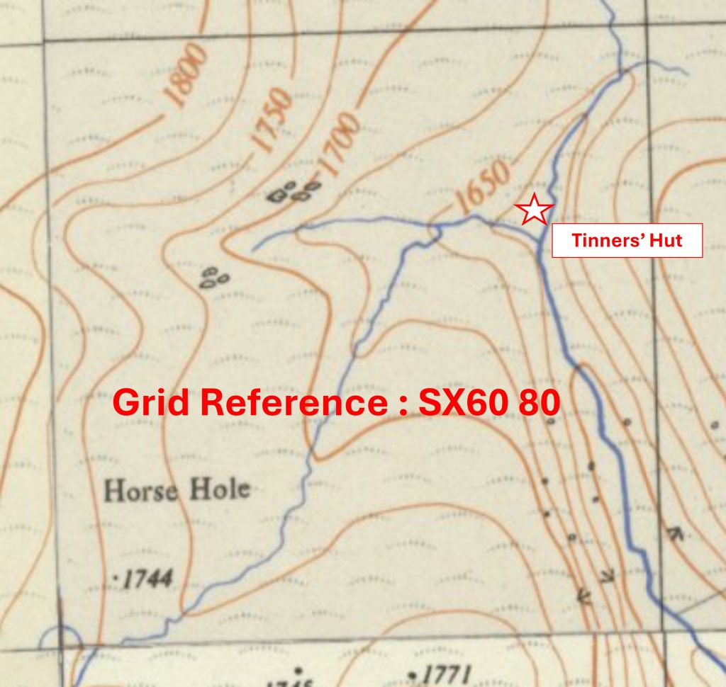
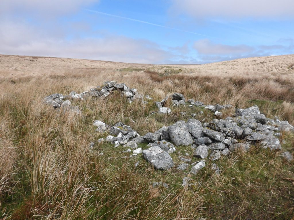
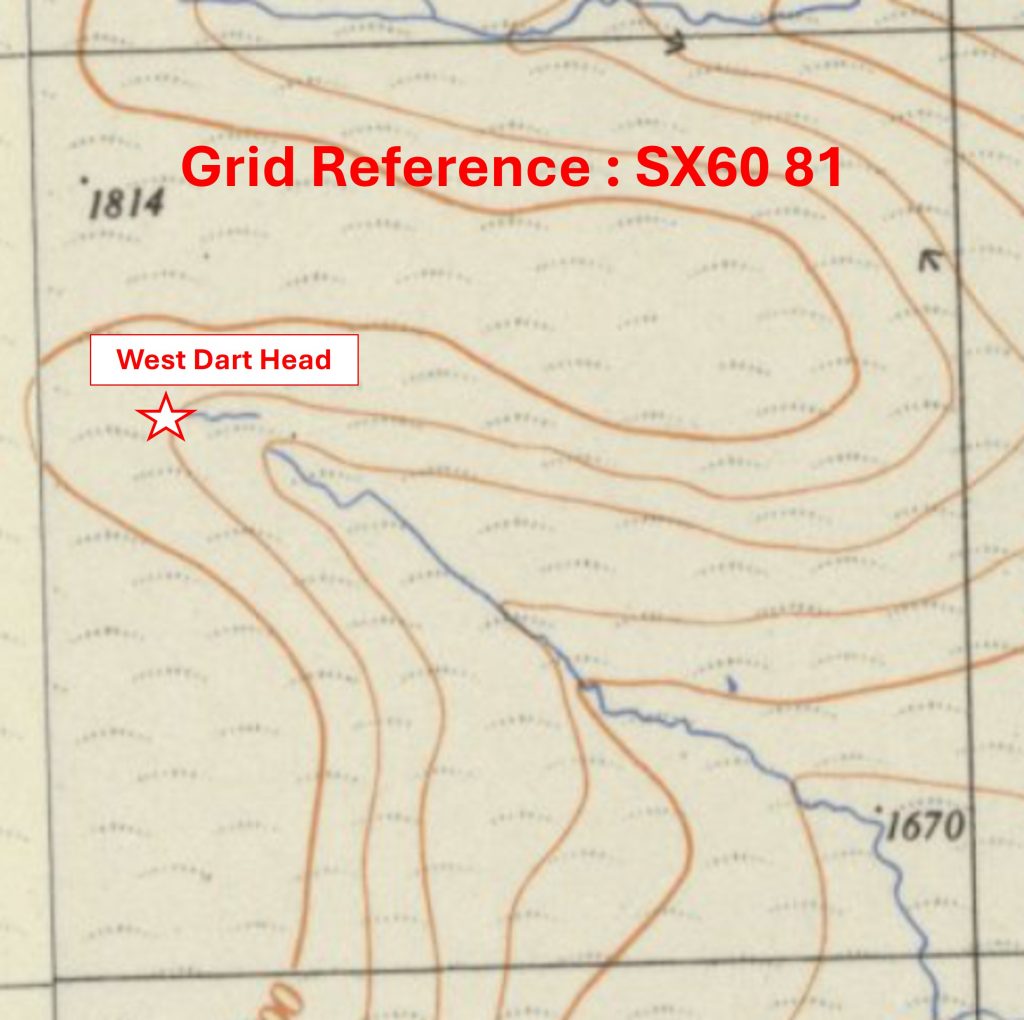
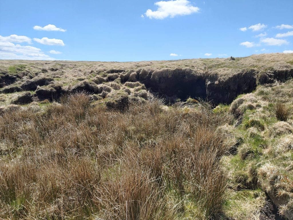
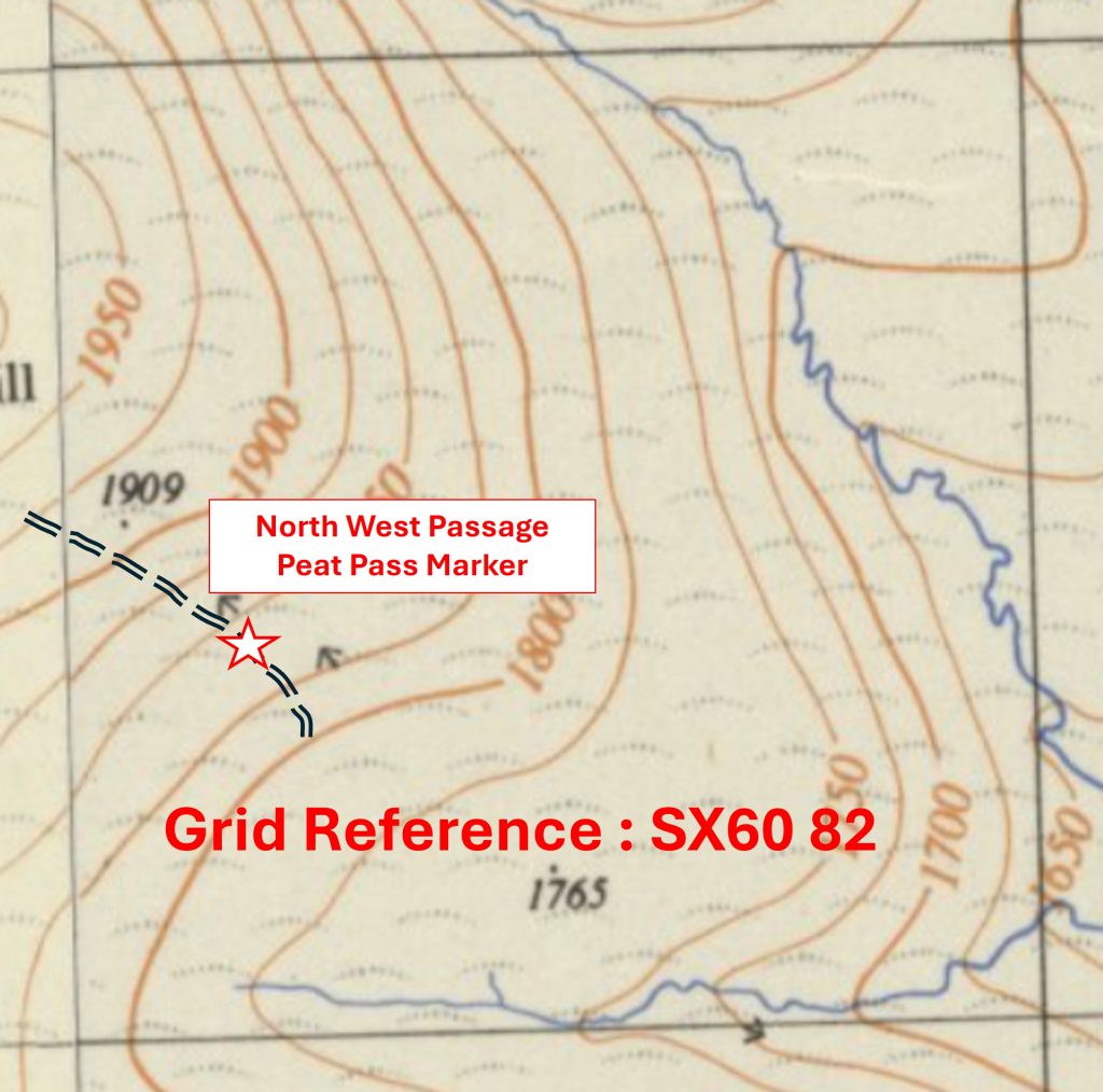
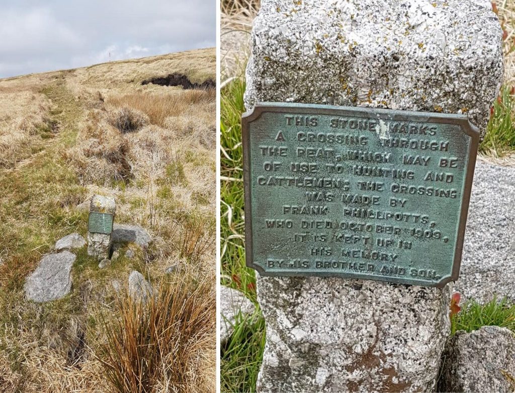
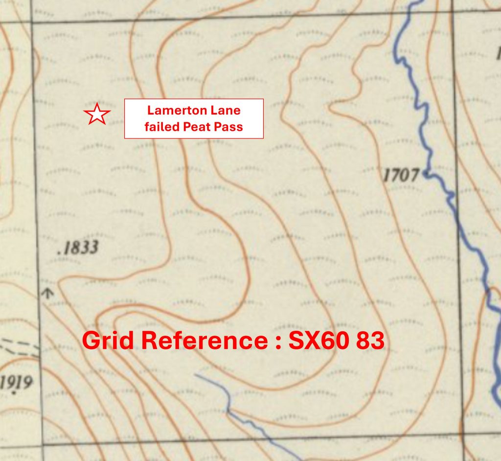
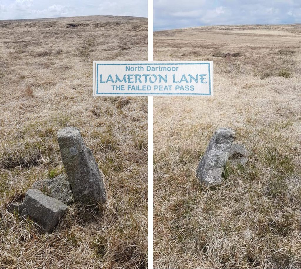
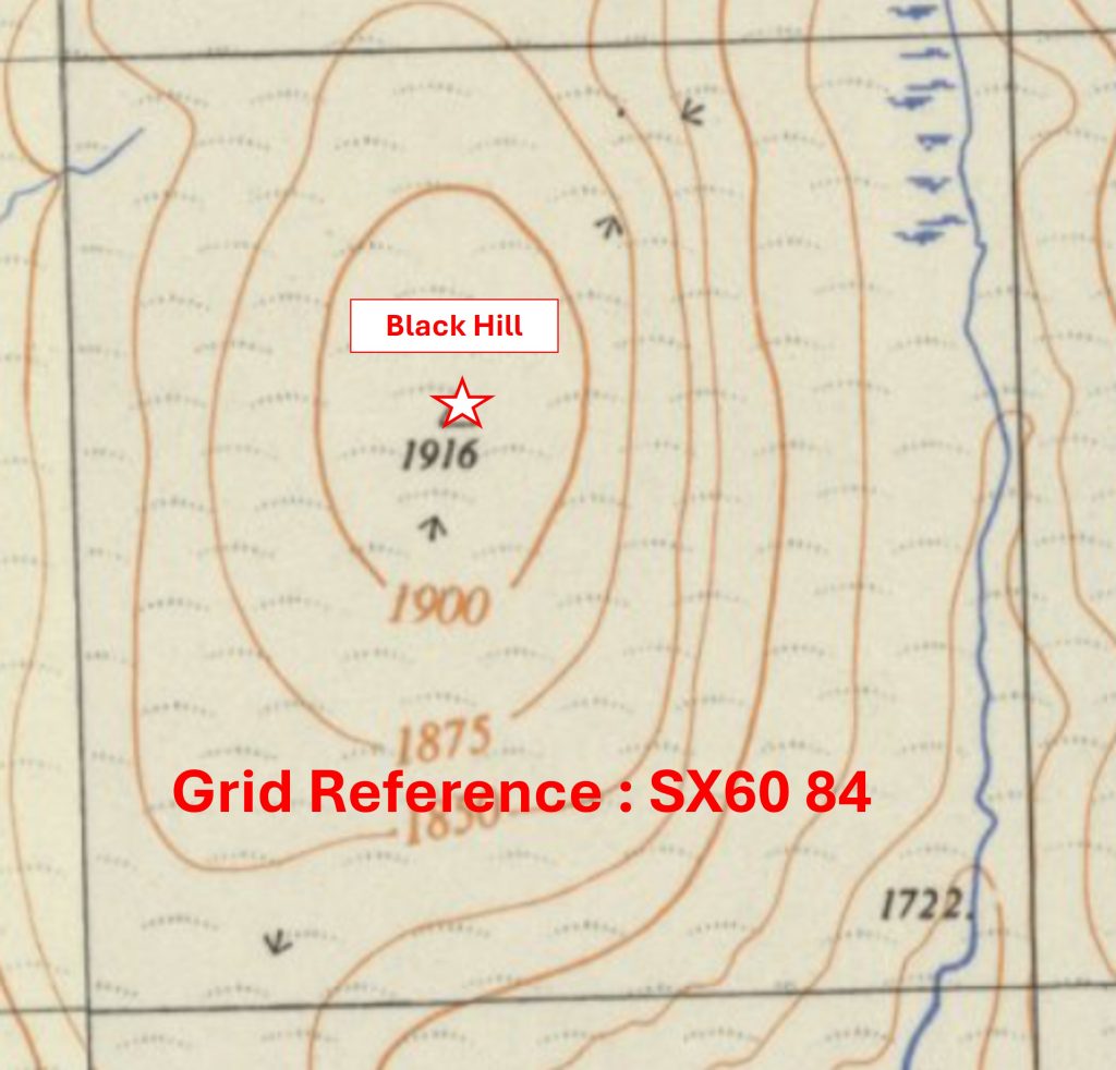
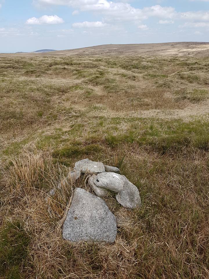
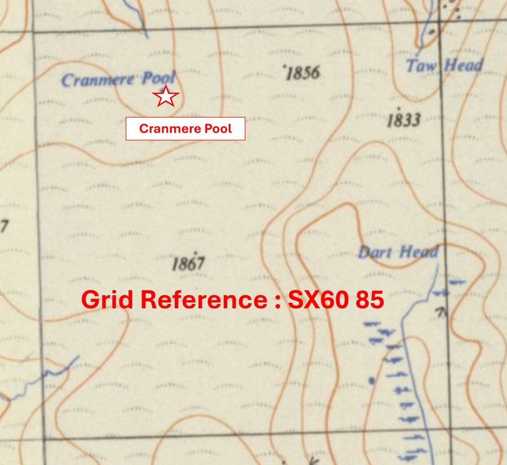
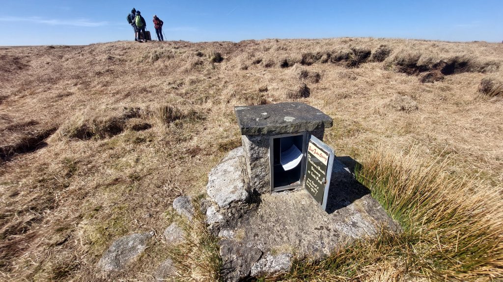
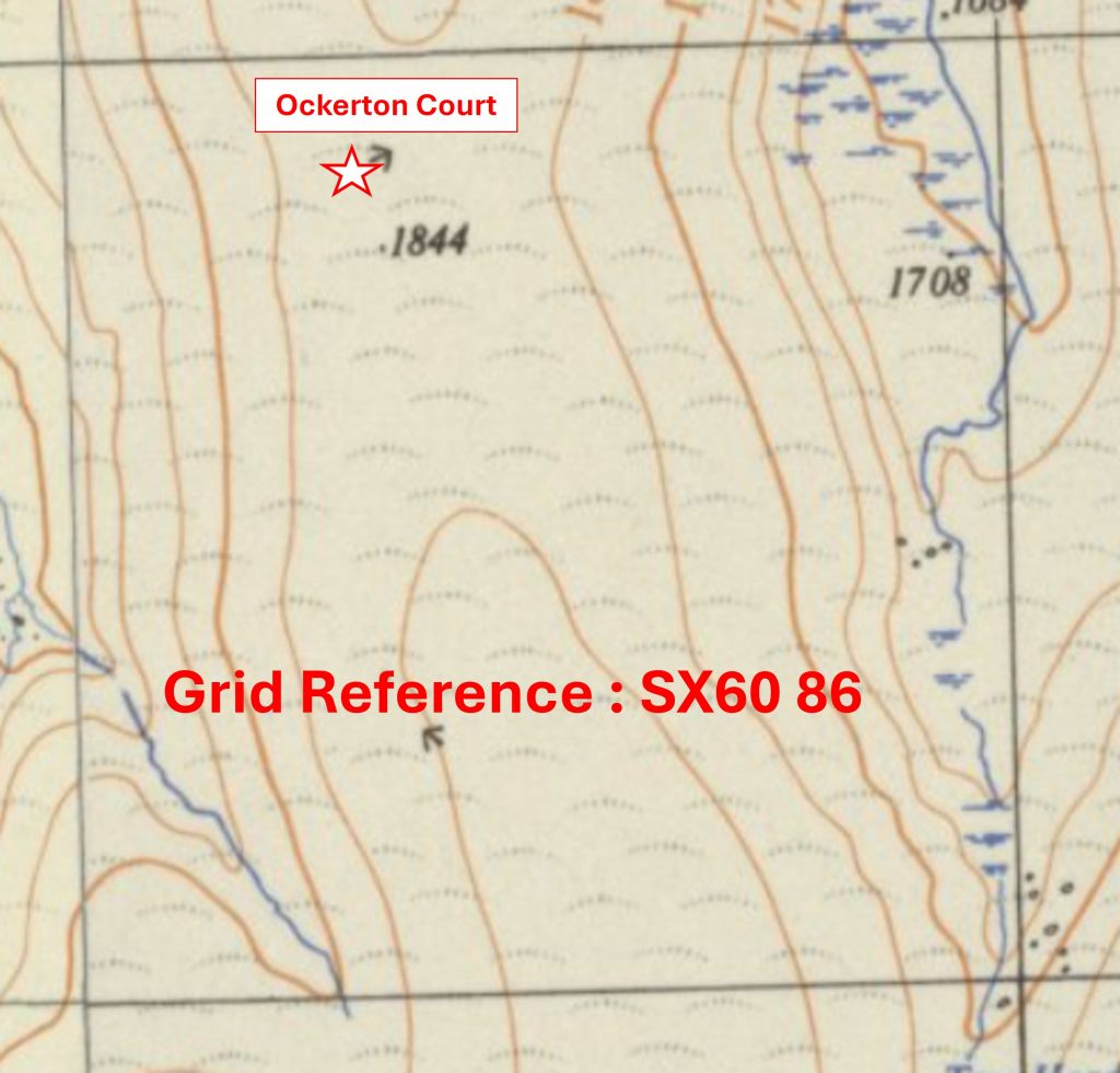
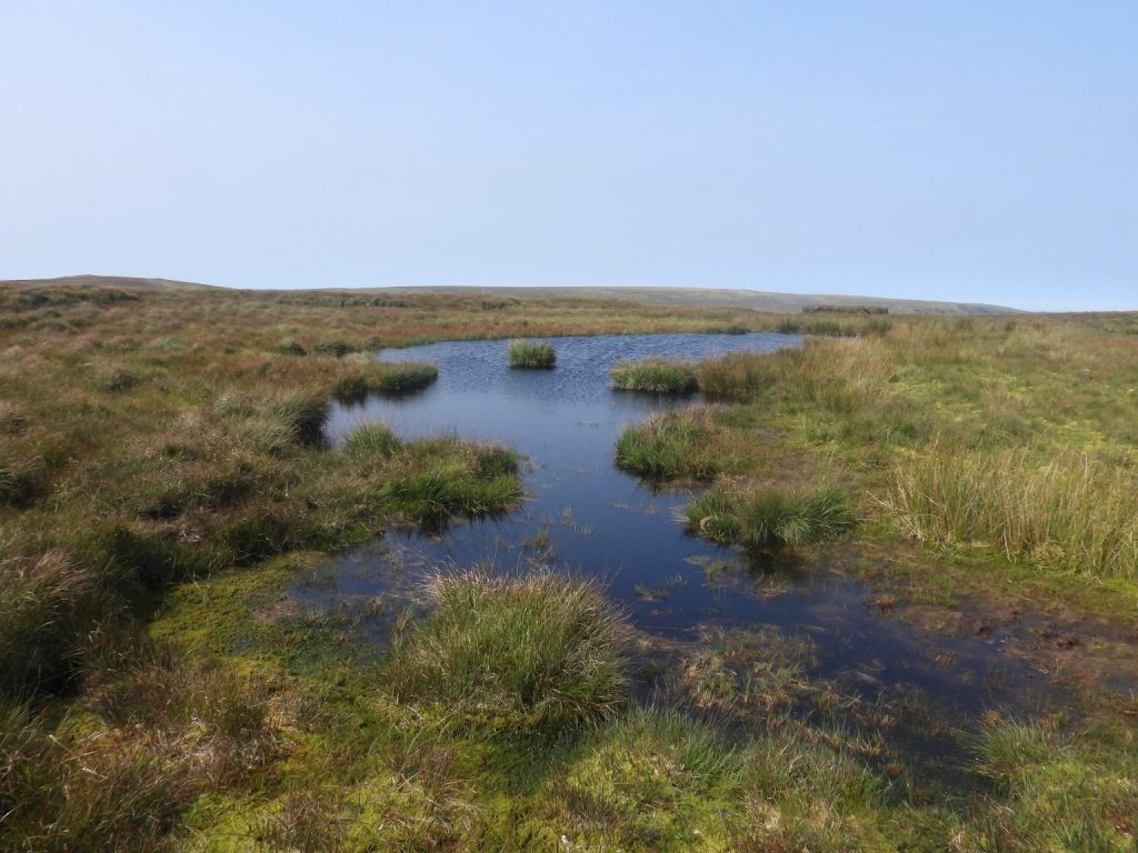
The recording of the ‘North West’ area in the Dartmoor 1000 project is 92.07% complete, with just 7 photographs to collect. Each km square is referenced with: an annotated map ‘snippet’ showing the SX grid with the location of the chosen artefact to represent the square and a photograph of that artefact. The OS map ‘snippets’ are 70 years old and not subject to copyright

0. Map and Table
The ‘North West’ area comprises 86 ‘Whole’ and 15 ‘Part’ km squares, which represents 9.6% of the total. The south west corner is SX4649, the south east corner is SX6079 and the north east corner is SX6086.
4879 a
Grid Reference SX48 79. The item selected to represent this square is a Mary Tavy / Brentor Parish Boundary Marker
4879 b
Grid Reference SX48 79. The Mary Tavy / Brentor Parish Boundary Marker is located at SX48619 79775
4880 a
Grid Reference SX48 80. The item selected to represent this square is Wortha Mill
4980 b
Grid Reference SX48 80. Wortha Mill is located at SX48546 80276
4979 a
Grid Reference SX49 79. The item selected to represent this square is Wheal Hope Sett Marker
4979 b
Grid Reference SX49 79. Wheal Hope Sett Marker is located at SX49839 79875
4980 a
Grid Reference SX49 80. The item selected to represent this square is a Buller / Edgecombe Boundary Marker
4980 b
Grid Reference SX49 80. The Buller / Edgecombe Boundary Marker is located at SX49248 80175
4981 a
Grid Reference SX49 81. The item selected to represent this square is a GWR Iron Marker (Dated 1891)
4981 b
Grid Reference SX49 81. The GWR Iron Marker (Dated 1891) is located at SX49050 81689
4982 a
Grid Reference SX49 82. The item selected to represent this square is Mary Tavy / Brentor Parish Boundary Marker
4982 b
Grid Reference SX49 82. The Mary Tavy / Brentor Parish Boundary Marker is located at SX49623 82105
5079 a
Grid Reference SX50 79. The item selected to represent this square is an Old Flatrod by Wheelpit
5079 b
Grid Reference SX50 79. The Old Flatrod by Wheelpit is located at SX50853 79361
5080 a
Grid Reference SX50 80. The item selected to represent this square is Wheal Jewell Compressor House
5080 b
Grid Reference SX50 80. The Wheal Jewell Compressor House is located at SX50919 80873
5081 a
Grid Reference SX50 81. The item selected to represent this square is a Triangulation Pillar (Flush Bracket S3450) on Gibbet Hill
5081 b
Grid Reference SX50 81. The Triangulation Pillar (Flush Bracket S3450) on Gibbet Hill is located at SX50305 81141
5082 a
Grid Reference SX50 82. The item selected to represent this square is Mary Tavy Footpath 32 entering Black Down
5082 b
Grid Reference SX50 82. Mary Tavy Footpath 32 entering Black Down is located at SX5033 8293
5083 a
Grid Reference SX50 83. The item selected to represent this square is Homeleigh Coach House
5083 b
Grid Reference SX50 83. Homeleigh Coach House is located at SX50349 83457
5084 a
Grid Reference SX50 84. This is a part square. The item selected to represent this square is a Viking or Rune Stone by the Castle
5084 b
Grid Reference SX50 84. This is a part square. The Viking or Rune Stone by the Castle is located at SX509 847
5085 a
Grid Reference SX50 85. This is a part square. The item selected to represent this square is a ‘Take Off Stone’ (in a private garden)
5085 b
Grid Reference SX50 85. This is a part square. The ‘Take Off Stone’ (in a private garden) is located at SX50959 85027
5179 a
Grid Reference SX51 79. The item selected to represent this square is a Miners Dry
5179 b
Grid Reference SX51 79. The Miners Dry is located at SX51187 79067
5180 a
Grid Reference SX51 80. The item selected to represent this square is an Old Hay Turner at Kingsett
5180 b
Grid Reference SX51 80. The Old Hay Turner at Kingsett is located at SX51220 80363
5181 a
Grid Reference SX51 81. The item selected to represent this square is a Boundary Stone Inscribed ‘B / C’
5181 b
Grid Reference SX51 81. The Boundary Stone Inscribed ‘B / C’ is located at SX51349 81228
5182 a
Grid Reference SX51 82. The item selected to represent this square is an Old Shaft
5182 b
Grid Reference SX51 82. The Old Shaft is located at SX51187 82265
5183 a
Grid Reference SX51 83. The item selected to represent this square is Lamerton / Mary Tavy Boundstone
5183 b
Grid Reference SX51 83. The Lamerton / Mary Tavy Boundstone is located at SX51771 83509
5184 a
Grid Reference SX51 84. The item selected to represent this square is Lydford Viaduct
5184 b
Grid Reference SX51 84. Lydford Viaduct is located at SX51358 84691
5185 a
Grid Reference SX51 85. This is a part square. The item selected to represent this square is the War Memorial at Rowell Cross
5185 b
Grid Reference SX51 85. This is a part square. The War Memorial at Rowell Cross is located at SX51297 85105
5186 a
Grid Reference SX51 86. This is a very small part of a square. The item selected to represent this square is a View from Gate
5186 b
Grid Reference SX51 86. This is a very small part of a square. The View from Gate is located at SX51273 86017 (looking south into the small part square)
5279 a
Grid Reference SX52 79. The item selected to represent this square is a Milestone inscribed ‘Tavistock 5 miles / Horndon 1/2 mile / Wapsworthy 1 mile’
5279 b
Grid Reference SX52 79. The Milestone inscribed ‘Tavistock 5 miles / Horndon 1/2 mile / Wapsworthy 1 mile’ is located at SX52480 79441
5280 a
Grid Reference SX52 80. The item selected to represent this square is St. Joseph’s Chapel
5280 b
Grid Reference SX52 80. St. Joseph’s Chapel is located at SX52064 80082
5281 a
Grid Reference SX52 81. The item selected to represent this square is a Powder House at Wheal Jewell
5281 b
Grid Reference SX52 81. The Powder House at Wheal Jewell is located at SX52373 81417
5282 a
Grid Reference SX52 82. The item selected to represent this square is a Boundary Stone Inscribed ‘WB’ at location called ‘Tin Pits’
5282 b
Grid Reference SX52 82. The Boundary Stone Inscribed ‘WB’ at location called ‘Tin Pits’ is located at SX52361 82239
5283 a
Grid Reference SX52 83. The item selected to represent this square is WD Boundary Stone (WD4) at Prescombe Corner
5283 b
Grid Reference SX52 83. The WD Boundary Stone (WD4) at Prescombe Corner is located at SX522 834
5284 a
Grid Reference SX52 84. The item selected to represent this square is WD Boundary Stone (WD14)
5284 b
Grid Reference SX52 84. WD Boundary Stone (WD14) is located at SX5264 8447
5285 a
Grid Reference SX52 85. The item selected to represent this square is a Holed Stone
5285 b
Grid Reference SX52 85. The Holed Stone is located at SX52937 85300
5286 a
Grid Reference SX52 86. This is a part of a square. The item selected to represent this square is Vale Down Boundary Stones
5286 b
Grid Reference SX52 86. This is a part of a square. Vale Down Boundary Stones are located at SX52645 86169
5379 a
Grid Reference SX53 79. The item selected to represent this square is Wheelpit at East Wheal Friendship
5379 b
Grid Reference SX53 79. The Wheelpit at East Wheal Friendship is located at SX53056 79440
5380 a
Grid Reference SX53 80. The item selected to represent this square is Hill Bridge
5380 b
Grid Reference SX53 80. Hill Bridge is located at SX5318 8036
5381 a
Grid Reference SX53 81. The item selected to represent this square is Standon Bridge / Steps WWII Inscription
5381 b
Grid Reference SX53 81. Standon Bridge / Steps WWII Inscription is located at SX53914 81574
5382 b
Grid Reference SX53 82. The item selected to represent this square is Yellowmead Farm (Ruined Barn)
5382 b
Grid Reference SX53 82. Yellowmead Farm (Ruined Barn) is located at SX53040 8275
5383 a
Grid Reference SX53 83. The item selected to represent this square is Target Hoist and Bunker at Target Tramway
5383 b
Grid Reference SX53 83. The Target Hoist and Bunker at Target Tramway is located at SX53779 83253
5384 a
Grid Reference SX53 84. The item selected to represent this square is Doe Tor Farm
5384 b
Grid Reference SX53 84. Doe Tor Farm is located at SX53638 84921
5385 a
Grid Reference SX53 85. The item selected to represent this square is Wheal Mary Emma Ruined Building
5385 b
Grid Reference SX53 85. Wheal Mary Emma Ruined Building is located at SX53238 85189
5386 a
Grid Reference SX53 86. The item selected to represent this square is a Boundary Stone Inscribed ‘L / MM’
5386 b
Grid Reference SX53 86. The Boundary Stone Inscribed ‘L / MM’ is located at SX53783 86252
5479 a
Grid Reference SX54 79. The item selected to represent this square is a Winch at Jack Cloke’s Prospect
5479 b
Grid Reference SX54 79. The Winch at Jack Cloke’s Prospect is located at SX54496 79839
5480 a
Grid Reference SX54 80. The item selected to represent this square is Bagga Tor
5480 b
Grid Reference SX54 80. Bagga Tor is located at SX5480 8058
5481 a
Grid Reference SX54 81. The item selected to represent this square is Standon Farm
5481 b
Grid Reference SX54 81. Standon Farm is located at SX5449 8145
5482 a
Grid Reference SX54 82. The item selected to represent this square is Nat Tor
5482 b
Grid Reference SX54 82. Nat Tor is located at SX5458 8239
5483 a
Grid Reference SX54 83. The item selected to represent this square is a Possible Sheepfold in Hamlyn’s Newtake
5483 b
Grid Reference SX54 83. The Possible Sheepfold in Hamlyn’s Newtake is located at SX54179 83492
5484 a
Grid Reference SX54 84. The item selected to represent this square is a View from Doe Tor
5484 b
Grid Reference SX54 84. The View from Doe Tor was taken at SX542 848
5485 a
Grid Reference SX54 85. The item selected to represent this square is Wheal Frederick (Foxhole Mine)
5485 b
Grid Reference SX54 85. Wheal Frederick (Foxhole Mine) is located at SX54568 85361
5486 a
Grid Reference SX54 86. The item selected to represent this square is Little Links Tor
5486 b
Grid Reference SX54 86. Little Links Tor is located at SX5471 8698
5579 a
Grid Reference SX55 79. The item selected to represent this square is a Butterbury Boundary Marker (Recumbent)
5579 b
Grid Reference SX55 79. The Butterbury Boundary Marker (Recumbent) is located at SX55213 79305
5580 a
Grid Reference SX55 80. The item selected to represent this square is a Mine Adit
5580 b
Grid Reference SX55 80. The Mine Adit is located at SX55153 80959
5581 a
Grid Reference SX55 81. The item selected to represent this square is Standon Hill
5581 b
Grid Reference SX55 81. Standon Hill is located at SX555 814
5582 a
Grid Reference SX55 82. The item selected to represent this square is Deep Bottom
5582 b
Grid Reference SX55 82. Deep Bottom is located (centred) at SX558 828
5583 a
Grid Reference SX55 83. The item selected to represent this square is the Staircase Waterfall and Pool
5583 b
Grid Reference SX55 83. The Staircase Waterfall and Pool are located at SX5544 8307
5584 a
Grid Reference SX55 84. The item selected to represent this square is a WD 20 Standing Stone plus a Recumbent WD Stone
5584 b
Grid Reference SX55 84. The WD 20 Standing Stone plus a Recumbent WD Stone are located at SX55474 84610
5585 a
Grid Reference SX55 85. The item selected to represent this square is Chat Tor
5585 b
Grid Reference SX55 85. Chat Tor is located at SX55531 85276
5586 a
Grid Reference SX55 86. The item selected to represent this square is a Peat Cutters Bondstone
5586 b
Grid Reference SX55 86. The Peat Cutters Bondstone is located at SX55111 86734
5679 a
Grid Reference SX56 79. The item selected to represent this square is White Barrow
5679 b
Grid Reference SX56 79. White Barrow is located at SX56839 79286
5680 a
Grid Reference SX56 80. The item selected to represent this square is Lynch Tor
5680 b
Grid Reference SX56 80. Lynch Tor is located at SX 5646 8064
5681 a
Grid Reference SX56 81. The item selected to represent this square is WD 25 Standing Stone
5681 b
Grid Reference SX56 81. WD 25 Standing Stone is located at SX56528 81709
5682 a
Grid Reference SX56 82. The item selected to represent this square is the Range Pole where three ranges meet (Okehampton, Merrivale and Willsworthy)
5682 b
Grid Reference SX56 82. The Range Pole where three ranges meet (Okehampton, Merrivale and Willsworthy) is located at SX56599 82406
5683 a
Grid Reference SX56 83. The item selected to represent this square is Rakernesbrokyfote (Rattlebrook Foot)
5683 b
Grid Reference SX56 83. Rakernesbrokyfote (Rattlebrook Foot) is located at SX56028 83749
5684 a
Grid Reference SX56 84. The item selected to represent this square is an Un-used wheelpit
5684 b
Grid Reference SX56 84. The Un-used wheelpit is located at SX56303 84267
5685 a
Grid Reference SX56 85. The item selected to represent this square is Tinners’ Streamworks
5685 b
Grid Reference SX56 85. The Tinners’ Streamworks are located at SX5619 8509
5686 a
Grid Reference SX56 86. The item selected to represent this square is Green Tor
5686 b
Grid Reference SX56 86. Green Tor is located at SX562 864
5779 a
Grid Reference SX57 79. The item selected to represent this square is a Building at Wheal Prosper
5779 b
Grid Reference SX57 79. The Building at Wheal Prosper is located at SX57348 79341
5780 a
Grid Reference SX57 80. The item selected to represent this square is Walkham Head Peat Works
5780 b
Grid Reference SX57 80. Walkham Head Peat Works is located at SX57280 80662
5781 a
Grid Reference SX57 81. The item selected to represent this square is Walkham Cut Peat Pass Marker
5781 b
Grid Reference SX57 81. The Walkham Cut Peat Pass Marker is located at SX57850 81495
5782 a
Grid Reference SX57 82. The item selected to represent this square is Tavy Hole Stone
5782 b
Grid Reference SX57 82. The Tavy Hole Stone is located at SX5765 8258
5783 a
Grid Reference SX57 83. The item selected to represent this square is the junction of Amicombe Brook and River Tavy
5783 b
Grid Reference SX57 83. The junction of Amicombe Brook and River Tavy is located at SX5713 8337
5784 a
Grid Reference SX57 84. The item selected to represent this square is a section of Amicombe Brook
5784 b
Grid Reference SX57 84. The section of Amicombe Brook is located at 5780 8457
5785 a
Grid Reference SX57 85. The item selected to represent this square is a Broad Amicombe Hole
5785 b
Grid Reference SX57 85. Broad Amicombe Hole is located at SX 5782 8566
5786  a
Grid Reference SX57 86. The item selected to represent this square is a 629 Capping Stone
5786 b
Grid Reference SX57 86. The 629 Capping Stone is located at SX57009 86201
5879 a
Grid Reference SX58 79. The item selected to represent this square is Conies Down Tor
5879 b
Grid Reference SX58 79. Conies Down Tor is located at SX5892 7910
5880 a
Grid Reference SX58 80. The item selected to represent this square is Tussocks near Spriddle Lake
5880 b
Grid Reference SX58 80. The Tussocks near Spriddle Lake are located at SX58491 80196
5881 a
Grid Reference SX58 81. The item selected to represent this square is a Tethering Ring
5881 b
Grid Reference SX58 81. The Tethering Ring is located at SX5811 8177
5882 a
Grid Reference SX58 82. The item selected to represent this square is Fur Tor Brook
5882 b
Grid Reference SX58 82. The photograph of Fur Tor Brook was taken at SX5823 8243
5883 a
Grid Reference SX58 83. The item selected to represent this square is Fur Tor
5883 b
Grid Reference SX58 83. Fur Tor is located at SX588 831
5884 a
Grid Reference SX58 84. The item selected to represent this square is Little Kneeset Tor
5884 b
Grid Reference SX58 84. Little Kneeset Tor is located at SX5856 8404
5885 a
Grid Reference SX58 85. The item selected to represent this square is Great Kneeset
5885 b
Grid Reference SX58 85. Great Kneeset is located at SX589 859
5886 a
Grid Reference SX58 86. The item selected to represent this square is Kneeset Nose
5886 b
Grid Reference SX58 86. Kneeset Nose is located at SX5871 8685
5979 a
Grid Reference SX59 79. The item selected to represent this square is Beardown Man
5979 b
Grid Reference SX59 79. Beardown Man is located at SX5961 7962
5980 a
Grid Reference SX59 80. The item selected to represent this square is Cowsic Head
5980 b
Grid Reference SX59 80. Cowsic Head is located at SX5935 8030
5981 a
Grid Reference SX59 81. The item selected to represent this square is Tavy Head
5981 b
Grid Reference SX59 81. Tavy Head is located at SX59516 81920
5982 a
Grid Reference SX59 82. The item selected to represent this square is a Ditched Barrow at summit of Cut Hill
5982 b
Grid Reference SX59 82. The Ditched Barrow at summit of Cut Hill is located at SX59814  82748
5983 a
Grid Reference SX59 83. The item selected to represent this square is the Lower Guide Stone on Cut Hill
5983 b
Grid Reference SX59 83. The Lower Guide Stone on Cut Hill is located at SX59862 83085
5984 a
Grid Reference SX59 84. The item selected to represent this square is Pinswell Cut Northern Peat Pass Marker
5984 b
Grid Reference SX59 84. Pinswell Cut Northern Peat Pass Marker is located at SX59155 84345
5985 a
Grid Reference SX59 85. The item selected to represent this square is Black Ridge Peat Pass
5985 b
Grid Reference SX59 85. Black Ridge Peat Pass is located at SX596 856
5986 a
Grid Reference SX59 86. The item selected to represent this square is a Tinners’ Hut
5986 b
Grid Reference SX59 86. The Tinners’ Hut is located at SX59471 86655
6079 a
Grid Reference SX60 79. The item selected to represent this square is Rowter (Rough Tor)
6079 b
Grid Reference SX60 79. Rowter (Rough Tor) is located at SX606 798
6080 a
Grid Reference SX60 80. The item selected to represent this square is a Tinners’ Hut
6080 b
Grid Reference SX60 80. The Tinners’ Hut is located at SX60814 80711
6081 a
Grid Reference SX60 81. The item selected to represent this square is West Dart Head
6081 b
Grid Reference SX60 81. West Dart Head is located at SX6013 8160
6082 a
Grid Reference SX60 82. The item selected to represent this square is a North West Passage Peat Pass Marker
6082 b
Grid Reference SX60 82. North West Passage Peat Pass Marker is located at SX602 824
6083 a
Grid Reference SX60 83. The item selected to represent this square is Lamerton Lane failed Peat Pass
6083 b
Grid Reference SX60 83. Lamerton Lane failed Peat Pass is located at SX60198 83744
6084 a
Grid Reference SX60 84. The item selected to represent this square is Black Hill
6084 b
Grid Reference SX60 84. Black Hill is located at SX604 846
6085 a
Grid Reference SX60 85. The item selected to represent this square is Cranmere Pool
6085 b
Grid Reference SX60 85. Cranmere Pool (old and new letterboxes) are located at SX603 858
6086 a
Grid Reference SX60 86. The item selected to represent this square is Ockerton Court
6086 b
Grid Reference SX60 86. Ockerton Court is located at SX60321 86877

Total Page Visits: 57 - Today Page Visits: 2

Next Post

Previous Post

Leave a Reply

© 2026 Dartmoor Explorations

Theme by Anders Norén

Social media & sharing icons powered by UltimatelySocial