A collection of walks, discoveries, insights and pictures of exploring Dartmoor National Park
May 8, 2021
Kerbeam Mine
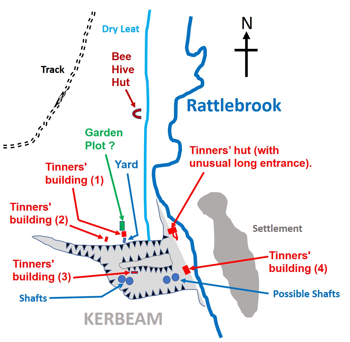
Kerbeam mine is located at the lower end on the Rattlebrook on its west site. It is believed to have been a former medieval opencast tinwork and which there is documentary evidence for reworking it at the end of the 18th century and early in the 19th century. The area affords the explorer deep tinners’ openworks, numerous shafts and spoilheaps, a leat, four tinners’ buildings (one with an associated yard and possible garden plot), a tinners’ hut and a bee hive hut just a short distance away. References for this post are from Dartmoor Heritage Gateway website, a superb resource of information. The intention of this post is to complement the descriptions of artefacts from on the website with a pictorial record of them.
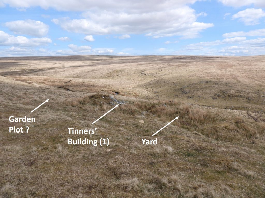
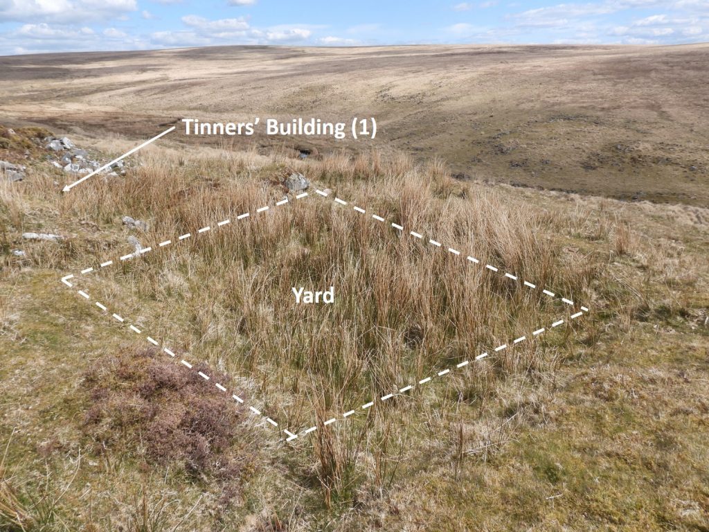
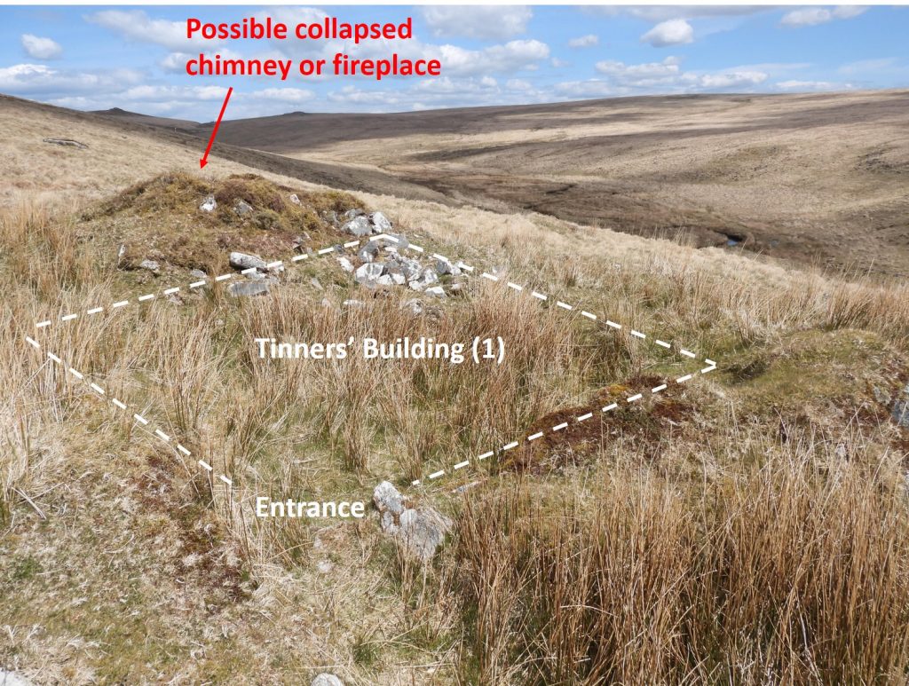
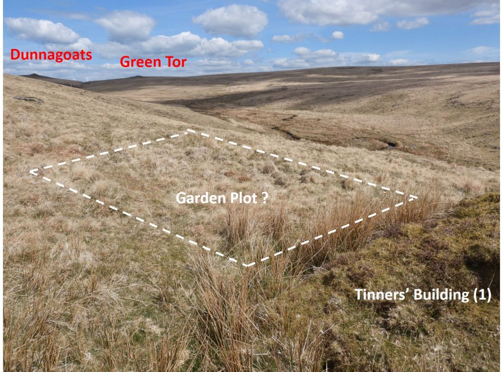
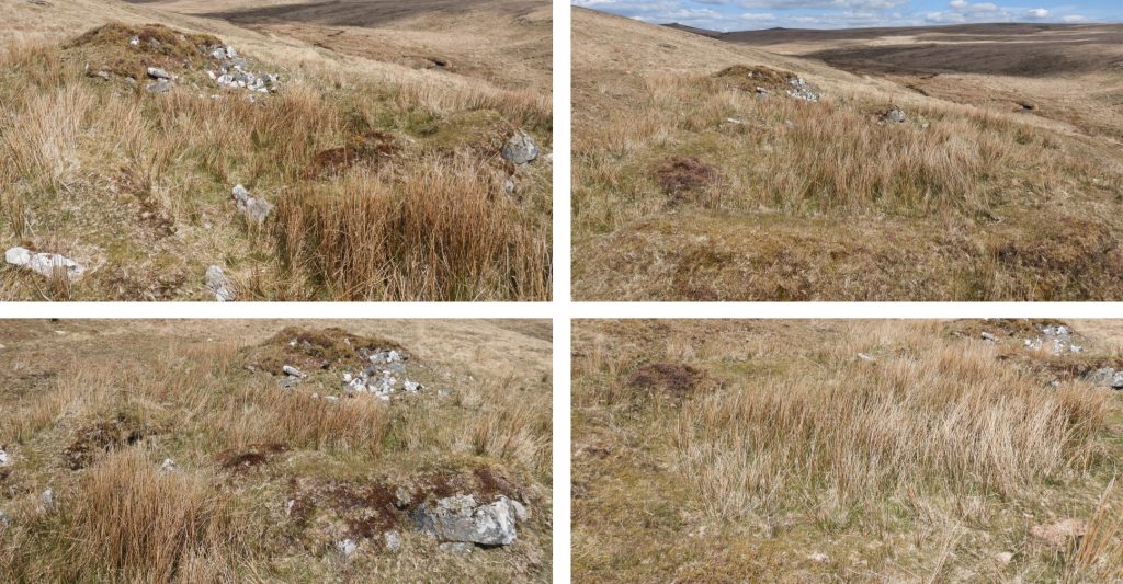
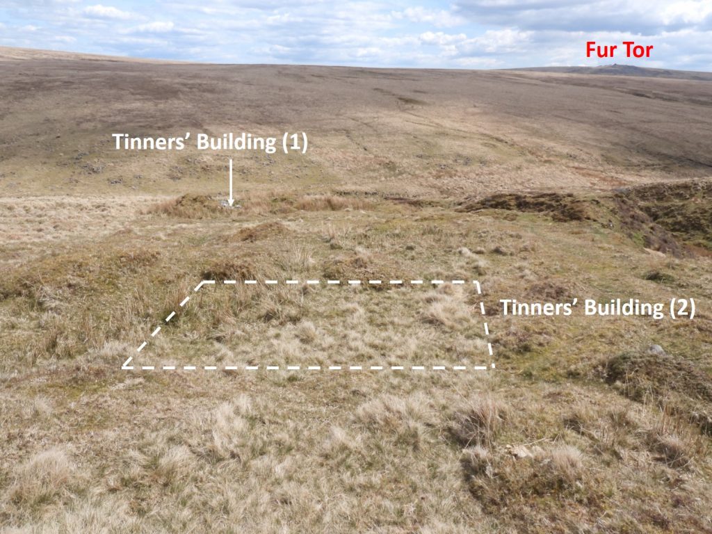
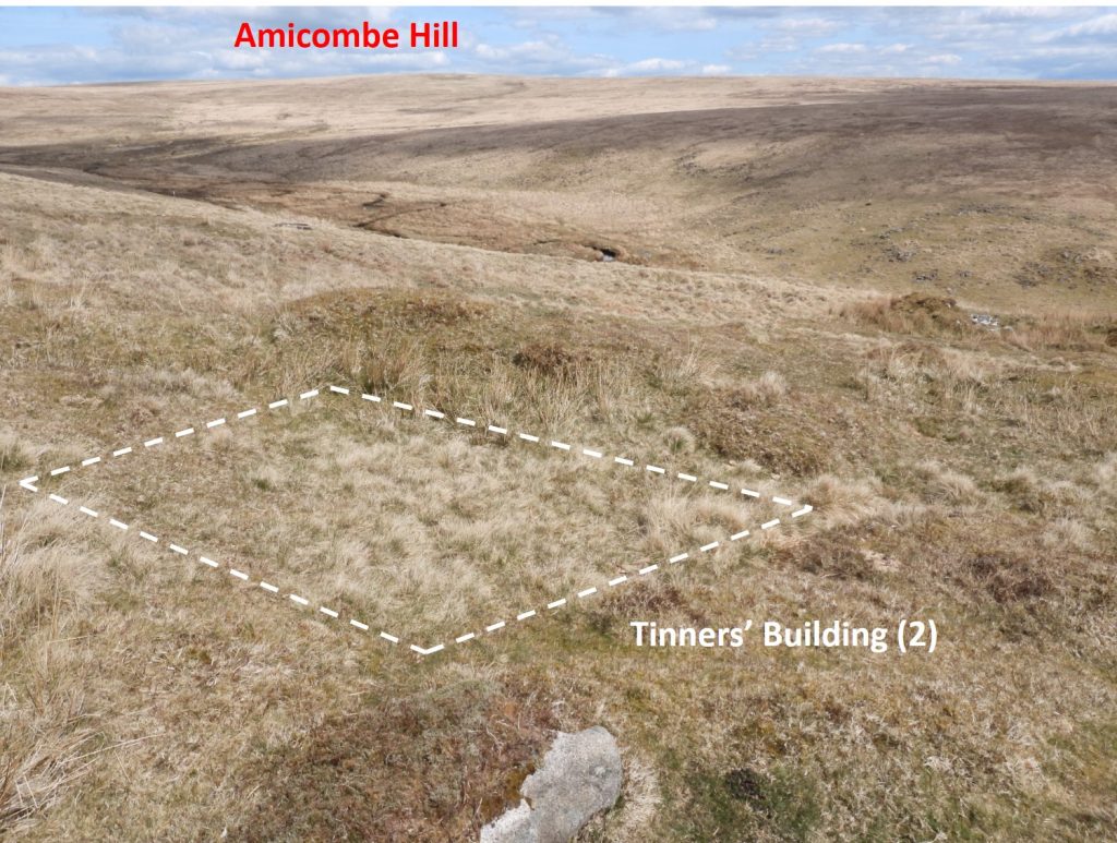
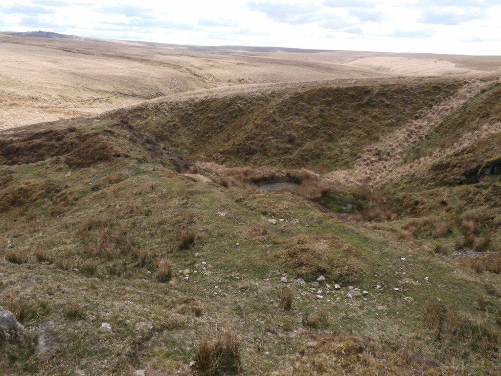
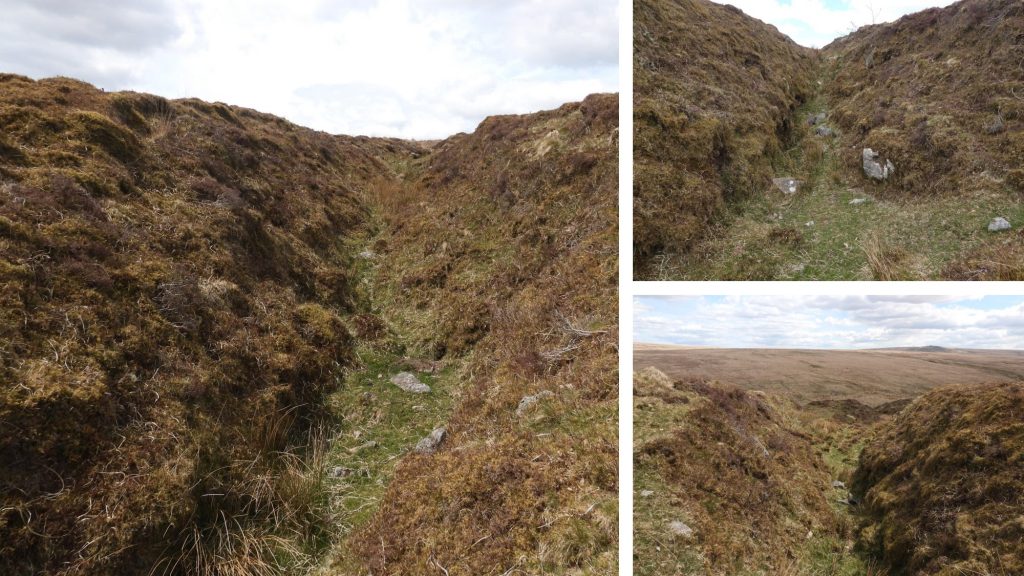
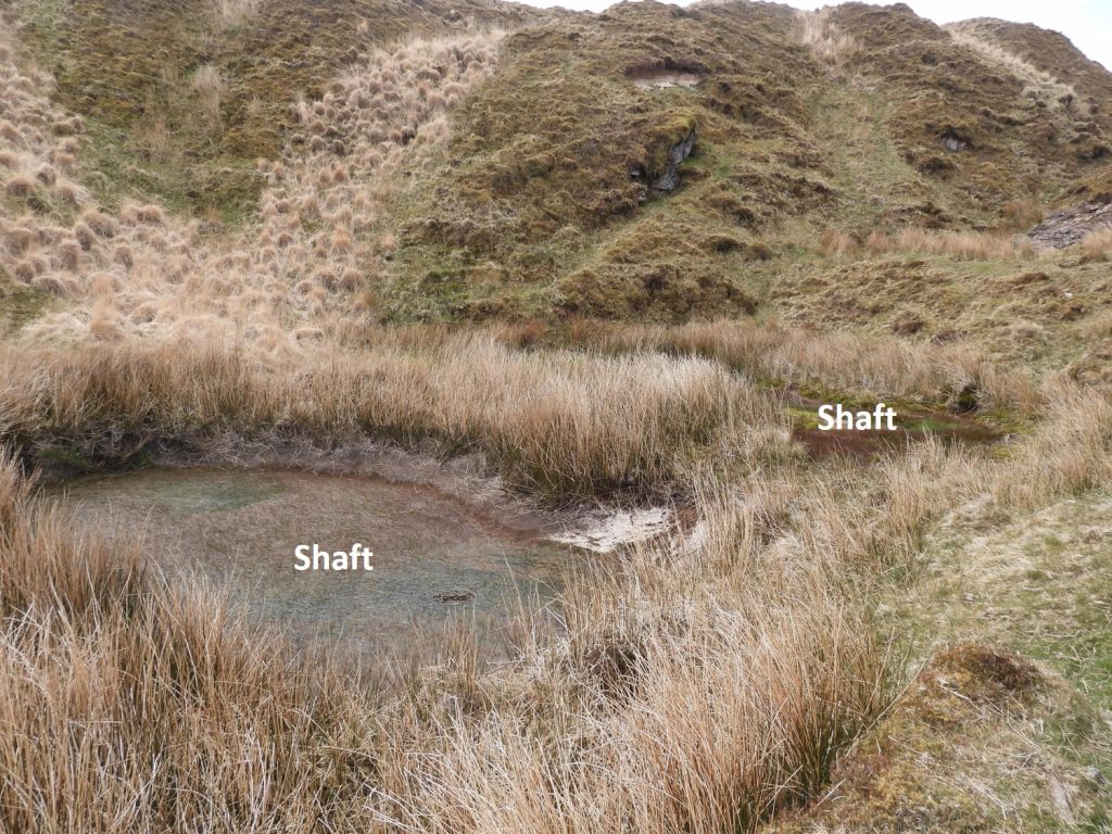
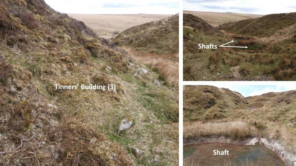
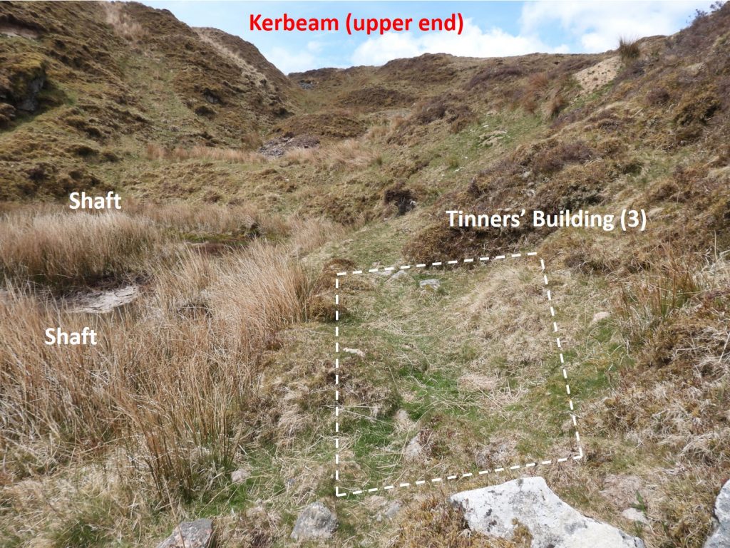
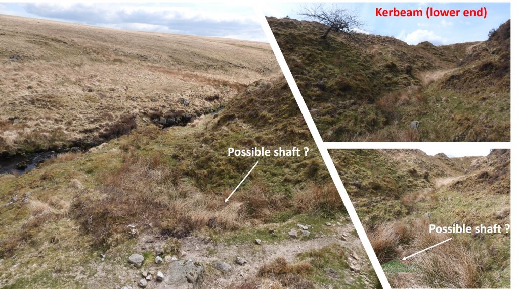
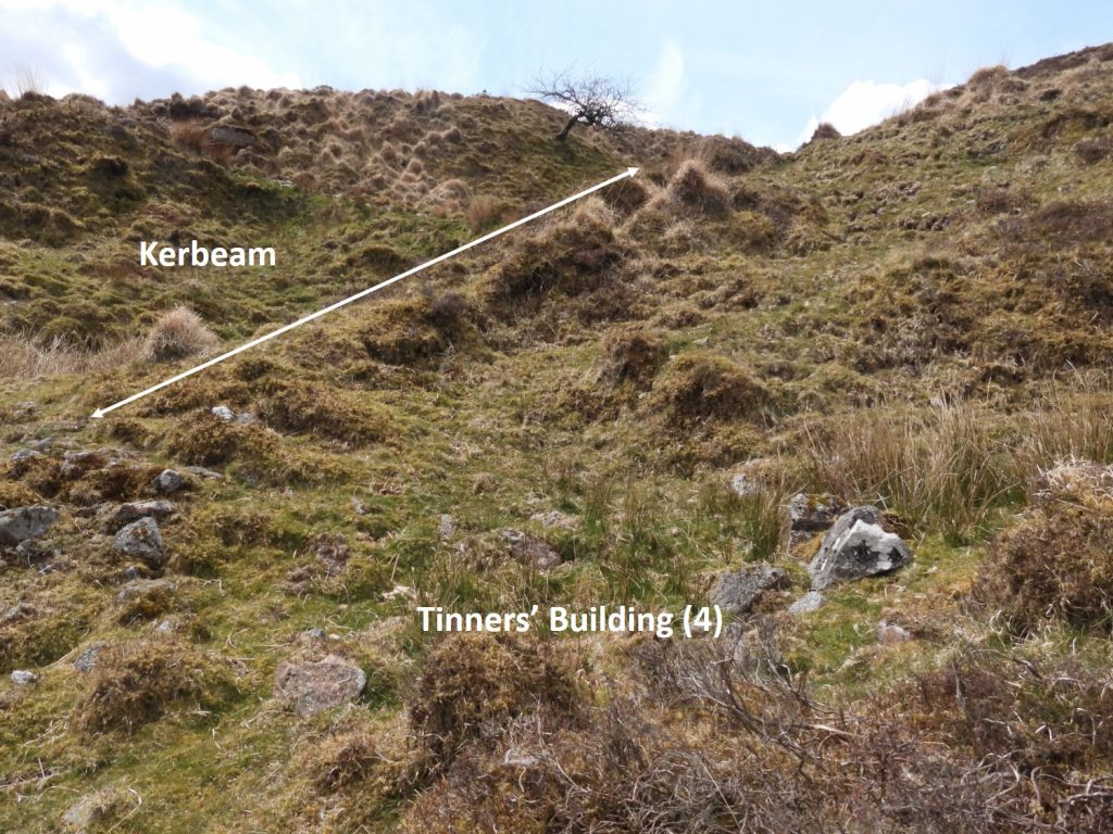
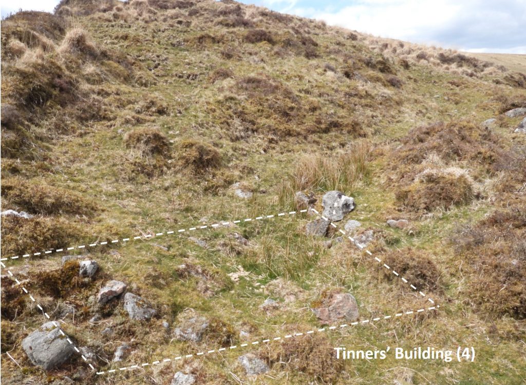
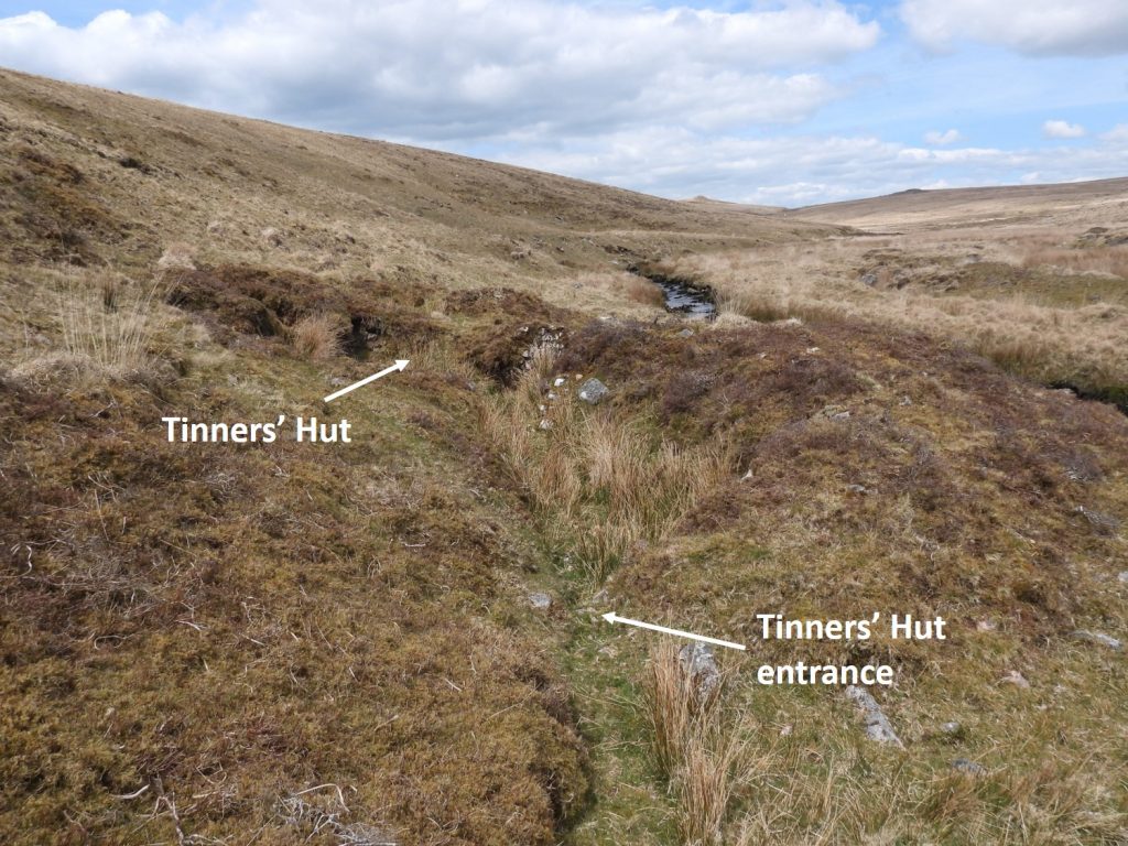
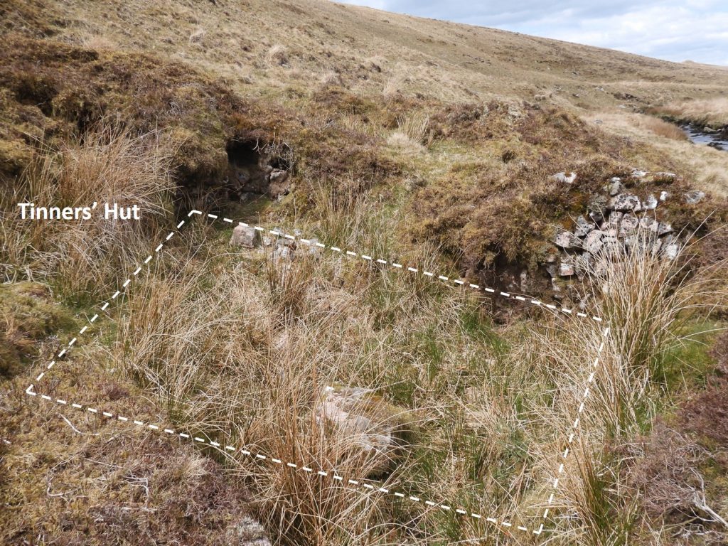
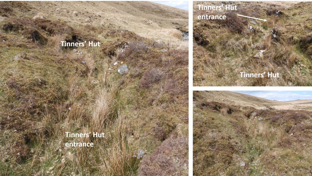
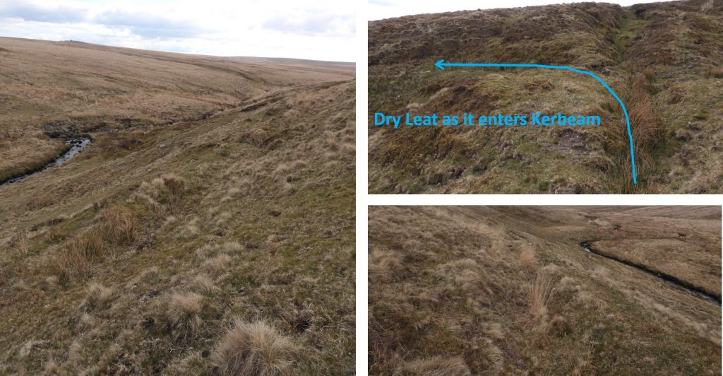
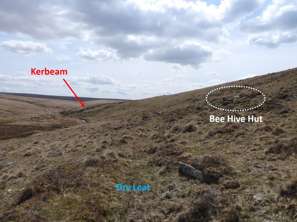
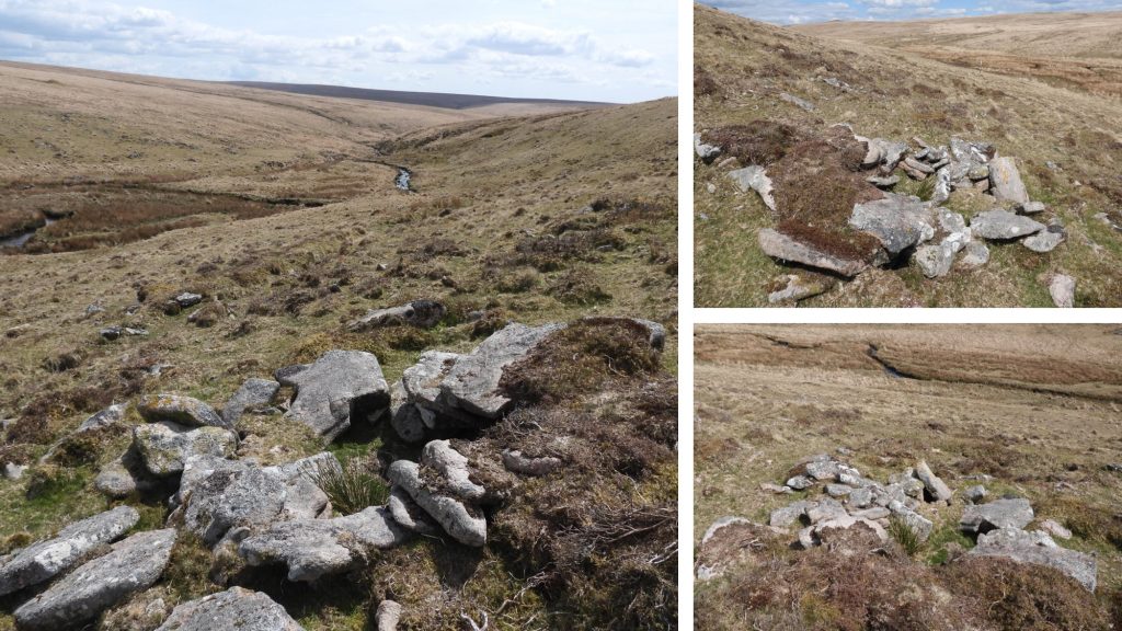
The authors plan if the Kerbeam area with features explored. Grid references of the salient features are shown in subsequent photographs.Approaching the mine workings from the north west, one of the first features to encounter is what are described as “three structures in a line on the northern edge of the workings” in the Dartmoor HER.The southernmost of the three structures was what believed may have been a yard. The Dartmoor HER states : “It measures 4.2m by 3.0m with partially collapsed walling 0.7m high and 1.0m wide. There is an entrance in the west side”. It can be located at SX56088 84564 The central of the three structures structure was probably a dwelling or workshop. The author has named in Tinners’ Building (1). The Dartmoor HER states that it “measures 4.5m by 3.6m with at the northern end a 1.1m high mound of tumbled material which may be the remains of a collapsed chimney and fireplace. The only visible entrance in the 0.5m to 0.7m high spread walls is in the SW corner”. The structure is located at SX56089 84564. The northernmost of the three structures structure is a long, narrow enclosure of unknown function. The Dartmoor HER describes is a measuring “9.7m by 3.4m wide internally with a 0.5m high 2.4m wide bank” and that “it may be a small garden plot”. The grid reference is SX 56088 84576.General views of Tinners’ Building (1) and the associated yard.Located approximately 20m west of a group of three structures (Dartmoor HER reference: MDV12203) is another structure, which the author has labelled Tinners’ Building (2). It is a little more difficult to discern than Tinners’ Building (1)Tinners’ Building (2) measures approximately 5m by 4m internally and can be located at SX56071 84565A few metres to the south of the Tinners’ Buildings (1) and (2), a great view of the Kerbeam open cast workings can be seen. Two flooded shafts can be seen in the centre of the photograph. Fur Tor can be seen at top left of the photographViews of the upper workings of Kerbeam. These two water filled hollows are probably 18th / 19th century shaftsThere is another Tinners’ building built into the steep northern edge of the Kerbeam mining gully (southern gully). It is quite small and is on the north side of the easternmost of two water filled hollows / shafts. Tinners’ Building (3) can be located at SX56106 84527The location of Tinners’ Building (3) in relation to the two water filled shafts. This small rectangular building measures internally approximately 4m by 2.5m.At the very bottom of Kerbeam are two boggy depressions, which quite possibly might have been shafts (or at least deeper) excavations.Adjacent to the bottom of the Kerbeam workings is the outline of a fourth Tinners’ Building.Tinners’ Building (4) is very ruinous and has internal measurements of approximately 5m by 3m. It can be located at SX56176 84518A short distance upstream (north) from Tinners’ Building (4) can be found a rather nice Tinners’ Hut with an unusually long entrance which appears to have been constructed in an old water channel.This Tinners’ Hut is described in the Dartmoor HER as :”At the foot of the hillslope, set within extensive tin streamworkings. It measures 4.3m by 2.8m and is built into a tinners spoil mound. Parts of the walling are coursed facing up to 1.3m high”. It can be found at SX56153 84576The entrance of the Tinners’ Hut is 5.6m long sunken area.A dry leat course can be traced leading north from Kerbeam. The leat appears to be taken off the Rattlebrook near to where the track meets the brook. The reference in the Dartmoor HER is limited describing it as: “Early Medieval to Post Medieval – 1066 AD to 1750 AD (Between))”. If this is the case, the leat will have predated the 18th / 19th century operation at Kerbeam and probably why there is no obvious wheelpit associated with the leat. Following the dry leat north from Kerbeam for approximately 200m, a fine Bee Hive Hut can be located.The Bee Hive is located just above the old leat leading to Kerbeam. It is quite small and would have been used a a store (it is too small to have been a dwelling). It stones overlapping inwards as part of the construction of its walls. It is roughly circular in shape and can be located at SX56101 84739.