A collection of walks, discoveries, insights and pictures of exploring Dartmoor National Park
August 10, 2026
Triple Parish Meeting Point of South Tawton, Throwleigh and Dartmoor Forest Parishes
Located on the saddle between Little Hound Tor and Hound Tor to the south of Cosdon is the ‘White Moor Stone’ which has been a major crossroads on northern Dartmoor for hundreds if not thousands of years. It is located near a Stone Circle and may well have been part of that complex, either directly or indirectly. Nearby there is a Cairn and on the slopes of White Hill is a Bronze Age settlement, so the richness of history in the area is very evident. Fast forward to the 13th century, the Henry III 1240 perambulation (to affirm the original Dartmoor Forest) passed through the area as did the 1608/9 attempt was to clarify the boundary.
The White Moor Stone (and nearby stone circle) are located near an ancient (probable) medieval track which leads from South Zeal to Hangingstone Hill. This track is believed to have originally been used to carry peat from the moorland. In the relative modern era (post medieval), the White Moor Stone is used as a boundstone marking the Triple Parish meeting point for the parishes of Dartmoor Forest, South Tawton and Throwleigh and is still a major ‘crossroads’ for walkers with tracks radiating out from this point.
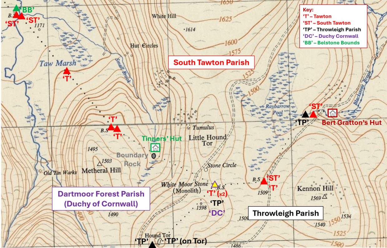
This post considers and records this Triple Parish meeting point and associated boundstones / markers and features of interest in three directions; firstly to the west, the Dartmoor Forest / South Tawton Parish boundary from the River Taw, where it meets the Belstone boundary to the White Moor Stone; secondly, to the east, the South Tawton / Throwleigh Parish boundary from Blackaton Brook near Raybarrow Pool to the White Moor Stone; finally, to the south from Hound Tor to the White Moor Stone which is the boundary between Throwleigh and Dartmoor Forest Parishes.
Bibliography
Dave Brewer – (2002) – Dartmoor Boundary Markers book (second edition)
Royal Commission for the Historical Monuments of England (1993-1998) – Dartmoor Royal Forest Project, S. Probert (Report – Survey). SDV346608
S.A.J. Probert & P. Newman – (2003-2004) – Measured survey North Dartmoor Military Range Okehampton Range: Monument Baseline Condition Survey, M. J. Fletcher (Report – Survey). SDV350801.
English Heritage – (2011) – National Heritage List for England (National Heritage List for England). SDV347072
S. Baring Gould – (1896) Dartmoor Explorations Committee Presidential Address, 181-2 (Article in Serial). SDV88642
J.R. Turner– (1990) – Ring Cairns, Stone Circles and Related Monuments on Dartmoor, 54-6, 81 (Article in Serial). SDV229817
J. Butler – (1991) – Dartmoor Atlas of Antiquities: Volume Two – The North, 204, 210, Map 40, sites ‘e’ and ‘g’ (Monograph). SDV219155
Rosemary Robinson, – (1982) – Parish Boundary stone (Worksheet). SDV219132
Eric Hemery – (1983) – High Dartmoor, page 795
Exeter & Plymouth Gazette: Friday 15th September 1933
Dartmoor Chris – (2026) – Pers. Conv.
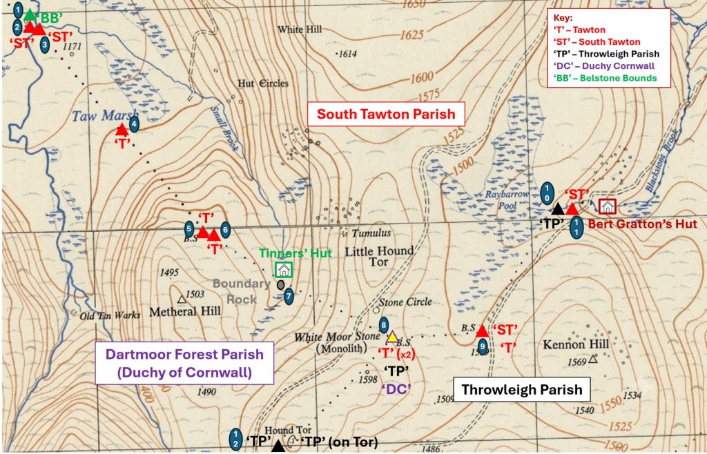
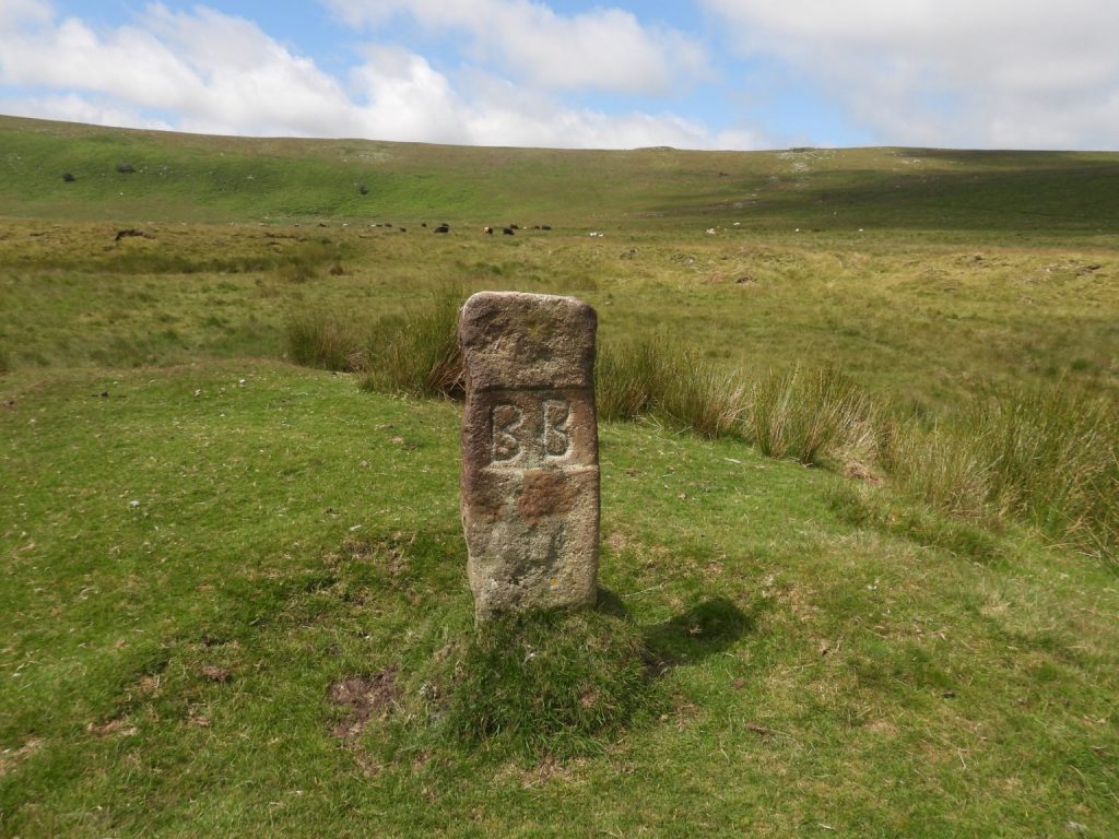
This annotated map shows the locations of boundstones and other interesting features covered in this post, which include a Tinners’ Hut, a Boundary Rock and an old Quarryman’s Hut (Bert Gratton). The Belstone Parish bounds marker is incised ‘BB’, the Throwleigh Parish bounds markers are incised ‘TP’, the South Tawton Parish bounds markers are incised either ‘ST’ or just ‘T’ and the Dartmoor Forest Parish bound (at White Moor Stone) is incised ‘DC’ (Duchy of Cornwall)“BB” (Belstone Boundstone) dating from 1968 (marked as number 1 on the annotated map). It is located on a small “tump” as described by Dave Brewer on page 45 of Dartmoor Boundary Markers book (second edition). Close by are two South Tawton (“ST”) boundstones. The boundary between the two parishes was in dispute for many years and it is recorded that Belstone lays no claim to the river. At the base of the stone are the initials ‘PC’, which is believed to be the stonemason
General views of the “BB” boundstone. The historic dispute with South Tawton is recorded to be related to who had the right to remove gravel from the river. On 3rd June 1993, the Belstone Commoners beat their bounds and at this marker they also claimed rights no longer theirs, by firing a gun to claim game rights and also the right to cast rods for catching fish (Brewer). The stone is located at SX61755 90949
The fact that boundary between the two parishes of Belstone and South Tawton was in dispute for many years and that Belstone lays no claim to the river is beautifully illustrated by this photograph. The Belstone Parish boundary marker is located around 30 metres (or so) from the river (Taw) with the South Tawton Parish boundary marker being located between the Belstone one and the river.
This “ST” (South Tawton) boundstone (number 2 on the annotated map) lies close to the west bank of the river, which is evidence that the parish claimed the river within its bounds.
This ‘ST’ boundary marker is located between the “BB” boundstone and the river at SX61754 90937
This “ST” (South Tawton) boundstone (number 3 on the annotated map) lies on the east bank of the river. The two “ST” stones may only be a few 10’s of metres apart but the river is difficult to cross at this point and the explorer is advised to consider crossing at the horse shoe ford a few hundred metres downstream. The difference between the two “ST” stones is very evident with this one being barely a quarter the same height as its nearby neighbour. It is partially hidden by reeds. Only the top of the stone can be seen from the west side.
This ‘ST’ marker can be located at SX61777 90929. The inscription has been picked out with black paint.
This view shows all three boundary markers (two ‘ST’s’ and one ‘BB’) either side of the Taw. Higher Tor is on the horizonFollowing the South Tawton / Dartmoor Forest Parish boundary in a south easterly direction from the Taw, this boundary marker, inscribed ‘T’ (Tawton) can be found. It is number 4 on the annotated map. It is interesting to note that some South Tawton markers are inscribed ‘T’ and some ‘ST’. In some cases both ‘T’ and ‘ST’ are evident on the same stone.The boundary marker is located on the north western foot of Metheral Hill above Taw Marsh. The inscribed stone lies on the western margin of cairn. The RCHME entry in the Devon Historic Environment Record describe the marker, thus: “The stone, an undressed granite post, leans to the west and measures 1.0m high, 0.4m wide and 0.3m thick. Its north eastern face carries the letter ‘T’, 15cm high and 1cm deep. An erosion hollow on the western side has exposed the large boulders which served as trig stones”. The inscription has been picked out with black paint.
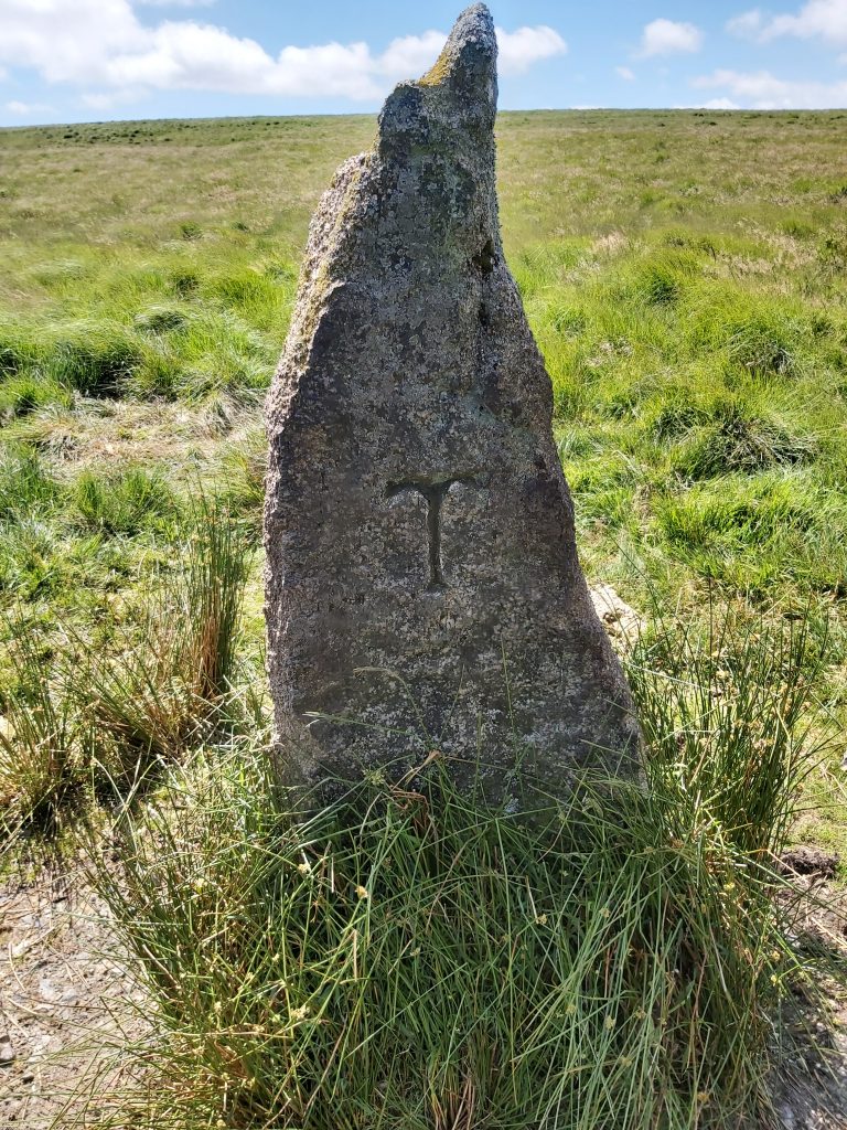
Heading south east once more following the South Tawton / Dartmoor Forest Parish boundary up the northern slopes of Metheral Hill, two more Parish Boundary markers can be found. The first is located at SX62524 90016. It is inscribed ‘T’ (Tawton) and numbered as 5 on the annotated map. The inscription has been picked out with black paint.
The second boundary marker is around 20m from the first and is located at SX62536 90001. Like its ‘twin’ it is inscribed ‘T’ (Tawton). It is numbered 6 on the annotated map. Quite why there are two ‘T’ stones so close together here is unknown to the author. The RCHME entry in the Devon Historic Environment Record: “Two upright stones marking the boundary of Dartmoor Forest and South Tawton parishes. These large undressed moorland blocks stand a maximum of 1.85m high and possess erosion hollows 0.2m deep around their bases. Both have the letter ‘T’ 15cm high and 1cm deep inscribed on the north side, that facing South Tawton Parish”. The inscription has been picked out with black paint.
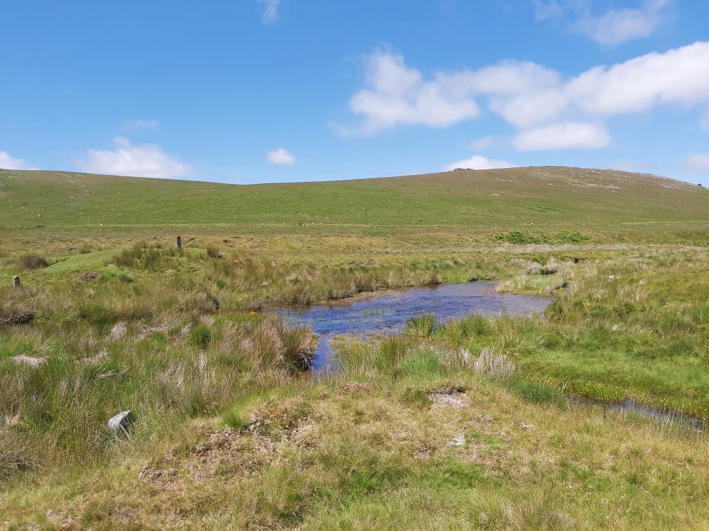
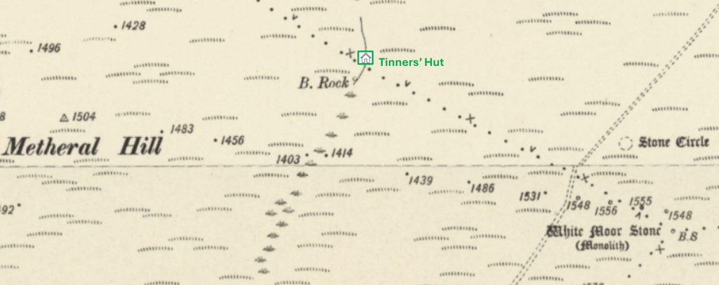
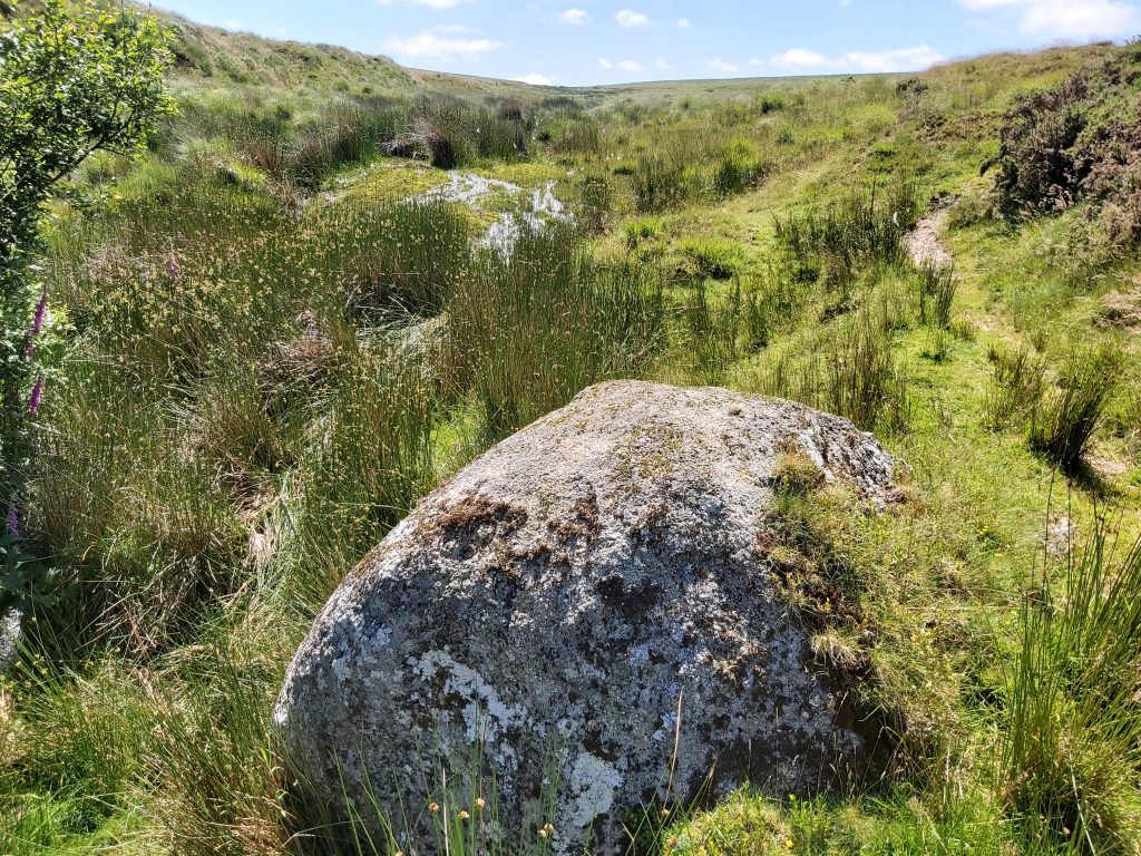
The Dartmoor Forest / South Tawton Parish Boundary line crosses the upper part of the Small Brook Valley between the slopes of Metheral Hill and the White Moor Stone, where historically a B. Rock (Boundary) is shown. The B. Rock, however, does not lie exactly on the boundary (as shown on the above map). The B. Rock actually lies around 20-25m to the south west of the Parish Boundary. Also, close to the Parish Boundary are the remains of a Tinners’ Building This rock is very conspicuous in the Small Brook Valley and is the most likely candidate for the B. Rock as shown on the 19th century map. It is located at SX62842 89719. The rock does not appear to be inscribed. It is annotated at number 7 on the sketch map in this post
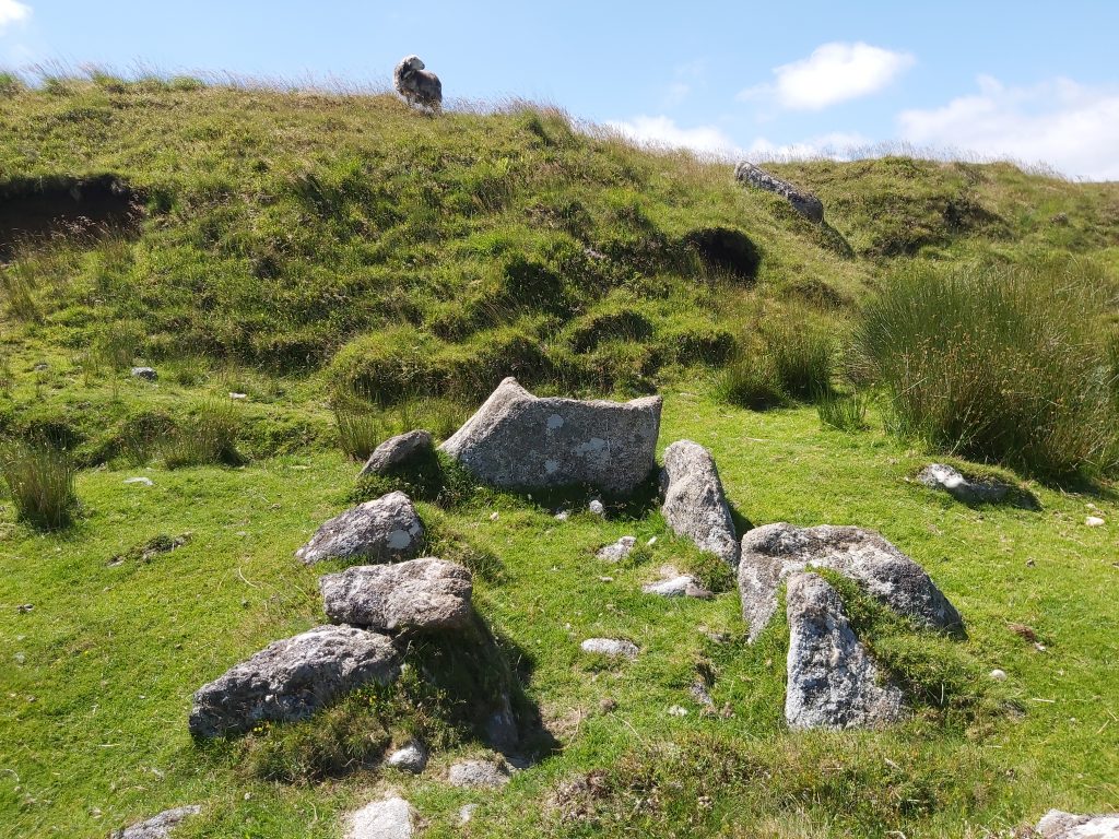
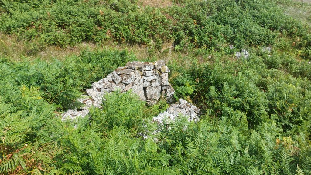
A short distance from the B. Rock is this Tinners’ Building. The foundations of the rectangular structure are located at the foot of a low ‘cliff’ within an area of Tinners’ stream working
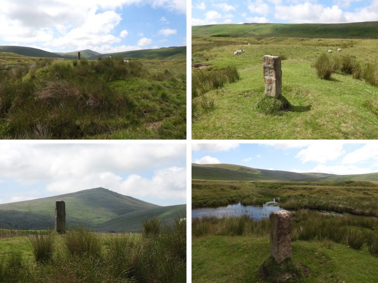
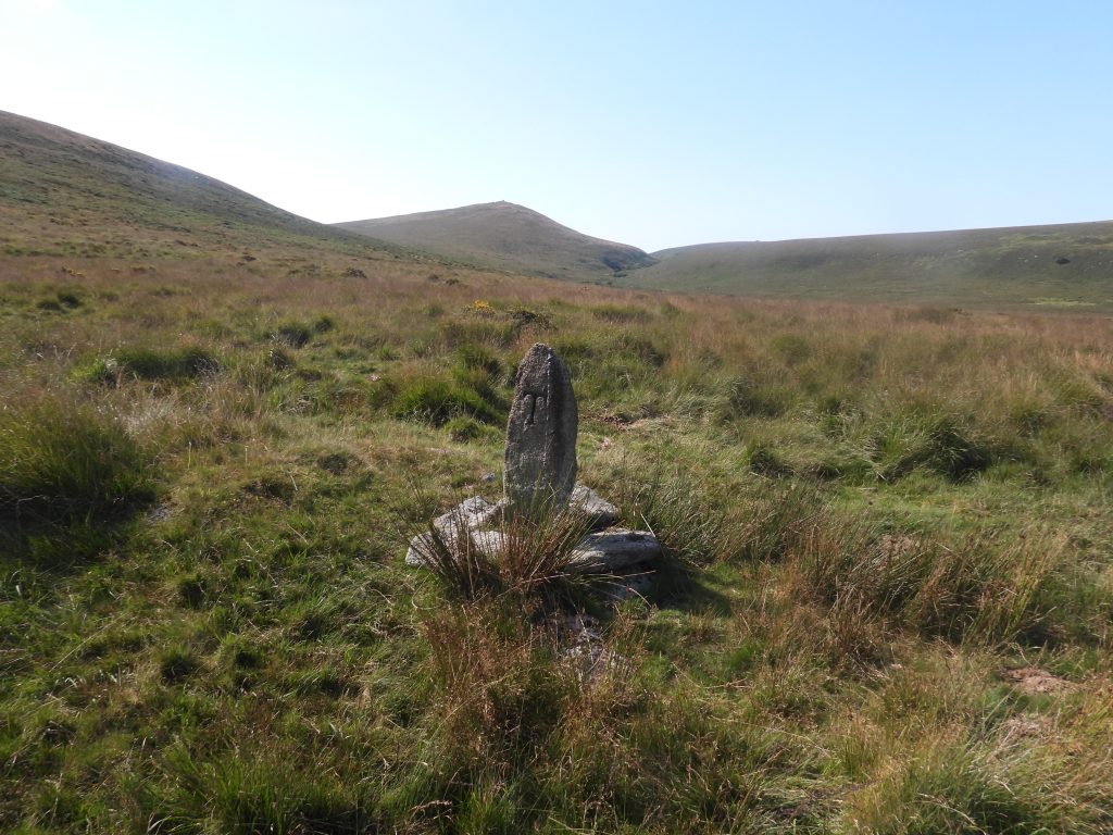
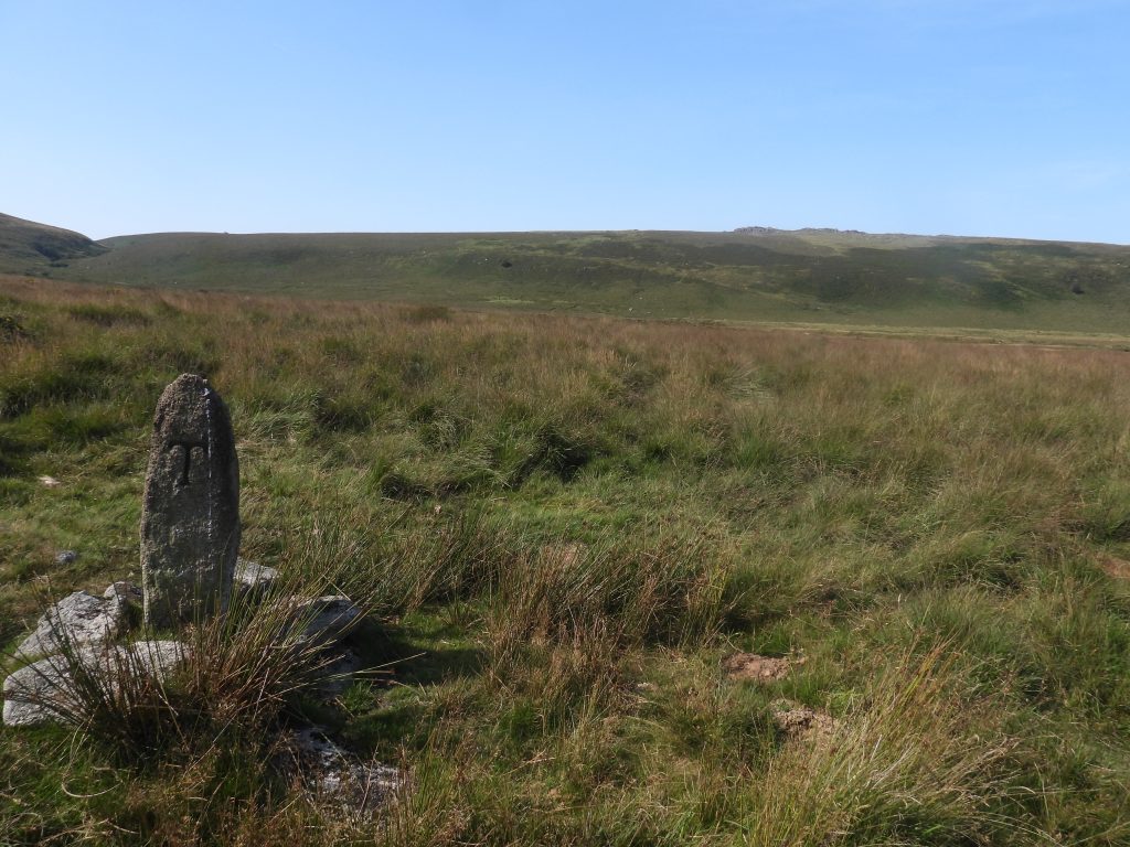
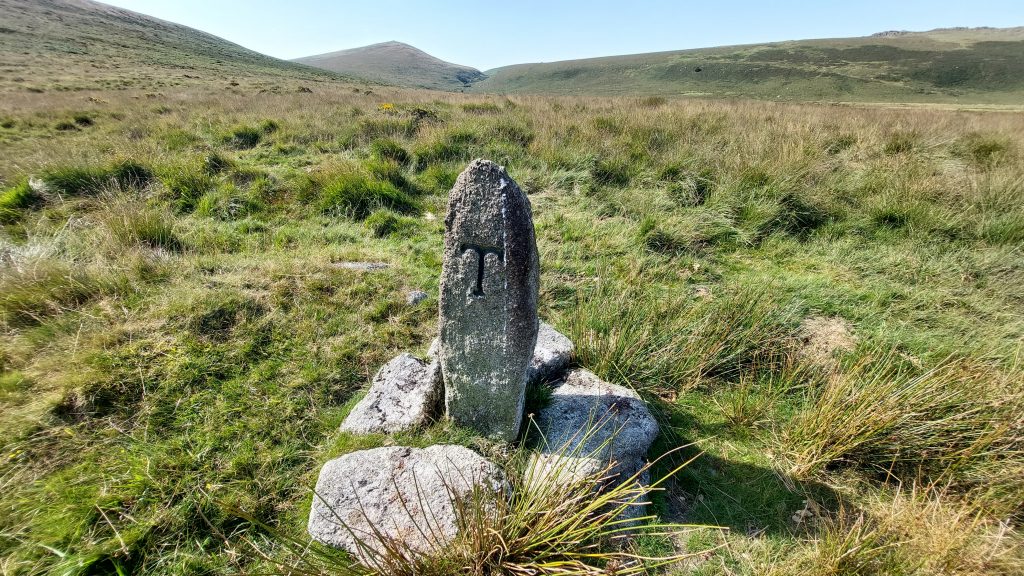
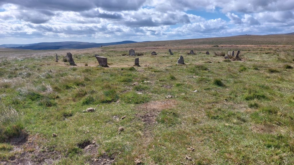
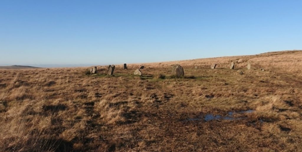
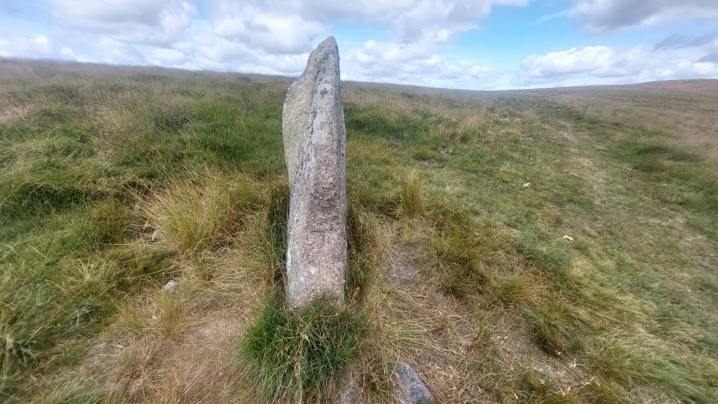
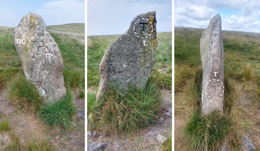
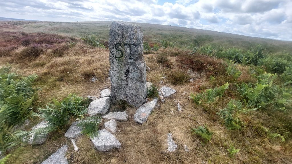
The building is recorded as measuring internally 0.9 metres by 1.5 metres (Probert / Newman). The crude line of boulders measure up to 0.4 metres high. The entrance lies in the south-east corner. The Tinners’ Building is located at SX62853 89773Close to the Triple Parish Boundary at the White Moor Stone and on the col / saddle between Little Hound Tor and Hound Tor lies a Stone Circle (known to some as White Moor Stone Circle). It is located next to the track which leads from South Zeal to Hangingstone Hill. This track is believed to have originally been used to carry peat from the moorland and may date from the Medieval period. English Heritage (2011) record the diameter of the stone circle as 20.2 meters and state it includes 18 stones, of which one has fallen and another is leaning. Turner (1990) observes that it is the only Dartmoor Stone Circle with an entranceThe stones in the circle are evenly spaced at around 3m. They are between 0.3m and 1.15 m tall. It appears that several have had their tops broken off. Baring-Gould (Dartmoor Exploration Committee – 1896) remarked that the sone circle had suffered from turf cutters who “skimmed the surface of its natural coating”. The slight undulations within the interior of the circle are probably the result of this 19th century turf stripping. Five of the stones were re-erected by the Dartmoor Exploration Committee (note: it is suggested thta these may have a ‘fresher’ appearance than the others)The White Moor Stone, which is central to this post, is located at the Triple Parish Boundary of Dartmoor Forest, Throwleigh and South Tawton. This is annotated at number 8 on the map in this post. On the south-western face are the inscribed letters ‘DC’ near the top of the stone which refers to Duchy of Cornwall (ie Dartmoor Forest Parish). Below and to the right are the above the letters ‘TP’ referring Throwleigh Parish.On the broad north-east face of White Moor Stone there is an inscribed ‘T’. This letter refers to South Tawton. This ‘T’ is probably the newest of all the inscriptions as it is serifed. The inscription has been picked out with black paint.On the narrow south-eastern face there is another incised letter ‘T’ (South Tawton). It is probable that this ‘T’ is the earliest of the two ‘T’ inscriptions as it is a crude un-serifed letterThe White Moor Stone leans very slightly to the north. It is 1.7m high and up to 1m wide. This collage of pictures show the inscriptions: ‘DC’ / ‘TP’ (left), ‘T’ (middle) and ‘T’ (right). William Crossing, Sandy Gerrard and Jeremy Butler all suggest that the stone could have originally been a freestanding menhir associated with the nearby stone circle (most likely) or possibly actually robbed from the circle itself for reuse as a boundary marker.The four inscriptions on the White Moor Stone. All inscribed letters are between 0.12m and 0.19m high. The White Moor Stone is located at SX63347 89474Continuing in a easterly direction from the White Moor Stone along the South Tawton / Throwleigh Parish Boundary around the south of Raybarrow Pool the next Boundary marker can be found. It has a serifed ‘ST’ inscription (South Tawton) which is 20cm high and a crude un-serifed ‘T’ inscription (which is the old representation for South Tawton) which is 10cm high
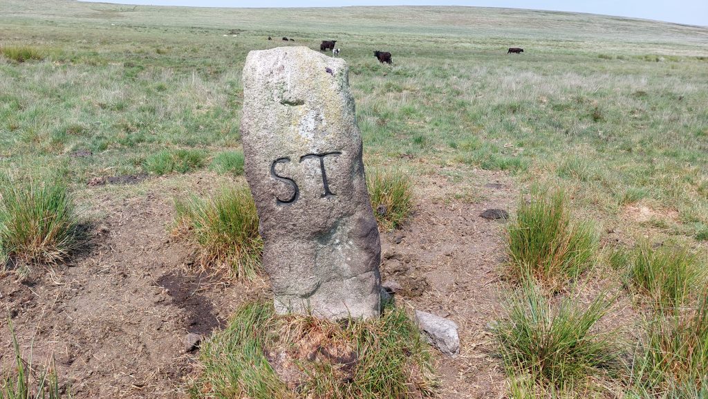
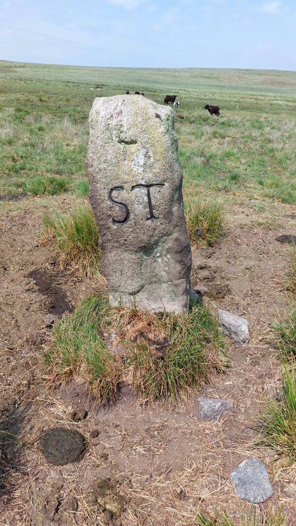
The ‘ST’ inscription has been picked out with black paint. The stone measures 1.7m high, 0.5m wide and 0.3m thick.
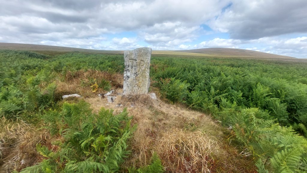
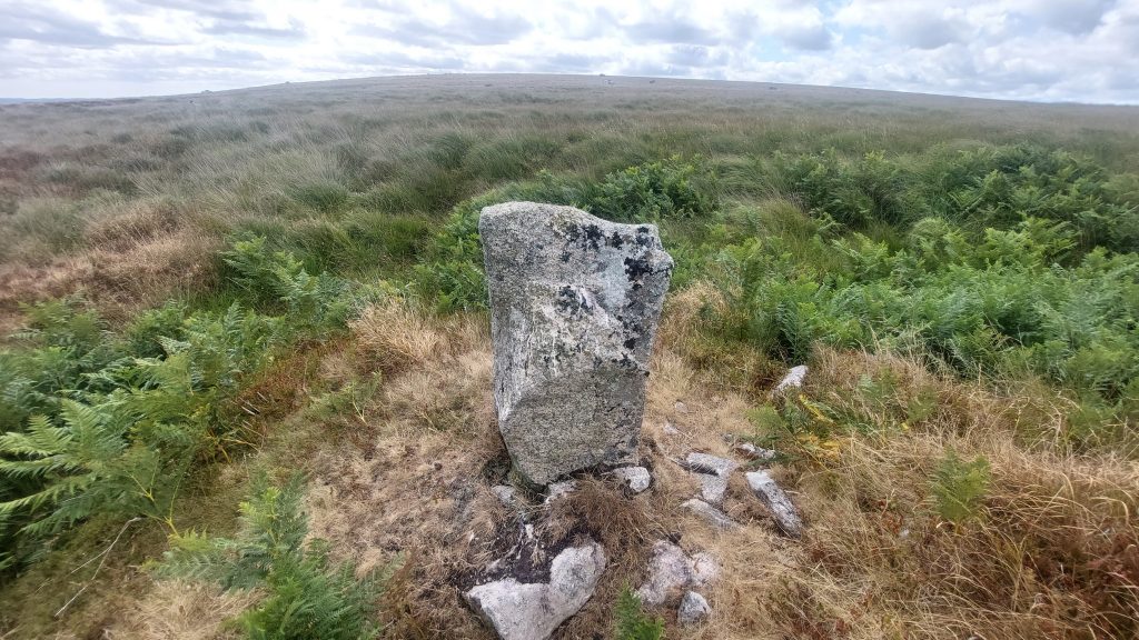
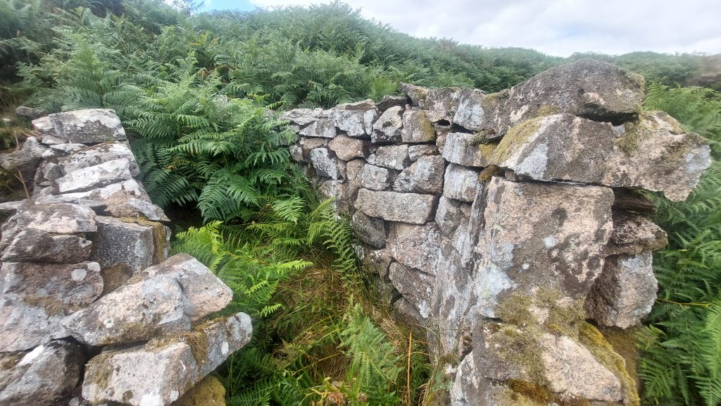
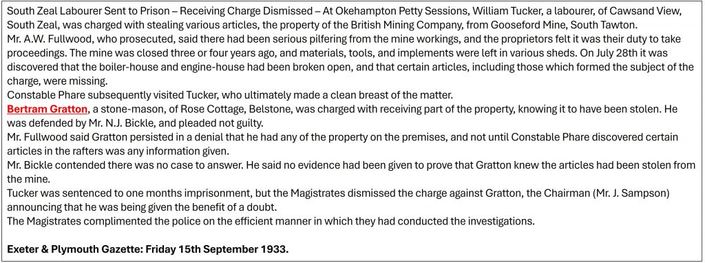
The four sides of the Boundary marker. It is annotated as number 9 on the map in this post. It is located at SX63753 89498To the east of Raybarrow Pool, near where it drains into Blackaton Brook two more boundstones can be found. These are annotated 10 and 11 on the map in this post. They are set only about 10 metres apart and have been erected on tinners’ moundsThe western boundstone (number 10) is inscribed ‘TP’ for Throwleigh Parish. The picture shows the inscription facing towards Kennon Hill (as Cosdon or Cawsand Hill is in the background). It is located at SX64075 90029The reverse side of the ‘TP’ inscribed boundstone (looking towards Kennon Hill) is un-inscribed. Side on view of the ‘TP’ inscribed boundstone.The ‘TP’ boundstone (number 10) looking east towards its neighbour (number 11) just 10 metres awayThe second boundstone (number 11) on the tinners’ mounds is inscribed ‘ST’ in serif. The inscription has been picked out in black paint and faces South Tawton Parish. Kennon Hill can be seen in the background. It is located at SX64085 90038The ‘ST’ inscribed stone looking east (effectively down the Blackaton Brook Valley)The reverse side of the ‘ST’ inscribed boundstone with Cosdon (Cawsand) Hill beyondThe ‘ST’ inscribed boundstone looking west towards the ‘TP’ inscribed boundstone. One wonders why there are two boundstones here and why possibly the two parishes didn’t share one with their inscriptions on two sides of the same stone?The Tin Streaming / Tin Works to the east of boundstones numbered 10 and 11 looking down Blackaton Brook ValleyA short distance east from the last boundstones (numbers 10 and 11) as the Blackaton Brook descends into a deep valley are the remains of a crude shelter known as Bert Gratton’s Hut. Here, at the head of the deep valley, at the turn of the 20th century, stone was quarried to supply granite-rollers, blocks, steps, troughs, pillars and gatepost as needed by the local farming community (ref: Hemery). The quarrying operations here were initiated by granite-mason Will Osborne, whose foreman was Bert Gratton of South Zeal. Gratton succeeded Osborne as owner of the enterprise and was able to employ several labourers. The shelter was built by Gratton for the protection of his men in severe weather conditionsHemery cites some lovely history relating to the quarrying enterprise, which is quoted here: “His (Gratton) work-shed was at Prospect Place near Ramsley…Such was the doggedness of Gratton and his carter, Jack Tucker of South Zeal, that a single, horse-drawn two-wheeled cart brought all the quarried granite from the site to Prospect Place (via Higher Crossing-Place, Clannaborough Down and Moor Farm) for dressing and finishing”. Bert Gratton’s Hut is located at SX64347 90058From this published article in the Exeter and Plymouth Gazette from September 1933, it would seem Bert Gratton got himself into a spot of bother. One wonders if the William Tucker mentioned in the article was related to Gratton’s carter, Jack Tucker (or even that Jack / William Tucker were the same person ?)
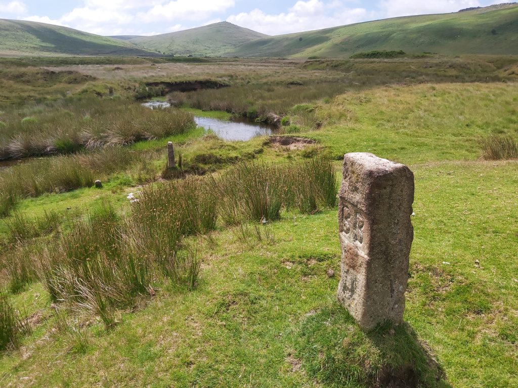
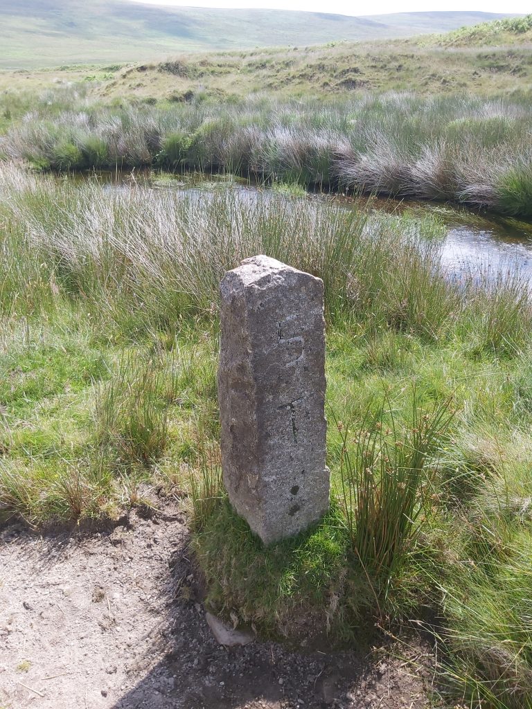
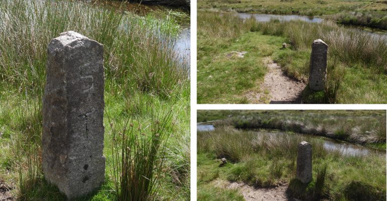
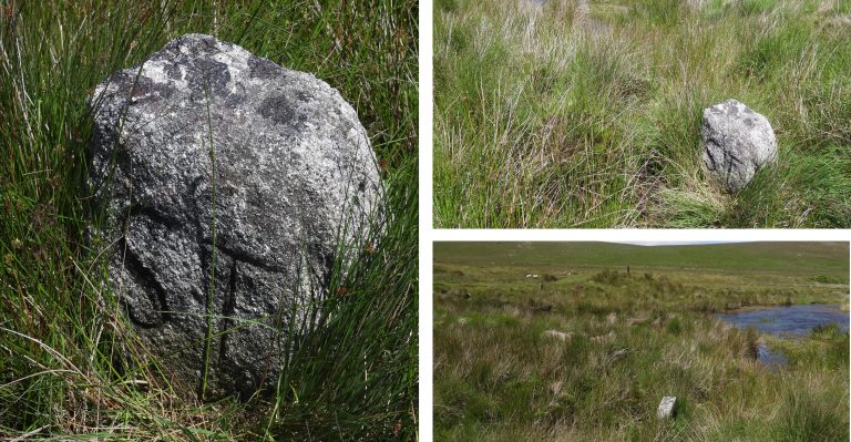
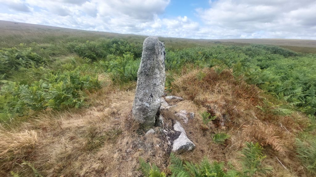
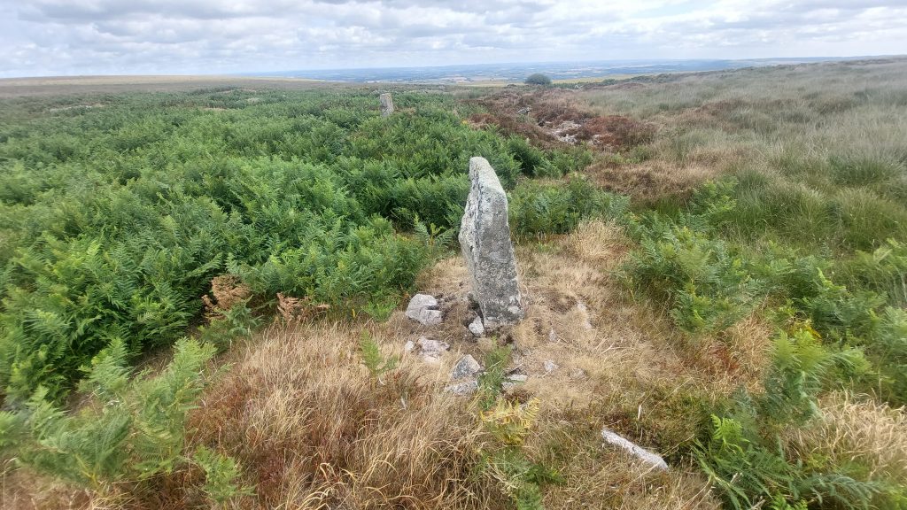
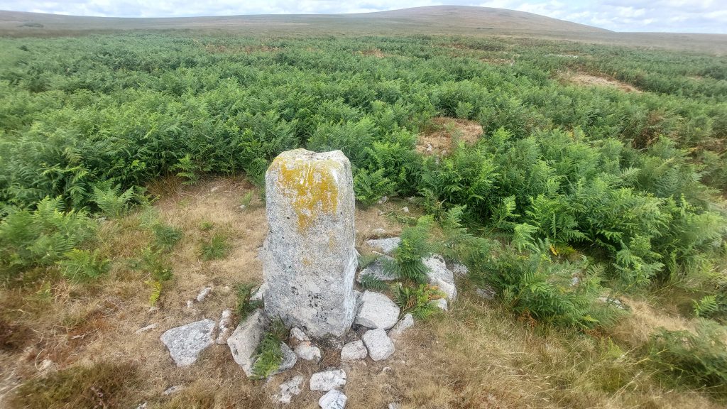
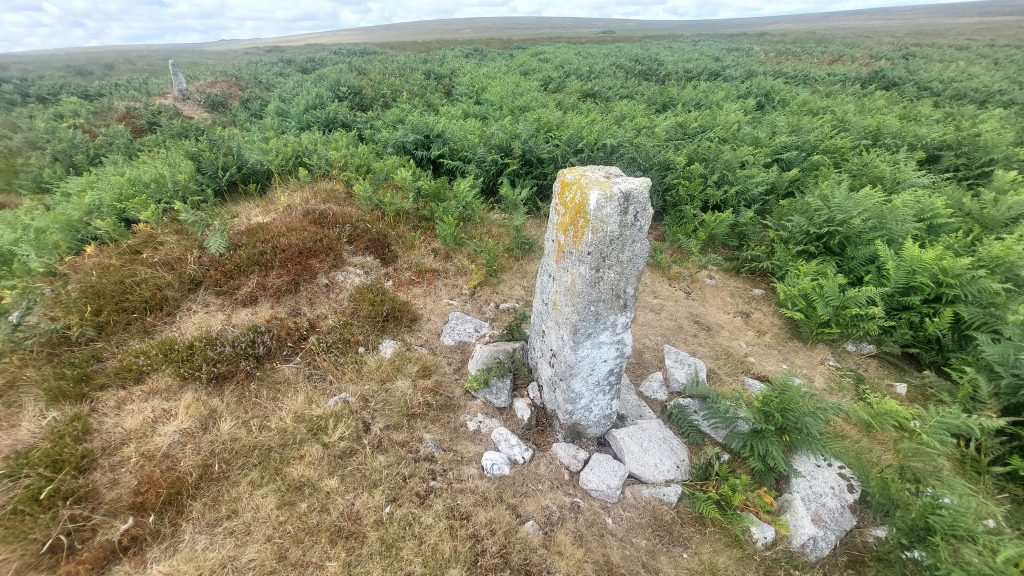
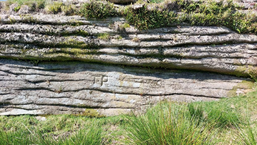
This granite boundary stone (annotated as number 12 on the map in this post) is sited approx. 30m south-west of Hound Tor. It is recorded as being height 1m, width 0.9m and 0.35m thick. It is incised vertically on its east face with ‘TP’ (Throwleigh Parish) in un-serified capitals. The stone appears to mark the former boundary between Throwleigh Parish and Dartmoor Forest, however, it is likely that this boundary marker has been superseded by a boundary mark on Hound Tor itself.
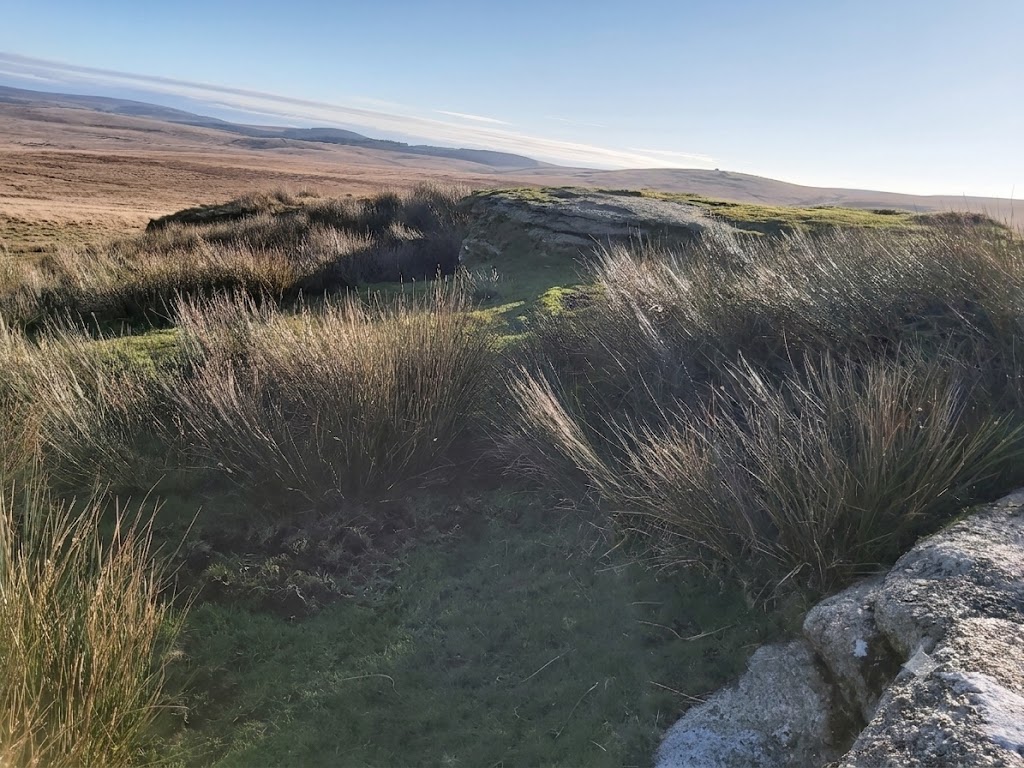
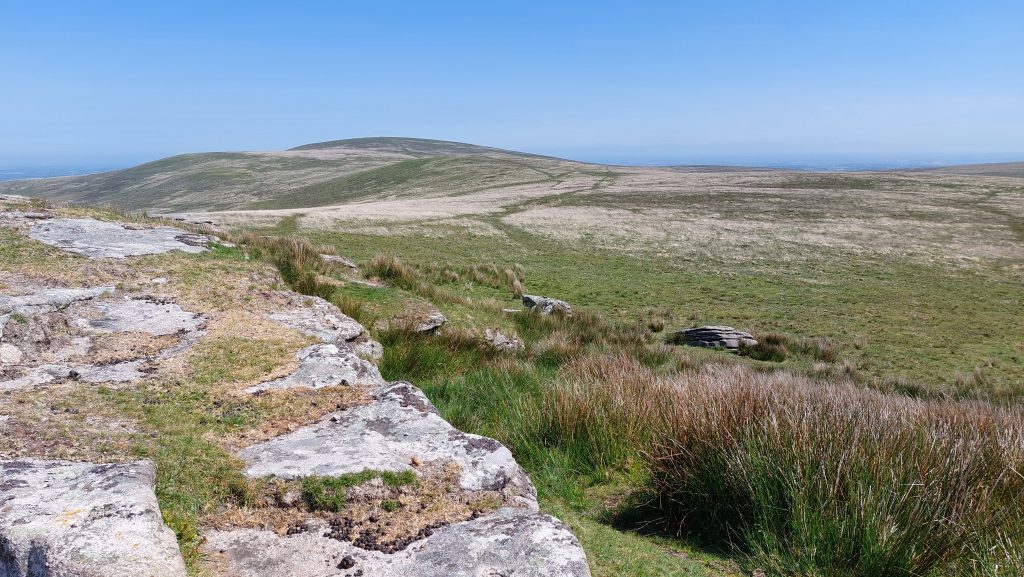
On the east face of Hound Tor are the deeply incised initials ‘TP’ (Throwleigh Parish). These initials, no doubt replacing the small upright in the previous picture as the Parish boundary markThe east side of Hound Tor looking south (ish) towards Fernworthy Forest (Assycombe Hill) and Watern Tor (Thirlstone)East side of Hound Tor (just above the ‘TP’ inscription) looking north to Little Hound Tor and the White Moor Stone. Throwleigh Parish is on the right (east) side of the photograph












David Kirby August 10, 2026
Solid research, superb photos and diagrams, and clear walking notes. Makes me want to get down there to look at it for myself