A collection of walks, discoveries, insights and pictures of exploring Dartmoor National Park
January 8, 2026
Newleycombe (Newlacombe) Farm
Newleycombe (or Newlacombe) farm is one of at least five abandoned farms located in the Newleycombe valley between Norsworthy bridge and the head of the valley at Drivage Bottom. The five farms from west to east are: Norsworthy, Kingsett, Roundy Park, Classiwell / Colliers with Newleycombe being being situated towards the easternmost point and borders of the wastes, or commons in the valley.
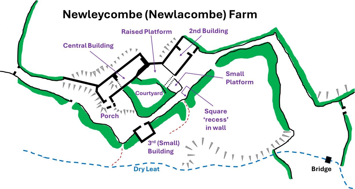
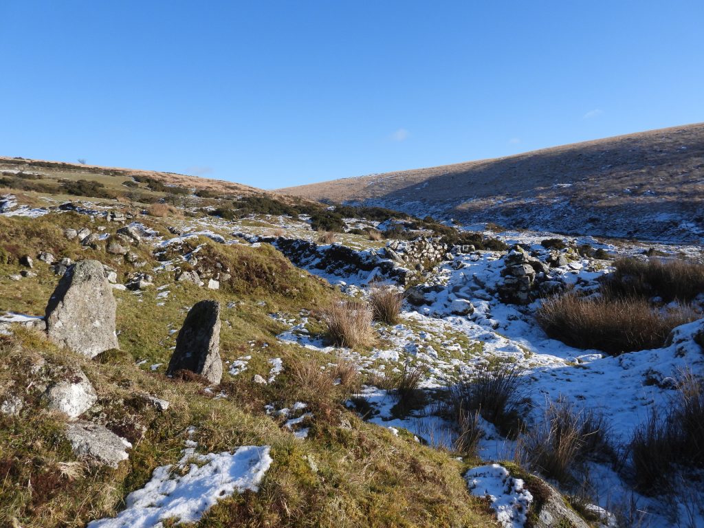
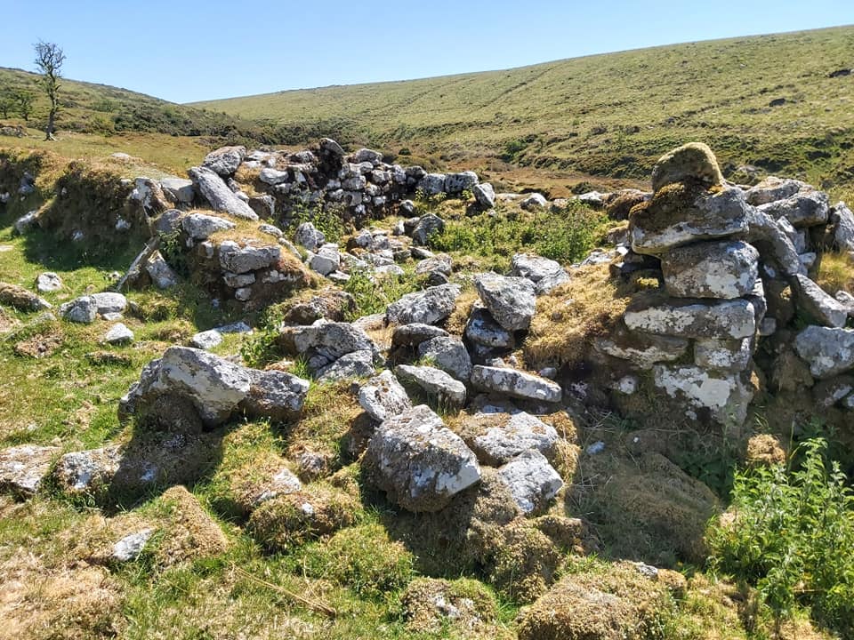
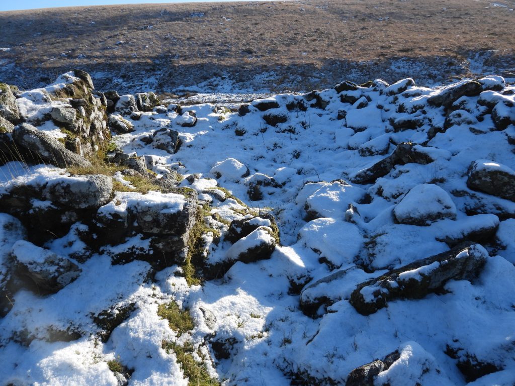
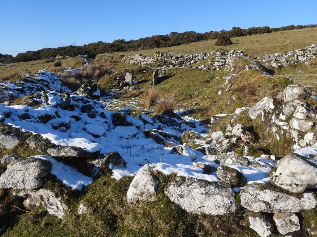
Hemery, in ‘High Dartmoor’ describes Newleycombe farm as being “…the farthest ‘out’ of the former valley settlements……. where there can be seen the original seventeenth-century ground plan and remains”. Indeed, the remains of the farm probably represents the original layout from a century earlier according to other observers and from documentary evidence. Unlike, other farmsteads in the locale it is unlikely that there was any (significant) rebuilding in the nineteenth century, except for hedging and walling of fields conducted by the Maristow Estate. The structures are in poor condition and are obscured by tumble and some vegetation but an exploration can reveal at least two large buildings, a courtyard and a smaller building all neatly enclosed by boundary walls and narrow lanes between the buildings. There are other interesting features worth exploring including on the southern flank of the farmstead a leat, which served a possible tip-stone (or lip-stone) within the farm boundaries. The leat can be followed, both upstream to its take-off point on Newleycombe Lake and downstream to the former Plym Consols Tin Mine where it served a waterwheel. Might this indicate that the tinners extended the leat for their purposes ?
Newleycombe farm appears to have been first documented in 1585 and the common belief is that it was abandoned by the early 1870s (or possibly earlier), probably wholly or at least in part by the ‘interference’ of the mine downstream. The Maristow estate recorded that John Hamlyn, a tenant in 1838, had complained that the farm had been “rendered worthless to him by the mining operations”. The mine appears to be largely undocumented and there is no record of production but a building and the waterwheel are depicted on the OS map of 1873. William Crossing records in the early 20th century (1905) that Newleycombe was one of four farms which were part of the Kingsett holding; Crazy Well and Roundy making up the four.
Bibliography
Eric Hemery – (1983) – High Dartmoor, pages 140/141
R.G. Haynes – (1966-1969) – Ruined Sites on Dartmoor, 94
Mike Brown – (1999) – Dartmoor Field Guides (Volume 11) – Ditsworthy, The Higher Reaches of the Outcombe, Deancombe, Narrator & Newleycombe Valley
Phil Newman – (2006) – Cramber Tor Training Area Archaeological Field Investigation (Report – Survey). SDV233640.
Phil Newman – (2011) – The Field Archaeology of Dartmoor
Paul Rendell – (2007) – Exploring around Burrator
William Crossing – (1986) – Gems in a Granite Setting, Beauties of the lone land of Dartmoor (Facsimile version)
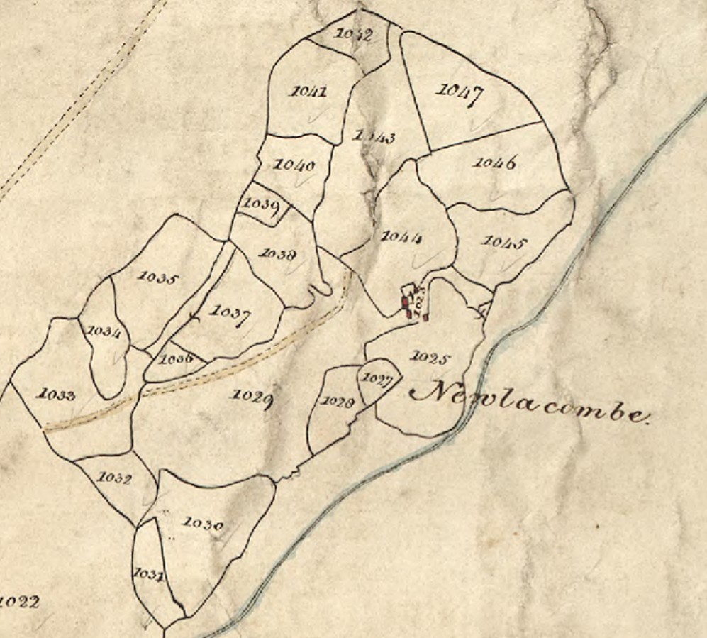
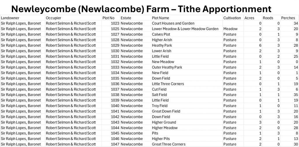
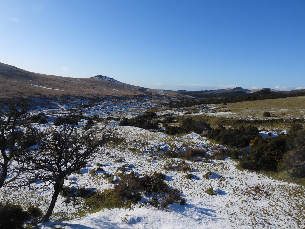
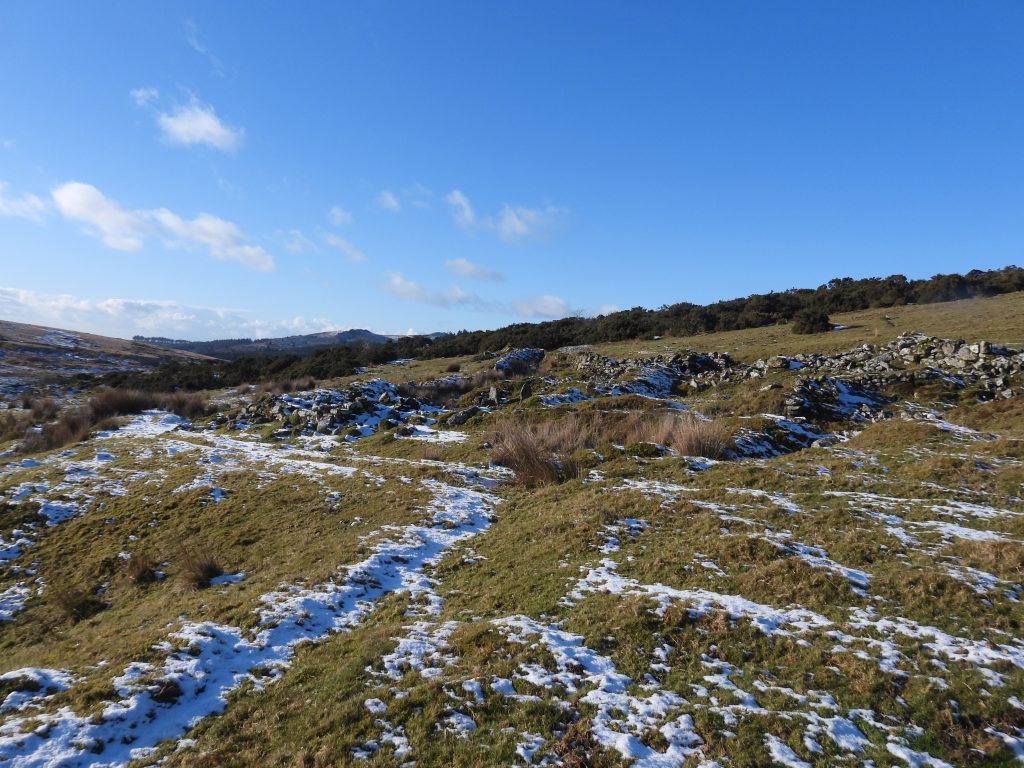
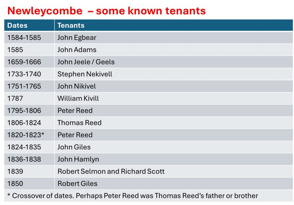
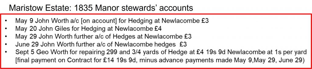
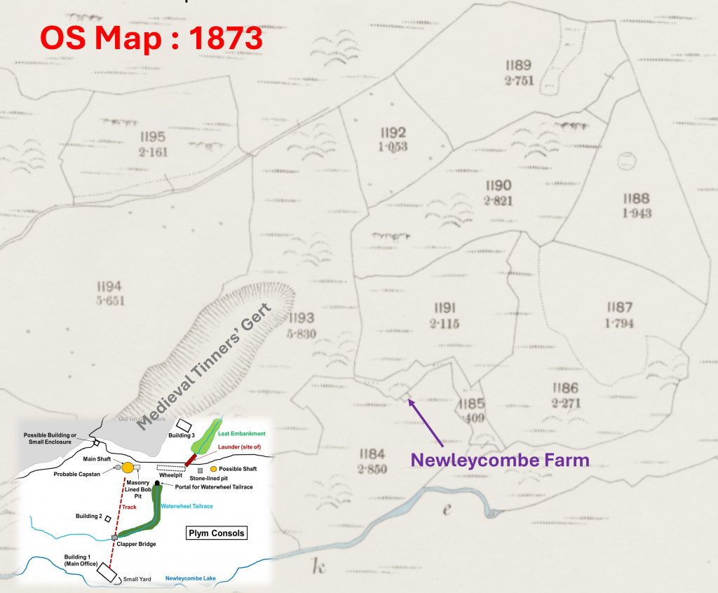
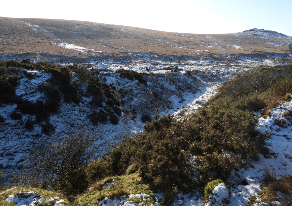
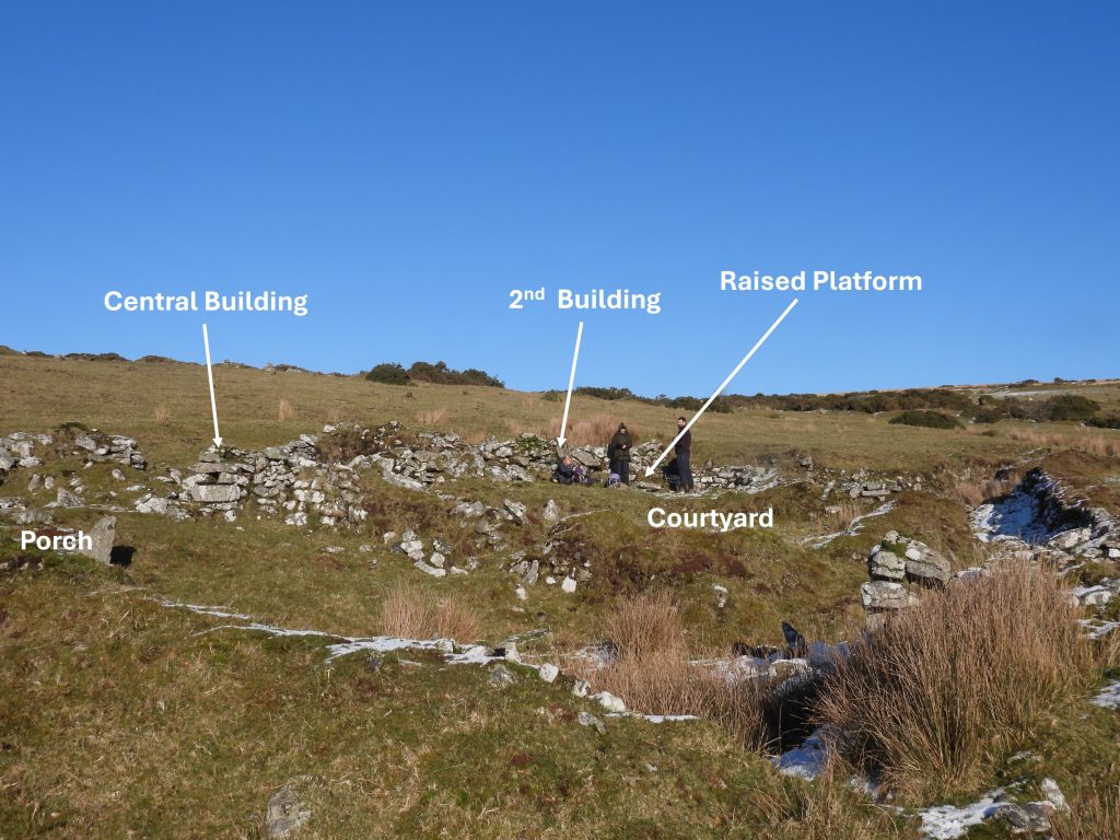
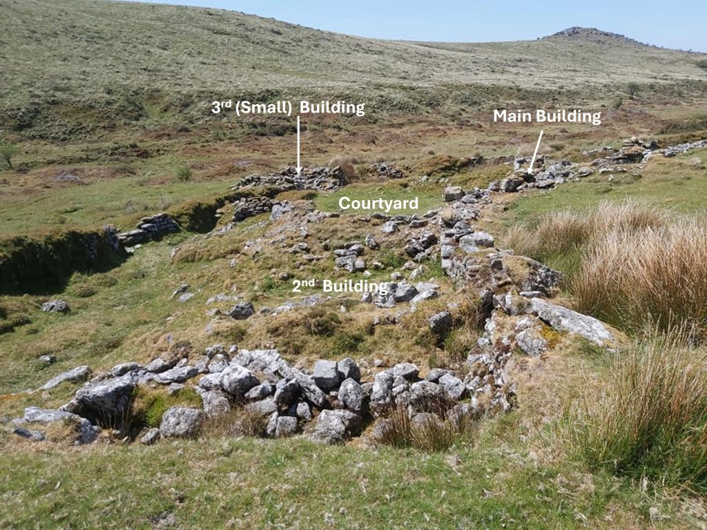
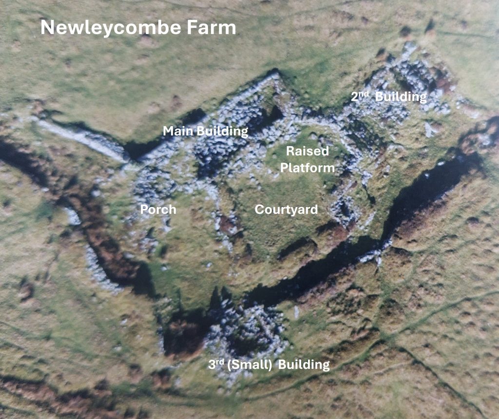
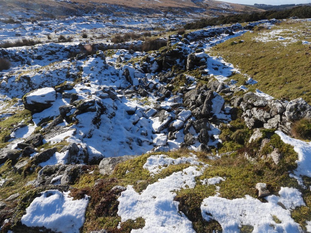
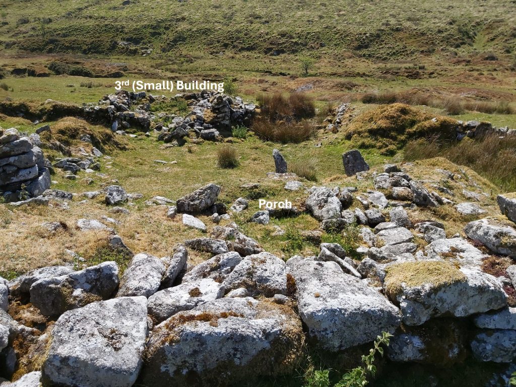
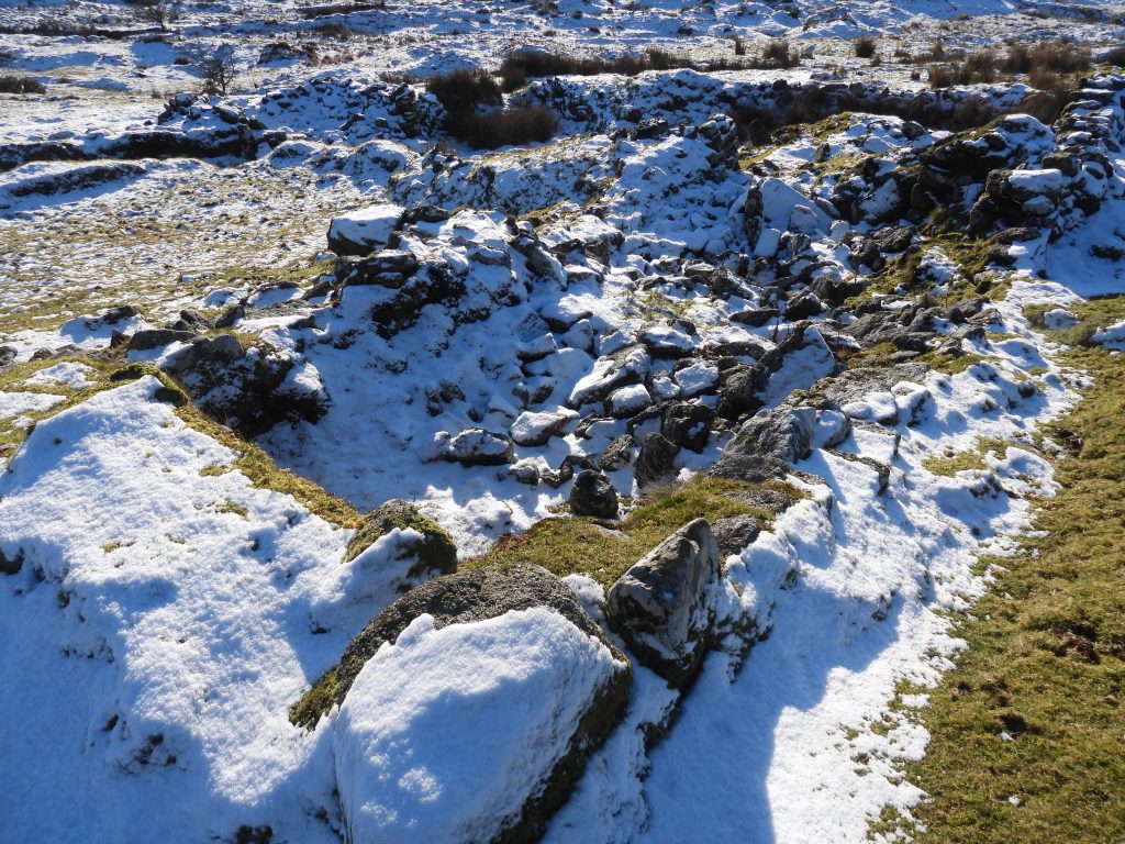
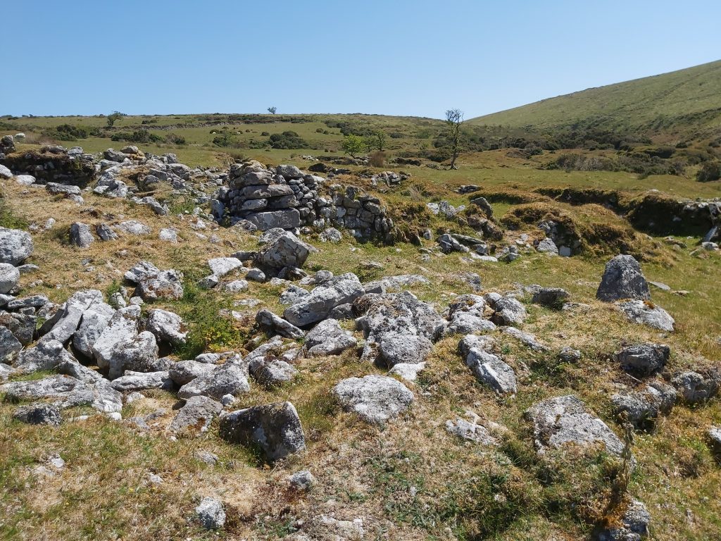
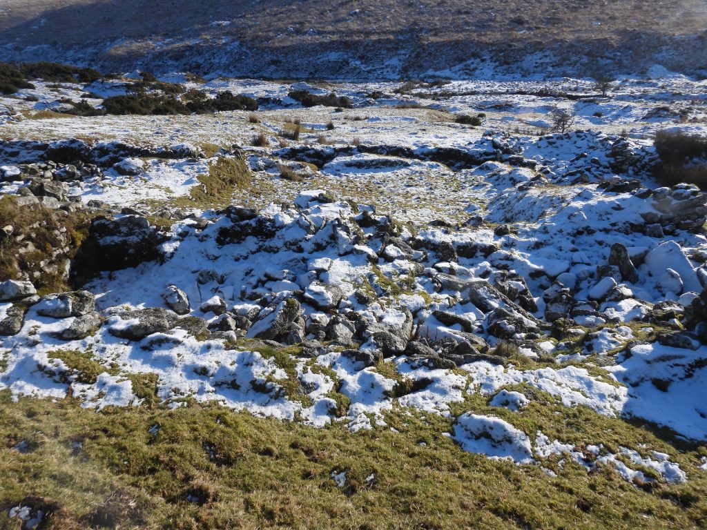
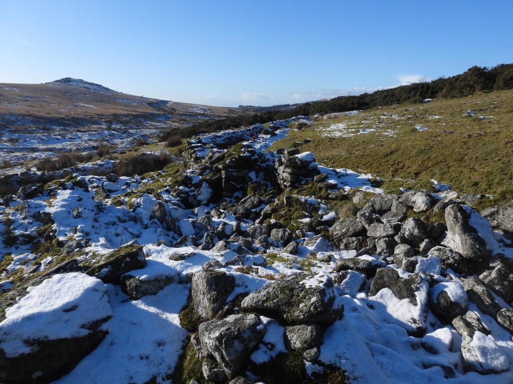
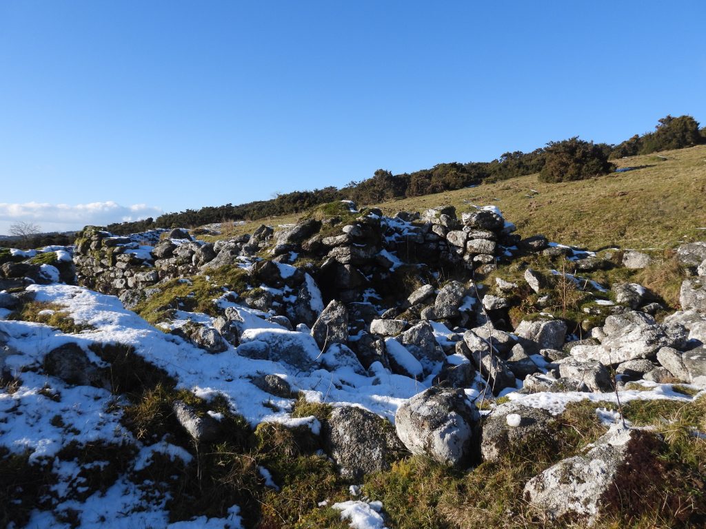
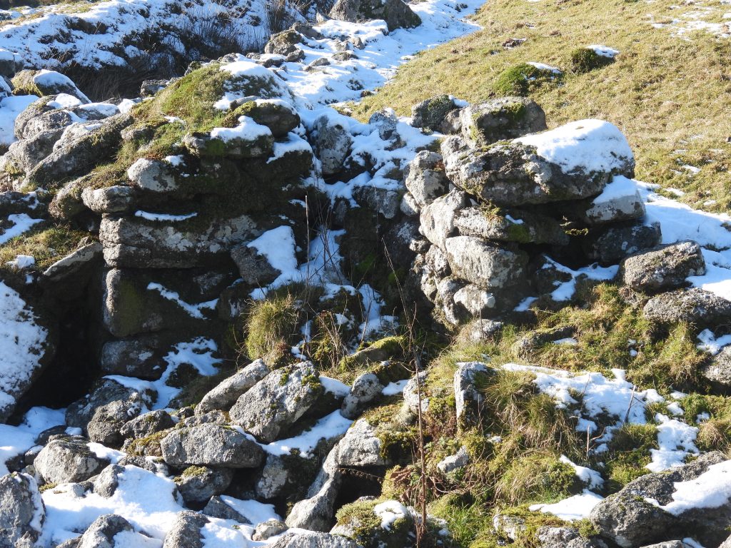
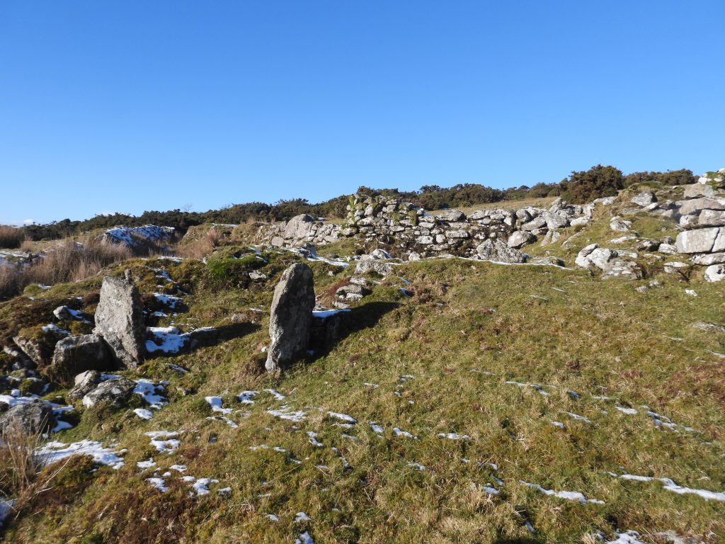
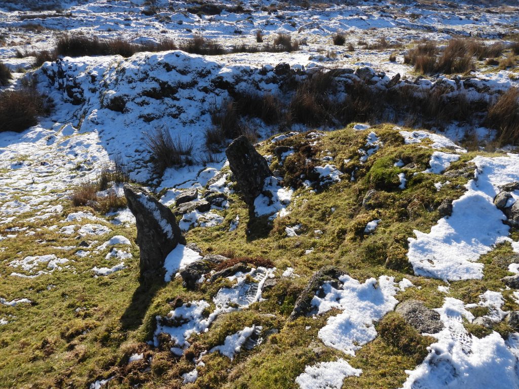
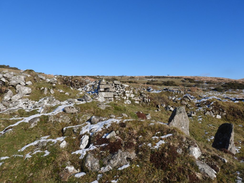
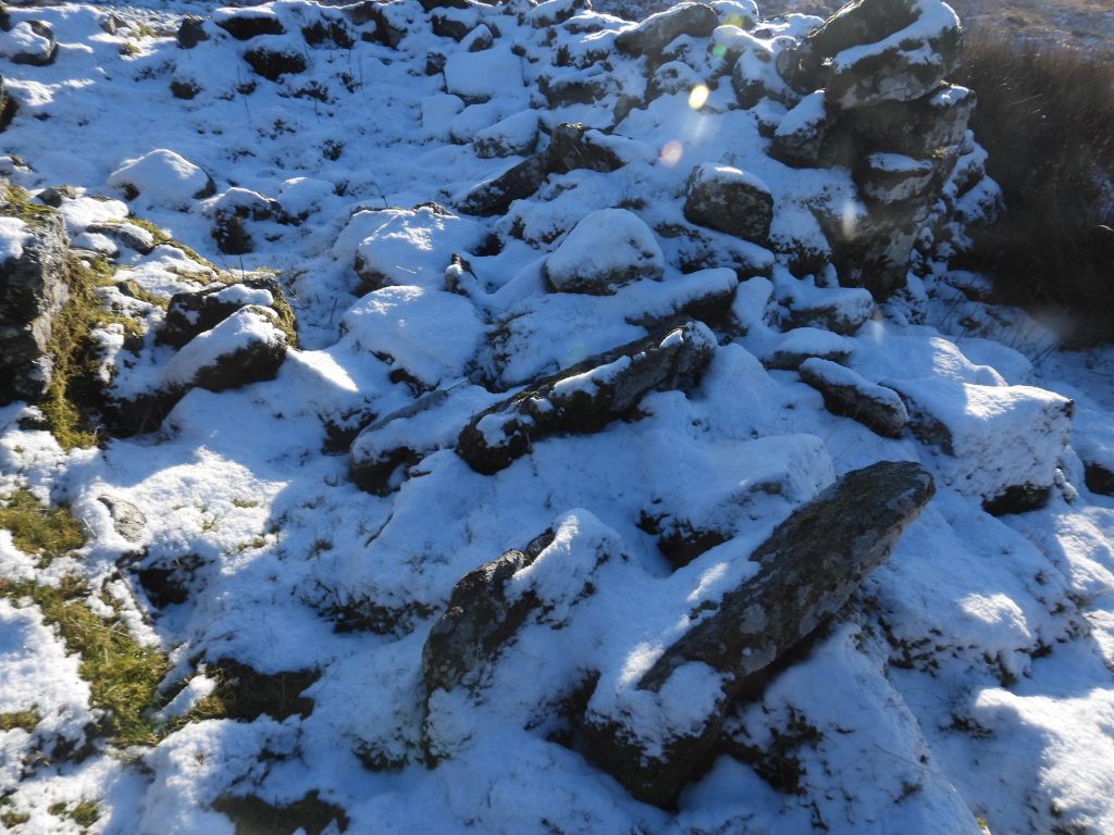
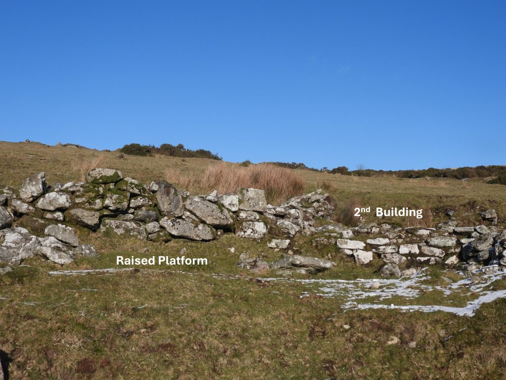
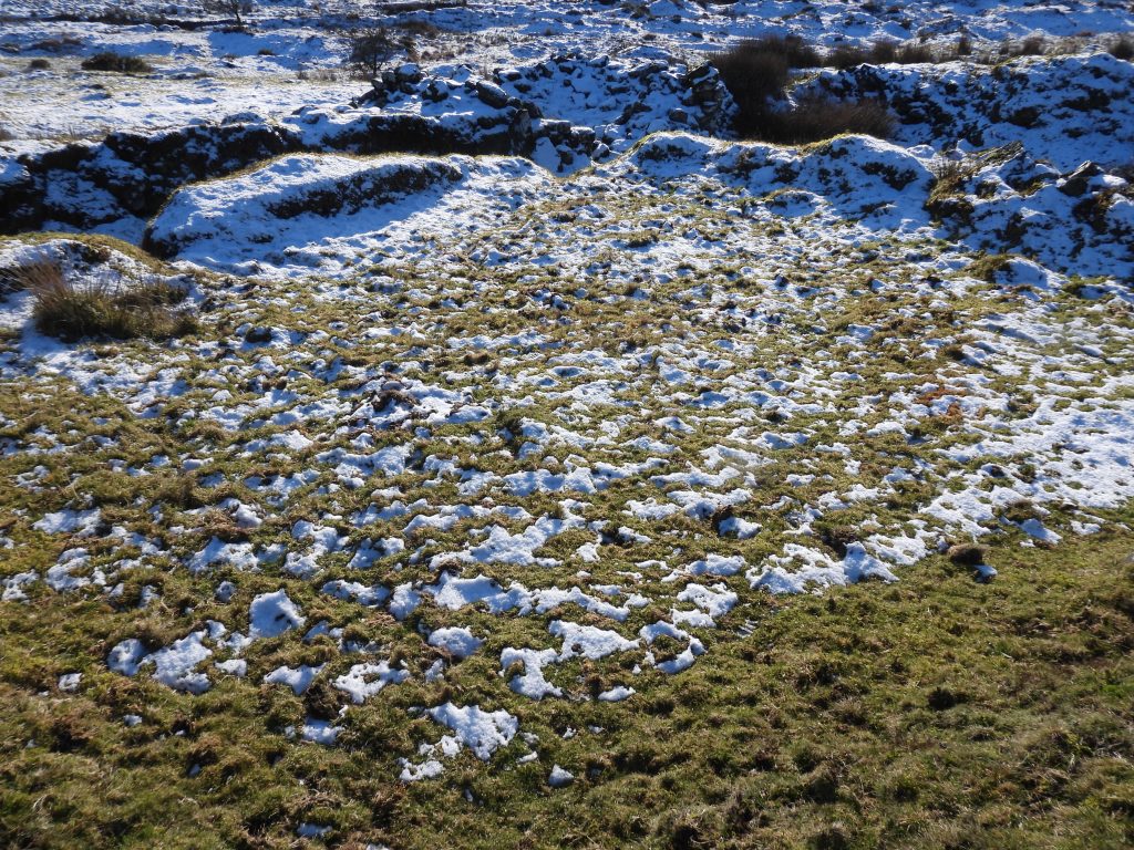
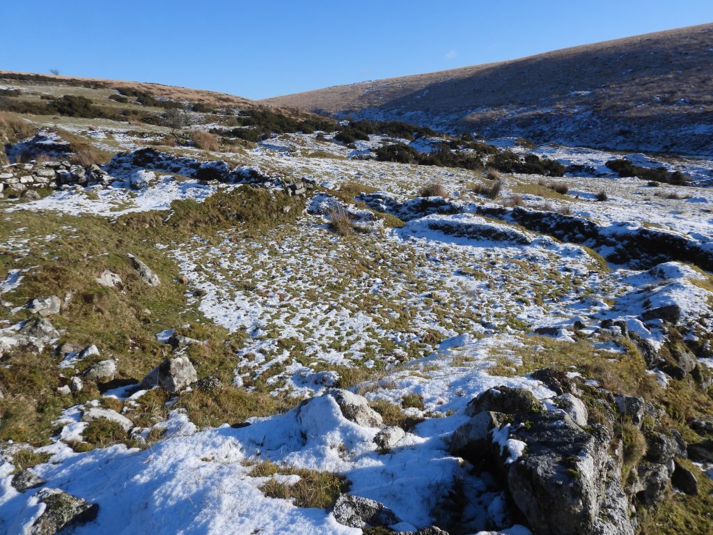
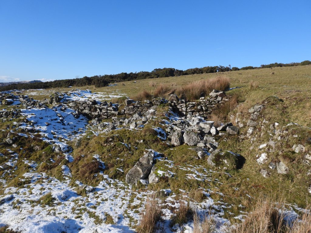
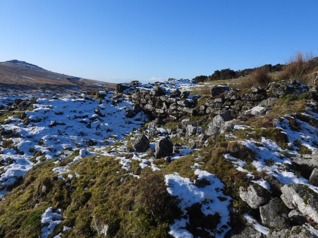
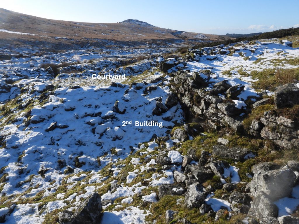
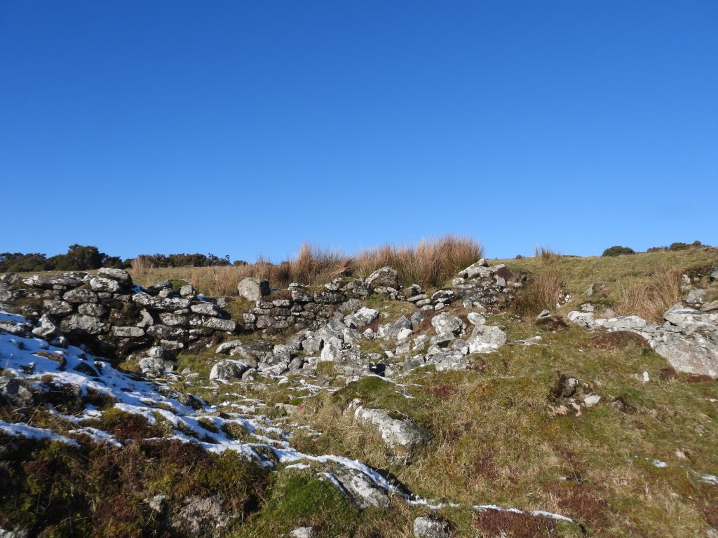
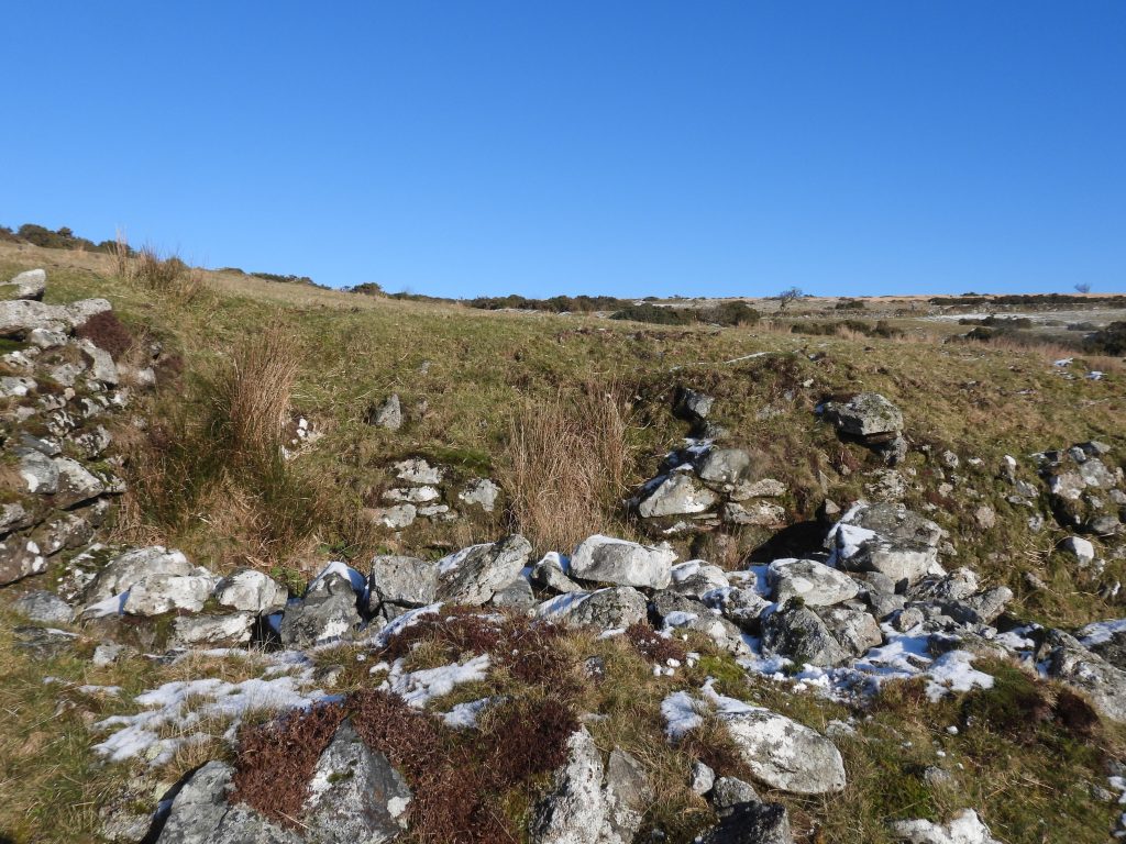
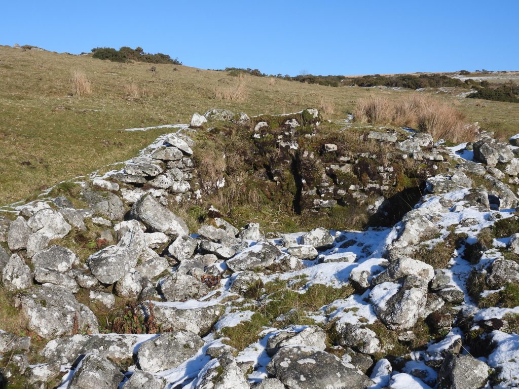
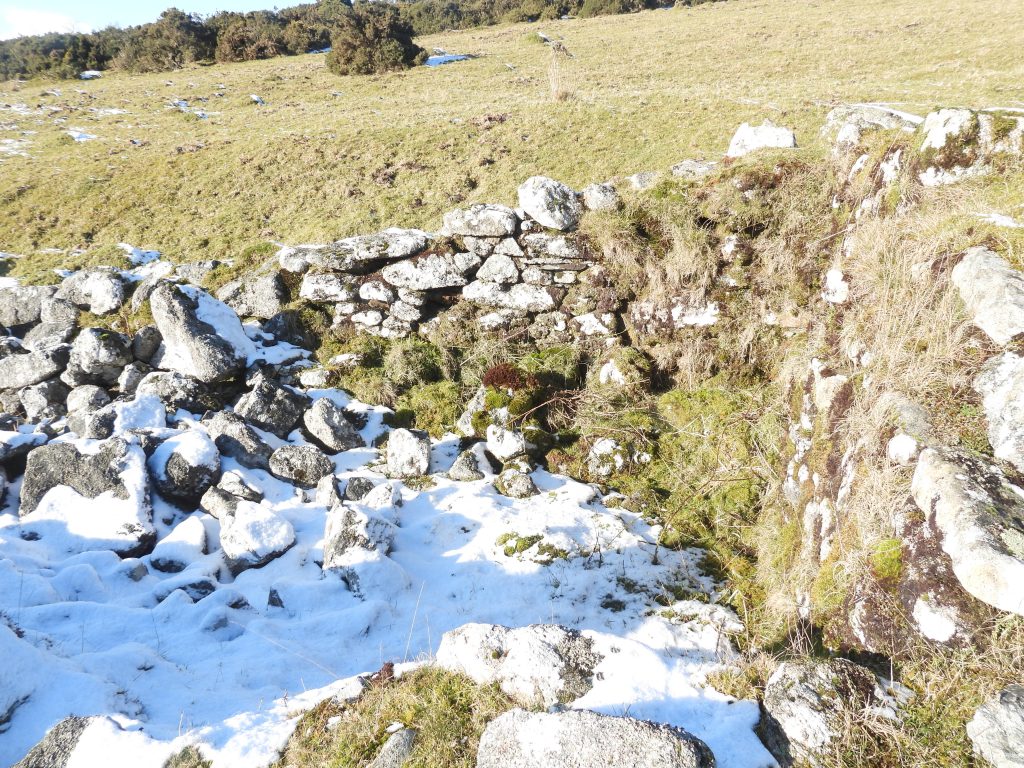
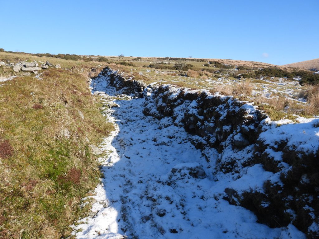
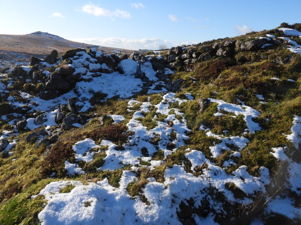
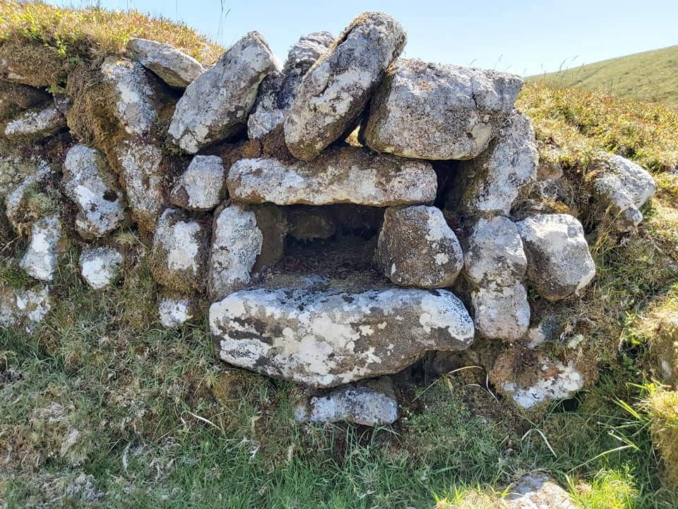
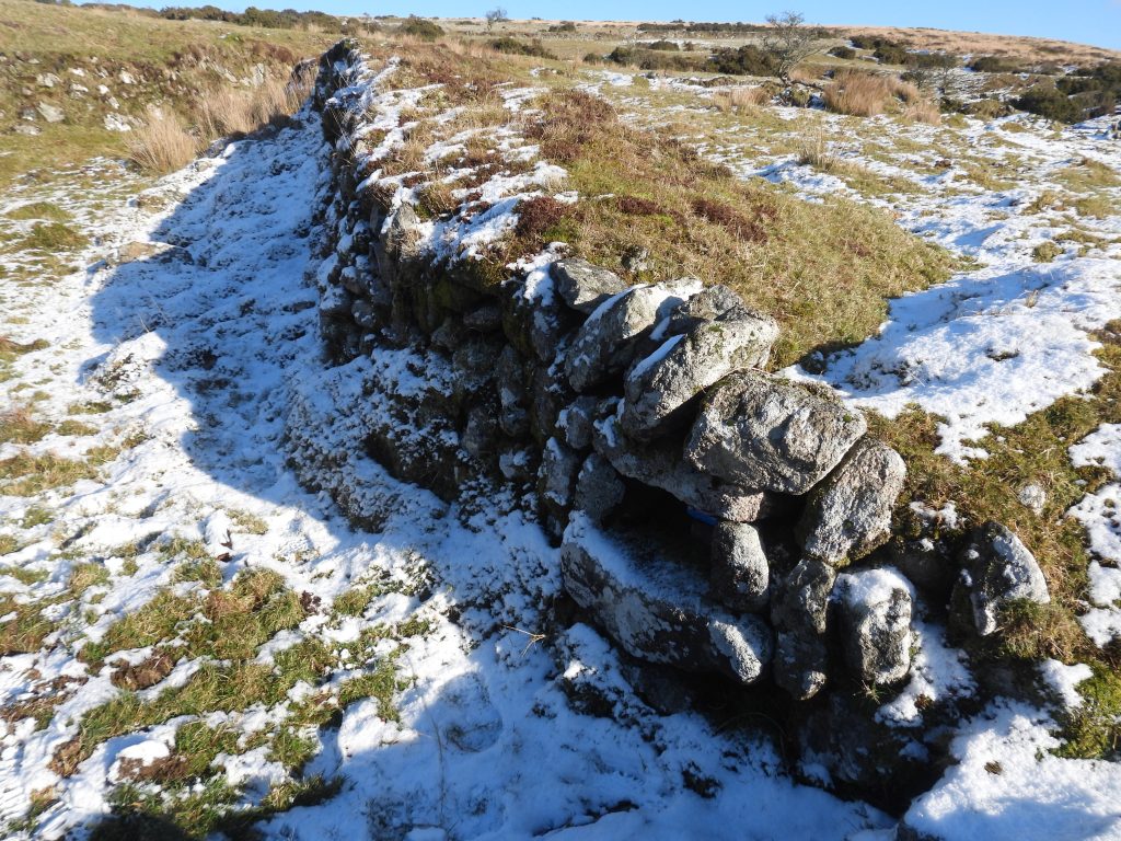
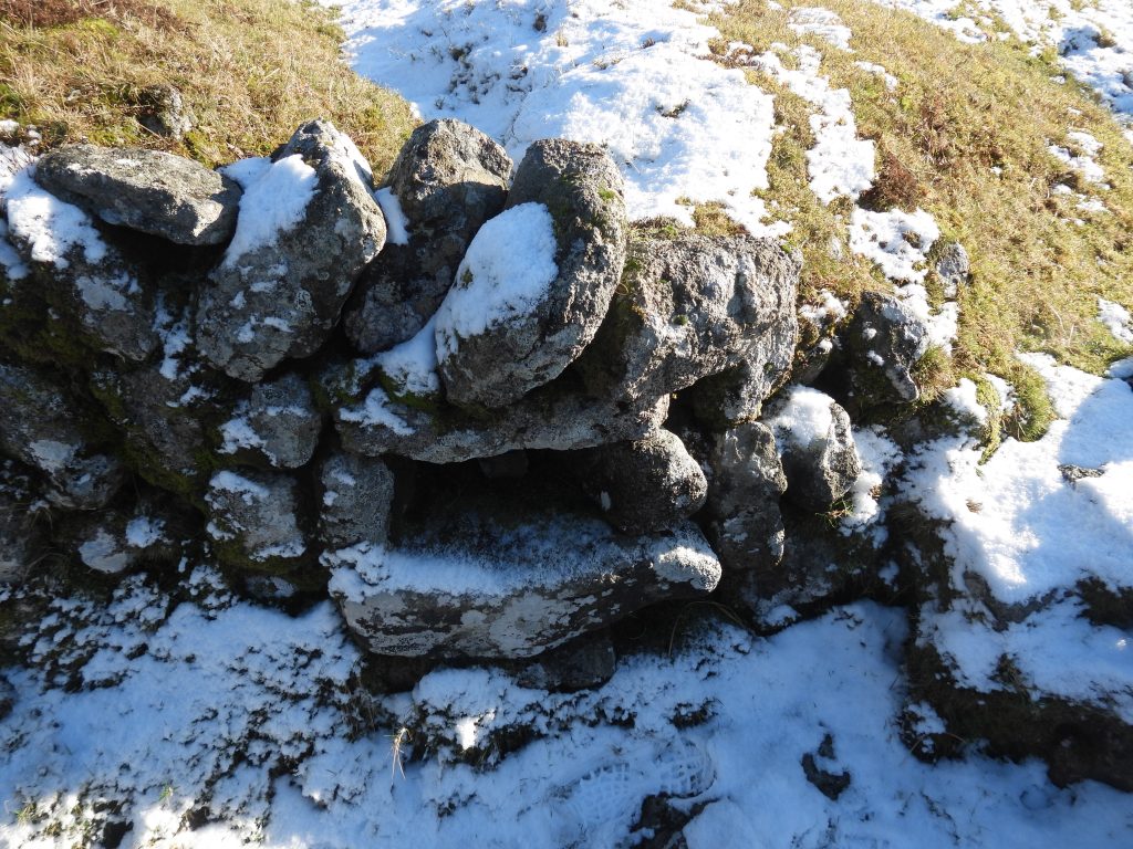
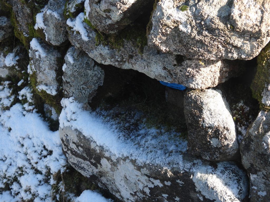
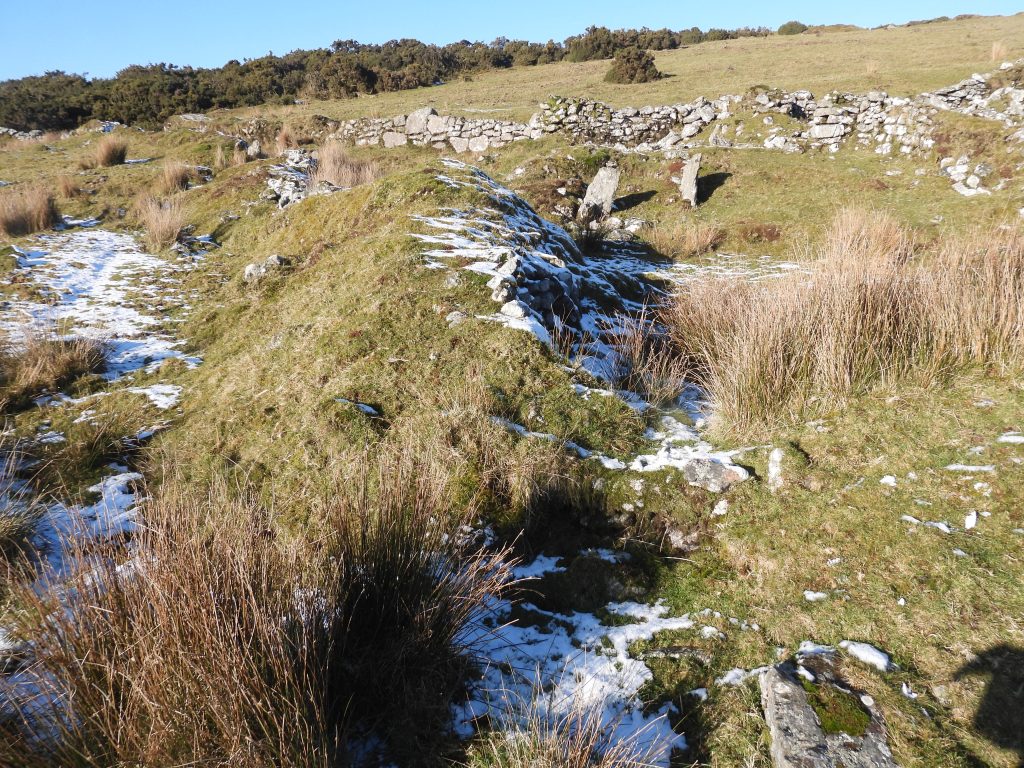
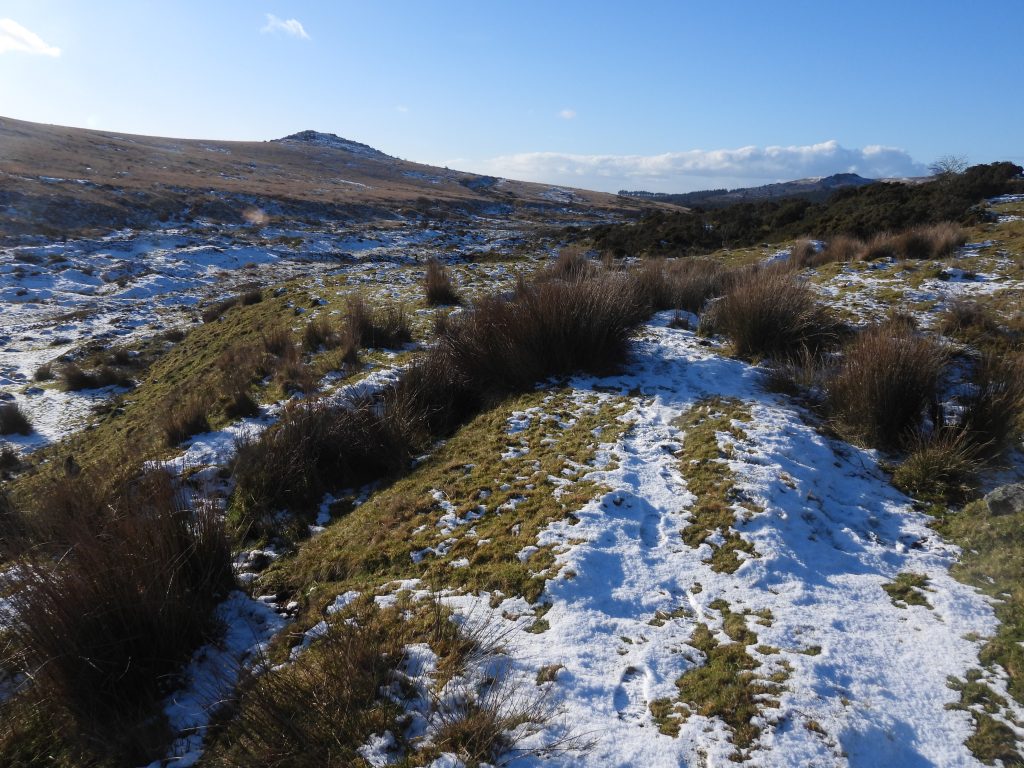
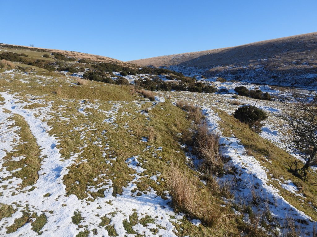
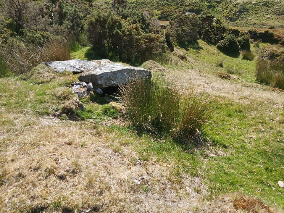
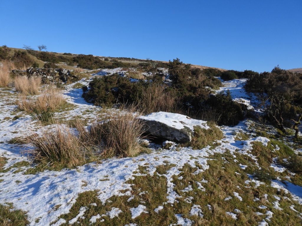
Newleycombe is shown as Newlacombe on the tithe map. The apportionments were 1023 through to 1047, which followed on from those of Classiwell (1015 through to 1022). The old lane from Older Bridge through Cockle’s Gate and onto Norsworthy can be seen (top left) on the mapThe plot names, cultivation purpose and sizes from the Tithe Apportionment are shown in the table above. The total area was 40 Acres, 3 Roods and 18 Perches, which was approx. twice the size of its westerly neighbour, Classiwell (or Crazy Well)Approaching Newleycombe farm from the east, likely from the ‘Pits’ (1045) location (ref: Tithe Map / Apportionment)The farm from the south east. Note the line of snow running diagonally towards the ruins, which is the line of a dry leat, which appears to have served the farm and possibly later Plym Consols Tin Mine waterwheel further downstreamLayout of the farm buildings. The sketch is based on an original in the publication “The Field Archaeology of Dartmoor” with annotations based on the various interpretations by Dartmoor observers, who include: Dr Phil Newman, Mike Brown and Eric HemerySome of the known tenants from 16th to 19th century based on data from Mike Brown and Paul Rendell. The Maristow Estate took over the farm in 1827. Of interest, recorded by Mike Brown is the following: “A letter written by the Manor steward to a Capt Joseph Callum of Bedford Bridge, Horrabridge, on 1st May 1838. The letter which reveals some secondary details about the mining operations in the valley and the state in which some of the Newleycombe fields had been left by these activities, which was doubtless the reason for its demise as a working farm – ‘I beg leave to enquire whether it be intended to resume working of the Mine at Newlacombe, as I found everything at a standstill when I was there yesterday. I went there to examine the actual state of the little farm. Mr Hamlyn our late Tenant having thrown it up at Lady Day – on the ground that it was rendered worthless to him by the mining operations. I must say the premises are greatly damaged in various ways – by the cutting of four different channels for water, by the destruction of Fences [walls] – by Roads [tracks] – Rubbish Heaps &c. The Meadow and one other of the best plots are, by the means aforesaid, utterly spoiled for any useful purpose. Mr Hamlyn claims an allowance for these damages, which the Adventurers certainly ought to make to him. If the workings be resumed, the Adventurers ought to hire the land, and do the best they can by it – as I despair of finding any Farmer that will hire it…under such circumstances”. In spite there being no records of improving the buildings, the Maristow Estate records do show expenditure in 1835 for hedging (walls). This expenditure was 3 years before the ‘John Hamlyn’ affair of 1838. Indeed, it would appear Hamlyn became tenant in 1836, a year after this expenditure and lasted two years until Lady Day (March) 1838This 1873 annotated map shows how relatively close Newleycombe farm was to a large medieval tinners’ gert and latterly in the mid / late 19th century the Plym Consols Tin Mine. The letter of 1st May 1838 to Capt Joseph Callum is perhaps put into context by the annotated map. Whether or not the mine adventurers eventually compensated Hamlyn for the damages is not known, but the Maristow Estate did pay him something, as recorded in the contemporary stewards’ accounts, viz: ‘March 23rd 1839 Pd John Hamlyn for damages he sustained on Newlacombe from the working of a Tin Mine there in the two last years of his holding £5’. One wonders if £5 was a paltry sum as a token gesture as todays value would only be just over £800. For detail of the mine, see also:Plym Consols Tin Mine – Dartmoor ExplorationsThe medieval tinners gert to the west of Newleycombe farm, to the south of which, was Plym Consols Tin Mine. The farmstead from the south at approx. the location of the 3rd (Small) Building. The author (and friends) had just finished lunch on the ‘Raised Platform’ between the Central Building and the 2nd Building. This was taken in January 2026An early summer (May 2020) view of the farmstead buildings from the east, just above the 2nd BuildingAn aerial view of the ruins. The central building ruins, which comprises two compartments and a porchOverlooking the western end of the Central Building, where the porch is located, looking south towards the 3rd (Small) Building and Newleycombe Lake beyond. The western compartment has been measured as being 4.60 m long by 3.50m wide with walls 0.70 m thick (Newman).The eastern end of the Central Building with a large amount of rock tumble. The farm courtyard can be seen just beyond the wallsWestern end / compartment of the Central Building. There appears to be a break in the wall between the two compartments. The eastern end of the Central Building (foreground) with Courtyard beyond. Phil Newman records: “This compartment……has a larger interior: 8.60m long, 3.50m wide with a maximum height of 1.40m. It may have been separated into a further two rooms for the south wall projects inwards at 5.10 m tapering the room. Apart from a greater density of tumble there is no further indication of an interior wall”.Looking over the eastern compartment of the Central Building. Down Tor in the background. The grid reference is SX58759 69951In the north west corner of the eastern compartment of the Central Building is a possible fireplace.The fireplace surround is around 1m long and 0.60 m wide (Newman).The porch to the Central Building is attached to the south western corner of the exterior wall. Immediately behind it is the western (smaller) compartment. To the south it overlooks the 3rd (Small) Building. The entrance way is framed by two uprights or orthostatsThe two orthostats have been measured as being 1 m x 0.50 m x 0.15 mThe porch and western compartment of the Central Building. The dimensions of the porch have been approximate to 1.50m x 1.90m. Mike Brown records: “Located inside the porch is a short granite bench, a luxury which has not been found at any of the other ruined sites on the Moor”. The entrance orthostats overlooking a small enclosure and the 3rd (Small) Building. The Newleycombe ‘gorge’ can be seen in the distanceThe 3rd (Small) Building in May 2020. It has been measured as 4m in length, 2.50 m wide with walls 0.60 m thick. The 3rd (Small) Building in January 2026. There is a lot of rock tumble in the interior and there is a 0.50m wide entranceway located on the north wall (nearest the camera). The maximum height the walls in the building reach 1.10m. It is located at SX58766 69934Overlooking the 3rd building towards the porch and western compartment of the Central BuildingThere is a small Raised Platform in the north east corner of the Courtyard, which appears to have been constructed to be ‘flush’ with the 2nd BuildingThe courtyard is located at SX58768 69944. As can be seen in the photograph, it is square in shape and is surrounded by turf covered walls. It has a level interior that has been modified to sit flush with the main buildingThe CourtyardThe 2nd Building has contains two compartments, both of which appear to have a doorway on the south wall. The division between the compartments is very clear. The 2nd Building is located at SX58775 69955The western compartment of the 2nd Building is 5.80 m in length and 3.50 m in widthThe western compartment of the 2nd Building with the Courtyard beyondThe 2nd Building. The south wall has almost disappearedThe eastern compartment of the 2nd Building is 3 m by 3.80 mThe eastern compartment of the 2nd Building. Along the eastern wall is a recess, which can be seen in the photograph. It is 1m in length, 0.60 m tall and 0.60 m deep.2nd Building, eastern compartment. Its north and east wall are both revetment walls, with a maximum height of 1.30m.Internal (east) lane in the farm below the 2nd Building. Deep sunken lanes approach the farm from both the west and the east.Another small platform adjacent to the lane and just over the wall from the CourtyardThis square recess is located in the lane set into the southern boundary wall. It is located at SX58776 69945Contextual view of the recess which is 0.40m tall, 0.30m wide and 0.50m deep. The dry leat is just a few metres away beyond the wall, which may give a clue as to its original use.Various Dartmoor authors have described this as being; a post box, a grooved lip-stone over a dipping well or a tip-stone for a pot water leat.Close-up of the small cavity or recessIn the south western corner of a small enclosure below the Central Building porch, is a possible drainage outlet attached to the wall. Without it, due to the lie of the ground, no doubt there would have been flooding here. Water would have fed into the dry leat below. The outlet is around 1m wide and 0.30m high. It is located at SX58760 69929The dry leat looking west. It leads to the wheelpit of Plym Consols Tin MineThe dry leat coming in from the upper reaches of Newleycombe LakeTo the east, across the dry leat is a clapper The clapper is located at SX58815 69926