A collection of walks, discoveries, insights and pictures of exploring Dartmoor National Park
October 30, 2025
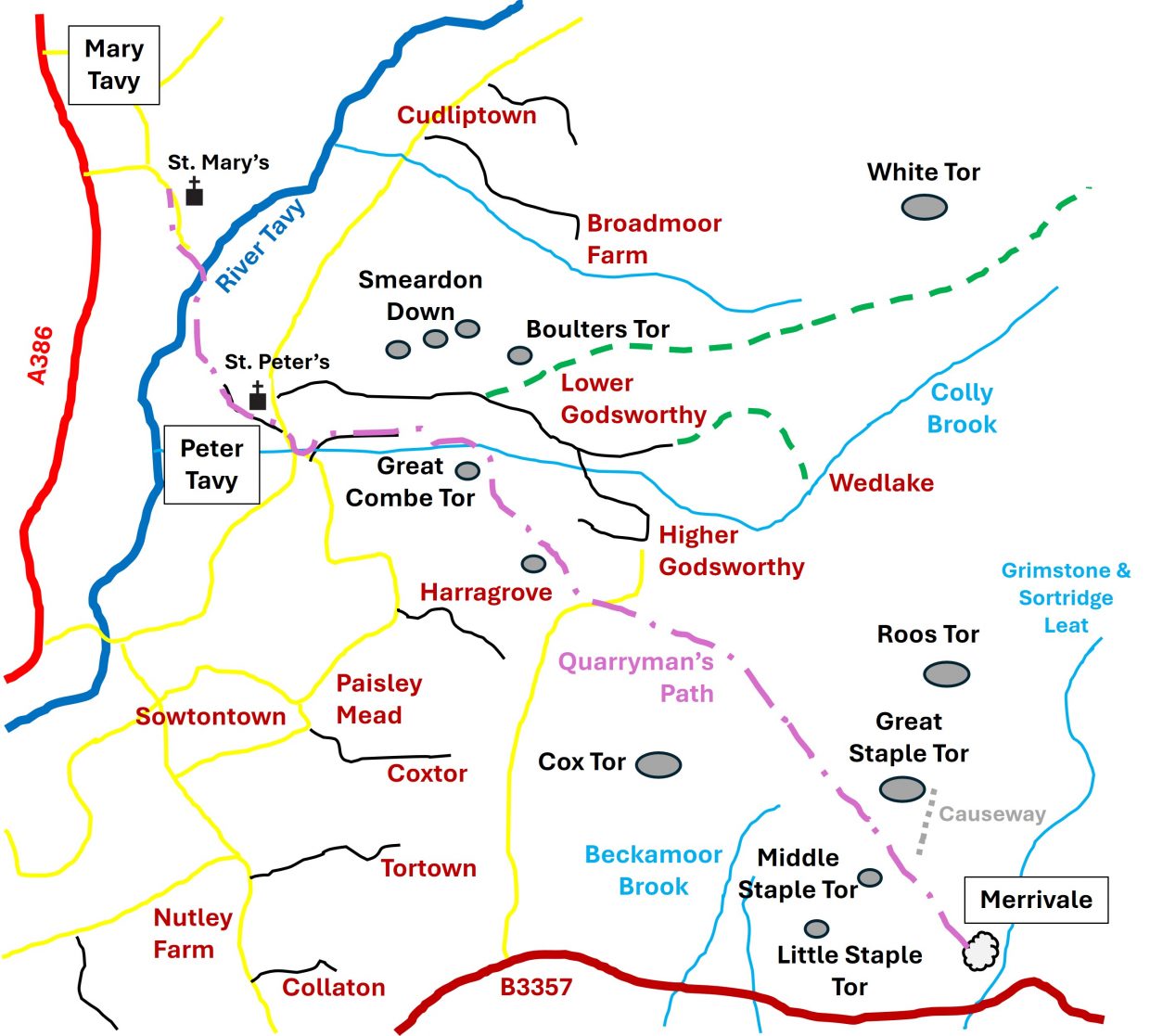
Quarryman’s Path (aka Sheep Path)
This route or track is described by Eric Hemery in his book ‘Walking Dartmoor’s Ancient Tracks – A guide to 28 routes which was published in 1986, three years after his more well known publication ‘High Dartmoor’
The Quarryman’s Path (Track 17 – pages 193 to 198) is picked out by Hemery as a particular route to exemplify the tracks, paths and journeys, the quarry workers of the Victorian era would have had to take to get to their work. Hemery has justified the route on the basis of it being noted by William Crossing (the renowned Dartmoor Guide writer from the turn of the 20th century) and by oral history relayed to him by a George Penrose of Peter Tavy. It would also seem that is it also one of the longer Quarryman’s tracks or routes of the period and Hemery chooses the route to start at Mary Tavy enroute to Merrivale, a distance of around 4 miles.
Penrose passed onto Hemery, what he knew of his father Frederick’s work as a quarryman. Frederick Penrose was born in 1870 and lived at Higher Godsworthy Farm. This would have been around the time (ie 1870) that the small industry of ‘Sett Making’ on the eastern slopes of Great Staple Tor was in its heyday, a full 5 or 6 years before Merrivale Quarry (then known as ‘Tor Quarry’) had been opened. Frederick said he would walk to work following the ‘Quarryman’s Path’, which in those days was known as ‘The Sheep Path’, waiting for his workmates coming through the combe (Peter Tavy Combe). It would seem that Frederick would have worked at ‘Tor Quarry’ when it had been operational around 10 years (mid to late 1880’s). He would have been acutely aware of Sett making although might not have endured the conditions of his predecessors on the slopes of Great Staple Tor. That said, the evidence in this post does suggest that ‘Quarryman’s Path’ was likely to have been used by the early Sett Makers possibly as early as 1860.
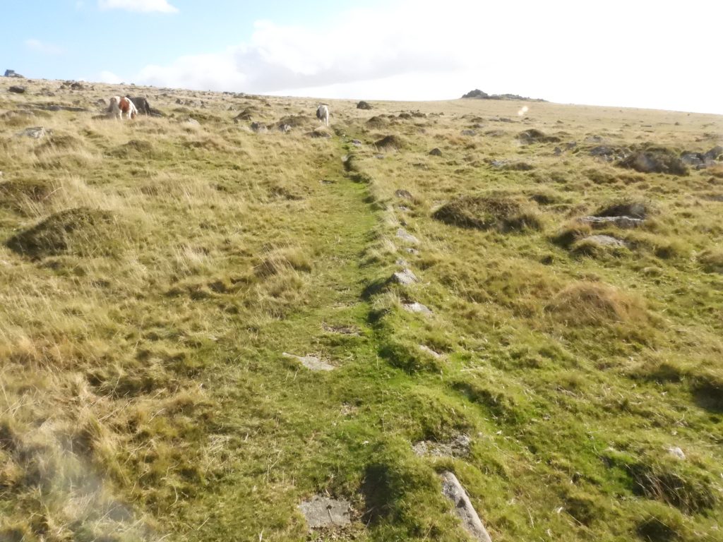
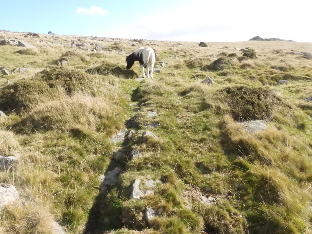
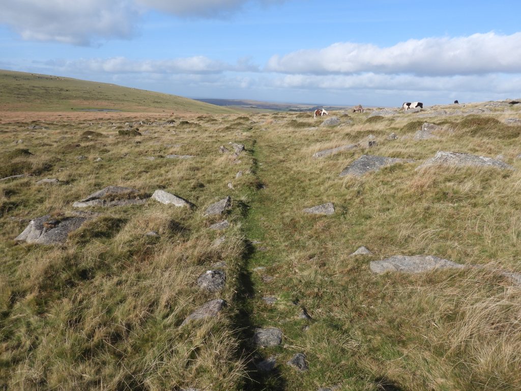
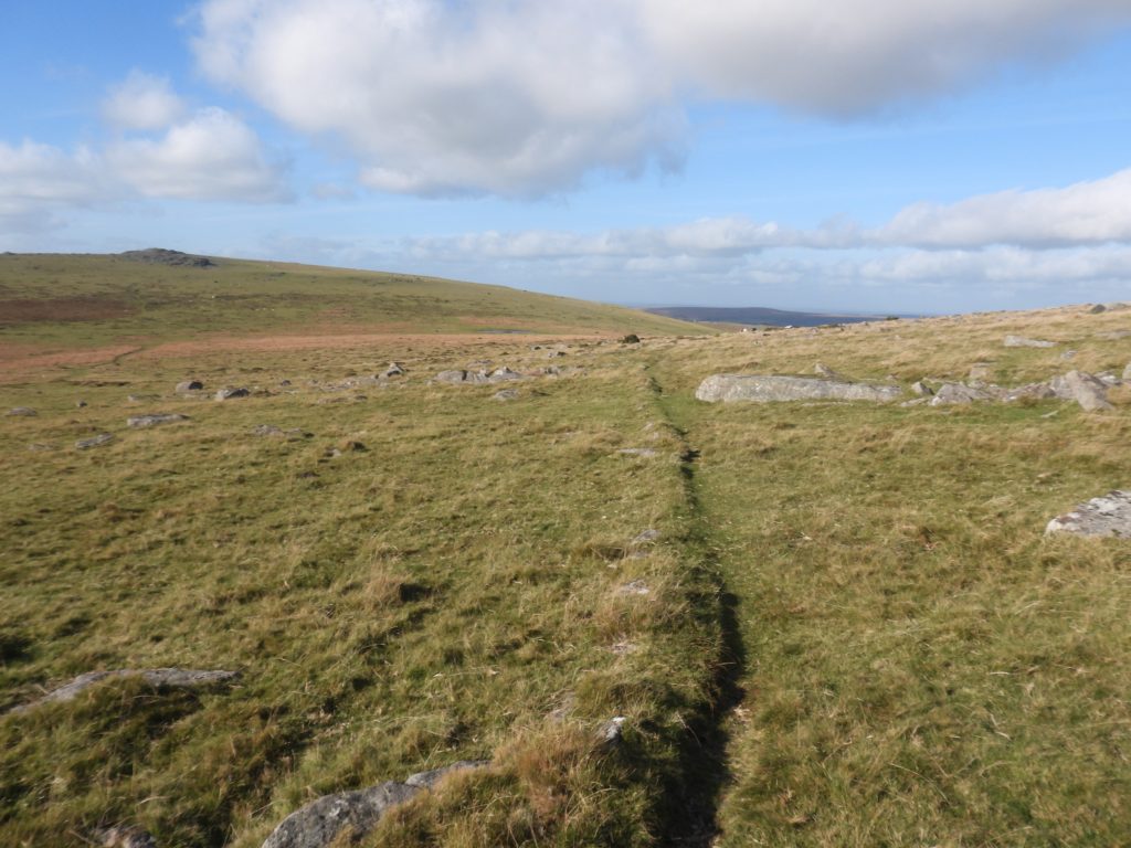
What does set this ‘Quarryman’s Track’ apart from others is a ’causeway of granite’ which has been set out like “……a kerb like series of set stones” (ref: Hemery, 1986, p198), which seem to have been laid by the quarrymen across the col, between Great Staple Tor and Cox Tor and then onwards towards the ridge between Great and Middle Staple Tors. The conjecture being that the causeway would have either been to keep dry from the boggy and less wet conditions or indeed to prevent them losing their way in the dark or mist.
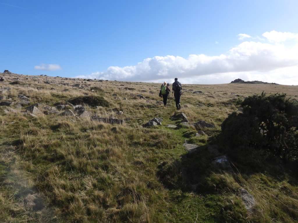
On a dry and bright October day with a group of friends, the author embarked on following the ‘Quarryman’s Path’ as defined by Hemery between Mary Tavy (St. Mary’s Church) to Merrivale Quarry and return in the footsteps of these hardy Victorians. The author had only previously walked the route one way and decided to experience a return journey. This post covers this journey and points of interest along the way, with a few ‘minor’ side trips to record interesting features.
Bibliography
Eric Hemery (1986) – Walking Dartmoor’s Ancient Tracks, A guide to 28 routes, Track 17 (pages 193-198)
Simon Dell and John Bright (2008) – Dartmoor’s Sett Makers’ Bankers (An industrial mystery solved?)
Helen Harris (1968) – Industrial Archaeology of Dartmoor
Helen Harris (1981) – 19th Century granite working on Pew Tor and Staple Tor, Western Dartmoor, 31-34 (Article in Serial). SDV236242.
P.H.G. Richardson (1992) – Mines of Dartmoor and the Tamar Valley after 1913 – Chapter 5 (pages 53-60)
C.W. Pilkington-Rogers (1930) – Days on Dartmoor, pages 96/7
William Crossing (1910) – Guide to Dartmoor – Page 150
Royal Commission for the Historical Monuments of England (RCHME) – (1987-1993) -Duchy Farms Project Survey Visit (Report – Survey). SDV350839
Anthony R. Kingdom – (1991) – The Yelverton to Princetown Railway (page 75)
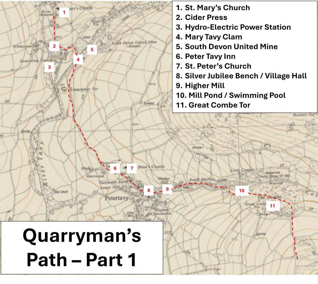
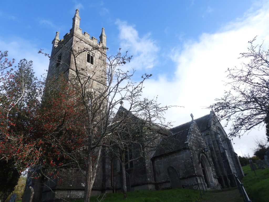
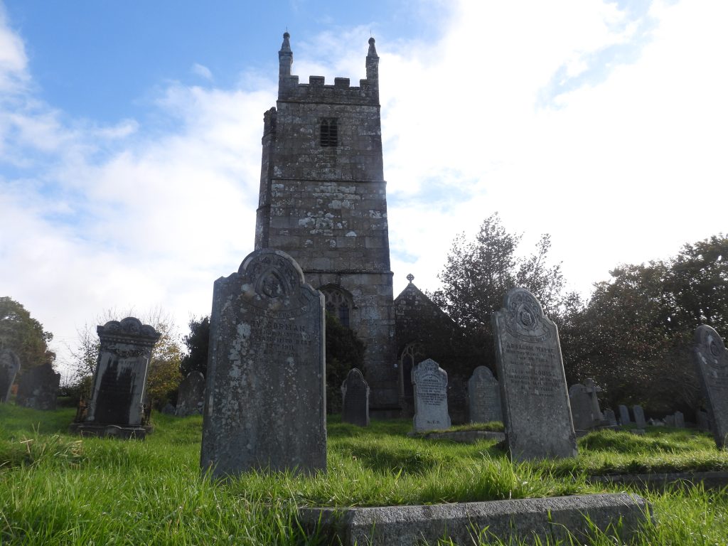
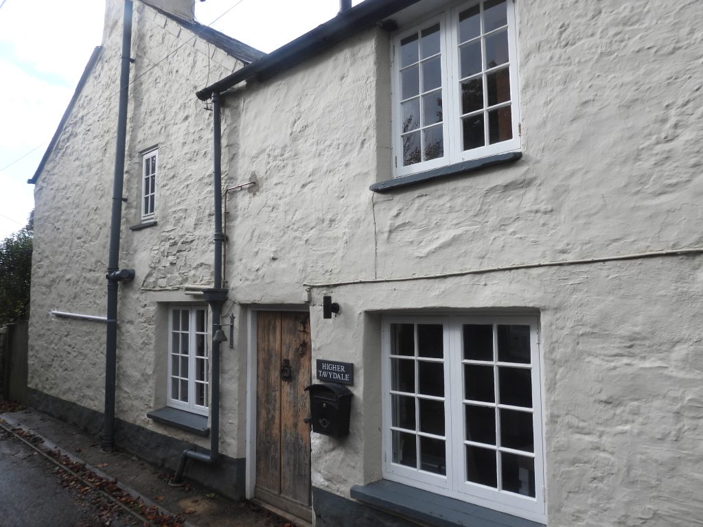
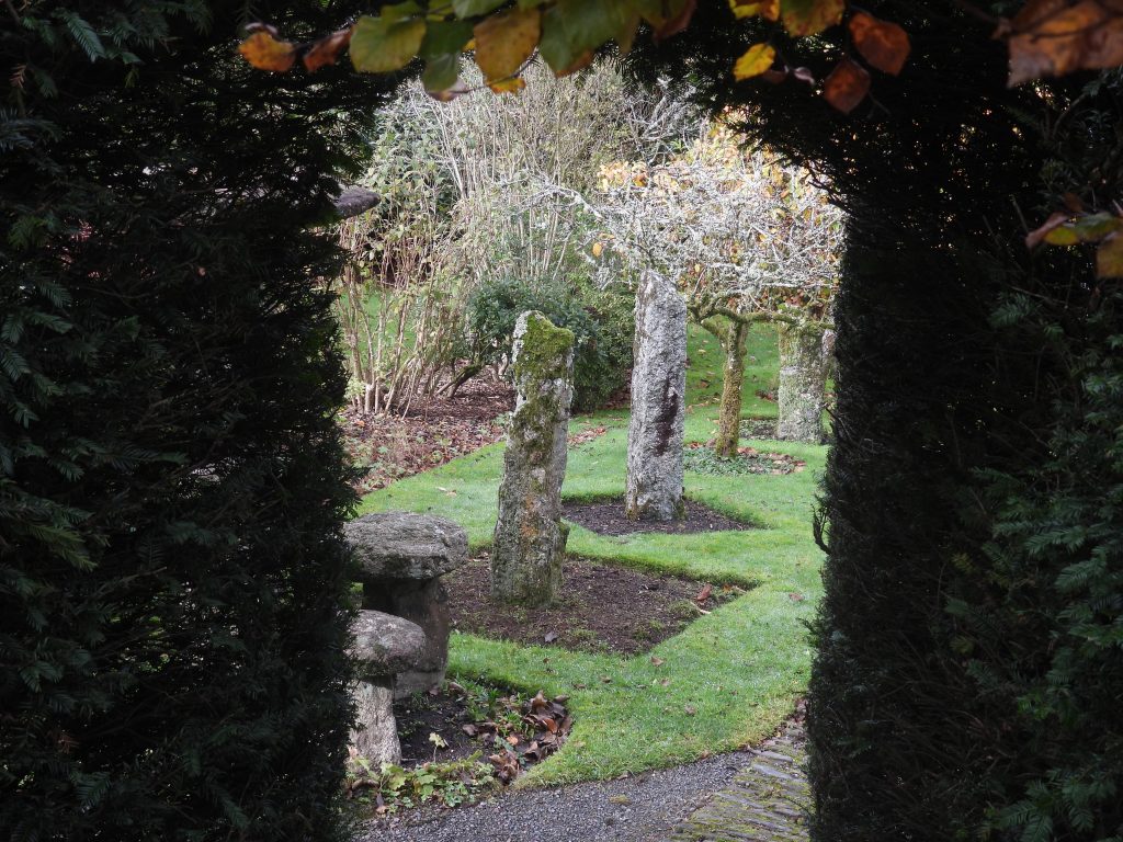
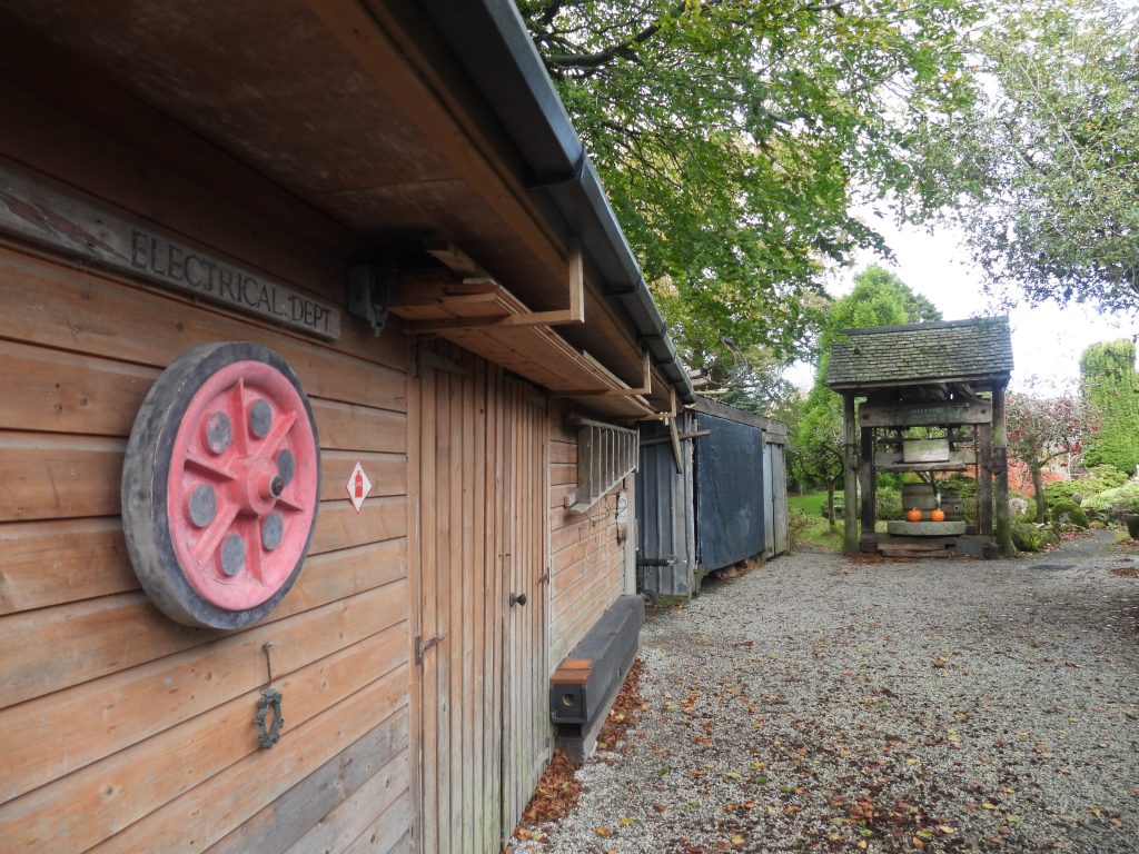
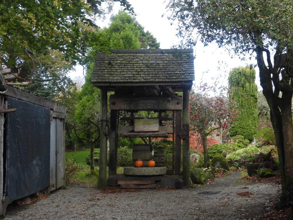
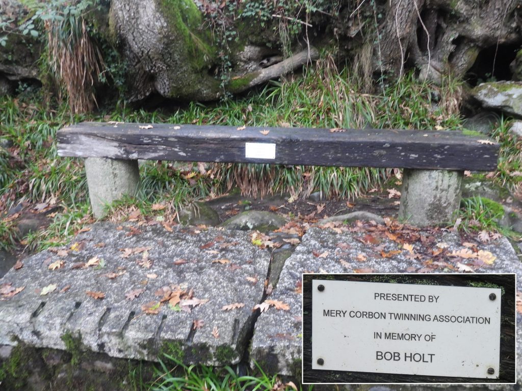
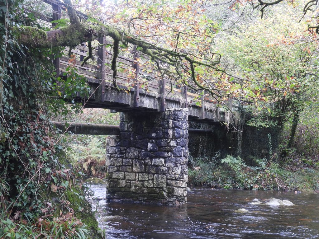
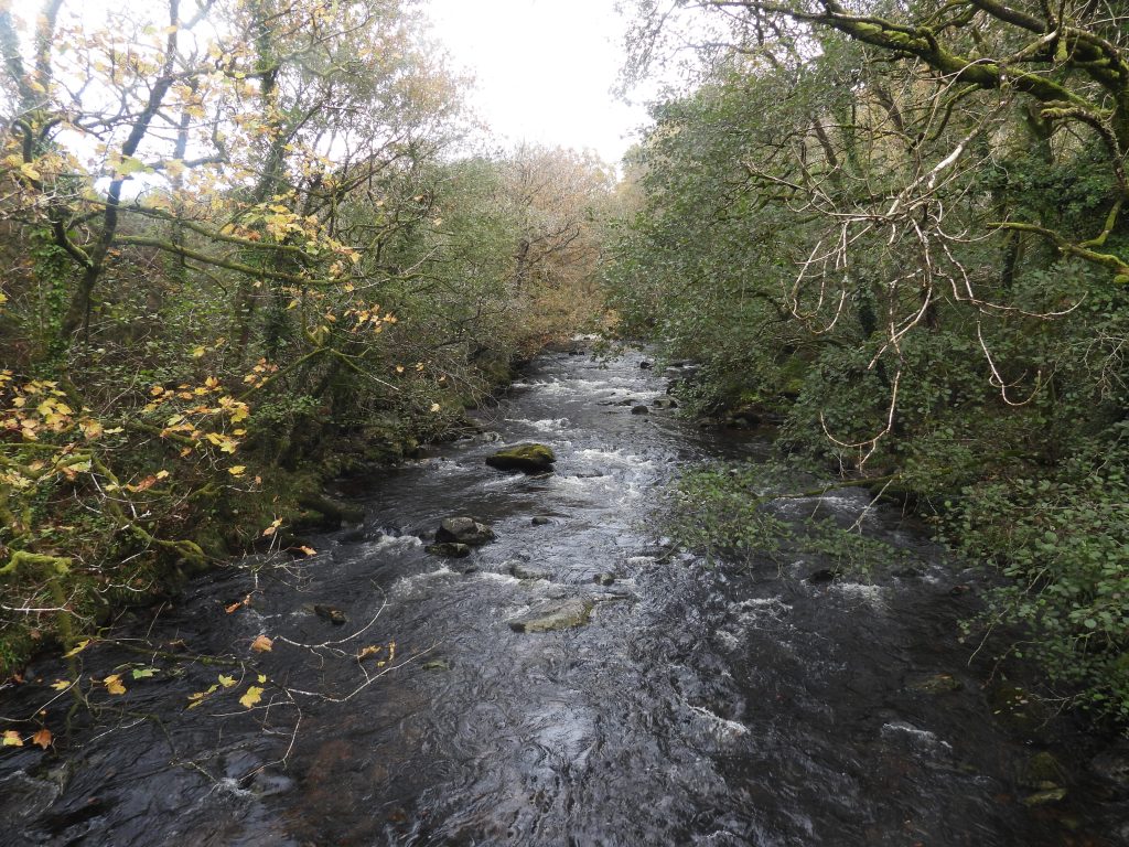
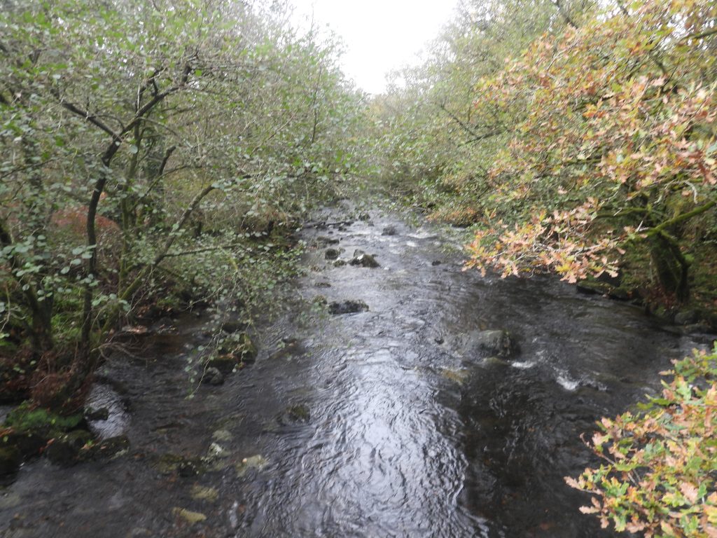
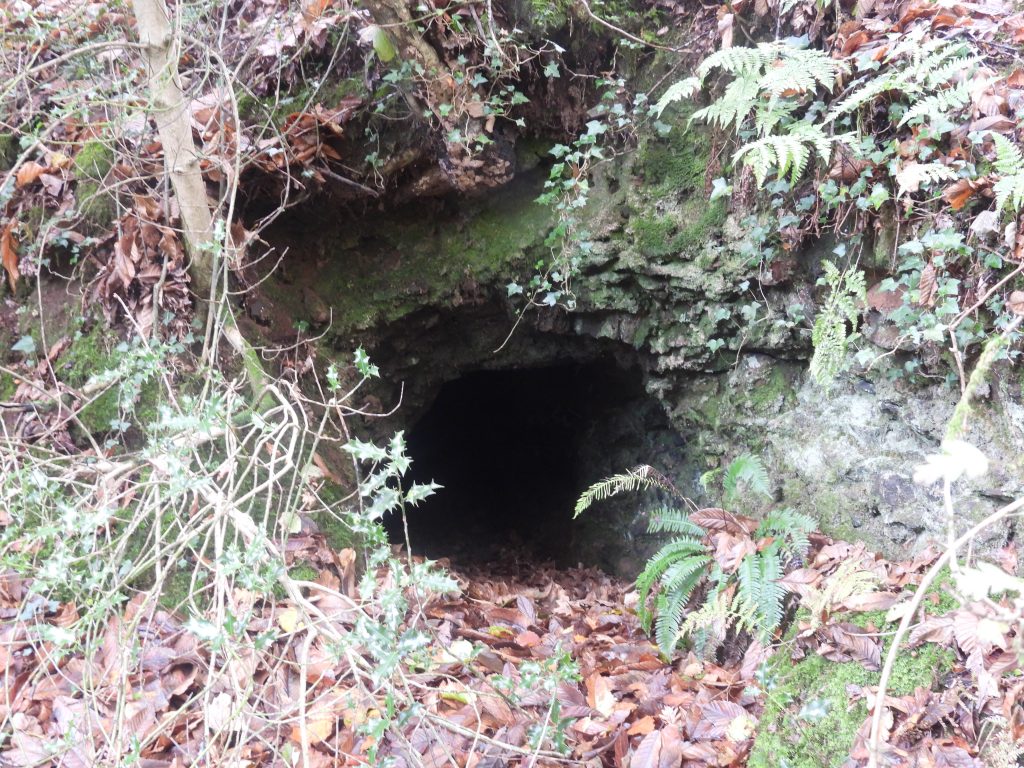
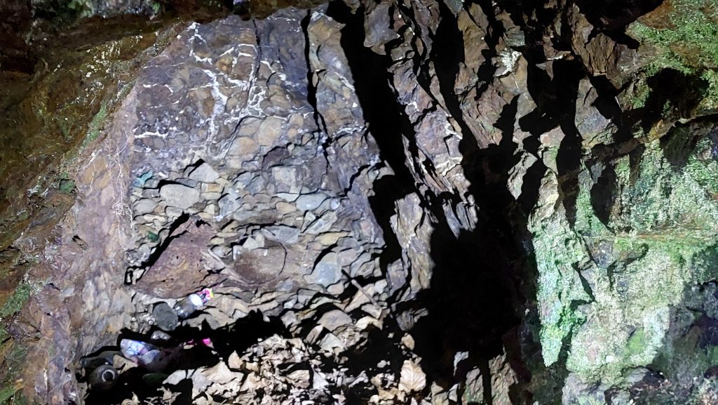
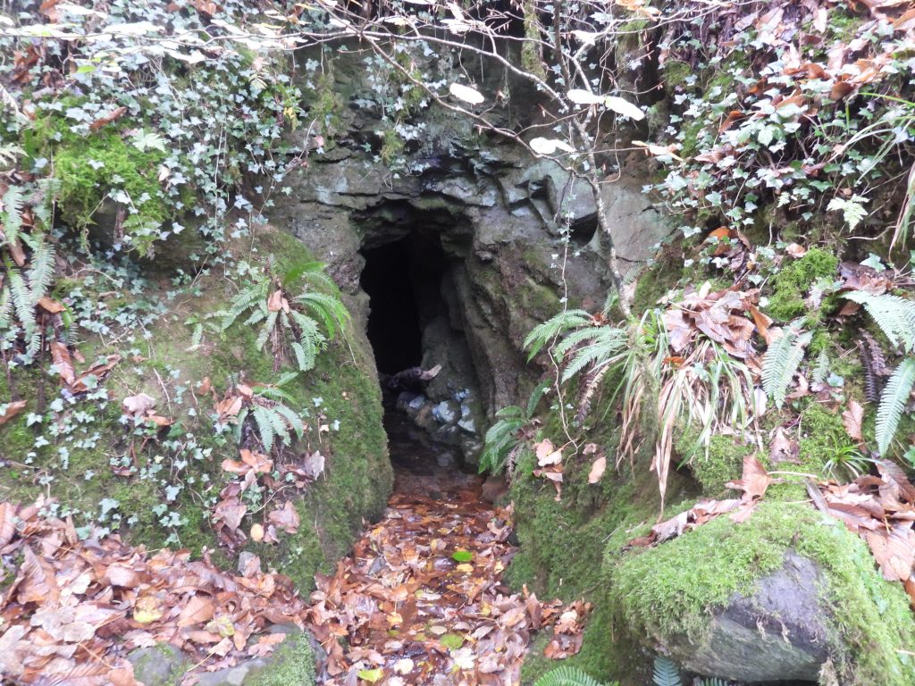
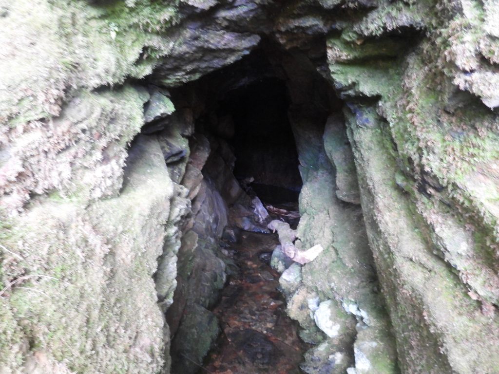
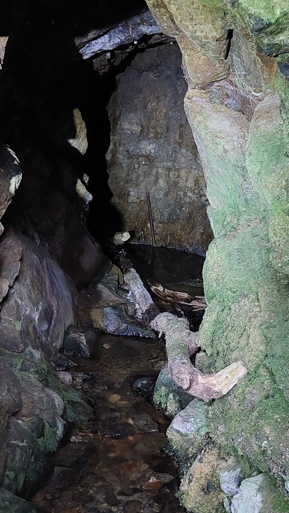
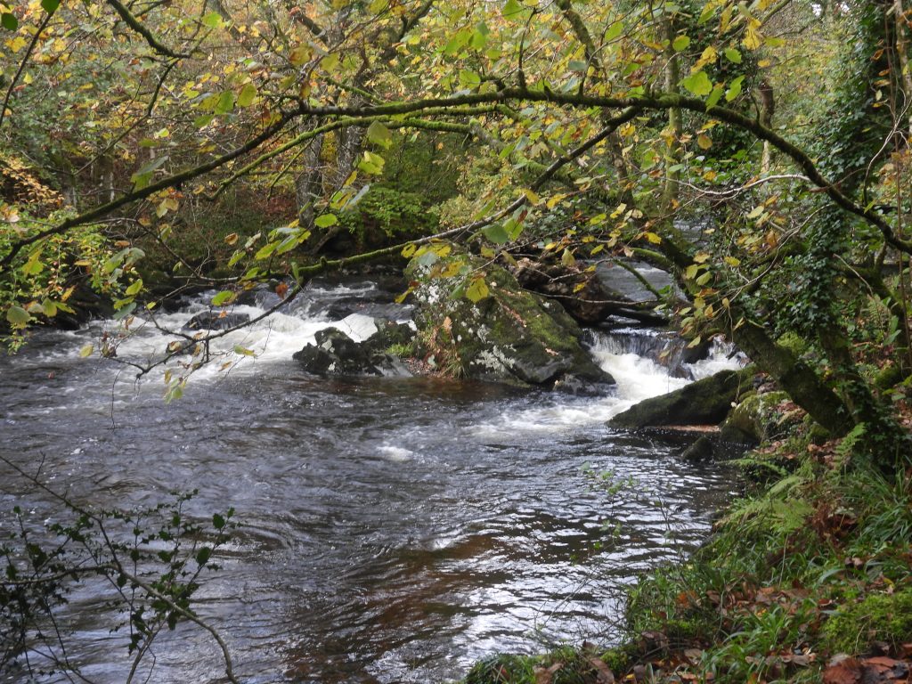
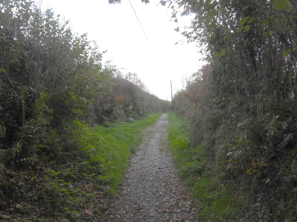
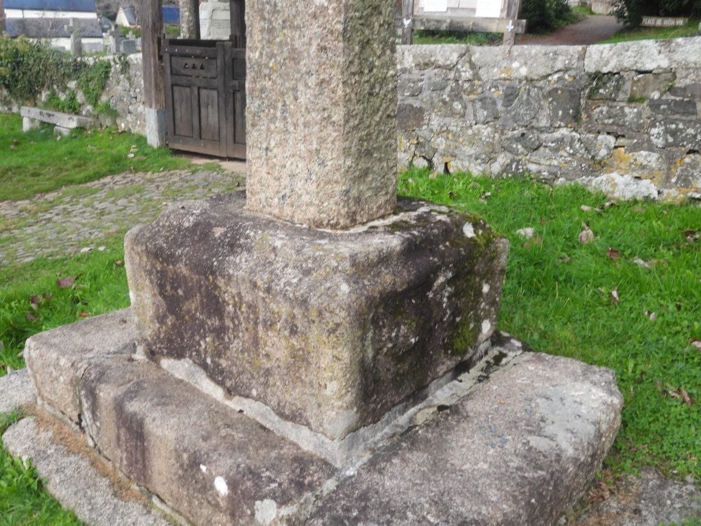
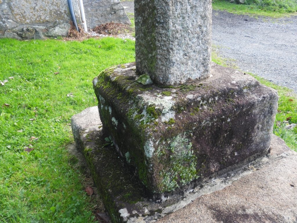
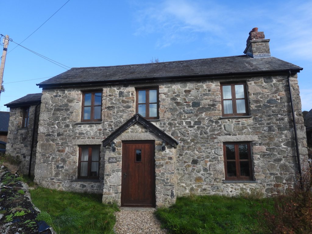
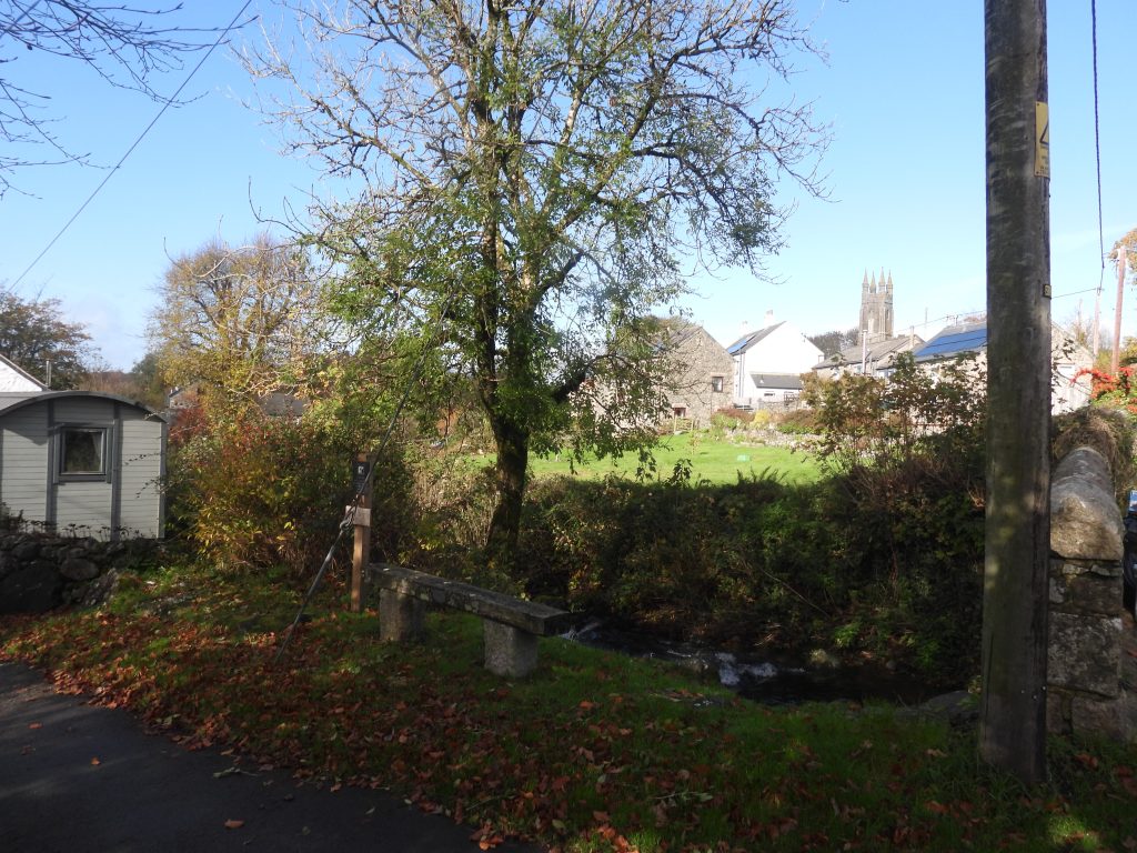
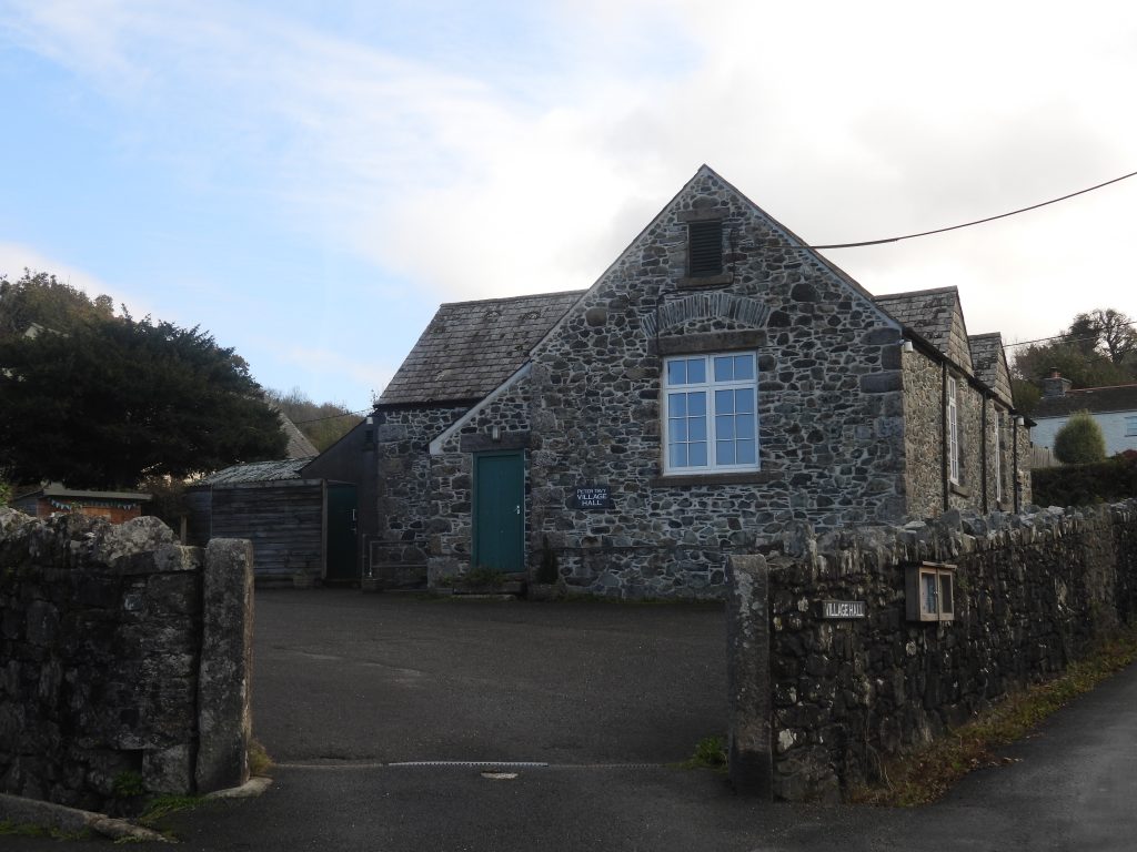
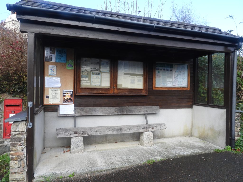
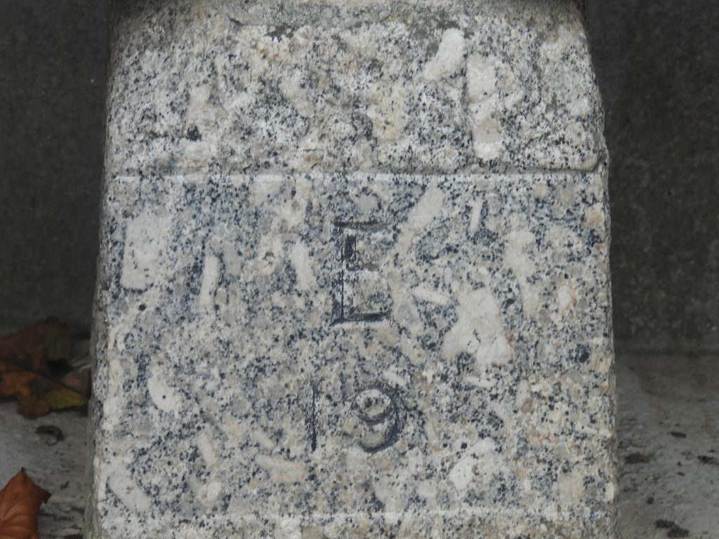
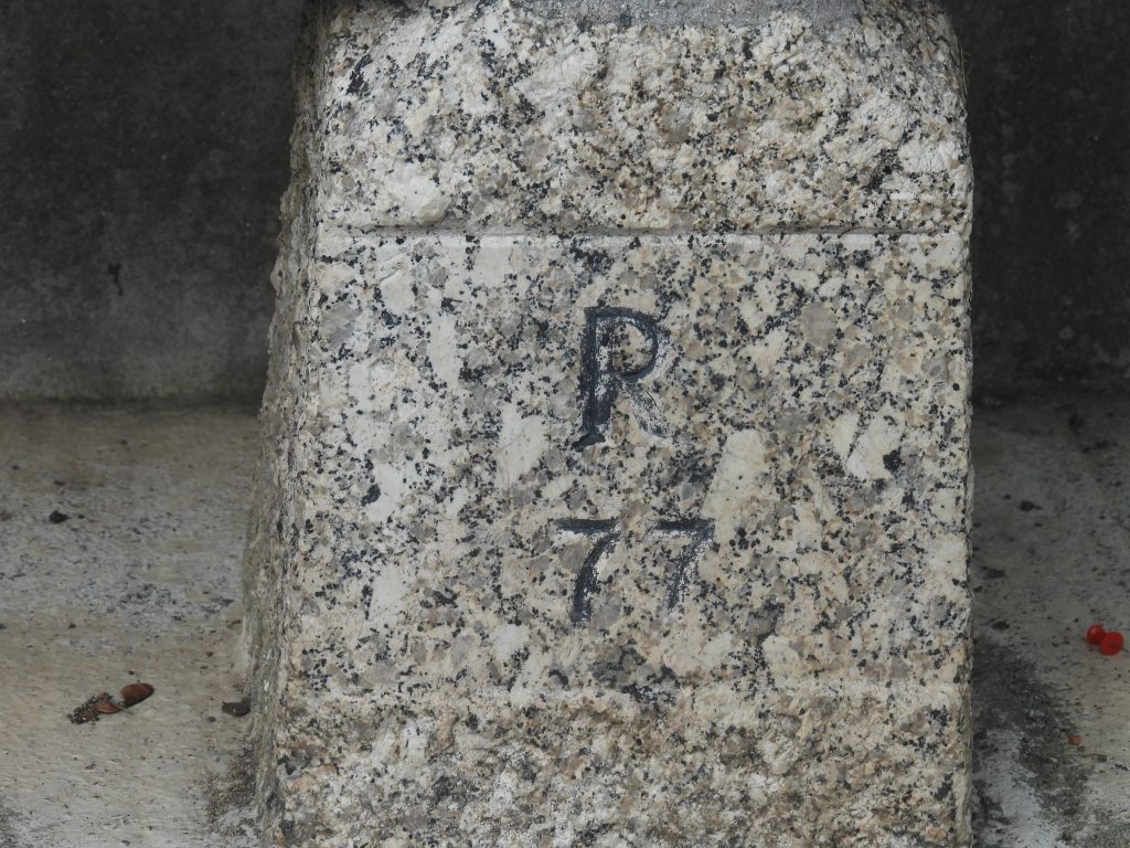
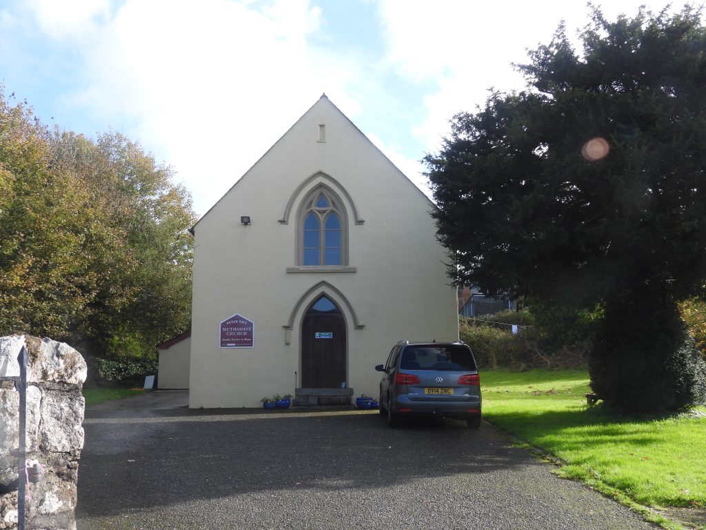
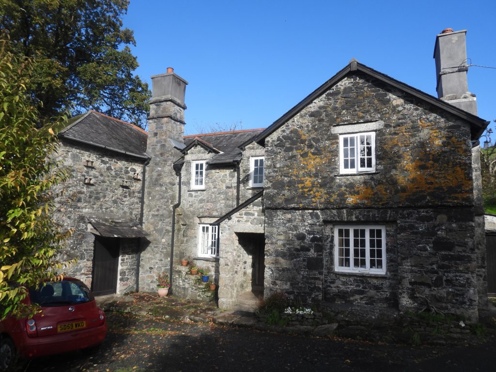
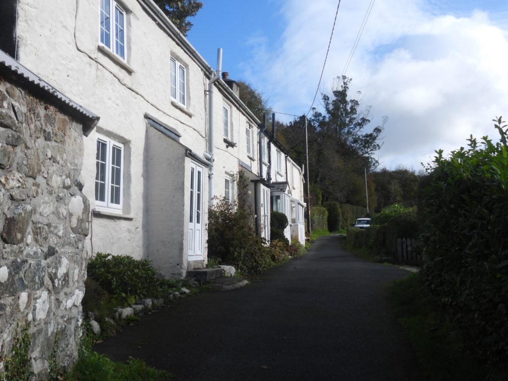
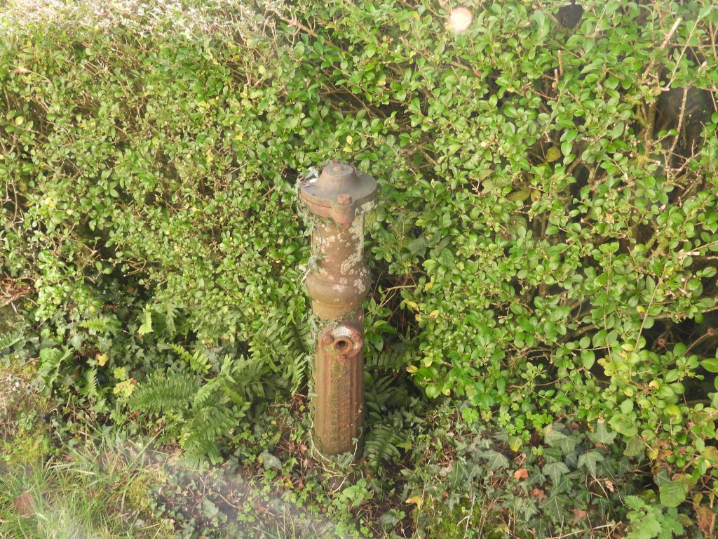
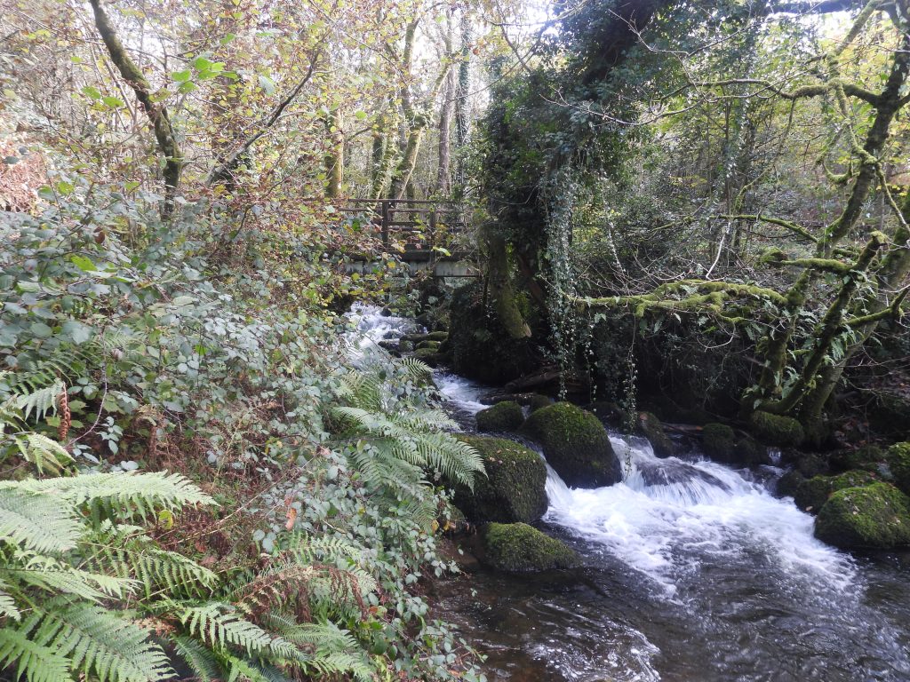
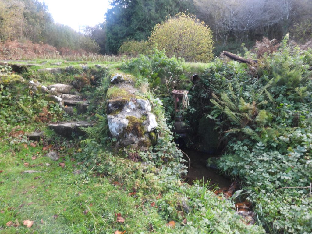
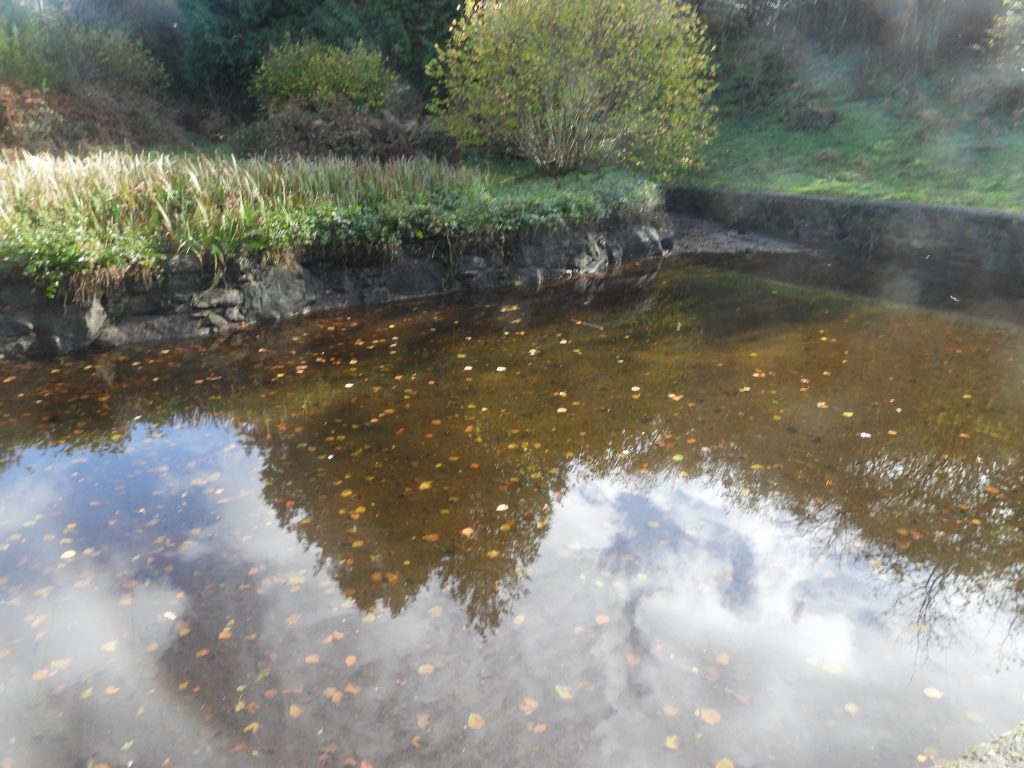
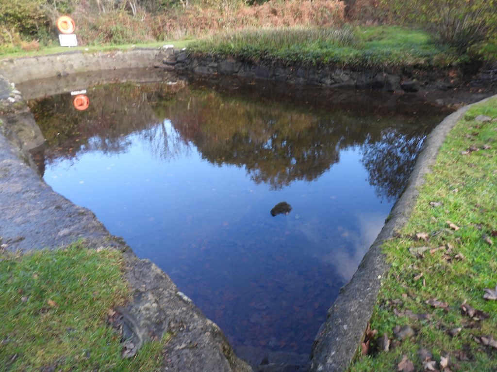
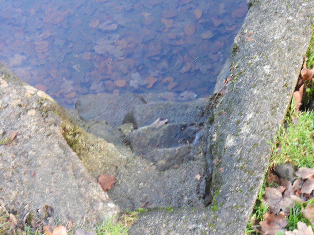
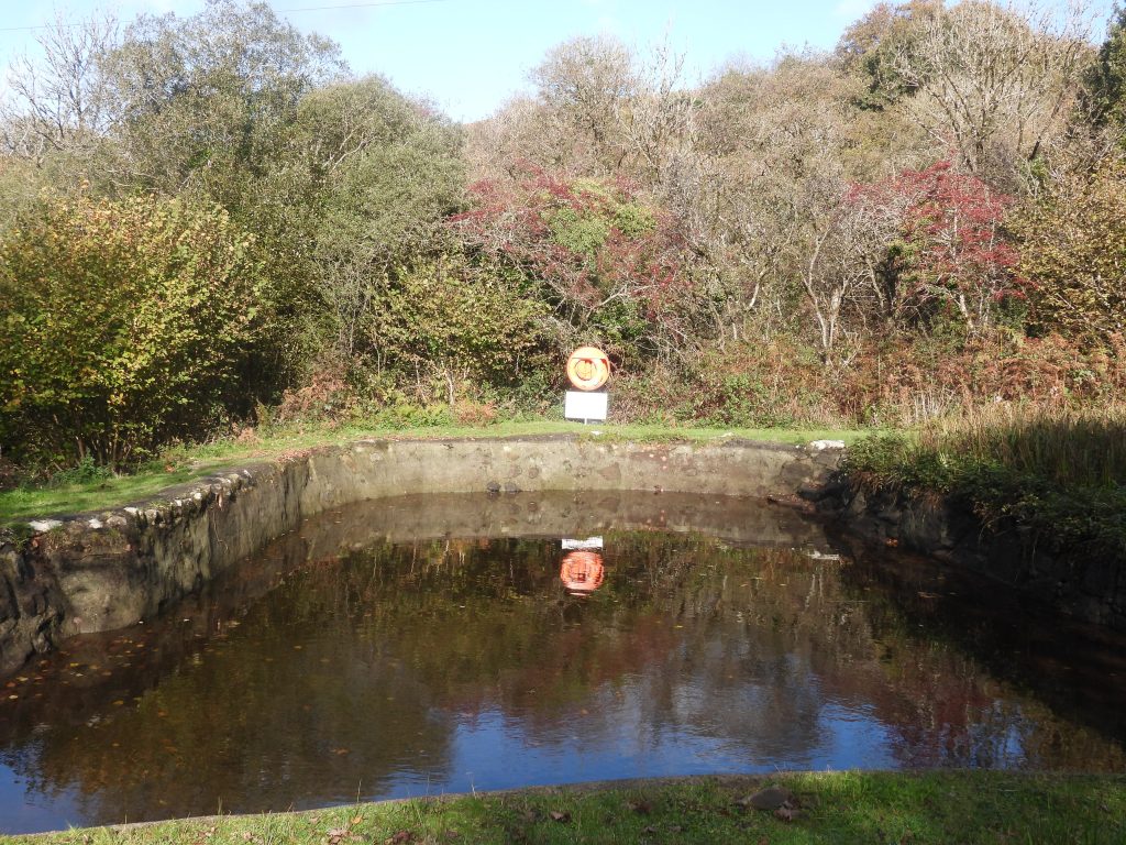
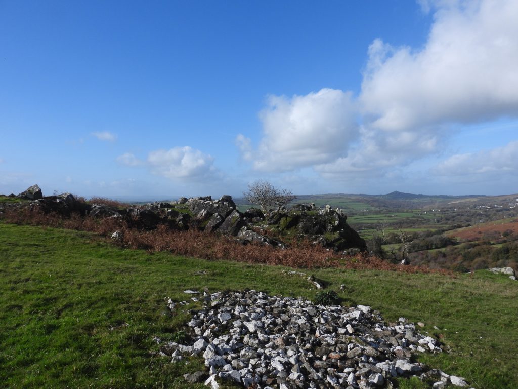
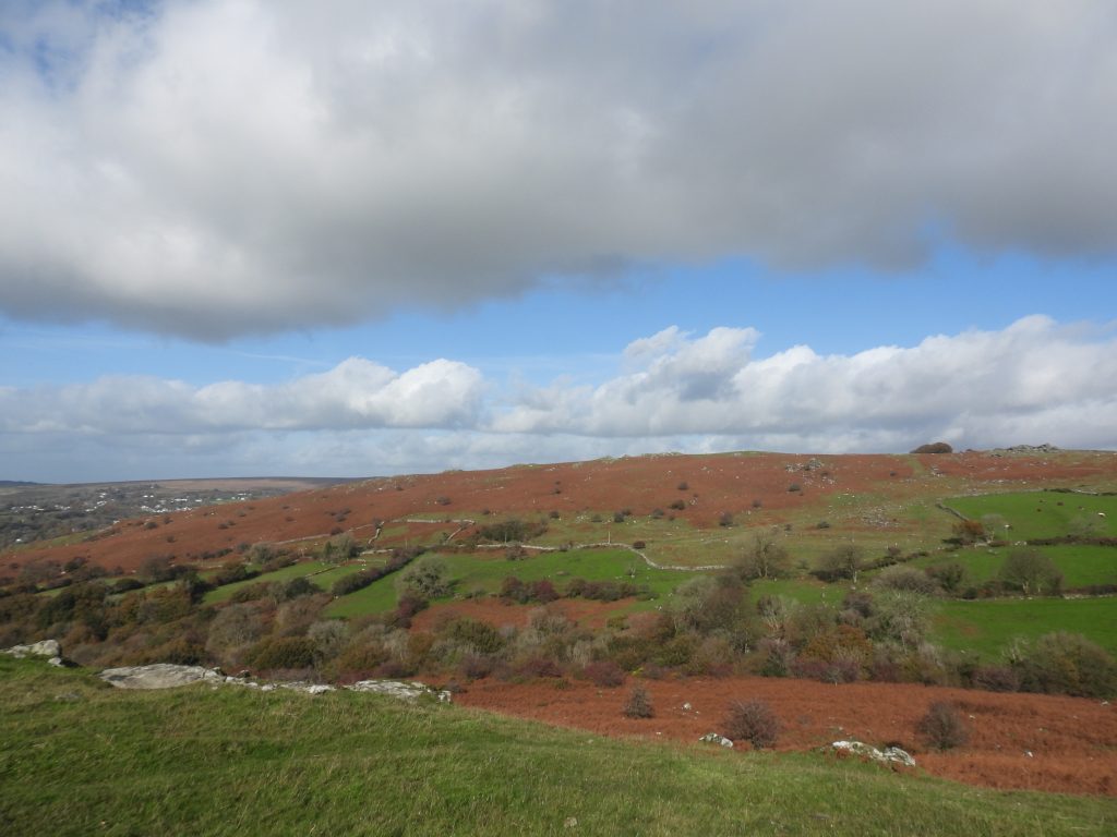
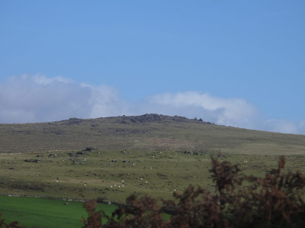
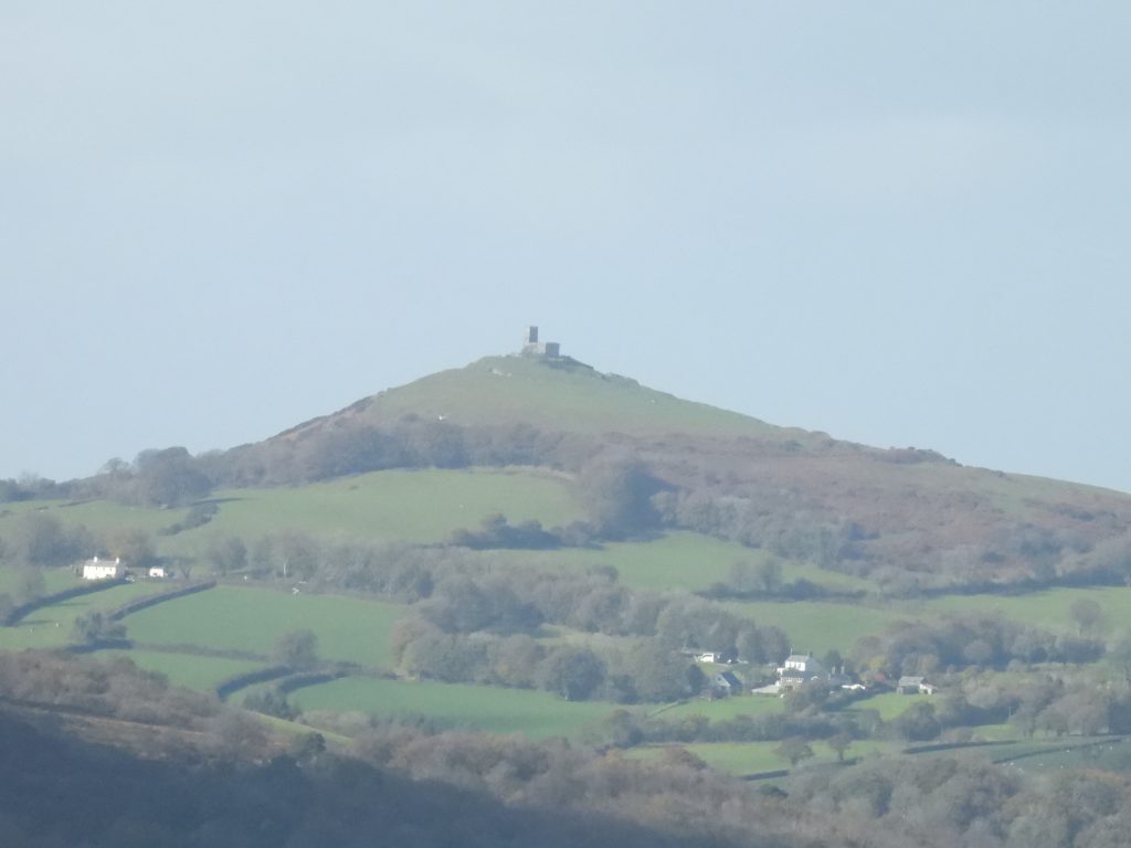
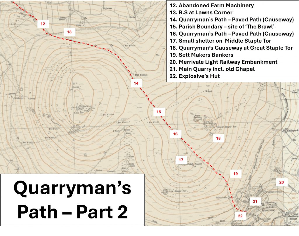
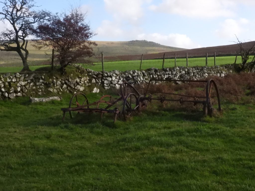
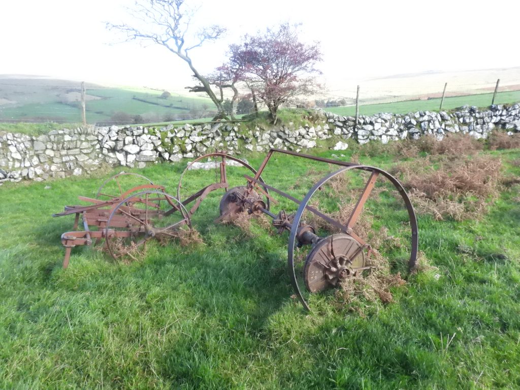
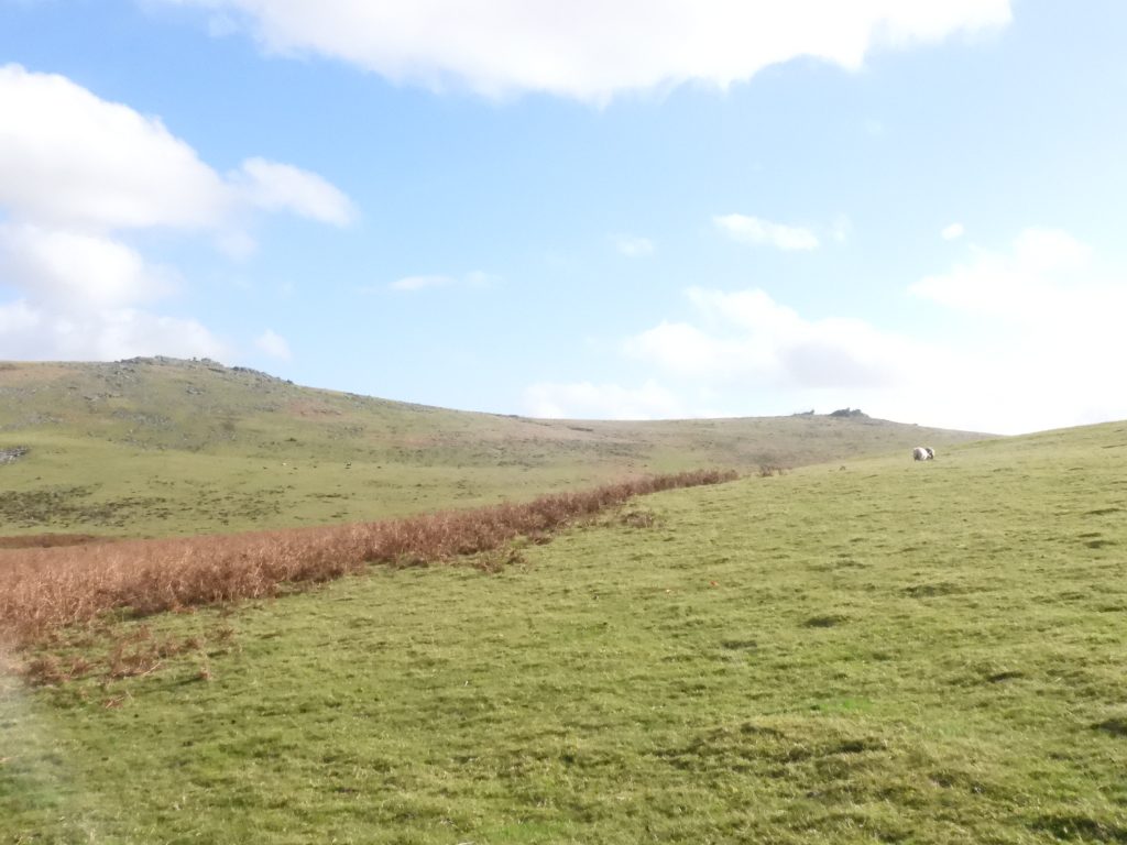
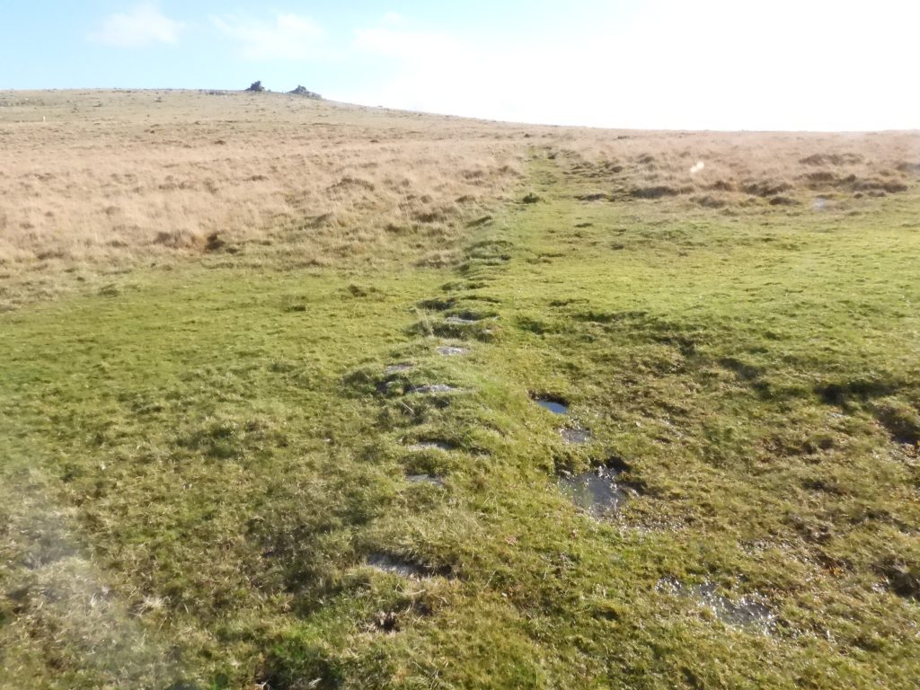
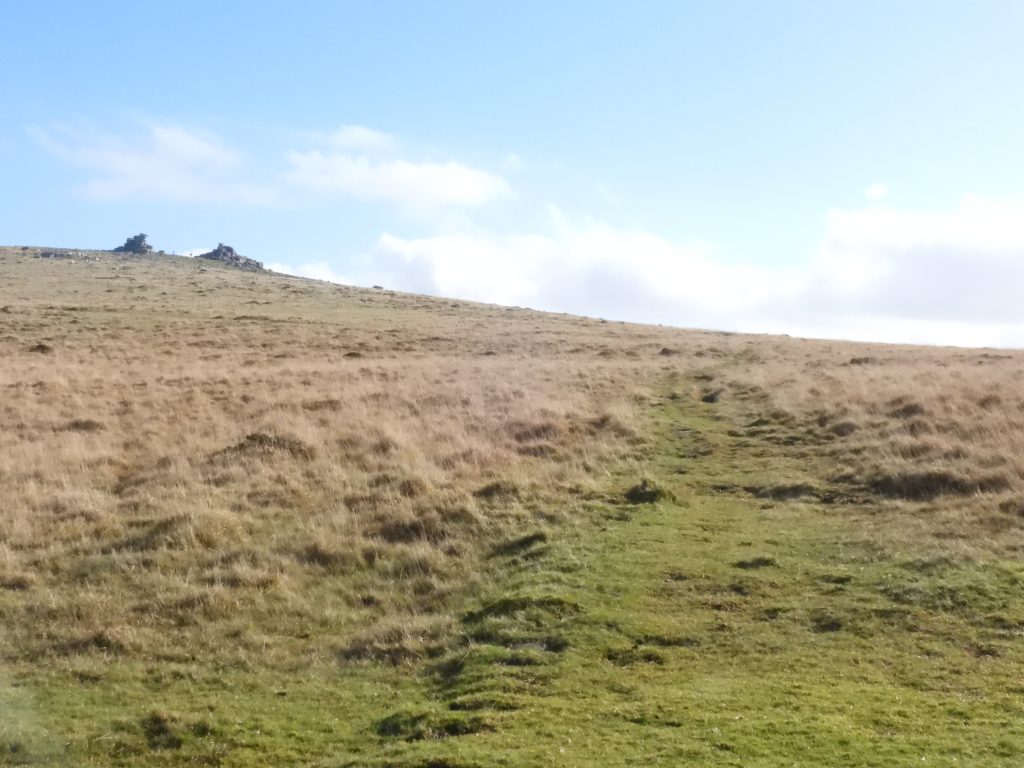
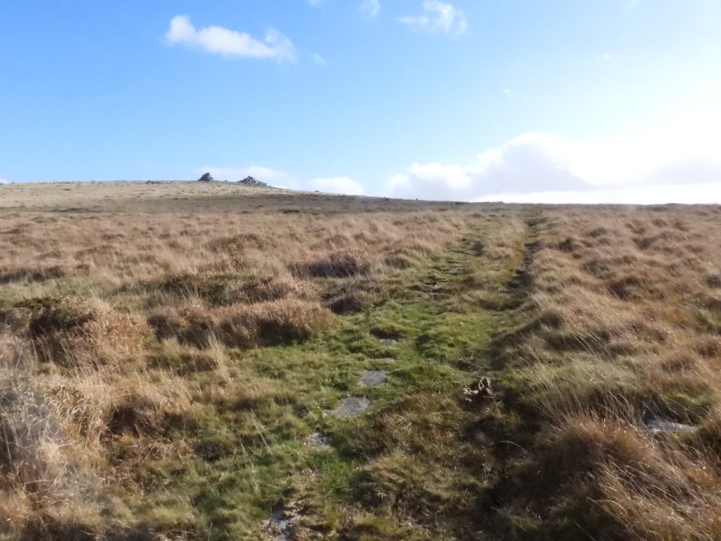
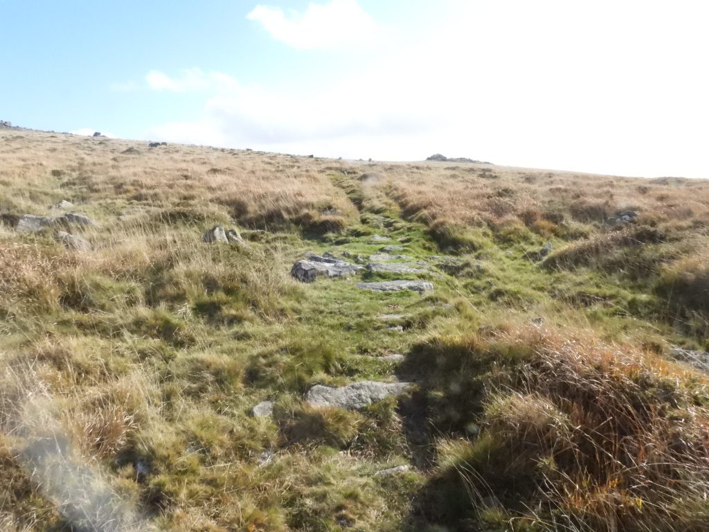
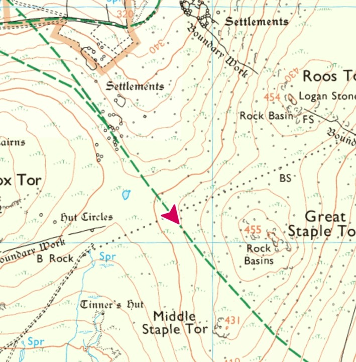
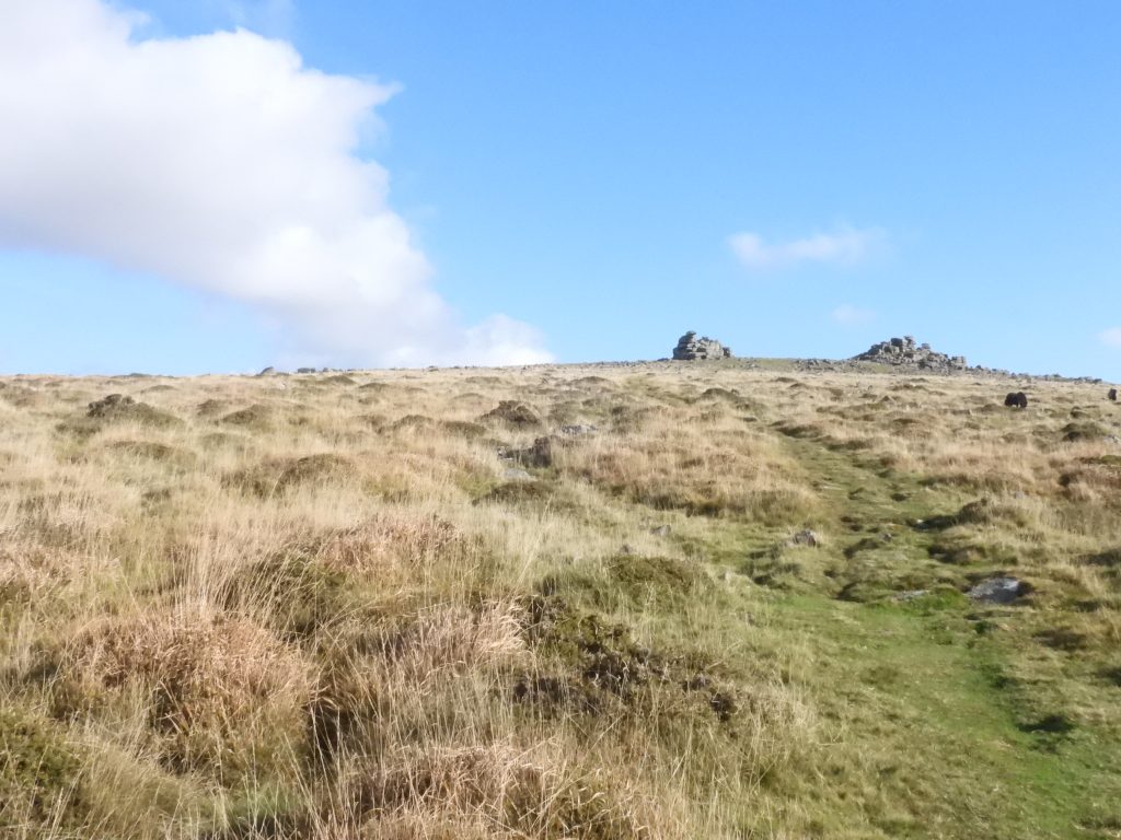
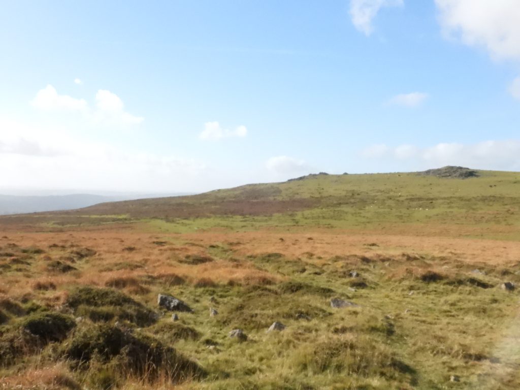
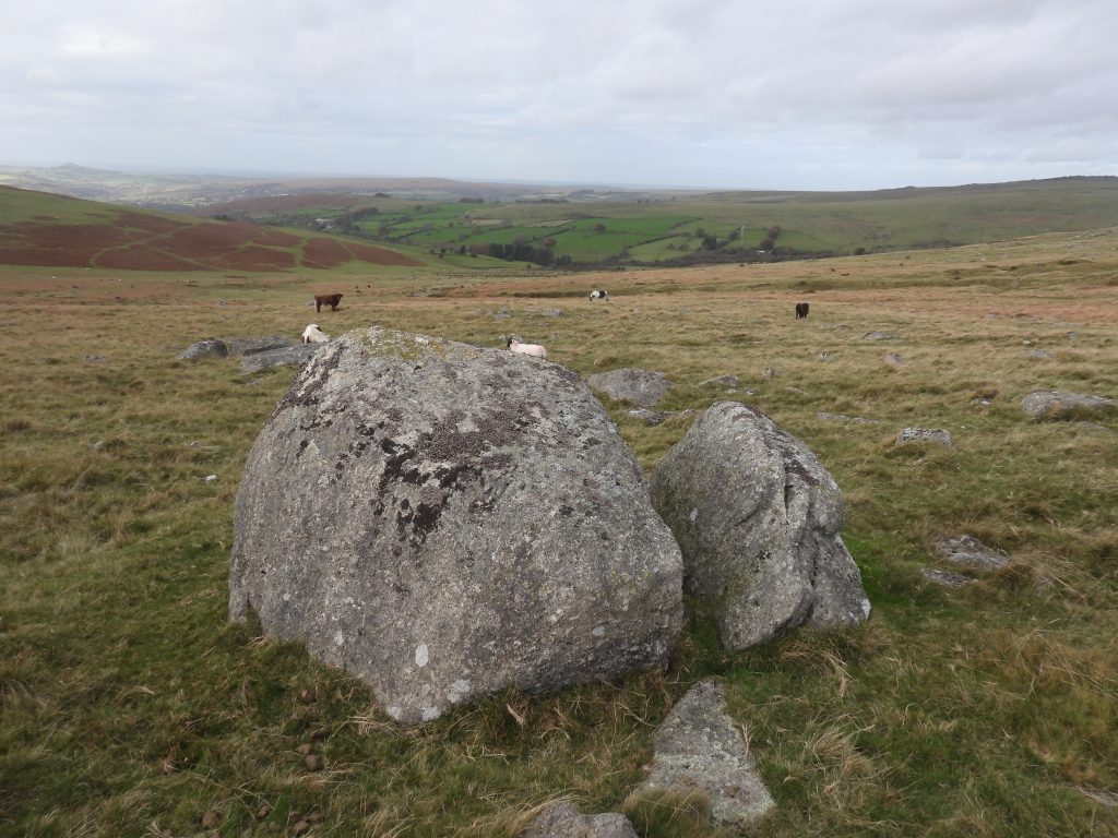
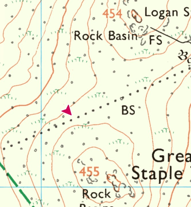
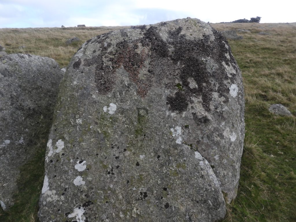
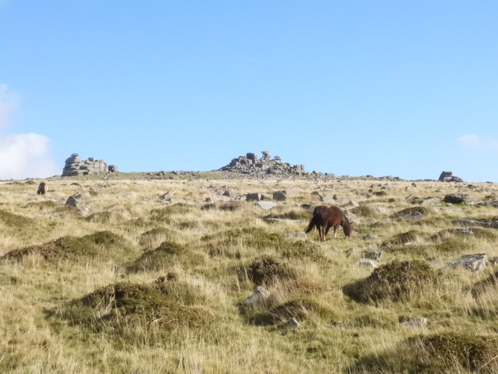
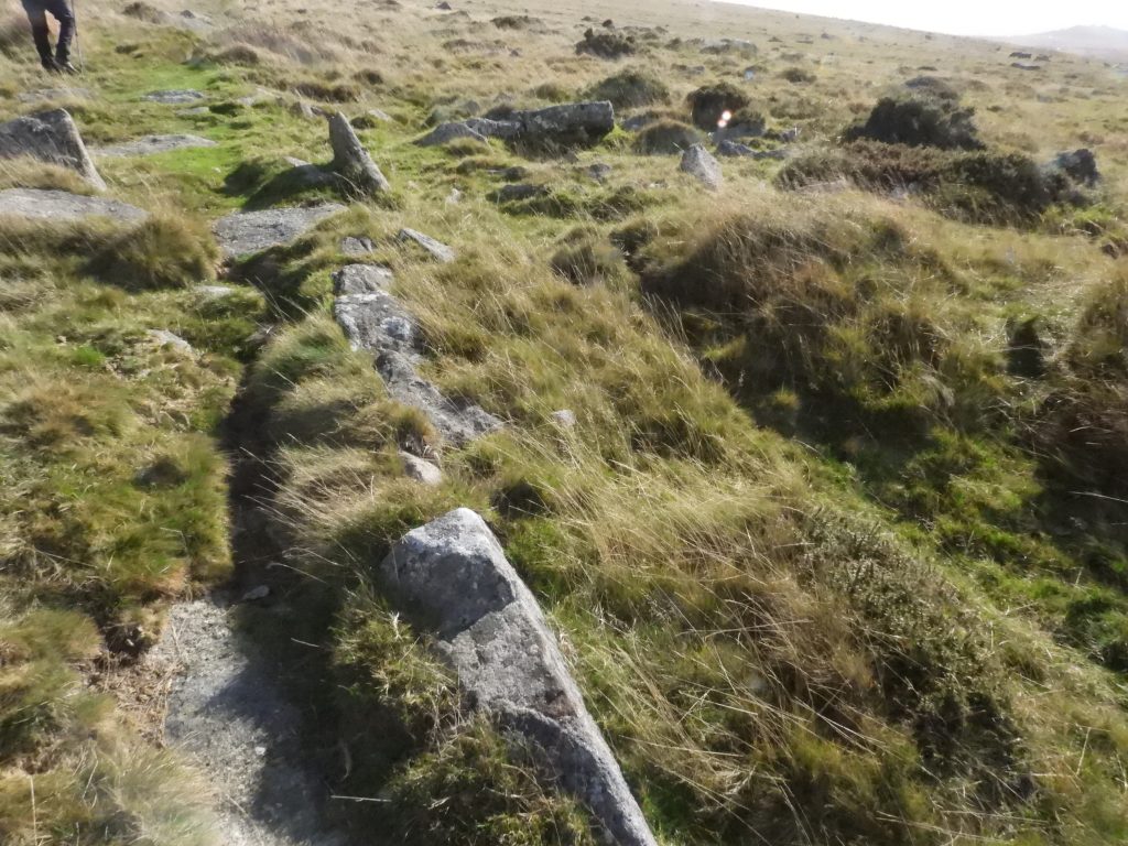
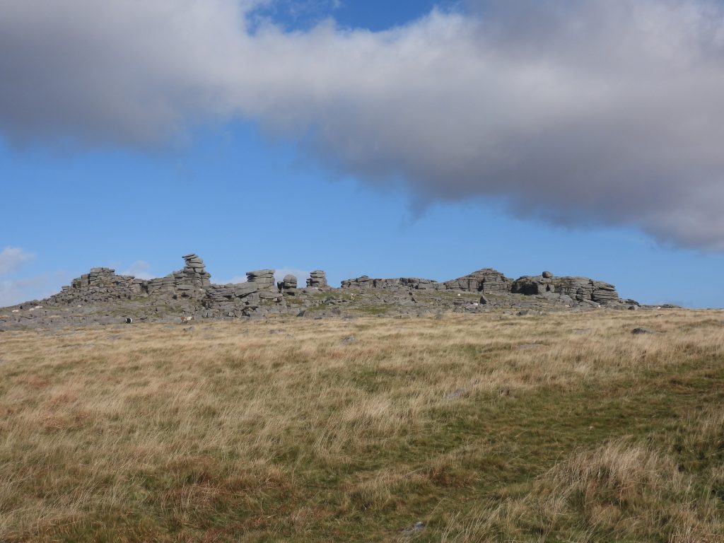
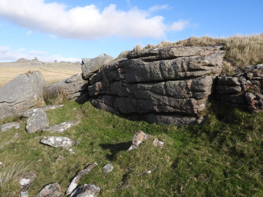
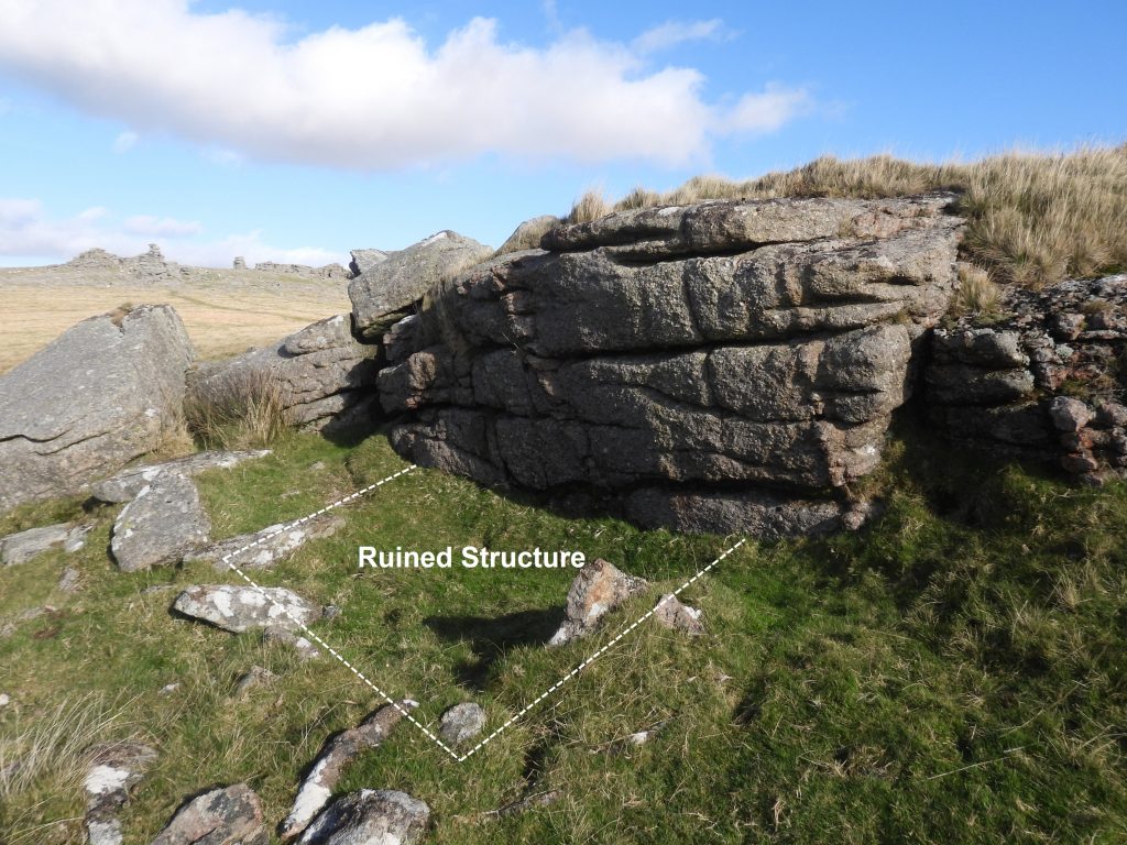
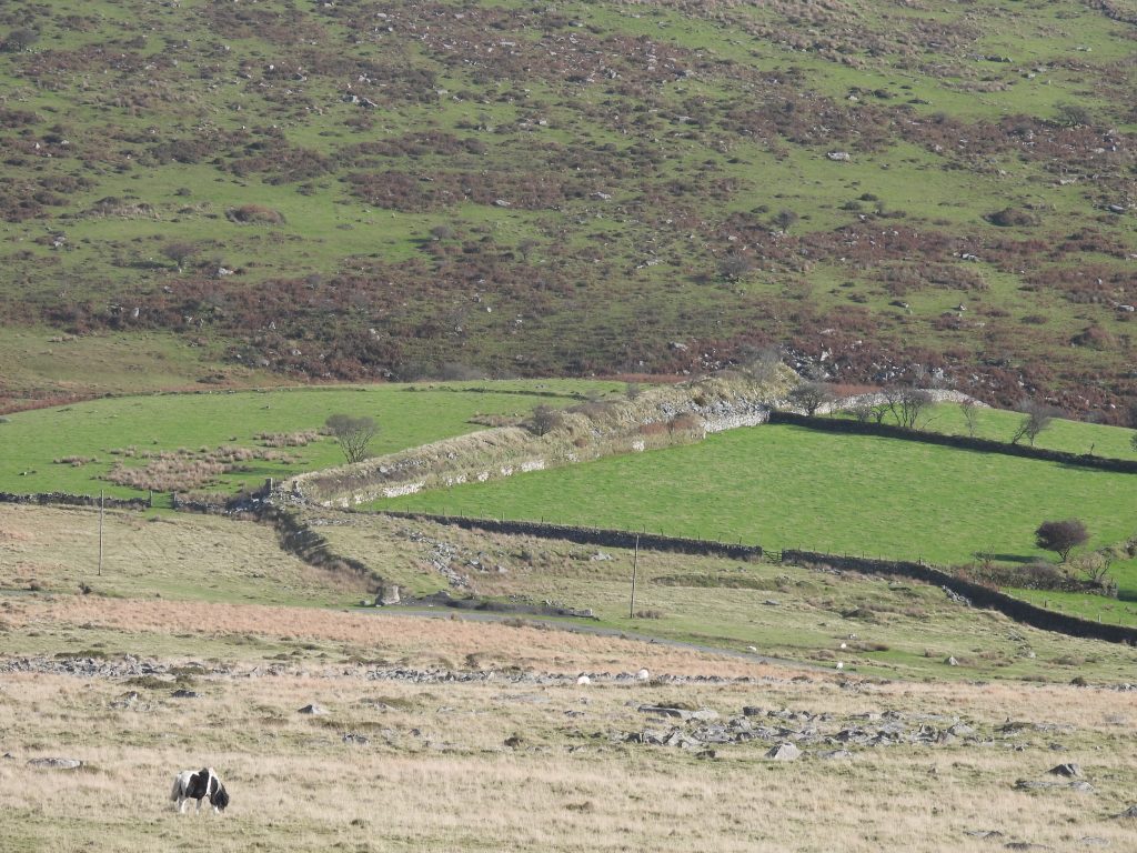
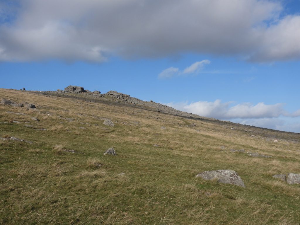
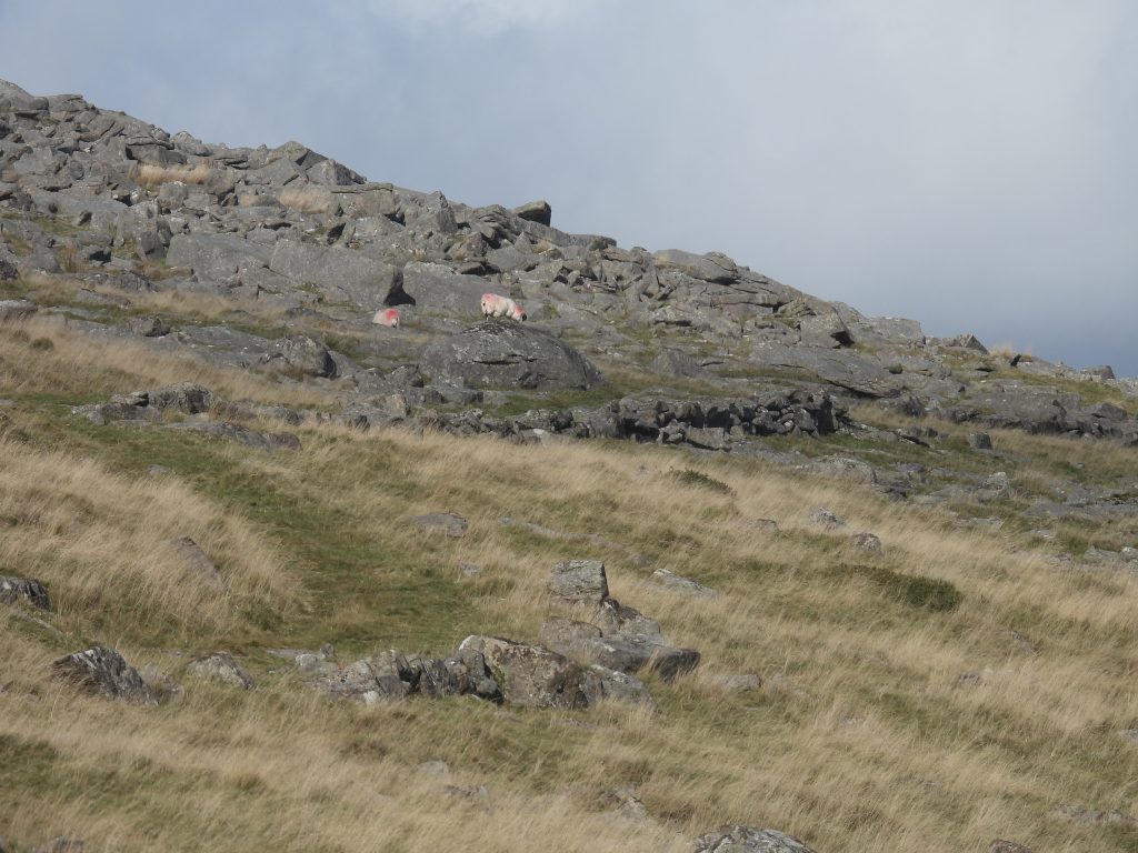
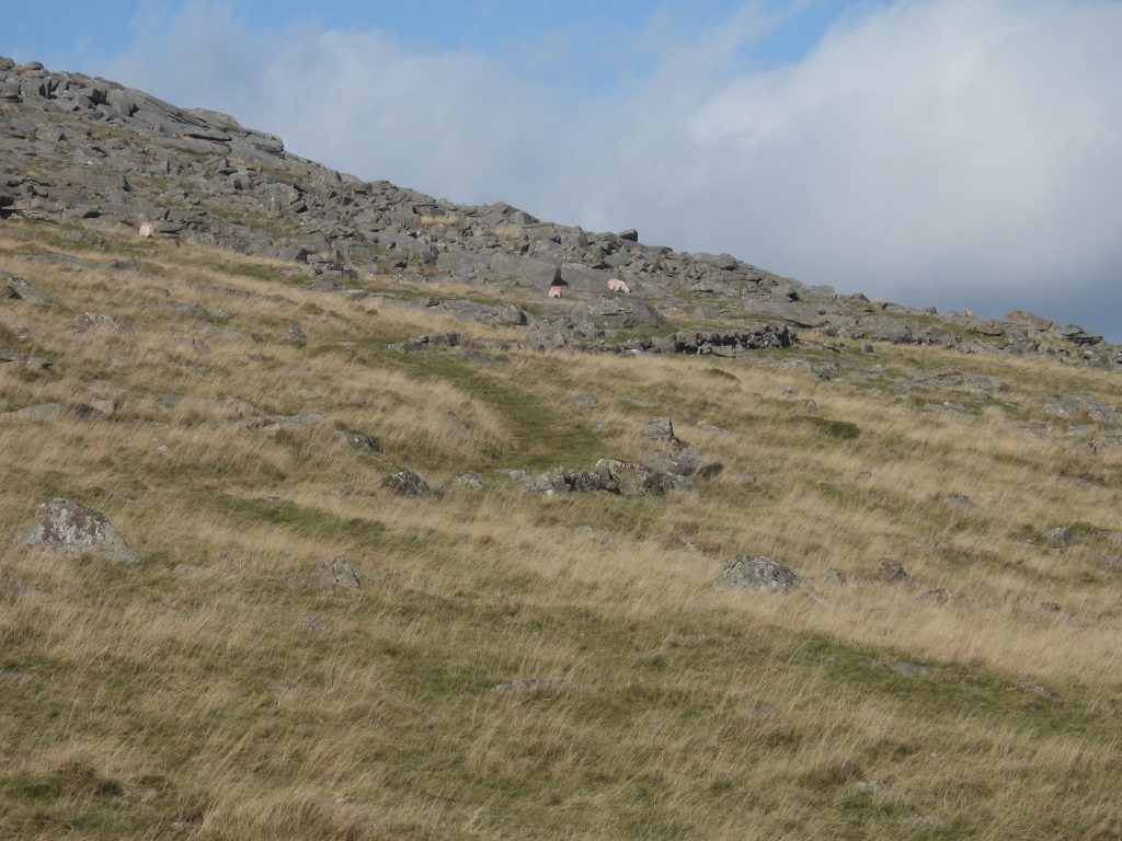
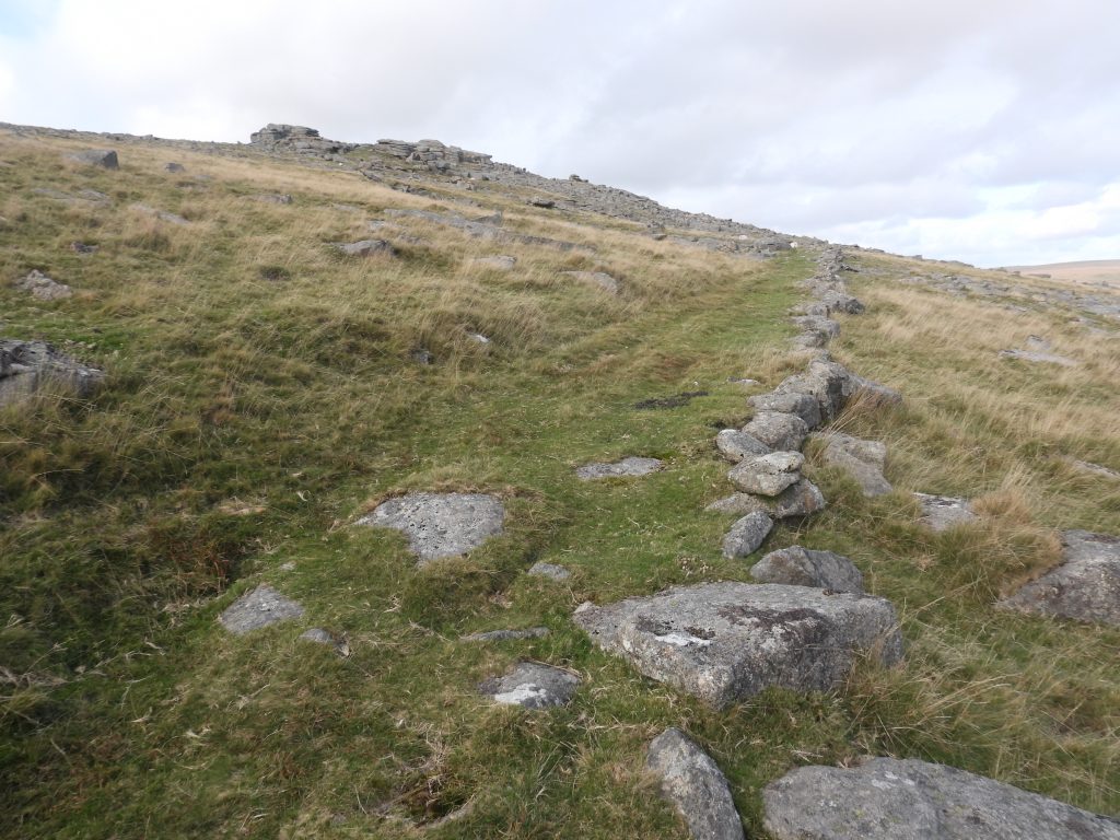
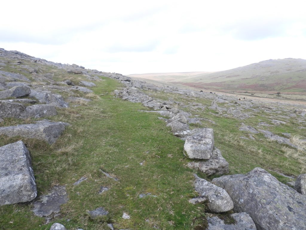
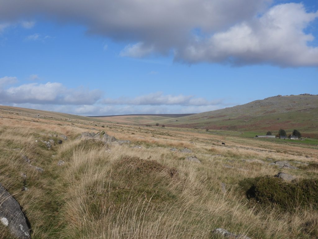
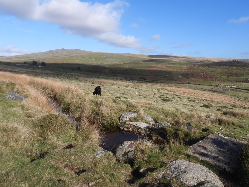
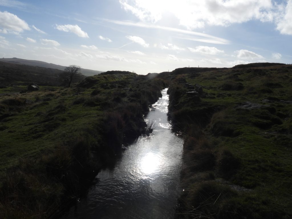
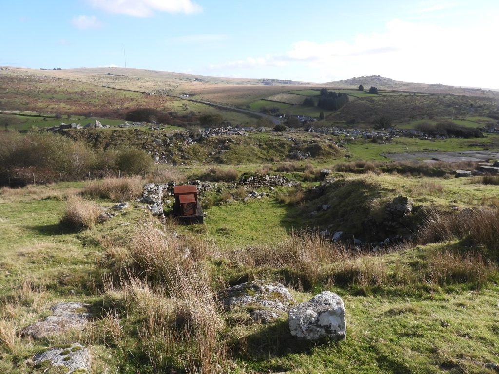
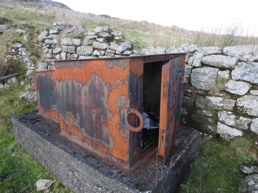
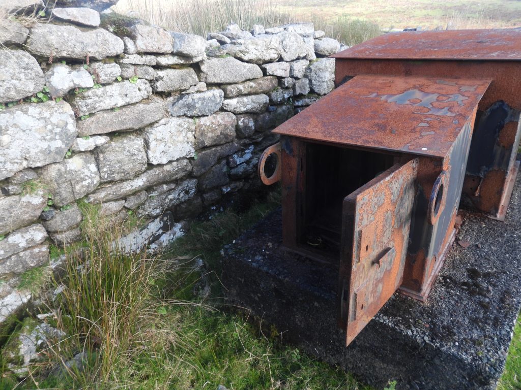
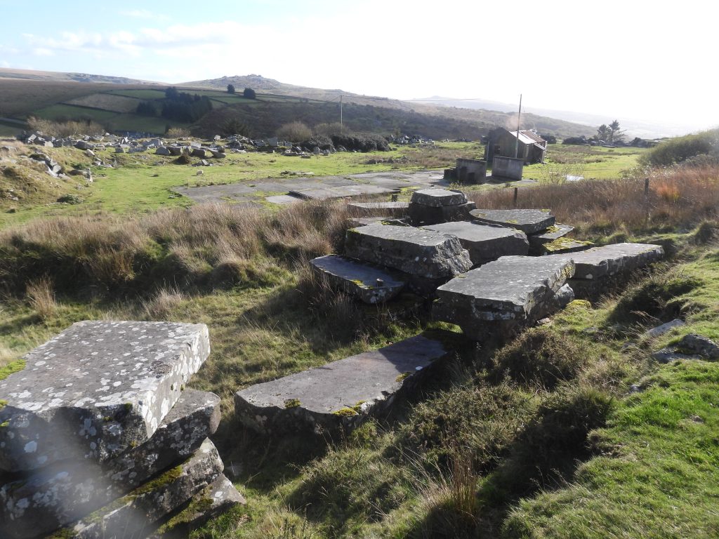
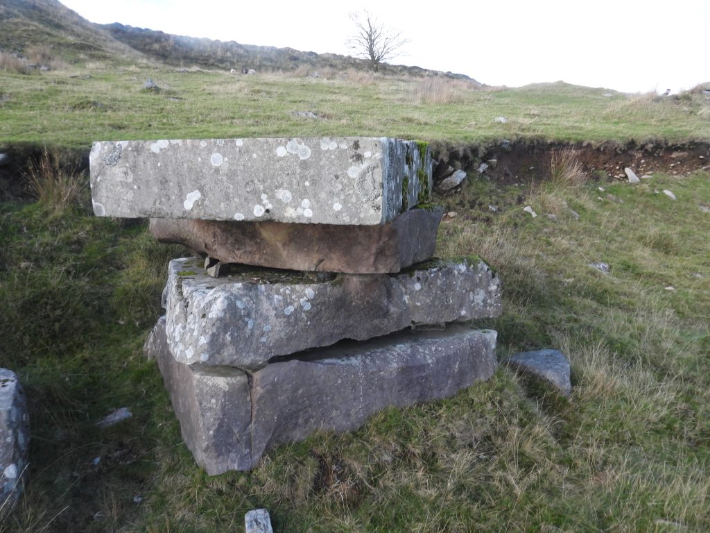
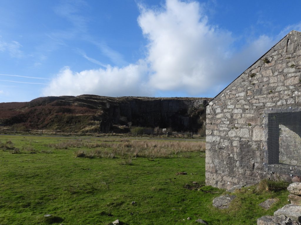
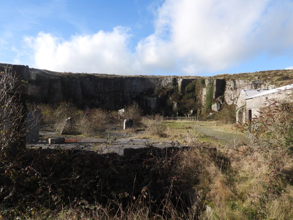
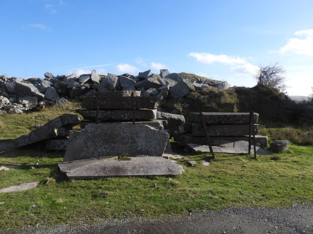
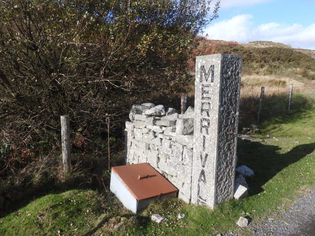
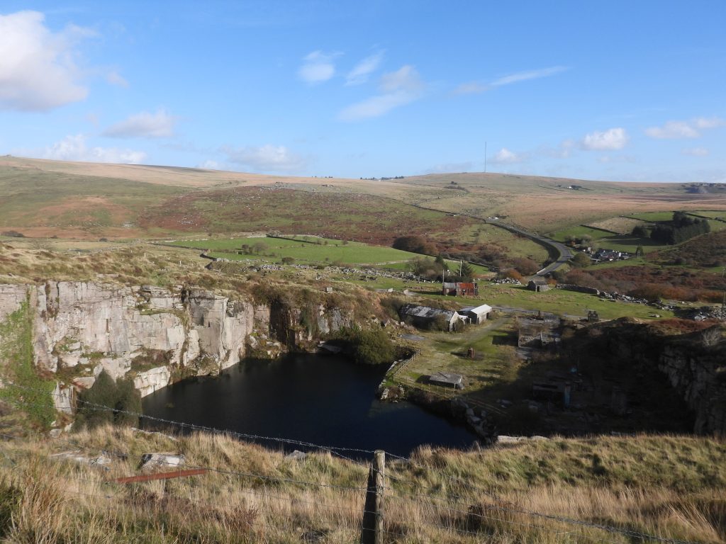
This sketch map is based on the route (Track 17) described by Eric Hemery in his book ‘Walking Dartmoor’s Ancient Tracks – A guide to 28 routes’ published in 1986. The route was according to William Crossing and to a tradition recorded by Hemery through George Penrose of Peter TavyThe first part of the Quarryman’s Path with some of the features found along to way (or at least a close to the route). This is the non-open moorland section from St. Mary’s Church at Mary Tavy through to the tarmac road below the northern slopes of Cox Tor which leads to Higher Godsworthy FarmThe journey in this post starts at St. Mary’s Church. The author and friends decided to follow the route from here to Merrivale and return as if they were ‘Quarrymen’. St. Mary’s Church is believed to have had 14th century origins. The second phase of building St. Mary’s was early 15th century. It was drastically restored in 1878/9. The churchyard is the resting place of William Crossing, the famous early 20th century author of ‘Guide to Dartmoor’.‘Tavydale’ was divided into two dwellings (higher and lower) have originally been a single rambling farmhouse. It dates from at least the early 19th centurySt. Raphael. The building here is not depicted on the Tithe Map as another dwelling is shown here, closer to the road. That said, the late 19th century historic map shows a new building has replaced that shown on the Tithe Map, which, presumably is St. Raphael. Peeking through a gate and arch, there are some upright standing stones in the garden.Outbuildings and a cider press near Mary Tavy power station.The author is grateful to Andy Benham who provided the following story: “the current owner is a very affable chap and we spent over an hour chatting with him on the way to the pub in Peter Tavy. It was an unsold item at the local farm machinery sale for a couple of years until he made a ‘silly’ offer and ended up the proud owner of a cider press. He’s got an orchard and it has been used to make a village cider from local windfalls and the like”.Glimpse of Mary Tavy hydro-electric power station. The first phase of the power station was opened in December 1932 using water diverted from the River Tavy at Hillbridge Weir. There was a 1 and 1/4 mile long extant leat originally and this was extended another 3/4 mile then a 1 metre diameter pipe took the water to the power station. The plant was started as a business opportunity by the Christy Bothers who acquired the water rights from the Wheal Jewel and Mary Tavy Mining Company. Another glimpse of Mary Tavy hydro-electric power station. The second phase of the power station took place in 1936 using water diverted from Tavy Cleave along the 200 year old Reddaford Leat for 4 and 1/2 miles. Water entered a linear reservoir at Wheal Jewell before being taken by pipe to the power station.A great place for lunch next to the footbridge (clam) over the River Tavy. Méry-Corbon is twinned with Mary Tavy and is the former commune in the Calvados department in the Normandy region of north western France. On 1 January 2017, Méry-Corbon was merged into the new commune Méry-Bissières-en-Auge. The Twinning Charter between Mary Tavy and Méry-Bissières-en-Auge, was signed on 24th April 1982.View of the bridge from the Bob Holt benchView from the west side of the bridge. Note the ‘Dartmoor Way’ sign. The Quarryman’s Path is on the eighth stage of the Dartmoor Way which is stated on the official website (dartmoorway.co.uk) as being 12.75 miles (20.5 km) starting at Lydford and finishing at Tavistock. Upstream – Tavy from the bridgeDownstream – Tavy from the bridgeFrom the eastern side of the bridge a short detour of just a few minutes will lead you to some remains of South Devon United Mine. The first feature of interest is this adit entrance (one of two)Inside the adit entranceA short distance along the path a second adit entrance can be found. This adit is part of South Devon United Mine, which was formerly worked as Wheal Ann and was one of the three mines which formed part of Devon United Mines. Mining here for copper probably started during the 1820s. The mine finally closed in 1922.The second adit entrance.
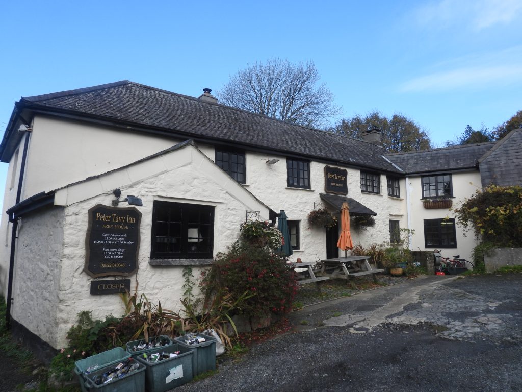
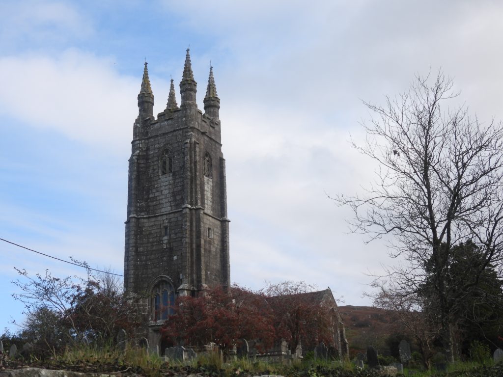
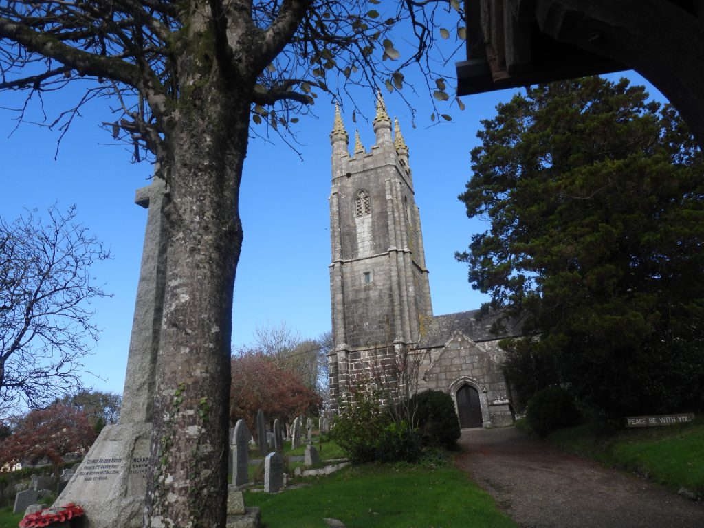
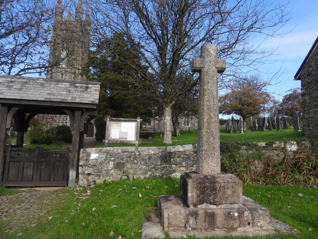
Inside the second adit entrance
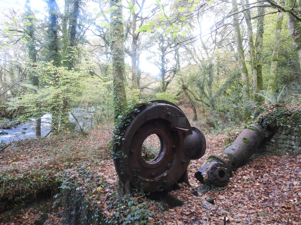
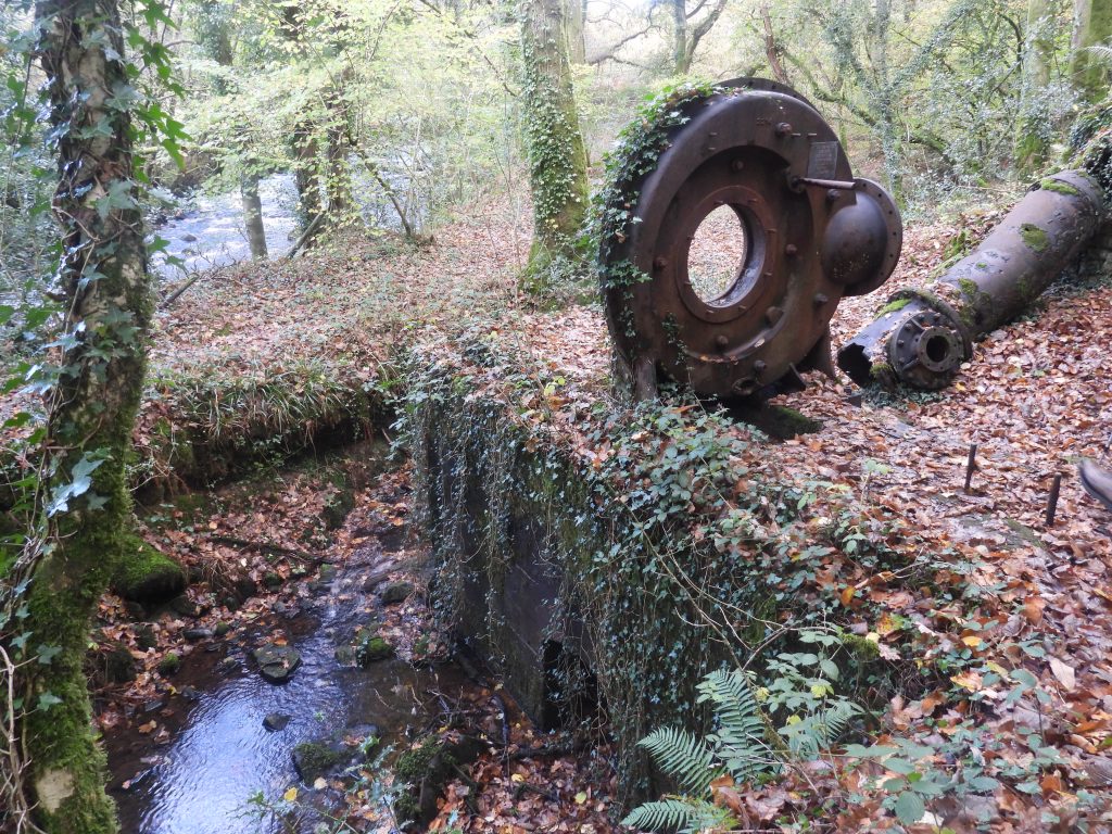
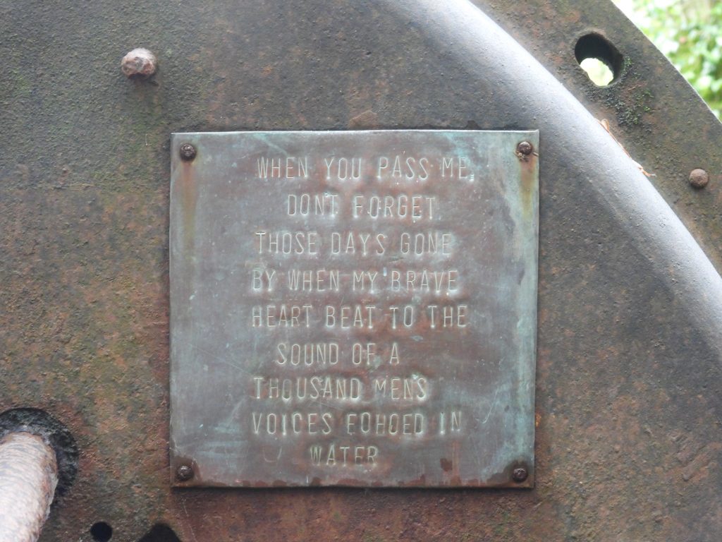
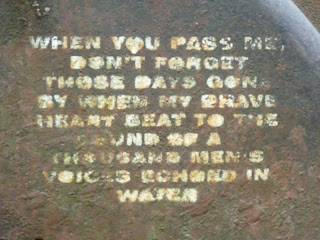
A surprise relic still remains at the mine – the turbine. Although lacking its rotor it is remarkably intact given the fact it was abandoned over 100 years ago. It is understood (Richardson) that this was a ‘Thompson inward flow’ variety of turbine with the amount and direction of water (supplied by the pipe seen in the picture) impinging on the central rotor or ‘runner’ having been controlled by four moveable vanes. The rotor originally drove an air compressor and a dynamo which is thought could have (with an adequate head of water) produced an output of 200 kW.This sign “When you pass me, don’t forget those days gone by when my brave heart beat to the sound of a thousand men’s voices echoed in water” is a relatively new one and seems to have replaced an earlier inscription on the turbine. The original inscription – photograph taken by John Stickland in October 2011.The River Tavy taken from near the two adit entrances and the turbine of South Devon United Mine…back to the Quarryman’s Path. On the south side is Longtimber Tor which is very overgrown but it is possible to get to the summit as there is a pathThe lane to Peter Tavy from the bridgePeter Tavy Inn is believed to date from at least the 17th century, although it may actually be 15th century, according to one source (Quick: 1992, Dartmoor Inns). It was originally a farm cottage and blacksmith’s shop. It is possible that the original cottage was built to house stonemason’s and workers who were employed to repair the walls and tower of the Church during the 15th century. The inn was extended and altered in 19th and 20th centuries. An intriguing story is that the famous escapee, Frank ‘Axeman’ Mitchell (the only man to escape from Princetown prison without recapture) is said to have visited and possibly stayed here around 1965 with his bills being paid by one of the notorious Kray twins. Source: Dartmoor HER records.St. Peter’s is believed to be of 14th century origin, was much rebuilt in 15th century and restored in the 1870s. This memorial cross (partially hidden by the tree in the picture) was erected in 1922 with funding from parishioners to commemorate those who fell in the First World War. It also includes the names of those who died during the Second World War. Running around the riser of the base is an inscription: ‘IN HONOURED MEMORY OF / THOSE OF THIS PARISH / WHO GAVE THEIR LIVES / IN THE GREAT WAR / 1914 – 1919.’ Peter Tavy’s cross was re-erected on 11th December 2000 to mark the millennium. The new shaft and cross was made by Messrs Pascoe of Gunnislake with granite being donated by DNPA which was quarried at Merrivale. A special service was held on 1st January and was attended by about 50 people. Source: Dartmoor Magazine (issue 63).There are carvings on all four sides of socket stone. The original cross was dismantled around 150 years ago as horse drawn hearses needed extra room to turn around outside the church. The pieces were laid outside the church wall and the shaft and cross were lost just leaving the socket. The views in the photograph here are of the south and east sides. The east facing side of the socket stone only one panel which is a Rampant Lion, representing courage and kingship, whereas the south facing side has two panels showing the Cross Keys of St Peter, the Patron for the church and an anchor with a coil of rope at its base – representing hope and salvation. This also links with St Peter’s occupation as a fisherman.The views in the photograph here are of the north and west sides. The west facing side of the socket stone has two panels. The left panel shows a fish – representing the Eucharist or Jesus. In medieval times there were strict ‘fish days’, commonly on Friday, representing abstinence. On the right panel is a Ram’s Head – this connects with the rural work of agriculture and also indicates the sacrifice and the blessings of the lamb. The North facing side of the socket stone has only one panel which is of a Salamander – representing divine peace. This animal is said to have the ability to exude a mucus which was believed to have the effect of calming troubled waters.The old Post Office dates from at least the early – mid 19th century.Bench by Colly Brook with plaque to John and Joyce Whiffin – delightful words on the plaqueThe village hall in Peter Tavy was built at a cost of £300 as a school. It was a two-roomed building opened in 1865 for girls and infants (the boys were still taught in the old school). The school finally closed in 1959The bus shelter with interesting inscriptions here on the two granite bench pedestal, to celebrate Queen Elizabeth’s Silver Jubilee. On the Left hand granite pedestal is an “E” with “19” underneath and on the Right hand granite pedestal is an “R” with “77” underneath.Left hand granite pedestal is an “E” with “19” underneathRight hand granite pedestal is an “R” with “77” underneath.Peter Tavy Methodist Chapel Next to the Colly Brook and a small bridge is Higher Mill. It is 18th century and has a 19th century addition. There is still a millstone here (just behind the red car). Pigeon holes can be seen in the exterior walls of the (left) wing and the different designs of the chimney stacks can also be notedCombe Cottages. A water hydrant in Combe. The author has conducted some research of this Hydrant by Ham Baker & Co, Westminster as follows: “In December 1893 the business of Ham Baker and Co. of Grosvenor Road, Westminster, and Langley Green, Worcestershire, were founded. They were engaged in the erection of iron and brass foundries and fitting shops for the manufacture of engineers’ specialities for sewerage and water works. In 1905 they became engaged in sewage and water fittings. The Ham Baker group are still going in 2021 With manufacturing bases in the UK, China, Hong Kong, UAE and Australia.“Footbridge over Colly BrookSluice gate at the ‘Mill Pond’ in the CombeThe Mill Pond in the Combe, which has been used as a swimming pool. It was reputedly constructed in the 1930sThe pond is fed by a leat with water collected from the Colly Brook upstream. Over the years it has often been drained for safety reasons. Steps into the pool The author has seen swimmers in the pool in recent yearsGreat Combe Tor.View to Smeardon Down and Boulters Tor across the Combe from Great Combe TorWhite Tor (with red flag indicating firing on the Merrivale Range)Zoomed in view of Brentor with St Michael Rupe, an iconic 12th century church on top of the TorThe second part of the Quarryman’s Path with some of the features found along to way (or at least a close to the route). This is the open moorland section from the tarmac road below the northern slopes of Cox Tor which leads to Higher Godsworthy Farm and Merrivale QuarryOld farm machinery next to the track (now known as Peter Tavy Bridleway 11) at SX52719 76983. This machinery is most probably from late 19th century.The old machinery was made by Henry Bamford and Son, Uttoxeter. It is a ‘Tedder’. Henry Bamford and Son (Samuel) was founded in 1871. The company closed in 1987.Boundary stone at Lawns Corner. Recorded by Tim Jenkinson in 2007, (Miscellaneous Milestones and Boundary Markers of Dartmoor Roads) he states: “Boundary Stone at Lawns Corner where the road bends north towards Higher Godsworthy Farm. Leaning beside wall next to yellow grit bin west side of road (SX52980 76931)”. The boundary stone has the legend ‘P’. It is misshapen stone worn and apparently moved to current spot in c. 1970s (citing Hemery) after being found in wall. ‘P’ is thought to relate to Peter Tavy. Thought to be late 18th century in date”.North East slopes of Cox Tor looking towards Roos Tor (left) and Great Staple Tor (right). Here the moorland section of the Quarryman’s Path can be found as it passes through a Hut Circle SettlementAt SX53674 76320, the Quarryman’s Path consists of a paved path comprising laid slabs which are now up to 0.25m above the turf levelThis path carries the walker over the (sometimes) boggy saddle between Cox Tor and Great Staple Tor as it approaches the Whitchurch / Peter Tavy Parish boundaryThe path with Great Staple Tor on the horizonAs Middle Staple Tor comes into view the path approaches the Whitchurch / Peter Tavy Parish boundaryThe crossing point of Quarryman’s Path and the Whitchurch / Peter Tavy Parish boundary at SX53822 76121The Whitchurch / Peter Tavy Parish boundary looking east towards Great Staple TorThe Whitchurch / Peter Tavy Parish boundary looking east towards Cox Tor and the head of Beckamoor BrookMinor side trip from the Quarryman’s Path. This natural rock is a boundary marker on the saddle between Roos Tor and Great Staple Tor. It is inscribed with a “W” (facing the camera position) and a “P” on the reverse indicating the two Parishes of Whitchurch and Peter Tavy. It is also known as either “Picket” or “Picke” Rock.Of interest is that Picket Rock actually is located inside the Peter Tavy Parish. William Crossing in his ‘Guide to Dartmoor’ page 150, describes that near this location: “This was once the scene of a quarrel which terminated in the manner usually associated in our minds with the slight misunderstandings that occasionally arise at Donnybrook Fair [a slang term for a brawl or riot, based on the Fair which used to be held in Dublin between the 14th and 19th centuries]. The men of one of the parishes named were viewing their bounds, the operation being watched by the men of the other, when a dispute arose about a bondmark. Heated arguments followed, but failed to be convincing, and finally recourse was had to another means of settling the matter. But that also failed to do so, though it cannot be said that it was barren of results. Those who returned home with broken heads were certainly not inclined to think so”. The author suspects the ‘brawl’ was either held where the Quarryman’s Path crossed the Parish boundary or near Picket Rock (as there does appear to be a deviation from the Parish boundary)The “P” inscription on “Picket” or “Picke” Rock. Returning to the Quarryman’s Path…approaching Middle Staple Tor. Pilkington-Rogers (1930) in ‘Days on Dartmoor’ (p96/7) records this path “over a portion of its length…has been roughly paved”. Continuing it is hypothesised, that “It might be an ancient track, for it must have served the people of the latter (Peter Tavy) and Mary Tavy as their road to the Tavistock to Ashbuton highway”.Great Staple Tor from Quarryman’s pathPilkington-Rogers in ‘Days on Dartmoor’ also states: “It (the track) has also been in long continuous use as a path for the men living at Peter Tavy, who were employed in the quarries at Merrivale, King’s Tor and Foggintor, and these men have been responsible for the rough paving of the way across the hollow between Great Staple and Cocks (or Cox) Tors and around the flank of the latter, the purpose being to prevent their straying from it in darkness” Pilkington-Rogers continues when describing the track and the quarrymen: “Each man, on each occasion of his passing by, added a stone”. The text continues suggesting that ‘broken crockery’ might also once have been used – an interesting thought. Modern day Quarrymen (and Quarrywomen) approaching the saddle between Middle and Great Staple Tors – October 2025Looking back north west along the path from near the saddleGreat Staple Tor from near the saddleAnother minor side trip, this time to Middle Staple Tor to view a ‘Ruined Structure’ as recorded by RCHME. It is situated on the NW side of the tor and measures 2.1m by 1.6m, with crude walls between 0.6m to 0.9m wide. The location is SX54022 75676Annotated photograph showing the location of the structure. The RCHME state: “There is no entrance visible. It is almost certainly a temporary shelter, of unknown origin, and is of minor significance”.The Quarryman’s Path from the Saddle between Middle and Great Staple TorEvidence of early 20th century Quarryman endeavours. This zoomed in view of the only part (raised embankment) of a proposed connection from the GWR line near King’s Tor to Merrivale Quarry. In 1908 plans were drawn up by Prigg & Lindon (Engineers) for this railway. It was to be 1 mile, 5 furlongs and 7.25 chains long, which is 1.72 miles or 2.76km. (NOTE: A furlong is 220 yards and a chain is 22 yards). It was to be known as the “Merrivale Light Railway” (MLR) of standard 4 ft 8.5″ gauge and its departure point was just past the Swell Tor sidings on the main Yelverton – Princetown line. This post traces the course of that railway and what might have been. The estimate for the construction was around £12.6k in 1908, which in 2020 prices would be around £1.53m. Descending the hill towards Merrivale Quarry, then looking north towards Great Staple Tor, a track and causeway are evidentZoomed in view of the track and causeway.Another side trip from the Quarryman’s Path to investigate the causeway, which was very much part of the early quarrying in this area. The Duke of Cornwall first granted a licence to quarry granite in this area in 1847. At that time, the quarrymen were limited to taking surface granite or ‘moorstone’. This causeway is part of the evidence of their work. Following the causeway on the eastern slopes of Great Staple Tor. In this area there is evidence of tare / feather marked (splitting of granite) blocks still being seen. These blocks (and completed setts which would have been made from them) would have been transported along this causeway. Demand for this granite had increased during the 19th century, as paving stones, kerbs and cobbles (or setts as they are known) were part of the revolution to improve roads especially around Plymouth and Tavistock.The causeway is wide enough for a horse (usually a shire) and a single axis wagon, which would have trundled along here from around 1860’s to around 1880’sAt the end of the causeway, under the deep eastern clitter field of Great Staple Tor is a granite ‘bench’ structure. This bench (along with nearly 100 others) along the eastern slopes of the tor and around Middle Staple Tor was used in the manufacture of granite ‘setts’. The structure is called a ‘Sett Makers’ Banker’. Back to the Quarryman’s Path and two Sett Makers’ Bankers….the evidence of these constructions would have pre-dated the opening of Merrivale Quarry (then known as ‘Tor Quarry’). They are believed to date from around 1870 (Helen Harris), although some suggest as early as 1850–60, which would have been shortly after the Duke of Cornwall first granted a licence to quarry granite in this area. Therefore, it is likely that the path was used from at least this era. Some of the bankers would have been sheltered using a construction called a ‘Shaker’. There is evidence of a granite ‘Shaker’ near Middle Staple Tor. Other may have been constructed from corrulgated ironThree more Sett Makers’ Bankers. Setts were made with the quarryman stood upright with their knees against the ‘Banker’. A typical ‘Banker’ was constructed (described by Helen Harris) as follows; “…it is a single bench 17 in (35 cm) high at the front (from current ground level), with an internal width of 17 in (35cm), a dip of 40 degrees from horizontal on the working surface and 50 degrees from horizontal on the front face of the work surface. It was usually built facing upslope…” Setts were made from blocks, 45cm x 22cm with thickness of 12cm, which had been prepared from the surface moorstone. The Sett Maker would then (typically) cut a sett from this block which was around 20cm x 12cm x 10cm. The author would recommend reading the excellent book by Simon Dell and John Bright (2008), titled ‘Dartmoor’s Sett Makers’ Bankers (An industrial mystery solved?)’ published by The Dart Company from which much the information found here has been gleaned.A triple line of Sett Makers’ Bankers. Across south west Dartmoor these structures can be found at Ingra Tor, King’s Tor, Swell Tor, Foggintor, Grenofen, Leather Tor, Lowery Tor and North Hessary Tor. There can also be found around Minions on Bodmin Moor. There has also been other ‘multiple’ bankers found such as quadruples, doubles and even ‘back-to-back’ ones. Sett makers were paid one (old) penny per sett and on average could make 50 in a single day or 60 at a push (5 shillings or 25 pence in decimal). £1 in 1870 is worth £152.11 today (2025) and there are 20 shillings in a pound…doing the maths it doesn’t amount to much!Descending the hillside a dry leat is encountered which is thought to have been the predecessor of the (still flowing) Grimstone and Sortridge LeatCrossing the Grimstone and Sortridge Leat at SX54679 75442The leat flows from from Grimstone Head Weir at SX5528 7729 to Sortridge Farm at SX5085 7109, a distance of over 9 kilometres. The leat appears to have once flowed into a reservoir here and used to drive at least one waterwheel at the quarry (possibly two – ref: Passmore)The destination of the path. The demand for sett granite, lead to William Duke opening ‘Tor Quarry’ in 1875 (some observers state 1876). The enterprise was taken over by his son after his death. The quarry although originally known simply as ‘Tor Quarry’ has also been known as ‘Duke’s Quarry’ and of course latterly as ‘Merrivale Quarry’. The quarry was operational for around 120 years and eventually closed in 1997. This view is the north end of the quarry. It is probable that sett making was transferred to the quarryDug into the hillside with a concrete plinth is an unusual metal (two doored) storage unit.Both of the doors on the metal storage unit appear to have had a double lock. It is located at SX54709 75347Stacked cut granite at the quarry. The quarry was operational for around 120 years and eventually closed in 1997. In its final years the quarry had been operated by the Tarmac Group and was the last operational quarry on Dartmoor. It is recorded that granite from the quarry provided granite for New Scotland Yard, Portcullis House (in Westminster) and the paving of Trafalgar Square. Granite here was provided for the Falklands Island War Memorial commemorating the Falklands War of 1982More stacked graniteWesleyan Methodist Chapel was built in 1904 (Passmore) for the quarry workforce. Tavistock and District Local History Society, however, suggest it was built in 1901. The chapel was originally constructed as a corrugated iron building having which was intended to be only temporary until a new masonry chapel could be built. The iron chapel continued in use until its closure in 1962 having never been replaced by a masonry building. It is located at SX54711 75242The ‘crib’ or mess room with its west facing doorway. The building is located at SX54722 75210View from the ‘crib’ room looking west towards the main part of the quarryOn the north east side of the main quarry are the remains of the Blacksmith’s workshop which were built in four phases from late 19th / early 20th century to the second half of the 20th century (ref: Passmore)More stacked granite near the quarry entranceThe quarry entrance (left post ‘MERRIVALE’)The quarry entrance (right post ‘QUARRY’)This structure is shown as a ‘Magazine’ (explosives hut) on early 20th century map. The map shows a small square building within a small circular enclosure. The ‘Magazine’ can be found at SX54530 75211Looking over the edge of the main quarry. Further reading can be found here: Merrivale Quarry (Tor Quarry) and nearby Sett Makers’ Bankers – Dartmoor Explorations