A collection of walks, discoveries, insights and pictures of exploring Dartmoor National Park
October 28, 2022
The Enigmatic Folly – Scobitor
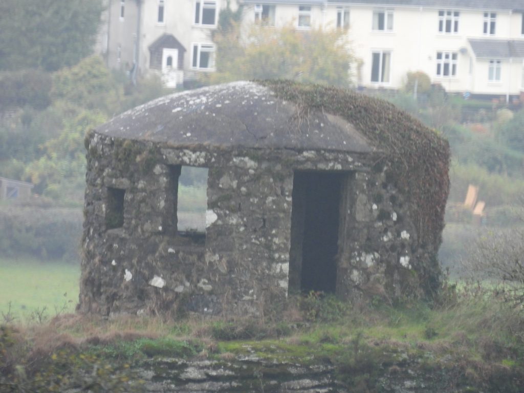
The folly at Scobitor, sometimes called the ’round house’, is located on private land approx 115m south west of the farm which lies within the parish of Widecombe and overlooks the East Webburn valley. Over the years the folly has created a lot of confusion and contradiction and whose use has variously been recorded as being: a look-out (for a farmer and also the home guard), a belvedere, a beacon, an ash house, a shooting hide, an artist’s gallery and a fire tower. The date of its construction is also shrouded in mystery with it variously having been recorded as being in the 19th century (around 1868) by a gentleman farmer to early 20th century.
Scobitor was first mentioned in the domesday book in 1086 as Scabatora. However, the name appears to have had several name changes since then. It was recorded as ‘Scobetorre’ in 1200, ‘Scobbetorre’ in 1219 and ‘Skobbetorre’ in 1452. Gover, Mawer and Stenton in 1931 (The Place-Names of Devon)suggested that the name probably means ‘sceobba’s torr’. Scobitor originally belonged to the monks of Torre abbey until the dissolution having been given to them by the de Bokeland family of Buckland. Scobitor was owned by the Dunning family from 1769 and by 1844 was in possession of Margaret Baring. It was sold again in 1867. Did Margaret Baring or the new owners from 1867 build the folly ?
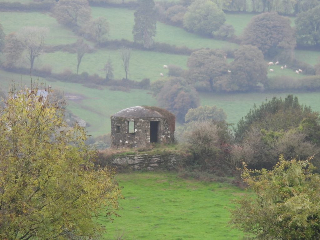
This post explores the various stories behind the possible uses of the folly over the years and its possible origins of construction. The information obtained for this post has been obtained from the Dartmoor Historic Environment Record (HER) and from ‘Dartmoor Follies’ by Philip Knowling. The folly is best viewed from Pudsham Down and this post also records some features of interest across the Down en-route from Cold East Cross where there is ample parking.
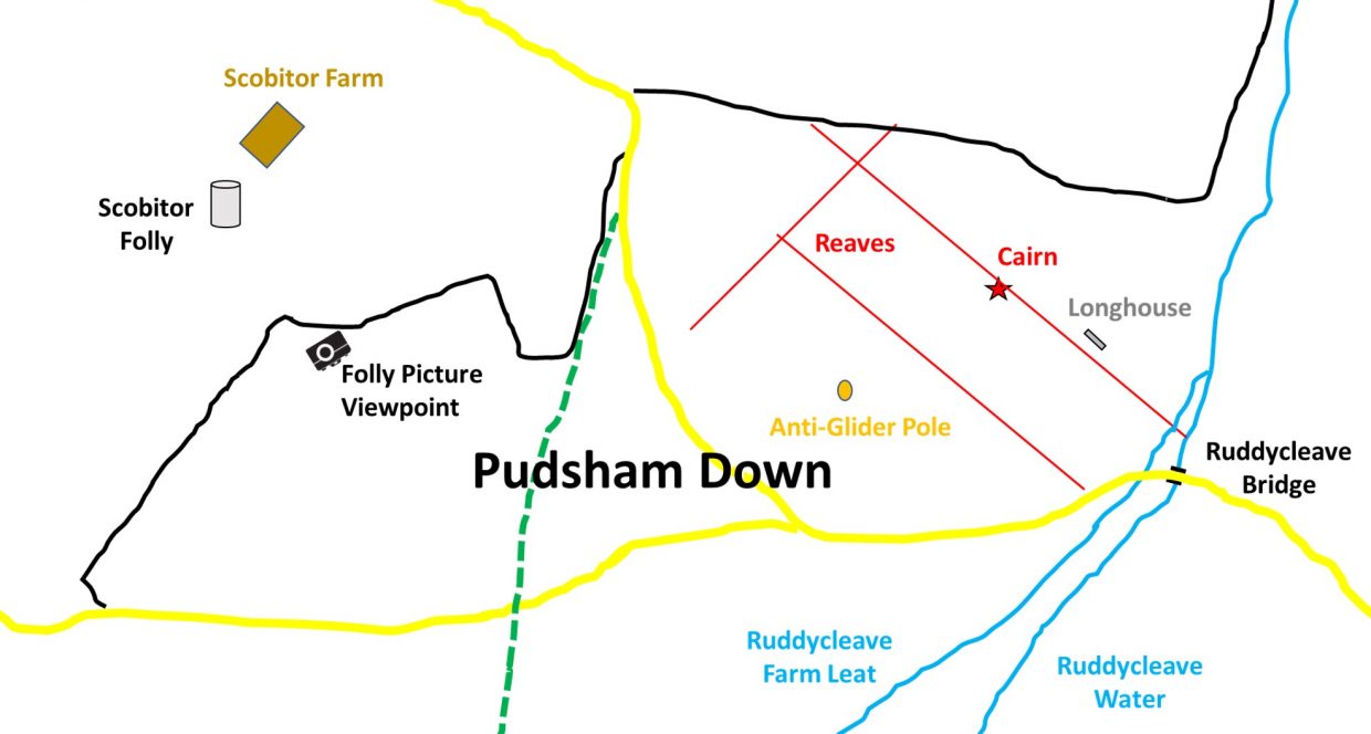
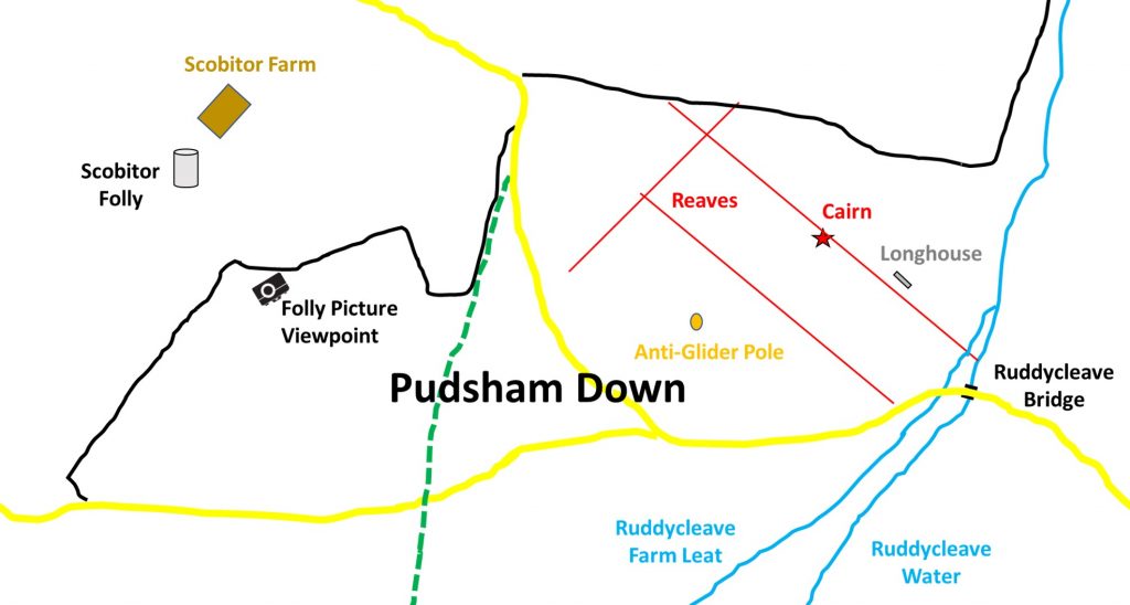
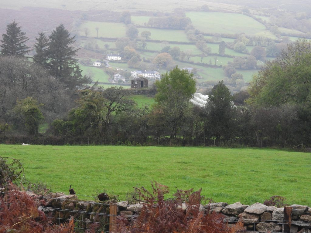
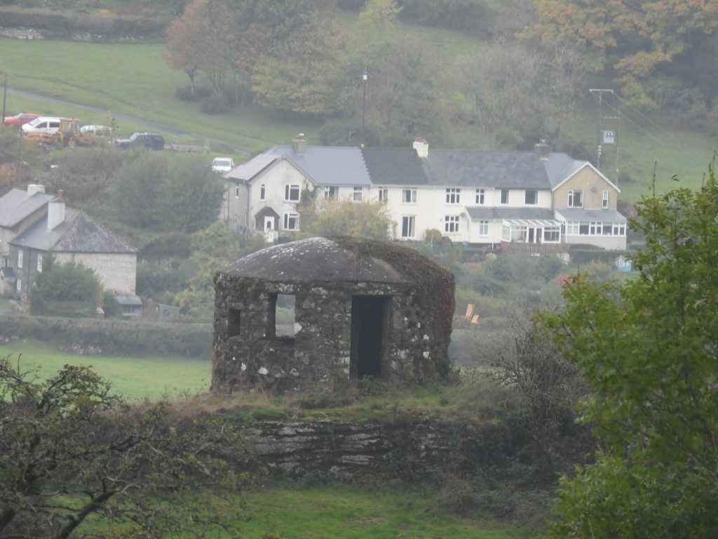
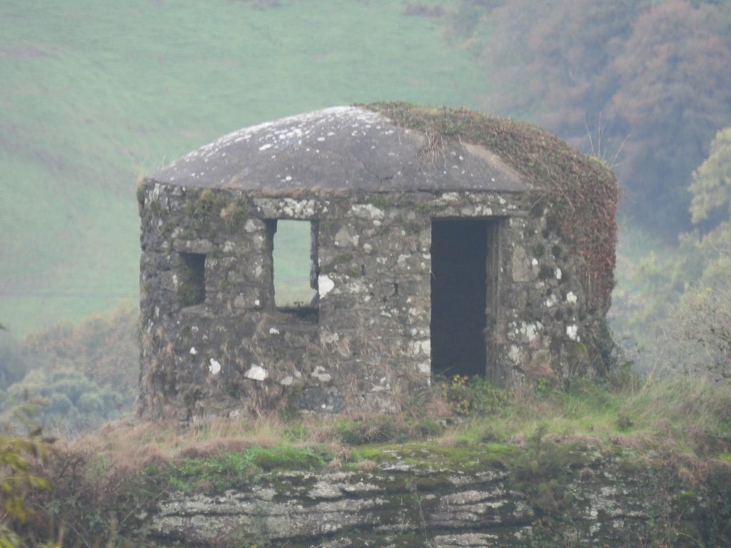
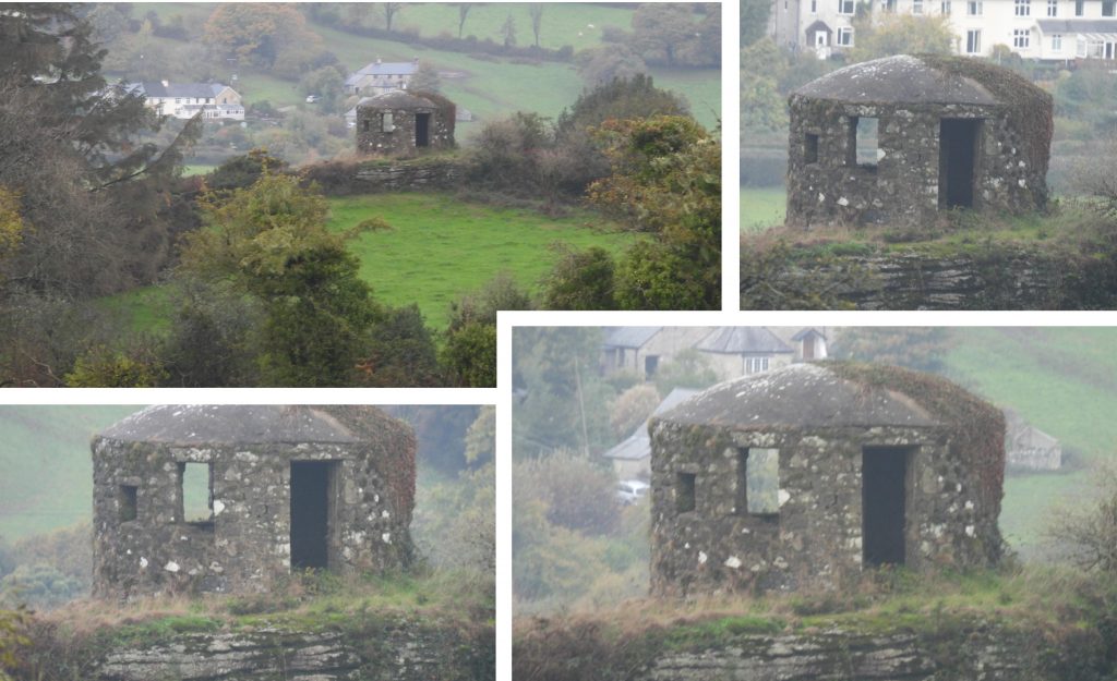
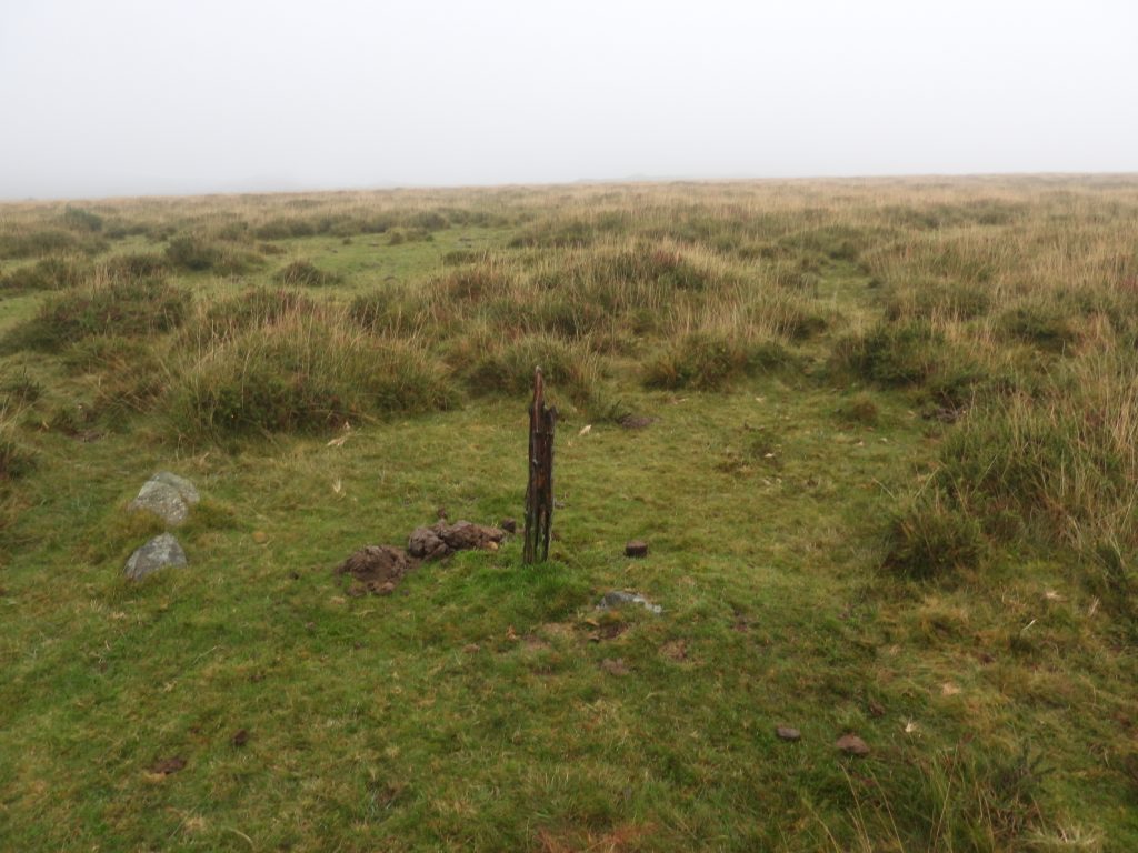
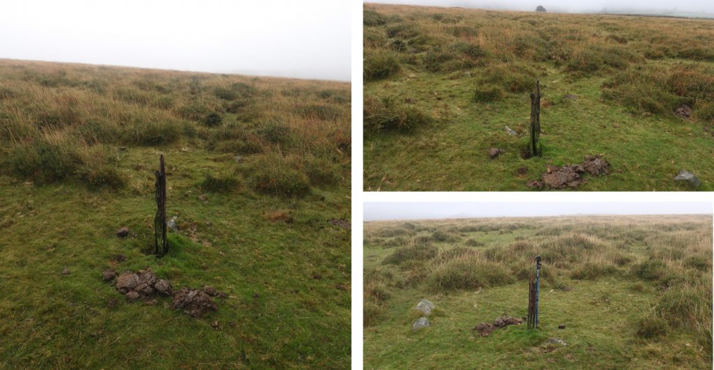
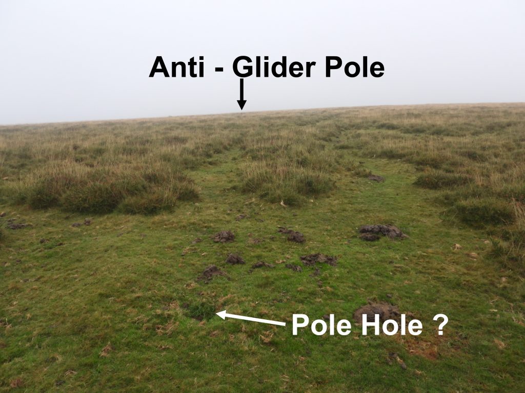
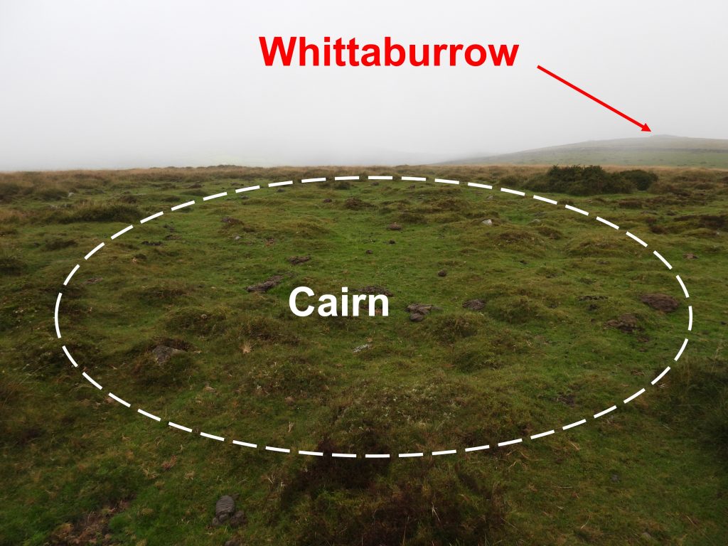
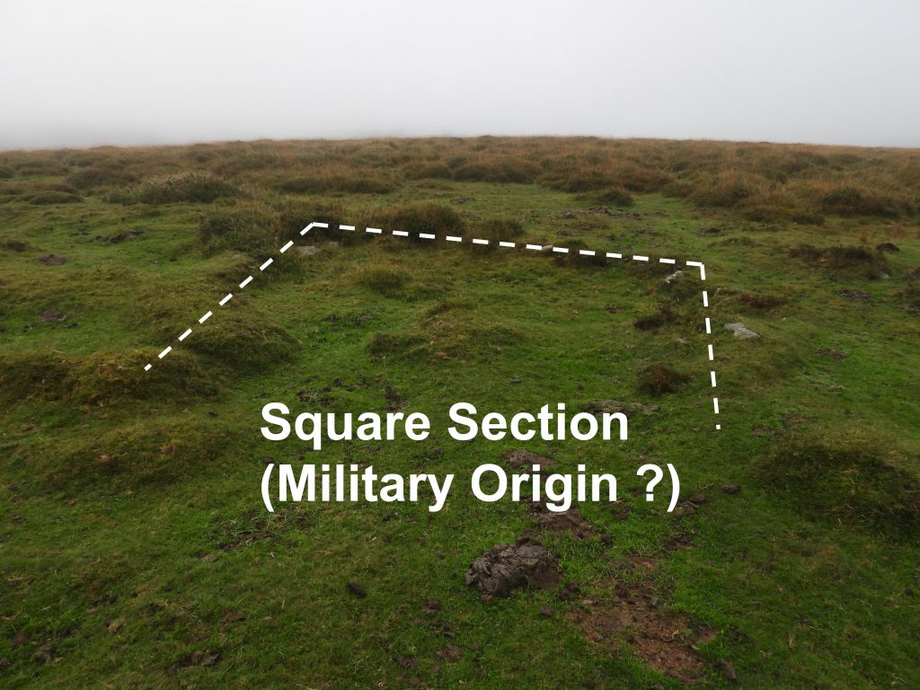
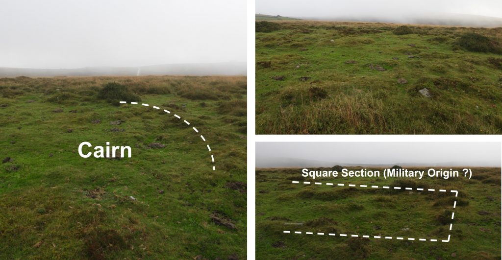
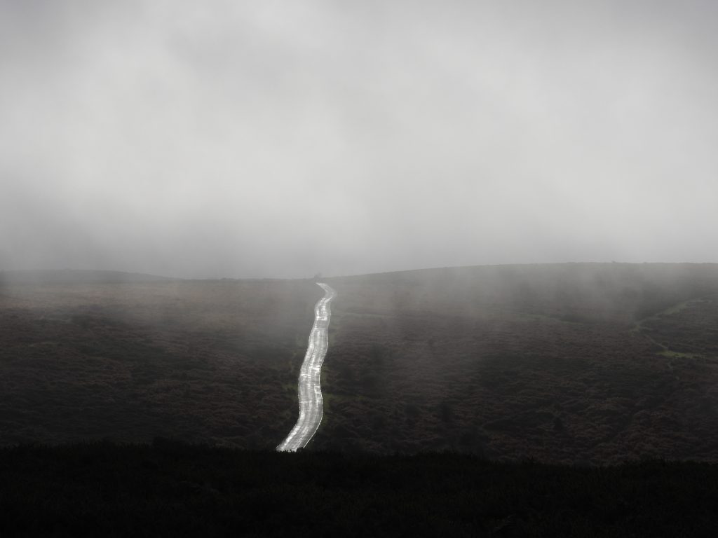
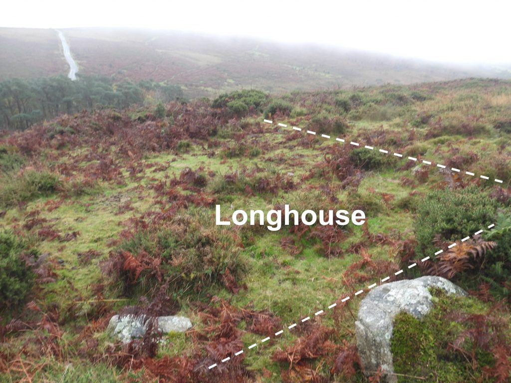
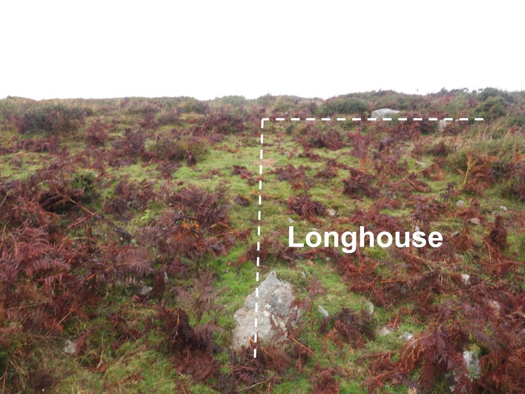
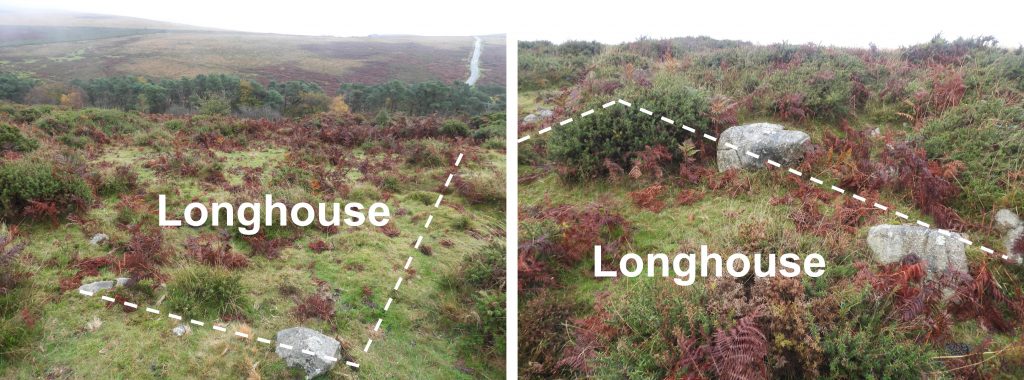
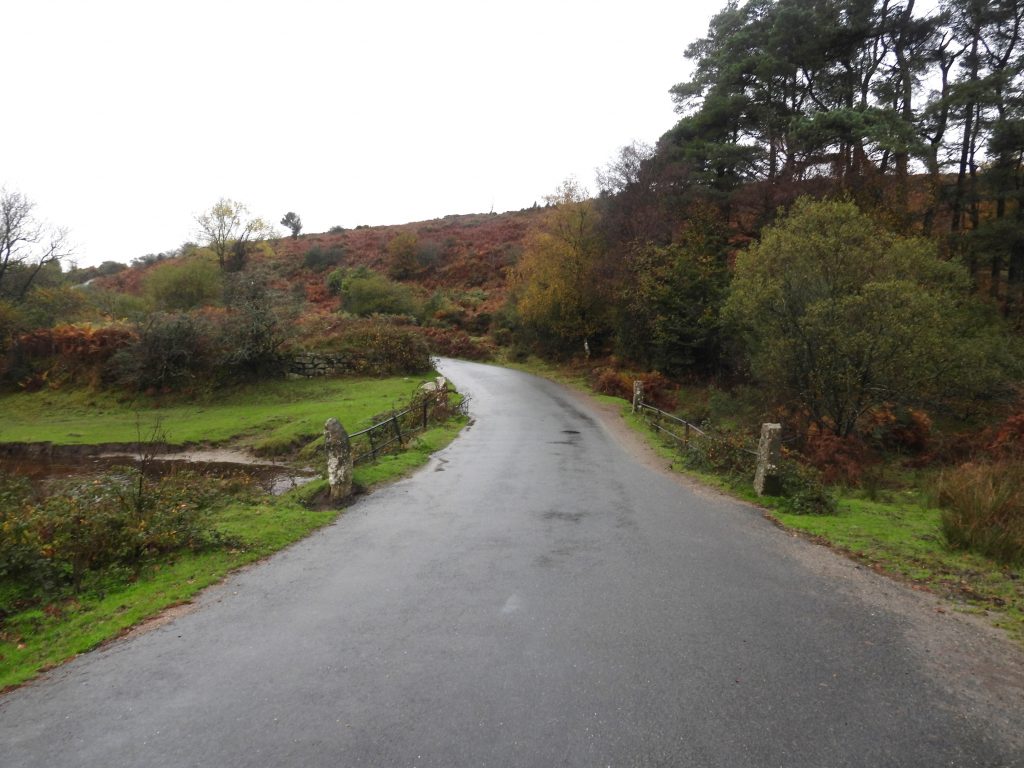
Sketch map showing the best location to observe the Scobitor Folly from Pudsham Down. The east side of the down appears to be featureless but does have a few features which are worthy a closer look. These are covered in this post.View of the Scobitor Folly across a couple of fields from Pudsham Down. The National Heritage List for England (SDV350785) records that the folly was once referred to as ‘Tower at Scobitor’. Their record states that the folly dates from 1868 and describes it as “Granite rubble with saucer-shaped, cement- rendered roof. Short round tower, possibly now reduced in height, standing on a natural outcrop of rock”. The folly is grade II listed.Zoomed in view of the folly with the hamlet of Great Dunstone in the background. The structure has a central granite pillar with 9 granite beams supporting the roof. The National Trust Guide to Follies (Headley and Meulenkamp, 1986) speculates that granite beams were too heavy to merely support the roof and may indicate the structure was intended to be taller. The structure has five windows of differing sizes and a door facing south. The internal diameter is recorded as being 3.6 metres and the height of the structure to the beams as around 2.0 metres (ref: Beeson and Masterman, 1979, An Archaeological Survey of Enclosed Land in Widecombe-In-The-Moor Parish.)The folly cemented domed roof suggests that this part of the structure dates from 21st century. According to Philip Knowling in his Dartmoor Follies book, the late Tony Beard (“Wag of Widecombe”, BBC Presenter and former secretary of the Widecombe History Group) once suggested the folly was built around 1900 and placed in this location so the farmer could see every field in his farm. Others have suggested it was built by a 19th century farmer and has been used as a Home Guard look out during WWII and used as an artists studio. Also recorded in the Philip Knowling Dartmoor Follies book is that Judy Chard (Devon Life, 1993) suggested the folly was a beacon in spite the fact it is not on top of a hill. Also recorded in the Knowling publication is a reference to a local historian (a Miss Gawn), who once told the occupants of Scobitor (Captain and Mrs Curnock – occupants from 1968 and 1983) that the folly was late Victorian and was built by the landowner to teach his children to shoot.Eric Hemery in ‘High Dartmoor’ (P663) suggests the folly was built during the First World War as a look-out. Knowling questions this as “one wonders what it was the military expected to see from a position above Widecombe”.Knowling makes an interesting reference to William Crossing, who visited Scobitor in 1912 (Guide to Dartmoor, excursion 26, page 330) and who recorded that “the rocks are in an enclosure near the house”. Knowling further comments that remarkably Crossing didn’t say anything about the folly, although it was almost certainly extant at that time. Anti glider poles (similar to those on Hamel down) were erected on Pudsham Down during the 1940s as a preventative measure to prevent / discourage enemy gliders landing.In 2015, a survey carried out in the area suggested there were two very decayed anti-glider poles left in situ and still erect. The author only found one erect pole (October 2022) at SX73103 74734. The bottom right picture shows a walking pole leaning up against the anti-glider pole for scale.It is not known how many poles were originally erected on Pudsham Down but there is still (probable) evidence of where some were located. This probable pole hole is at SX73081 74685On the summit of Pudsham Down is a much robbed and disturbed round cairn and comprises a circular, slightly raised, uneven spread of stone with a diameter of 21m (ref: Dr Phil Newman – Rippon Tor Premier Archaeological Landscape, Dartmoor National Park, Devon – A New Survey – July 2015). Interestingly, the cairn is not mentioned by Jeremy Butler in Dartmoor Atlas of Antiquities – The East, which is quite a definitive works on such antiquities. The cairn is located at SX73275 74832It is believed that the cairn might include former military remains. There is certainly a ‘square section’ at the summit which looks of possible military origin.The cairn overlies a course of one of the reaves that runs SE to NW across this hilltop. This atmospheric photograph is looking east from near the summit of Pudsham Down towards the road climbing the hill to Cold East Cross. On the higher eastern slopes of Pudsham Down is a small cross passage Longhouse. It was recorded by the one of most prolific recorders of Dartmoor features and antiquities in the late 1960s and early 1970s, R.G.Haynes. Haynes recorded the Longhouse as being 11 metres long x 3.6 metres wide. The Longhouse is located at SX73363 74778The Longhouse comprises a shallow rectangular hollow. There is a stony banked wall defining the long (11m) side. The short uphill (3m) side has several large boulders.Ruddycleave Bridge is of 18th or early 19th century origin and has two spans. There was formerly a ford here crossing Ruddyleave Water. A short distance upstream (into the woods) from the bridge is a leat take off point for the leat leading to Ruddycleave Farm. The leat passes under the road to the west of the bridge.