A collection of walks, discoveries, insights and pictures of exploring Dartmoor National Park
April 3, 2022
Red Lake Ford and Brown Heath – an exploration of Boundary Stones and old clay works structures
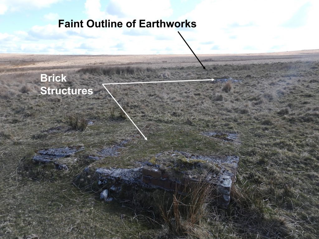
Where the Abbots Way descends to Red Lake Ford from Red Lake Cottage and the Tramway, lies the remnants of some rectangular earthwork pits on the south side of Red Lake Mire, with associated brick structures which are possibly related to the Red Lake clay pit workings from between circa 1913 and 1932. Also in the area are a number of uncut (or rough cut) boundary stones, which mark the parish boundaries of Ugborough and Harford. This post covers a brief exploration of this area.
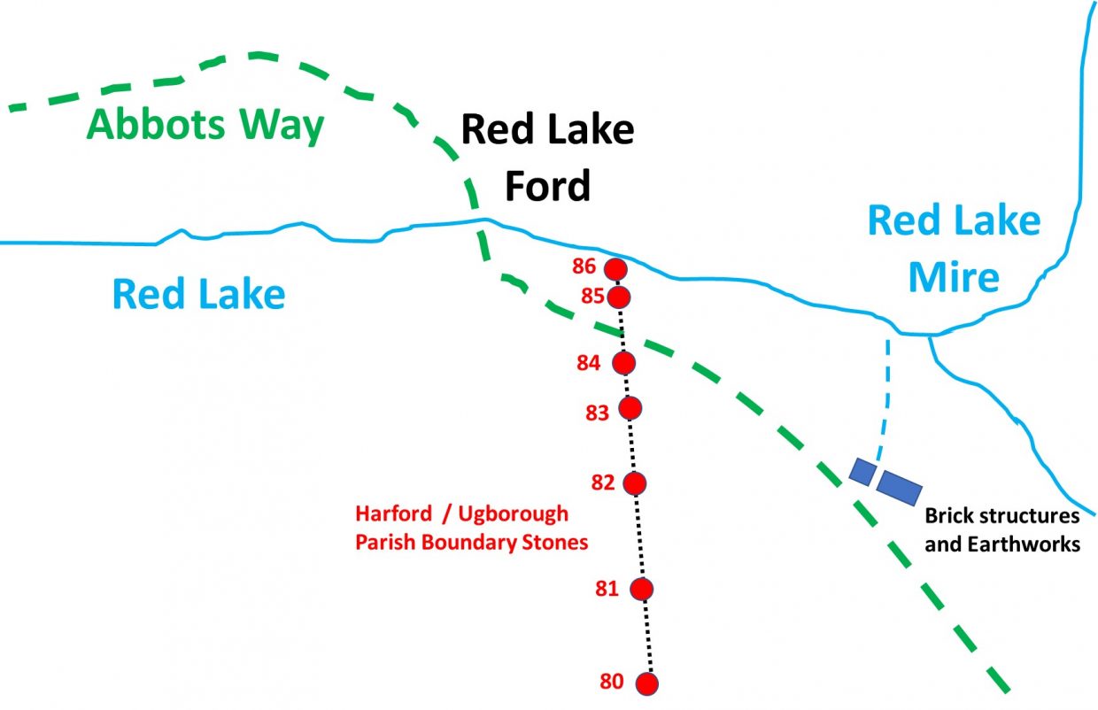
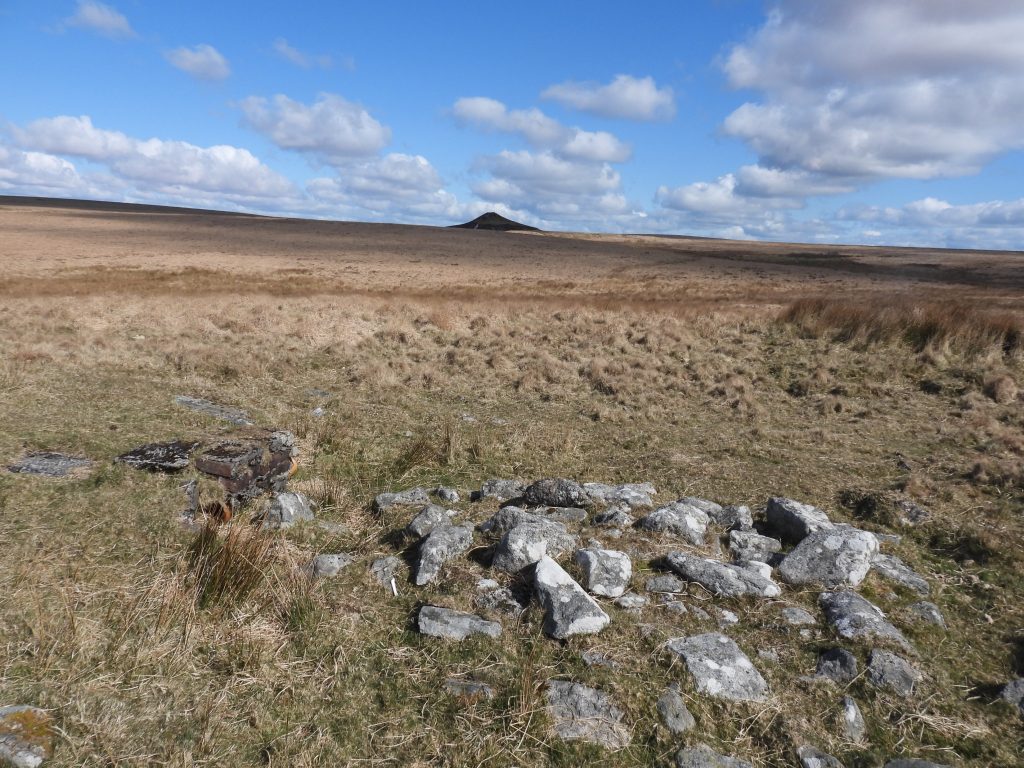
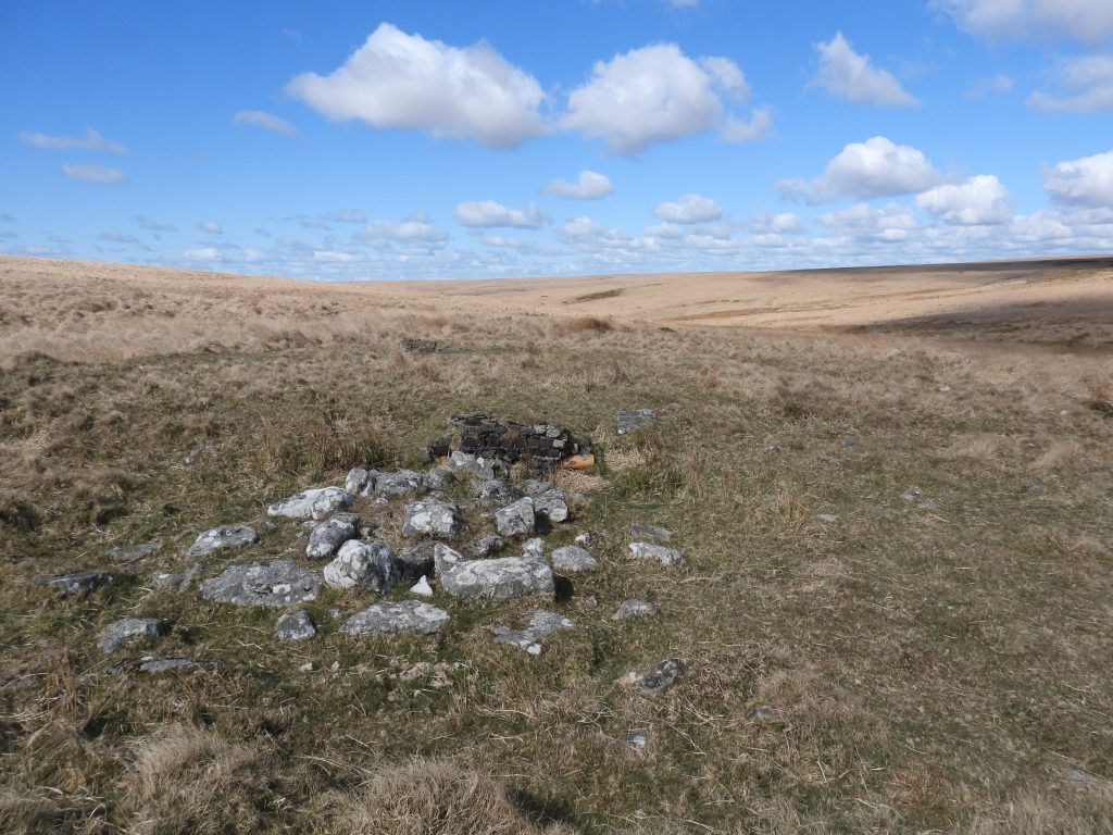
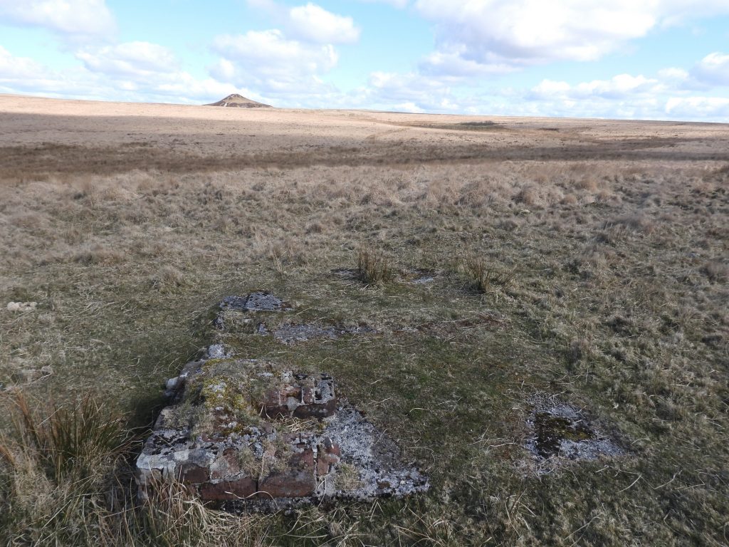
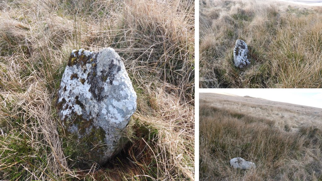
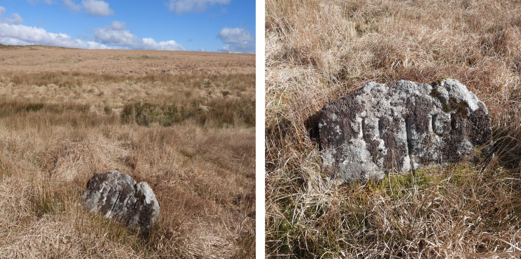
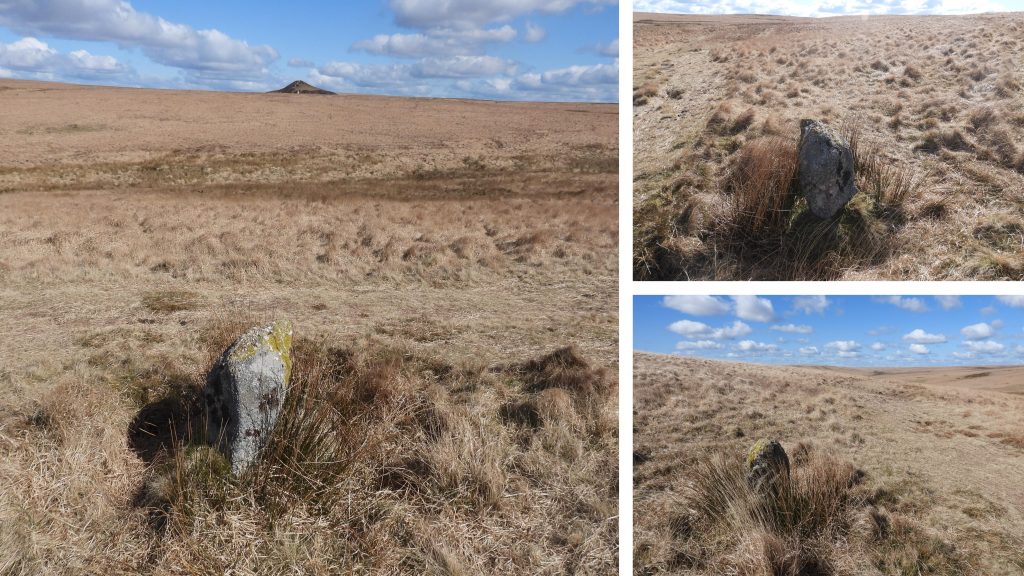
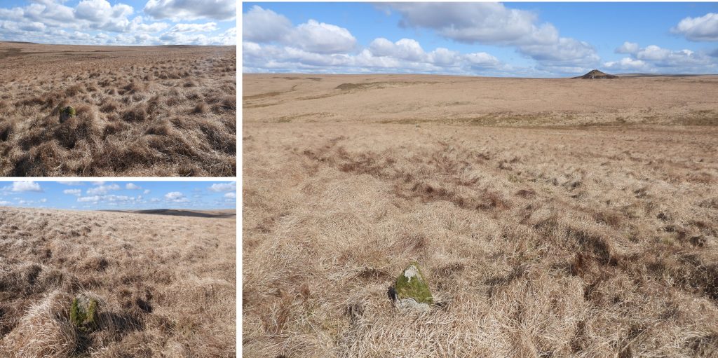
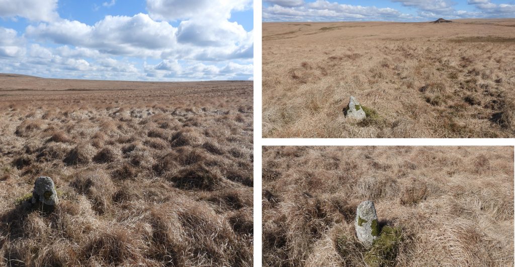
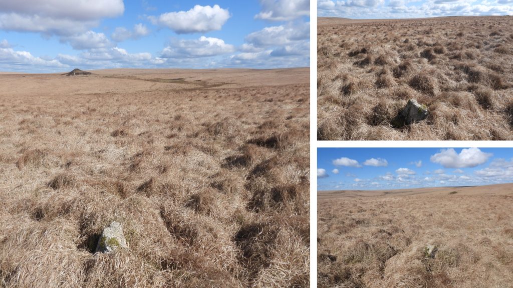
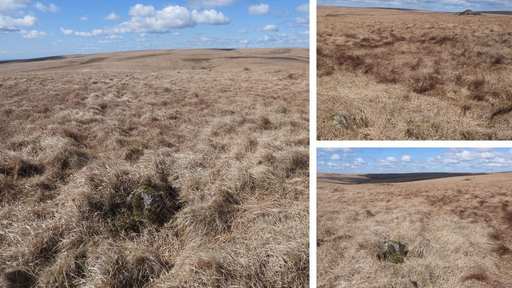
Area covered in this post. Note the numbering of the Parish Boundary Stones comes from “Dartefacts”, which the author believes may have originated from Mark Fenlon (who in turn uses the old Dave Brewer archive records in his research). One of two brick / granite structures to the south of Red Lake sandwiched between the Abbots Way and Red Lake mire. Its full purpose is unknown but conjecture is that it served to assist cleaning water before releasing it into the river and was used in conjunction with two adjacent, rectangular earthwork pits.This structure, which also has a piece of piping in its construction is located at SX64464 66269. The location of the structure is rather odd as it is south of Red Lake and the (1913-1932) clay pit is north of Red Lake, so if it were a water cleaning / filtration process the input would have come from the south (up hill at Brown Heath). That said, there is a return pipeline from the Greenhill processing plant which returned / recycled water back to the Red Lake reservoirs. Is this construction merely an overflow from this pipeline ? This hypothesis is not without question, as water must have been of a premium to operate the monitors at Red Lake clay works, so why direct water to the river (Erme) via Red Lake?The second brick and cement structure can be found at SX64453 66272. If anyone can suggest other theories as to the reason for these constructions, the author would be most grateful.The associated earth works are heavily silted so the banks are only up to 0.4 metres high. According to the Dartmoor HER there is also a linear earthwork, running north for 56 metres from between the pits, this area and is visible on LiDAR (Light detection and ranging) data but difficult to see on the ground.This moorland slab (labelled 86 on map) marks the outermost bound of Ugborough Parish and its division from Harford Parish. This point is also the boundary of these two parishes with Dartmoor Forest (ref Dave Brewer 1986, A field guide to the boundary markers on and around Dartmoor). The stone is recorded as being 1m high, 0.7m wide and 0.15m thick. There is no inscription. It can be located at SX64312 66393.Some 5m approx. from the moorland slab (No 86) is the “Outer U Stone” (labelled 85 on the map), which is recorded on the Dartmoor HER as being 0.8m high, 1.0m wide and 0.25m thick. As can be seen by the photographs, it is leaning slightly (to the NE). It has deeply inscribed letters (H and U), which are 12cm high and are inscribed on the SW face. There is also an deeply inscribed “line” between the letters indicating the boundary line. The stone can be found at SX64311 66386Moving south from Red Lake, the next Harford / Ugborough Parish Boundary Stone (labelled 84 on map) can be found at SX64317 66312.Continuing south across Brown Heath, the next Harford / Ugborough Parish Boundary Stone (labelled 83 on map) can be found at SX64323 66262.The Harford / Ugborough Parish Boundary Stone (labelled 82 on map) can be found at SX64329 66198.Harford / Ugborough Parish Boundary Stone (labelled 81 on map) can be found at SX64332 66123.The final Harford / Ugborough Parish Boundary Stone (labelled 80 on map) of this post can be found at SX64343 66028. This stone can be located close to the “loop” of the Red Lake tramway as it contours around Brown Heath.