A collection of walks, discoveries, insights and pictures of exploring Dartmoor National Park
June 23, 2021
Okehampton WD (War Department) Stones
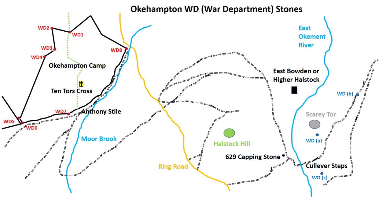
In his 2nd edition of Dartmoor Boundary Stones, Dave Brewer writes that the earliest record of the army training on Dartmoor was in 1794 on Ugborough Down. At the same time an encampment was also set up at Hemerdon Ball due to the threat of invasion by Napoleon. Forward 80 years, army manoeuvres took place in 1873 on Yennadon Down and at Roborough. These latter two served as a forerunner to the summer encampments (6 weeks) at Okehampton from 1875. Following the summer encampments, the Duchy agreed the establishment of the permanent camp at Okehampton and in 1892, a 99 year lease* was granted, 80 acres of which were acquired from Okehampton. The bounds of the original 80 acres granted to the War Department to set up the permanent camp were defined by a series of 8 bound stones, (inscribed in the format No.1 / W.D / –) . This post covers these 8 stones and three other “WD” stones which are located approximately a mile away to the east around the Cullever Steps / Scarey Tor area.
Information from the Dave Brewer publication. Nigel Sharpe has provided information which states that the lease was actually for 999 years. Thank you
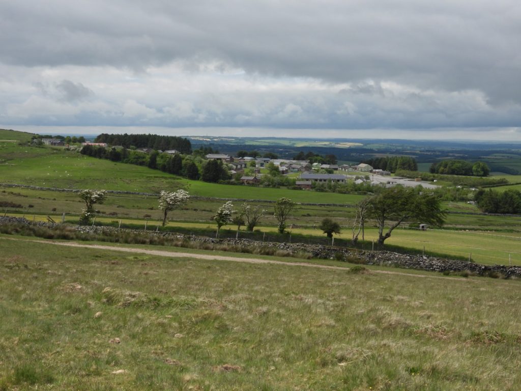
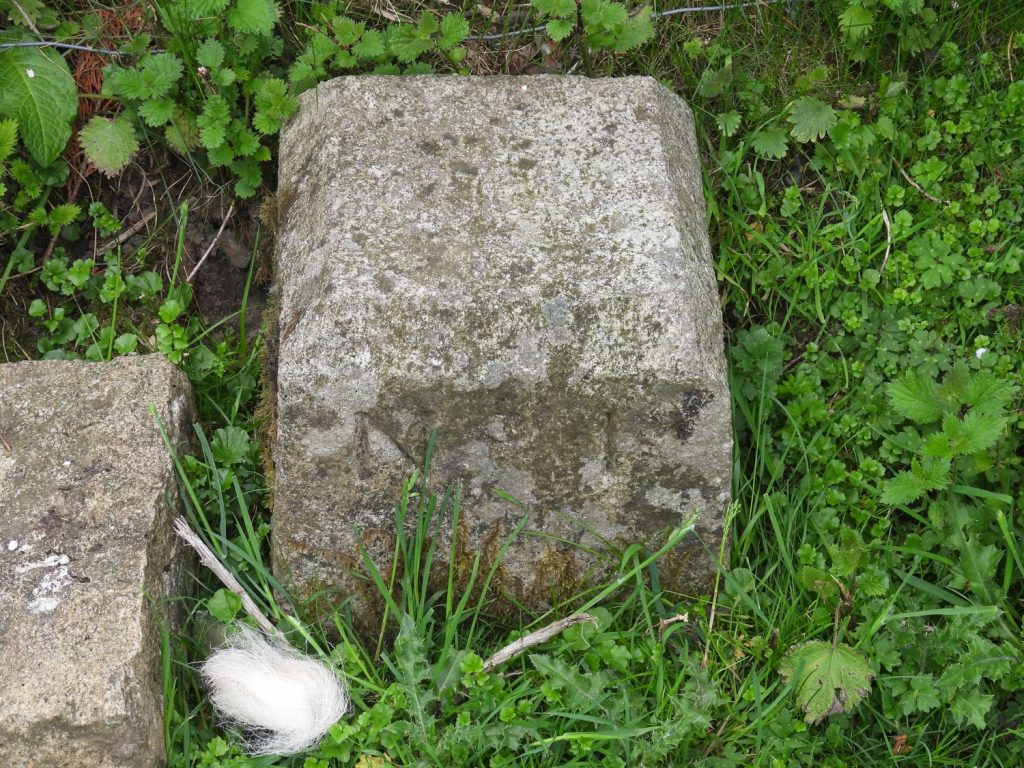
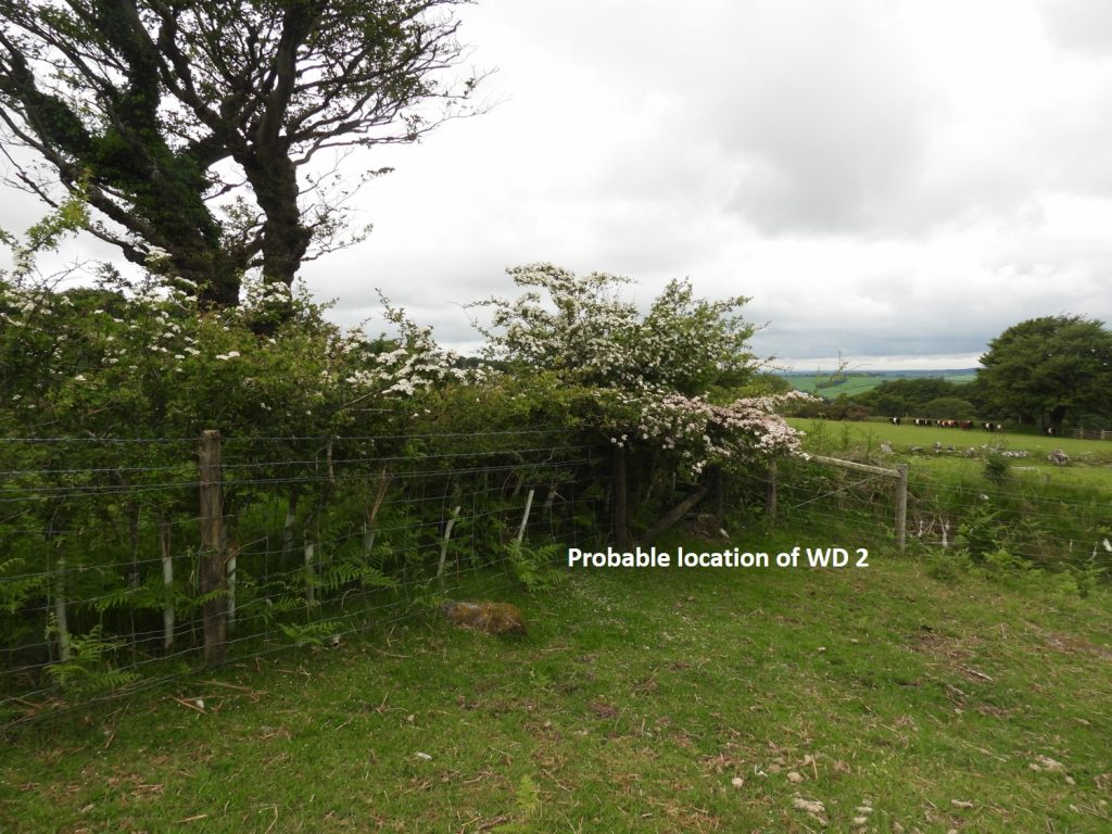
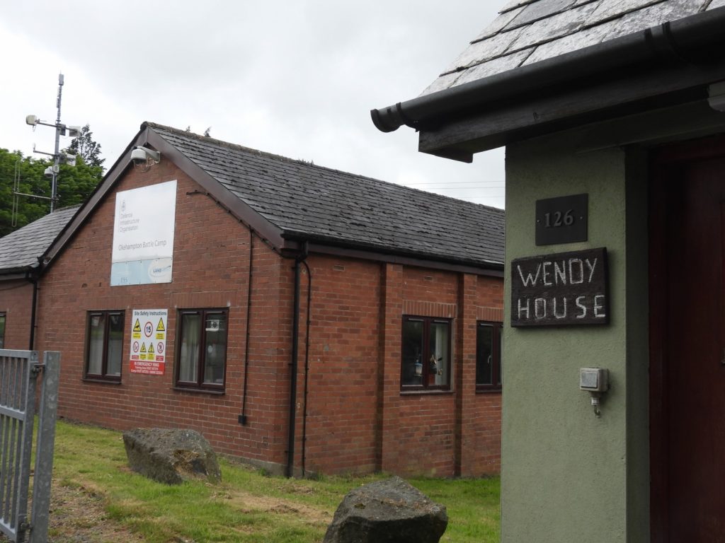
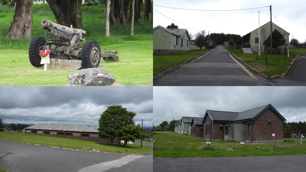
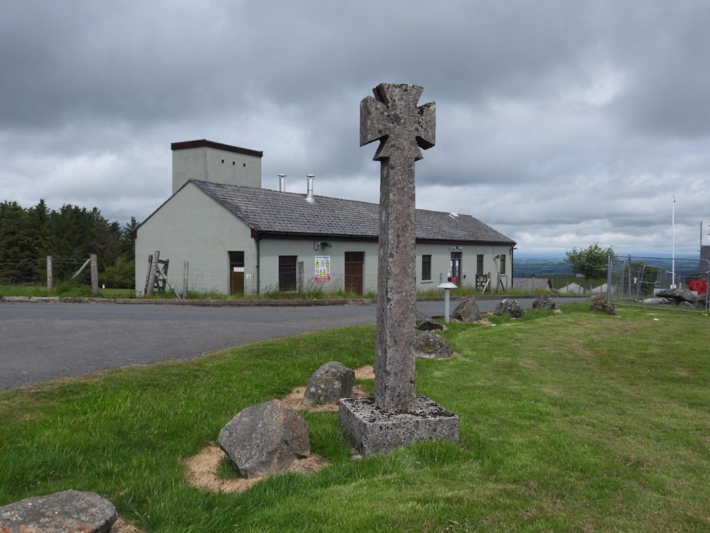
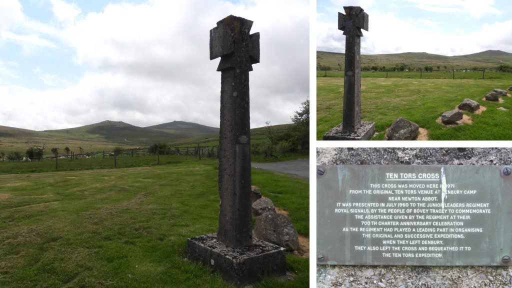
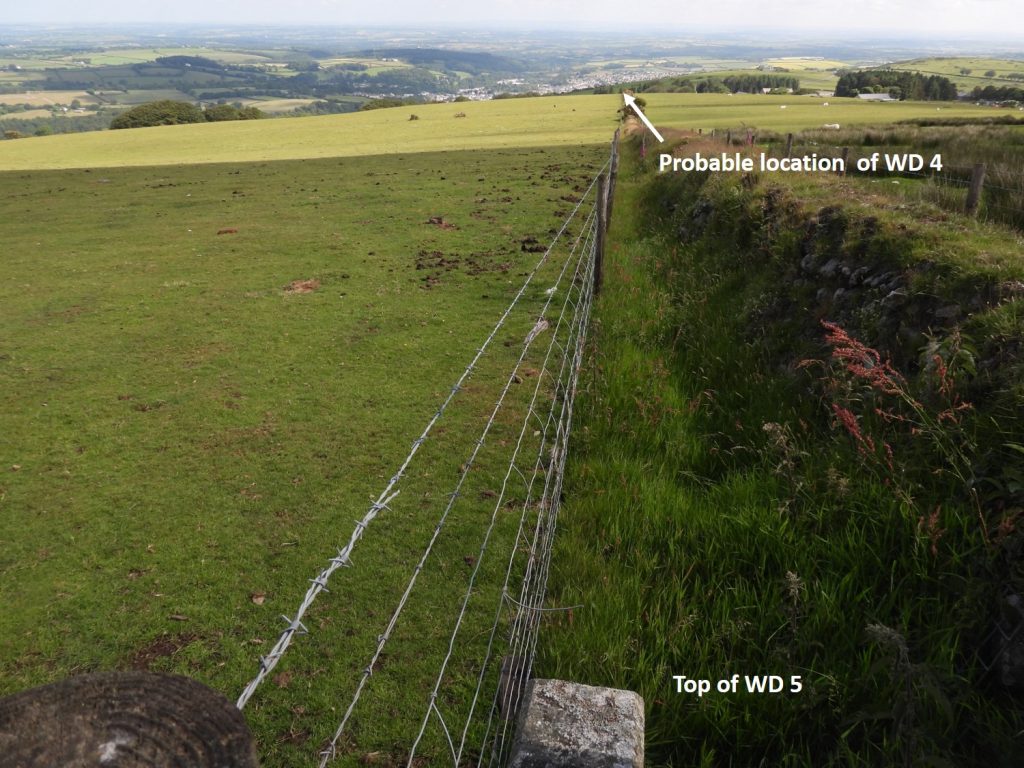
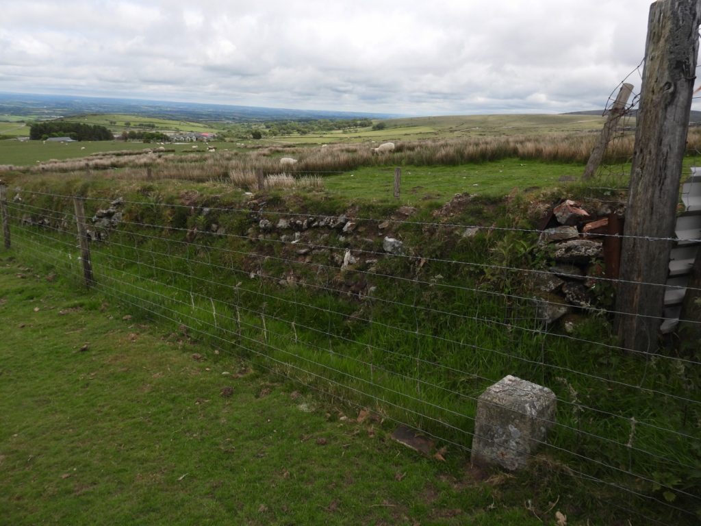
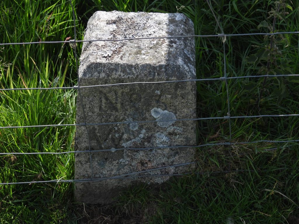
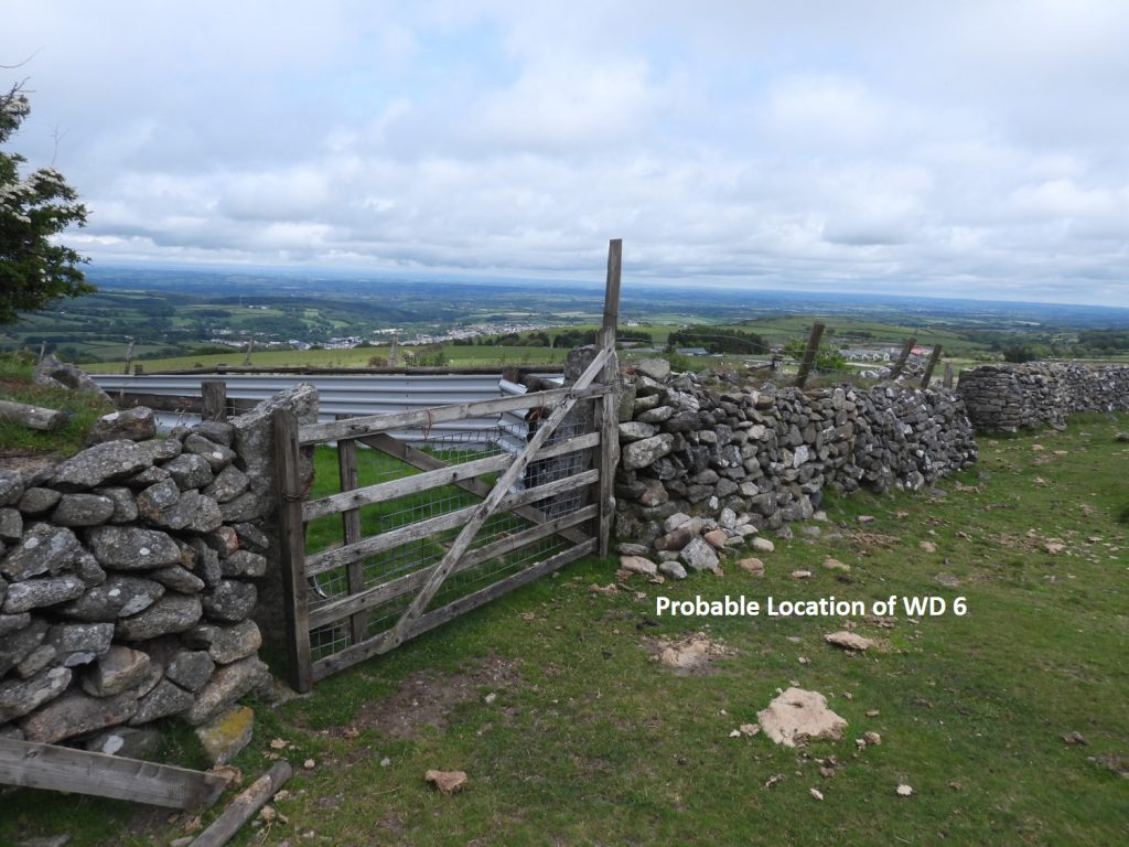
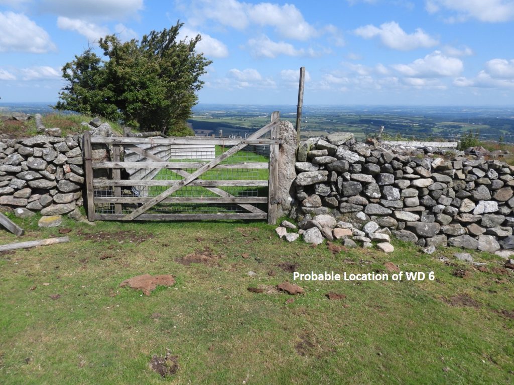
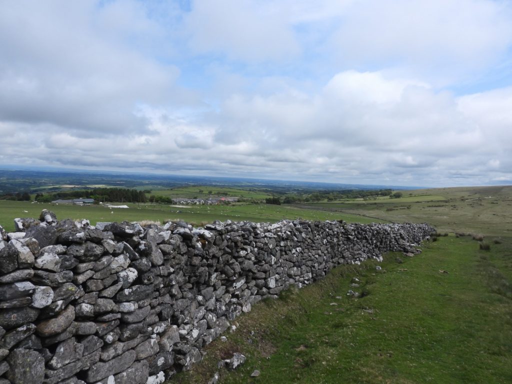
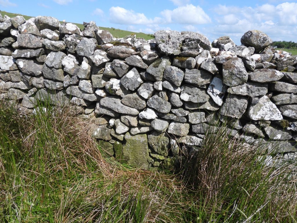
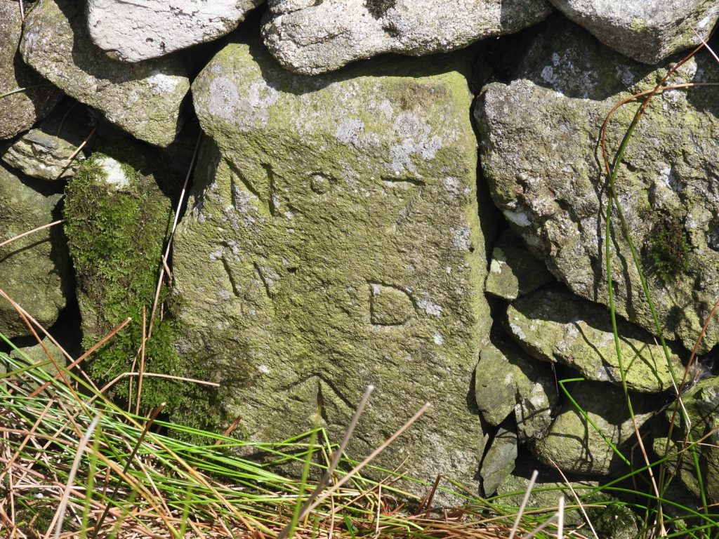
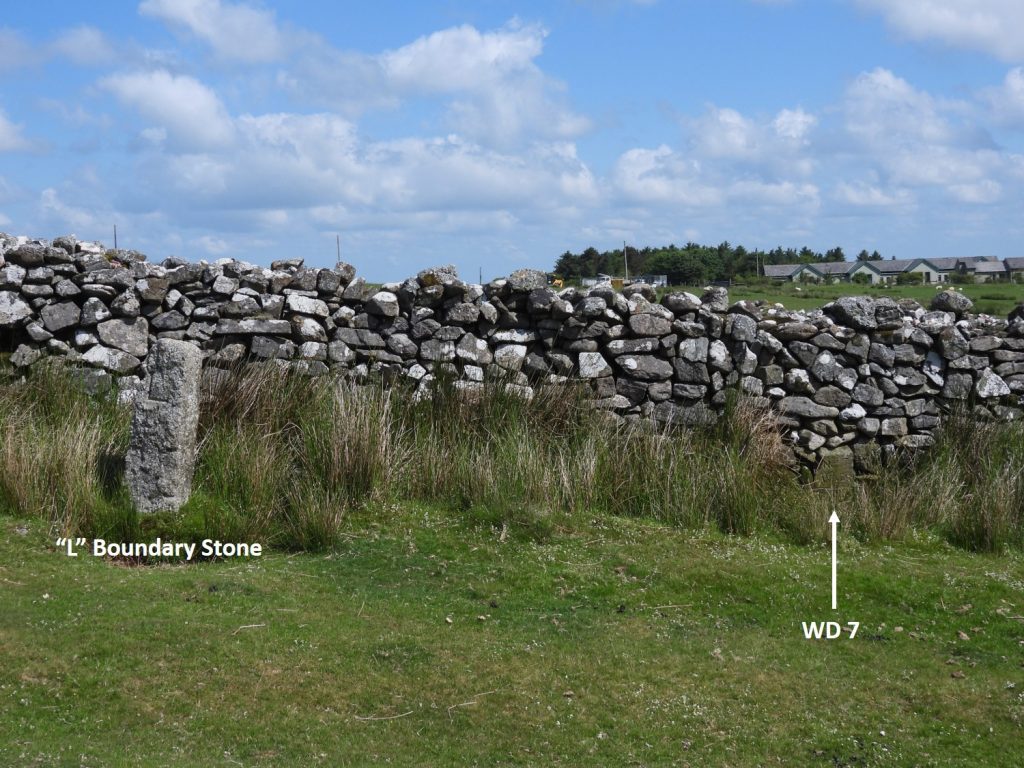
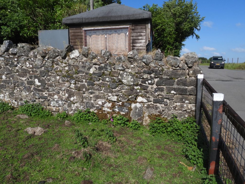
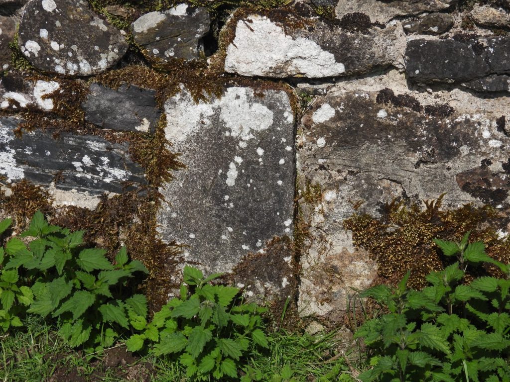
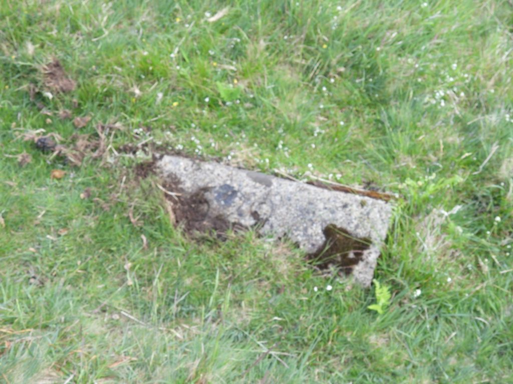
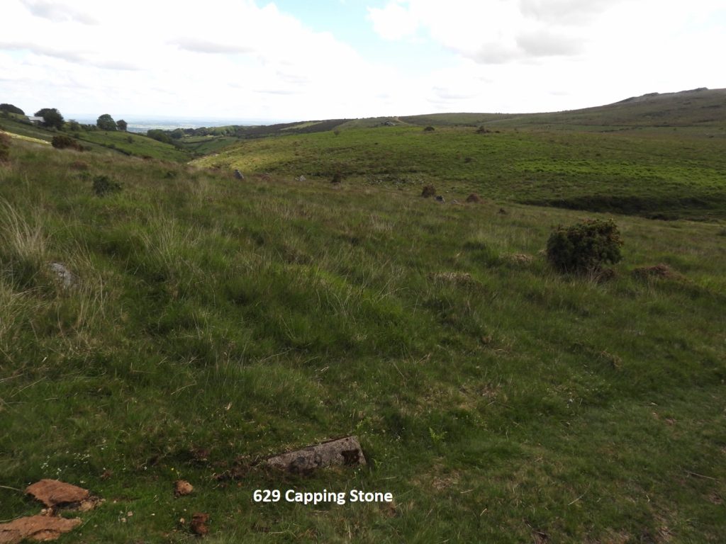
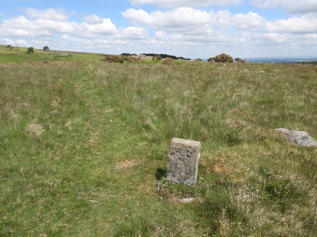
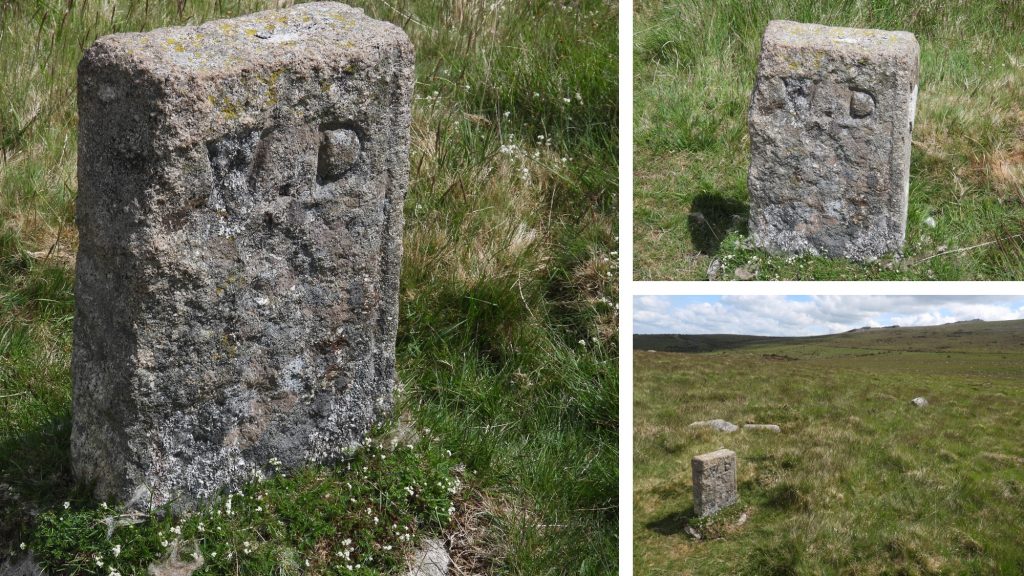
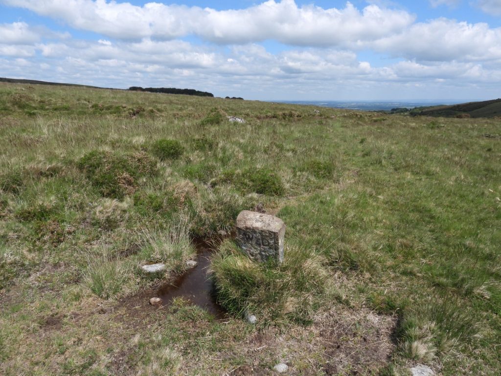
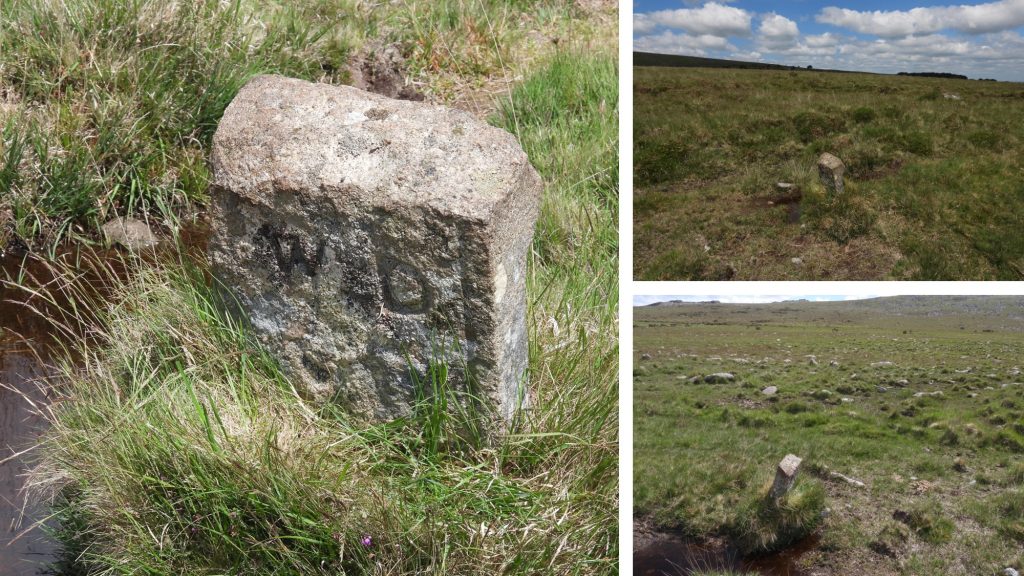
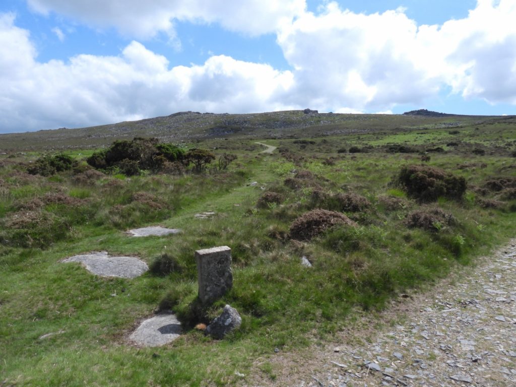
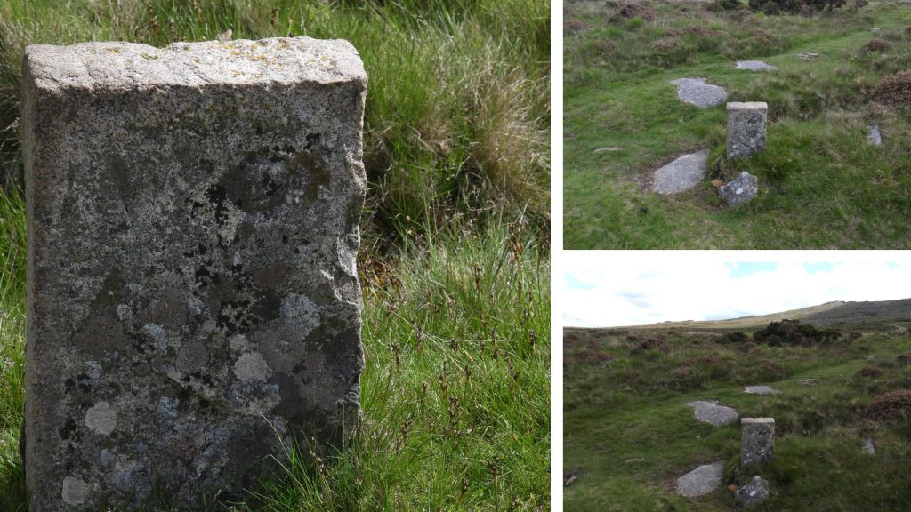
This map shows the two distinct locations of the two sets of WD bound stones. The first set (in red) at Okehampton Camp and the second set (in blue) around the Scarey Tor / Cullever Steps area. On the military subject, the post also details the location of a “629 Capping Stone”.Okehampton Camp as viewed from the slopes of Halstock Hill.WD1 boundstone is located near the North Gate entrance to the camp. Zoomed in picture of WD 1. It can be located at SX58700 93226.WD 2 could not be located. If it is extant then it is likely to be amongst the overgrown hedge, which is just inside the camp, so pubic access is not permitted.There is a public footpath through the camp. The first building is called “Wendy House”.General views of Okehampton Camp from the public footpath.Ten Tors Cross in the campThe cross was originally located at Denbury (where the first ten tors took place in 1960). The boundstones WD 3 and WD 4 are on private land. An unlocked gate allowed me to take this picture from WD 5 looking towards where WD 4 is likely to still be extant.WD 5WD 5 close up. It can be located at SX58295 92498.WD 6 could not be found. Its probable location would have been next to this gate. This gate is near the Black Down hill.WD 6 is described by the Dartmoor HER as “survives in excellent condition but is close to falling over”. After much searching, it could not be located.The wall boundary from WD 6 down to WD 7WD 7 had been hidden from the outside world for some time with a bank of reeds growing in front of it.WD 7 is a nice example of the series. It can be located at SX58673 92549The location of WD 7 in relation to the nearby “L” boundary stone. The “L” is considered to stand for Lydford, although there is a school of thought it might stand for Luxmoore (the name of a 18th century land owner).WD 8 is located next to Moor GateWD 8 close up. The stone is very weathered and can be found at SX59150 93122629 capping stone. A.H. Clark, Lt Col (Retd), Commandant Dartmoor Training Area, Okehampton, Devon wrote in Dartmoor Magazine No 63, Summer 2001, Letters Page) and stated that the capping stone marked precisely the buried junction points of the military range safety telephone system. The use of 629 was due to 629 Signal Works Troop, from Crownhill (Plymouth) who were responsible for maintaining line communications on Dartmoor, hence their unit number marks the concrete blocks.The 629 capping stone in relation to East Okement valley.Marked as WD (a) on the map, this “WD” stone is located just south of Scarey (Skurry) Tor.WD (a) is located at SX60731 92377WD (b) on the map, close to the track leading from Nine Maidens to Cullever Steps. It can be located at SX60821 92363.WD (b) is described on the Dartmoor HER as follows: “A military boundary stone located in open moorland. It measures 0.7 metres high, 0.35 metres wide and up to 0.15 metres thick with the inscription ‘W.D.’, and with a broad arrow on one face. This dressed stone, of fine granite, is part of a reused, cement rendered window cill – the plain moulding, the incision for the glass and, on the reverse the drip recess are all clearly visible. Part of the cill is cement redered”. The other half of the stone is WD (c) shown in this post.WD (c) on the map, close to the track leading from Cullever Steps under Winter Tor. It can be located at SX60756 92057.WD (c) is described on Dartmoor HER identically as WD (b) thus: “A military boundary stone located in open moorland. It measures 0.7 metres high, 0.35 metres wide and up to 0.15 metres thick with the inscription ‘W.D.’, and with a broad arrow on one face. This dressed stone, of fine granite, is part of a reused, cement rendered window cill – the plain moulding, the incision for the glass and, on the reverse the drip recess are all clearly visible. Part of the cill is cement rendered”.
Hi Steve,
WD 3 is on site as follows: Okehampton Camp – WD OKC 3 @ SX58599 93088. No.4 & No.6 were was not found when Paul Rendell and I visited. Missed the 629 capping stone – good find.


Mark F June 26, 2021
Hi Steve,
WD 3 is on site as follows: Okehampton Camp – WD OKC 3 @ SX58599 93088. No.4 & No.6 were was not found when Paul Rendell and I visited. Missed the 629 capping stone – good find.
SteveGrigg1961 June 26, 2021 — Post author
Thanks Mark. Can I get to WD3 outside the camp or is it private ?
Nigel Sharpe March 18, 2023
The lease granted in 1892 was for 999 years, not 99 years
SteveGriggDartmoor March 19, 2023 — Post author
Thank you Nigel. I have amended the post, acknowledging you
Kind Regards,
Dartmoor Explorations