A collection of walks, discoveries, insights and pictures of exploring Dartmoor National Park
December 10, 2025
Miner’s Path : Manaton to West Webburn Tin Mines
During the 18th and primarily 19th / early 20th centuries the mines of the upper valleys of Redwater Brook and West Webburn would have employed some men who lived comparatively close in villages and settlements like Postbridge and Challacombe. Many others would have had longer distances to travel from outlying towns and villages such as Chagford, North Bovey, Manaton, Widecombe and Moretonhampstead. Those who travelled longer distances would have lodged at the mines (e.g Birch Tor / Vitifer Mine) in ‘barracks’.
Miners who ‘commuted’ (presumably on a weekly basis) from Chagford, North Bovey and Moretonhampstead would have used the route using part of the B3212 before descending into the Redwater Brook and West Webburn Valleys via tracks and paths from the Challacombe Cross to Firth Bridge road near Headland Warren Farm. Those ‘commuting’ from Manaton would have had a more open moorland route across Hayne Down, Cripdon Down, Heatree Down and the northern flanks of Hamel Down.
William Crossing in his ‘Guide to Dartmoor’ (page 67) writes in the section titled ‘Tracks near Challacombe’ (Track 47), about the road from Challacombe Cross to Challacombe and onwards to Blackaton, Grendon and Cator, viz : “In this locality are several , paths mostly formed by the miners, but none likely to prove much service to the rambler”. This description appears to refer to part of the path of the modern ‘Two Moors Way’ in the area. Crossing adds: “A path also led from the enclosed lands in Manaton parish to Headland and Vitifer. It ran through Grim’s Pound, the wall of which has been broken down in two places”.
Eric Hemery in his ‘Walking Dartmoor’s Ancient Tracks’ – Track 28 references this William Crossing record and writes of a surmised Miner’s route from Manaton based on this. This post covers the full ‘Miner’s Path’ route from Manaton to Redwater Brook valley suggested by ‘Hemery’ which is based on the ‘Crossing’ observations.
NOTE: As per Hemery’s path title, this post title uses ‘West Webburn Tin Mines’ which relate to mines in both the West Webburn Valley and Redwater Brook Valley, the latter water course being a tributary of the West Webburn river
Bibliography
Eric Hemery – (1986) – Walking Dartmoor’s Ancient Tracks – Track 28 (Pages 264, 269-276)
William Crossing – (1912 reprint) – Guide to Dartmoor (page 67)
M.Bodman -(2015) – Mills on the Teign. A gazetteer of water-powered sites on the Teign and Bovey and their tributaries, 94
J.Gover ; A.Mawer ; F.Stenton – (1932) – The Place-Names of Devon: Part Two, 483
Jeremy Butler – (1991), Dartmoor Atlas of Antiquities: Volume One – The East, 155
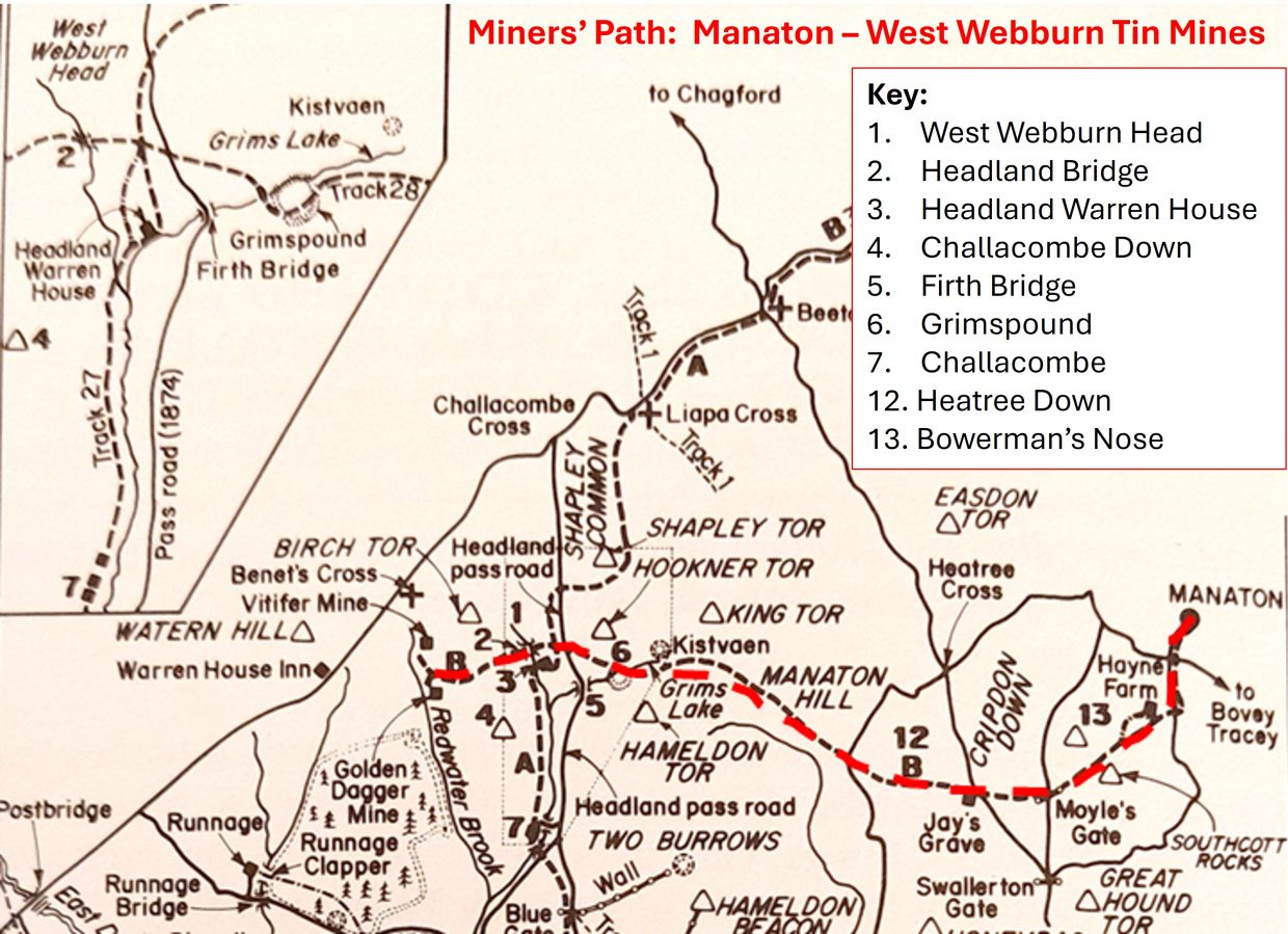
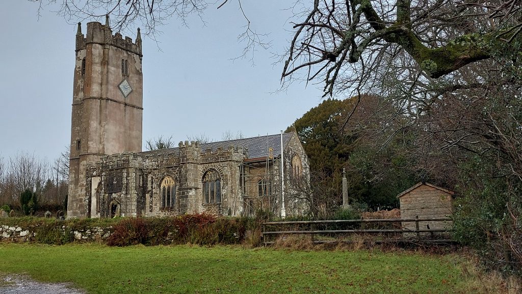
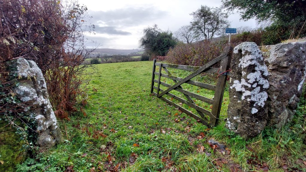
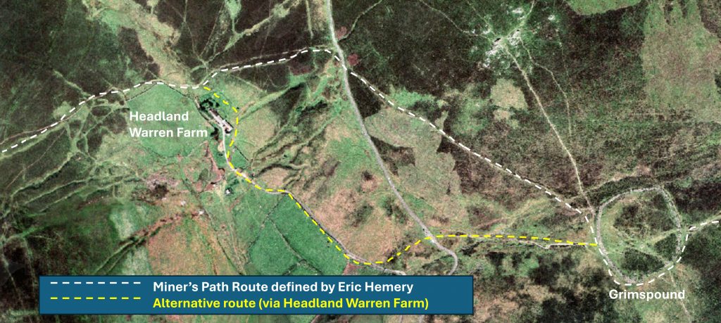
This annotated map is based on Eric Hemery’s ‘Walking Dartmoor’s Ancient Tracks’ on page 264. The track description can be found on pages 269-275. The author believes there is a minor error on the original sketch map showing the track going from Grimspound onto the col between Birch Tor and Challacombe Down passes too far north of Headland Warren House (see inset). Hemery records the route on page 274 where he describes descending to the valley floor from the road north of Firth bridge but then states it (the path) ascends the hill opposite beside the upper wall of the of the large warren home-meadow (which is right next to the house)The start of the Miner’s Path at the parish church of St. Winifred. A bell here was dedicated in c.1440 to St. George; patron saint of England and Manaton’s Guild of Tinners. On 13th December 1779, lightning struck the Church. A terrible thunderstorm with hail and lightning took place, and the east front of the Chancel was demolished, along with a new altar piece and the communion table. A large stone was hurled into the parsonage seat, which broke part of it.Next to the crossroads, a short distance south from Manaton green, are two slotted gateposts which beautifully from the hills around Haytor on the horizon – from here the Miner’s Path runs south towards Mill Farm
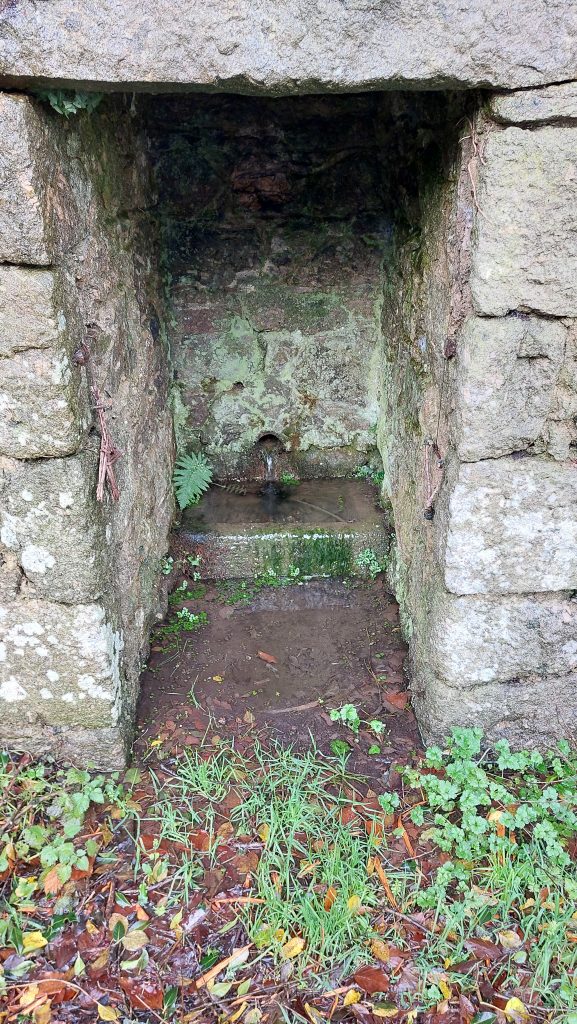
Well on the north west corner of the crossroads downhill from Manaton Green
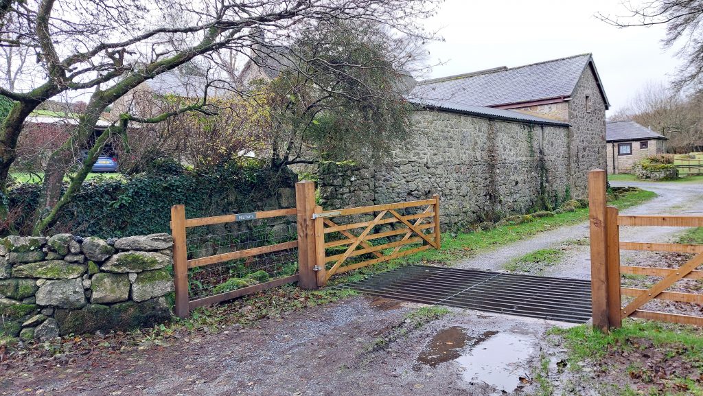
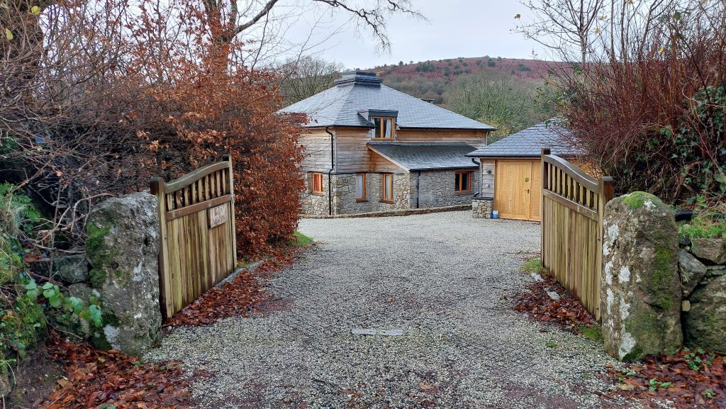
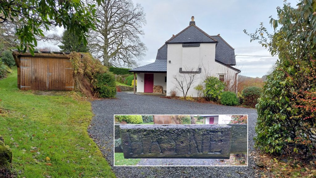
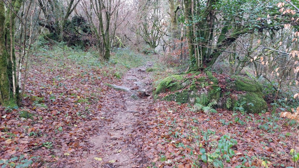
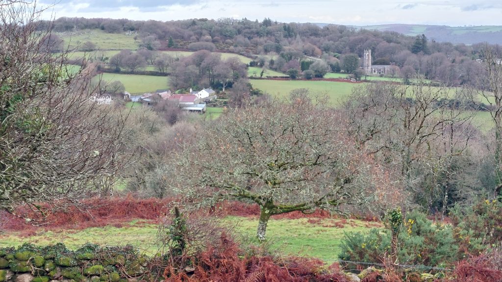
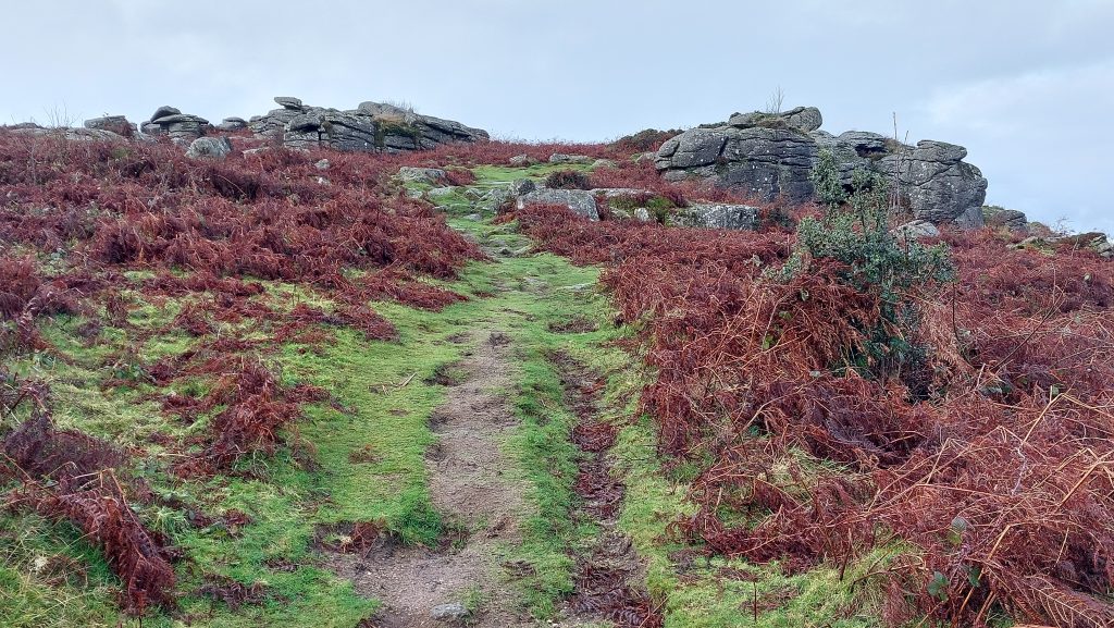
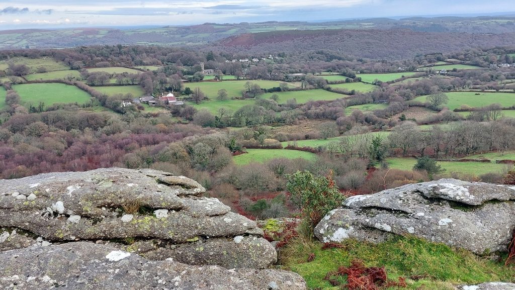
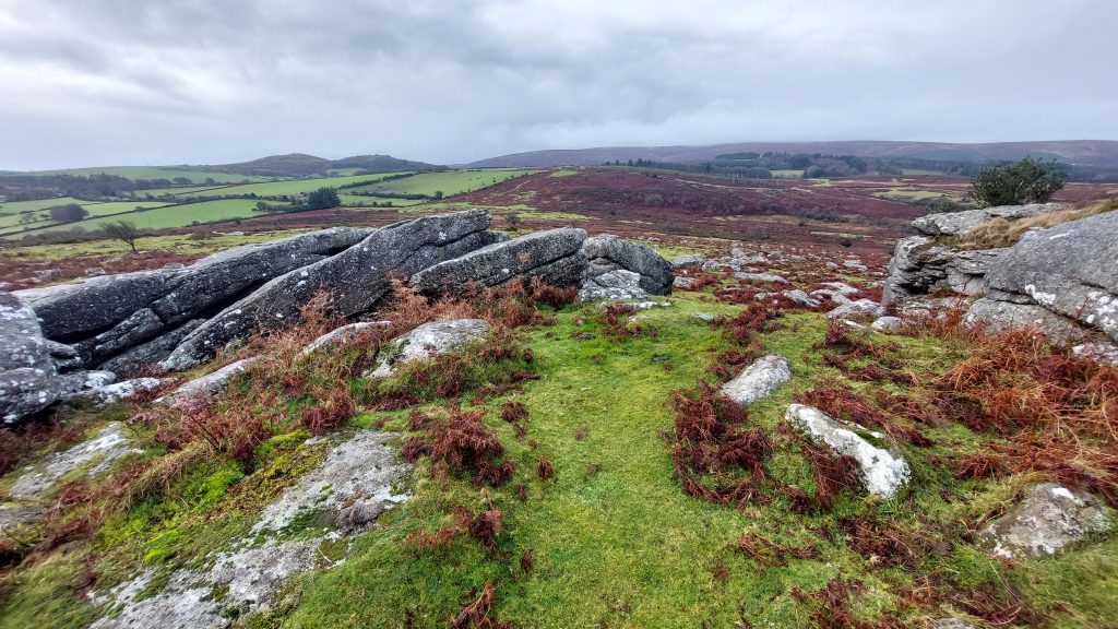
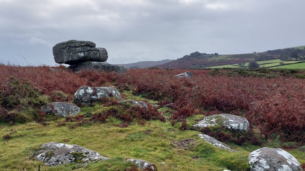
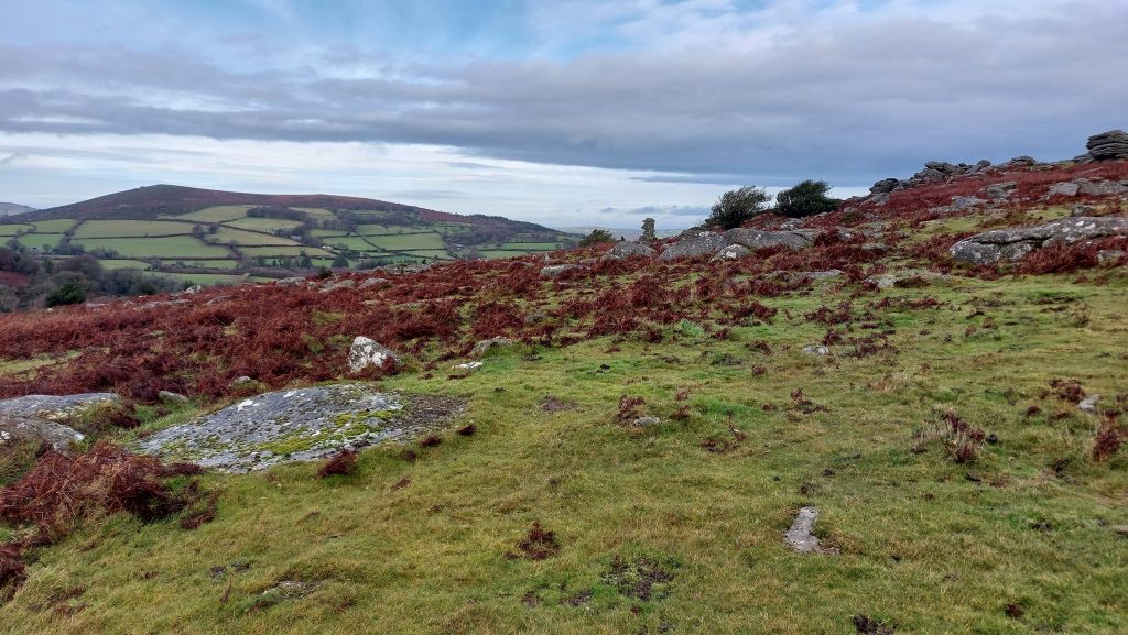
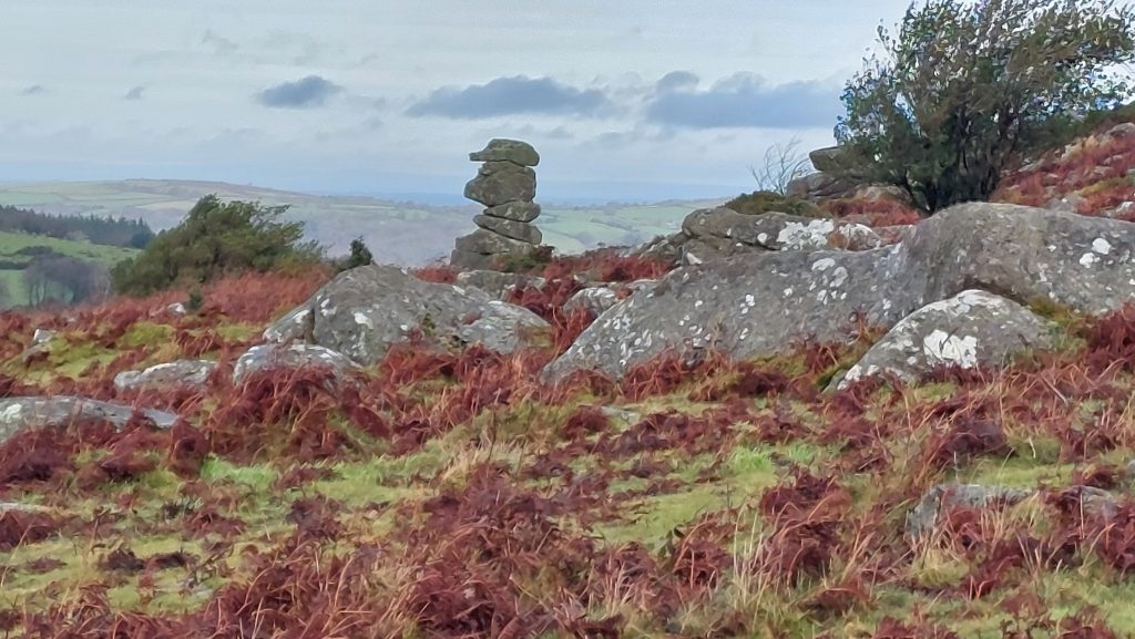
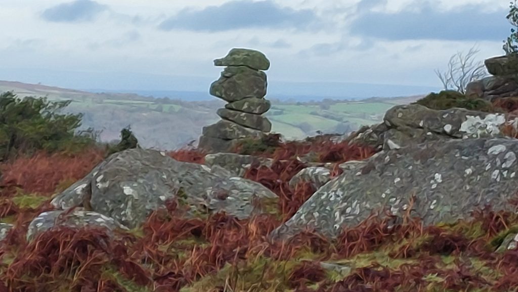
Mill Farm – was known as East Mill in the 17th century, being powered by a leat from the Hayne Brook that fed a millpond near the waterwheel. It was marked as ‘East Corn Mill’ on OS Maps from 1873 – milling ceased on the site in 1901.Modern dwelling of Sandy Meadow en-route to Hayne Down at Hayne Cross lies next to a crossroads (also called ‘Sandy Meadow’). The path turns west from this pointHayne is shown on 19th century maps as comprising an irregular shaped building to the north and a group of five or six buildings to the south. The author is unaware when the modern dwelling was built or upgradedFrom ‘Hayne’ the path leads through a small wood onto Hayne DownClimbing up to Hayne Down passing the enclosure walls of ‘Hayne’View from the path looking north towards Wingstone Farm and St. Winifred’s ChurchApproaching Hayne Rocks (south) View from Hayne Rocks (south) or Hayne Down Tor (south) towards ManatonThe Miner’s Path crosses Hayne Rocks (south) – the view is looking south towards Hound Tor and Haytor (on the horizon)Hayne Rocks (south) looking north west across Cripdon Down towards Easdon Tor and King TorBalanced rock on Hayne Down. Hound Tor is mid distanceCrossing Hayne Down – Easdon Tor on the horizon and the iconic Bowerman’s Nose making an appearanceBowerman’s Nose, said to be named after a former moorman of the locality called John Bowerman, who was buried at North Bovey in 1663 (Hemery). The ‘Dartmoor Legend’ is that a hunter named Bowerman was turned to stone after an altercation with a witch.Zooming in on Bowerman’s Nose
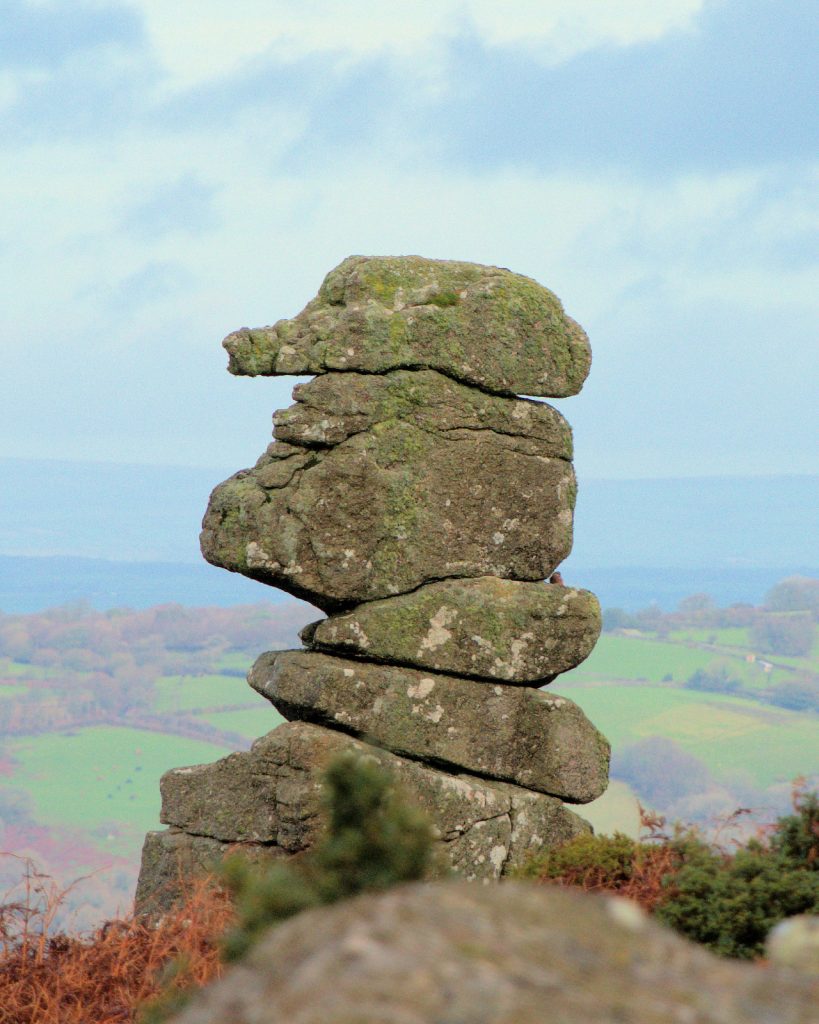
Bowerman’s Nose – full zoom (picture courtesy of Frank Collinson)
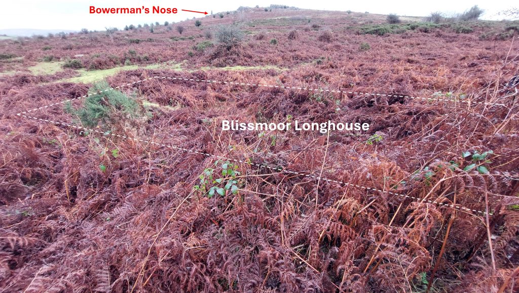
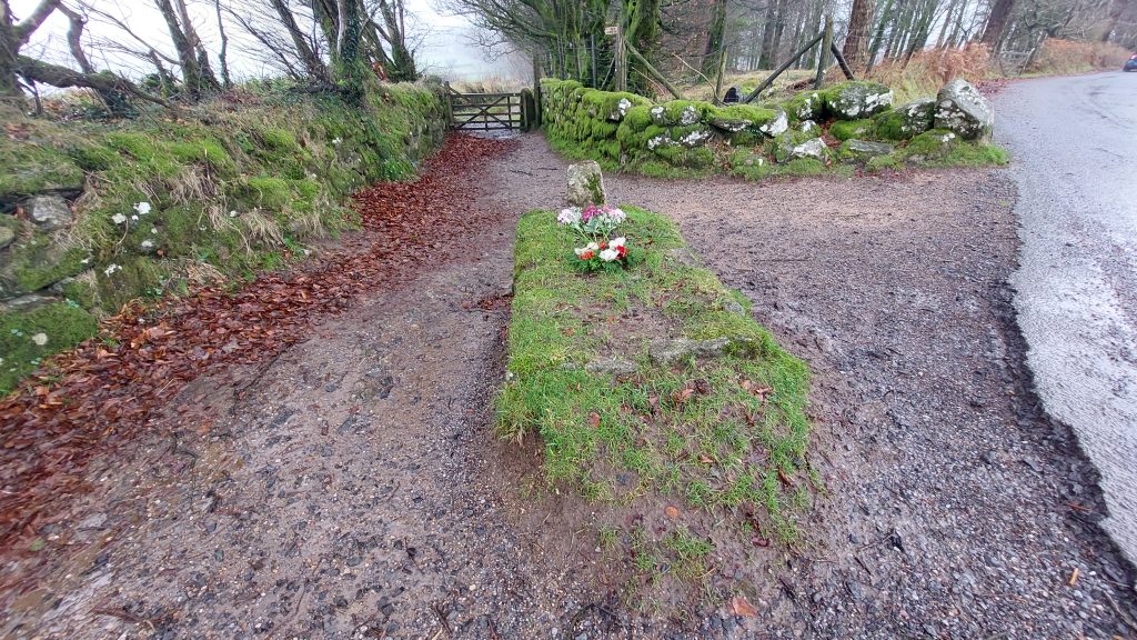
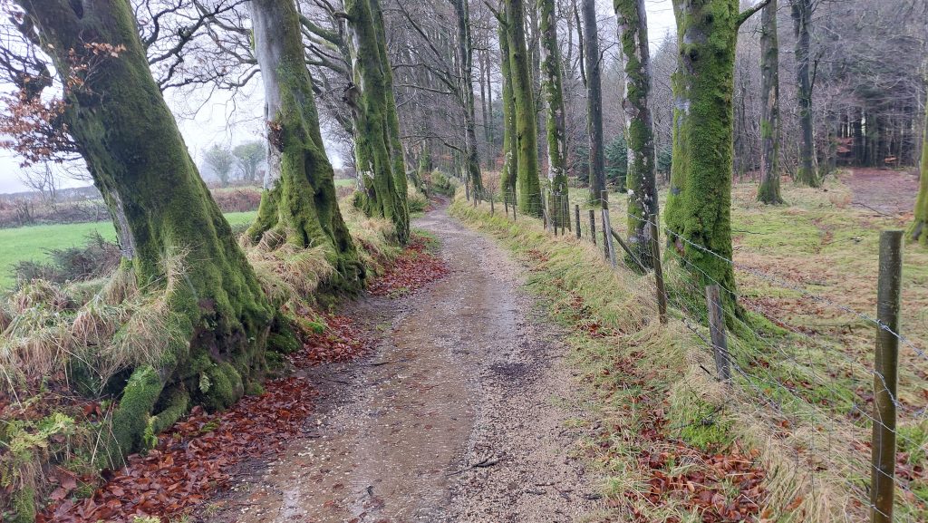
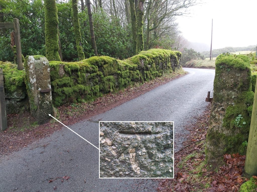
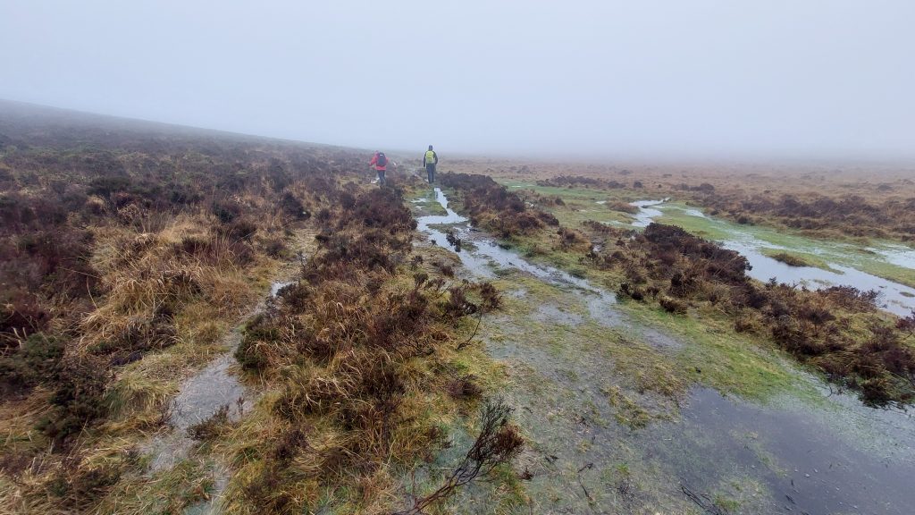
A minor (no pun intended) off the Miner’s Path, a lesser well known Longhouse near Blissmoor Farm can be found. It is located close to the Swallerton Gate to Manaton Road, a few hundred metres to the south west of the of Bowerman’s Nose. The name Blissmoor appears to have been first mentioned as ‘Blissmore’ in 1622 which post-dates the (Medieval) Longhouse. It is located at SX73728 80246Having crossed Cripdon Down (near Moorhayes), the Miner’s Path passes the well known land mark of Kitty Jay’s Grave. The author does not intend to repeat the full legend or story of Kitty Jay here but just give a short synopsis. Kitty Jay committed suicide around 200 years ago and the church would have denied her a Christian burial in consecrated ground. She therefore was buried at a cross road on the Parish Boundary and now lies at the crossways where the parishes of Widecombe and Manaton meet. There are always fresh flowers on her grave.Miner’s Path track leading west to Natsworthy Gate from Kitty Jay’s GraveNatsworthy Gate with a benchmark on the easternmost post (B.M 1254.5)
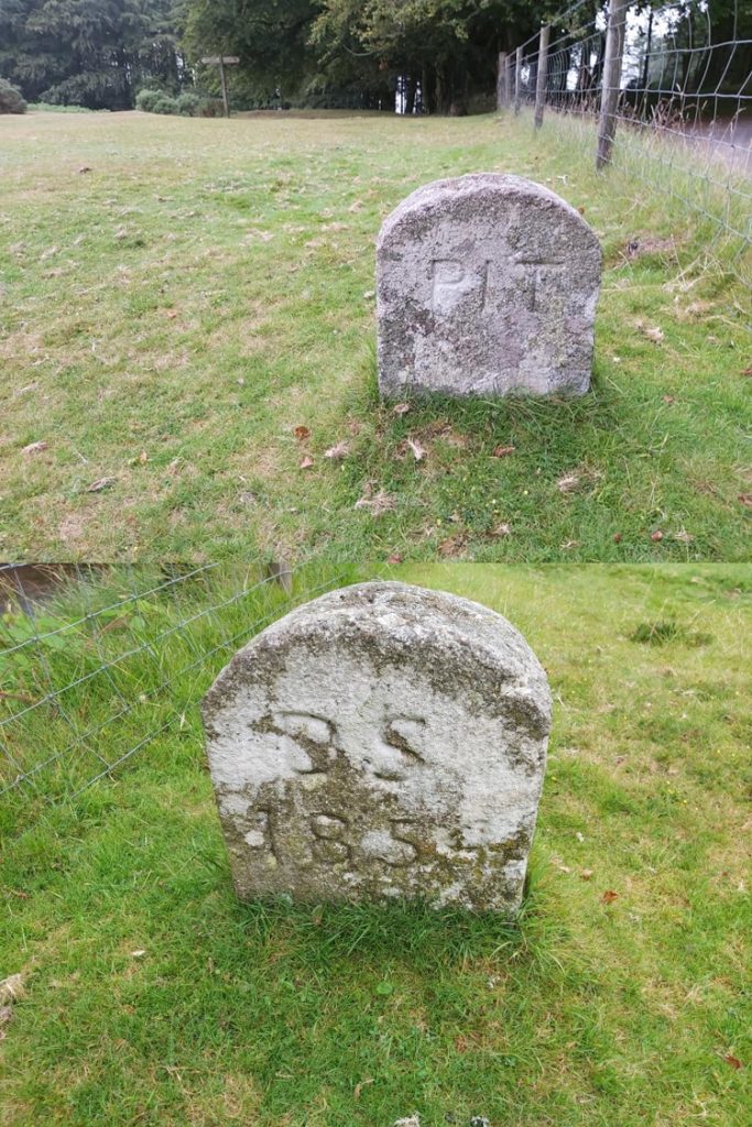
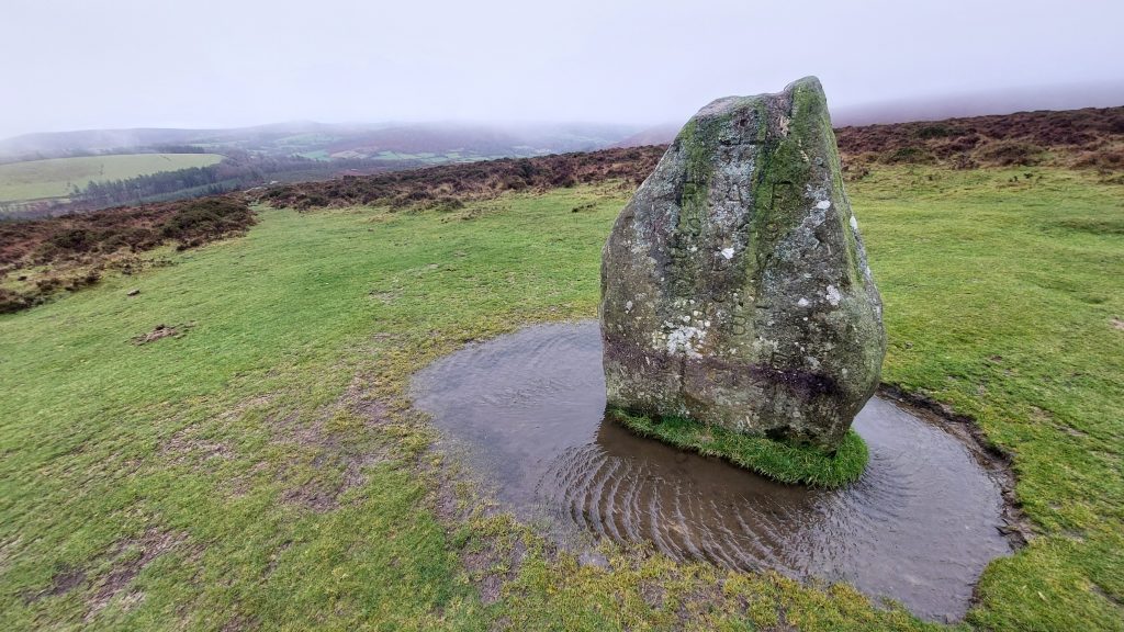
The 11th Duke of Somerset (Edward Adolphus Seymour) owned the manors of Ilsington and Natsworthy around 1853 / 1854. Just north of the Natsworthy Manor (and near the Natsworhty Gate) is this boundary marker, one of around 17 which mark the boundary. On one side it is inscribed ‘PIT’ and ‘DS 1854’ on the other side. It is typical of the Duke of Somerset’s dressed boundary markers. It is located at SX72096 80187
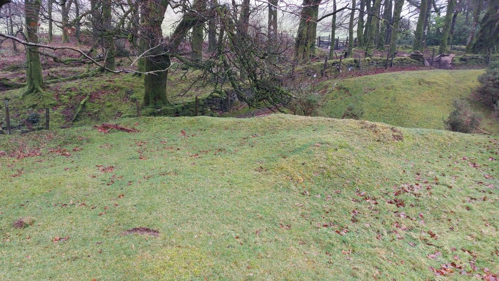
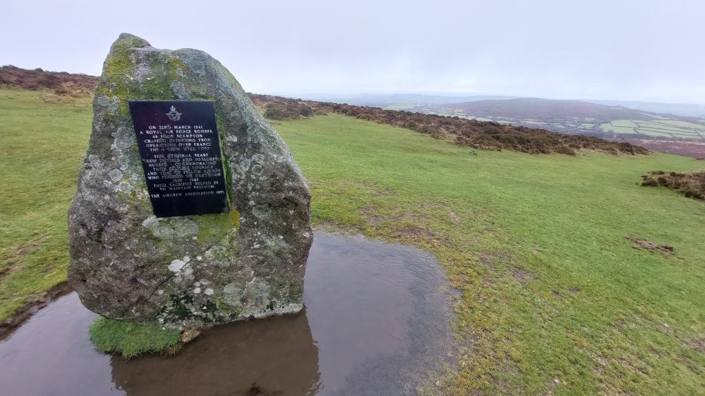
This small earthwork feature near Natsworthy Gate is located on the west side of the leat gully and is possibly the remains of a building or small tinners’ reservoir. The feature is a slightly hollowed irregular rectangle 10.5m x 5.5m internally with a 4m wide central gap between the banks on the downslope side (Ref: Dr Tom Greeves).The Miner’s Path climbs the north east flank of Hamel Down (or Hameldown). The route passes an RAF Memorial at SX71280 80693. The memorial commemorates a tragic event which started at 22:50, on 21st March 1941, when six of 49 Squadron’s (Bomber Command) Hampden bombers took off from RAF Scampton. They set course for the German naval base at Lorient, in occupied France. On their return, Hampden X3054, experienced problems with a radio that was unable to receive. The aircraft struck Hameldown and caught fire. Sgts Brames, Ellis and Lyon died on impact with Pilot Officer Wilson surviving until the following day. The inscription contains the inscribed initials of all those who sadly perished. The memorial at the site was commissioned by Lady Marjorie Cecilia Wilson, the mother of the pilot (Robert Wilson). The inscribed memorial was erected by Mr Alec Kitson (of Heatree House) and Mr Charlie Hannaford (of Natsworthy)
Having taken off on the 21st March, the Hampden X3054, must have struck Hameldown in the early hours of 22nd March. The date on a ‘modern’ plaque on the reverse of the memorial is therefore 22nd March, not 21st March as on the reverse side. The plaque reads: “ON 22ND MARCH 1941 / A ROYAL AIR FORCE BOMBER / 49 SQDN SCAMPTON / CRASHED RETURNING FROM / OPERATIONS OVER FRANCE ‘ THE 4 CREW WERE LOST” “THIS MEMORIAL BEARS / THEIR INITIALS AND SQUADRON / NUMBER – COMMEMORATING / THEIR SELFLESS COURAGE / AND THAT OF FELLOW AIRMEN ‘ WHO PERISHED ON DARTMOOR / 1939 – 1945” “THEIR SACRIFICE HELPED US / TO MAINTAIN FREEDOM.” “THE AIRCREW ASSOCIATION 1991.”
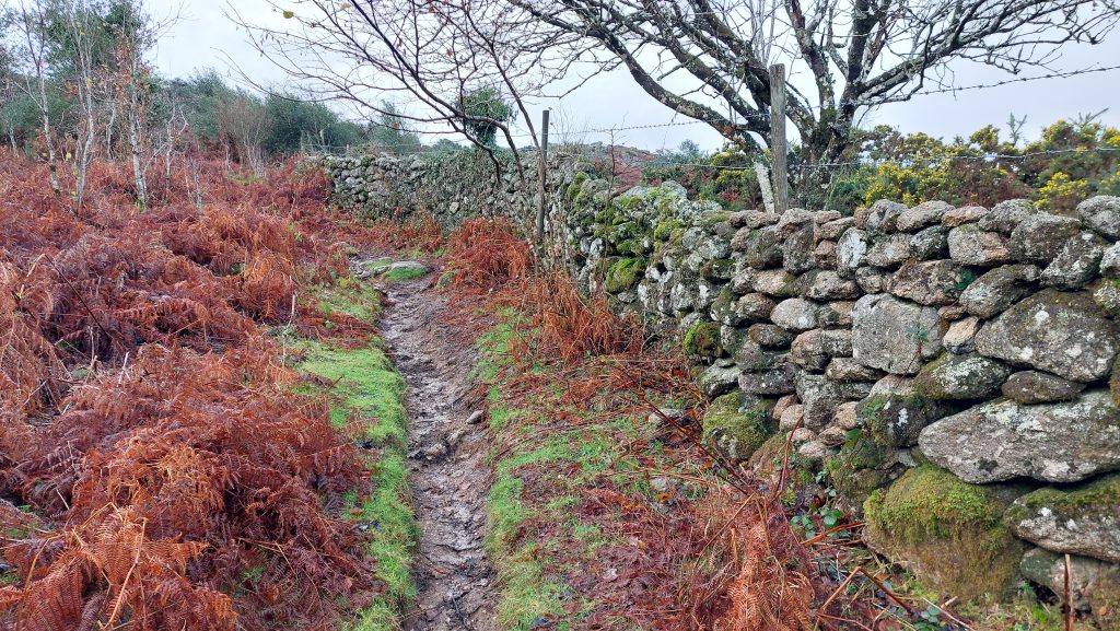
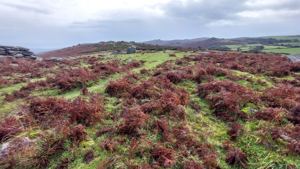
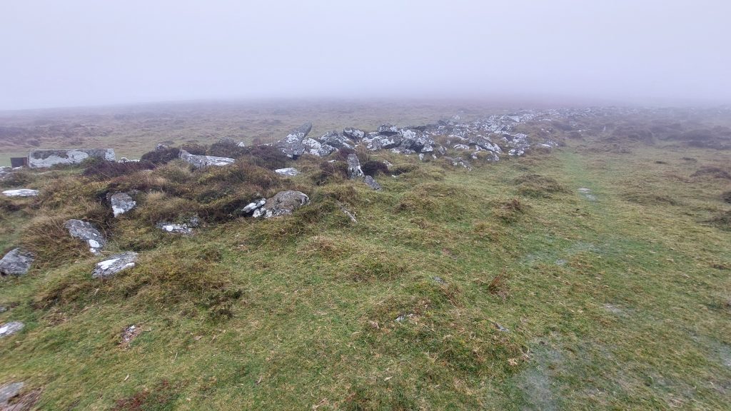
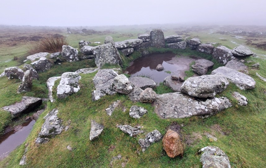
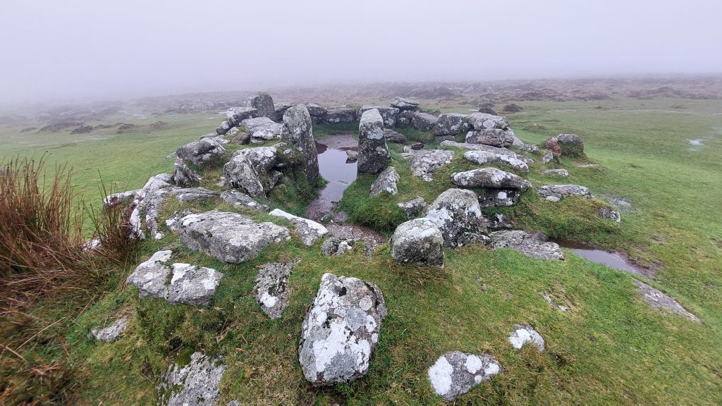
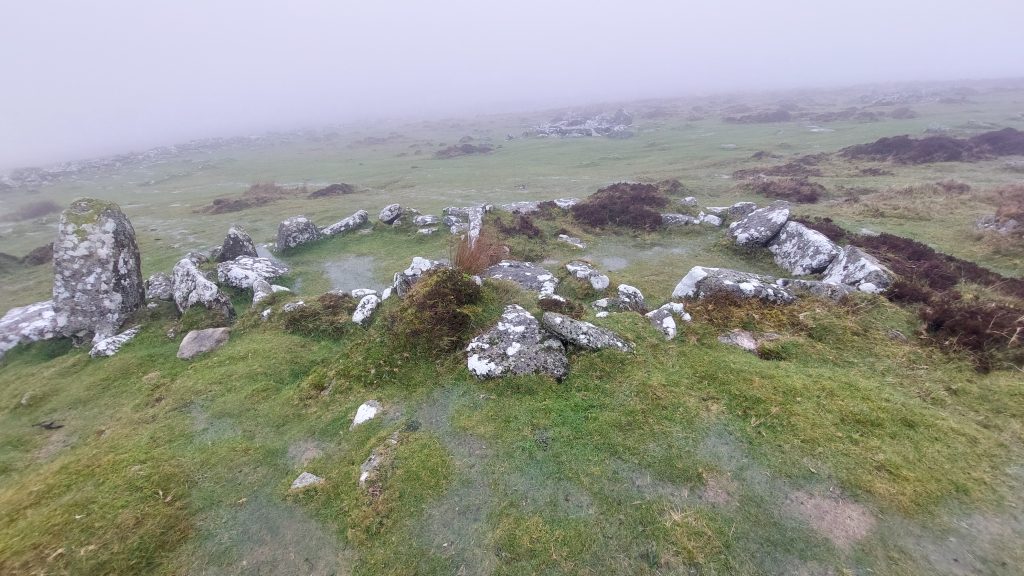
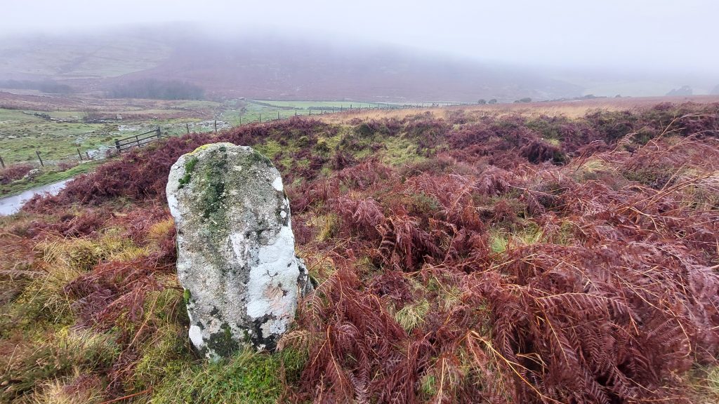
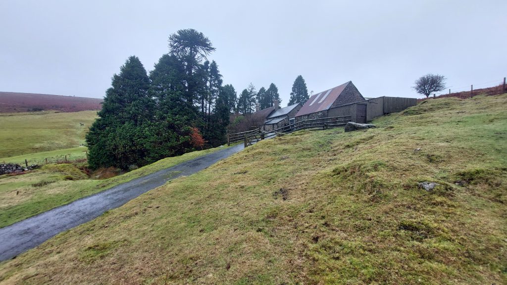
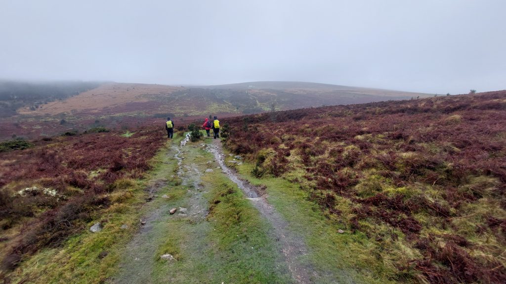
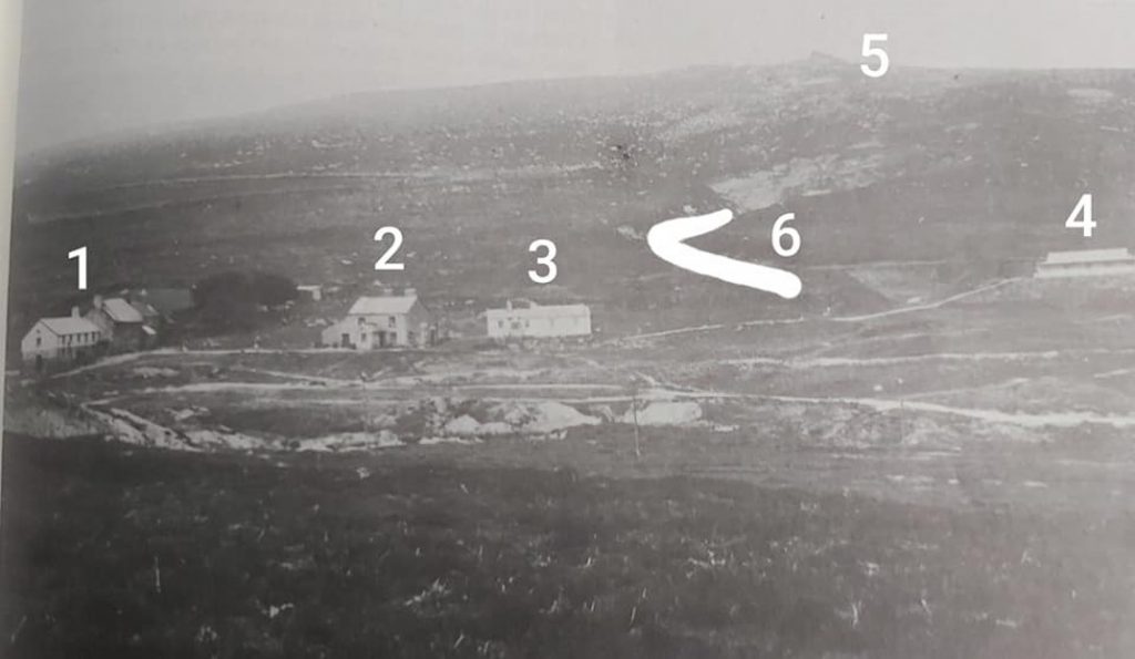
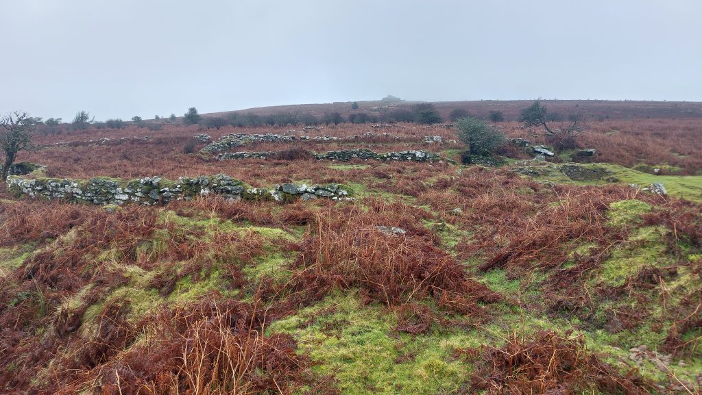
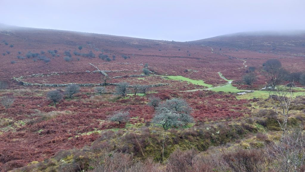
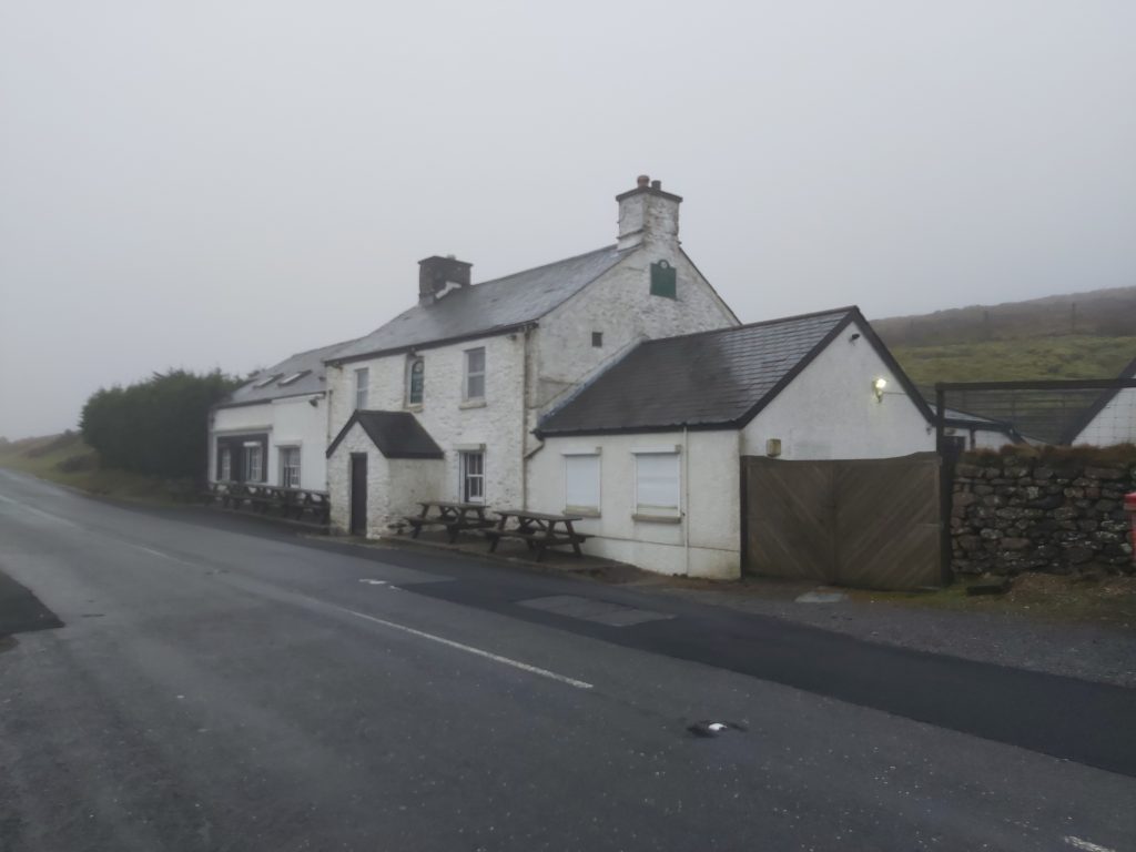
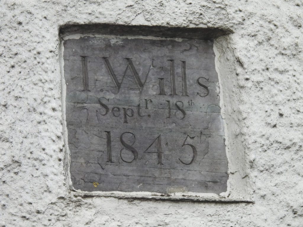
Path on the north side of Hamel Down approaching GrimspoundGrimspound walling near where William Crossing mentions “The wall of which has been broken down in two places”. Grimspound is described on the Devon Historic Environment Record as a “Prehistoric enclosed settlement with a substantial granite surrounding wall, containing 24 hut circles, as well as several ‘pens’ built into the enclosure wall” The first known plan of the site was by A. C. Shillibeer in 1829. It was famously excavated by the Dartmoor Exploration Committee (Robert Burnard, Sabine Baring-Gould et.al) in 1894-5. It is now within the guardianship area managed by Dartmoor National Park Authority.Grimspound hut – This is known as hut ‘3’ (Baring-Gould) which has a ‘hooked’ porch. The interior is around 3.3 meters in diameter with a 1.2 metre wide wall standing up to 0.9 metre high. The doorway is 1.25 meter wide and is south-facing and no doubt the hooked porch which extends east from the west side of the doorway would have protected the hut from wind.Recorded by Baring-Gould in 1894, Huts 18 and 19 are cojoined. Excavation by the Dartmoor Exploration Committee in 1894 revealed a hearth, cooking hole and two raised benches.The author has attempted to interpret the Miner’s Path route after Grimspound (suggested by Hemery), leading north of Headland Warren Farm and climbing the hill to the col between Birch Tor and Challacombe Down. The attached aerial photograph shows a path (white dotted line), which is likely to be the one described by Hemery, albeit it does not extend as far north of Headland Warren Farm as suggested in the sketch of Track 28 of ‘Walking Dartmoor’s Ancient Tracks’. As there is no historic record of any exact route, the author suggests (with due respect to Eric) that there might have been an alternative path (yellow dotted line) as it would have passed directly through or at least very close to Headland Warren Farm. Taking the (yellow dotted line) ‘alternative route’ to that considered by Hemery, this boundstone (the most southern of three stones) marking the eastern boundary of Headland Warren can be found. It is inscribed ‘WB’ and is located at SX69662 80844The house at Headland Warren Farm was originally built specifically for the warren in the late 18th century although the site itself is believed to have much earlier origins from probably the late 16th/early 17th century. It was considerably altered in the 20th century. One of the buildings at Headland Warren Farm had part of its roof re-thatched in 2020. The 19th century building doubled up as an ale house and was renamed Birch Tor Inn, for a short period, no doubt to cater for the tin miners who were working in the immediate area. The warrener at the time of Birch Tor Inn was Jan Roberts. The modern OS map shows a footpath through the farm but there are now signs up suggesting the permissive path is to the east and north.Having passed over the Birch Tor / Challacombe Down col these modern ‘Miner’s’ can be seen descending into Redwater Valley, ready to start work at Birch Tor and Vitifer Mine. On the gloomy December day this photograph was taken the Warren House Inn is still just discernible just below the dome of Water Hill on the horizonThe path here has no doubt been used by miner’s over the centuries as it connects the West Webburn valley (East Birch Tor Mine) with Redwater Brook Valley (Birch Tor and Vitifer Mine). It also passes (to the north) of the openworks at Chaw GullyThe general view of the Redwater Brook valley “mining village” complex of Birch Tor and Vitifer Mine, with all buildings intact, taken c1912. 1 = Dormitory, kitchen, canteen, mine captains house and a cottage, 2 = Mine offices, 3 = Bungalow for miners families, 4 = Managers House, 5 = Birch Tor, 6 = Garden LodesMiners bungalow at Birch Tor and Vitifier Mine. Located at SX68277 80970. More information on the mine can be found at Birch Tor and Vitifer Mine (and miners) – Dartmoor ExplorationsJan Reynold’s Ace – club (field) in Redwater Brook valley with the ruins of the miners dormitories complex (by the two trees – mid right)Exiting Redwater Brook Valley to the west enroute to a well known miner’s hostelryThe Warren House Inn was no doubt used by the miners from Birch Tor and Vitifer Mine as well as other mines in the area. It was rebuilt having starting life as the “New House Inn” on the opposite side of the road. At 1425 ft (434m) above sea level it is claimed to be the third highest inn in England (after Tan Hill Inn and Cat and Fiddle Inn). When the inn was rebuilt it was originally called the Moreton Inn. The move meant the inn moved from common land to Duchy Land, and rent was therefore due. After being called the Moreton Inn in 1845, the name was changed later in the century, based on the nearby rabbit warren to the Warren House InnThe “New House Inn” had been in a rather dilapidated state and the replacement Inn was built by John Wills around 1845. It was around this time that the story of the (peat) fire having never gone out can be attributed. Apparently, smouldering peat was brought across the road from the old inn to the new one and put in the fireplace. The slate plaque set into the eastern gable wall has a curiously very precise date on it was it is inscribed: “I. Wills Septr 18th 1845”. In that era, the letter ‘J’ (in this case for John) wasn’t used and an ‘I’ used instead.