A collection of walks, discoveries, insights and pictures of exploring Dartmoor National Park
April 25, 2021
MANGA (MANDLES) FARM – AN EXPLORATION
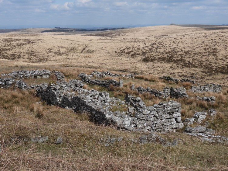
Manga Farm can be located in north eastern section of Dartmoor but still within the parish of Lydford at approx SX639 848. It lies within the Teignhead Farm newtake and both farms were built in the 19th century during the period of the agricultural enclosure movement. On 13th May 1808 a Mr Matthew Crawford and a Lt Col Richard Fleming took out a 99 year lease to build both Teignhead and Manga farms for them to be built within 10 years. The lease was for 1551 acres (reduced later to 904) and the annual rent was £58 3s 11d (about £5,300 today). The building of the was overseen by a Mr William Rogers, who was the agent for Crawford and Fleming. It is believed that the farm with its thatched roof was abandoned in the 1870’s.
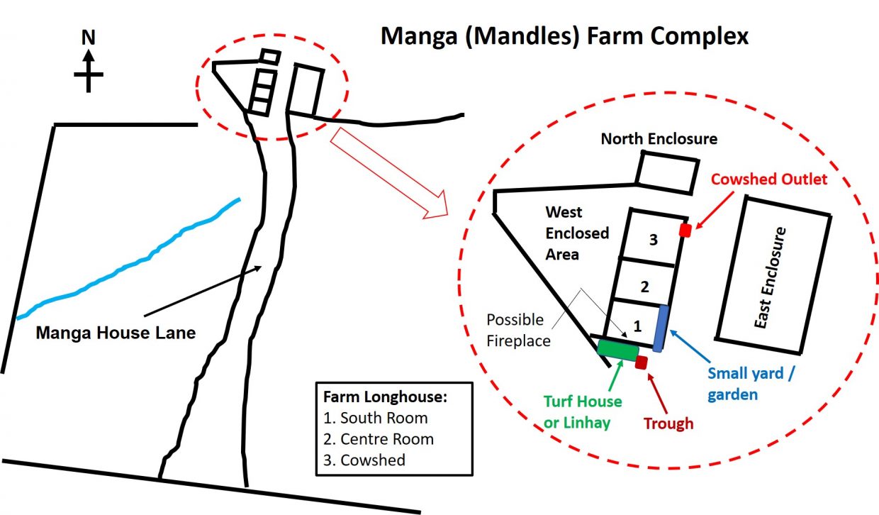
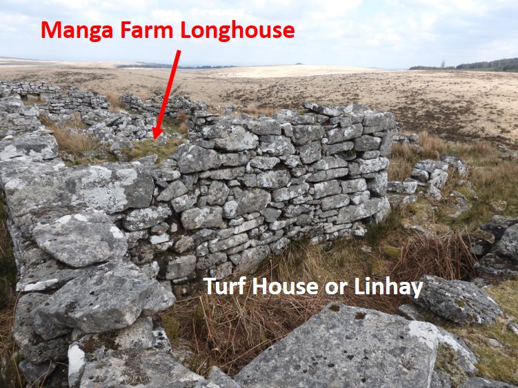
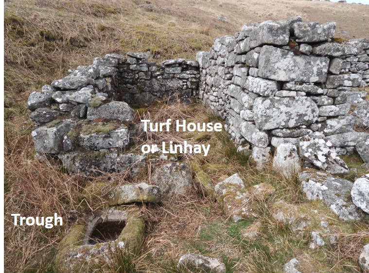
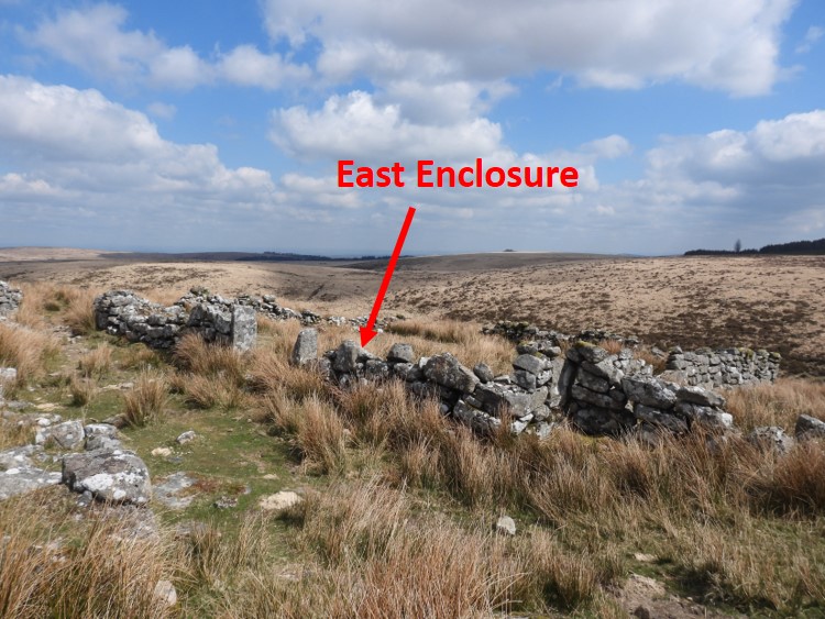
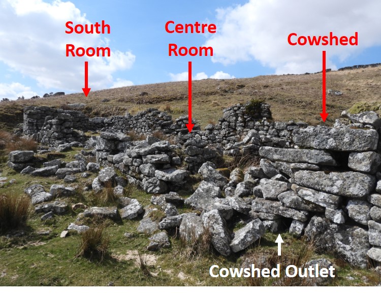
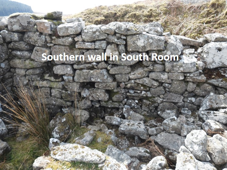
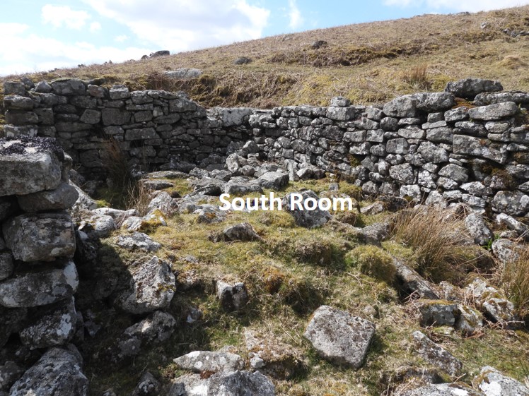
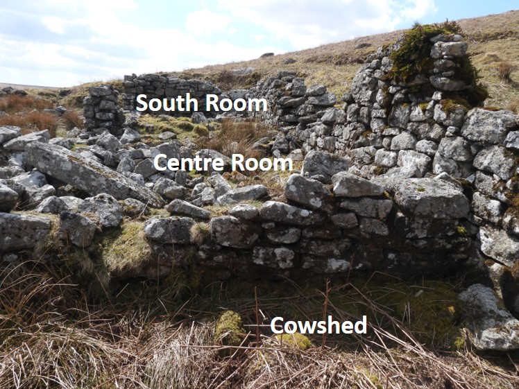
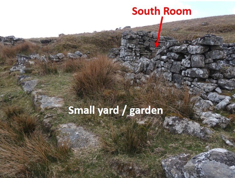
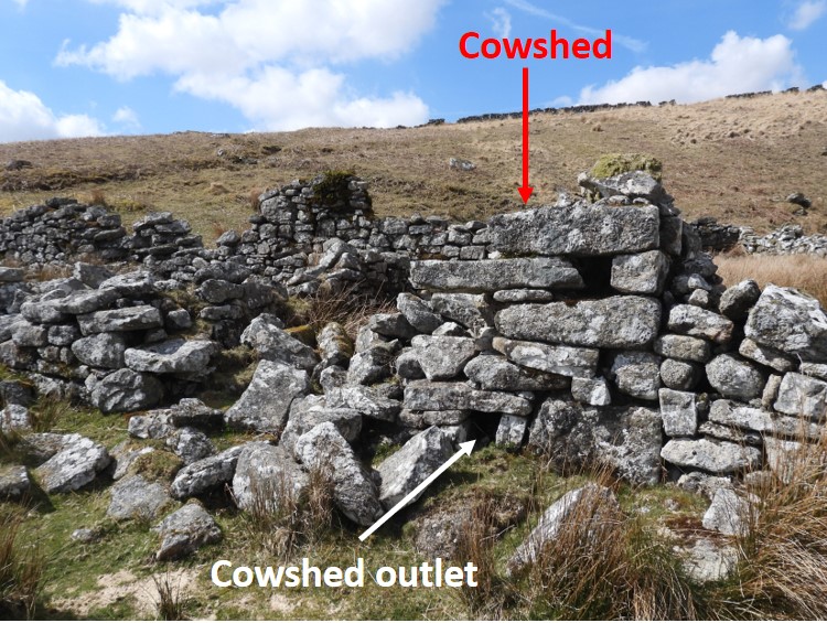
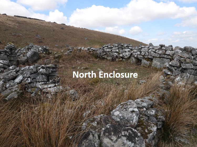
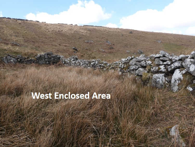
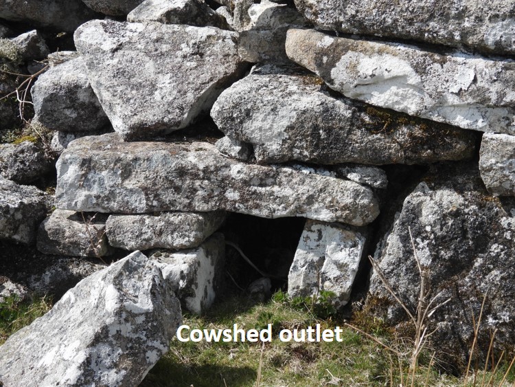
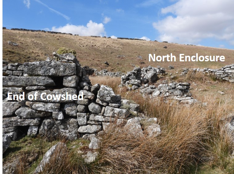
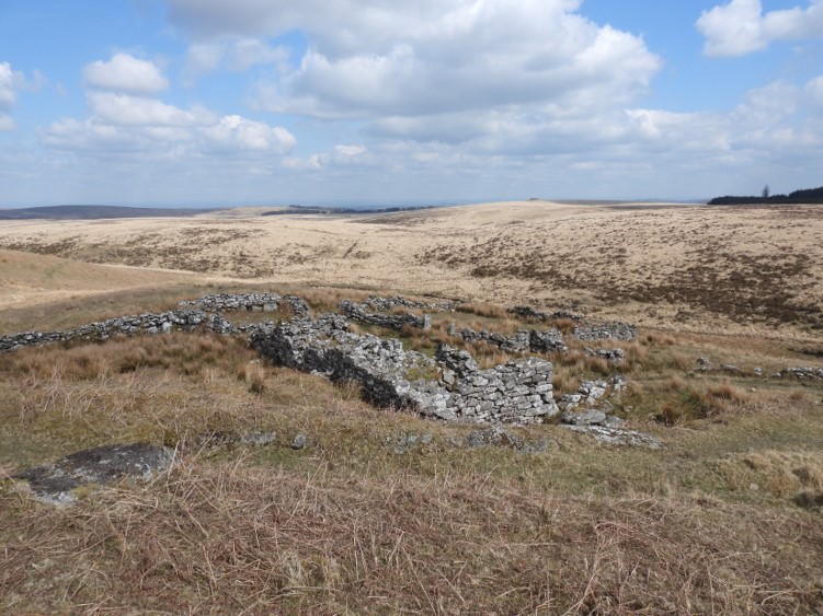
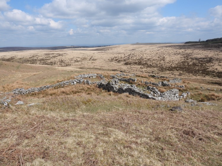
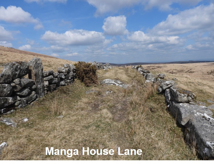
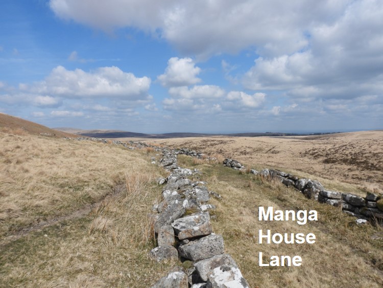
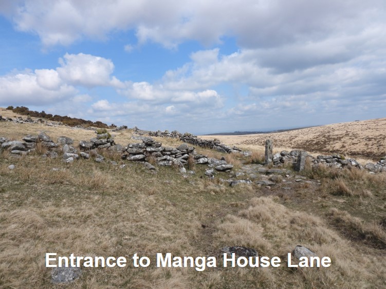
This plan is an interpretation of the site following research using the Dartmoor Magazine article (from Autumn 2002 ), the Forest Farms book by Elisabeth Stanbrook and from the Dartmoor HER. An early interpretation of the farm was from R.G.Haynes, (SDV150434) who visited the site on 14th June 1966. He described it as “A longhouse of three rooms with additions and enclosures. Mortared stone with porch and remains of two windows with sills”.A small linhay is attached to the south wall. It is referred to as a Turf House by Elisabeth Stanbrook in the Dartmoor Magazine article.Outside the Linhay / Turf House is a troughEast enclosure, one of two enclosures identified on the Dartmoor HER. Due to the locating of the cowshed outlet, is this picture showing four rooms or three ? Is there a “northern” room between the cowshed and the centre room ?In the National Monument Record from 2016, (SDV359354) it is recorded that the southern room contains the remains of a fireplace. The only wall which survives (in 2021) is on the southern wall of the south room (see picture). The Dartmoor Magazine article suggests the fireplace is in the northern wall of the south room, which seems plausible as it would have provided heat for both the south room and the centre room. However, pictures from the 2002 article show the north wall of the south room to have fallen. Are there remains of the fireplace in the rubble ?View of the south room taken approximately from the position of the dividing wall from the centre room.In the National Monument Record from 2016 (SDV359354) a small yard or garden is described which abuts the south-east corner of the main building. This small area seems plausibly to be the small yard / garden as describedF.H. Starkey (1978-1981) states : “Farmhouse circa 12 metres by 4 metres with three rooms”. The south room is suggested by some as the kitchen and the centre room being the main living area and where the entrance was on the east side. In the Dartmoor Magazine article, it suggests that the northern most room was a bedroom. Confusingly, the Dartmoor Magazine article also states there was a cowshed to the north with a drainage channel which can still be seen. So, if this is the case there would have been “four” rooms / cells, namely; south room (kitchen), centre room (living area), north room (bedroom) and cowshed. The confusion is that the Dartmoor HER only refers to three rooms.Another view of the small yard / garden on the south-east corner of the building, next to the south roomAs mentioned in the Dartmoor Magazine, there was a cowshed outlet, which can clearly be located today. Is the cowshed really a fourth room or is it the northern most of three rooms mentioned by the Dartmoor HER ?The north enclosure, which is adjacent to the cow shedThe west enclosed area, showing the slopes of Manga Hill behind. Access to this enclosure is between the north enclosure and the cow shed.Close up of the cowshed outlet.The access point to the west enclosed area is between the end of the cow shed and the north enclosure. Some walling running north-south can be seen beyond on the slopes of Manga Hill.General view of the Farm from the south west. The valley of the Teign is in the foreground, the edge of Fernworthy forest can be seen (top right) and very top of Kes Tor is just about discernible on the horizon.S.A. J. Probert visited the site on 9th April 1990, (SDV269516) and stated that it was centred at SX63918486. It was stated in the report that “it lies on a slight shelf on the steep east facing slope of Manga Hill. The remains comprise a 3-roomed dwelling and two small enclosures. Positioned along the slope the structure measures 14 metres north to south by 3.8 metres internally with boulder walls 0.6 metres thick and up to 2 metres high”.William Crossing sited the farm (which he called Mandles) on Great Varracombe. In the Dartmoor HER, F.H. Starkey states this is in error – but is this the case ? On the original lease map the farm was built on was then known as Great Varracombe (not Manga Hill as it is today). Little Varracome was on land to the south. Early (pre-1829) records suggest the farm was called Varracombe. Of course, today Great and Little Varracombe’s are attributed to brooks only and not to tracts of land. Was the farm renamed due to its proximity to other things “Manga” (ie brook, falls, hole and rock) ?Access to the farm was via a track from Teignhead clapper. Manga House Lane with the North Teign valley visible to the right (east)A gatepost marks the entrance to the lane leading up to the farm. At this point the explorer is approx a quarter distant from Manga Farm to Teignhead Farm.