A collection of walks, discoveries, insights and pictures of exploring Dartmoor National Park
October 4, 2025
Longhouse, Bronze Age Antiquities and Reaves on Peek Hill
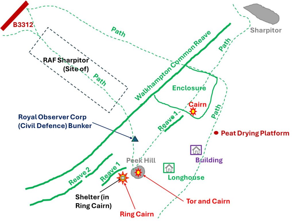
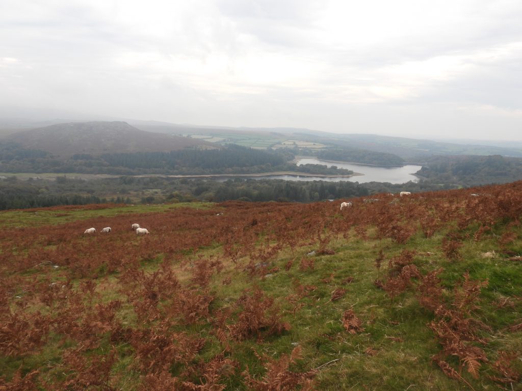
The area included in this post comprises a length of the Walkhampton Common Reave between Sharpitor and Peek Hill plus two further parallel reaves near the tor at Peek Hill. The area also includes prehistoric (Bronze Age) antiquities; a tor cairn and ring cairn. There is also a Medieval settlement with a Longhouse and outbuilding, a historic enclosure, a Royal Observer Corp bunker and a peat drying platform to add to an eclectic mix of artefacts situated on the upper slopes of Peek Hill where there are sweeping views of West Devon down to the city of Plymouth.
Jeremy Butler (1994) – Dartmoor Atlas of Antiquities: Volume Three – The South-West, 40, Map 45
M.J. Fletcher (2007-2008) – Walkhampton Premier Archaeological Landscape; Field Investigation Project (Report – Survey). SDV359195.
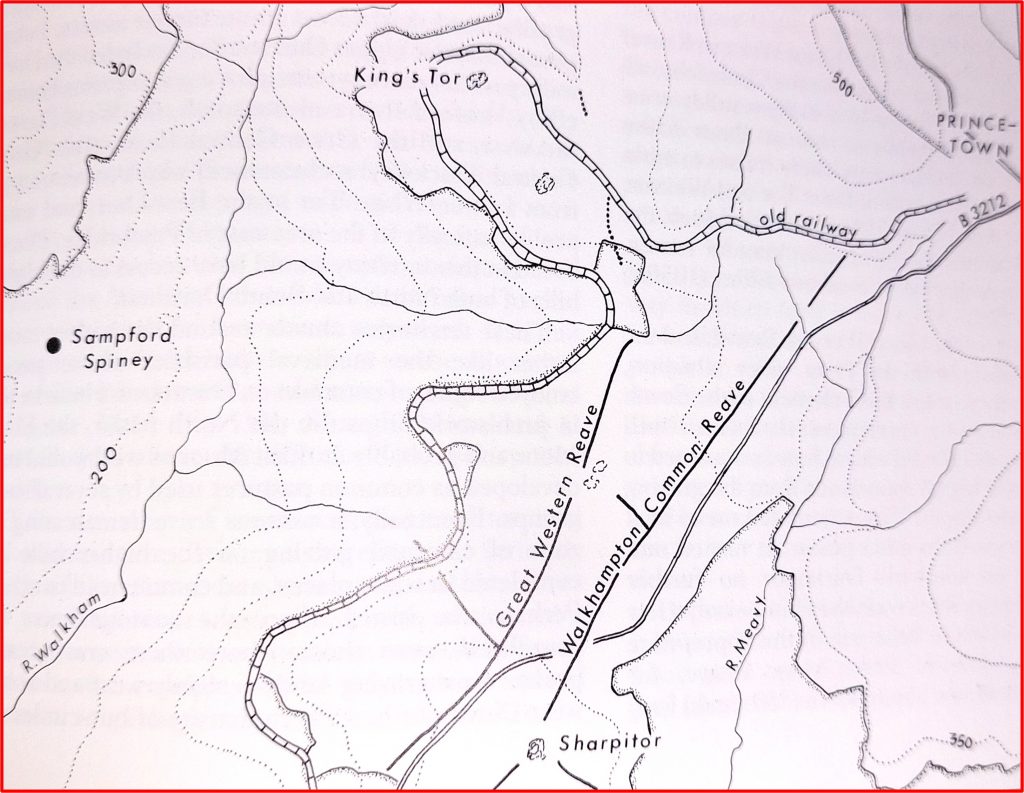
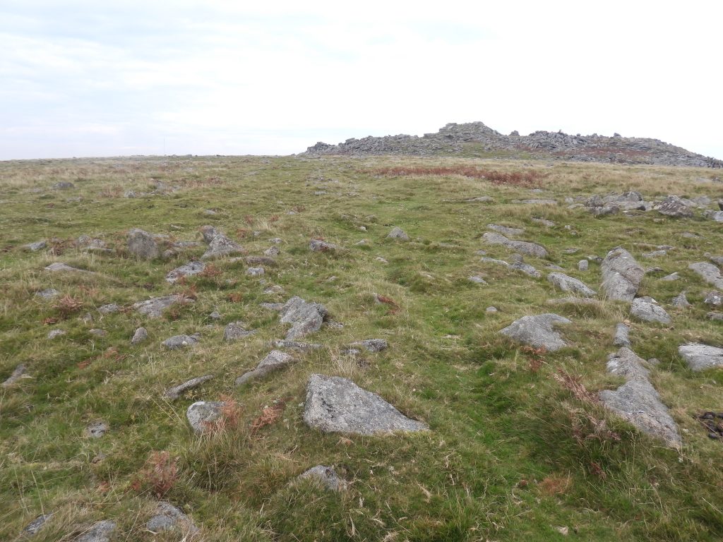
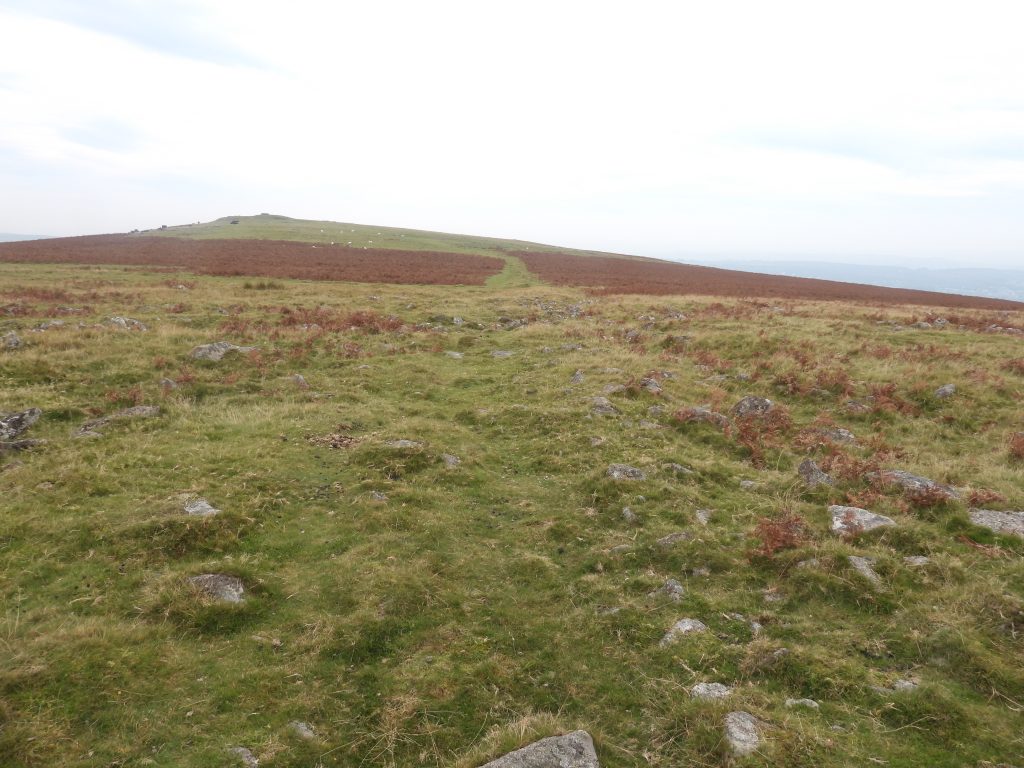
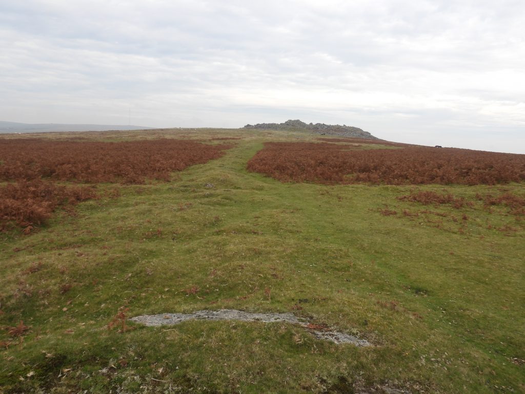
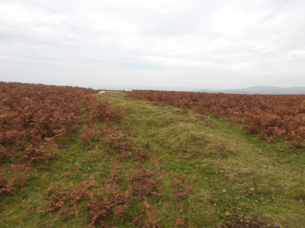
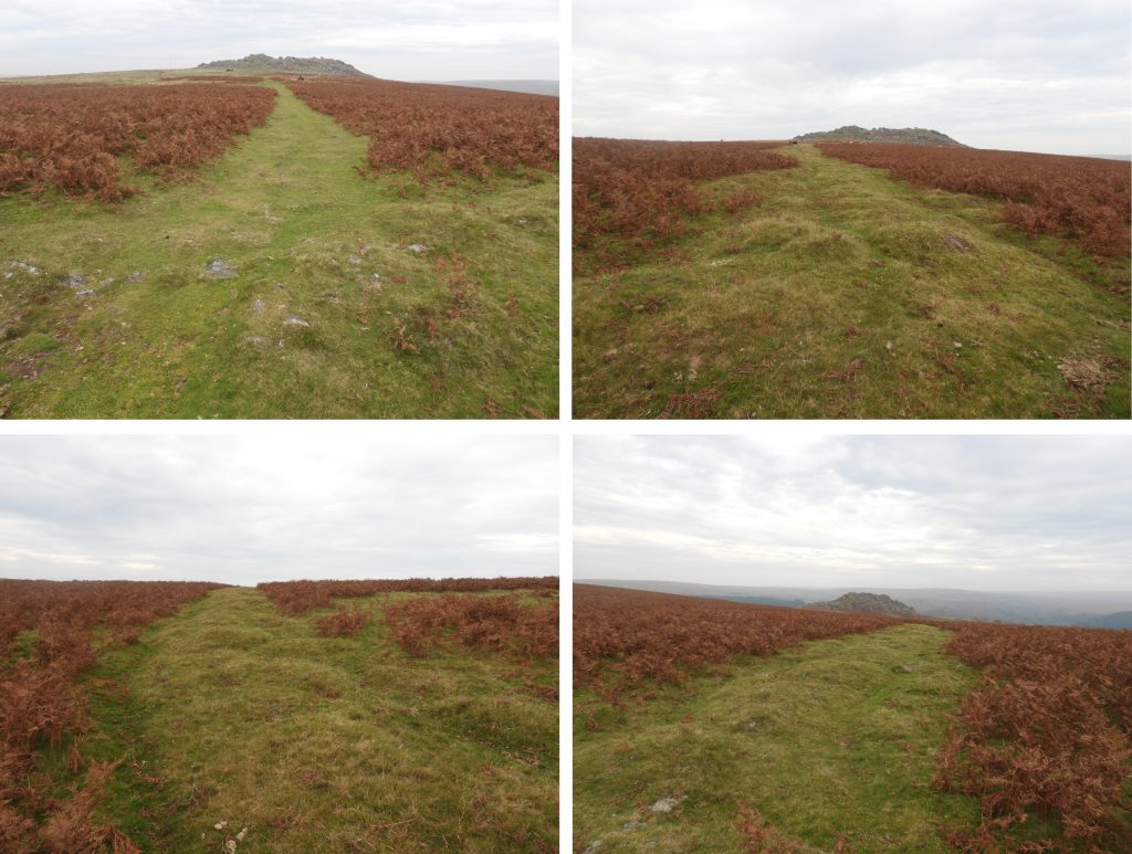
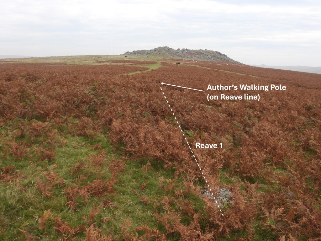
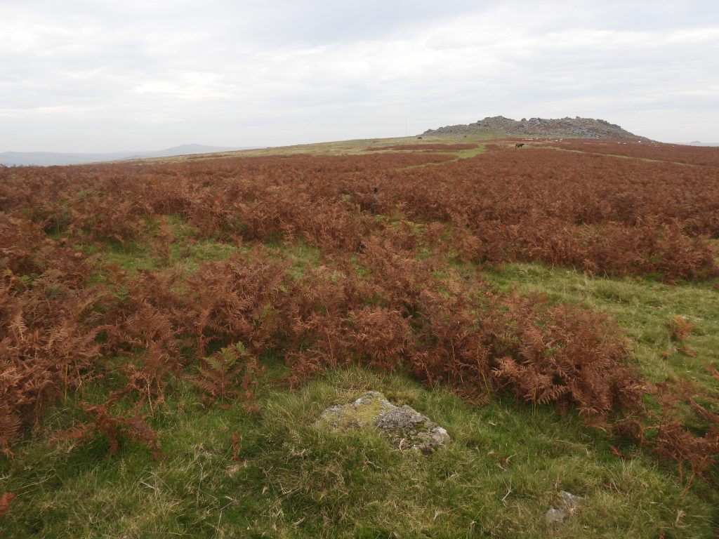
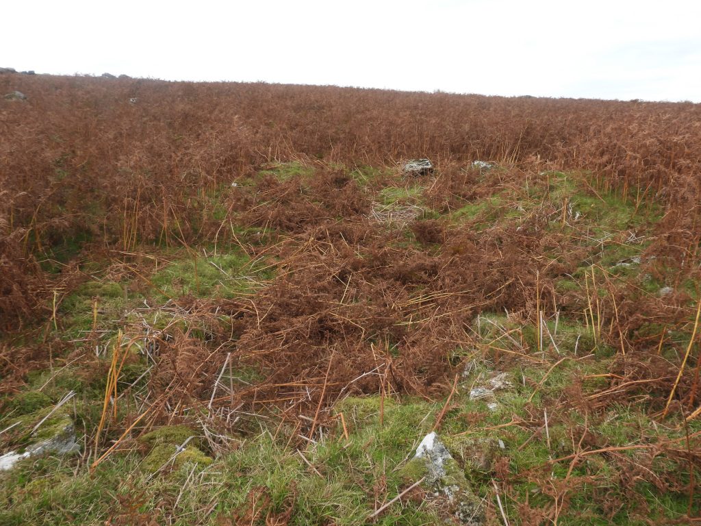
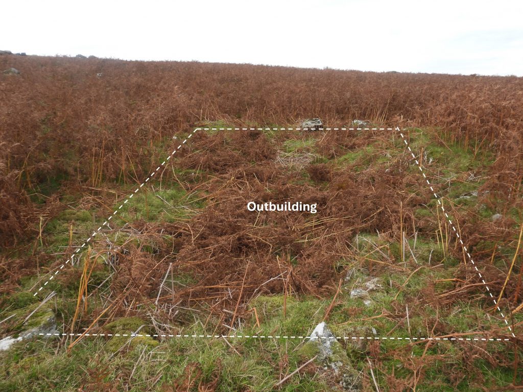
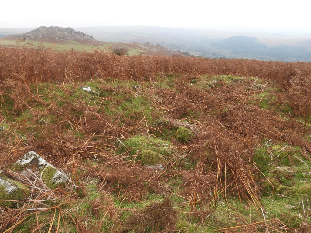
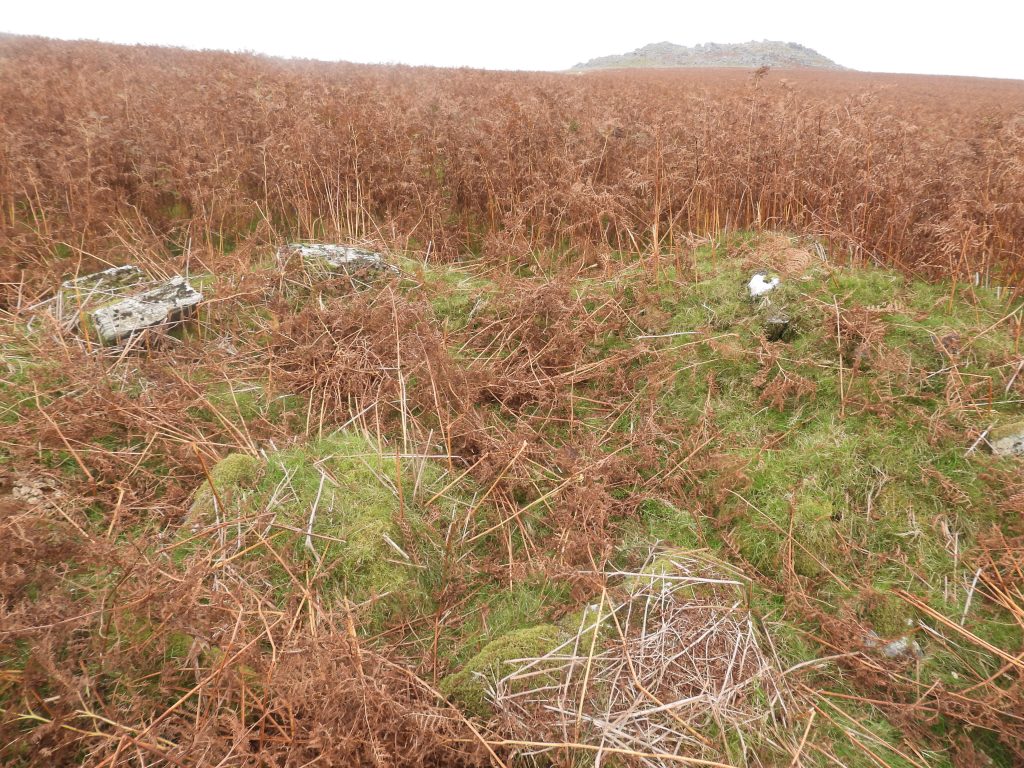
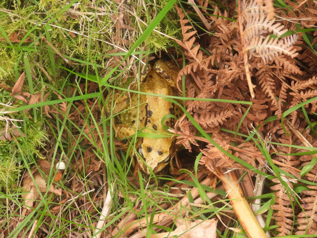
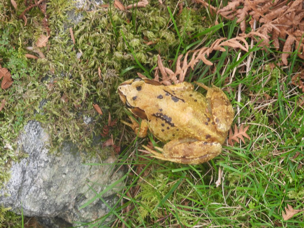
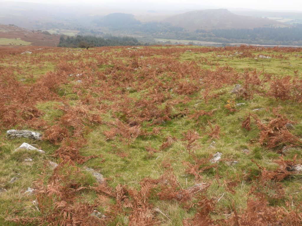
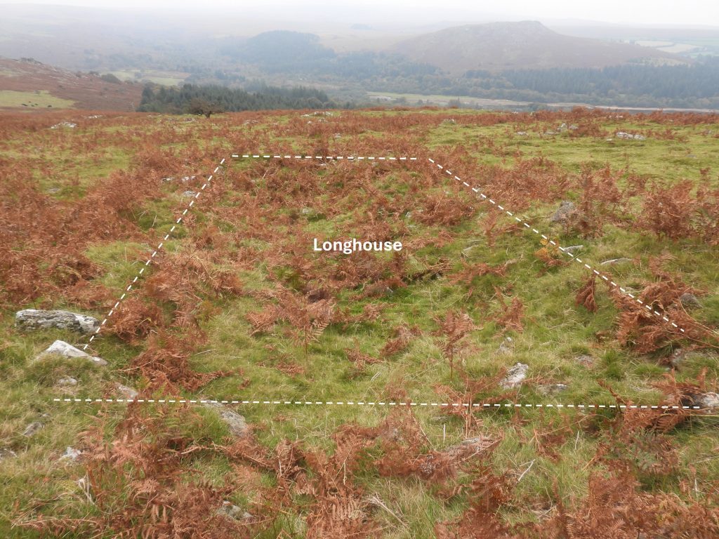
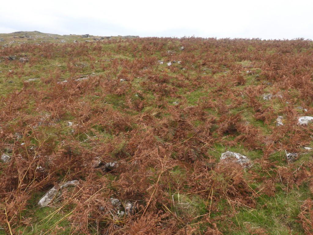
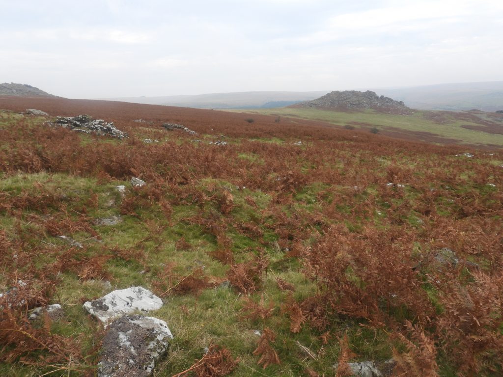
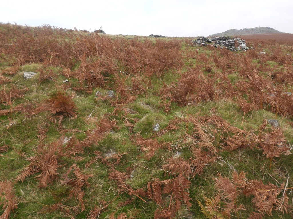
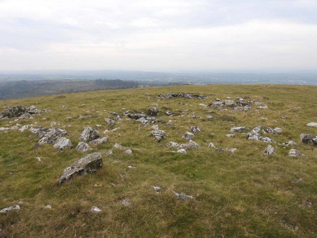
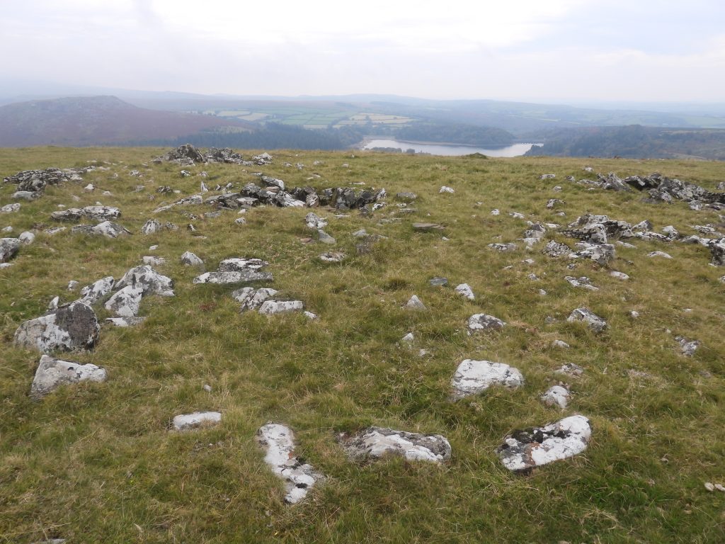
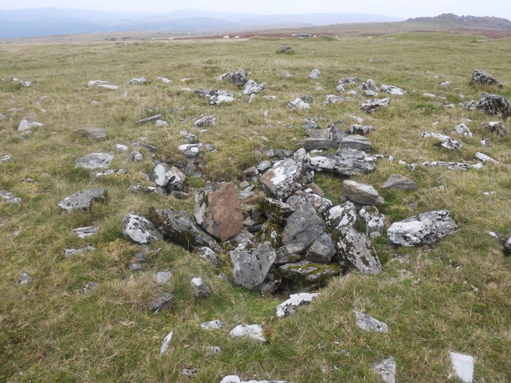
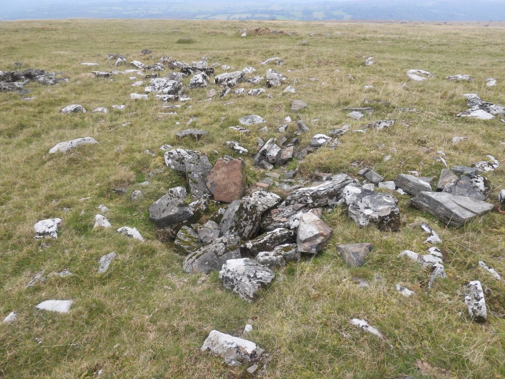
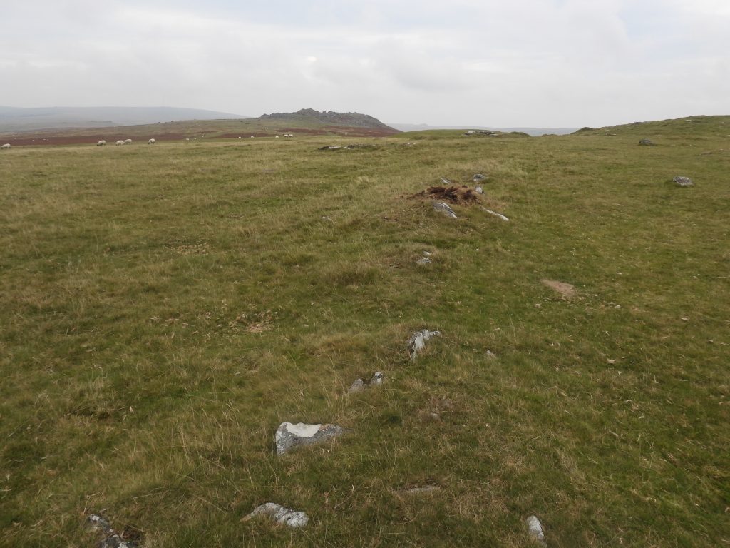
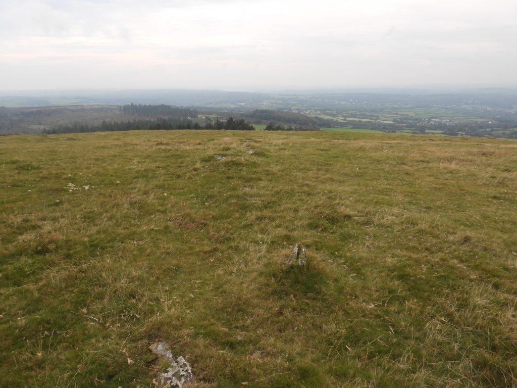
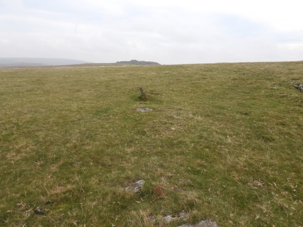
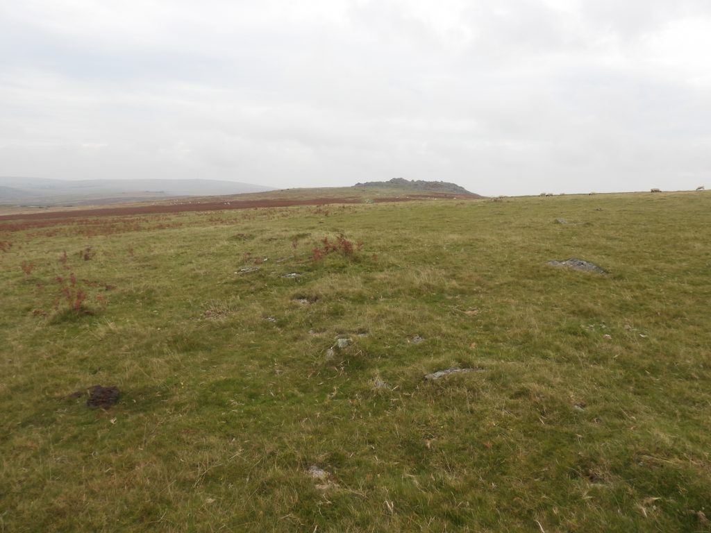
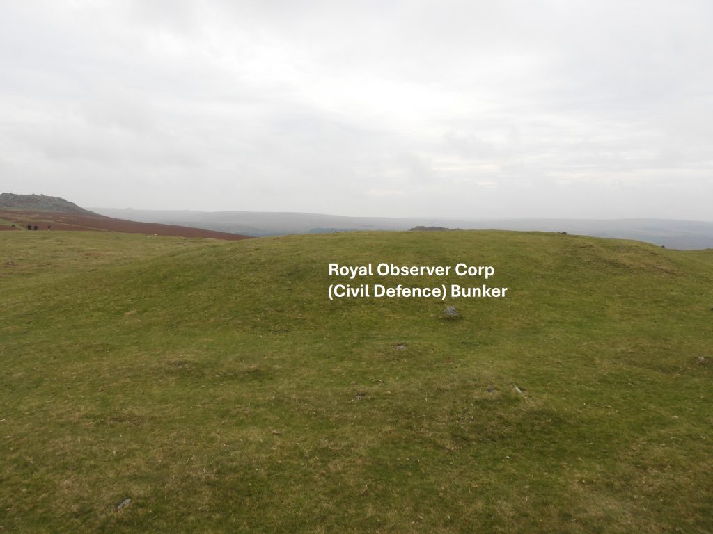
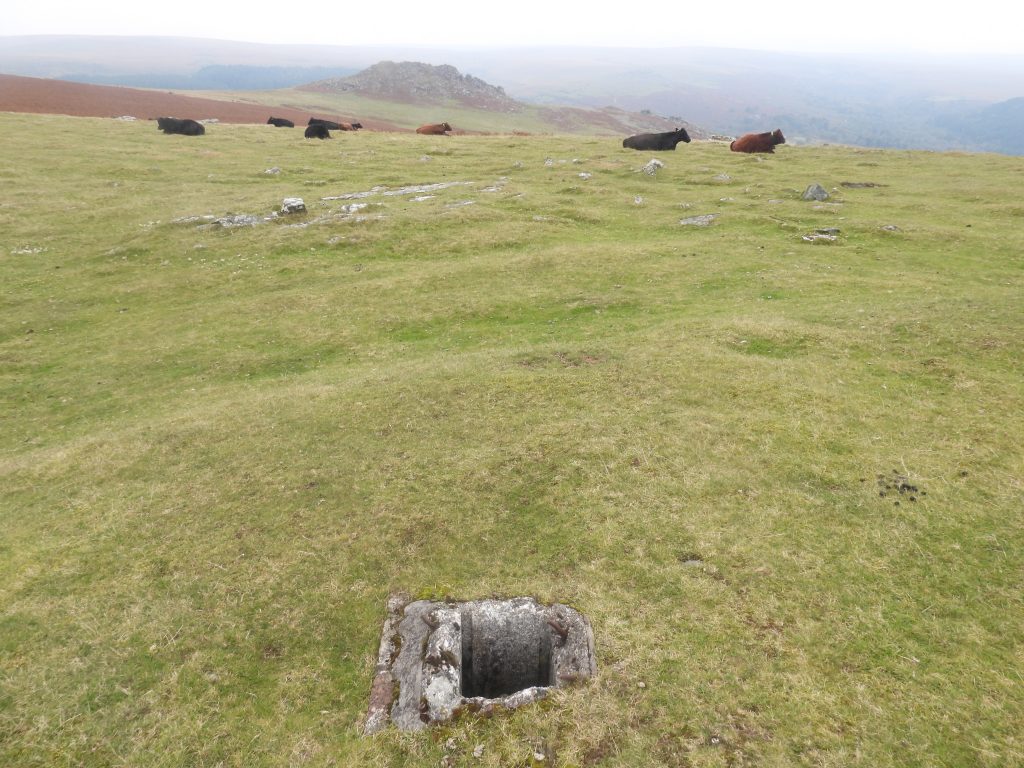
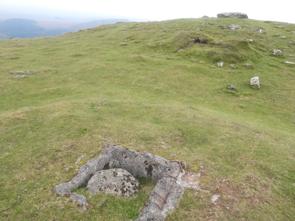
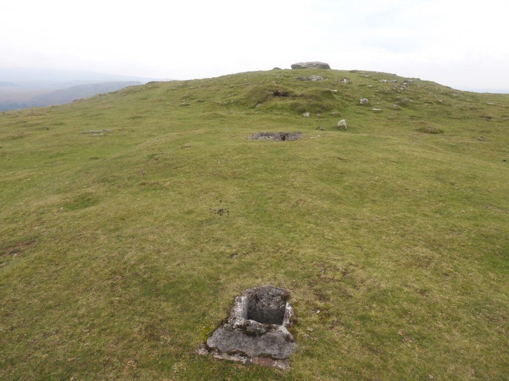
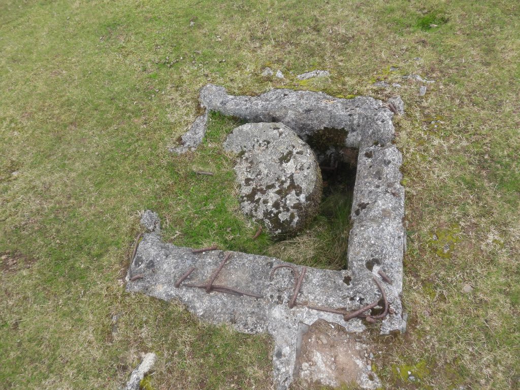
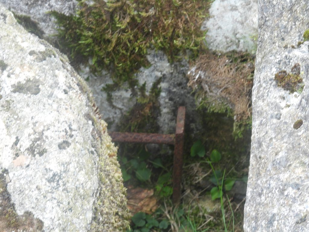
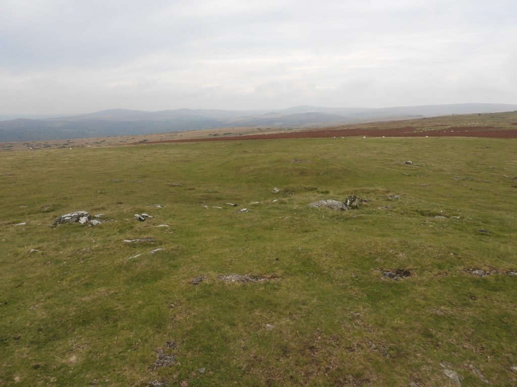
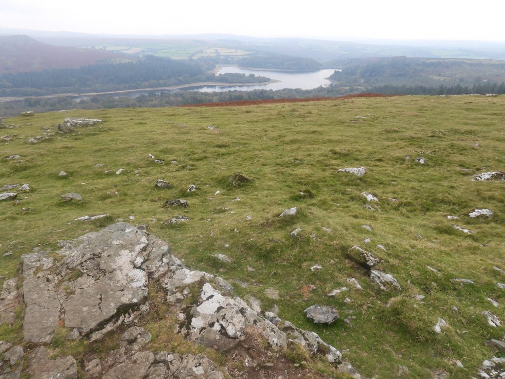
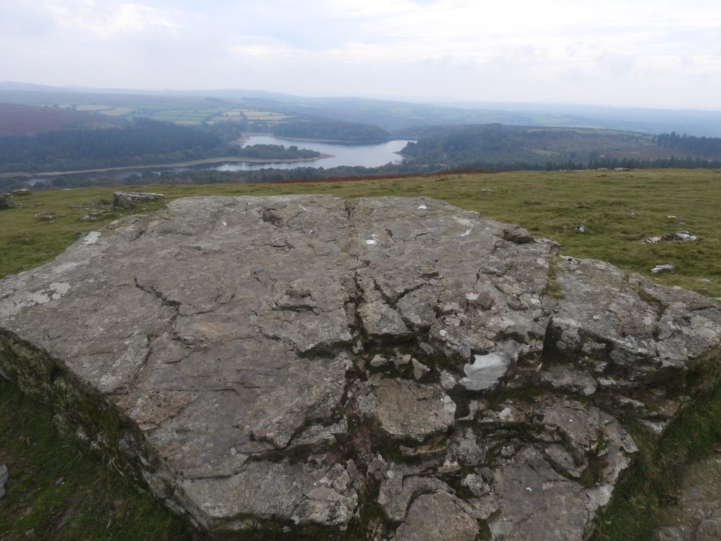
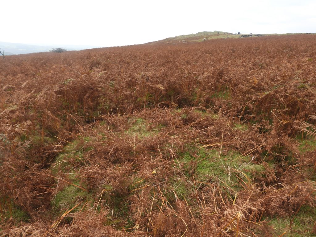
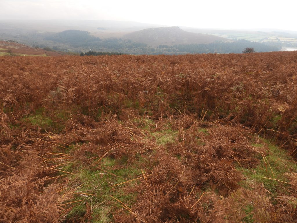
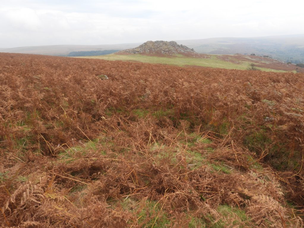
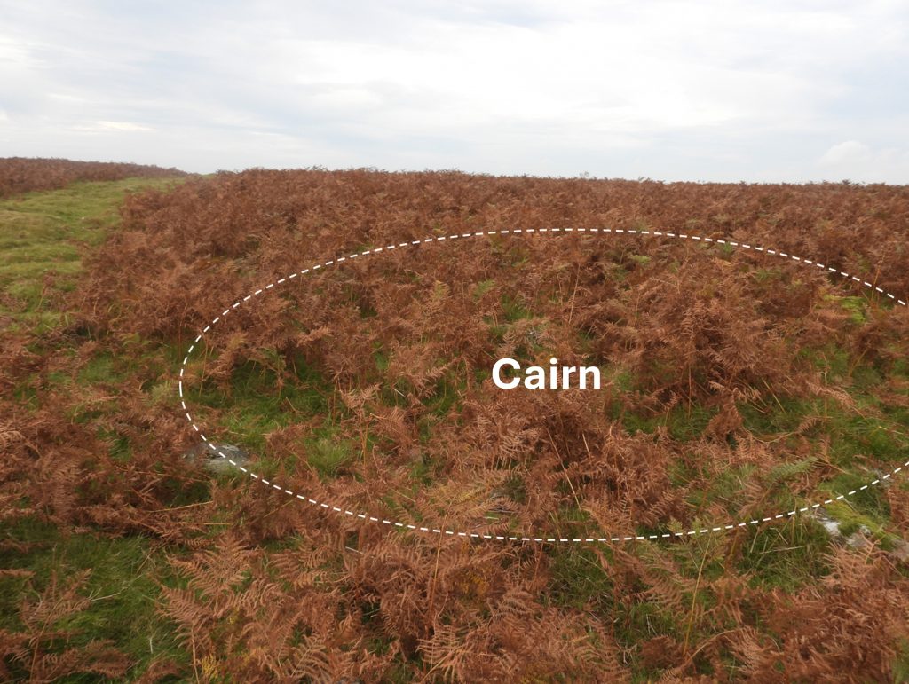
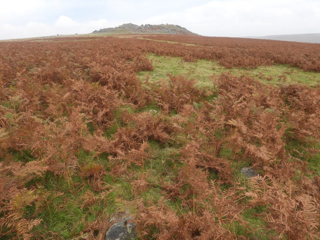
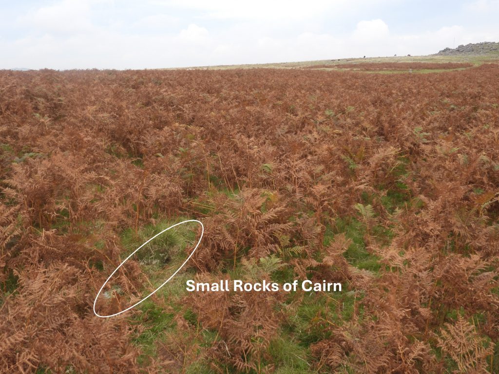
Sketch map of the area covered in this postThe Bronze Age Walkhampton Common Reave runs from just west of Princetown by the old railway, crosses the B3312 below Sharpitor before climbing the lower slopes of the tor before passing over Peek Hill, where it is referenced in this post. The total distance of the reave is just over 3kmThe Walkhampton Common Reave to the south west of Sharpitor. It (re) starts from around SX5588 7031, in the clitter at SharpitorFrom Sharpitor, the Walkhampton Common Reave extends for over 500 metres to the south-west to around SX5538 6992 on the western slopes of Peek HillWalkhampton Common Reave separates the Meavy and Walkham Valleys with a remarkably straight central section, overgrown by peat. In 1976, Andrew Fleming had a breakthrough in his research and records this in his ‘Dartmoor Reaves’ book (Chapter 4). He reveals that the reaves in the southern moor showed them “to be based on ‘territories’ based on river valleys, with each territory having a large parallel reave system (a zone of enclosed land) and a grazing zone, separated from its neighbour by a watershed reave and from the high moors by a contour reave”The Walkhampton Common Reave mainly comprises a turf-covered bank of small stones, averaging 2.5 metres wide and 0.3 metres high. It fades considerably at an enclosure before continuing west of Peek Hill where it runs parallel to other reaves (labelled Reave 1 and Reave 2 on the sketch map in this post)To the south-east of and abutting the Walkhampton Common Reave is an rectilinear enclosure. It is centred at around SX5577 7014 on a slight southeast slope of the Sharpitor to Peek Hill ridge are the remains of a rectilinear enclosure, and is just under 2 hectares in size. The enclosure is thought to have been constructed later than the reave but the presence of the ditch does suggest an historic date.The enclosure comprises a turf covered bank of small stones, between 1.8 metres and 2.3 metres wide and from 0.2 metres to 0.4 metres high (ref: OS Archaeology Division). Inside the enclosure, near the south-east corner, is a circular patch of stones, thought to be a cairn, possibly the result of stone clearance. This is covered towards the end of this post. There are three reaves between Sharpitor to Peek Hill. These are labelled as Walkhampton Common Reave, Reave 1 and Reave 2 on the sketch map in this post. It is suggested (Fleming) that they may link with other reave systems (for example Lowery Cross Reave). Reave 1 is covered in bracken but can still be found north east and north west of Peek Hill. The north east section shown above is around 40m long and runs just SW of the enclosure shown in this postIn the foreground is a stone from Reave 1This ruined Building near the Enclosure is probably an outhouse to the Longhouse, both of which formed a Medieval settlement. It measures 8.5 metres by 3.8 metres internally with similar walling 1.0 metre wide and 0.7 metres high. The building has a doorway in the south-west wallAnnotated outline – The Building (or Outbuilding to the Longhouse) is best visited in the winter as it is covered in bracken in the summer. The author had to clear the area for this picture (late September).The Building measures 8.5 metres by 3.8 metres internally with similar walling 1.0 metre wide and 0.7 metres high (ref: Ordnance Survey Archaeology Division). It is centred at SX55792 69997There is an outshut attached to the north-east side of the building, which measures 2 m by 1.1 mOnto the Longhouse, where this Common Frog (Rana Temporaria) appeared to be the latest tenantClose up of the frogPeek Hill LonghouseAnnotated outline – The Longhouse (as with its associated Outbuilding) is best visited in the winter as it is covered in bracken in the summer. The author had to clear the area for this picture (late September).The Longhouse and the outbuilding (or outhouse) are considered to be the remains of a medieval settlement on Peek Hill. The OS Archaeology Division record is as being “set at right angles to a fairly steep south slope into which the north end is cut to a depth of 0.5 metres. The house has rounded corners and a centrally placed entrance in the east side”. The Longhouse has been recorded as measuring 13 m by 4m internally, with walling of small undressed stones 1 m wide and 0.6 m high. It is located at SX55729 69956Longhouse entrance in the western wallView from the LonghouseThis Ring Cairn to the west of Peek Hill has been extensively robbed. It is located at SX55619 69936OS Archaeology Division description : “It measures 18 metres in diameter, is generally 0.4 metres high and is constructed of small stones. The remains of a probable concentric inner ring of slabs, about 10 metres in diameter, rise a further 0.2 metres above the general level of the cairn”.In the centre of the Ring Cairn is a small pit. It is marked as a Shelter on the sketch map of this post as Sandy Gerrard in the 1990’s. It measures around 2 m by 2 m and is clearly a relatively modern constructionAn interesting observation (Fletcher) suggests the Ring Cairn has the impression of quarrying disturbance and that perhaps a rocky outcrop was cut away when the cairn was constructed.Just to the north of the Ring Cairn, Reave 1 makes a re-appearance and is more pronounced here. It is roughly 1.2m wide and 0.4m highA little further north from Reave 1 to the north west of Peek Hill, a second Reave (Reave 2 on sketch map) can be found. Similar to Reave 1, it is has intermittent banks of rubbleReave 2 looking east towards Sharpitor. It runs parallel to Reave 1 and the Walkhampton Common ReaveNorth of Reave 2 is the continuation of the Walkhampton Common Reave. All the reaves are shown on modern OS maps as either a solid black or a ‘dashed’ black lineNear the top of Peek Hill is a distinctive mound which once was a Royal Observer Corp (Civil Defence) underground bunker. It was designed and located here for rather a ominous reason; to record nuclear bomb explosions and the drift of fallout. The bunker just lies beyond the perimeter of the old RAF Sharpitor. The structure is rather conspicuous and is 17m long by 12m wide and 1.3m high with a flat-topped oval mound. The bunker was constructed in 1957 and possibly was still operational until the ROC was abolished in 1991. The photograph is the blocked ventilation shaftThe blocked entrance hatchThe blocked entrance hatch and a ventilation shaft in one photograph. These posts were usually created from a pre-cast concrete factory-built structure called an Orlit Post – named after the manufacturer (ref: Fletcher / Passmore)Close up of the access hatch. Once there was a short brick ‘stack’ and a steel trapdoor. This has now been removed exposing a 0.5m square concrete-lined shaft reinforced with iron rods; the top rung of an iron access ladder is still just visible.The top rung of an iron access ladder is still just visible.Top of the small tor at Peek Hill. There is a ‘Tor Cairn’ here with diameter 22 m and height 1.5 m. The Cairn survives best around the west side where it is 5 m wideTop of Peek Hill Tor overlooking Burrator reservoir. There are also the foundations of a concrete building measuring 4.2 metres by 2.1 metres herePeek Hill Tor. Eric Hemery tells us that: “Peak Hill marks the meeting of the moorland granite with the metamorphosed country rock.”This peat drying platform lies on a slight SW facing slope near to the Longhouse settlement. It is best to visit in winter as it is covered in dense bracken in the summer months. The peat drying platform is slightly oval in shape and measures 3.9m by 3.6m. The first thing to notice when looking for it is the narrow sub-circular ditch up to 0.3m deep It is thought that it most probably provided the dried peat fuel for the settlement. It is located at SX55848 70046Cairn next to the Enclosure. Located at SX55792 70088Looking east towards Sharpitor with a few stones from the ‘Cairn’ in the foregroundIt is possible that this ‘Cairn’ is just stone clearance.