A collection of walks, discoveries, insights and pictures of exploring Dartmoor National Park
March 30, 2021
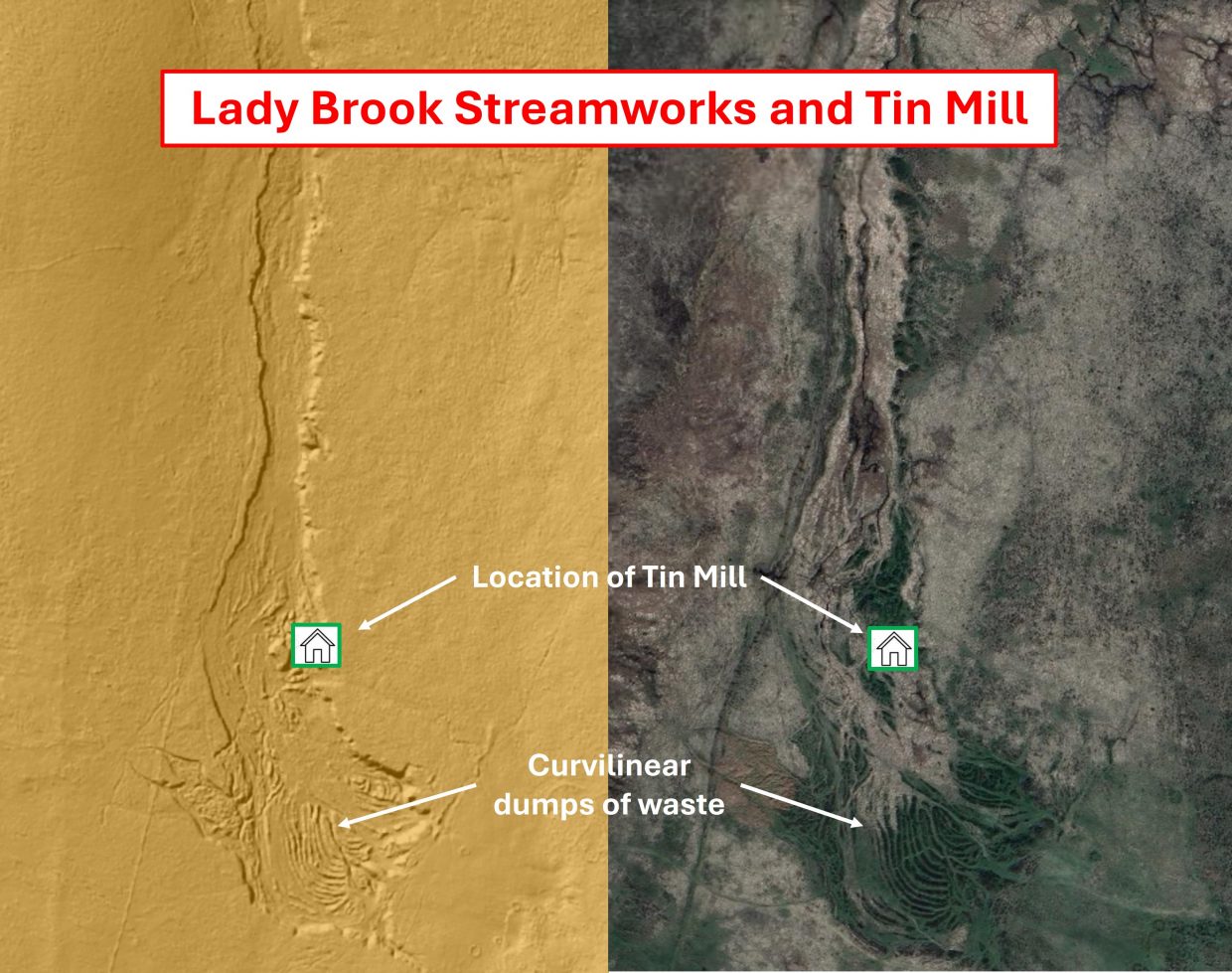
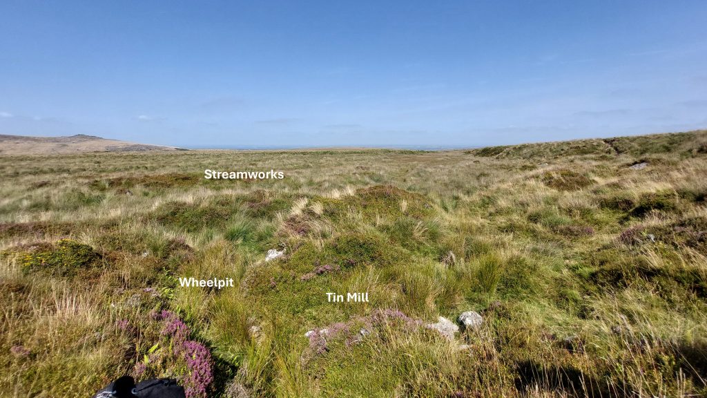
Lady Brook Streamworks and Tinners’ Mill
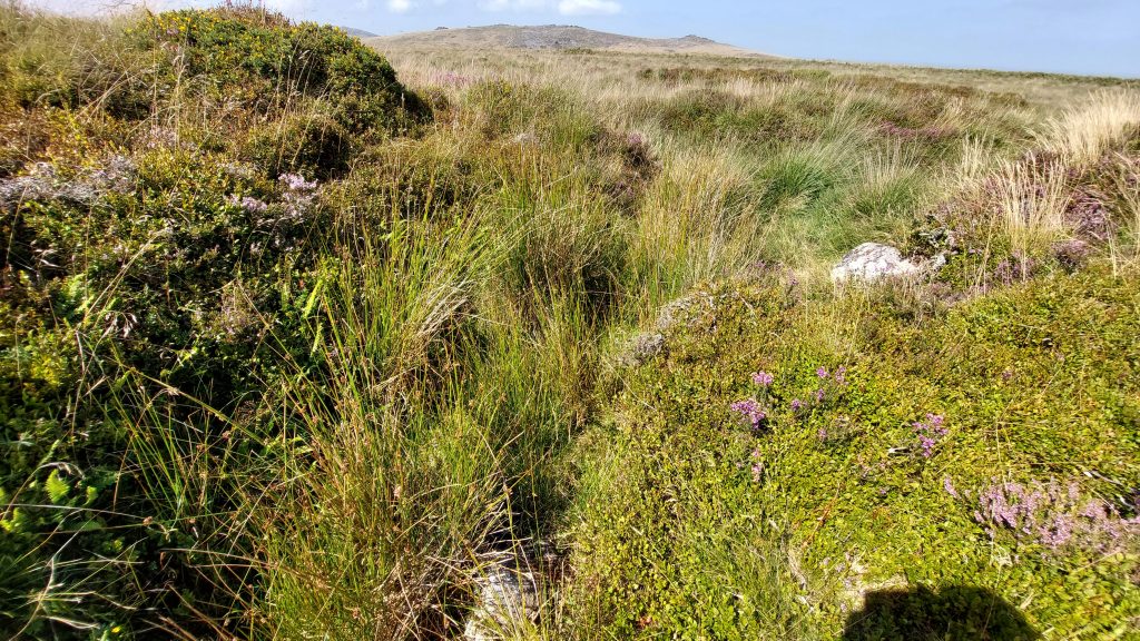
Located near the head of Lady Brook (marked as Ivy Tor Water on older copies of the OS map) are some of the most impressive tin streamworks on Dartmoor, with both linear and unusual curvilinear dumps of waste. The streamworks are Eluvial, namely; those that had weathered from a lode in the usual way, but had not then been transported by flowing water. These tended to be poorer deposits due to the lack of sorting that a stream provides and they usually did not have such a ready supply of water available to work them.
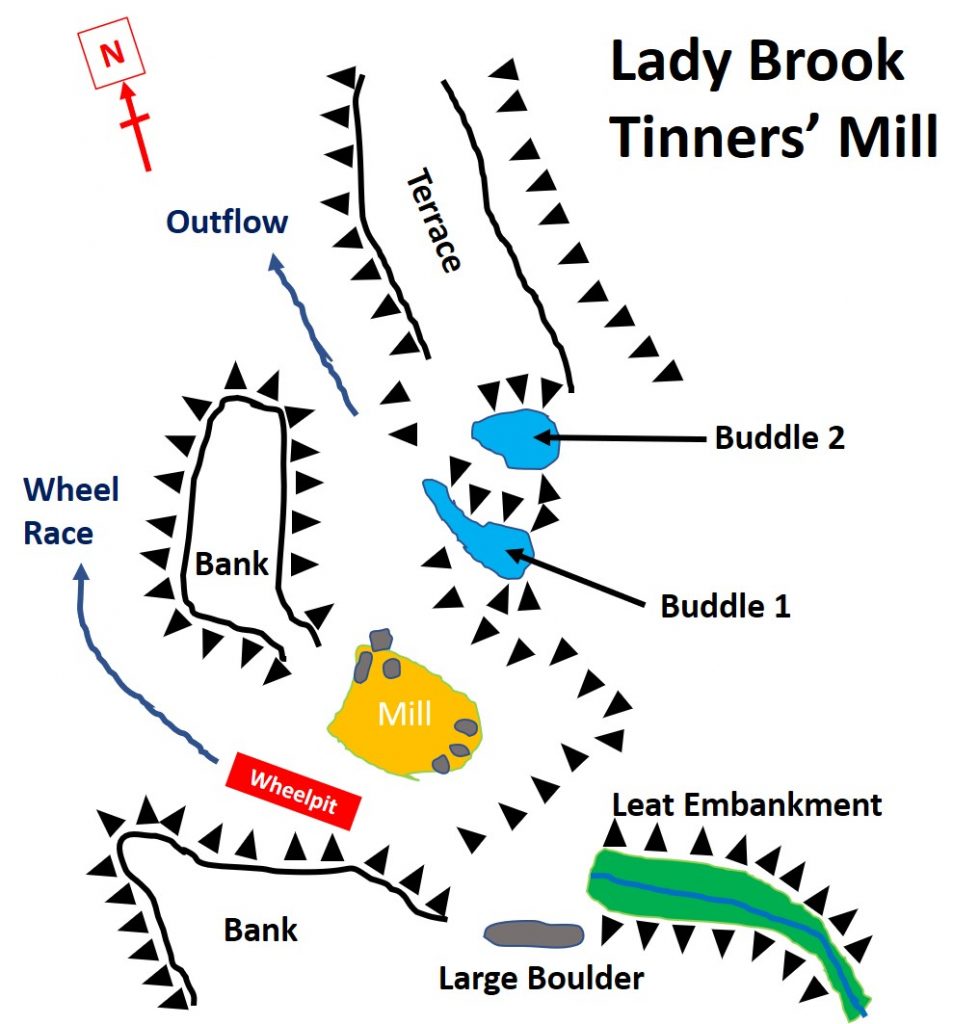
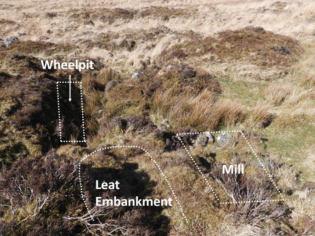
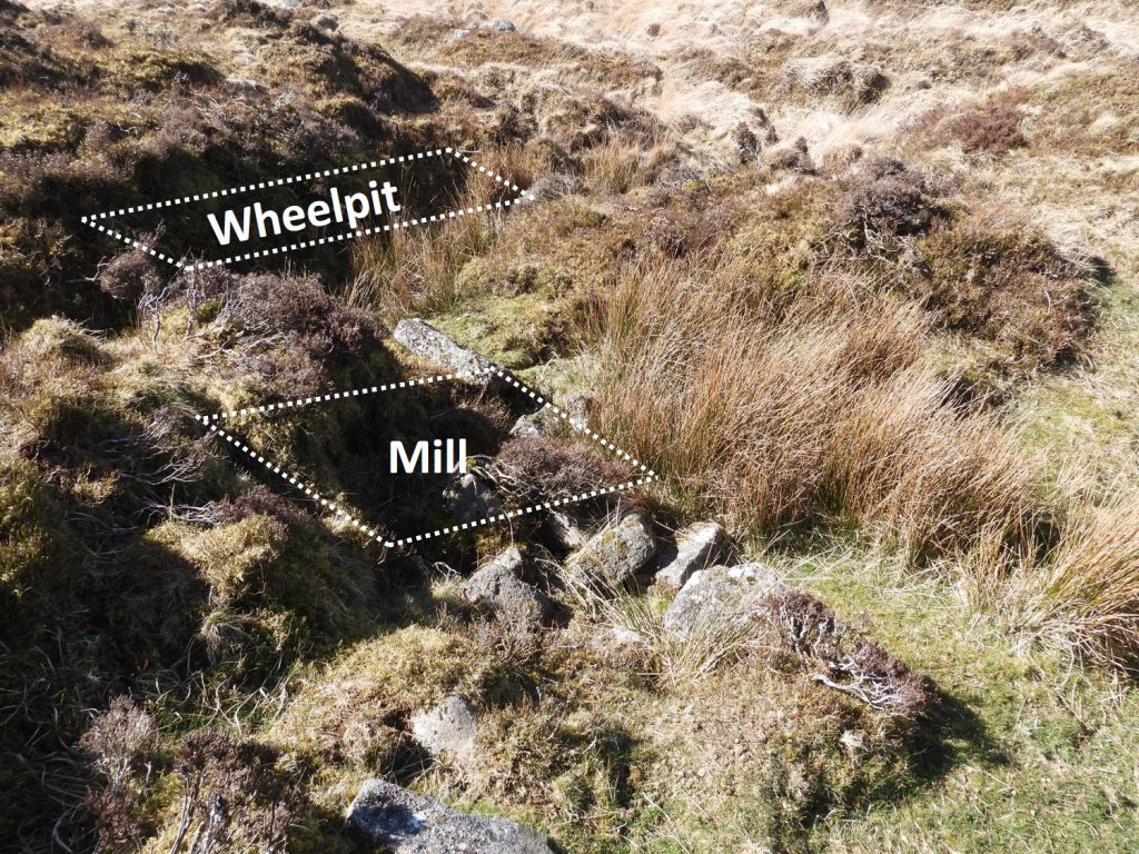
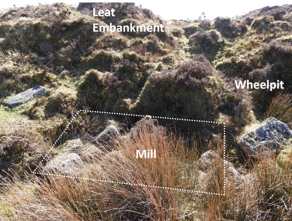
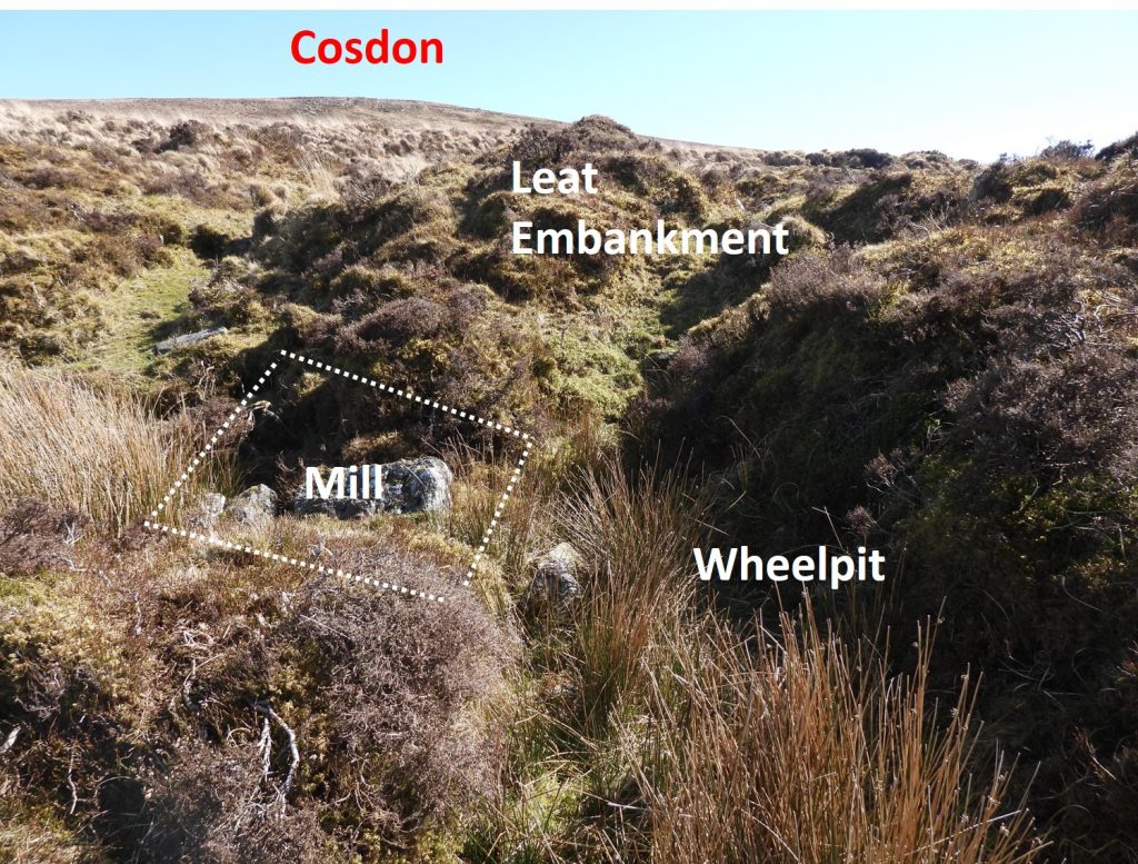
There is also a tinners’ mill here which is probably the smallest on Dartmoor. It is in a lovely location being amongst the many tinners’ workings on the west side of Cosdon Hill in an area also known as Queenie Meads. The features of the mill and associated leat embankment, wheelpit and two buddles are quite difficult to discern and the use of a plan is needed if making a visit. The exploration was inspired by finding a copy of a plan of the mill (titled “Ivy Tor Water Tinners’ Mill) in an old Dartmoor Magazine article by Dr Tom Greeves, who has conducted some superb industrial archaeological research across the moor. Further research for this post was obtained from the Historic England website.
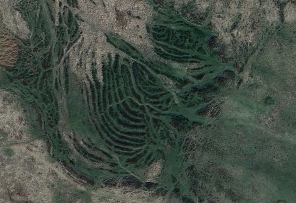
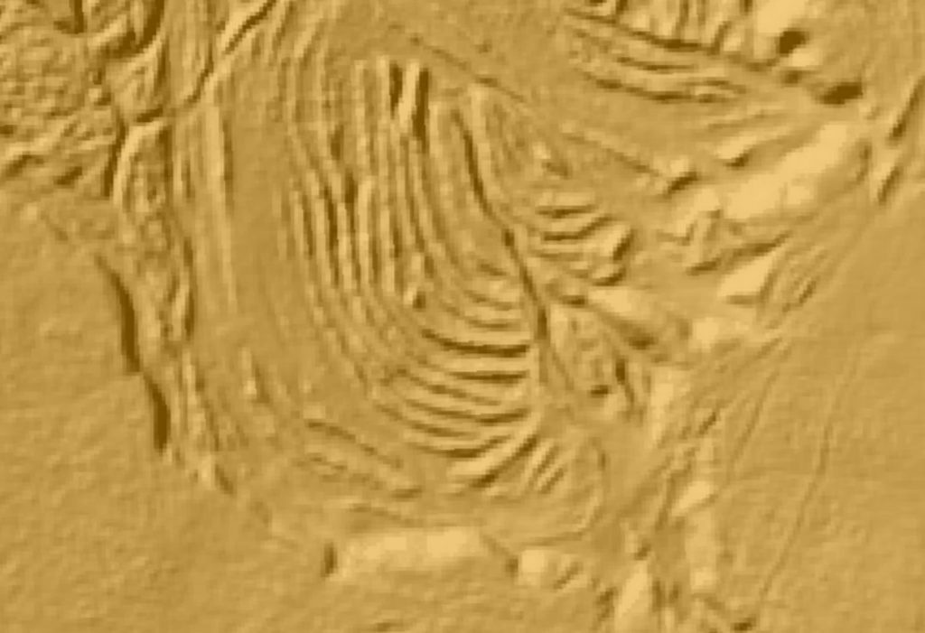
This LiDAR and Google Earth pictures show the extent of the Streamworks and the Tin Mill. Of interest near the south end of the workings are some very curious and unusual curvilinear dumps of wasteThis drawing is based on the original Dr Tom Greeves plan of the mill (from Dartmoor Magazine).
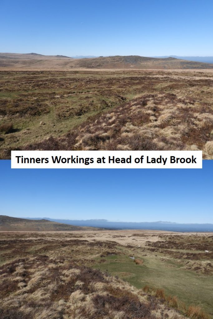
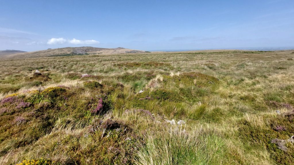
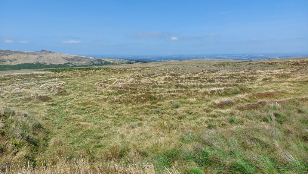
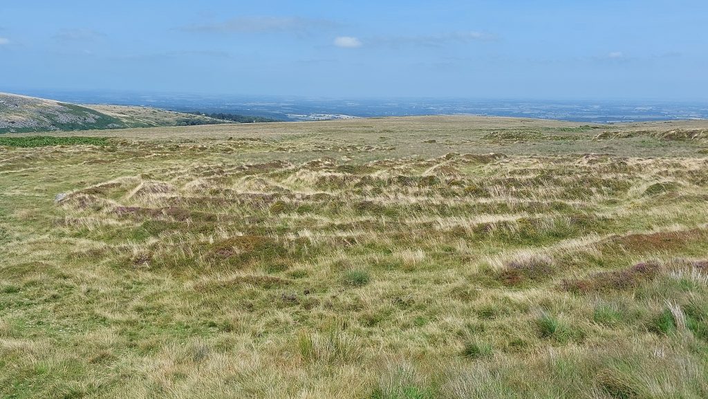
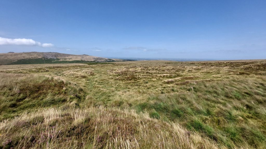
There are lots of tinners’ workings at the head of Lady Brook
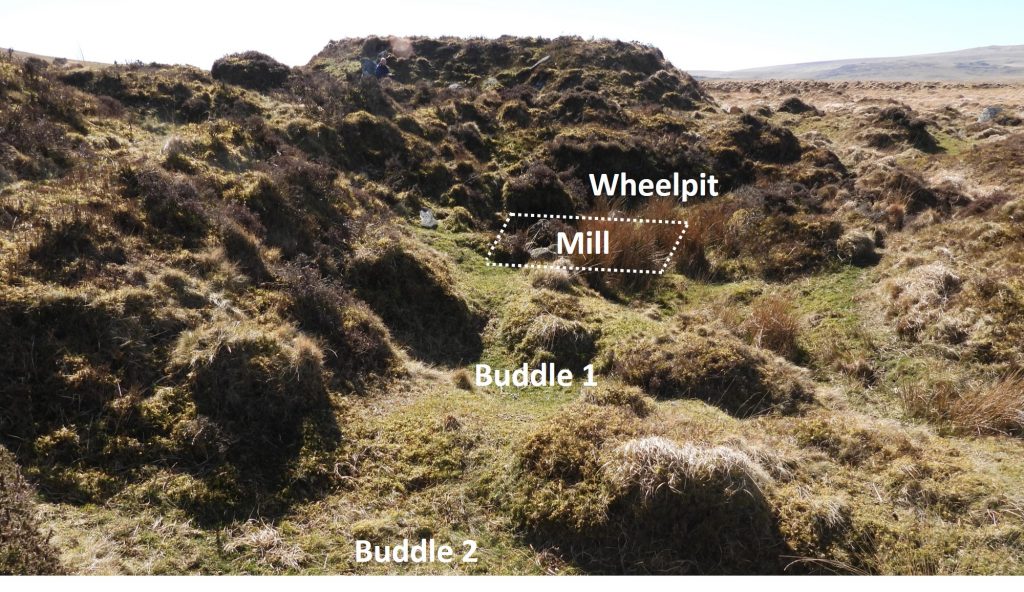
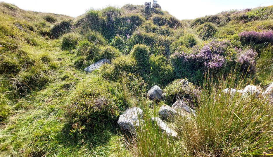
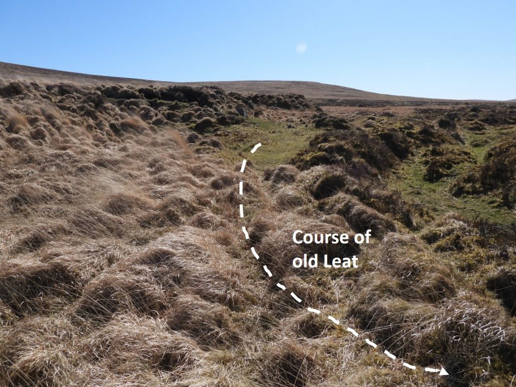
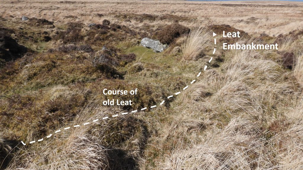
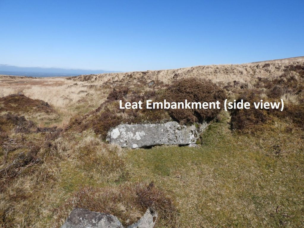
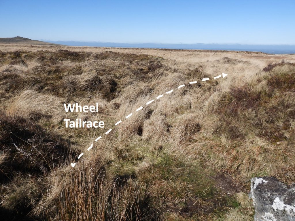
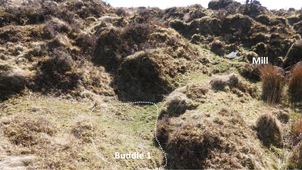
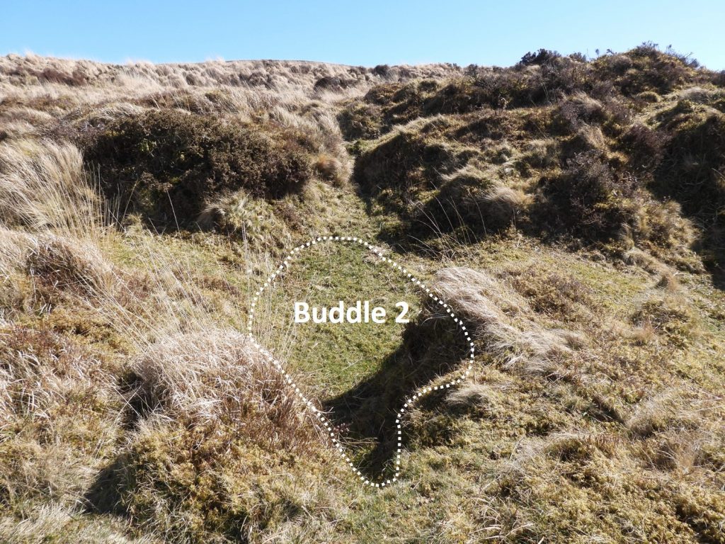
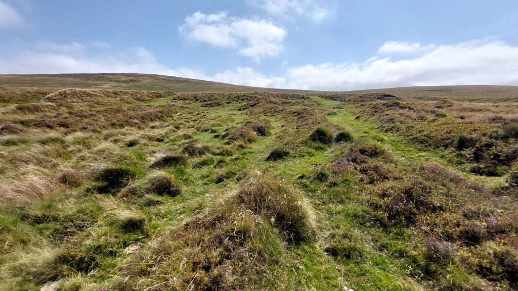
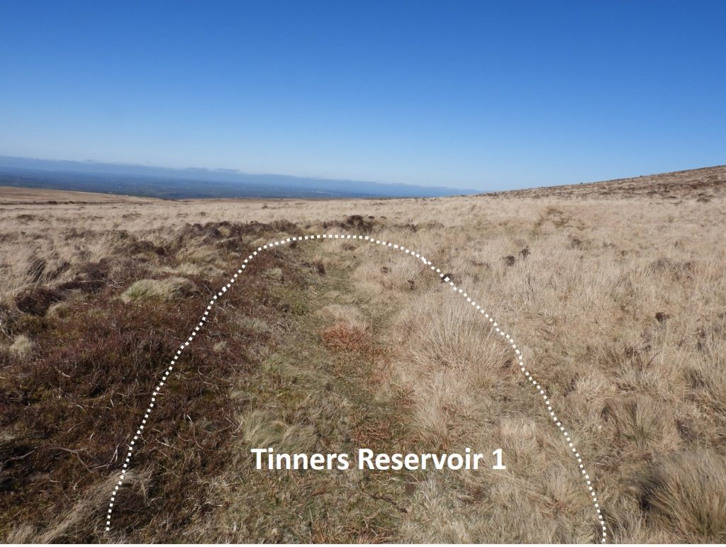
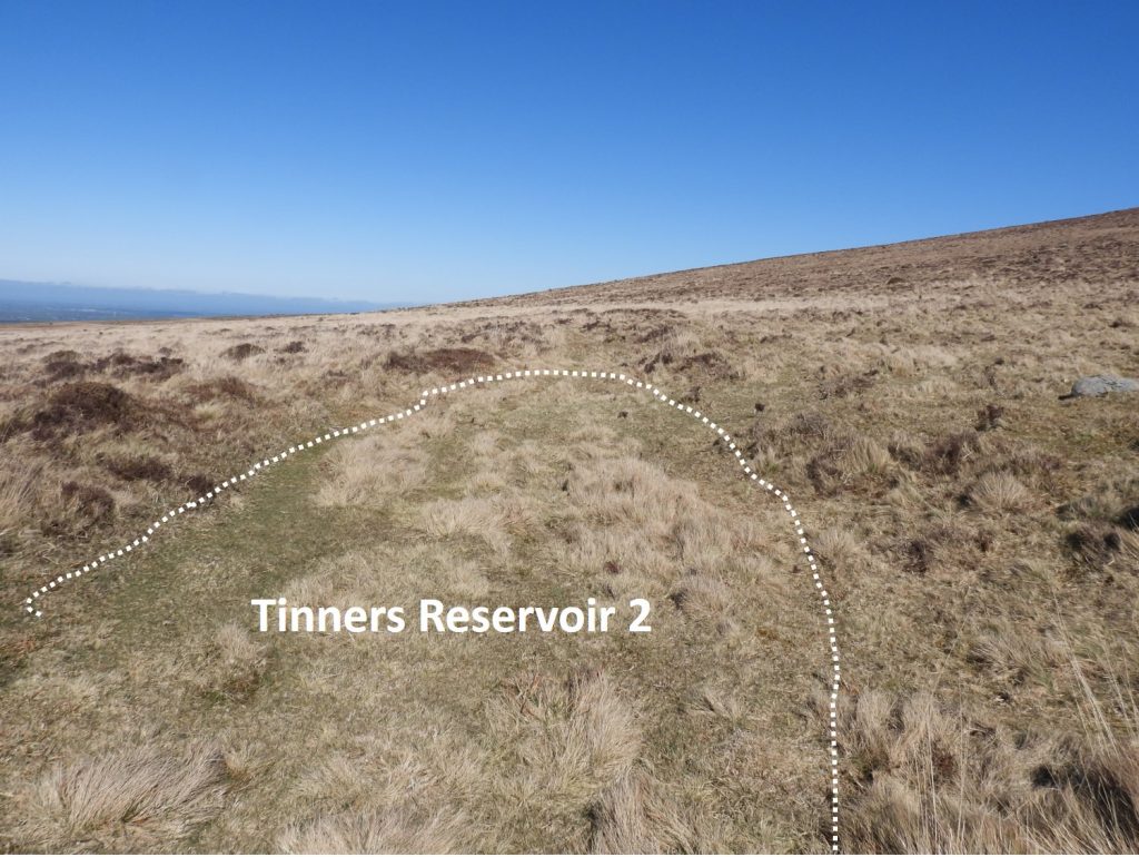
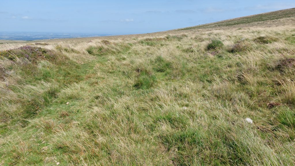
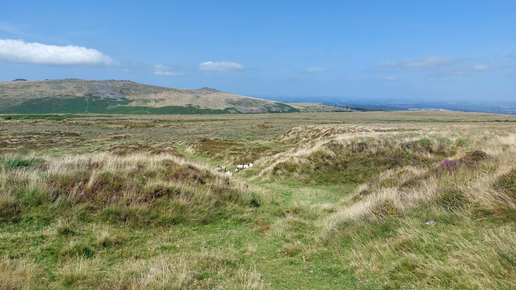
The site is best located by looking for a very large mound (see top of picture) which is a few metres to the south of the mill.View of the Mill and Wheelpit taken from the top of the Leat Embankment. The presence of tin slag on this site demonstrates that it was a smelting site.The Mill, Wheelpit and StreamworksThe Mill (rocks in the foreground)Close up of the Tin MillDescribed in Historic England as a “mill consisting of a drystone-built rectangular structure, with a small wheelpit for the stamps and furnace power in the NE corner”. The mill is stated as measuring 4.2m by 2.5m and is defined by drystone wall standing up to 0.6m high and is orientated NW-SE. The mill GR is SX62842 91737.Next to the mill, the wheelpit is 1.4m wide. The wheelpit is located at SX62840 91733The Historic England website further states “documentary evidence exists of a c15 mill in the locality and it could be the site leased to a ‘nicholas tuckfield’ in 1608 (viant)”. There are several stones within the mill, which if turned maybe reveal they are mould stones.Close up of the wheelpit and tailraceThe leat embankment can be traced behind the mill for several metresAnother view of the old leat leading to the leat embankmentA obvious feature in the area (shown on plan) is a large boulder on the to the front of the leat embankment.Below the wheelpit a tail race can be found leading back to Lady Brook. Two buddles lie immediately NE of the mill. Both are triangular in shape and the one nearest to the mill (labelled here as Buddle 1) and is approx. 2.1m by 2m in a 0.4m hollow. It is located at SX62844 91739The second buddle is 2.6m by 2m and can be found at SX62849 91741.Linear dumps of wasteTwo reservoirs lie upslope of an eluvial streamwork and were supplied with water by a leat. Reservoir 1 is described thus: “The dam survives as a 3.7m wide and 1m high bank, with a 12m long S and 7m long N arm”. This picture is the best location that the author could fund which matches the description and is located at SX63005 91597.Reservoir 2 is located at SX62970 91555. It is described in the Historic England website as a 4m wide v-shaped bank standing up to 1m high, upslope of which is a hollow which would have contained the water and which was formed by the digging of material to construct the dam”. This picture is the best location that the author could find which matches the description.Reservoir 2Looking west across the streamworks from the reservoirsGoogle Earth view of the curvilinear dumps of waste at the head of Lady BrookLiDAR view of the curvilinear dumps of waste at the head of Lady BrookCurvilinear dumps of waste looking west to Belstone Tors and beyondThe curvilinear dumps of waste are centred at SX6287 9153The curvilinear dumps of waste look like a giant labyrinthThe reason why these dumps of waste are curved is unknown


Mike Jeffery January 25, 2022
Brilliant photos and descriptions keep up the good work, I do a similar sort of thing for my own use.