An original Horrabridge ancient chapel (St. John) was in the parish of Buckland Monachorum until the dissolution of Buckland Abbey during Henry VIII’s reformation. That chapel fell into decay until the late 19th century when a new church was built. In 1833, sixty years before the new church was built, Horrabridge acquired a ‘chapel of ease’ *, which had formerly been a non-conformist chapel. 34 years after Horrabridge acquired this chapel an Ecclesiastical Bounds was created.
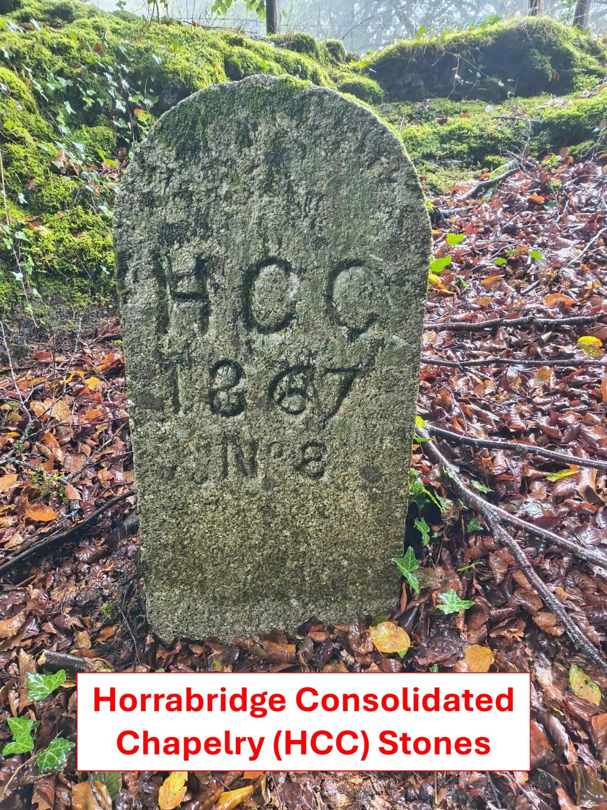
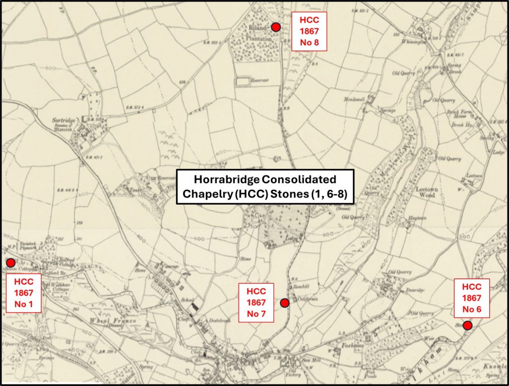
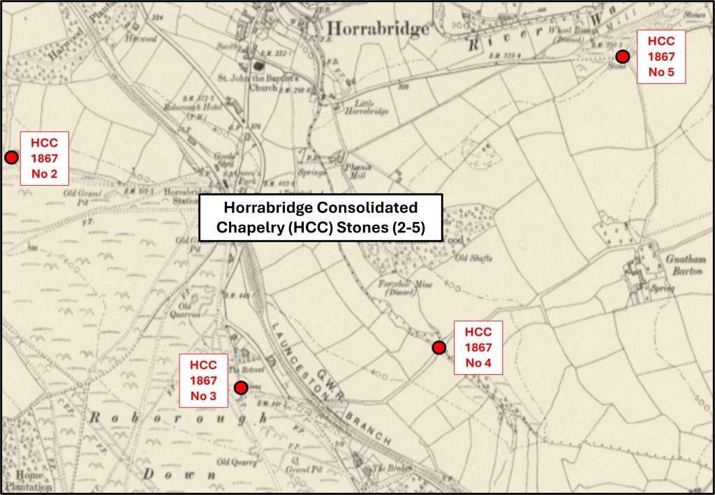
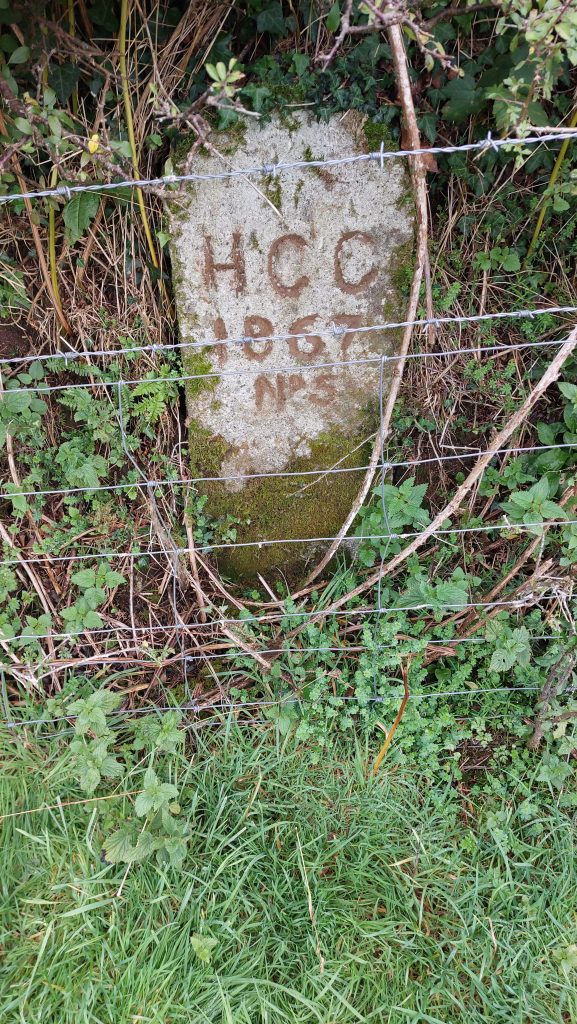
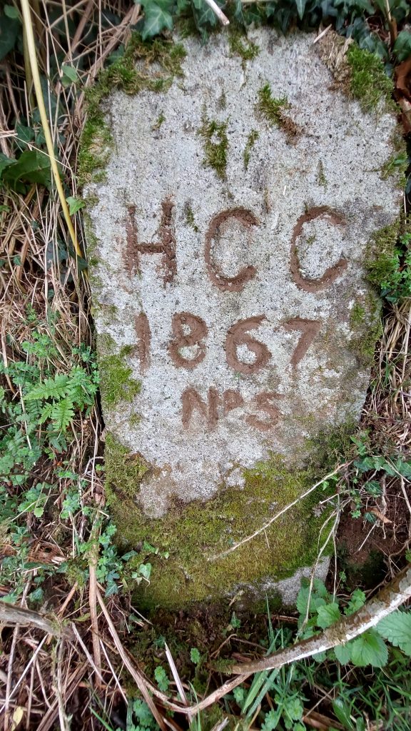
Originally the Ecclesiastical Bounds was exactly the same as the civil parish and when the ‘Horrabridge Consolidated Chapelry’ (HCC) was created in 1867, Horrabridge became an ecclesiastical parish in its own right. The bounds of ‘HCC’ were marked by a series of eight numbered stones ‘HCC/1867/No 1 through HCC/1867/No 8’. Horrabridge became a civil parish in its own right on 1st October 1950 and today many of the ‘HCC’ stones share the boundary of this parish.
*A chapel of ease is a building other than the parish church, built within the bounds of a parish for the attendance of those who cannot reach the parish church conveniently, generally due to travel distance
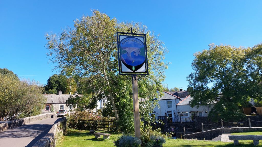
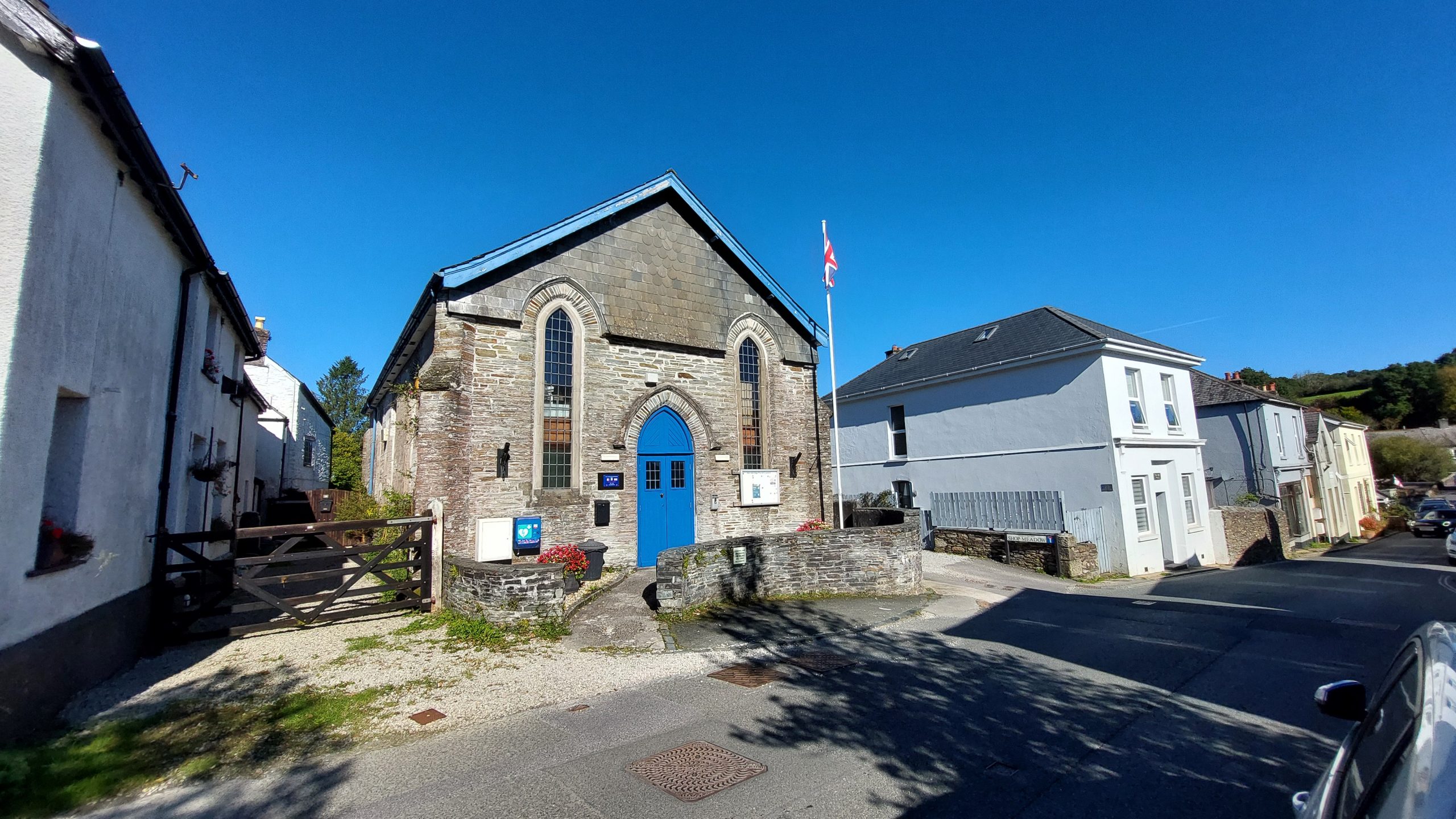
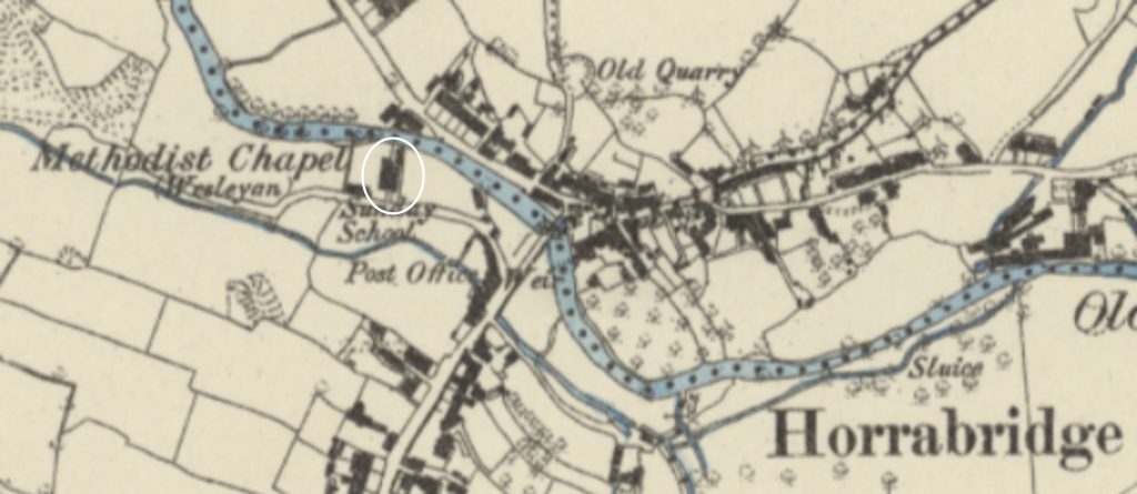
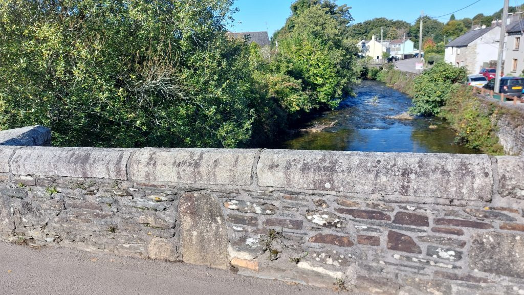
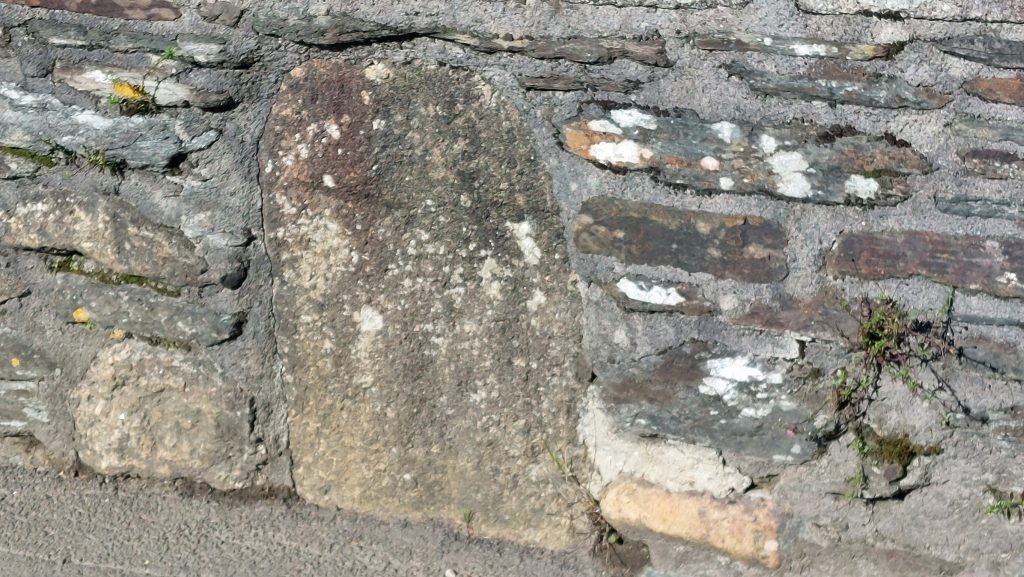
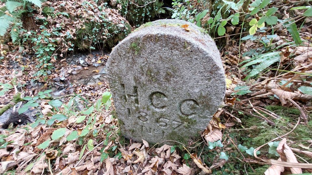
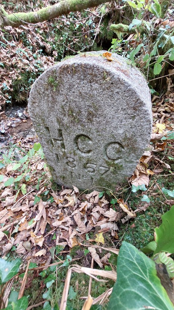
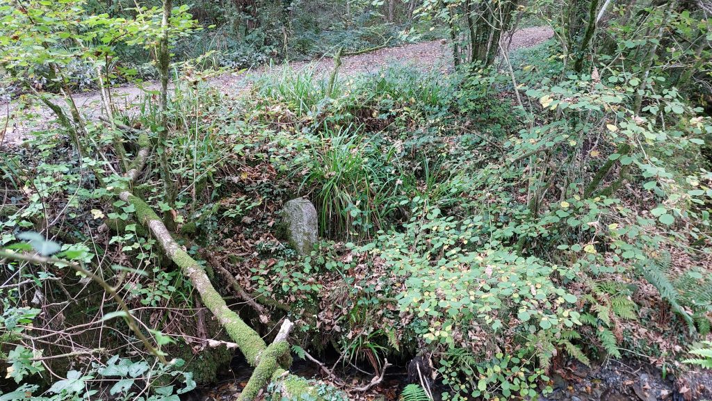
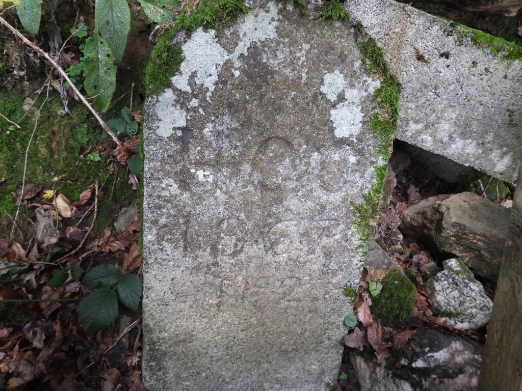
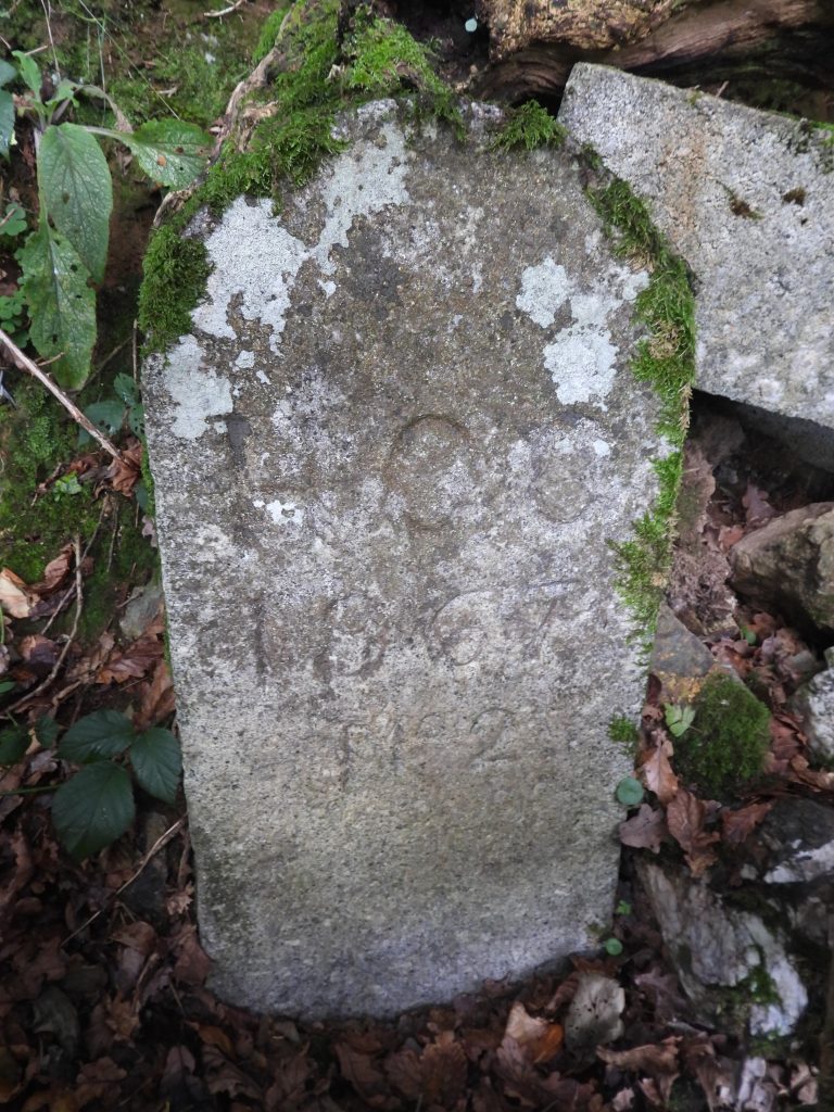
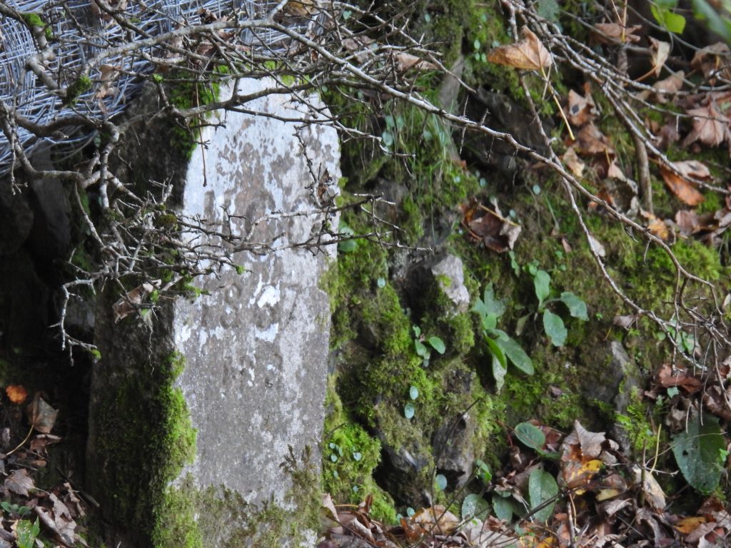
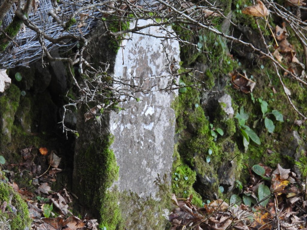
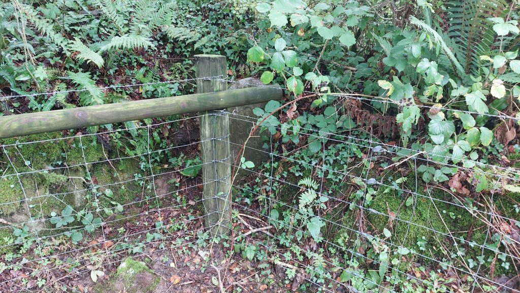
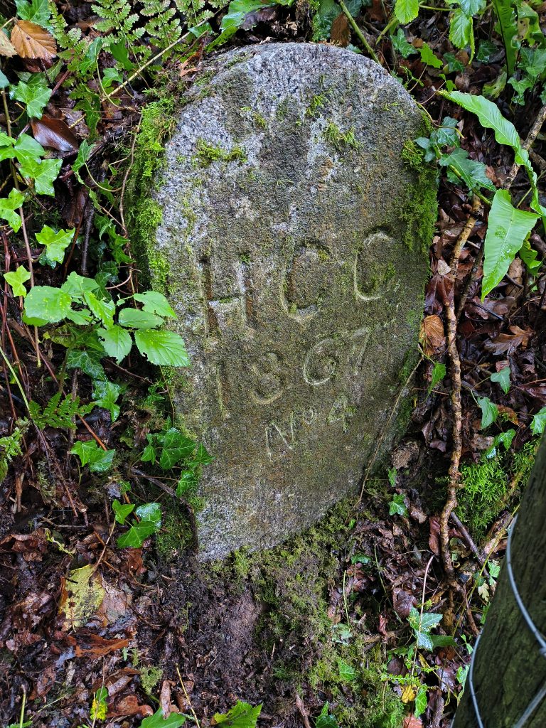
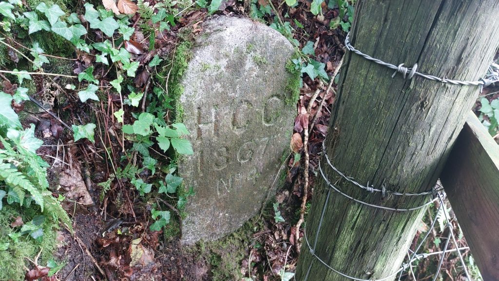
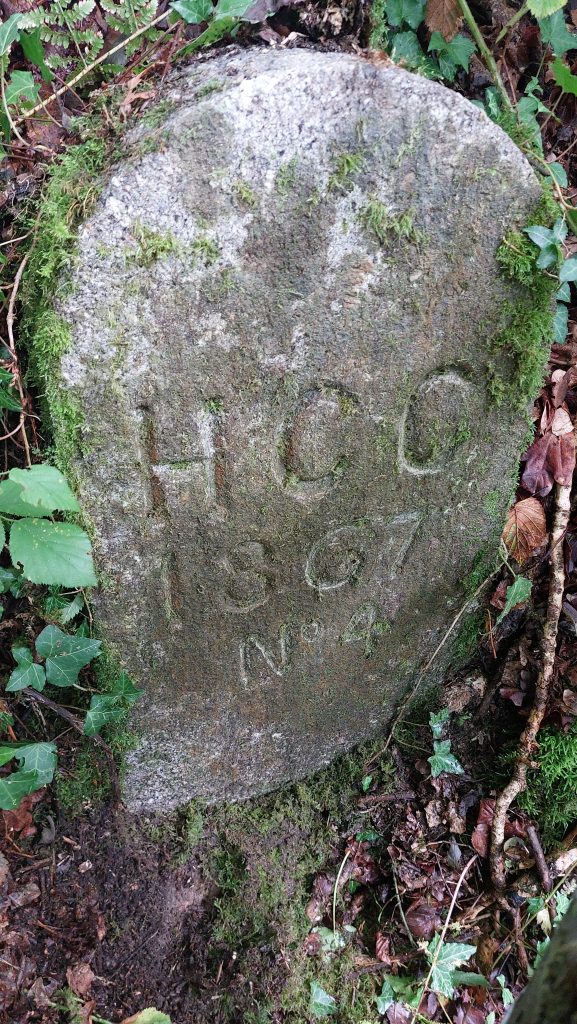
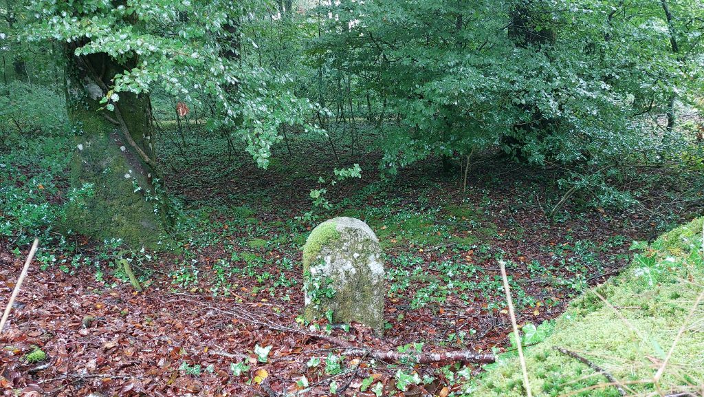
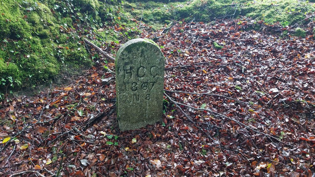
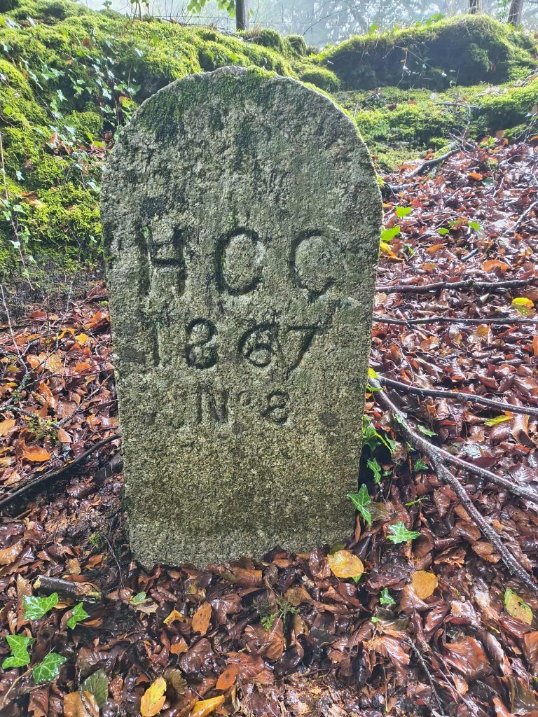
Through the centuries Horrabridge has also been known as ‘Horebrigge’ (1345), ‘Harrowbridge’ (1665) and ‘Hollow Bridge’ (1675)Dave Brewer records that in 1833, Horrabridge acquired a ‘chapel of ease’, which had formerly been a non-conformist chapel. It is possible the chapel no longer exists and existed on Chapel Close. That said, the current village hall was built in early – mid 19th century and may just fit the timeline but this is doubtful. If anyone reading this post is able to add any further information, the author would be most gratefulThe author believes this may be the location of the chapel mentioned by Brewer. It appears as plot 139 on the Buckland Monachorum Tithe Map; ‘Chapel and Court’, owned by the Wesleyan Methodists. The timeline fits perfectly….Horrabridge Cross (the tomb stone shaped stone inset into the west or downstream side of the bridge). Masson-Phillips in 1937 recorded it as being “An ancient boundary stone is built into the centre of the western parapet. Granite with incised cross. The bridge is at the boundary of the three parishes of Whitchurch, Sampford Spiney and Buckland Monachorum”.Close up of Horrabridge Cross. In the Dartmoor-Crosses website they state: “According to the Western Antiquary, December 1882, the stone once had the letters ‘B’ and ‘W’ incised into opposing faces, marking the boundary of two of these parishes. However, all trace of these letters has now disappeared, to be replaced by an incised cross on the roadside face which, in itself, has now become very faint”. This annotated map shows the approx. locations of HCC stones 1 and 6-8 as defined by Dave Brewer in Dartmoor Boundary Stones (2nd edition)This annotated map shows the approx. locations of HCC stones 2 to 5 as defined by Dave Brewer in Dartmoor Boundary Stones (2nd edition)‘HCC / 1867 / No 1’ is located at SX49942 70477 and is shown on modern OS Maps. It is located near the north bank of the Walkham near the old ‘Magpie Mill’. This stone is shared as a boundary marker for both the church parish and the civil parish.Close up of ‘HCC / 1867 / No 1‘Contextual view of ‘HCC / 1867 /No 1’ sandwiched between the track by Magpie Mill and the River Walkham as described by Dave Brewer‘HCC / 1867 / No 2’ is located at SX50518 69451 and is shown on modern OS Maps. This stone (as with number 1) is shared as a boundary marker for both the church parish and the civil parish‘HCC / 1867 / No 2’ is described by Dave Brewer as being located “above Horrabridge Station”‘HCC / 1867 / No 3’ is located at SX51160 68826 and is shown on 19th century maps.Zoomed in view of ‘HCC / 1867 / No 3’Another zoomed in view of ‘HCC / 1867 / No 3’ is described by Dave Brewer as being located “in corner of field opposite Sadlers Retreat”‘HCC / 1867 / No 4’ is hidden behind a wire fence‘HCC / 1867 / No 4’ is located at SX51730 68929. ‘HCC / 1867 / No 4’ is described by Dave Brewer as being located “on the track to Gnatham Barton where stream crosses it”
‘HCC / 1867 / No 4’ close up
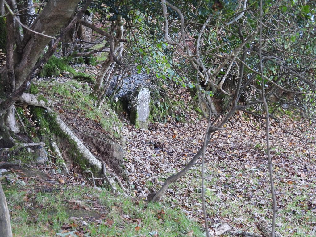
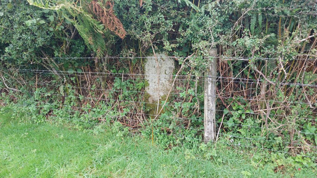
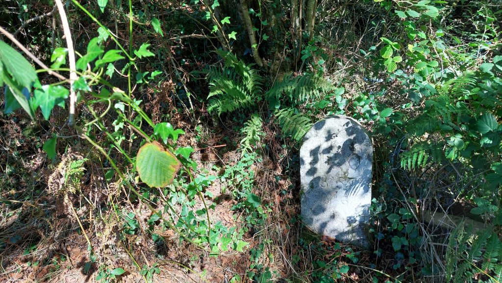
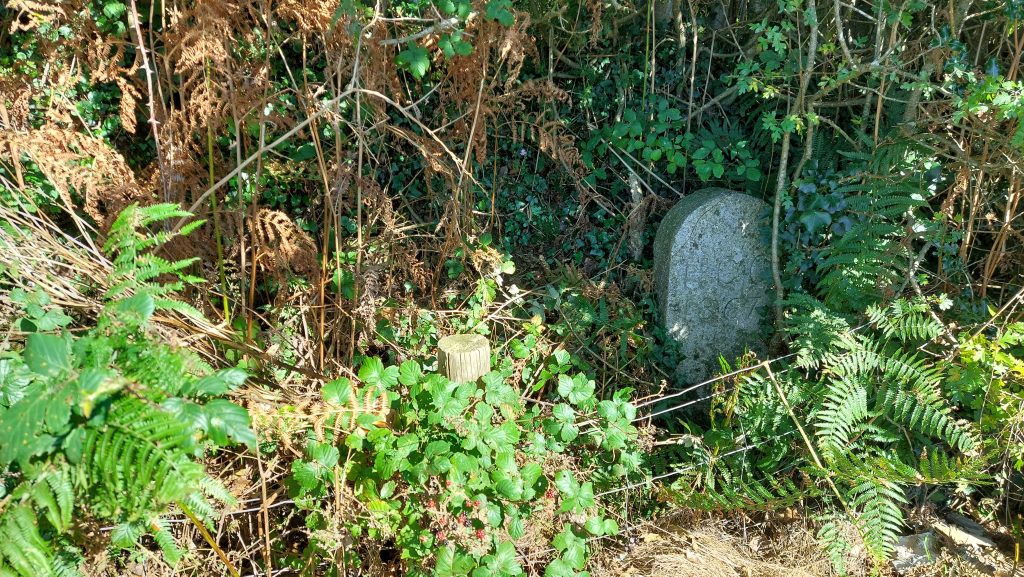
‘HCC / 1867 / No 5’ is located behind a wire fence‘HCC / 1867 / No 5’ is located at SX52268 69662 and is shown on 19th century maps.‘HCC / 1867 / No 5’ is described by Dave Brewer as being located “inside field south of the back road on Knowle Down”
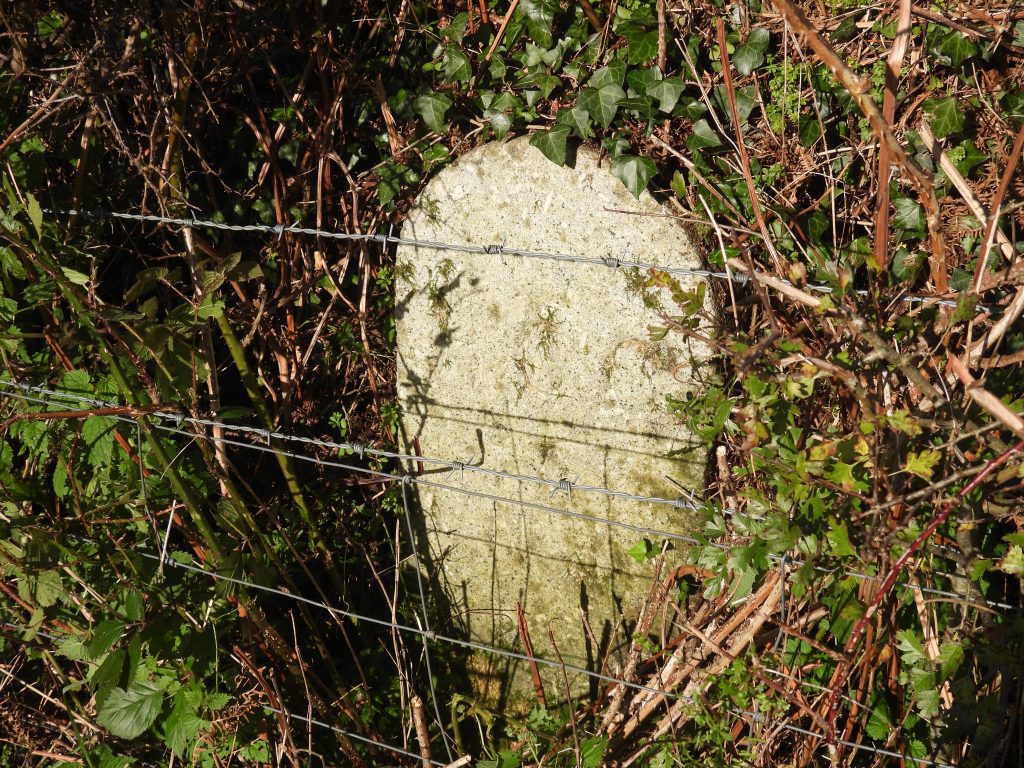
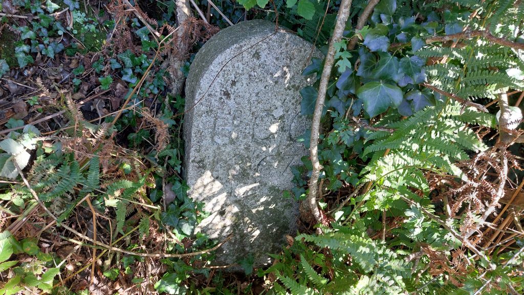
‘HCC / 1867 / No 5’ with a mud make over
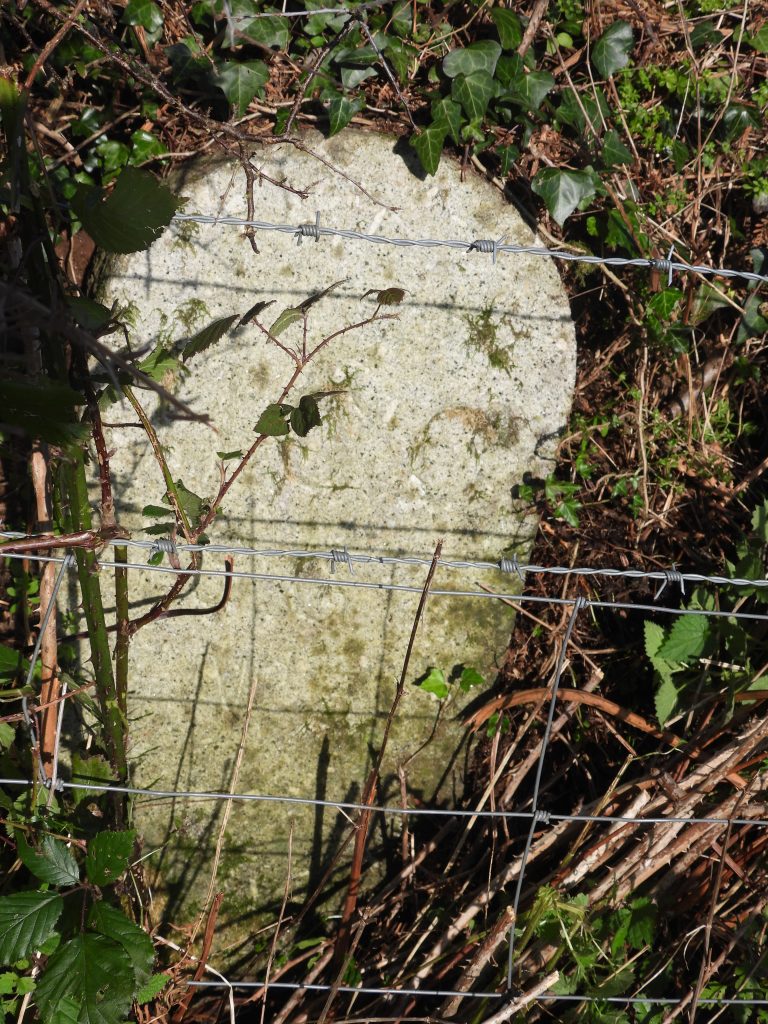
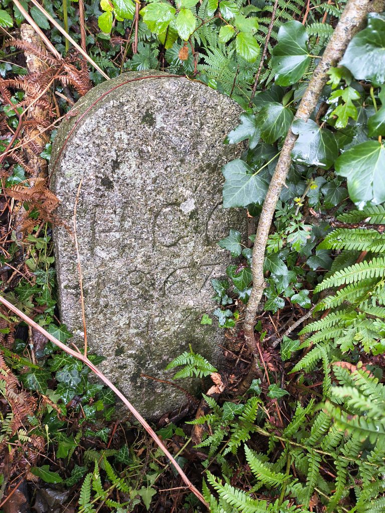
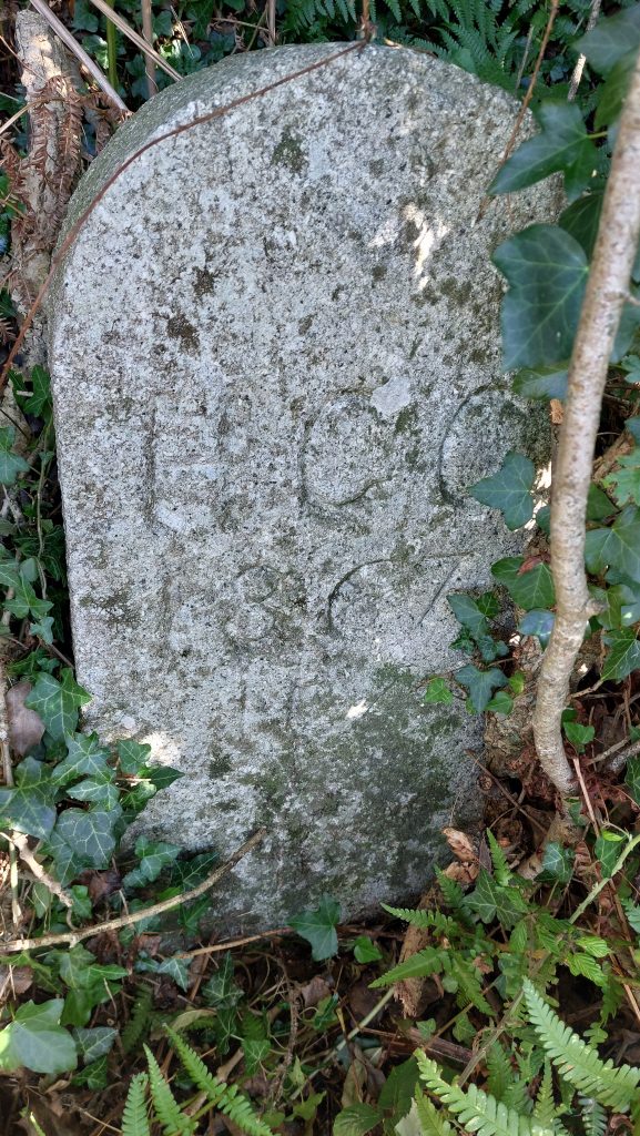
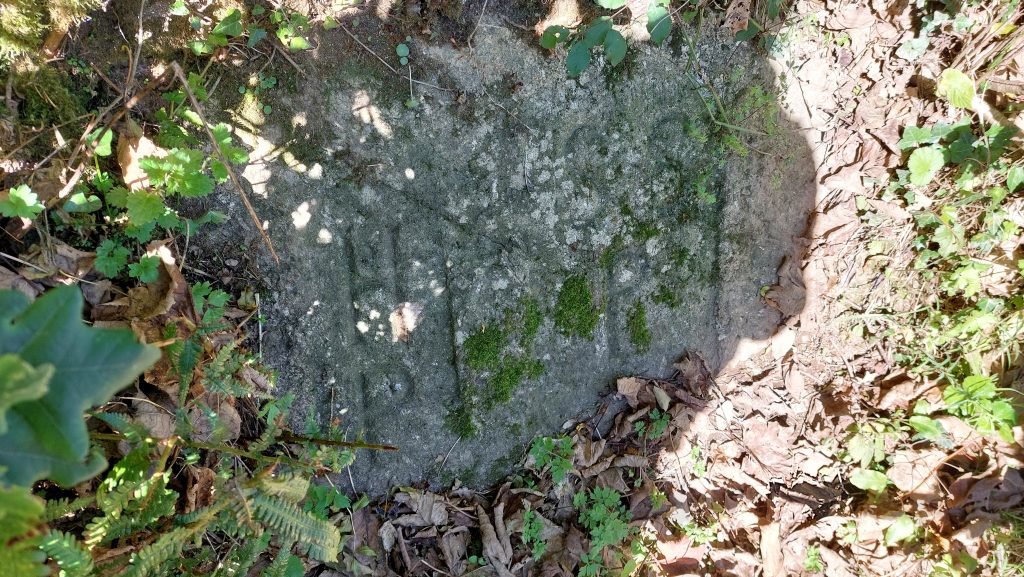
‘HCC / 1867 / No 5’ close up
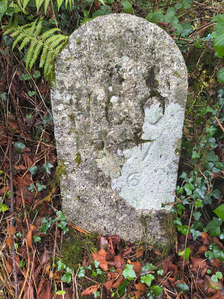
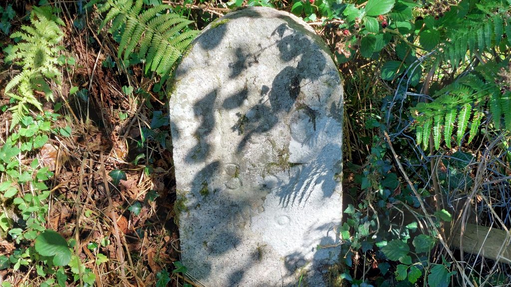
‘HCC / 1867 / No 6’ is located near the north bank of the Walkham‘HCC / 1867 / No 6’ is located at SX52538 70057. It is described by Dave Brewer as being located “above the north bank of the Walkham opposite Knowle Down”‘HCC / 1867 / No 6’ is described by Dave Brewer as being located “above the north bank of the Walkham opposite Knowle Down”Close up of ‘HCC / 1867 / No 6’‘HCC / 1867 / No 7’ is located at SX51641 70204‘HCC / 1867 / No 7’ is described by Dave Brewer as being located “inside field opposite house called California”. ‘HCC / 1867 / No 7’ was note by Dave Brewer as being no longer on the boundaryClose up of ‘HCC / 1867 / No 7’‘HCC / 1867 / No 8’ as seen from the road at the corner of Riland Plantation‘HCC / 1867 / No 8’ inscription still looks quite fresh over 150 years later‘HCC / 1867 / No 8’ is located at SX51628 71489. It is described by Dave Brewer as being located “at the corner of Rilland (sic) Plantation on the Plaster Down road”On the parish boundary, this stone in the hedgerow is located around 200m north east of a property called Dunridge. It is inscribed HP / SSP (for Horrabridge Parish / Sampford Spiney Parish). It is thought it dates to around 1950HP / SSP stone is located at SX52358 70318