A collection of walks, discoveries, insights and pictures of exploring Dartmoor National Park
August 7, 2025
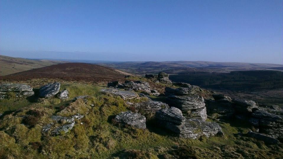
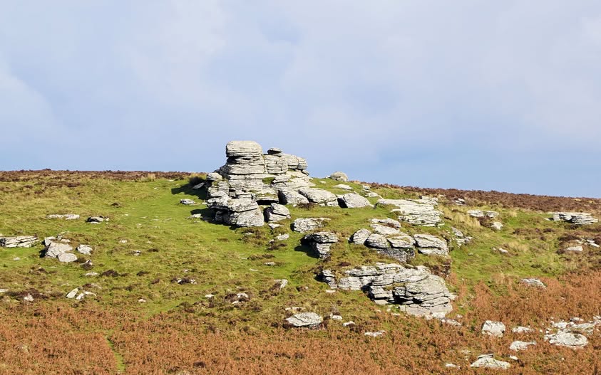
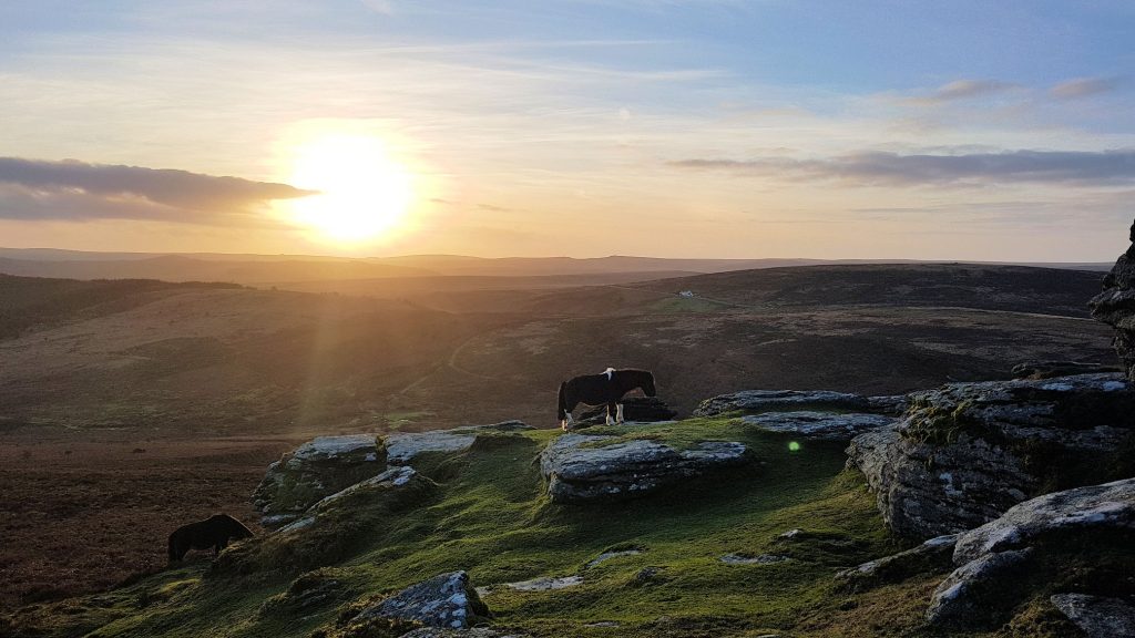
Headland Warren
Headland Warren has been recorded as being in existence by 1754 (English Heritage / Newman recording that ‘Head Warren’ is mentioned on the bounds of a tin sett) and continued in use until around 1920, covering an area of just over 600 acres (246 ha). On a map of Viscount Courtenay’s lands of 1790 (which depicted boundary stones, the house and the enclosures), Robert Mead was the tenant and in 1797 the Rev. John Swete passed through what was known a ‘Mead’s Warren’. An extract from ‘Forest Law’ reads as follows: “The word Warren was used to denote either the exclusive right of hunting and taking of certain beasts (ferae naturae) in a particular piece of land or the land over which right extended”. Brewer (1986) explained this only normally was used in reference to the ‘farming’ of rabbits for both their meat and fur.
Having been established in the 18th century the warren embraced the Birch Tor and Vitifer Mine and part of the East Birch Tor Mine. When the warren was first established the deep open workings, which were worked extensively by the tinners around the 16th and 17th centuries were the very conspicuous features of the area . Into the 18th, 19th and early 20th centuries these mines were further worked below ground with shafts, leats, waterwheels, tramways, dressing floors and buildings being constructed and would have co-existed with Headland Warren. Interestingly Burch Tor bounds of the ‘modern mining era’ were first recorded in 1757 around the same time of the establishment of the warren. It would be interesting to know how harmonious the mines and the warren co-existed. No doubt the miners had a diet which included rabbit and there are numerous records and stories about the poaching activities of tin miners who would often raid the warrens in search of a meal. In some cases the miners living in remote locations on the moor throughout the week and their meagre food stocks would often be replenished with stolen rabbits.
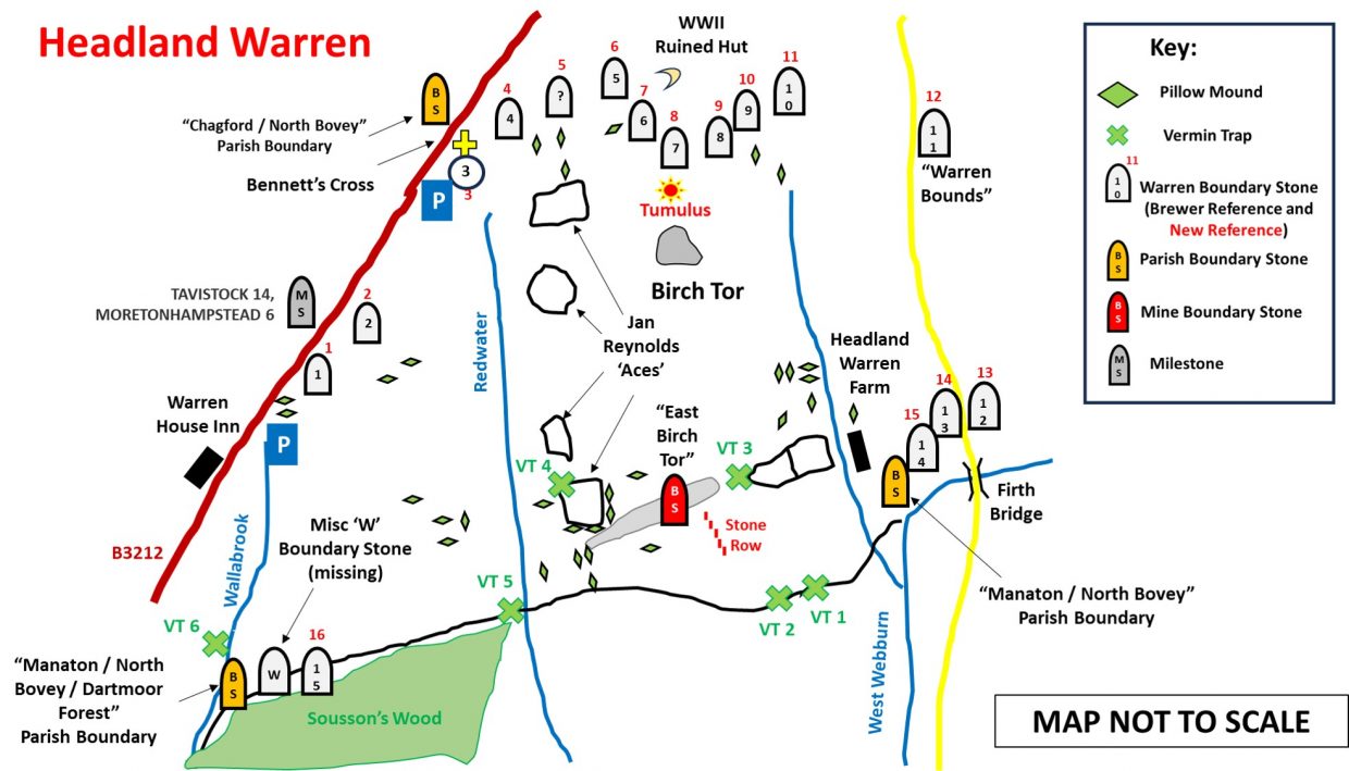
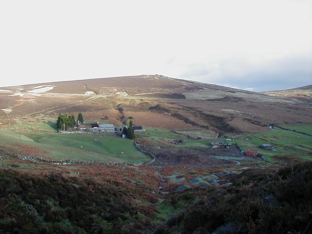
The warren house is now a private dwelling (named Headland Warren Farm) and is located on the left (east) bank of the West Webburn. The warren lands extended from the country road leading from Challacombe Cross to Firth Bridge in the east to the Wallabrook in the west. The northern boundary followed the turnpike road (B3212) from the Wallabrook near its head to Bennetts Cross before following an easterly course over the northern flanks of Birch Tor to the country road between Shapley and Hookney Tors. The southern boundary was largely bounded by a high rabbit proof wall from Firth Bridge (at Grimms Lake) across the northern flanks of Challacombe Down and Soussons Down to the Wallabrook. The warren itself includes at least 34 (possibly 37) pillow mounds, 6 vermin traps, 6 or 7 rectilinear enclosures as well as the warren house itself. The warren was bounded by more boundary markers compared with other the warrens across Dartmoor. There are at least 16 stones still extant (although a 17th was in existence at the turn of the 21st century).
An interesting observation by R.G.Haynes in 1970 was that: ‘The warren is deficient in buries (pillow mounds). One has been found in the vicinity of the house, and seven on the slopes below Bennett’s Cross. The rabbits were kept in walled enclosures thickly planted with sheltering gorse”. This observation has been challenged over the intervening 55 years and is considered in this post. Also included in the post are other features and artefacts in the area including the Warren House Inn, another old building, a telegraph marker, three parish boundary markers, a mine boundary marker, a stone row, a milestone, a possible WWII ruined hut / shepherds hut and a tumulus (kerbed circle / cairn).
Bibliography
Dave Brewer – Dartmoor Boundary Markers (2002), pages 265-8
Dave Brewer – Dartmoor Magazine – Spring 1986, number 2 – Headland Warren, pages 22 and 23
Phil Newman – Dartmoor Magazine – Spring 2002, number 66 – New Observations at Headland Warren
Phil Newman (2001) – Headland Warren Part 2: Medieval Settlement and Enclosures
Phil Newman (2001) – Headland Warren Part 3: The Warren
Tim Jenkinson (2007) – Miscellaneous Milestones and Boundary Markers of Dartmoor Roads
Jeremy Butler (1991) – Dartmoor Atlas of Antiquities: Volume Two – The North, 238, Map 24
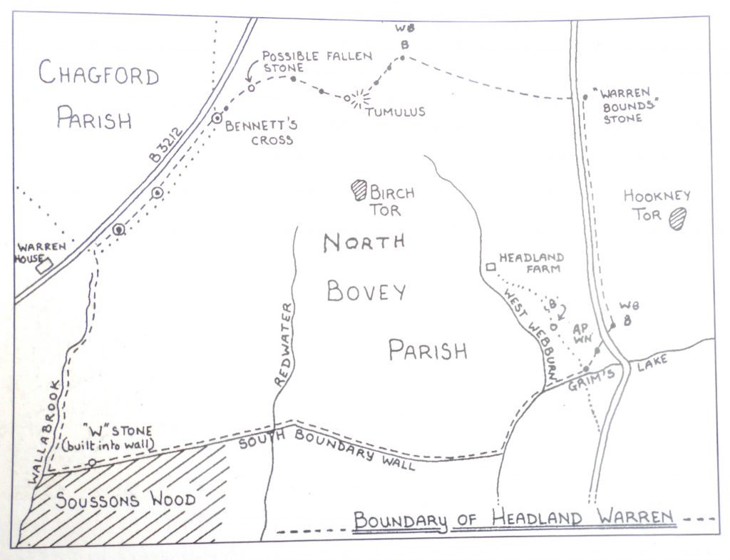
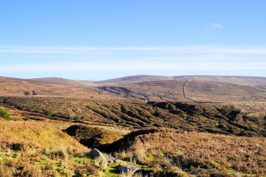
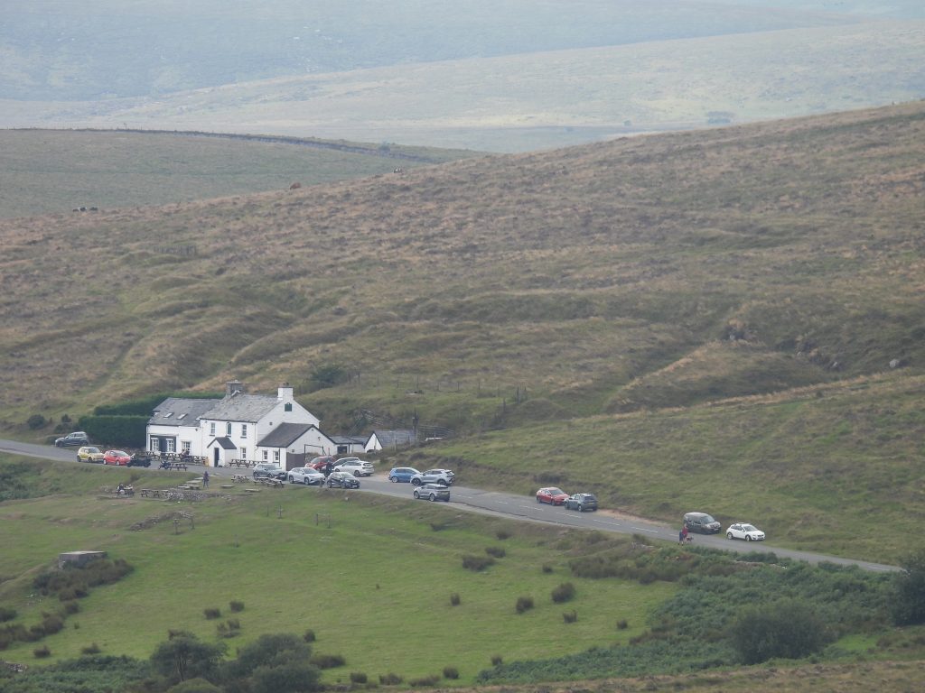
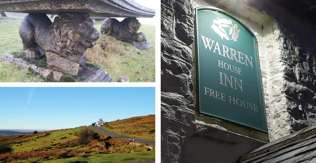
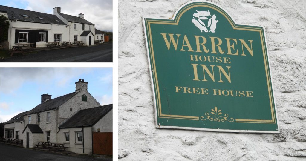
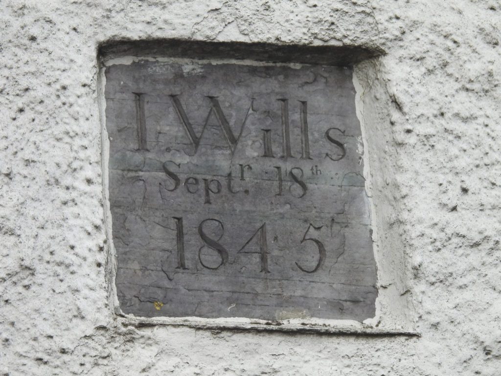
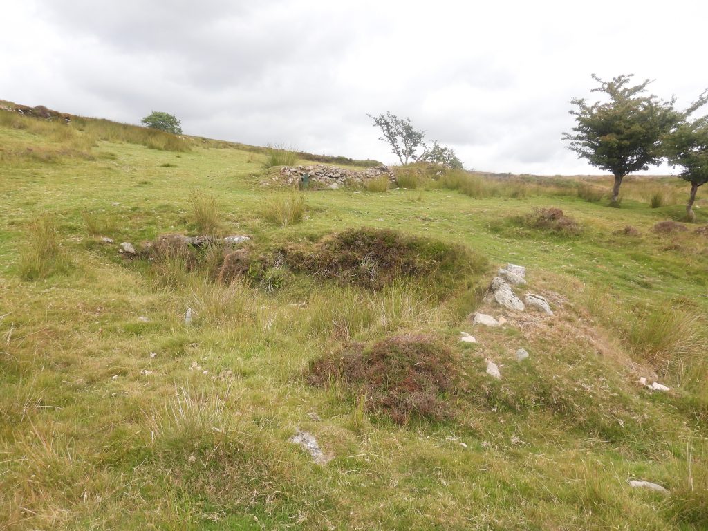
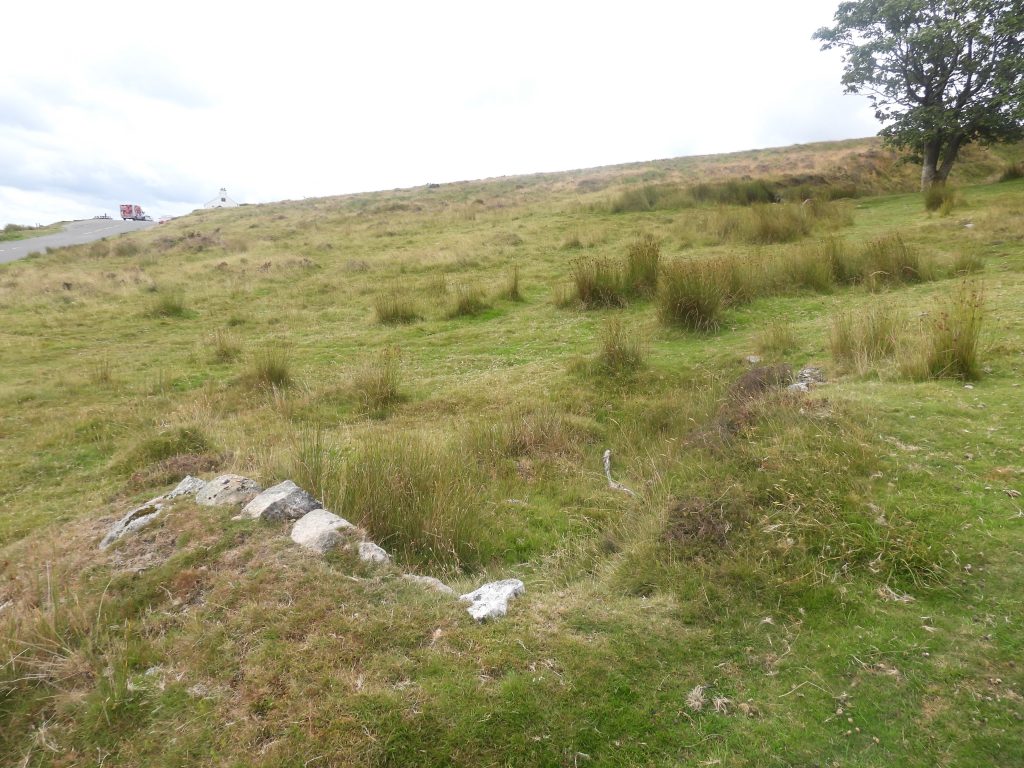
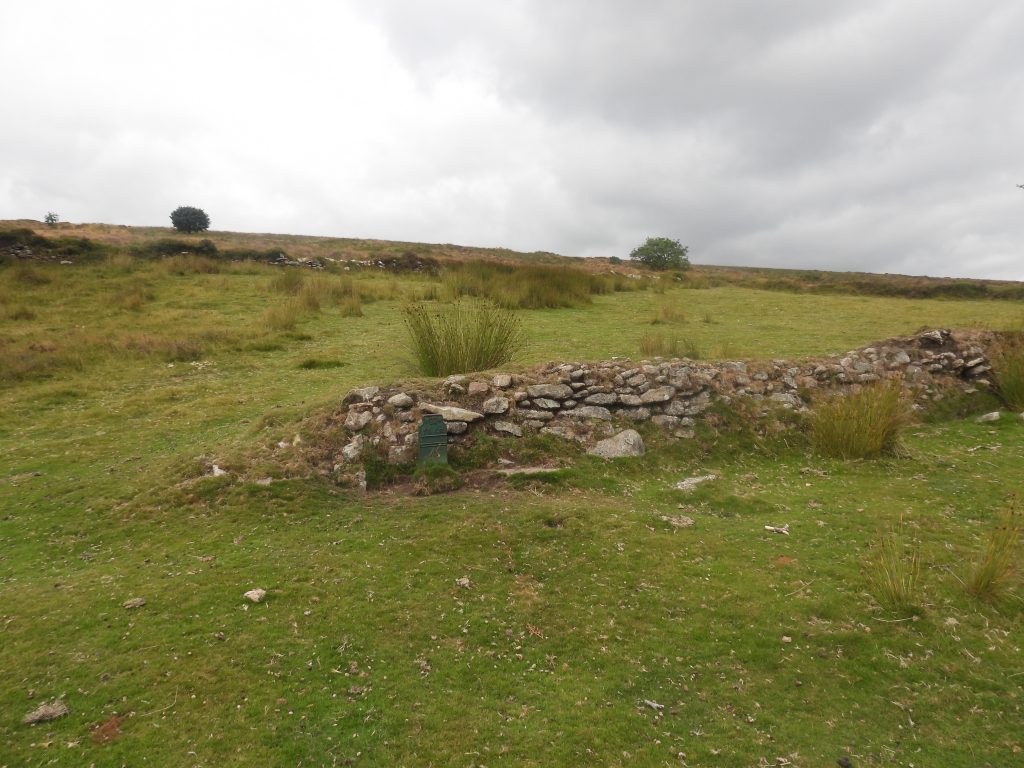
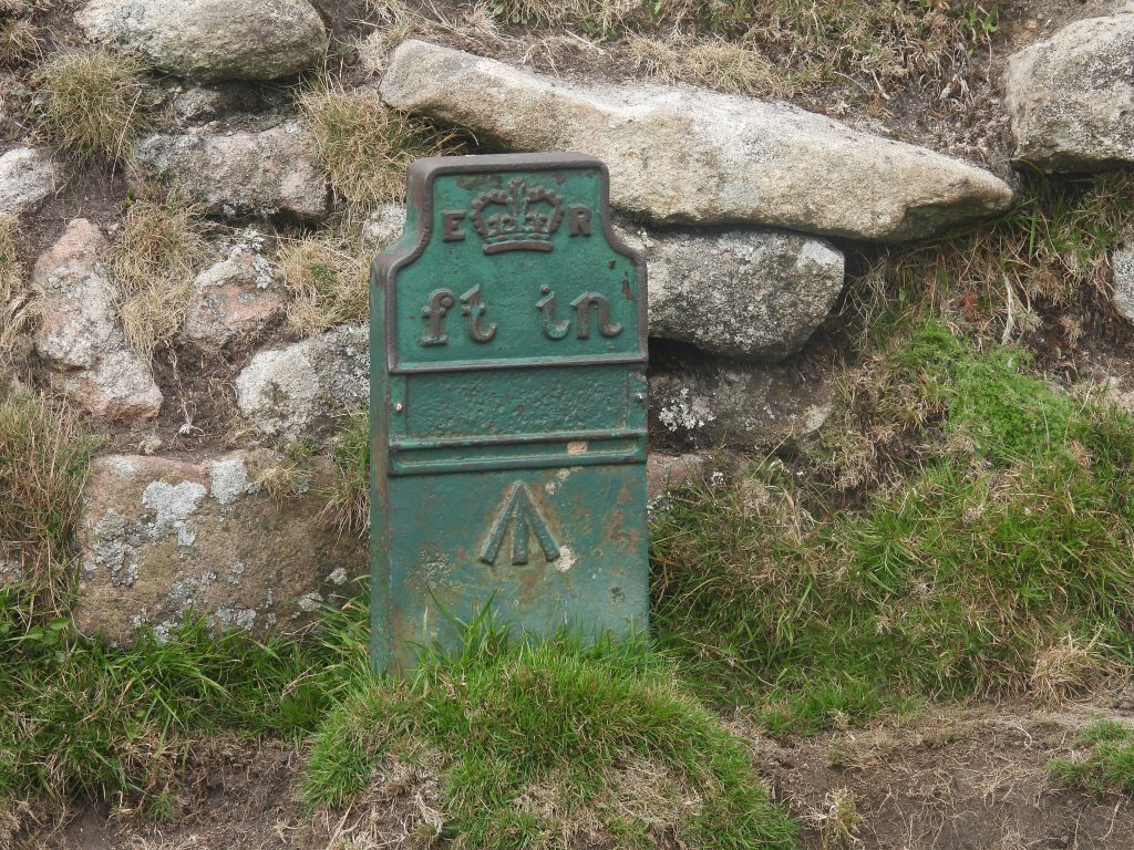
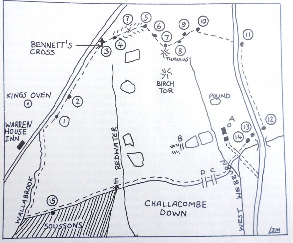
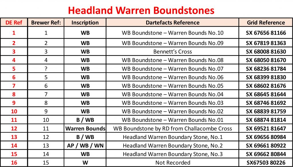
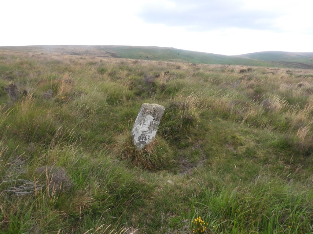
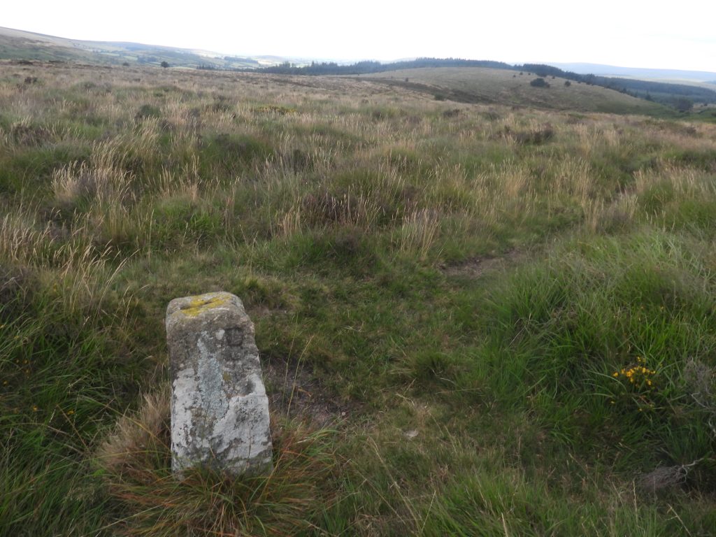
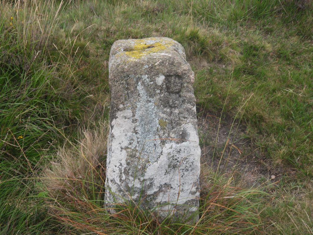
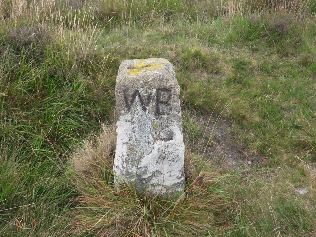
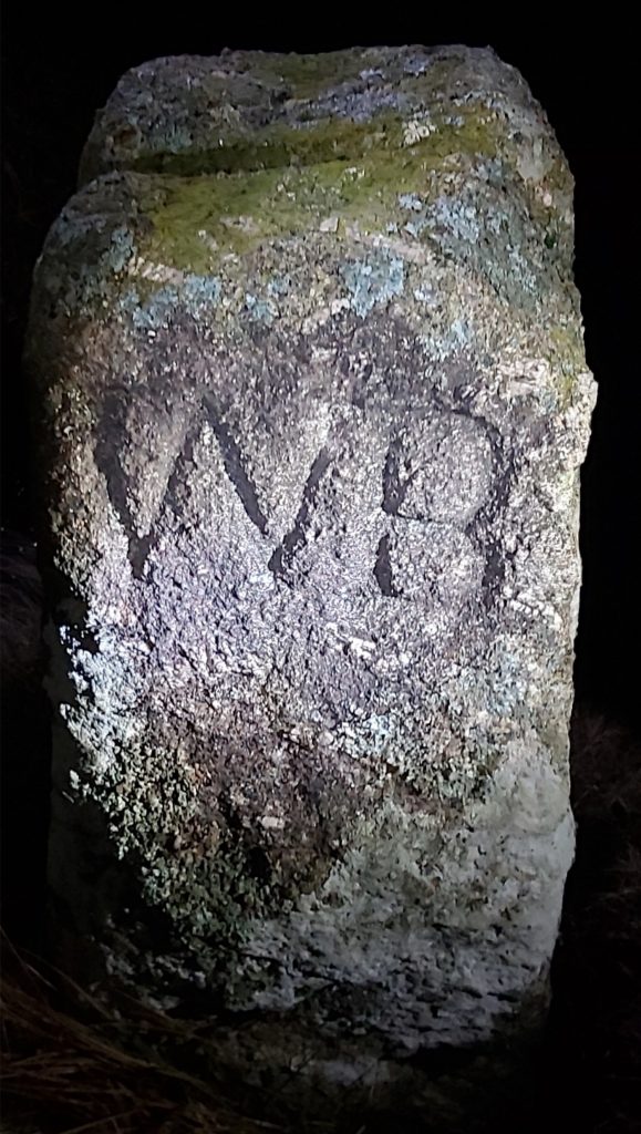
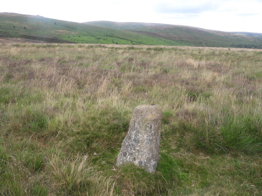
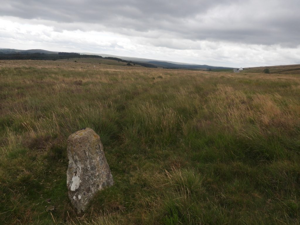
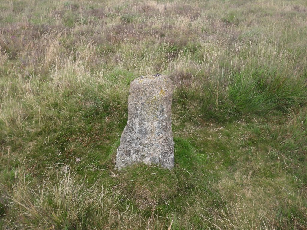
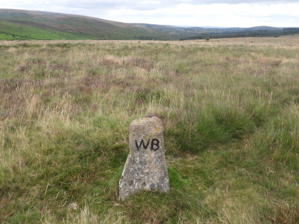
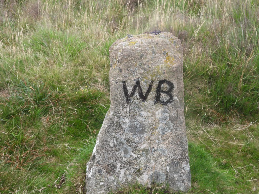
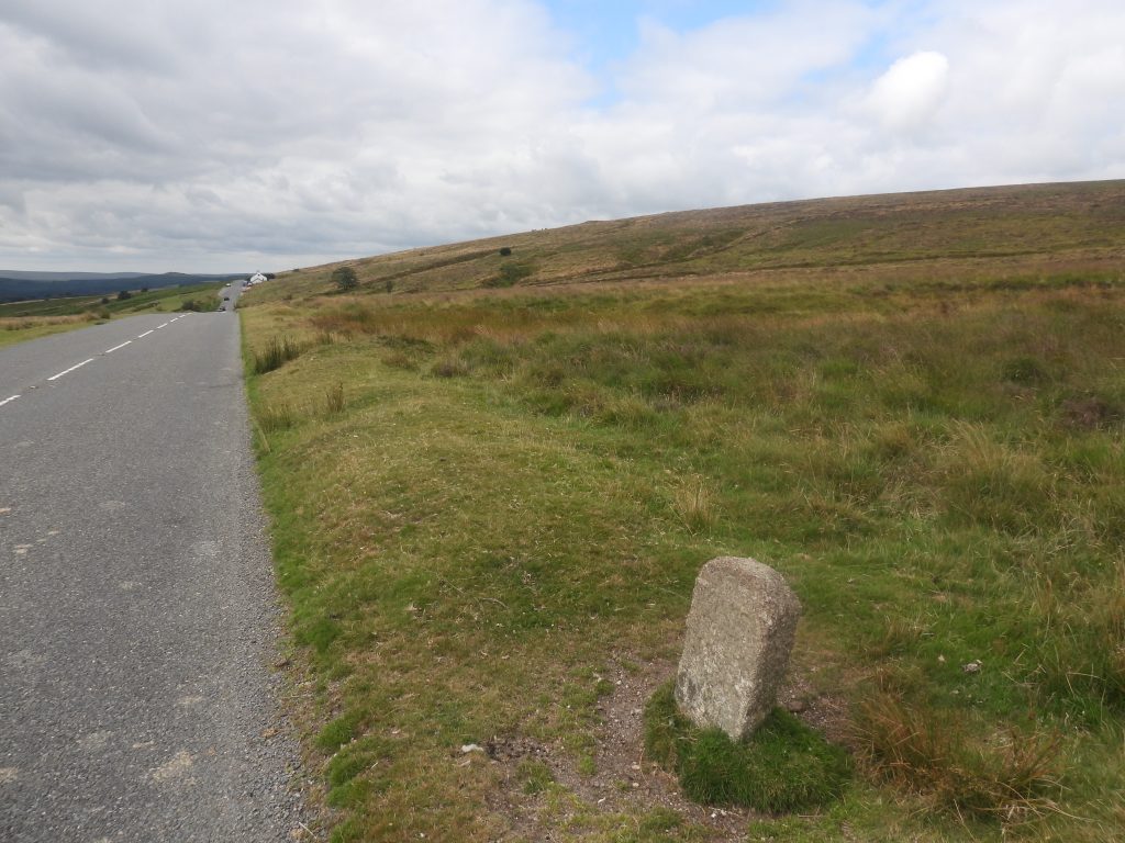
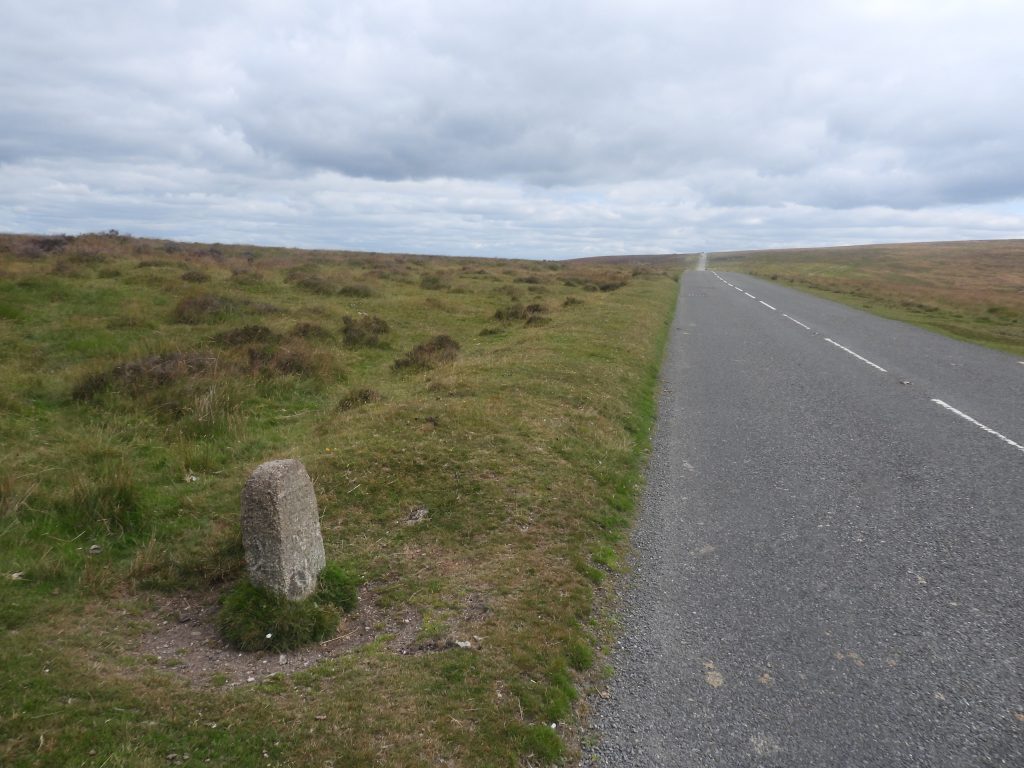
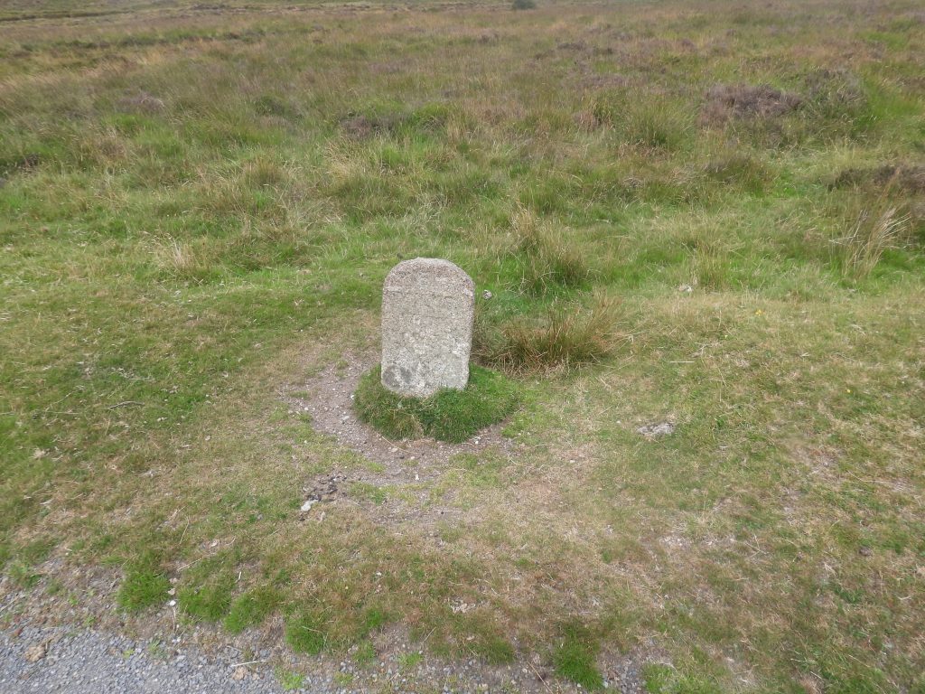
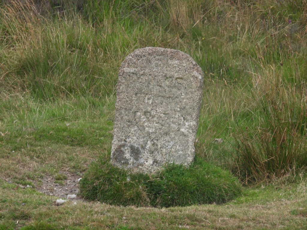
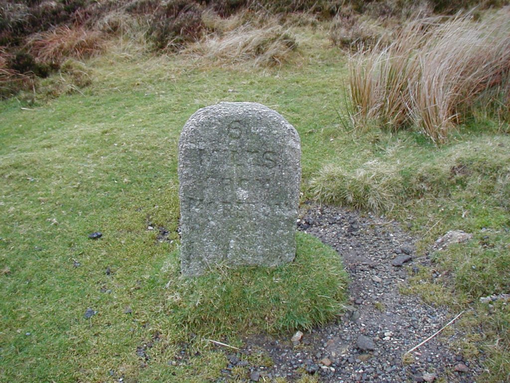
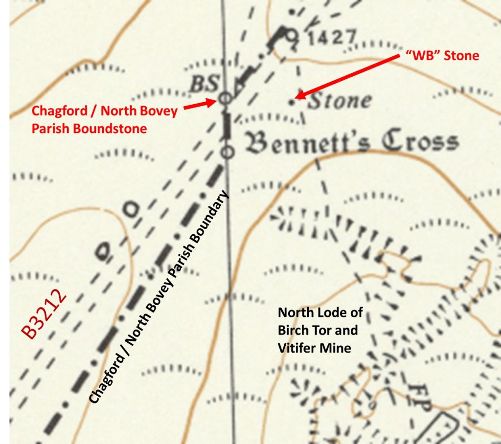
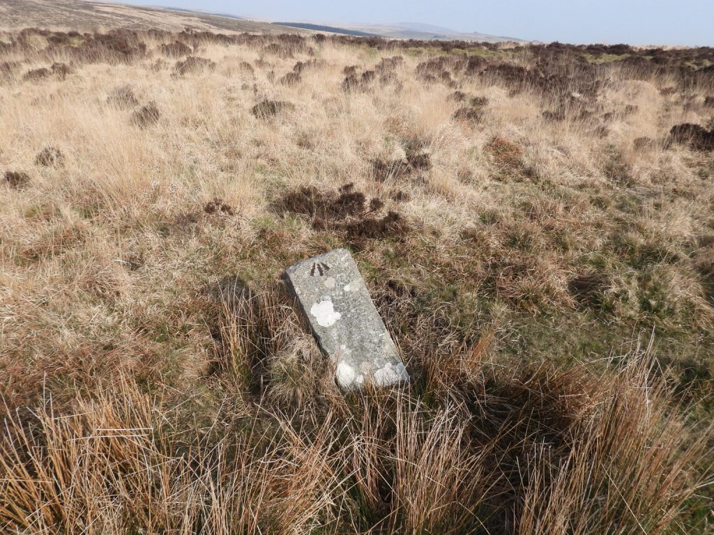
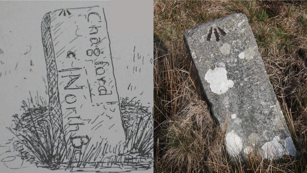
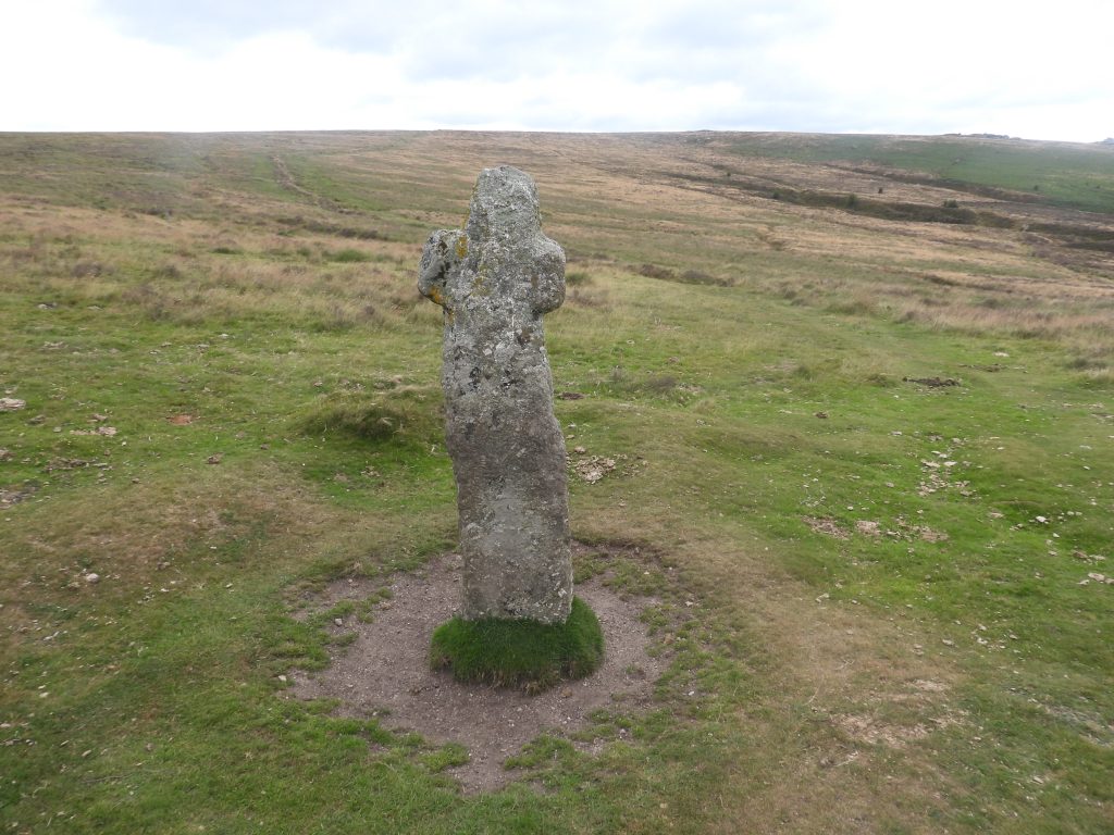
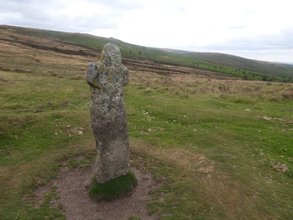
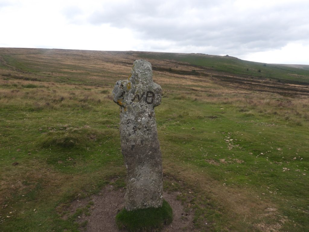
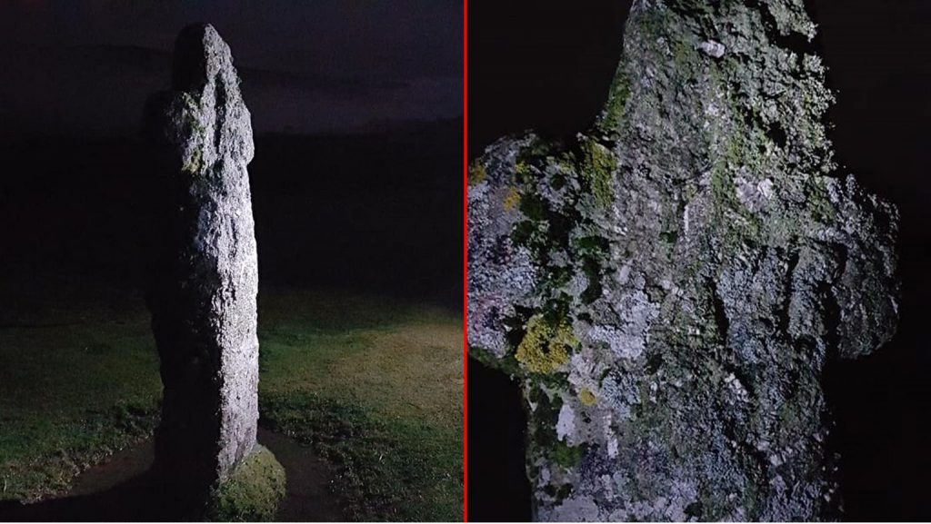
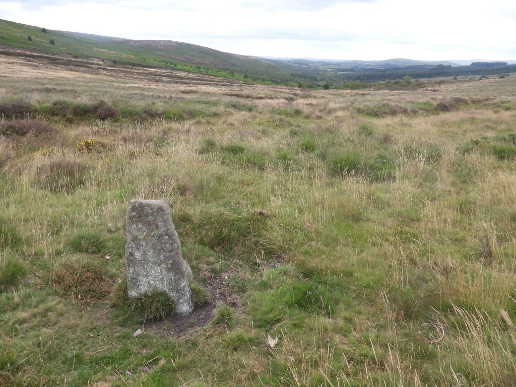
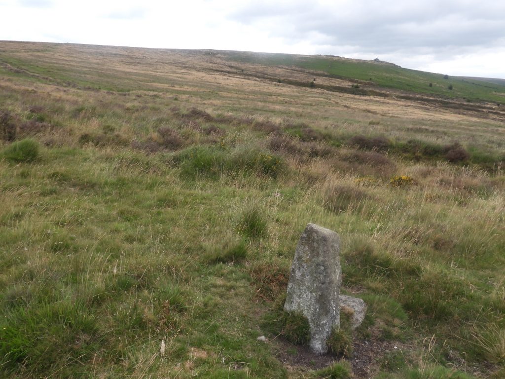
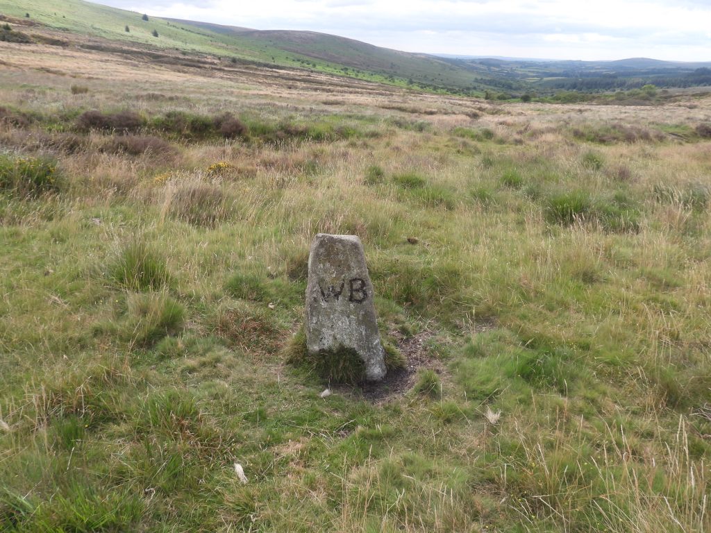
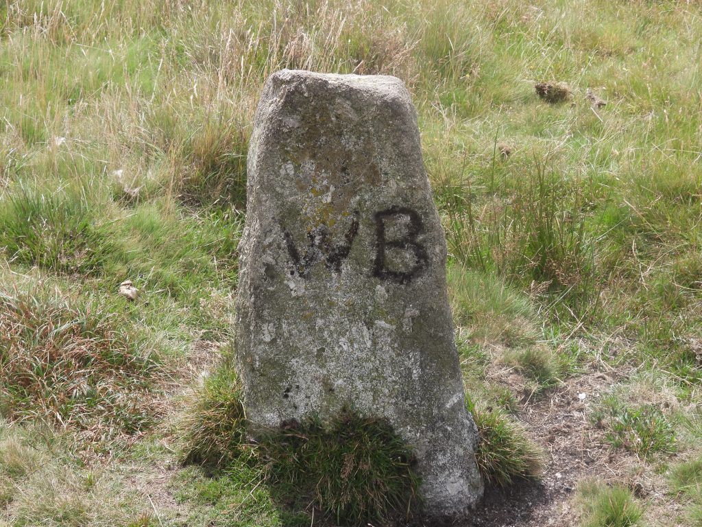
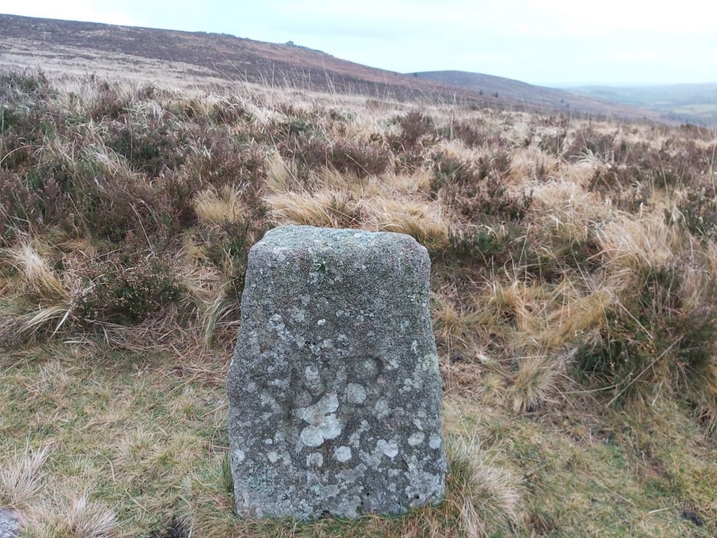
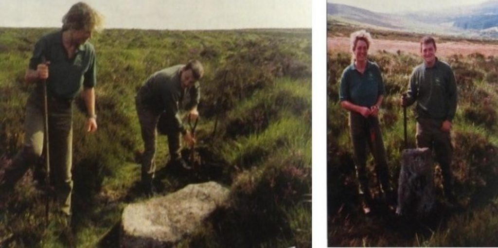
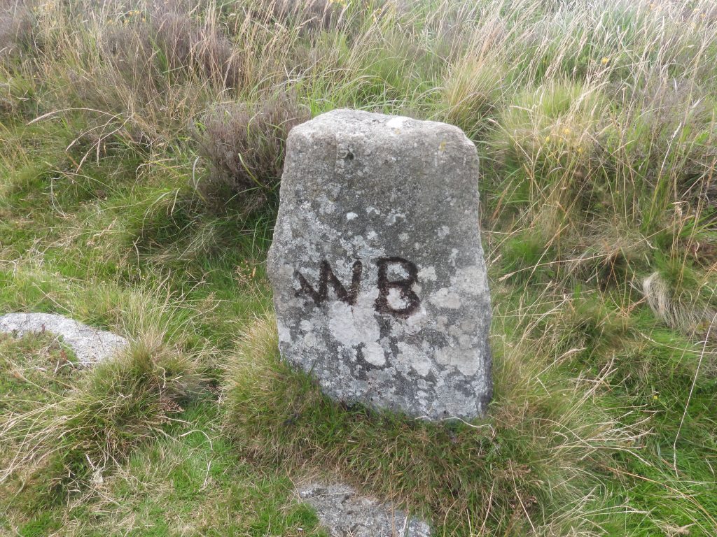
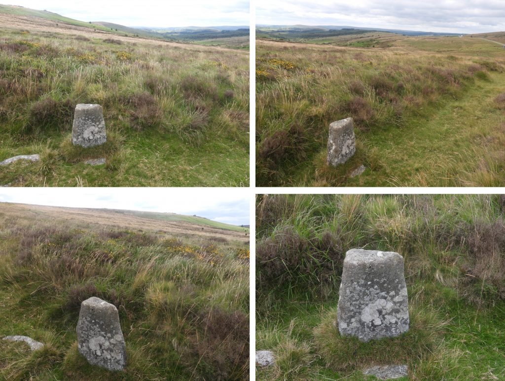
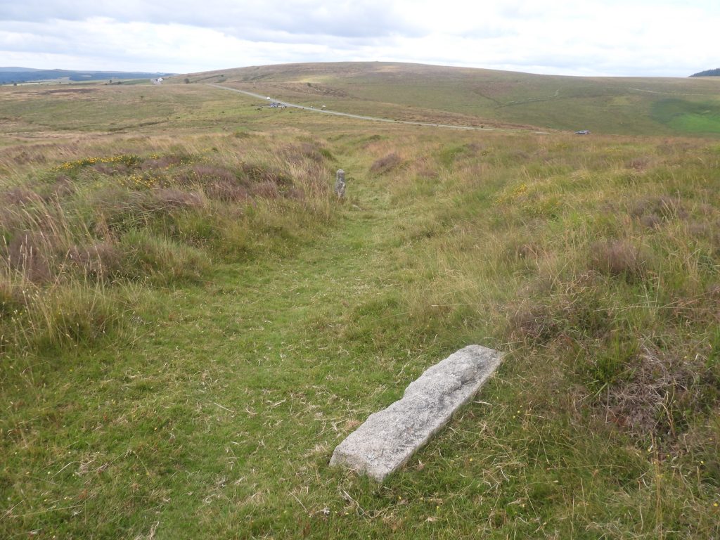
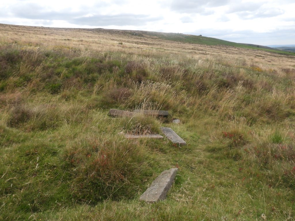
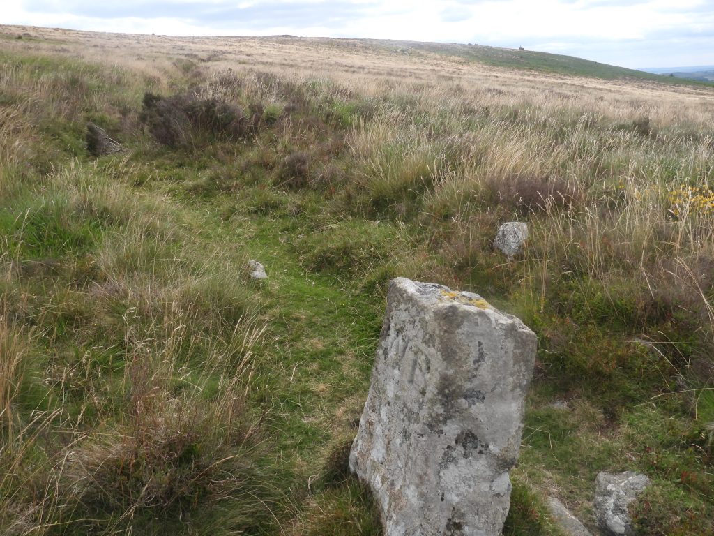
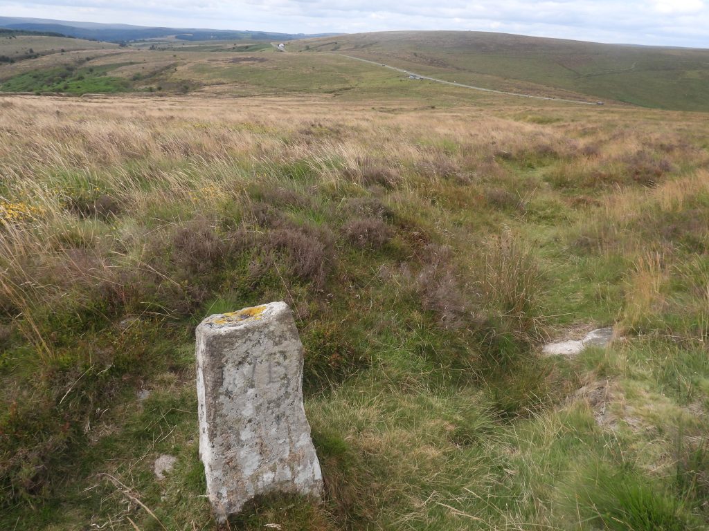
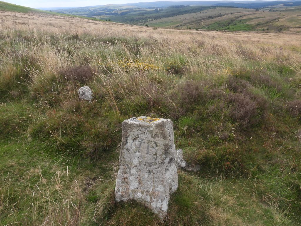
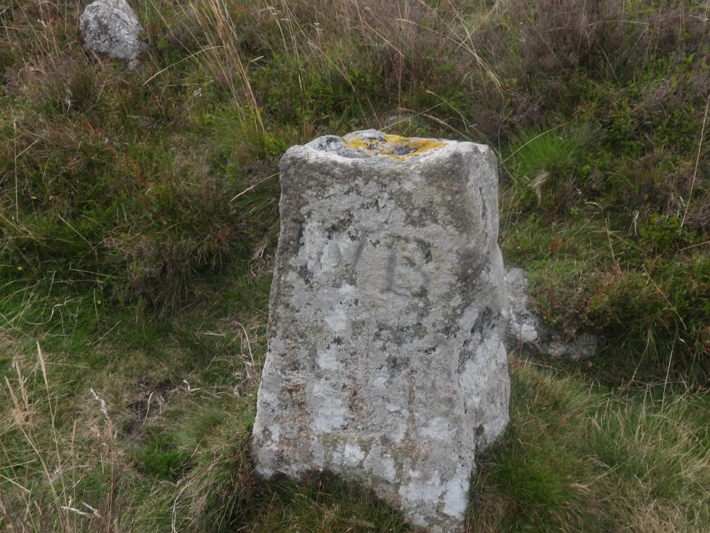
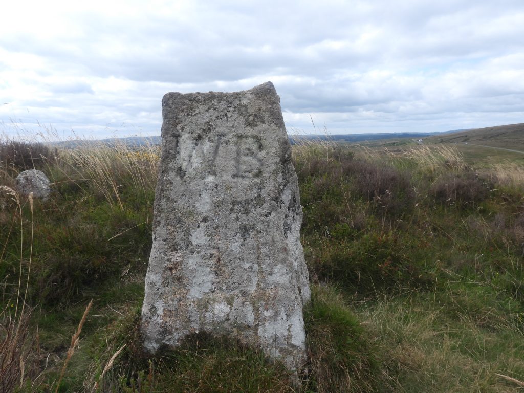
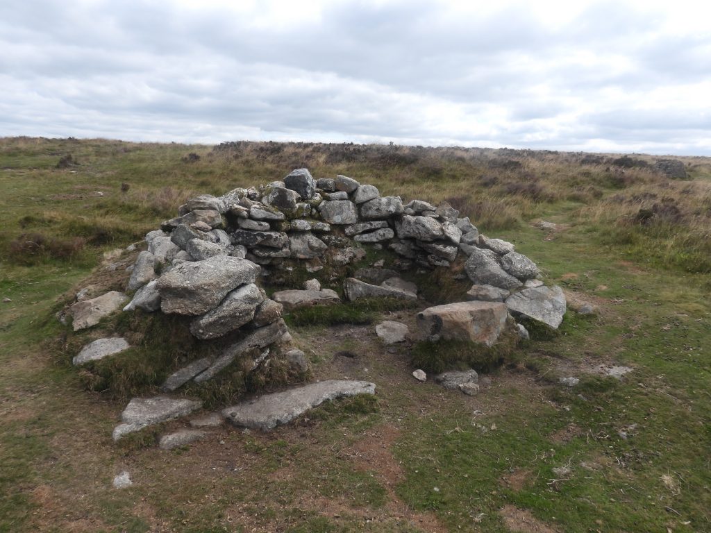
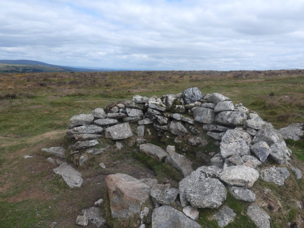
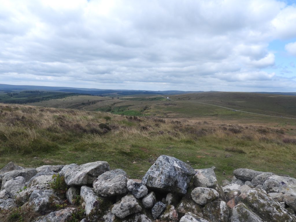
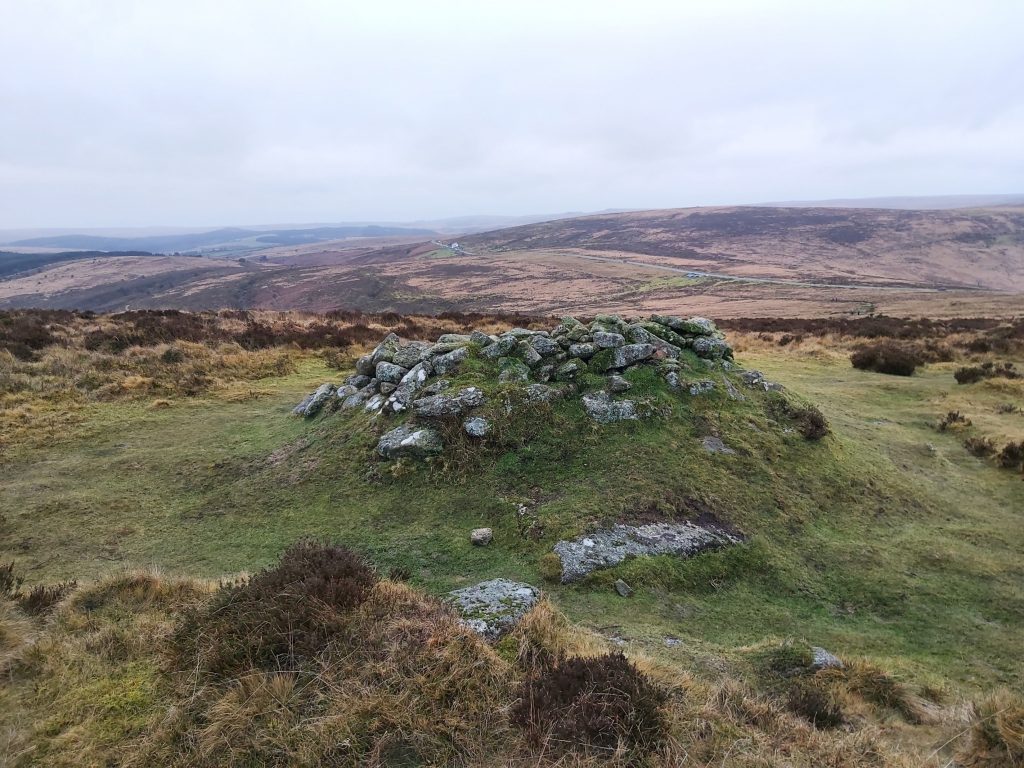
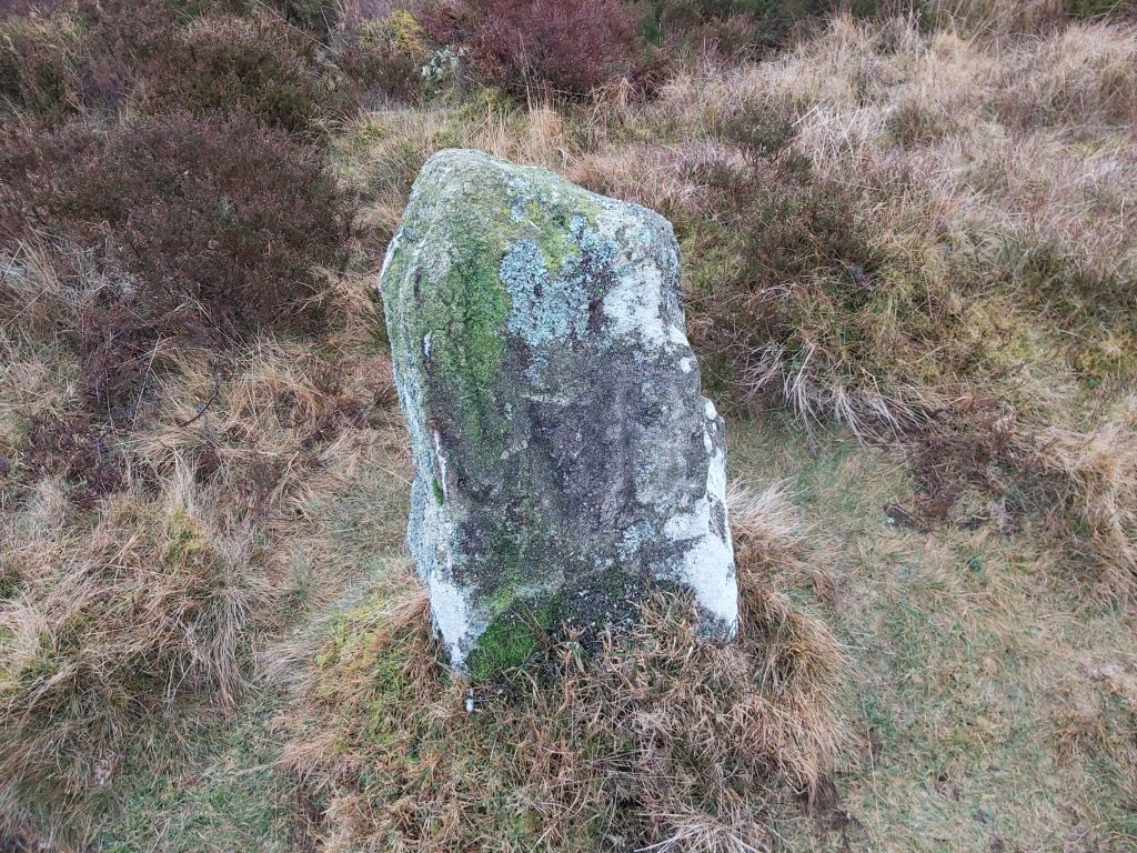
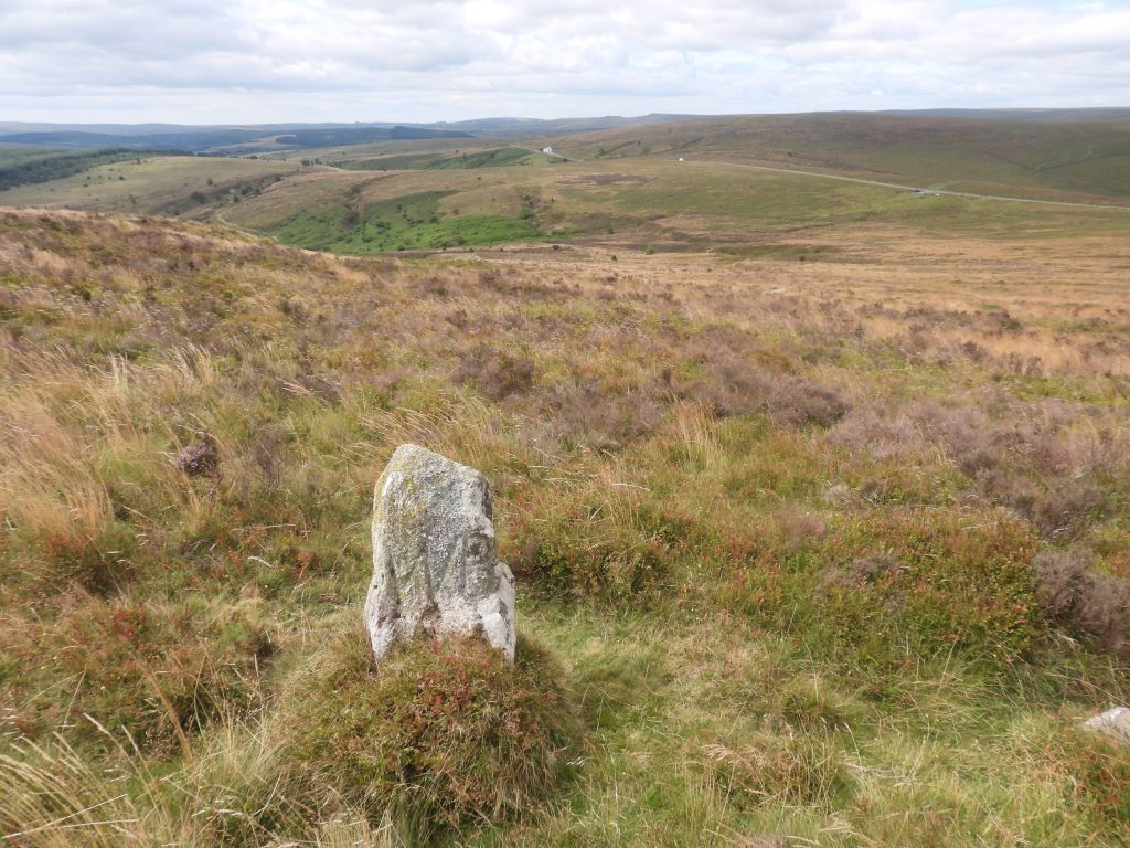
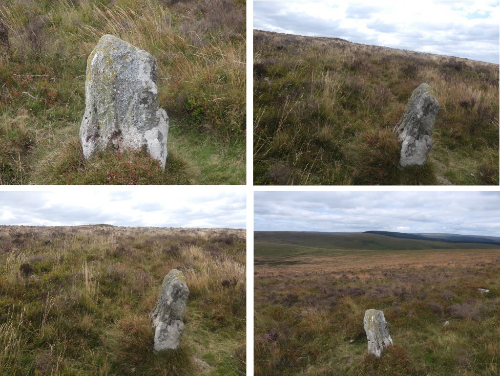
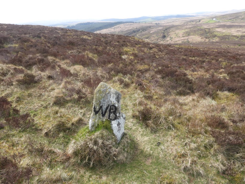
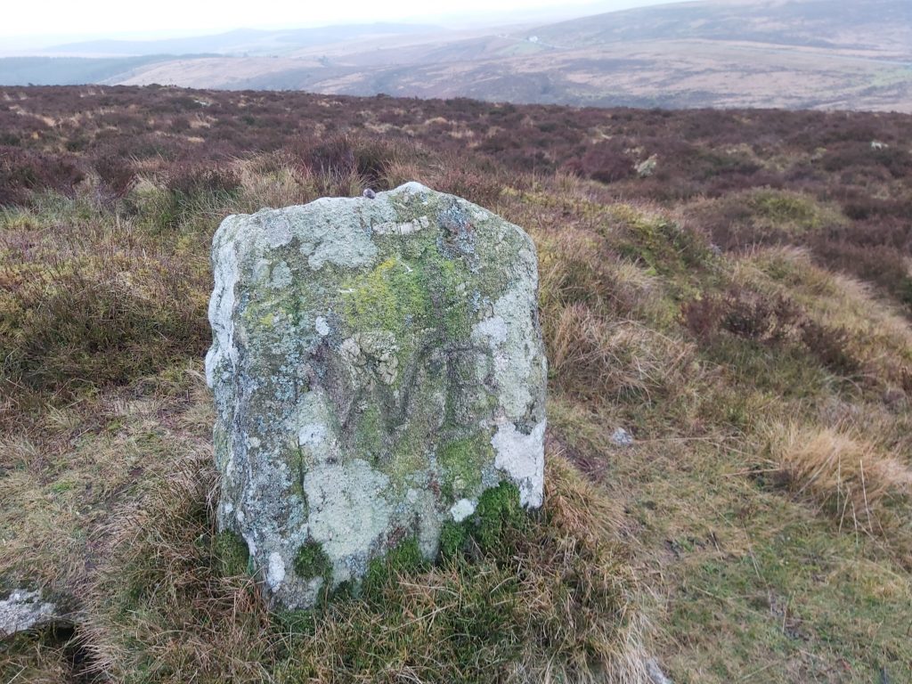
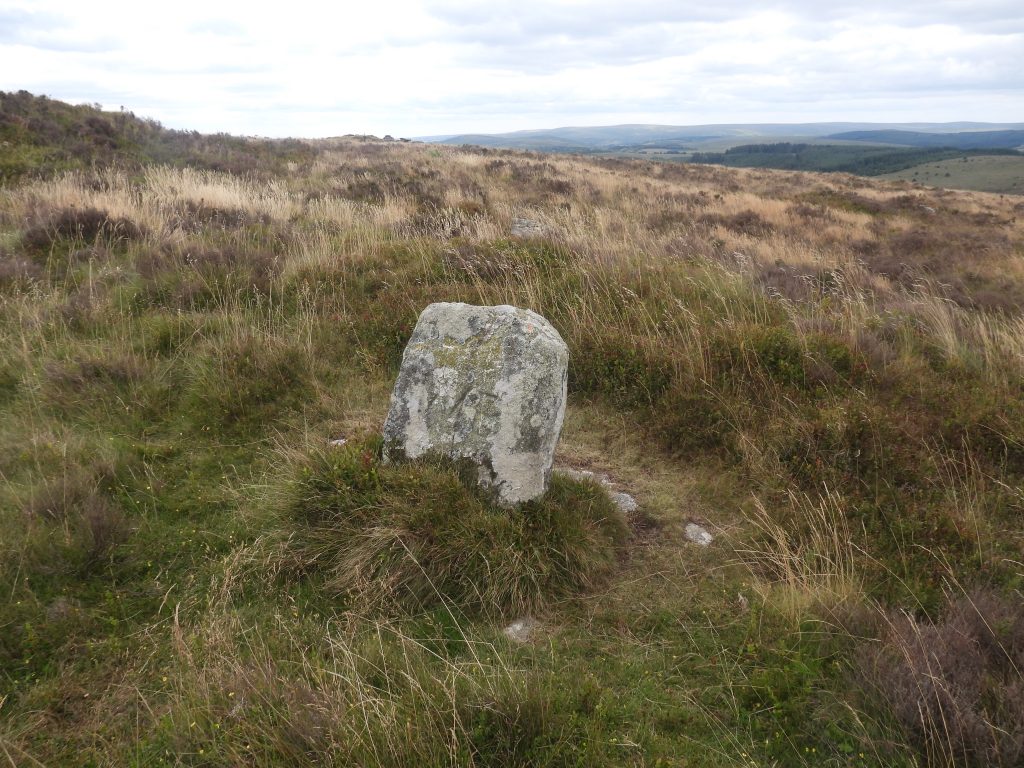
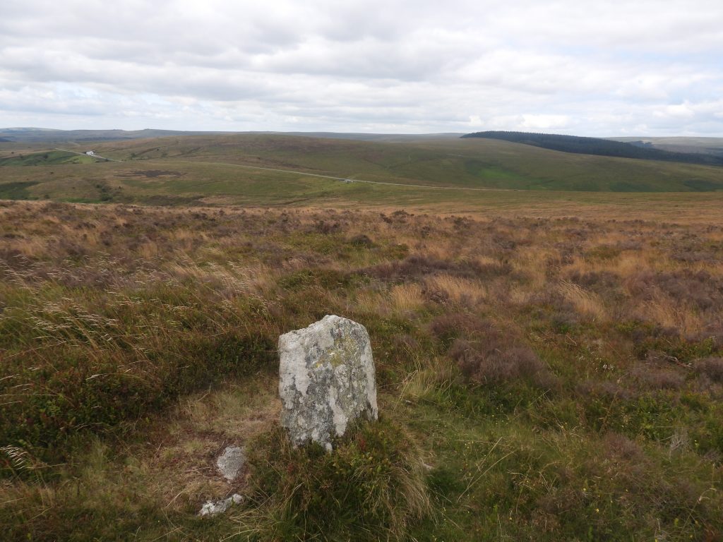
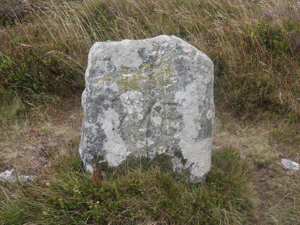
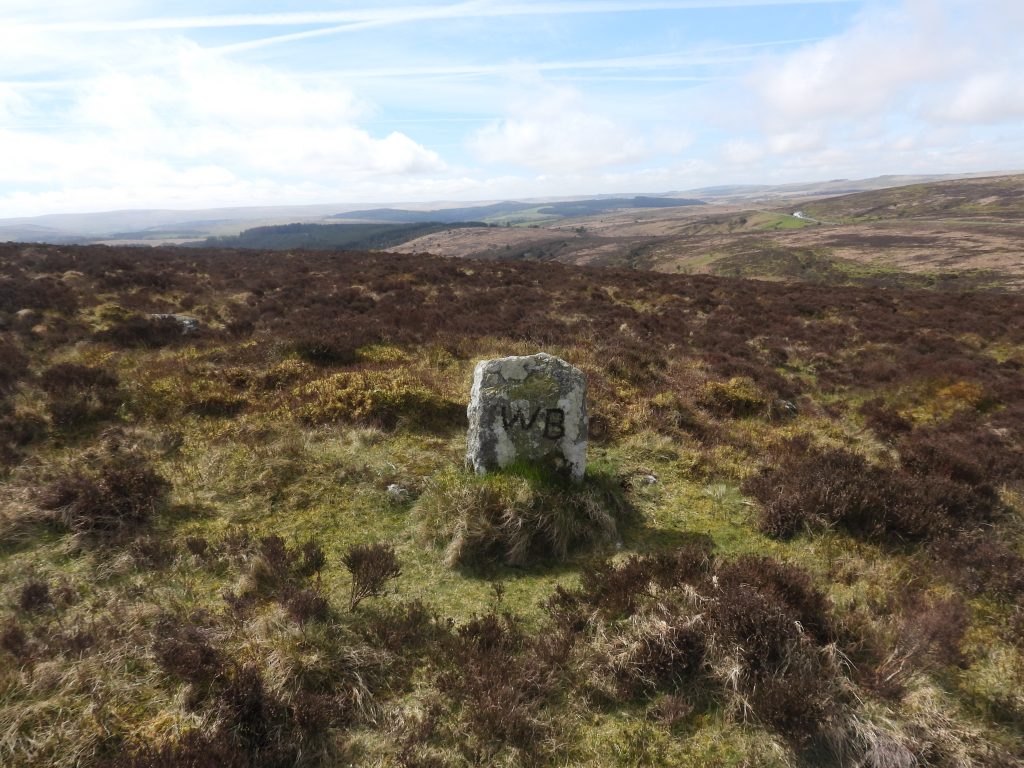
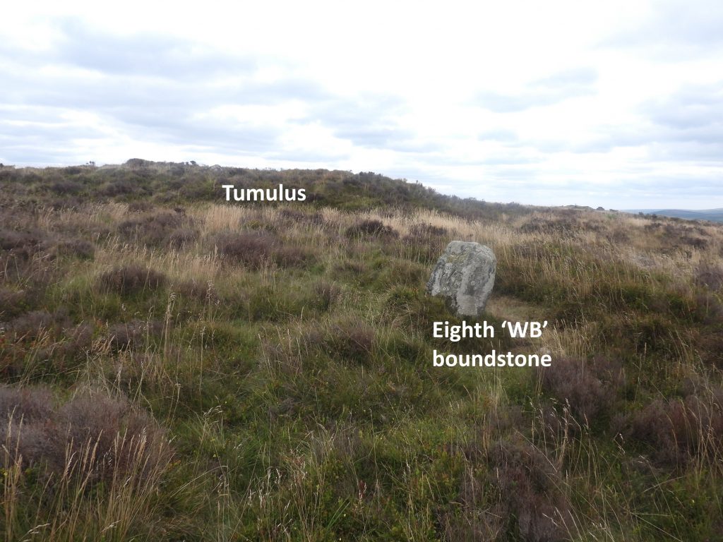
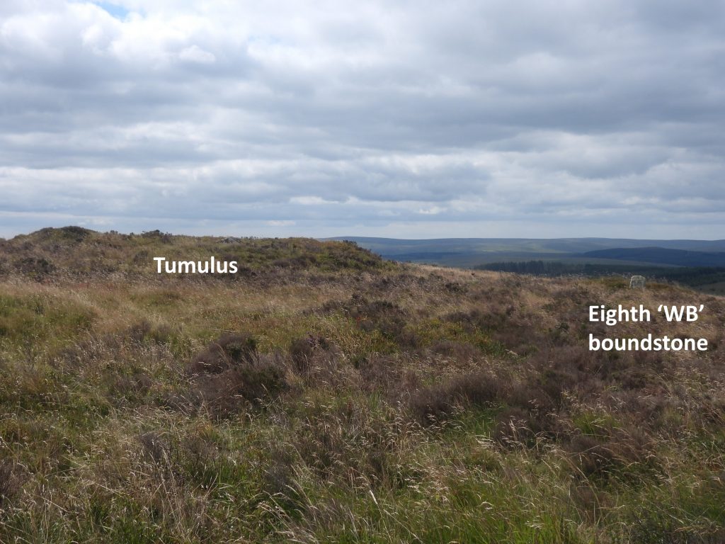
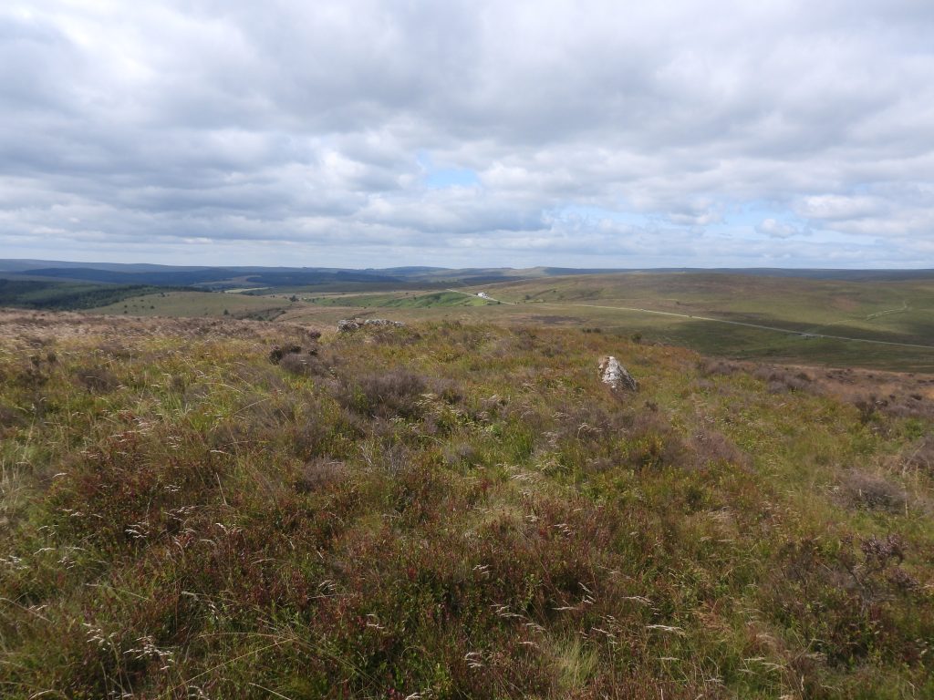
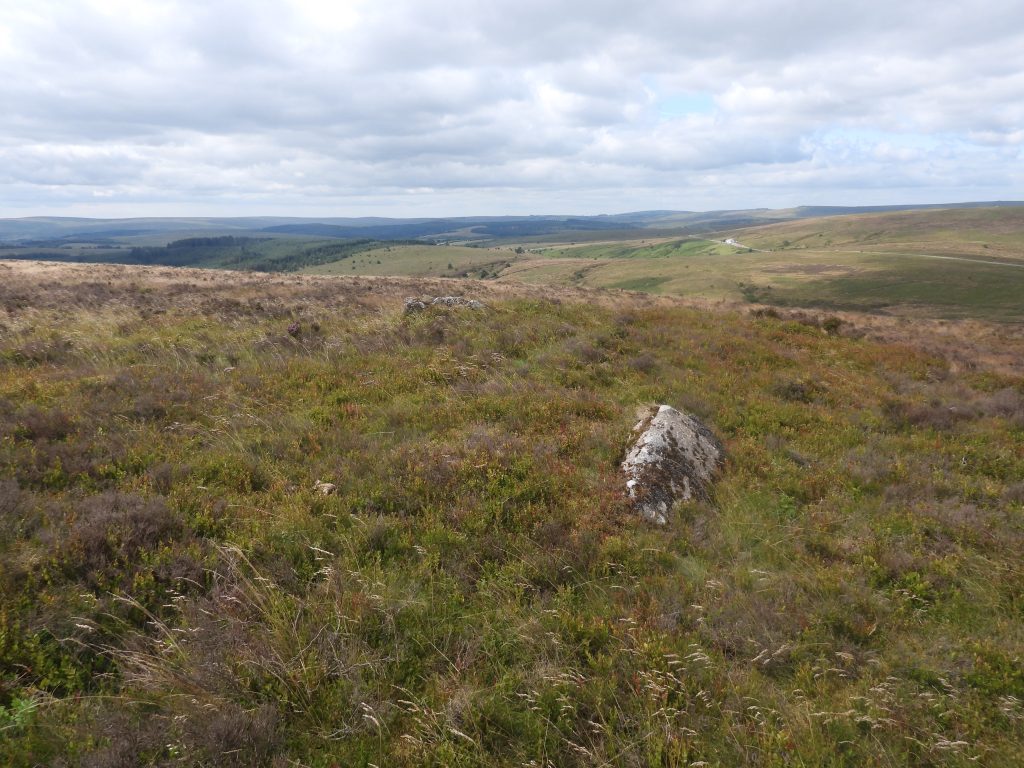
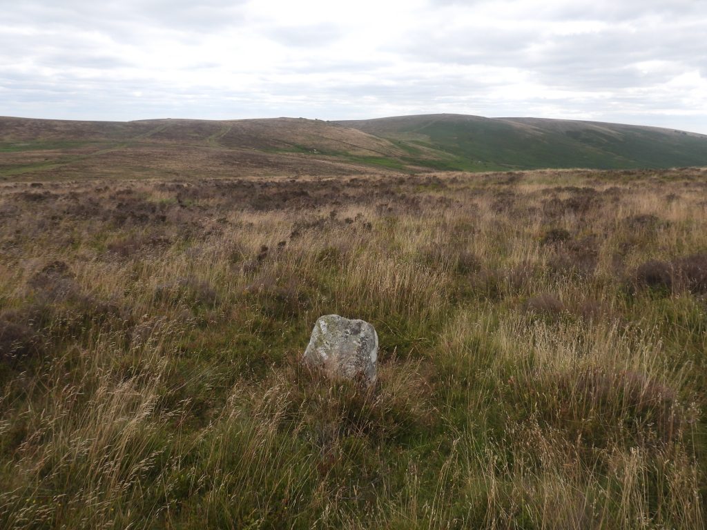
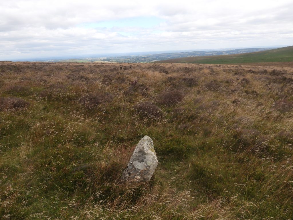
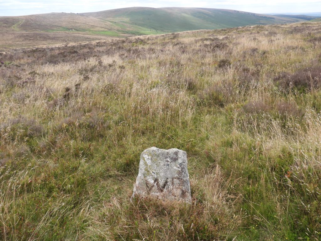
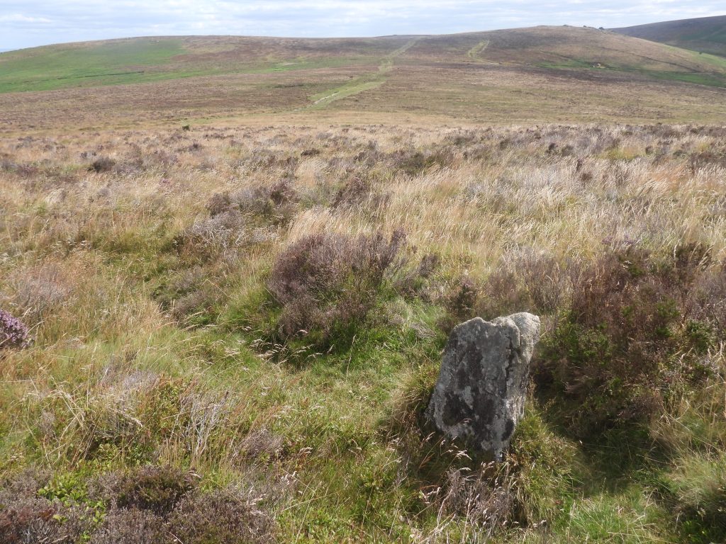
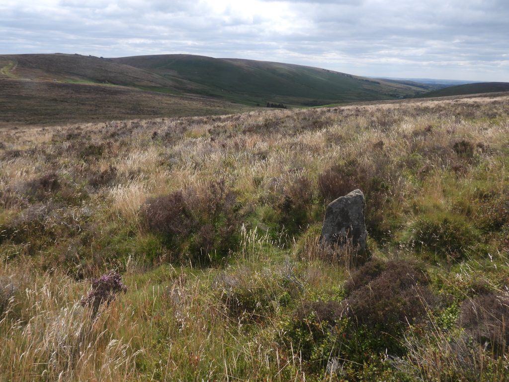
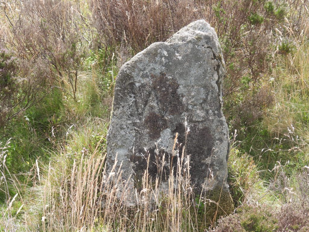
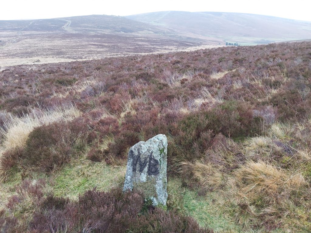
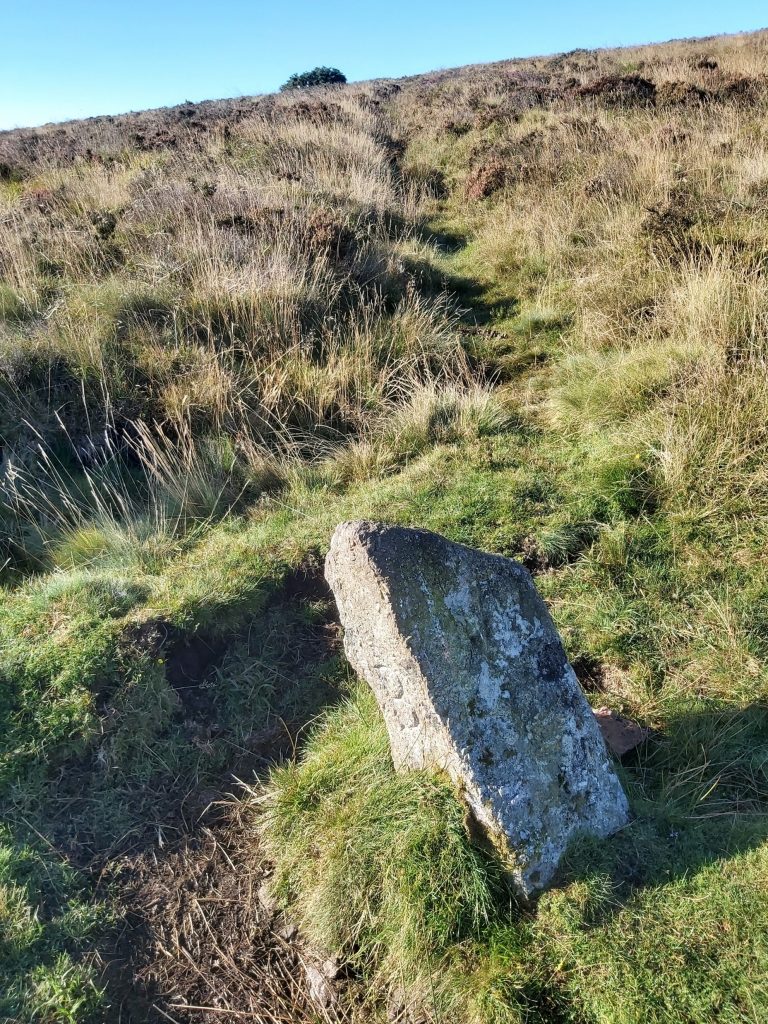
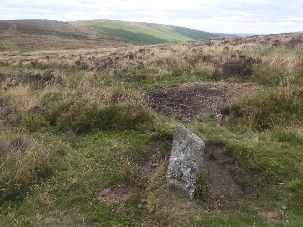
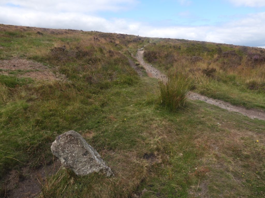
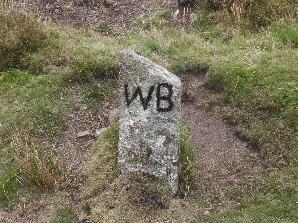
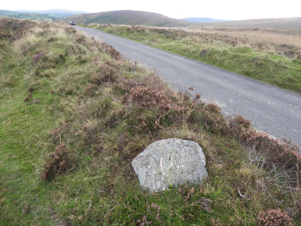
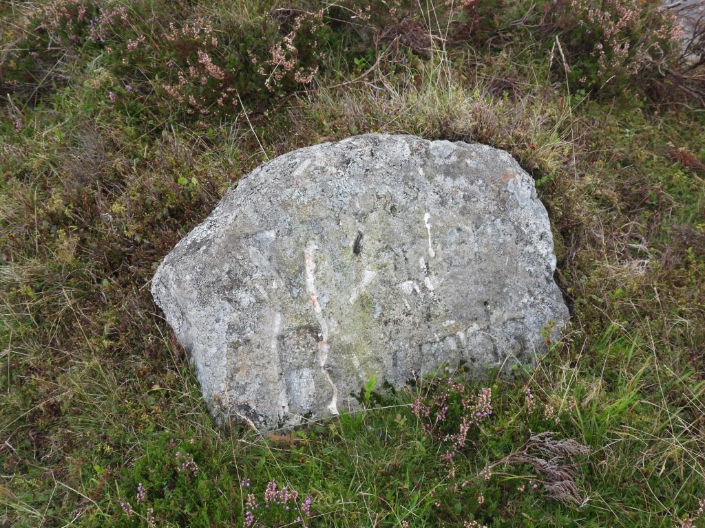
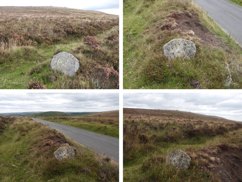
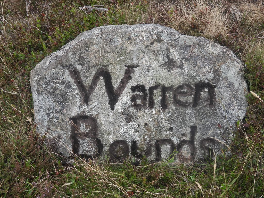
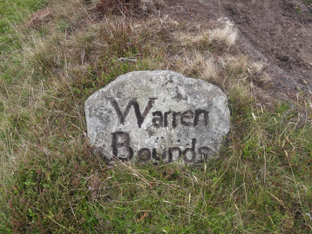
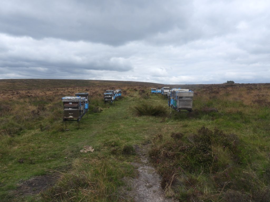
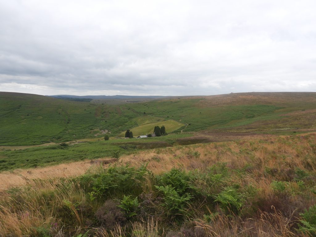
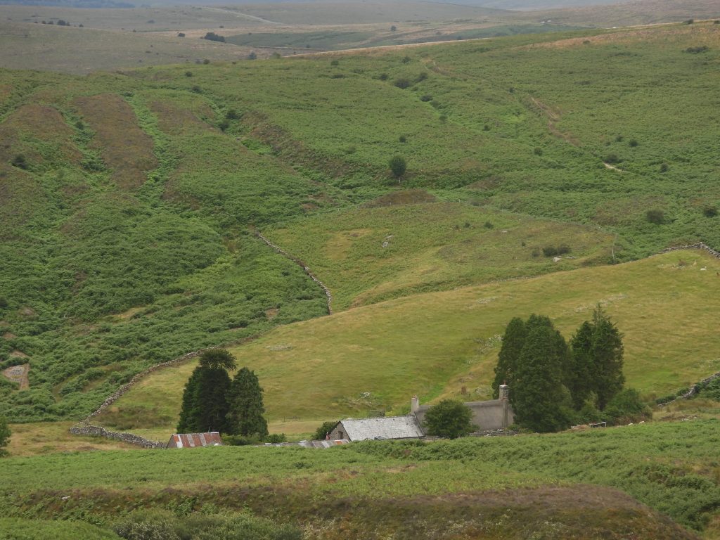
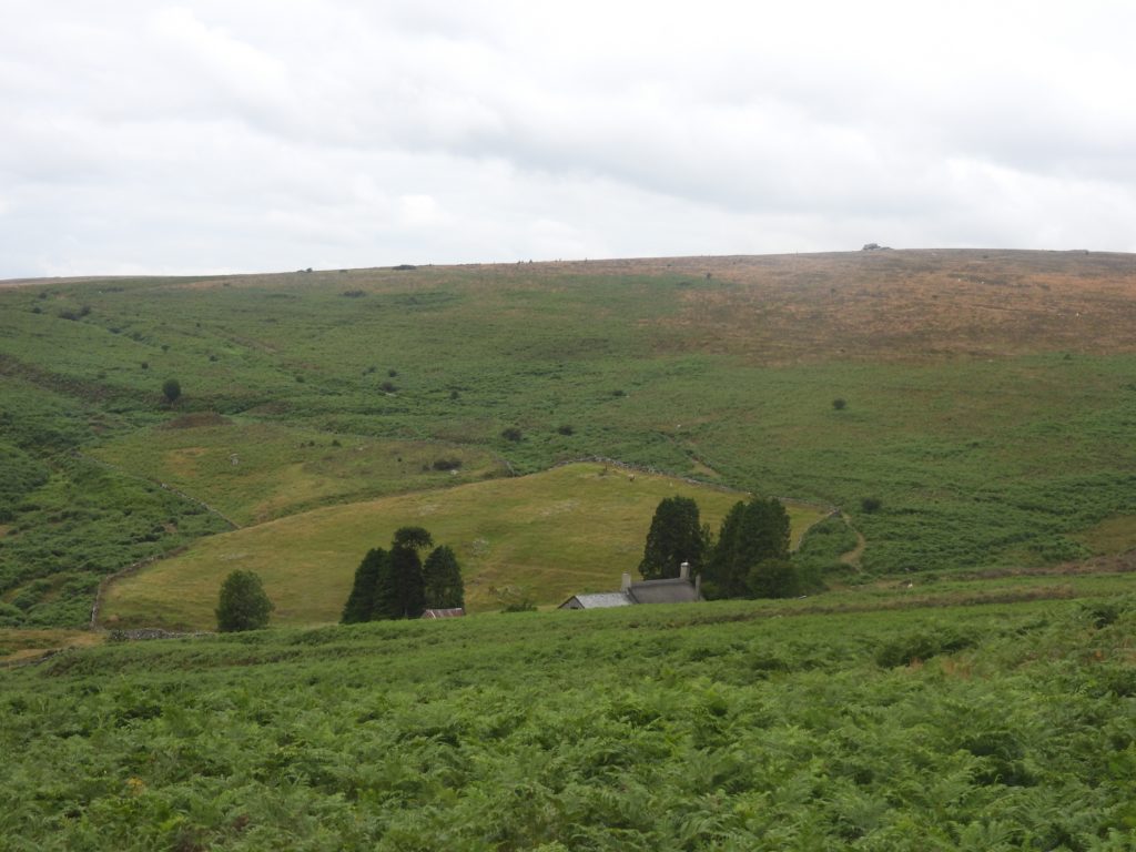
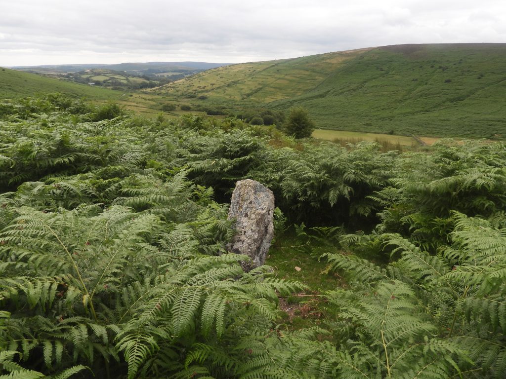
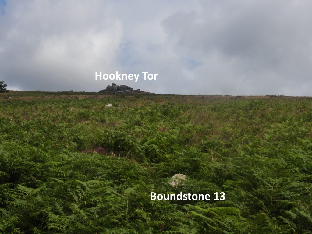
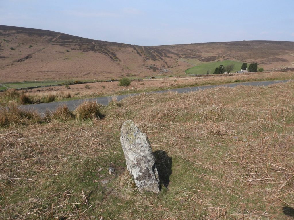
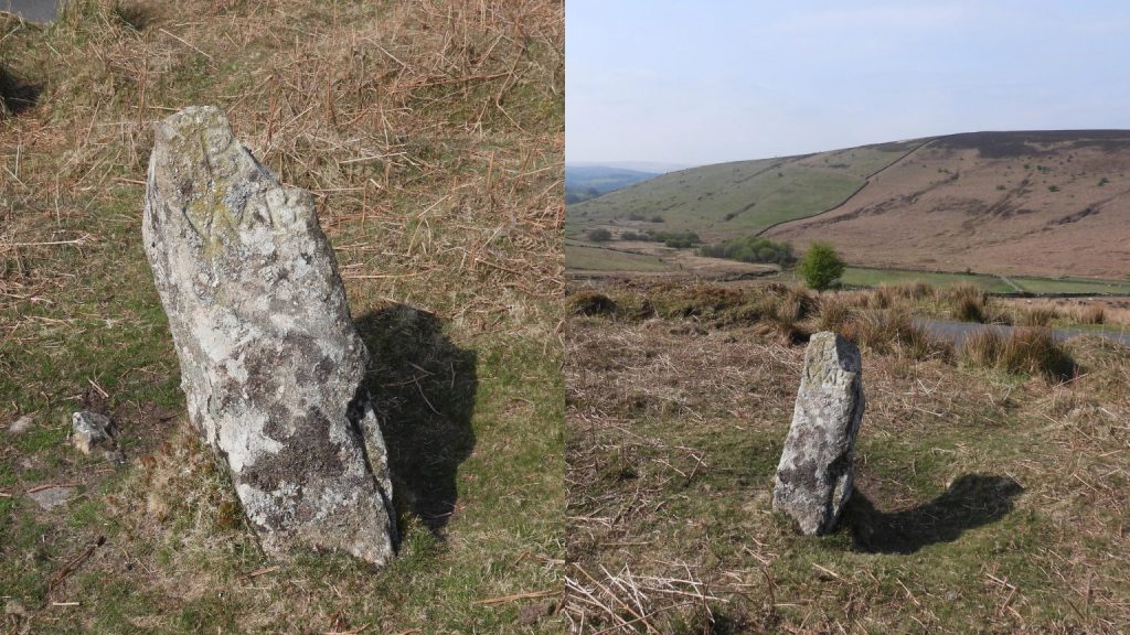
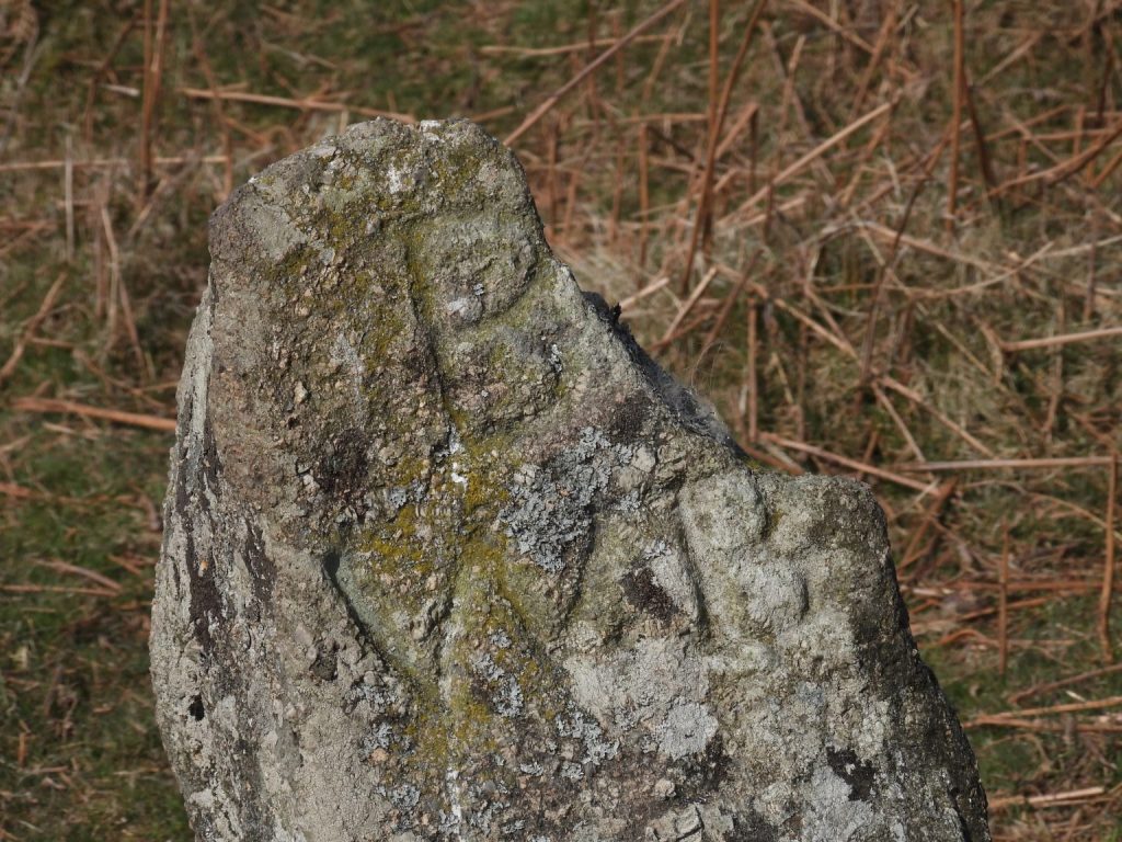
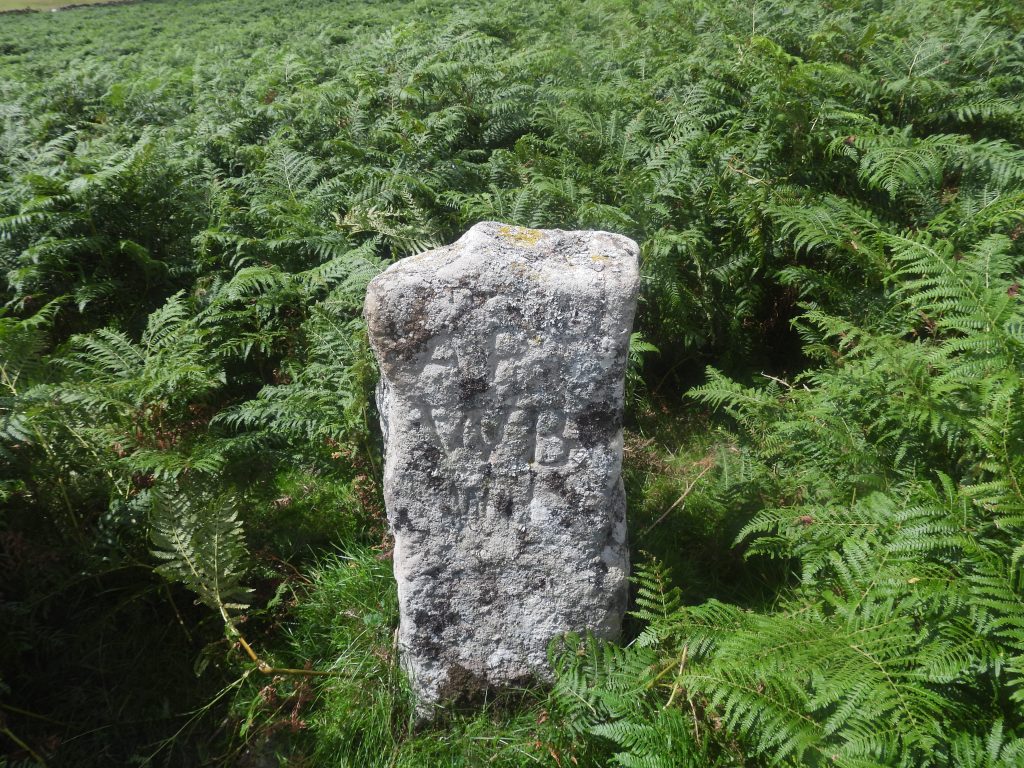
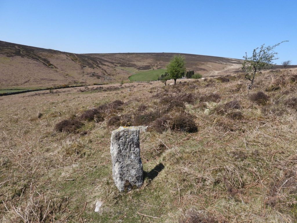
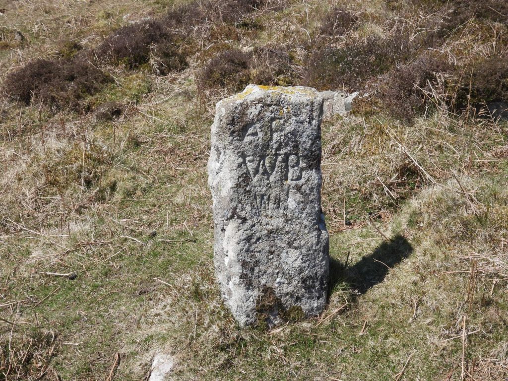
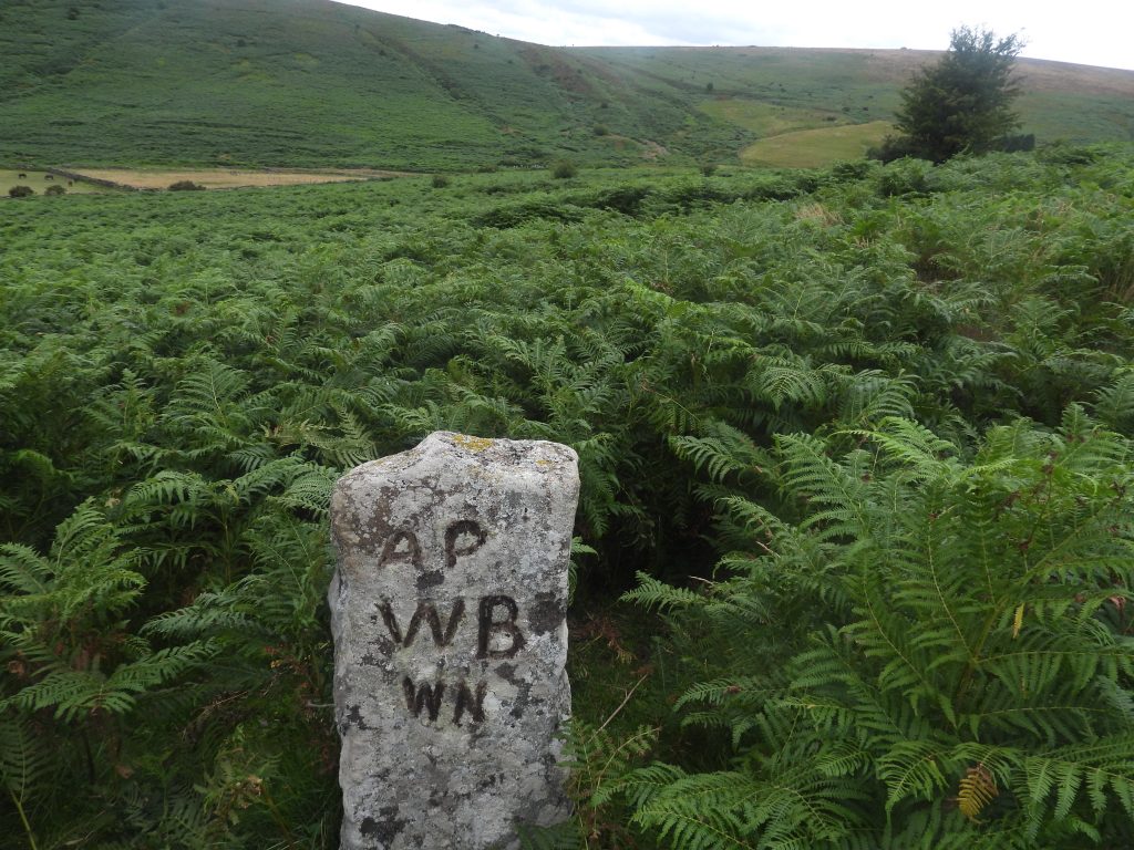
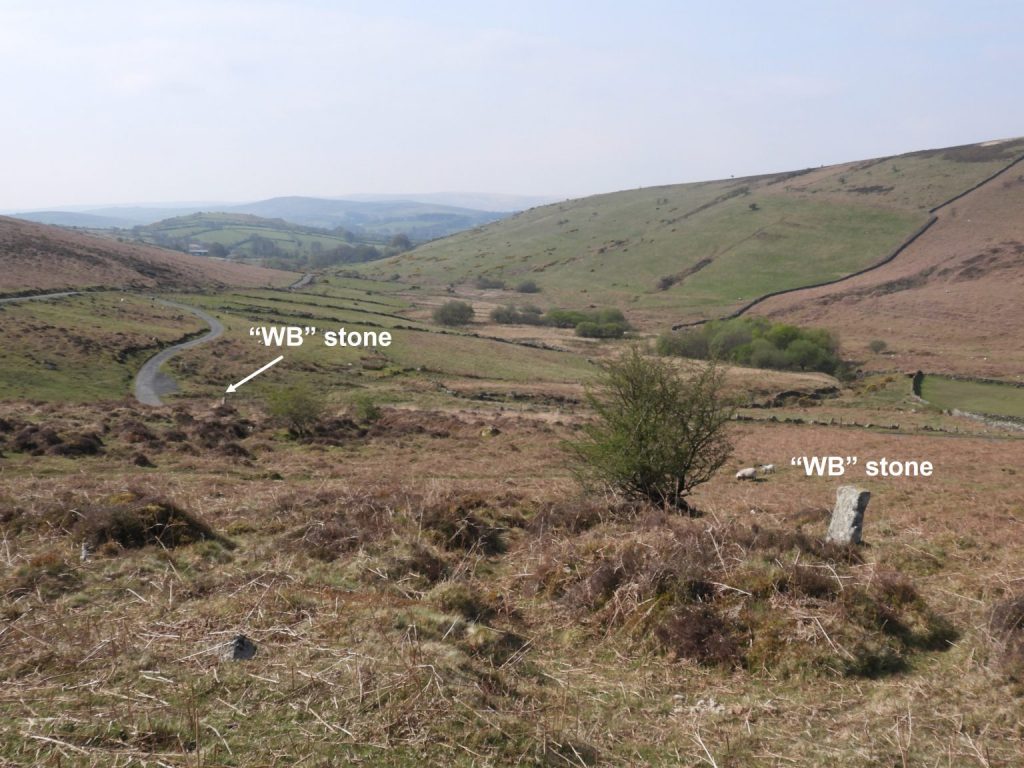
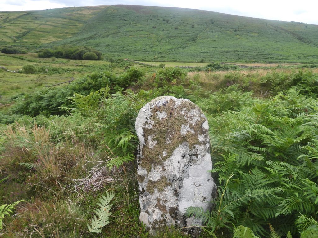
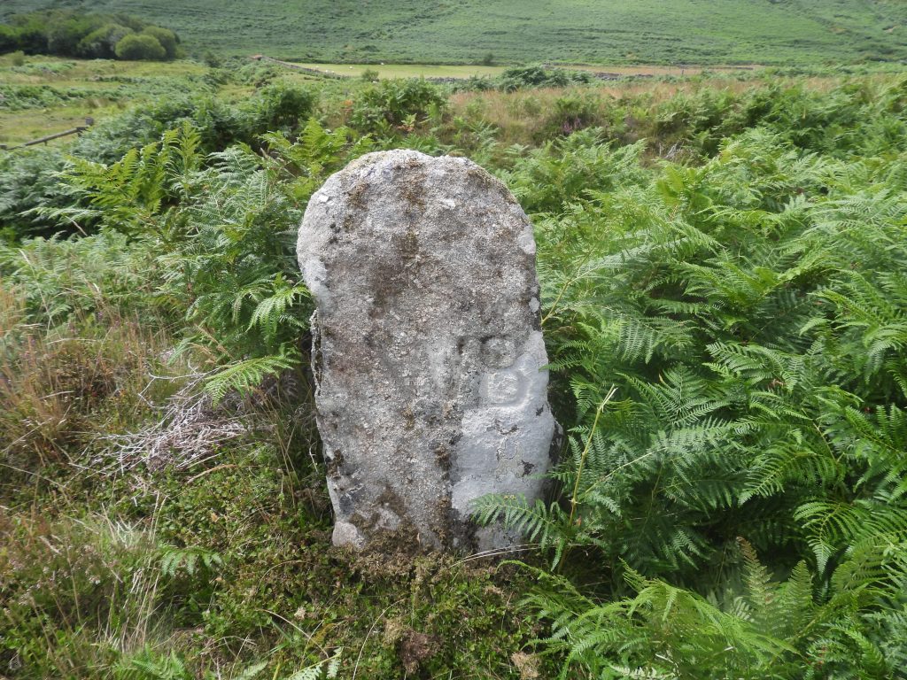
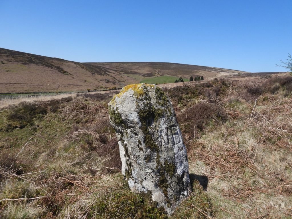
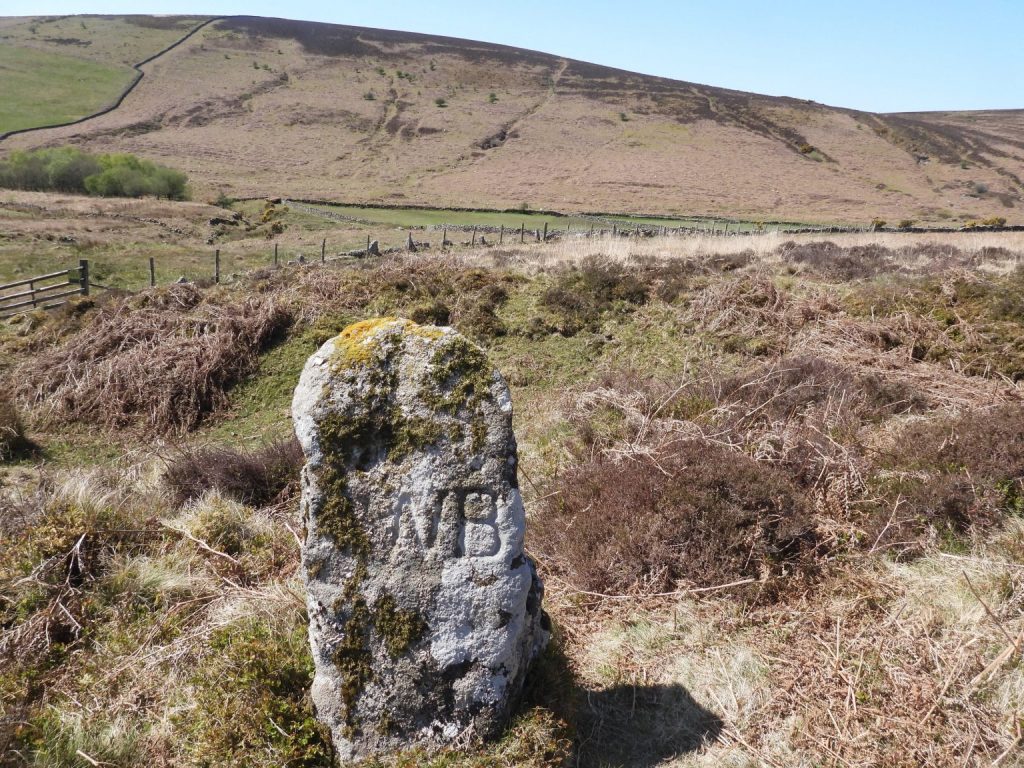
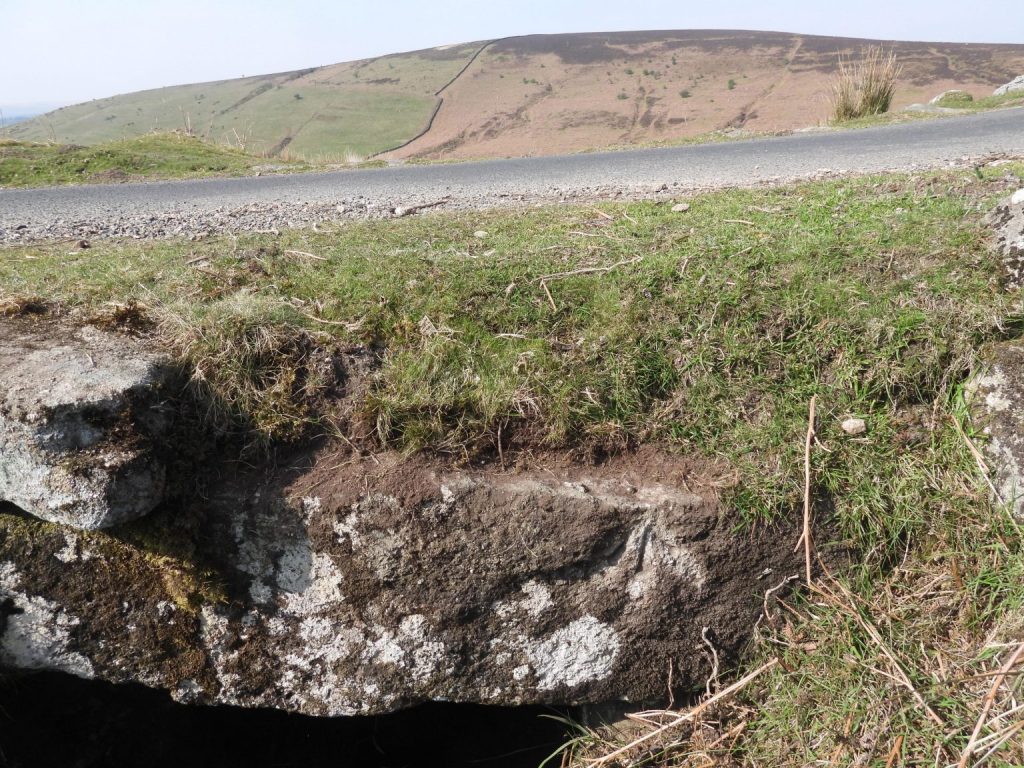
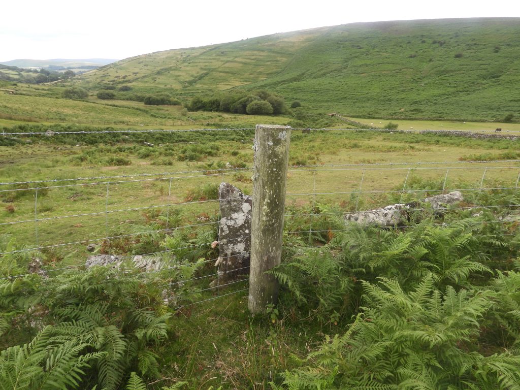
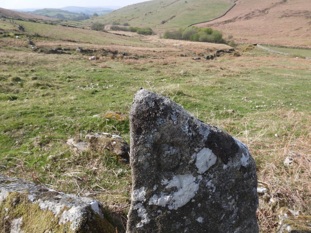
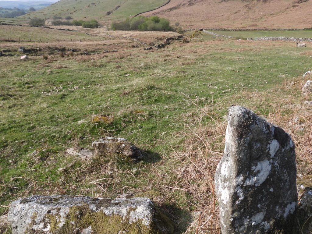
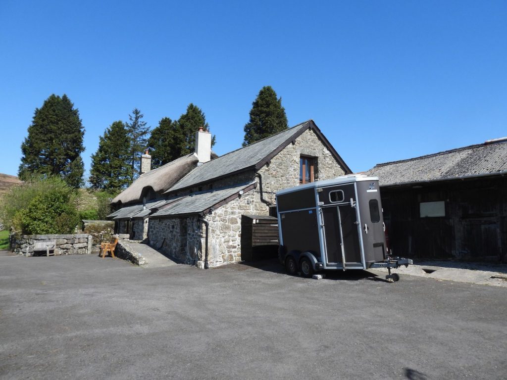
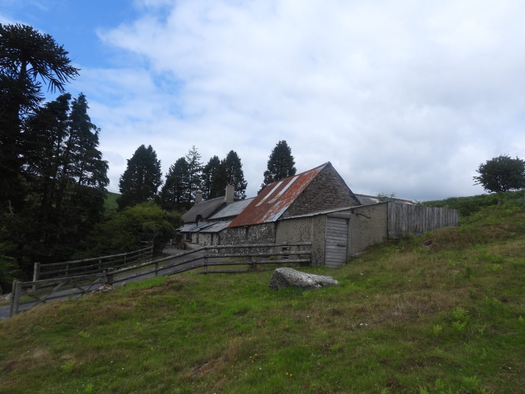
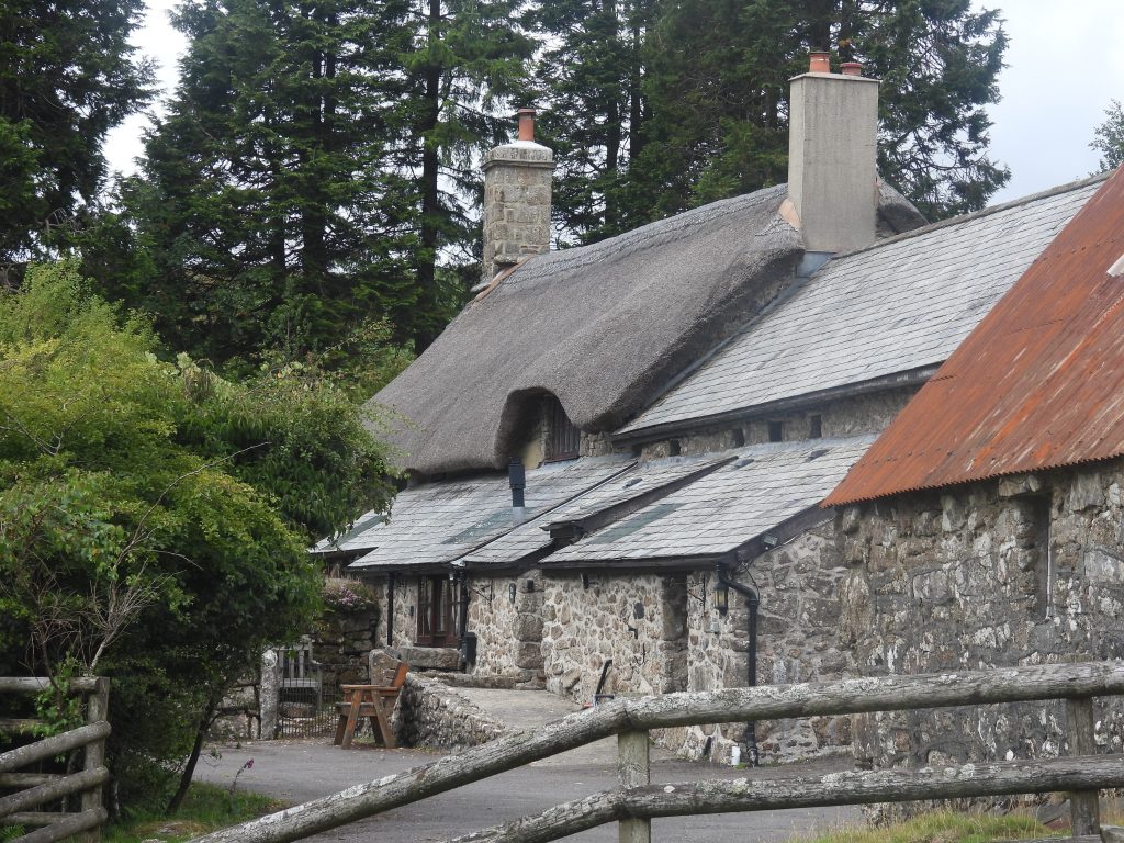
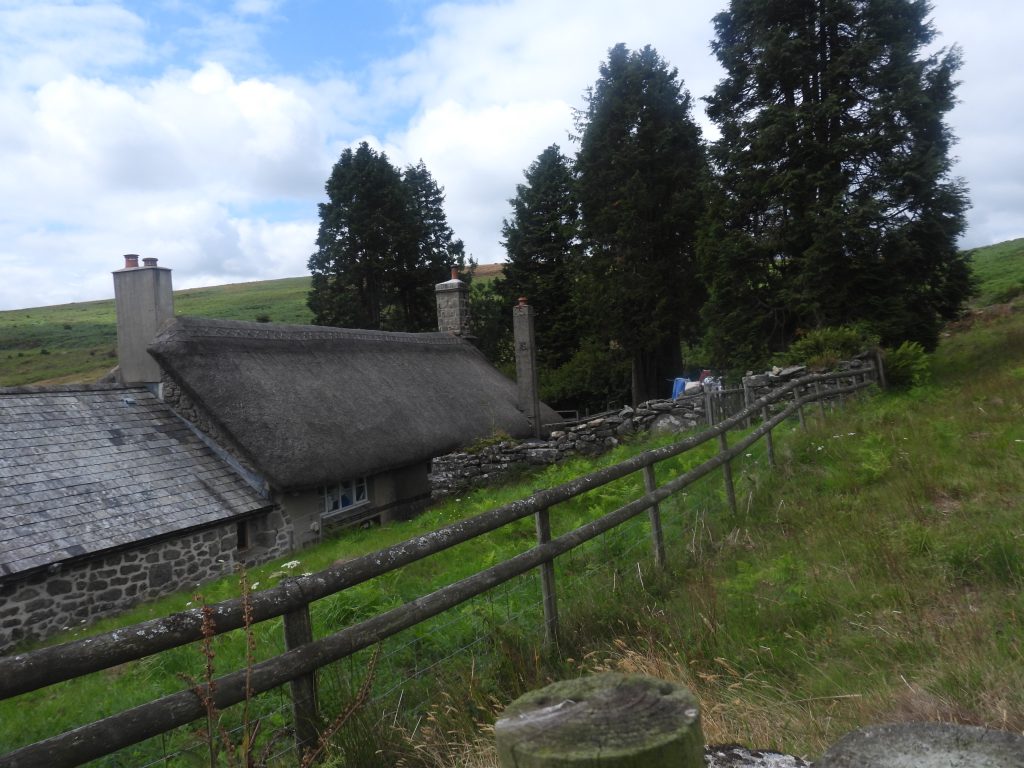
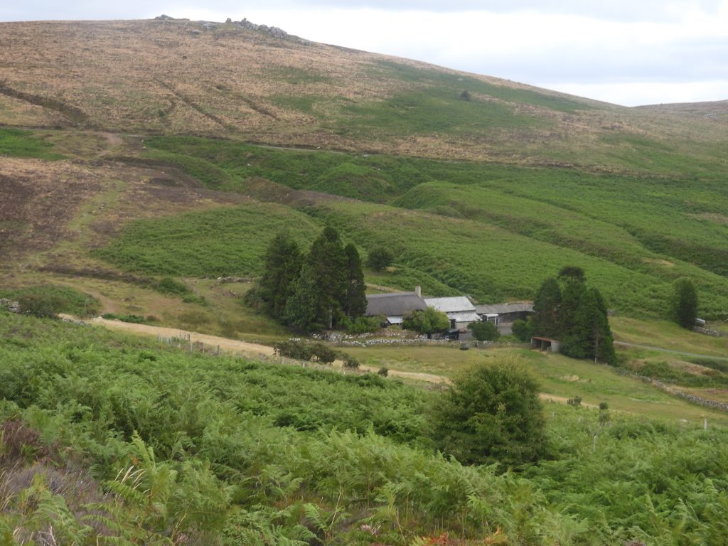
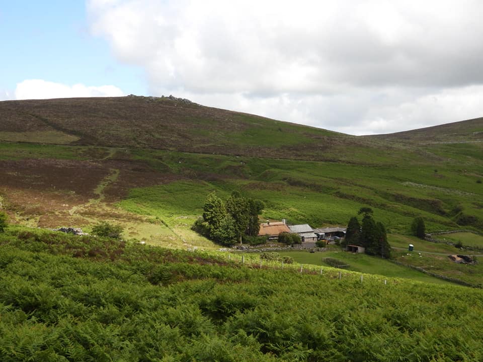
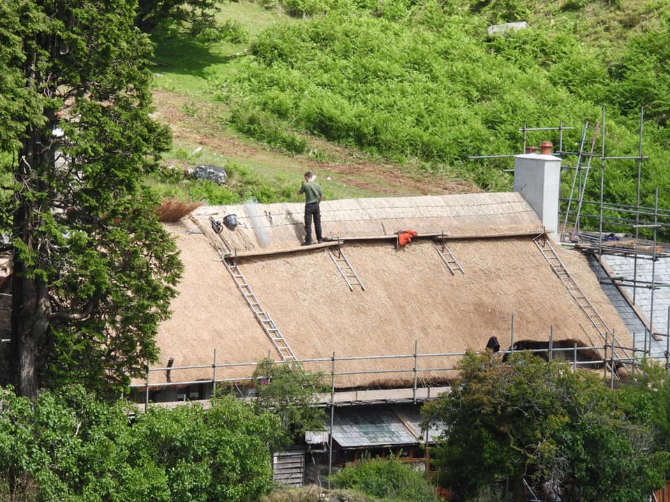
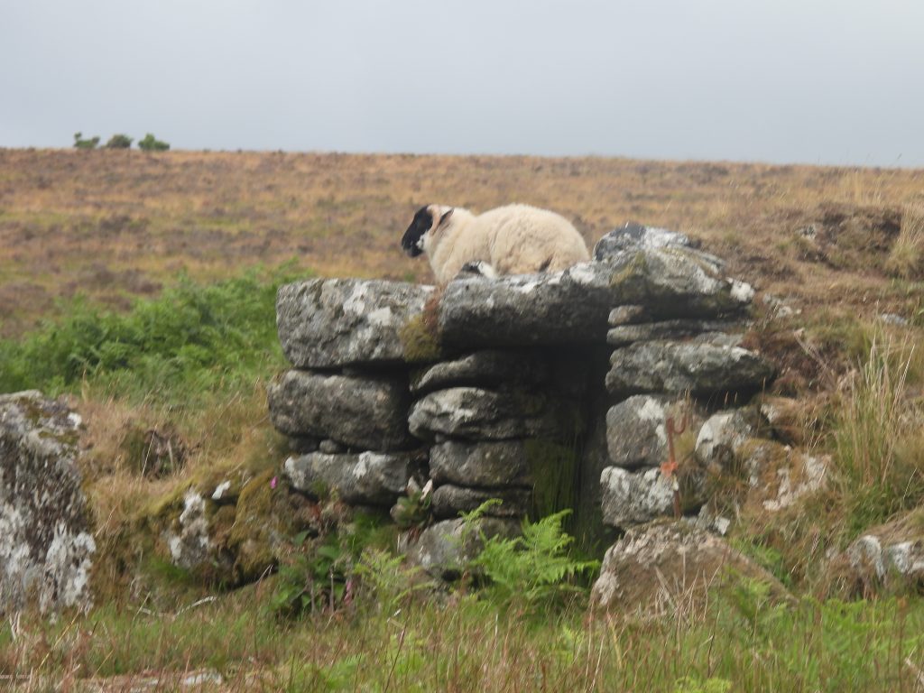
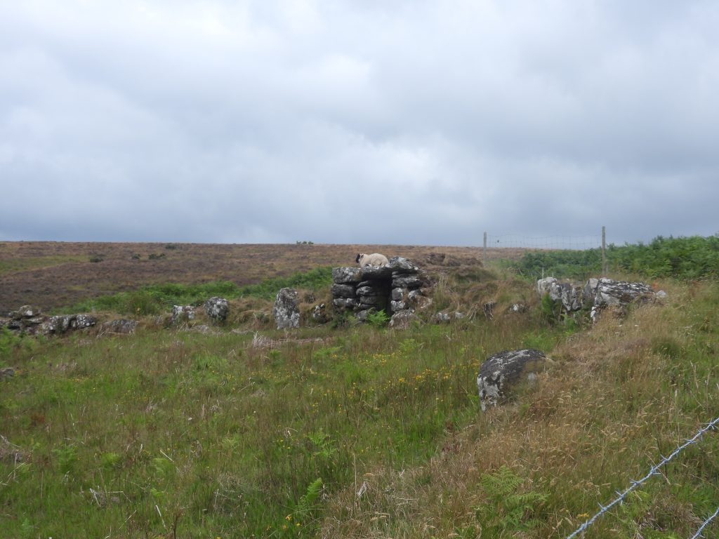
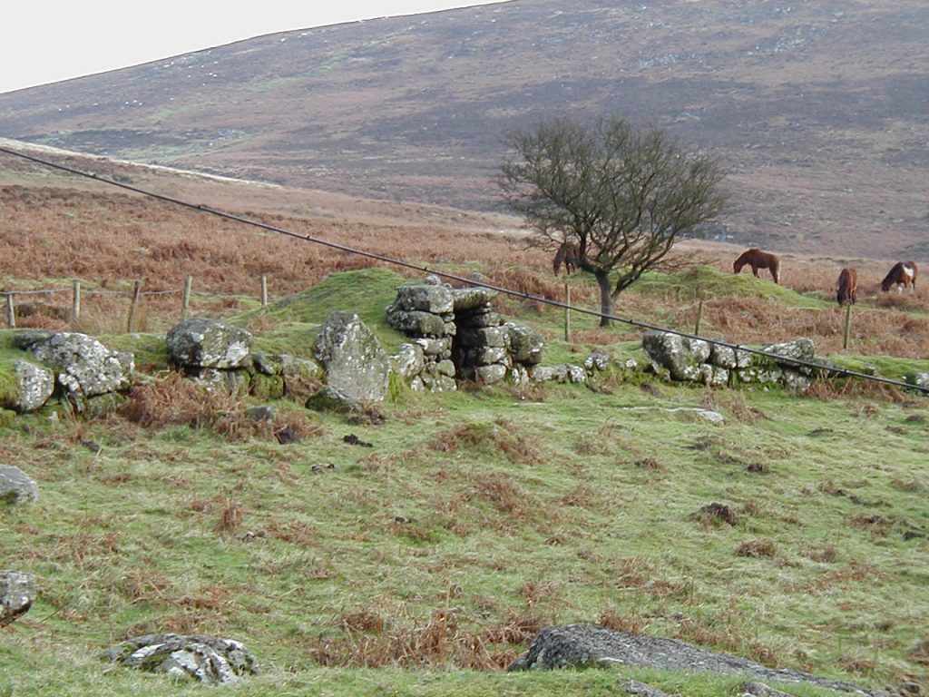
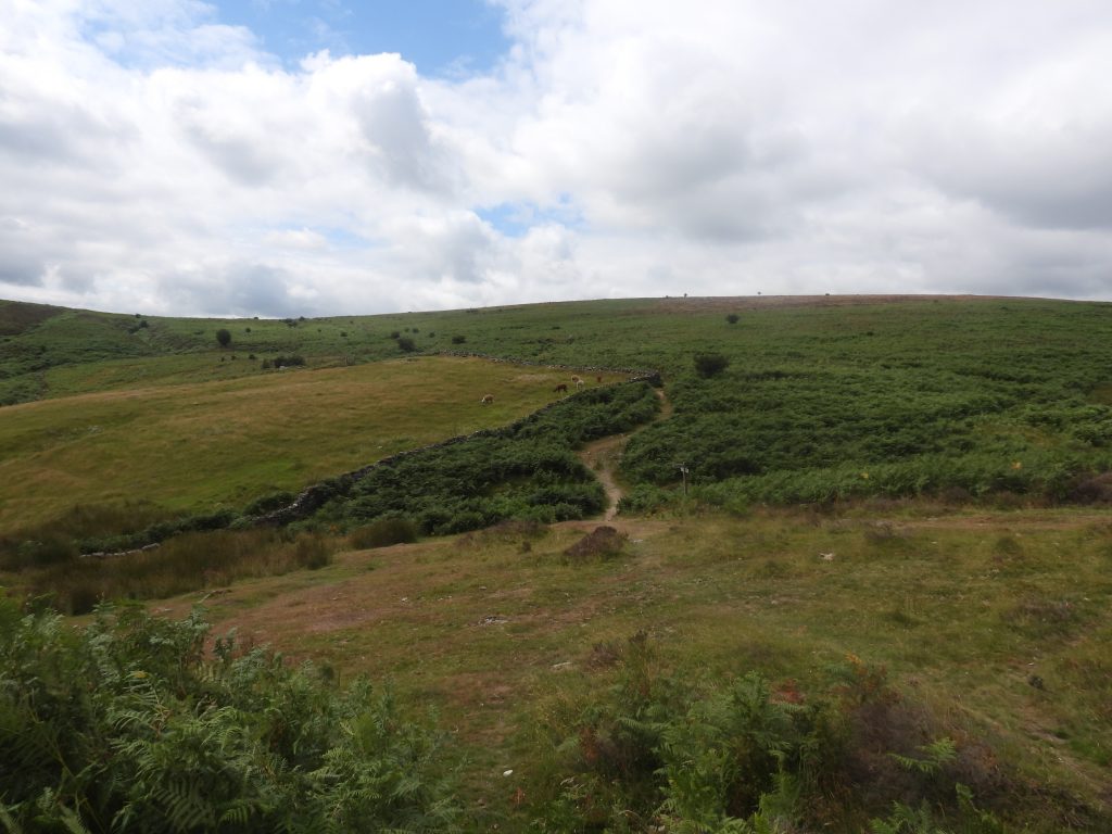
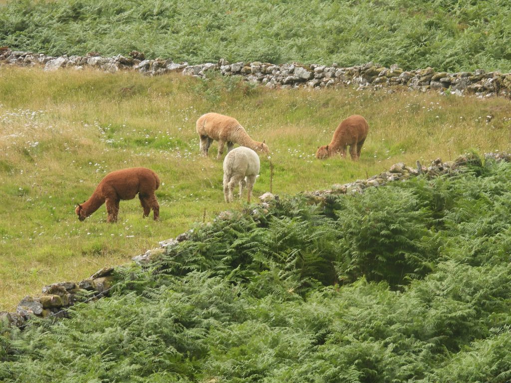
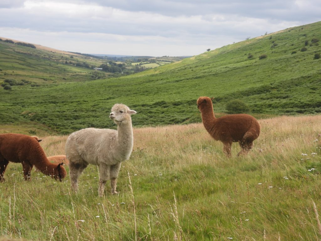
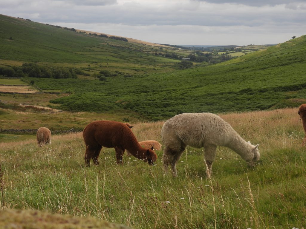
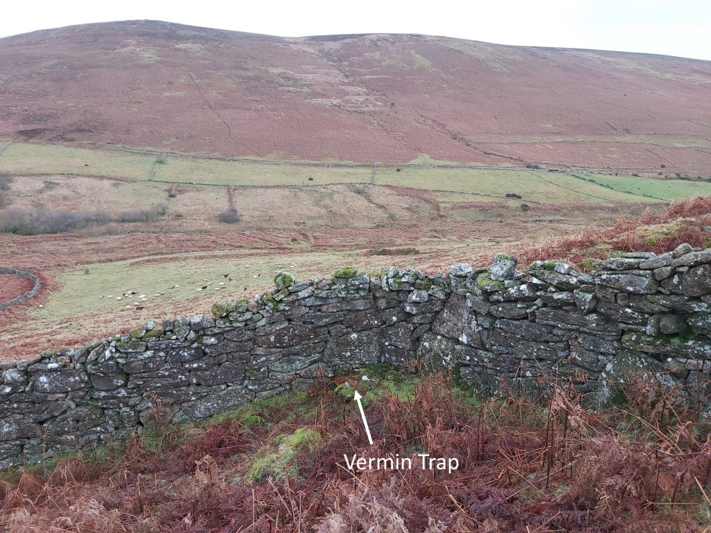
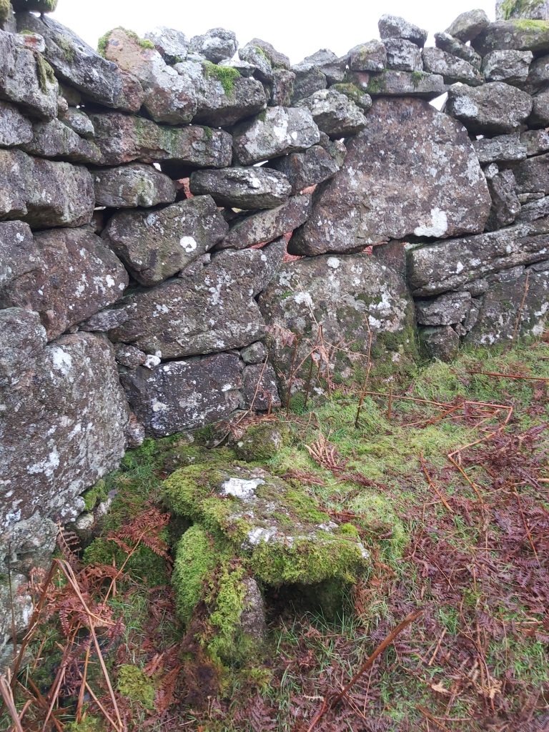
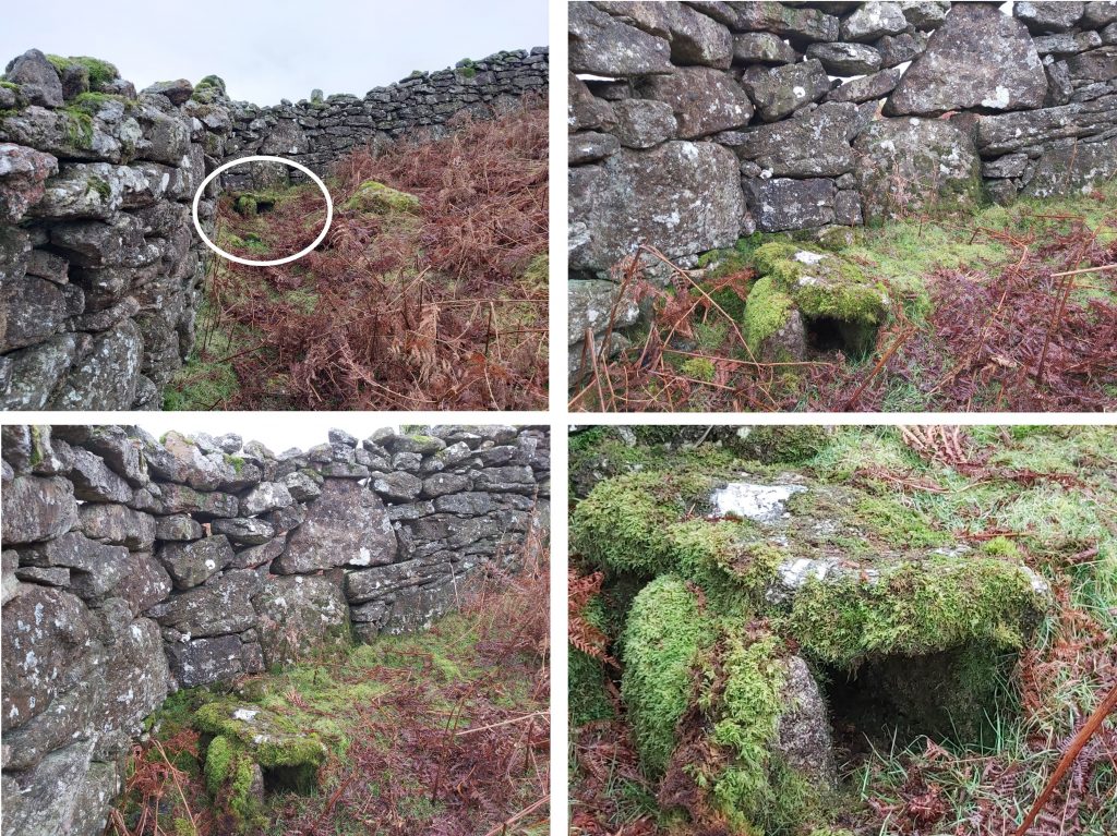
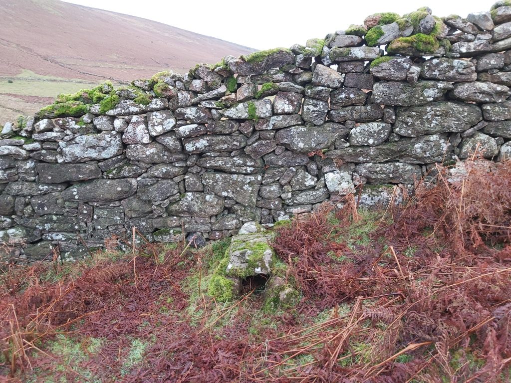
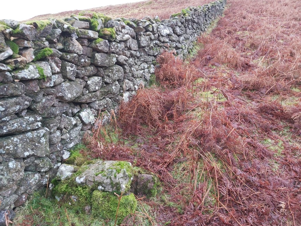
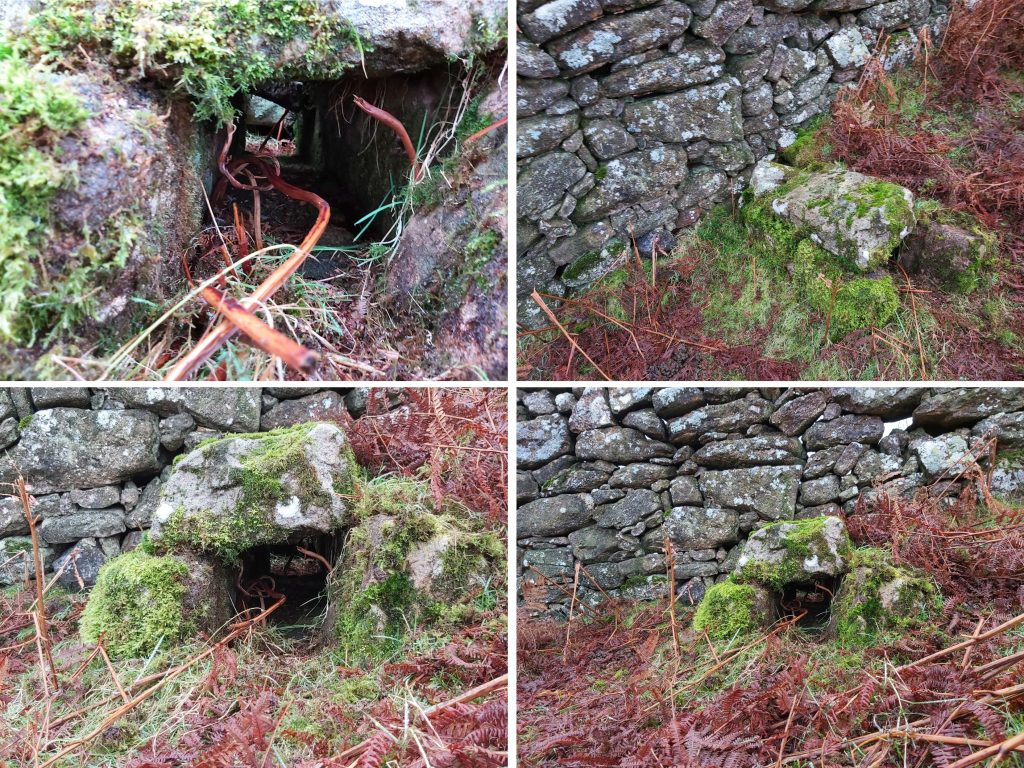
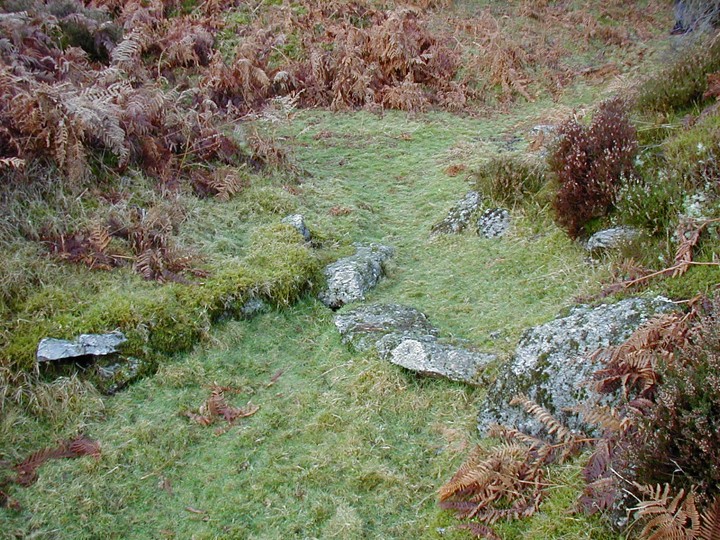
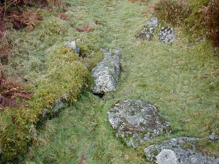
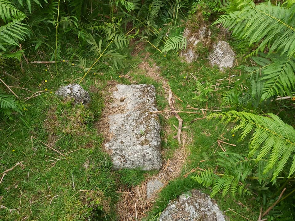
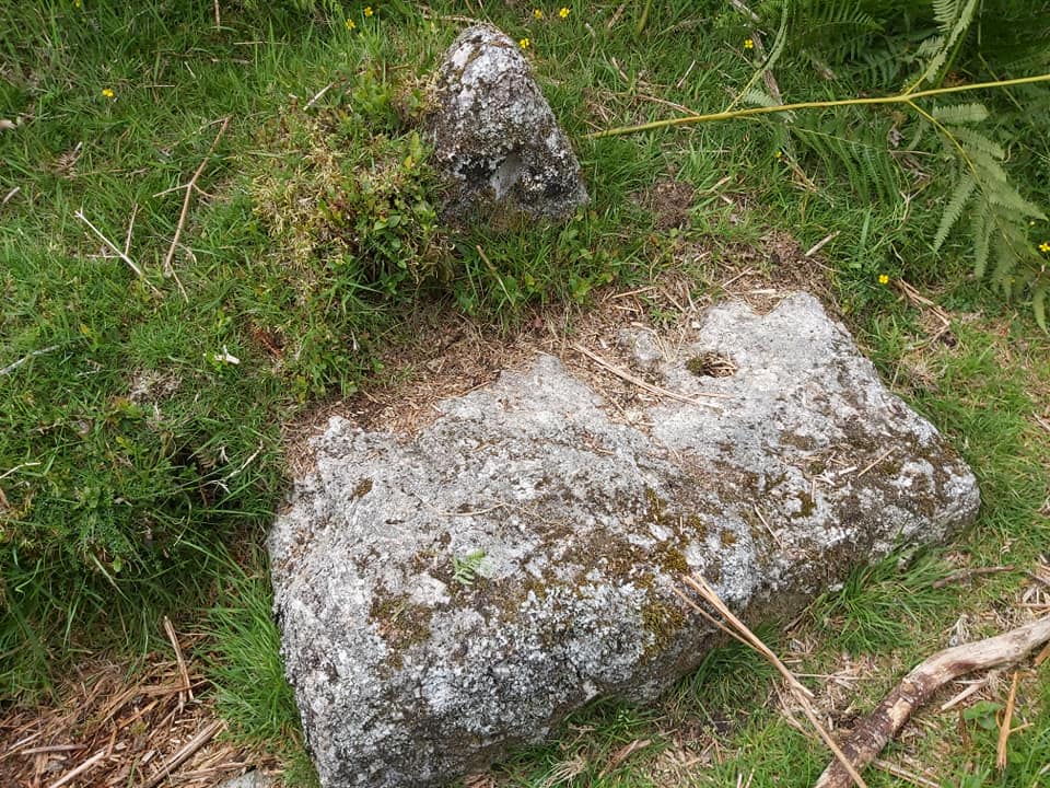
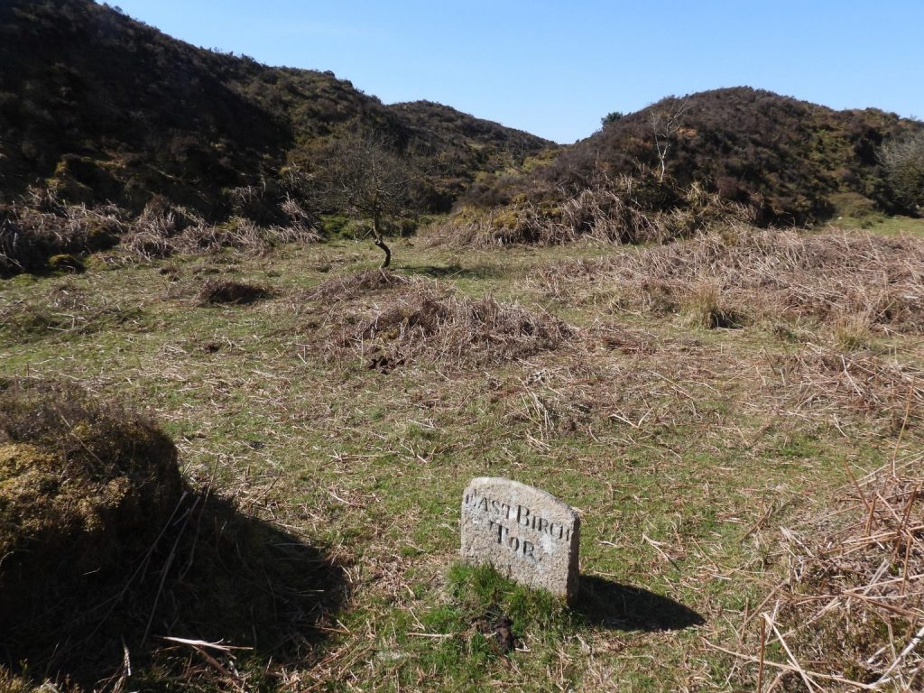
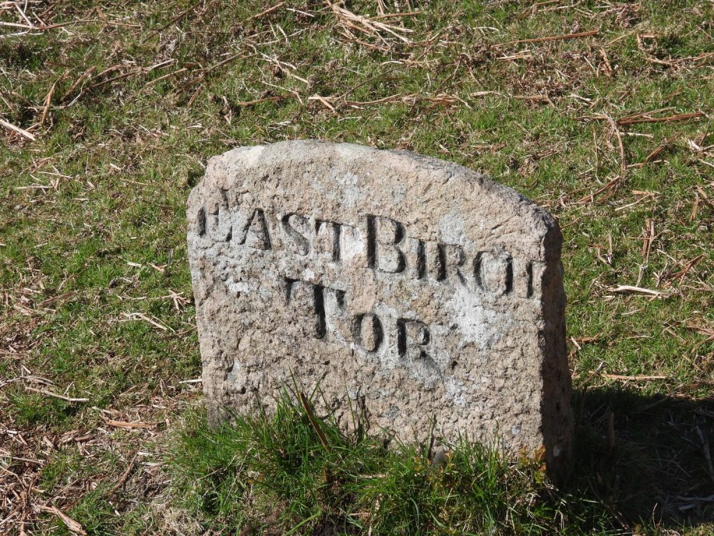
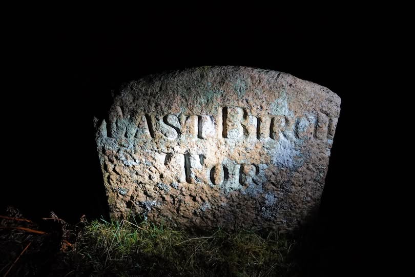
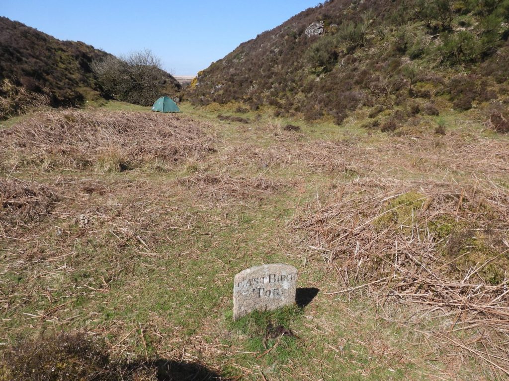
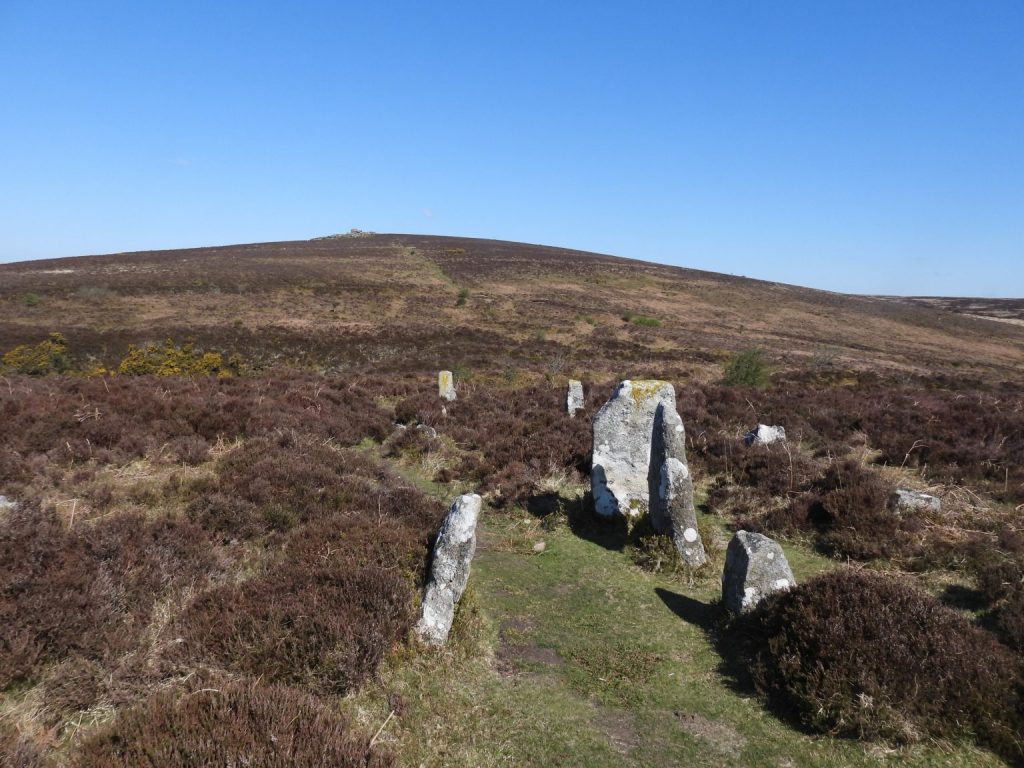
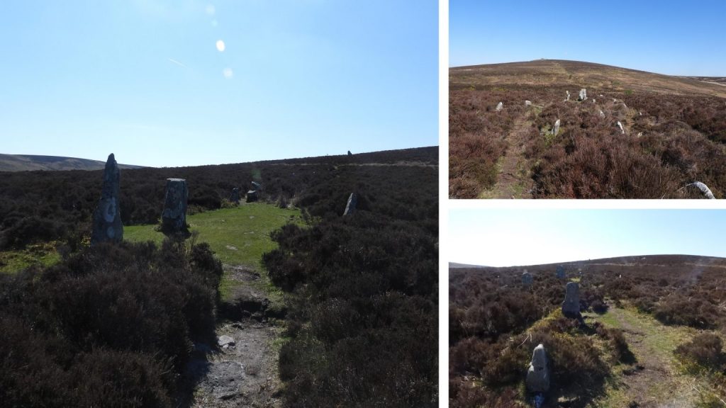
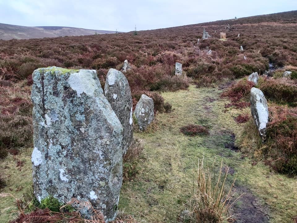
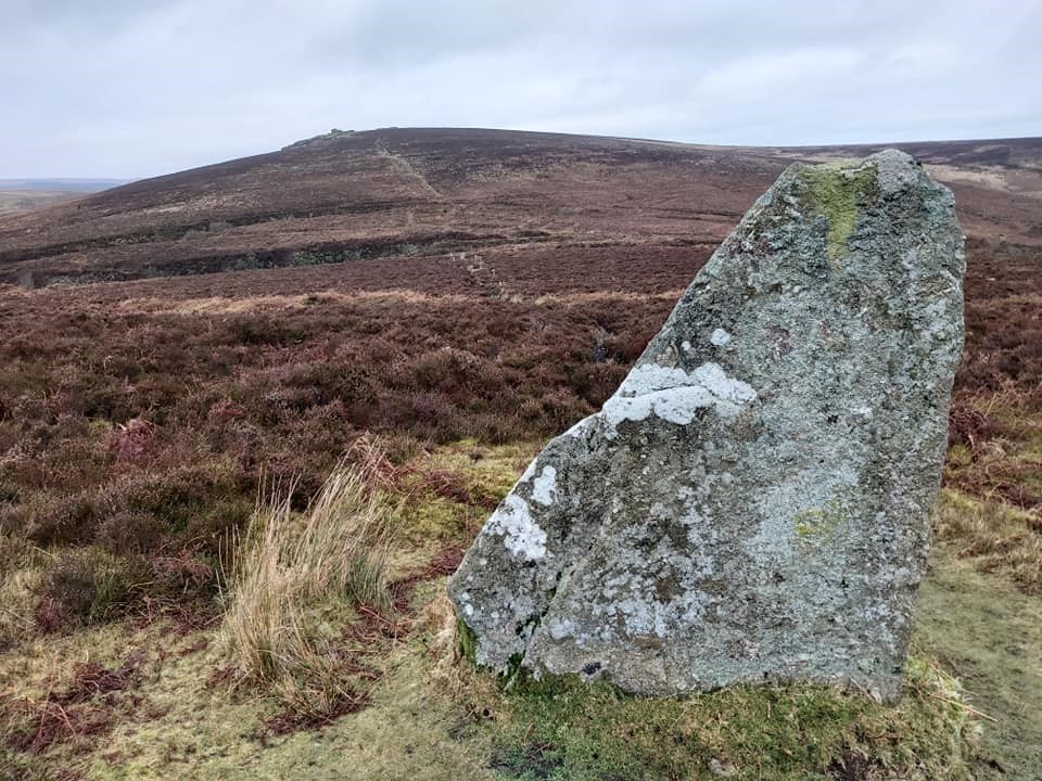
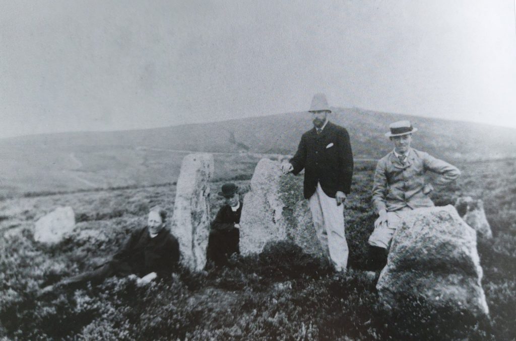
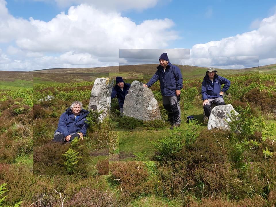
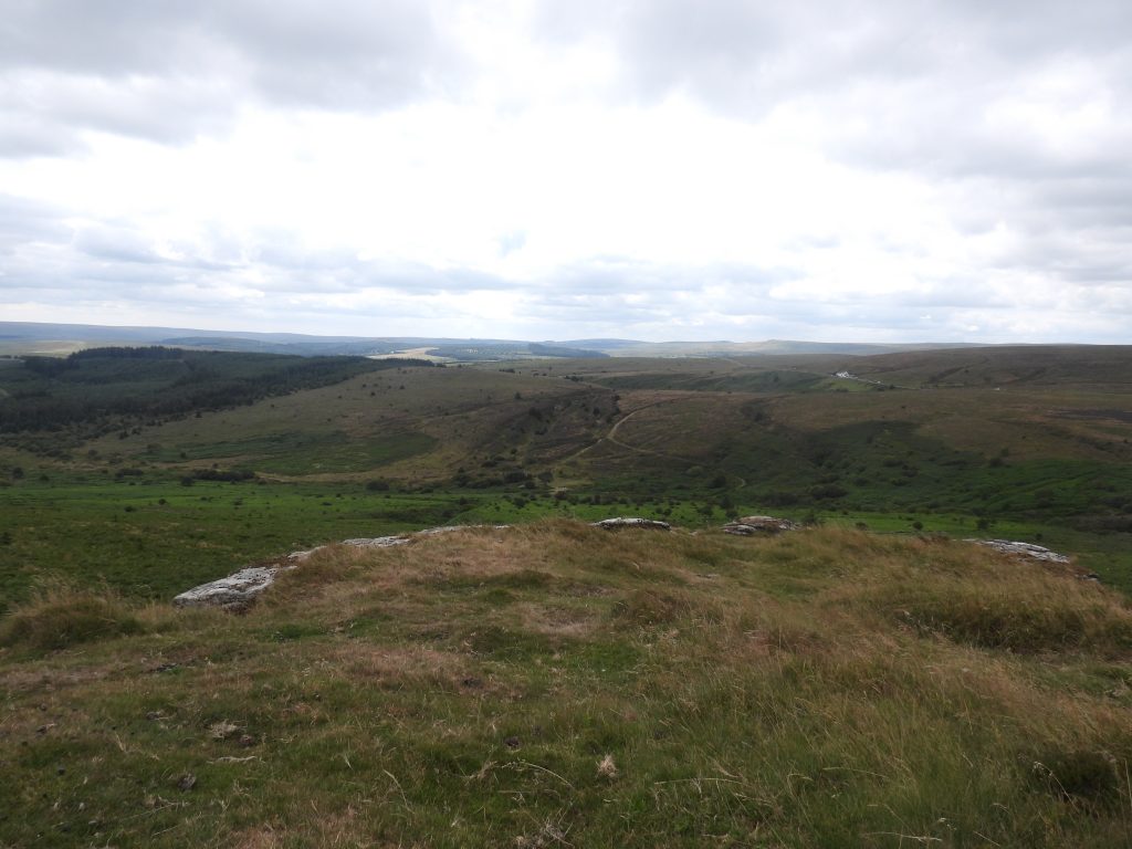
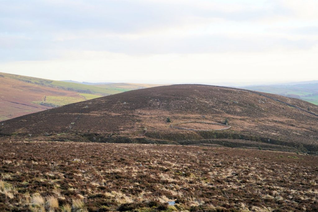
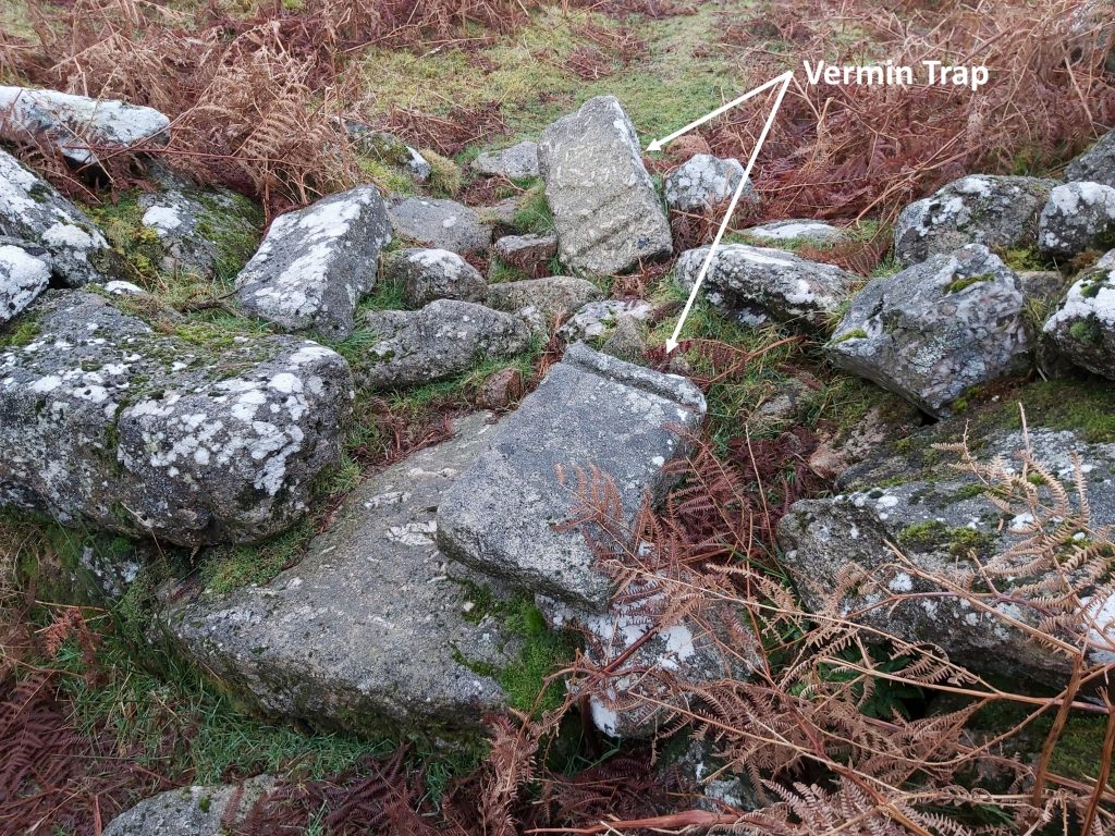
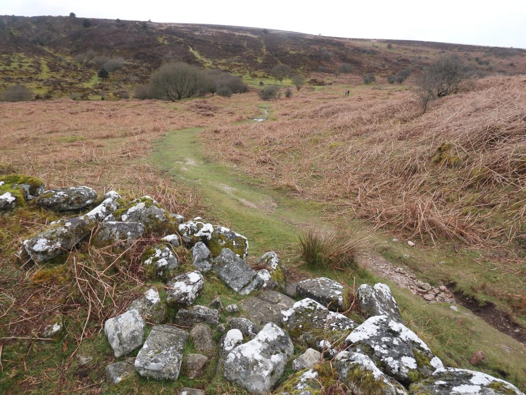
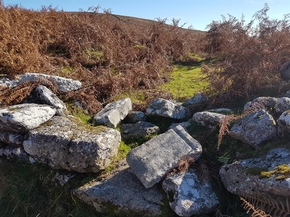
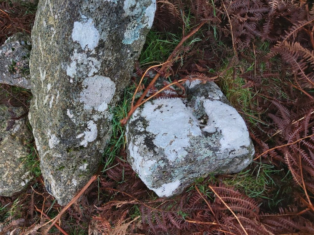
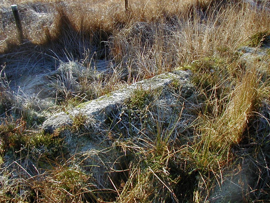
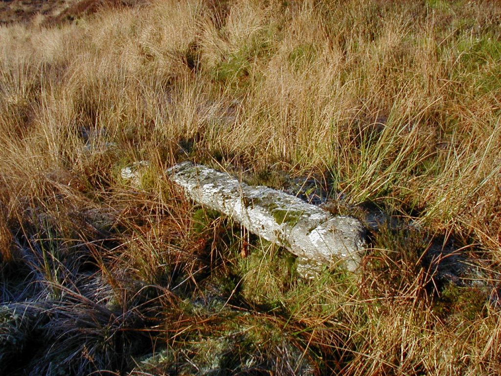
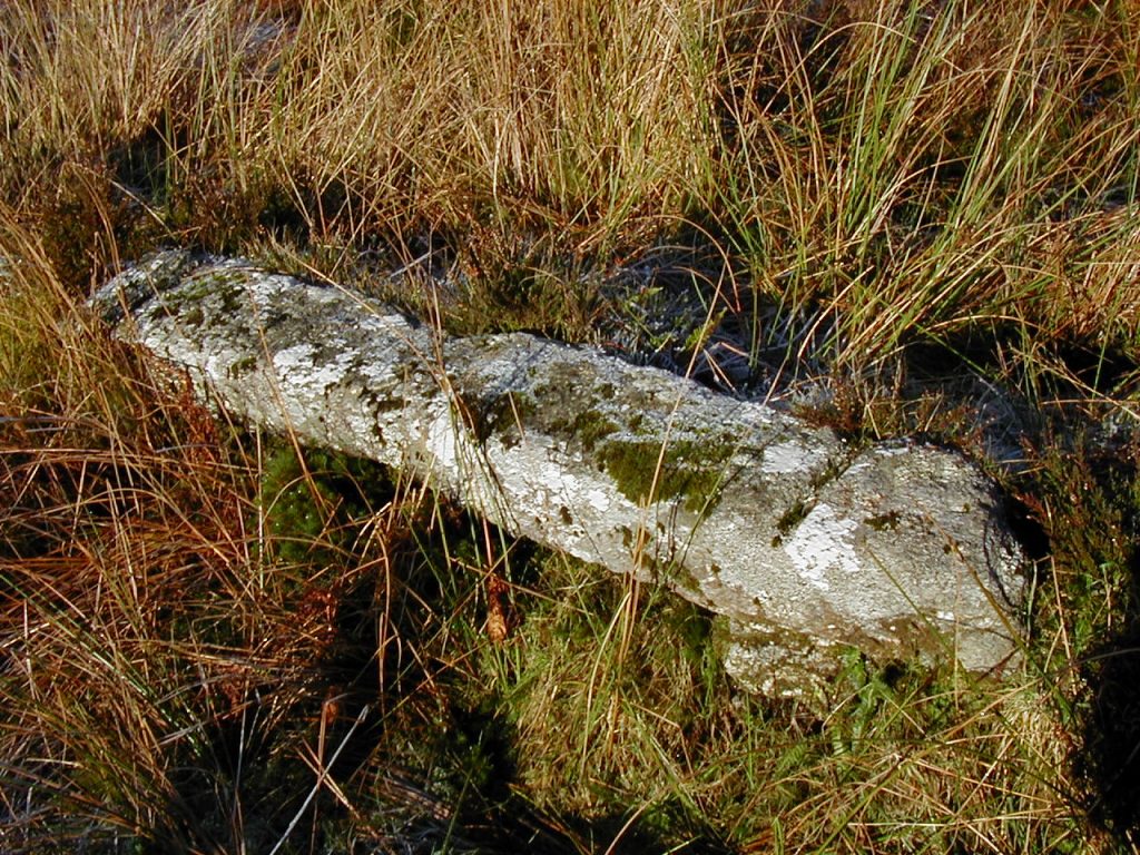
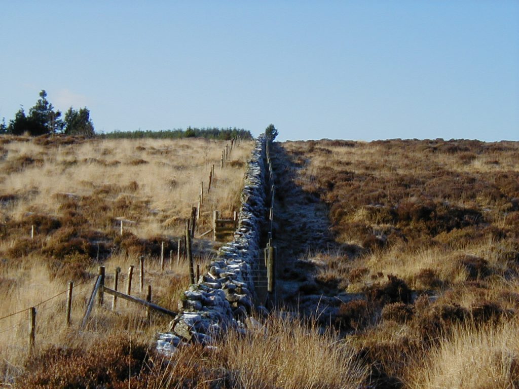
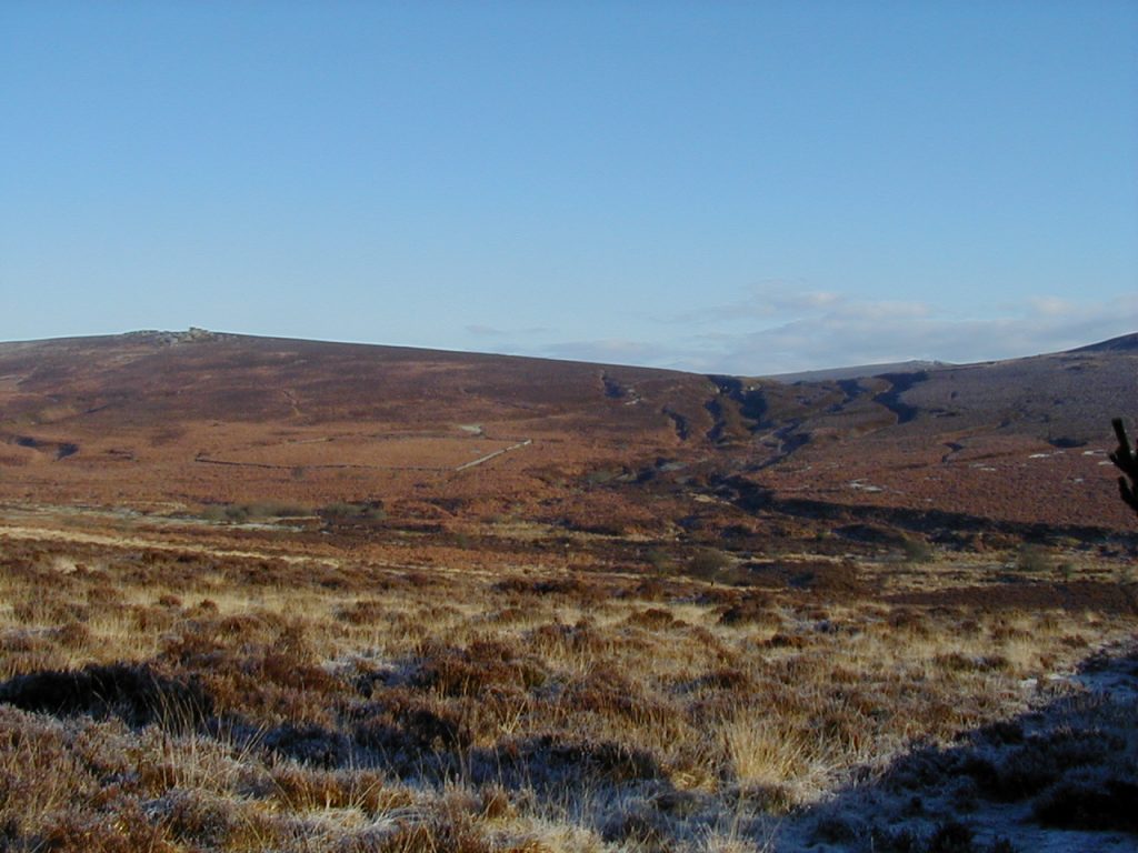
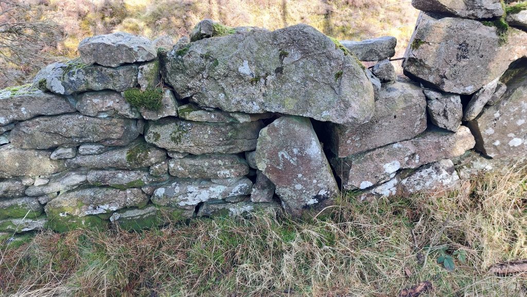
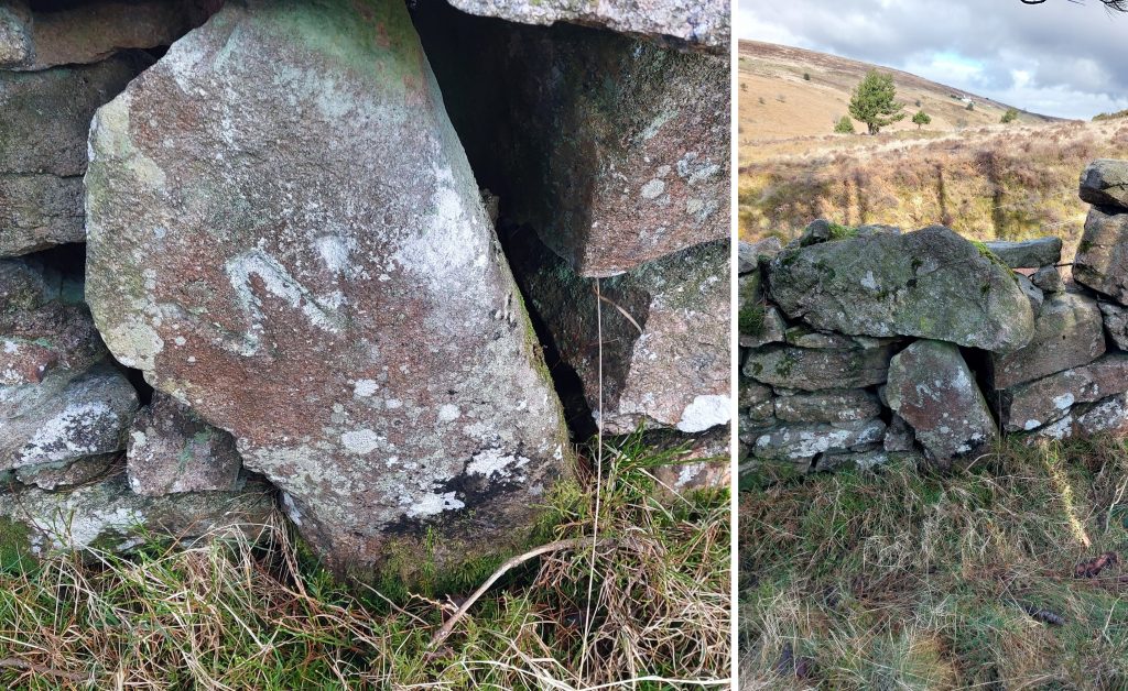
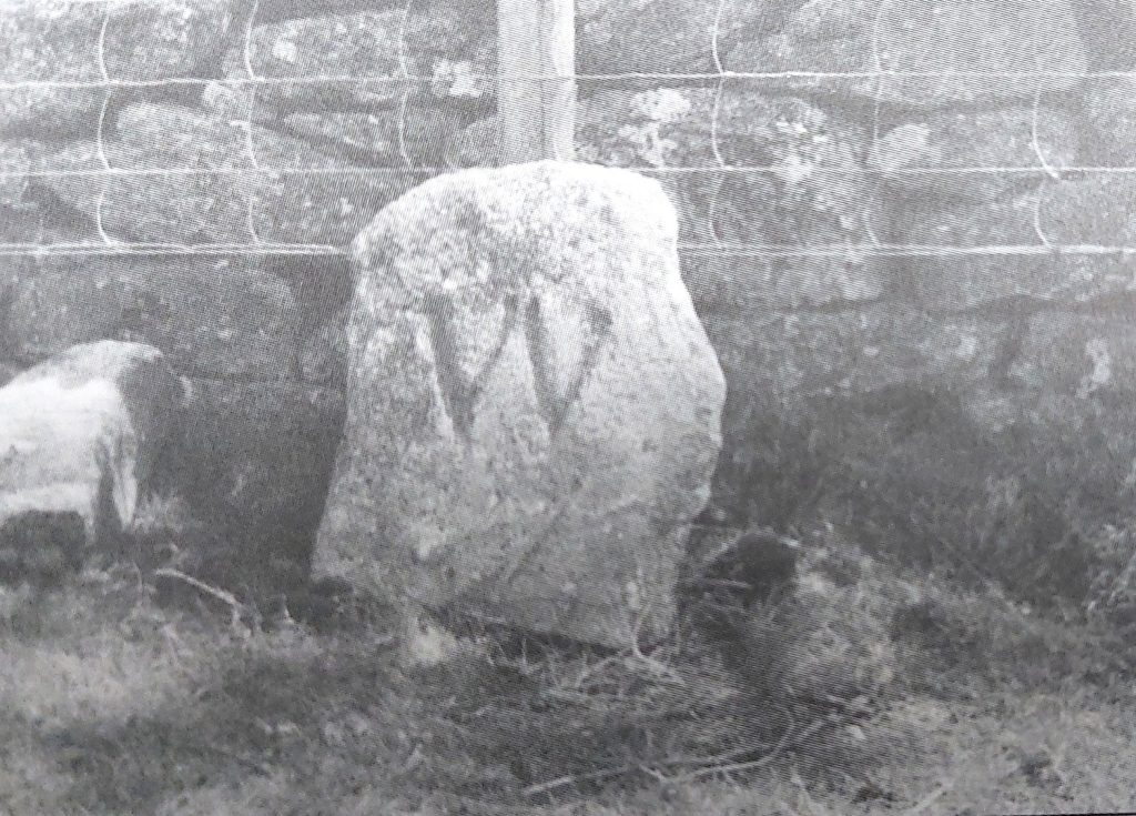
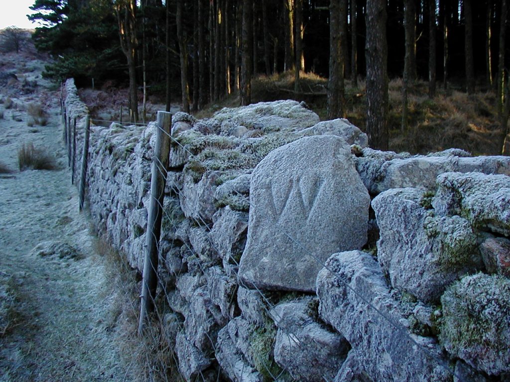
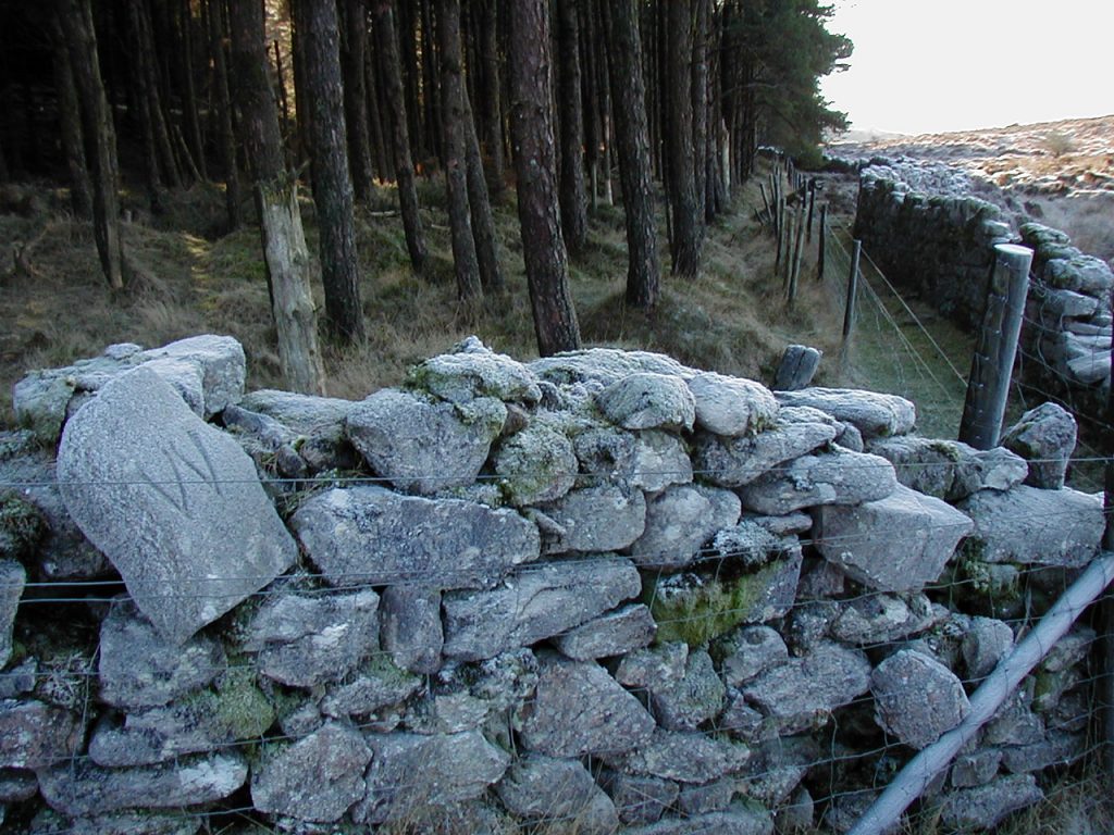
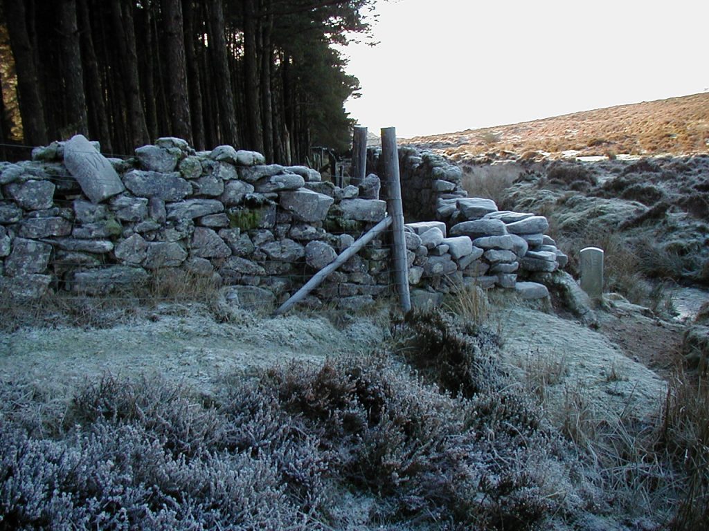
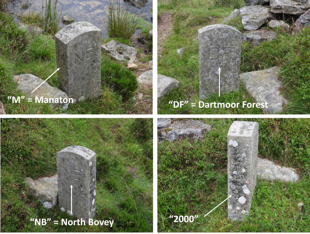
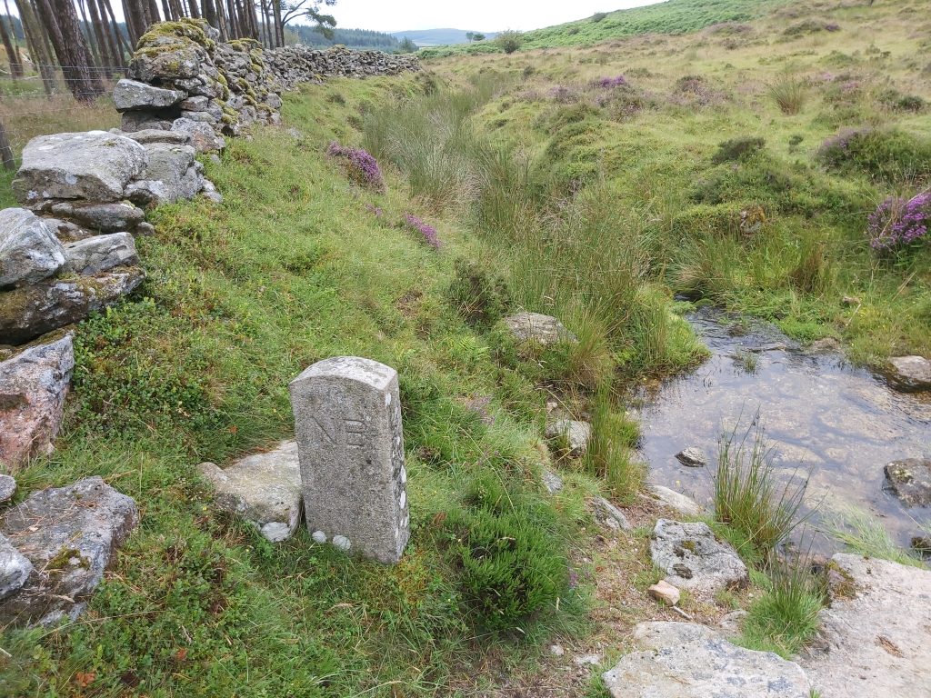
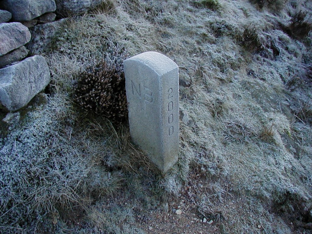
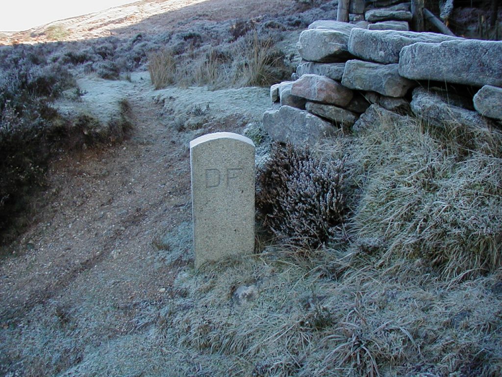
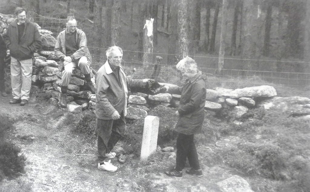
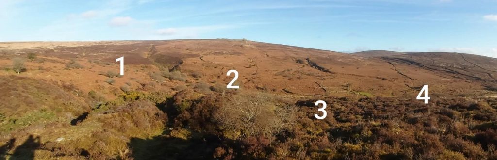
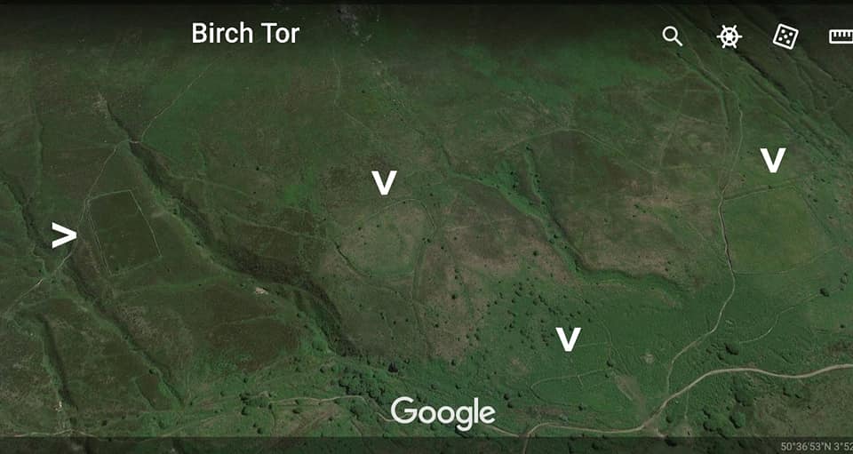
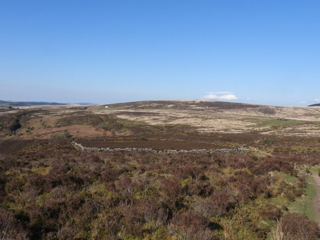
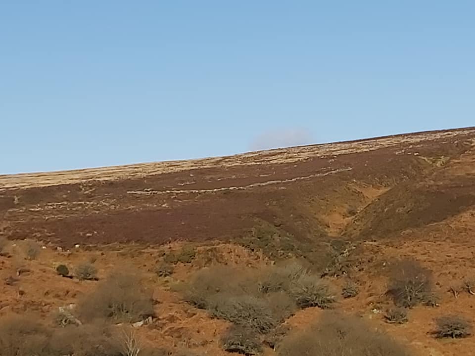
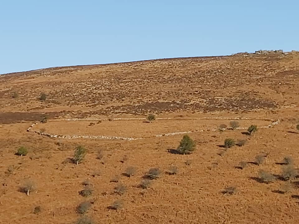
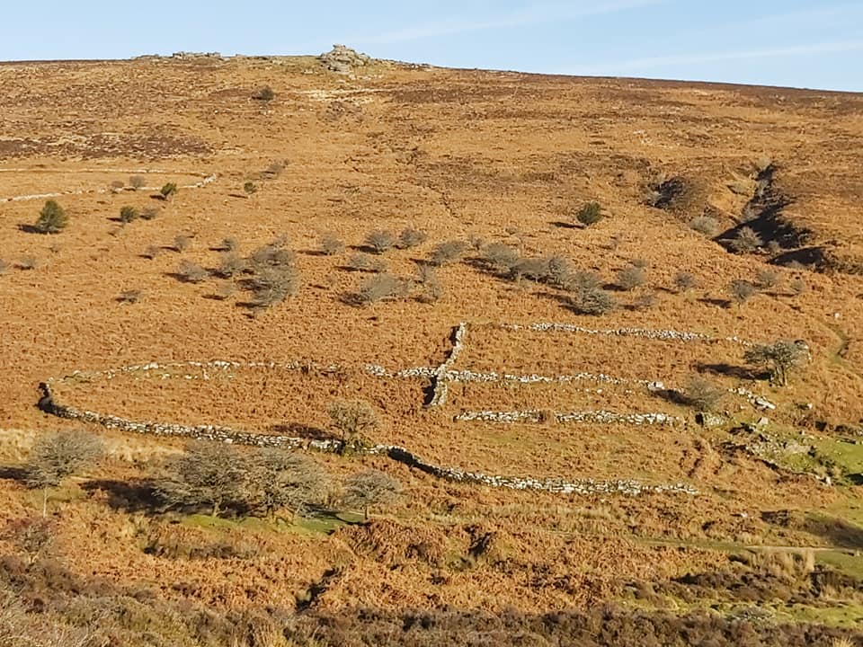
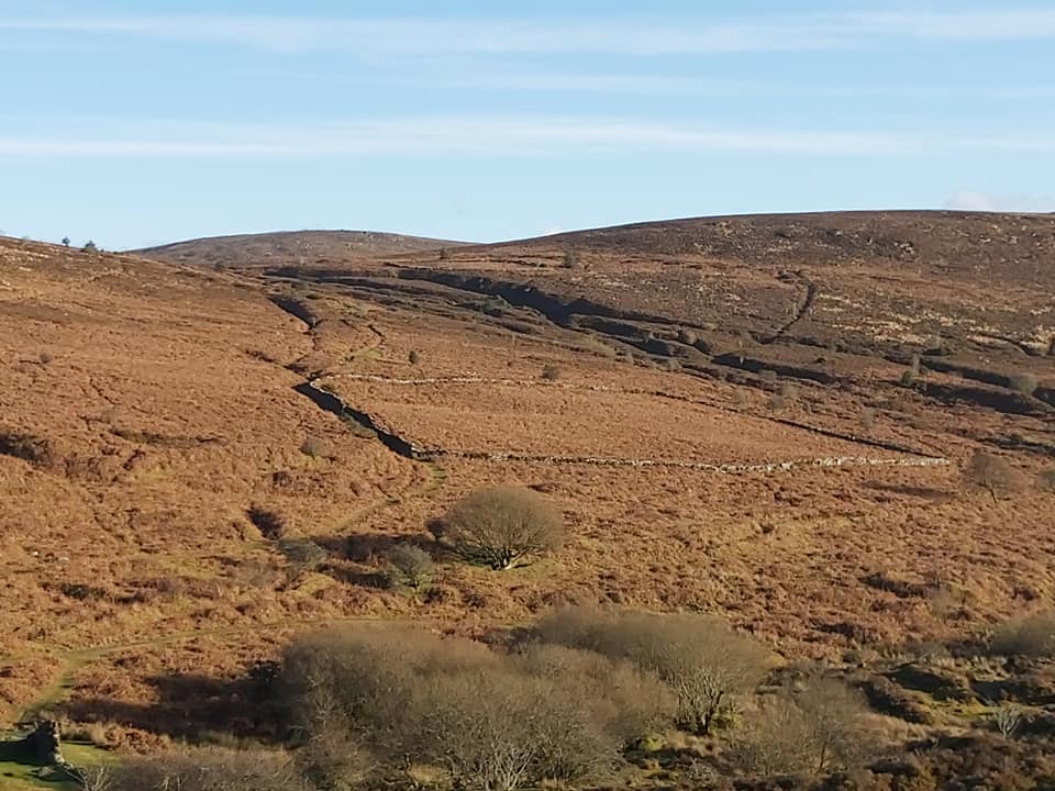
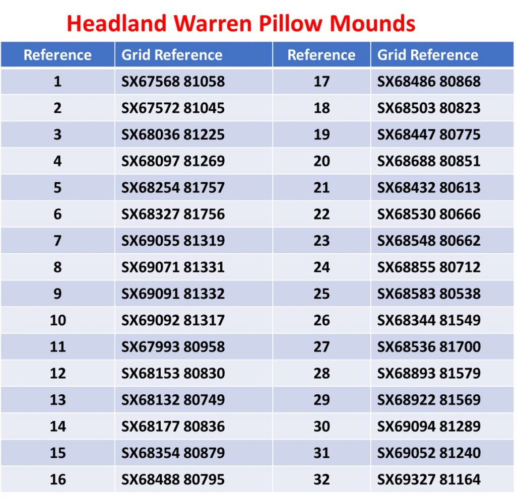
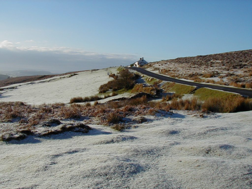
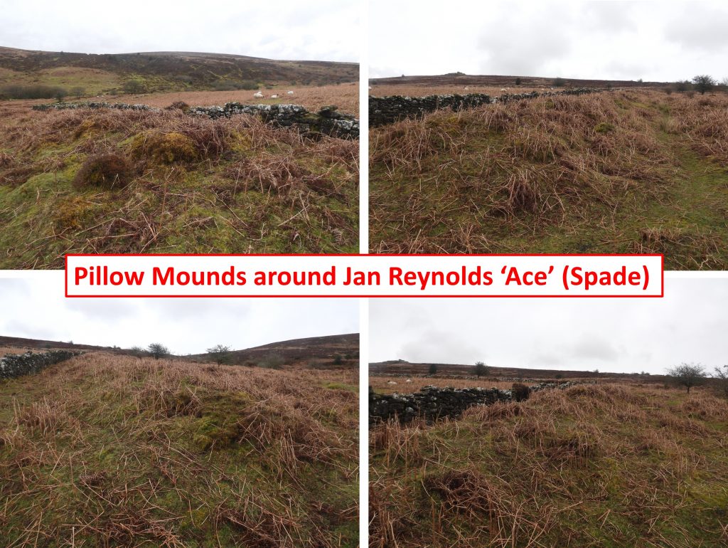
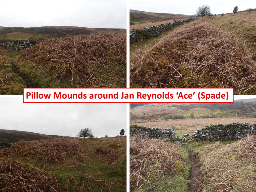
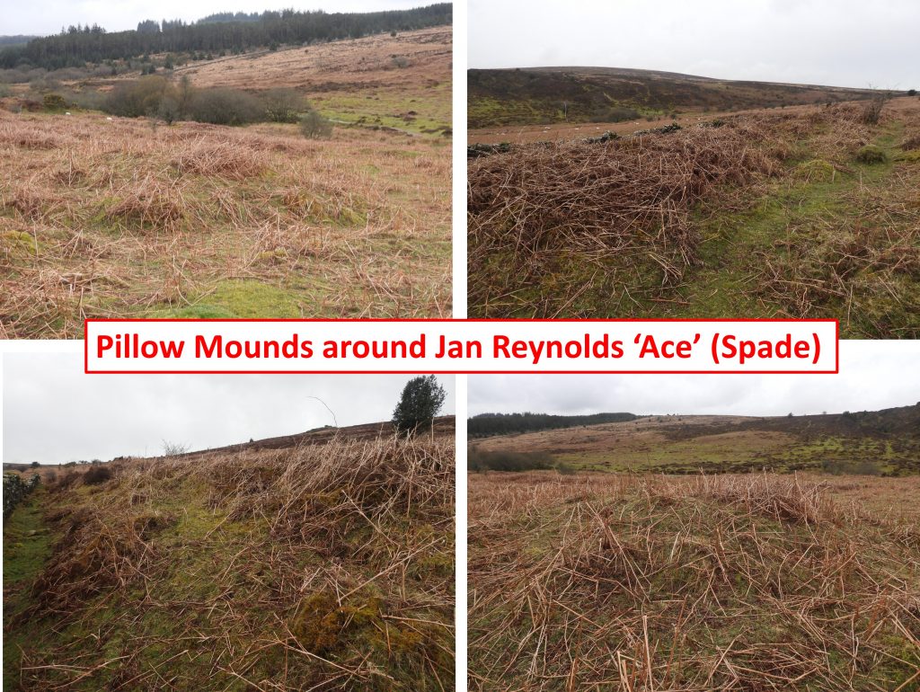
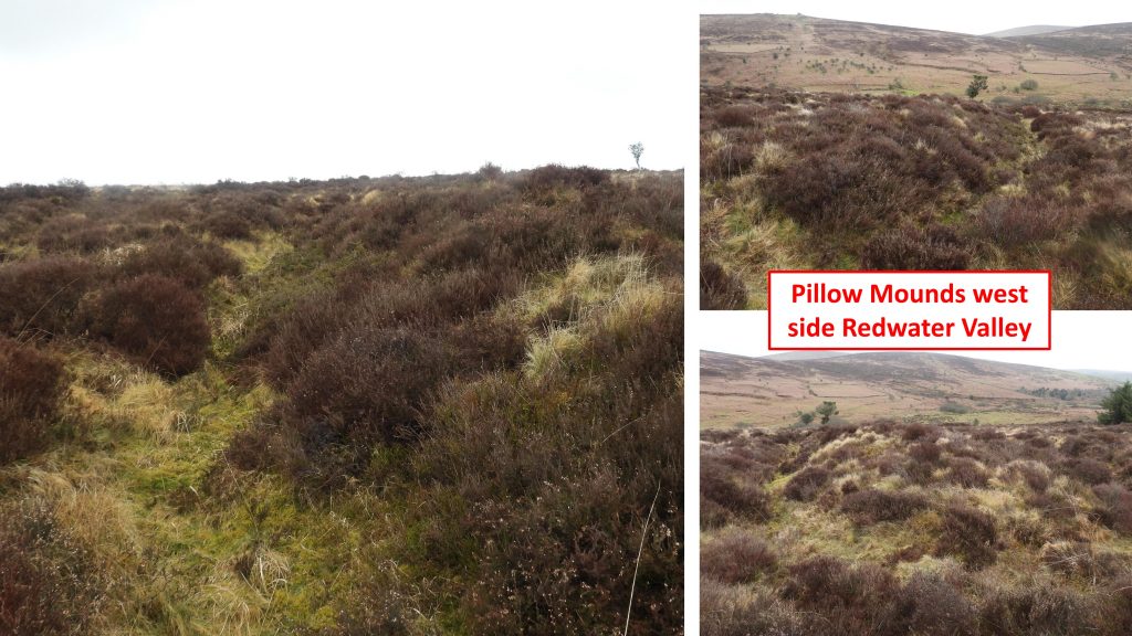
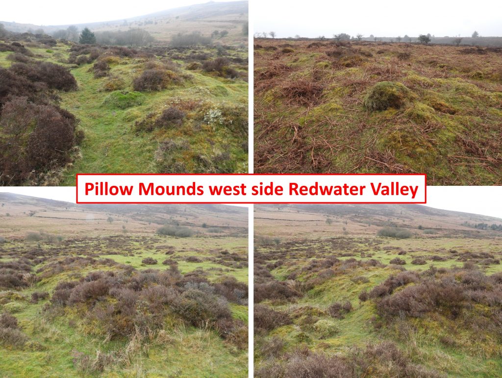
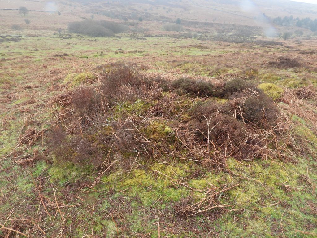
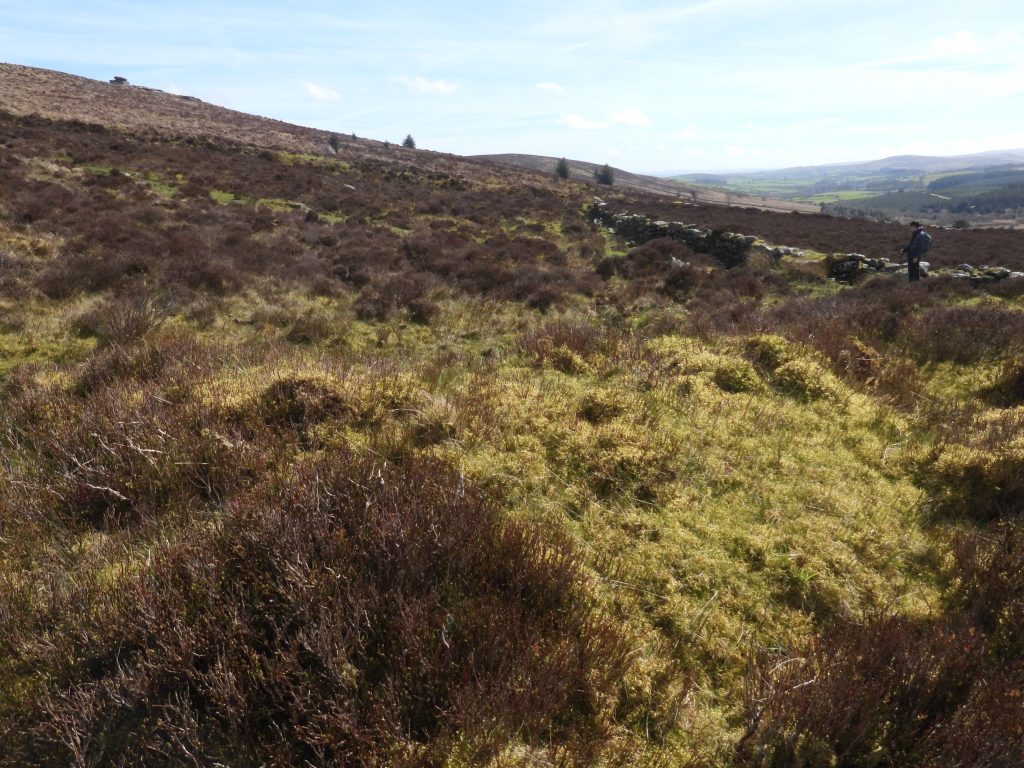
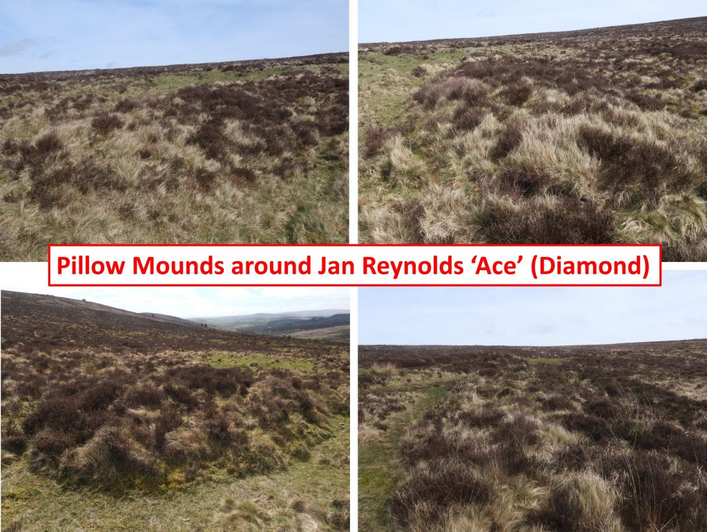
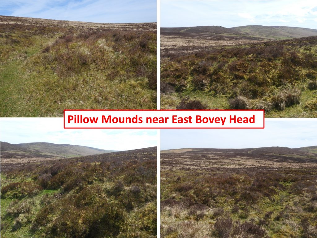
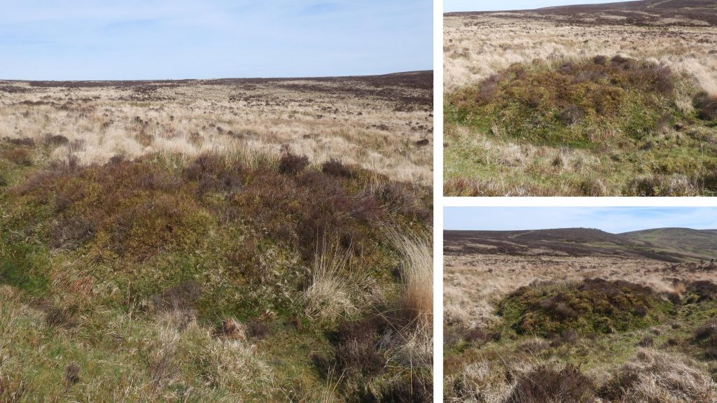
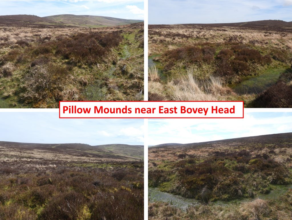
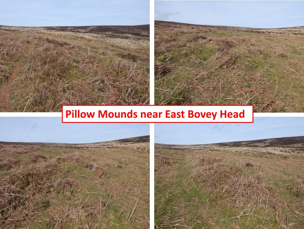
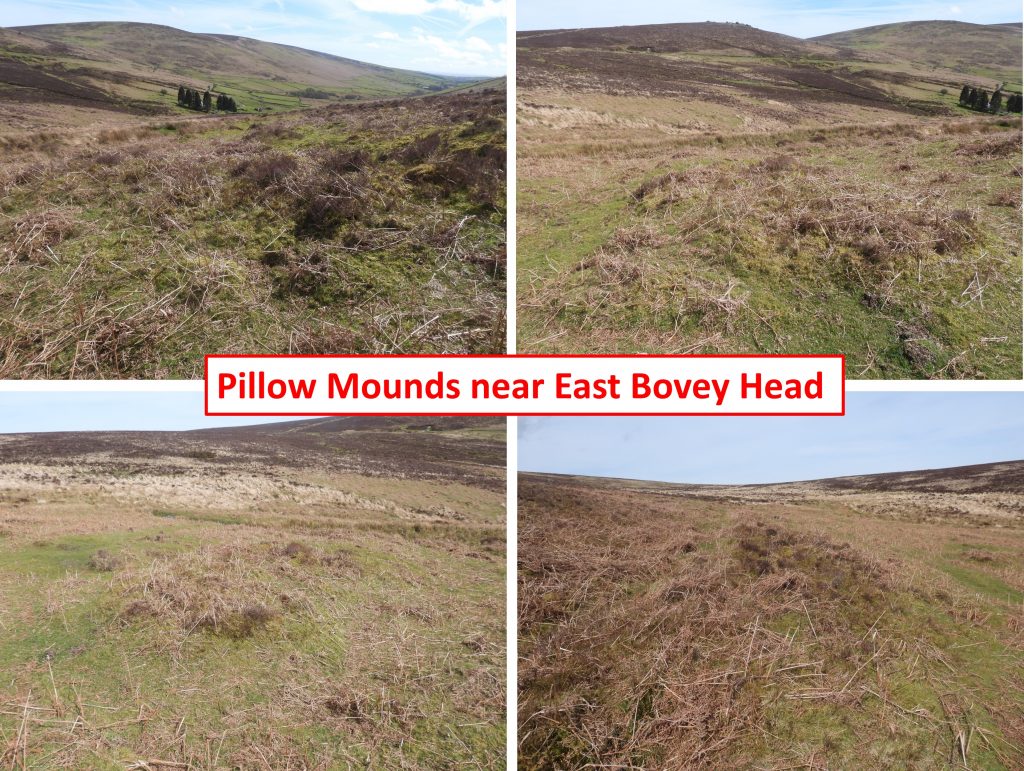
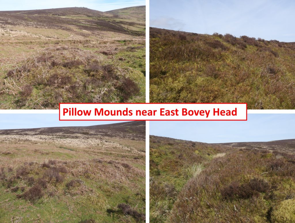
Sketch Map of Headland Warren, showing the locations of the 16 extant Warren Boundstones plus other feathers covered in this post. Note that there are two numbering references relating to the Warren Boundstones, viz; The ‘black’ numbers within the Boundary Stone icons refer to the original Dave Brewer labelling and the ‘red’ numbers alongside relate to this authors labelling.This sketch appears in the Dave Brewer publication – Dartmoor Boundary Markers (2nd edition 2002) on page 266 and shows the Boundary of Headland Warren. This is the view from near Warren House Inn showing the north western side of Headland Warren, which shared its borders with Birch Tor and Vitifer Mine and part of East Birch Tor Mine (east end of Chaw Gully) as the medieval tinners working (‘scars’) across the hillsides testifyThis post starts near the north western point of Headland Warren (at Warren House Inn) and follows an approximate clockwise route. This view of the Warren House Inn is as viewed from Birch Tor. The western edge of the Headland Warren boundary lies just below the inn following the WallabrookThe Warren House Inn was rebuilt having starting life as the “New House Inn” on the opposite side of the road. At 1425 ft (434m) above sea level it is claimed to be the third highest inn in England (after Tan Hill Inn and Cat and Fiddle Inn). When the inn was rebuilt it was originally called the Moreton Inn. The move meant the inn moved from common land to Duchy Land, and rent was therefore due. After being called the Moreton Inn in 1845, the name was changed later in the century, based on the nearby rabbit warren to the Warren House InnThe “New House Inn” had been in a rather dilapidated state and the replacement Inn was built by John Wills around 1845. It was around this time that the story of the (peat) fire having never gone out can be attributed. Apparently, smouldering peat was brought across the road from the old inn to the new one and put in the fireplace.The slate plaque set into the eastern gable wall has a curiously very precise date on it was it is inscribed: “I. Wills Septr 18th 1845”. In that era, the letter J (in this case for John) wasn’t used and an I used instead.To the east of the Warren House Inn and near the head of the Wallabrook, the ruinous foundations of a small dwelling can be found. The building is named ‘The Bungalow’ on an early 20th century (1905) historic map.A mid-20th century (1963) historic map labels the house as ‘King’s Oven Bungalow’, albeit ‘King’s Oven’ (which has two disputed locations) is several hundreds of metres away to the north. It was sometimes known as ‘King’s Bungalow’Next to this enclosure wall (a few metres north of the ruined bungalow) is an iron marker, which is a Telegraph Cable Marker dating to the early 20th century. It is one of a series marked the location of a buried telegraph cable which crossed the South West and into Cornwall. At the top of each (telegraph) marker is a Royal Cypher (ER) and Crown which represents King Edward VII who reigned from 1901 to 1910, which dates the marker. (NOTE: in other parts of the country there are similar markers with VR (Victoria) and GR (George V)). The broad arrow (called a ‘pheon’) represents objects purchased with the monarch’s money. There are two guided slots below the ‘ft in’ inscription which would have been the location of a numerical guide, which the author assumes relates to the feet and inches from the marker to the cable. There are other Telegraph Markers across Dartmoor which can be found at: Moretonhampstead Square; Moretonhampstead, Court Street; Shapley Common; next to B3212 at Bush Down and Tavistock, Callington Road.This sketch by Dave Brewer was part of an article written for the Dartmoor Magazine number 2 published in Spring 1986. The article was titled ‘Headland Warren’ and can be found on pages 22 and 23 of that publication. The circled numbers (1-15) are the Warren Boundstones, A-E are the Vermin Traps and the irregular shapes are old enclosures. Note that one of the circles has a ‘?’, at the time represented a recumbent Boundstone, which was to be re-erected in 2003. In 1986, the recumbent stone had its inscription (‘WB’) facing downwards. Interestingly, a contemporary map of c.1785 shows only 11 Boundstones plus Bennetts CrossTable of the 16 extant Warren boundary stones, their inscriptions and their locations. For completeness, the author has added the original Brewer labelling (from circa 1986) and those from Dartefacts (circa August 2025). However, note that Dartefacts only records 15 of the 16 stones. The author noted that in 2003 the Brewer ‘?’ boundstone was re-erected. This was reported in the Autumn 2003, number 72 (‘Back Chat’ section) of the Dartmoor Magazine. The article mentioned, tongue in cheek, that all the boundstones needed re-labelling – this has been done in the first column of the table in red!The 1st of the ‘WB’ (Warren Bounds) inscribed boundstones can be found approximately 250 metres north-east of the Warren House Inn and some 15 metres back from road (B3212) in a shallow gullyThis 1st ‘WB’ boundstone has a split on topClose up of the 1st boundstone, showing yellow and silver lichen all over stoneEnhancement of the ‘WB’ inscription with a bit of mud painting. The boundstone can be found at SX67656 81166The 1st ‘WB’ boundstone photographed on a night walk by the authorThe 2nd ‘WB’ boundstone can be found approximately 400 metres north-east of the Warren House Inn and 100 metres north-east of a milestone, which is located on the north side of the road. It is set about 20 metres back from road in a shallow gullyView of the 2nd boundstone looking west towards Warren House Inn and Soussons DownThe boundstone is very slightly leaning back and is covered in lichen. Mud painted boundstone 2Boundstone 2 is located at SX67819 81363Around 100m to the south-west of boundstone 2 is this milestone. The view is looking south- west(ish) along B3212. The milestone was erected c1772 and is 14 Miles to TavistockMilestone looking north-east along B3212 – 6 Miles from Moretonhampstead. The road from Yelverton to Princetown and then from Princetown to Moretonhampstead is known as the ‘Trans Dartmoor route’. It was constructed and maintained jointly by the Tavistock and Moretonhampstead trusts from 1772, which would have been around the same time as when Headland Warren was createdGood light conditions are needed to read the inscription. Photograph taken in January 2001. The light conditions enabling milestone inscription to be read “6 MILES FROM MORETON”This annotated 19th century map shows the Chagford / North Bovey Parish Boundary which roughly follows the Headland Warren Boundary from the Wallabrook through to Bennetts Cross before crossing the road. The map shows a Parish Boundary Marker a few metres north of the B3212 and the location of the 4th Warren BoundstoneThe dressed stone marker shown in the photograph is located a few metres from the road to the north of Bennett’s Cross and marks the boundary between North Bovey and Chagford parishes. This boundary is shown on the sketch map in this postThe parish boundstone inscriptions are very worn and light has to be near perfect to make them out. The stone is inscribed ‘Chagford’ and ‘North Bovey’, with only the “B” in “Bovey” being above ground. The sketch shown in the picture is from the Dave Brewer Dartmoor Boundary Markers, 2nd Edition from 2002 (page 74). The boundary marker has a benchmark inscribed near its top and there appears to have once been a benchmark rivet located on topThis wayside cross is instantly recognisable to most Dartmoor enthusiasts as Bennetts Cross. It is oddly misshapen and is probably one of the most photographed crosses on the moor. It has been used as a boundary stone between Chagford and North Bovey parishes and was used by the Warreners as a boundary stone for Headland Warren as it has “WB” (Warren Bounds) inscribed on its north face.In the Dartmoor Historic Environment Record, it is speculated that the cross may be a Christianised prehistoric standing stone.Either in advantageous light or with the help of a little mud painting the ‘WB’ inscription can be seen on the north face of Bennetts Cross. The left part of the ‘W’ appears to have been eroded or chipped off the crossBennetts Cross on a night walk. The author managed to capture the ‘WB’ under these conditionsWarren boundstone number 4 is located around 40 metres to the north east of Bennetts Cross, close to some very shallow tinners’ openworksWarren boundstone 4 with view across to Birch TorBoundstone 4 with mud painted ‘WB’Boundstone 4 can be found at SX68050 81670This 5th boundstone was labelled as ‘?’ by Dave Brewer in his Dartmoor Boundary Markers book from 2002. The reason being is that in was recumbentOn 11th July 2003, this fifth Headland Warren bound stone (marked as ‘?’ by Dave Brewer and now as number 5 in this post), having remained recumbent for some time, lying face down for many years was re-erected. It had been ‘found’ by a Mr and Mrs Vane from Lincoln to have the initials ‘WB’ on the underside. Sally Perryman from DNP and Simon Lee (a student ranger from Seale Hayne College) re-erected the stone as the above pictures testify. Source: Dartmoor Magazine Autumn 2003, number 72 in the ‘Back Chat’ section.Boundstone 5 with a mud painted enhancement of the ‘WB’The 5th ‘WB’ boundstone can be found at SX68236 81784. Phil Newman states that the gully here is a “Medieval field boundary around part of the northern boundary of Headland Warren. This hedge-bank was later adapted by tinners as a water course and was utilised as the boundary of Headland Warren in the late 18th century and boundary stones were spaced along it”. A short distance north-east (uphill) from the 5th boundstone is this dressed recumbent stone. Why it is here remains a mysteryFurther up the shallow gully are 6 or 7 more recumbent dressed stones. Why they are here is a mysteryContinuing up the gully a 6th ‘WB’ inscribed boundstone can be found (labelled as ‘5’ by Brewer and as ‘6’ by Dartmoor Explorations (DE)).The 6th boundstone with views to the west to Water Hill, Warren House Inn and to BelleverThe 6th boundstone looking southThe 6th boundstone is located at SX68399 81830Good light conditions meant that the ‘WB’ inscription was easily seen. The inscriptions are in remarkable condition considering they are around 240 years oldThis structure, close to the northern boundary of Headland Warren has been listed as a WWII ruined hut and even an air raid shelter. Brewer (1986) suggested it was a Shepherds Hut. However, its true history remains a mysteryThe ‘open’ part of the structure faces west across the northern boundary of the warrenWith this view from the ruined hut, might it have been a warreners shelter or lookout?A winters view of the ruined structureThe next ‘WB’ boundstone is south-east from the previous one and was labelled at number 6 by Dave Brewer. It has a very distinct triangular top to it The ‘WB’ inscription on this 7th boundstone appears to have larger (taller) letters and look different to the inscriptions on the stones 1-6 visited thusfar. Could this indicate it was inscribed by someone different at a different time?The 7th boundstone has a slight lean to it.The 7th boundstone with ‘WB’ mud painted inscription can be found at SX68602 81676This Warren Boundstone lies 10m north west of a cairn (tumulus). It was annotated as number 7 by Dave Brewer and is the 8th in the sequence from the Warren House Inn. The 8th boundstone stands 0.8m high and is inscribed with the letters `WB’ on its eastern face.The 8th boundstone with views to Warren House Inn, Water Hill, Assycombe Hill and beyondThe 8th boundstone can be found at SX68645 81644The 8th boundstone with a mud painted inscriptionThe 8th boundstone is only 10m from a ‘Tumulus’ (as described by Brewer)Another contextual view of the 8th boundstone in relation to the ‘Tumulus’The flat topped cairn (tumulus) was described by R.H. Worth in the 56th Report of the Barrow Committee (1937) as having been destroyed partly by a road contractor in 1925. He (the contractor) had started to break up the stones of the retaining circle until he was stoppedThe cairn (tumulus) has been measured as being 17.0 metres diameter by 2.0 metres high (Butler). The road contractor in 1925 removed much material and the southern half exposing a kerb of large slabs leans inwards towards the centreCresting the hill from the Tumulus the 9th boundstone can be found overlooking the West Webburn / East Bovey valley. There are views to Hookney Tor, Grimspound and HameldownThe 9th boundstone looking north. It is 0.7m highThe 9th boundstone with partial mud paint on the ‘WB’ inscriptionThe 9th boundstone (Brewer = 8, DE =9) can be found at SX68746 81692A short distance to the north of the 9th bounstone is the tenth. Hookney Tor and part of the Two Moors Way can be seen in the distanceThe 10th boundstone with views down the West Webburn / East Bovey valley.The 10th boundstone is located at SX68839 81759The 10th boundstone with a mud painted ‘WB’ inscriptionThe 11th boundstone (Brewer = 10, DE = 11) is one of two which also bear an additional letter ‘B’, which is surmised by Dave Brewer (page 266 of Dartmoor Boundary Markers, 2nd edition, 2002) indicates the bounds of East Birch Tor Tin Mine. The ‘B’ can clearly be seen in the sunlight in the above photograph. The ‘WB’ inscription is on the shady part of the boundstone in the pictureThis 11th boundstone is located at SX68874 81814This 11th boundstone is located next to the Two Moors WayMud painted ‘WB’ inscription on the 11th boundstoneThe 12th Headland Warren boundary stone is located next to the country road between Challacombe Cross and Firth Bridge, around 570 metres north-north-east of Headland Warren Farm. This boundstone is unique in the collection of 16 boundstones insofar as it has a full inscription`Warren Bounds’ which appears on its northern face.The boundary stone is around 1/4 mile north of Firth Bridge and around 10 metres south of the Two Moors Way where it crosses the road. It is located in heather bank and although the condition is fair, its inscription is quite worn.The ‘Warren Bounds’ boundary marker is located at SX69521 81647With a little patience, the author mud painted the inscription to embolden the lettersThe inscribed letters are quite neat and well spaced. In spite of its location this stone can easily be missed when driving (south) down the road as it is often hidden by heather. The road was once a track and was built in 1874A short distance down the road towards Firth Bridge a group of around 20 beehives can be foundThese beehives belong to Buckfast Abbey, who have deployed several ‘Bee Stations’ across the Moor. The honey from these apiaries is sold at the Abbey and is also used in the making of mead. The location of these hives is likely due to their location to heather in the areaView of Headland Warren Farm from the Challacombe / Firth Bridge roadHeadland Warren Farm with the workings of East Birch Tor Mine beyondHeadland Warren Farm with the eastern side of the warren behind and Birch Tor poking out on the horizonThe 13th boundstone is located on the east side of the road, a short distance north of Firth Bridge. The boundstone is engulfed by bracken in the summer months as the photograph testifies. This boundstone is the second (of two) which bears an additional letter ‘B’, which is surmised by Dave Brewer (page 266 of Dartmoor Boundary Markers, 2nd edition, 2002) indicates the bounds of East Birch Tor Tin Mine. This picture clearly demonstrates the amount of bracken in the area around boundstone 13 in the summer. The picture was taken just a few metres from the roadThe 13th boundstone in winter, devoid of bracken, with Headland Warren Farm in the valley belowIn sunlight this boundstone inscriptions of the additional letter ‘B’ with the ‘WB’ below it can easily be discerned. This is the northern of three boundary stones marking the eastern boundary of Headland WarrenThis boundstone is located at SX69656 80984The 14th boundstone is just west of the road and like the 13th is surrounded by bracken in the summerThe winter view of the thirteenth boundstone is quite a different story. Note that as well as the ‘WB’ inscription there are initials above and below. This stone represents the middle one of three boundary stones marking the eastern boundary of Headland Warren. Above the ‘WB’ are the initials ‘AP’ and the initials below are ‘WN’. These additional initials are believed to have been from former warreners (ref: Brewer)The 14th boundstone with all the inscriptions mud painted. The boundstone can be found at SX69661 80922Contextual picture showing the locations of the 14th and 15th warren boundstones (Brewer designations 13 and 14)Boundstone 15 (or 14 as recorded by Dave Brewer)The ‘WB’ inscription is discernibleWinter sunshine on the 15th boundstone, which is the southern of three boundary stones marking the eastern boundary of Headland WarrenThis boundstone can be found at SX69662 80844Firth Bridge with its benchmark and rivetOn the fence boundary of Headland Warren Farm road overlooking Grim’s Lake a upright boulder with a “B” inscribed on it can be located. It is built into and old wall.This “B” inscribed stone could have one or two reasons for being here. Firstly it could be an old North Bovey / Manaton parish boundary marker, albeit it is not exactly on the boundary but is around 50m to the north of the boundary at Grim’s lake. The author speculates that at some point this stone may have been taken from the true boundary and placed here when the wall was either constructed or repaired. Alternatively, it could be another boundary marker for the East Birch Tor MineThis boundary marker can be found at SX69614 80836.Headland Warren Farm had part of its roof re-thatched in 2020. The 19th century building doubled up as an ale house and was renamed Birch Tor Inn, for a short period, no doubt to cater for the tin miners who were working in the immediate area. The warrener at the time of Birch Tor Inn was Jan Roberts. The modern OS map shows a footpath through the farm but there are now signs up suggesting the permissive path is to the east and north.The warren house lies near to the head of the West Webburn river and is located on a level shelf just east of the river. The house was originally built for the warren in the late 18th century although the site itself is believed to have much earlier origins from probably the late 16th/early 17th century. It was considerably altered in the 20th century. Back of the farmhouse on the newer ‘permissive’ pathView of Headland Warren Farm from the path leading up to the col between Challacombe Down and Birch Tor. Note the tinners’ openworks between the farmhouse and Hookney TorThis picture was taken in 2020, when Headland Warren Farm was having its roof re-thatchedThe thatcher at work in 2020The farmhouse looking down one of the openworks on the north eastern slopes of Challacombe Down. Attached to the rear eastern side of the farmhouse is a small stone enclosure which has a stone chamber built into one corner. The author caught a sheep on top just ‘chilling out’This structure is traditionally described as a dog pit or kennel which accommodated working dogs used at the warren. There are three similar ones at Ditsworthy Warren House close to the River Plym on the west side of the MoorAnother view of the dog kennelHeading west from the dog kennel. This entire view encompasses a large section of the eastern side of the warrenLlamas at Headland Warren FarmWhy do Llamas always have a haughty look about them ?Haughty look over, now to munch some grassOn the southern boundary there is a rabbit proof wall on the steep slopes of Challacombe Down. Within the wall there are two Vermin Traps, which were used to catch stoats and weasals. Each trap is rectangular in plan, with opposing long sides of edge-set granite slabs set in the ground. The traps here are described as being ‘Hutch Type’, which Haynes states are unusual insofar as “having slate shutters at the two ends only with no funnel walls, as trap guards”The 1st Vermin Trap can be found in the corner of the wall as it briefly for a few metres changes direction from east-west to north-south. The two Vermin Traps here were not only set up along the ‘runs’ of the vermin but also line up with medieval lynchets on the eastern slopes of Challacombe DownVermin Trap (VT1) is located at SX69277 80486 approx 75 metres above (west) the Challacombe trackThe 2nd Vermin Trap is another 30-40 metres up the wall from the first trapAs with the 1st trap, the 2nd one (VT2) is in remarkable condition. The two Vermin Traps’ although positioned close together are some distance from any recorded pillow mounds, where the rabbits would have livedVermin Trap (VT2) is located at SX69238 80454. The trap can clearly be seen to be open on both sides of the wall stillAround 200metre to the west of Headland Warren farm is another Vermin Trap (VT3), of differing construction to VT1 and VT2The trap is in quite a ruinous state and a three metre wall alongside it is covered in moss and grass and is virtually invisible. None of the trap stones are present but the giveaway of this being a vermin trap is the backstone which contains a hole, which was part of the trigger mechanism.This Vermin Trap was observed by Dave Brewer in 1986 and unusually wasn’t recorded by Haynes or Cook (other experts on the subject who preceded Brewer) The Vermin trap is located at approximately SX69098 81062Just below the col between Challacombe Down and Birch Tor (at the head of Chaw Gully and Lane Shaft Gully), another inscribed stone can be found. The “East Birch Tor” Boundary Stone marks the western boundary of the sett of the mine. Behind the tree in the picture lies a working known as Lane Shaft Gully.“East Birch Tor” is inscribed on the eastern face of the upright slab and is believed it was erected about the middle of the 19th centuryThe boundstone pictured during a night walkThe boundstone can be found at SX68888 80883.Just above the gullly where the ‘East Birch Tor’ Mine boundary marker is located, there is a stone row. The early tinners attempted to take great care to avoid unnecessary damage to prehistoric antiquities such as Challacombe Stone Row. This row, overlapped their workings but was spared. The picture shows part of the row looking north towards towards Birch Tor.At the northern end of the stone row is a grouping of stones, which could indicate a fourth row, but is more likely to be the result of partial reconstruction in the 19th century. This rather curious re-erection is recorded as having taken place in 1893. Challacombe triple stone row is recorded as being 141.7 metres long with 57 upright stones. Challacombe Stone Row terminal (blocking) stone at the south end.This Robert Burnard photograph was captioned as Headland Warren Row (also known as Challacombe Stone Row) and was taken in August 1893. The group (left to right) were rev. S. Baring-Gould, rev. Gordon Gray, Dr Prowse and Mr WilderThis is a 2020 recreation of the Robert Burnard original from August 1893. The photographer was Frank Collinson. The author is in the compositionBirch Tor, which ironically is also known as Warren TorWilliam Crossing in his ‘Guide to Dartmoor from 1912 wrote quite dismissively of this tor stating that “We shall find nothing remarkable on Birch Tor…” In spite Crossing’s assertion, the author has always marvelled at the views to the west. The above picture was taken during a night walk. The light is Warren House Inn, a welcome sight on a cold nightSunset at Birch Tor – beautiful viewsThe western part of Headland Warren from Birch TorThe southern boundary of Headland Warren – the dome is Challacombe Down. Note the enclosure above Chaw GullyThis Vermin Trap (VT4) has individual stones each with a linear slot of c. 40mm by 20mm deep. The trap was built into the corner of one of the Headland Warren enclosures (aka Jan Reynolds Ace – Spade)View from VT4, looking up Redwater Valley, where the buildings of Birch Tor and Vitifer Mine were located in the 19th centuryThis part vermin trap can be found at SX68382 80896Close up of one of the slotted stone of VT4Dave Brewer describes this Vermin Trap (VT5) as having : “…a complete side piece having been used to repair the wall just to the west of the track which leads down Redwater Valley”Phil Newman has meticulously measured and recorded this as a: “single linear stone 1.68m long with a squared profile of 0.25m, into which two c.40mm wide by 20mm deep slots have been cut, 1.2m apart, on one of the faces”. VT5 is located at approximately SX68278 80445This picture was taken in 2001 of the southern wall of Headland Warren as it runs west over Soussons DownView over the warren looking east, taken from near the crest of the hill over Soussons Down alongside the southern boundary wallThe 16th and final extant boundstone of the warren (Brewer = 15, DE =16). It is quite difficult to locate as it is on the south side of the southern wall. It has been built into the base of the wall about 200m from where the wall meets the Wallabrook to the westUnlike all the other boundstones, this one only has an inscribed ‘W’ as opposed to ‘WB’. This stone is likely to predate the building of the southern boundary wall. The stone is located at SX67503 80226This picture was taken circa 1986 and shows a 17th boundstone. It is no longer extant, however. It is similar to the 16th boundstone insofar as it is inscribed with a single ‘W’By January 2001, the 17th boundstone was still extant but now placed on top of the wall. It is no longer located here and the author does not know where it is locatedThe 17th boundstone was located close to the south-west corner of the warren (note the walls) and once denoted where the warren turned from east-west to north-south (along the Wallabrook towards Warren House Inn)The south-west corner of Headland Warren (January 2001). Note the 17th boundstone and a tombestone style boundary marker alongside the WallabrookThe new ‘tombstone’ style boundary marker was erected in the year 2000 to denote the boundaries of Manaton, North Bovey and Dartmoor Forest with each inscription pointing towards the relevant parishes. It is inscribed on all four sides as shown on the annotated photographsThe boundary marker adjacent to the WallabrookThe boundary marker on a frosty January day in early 2001. The inscriptions ‘NB’ and ‘2000’ are shownThe boundary marker on a frosty January day in early 2001. The inscriptions ‘DF’ is shownThe new boundary marker was unveiled on 20th May 2000 by Tom Pollard (representing North Bovey) and Rosemary Mudge (representing Lydford – Dartmoor Forest)The site of a possible 6th Vermin Trap (VT6), with low funnel walls on right bank of walla brook about 750m (approx) south of warren house inn was recorded by Dr Tom Greeves in 1981. There is no sign of trap itself or coverstone. It is located at approximately SX67350 80250General view of the centre of Headland Warren from the western slopes of Redwater Valley. Chaw Gully is on the right and centre left is the Garden Lode of Birch Tor and Vitifer MineView of the Jan Reynolds Aces. The Dartmoor myth involves a heavy drinking and gambling tin miner who had a brush with the devil in the 17th century. The enclosures are supposed to resemble four aces from Jan Reynolds card hand he had. The enclosures were first recorded on a map of the warren in 1797. In the authors opinion : 1 = diamond, 2 = heart, 3 = clubs, 4 = spade. The purpose of these fields / enclosures was presumed to relate to the trapping and harvesting of rabbits as part of Headland WarrenJan Reynold’s Aces from Google earthJan Reynold’s Ace (1) – diamond. It is known that some of the enclosures within Headland Warren were once used to grow fodder for BullocksJan Reynold’s Ace (1) – diamond. Jan Reynold’s Ace (2) – heart.Jan Reynold’s Ace (3) – club.Jan Reynold’s Ace (4) – spade.Dave Brewer (2002) stated that ‘Pillow Mounds’ (or Buries as they are sometimes known) on Headland Warren were few and far between as did R.G. Haynes, Eric Hemery and Jeremy Butler. In spite of this, there have now been variously recorded up to 37 within the warren on the Devon Historic Environment Record (HER), largely as a result of an English Heritage archaeological survey in 2000/1. The above table has been created by the author using the mapping function on the HER and may not represent all the Pillow Mounds within the warren. What is an interesting debate is why are there so many Pillow Mounds if some observers believed the rabbits were kept in the enclosures? Perhaps the Pillow Mounds were from a different period? Phil Newman has recorded 34 Pillow Mounds and stated that there are several different types within the warren including the ‘standard type’ with parallel side and rounded ends, circular, and elongated. Most Pillow Mounds are now covered by heather and furze and not very photogenicThese mounds near Wallabrook Head are said to be 2 Pillow Mounds (ie artificial earthen mounds in which the rabbits could burrow)There are 5 Pillow Mounds located next to the Jan Reynolds ‘Ace’ (Spade) field. Also in this area there is a small medieval settlement comprising two longhouses; Redwater Valley Medieval Farmstead / Settlement – Dartmoor ExplorationsThe enclosure has Pillow Mounds running along its entire east and south sides. These mounds stand up to 1.2 metres high. They have ditches on the exterior. With these Pillow Mounds located adjacent to the enclosure, this may suggest (Newman) that they were used in conjunction with each other and the enclosure was used for trapping. These Pillow Mounds were adapted from existing earthwork features (field banks or upcast from a disused leat). There are 4 mounds here located on the west side of Redwater Valley appoximately 200 metres to the west of the Jan Reynolds ‘Ace’ (Spade) enclosureClose up of one of the Pillow Mounds on the west side of Redwater ValleyNear to the northern boundary and the Jan Reynolds ‘Ace’ (Diamond) enclosure there are a couple of Pillow MoundsClose up of the Pillow Mound next to the the Jan Reynolds ‘Ace’ (Diamond) enclosureMore views of the Pillow Mounds next to the the Jan Reynolds ‘Ace’ (Diamond) enclosure2 Pillow Mounds located close to the East Bovey HeadClose up view of one one of the Pillow Mounds located close to the East Bovey HeadThese Pillow Mounds are easily recognisable due to the ditches (for drainage) surrounding them There is a grouping of 5 Pillow Mounds hereThere are great views from this location looking south towards the West Webburn valleyMore views of the grouping of 5 Pillow Mounds near East Bovey Head