A collection of walks, discoveries, insights and pictures of exploring Dartmoor National Park
August 17, 2020
HART TOR RIFLE RANGE
Steve Grigg
This Rifle Range has fascinated me for a long time especially the target end, so armed with some additional information from the Heritage Gateway website, I made this visit to photograph and record my explorations.
The Heritage Gateway describes the range as “surviving as a line of low granite posts about 600mm high beside a footpath leading to Hart Tor. The row of posts goes through a Bronze Age settlement with one post actually set into the wall of one of the roundhouses. The date given varies from early 19th century to mid Victorian. Suggested that it was constructed for guards at the nearby Dartmoor Prison which was built by French and American POWs in 1806 but lay empty after the wars of that period until 1850 when began to be used for convicts and criminals. The target is at the Hart Tor end of the range”
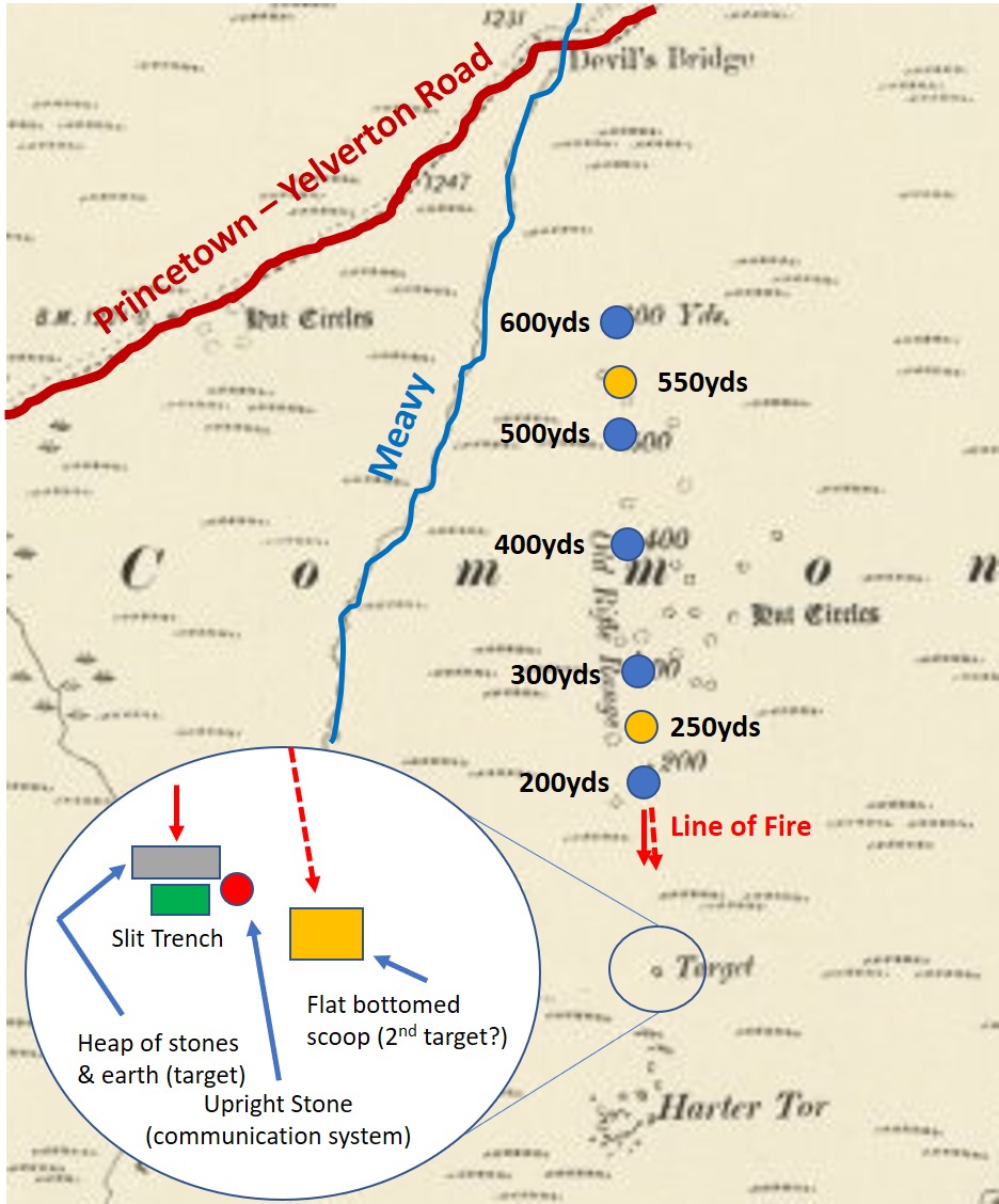
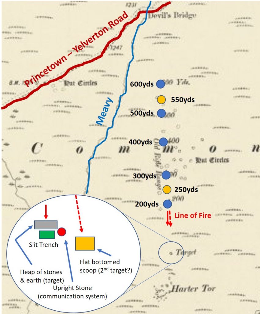
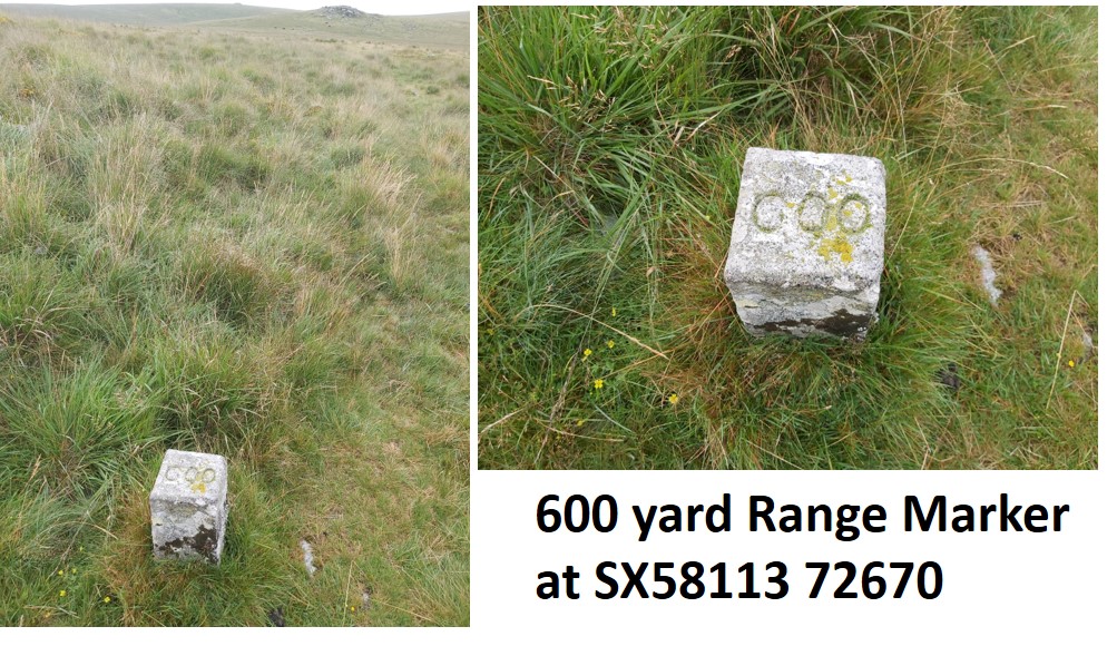
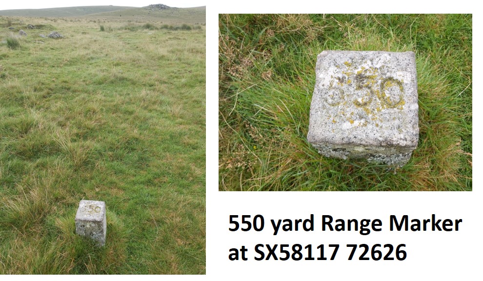
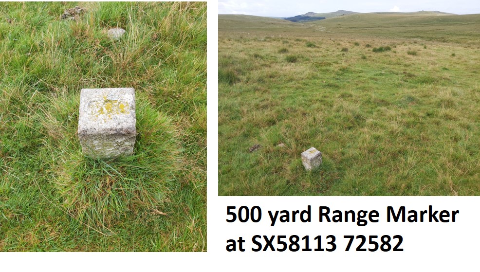
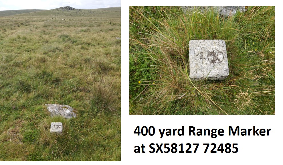
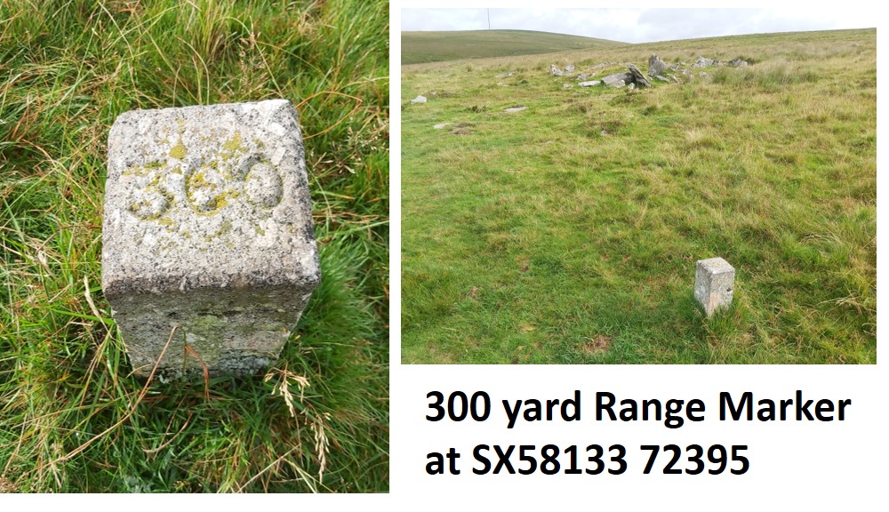
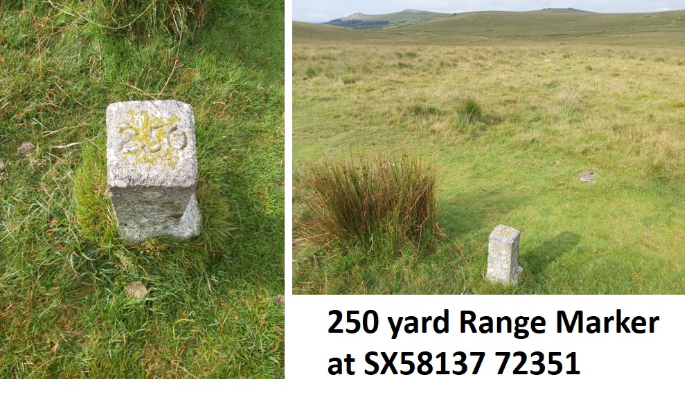
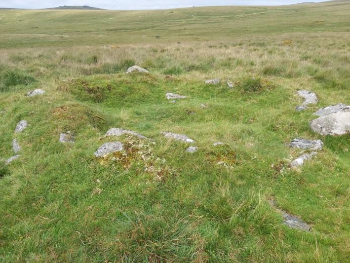
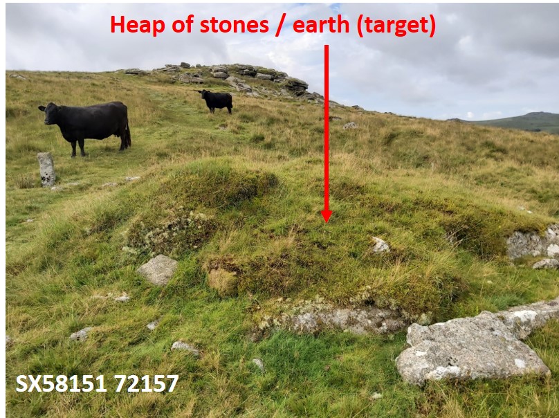
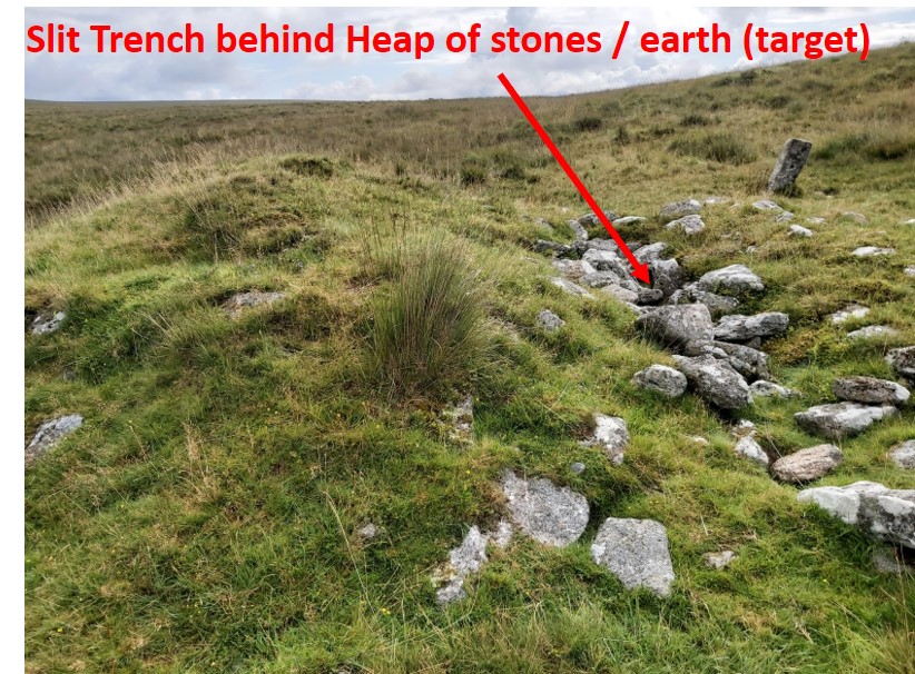
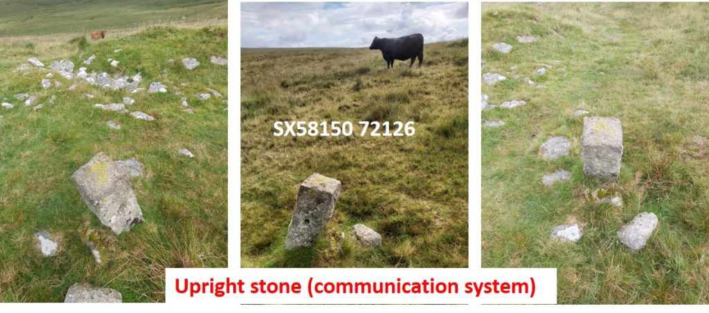
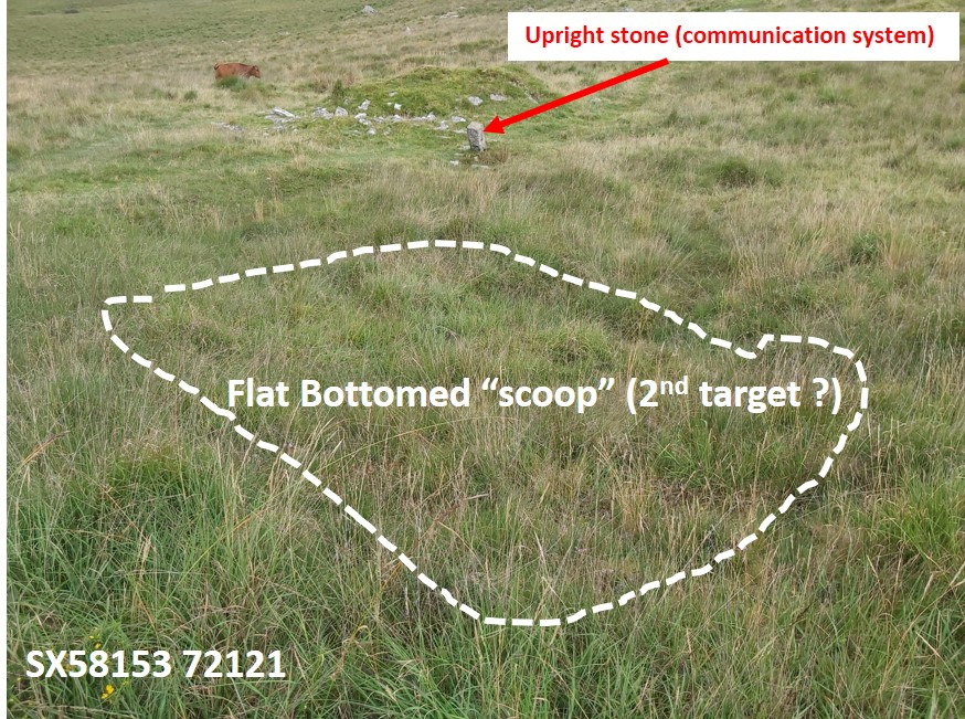
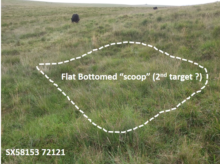
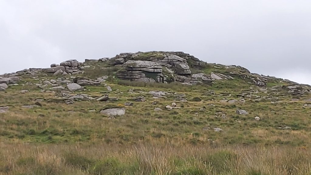
This overlay is on top of the OS 6 inch 1888-1913 map, which shows only the “100 yard” interval markers from 200 yards to 600 yards. In actual fact there are two additional markers at 550 yards and 250 yards. Of particular interest is the target end, shown in the magnified area which contains two possible target locations and a upright stone used as a communication system. Note the name Harter Tor (not Hart Tor) on the map600 yard marker, with Hart Tor in the background550 yard marker, with Hart Tor in the background500 yard marker, with Leather Tor, Sharpitor, Black Tor and Leeden in the background400 yard marker, with Hart Tor in the background300 yard marker, with North Hessary Tor in the background250 yard marker, with Leather Tor, Sharpitor, Black Tor and Leeden in the background200 yard marker, with Hart Tor in the backgroundThe range cuts through many hut circles like the one in this pictureThis heap of stones / earth embankment is stated by Heritage Gateway (SDV 254969) as being 1.3m high with some particularly large slabs facing the line of firing.Behind the heap of stones / earth embankment is what is described by the Heritage Gateway as a rubble filled rectangular stone lined pit (4m x 0.8m x 0.45m deep), which would have served as a shelter for those responsible for placing the targets on top of the heap. This is the point I cannot fathom – I agree that it could be a shelter but cannot personally reconcile the fact that it is immediately behind the target ! (A 6′ soldier stood up would have been in the line of fire)Alongside the “target” is a standing stone (2.4m away), which is believed to form part of a communication system. The post has two drilled holes, which could have held communication cords.Immediately SSE from the upright stone is flat “scoop”, which is speculated might have been a 2nd target. Interestingly this hollow is more in line with range markers that the earth moundMy personal speculation is that it is possible that this was the only target and the earth mound (which is offset) was indeed to protect soldiers but that was its only use (would they really have soldiers located immediately behind a target ?)Hart Tor